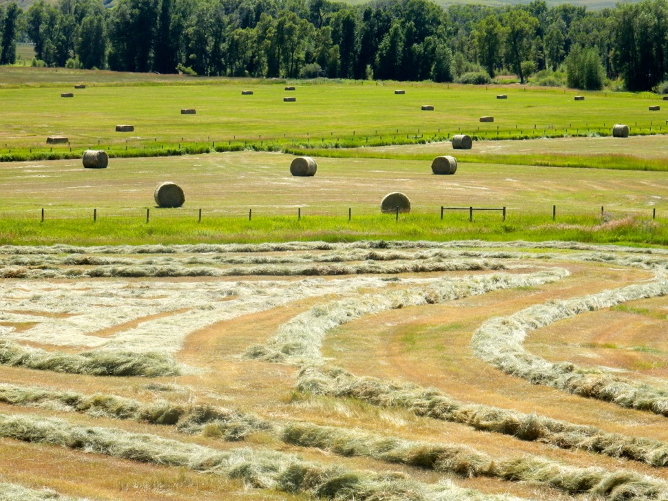
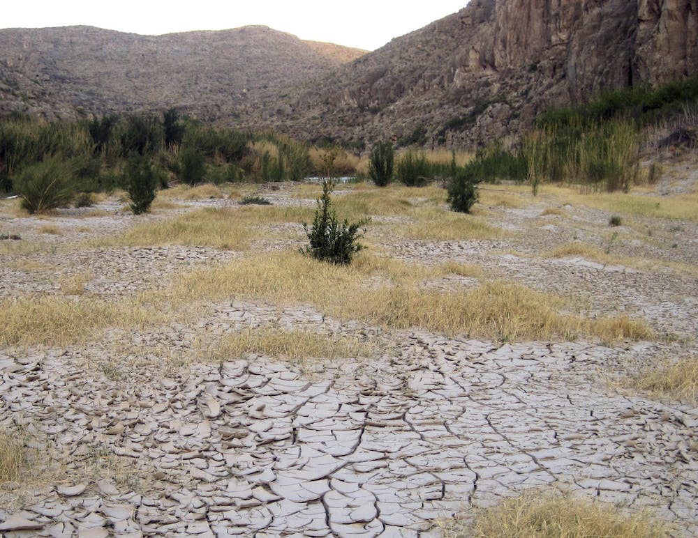
In #Coloradoโ€™s #SanLuisValley, paying for the water they use — John Fleck (InkStain.net) #RioGrande

Click the link to read the article on the InkStain website (John Fleck):

February 10, 2024

Folks in Coloradoโ€™s San Luis Valley are engaged in a bold experiment in western water management โ€“ charging farmers for the water they use. Jerd Smith [Fresh Water News] explains:

The challenge in the valley is that, with climate change inexorably chomping at the Rio Grande, and the groundwater used to replace the riverโ€™s dwindling irrigation supplies, there simply isnโ€™t enough water to keep farming all the acreage theyโ€™ve got up there.

The valley is operating under the same two constraints that we see up and down the river โ€“ less water flowing in, and requirements established in the Rio Grande Compact to pass some of what does come in to folks downstream โ€“ Colorado canโ€™t use it all, but must pass some water along to water users in central New Mexico. Those of us in central New Mexicoโ€™s โ€œMiddle Rio Grandeโ€ (the stretch from Cochiti through Albuquerque to Socorro) get to use some, but must pass some of on to farmers in Southern New Mexico. Under the deal now pending before the U.S. Supreme Court, the southern New Mexicanโ€™s (the Elephant Butte Irrigation District and Las Cruces area) must then pass some water across the border to people in Texas and Mexico.

PAYING TO REDUCE USE: PRIVATE V. PUBLIC GOODS

In each of those stretches โ€“ Colorado, central New Mexico, and southern New Mexico โ€“ we face the challenge of reducing use in order to meet downstream obligations.

In New Mexico, our approach to problems like this has been to treat the water as a private good, and pay its users to not use the water. This year, for example, a pipeline of money from the federal government, through the state, to our local water agency, the Middle Rio Grande Conservancy District, is paying irrigators $700 an acre to not irrigate.

The approach in the San Luis Valley is different. There, farmers who want to pump groundwater (recognizing that groundwater and surface water are an interconnected part of a single system, and that as river flow declines farmers have been pumping groundwater to replace it) have to pay for it. If you want to pump more, you have to pay more. And as it gets scarcer, the price needs to go up.

The legal terminology involving the notion of property rights here is tricky, but as a practical matter this suggests two very different approaches. In New Mexico, we are treating the water as the irrigators property, and paying them to forego its use. In Colorado, theyโ€™re treating it as public property, and requiring them to pay if they want to use it.

THE COASIAN SOLUTION

Students of the Berrens-Fleck Lab will recognize this as a version of the classic problem of assigning the property right, as laid out by Ronald Coase in his classic 1960 paper The Problem of Social Cost. Overuse of water in a climate change-constrained system is a classic โ€œexternalityโ€ โ€“ a burden pushed off onto others, rather than the people who get to benefit from the use of water. [ed. emphasis mine]

Coaseโ€™s answer โ€“ โ€œassign the property right!โ€ โ€“ has made his paper one of the most-cited papers in the history of papers, and won him a Nobel prize. Coaseโ€™s argument is that by assigning the property right, and starting from that point to figure out who pays and how much to solve the problem, we can converge on solutions. You can either make the people being harmed pay to stop the harm, or the people causing the harm pay to stop the harm.

We can, for example, require the factory polluting our river pay the cost of installing pollution control equipment. Or we can make the folks downstream, or the community as a whole, pay. Either way will work. The question of which approach we take is an ethical and political question.

Colorado has chosen (or at least is trying to chose โ€“ thisโ€™ll end up in court) one approach. New Mexico has chosen another.

CARTOON COASE

This is a cartoon of Coaseโ€™s argument. In the paper (which is a terrific read) heโ€™s making a more nuanced argument involving transaction costs. In both the New Mexico and Colorado cases, the cost of setting up the payment system makes actually carrying out the policies we need super hard. But the cartoon helps frame our approach to western water management challenges more broadly.

This image is fake. There also is no Large Container Ships Full of Money Act. I made that up too. Itโ€™s really the โ€œBuild Inflation Better Actโ€ or something, I can never get that right. Graphic credit: John Fleck/InkStain

The Colorado example โ€“ charge more to use water! โ€“ is rare. In the Lower Colorado River right now, weโ€™re paying farmers, through their agricultural districts, giant container ships full of money to reduce their use โ€“ the New Mexico approach. Weโ€™re treating the water as their property, and paying them not to use it. This is an ethical and political (and possible legal?) choice.

But the key difference between the New Mexico/Lower Colorado approach and the classic Coasian cartoon is whoโ€™s doing the paying. In both cases, at least for now, weโ€™re using Other Peopleโ€™s Money (OPM), via the recently passed Large Container Ships Full of Money Act (LCSFMA). Those of us in the West have somehow worked a racket where folks in Maine and Georgia and elsewhere are paying to bail us out of our mess. (To be fair, Iโ€™m sure weโ€™re bailing them out in some way too.)

The processes by which we have to figure out how to move all this money and water around โ€“ to pay people to not use water, or to charge them for the water they use โ€“ are a great example of the power of the deeper insights in Coaseโ€™s 1960 paper. Working out the ways things donโ€™t match up to Cartoon Coase is where the real value of the intellectual framework is found.

SOURCES AND METHODS

Two huge thanks. First, to Daniel Rothberg, whose Western Water Notes alerted me to the issue. And to Jerd Smith, for supporting and publishing the great water journalism we all need to understand these issues. If you can, Iโ€™d encourage you to contribute to one or the other or both, to support the fundamental underlying knowledge base we all need to move forward on climate change and western water issues.

The Rio Grande flows near Albuquerque as the sun rises over the Sandia Mountains. (Photo by Diana Cervantes for Source NM)

State climatologist: โ€˜Warming is going to have impacts on our snow in the winter and our water supply in the summerโ€™: Russ Schumacher talks about #ClimateChange and #Colorado — @AlamosaCitizen #RioGrande #snowpack

Click the link to read the article on the Alamosa Citizen website (Owen Woods):

February 7, 2024

State climatologist Russ Schumacher appeared on the latest episode of the Outdoor Citizen podcast to talk to us about Coloradoโ€™s snow and climate. Schumacher, who took over as Coloradoโ€™s state climatologist in 2017, is also professor of atmospheric science at Colorado State University. In a time of climate change and increasingly unpredictable events, Schumacher and people like him are here to help us all make sense of it. 

โ€œThereโ€™s always something new happening,โ€ and thatโ€™s what fascinates him most about his work and the weather. In Colorado, especially, he said. โ€œWe have such fascinating weather. The weather and the climate can vary hugely over short distances.โ€ย 

Itโ€™s both fascinating and challenging, he said. 

The San Luis Valley is a great example of the variability of weather, he noted. โ€œFor one thing, I think itโ€™s not as well understood as other parts of the state.โ€ 

Everybody loves to study the weather in the northern part of the state, he said, but โ€œI think some of what happens there in the Valley is so fascinating, and a lot of times it flies under the radar either literally or figuratively.โ€

New radar installed near the Alamosa airport helps track local weather, he said. 

Schumacher and his colleagues at the climate center just released the third edition of the Climate Change in Colorado report. The last time that report was updated was in 2014. A lot has happened since then, he said, and they realized a new update was needed. 

You can read the reportย here. Schumacher broke down some of the key takeaways from that report.ย 

Screenshot from the recently released Climate Change in Colorado Report update

LIke most of the planet, Colorado has been warming. Colorado has warmed by 3 degrees fahrenheit on average since the late 1880s. Precipitation is much harder to pin down, but the past two decades have been very dry. 

As the planet continues to warm, Colorado will see the effects.ย 

Climate models are all over the place, he said, when it comes to precipitation. There is a lot of variation. When it comes to snow and water, he said, even if the precipitation doesnโ€™t change and the amount of liquid coming out of the sky doesnโ€™t change โ€œthe fact that itโ€™s warmer is going to put more stress on those water resources.โ€

In the summer, when the air is hotter it means quicker evaporation. In the winter, there is a shift in timing when runoff occurs in the spring and that changes when there are peak flows in the river. 

โ€œWarming is going to have impacts on our snow in the winter and our water supply in the summer,โ€ he said. 

Weโ€™re havenโ€™t yet seen much of the effects for this El Niรฑo year. Schumacher says there is still more time for that. Yet, weโ€™re still below average in many of the nationsโ€™ southern river basins. 

The current atmospheric river conditions on the west coast and in California are likely to head our way in the coming days and weeks. โ€œItโ€™ll be on the warm side when it hits Southern Colorado, as well.โ€ย 

Westwide SNOTEL basin-filled map February 9, 2024 via the NRCS.

โ€œNowhere in the state is looking great at this point,โ€ but we are much better than we were at the end of 2023. This last bout of snowstorms this month is helping. But itโ€™s not a โ€œboom yearโ€ that is typical with El Niรฑo years.ย 

Thereโ€™s still hope to be had, he said. 

The storms coming from the southwest are typically warmer than winter weather. He said that Saturday, Feb. 4, was the wettest day Fort Collins has seen. The city received 1.66 inches of precipitation in just that one day, which he said is not typical for early February. 

The current snow drought will have long-term effects. Itโ€™s been โ€œmost acuteโ€ in Southern Colorado. There have been more years with low snowpack rather than a higher snowpack. 

Since Colorado is a headwaters state, that doesnโ€™t just impact us but the states surrounding us. Their water levels are reliant on Coloradoโ€™s snowpack. 

The larger reservoirs in the Colorado River system require more consistently good years. One good year wonโ€™t necessarily create good levels. That system is in better shape than it was a year ago, but overall is in a bad state. 

In the Rio Grande basin, he said, as the river flows down to New Mexico, there are increasing water supply issues further south. โ€œEven if you have a good snowpack year, if the summer monsoon doesnโ€™t come through and itโ€™s really hot, that air is really thirsty for that water. Itโ€™s gonna try and pull that water out of the soils and out of the crops back into the air which means if youโ€™re growing crops youโ€™ve got to irrigate more, which means youโ€™re using more water. That all is really a vicious cycle that puts stress on the system all around.โ€

Listen to the podcastย here, or wherever you get your podcasts to hear more about what Schumacher is seeing.

Cost to water crops could nearly quadruple as #SanLuisValley fends off #ClimateChange, fights with #Texas and #NewMexico — Fresh Water News #RioGrande

Sunrise March 16, 2022 San Luis Valley with Mount Blanca in the distance. Photo credit: Chris Lopez/Alamosa Citizen

Click the link to read the article on the Water Education Colorado website (Jerd Smith):

Hundreds of growers in Coloradoโ€™s San Luis Valley could see their water costs nearly quadruple under a new plan designed to slash agricultural water use in the drought-strapped region and deflect a potential legal crisis on the Rio Grande.

A new rule approved by the areaโ€™s largest irrigation district, known as Subdistrict 1, and the Alamosa-based Rio Grande Water Conservation District, sets fees charged to pump water from a severely depleted underground aquifer at $500 an acre-foot, up from $150 an acre-foot. The new program could begin as early as 2026 if the fees survive a court challenge.

โ€œItโ€™s draconian and it hurts,โ€ said Sen. Cleave Simpson, a Republican from Alamosa who is also general manager of the Rio Grande water district.

The region, home to one of the nationโ€™s largest potato economies, has relied for more than 70 years on water from an aquifer that is intimately tied to the Rio Grande. The river begins high in the San Juan mountains above the valley floor.

Both the river and the aquifer are supplied by melting mountain snows, but a relentless multi-year drought has shrunk annual snowpacks so much that neither the river nor the aquifer have been able to recover their once bountiful supplies.

And thatโ€™s a problem. Under the Rio Grande Compact of 1938, Colorado is required to deliver enough water downstream to satisfy New Mexico and Texas. If the aquifer falls too low, it will endanger the riverโ€™s supplies and push Colorado out of compliance. Such a situation could trigger lawsuits and cost the state tens of millions of dollars in legal fees.

Subdistrict 1 has set state-approved goals to comply with the compact. Within seven years, it must find a way to restore hundreds of thousands of acre-feet of water to the aquifer, a difficult task.

Rio Grande River, CO | Photo By Sinjin Eberle

An acre-foot equals nearly 326,000 gallons of water, or enough to cover an acre of land with water a foot deep.

The specter of an interstate water fight is creating enormous pressure to reorganize the valleyโ€™s farming communities in a way that will allow them to use less water, grow fewer potatoes, and still have a healthy economy.

For more than a decade, valley water users have been working to reduce water use and stabilize the aquifer. Many have already started experimenting with ways to grow potatoes with less water by improving soil health, and to find new crops, such as quinoa, that may also prove to be profitable.

They have taxed themselves and raised pumping fees, using that revenue to purchase and then retire hundreds of wells. In fact, the district is pumping 30% less water now than it was 10 years ago, according to Simpson.

But the pumping plans, considered innovative by water experts, havenโ€™t been enough to stop the decline in aquifer levels. The Rio Grande Basin is consistently one of the driest in the state, generating too little water to make up for drought conditions and restore the aquifer after decades of over pumping.

With the new fees, the region will likely have some of the highest agricultural water costs in the state, said Craig Cotten, who oversees the Rio Grande River Basin for Coloradoโ€™s Division of Water Resources.

Perhaps not as high as water in the Colorado-Big Thompson Project on the northern Front Range, where cities and developers and some growers pay thousands of dollars to buy an acre-foot of water.

Still it is much higher than San Luis Valley growers and others have paid historically. Fees at one time were just $75 an acre-foot, eventually reaching $150 an acre-foot. The prospect of the fee skyrocketing to $500 is shocking.

โ€œThat is high,โ€ said Brett Bovee, president of WestWater Research, a consulting firm specializing in water economics and valuations. Typically such fees across the state have been in the $50 to $100 range, he said.

But Bovee said the water district is taking constructive action while giving growers opportunities to find their own solutions to the water shortage. โ€œItโ€™s putting the decision-making power into the hands of growers and landowners, rather than saying โ€˜everybody take one-third of your land out of production.โ€™โ€

Third hay cutting 2021 in Subdistrict 1 area of San Luis Valley. Photo credit: Chris Lopez

Subdistrict 1 is the oldest and largest of a group of irrigation districts in the valley, according to Cotten. Its $500 fee has triggered a lawsuit by some growers, who believe the district is applying the new fees unfairly.

โ€œThe responsibility for achieving a sustainable water supply is to be borne proportionately based on (growersโ€™) past, present and future usage,โ€ Brad Grasmick, a water attorney representing San Luis Valley growers in the Sustainable Water Augmentation Group and the Northeast Water Users Association, said, referring to state water laws. โ€œBut we believe the responsibility is being disproportionately applied to our wells.โ€

Those growers are now trying to create their own irrigation district and they are suing to stop the new fee.

โ€œI think that more land retirement and more reduction in well pumping is needed and that is what my group is trying to do,โ€ Grasmick said. โ€œNo one wants to see the aquifer diminish and continue to shrink. If everybody can do their part to cut back and make that happen, that is the way forward. My guys just want to see the proportionality adhered to.โ€

To date, tens of millions of dollars have been raised and spent to retire wells in the San Luis Valley, with Subdistrict 1 raising $70 million in the last decade, according to Simpson. And in 2022 state lawmakers approved another $30 million to retire more wells.

But itโ€™s not enough. With each dry year, the water levels in the aquifer continue to drop.

Republican River Basin by District

Similar issues loom for Eastern Plains irrigators

The San Luis Valley is not the only region faced with finding ways to reduce agricultural water use or face interstate compact fights. Colorado lawmakers have also approved $30 million to help growers in the Republican River Basin on the Eastern Plains reduce water use to comply with the Republican River Compact of 1943, which includes Kansas, Nebraska and Colorado.

Lawmakers are closely monitoring these efforts to reduce water use while protecting growers.

Sen. Byron Pelton, a Republican from Sterling, said the combined money that is going to the Rio Grande and Republican basins is critical. But the potential for legal battles, he said, is concerning.

โ€œAgriculture is key in our communities,โ€ Pelton said. โ€œBut the biggest thing is that we have to stay within our compacts. Sometimes youโ€™re backed into a corner and that is just the way it has to be. I hate it, but we have to stay in compliance.โ€

How much irrigated land will be lost as wells are retired isnโ€™t clear yet. Simpson said growers who have access to surface supplies in the Rio Grande will still be able to irrigate even without as many wells or as much water, but the land will likely produce less and farms may become less profitable.

And it will take more than sky-high pumping fees to solve the problem, officials said. The Division of Water Resources has also created another water-saving rule in Subdistrict 1 that will force growers to replace one-for-one the water they take out of the aquifer, instead of allowing them to simply pay more to pump more.

Cotten said the hope is that the higher fees combined with the new one-for-one rule will reduce pumping enough to save the aquifer and the ag economy.

Valley growers are already shifting production and changing crops, said James Ehrlich, executive director of the Colorado Potato Administrative Committee in Monte Vista, an agency involved in overseeing and marketing the regionโ€™s potato crops.

Still the new fees could jeopardize the entire potato economy, Ehrlich said.

โ€œThere are a lot of creative things going on down here,โ€ Ehrlich said. โ€œBut we have to farm less and learn to survive as a community together. And Mother Nature has not helped us out. Weโ€™ve stabilized but we canโ€™t gain back what (state and local water officials) want us to gain back. It is just not going to happen.โ€

More by Jerd SmithJerd Smith is editor of Fresh Water News. She can be reached at 720-398-6474, via email at jerd@wateredco.org or @jerd_smith.

San Luis Valley Groundwater

#RioGrande flow at Otowi in decline, fancy graph edition — John Fleck (InkStain.net)

Changing Rio Grande flow at Otowi over time. Credit: John Fleck/InkStain

Click the link to read the article on the InkStain website (John Fleck):

February 2, 2024

Iโ€™ve been updating the crufty old code I use to generate graphs to help me (and colleagues) think about river flows.

This oneโ€™s a little busy, so maybe for specific nerd colleaguesโ€™ use, and not general consumption?

Itโ€™s based on a request from a friend who uses these, and asked for a visualization of the wet 1981-2000 period compared to the drier 21st century. This is an important comparison given that a whole bunch of New Mexicans (including me!) moved here in the wet 1980s and โ€™90s, which created a sense of whatโ€™s โ€œnormal.โ€

Itโ€™s important to note that this is not a measure of climate, at least not directly. This is a measure of how much actual water flows past the Otowi gage, which is a product of:

  • climate-driven hydrology adding water
  • trans-basin diversions adding water (โ€œtrans basin diversionโ€ singular, I guess, the San-Juan Chama Project)
  • upstream water use subtracting water
  • reservoir management decisions moving water around in time (sometimes reducing the flow by storing, sometimes increasing it by releasing)

I get so much out of staring at these graphs. A few bits from this one, which I did a few evenings ago curled up with my laptop in my comfy chair:

  • Look at the curves around Nov. 1 โ€“ a drop as irrigation season ends, following by a rise as managers move compact compliance water down the river to Elephant Butte. Makes me curious about what they were doing back in the โ€™80s and โ€™90s in November.
  • This yearโ€™s winter base flow is low.

At some point soon Iโ€™ll get the updated code ontoย Github, but itโ€™s not quite ready for sharing. (Iโ€™m rewriting it in Python, because learning is fun!)

SCOTUS sets March 20 date to hear #Texas vs #NewMexico oral arguments on #RioGrande — Source NM

The Rio Grande flows near Albuquerque as the sun rises over the Sandia Mountains. (Photo by Diana Cervantes for Source NM)

Click the link to read the article on the Source NM website (Danielle Prokop):

The nationโ€™s highest court will hear federal objections to a deal between Texas and New Mexico in their dispute over Rio Grande water in oral arguments scheduled for a midweek date on March 20.

The U.S. Supreme Court agreed to take up the case last week, as the lawsuit crawls into a decade since its filing.

Justices will evaluateย argumentsย from the federal government taking exception to aย compromise planagreed to by Texas, New Mexico and Colorado to settle the case. The three states are parties in the lawsuit and agreed to the compromise in January 2023. [ed. emphasis mine]

The New Mexico Office of the State Engineer said there would be no need to adjust its budget request before the New Mexico State Legislature because of the oral arguments in D.C. State Engineer Mike Hamman said in a written statement that the office is looking forward to the oral argument in March.

โ€œWe are confident that the Supreme Court will accept the statesโ€™ proposed settlement, which will allow us to move forward towards securing a stable water future for all users in the lower Rio Grande,โ€ said Hamman.

Budget asks

Also on Monday morning, the New Mexico House of Representatives released its state budget proposal for the next fiscal year. In the proposed budget, the House Appropriations and Finance committee extended $2 million given last year to the New Mexico Department of Justice for Rio Grande litigation and notes another $6.4 million on interstate water litigation will carry forward from last year. 

In the Office of the State Engineer, $8.9 million is set aside for litigation and adjudication of water rights within streams around the state and underground basins. 

Separately, the agency will transfer $2.5 million to the litigation and adjudication programs of the state engineer. While not all adjudication and litigation is specific to the supreme courtโ€™s Rio Grande case, that in all, totals to nearly $20 million between both agencies. 

How we got here

Formally called Original No. 141 Texas v. New Mexico and Colorado, the case has cost taxpayers tens of millions of dollars.

The 2014 filing by the state of Texas centers on allegations that New Mexico groundwater pumping downstream of Elephant Butte Reservoir took Rio Grande water  allocated to Texas.

Texas said New Mexicoโ€™s pumping violated the 1938 Rio Grande Compact, a legal agreement between Colorado, New Mexico and Texas to split the riverโ€™s water.

While 80% of the riverโ€™s water is used for agriculture, itโ€™s a major source of drinking water for cities such as El Paso and Albuquerque, and for wildlife. Las Cruces sits below Elephant Butte Reservoir and receives all its drinking water from groundwater.

In 2018, the U.S. Supreme Court allowed the federal government to intervene in the case. Attorneys for federal agencies said New Mexico groundwater pumping threatened federal abilities to deliver water to tribes, regional irrigation districts and Mexico under a federal treaty.

The case pressed on to trial in 2021 and was split into two parts. A six-week virtual portion of the trialwas held in the fall, and a second in-person technical portion was pushed back after months of negotiations by parties took up much of 2022.

Just before the trial was set to resume, the three states announced an agreement which would resolve issues between Texas and New Mexico. It includes measuring water deliveries at the state line, new conditions for over- and under-deliveries of Rio Grande water and incorporating drought baselines and groundwater pumping into the formulas for how much water is available.  

Attorneys for the federal government objected, arguing that the agreement was made without their consent.

U.S. 8th Circuit Judge Michael Melloy recommended last year that the Supreme Court accept the deal over objections from the federal government, calling it โ€œfair and reasonableโ€ in his 123-page report. He said disputes over federal operations in Southern New Mexico could be resolved in other courts.

In December, the federal government submitted a filing objecting to Melloyโ€™s recommendation. In the filing, attorneys said the settlement โ€œimposes obligations on the United States without its consent.โ€ Attorneys further argued that the deal should be thrown out because it is โ€œcontrary to the Compactโ€.

 Itโ€™s expected that only attorneys for the states and the federal government will have time to speak during oral arguments before the Supreme Court in March. If that happens, groups unable to present arguments would include farming associations, irrigation districts, the city of Las Cruces and New Mexico State University, which appear as amici curae or โ€œfriends of the court.โ€

Opinions from the Supreme Court are typically issued by late June, occasionally early July, during their session.

Map of the Rio Grande watershed. Graphic credit: WikiMedia

New Mexicoโ€™s Middle #RioGrande: forest of cottonwoods, forest of pecans — John Fleck (InkStain.net)

Belen AT&SF Rio Grande crossing, looking east, March, 1943. Note lack of trees. Jack Delano, courtesy Library of Congress

Click the link to read the article on the InkStain.net website (John Fleck):

This Rio Grande crossing, just south of Belen, 30-plus miles downstream from Albuquerque, has changed dramatically since Jack Delano took the picture above in spring 1943.

Beyond drains, a forest. John Fleck, January 2024

THE BOSQUE

Iโ€™ve stared atย Delanoโ€™s pictureย often, because of the story it tells โ€“ a broad open river valley. Itโ€™s nothing like that today.

I pieced together some dirt roads and ditchbanks to visit the site on this morningโ€™s bike ride. I had hopes of duplicating Delanoโ€™s picture, but the train traffic made standing in the middle of the tracks seem ill-advised. The picture to the right, facing the river looking east, should give you a feel. The Rio Grande here is now flanked by a magnificent cottonwood gallery forest, with low stands of coyote willow and salt cedar and some other stuff. We call it โ€œthe bosque.โ€

Looking at the picture last night as I was doing the map work to figure a sane bike route to get to the bridge, the date clicked: Spring 1943. In thinking about the modern relationship between human communities and the Rio Grande, 1941-42 is a dividing line โ€“ the last big flood years, the floods that drove the major changes in river management that created an ecological niche that the cottonwoods exploited in the second half of the twentieth century with full-throated glee.

Delanoโ€™s picture can be misleading. It wasnโ€™t all treeless like that. The 1917-18 Rio Grande drainage survey, which is our best โ€œbeforeโ€ snapshot of the valley, shows clumps of cottonwoods up and down the river. Following the 1941-42 floods, the federal Middle Rio Grande Project reengineered the main river channel with a series of sediment traps on the banks that were intended to push the river into a narrower central channel. In the process, they created ideal seed bed habitat for the cottonwoods to fill in the empty spaces.

A cottonwood forest in Bosque del Apache National Wildlife Refuge. Credit: Matthew Schmader/Open Space Division

The result is a linear cottonwood gallery forest more than 150 miles long. Iโ€™ve always called it โ€œcontinuous,โ€ but I just scanned the whole length using satellite imagery and found two short gaps. So โ€œnearly continuous,โ€ to add precision.

The bosque is often treated as one of the Middle Valleyโ€™s great natural treasures, and I donโ€™t disagree. But โ€œnaturalโ€ may not be quite the right word.

Belen High Line Canal, feeding pecan orchards in New Mexicoโ€™s Middle Rio Grande Valley. John Fleck, January 2024

PECANS

Next stop: one of the most interesting climate change adaptation experiments underway in Middle Valley agriculture.

Past the railroad bridge, I found a ditch crossing and peeled away from the river toward the sand hills to the east, winding through the small farms of Jarales that make this stretch of the valley a lovely exemplar of the โ€œribbons of greenโ€ we talk about in the new book. Nearly all the farms were less than 10 acres โ€“ non-commercial, โ€œcustom and cultureโ€ agriculture, mostly alfalfa or other forage crops, lots of horses. Dodging the one busy highway the best I could, I veered into a neighborhood and under the interstate, where the road kicked up to a geomorphic bench in the sand hills maybe 30 feet in elevation above the nearby valley floor.

The pecans are in the distance in the picture to the right, though you canโ€™t really see them. I was on relatively unfamiliar ground, and was cautious in my interpretation of the โ€œNo Trespassingโ€ signs on the ditchbank road. Itโ€™s land that was once scrubland just like the land in the foreground. Now itโ€™s irrigated with water from the ditch in the picture, to the tune of more than 1,000 acre feet per year. (We donโ€™t know exactly. We donโ€™t meter this use of water here.) There was a lot of controversy nearly 20 years ago when the land was brought into production. Critics (included regular Inkstain commenter Bill Turner, who was on the MRGCD board at the time) argued it wasnโ€™t entitled to irrigation water from the Middle Rio Grande Conservancy Districtโ€™s ditches. Iโ€™m not going to relitigate that argument here. Those objecting to serving the land with MRGCD irrigation water lost. Now the land is home to a fascinating experiment in climate change adaptation.

With a warming climate, the optimal range for pecans has moved north. (UNM Water Resources Program grad Tylee Griego took a deep dive into the pecansโ€™ migration here.)

We have seen a century of failed efforts to foster a commercially successful crop in the valley โ€“ wheat, tomatoes, sugar beats, pinto beans, tobacco (!). Pecans are the latest, and rather than climate change making it harder to grow stuff, in this case it has made it easier. By increasing irrigated acreage in the valley. We usually think of agricultural climate change adaptation as โ€œcrop switching,โ€ not โ€œcrop adding.โ€ In addition to the big orchards by the river, the latest USDA CroplandCROS dataset, which uses satellite data and algorithms to identify crop types, is showing more pecans in small patches across the valley. I donโ€™t full trust CroplandCROS โ€“ it gets a lot of pixels wrong โ€™round here, unfortunately. But this just means more bike rides needed to โ€œground truthโ€ my blog posts. This is a part of the valley I donโ€™t know as well, so fun ahead!

As I was riding through Jarales this morning and writing this post in my head, I was playing with the theme suggested by the two forests โ€“ each spread across a niche created by human alteration of the hydrologic system. Not sure it quite works, but Iโ€™ll leave it here.

โ€œSanta Fe R.R. streamliner, the โ€œSuper Chief,โ€ being serviced at the depot, Albuquerque, NM. Servicing these diesel streamliners takes five minutesโ€. Jack Delanoโ€™s original caption. Courtesy Library of Congress

A NOTE ON JACK DELANO

Jack Delanoโ€™s 1943 trip through New Mexico is worthy of note.

Delano, born Jacob Ovcharov in Ukraine, was one of the Farm Service Administration/Office of War Information photographers whose work dominates our visual understanding of the 1930s and early โ€™40s in the United States. His photographs of the AT&SF rail yard in Albuquerque, taken on the same spring 1943 trip that he took the Belen railroad bridge above, represent a remarkable documentation of a moment in time, as freight bustled through Albuquerque in service of the war effort.

We tend to think of the classic FSA photography as โ€œdocumentaryโ€ work of the highest order โ€“ which it was. But it also was government propaganda โ€“ artists paid by the government to tell particular kinds of stories, and share particular kinds of messages.

Much of the classic visual vocabulary of the FSA pictures โ€“ think Dorothea Lange โ€“ is very much black and white. But with the development of Kodachrome in the 1930s, photographers of the period were beginning to shoot in color too. Most of Delanoโ€™s Albuuquerque pictures are in black and white, but his color picture of the Albuquerque rail yard, taken from the Lead Avenue orverpass circa 1943, is a classic.

Birds and water at Bosque de Apache New Mexico November 9, 2022. Photo credit: Abby Burk

Mining Monitor: Uranium buzz, buzz, buzz — Jonathan P. Thompson (@Land_Desk) #ActOnClimate

Graphic credit: Jonathan P. Thompson/The Land Desk

Click the link to read the article on The Land Desk website (Jonathan P. Thompson):

January 26, 2024

โ›๏ธMining Monitor โ›๏ธ

The uranium-mining buzz is reaching a fevered pitch lately as uranium prices climb above $100 per pound, the highest since October 2007. I already reported on Energy Fuelsโ€™ intent to begin or resume production at its Pinyon Plain and La Sal complex mines. But nearly every day another press release lands in my inbox touting a big find or big plans somewhere on the Colorado Plateau. 

Letโ€™s start with the headline that irks me the most: โ€œChurchrock could pump out 31 million lb of US uranium over three decades, Laramide PEA shows.โ€ On its surface, this one looks like just another attempt to drive up share prices. And it probably is. But itโ€™s the location and the name that gets to me: The project is just a couple of miles from the 1979 Church Rock disaster, when a uranium mill tailings dam failed, sending 94 million gallons of acidic liquid raffinate and 1,100 tons of uranium mill tailings rushing down the Puerco River and across the โ€œcheckerboardโ€ area of the Navajo Nation. The slug of material, containing an estimated 1.36 tons of uranium and 46 trillion picocuries of gross-alpha activity, continued past Gallup and down the Puerco for another 50 miles or more, seeping into the sandy earth and the aquifer as it went, and leaving behind stagnant and poisonous pools from which livestock drank.ย 

The Rio Puerco, an ephemeral tributary of the Rio Grande, west of Albuquerque, crossing the eastern edge of the Tohajiilee Indian Reservation; December 2016. By Dicklyon – Own work, CC BY-SA 4.0, https://commons.wikimedia.org/w/index.php?curid=54602926

It seems like an appropriate site for a memorial, warning about the potential dangers of mining and energy development. But a new mine? Iโ€™m afraid so. For years, Hydro Resources worked to build an in-situ recovery operation there (and at another site closer to Crownpoint). ISR is a form of mining in which a solution is pumped underground to dissolve the uranium ore and then itโ€™s pumped back out and processed. As one might expect, area residents, the Navajo Nation, and environmental advocates pushed back on the proposal

Last year Laramide bought the project from Hydro Resources and is now looking toย jumpstart it.ย I doubt it will come without a fight. In other mining news:

  • Laramide is busy these days: They also recently announced the U.S. Forest Service hasย restarted the environmental review and permitting processย for the companyโ€™s proposed La Jara Mesa project north of Grants, New Mexico. During the uranium industryโ€™s last โ€œrenaissanceโ€ (lasting from 2007 to 2011), Laramide looked to open an underground mine on Cibola National Forest land. They made it as far as a draft environmental impact statement, released in 2012, before low uranium prices stalled the project.ย 
  • Nexus Uranium says it willย begin exploratory drillingย on its Wray Mesa claims near La Sal, Utah, on the northern edge of the Lisbon Valley.ย 
  • Anfieldโ€™s subsidiary, Highbury Resources,ย acquiredย another 12 Department of Energy uranium leases fromย Gold Eagle Miningย in the Uravan Mineral Belt in western Colorado. The tracts are near Slickrock, on Monogram Mesa south of the Paradox Valley, and near Uravan. Anfield also says it plans to reopen the Shootaring uranium mill near Ticaboo, Utah, although it appears to have made little progress in that regard.ย 
  • Thor Energy says it hasย found high-grade uranium at its Wedding Bell and Radium Mountain projects on a mesa just east of the Dolores River in western Colorado.ย 
  • Kraken Energy got the Bureau of Land Managementโ€™s go-ahead to drill on Harts Point, right along the northeast border of Bears Ears National Monument in Utah. This is the second time the company (or its partners Atomic Minerals and Recoupment Exploration) have purportedlyย received a drilling permitย for the slickrock peninsula adjacent to the Indian Creek climbing area. The first time the company failed to come up with a reclamation bond and the permit was cancelled.ย 
  • Australia-based Okapi Resources is set to begin exploratory drilling near Caรฑon City, Colorado,ย raising concernsย among the locals.
  • And, perhaps the only big buzz in the lithium space right now (lithium prices are in the dumps): American Battery Metals is pushing its Lisbon Valley lithium project. Well, that is to say they areย looking to get exploratory drilling permitted.
  • Explore the above projects and more on theย Land Desk Mining Monitor Map.
Pictorial representation of the In situ uranium mining process. Graphic credit: (source: Heathgate Resources)

SB-28 (#Groundwater Compact Compliance Fund) accounting: Almost entire $30M to retire wells is spent — @AlamosaCitizen #RioGrande

Photo credit: The Alamosa Citizen

Click the link to read the article on the Alamosa Citizen website:

January 21, 2024

Fund will retire approximately 11,296 acre-feet of water

When Colorado Senate Bill 28 was adopted during the 2022 legislative session, it created the Groundwater Compact Compliance Fund with $30 million earmarked for irrigators in the Upper Rio Grande Basin.

The state money derived from Coloradoโ€™s share of federal COVID dollars that came through the American Rescue Plan Act would serve to incentivize local farmers to permanently retire more groundwater wells. Doing so would further reduce groundwater pumping and translate to fewer irrigated acres in the Valley as a whole.ย 

Seven months after opening applications to the fund, the Rio Grande Water Conservation District has enough contracts to spend nearly the entirety of the $30 million. The contracts represent the full retirement of approximately 34 crop circles and partial restrictions on 28 circles, according to an accounting from the Rio Grande Water Conservation District. 

When itโ€™s all said and done, the $30 million will have paid for the retirement of approximately 11,296 acre-feet of water. An acre-foot represents around 326,000 gallons, or enough water to cover an acre of land.

Each application submitted to the Groundwater Compact Compliance Fund was reviewed by the Rio Grande Water Conservation District and Colorado Division of Water Resources. So far six applications representing $4,772,204 have been closed and the RGWCD now owns those water rights, according to deputy general manager Amber Pacheco.

The remaining applications have to be approved or rejected by March 31.

Republican River Basin. By Kansas Department of Agriculture – Kansas Department of Agriculture, Public Domain, https://commons.wikimedia.org/w/index.php?curid=7123610

The senate bill also directed $30 million to sustainability efforts on the Republican River Basin in the eastern plains. Like the Rio Grande Water Conservation District, the Republican River Water Conservation District has been successful in administering the program, Pacheco said.

โ€œWeโ€™ve been pretty successful,โ€ she said at the Jan. 16 board meeting of the Rio Grande Water Conservation District. โ€œItโ€™s pretty shocking that in six months that amount of money was obligated.โ€

A small amount of funding will likely remain after current applications are all reviewed, Pacheco said.

The RGWCD received a total of 27 applications. Hereโ€™s a breakdown of applications by subdistrict. The applications represent 11,296 acre-feet of past annual withdrawals that would be retired.

Applications total approximately $29,000,000

14 applications in Subdistrict 1* โ€“  $11,700,000
2 applications in Subdistrict 3* โ€“ $1,200,000
1 application in Subdistrict 4 โ€“ $500,000
4 applications in Subdistrict 5 โ€“ $5,100,000
2 applications in Subdistrict 6 โ€“ $1,300,000
4 applications in Subdistrict 7 (Trinchera Subdistrict) โ€“ $9,300,000

*SD1 and SD3 both offered some type of incentive on top of the SB28 program.

Rio Grande and Pecos River basins. Map credit: By Kmusser – Own work, Elevation data from SRTM, drainage basin from GTOPO [1], U.S. stream from the National Atlas [2], all other features from Vector Map., CC BY-SA 3.0, https://commons.wikimedia.org/w/index.php?curid=11218868

#Snowpack still below average peak levels — The Alamosa Citizen #RioGrande

Click the link to read the article on the Alamosa Citizen website (Chris Lopez):

January 20, 2024

Current levels are at 71 percent of normal for the Rio Grande Basin

The Rio Grande Basin has about another 70 days to get itself up to average peak levels for snowpack that would deliver a normal spring runoff year for San Luis Valley irrigators in 2024. Water from melting snow in the surrounding mountain ranges also irrigates farm fields in New Mexico and Texas through the Rio Grande Compact. 

The snowpack levels and corresponding 2023 spring runoff was the focus of a presentation at the Rio Grande Water Conservation Districtโ€™s quarterly meeting held on Tuesday, Jan. 16. Craig Cotten, Division 3 engineer for the Colorado Division of Water Resources, walked water managers through a series of slides showing the conditions of rivers and creeks all critical to Valleyโ€™s agricultural economy as well as Coloradoโ€™s ability to deliver water to the New Mexico state line for Rio Grande Compact obligations.

Rio Grande and Conejos River

These charts represent the two river systems tied to the Rio Grande Compact and the effect on stream flows from snow runoff during the spring of 2023. The winter of 2022-23 translated into significantly above-average runoff for several months and then by the first of July a drop in streamflows to below average on the Rio Grande and right at average to below on the Conejos River. 

Itโ€™s the Rio Grande and Conejos that form theย Rio Grande Compactย between the states of Colorado, New Mexico and Texas. The annual spring runoff determines how much water Colorado delivers to the New Mexico state line to fulfill its compact obligation. From the 2023 runoff Colorado delivered 29 percent of the streamflow or 208,000 acre-feet of water from the Rio Grande, and 47 percent or around 200,000 acre-feet from the Conejos River.

Los Pinos River near Ortiz

Los Pinos is the main contributor to the San Antonio River, which is a main tributary to the Conejos. Los Pinos had significant above-average runoff that resulted in some flooding on the lower end of the San Antonio in the spring of 2023. With its tributaries, the Conejos River had 411,000 acre-feet or 137 percent of its long-term average in 2023. Again, 47 percent of that water had to be delivered to the New Mexico state line to meet Coloradoโ€™s Rio Grande Compact obligations.

Saguache Creek near Saguache

Saguache Creek forms from runoff coming off the San Juan Mountains. It had above-average spring streamflows like others, and ended up below-average when the normal summer rains did not materialize in 2023.

Trinchera Creek above Turnerโ€™s Ranch

Trinchera Creek presented the biggest challenges for irrigators in 2023 due to less snow on the Sangre de Cristos than on the San Juans. Trinchera Creek was significantly below average for most of the irrigation season.

Ute Creek near Fort Garland

Ute Creek too forms from the Sangres. Unlike the Trinchera Creek, it got to average and a bit above for the peak of the 2023 spring runoff and then dropped to below-average streamflows for the year.

Alamosa Creek above Terrace Reservoir

The highlight of the heavy snow from 2022-23 and the corresponding spring runoff was the spilling of Terrace Reservoir for the first time in 40 years. โ€œThat was really neat to see,โ€ Cotten said.

Spring and summer 2024 forecasts

Looking to the 2024 spring runoff, current snowpack levels are at 71 percent of normal for the Rio Grande Basin and the lowest for any basin in Colorado by a significant amount. โ€œWe do still have some time to get up that average,โ€ Cotten said. โ€œIf we can get some good snowstorms coming our way, hopefully weโ€™ll be in decent shape for this year.โ€

Precipitation outlook through March shows potential for more snow that would help build up the snowpack for spring water. The spring months show an equal chance for precipitation and then below-average forecasts for the summer months. The temperature forecasts for the summer do not predict the same type of record-setting heat as the summer of 2023.

Preliminary: #NewMexicoโ€™s #RioGrande Compact debt rose ~25,000 acre feet in 2023 — John Fleck (InkStain.net)

Elephant Butte Reservoir back in the day nearly full. Photo credit: USBR

Click the link to read the article on the InkStain website (John Fleck):

January 12, 2024

New Mexico once again fell short in 2023 of the requirement set out in the Rio Grande Compact to deliver water to Elephant Butte Reservoir for use in Southern New Mexico, Texas, and Mexico, delivering ~25,000 acre feet less than the Compact requires, according to preliminary estimates presented at Mondayโ€™s meeting of the Middle Rio Grande Conservancy District.

These numbers are preliminary. The final, official numbers will be sorted out at this springโ€™s meeting of the Rio Grande Compact Commission. But if they hold, that would put New Mexicoโ€™s cumulative Compact debt at ~125,000 acre feet.

Reallyย bad things donโ€™t start happening until New Mexicoโ€™s cumulative Compact debt rises above 200,00 acre feet, butย lessbad things are already happening now as a result of the debt. Under Article VI of theย Compact:

Translated, that means any runoff we could actually store in upstream reservoirs in 2024 we canโ€™t use, but rather have to hang onto to run down to Elephant Butte after the end of the irrigation season.

RUN-OF-THE RIVER AGAIN FOR MIDDLE VALLEY IRRIGATORS, AND FOR THE FISH

Thereโ€™s a complex interaction here between physical storage* and rules. But the bottom line is that once again this summer, water users in New Mexicoโ€™s Middle Rio Grande Valley, the stretch of the river between Cochiti Pueblo and Elephant Butte Dam, will be entirely dependent on natural runoff available after the farmers in the San Luis Valley of Colorado take their share of the river.

I would predict, as a result, that:

  1. People who irrigate in the Middle Valley should expect a high risk of significant stretches with no ditch water in the summer,
  2. Water available for instream flows for the endangered Rio Grande silvery minnow will once again be extremely tight, with a high likelihood of drying in the Isleta and San Acacia reaches this summer, and
  3. The Albuquerque Bernalillo County Water Utility Authority is likely to shut down river diversions for its drinking water plant at some point in the summer and switch over to groundwater pumping so I can keep taking showers.

* PHYSICAL STORAGE

El Vado Dam, built by the federal government and the Middle Rio Grande Conservancy District in the 1930s to store water during the spring runoff peak for irrigators to use in the late summer is under repair, a project taking way longer than expected. Itโ€™s likely that the necessary paperwork to store some water in Abiquiu Reservoir will be in place by runoff season, but the Compact Article VI debt means that water cannot be used for irrigation in 2024.

El Vado Dam and Reservoir. Photo credit: USBR

#Colorado #Climate Center: Expect a drier, warmer state: Report predicts higher temperatures and lower precipitation, especially in the Southwest and #SanLuisValley — @AlomosaCitizen #RioGrande #SanJuanRiver #ColoradoRiver #COriver #aridification

Click the link to read the article on the Alamosa Citizen website (Owen Woods):

January 13, 2024

Theย Colorado Climate Centerโ€™s reportย on the 2023 climate year and its outlook on the future of our climate and our snowpack, is full of data that shows a trend we all saw coming: the seasons are getting warmer, the melt-off is happening sooner, and most of all, the snowpack is decreasing year after year.ย 

Coloradoโ€™s average temperature, season after season, since 1980 has increased by an average of 2.3 degrees. The winter has seen a 1.0 degree increase; spring has increased by 1.7 degrees; summer at 2.5 degrees; and autumn has seen an increase in temperature by 3.1 degrees.

โ€œAnnually,โ€ the report says, โ€œthe greatest warming has been observed over the Southwest and San Luis Valley climate regions.โ€

The seven of the 10 hottest years on record have occurred since 2010. The rise in temperature means a reduced snowpack. Nothing is more of a key indicator for the health and wellness of Colorado than its snowpack. 

Snowpack serves as a seasonal reservoir that stores upwards of 15 million acre-feet, on average, across the state. Colorado is a โ€œheadwaters state,โ€ which means that four major rivers have their headwaters right here: the Colorado River, the Rio Grande, the Arkansas River and the Platte River. 

Precipitation from snow is more likely to end up as runoff than precipitation from rain. 

Credit: Climate Change in Colorado: A Report for the Water Conservation Board, Executive Summary

The 21st century record, which ranges from 2001 to 2022, showed an average of three percentto 23 percent lower snow water equivalent on April 1 than the 1951 to 2000 average. 

Snow water equivalent (SWE) is the amount of water you get if you melted the snow down and were able to measure what was left. These measurements are more accurate than snowfall or snow depth, because those measurements donโ€™t always account for a wide array of snow densities. 

โ€œThe largest decreases occurred in the southwestern portion of the state, specifically in the San Juan and Rio Grande basins.โ€

Credit: Climate Change in Colorado: A Report for the Water Conservation Board, Executive Summary

Projections show a negative five percent to negative thirty percent measure of snow water equivalent by the year 2050. April 1 to May 15 is historically when true mountain runoff starts to occur with a change in temperature, but projections show that by 2050 that date will shift earlier by a few days then to a few weeks. 

The 114 SNOTEL sites that give us this information are mostly situated between 8,500 feet and 11,000 feet elevation, and report data every hour. They are all monitored by the National Resource Conservation Service. 

Studies showed that snowpack has decreased in many of Coloradoโ€™s major river basins; however the percentage of decline when compared to other Mountain West regions was โ€œgenerally smallerโ€ due to Coloradoโ€™s higher elevations and colder winters.

โ€œThese studies also found that warming temperatures were an important cause of the observed SWE declines, while below-normal fall and spring precipitation in the past few decades has also played a role.โ€

Credit: Climate Change in Colorado: A Report for the Water Conservation Board, Executive Summary

Although larger snowpacks have become less common, big snowfall years like 2019 can and will occur. 

Severe droughts are projected to increase, as well. โ€œRegardless of changes in precipitation, it is likely that warmer temperatures will contribute to more frequent and severe droughts. Warmer temperatures will also decrease the benefit of wetter years.โ€

โ€œSouthwestern and South-central Colorado have experienced the largest magnitude

of warming.โ€ฏ The observed warming trend in Colorado is strongly linked to the overall human influence on climate and recent global warming.โ€

Over the next several decades, the report suggests, further and significant warming is expected in all parts of Colorado, in all seasons. 


KEY REPORT FINDINGS

Temperature

  • Statewide annual average temperatures warmed by 2.3ยฐF from 1980 to 2022.
  • Only one year in the 21st century has been cooler than the 1971-2000 average. 2012 remains the stateโ€™s warmest year in the 128-year record, at 48.3ยฐF (3.2ยฐF warmer than the 1971-2000 average).
  • The greatest amount of warming has occurred in the fall, with statewide temperatures increasing by 3.1ยฐF from 1980-2022.
  • Southwestern and South-central Colorado have experienced the largest magnitude of warming.
  • The observed warming trend in Colorado is strongly linked to the overall human influence on climate and recent global warming. The observed warming over the last 20 years is comparable to what was projected by earlier climate models run in the 2000s.
  • Further and significant warming is expected in all parts of Colorado, in all seasons, over the next several decades.
  • By 2050 (the 2035-2064 period average), Colorado statewide annual temperatures are projected to warm by +2.5ยฐF to +5.5ยฐF compared to a 1971-2000 baseline, and +1.0ยฐF to +4.0ยฐF compared to today, under a medium-low emissions scenario (RCP4.5).
  • By 2070 (the 2055-2084 period average), Colorado statewide annual temperatures are projected to warm by +3.0ยฐF to +6.5ยฐF compared to the late 20th century, and +1.5ยฐF to +5.0ยฐF compared to today, under RCP4.5.
  • By 2050, the average year is likely to be as warm as the very warmest years on record through 2022. By 2070, the average year is likely to be warmer than the very warmest years through 2022.
  • Summer and fall are projected to warm slightly more than winter and spring.

Precipitation

  • Colorado has observed persistent dry conditions in the 21st century. According to water year precipitation accumulations, October 1 โ€“ September 30, four of the five driest years in the 128-year record have occurred since 2000.
  • Drying trends have been observed across the majority of the state during the spring, summer, and fall seasons.
  • Northwest Colorado summer precipitation has decreased 20% since the 1951-2000 period.
  • Southwest Colorado spring precipitation has decreased 22% since the 1951-2000 period.
  • Precipitation is slightly more favorable over the northern mountains during a La Niรฑa winter. For most regions and the remaining seasons, wetter conditions are slightly enhanced during an El Niรฑo.
  • The direction of future change in annual statewide precipitation for Colorado is much less clear than for temperature. The climate model projections for 2050 range from -7% to +7% compared to the late 20th century average, under a medium-low (RCP4.5) emissions scenario.
  • The model projections for precipitation change by 2070 are very similar to those for 2050.
  • Most climate models project an increase in winter (Dec-Feb) statewide precipitation; the model consensus is weaker for the other seasons. The models do suggest enhanced potential for large decreases (-10% to -25%) in summer precipitation.

Lousy start to the 2023-24 #snowpack year on the #RioGrande — John Fleck (InkStain.net)

Westwide SNOTEL basin filled map January 11, 2024 via the NRCS.

Click the link to read the article on the InkStain website (John Fleck):

Three months into the 2023-24 water year, we have our first early look at what sort of runoff to expect on the Rio Grande in the coming year, and it doesnโ€™t look great. The January NRCS median forecast for March-July runoff is 42 percent of โ€œnormalโ€ at Otowi, the critical forecast point where the Rio Grande enters New Mexicoโ€™s Middle Rio Grande. Itโ€™s still early in the snow season, with a wide range of possible outcomes depending on the storm patterns over the next few months. But the best possible outcome (statistically a one chance in 20 of this much water) is still below the 30-year median.

In other words, weโ€™re pretty clearly on track for a below-average runoff year.

The forecast uses the NRCSโ€™s new Multi-Model Machine-learning Metasystem (M4) forecasting tool, part of an effort to develop improved statistical tools using machine learning approaches to the big snowpack datasets rather than the principal components analysis used in the past. The peer-reviewed paper laying out the testing done over the last half decade suggests significant improvement in the tricky task of forecasting runoff.

The biggest uncertainty is always the weather, but Iโ€™m excited to see the new, improved statistical models shifting from the research world to operations.

Snow outlook into spring: Levels are the worst they have been since 2018 — @AlamosaCitizen #RioGrande #snowpack

San Juan Mountains January 3, 2024. Photo credit: Alamosa Citizen

Click the link to read the article on the Alamosa Citizen website (Owen Woods):

Despite a slow start to the snowpack season โ€œitโ€™s not too late to catch up,โ€ says Peter Goble, a climatologist from the Colorado Climate Institute. The El Niรฑo year that weโ€™re currently in could mean good spring precipitation. 

โ€œWe do see sometimes that we make up early deficits in these El Niรฑo years. So thereโ€™s a little bit of a reason to perhaps have some hope there,โ€ he said.ย ย 

Snow Water Equivalent in Upper Rio Grande January 5, 2024 via the NRCS

Weโ€™re really only in the first third of the snowfall season, but he said that snowpack values in the South San Juans and Sangre de Cristo ranges are in between the 10th and 30th percentile for snow, meaning that 70 to 90 percent of years on record weโ€™ve had higher snowpack values at this point in the snow season than we do right now. 

We have a little bit of hope on the horizon, he says, as the first and middle parts of January will be a โ€œlittle on the wetter side.โ€ 

However, the snow we have now, measured through the SNOTEL sites, is the worst snow has looked since January 1, 2018. Itโ€™s not as bad as it was, but itโ€™s the worst since then. โ€œWe definitely like to see fortunes reverse from here,โ€ he said.

Compared to years like 2020 and 2021, โ€œthose were years where we ended up with bad drought conditions in summer in spite of pretty good snowpack numbers at this time of year.โ€ The reason for that he said was that โ€œwe went into fall with much drier than normal soils and the spring in those years was quite dry, as well.โ€ 

Weโ€™re kind of seeing the opposite this year. 

Itโ€™s been a poor performing snowpack season till this point, but โ€œweโ€™re a little bit shielded because our precipitation earlier this fall and our soil moisture levels are better than weโ€™ve seen in some more recent years.โ€ย 

Itโ€™s not at all a guarantee for El Niรฑo to surprise us with good precipitation, but Goble said thereโ€™s reason to have โ€œat least someโ€ optimism that the spring may be on the wetter side of normal. The springs in 2020 and 2021 were on the drier side of normal. โ€œSo we may kind of see the reverse of one of those yearsโ€ฆ. Better moisture in the shoulder season could end up helping us out.โ€ 

โ€œSome of the good that came out of conditions earlier this fall, like October,โ€ he said, โ€œthose are benefiting us now. Weโ€™re in better shape given the snowpack than we could be if conditions last season and even this fall were different.โ€

#NewMexicoโ€™s Middle #RioGrande 2023 Review — John Fleck (InkStain.net)

Click the link to read the article on the InkStain website (John Fleck):

This was a big flow year on New Mexicoโ€™s Middle Rio Grande, but weird, in ways that highlight the challenges we face.

FLOW IN THE RIVER

Total flow into New Mexicoโ€™s Middle Rio Grande Valley (measured at Otowi) sits at 1.26 million acre feet with two more daysโ€™ flow to go, so round it off to 1.3maf.

Rio Grande flow at Otowi, with Brad Udall-style plots of 20th and 21st century means. Credit: John Fleck/InkStain

So a big year! Yay!  Look at all that water in the picture above, a bank-full Rio Grande flowing past Rio Rancho, New Mexico, in December. And yet there I was in August watching dogs gamboling on the sand bed of a nearly dry Rio Grande. Whatโ€™s up with that?

The answer involves the interaction between a climate change-driven megadrought, the use of the river by human communities, and the tangle of rules that govern management of the 21st century Rio Grande.

The short term tangle involves El Vado Dam, currently being renovated and therefore unusable for storage. That meant that by August the declining inflow of late summer with a lousy monsoon left the river nearly dry, regardless of the winter snowpack.

This problem, which will go on for several more years, means that irrigators will depend on run-of-the-river operations for late summer irrigation for a while yet. Given that irrigation water also supports environmental flows on its way to the irrigation diversions, this is also bad for things like the endangered Rio Grande silvery minnow and the river flowing through my city.

The longer term tangle involves competing community values among the various ways we use water, combined with a lack of tools to reduce that use.

Because, with climate changeย there is less water.

Albuquerqueโ€™s Rio Grande, drying September 3, 2023. Photo credit: John Fleck/InkStain

INKSTAIN IS READER SUPPORTED

Inkstain has been a Nazi-free zone for more than 20 years, mostly because itโ€™s just my blog and Iโ€™m not a Nazi. (If you donโ€™t know what Iโ€™m talking about, bless you. Google โ€œSubstackโ€ and โ€œNazisโ€, itโ€™s the latest digerati kerfuffle.)

But, like all your favorite Substackers, it is reader supported! Thanks as always to our readers. (And if you donโ€™t know what Substackers are, again, bless you.)

THE TANGLE: MOVING WATER IN TIME

First letโ€™s pin some data to our bulletin board:

Total storage on New Mexicoโ€™s Rio Grande and the Rio Chama, its main tributary. Credit: John Fleck/InkStain

Thereโ€™s an old water management adage: Canals move water in space, reservoirs move water in time. We built them to store water in wet years, effectively moving it in time to dry years. So how much did we so move this year?

Inspired by Jack Schmidtโ€™s monthly Colorado River posts, I spent my Saturday coffee wakeup this morning totaling up sorta year-end storage in the reservoirs I care about (from top to bottom Heron, El Vado, Abiquiu, Cochiti, Elephant Butte, and Caballo). It took longer than I expected because I was so distracted by all the amazing history embedded in this graph. 1986-87, yowza, whatโ€™s up with that?

Flow this year was ~440k acre feet above the 21st century average. Total end of year storage is up ~220k acre feet. Thereโ€™s so much mixing of apples, oranges, durian, and pawpaw here that itโ€™s not a straight up comparison, but it should give you a feel for the challenge: we only saved a part of the bonus water. We used a lot of it.

The Management Levers

Letโ€™s imagine for a moment that we wanted to pull some water management levers to change that balance by reducing consumptive use (by โ€œuseโ€ I mean evapotransporation, human and non-human) in the Middle Rio Grande Valley. Weโ€™ve basically got four different categories of use:

  • The cities, especially Albuquerque
  • The Middle Rio Grande Conservancy District, which manages irrigation water for some commercial farms and a lot of custom and culture/lifestyle stuff
  • Domestic wells
  • The river โ€“ evaporation and riparian consumption by our beloved bosque

Letโ€™s take these in order of smallest to largest water use.

THE CITIES

Weโ€™ve already cranked down pretty hard on this lever. With a combination of water use reductions and a shift from groundwater pumping to imported Colorado River water, weโ€™ve already cranked down extremely hard on this lever. This is the one area of the system that is already aggressively regulated.

If you want to crank down harder on this lever, the two points of entry in the legal/political/policy system are the Office of State Engineer/Interstate Stream Commission, which do the regulating, and the Albuquerque Bernalillo County Water Utility Authority Board, which is made up of elected city councilors and county commissioners.

THE DISTRICT

Consumptive use by the Conservancy Districtโ€™s irrigators is several times larger than the cities. The District took voluntary action this year to reduce use, delaying the start of irrigation season and cutting diversions once they started by 20 percent to try to get more water to Elephant Butte Reservoir.

With federal money, the District paid folks irrigating a relatively small portion of the valleyโ€™s acreage to fallow this year, and the acreage is going up in 2024. But the numbers remain small relative to the size of the problem.

If you want to crank down harder on this lever, itโ€™s not clear to me what the stateโ€™s legal authority might be. There may be some, but itโ€™s not been tested. But the District is governed by an elected board. Thatโ€™s a lever, though itโ€™s worth pointing out that the board got a lot of crap this year from irrigators about they steps they did take. Incentives in all of this are weird, itโ€™s tricky to figure out how to work this lever.

DOMESTIC WELLS

We donโ€™t regulate these at all. We have no idea how much water they use, but it sure looks to use like thereโ€™s a lot.ย  We donโ€™t really even know how many there are, there seem to be a lot drilled illegally. (If youโ€™re a UNM Water Resources Student, hit me up on this! We have some ideas for a really impactful masters degree research project.) We probably need to think about building a lever here, but we currently donโ€™t have one. The state legislature might be a place to start? Maybe some un-exercised legal authority at the Office of State Engineer? (Seeย NMAC 19.27.5.14, my day job, such as it is, is at a law school, though IANAL it sure looks like that could only apply to new wells, so horse out of barn etc.)

Birds and water at Bosque de Apache New Mexico November 9, 2022. Photo credit: Abby Burk

THE BOSQUE

The biggest water user, likely larger than irrigation, is the riparian corridor itself. Itโ€™s largely unnatural, vegetation exploiting a niche created when we built levees and constrained the riverโ€™s flow, but whatever. It feels like โ€œnatureโ€, and we love it. And even if we didnโ€™t itโ€™s not clear what a lever to reduce that use might look like.

VALUES

Each one of these uses is valued by some segment of our community, and we seem to lack the tools to reconcile these competing values, which is why Iโ€™m pretty excited about the 2023 Water Security Planning Act.

A NOTE ON SOURCES AND METHODS

The reservoir data is from the USBRโ€™s reservoir data archive. The latest 2023 data is from Dec. 18, so I matched up this yearโ€™s with Dec. 18 in previous years. My quick sensitivity check led me to conclude โ€œMeh, good enough for a blog post.โ€ For the early years, the USBR just reports a single year-end number for El Vado. My quick sensitivity check led me to conclude โ€œMeh, good enough for a blog post.โ€

Flow data is from the USGS Otowi gage.

It is, in fact, spelled โ€œgageโ€œ, just ask Bob, heโ€™ll tell you.

I currently have 26 browser tabs open, including one with an amazing list of obscure fruit, did you know that Mark Twain called cherimoya โ€œthe most delicious fruit known to men.โ€? I had a bunch more I wanted to say, but thatโ€™s enough, itโ€™s time to hit โ€œpublishโ€. Thanks for reading.

Rio Grande and Pecos River basins. Map credit: By Kmusser – Own work, Elevation data from SRTM, drainage basin from GTOPO [1], U.S. stream from the National Atlas [2], all other features from Vector Map., CC BY-SA 3.0, https://commons.wikimedia.org/w/index.php?curid=11218868

What should we call that 14er above #Crestone? — @BigPivots

Kit Carson Peak, right, and Challenger, also a 14,000-foot peak, as seen from the area near Moffat, in the San Luis Valley. Photo/Allen Best

Click the link to read the article on the Big Pivots website (Allen Best):

December 24, 2023

Itโ€™s called Kit Carson, but a state advisory board in January will review alternatives more acceptable to the Dinรฉ and others

My hike up Kit Carson Peak in June 2000 began with great ambition and ended with confusion. Confusion remains now, almost 24 years later, if in a different way. Weโ€™re not sure what to call the 14,167-foot summit in the Sangre de Cristo Range.

My 12 hours above treeline that day left me hypoxic, my brain suffering from too little oxygen. I insisted that the route down took us the west side of Willow Lake, but my companions knew better.

Now I contemplate what to call Kit Carson from the floor of the San Luis Valley. A proposal before the Colorado Geographic Naming Advisory Board would have us call it Frustum Peak. A frustum is a flat-topped cone or pyramid.

Still others prefer Crestone, as was considered โ€” but rejected โ€” by a federal board in 2011. Two other 14,000-foot peaks, Crestone Peak and Crestone Needle, lie a short distance away. Three 14ers named Crestone? One stone too many. Other names may yet be considered.

Colorado also has a town and a county named Kit Carson, but neither is up for change as they are not on federal land.

The state advisory board members will resume their discussion on Jan. 24. They will also review alternatives to Garfield Countyโ€™s Dead Mexican Gulch, Jefferson Countyโ€™s Redskin Creek and Redskin Mountain, and Montezuma Countyโ€™s Negro Draw.

Sloans Lake with Mount Blue Sky in the background April 2, 2021.

Whatever they recommend will be just that. The U.S. Board of Geographic Names has final authority for names on federal lands as Colorado seeks to cleanse its geographic drawers of names with tawdry historical footnotes. Earlier this year, the 14er west of Denver gained a new name, Blue Sky. It had been called Evans, after the territorial governor in 1864 who seemingly turned a blind eye to the Sand Creek Massacre.

Christopher Houston โ€œKitโ€ Carson has a more confused and interesting story. Born in Kentucky, reared in Missouri, he fled an apprenticeship in leathermaking for western adventures. As a fur trapper, he was quite successful. He survived.

Like other trappers, he found friends โ€“ and foes โ€“ among the native Americans, taking two of them as spouses. One called it quits, putting his belongings outside their teepee, as was the custom.

Taos was his favored home. His remains are buried there along with those of Josefa, his final wife. They both died in southeastern Colorado, at Boggsville, near todayโ€™s Las Animas. By then, he was General Carson in the U.S. Army.

Kit Carson and his third wife, Josefa, both died in southeastern Colorado but are buried in Taos, which he considered home. Photo credit: Allen Best/Big Pivots

Consult  โ€œBlood and Thunder,โ€ by Hampton Sides, for an immensely rewarding read about Carson. Sides acknowledges the complexities of Carson and other frontiersmen. โ€œThe mountain men lived with Indians, fought alongside and against them, loved them, married them, buried them, gambled and smoked with them,โ€ he writes.

Trappers unwittingly left a more damning legacy.

โ€œAs the forerunners of Western civilization, creeping up the river valleys and across the mountain passes, the trappers brought small pox and typhoid, they brought guns and whiskey and venereal disease, they brought the puzzlement of money and the gleam of steel. And on their liquored breath they whispered the coming of an unimaginable force, of a gathering shadow on the eastern horizon, gorging itself on the continent as it pressed steadily this way.โ€

That is the conundrum of Carson. Itโ€˜s also the question many of us ask ourselves. Will we leave the world a better place โ€“ or worse? Or both?

While in the U.S. Army, Carson was responsible for corralling the recalcitrant Navajo, who had long been feared by Spanish, Hispanic and Anglo settlers because of their persistent raiding and sometimes killing. He complained to superiors about the lack of provisions for the Navajo as he marched them to an encampment in eastern New Mexico. Once there, a third died.

Afterward, although gravely ill, Carson accompanied Ute leaders to Washington D.C. at their request to represent them in meetings with President Ulysses Grant and others.

Kit Carson was photographed in 1868 in Washington D.C., shortly before his death in southeastern Colorado at the age of 59. Photo/Wikipedia

His story was complicated.

Carson was mythologized in his own time. Today, we tend to idealize Native Americans even while we fail, in some important ways, to pay them their due, such as their water rights in the Colorado River Basin.

A former newspaper columnist in Colorado Springs responded to my ruminations on Facebook with this: โ€œIn our re-naming craze, we should not name anything after humans any more. It turns out that all humans put their pants on one leg at a time.โ€

Conquerors generally name things in their own honor. Sometimes, we do honor the vanquished. To honor Utes, among Coloradoโ€™s 14ers we also have Antero, Shavano, and Tabeguache. We have none to honor Navajos, who call themselves Dinรฉ. If they emphatically dislike Kit Carson, so far they have not proposed an replacement.

We already have a Conundrum Peak, near Aspen.

I suggest Complicated Peak.

Mount Confusion could work, too.

A new kind of mushroom farm emerges — @AlamosaCitizen #RioGrande #SanLuisValley

Credit: Alamosa Citizen

Click the link to read the article on the Alamosa Citizen website (Owen Woods):

The Sand Dunes Mushroom Cooperative is the answer that came out of the closure of the Colorado Mushroom Farm

Standing in a cold, unassuming warehouse off Gaumer Lane in Alamosa County, Matias Francisco holds out a handful of soy pellets and a handful of wood pellets. Heโ€™s smiling. These little pieces of material are the food and energy for a hidden form of life: mycelium. 

The warehouse is bare but insulated on the inside. There are machines wrapped in plastic and some still in their wooden boxes. A hopper is leaned over, already constructed, waiting. Francisco pulls up a hand-drawn blueprint on his phone showing where growing tents will be set up, where the humidifier will sit, and where six or seven โ€“ and one day perhaps many more โ€“ species of mushrooms will be produced.

Credit: Alamosa Citizen

โ€œThereโ€™s a science,โ€ he said. He spends a lot of his time lately researching the best environments to grow organic mushrooms and how to curate an environment that will lead to success.

โ€œIt started out really small with an ideaโ€ฆ.โ€ he said. โ€œWeโ€™re learning as weโ€™re going along and learning the ins and outs of the trade. Our goal is to master it and get really good at it.โ€

Francisco started his career as a coordinator. Working as a migrant coordinator at Adams State University, he eventually found himself working with employees of the mushroom farm. After the farm closed, he ended up being โ€œthe mushroom guyโ€ because he knew that there could be solutions through conversations. 

Conversations are how this new project got off the ground. This organic mushroom project is more than just creating a new avenue for culinary, beneficial, and most of all, delicious mushrooms. Itโ€™s a connection to the community of mushroom growers. People, Francisco says, who are very tuned into the mushroom. The seven families creating this new organic fungus cooperative come from various parts of Mexico and Guatemala.

Mushrooms and their interactions with the people of regions in southern Mexico and many regions in Guatemala can be linked back thousands of years.ย 

Credit: Alamosa Citizen

As people from these regions made their way to the San Luis Valley, which once had one of the largest mushroom operations in the United States, mushroom cultivation was familiar. 

At the now-defunct Colorado Mushroom Farm, only three types were grown: portobellos, crimini, and button. They were sold around the state and across the country. When the only mushroom producing plant for hundreds of miles suddenly and quietly closed in September 2022, it left people with a special and unique set of skills and knowledge with hardly any recourse, and certainly without income.

The Sand Dunes Mushroom Cooperative is the answer that came out of the closure of the Colorado Mushroom Farm. That closure was the result of environmental concerns, bankruptcy, and unpaid wages and injuries

Some 300 families were displaced. A majority, if not all, of the workers at the farm were migrants or were from families of migrants. Many of those people had worked for owner Baljit Nanda for the better part of 30 years. Entire generations worked in the blue-and-white-striped building just northeast of Alamosa.

Now the 10-acre plot of land sits cold and empty, waiting for the completion of bankruptcy court and environmental remediation.ย 

In that midst of insecurity and a total loss of their current way of life, seven families came together and said they could do something with mushrooms that was totally different, completely unique. 

Francisco said it was the good result of a bad thing. 

The co-op was officially formed on Nov. 28, 2023. It took a yearโ€™s worth of work for that alone to happen. Thereโ€™s a lot of work left to be done, but Francisco says everyone is happy, excited and eager. 

On top of learning the business side of cooperative farming, the seven families have been traveling to Bennet and Grand Lake, Colorado, to learn organic cultivation techniques from Sugar Moon Mushrooms and Mystic Mountain Mushrooms.

It started with a survey and a feasibility study. Francisco said the survey took a lot of time, a lot of translation, and a lot of house visits to complete. The survey was to get a sense of what the people wanted to do. Many of them wanted to form a co-op to purchase the old mushroom farm and revitalize it. So the Rocky Mountain Employee Ownership Center came in and conducted a feasibility study to determine if that, in fact, could get done. 

โ€œOur program started out as a kind of a hope based off of a migrant coalition meeting we went to. In that coalition, hope was inspired,โ€ Francisco said in an earlier interview.ย 

Through the surveys and study, he said, they were able to make โ€œgood, conscious decisionsโ€ for figuring out how to get families back on their feet and โ€œto figure out different ways, different avenues on how to grow organic, speciality mushrooms.โ€

The goal is to serve anything from big shipments to local food hubs. Francisco told The Citizen that a happenstance meeting at the Windsor Hotel in Del Norte resulted in a conversation about how the chefs can get their hands on mushrooms for their menu. 

โ€œWeโ€™ve come far with this idea. I think the families are excited and weโ€™re learning as weโ€™re going,โ€ he said. 

Once they have the operational warehouse, employees are trained, and practices are filed down to the careful science required for fungus cultivation, Francisco says they plan on starting with six to eight species. Theyโ€™ll start with Chestnuts, Lionโ€™s Mane, Kingโ€™s Trumpet, Blue Oyster, and a few other unique speciality species. โ€œTheyโ€™re more unique, theyโ€™re not just regular organic mushrooms. Because these mushrooms will be cultivated with love from the people that are wanting to try to tell a story.โ€

After they fine tune the processes for that, he plans on learning as a group how to farm other mushrooms. Whatโ€™s more exciting for him, though, he said, was the concept of creating a unique species of mushroom through a liquid culture process. 

Alece Montez, co-executive director of theย AJL Foundation, a company thatโ€™s helping co-op members develop their business, said that because of the love the mushrooms are being cultivated in, it creates an environment that caters to โ€œquality over quantity.โ€ย 

The timeframe to start full operations is sometime in late spring or early summer of 2024. There is still an overhead capital that is needed to ensure things can operate for some time. 

โ€œFinding the funding that will give them the freedom and space to explore and pioneer together and innovate together is really critical without them having to take out loans to do that. Itโ€™s really critical that the co-op gets more grants and donations,โ€ Montez said. 

She said they are looking at a capital fundraising effort to reach a goal of $1.5 million. Currently, they have earmarked funds that are helping workers to get paid while they train and to set up the operation. 

The cooperative, she noted, doesnโ€™t need a space the size of the former mushroom farm. She said the new operation, even as it sits in the final stages of nearing completion, is โ€œmuch more sustainable. Itโ€™s cleaner for the environment and less water intensive.โ€ 

Is there pushback from Nanda and the representatives from Rakhra Mushroom Farm?

Montez said there hasnโ€™t been any direct pushback, but she said there is a โ€œsense that somehow this is competitive. If Rakhra opened again theyโ€™re gonna be growing such different mushrooms than what the co-op is growing. And the co-op is going about it in a way that the labor โ€ฆ Itโ€™s just going to be a physically safer place to be working. Also I think itโ€™s just a more belonging place because it is a co-op.โ€ย 

Helping hands, voices in direction of the company, collectively working toward improvements and sharing profits are what set the Sand Dunes Mushroom Cooperative apart from the old mushroom farm. โ€œThey are all a part of that conversation,โ€ Montez said. 

Francisco said that this journey has been all about growth: growth of people and growth of mushrooms. 

โ€œThis is more than a human effort,โ€ Montez said. โ€œThis group is doing a lot to stay together, to work together. Itโ€™s a human effort, and I think when you have a lot of families and people together trying to innovate on top of already facing so many barriers that it can be even more difficult when other members of the community have negative things to sayโ€ฆ. I think people, naturally itโ€™s very human, to fill in the blanks with stuff that isnโ€™t true or with assumptions.โ€ 

Montez said her hope is that the community will see that this is โ€œan effort that will succeed. This is an effort that is meant to bring in more people and to really look out for everyone in the community. This isnโ€™t just a few people trying to do right by their own families. Theyโ€™re trying to figure this out so that they can make it possible for others to benefit.โ€ 

โ€œWe got this,โ€ Francisco said.

Where the money goes from a La Jara Reservoir sale — @AlamosaCitizen #RioGrande

A view across La Jara Reservoir from a hill between the reservoir’s two dams. The reservoir is in Conejos County, Colorado. By Jeffrey Beall – Own work, CC BY 4.0, https://commons.wikimedia.org/w/index.php?curid=140180051

Click the link to read the article on the Alamosa Citizen website:

December 22, 2023

$43.5 million can be used to acquire another property or will be added to the State Land Board Trustโ€™s Permanent Fund that supports K-12 education

When the story of the appraised value of La Jara Reservoir was published, the question readers came back with was โ€˜So what happens to the $43.5 million?โ€™ which is the revenue the State Land Board would take in from the transfer of land to the U.S. Forest Service and Bureau of Land Management. For that answer we reached out to Kristen Kemp, communications officer for the State Land Board.

โ€œProceeds of the trust land disposal can only be used in one of two ways: reinvested into the acquisition of another property or deposited into the Trustโ€™s Permanent Fund. Specifically, we have up to two years to use the money to reinvest into the acquisition of another property; at the two-year mark the money must go into the Permanent Fund,โ€ she said of the policy set by the Colorado Legislature.

The State Land Boardโ€™s $4-plus billion Trust comprises more than land, she explained. It has four main components: land, mineral estate, commercial real estate, and a $1.4 billion endowment called the Permanent Fund. The interest revenue the state earns from its Permanent Fund is used to support K-12 public education. In FY 22-23, the Permanent Fund generated $40.2 million in interest income, according to the State Land Board annual report. 

Kemp earlier explained that the State Land Board โ€œrarely dispose of trust land properties but revenue from ag and recreation leases had not been optimal at the La Jara property.โ€ There are no water rights that transfer with the sale of the La Jara Reservoir to the two federal agencies. Colorado Parks and Recreation is also part of the land exchange.

Hereโ€™s the original story. La Jara Reservoir transfer price: $43.5 million.

#Colorado Parks & Wildlife partners with USFWS, Great Sand Dunes National Park to expand #RioGrande chub and sucker populations

CPW’s Daniel Cammack, right, and Fred Bunch of Great Sand Dunes National Park transfer Rio Grande chub and sucker captured from Crestone Creek into a holding tank for transport to Big Spring Creek on Sept. 26, 2023 in the San Luis Valley. CPW photos/John Livingston

Click the link to read the release on the Colorado Parks & Wildlife website (John Livingston):

December 22, 2023

A decades-long effort to establish new populations of imperiled Rio Grande chub and Rio Grande sucker fish in Coloradoโ€™s San Luis Valley led to a historic day on the Medano Ranch of Great Sand Dunes National Park and Preserve.

Colorado Parks and Wildlife (CPW) collaborated with the U.S. Fish and Wildlife Service (USFWS) and National Park Service (NPS) on Sept. 26, 2023 to translocate a population of Rio Grande chub and sucker from Crestone Creek on the Baca National Wildlife Refuge to Big Spring Creek on the Medano Ranch. 

More than 600 fish were collected from Crestone Creek and transported to Big Spring Creek, where aquatic biologists hope to create a new self-sustaining population of the native fishes. Currently, there are only seven known self-sustaining populations of Rio Grande sucker in the state.

โ€œThis is just a good collaboration between the National Park Service, U.S. Fish and Wildlife Service and CPW and shows good common-sense management to replicate this resource in newly acquired habitat,โ€ said CPW Native Aquatic Species Biologist Daniel Cammack. โ€œUsing these fish from Crestone Creek and moving them to a habitat where they are likely to thrive and start another population is a really great effort.โ€

Rio Grande chub and suckers are currently petitioned to be listed as federally endangered. In Colorado, Rio Grande chubs are listed as a species of special concern and have lost as much as 80% of their historical range within the upper Rio Grande Basin. Rio Grande suckers are a state endangered species, whose occupancy has declined as much as 90%.

The NPS acquisition of Big Spring Creek and the Medano Ranch from The Nature Conservancy presented a unique opportunity to restore these fish to historic habitat in the low gradient creek. The creek is sustained by a perennial supply of spring water that averages 5 cubic feet per second, making it pristine habitat for the native fish species.

Through consistent monitoring of Big Spring Creek, the NPS determined conditions would be suitable for Rio Grande chub and sucker. As soon as it was deemed quality habitat, all three agencies worked together to quickly populate the stream.

โ€œThis is a great opportunity to replicate an imperiled population from 20 miles north of us on the Baca Refuge,โ€ said Dewane Mosher, biologist for Great Sand Dunes National Park. โ€œItโ€™s important to secure those genetics from the wild fish here in the National Park.โ€

Crestone Creek exists on the Baca National Wildlife Refuge, adjacent to Great Sand Dunes National Park and is roughly 20 miles north of the Medano Ranch. Fish were first discovered in Crestone Creek in the early 2000s by Ron Garcia, manager of the Baca Refuge. CPW aquatic biologist John Alves identified the population of fish as Rio Grande chub and sucker, only the second known population of both species that existed at that time. 

Since that important discovery, CPW has worked with USFWS to protect and expand the population on the refuge, which is considered one of the most important populations in the speciesโ€™ range.

โ€œThis is an ideal opportunity and it was a historic day to restore some native fish into Big Spring Creek here at the Medano Ranch,โ€ said Fred Bunch, Chief of Resources Management for the Great Sand Dunes National Park and Preserve. โ€œWe want to restore endangered species to their habitat. We are very optimistic about their chances of making it here. We want to help these species expand their habitat, and we want to be true to our word and do what we can to help these species.โ€

The translocation project also allowed CPW and the USFWS to salvage a portion of the population within Crestone Creek. The creek flowing through the Baca Refuge has fluctuating water flows and was running below 1 cfs in September. The Rio Grande chub and suckers occupied small pools where high densities could have led to natural mortality in the winter. 

โ€œHistorically, Big Spring and Crestone would have been connected here in the Valley and fish may have migrated from one creek to another,โ€ said USFWS Fish Biologist Cole Brittain. โ€œHowever, with recent drying and lack of water from the abundance of agriculture and ranching related water use, we donโ€™t have those same connections today.

โ€œWith the NPS acquiring this property, we can manually transport these fish, and thatโ€™s a unique opportunity. This project is 20 years in the making and one we wish we could replicate all over the place, but these properties donโ€™t come by very often. It takes a lot of work from a bunch of agencies.โ€

Plans are in place to continue introducing more chub and suckers to Big Spring Creek in 2024 utilizing fish from CPWโ€™s John W. Mumma Native Aquatic Species Restoration Facility and additional salvage of wild fish from Crestone Creek as opportunities are presented.

โ€œPast experience with these reintroductions suggests that it can take anywhere from two to five years of stocking before a self-sustaining population is created,โ€ Cammack said. โ€œWe will continue to monitor annually, hoping to detect young-of-year fish, providing evidence that natural reproduction is taking place.โ€

CPW, NPS and USFWS will remain committed to the protection and restoration of these fish to their native range, as projects such as Big Spring Creek align with their shared mission.

โ€œTheyโ€™re not the species people want to go out and catch on hook and line, but they are an important part of Coloradoโ€™s natural legacy,โ€ Cammack said. โ€œThey evolved in this landscape, and if you want to consider the environment good as a whole, we want to keep all the pieces. Itโ€™s important we not only pay attention to sport fish but also these native species that historically havenโ€™t been managed very well.โ€

An exit interview with #Colorado State Engineer Kevin Rein — @AlamosaCitizen #RioGrande

Kevin Rein. Credit: Alamosa Citizen

Click the link to read the article on the Alamosa Citizen website (Chris Lopez):

December 9, 2023

State Engineer Kevin Rein is retiring at yearโ€™s end and agreed to join The Valley Pod podcast for an interview with host Chris Lopez before he departs. Weโ€™re calling it an exit interview.

In it, Rein talks about the importance of bringing sustainability to the unconfined aquifer of the Rio Grande Basin, how the economic future of the San Luis Valley and its agricultural industry is at stake without a sustainable aquifer system, the unique nature of the Rio Grande compared to the Colorado River Basin and others, and the urgency of achieving sustainability in the face of prolonged drought and climate change.

โ€œI wish there was enough water for everybody, but we developed agricultural and municipal uses in a state that is largely a desert and it often has an abundance for a couple months out of the year,โ€ Rein said. โ€œI think itโ€™s good for us to at least feel comfortable that we have that structure in place. But the other thing we need to know, as I alluded to, is that that structure is going to cause us to make difficult decisions, especially as we see climate change, the effects of climate change reducing our water supply, and we see our demands grow.โ€

Hereโ€™s an edited version of the conversation. The full Valley Pod episode is here.

ALAMOSA CITIZEN: Thank you again for giving us some of your time as you exit. And again, congratulations on your retirement. Is the stress of the job starting to subside?

KEVIN REIN:ย No. The stress, if we can call it that, is not subsiding at all. This trepidation that I face with the idea of retirement and ending a job that I really love doing, weighs pretty heavily on me and wanting to get in every last bit of good work I can do. Thatโ€™s weighing on me. Yes. Yeah, itโ€™s very important for me to try to finish this. Weโ€™re doing as much as I can.

Rio Grande and Pecos River basins. Map credit: By Kmusser – Own work, Elevation data from SRTM, drainage basin from GTOPO [1], U.S. stream from the National Atlas [2], all other features from Vector Map., CC BY-SA 3.0, https://commons.wikimedia.org/w/index.php?curid=11218868

AC:ย We want to start with some local issues with you of the Rio Grande Basin and then stretch more into the role of the state engineer for Colorado, if you donโ€™t mind. First, can you sum up the importance of the upcoming year 2024 and the influence upcoming water court trials will have on the Rio Grande Basin? And weโ€™re thinking specifically of the water trial around Subdistrict 1 Plan of Water Management, the alternative plan for operating in that particular subdistrict with the Sustainable Water Augmentation Group court filing, and then the idea of the U.S. Supreme Court weighing in on a new settlement between Texas, New Mexico and Colorado when it comes to the Rio Grande Compact. 2024 seems like a significant year in water court.

REIN:ย Itโ€™s going to be very significant that affects the people in the Valley to greater or lesser degrees depending on those three items that you just mentioned. And so that is critical. And Chris, Iโ€™ll apologize to you and the listeners that Iโ€™m going to be very cautious about my comments on these because of the legal implications and the fact that itโ€™s really active litigation in three areas and regarding the lawsuit on the Rio Grande Compact with Texas and New Mexico. And then as you mentioned the United States, I will probably not say much at all about that because the facts are there and I donโ€™t want to step in front of our good legal staff and say something that is not quite true to the case in terms of the legal implications of whatโ€™s going on. But when it comes to SWAG and that case and the groundwater management plan containing the plan of water management for Subdistrict 1, those are very important issues. And I will admit that Iโ€™m going to be a little guarded in my comments about those two because pardon me, as you know, the SWAG case was dismissed, but they have re-filed and we may see that play out in a similar fashion. And without saying too much about that and the groundwater management plan for the subdistrict, from my perspective as a state engineer, thereโ€™s one critical aspect of that for both cases and that is the sustainability of the unconfined aquifer. As we know, thatโ€™s a difficult component of groundwater management in the Valley because we have a statutorily required sustainability objective. And that has found its way into the rules and into the groundwater management plan for the subdistrict. And Iโ€™ll speak to the existing groundwater management plan thatโ€™s in place right now that has a deadline of 2031 to meet the objectives, the sustainability objectives, that that very plan sets out. As we all know, and Iโ€™ve been on record through letters and public comments, that itโ€™s going to be very difficult to meet that sustainability objective under that existing plan of water management. And I know that the subdistrict has worked hard toward an alternative in this current plan that I approved and is before the court and the way that plays out is going to be so important to the irrigators in the Valley under the rules under their annual replacement plans. And I look forward to seeing the resolution of that. Obviously I wonโ€™t be the state engineer at the time and Iโ€™m not certain to what extent I personally will stay involved in that, but it is critical to get resolution on that for the irrigators. And since we are under active litigation, if I can use that term for the groundwater management plan component of the plan of water management, Iโ€™ll stop right there, but I will mention that as we know, the SWAG applicants have also attempted to address sustainability, at least in their previous application they did. That was dismissed. And for this upcoming application, Iโ€™ll admit that I have not reviewed that in detail yet, but that will be also very important to properly review and respond to sustainability objectives in the upcoming SWAG case.

AC: Why is it important for the water court to be dealing with these particular issues now? Can you address the importance of the court doing its work in 2024 and whatโ€™s the best scenario in terms of how the court adjudicates these trials or deals with these cases?

REIN: The importance of the water courtโ€™s involvement now is because the issue is important now in 2024. The reason itโ€™s important right now is because weโ€™re currently working under the 2031 deadline, and that seems, it doesnโ€™t just seem it is seven years away, it seems like a lot of time, but as we know, weโ€™re under sustained drought in the valley and obviously the economic future is at stake. We canโ€™t just shut down production. So we need to find that way to address sustainability now. And as I said, weโ€™re under sustained drought. Thereโ€™s no confidence I think from anyone in saying that that will turn around and end. You have to assume a difficult case scenario. And with that seven years is not a lot of time to make up the perhaps 1 million acre-foot gain that would be necessary to get to the sustainability standard. Therefore it is timely.

AC:ย Do you think groundwater users as a whole in Division Three are making good or reasonable enough progress in solving our water security challenges and what stands out for you there?

REIN: Yeah, so a broader water groundwater availability use challenges, and I need to break away from this sustainability discussion for a minute and just talk about the efforts of all the water users through seven subdistricts under the rules in the Rio Grande Basin. And as we know, the rules that became final in 2019 and are now completely applicable do hold the water users to a high standard. Itโ€™s a standard that we have statewide. Itโ€™s a standard that came out of our 1969 water right Determination and Administration Act that we need to administer groundwater in conjunction with surface water in the prior appropriation system. Thatโ€™s what came upon the water users in the Rio Grande gradually over the last 10 to 15 years, but again, in 2019 and certainly a couple years later, finally hit them. And what they have done is developed very comprehensive, very complex annual replacement plans that allow them to pump and comply with the law. What is compliance with the law? Basically it means replacing depletions to the stream system in time, location and amount to prevent injury to senior surplus water rights, and obviously the stay of compliance with a compact. And let me just say quickly, we have a unique situation in Division Three, the Rio Grande Basin, that instead of replacing depletions, they can enter into forbearance agreements to just compensate financially for that. But thatโ€™s what they have done to respond to this groundwater challenge is they have developed these annual replacement plans, they have gotten their sources of replacement water, they operate according to the Rio Grande decision support system to ensure that their depletions are properly recognized at the time, location, and the amount so that they can be replaced. I think itโ€™s very gratifying. I wish I could take more credit, but I think itโ€™s very gratifying that the water users, excuse me of the basin, have responded as theyโ€™ve needed to, but responded in such a complete and detailed and verifiable way. And I really canโ€™t say that without also addressing the division of water resources staff in our Alamosa office, Craig Cotton and his highly competent staff, theyโ€™ve just put in countless hours to analyze and verify and approve these annual replacement plans. Without those, the wells just simply are not pumping.

AC: I want to ask you one more question about 2024 and the Rio Grande Compact because thereโ€™s a lot of people scratching their heads around the federal governmentโ€™s opposition to the negotiated agreement between Texas, New Mexico and Colorado is also a party, too. And I just wonder if youโ€™ve figured out the federal governmentโ€™s motivation in that case?

REIN:ย Chris, thatโ€™s a very good question and if you donโ€™t mind, Iโ€™d like to just not answer that because of the legal implications and I leave those questions to our attorney general staff.

AC:ย No, I appreciate that. One of the issues or one of the programs right now is the Groundwater Compact Compliance Fund and the $60 million that was put into that fund through Senate Bill 28. What should be the overall outcome of that $60 million for both the Rio Grande Basin, the Republican River Basin as itโ€™s spent? Whatโ€™s the expectation and what is the advantage gained by spending that money on those two basins?ย 

Kansas River Basin including the Republican River watershed. Map credit: By Kmusser – Self-made, based on USGS data., CC BY-SA 3.0, https://commons.wikimedia.org/w/index.php?curid=4390886

REIN:ย The ultimate outcome for both basins is similar but distinct and the mechanism by which those outcomes are realized is also pretty similar. But let me just start with the end game. The outcome for the Republican River Basin, first of all, is to assist in the retirement of irrigated acres to comply with a 2016 resolution entered into by the states of Kansas, Nebraska, and Colorado. And itโ€™s tempting to get into great detail, but just let me say at a high level that part of compact compliance in the Republican River Basin is operating a compact compliance pipeline to deliver water at the state line to make up for overuse of Coloradoโ€™s allocation in the Republican River Basin. That works well except for a detail that not all the water is delivered exactly where it should be. And to deal with that, the three states entered into a resolution that among other things, allows a consideration that Colorado is meeting the compact. If Colorado retires 25,000 acres, this began in 2016, by the year initially 2027 but now 2029, with that background, how to retire 25,000 acres, itโ€™s very difficult because people own land, they have water rights, they want to continue irrigating. So itโ€™s through funding. The funding is difficult, youโ€™re assessing fees, you are asking people to help fund this out of their economic development. Senate Bill 28 for the Republican (River Basin) then brought that $30 million in to help fund the irrigated acres, the reduction of irrigated acres, and itโ€™s just purely economic incentive. People want to do the right thing, but itโ€™s very helpful to have that economic incentive. So thank you for letting me go into some detail, but that is the outcome. The desirable outcome is to stay in compact compliance by tying that 25,000 acres in the south port and itโ€™s working well. Weโ€™ve met an intermediate goal for the Rio Grande. It is a similar situation as you know, with great interest toward meeting sustainability obligations in the unconfined aquifer, but in general throughout the basin, reducing groundwater usage. And then to do that, and let me just go back specifically to our sustainability discussion in the unconfined aquifer. Subdistrict 1, reduce those irrigated acres. Their current plant of water management has a goal of reducing 40,000 irrigated acres. Reduce that and then youโ€™re going to reduce groundwater consumption. That helps the water balance so that the aquifer can begin to, and they can meet their sustainability obligation. But we have to say that itโ€™s not limited to Subdistrict 1 or the unconfined if we are reducing groundwater usage throughout the basin. The endgame again is to meet the sustainability obligations and also it makes it easier to comply with a compact if we do that, but reduce the pumping from the aquifers and reduce that groundwater usage.

AC:ย Does it look to you now that that money, all $60 million, $30 million for each basin will get appropriated at this point? Does it look like the conservation districts have put in place enough of the programs for that money to get spent?

REIN: I believe first of all on the Republican (River Basin) that since they had a structure in place and were already retiring acres in the south, just not at the pace they wanted, that with that structure in place, they are on a good pace to use that funding. For the Rio Grande, they did not have as much of a structure in place and have developed that. But with that development, I believe they have the interest, the applications, I canโ€™t quantify that or go into detail on that, but they certainly will have the interest. And I believe that I would have to really check in with some of the district and subdistrict folks to see what their projection is. But certainly the need is there and the funding is there. So we would hope those come together to see the effective use of all that funding to accomplish the goals.

AC:ย When you think of the work thatโ€™s been done and being done both on the Rio Grande Basin and then Colorado River Basin, what lessons, if any, can be learned from those efforts as we work to bring sustainability to our water resource, our water supply? What are the lessons or what is the work that stands out for you now.

Map credit: AGU

REIN:ย My role as state engineer, I like to keep my eyes on a few different things just to ensure balance. And we need to look in both the Rio Grande Basin and the Colorado River Basin, first and foremost at the importance of agriculture and how important that is in the Rio Grande Basin. Itโ€™s the culture, itโ€™s the economy, itโ€™s a way of life. Thatโ€™s what sustains that basin. And thatโ€™s also true in the Colorado River Basin, but in different ways for the Rio Grande. We just need to balance that attention to the importance of agriculture, to compliance with the law, balance those and balance the importance of agriculture with a compact. And thatโ€™s why we have to make these difficult decisions to reduce irrigated acreage because with drought and with demands, the water is just not there. We canโ€™t achieve a water balance. And so thatโ€™s how we do that. And I canโ€™t therefore go to the Rio Grande Basin and encourage as much beneficial use as they can possibly accomplish because that would run counter to this effort to comply with the Arps and to achieve sustainability in a slightly different way. I have to deliver a message to the Colorado River Basin that says, yes, our balance is important to the way we regard agriculture and itโ€™s important. And my message to them is, if you have water available and you have a beneficial use and you have the right to water as your water administrator, Iโ€™m going to tell you to divert it. I donโ€™t have a basis to tell you to try to conserve, to try to curtail because this is important. I deliver a message of beneficial use on the Colorado River Basin. Now thatโ€™s within their water right. And within our system of prior appropriation and in consideration of the fact that in the Colorado River Basin, those tributaries in Colorado and the other three upper basin states, we use less than our allocation under the compact. But thereโ€™s no basis to tell people as the state engineer, I want you to conserve. That might be a message from someone else, but not from me. And thatโ€™s the message I have to deliver there. But at the same time, we need to be mindful of what other obligations could be put on Colorado in the future. And perhaps you or others whoโ€™ve heard me talk about that in the Colorado River Basin right now, we are well in compliance with a compact 75 million acre-feet over every running 10 years. Well in compliance. I spoke to the task force about it just a couple days ago, and we have to be mindful of that number. And if we ever do drop below that number as four upper basin states, the next question is โ€˜Did we cause it?โ€™ Which really goes to the language of the compact. So itโ€™s very complex and itโ€™s inquiry based. I canโ€™t really project in the near future that we would be out of compliance with a compact. So thatโ€™s that different message. But still responsible water usage is the same.

AC: I want to switch to another general topic here, and thatโ€™s water for the state of Colorado and the Front Range communities as a whole. In your judgment, have Front Range communities secured enough water for their future or what has to happen for the Front Range to be able to maintain any of its population growth?

REIN: Iโ€™m going to give you some quick background as far as our role, and then Iโ€™ll be giving you a couple of thoughts on your question. But first of all, itโ€™s good to understand that the role of the Division Water Resources from a statutory standpoint is somewhat limited. And certainly when thereโ€™s a development in an unincorporated area, we have a statutory responsibility to provide an opinion to the county, whether the water supply for that developing area is adequate and can be delivered without causing injury. So we do that and that really helps the developments incorporated areas take the steps to ensure that they donโ€™t overextend themselves so that they donโ€™t develop land that has no reliable water supply. When we look at the big municipal and quasi-municipal water providers along the Front Range, itโ€™s a different approach because we donโ€™t have that role or that authority to review their portfolio, review their developments, and ensure that they have enough water. And my observation, even though itโ€™s not a statutory obligation, is that their approach is to develop their water supplies, look closely at their developments, and then they have their role, to things like water and restrictions or other steps. They might take incentives for turf removal, conservation measures, funding conservation measures, or encouraging conservation measures. And thatโ€™s how they, and by they I mean greater minds than mine, run municipal water systems. Thatโ€™s how they keep that balance and ensure that theyโ€™re able to provide the water they need to, for their communities in the future.

AC:ย Weโ€™re used to associating you with the enforcement of groundwater rules in the San Luis Valley and Rio Grande Basin. But in reality, thatโ€™s just a portion of what the state engineerโ€™s responsible for. Explain the larger role and where the majority of the focus is in the state engineers position.

REIN: The state engineerโ€™s role is just so interesting, and I canโ€™t help but go back about 140 years to 1881 when the position of the state hydraulic engineer was created. And that was created largely to major stream flows so that we could implement these tenets of our prior appropriation system and know the stakes of our 10 newly appointed water commissioners, how to administer water rights that called for the state hydraulic engineer. And over time some of those responsibilities developed to approving bridge design and highway design and reviewing county surveys. But it has both narrowed and expanded in the last 140 years and actually, beginning a hundred or more years ago, to administering these water rights in prior appropriations statewide and supporting our local staff that does that. And of course our dam safety and our water information program. But to answer your question more directly, it is that oversight and support of on-the-ground, bread-and-butter water administration. We have a hundred, 120 water commissioners on the ground that do this work and do it well. What do we need to do to support them? Thatโ€™s often engineering and technical support. And that comes to a large degree through our involvement in water court, ensuring that we have decrees that are administrable that can be implemented through proper accounting. And then one other facet of that that is very significant, Chris, that Iโ€™d like to highlight is what I call or what are known as administrative approvals. And those administrative approvals substitute water supply plans or in the case of the Valley, annual replacement plans, or in the case of the Arkansas, replacement plans. And these are plans that allow water users to use water out of priority, which otherwise would just be disallowed, and recognize their efforts to quantify their impacts to the stream and mitigate those impacts usually through replacement water. This is a significant matter, particularly in the South Platte, the Arkansas and the Rio Grande Basin, and itโ€™s much of what we talked about earlier. It is recognition that groundwater, our formal recognition in 1969, groundwater impacts surface water diversions and we need to account for that in prior appropriation. So since we talked about that in depth before, I will say that much of our staff is actively reviewing the engineering and the administration and the legal aspects of these plans to use groundwater out of priority with replacement to the stream to keep the stream and therefore the other water users whole.

AC:ย What should the general public know about water as a resource when you think of the years ahead?

REIN:ย First, I would say that weโ€™re very fortunate in Colorado that we started 150, 160 years ago with a structure in the system called prior appropriation that although it can be very rigid and very harsh, gives us structure and order in what we do so that people have a reasonable ability to project how their water supply may or may not be affected by future conditions and how it might be administered. That structure is so important. I wish there was enough water for everybody, but we developed agricultural and municipal uses in a state that is largely a desert and it often has an abundance for a couple months out of the year. I think itโ€™s good for us to at least feel comfortable that we have that structure in place. But the other thing we need to know, as I alluded to, is that that structure is going to cause us to make difficult decisions, especially as we see climate change, the effects of climate change, reducing our water supply, and we see our demands grow.ย Those two curves have unfortunately crossed and when they cross, we call it over-appropriation. So weโ€™ve got to implement that. But I think people should also know that Coloradans are smart, theyโ€™re creative, theyโ€™re solution-oriented. So a lot of these areas where we do see that crossing of those curves, that conflict of the water balance between demand and supply, weโ€™re trying to solve that in ways that address peopleโ€™s needs. And that may be, or it is so well articulated in our Colorado water plan, but it also is what you see daily on the ground as people maybe seek new initiatives to the general assembly on ways to do things or just creative ways to share water with each other all within the legal structure of our prior appropriation system. Of course. And thatโ€™s what I see for the future of Colorado water. Weโ€™ve got a difficult balance to achieve, but people are being creative within the system to achieve it.

Water sustains the San Luis Valleyโ€™s working farms and ranches and is vital to the environment, economy and livelihoods, but we face many critical issues and uncertainties for our future water supply. (Photo by Rio de la Vista.)

AC:ย What is the effect of these drought periods and the warming temperatures that we definitely are feeling in the San Luis Valley and across Colorado?

REIN: Let me be very specific and then work my way out to a more geographically diverse answer to that. But letโ€™s go back to the unconfined aquifer again. Why are we struggling? The fact is that with the prolonged at this point, 20-plus year drought, oh, weโ€™ve had a couple of good years, but the trend is, itโ€™s a 20-year drought that reduced inflows into the unconfined aquifer. There are sources that recharge either through import or through natural inflow. These sources recharge the unconfined aquifer and provide water for the wells to pump, plain and simple. When that inflow is reduced, thereโ€™s less water to pump. And thatโ€™s also made more difficult by the fact that under these drought conditions, higher temperatures, drier climate, then those crops are going to demand more water. So we get hit twice by that climate impact, and thatโ€™s just the unconfined aquifer. If we look at the Rio Grande Basin in general and the reduced snowpack and the San Juans and the Sangres, then weโ€™re going to see less water in the rivers available for diversion. And of course, the compact is somewhat complex in the way that flows are indexed within the state and result in the need to deliver a certain amount to the state line. Thatโ€™s of course more difficult because of the prolonged drought and the climate change. Thatโ€™s the impact in the Rio Grande statewide, because we are this headwater state, because we rely so heavily on snowpack that occurs in our central mountains and flows out of the state, then that reduced snowpack is a big part of whatโ€™s going to impact us and weโ€™ll get less runoff typically. And that reduced runoff also may occur later, earlier in the season, more likely earlier, and that changes the dynamics. But then the crops are going to demand irrigation at different timing. And again, like I said, for the Rio Grande, the crops have a higher demand if we have a hot or drier climate, so we get hit twice. Again, all in all, itโ€™s that reduced supply generally from snow, excuse me, generally from snowpack thatโ€™s going to impact our water users. Now youโ€™ve noticed my focus is really on agriculture because as most Coloradoans know around 85 percent of our diversions go toward agriculture. Now consumption is always a different, more complex matter, but at least 85 percent or so of our diversions go toward agriculture. The municipal supplies are being managed, but thatโ€™s where we see the big impact, our lionโ€™s share of diversions.

AC:ย What is the most worrisome aspect you see when it comes to water as a natural resource?

REIN: I would say that the most worrisome aspect is, again, watching your irrigators. Let me say our irrigators in the Valley. Iโ€™ve spent enough time and I seem to know those folks and have a high regard for them. So hopefully theyโ€™ll let me say our irrigators in the Valley and the impacts it has on them as they try to deal with this reduced water supply. Itโ€™s happening in the Republican River Basin, itโ€™s happening on the South Platte, all of our irrigators in their diversions in the Colorado River Basin. And when I say that, I mean all the tributaries from the YM of the white, the Colorado main stem, the Gunison, the San Juan Animas, La Plata, Dolores, all those areas on the west slope that contribute to the Colorado River. Their irrigation diversions are incredibly important to them. Theyโ€™re necessary. Itโ€™s part of the economy on the west slope. So I spent a lot of time thinking about their need for solutions and strategies and initiatives. Thatโ€™s an answer to your question of what is worrisome to me. But again, I need to go back to what I said earlier, itโ€™s worrisome but then I also watch creative people with creative solutions. So maybe that takes away some of my worry.

AC: Are there improvements that have to happen so Colorado and the Division of Water Resources get a better at reading snowpack levels with what weโ€™re seeing in the changes of the environment? Because you hear different things about the snowpack itself and is it really as strong as it appears?

REIN: I think that Colorado can benefit from more measurement. I wonโ€™t say that Colorado has to get better because Colorado does so many things so well, but Iโ€™ll be geographically specific and address the Rio Grande Basin. Due to the nature of the compact and the way Craig Cotton has to administer the compact, I know that he is uniquely interested in good snowpack data because he needs literally to forecast amounts of water so that he knows how much will need to be delivered to the state line on a year-to-year, sorry, maybe I should say on a month-to-month basis. And in order for him to do that, he is actively curtailing water rights again, just to ensure that he comes close to hitting that target and that target is so dynamic based on the types of flows that are occurring. So he has that unique interest in being able to see whatโ€™s up in the mountains early on and what could occur as runoff around the state in general, we do have an interest in that. It helps our water users, our municipalities, our producers, forecast what theyโ€™re going to see and maybe they can make their own economic decisions too. More data is always good, so I wonโ€™t deny that, but Iโ€™ll fall short of saying Colorado needs to do better.

AC:ย Fair enough. Again, we really appreciate all the time youโ€™ve given us. Let me ask you, whatโ€™s the advice you leave for your successor when dealing with the Rio Grande Basin and Colorado River issues moving forward?

REIN: My advice for my successor in the Rio Grande and the Colorado River Basin probably applies statewide, but you are right on target that those are two very sensitive areas. And my advice is we really need to give our water users the assurance that the structure I described โ€“  prior appropriation, water court decrees โ€“ are in place and theyโ€™re there for a reason. Theyโ€™re there for us to abide by them, but we also need to keep one eye on solutions that are based on flexibility, technical innovation that you described, new ways of looking at old problems and being very thoughtful and deliberative about those potential solutions. Can we, under our very rigid system, entertain those solutions? And of course, the answer should be yes, but it requires a character that is willing to say, let me look at that. Let me consider, even though I have concerns right now, let me consider whether there are ways that we can make that work and not injure other water users and not step outside of our very important legal tenants that we have to follow.

AC: Whatโ€™s next for you?

REIN:ย Oh boy. I am so looking forward to doing more things with my wife, who, of course, sheโ€™s my bride all that time and love in my life, and I have kids and a grandson. And so to have so much of my time opened up to do that is important. Will I step away from water? That would be very hard to do. Do I have a specific plan? No, but I do intend to, either as an observer or something beyond a passive participant, I plan to stay mentally engaged in water.

Farmers Union Canal project gets federal funding: $1.27 million grant will allow replacement of diversion dam and headgates — @AlamosaCitizen #RioGrande #SanLuisValley

Graphic credit: Rio Grande Headwaters Trust via the Alamosa Citizen

Click the link to read the article on the Alamosa Citizen webiste (Owen Woods):

The Farmers Union Canal and Headgate Improvement Project is going forward with a bump in funds from the Department of Interior. The multi-benefit project from the Rio Grande Headwaters Restoration Project, in conjunction with the San Luis Valley Irrigation District and Colorado Rio Grande Restoration Foundation, will replace the diversion dam and headgates with new structures that divert water more efficiently and provide increased watershed health benefits, including improved fish and boat passage. 

The old and ailing headgate, which bifurcates the Rio Grande into its north and south channels downstream of Del Norte, is in need of repairs. So a full replacement will be done instead. A new diversion dam and automated headgates will improve ditch operations, reduce maintenance, and protect and preserve the Farmers Union Canalโ€™s full water rights in the future.

The diversion upgrade will provide safe boat passage and more efficiently deliver water to the Farmers Union Canal and Rio Grande #1 Ditch.

The new diversion dam will include fish and boat passage, connecting aquatic habitat and improving community safety. Adjacent streambank stabilization work will also be done along with the replacement of the headgate. This streambank work will protect the diversion infrastructure, reduce sedimentation in the river, improve water quality for downstream users, and enhance surrounding wildlife habitat. This work will include the installation of rock and root wad structures, along with streambed and aquatic habitat through improved sediment transport at the diversion structure.

By controlling flows into the North Channel, this irrigation infrastructure delivers water to the Farmers Union Canalsโ€™ 140 water users and nine other irrigation ditches, irrigating a combined 42,980 acres. 

The Farmers Union Multi-Benefit Diversion Infrastructure Improvement Project was awarded a $1.27 million grant on Nov. 15 from the Department of Interior through the Bureau of Reclamation. Along with 30 other projects across 11 states, the funding is part of President Joe Bidenโ€™s Investing in America agenda. Colorado U.S. Senators Michael Bennet and John Hickenlooper wrote letters in support of the project.

The collaborative projects focus on water conservation, water management and restoration efforts that will result in significant benefits to ecosystem or watershed health.

โ€œAdequate, resilient and safe water supplies are fundamental to the health, economy and security of every community in our nation,โ€ said Interior Secretary Deb Haaland. โ€œThe Interior Department is focused on ensuring that funding through President Bidenโ€™s Investing in America agenda is going to collaborative projects throughout the West that will benefit the American people.โ€

Through the Bipartisan Infrastructure Law, the Bureau of Reclamation is investing a total of $8.3 billion over five years for water infrastructure projects, including rural water, water storage, conservation and conveyance, nature-based solutions, dam safety, water purification and reuse, and desalination. Over the first two years of its implementation, the Bureau of Reclamation selected 372 projects to receive almost $2.8 billion.

The WaterSMART program also advances the Justice40 Initiative, part of the Biden-Harris administrationโ€™s historic commitment to environmental justice, which aims to ensure 40 percent of the overall benefits of certain climate, clean energy, and other federal investments flow to disadvantaged communities that have been marginalized by underinvestment and overburdened by pollution.

New Mexicoโ€™s #RioGrande Compact debt is likely to grow; El Vado Dam wonโ€™t be fixed for a long while yet; we might see a lot more Middle Rio Grande Valley farmers paid next year to fallow — John Fleck (InkStain)

Rio Grande at Albuquerque, November 2023. Photo credit: John Fleck

Click the link to read the article on the InkStain website (John Fleck):

Finishing the new book has thrown me into a time warp.

Weโ€™re about to hand in a manuscript for a book that traces a century and a half of the evolution of Albuquerqueโ€™s relationship with the Rio Grande, leading up to now. But the now of the act of writing (November 2023) is different from the now that will exist when the book first emerges in 2025, and the now in which readers experience it in the years that follow.

This conceptual muddle is crucial for the book. We are trying to describe the process of becoming that made Albuquerque what it is. That process of becoming, we argue at some length, cannot be understood without understanding how we as a community came together to act collectively to manage our relationship with the river that flows through our midst.

But โ€“ and this is the crucial thing, because it explains why we are writing this book โ€“ the process of becoming is never done. We hope to help inform Albuquerqueโ€™s discussion of what happens next.

Thereโ€™s less water. What do we do? We will never stop negotiating our complex relationship as a community with the Rio Grande.

I spent a delightful afternoon yesterday that stretched well into the evening, listening to a series of enormously consequential discussions of these issues at the monthly meeting of the board of directors of the Middle Rio Grande Conservancy District. One of the districtโ€™s senior folks recently pointed out how often, during the most difficult of discussions, they look at me sitting in the audience and see me grinning. Those most difficult discussions are the most fascinating to me.

I found myself leaning forward in my chair frequently, shifting my position to see the faces of the board members and staff as they wrestled with this stuff.

I grinned a lot.

Three things from yesterdayโ€™s meeting stood out. All three are things that would have merited a significant newspaper story back in my Albuquerque Journal days. This blog post is not that, but if youโ€™re paying attention to Middle Valley water you should keep an eye out for these three incredibly important developing issues.

1) NEW MEXICOโ€™S RIO GRANDE COMPACT DEBT IS LIKELY TO RISE

The Rio Grande Compact, an agreement among Colorado, New Mexico, and Texas to share the waters of the compactโ€™s eponymous river, has a tricky sliding formula determining how much water each state is allowed to consume (through human use as well as riparian evapotranspiration), and how much it must pass to its downstream neighbor. Itโ€™s got some wiggle room โ€“ states can run a debt, as long as it doesnโ€™t get too large and they catch up in subsequent years. But the changing hydrology of the Middle Valley has made it increasingly difficult for New Mexico to meet its downstream delivery obligations.

New Mexico is currently 93,000 acre feet in debt because of under deliveries in recent years. The holeโ€™s likely to get a lot deeper this year, thanks to a big spring runoff (which increases New Mexicoโ€™s required deliveries) and a lousy monsoon (good summer rains can help make up a deficit โ€“ this year they did not). If our debt rises above 200,000 acre feet,ย bad things happen.

El Vado Dam and Reservoir. Photo credit: USBR

2) EL VADO DAM RECONSTRUCTION IS TAKING A LOT LONGER THAN IT WAS SUPPOSED TO TAKE

El Vado Dam was built in the 1930s to store water for Middle Rio Grande Valley irrigators, allowing storage of spring runoff to stretch the growing season threw summer and into fall. But itโ€™s kinda broken. Contractors working for the US Bureau of Reclamation began work a couple of years ago to fix it, with the expectation that it would takeย a couple of years. It is now widely understood that it may not be done and in operation again until 2027.ย Or later.

This would be devastating to the portion of irrigators in the Middle Rio Grande Valley that farm for a living. As our book will deeply argue, itโ€™s critical to understand that this represents a minority of irrigated land in the valley. Much of the farming here is non-commercial, โ€œcustom and cultureโ€ farming, a supplemental income (or even, for the affluent, a delightful money loser) for people whose livelihood doesnโ€™t depend on it. But for either class of irrigators, a lack of late summer and fall water makes things incredibly hard.

El Vadoโ€™s problems have not been publicly announced yet, but all the cool kids are talking about them. Expect something more substantive at Decemberโ€™s MRGCD board meeting.

Side channels were excavated by the Bureau of Reclamation along the Rio Grande where it passes through the Rhodesโ€™ property to provide habitat for the endangered silvery minnow. (Dustin Armstrong/U.S. Bureau Of Reclamation)

3) FALLOWING

We could see a substantial expansion of acreage fallowed, with a big chunk of federal money paid to irrigators to forego their water in the next few years. MRGCD has been building the institutional widget to do this for several years, with federal money flowing to irrigators to lay off watering their land for either a partial or full season as part of a federally funded program to generate water to meet Endangered Species Act requirements for our beloved Rio Grande silvery minnow. In 2023, that generated (in accounting terms, be skeptical of the four-digit precision) 3,615 acre feet of water.

For 2024, the MRGCD, working with federal money funneled through the state, will push for a dramatic increase. Price per acre will double, to $400 an acre for a split season (irrigate in spring and fall, but not in summer when demand is highest) and $700 an acre for a full season. Itโ€™s a voluntary program, so all depends on how much irrigators want to join in, but I can imagine a lot of people looking at the El Vado shitshow and taking the money.

There was a very confusing board discussion that involved an actual invocation of Roberts Rules of Order by the districtโ€™s legal counsel and a vote that I still donโ€™t understand with people who support the program voting โ€œnoโ€ and people who oppose it (I think) voting โ€œyesโ€. If I was still a reporter I would have had to sort all of this out while an editor hovered barking about deadlines, but thankfully itโ€™s just a blog that no one actually reads, written by an old guy in pajamas still working on his morning coffee and breakfast.

The bottom line is the possibility of the compensated fallowing of as much as 8,000 acres next year, ~15-ish percent of all irrigated land. I think. As I said it was a pretty confusing thing, and Iโ€™m not done with breakfast.

The Rio Grande Basin spans Colorado, New Mexico and Texas. Credit: Chas Chamberlin

Biden-Harris Administration Announces $51 Million from Investing in America Agenda for Water Resources and Ecosystem Health — Department of Interior

Click the link to read the release on the Department of Interior website:

President Bidenโ€™s Bipartisan Infrastructure Law investing in environmental projects to increase water availability
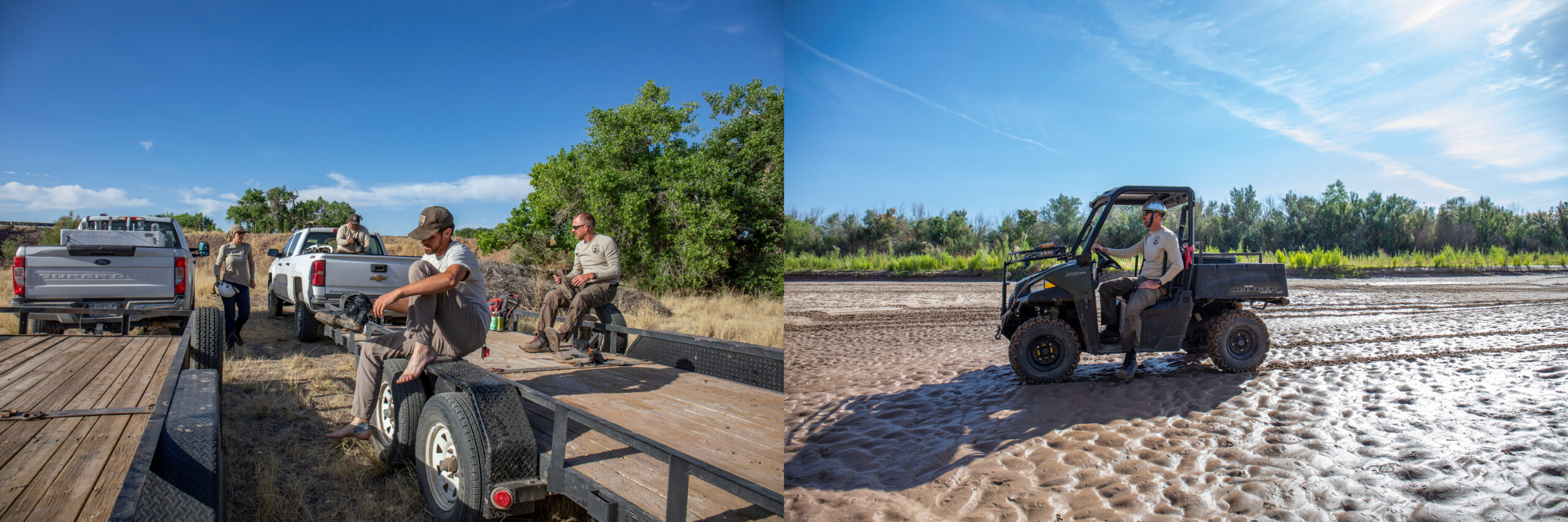
11/15/2023 WASHINGTONย โ€” The Department of the Interior today announced $51 million from President Bidenโ€™s Investing in America agenda for 30 new Environmental Water Resource Projects in 11 states through the Bureau of Reclamation. The collaborative projects focus on water conservation, water management and restoration efforts that will result in significant benefits to ecosystem or watershed health.

โ€œAdequate, resilient and safe water supplies are fundamental to the health, economy and security of every community in our nation,โ€ said Secretary Deb Haaland. โ€œThe Interior Department is focused on ensuring that funding through President Bidenโ€™s Investing in America agenda is going to collaborative projects throughout the West that will benefit the American people.โ€

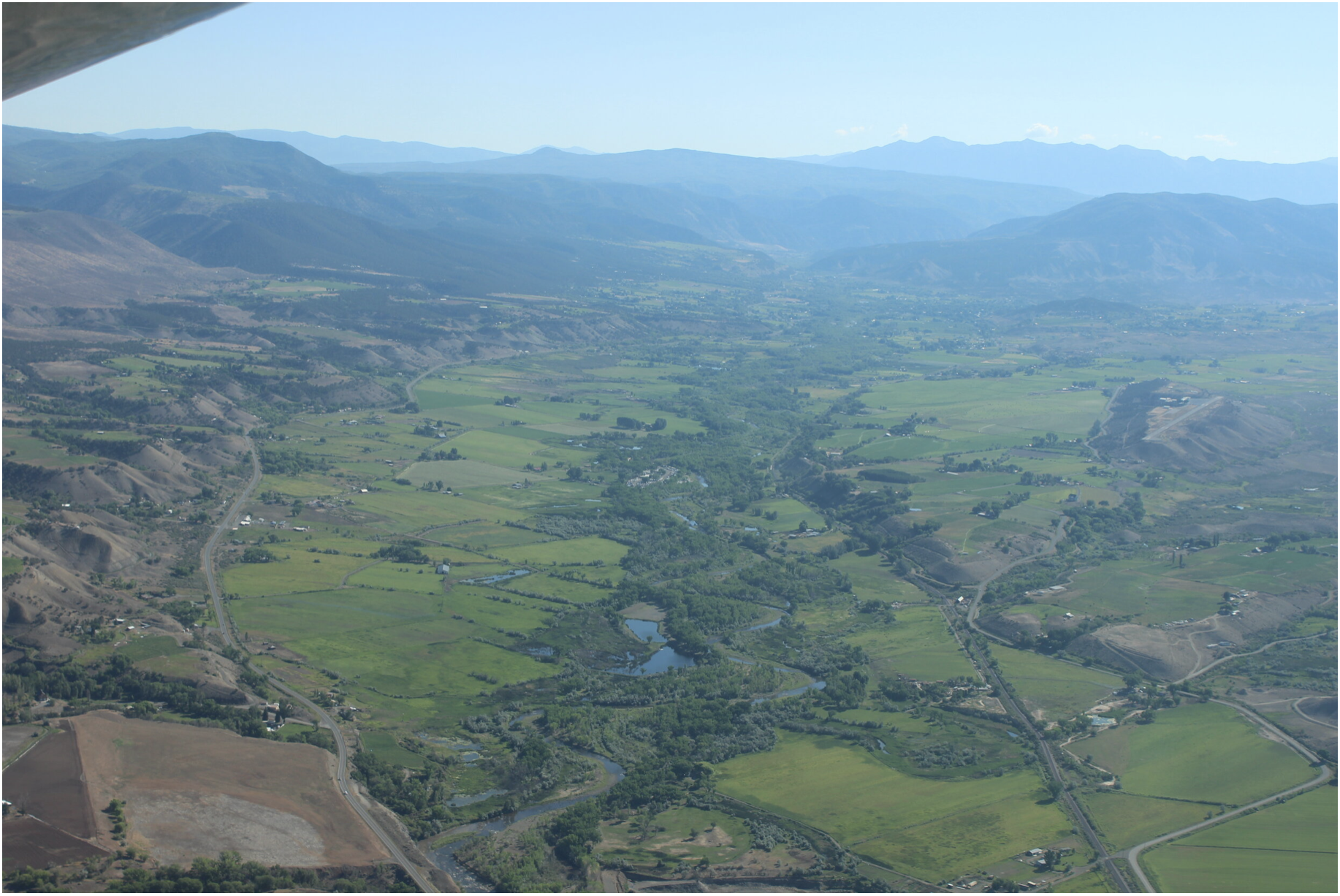
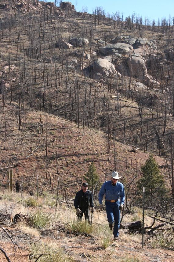
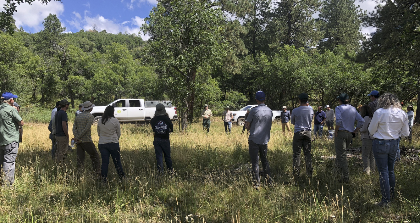
As part of the Biden-Harris administrationโ€™s commemoration of the two-year anniversary of the Bipartisan Infrastructure Law, Principal Deputy Assistant Secretary for Water and Science Michael Brain announced the selections during a visit to Grand Junction, Colorado, where eight of the selected projects are located.

โ€œThese locally led initiatives utilize the investments from President Bidenโ€™s Bipartisan Infrastructure Law to demonstrate quantifiable and sustained water savings, all while providing a direct benefit to the surrounding ecosystems,โ€ said Principal Deputy Assistant Secretary Michael Brain. โ€œThese types of projects and robust cooperation with stakeholders are helping to improve watershed health and increase water reliability and access for families, farmers, and Tribes.โ€

President Bidenโ€™sย Investing in America agendaย represents the largest investment in climate resilience in the nationโ€™s history and is providing much-needed resources to enhance Western communitiesโ€™ resilience to drought and climate change. Through the Bipartisan Infrastructure Law, Reclamation is investing a total of $8.3 billion over five years for water infrastructure projects, including rural water, water storage, conservation and conveyance, nature-based solutions, dam safety, water purification and reuse, and desalination. Over the first two years of its implementation, Reclamation selectedย 372 projects to receive almost $2.8 billion.

The WaterSMART program also advances the Justice40 Initiative, part of the Biden-Harris administrationโ€™s historic commitment to environmental justice, which aims to ensure 40 percent of the overall benefits of certain climate, clean energy and other federal investments flow to disadvantaged communities that have been marginalized by underinvestment and overburdened by pollution.

Arizona

Altar Valley Conservation Alliance, Surface Water Conservation for Drought and Climate Resilience in the Altar Valley Watershed

Reclamation Funding: $1,213,809         

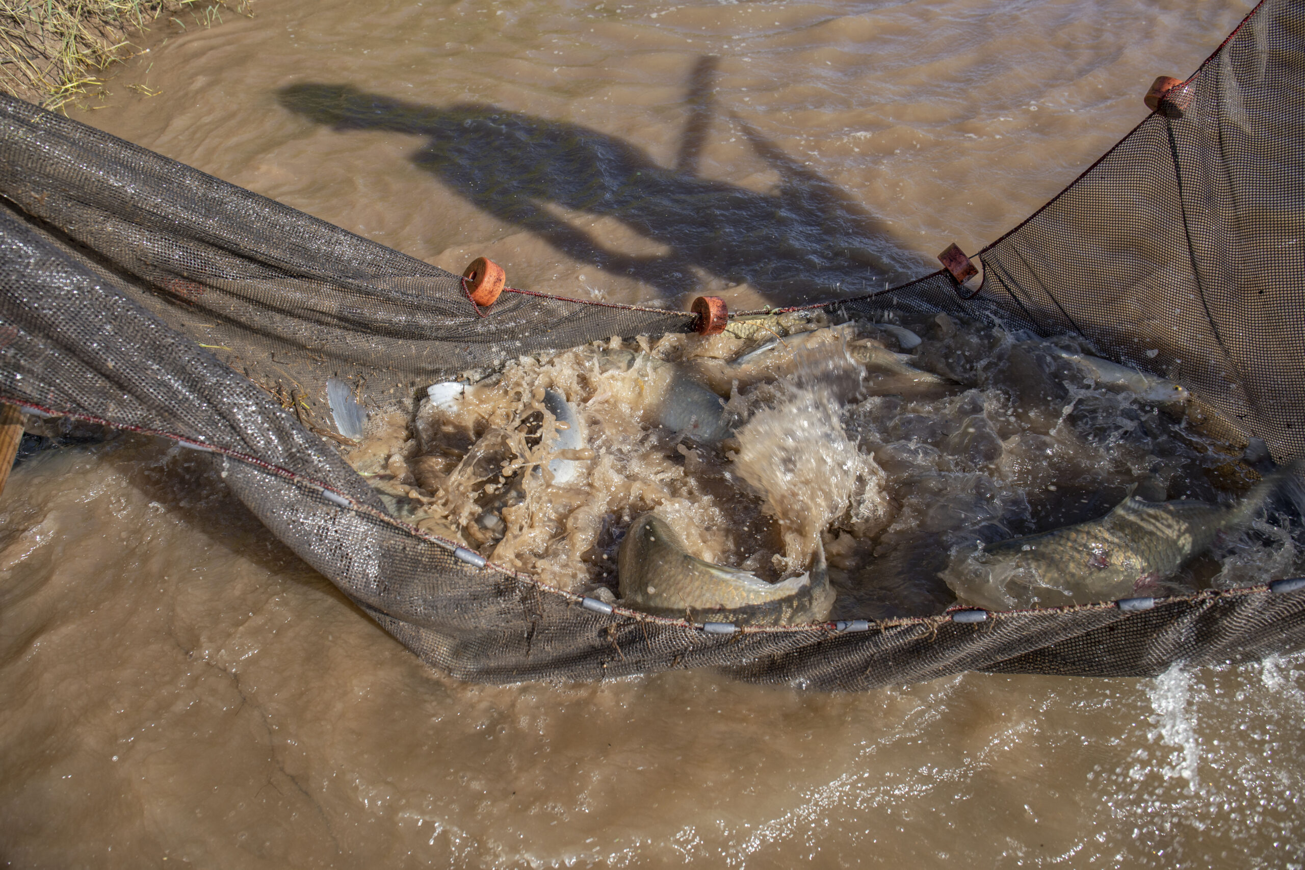
The Altar Valley Conservation Alliance, in partnership with the Pima County Regional Flood Control District, will use a series of nature-based features in the Altar Wash watershed, southwest of Tucson, Arizona, to slow flows, improve groundwater infiltration, and create surface water habitat for wildlife. The Alliance will install low-tech natural infrastructure in dryland streams facilities across 8,985 acres of the wash, which will slow the runoff, reducing erosion and retaining water in the wash for longer periods. The project will enhance drought and climate change resilience, reduce downstream flood impacts and increase the sustainability of agricultural operations.

California

San Bernardino Valley Municipal Water District, Hidden Valley Creek Aquatic and Riparian Habitat Restoration Project

Reclamation Funding: $3,000,000

San Bernardino Valley Municipal Water District will implement the Hidden Valley Creek Aquatic and Riparian Habitat Restoration Project within the Upper Santa Ana River Watershed, a tributary of the Santa Ana River, in southern California. The project will restore and improve the condition of 21.7 acres of degraded aquatic and riparian habitat, including habitat for the threatened Santa Ana Sucker. The district will construct new and restored stream channel, establish a buffer of native riparian vegetation on each side of the stream, and enhance a 1.2 acre floodplain bench. The project will include non-native plant removal and site revegetation efforts. This restoration will improve water quality, increase habitat connectivity, and provide crucial support for recovering endangered and sensitive species.

Uncompahgre River

Colorado

American Rivers, Inc, Uncompahgre River Multi-Benefit Project

Reclamation Funding: $ 1,198,376        

American Rivers, in partnership with the Ward Water Group and local landowners, will upgrade irrigation infrastructure and enhance aquatic and riparian habitats along one mile of the Uncompahgre River in western, Colorado. The current push-up diversion dam structure has caused channel widening, reduction of aquatic habitat diversity, and a decrease in floodplain connectivity. American Rivers will improve the Ward Irrigation Ditch infrastructure by constructing 2 cross-vane weirs, installing a new concrete stoplog bypass at the headgate, and piping 5,600 linear feet of open irrigation ditches. The project will improve aquatic and riparian habitat within the channel by constructing cross-vane weirs, J-hook vanes, rock vanes, and boulder clusters; revegetating the banks and meanders using willow pole clusters and riparian plant species plugs; and removing invasive vegetation.

Rio Grande through the eastern edge of Alamosa July 5, 2022. Photo credit: Chris Lopez/Alamosa Citizen

Colorado Rio Grande Restoration Foundation, Farmers Union Multi-Benefit Diversion Infrastructure Improvement Project

Reclamation Funding: $1,274,625

The Colorado Rio Grande Restoration Foundation, in partnership with the San Luis Valley Irrigation District, will upgrade the diversion infrastructure for the Farmers Union Canal and Rio Grande #1 Ditch, in southwestern Colorado, to meet agricultural, ecological, recreational, and community needs. The current diversion infrastructure creates a barrier to fish passage, is hazardous for boaters, and requires frequent maintenance. The partners will construct a new diversion structure, incorporating fish passage that will allow fish to access an additional 1.42 river miles of habitat. The project also includes restoration of streambank through the installation of rock and root wad structures and streambed and aquatic habitat through improved sediment transport at the diversion structure. The diversion upgrade will provide safe boat passage and more efficiently deliver water to the Farmers Union Canal and Rio Grande #1 Ditch.

Mancos River in Montezuma County

Mancos Conservation District, Riparian Restoration and Infrastructure Improvements to Better the Ecological Processes of the Mancos Watershed

Reclamation Funding: $2,482,686ย ย ย ย 

The Mancos Conservation District, in partnership with the Town of Mancos, will implement a multi-benefit project consisting of a suite of infrastructure improvements and nature-based solutions along the Mancos River, a tributary of the San Juan River, in southwestern, Colorado. The partners will upgrade three agricultural diversion structures, install remote metering and telemetry equipment on 10 agricultural pipeline headgates, complete fire mitigation work on 650 upland acres and replace invasive riparian plants with native species adjacent to the Mancos River. The project is downstream of Reclamationโ€™s Jackson Gulch Reservoir and will mitigate wildfire risk to the reservoir and water supplies in the Mancos River Watershed.ย 

Roan Cliffs Aerial via Rocky Mountain Wild

Middle Colorado Watershed Council, Roan Creek Fish Barrier and Diversion Infrastructure Upgrade

Reclamation Funding: $746,423

The Middle Colorado Watershed Council, working in partnership with Garfield County, will install a fish barrier to prevent non-native fish migration, and upgrade a diversion structure on Roan Creek, in western Colorado. The upper portion of Roan Creek, a tributary of the Colorado River, contains a unique native fish assemblage comprised of Colorado River cutthroat trout, bluehead sucker, Paiute sculpin, and speckled dace. Non-native fish in the Roan Creek watershed harm the river systemโ€™s ecology by predating on or hybridizing with the unique native species. Construction of a fish barrier will effectively eliminate the upstream movement of non-native fish to improve Roan Creekโ€™s aquatic and riparian habitat and protect the native fish.

Purgatoire Watershed Partnership, Purgatoire River Fish Passage

Reclamation Funding: $2,403,748

The Purgatoire Watershed Partnership will improve fish passage at the Baca-Picketwire diversion dam on the Purgatoire River in downtown Trinidad, Colorado. The Purgatoire River supports a robust assemblage of fish species and is of local and regional interest for conservation. Currently, ecological function is impaired because the existing concrete diversion dam is not passable to fish. This project will restore fish habitat connectivity and enhance recreation opportunities by adding a low-gradient engineered riffle feature that mimics a natural channel. The upgrade will allow fish access to 3.3 miles of main river, wetlands, 20 miles of Raton Creek, and many stream miles within ephemeral drainages, including approximately 4 miles of Mooreโ€™s Canyon and 9 miles of Colorado Canyon. The project is also expected to have flood mitigation, sediment transport, and bank stabilization co-benefits.

Los Pinos River

Southern Ute Tribe, Nannice Canal Diversion and Fish Passage Project

Reclamation Funding: $651,920

The Southern Ute Tribe, in partnership with the Bureau of Indian Affairs (BIA) and The Nature Conservancy, will implement the Nannice Canal Diversion and Fish Passage project on the Southern Ute Indian Reservation in southwestern, Colorado. Part of the BIA-owned and operated Pine River Indian Irrigation project that receives water from Reclamationโ€™s Vallecito Dam, the Nannice Canal Diversion is a low-head dam that sweeps across the Los Pinos River and creates a significant fish barrier. Fish get entrained in the Nannice Canal during low flows and during irrigation season. The Southern Ute Water Resources Division will upgrade the diversion structure and install a fish screen and fish ladder. The project will restore river connectivity, improve fish passage, and eliminate fish entrainment during low flows, while continuing to allow the diversion of Nannice Canalโ€™s decreed water.

August, in the Elk Creek valley. Photo: Brent Gardner-Smith/Aspen Journalism

Trout Unlimited, Inc,ย Middle Colorado River Agriculture Collaborative: 4 Fish Passage/ Irrigation Diversion Upgrade Projects on Elk Creek-a tributary to the Colorado River

Reclamation Funding: $2,999,595

Trout Unlimited and the Middle Colorado Agriculture Collaborative will upgrade, relocate, or combine six diversion structures to remove instream barriers to fish passage in the Elk Creek west of Glenwood Springs, Colorado. These upgrades will open approximately five miles of aquatic habitat in Elk Creek to fish passage. The project is anticipated to improve stream morphology, increase instream flows, and benefit irrigators by increasing the operational capabilities of the diversions and reducing transmission losses of vital irrigation water.

Agriculture in the U.S. Southwest is at high risk from the impacts of climate change. EcoFlight photo of the North Fork Valley by the Western Slope Conservation Center.

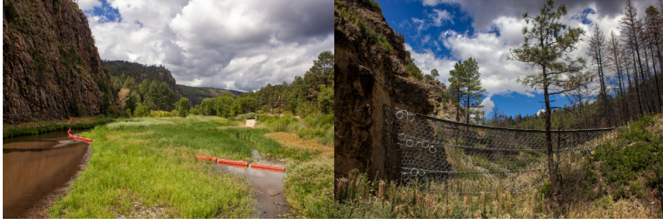
Western Slope Conservation Center, Farmer’s Ditch Improvement Project

Reclamation Funding: $ 1,594,799

The Western Slope Conservation Center, in partnership with North Fork Farmer’s Ditch Association, located in west-central Colorado, will modernize the Farmers ditch diversion and headgate structures to improve upstream fish passage, increase diversion efficiency, and improve safety for boaters. The project will upgrade the existing concrete headgate structure with a long-lasting alternative headgate that is equipped with remote automation technology, enabling more efficient water deliveries to irrigators while maximizing water that remains in the river. In addition, the Center will install graded riffle and small pools and drops to mimic the natural morphology of the river for approximately 200 feet below the diversion to promote upstream fish passage and allow for safe recreational boating.

Hawaii

Hawaii Department of Land and Natural Resources, Protecting Forests for Water Supply Sustainability in Molokai, Hawaiโ€™i

Reclamation Funding: $936,892

The state of Hawai’i Department of Land and Natural Resources, Division of Forestry and Wildlife, will expand protection of native landscapes in the north-eastern portion of Molokai, one of the five Hawaiian Islands. Invasive hooved animals, including feral pigs, deer, and goats, are the main threat to Hawai’iโ€™s original forests, negatively impacting water supply, increasing flood risk and land erosion, and threatening several listed species. The project will reduce populations and associated damage to the forest due to these invasive animals through animal control and installation of fencing to exclude them from 3,340 acres within the Pelekunu Valley. The project will also remove hooved animals from an additional 12,000 acres along the north shore of Molokai in an area with steep terrain that is not possible to fence. The island of Molokai relies on ground water for all fresh water needs and is designated as a groundwater management area by Hawaiโ€™iโ€™s Commission of Water Resources Management. The forest provides increased water infiltration into the aquifer and reduces soil erosion and associated water quality issues.

Idaho

City of Pocatello, Rainey Park Stream Restoration and Wetland Creation

Reclamation Funding: $1,635,276

The city of Pocatello, Idaho, will implement a river restoration project on the Portneuf River in downtown Pocatello. The health of the Portneuf River has been severely compromised by flood protection levees and the construction of a concrete channel, which removed hundreds of acres of wetlands when installed. Restoration will be accomplished by moving the riverโ€™s existing riprapped levee to an area of city-owned property. A wetland and side channel will be installed adjacent to the levee, along with accessible river access for anglers and floaters. Additionally, a stormwater pond will be installed to capture the first flush of sediment-laden waters from city streets. This project builds on the concepts developed in the 2016 Portneuf River Vision Study and addresses a wide range of environmental goals, including improving hydrologic functions by increasing floodplain, wetland, and riparian habitat areas, and improving water quality.

The Nature Conservancy, Loving Creek Tributaries Restoration and Water Conservation Project

Reclamation Funding: $1,900,217

The Nature Conservancy, in partnership with Idaho Department of Fish and Game and landowners, will complete a suite of nature-based features on four reaches of Loving Creek, located in Blaine County in south central Idaho. The four project locations span the full extent of Loving Creek from its headwaters to the outlet at Silver Creek. Through a combination of in-stream restoration work, sediment removal, and riparian habitat creation, the project will restore 2.75 miles of active stream channel, regenerate riparian and wetland habitat, and remove one fish passage barrier to holistically restore connectivity to 5.72 miles of upstream habitat. The project also will revive upland and agricultural buffer habitat and pipe 1,200 linear feet of open water delivery canal to conserve 9 acre-feet of water, which will remain in Loving Creek as instream flow. Despite improvements in agricultural management and land use practices over the past several decades, water quality and habitat conditions in Silver Creek and its tributaries remain degraded. This project will restore more natural channel morphology, increase habitat complexity, and improve water quality in Loving Creek.

Nez Perce Soil and Water Conservation District, White Road Passage Project

Reclamation Funding: $367,091

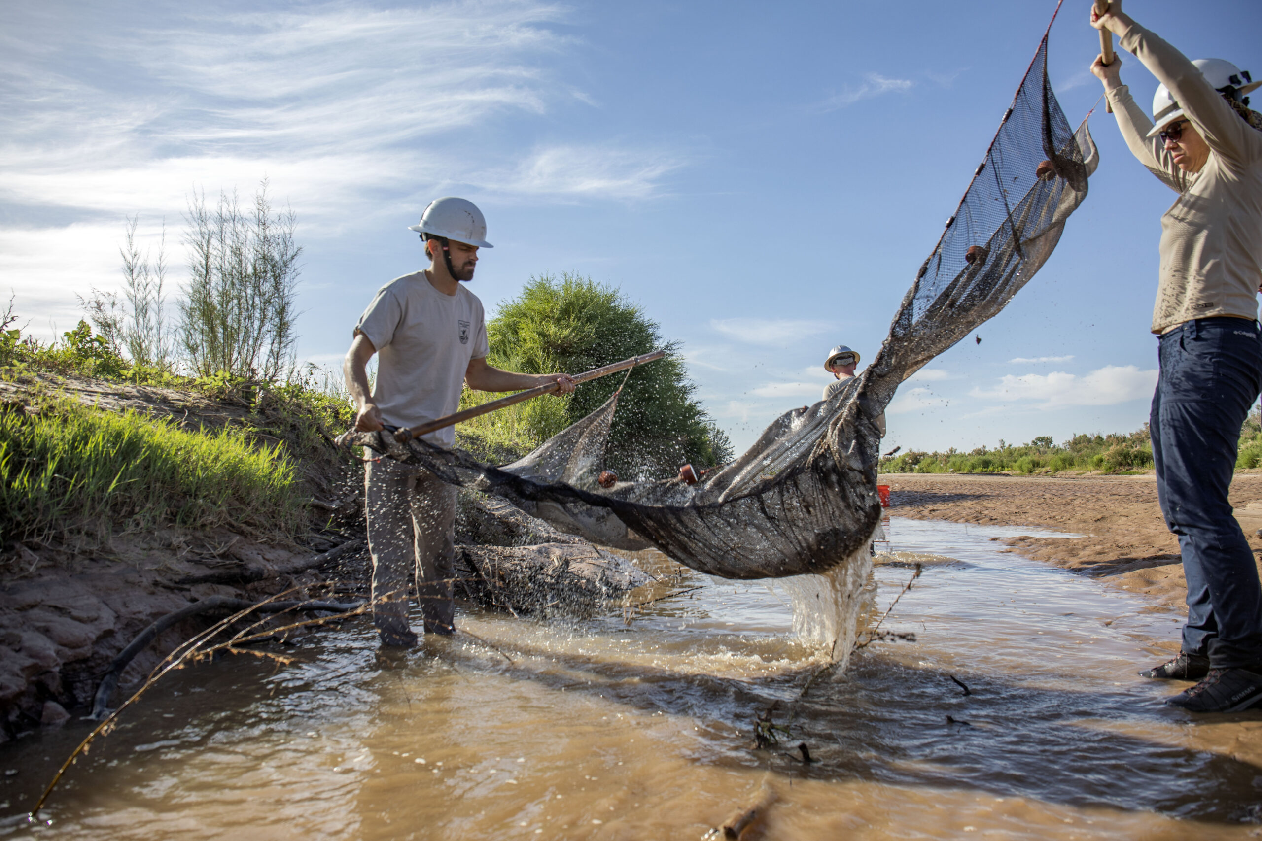
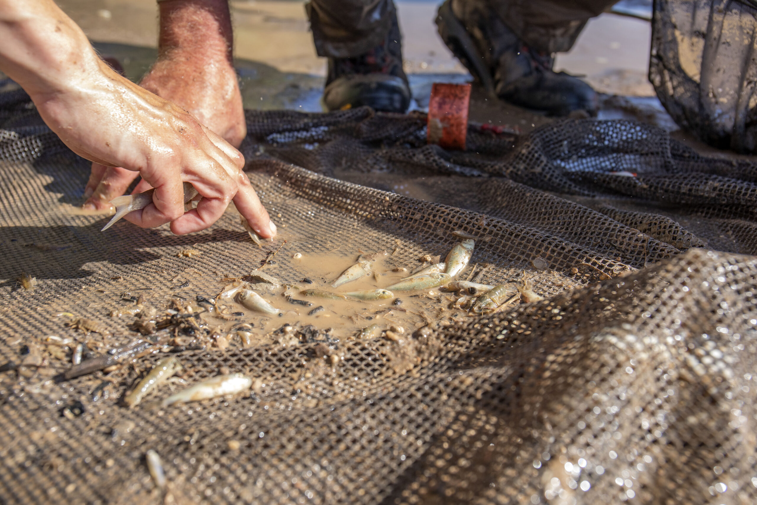
The Nez Perce Soil and Water Conservation District will improve anadromous fish habitat for Federally listed Steelhead Trout in the Tom Beall Creek watershed, a tributary to Lapwai Creek, located in northern Idaho. The project will improve watershed health within the boundaries of the Reclamationโ€™s Lewiston Orchard Project. The district will replace an existing culvert with a fish passable structure to support the migration of the Steelhead Trout and additional species including Coho and Chinook Salmon. When completed, the project will provide access to approximately two miles of habitat and reduce area flood risk. The project also will improve water quality to downstream recreational and agricultural water users. The project is supported by the Lapwai Creek Ecological Restoration Strategy developed collaboratively with the Nez Perce Tribe, National Marine Fisheries Service, Idaho Department of Transportation, Nez Perce County, city of Lapwai, city of Culdesac, Lewiston Orchards Irrigation District, a landowner advisory group, and several Idaho state government divisions.

Nez Perce Soil and Water Conservation District, Lower Clearwater Snake Rivers Phase I

Reclamation Funding: $451,889

The Nez Perce Soil and Water Conservation District will undertake the Lower Clearwater Snake Rivers Phase I Project in Culdesac, Nez Perce, and Lewis Counties, in northwest Idaho. The project will improve watershed health within the boundaries of the Reclamationโ€™s Lewiston Orchard Project. The district will enhance anadromous fish habitat for Federally listed Steelhead Trout and improve overall water quality in the Lower Clearwater River Basin. The district will upgrade a culvert for aquatic organism passage, thin approximately 129 acres of forest to mitigate wildfire risk and install over 100 instream wood structures to enhance over 10,000 feet of stream for juvenile steelhead habitat. The project will yield ecological benefits including improved habitat function, optimized flow timing, increased groundwater recharge, and reduced sedimentation.

Trout Unlimited, Inc, Completion of the Alta Harris Creek Boise River Side Channel and Fish Passage Project Along the Boise River

Reclamation Funding: $734,103

Trout Unlimited, together with the city of Boise, Idaho, will improve aquatic ecology in the Boise River by restoring spawning and rearing habitat for salmonid fishes, and providing fish passage connection between the lower Boise River and Barber Pool, downstream of Reclamationโ€™s Arrowrock Dam. The project will enhance 3,800 feet of existing side channel and include construction of 1,600 feet of new side channel, complete riparian revegetation with native plants, and construct of a fish passage facility at Barber Dam. The fishway design will better accommodate fluctuating river flows and variable water surface elevation. Completion of this project will reconnect 2.5 miles of the main-channel Boise River with 5 acres of adjacent riparian habitat and over a mile of side channel for spawning and rearing of juvenile fish. The project also will allow fish to bypass a half mile of the Boise River with a risk for fish entrainment in water delivery canals.

Wood River Land Trust, Warm Springs Preserve Stream Restoration and Irrigation Improvement Project

Reclamation Funding: $1,733,154

Wood River Land Trust, in partnership with the city of Ketchum, Idaho, will enhance and improve the ecological function of the 65 acre Warm Spring Preserve along the Warms Springs Creek in Blaine County, in central Idaho. Warm Springs Creek in the project area has been artificially confined, concentrating flow, and creating incision and floodplain abandonment. There is virtually no floodplain connectivity within the northern half of the project reach. The project will restore 1.3 miles of Warm Springs Creek through instream earthwork to create pools, point bars, and constructed riffles, and installation of woody debris structures to promote in-channel complexity. The project will also create nine acres of adjacent floodplain habitat by lowering the floodplain. The floodplain restoration will be complemented by revegetation with low-water native plant species along the riparian zones and throughout the preserve, which will collectively aid in improvement of water quality and temperature of Warm Springs Creek.
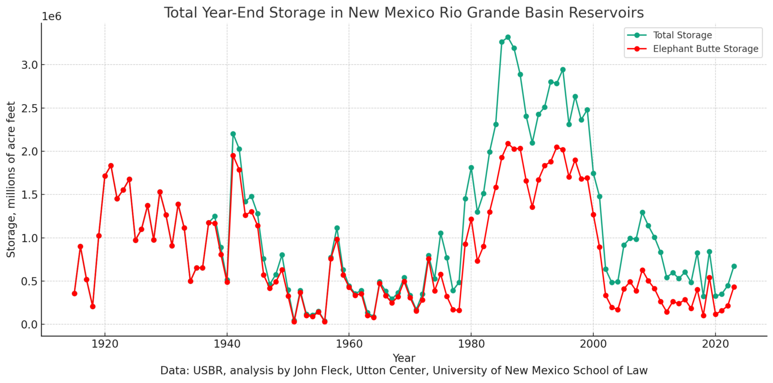
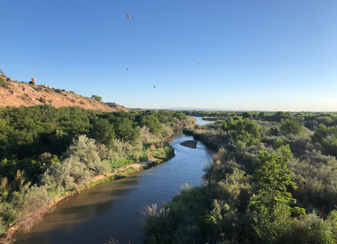
New Mexico

Chama Peak Land Alliance, Increasing Resiliency in the San Juan-Chama Project Headwaters

Reclamation Funding: $3,000,000

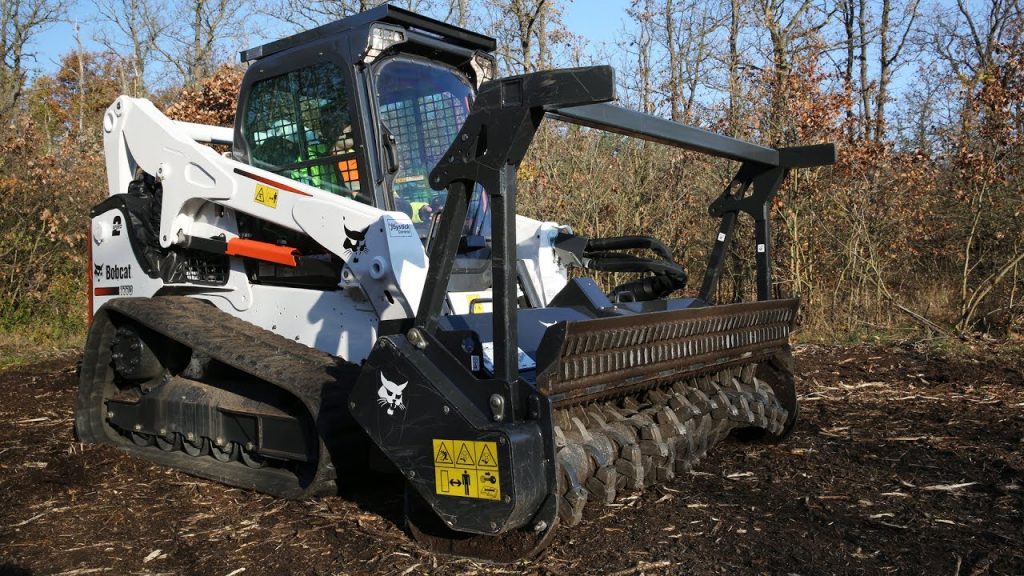
The Chama Peak Land Alliance will conduct ecological forest thinning on approximately 2,150 acres to protect source watersheds for Reclamationโ€™s San Juan-Chama Project, the Rio Chama headwaters, and the Rio Brazos headwaters from the impacts of future wildfires. Forests in these headwaters are unnaturally dense and homogenous, putting them at risk of severe wildfires and deterioration of watershed function. These watersheds supply crucial drinking water to the cities of Albuquerque and Santa Fe, and numerous tribes, Pueblos, and rural communities throughout New Mexico. In addition to threatening water supply infrastructure, a severe wildfire could cause water quality impairments, flooding erosion and significant degradation of habitat for fish and wildlife.

Pueblo of Isleta, Restoring Watershed Function and Protecting Sacred Ancestral Sites on the lower Rio Puerco, a tributary of the Rio Grande

Reclamation Funding: $2,487,942

The Pueblo of Isleta will build resilience in the lower Rio Puerco watershed by implementing nature-based watershed restoration techniques to restore natural watershed function on an approximately 30,000 acre parcel of the Comanche Ranch and neighboring lands, in central New Mexico. Forming a part of the Pueblo of Isleta lands, the Comanche Ranch comprises over 90,000 acres of public and private lands and is home to upwards of one hundred sacred ancestral sites, including an important cultural site, the Pottery Mound. The ranch forms an integral part of the Rio Puerco lower watershed, the primary source of sediment to the middle Rio Grande and Reclamationโ€™s Elephant Butte Reservoir. The Pueblo and stakeholders have identified that loss of vegetation and increasingly higher energy monsoonal storms that have resulted in erosion and soil loss throughout the uplands in this region and threaten the cultural sites downstream. The Pueblo will utilize a series of watershed restoration practices that spread and slow runoff flows, increase groundwater infiltration, and reduce erosion, including contour plowing with native seed imprinting, contour stone line and brush weir installation to protect plantings and slow runoff, and riparian restoration and revegetation on a section of the Rio Puerco adjacent to Pottery Mound, including the planting of wild medicinal and traditionally gathered edible plants.

Nevada

Southern Nevada Water Authority, Muddy River Riparian Corridor Improvements at Warm Springs Natural Area

Reclamation Funding: $743,329

The Southern Nevada Water Authority will protect the Warm Springs Natural Area, a 1,250 acre property located in southern Nevada, and downstream habitat from drought impacts. The property is regionally significant as it contains more than 20 perennial springs that form the headwaters of the Muddy River and numerous habitat types. These resources provide habitat for several protected and sensitive species, including the endangered Moapa dace, endangered southwestern willow flycatcher, and threatened yellow-billed cuckoo. The project will widen the riparian corridors along 0.3 miles of the mainstem of the Muddy River and establish mesquite bosques along the corridor, resulting in the creation of 12 acres of new habitat. These actions will increase habitat for listed species, improve hydrologic conditions, lessen wildfire risk, and reduce erosion and sedimentation during flood events. Non-native vegetation will be removed and replaced with native vegetation to restore the area to the natural habitat that existed before the area was converted for agricultural purposes.

Oregon

Crooked River Watershed Council, Lower Crooked River Riparian, Floodplain, and Habitat Restoration Project

Reclamation Funding: $1,400,000         

The Crooked River Watershed Council, working in partnership with the Ochoco Irrigation District, will restore habitat and enhance ecological features on two project sites just downstream from Prineville, Oregon. Hydrology in the Crooked River watershed is impacted by upstream Dams, including Reclamationโ€™s Bowman Dam, leading to loss of floodplain continuity, degraded channel structures, and water quality impairments, impacting native Spring Chinook Salmon and Columbia River Steelhead populations that inhabit the watershed. To address these impairments, the Council will strategically place approximately 130 large wood structures to promote habitat complexity, stabilize eroding streambanks on 3,285 linear feet of stream channel, restore approximately 19 acres of floodplain and upland habitat, improve 0.22 acres of alcove habitat, and create 0.42 acres of wetland.

Deschutes Land Trust, Ochoco Preserve Restoration – Phases 2 and 3

Reclamation Funding: $3,000,000         

The Deschutes Land Trust, with support from the Oregon Department of Fish and Wildlife, will restore aquatic, floodplain, and upland habitat across 124 acres on the Ochoco Preserve, located in Crook County, Oregon, adjacent to the city of Prineville. The Crooked River and Ochoco Creek support reintroduced spring Chinook salmon and summer steelhead, as well as a host of other native aquatic species. The waterways frequently experience low flows, elevated summer stream temperatures, and poor water quality. These issues are compounded by a lack of suitable habitats for both fish and terrestrial wildlife, and the impacts to river ecology of Reclamationโ€™s Crooked River Project, including Bowman and Ochoco Dams. The Deschutes Land Trust will lead efforts to create over 2 miles of new main baseflow stream channels, 1.5 miles of side channels, over 11 acres of wetland, and restore 37 acres of floodplain and 75 acres of upland habitat, significantly increasing available habitat for native species.

Texas

Menard County Water Control and Improvement District #1, Pipe a 2.5 mile section of the Menard Canal and dedicate 1,100 acre-feet instream

Reclamation Funding: $1,891,500         

Menard County Control and Improvements District #1, in central Texas, will upgrade the Menard Canal irrigation water conveyance system to reduce losses so that more water is kept in the San Saba River for fish and wildlife benefit. A water loss study conducted by U.S. Geological Survey in the summer of 2014 showed that the 6-mile long canal experiences an approximately 50% loss over the first 2.5 miles. The project involves replacing the first 4,000 feet of the unlined Menard Canal with pipe, and re-sloping, reshaping and partially filling the next mile of unlined canal to create a narrower channel profile. Following that narrowed span of canal, the district will pipe an additional 2,000 feet of the canal and install gates to control flow. The district has committed to leaving the majority of the conserved water, 1,100 acre-feet per year instream for a 30 year term. The additional instream flows will contribute significantly to baseflow of the San Saba River and create a more reliable supply of water for downstream aquatic habitat. Sections of the San Saba River downstream from the project that will benefit from the increased flows include critical habitat for the Texas fatmucket and Texas pimpleback mussel species.

Washington

The Confederated Tribes and Bands of the Yakama Nation, Lower Yakima River: Anadromous Fish Survival

Reclamation Funding: $2,248,677

The Yakama Nation, in partnership with the Benton County Conservation District, will improve conditions for anadromous fish species in the Prosser, Snively, and Confluence reaches of the lower Yakima River, in central Washington. The project will address two key elements of the Yakima Basin Integrated Plan: fish passage and habitat protection and enhancement. The Yakima Nation will complete instream restoration work to expand a cold-water refuge within the Yakima River mainstem at the confluence of Amon Creek, including construction of 1,400 linear feet of cool water channel habitat and restoration of 20 acres of riparian zone through invasive vegetation removal and revegetation with native species. The Yakima Nation will also complete electrofishing and install a fish trap on the Wanawish Dam to remove and prevent reintroduction of invasive predatory fish species that impede the migration of endangered fish species. These improvements will benefit the federally threatened Middle Columbia River steelhead; spring and fall/summer run Chinook, Coho, and Sockeye salmon; and the Yakima population of Pacific lamprey. The project area is downstream of Reclamationโ€™s Yakima Project, which impacts river flows, temperatures, and habitat conditions in this area.

The Confederated Tribes and Bands of the Yakama Nation, Yakima River Mile 89.5 Side Channel and Floodplain Restoration

Reclamation Funding: $600,000

The Confederated Tribes and Bands of the Yakama Nation will reconnect approximately 9 miles of side channel along the Yakima River within the Yakama Reservation, in south central Washington. Upstream flow regulations tied to Reclamationโ€™s Yakima Project have constricted historical floodplain processes and cut-off side channel access for native fish species, leading to degradation of riparian and wetland habitat areas. The Yakama Nation will excavate five historic side channel sections connecting to the mainstem of the Yakima River, install two constructed logjam inlet structures to ensure fish access to the mainstem of the river, and install three stream ford crossings to access the project site. The excavation of side channels will increase winter and spring off-channel habitat utilized by Middle Columbia River Steelhead and restore hydrologic connectivity to a total of 135 acres of floodplain and wetland habitat. The project is supported by the Yakima Basin Integrated 10-Year Action Plan developed by water and land management stakeholders.

The County of Chelan, Camas Meadows Streamflow and Ecosystem Restoration Project

Reclamation Funding: $468,903

The Chelan County Natural Resource Department, in coordination with the Washington Department of Natural Resources, will restore wet meadow hydrology in Camas Meadows, a unique meadow ecosystem within the steep canyon drainages of north-central Cascade Mountains in Washington. The 1,300 acre meadow flows into Camas Creek, a tributary of Peshastin Creek, in the Wenatchee Watershed. Due to widespread floodplain disconnection and irrigation withdrawals, the Peshastin sub-basin is among the top three flow-limited sub- basins in the Wenatchee Watershed, with chronic low flows and high stream temperatures limiting recovery of ESA-listed steelhead and spring Chinook that reside throughout Peshastin Creek and in the lower reaches of Camas creek. Historic land use practices have resulted in Camas Meadows being confined into ditch-like channels with incision ranging from 4 feet to 8 feet, causing rapid and early drying of the meadow. This projectwill restore the natural hydrology of the meadow by replacing the meadow outlet culvert, re-grading the channel and meadow elevations, installing channel-spanning habitat log structures, and re-planting with native shrubs and plants. The project will restore floodplain connectivity and wet meadow hydrology for a modeled additional water storage of 180 acre-feet and an anticipated year-round baseflow contribution of 0.2 cfs.

Kittitas Conservation Trust, Gold Creek Restoration Phase 2 RM 2-3 Implementation

Reclamation Funding: $2,475,000

Kittitas Conservation Trust will implement an in-stream restoration project on river mile 2-3 of Gold Creek, in Kittitas County, Washington. Located just east of Snoqualmie Pass in Kittitas County, Washington, Gold Creek is the headwaters of the upper Yakima River and flows for approximately 8 miles from the Alpine Lakes Wilderness into Keechelus Reservoir in the Central Cascade Mountains. Upstream fish passage is blocked at Reclamationโ€™s Keechelus Dam on the downstream end of the reservoir. Prolonged dewatering conditions and a centuryโ€™s worth of anthropogenic channel widening have dramatically impacted the habitat and health of the creekโ€™s Federally threatened Bull Trout. The Trust will install a total of 28 large woody debris structures along the river mile. The instream wood replenishment will create habitat complexity, including deeper pools with shaded cover, provide relief from high velocity flood flows, and ensure optimal habitat for both the successful rearing of juvenile Bull Trout and migration of mature fish. The project also will provide floodplain reconnection, which will improve groundwater recharge from flood flows, and reduce the likelihood of future flood events further harming the channel morphology.

Kittitas Reclamation District, Kittitas Reclamation District – South Branch Piping

Reclamation Funding: $3,000,000         

The Kittitas Reclamation District, located in central Washington, will restore in-stream flows and provide benefits to fish and wildlife in Mantash Creek, an over-appropriated tributary of the Yakima River. The project will involve the piping of a 2,656 linear feet section of the currently unlined South Branch Canal, which is part of Reclamationโ€™s Yakima Project. Once piped, the district anticipates conserving approximately 385 acre-feet per year currently lost to seepage. The district will designate this otherwise lost water through an allocation, management, and protection agreement, that involves careful monitoring of stream flow on Mantash Creek to maintain optimal conditions for Yakima Basin fish species, including Coho and Chinook Salmon, Mid-Columbia Steelhead, and Bull Trout. The Washington State Department of Ecology is responsible for water protection and enforcement and will ensure that conserved water stays instream.

Wyoming

City of Casper, North Platte River Restoration — Izaak Walton Reach

Reclamation Funding: $3,000,000

The city of Casper, in collaboration with members of the Platte River Revival Committee, will complete a river and riparian restoration project on the Izaak Walton reach of the North Platte River in Natrona County, Wyoming. The North Platte River is a Blue Ribbon trout fishery, but this reach suffers from significant bank erosion, tight riverbend geometry, a lack of riffle-pool complex development, poor bedform complexity, meager floodplain connectivity, and is characterized by a low quality riparian vegetation community. These conditions have resulted in degraded habitat for trout as well as native aquatic and terrestrial species. These characteristics have also contributed to reduced ecological function, adversely affected the regional municipal water supply, degraded aesthetic values, and impaired river recreation. The city of Casper will restore over 5,150 linear feet of the North Platte River that will involve regrading of the riverbed, banks, and floodplain to create appropriate geometry and bedform complexity, reduce riverbank degradation, and improve instream and riparian habitats.

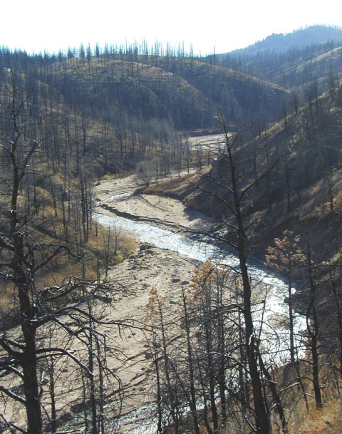
Trout Unlimited, Inc, Sage Creek Watershed Restoration for Drought Resilience and Sediment Control

Reclamation Funding: $1,513,538

Trout Unlimited, working in partnership with Wyoming Game and Fish, will complete a multi-part restoration project, including nature-based features, in the Sage Creek Watershed, located in southwestern Wyoming. The project will involve the installation of 50 beaver dam analogs, 160 aggradation structures, and an aquatic invasive species barrier along a 5.6 mile stretch of Sage Creek. These installations will be complemented by a robust invasive plant removal and native riparian reseeding along 7.6 miles of both the Sage and Trout Creeks. Together, these actions are estimated to restore 453 acres of valley floor habitat and protect 79.5 linear miles of aquatic habitat from invasive trout that inhabit Reclamationโ€™s Flaming Gorge Reservoir just downstream of the project site. The project is additionally expected to reduce channel incision and erosion to reduce sediment and nutrient delivery to Flaming Gorge Reservoir, protect native trout from hybridization, and increase groundwater recharge and surface water availability.

Backer of #SanLuisValley water plan, state water buff chosen for board on Douglas Countyโ€™s water future — The Douglas County News-Press #RioGrande

Rueter-Hess Dam before first fill. Photo credit: Parker Water & Sanitation

Click the link to read the article on the Douglas County News-Press website (Ellis Arnold). Here’s an excerpt:

Months of discussion on who will help decide the future of water supply in Douglas County have come to an end now that county leaders have chosen 11 members of a new volunteer board…The forming of the new volunteer board โ€” the Douglas County Water Commission โ€” comes against the backdrop of a controversial proposal to pump about 22,000 acre-feet of water per year to Douglas County from the San Luis Valley in the southern part of the state…Last year, county leaders Abe Laydon and Thomas joined together in deciding not to move forward with that project, while elected leader George Teal has continued to support it. [Sean] Tonner, one of the principals of Renewable Water Resources, attracted news media attention for throwing his hat in the ring to serve on the water commission…The water commission is expected to help create a plan regarding water supply and conservation, among other aspects of water in the county. Itโ€™ll consist of unpaid volunteers, according to the county…The main members of the water commission, named on Nov. 6, include the following.

Representing District I, or northeast Douglas County:

โ€ข James Eklund, who had worked on the stateโ€™s water plan, according to county staff.(Removing the requirement for being a landowner or a resident of Douglas County allowed for choosing Eklund, who told county leaders he is โ€œin the city and county of Denver.โ€)

โ€ข Jack Hilbert, formerly one of Douglas Countyโ€™s elected leaders.

โ€ข Donald Langley, who serves on the Parker Water board.

Representing District II, including central and south Douglas County:

โ€ข Clark Hammelman, a former Castle Rock town councilmember.

โ€ข James Maras, a Perry Park Water and Sanitation District board member.

โ€ข Roger Hudson, a Castle Pines city councilmember.

Representing District III, or northwest Douglas County:

โ€ข Frank Johns, who said he has worked on various water plans for communities over the years. Johns serves on the board of the Centennial Water and Sanitation District, which serves Highlands Ranch.

โ€ข Evan Ela, a longtime water attorney.

โ€ข Harold Smethills, a member of the Dominion Water and Sanitation District board and a developer of the Sterling Ranch area in northwest Douglas County.

Appointees โ€œat large,โ€ meaning from the county as a whole, include Tonner and Tricia Bernhardt, who has a bachelorโ€™s degree in agricultural economics from Colorado State University and a masterโ€™s degree in environmental policy and management from the University of Denver, according to a LinkedIn page.

Potential Water Delivery Routes. Since this water will be exported from the San Luis Valley, the water will be fully reusable. In addition to being a renewable water supply, this is an important component of the RWR water supply and delivery plan. Reuse allows first-use water to be used to extinction, which means that this water, after first use, can be reused multiple times. Graphic credit: Renewable Water Resources

#Colorado sends too much #RioGrande water downstream — @AlamosaCitizen

Sunrise March 10, 2023 Alamosa Colorado with the Rio Grande in the foreground. Photo credit: Chris Lopez/Alamosa Citizen

From email from the Alamosa Citizen (Chris Lopez):

Colorado figures it over-delivered on the Rio Grande Compact this year by 10,000 to 15,000 acre-feet and as such extended the irrigation season for some Valley farmers to Nov. 8. The over delivery on Rio Grande Compact water is another reason why the Rio Grande has so little flow this fall and likely wonโ€™t pick up without some natural moisture. โ€œItโ€™s probably not going to happen for any time soon because we are actually over-delivered on our compact obligations,โ€ said Craig Cotten, division engineer in the San Luis Valley for the Colorado Division of Water Resources. โ€œWe will have delivered a little bit too much to downstream states.โ€ Cotten made the comments during a taping last week of The Outdoor Citizen podcast hosted by Marty Jones. You can hear his full remarks on the over delivery of Rio Grande Compact water inย this episodeย of The Outdoor Citizen.

#NewMexicoโ€™s Largest Fire Wrecked This Cityโ€™s Water Source: Era of megafires endangers #water supplies in American West — Circle of Blue

Hermit’s Peak Fire scar. Photo credit: Circle of Blue

Click the link to read the article on the Circle of Blue website (Brett Walton):

October 25, 2023

LAS VEGAS, New Mexico โ€” The largest fire in New Mexico history began with a disastrous government agency blunder. Its consequences for land and a small northern New Mexico cityโ€™s water were magnified by man-made climate change. 

In the first week of April 2022, the U.S. Forest Service was setting a controlled burn in Santa Fe National Forest near the rocky promontory of Hermitโ€™s Peak. A tool to thin overgrown forests, prescribed fires are intended to reduce the risk of hundred-thousand-acre megafires that have recently incinerated the American West.

Fanned by shifting winds blowing across dry timber, the deliberately ignited flames jumped containment lines. Then a dormant fire in nearby Calf Canyon reignited and merged with the blaze beneath Hermitโ€™s Peak. Combined, the fire grew into an uncontrolled juggernaut that burned 341,735 acres of public and private land over four months.

But the collision between government error and climate change that produced a colossal fire disaster in the forests of northern New Mexico didnโ€™t end once the flames were extinguished. The fire was a prelude to a water supply emergency that the city of Las Vegas still reckons with.

New Mexico Lakes, Rivers and Water Resources via Geology.com.

The fire burned the upper reaches of the Gallinas River watershed, the drinking water source for more than 17,000 people in and around Las Vegas. The fire had plenty of fuel โ€” the watershed hadnโ€™t had a major burn in more than a century. Ash and sediment flushed into the river from the bald slopes of the burn scar are undeniable threats to the cityโ€™s water treatment system.

By the end of August 2022, amid heavy monsoon rains, Las Vegas had a full-blown menace: a deteriorating river and just 21 days of water remaining in storage.

The trials of Las Vegas in the last year and a half are a sharp illustration of climate vulnerability in the American West, the domino effect of climate disasters, and the cost to taxpayers of repairing the damage. Similar cautionary tales dot the regionโ€™s map. Fires in recent years have destroyed water systems in Superior, Colorado; Detroit, Oregon; Malden, Washington; and in the California locales of Paradise, Santa Rosa, and the San Lorenzo Valley. 

The risk of high-severity fire is growing due to decades of fire suppression combined with a warming planet. A fuels buildup is being conditioned to burn. As the number of burned acres trends upwards, the U.S. Forest Service expects one-third of western U.S. watersheds to experience a doubling of post-fire sediment flows in rivers by mid-century. Towns downstream of flammable terrain are a lightning strike or undoused campfire away from being unable to provide reliable water service.

The seat of San Miguel County, Las Vegas is one of the poorest municipalities in one of the countryโ€™s poorest states. The cityโ€™s poverty rate is more than 30 percent. The Hermitโ€™s Peak/Calf Canyon fire so damaged the Gallinas watershed โ€“ charring the soil and increasing the sediment load in streams โ€“ that the drinking water treatment system cannot keep up. It must be replaced. 

Unable to afford such a large expense on its own, Las Vegas turned to Congress. Lawmakers were willing to open the public purse due to the federal governmentโ€™s role in causing the disaster. The Hermitโ€™s Peak/Calf Canyon Fire Assistance Act was included in a short-term budget extension that President Biden signed on September 30, 2022. It offered $2.5 billion to compensate property owners for fire damage. The final 2023 budget bill added $1.45 billion to the pot, bringing the total federal assistance for injuries and property losses to $3.95 billion. That includes $140 million to replace water treatment facilities damaged by the fire.

Las Vegas intends a complete overhaul: a new water treatment plant, equipment to remove sediment from river water before it enters the treatment facility, and a system to purify wastewater to reuse as drinking water. Full build-out might take seven years, but when all the pieces are in place it will be the largest capital project in the cityโ€™s history.

โ€œItโ€™s huge,โ€ Mayor Louie Trujillo told Circle of Blue about the federal assistance. โ€œWe could have never done it. We donโ€™t have the budget.โ€

The muddy Gallinas River just downstream from the water intake for Las Vegas, New Mexico. Photo ยฉ Brett Walton/Circle of Blue

A Chaotic Period

As soon as the fire started, Maria Gilvarry knew that her cityโ€™s water supply was in jeopardy.

โ€œThe watershed is our water system,โ€ Gilvarry, the Las Vegas Utilities Department director, told Circle of Blue. โ€œSo the more of the watershed that burns, the more that impacts our ability to treat and provide water.โ€

Even as the forests above Las Vegas smoldered, monsoon rains pummeled the burn scar last summer, delivering huge slugs of soil and debris into the Gallinas River. โ€œIt was just day after day of brown and black water,โ€ Gilvarry recalled. The sediment load was too thick for the 1970s-era treatment facility. Two of the cityโ€™s three reservoirs were incapacitated by the muck.

Forests are on the frontlines of climate disasters. Hotter temperatures are a hair dryer pointed at mountain slopes that bristle with dense stands of trees and understory growth.

Because forests provide a disproportionately large share of the nationโ€™s drinking water, what happens in the woods doesnโ€™t stay in the woods. Though forests are water sources in eastern ranges like the Appalachians and Catskills, the water-forest-fire relationship is especially acute in the drying American West. 

According to U.S. Forest Serviceย research, national forests in the western states account for just 19 percent of the land area. But they contribute 46 percent of the surface water supply. [ed. emphasis mine]

Amanda Hohner, an assistant professor at Montana State University, has spent a decade studying the effect of wildfire on municipal water systems. She says the places most vulnerable to wildfire contamination of drinking water sources share several characteristics. They are small systems with a single, surface water source โ€” usually a river or lake. Who fits that description? The city of Las Vegas, for one.

Las Vegas has a backup groundwater well for emergencies. But Gilvarry said that mechanical problems kept it offline last summer. When the fire started, the Gallinas River was the only option.

It was a chaotic, high-stress period. Evacuated from her property, Gilvarry was running the utility department while staying in a trailer on a co-workerโ€™s property. Her husband volunteered to fight the fire.

The utility crew shifted to round-the-clock operations at the water treatment plant, watching nervously as the fire approached โ€” but never overran โ€” the facility.

โ€œYoung staff members could look out and see flames,โ€ Gilvarry said. โ€œAnd, you know, they wanted to go home with their families at night. So part of my job was to counsel them and keep them safe, while also keeping water flowing for the community. And they did it โ€” those employees were awesome.โ€

After the fire threat subsided, the task did not get easier. The Army Corps of Engineers installed 10-foot-tall steel Geobrugg netting across side canyons to catch large trees and boulders. The U.S. Geological Survey ramped up its stream monitoring. Straw-filled wattles, rock-filled gabions, berms, and barricades were deployed to prevent ash and sediment from entering the Gallinas. And yet it was not enough. Monsoon rains were severe, and sediment spiked. 

Trujillo and Gilvarry said that Las Vegas made it through the emergency period by focusing on conservation until a temporary state-funded sediment removal system could be installed at Storrie Lake, one of the storage reservoirs. Water department staff talked with restaurants and laundries. They asked car washes to voluntarily shut down. They identified pipe leaks and sealed them. Water was brought in via truck and bottle. Trujillo made frequent appearances on radio, in town hall meetings, at the senior center, at the community college.

โ€œThe citizens were ready to help us and they did,โ€ Trujillo said.

After the Hermitโ€™s Peak/Calf Canyon fire, booms and other structures were deployed in and around the Gallinas River to trap large debris and sediment. Photo ยฉ Brett Walton/Circle of Blue

โ€˜A Marathon, Not a Sprintโ€™

High-intensity fires do more than scorch trees and destroy homes. They upend the ecological function of entire watersheds. Burned forests become riddled with impairments. Shorn of trees, the land sheds more water than before. Though more water flows downstream, the costs of megafire outweigh this benefit. Without the forest buffer, floods are more destructive and more common. The land erodes easily. More nutrients are flushed downstream. 

For these reasons, the conservation groups American Rivers named the Gallinas one of the countryโ€™s most endangered rivers for 2023.

โ€œThe recovery of wildfire can be a little bit different from other natural disasters, in that the impacts can be cascading,โ€ explained Madelene McDonald, a water scientist with Denverโ€™s drinking water utility, which has also contended with the ripple effects of wildfires. โ€œTheyโ€™re not necessarily all at once, but itโ€™s those repetitive storm events that can cause the greatest impact.โ€

Subsequent rains following the Hayman Fire in 2002 led to erosion problems and silt buildup in the creeks surrounding the Cheesman Reservoir. Photo credit: Denver Water

It happens again and again in the western states. Nitrogen levels in Colorado streams spiked immediately after the 2002 Hayman fire and remained elevated for more than a decade. Nitrogen is a plant vitamin that feeds lake-befouling algal blooms. And thatโ€™s not the only contaminant. Carbon, organic matter, heavy metals, and sediment โ€” all accumulate in post-fire streams.

These chemical and physical changes to land and water are impairments that Gilvarry and her staff will face for years. More organic matter in the river can interfere with drinking water treatment. Disinfection chemicals like chlorine can produce toxic byproducts when too much carbon is in the source water. Sediment also clogs reservoirs and reduces water storage capacity.

The risks for Las Vegas were not unknown. The 1994 Gallinas River Watershed Plan, a joint effort with the city, U.S. Forest Service, and Tierra y Montes Soil and Water Conservation District, noted the need to reduce the fuel load in the watershed. The Viveash fire, in year 2000, burned mostly in the adjacent Cow Creek drainage. But some 820 acres of high-intensity fire did creep into the Gallinas watershed.

โ€œA fire of Viveashโ€™s magnitude occurring completely in the Gallinas Watershed would be disastrous for those who depend on Las Vegasโ€™ water quality,โ€ according to a March 2006 environmental assessment of prescribed fire that was prepared by the Santa Fe National Forest. That is exactly what happened with Hermitโ€™s Peak/Calf Canyon.

Though the summer of 2022 was a nightmare, the summer of 2023, in terms of water quality, was much better. Monsoon rains were a trickle, not a flood. Sediment levels have been manageable. All three reservoirs are functioning again.

A bright spot for Gilvarry is that Las Vegas itself did not burn. That means there are no contaminants to flush from drinking water pipes. Cities in California, Colorado, and Oregon had to deal with benzene and other volatile chemicalsย in their water distribution systemsย after fires burned within city limits.

Slopes above Cheesman Reservoir after the Hayman fire photo credit Denver Water.

Denverโ€™s experience with wildfire is a template for Las Vegasโ€™s future. Both the Hayman fire and the 1996 Buffalo Creek fire burned the watersheds above Strontia Springs reservoir, a storage facility through which 80 percent of Denverโ€™s drinking water passes. Denver Water is still planting trees in the burn scar. Even today, more than two decades after the fires, McDonald sees sediment levels in the reservoir climb after heavy rain.

โ€œRecovery really is a marathon and not a sprint,โ€ McDonald said.

How can communities like Las Vegas better prepare for the race? McDonald is part of the Wildland Fire Mitigation and Management Commission, a group of more than 50 national and regional fire experts tasked by Congress to recommend policy solutions to the wildfire crisis.

In September the commission submitted its report. Among its many recommendations are five specific to drinking water. In essence, they focus on prevention and response. Before a fire, utilities need to map their vulnerabilities and reduce fire risk in their watersheds by thinning and incorporating low-intensity burns. Risk assessments could identify utilities in need of water infrastructure upgrades โ€“ those like Las Vegas that have a sole surface water source or do not have the equipment to handle higher sediment levels. Portland, Oregon, for instance, is building a $1.48 billion water filtration plant, scheduled for completion in 2027, that will filter sediment from post-wildfire erosion in its forested Bull Run watershed.

Congress also has a role, the commission argues. Lawmakers could authorize grant funding for these assessments and amend existing forest restoration programs so that they explicitly target funds to areas with critical sources of drinking water, even though those areas may be far from where people live. Lawmakers could expand the timeline for disaster-relief funding, acknowledging that fire can harm water quality for years.

Gilvarry points to funding as a major obstacle to protecting water for smaller, low-income areas. Even if they are aware of the risks, can they bear the adaptation costs? โ€œFor the community to have built a top-of-the-line system ten, twenty, thirty, forty years ago to plan for this would have been multi-million dollars, but it would have come from the residents here,โ€ Gilvarry said. โ€œAnd I donโ€™t think the residents could have afforded that.โ€

There are targeted research approaches, too. The Wildfire and Water Security project is investigating how drinking water systems can become more resilient to wildfire. Led by the U.S. Forest Serviceโ€™s Pacific Northwest Research Station along with academic partners at Montana State, Oregon State, and Washington State, the initiative is considering water treatment options, water quality after fires, and the economic implications of fire damage and risk-reduction costs.

At the state level, the Colorado Water Conservation Board assessed the vulnerability of drinking water infrastructure in the state to wildfire damage. Called Wildfire Ready Watersheds, the program is intended to enable community-level preparation before a fire.

Critical to the effort is the U.S. Forest Service. Armed with $3.5 billion from the two-year-old Infrastructure Investment and Jobs Act to prepare communities for wildfire, the land management agency has adopted a โ€œfireshedโ€ approach in responding to the wildfire crisis. Firesheds are forest and rangeland units of roughly 250,000 acres that, if wildfire erupted, could damage homes, watersheds, water supplies, utility lines, and other critical infrastructure.

The U.S. Forest Service did not make any staff available for an interview. โ€œThe agency collaborates in the development and implementation of source water protection plans,โ€ the press office wrote to Circle of Blue in an email. โ€œIn many places, we have agreements with local municipalities on how activities in the municipal watershed will be carried out to ensure the drinking water supply is protected; some of these agreements go back decades.โ€

A year after being pushed to the brink, Las Vegas residents celebrated the return of the Peopleโ€™s Faire, a community arts festival held on August 26 that had been absent for three years due to Covid and the fire.

Food and crafts vendors lined the sun-dappled lawn in front of the Monticello-inspired Carnegie Library, while children plotted their moves on a giant chess board.

Trujillo, in sunglasses and a stylish floral shirt, acted as unofficial host, greeting nearly everyone who passed by. For a moment, on a warm late-summer day, the water emergency was a memory and all was right in Las Vegas.

โ€œItโ€™s nice that we have all this,โ€ an older woman told him.ย 

Her friend, who was shopping for Christmas presents, agreed. โ€œWhen I lived in Oregon, we didnโ€™t have the parades,โ€ she said. โ€œWe didnโ€™t have all this stuff that we have here. So it is nice. This little town does a lot.โ€

This article was supported byย The Water Desk, an independent journalismย initiative based at the University of Coloradoย Boulderโ€™sย Center for Environmental Journalism.

Louie Trujillo is the mayor of Las Vegas. โ€œIt was couldnโ€™t have happened at a worst time,โ€ Trujillo said about the fire. โ€œWe were just surfacing from Covid. And then the fire broke out and then as a result of the fire, of course, it caused a water crisis in our community.โ€ Photo ยฉ Brett Walton/Circle of Blue

Lobatos Bridge at the intersection of history, recreation — @AlamosaCitizen #RioGrande

Click the link to read the article on the Alamosa Citizen website (Chris Lopez):

One of Coloradoโ€™s oldest areas sees renewed interest

Acouple of years back there was a post on Facebook that identified locations of petroglyphs which exist in eastern Conejos County and western Costilla County, near historic Lobatos Bridge.

Vandals took notice and defaced the ancient carvings, and in turn heightened the concern among local land managers and residents who talk about the Facebook episode and fear too much public exposure to one of Coloradoโ€™s oldest areas could have a detrimental effect on preserving the cultural heritage of the southern end of the San Luis Valley.

Rio Grande. Photo credit: Ryan Scavo/Big River Collective

The Lobatos Bridge corridor has more than 10,000 years of human occupation and heritage to it, and serves as a gateway for the Rio Grande as it flows into northern New Mexico and then south into El Paso, Texas. Itโ€™s the Pass of the North, El Paso del Norte, that is considered the cradle of civilization of the Southwest United States. People followed the Rio Grande north, including into the San Luis Valley.

The traces of history are strong in the southern end of the San Luis Valley, and any efforts to bring attention to the favorite fishing holes and hunting grounds for generations of families is frowned upon and can be met with unfortunate displeasure.

It is with this understanding that two efforts are underway to carefully and thoughtfully showcase the public land corridors of the Lobatos Bridge and theย Rio Grande Natural Area. The U.S. Bureau of Land Management is moving forward on creating theย Lobatos Bridge Recreation & Interpretiveย area to showcase its history and to provide boat access and other recreational opportunities on the Rio Grande at Lobatos Bridge. BLM officials, along with champions of the project which include the Sangre de Cristo National Heritage Area and San Luis Valley Great Outdoors, met this month with residents of Conejos County to update them on a timeline for an educational outdoor classroom and public recreation in place come late 2024. Key to the timeline is an upcoming decision fromย Great Outdoors Coloradoย to provide grant funding.

A separate push is underway in Conejos County to revive the idea of connecting the Rio Grande corridor for recreational purposes from the Alamosa Wildlife Refuge through the Lobatos Bridge passageway and into northern New Mexico and the Rio Grande Gorge Bridge near Taos. Itโ€™s a conversation fraught with lessons learned from the last time the idea of creating a national monument area between the two states and along the Rio Grande was tried and met with distrust.

Both the Lobatos Bridge recreational and educational area and the idea of establishing either a national conservation area designation or national monument designation for the Rio Grande corridor into New Mexico are considered potential boons for Conejos County and its efforts to expand its recreational footprint and the potential for more discovery of the historic landmarks among tourists.

Casting an imposing shadow over all of it is one Ken Salazar, currently the U.S. ambassador to Mexico, and former U.S. senator, former U.S. secretary of the interior, former Colorado attorney general, and always a Valley native who touts his roots. His name came up at the BLM meeting on Lobato Bridge and is on the minds of local organizers working on a Rio Grande national conservation area designation. Itโ€™s both his love for his homeland and his concern for the local Conejos County economy that continues to hold his interest and help spur efforts forward, according to those who stay in touch.

Photo credit: Ryan Scavo/Big River Collective

History behind the projects

Sean Noonan, the outdoor recreation planner for BLMโ€™s field office in the San Luis Valley, provided Conejos County meeting attendees in September with the history of the Lobatos Bridge project and why now. He took the crowd back to the late 1970s and how BLM came to swap land with a local property owner to gain control of the Lobatos Bridge area, and then the years of efforts to put in place a wild and scenic river designation for the Rio Grande area from the Valley into New Mexico.

It was during the process of the wild and scenic river designation debate that the federal governmentโ€™s master planning fell off track due to its efforts to secure a guarantee of a federal water right along the Rio Grande, which raised the ire of local irrigators. Once heads cooled and the federal government backed off the guaranteed water rights concept, the designation became official. Now BLM talks about the recreation and heritage corridor at Lobatos Bridge as a way to keep history alive.

โ€œIt starts with millions of years of geology and the river that runs through it, and all the plants and animals, and all the people that have come up that river since time and memorial and the centuries of history that are literally scratched into the walls of the canyon and are still in existence from the recent past till today,โ€ Noonan told the audience at the recent Conejos County meeting held at Our Lady of Guadalupe Parish Hall.

โ€œThatโ€™s really the goal of this project,โ€ he said, โ€œto help tell that story and to continue to provide the access to the river to the public and to experience the river and to experience the landscape and to become ingrained in all of that heritage that many of you really carry in your blood.โ€

Photo credit: Ryan Scavo/Big River Collective

Should the GOCO funding come through, there is expectation that the Lobatos Bridge Recreation & Interpretive Education project will break ground in spring 2024. Local architect and designer Kelly Ortiz is hard at work building the storyboards for the educational area and actively seeking input from residents to bring their family histories to light.

One is the Mondragon Family and the trading post it once ran at the site. It was at the Mondragon Trading Post that people would pay a fee to ride the ferry that crossed through the Rio Grande at Lobatos Bridge and up the river to New Mexico. Providing boating river access once again at Lobatos Bridge is part of the BLM plan.

โ€œAt the bridge, the water was as deep as the rim of the gorge,โ€ Julie Chacon, executive director of the Sangre de Cristo National Heritage Area said of the history of the area and the period when the Mondragon store operated. She too is focused on uncovering and telling the stories for the Lobatos Bridge educational project.

Photo credit: Ryan Scavo/Big River Collective

Connecting all the river dots

Later this month another community meeting, this one in Manassa, will be held to continue conversations started in June on requesting either a national conservation area designation or national monument extension for the upper and middle portions of the Rio Grande and across two states.

Chris Canaly, the savvy leader of San Luis Valley Ecosystems Council, is among those in the room. Also helping with the conversations are Anna Vargas, well-known in Conejos County for her environmental activism, and Nathan Coombs, head of the Conejos Water Conservancy District and whose voice in Manassa and Conejos County carries weight through his leadership in the Mormon community. Staff for both Sen. John Hickenlooper and Sen. Michael Bennet are paying attention.
A federal designation has been tried before, back in 2014, and failed to gain consensus after Congress designated the Rio Grande del Norte National Monument which encompasses the Rio Grande Gorge just downstream from Lobatos Bridge. Like the Lobatos Bridge area, BLM manages the public lands of the Rio Grande national monument area and has to deal with the gnarly local issues of private land ownership and historic grazing rights in both neighboring New Mexico and the Valley.

Canaly thinks BLM gets a bad rap for its management of public lands overall. The federal agency, she said, is mindful of the importance of its engagement with community members and takes great care in its management of public lands in the San Luis Valley and Colorado.

โ€œWe are paranoid about recreation. We have to take the side of protecting the ecosystem,โ€ Canaly said of her organization. โ€œBut we also understand the importance of planning recreation well and if itโ€™s planned well, itโ€™s a huge benefit to the communities nearby.โ€

There is no better example than the Great Sands Dunes National Park and Preserve and how that designation spurred a growth in tourism through Alamosa County.

Canaly said there appears to be more openness this time around to the idea of creating a federal designation for the Rio Grande corridor through Alamosa, Conejos and into neighboring Taos County.

Photo credit: Ryan Scavo/Big River Collective

Whether the current effort results in a request for a national conservation area or national monument designation, the feeling among environmental and recreational groups is there is enough momentum with the Lobatos Bridge project that it only makes sense to finish connecting the dots of the Rio Grande and let a rich story of the nationโ€™s history come to life.

โ€œThe opportunity is there to understand the cultural resources that were here and the continuation of human activity that is well-documented here over the last 10,000 years. It is super, frickinโ€™ interesting. Why not elevate that consciousness?โ€ Canaly said.

Photos by: Ryan Scavo | Big River Collective

The Rio Grande isnโ€™t just a border โ€“ itโ€™s a river inย crisis

The Rio Grande, viewed from the Zaragoza International Bridge between El Paso, Texas, and Ciudad Juarez, Mexico. Vianey Rueda, CC BY-ND

Vianey Rueda, University of Michigan and Drew Gronewold, University of Michigan

The Rio Grande is one of the longest rivers in North America, running some 1,900 miles (3,060 kilometers) from the Colorado Rockies southeast to the Gulf of Mexico. It provides fresh water for seven U.S. and Mexican states, and forms the border between Texas and Mexico, where it is known as the Rรญo Bravo del Norte.

The riverโ€™s English and Spanish names mean, respectively, โ€œlargeโ€ and โ€œrough.โ€ But viewed from the Zaragoza International Bridge, which connects the cities of El Paso, Texas, and Ciudad Juรกrez, Mexico, what was once mighty is now a dry riverbed, lined ominously with barbed wire.

Map of the Rio Grande basin, from southwest Colorado to the Gulf of Mexico.
The Rio Grande is one of the largest rivers in the southwest U.S. and northern Mexico. Because of drought and overuse, sections of the river frequently run dry. Kmusser/Wikipedia, CC BY-SA

In the U.S., people often think of the Rio Grande mainly as a political border that features in negotiations over immigration, narcotics smuggling and trade. But thereโ€™s another crisis on the river that receives far less attention. The river is in decline, suffering from overuse, drought and contentious water rights negotiations.

Urban and rural border communities with poor infrastructure, known in Spanish as colonias, are particularly vulnerable to the water crisis. Farmers and cities in southern Texas and northern Mexico are also affected. As researchers who study hydrology and transboundary water management, we believe managing this important resource requires closer cooperation between the U.S. and Mexico.

A hidden water crisis

For nearly 80 years, the U.S. and Mexico have managed and distributed water from the Colorado River and the Lower Rio Grande โ€“ from Fort Quitman, Texas, to the Gulf of Mexico โ€“ under the 1944 Water Treaty, signed by presidents Franklin D. Roosevelt and Manuel Avila Camacho. The Colorado River was the central focus of treaty negotiations because officials believed the Colorado basin would have more economic activity and population growth, so it would need more water. In fact, however, the Rio Grande basin has also seen significant growth.

For the Rio Grande, the treaty allocates specific shares of water to the U.S. and Mexico from both the riverโ€™s main stem and its tributaries in Texas and Mexico. Delivery of water from six Mexican tributaries has become the source of contention. One-third of this flow is allocated to the U.S., and must total some 76 million cubic feet (2.2 million cubic meters) over each five-year period.

The treaty allows Mexico to roll any accrued deficits at the end of a five-year cycle over to the next cycle. Deficits can only be rolled over once, and they must be made up along with the required deliveries for the following five-year period. https://www.youtube.com/embed/Ym6m2rZeXPw?wmode=transparent&start=0 Farmers as far north as Colorado rely on water from the Rio Grande for irrigation.

These five-year periods, called cycles, are numbered. Cycles 25 (1992-1997) and 26 (1997-2002) were the first time that two consecutive cycles ended in deficit. Like the Colorado River, the Rio Grande has become over-allocated: The 1944 treaty promises users more water than there is in the river. The main causes are persistent drought and increased water demand on both sides of the border.

Much of this demand was generated by the 1992 North American Free Trade Agreement, which eliminated most border tariffs between Canada, the U.S. and Mexico. From 1993 through 2007, agricultural imports and exports between the U.S. and Mexico quadrupled, and there was extensive expansion of maquiladoras โ€“ assembly plants along the border. This growth increased water demand.

Ultimately, Mexico delivered more than the required amount for Cycle 27 (2002-2007), plus its incurred deficit from cycles 25 and 26, by transferring water from its reservoirs. This outcome appeased Texas users but left Mexico vulnerable. Since then, Mexico has continued to struggle to meet its treaty responsibilities and has experienced chronic water shortages.

In 2020, a confrontation erupted in the state of Chihuahua between the Mexican National Guard and farmers who believed delivery to Texas of water from the Rio Conchos โ€“ one of the six tributaries regulated under the 1944 treaty โ€“ threatened their survival. In 2022, people lined up at water distribution sites in the Mexican city of Monterrey, where the population had doubled since 1990. As of 2023, halfway through Cycle 36, Mexico has only delivered some 25% of its targeted amount.

Border politics overshadow water shortages

As climate change makes the Southwest hotter and drier, scientists predict that water shortages on the Rio Grande will intensify. In this context, the 1944 treaty pits humanitarian needs for water in the U.S. against those in Mexico.

It also pits the needs of different sectors against one another. Agriculture is the dominant water consumer in the region, followed by residential use. When there is a drought, however, the treaty prioritizes residential water use over agriculture.

The Rio Grande is affected by nearly the same hydroclimate conditions as the Colorado River, which flows mainly through the southwest U.S. but ends in Mexico. However, drought and water shortages in the Colorado River basin receive much more public attention than the same problems on the Rio Grande. U.S. media outlets cover the Rio Grande almost exclusively when it figures in stories about immigration and river crossings, such as Texas Gov. Greg Abbottโ€™s 2023 decision to install floating barriers in the river at widely used crossing points.

The compact that governs use of Colorado River water has widely recognized flaws: The agreement is 100 years old, allocates more rights to water than the river holds, and completely excludes Native American tribes. However, negotiations over the Colorado between compact states and the U.S. and Mexico are much more focused than decision-making about Rio Grande water, which has to compete with many other bilateral issues.

Dry, cracked mud with mountains in the background
Dry, cracked mud along the banks of the Rio Grande at Big Bend National Park in Texas, March 25, 2011. In the spring and early summer of 2022, up to 75 miles of the river went dry in the park. AP Photo/Mike Graczyk

Adapting to the future

As we see it, the 1944 water treaty is inadequate to solve the complex social, economic, hydrological and political challenges that exist today in the Rio Grande basin. We believe it needs revision to reflect modern conditions.

This can be done through the minute process, which permits Mexico and the U.S. to adopt legally binding amendments without having to renegotiate the entire agreement. The two countries have already used this process to update the treaty as it pertains to the Colorado River in 2012 and again in 2017.

These steps allowed the U.S. to adjust its deliveries of Colorado River water to Mexico based on water levels in Lake Mead, the Coloradoโ€™s largest reservoir, in ways that proportionally distributed drought impacts between the two countries. In the Rio Grande basin, Mexico does not have similar flexibility.

The U.S. also has the ability to proportionally reduce deliveries under a separate 1906 agreement that outlines water delivery from El Paso to Ciudad Juarez. In 2013, for example, Mexico received only 6% of the water it was due under the 1906 Convention.

Enabling Mexico to proportionally reduce Rio Grande deliveries according to drought conditions would distribute drought and climate change impacts more fairly between both countries. As we see it, this kind of cooperation would deliver human, ecological and political benefits in a complex and contentious region.

Vianey Rueda, PhD Student in Resource Ecology Management, University of Michigan and Drew Gronewold, Associate Professor of Environment and Sustainability, University of Michigan

This article is republished from The Conversation under a Creative Commons license. Read the original article.

Trinchera Subdistrict makes case for SB22-028 Groundwater Compact Compliance Fund money — @AlamosaCitizen #RioGrande #SanLuisValley

Credit:ย Trinchera Groundwater Management Subdistrict

Click the link to read the article on the Alamosa Citizen website:

Questions raised whether retirement of Trinchera wells would help reduce groundwater use

Monty Smith, president of the Trinchera Groundwater Management Subdistrict, raised objections at last weekโ€™s Rio Grande Water Conservation District quarterly board meeting with how two applications to retire groundwater wells from the Trinchera subdistrict are being reviewed through rules the water conservation district adopted to administer theย Groundwater Compact Compliance Fundย established under Colorado Senate Bill SB22-028.

Smith and Trinchera subdistrict engineer Jason Lorenz said Trinchera irrigators are not getting the same consideration as irrigators in the Valleyโ€™s other subdistricts to access the $30 million in the Groundwater Compact Compliance Fund due to how the subdistrict allocates groundwater each irrigation season.

โ€œIโ€™m kind of feeling like our applicants are being treated unfairly because they happen to be part of a subdistrict that took the bull by the horns from the beginning and did something that makes a real difference for the subdistrict as a whole,โ€ said Smith.

The Trinchera subdistrict operates within the Trinchera Water Conservancy District and away from Rio Grande Water Conservation District governance. Two farmers operating in the Trinchera subdistrict have applied to be compensated through the Groundwater Compact Compliance Fund for retiring groundwater wells under the rules the Rio Grande Water Conservation District adopted to access money in the fund.

โ€œYouโ€™re changing the rules for Costilla County, you are,โ€ said Lorenz, who designed the water allocation formula the Trinchera subdistrict uses to tell farmers how much they can use each irrigation season. Like irrigators in the six subdistricts of the Rio Grande Water Conservation District, irrigators in the Trinchera subdistrict have to contribute to the overall sustainability of the aquifers under state groundwater pumping rules.

The debate centers around whether the retirement of the groundwater wells in the Trinchera subdistrict will actually contribute to the stateโ€™s overall goal to reduce the amount of groundwater pumped by Valley irrigators.

โ€œWe have not denied those applications. They are still in the line for the money,โ€ said Amber Pacheco, deputy general manager for the Rio Grande Water Conservation District.

She said the review of the two applications from the Trinchera subdistrict are ongoing in consultation with the Colorado Division of Water Resources, which has to also approve each application to the stateโ€™s Groundwater Compact Compliance Fund. 

โ€œThe state engineer does have the same concerns as the (Rio Grande Water Conservation District) board in general,โ€ said Craig Cotten, the state water engineer in the Valley. He said State Engineer Kevin Rein is concerned whether the applications from the Trinchera subdistrict farmers will withstand state audits of the money since there are questions whether the retirement of the Trinchera wells would lead to a cutback in groundwater use.

Smith said each of the applicants is nearing retirement and could use the money to help retire farm debt since they likely wonโ€™t continue on with farm operations. 

โ€œIf you donโ€™t approve these funds, it sucks for them. Youโ€™re just hurting them. Youโ€™re not hurting the subdistrict,โ€ said Smith. โ€œBy reading the rules, we think they are eligible for this money. The rules are clear. I think you did a good job. They are very straight forward. But when it came to the application of them, it feels like the rug got pulled back from us.โ€

The Rio Grande Water Conservation District has approved at least two contracts with crop producers worth $1.2 million through the Groundwater Compact Compliance Fund. While it reviews additional applications submitted initially, it has opened up a second-round of applications that allows crop producers to submit proposals to get compensated through the fund by retiring groundwater wells.

Culebra Peak via Costilla County

Department of Justice attorneys object to judgeโ€™s nod to settle #RioGrande SCOTUS case — Source #NewMexico @source_nm

A small stream flows alongside the Rio Grande at Isleta Blvd. and Interstate 25 on Sept. 7, 2023. (Photo by Anna Padilla for Source New Mexico)

Click the link to read the article on the Source New Mexico website (Danielle Prokop):

The federal government will fight the 11th hour settlement that came down last year, and will stretch into 2024 at least.

Whether the water is low or high, the Supreme Court fight over Rio Grande water stretches on.

The latest iteration of the legal fights that span decades, is the Texas claim before the U.S. Supreme Court that New Mexico groundwater pumping below Elephant Butte Reservoir shorts the downstream state its rights to the riverโ€™s water.

This would be a violation of the 1938 Rio Grande Compact, which splits the water between Colorado, New Mexico and Texas.

A recent settlement proposal between the three states was accepted by a federal judge overseeing the case as special master in July.

Not everyone is on board.

The federal government officially laid out its objections to the special masterโ€™s recommendation that the U.S. Supreme Court adopt a compromise to end the lawsuit over the Rio Grandeโ€™s water between Texas and New Mexico.

In a 96-page document, Solicitor General Elizabeth Prelogar and other Department of Justice attorneys lay out three legal arguments arguing why the high court should reject the deal.

First and foremost, they argue, settlement is impossible without the federal governmentโ€™s consent.

A settlement requires consent from each party, and the agreement adds a โ€œhost of obligations,โ€ on the federal operation of the Rio Grande Project, which delivers water in a series of canals and ditches to two regional irrigation districts and to Mexico.

Finally, the federal government argues the settlement violates the compact by moving the location of water deliveries, and fails to recognize a โ€œ1938 baseline,โ€ of minimal groundwater pumping.

Creating a balance of water that’s taken from aquifers and water that replenishes aquifers is an important aspect of making sure water will be available when itโ€™s needed. Image from โ€œGetting down to facts: A Visual Guide to Water in the Pinal Active Management Area,โ€ courtesy of Ashley Hullinger and the University of Arizona Water Resources Research Center

The proposed settlement uses a mathematical model to determine splitting the water, based on drought conditions from 1951 until 1972, when drought and development pushed pumping to increase significantly. Much of the regionโ€™s agriculture and its entire residential use is pumped from groundwater.

The federal government argues using the model violates the Compact.

โ€œBut the baseline on which the Compact was predicated was the baseline that existed when the Compact was signed โ€” not decades later, after groundwater pumping in New Mexico had greatly increased and drawn water away from the Project,โ€ the federal government wrote.

The region is already expecting the state government to curb pumping โ€“ with the New Mexico Office of the State Engineer announcing the need to cut 17,000 acre feet to meet the settlement using the proposed model.

TheElephant Butte Irrigation District and El Paso County Water Improvement District No. 1 supported the federal governmentโ€™s position in legal briefs of their own.

They agreed that the state compacts have no authority over the operation of the Rio Grande Project.

The Supreme Court has accepted the federal governmentโ€™s arguments over a special masterโ€™s recommendation in this case before. In 2018, justices unanimously admitted the Department of Justice as a party into the case.

Additional responses and replies from the party will be collected into 2024, and thereโ€™s no expectation of scheduling a hearing with the Supreme Court until then.

Rio Grande and Pecos River basins. Map credit: By Kmusser – Own work, Elevation data from SRTM, drainage basin from GTOPO [1], U.S. stream from the National Atlas [2], all other features from Vector Map., CC BY-SA 3.0, https://commons.wikimedia.org/w/index.php?curid=11218868

Senate Bill 28 at work in the #SanLuisValley — @AlamosaCitizen #RioGrande

San Luis Valley center pivot. Photo credit: Chris Lopez/Alamosa Citizen

From email from the Alamosa Citizen (Chris Lopez):

When it meets this week, the Rio Grande Water Conservation District Board will announce it has closed on its first two deals with crop producers to purchase groundwater wells that will beย permanently retired. The deals are part of the $30 million earmarked to the Rio Grande Water Conservation District under stateย Senate Bill 28, which was adopted to pay Valley irrigators for their groundwater wells as part of Coloradoโ€™s efforts to reduce groundwater usage among Valley farmers and save the Rio Grande Basin. The Rio Grande Water Conservation District is payingย  $1.2 million to two crop producers in the first of the deals. The district opened up a second-round of applications on Oct. 10 that allows crop producers to submit a proposal for the state dollars. The second-round application period ends on Dec. 29.

First batch of Douglas County water board interviews sees rural focus — #Colorado Community Media

One of the large bodies of water in Douglas County, the Rueter-Hess Reservoir is a drinking-water storage facility owned and operated by the Parker Water and Sanitation District, the entity that provides drinking water to much of Parker and some nearby areas. Photo credit: Parker Water & Sanitation

Click the link to read the article on the Colorado Community Media website (Ellis Arnold). Here’s an excerpt:

More than 50 people applied to serve on the Douglas County Water Commission, a new entity that is expected to help shape the future of water supply in a continually growing county. After county leaders narrowed theย pool of applicantsย down toย 12 whom they wanted to bring in for interviews, the applicants fielded questions, including ones about their connections and any conflicts of interest they might carry. The water commission isย expected to help create a planย regarding water supply and conservation, among other aspects of water in the county. Itโ€™ll consist of unpaid volunteers, according to the countyโ€™s elected leaders.

The forming of the new body comes against the backdrop of a controversial proposal to pump about 22,000 acre-feet of water per year to Douglas County from the San Luis Valley, a region of Southern Colorado. Renewable Water Resources is the private company that proposed the project. Last year, county leaders Laydon and Lora Thomas joined together in deciding not to move forward with that project, while county leader George Teal has continued to support it.

Potential Water Delivery Routes. Since this water will be exported from the San Luis Valley, the water will be fully reusable. In addition to being a renewable water supply, this is an important component of the RWR water supply and delivery plan. Reuse allows first-use water to be used to extinction, which means that this water, after first use, can be reused multiple times. Graphic credit: Renewable Water Resources

In a drying West, every drop counts. A new Colorado-created tool could help farmers care for their crops โ€” and themselves: Increasing irrigation efficiency crucial, experts say — The #Denver Post

Credit: Intermountain West Joint Venture

Click the link to read the article on The Denver Post website (Elise Schmelzer). Here’s an excerpt:

…driving all over Costilla County and manually opening and closing gates or placing tarps to direct water is time intensive โ€” especially since Lobato and his family all work other full-time jobs in addition to farming.

โ€œYou have to work a day job to afford to farm or ranch,โ€ he said.

The Lobatos are one of the first farming families in the state to try a new, Colorado-grown technology aimed at reducing farmersโ€™ workload and managing Coloradoโ€™s shrinking water supply more efficiently. The Auto Tarp allows farmers to remotely drop irrigation gates and monitor weather and soil conditions from their phones. The 3D-printed gadget was created in a garage outside Gunnison by a rancher who decided water users without lots of money should also have access to water efficiency tools…Three ranchers and farmers have adopted the technology so far as state and regional authorities work to help agricultural water users cut their water use or use water more efficiently as Colorado and the Westย endure two decades of droughtย and prepare for long-term projected aridification…

Creating more water-efficient and labor-saving irrigation systems is crucial in the West, saidย Perry Cabot, a research scientist at Colorado State Universityโ€™s Colorado Water Center. Cabot is working on a project that would use artificial intelligence to monitor and water fields…Kruthaupt started working on the tool in his garage several years ago. The device uses a powerful magnet to hold an irrigation gate open until a user remotely tells the Auto Tarp to release the magnet. When the magnet is released, the gate drops into the ditch and blocks the waterโ€™s flow, causing water to spill out of the ditch and flood nearby fields. Other people had attempted to create a similar device โ€” one involved a wind-up mechanical timer โ€” but nothing had made it to the market, he said. The U.S. Department of Agriculture awarded Trout Unlimitedย a three-year Natural Resources Conservation Service Conservation Innovation Grantย to continue to develop the technology.

@AlamosaCitizen: Despite Renewable Water Resources principalsโ€™ claims, Upper #RioGrande Basin remains over-appropriated — โ€˜There is no surface or #groundwater available for a new appropriation in Water Division 3′ — Craig Cotten

San Luis Valley irrigation crop circles. Photo credit: The Alamosa Citizen

Click the link to read the article on the Alamosa Citizen website:

In response to claims by principals of Renewable Water Resources, officials this week with the Colorado Division of Water Resources reiterated that the Upper Rio Grande Basin is over-appropriated and has no surface or groundwater available for a new appropriation.

The reply from state water officials came in response to questions fromย Alamosa Citizenย after the Douglas County Future Fund made a series of claims in a recent newsletter it publishes to influence decision-makers in Douglas County.

RWR principals, who include former Colorado Gov. Bill Owens and political strategist Sean Tonner, have been working to convince Douglas County commissioners that there is water available in Rio Grande Basin that Douglas County could own and pump into the Front Range bedroom community.

The search for a future water source by suburban communities like Douglas County is one of the pitched battles of the climate-influenced 21st century. The storyline goes like this: Sprawling suburban communities that blew up during the 1980s and โ€™90s and first decades of the 21st century are on the hunt for new water sources as periods of extreme drought and intensified changes to surface temperatures reduce the availability of water as a natural resource.

Theย agricultural corridorsย of America, meanwhile, are working to reduce their own consumption of water through technological advances and through reducing the amount of acreage used to grow crops.

Potential Water Delivery Routes. Since this water will be exported from the San Luis Valley, the water will be fully reusable. In addition to being a renewable water supply, this is an important component of the RWR water supply and delivery plan. Reuse allows first-use water to be used to extinction, which means that this water, after first use, can be reused multiple times. Graphic credit: Renewable Water Resources

Itโ€™s a classic new battle: population centers vs.ย rural regions, and there is no clearer example of the conflict thanย Renewable Water Resourcesย and its efforts to export 22,000 acre-feet of water from the Upper Rio Grande Basin to Coloradoโ€™s Front Range on a perpetual basis.

โ€œThe San Luis Valley has 1.02 billion acres of unused water, because it sits over the second-largest aquifer in the United States,โ€ is one of the claims RWR made in a Douglas County Future Fund newsletter in September.

Another claim it made as fact: โ€œThe RWR project proposes to use 22,000 acre-feet. This water would come from the confined aquifer in the San Luis Valley, which is fully renewable within five days of runoff from the San Luis Valley mountain ranges.โ€

Neither is the case and both claims fly in the face of state groundwater rules governing irrigatorsโ€™ use of water in the Valley. The lack of recharge and dropping levels of the confined and unconfined aquifers of the Rio Grande Basin have pushed state water engineers to develop specific groundwater usage rules in an effort to restore the aquifers and save the Rio Grande Basin. Each irrigation season, the state curtails water usage along the Rio Grande Basin, which impacts farming and ranching production in the Valley as Colorado works to control the water availability and meet its own obligations to New Mexico and Texas under the Rio Grande Compact. 

โ€œAt this time the Division of Water Resources is not going to comment on the specific details included in the newsletter produced by the Douglas County Future Fund. However, due to the over-appropriated nature of our water system, there is no surface or groundwater available for a new appropriation in Water Division 3, the Rio Grande Basin in Colorado,โ€ said state water Division 3 Engineer Craig Cotten.

Douglas County recently created a 12-member water commission to advise it on water issues. The new committee includes Tonner, who uses the Douglas County Future Fund newsletter to make the case for Renewable Water Resourcesโ€™ water exportation proposal.

The Douglas County water commission members include:

District 1
Merlin Klotz, James Myers, Donald Lagley

District 2
Clark Hammelman, James Maras, Roger Hudson

District 3
Frank Johns, Evan Ela, Kurt Walker, Harold Smethillis

At-large Seats
Sean Tonner, Tricia Bernhard

Water managers on the Rio Grande Basin continue to monitor the efforts in Douglas County. The county government in Douglas County is not set up to be a water provider and is dealing with its own conflicts.ย 

The Douglas County commissioners have been advised by attorneys that the Renewable Water Resource concept is littered with problems and would have difficulty gaining traction in state district water court. 

Any effort to export water from the San Luis Valley would get tied up for years in state water court. The six counties in the San Luis Valley also recently banded together to createย local planning rulesย that local officials believe would block a water exportation plan from moving forward.

San Luis Valley Groundwater

Archuleta County joins coalition for #RioGrande fish conservation — The #PagosaSprings Sun

Sunrise March 10, 2023 Alamosa Colorado with the Rio Grande in the foreground. Photo credit: Chris Lopez/Alamosa Citizen

Click the link to read the article on the Pagosa Springs Sun website (Josh Pike). Here’s an excerpt:

At the Board of County Commisioners work session earlier that day, County Attorney Todd Weaver explained that Archuleta County was approached by a coali- tion of counties about contributing $1,000 for the conservation of the Rio Grande trout, Rio Grande chub and Rio Grande sucker in the Rio Grande watershed. He noted that the coalition represents local interests in efforts to enhance the environment for these fish with the goal of preventing them from becoming threatened or endangered, which Weaver stated would trigger a variety of requirements and restrictions.

#AnimasRiver: The 1911 Flood: Could it happen again? — @Land_Desk (Jonathan P. Thompson) #SanJuanRiver #RioGrande #DoloresRiver #GreenRiver #ColoradoRiver

Flood damage wrought by Junction Creek in October 1911. This is looking south down Main Avenue from around the current location of Durango High School.

Click the link to read the article on The Land Desk website (Jonathan P. Thompson):

At around four a.m. on October 6, 1911, Navajo Methodist Mission Superintendent J.N. Simmons woke up to find himself and the mission near Farmington, New Mexico, surrounded by water. It wasnโ€™t a total surprise. He and two other staffersโ€”Frank B. Tice and Walter Westonโ€”had received the flood alarm the previous day, but had chosen to stay, certain that the San Juan Riverโ€™s waters would never reach them, and if they did, the brand new, three-story cement-block mission building, watched over by God, would provide an unsinkable refuge. They were wrong.1.

The rain began in the San Juan Mountains late on the morning of October 4, 1911. It came down gently at first, slowly gaining intensity over the course of the day. By evening the tropical storm was a torrent, dropping two inches of precipitation on Durango in just 12 hours, nearly twice what the town normally gets during all of October. Weather watchers in Gladstone, above Silverton, recorded eight inches of rain on October 5โ€”a virtual high country hurricane.

Design for the whitewater park at Smelter Rapids via the City of Durango

Once-gurgling streams jumped from their banks and twisted steel railroad tracks into contorted sculpture, decimated roads and bridges, and demolished barns. Junction Creek tore out the Main Avenue and railroad bridges before adding its load to the Animas, which carried an estimated 25,000 cubic feet per second of water as it ran through town. Itโ€™s an almost incomprehensible volume. A good spring runoff these days might lift the waters to 6,000 cfs, high enough for the river to leave its banks and spread across the floor of the Animas Valley, and to turn Smelter Rapid into a churning hellhole for rafters.

The water unmoored the railroad bridge near Durangoโ€™s fish hatchery and carried it downstream, despite the fact that two full coal cars had been parked on the bridge to provide ballast. The river jumped its channel and headed onto 15th street, creating a five-foot-deep river that today would go right through a Burger King. further downriver the waters washed away 100 tons of toxic slag from the Durango smelter, and carried away several homes from Santa Rita, on the opposite shore.

The Animas River rushing beneath the Main Avenue bridge in Durango, Oct. 1911. Note the partially submerged house located about where the VFW is now and the water crossing Main near where Burger King is currently located. Photo credit Center of Southwest Studies, Fort Lewis College.

Sixty miles east of Durango, in Pagosa Springs, the upper San Juan River swept away more than 20 structures and destroyed the town water plant, hospital, and jail. Its power plant โ€œwas wiped out of existence, nothing left but the water wheel.โ€ The Bayfield Blade called Arboles, a village near the junction of the San Juan and Piedra Rivers, โ€œa thing of the past.โ€ That was a bit of hyperbole, but maybe also prophetic: the community survived that flood, but was later buried under the waters of Navajo Reservoir. Further east the Rio Grande grew even grander and threatened to carry parts of Espaรฑola, Bernalillo, and Albuquerque down to the Gulf of Mexico.

Over in Dolores, Colorado, the river peaked out at 10,000 cfs, more than 20% greater than the second highest peak hit in 1949. The raging river of sorrow ripped out railroad tracks, washed out roads, and inundated the town under four feet of water and four inches of mud, carrying away houses and the boardwalk. My great grandfather, John Malcolm Nelson, had come down from Ouray in early October to look at buying land in the Ute Strip โ€” and he did, down at Sunnyside Mesa. But his trip back north was delayed by the fact that every bridge and road in the region was washed out.

In Farmington the seething monsters of the upper San Juan and the Animas joined forces, spilling over the banks and onto the flats on either side of the river, where the Navajo mission sat. Simmons and his fellow staffers sent the children to higher ground at about midnight as a precaution, equipping each with a blanket and loaf of bread. Then they went to bed, not realizing their own mistake until they awoke four hours later.

Somehow, Weston was able to quickly escape on horseback (he may have snuck out earlier). Tice chose to stick around, heading for the top floor of the structure. Simmons ran out and climbed atop an outhouse, apparently in order to launch himself onto a horse. Simmons missed the horse and ended up in the water, instead, carried rapidly downstream alongside dead animals, haystacks, and pieces of peopleโ€™s homes.

Tice, it seemed, was the only survivor, and as the sun came up, onlookers gathered on the opposite shore. They watched Tice climb from the second story to the third, finally climbing onto the roof with his dog. It seemed safe enough; the water stopped rising after it inundated the third story. Little did he know, the waters were slowly dissolving the building underneath him, and it, the roof, the dog, and finally Tice were all swallowed up by the current.

The Shiprock Indian School campus was covered with water five feet deep, washing away several adobe buildings, and the fairgrounds, prettied up for the annual fair, were covered with a torrent of muddy water. Every bridge in San Juan County, Utah, where a miniature oil boom was on, was torn loose and carried away by the angry torrent; 150,000 cubic feet of water shot past the little town of Mexican Hat every second, according to a 2001 USGS paleo-flood hydrology investigation. Thatโ€™s about 100 times the volume of water in the river during a typical March or April, a popular time to raft that section. It took out the then-new Goodridge bridge โ€” some 39 feet above the riverโ€™s normal surface โ€” tore through the Goosenecks, backed up in Grand Gulch, deposited trees on sandstone benches high above where the river normally flows, and finally combined with the raging Colorado River to create a liquid leviathan of unknown volume that wreaked more havoc through the Grand Canyon and beyond.

***

The 1911 event is typically considered to be the Four Corners Countryโ€™s biggest flood, based on streamflow estimates, anecdotal accounts, and the damage wrought. Since then it has been rivaled only by the June 1927 flood, when the Animas River in Durango reached 20,000 cubic feet per second; and in 1949 and 1970 when the high-water mark was about 12,000 cfs and 11,600 cfs, respectively. That might make 1911 seem like a freak event โ€” a once-in-a-millennium confluence of factors. Combine that with the fact that the riverโ€™s annual peak streamflows have trended downward over the last century or so, and a 1911 repeat seems less and less likely.

But these waters are muddied, so to speak, by the relatively short timeline and limited geographical scope weโ€™re working with. Many streams didnโ€™t have gages on them at the time, and even those that were present werenโ€™t always accurate (most of the 1911 figures are estimates, not actual measurements). Even though most of the โ€œold-timersโ€ said it was the biggest flood theyโ€™d ever seen or heard of in these parts, we have to remember that they tended to be white guys, and white settler-colonists had only been in the area for four decades or so. Not that memories of weather events are ever all that reliable.

A swollen San Juan River nearly wiped Montezuma Creek and Bluff City, Utah, off the map back in 1884 (the 1911 flood wreaked less destruction). Yet there were virtually no stream gages, so the magnitude of that earlier event is hard to quantify and, besides, maybe the later flood was less destructive because there were fewer homes and infrastructure in the floodโ€™s path by then.

Also, when one looks beyond the San Juan Basin watershed, one finds streamflows that far exceed those of October 1911. On the USGS stream gage on the Green River in Green River, Utah, the 1911 flood (which was at the beginning of the 1912 water year, by the way) ranks as just the 5th largest flow since 1895. And 1911 places fourth overall on the Rio Grande at Otowi Bridge, outdone by 1920, 1941, and 1904.

We can extend the timeline dramatically by turning to paleoflood hydrology, which is sort of like dendrochronology, except instead of looking at tree rings to understand past climate, it uses geological evidence โ€” slackwater lines, debris โ€” to reconstruct the magnitude and frequency of past floods. I skimmed the available literature, including this Bureau of Reclamation survey of studies, and hereโ€™s what stood out:

  • The 1911 flood was likely the largest on the Animas River over the last several hundred years or more. On the San Juan River near Bluff, researchers found no evidence of floods higher than the 1911 debris, indicating it โ€œmay represent the largest flood on the San Juan River for a much longer time period than 1880-2001.โ€ In any event, 1911 was larger than the 1884 flood, even in Bluff.
  • On the Colorado River at Lees Ferry the 1884 flood was most likely the largest during white settler-colonial times, with an estimated flow of about 300,000 cubic feet per second (there were no gages there, yet), which would have provided quite the ride through the Grand Canyon. Some researchers believe an 1862 flood had a flow of about 400,000 cfs. Holy big water, Batman!
  • Extend the timeline further and the ride gets even wilder: A 1994 USGS paleoflood study found evidence of a 500,000 cfs flood at Lees Ferry between 350 and 750 A.D.; and a 2018 reconnaissance found slackwater deposits indicating a flow of 700,000 cfs. Iโ€™m sure it provided quite the scene for Puebloan observers looking down from the canyon rim. If you happened to be in the canyon at that time? Yikes.
From: โ€œA 4500 Year Record of Large Floods on the Colorado River in the Grand Canyon, Arizona,โ€ by Jim Oโ€™Connor et al.
  • study of floods on the Colorado near Moab found that, as is the case on the Animas River, there were a lot of large floods between the 1880s and 1930s, but peak streamflows have followed a decreasing trend ever since. One study suggested this resulted from: land-use changes, particularly a severe reduction in grazing after 1932; greater regulation of the river by upstream dams and so forth; greater upstream water consumption; and a decrease in intense, large flood-producing storms.
  • The Colorado River near Moab has experienced 44 floods during the last two millennia with flows ranging from 63,500 cfs to 325,000 cfs. (For context, the 1983 runoff, which threatened Glen Canyon Dam, reached 62,000 cfs on this stretch of river and in 1984 it hit 70,300). Most of those floods occurred during the last 500 years.
From โ€œA 2000 year natural record of magnitudes and frequencies for the largest Upper Colorado River floods near Moab, Utahโ€ by Greenbaum et al.

Warming temperatures, like those resulting from human-wreaked, fossil fuel burning-exacerbated climate change, can increase the intensity of storms and the amount of precipitation. That could, potentially, lead to bigger floods. So even though climate change has mostly manifested as drought in the Four Corners Country, it could also have the effect of putting a 1911-like storm on steroids. And with El Niรฑo brewing in the Pacific, we might see some whopper storms sooner rather than later. Or not. Either way, though, it seems silly to assume the 1911 flood wonโ€™t repeat someday. Maybe next time it will be even worse.

That 1911 storm dissipated over the next couple of days, leaving a bright sun to illuminate the river valleys, newly scoured of the roads, houses, bridges, railroad tracks, and other detritus that humans had littered the valleys with over the previous decades. But the folks of the San Juan Basin soon went to work rebuilding โ€” quite often in exactly the same spots that had flooded so catastrophically.

I used to see that as a combination of foolishness, hubris, obliviousness, and stubbornness all woven into a tapestry of denial. Surely they couldnโ€™t have believed a flood of that magnitude would never occur again.

Looking from Main Avenue in Durango (or thereabouts) toward the Day House. The Animas Brewing Co. now stands about where the right, foreground house is.

And yet, now that Iโ€™ve fallen victim to a flood, or at least my home has, I finally get it. What do I know about their circumstances? Maybe they had invested everything they owned into this little plot of land and a home, and they have nowhere else to go. Maybe they are just so wedded to this particular place that they figure itโ€™s worth the risk to build in a 100-year flood plain. Maybe they were just tenacious bastards shaking their fist at the sky in defiance.

What I do know is that if and when there is a repeat of the 1911 flood, or that whopper that sent 700,000 cfs into the Grand Canyon, it will leave some serious destruction in its wake.

The 1911 flood wrecked a lot of infrastructure, but the human death toll was much smaller than one might have expected. Among the handful of fatalities was Frank B. Tice, of the Navajo Methodist Mission, whose body was found 20 miles downstream from where he was swept away.

But there was something else, too. On an island in the San Juan River, somewhere between Farmington and Shiprock, a man huddled next to a small fire, cooking apples that he had snagged as they bobbed past. After falling in the water he had grabbed ahold of some debris, and it had carried him for miles until he finally reached the island, cold, wet and hungry but, maybe miraculously, alive. It was J.N. Simmons, of the Navajo mission.1

A 1998 paleo-flood investigation determined the measurement was in error and it was more likely that about four inches fell across a wider area. In any event, the author of the report does not dispute the magnitude of the flood that resulted.

Douglas County Commissioner George Teal proposes campaign donors for Douglas County #water commission — #Colorado Politics

Potential Water Delivery Routes. Since this water will be exported from the San Luis Valley, the water will be fully reusable. In addition to being a renewable water supply, this is an important component of the RWR water supply and delivery plan. Reuse allows first-use water to be used to extinction, which means that this water, after first use, can be reused multiple times. Graphic credit: Renewable Water Resources

Click the link to read the article on the Colorado Politics website (Marianne Goodland). Here’s an excerpt:

A Douglas County commissioner recommended individuals who contributed to his campaign to sit on a new water commission that would be tasked with ensuring sufficient future water supply for the county. The individuals included two principals of a water development firm that has been trying to get buy-in for a proposal to pipe water from the San Luis Valley into Douglas County, a move that has been met with stiff opposition from governments in the valley.

Douglas County commissioners, from left: George Teal, Lora Thomas and Abe Laydon. Courtesy Douglas County

Douglas County’s commissioners met earlier this week to begin deciding who they would put on the new 11-member water commission, which will include three representatives of each district and two at-large members. The nominees were among those who submitted applications for the water commission, a list that has been kept confidential. 

During Monday’s discussion, Commissioner George Teal announced his eight picks for members: Three for his district, three for another district, plus two at-large members. Five of his picks have made substantial contributions to his political campaigns, including two principals from Renewable Water Resources, the firm that pitched moving water from San Luis Valley’s groundwater to Douglas County…On Aug. 13, 2021, Renewable Water Resources principals, their spouses and friends contributed to pay down Teal’s 2020 campaign debt. The contributions totaled $16,000. Among the funders were Tonner and John Kim, both RWR principals, and Craig Broughton, an associate of Tonner’s. All three are on Teal’s list for the water commission. He also named Castle Pines City Councilman Roger Hudson, who is deputy chief of staff for the House Minority caucus at the state Capitol and who also made several contributions to Teal’s campaign for the 2020 election. Teal also recommended Harold Smethills, who doesn’t live in Douglas County but owns property in Sterling Ranch. Smethills has also contributed to Teal’s campaign.ย In a previous discussion, Teal had proposed allowing people who don’t live in the county but own property there to apply for the water commission.

San Luis Valley Groundwater

Objections to #RioGrande SCOTUS settlement could drop in October — Source #NewMexico

The Rio Grande at Isleta Blvd. and Interstate 25 on Sept. 7, 2023. (Photo by Anna Padilla for Source New Mexico)

Click the link to read the article on the Source New Mexico website (Danielle Prokop):

The clerk of the Supreme Court granted an extension for parties to submit arguments against a settlement proposal in the decade-long lawsuit over Rio Grande water.

U.S. 8th Circuit Judge Michael Melloy โ€“ overseeing the case as a special master โ€“ gave the nod in early July to a plan proposed jointly by attorneys from New Mexico, Texas and Colorado to settle the dispute.

The federal government argued for Melloy to toss the settlement, saying that issues about the administration of the terms would violate their status as a party to the lawsuit and would impose new burdens on federal agencies.

Melloyโ€™s 123-page report recommended the Supreme Court accept the lawsuit over the U.S. Department of Justiceโ€™s objections.

In a Sept. 5 letter to the court, Solicitor General Elizabeth Prelogar requested the date for arguments taking exception to the special masterโ€™s report to be pushed back to Oct. 6. Then other parties have a chance to reply in December, with one final round of arguments in January.

All parties agreed with the schedule changes according to the letter.

What happens next depends on the highโ€™s courtโ€™s opinion of any objections to the special masterโ€™s report โ€“ which would most likely come after all arguments are filed in early January.

The long history and new settlement

This leg of the dispute started in 2013 when Texas sued New Mexico in the U.S. Supreme Court, in the case officially called Original No. 141 Texas v. New Mexico and Colorado . Texas alleged groundwater pumping from farming and other uses below Elephant Butte Reservoir shorted Texas of its fair share of Rio Grande water.

The river was split by the 1938 Rio Grande Compact signed by Colorado, New Mexico and Texas.

Texasโ€™ lawsuit was an escalation of decades of lawsuits in different layer of court, which intensified as the megadroughtโ€™s grasp on New Mexicoโ€™s water supplies has intensified in the last 30 years.

In 2019, the U.S. Supreme Court allowed the federal government to join as a party. The federal governmentโ€™s argumentโ€™s mirrored Texasโ€™ claims, saying New Mexicoโ€™s pumping threatened a U.S. treaty with Mexico and contracts with irrigation districts in southern New Mexico and far west Texas.

In 2022, after pivoting between settlement talks and heading back to trial, the stateโ€™s presented an eleventh-hour settlement proposal, which laid out how the Rio Grande would be split below Elephant Butte Dam. New Mexico would receive 57% of water, and Texas would receive 43% (all excluding Mexicoโ€™s share). A new index based off of the drought period from 1951-1978 would factor in groundwater pumping. The agreement lays out penalties if deliveries are above or below the agreed amount.

It also would require establishing the El Paso Gage, just past the Texas-New Mexico state line.

Rio Grande and Pecos River basins. Map credit: By Kmusser – Own work, Elevation data from SRTM, drainage basin from GTOPO [1], U.S. stream from the National Atlas [2], all other features from Vector Map., CC BY-SA 3.0, https://commons.wikimedia.org/w/index.php?curid=11218868

Watching Albuquerqueโ€™s #RioGrande go dry — John Fleck (InkStain)

Albuquerqueโ€™s Rio Grande, drying September 3, 2023. Photo credit: John Fleck/InkStain

Click the link to read the article on the InkStain website (John Fleck):

Thereโ€™s so much going on in this picture.

The buildings on the horizon, downtown Albuquerque, are a couple of miles away โ€“ foreshortened by the cameraโ€™s zoom. Itโ€™s a modest downtown, which grew up in that spot 140 years ago because the real estate entrepreneurs collaborating with the newly arrived Athchison, Topeka, and Santa Fe Railway were able to get the land cheap. The spot where Albuquerqueโ€™s downtown sits today was basically a swamp.

If you look closely in the picture above, you can see a bit of water, a languid meander across the sand beds of a rapidly shrinking river. When I went out this morning (Sunday, Sept. 3, 2023) the Rio Grande through the Albuquerque reach was still โ€œconnectedโ€, in the words of the river managers. But barely. The river that is central to this communityโ€™s creation story is about to go dry.

THE FORMALISMS OF A DYING RIVER

In the parking lot by the old Barelas Bridge this morning, I ran into one of the members of theย RiverEyesย team, a young person of my acquaintance who bicycles through the riverside woods, checking at regularly spaced access points to see if the river is still connected. The operation is part of the staggeringly complex social-hydrological-institutional apparatus around this stretch of the river.

The RiverEyes observations feed into the elaborate effort to stave off the extinction of a fish called the Rio Grande silvery minnow (Hybognathus amarus), which survives only in a couple hundred miles of the Rio Grande through central New Mexico. And in hatcheries. Weโ€™ve been doing RiverEyes-like monitoring since 1996. River drying is common south of town, but last year was the first time we needed to monitor here, through Albuquerque. This is the second.

On Friday, there were 30.6 miles of dry channel in the San Acacia Reach 75 miles downstream from Albuquerque. There were 3.6 dry miles in the Isleta Reach, 20 miles downstream from Albuquerque. Sampling in one of the wet parts of the San Acacia reach found 615 juvenile silvery minnows and 14 adults.

Here, we count fish.

THE โ€œDEATHโ€ OF โ€œA LIVING RIVERโ€?

Some years ago, a consulting firm ran a series of interviews and focus groups among Albuquerque residents to try to better understand their attitudes toward the Rio Grande. They found that residents viewed water issues โ€“ their supply โ€“ as a major concern. The river, not so much.

The Rio Grande, in fact, was kind of an embarrassment to local residents, the consultant found โ€“ small and struggling, not what a โ€œrealโ€ river is supposed to look like.

Though, to be fair, even with lots of water, the Rio Grande here looks nothing like what a โ€œrealโ€ river is supposed to look like. In a more natural state, before we built a city here, the Rio Grande wandered a broad flood plain, five miles wide in places. The narrow 600-foot channel you see in the picture at the top is a 20th century creation, begun in the 1930s with levees, expanded in 1959 in a project the U.S. Bureau of Reclamation called โ€œchannel rectificationโ€ meant to turn a meandering river into a more efficient water delivery canal.

In response, the flood control works created ideal habitat for the development of the cottonwoods you see flanking the river, and the magnificent gallery forest we call the โ€œbosqueโ€ grew alongside the river for most of its 200-ish miles through central New Mexico.

Iโ€™m hunting for a good jetty jack photo for the book. This isnโ€™t it. Photo credit: John Fleck/InkStain

Riding this morning with a friend on a twisting path through the bosque, looking for spots to get out to the river channel to see for ourselves, we had to periodically stop and carefully navigate through โ€œKellner jetty jacksโ€, big metal contraptions installed in the โ€™50s as part of the โ€œrectificationโ€ effort. Their job was to slow water and hold sediment and enhance the narrowing of the river channel. In so doing, the trapped sediments made ideal seed beds for the opportunistic cottonwoods. They also can be gnarly if youโ€™re cycling, with cables that can snag a pedal, and sharp edges that can cut out a chunk of flesh if youโ€™re not careful.

They also are a reminder of how profoundly unnatural this lovely natural-seeming park, which I so love, really is.

In the circles in which I spend my time, thereโ€™s a lot of talk about how to maintain a โ€œliving riverโ€ here, which is an interesting conceptual framework. Maybe it means simply continuous flowing water? But the whole system is so completely hydrologically (and therefore ecologically) altered by human interventions that we quickly end up down a deep and confusing conceptual rabbit hole when we try to think too hard about what โ€œnaturalโ€ and โ€œliving riverโ€ might mean. The terms might help us think well about desired future conditions. But they also can mislead.

THE PART ABOUT HOW ITโ€™S GOING DRY

Weirdly, the Rio Grande is going dry this year through Albuquerque for the second time in the last four years because of a lack of plumbing. El Vado Dam on the Rio Chama, a tributary, is under repairs. Normally weโ€™d store water from the spring runoff, using it to stretch out the riverโ€™s flows into the dry months of late summer and early fall. If weโ€™d had El Vado storage this year, Iโ€™m told, the river would have been still flowing in the spot where I was standing to take the picture at the top of the post.

Without El Vado storage, the river here will likely dry through the lower end of the Albuquerque reach early next week. The RiverEyes team is on it. Theyโ€™ll let us know.

Rio Grande Silvery Minnow via Wikipedia

Forests to Faucets (and Headgates!) — John Fleck (InkStain) #SanJuanRiver #RioGrande

Informal collaborative governance in action. Photo credit: John Fleck/InkStain

Click the link to read the article on the InkStain website (John Fleck):

I spent a couple of days last week out of Pagosa Springs in southern Colorado, touring forest restoration work in the headwaters of the San Juan-Chama Project, which produces critical water supplies for central New Mexico. In others words, water for my neighhbors and me.

Weโ€™ve learned over and over in the last couple of decades the risk to city water from wildfire in our headwaters, and the benefits of forest restoration. But the institutional path to restoration is challenging โ€“ because of cost, because of the complicated mix of land ownership, and because of the distance (both physically and also conceptually) between the mountain watersheds and the people who depend on the water they supply.

I came away optimistic about the creative problem solving I saw. This stuffโ€™s hard, especially to do at the scale needed, but the efforts are impressive.

FOREST TO FAUCETS (AND HEADGATES)

A few years back, my University of New Mexico collaborator Bob Berrens helped guide a research project intended to flesh out the relationship between Albuquerque and the distant headwaters (a ~200 mile drive away) that provideย a critical piece of our water supply.

Thatโ€™s from the resulting paper, Adhikari, Dadhi, et al. โ€œLinking forest to faucets in a distant municipal area: Public support for forest restoration and water security in Albuquerque, New Mexico.โ€ Water Economics and Policy 3.01 (2017): 1650019. Using a contingent valuation survey (a technique Bobโ€™s used for many years to help us get our heads around non-market values of stuff related to water resources, see for exampleย here on the endangered Rio Grande Silvery minnow), the research group found:

  • a mean willingness to pay of $64 per household, which equates to $7 million a year flowing out of Albuquerque to help support forest restoration in the watershed on which we depend, and
  • even households far away from watersheds support shelling out cash to pay for the work โ€“ not just communities like Santa Fe that can look up from their back porch to see their watershed (more on this later โ€“ in addition to its back porch watershed, Santa Fe also gets water from the San Juan-Chama headwaters)

COLLABORATIONS AT THE WATERSHED SCALE

While in Pagosa Springs and the surrounding watersheds, we got to see and learn about an amazing set of collaborations involving theย Forest Stewards Guild, theย Chama Peak Land Alliance, and The Nature Conservancyโ€™sย Rio Grande Water Fund, which provides a crucial conduit for the โ€œpayment for ecosystemsโ€ model Bobโ€™s work talks about.

Bobcatยฎ Compact Track Loader with Masticating Attachment. Photo credit: Wilderness Forestry, Inc.

One of the keys to making this work is a business model โ€“ the money supports folks in communities like Pagosa Springs who actually drive the masticators (big machines that grind up overgrown forest stuff). Itโ€™s part of the rural-urban social contract Bob and I talk about in the UNM Water Resources Program class weโ€™re teaching this fall.

COLLABORATIONS AT THE REGIONAL WATER MANAGEMENT SCALE

Bobโ€™s called this stuff โ€œforests to faucetsโ€, but what weโ€™re seeing this year on the Rio Grande through central New Mexico is a reminder that the Middle Rio Grande Conservancy District, and the river channel itself, also depend on the importation of San Juan-Chama Project water across the continental divide. Absent the SJC water over the last couple of months, the MRGCDโ€™s ditches would have gone dry sooner, as would the river channel. (Both ditches and river channel are starting to go dry as we speak, after MRGCDโ€™s San Juan-Chama water ran out, but thatโ€™s a topic for another blog post.)

The organizer of last weekโ€™s tours was the San Juan-Chama Contractorโ€™s Association, a group formed several years ago to try to create a framework for collective action among the New Mexico water agencies that use this imported water. Other states have umbrella agencies to organize big parts of their Colorado River water management โ€“ the Central Arizona Water Conservation District (โ€œCAPโ€) in Arizona, the Metropolitan Water District of Southern California, and the Southern Nevada Water Agency (Las Vegas NV). In New Mexico, we have a bunch of separate San Juan-Chama Project water users, each with their own contract with the Bureau of Reclamation. The SJC Contractors Association has created a framework for thinking about collective action on things like physical infrastructure costs and maintenance โ€“ and forest restoration!

Key Rio Grande Valley players in attendance were leadership from Albuquerque, Santa Fe (which in addition to San Juan-Chama water, gets supplies from its own local Sangre de Cristo watersheds, which have forest health challenges too) and the Middle Rio Grande Conservancy District.

SOCIAL CAPITAL

In addition to spending time in drop-dead gorgeous mountain watersheds, last weekโ€™s tours and meetings also created a great framework for sitting out on the back patio at Motel SOCO in Pagosa Springs eating delicious bar food and drinking our choice of beverages and building social capital. Bonus points for the tours organizers for getting the forest nerds and the water nerds talking.

Great fun was had by me.

Near Pagosa Springs. Photo credit: Greg Hobbs

#RioGrande through Albuquerque could dry again in 2023 — John Fleck (InkStain)

Rio Grande in Albuquerque, Aug. 4, 2023. Photo by John Fleck

Click the link to read the article on the InksStain website (John Fleck):

The Rio Grande, already dry in the San Acacia reach south of Socorro, has begun drying in the Isleta reach south of Albuquerque. And with a record hot dry summer, we could see it dry in Albuquerque again this year, as it did last year for the first time in 40 years.

Via Dani Prokop:

Problem 1 this year is that itโ€™s hot and dry. Problem 2 is that El Vado Reservoir, built in the 1930s to store spring runoff for use at times like this, is under repair. So the stored water that would provide both irrigation and environmental benefits is unavailable.

This morningโ€™s water management notes from the USBR noted 30 miles dry in the San Acacia Reach and a mile of dry riverbed in the Isleta reach.

Flow this morning through Albuquerque was a bit above 300 cubic feet per second. The median for this point in August is ~600 cfs.

What to do about the unconfined aquifer — @AlamosaCitizen #SanLuisValley #RioGrande

Judge Michael Gonzales

Click the link to read the Monday Briefing from the Alamosa Citizen:

โ€œWhether we had a good (water) year or not, we know thereโ€™s a lot to address and deal with …ย I encourage you to continue with your discussions and continue talking.โ€ Those were the final words from District 3 Water Court Judge Michael Gonzales just before adjourning court last Thursday in the Sustainable Water Augmentation Group case. The water court trial may haveย ended suddenly, but the issues surrounding the unconfined aquifer do not, and therein lies the problem. The irrigators in Subdistrict 1, who are responsible for restoring the unconfined aquifer and feel the pressure of the clock running on a state engineer order to make it happen by 2031 or else, just did adopt and the state engineer approved, a new strategy to recover the aquifer. Problem is the plan, called theย Fourth Amended Plan of Water Managementย for Subdistrict 1, will undoubtedly end up in District 3 Water Court due to objections. And once it lands there, itโ€™s likely to be a couple of more years before the chief water judge makes a decision on whether to approve, according to the experts. In the meantime, expect more retired acres to permanently retire water. It seems to be the only way.

San Luis Valley Groundwater

Sustainable Water Augmentation Group #water trial ends after group withdraws application — @AlamosaCitizen #RioGrande #SanLuisValley

In the San Luis Valley. Photo credit: Alamosa Citizen

Click the link to read the article on the Alamosa Citizen website (Chris Lopez):

WHEN the town of Del Norte terminated its agreement this week to lease water to the Sustainable Water Augmentation Group, it effectively killed the SWAGโ€™s efforts to get an alternative augmentation plan through state District 3 Water Court. 

Sustainable Water Augmentation Group withdrew its application Thursday for its own augmentation plan separate from Subdistrict 1 of the Rio Grande Conservation District, whose rules SWAG operators have been following and now will continue to follow in the irrigation seasons ahead. The owners of SWAG irrigate 17,255 acres in Alamosa, Rio Grande and Saguache counties and had proposed fallowing 5,014 under the plan.

The withdrawal of SWAGโ€™s application was a sudden end to a water court trial that had been scheduled to last five weeks by Chief District Water Court Judge Michael Gonzales due to the technical and complicated issues of managing the supply of water for irrigators in the San Luis Valley.

Gonzalesโ€™ ruling earlier in the day Thursday, in which he denied a motion by SWAG on how it wanted to address the loss of the Del Norte water in its application, convinced members of SWAG to withdraw.

Since it had lost the Del Norte water as a replacement source for groundwater pumping, SWAG attorneys had proposed that they be allowed to update their application with data from the 2023 water year to demonstrate how the SWAG plan never really needed the Del Norte water to begin with.

Gonzales ruled that wouldnโ€™t be fair to water users and the state Division of Water Resources opposing the plan. Gonzales said SWAG knew going into the water trial that the Del Norte water may not be legally available to it and could have anticipated that before Del Norte actually took the water away.

โ€œThe Del Norte lease went away on the second day of trial through no fault of the applicant. I realize that,โ€ Gonzales said. SWAG at that point, he said, had an option to โ€œsimply remove reference to the Del Norte waterโ€ from its application and provide updated numbers for the trial to move forward. 

Instead, said Gonzales, โ€œthe applicant made what may be a strategic decision โ€ฆ to amend their disclosures to not only reflect that they would no longer be relying on the Del Norte water, but in addition to that to incorporate the 2023 numbers from the subdistrict and to ultimately change their theory of the case. I think thatโ€™s the best way to summarize it.โ€

โ€œThat I find significant. That is significant and substantial,โ€ Gonzales said.

The district court judge told applicants and opposers that it was unfortunate for the trial to come to such a sudden end given the important and complicated issues facing irrigators in Subdistrict 1 as they work to restore the unconfined aquifer of the Rio Grande Basin.

โ€œIโ€™m sorry weโ€™re at this point โ€ฆ I think our issues that we as a community and we as a district number three have to address, those donโ€™t end today. We know that full well. Whether we had good (water) year or not, we know thereโ€™s a lot to address and deal with โ€ฆ I encourage you to continue with your discussions and continue talking.โ€

Del Norte from the summit of Lookout Mountain with the Sangre de Cristo Range in the background. By C caudill1 – Own work, CC BY-SA 4.0, https://commons.wikimedia.org/w/index.php?curid=56369352

Alternative augmentation plan goes to #water court: Case pits Sustainable Augmentation Group against Subdistrict 1’s plan of water management — @AlamosaCitizen #RioGrande #SanLuisValley

Click the link to read the article on the Alamosa Citizen website (Chris Lopez):

THE eyes of the San Luis Valley water world will be on state District 3 Water Court on Monday, where District Water Court Judge Michael Gonzales begins to hear testimony on an augmentation plan filed by a group of ag producers inย Subdistrict 1ย of the Rio Grande Water Conservation District.

The group of 12 โ€“ umbrellaed under the name SWAG or Sustainable Water Augmentation Group โ€“ is seeking the first group augmentation plan filed under the Colorado Division of Water Resourcesโ€™ 2015 Groundwater and Irrigation Season Rules. The rules govern groundwater withdrawals in the San Luis Valley and are a constant source of state government oversight on the Valleyโ€™s groundwater and surface water users.

Opposing the SWAG application is the influential Rio Grande Water Conservation District, which applies the state groundwater rules through a formation of subdistricts with oversight from farmers and ranchers who own water rights and wells within a subdistrict. The Colorado Water Conservation Board and host of local water users have also filed objections to the SWAG plan.

The fact Chief Water Court Judge Gonzales set five weeks to hear from the applicants, and water managers and users in opposition, speaks to the weight of the case, both in substance and precedence, to the arguments and the sheer volume of court documents associated with the SWAG case.

There are 1,946 scanned documents and over 1,000 exhibits in the voluminous court file โ€“ all part of a water augmentation plan that has the potential to upend the years of collaboration that Colorado Attorney General Phil Weiser applauded during a recent trip to the Valley.

โ€œThis community has shown the state of Colorado what collaboration looks like,โ€ he said. โ€œThe Rio Grande Basin issues related to groundwater really have called for people figuring out how we work together.โ€

That notion of collaboration and everyone-in-it-together gets flipped on its head with the SWAG case.

What itโ€™s all about

SWAG producers are part of Subdistrict 1, the Valleyโ€™s most lucrative for crop sales of the six subdistricts, but also the most challenged when it comes to reaching the state engineerโ€™s order to achieve and maintain a sustainable water supply. 

In this case that means bringing stability to the unconfined aquifer of the Rio Grande Basin, a directive the subdistrict has been working on since it first formed in 2006 only to find itself continuing to fight an uphill battle. 

Hereโ€™s the problem: The state engineer has given the subdistrict until 2031 to reach the sustainable benchmark, but during the past 12 years that subdistrict irrigators have been reducing groundwater pumping and retiring once-productive land, the bar to water sustainability has hardly moved.

OW time is ticking and Subdistrict 1 has moved to adopt even more restrictive groundwater pumping measures under its Fourth Amended Plan of Water Management, which the state engineer blessed on June 20, some 13 years after approving the first plan. Itโ€™s an amended document the farmers and ranchers in the subdistrict spent the past 18 months discussing, crafting and sending to the full Rio Grande Water Conservation District board and state engineerโ€™s office for review and approval. 

Itโ€™s also the document that pushed the SWAG to develop and file its own augmentation plan in state District 3 Water Court. Its big objection to the Subdistrict 1 plan is a new groundwater overpumping fee of $500 per acre-foot, up from $150ย and the subject of lengthy debate during formation of the plan.

Farm operators would pay the hefty overpumping fee any time they exceed the amount of natural surface water tied to the property of their operation. The whole point of the Fourth Amended Plan of Water Management is to let Mother Nature dictate the pattern of how irrigators in Subdistrict 1 restore the unconfined aquifer and build a sustainable model for farming in the future. 

The plan relies on covering any groundwater withdrawals with natural surface water or the purchase of surface water credits, which is a game-changer particularly for farm operations like those in SWAG which have little to no natural surface water coming into their land.

SWAG says it owns 257 member wells covering 17,317 irrigated acres. Its augmentation plan relies on purchasing land for the surface water and retiring the acres. The finer arguments โ€“ on whether SWAG is contributing its โ€œproportionalโ€ share to creating a โ€œSustainable Water Supplyโ€ and not interfering with the state of Coloradoโ€™s obligations under the Rio Grande Compact โ€“ will define the case.

Members of the SWAG Board of Directors attend the Rio Grande Water Conservation District Board meeting on July 14: Les Alderete, left, Asier Artaechevarria and Willie Myers.

The finer arguments to be made

To wade a bit deeper into the mud, the state engineerโ€™s 2015 groundwater rules added more responsibility to the Valleyโ€™s groundwater users beyond making sure senior surface water rights arenโ€™t harmed. The rules also require augmentation plans like the one being sought by SWAG to โ€œbear proportionally the obligation to replace or Remedy Injurious Stream Depletions and for achieving and maintaining a Sustainable Water Supply.โ€

And the rules say groundwater irrigators canโ€™t โ€œprevent unreasonable interference with the State of Coloradoโ€™s ability to fulfill its obligations under the Rio Grande Compact.โ€

The directive to bear proportional share in achieving and maintaining a โ€œSustainable Water Supplyโ€ and not interfering with the stateโ€™s obligations under the Rio Grande Compact to New Mexico and Texas is what makes the SWAG application and the preceding weeks of testimony and evidence a water case to watch.

โ€œThis will be up to the court to finally figure out what do these (augmentation plans) look like going forward?โ€™โ€ said Cleave Simpson, the Rio Grande Water Conservation District General Manager and state senator representing the SLV. โ€œAs expensive as it is and as divisive as it is, itโ€™s kind of a necessary step I guess.โ€


STORY GLOSSARY

Augmentation PlanHistorically required of junior water users on over-appropriated streams, like those in the Rio Grande Basin, to obtain sufficient replacement water to offset any injurious depletions to senior water rights. Under the state Department of Water Resources 2015 Groundwater and Irrigation Rules, an augmentation plan also must help achieve and maintain a sustainable water supply and not interfere with Coloradoโ€™s obligations under the Rio Grande Compact and annual water delivery to New Mexico and Texas.

Subdistrict โ€“ A defined territory within the Rio Grande Water Conservation District that helps promote local interests and accomplish improvements within that defined โ€œspecial improvement districtโ€ or โ€œsubdistrict.โ€ Currently there are six subdistricts, numbered consecutively as they were created. Subdistrict 1 was formed in 2006, and others subsequently after. Participation among crop producers is voluntary. Each subdistrict has a board of managers. Their decisions are voted on by the Rio Grande Water Conservation Districtโ€™s Board of Directors.

SWAG โ€“ A group of groundwater users within Subdistrict 1 who have crafted their own augmentation plan rather than participate in the subdistrictโ€™s Plan of Water Management and Annual Replacement Plan that have been approved by the state. The group says it has 257 member wells covering 17,317 irrigated acres.

Fourth Amended Plan of Water Management โ€“ Specific to Subdistrict 1, it establishes how irrigators will meet the state Division of Water Resources order to recover and create a sustainable unconfined aquifer. The first Plan of Water Management was approved in May 2010, and there were subsequent amendments to the plan approved in June 2017 and August 2018. The fourth amended plan was approved by Colorado Division of Water Resources in June 2023 and final by the Rio Grande Water Conservation District Board on July 14. There is a 10-day period from when the RGWCD board gave final approval that allows irrigators to challenge the plan in district water court and there are already challenges, meaning it wonโ€™t go into effect until itโ€™s approved by the water court.

Saving cutthroat trout from the brink: Rio Costilla Native Fish Restoration Project hits 120-mile mark — The Taos News

Valle Vidal. By Jeremy L Davis – Jeremy L Davis, CC BY-SA 3.0, https://commons.wikimedia.org/w/index.php?curid=21037124

Click the link to read the article on the Taos News website (Idone Rhodes). Here’s an excerpt:

More than three decades of ongoing work to restore Rio Grande sucker, Rio Grande chub and, most importantly, Rio Grande cutthroat trout โ€” New Mexicoโ€™s state fish โ€” to their native environment culminated with a celebration last weekend (July 1)ย in the Valle Vidal Unit of Carson National Forest, hosted by the New Mexico Department of Game and Fish and the U.S. Forest Service.

Cutthroat trout historic range via Western Trout

Rio Grande Cutthroat Trout are the southernmost subspecies of cutthroat trout and are native to Southern Colorado and New Mexico. Once abundant in these waters, the subspeciesโ€™ population has been severely diminished by a variety of factors, including competition or breeding with non-native species, such as brook, brown and rainbow trout, as well as habitat loss. Rio Grande cutthroat and Rainbow spawn at the same time and can interbreed to produce hybrid โ€œcutbowโ€ trout.

The project restored Rio Grande cutthroat trout to 120 miles of their historic range in the Rio Costilla watershed, as well as 16 lakes and one reservoir. Teams worked tirelessly to remove native fish from waterways before treating the waters with the piscicide rotenone to kill off non-native fish.

Since 2002, the Seven Springs Fish Hatchery in Jemez Springs has raised over 72,000 Rio Grande cutthroat trout using pure trout taken from streams and other water sources. These fish are then used to restore wild populations and provide angling opportunities. Itโ€™s an ongoing collaboration between the Forest Service, which manages the land, and Game and Fish, which manages the subspecies, explained Carson National Forest Biologist Alyssa Radcliff. Some of the restored waterways are also on private land. As waterways were restored, fish barriers were built to keep non-native species from moving back up stream. In 2016, a permanent barrier was constructed in the Valle Vidal Unit to maintain the restored area.

The initial goal of the project was much smaller, with a focus on specific segments of waterways upstream. Eventually, however,โ€œWeโ€™re like, โ€˜Why donโ€™t we just do the whole basin?โ€ Francisco Cortez, the program manager for fisheries on the Carson, said. Cortez has been working on the project since the early 1990s and watched it grow from habitat and population surveys to the large-scale restoration operation it is today.

A Rio Grande cutthroat trout is pictured in 2014. Photo courtesy of U.S. Fish & Wildlife Service

What punch will #ElNiรฑo pack? — @AlamosaCitizen #RioGrande #SanLuisValley

From the “Monday Briefing” newsletter from the Alamosa Citizen:

The start of an El Niรฑo period was acknowledged in June by the National Oceanic and Atmospheric Administration and the World Meteorological Organization. As it forms in July and August weโ€™ll have a better sense of the impacts to the Valley lands and the Rio Grande Basin. Some global experts are beginning to suggest a moderate to strong El Niรฑo increases the chance that 2024 will be the warmest on record. Weโ€™re paying attention to the condition of the Rio Grande Basin and in particular the change in the unconfined aquifer storage after whatโ€™s been a strong runoff from the winter snowpacks. Itโ€™s a critical indicator on the overall health of the Rio Grande Basin and one that ultimately determines the state of agriculture in the SLV.

San Luis Valley Groundwater

It is irrigators inย Subdistrict 1ย of the Rio Grande Water Conservation District who shoulder the greatest responsibility for recovering the ailing unconfined aquifer. To that end, the Rio Grande Water Conservation District Board of Managers will hold a public hearing this week on the Subdistrict 1 Fourth Amended Plan of Water Management to manage groundwater pumping in the unconfined aquifer area. Itโ€™s been a year or so in development with lots of difficult conversations on how to reduce groundwater irrigation in the Valleyโ€™s most lucrative agricultural subdistrict. The state Division of Water Resources has signed off on the plan and now comes the final public comments. The idea of a lawsuit challenging the Fourth Amended Plan of Water Management also hangs out there. The meeting is scheduled for 1 p.m. on Friday, July 14.

Rescuing silvery minnows like โ€˜slapping a Band-Aid on a severed limbโ€™: The endangered species is only a symptom within a larger system in peril, conservationists sayย — SourceNM #RioGrande

Mallory Boro and Keegan Epping comb through the fine net for any silvery minnows left in the drying ponds of the Rio Grande at San Acacia. Fish litter the riverbed, inhabiting increasingly smaller ponds where the river breaks. (Photo by Diana Cervantes for Source NM)

Click the link to read the article on the Source NM website (Danielle Prokop):

SOCORRO COUNTY, N.M. โ€” Four people walk the streambed, combing the pools in Socorro Countyโ€™s San Acacia Reach. Two wade thigh-deep in the bank crook, a seine net strung between them, and tug it through the water. Another calls out temperatures and measures the pool. The fourth jots it down in a notebook.

At the edge of the pool, the net is suddenly boiling with violent wriggling and thrashing. Mallory Boro from the U.S. Fish and Wildlife Service gently grasps a small fish with one deft flick of a hand. An endangered silvery minnow.

The minnow is placed in a five-gallon bucket and then moved to an oxygenated rescue tank on the back of an all-terrain vehicle. Then, onward to the next pool to do it all again. There are miles of riverbed left to go.

This is a fish rescue on the Rio Grande. And the people doing it know itโ€™s not enough.

โ€œThis is like slapping a Band-Aid on a severed limb,โ€ said Thomas Archdeacon, who has led the silvery minnow recovery project for the U.S. Fish and Wildlife Service in Albuquerque, N.M., for the past decade.

Four team members, left, at the U.S. Fish and Wildlife service pull on their shoes before a fish rescue. Mallory Boro, Lyle Thomas, Keegan Epping and Thomas Archdeacon often work extended hours in the heat to comb through more than 18 miles of riverbed that can dry nearly overnight. Archdeacon, right, has led the silvery minnow program at U.S. Fish and Wildlife for the past decade. (Photo by Diana Cervantes for Source NM)

These rescues require a lot of work, but even so, the fish are often in poor health from being in shallow, hot pools with little oxygen. Or they are sickened by other dead and rotting fish left behind when the water recedes.

โ€œThe ones that we rescue donโ€™t survive very well. Weโ€™re getting between a 5% and 15% survival rate, which is bad,โ€ he said. โ€œHealthy fish have an 80% to 100% survival rate.โ€

Archdeacon drops his posture, taking a moment to rest against the ATV. He is an earnest speaker, lent gravitas by the touch of gray in his red hair. He has been studying and publishing research about the fish for nearly 15 years โ€” most of his career.

Between 18 and 20 miles of the river dried in the San Acacia Reach overnight in mid-June, pushing the fish rescue crew to work punishing hours. The pools were smaller and drying faster than usual for June.

A vehicle in the dry riverbed of the Rio Grande. The San Acacia Reach is a stretch of the Rio Grande that has dried nearly every year for the past 25 years. (Photo by Diana Cervantes for Source NM)

More effort has to go to restoring the habitat that fish could survive in, and securing water in the river, he said.

โ€œEventually, weโ€™re trying to take the emphasis off of the fish rescue, because itโ€™s not effective conservation,โ€ he said, running a hand across his face as the day creeps above 90 degrees.

Spawning between dams

The silvery minnow is not a charismatic species. The nondescript fish is green to yellow on top, a cream underbelly usually no more than 4 inches long, with small eyes and a small mouth. Itโ€™s short-lived, estimated to survive just over one year or up to two years in the wild, and four years in captivity.

Shoals of minnows used to swim nearly 3,000 miles of the Rio Grandeโ€™s length from the Gulf of Mexico to Espaรฑola, N.M., and along much of the Pecos River.

They are unique in one aspect: Unlike most freshwater fish, the silvery minnow directly spawns into the water in the spring, and then the fertilized eggs slip downstream. This technique, called pelagic broadcasting, is much more common for marine creatures. The silvery minnow is the last of five species that spawn this way living in the Rio Grande. One is extinct entirely. The others survive in different rivers, but no longer in the Rio Grande.

The U.S. Fish and Wildlife Service team pulls seine nets through almost any pool left in the drying riverbed. The rescuers check each pool for silvery minnow. They throw back the other species of fish. The pools are often hot and poorly oxygenated. (Photo by Diana Cervantes for Source NM)

In earlier times, shallow wetlands emerged at the riverโ€™s bend. In slow eddies and silty bottoms, the silvery minnow was prolific. The species follows the riverโ€™s rhythms, waiting to spawn when the spike of snowmelt pulses.

But federal and local irrigation projects straightened the river, making it deeper and faster. They removed the bump of snowmelt, storing it in reservoirs for crops. The construction of Elephant Butte and other dams prevented fish from moving upstream. Eggs and larvae drift downstream to face predators or cold water in Elephant Butte. The river carries others into irrigation ditches or dry streambeds, where fish may hatch, but there is little chance for returning to the river to spawn.

In 1994, after years of steep declines, the silvery minnow was listed as endangered at the federal level.

Now, the fish are primarily found in a stretch of river between Cochiti Dam and Elephant Butte โ€” if thereโ€™s enough river to support silvery minnow.

โ€œIf some catastrophic event occurs, theyโ€™re a lot more vulnerable because itโ€™s more likely to affect all of them,โ€ Archdeacon said.

Silvery minnow are primarily found in a stretch of the Rio Grande between Cochiti Dam and Elephant Butte โ€” if thereโ€™s enough river to support the fish. โ€œIf some catastrophic event occurs, theyโ€™re a lot more vulnerable because itโ€™s more likely to affect all of them,โ€ said Thomas Archdeacon, left. (Photo by Diana Cervantes for Source NM)

For 25 years, the San Acacia Reach has dried nearly every summer when farmers divert water for crops, according to documentation held by the Rio Grande Compact Commission.

Archdeacon said he doesnโ€™t have any answers as to why the silvery minnow population has better reproduction and recruitment chances in the reach, compared with upstream in Albuquerque, where the river has only dried once in the last 40 years โ€” in the summer of 2022.

โ€œMy guess is that the eggs float downstream, and the channel is wider โ€” more sand bed โ€” and shallower, which is just better for reproduction,โ€ he said.

Drought complicates recovery efforts on all sides. In a good year like 2017, the fish population boomed into the millions. But only a tiny number lasts long enough to continue the next generation. And in lousy years, which are more frequent, that dwindling number of spawners only shrinks. In 2018 and again in 2022, the river dried before the fish could spawn.

Even when thousands of fish spawn simultaneously, only a few successfully carry on to the next generations.

Some of the pools range in depth from a few feet to a few inches. Under the June sun, they rapidly shrink. Archdeacon noted that the pools were appearing earlier each year, and the river is drying faster. (Photo by Diana Cervantes for Source NM)

Federal agencies partnered with hatcheries and the ABQ BioPark to breed other silvery minnows, in the tens of thousands to hundreds of thousands, both for release into the wild and as a bank against inbreeding when wild populations crash.

โ€œGenetically speaking, itโ€™s keeping them from going down a hole they canโ€™t dig themselves out of,โ€ Archdeacon said.

But dumping hatchery fish into the Rio Grande is not a silver bullet. Recovery means a wild, sustainable population, which Archdeacon added would require โ€œserious large-scale habitat restorationโ€ and sufficient water flows to spawn.

If 1 million to 2 million fish were upstream and successfully spawning each spring, he estimated, then fish rescue may be worth it.

But thatโ€™s not the reality.

In 2022, early drying wiped out egg collection efforts. With the 2020 and 2021 generations reaching the end of their lifespan, the 2023 generation will be vital for keeping the hatchery populations alive.

โ€œBut thereโ€™s also nothing that prevents this from happening again,โ€ Archdeacon said.

Lyle Thomas places a silvery minnow found in a pool into an oxygenated holding tank on the back of the carts. The fish are transported to better environments, but their survival rate is low, since the fish are often unhealthy from being in the pools. (Photo by Diana Cervantes for Source NM)

Dry beds 

Nothing dies quietly in the riverbed. Dozens of blue catfish, golden green smallmouth buffalo and red shiners grow brown as they writhe in the silt, seeking a pool. Some red remains as their gill slits flare, and they twist and slam their bodies into the mud.

Their moments of frantic slapping stretch into long, excruciating minutes. It takes nearly an hour before some of the larger fish heave their last breath.

When the pools are large enough, maybe between ankle- and knee-deep, the team can throw the fish back in to survive in shrinking pools. But when the pools shrink to just the barest puddle, it means throwing the fish that arenโ€™t silvery minnows out into the mud.

The U.S. Fish and Wildlife team measures the temperatures of each pond, noting what kind of conditions the rescued fish are coming from. At right, Mallory Boro discards a fish from the net, when the pool is too small to return it, searching for silvery minnow. (Photos by Diana Cervantes for Source NM)

Archdeacon cradles a native smallmouth buffalo. โ€œIf the river wasnโ€™t dry, nothing would eat them,โ€ he said, putting it onto the ground. โ€œIโ€™d guess this one is about 10-years-old.โ€

The minnow, unlike the other fish trapped in the pools, is on the federal list of endangered species โ€” thatโ€™s why thereโ€™s a team to save them.

Human choice is central to whatโ€™s happening here, Archdeacon said, just as people make decisions to use water elsewhere, and this dry bed is a consequence.

โ€œYouโ€™re choosing people over fish,โ€ he said. โ€œYou cannot paint this into a rosy picture. If youโ€™ve been out here, itโ€™s not good.โ€

Some of the fish rescuers said theyโ€™ve become somewhat desensitized to the mass death of other fish. They have a job to do.

Still, it doesnโ€™t really get easy, either.

โ€œI think about this 365 days a year,โ€ Archdeacon said. โ€œI canโ€™t sleep at night. Itโ€™s pretty bad.โ€

From left, a gizzard shad in the streambed. At right, fish species of all kinds turn muddy and brown from struggling to find water in the San Acacia reach, dying by the hundreds. (Photos by Diana Cervantes for Source NM)

Driving out of the sand bed of San Acacia, away from fish gasping in the riverbed, irrigation canals criss-cross under roadways, full and glistening in the sun. Fields of green alfalfa zip by, watered by pivot sprinklers.

Little fish, big controversy

The silvery minnow has been central to a slew of lawsuits against the federal government, at district and appellate levels.

Out of a case brought jointly by New Mexico, irrigation districts and conservation groups, a 10th Circuit Appeals ruling in 1999 found that top U.S. Fish and Wildlife officials at the time had not followed procedures in securing habitat for the fish. Three years later, the same court found the agency was dragging its feet in providing needed documentation, writing: โ€œThese delays and irrational decisions come at the expense of the silvery minnow, officially endangered for nearly eight years.โ€

More years of litigation resulted in a 2020 federal appeals court decision upholding a lower courtโ€™s determination that the U.S. Army Corps of Engineers was not allowed to provide additional water for endangered species and was not required to consult with the U.S. Fish and Wildlife Service to change its practices.

In 2021, WildEarth Guardians โ€” a western conservation nonprofit headquartered in Santa Fe โ€” filed a notice of intent to sue the U.S. government over a 10-year plan between agencies to ensure they wouldnโ€™t harm endangered species.

That plan, set up just a few years before the lawsuit, was the result of a consultation on a series of reclamation projects and water operations in habitats for the silvery minnow, Southwestern willow flycatcher and yellow-billed cuckoo โ€” all species with federal protections in the Middle Rio Grande. 

Keegan Epping checks a seine net for any live silvery minnows from a pull. (Photo by Diana Cervantes for Source NM)

The nonprofit wrote a letter addressed to federal agencies and New Mexico state department leaders, announcing their intention to sue:

โ€œWe hope that this warning (both the legal notice and the dire conditions on the river) will provide water managers, and quite frankly all people, an incentive to rethink water management as it has existed this past century and chart a new course for this dying river,โ€ the letter said. โ€œThe Rio Grande is too valuable to lose.โ€

After talks and negotiations, further legal action is being taken.

In late November 2022, WildEarth Guardians filed a lawsuit in federal District Court, alleging that the U.S. Fish and Wildlife Service and Bureau of Reclamation violated the Endangered Species Act with the 10-year plan.

U.S. Fish and Wildlife found that the bureau did not jeopardize any endangered species in its 2016 plan. WildEarth Guardians alleges that the decision was โ€œarbitrary,โ€ relies on โ€œvague, uncertain and unenforceableโ€ conservation measures, and failed to consider climate changeโ€™s impact. 

The current plan wouldnโ€™t meaningfully recover species, the nonprofit said.

WildEarth Guardians asked the court to toss out the 10-year plan and require the agencies to reexamine projects and operations on the Rio Grande.

When the water dries fish gasp for hours in the streambed until they die.(Photo by Diana Cervantes for Source NM)

The silvery minnowโ€™s population is worse off than when it was listed three decades ago, said Daniel Timmons, the river programs director and Rio Grande waterkeeper for WildEarth Guardians.

โ€œActually limiting the amount of water thatโ€™s being taken out of the river in order to make sure thereโ€™s enough water left for fish is an action that the federal government has continued to refuse to do,โ€ Timmons said.

Federal management of dams, diversions and depletions is the primary threat that removes water from the river ecosystem, he said.

โ€œItโ€™s not just about the silvery minnow. Itโ€™s about the river as a whole,โ€ Timmons said. โ€œThatโ€™s the piece that the federal government to date has really failed to grasp, is the importance of the species as an indicator of an entire river system in crisis and collapse.โ€

Crisis on the Rio Grande is a multi-part series that travels along the river from Colorado through New Mexico and into Texas.

Read more: โ€˜Not an object to be bartered,โ€™ the Rio Grande is lifeblood for the land

Monday Briefing: #Water issues everywhere — @AlamosaCitizen #RioGrande #SanLuisValley

In the San Luis Valley. Photo credit: Alamosa Citizen

Click the link to read the newsletter on the Alamosa Citizen website. Here’s an excerpt:

1. Rio Grande Basin recovery

The Rio Grande Water Conservation District is moving forward on two major fronts: Itโ€™s ready toย open the application windowย for Upper Rio Grande irrigators to apply for some of the $30 million set aside under state legislation, SB 22-028, to permanently retire irrigated acres in the San Luis Valley. The money sits in the Groundwater Compact Compliance and Sustainability Fund, and Valley farmers can submit applications beginning Thursday to access it. The RGWCD is also moving to implement itsย Fourth Amended Plan of Water Managementย for its Subdistrict 1. The board of the Rio Grande Water Conservation District is accepting public comments on the amended plan, with a public hearing slated for July 14. Both the Groundwater Compact Compliance Fund and the Fourth Amended Plan of Water Management are key to the Valleyโ€™s efforts to restore and bring sustainability to the Rio Grande Basin.

Potential Water Delivery Routes. Since this water will be exported from the San Luis Valley, the water will be fully reusable. In addition to being a renewable water supply, this is an important component of the RWR water supply and delivery plan. Reuse allows first-use water to be used to extinction, which means that this water, after first use, can be reused multiple times. Graphic credit: Renewable Water Resources

2. Douglas County plans for water commission

Up north, Douglas County commissioners this week will continue their discussions around establishing a Douglas County Water Commission to assist in the broader effort to bring more water into the sprawling Front Range county. Douglas County has been reaching out to water providers and residents to pitch the idea and plans this week to continue those conversations around initially establishing a Technical Advisory Committee. In the background of it all is Douglas Countyโ€™s interest inย Renewable Water Resourcesย and the Rio Grande Basin as a source of water. Weโ€™ll keep tracking to see where it all goes.

Graphic credit: Alamosa Citizen

3. The Valleyโ€™s water checkmate

The various county commissions in the San Luis Valley have been working to put in place their own checkmate when it comes to pumping water out of the Upper Rio Grande Basin like the RWR proposal to Douglas County. We first told you about it back in January, and now Alamosa County last week adopted the โ€œIntergovernmental Agreement to Protect Water Resourcesโ€ and the Valleyโ€™s other county and municipal governments are expected to become signatories to the agreement as well. The agreement establishes the San Luis Valley Joint Planning Area to protect surface water and groundwater resources. The essence of the agreement is that anyone looking to transfer water out of the San Luis Valley would have to apply for a 1041 permit from each of the county and municipal governments and get sign off from all local governments to move a project forward. โ€œThis might be our best opportunity to stop water exportation,โ€ Saguache County Commissioner Tom McCracken, who chairs the San Luis Valley Regional Council of Governments board, said at the time of our first article. โ€œIโ€™m feeling really excited about it.โ€

Rio Grande and Pecos River basins. Map credit: By Kmusser – Own work, Elevation data from SRTM, drainage basin from GTOPO [1], U.S. stream from the National Atlas [2], all other features from Vector Map., CC BY-SA 3.0, https://commons.wikimedia.org/w/index.php?curid=11218868

Moving #Water Around #Colorado is Fraught Project — The Buzz

Potential Water Delivery Routes. Since this water will be exported from the San Luis Valley, the water will be fully reusable. In addition to being a renewable water supply, this is an important component of the RWR water supply and delivery plan. Reuse allows first-use water to be used to extinction, which means that this water, after first use, can be reused multiple times. Graphic credit: Renewable Water Resources

Click the link to read the article on The Buzz website (Floyd Ciruli):

Whether itโ€™s Colorado River water to the Platte for the Front Range or the San Luis Valley aquifer to the Denver suburbs, the quest to move water from the source to the population in Colorado never ends.

Jerd Smith in Fresh Water News (6-7-23) describes the latest effort.

“Real estate developers interested in exporting water they own from San Luis Valley to fast-growing, water-short Douglas County have contributed thousands of dollars to candidates for the Parker Water & Sanitation District board, one of the largest water providers in the county.

“Such large contributions are unusual in low-profile water district board elections, where candidates often provide their own funding for their campaigns of a few hundred dollars, rather than thousands, according to Redd, Manager of Parker Water. โ€œThatโ€™s a lot of money for a water board race,โ€ Redd said.”

Renewable Water Resources, the investor group, continues to search for a local government to help on costs, but I said:

“Floyd Ciruli, a pollster and veteran observer of Colorado politics who has done extensive work in the past for Douglas County water providers, said the RWR initiative faces an uphill battle.

“‘They have resistance at both ends.’ Ciruli said, referring to opposition in the San Luis Valley and in the metro area. ‘Itโ€™s interesting that [RWR] is contributing to these boards. Itโ€™s a real long shot.'”

Source: Developers behind San Luis Valley water export proposal contribute thousands to Douglas County water district races: https://www.watereducationcolorado.org/fresh-water-news/developers- behind-san-luis-valley-water-export-proposal-contribute-thousands-to-douglas-county-water-board- races/

Water year highlight: Terrace Reservoir spills over — @AlamosaCitizen #runoff #SanLuisValley #RioGrande

Click the link to read the article on the Alamosa Citizen website (Owen Woods):

COLORADO Division 3 Engineer Craig Cotten stood above the Terrace Reservoir dam early Tuesday morning watching the water fall into the concrete spillway below. He took his phone out and snapped some pictures, smiling the whole time. He introduced himself to a few people who watched the waterfall, too.ย 

Cotten said that in 2019, Terrace Reservoir, located northwest of Capulin, got just below the lip of the spillway, but didnโ€™t quite spill over. This was cool, he said. 

The greenish water of the reservoir stretched out past the bend, up to the Alamosa River. Along the north and south shores, stands of aspen trees were submerged. Some of them are almost entirely underwater. Further upriver, most of the cottonwoods along the Alamosa River were flooded, surreally resembling a Florida swamp. 

The word around the Valley is that nobody can remember when a spillover like this last occurred. Cotten admitted that it was probably sometime in the 1980s, but he wasnโ€™t quite sure. 

When this water year began in October 2022, Terrace was sitting with a mere 3,136 acre-feet of storage. Today, June 13, 2023, Terrace is spilling over with 15,251 acre-feet of storage. Terrace has a total storage capacity of 19,195 acre-feet. 

Looking at Coloradoโ€™s Division of Water Resources tracking of Terraceโ€™s storage since 1989, no data point since then comes even close to this weekโ€™s water levels.

Similarly, Cotten and Valley water managers have been paying attention to Platoro Dam and Reservoir on the Conejos River. It too is nearing capacity from this springโ€™s snowmelt but Cotten doubted it will actually spill over. Platoro has a storage capacity of 59,570 acre-feet.

Developers behind Renewable Water Resources contribute thousands to Douglas County #water district races — @WaterEdCO #SanLuisValley #RioGrande

The northern end of Coloradoโ€™s San Luis Valley has a raw, lonely beauty that rivals almost any place in the North American West. Photo/Allen Best

Click the link to read the article on the Water Education Colorado website (Jerd Smith):

Real estate developers interested in exporting water they own from the San Luis Valley to fast-growing, water-short Douglas County have contributed thousands of dollars to candidates for the Parker Water & Sanitation District Board, one of the largest water providers in the county.

Last month, Robert Kennah won a seat on the Parker water board and had received two donations from partners in Renewable Water Resources, a real estate development group whose principals include former Colorado Governor Bill Owens. The contributions were made by RWR principals John Kim and Hugh Bernardi, according to filings at the Colorado Secretary of Stateโ€™s office.

A second RWR-backed candidate, Kory Nelson, also received $10,000 in donations from RWR, but did not win a seat on the Parker water board. Nelson is contesting the results of the election.
If Nelson had won, RWR would have ties to three members of the five-member board, according to Parker Water and Sanitation District Manager Ron Redd.

Parker board member Brooke Booth is related by marriage to RWR principal Sean Tonner, Redd said.

Big money

Neither Booth, Kennah nor RWR responded to a request for comment. Nelson could not be reached for comment.

Such large contributions are unusual in low-profile water district board elections, where candidates often provide their own funding for their campaigns of a few hundred dollars, rather than thousands, according to Redd.

โ€œThatโ€™s a lot of money for a water board race,โ€ Redd said.

The donations come after Douglas County Commissioners last year declined to invest in RWRโ€™s controversial $400 million San Luis Valley pipeline proposal using COVID-19 relief funding. Douglas County Commissioners Lora Thomas and Abe Laydon voted against the funding, while Commissioner George Teal supported the proposal.

San Luis Valley Groundwater

Among other objections, the county said that RWRโ€™s claim that there was enough water in the San Luis Valleyโ€™s aquifers to support the export plan, was incorrect, based on hydrologic models presented over the course of several public work sessions.

The countyโ€™s attorneys also said the proposal did not comply with the Colorado Water Plan, which favors projects that donโ€™t dry up productive farmland and which have local support.

Opposition to the proposal in the San Luis Valley is widespread. The Rio Grande Water Conservation District in Alamosa argues that no water should be taken from the San Luis Valley because it is already facing major water shortages due to the ongoing drought and over-pumping of its aquifers by growers. The valley faces a looming well shutdown if it canโ€™t reduce its water use enough to bring its fragile water system back into balance.

Out of compliance

That lack of compliance means that Douglas County would likely not win any potential state funding for the export proposal.

Last year, after the county rejected the San Luis Valley proposal, RWR said it would continue to work with Douglas County to see if its objections could be overcome. It has also maintained that the agricultural water it owns in the San Luis Valley would be pulled from a portion of the valleyโ€™s aquifer system that is renewable, minimizing any damage that might occur from the project, and that even though farmlands would be dried up when the water is exported, the valleyโ€™s water situation would benefit from a reduction in agricultural water use.

RWRโ€™s water rights, however, have not yet been converted to municipal use, as is required under Colorado law. That process could take years to complete and would likely be fiercely contested by farm interests in the San Luis Valley, as well as other opponents.

Still RWR continues to deepen its ties to Douglas County water districts. RWR principal John Kim, one of the contributors to the Parker water board elections, won a seat last year on the Roxborough Water and Sanitation District Board, according to the districtโ€™s website. Kim lives in that district. He declined a request for comment.

Douglas County government does not deliver water to its residents, but relies on more than a dozen individual communities and water districts to provide that service.
Fast-growing towns and water districts early on simply drilled wells into aquifers, but the aquifers have been declining and water districts have been forced to implement aggressive water conservation programs, water reuse programs, and use of local surface supplies to meet their needs.

Lawn sizes in Castle Rock are sharply limited to save water, with some homeowners opting to use artificial turf for convenience and to help keep water bills low. Oct. 21, 2020. Credit: Jerd Smith, Fresh Water News

No support

Two of the largest water providers in Douglas County, Parker Water and Sanitation District and Castle Rock Water, have said they would not support the RWR proposal because they had already spent millions of dollars developing new, more sustainable, politically acceptable projects. Those projects include a South Platte River pipeline that is being developed in partnership with farmers in the northeastern corner of the state.

A host of politicians across the political spectrum came out against the RWR proposal as well, including Gov. Jared Polis and Rep. Lauren Boebert, who represents the San Luis Valley.

Still, Douglas Countyโ€™s Teal, who has also received funding from RWR principals, said he believes the RWR water could have a role to play in helping ensure the county has enough water to grow over the next 50 years.

โ€œI donโ€™t know [if we have enough water,]โ€ Teal said. โ€œThat is part of what makes me wonder if we do have enough. Water projects take time. There is no snapping your fingers and then delivering 10,000 acre-feet of water.โ€

But Douglas County Commissioner Lora Thomas says the countyโ€™s water providers are well prepared for the future and there is no need to spend money on a project that has little public support and which may never come to fruition.

โ€œWe are secure without it,โ€ Thomas said. โ€œBut I think that RWR is doing everything it can to get Douglas County to buy into their scheme.โ€

Long shot?

Floyd Ciruli, a pollster and veteran observer of Colorado politics who has done extensive work in the past for Douglas County water providers, said the RWR initiative faces an uphill battle.

โ€œThey have resistance at both ends,โ€ Ciruli said, referring to opposition in the San Luis Valley and in the metro area. โ€œItโ€™s interesting that [RWR] is contributing to these boards. Itโ€™s is a real long shot.โ€

Parker Water and Sanitation District says it plans to continue its development of the South Platte pipeline project in northeastern Colorado and to craft deals with farmers so that agricultural water wonโ€™t be removed from farmlands, helping preserve the rural economy there. Most of Parkerโ€™s water rights have already been approved for municipal use, according to Redd.

โ€œWeโ€™re concerned because Parker water has no interest in the RWR project and we basically stated that a year ago when Douglas County was looking at their project. It has no clear path to being done. Itโ€™s years if not decades before they could even get started,โ€ Redd said.

โ€œWe have a clear path. We already have the water. I am not sure what the intent was to try and get people on our board. It is just concerning.โ€

Jerd Smith is editor of Fresh Water News. She can be reached at 720-398-6474, via email atย jerd@wateredco.orgย or @jerd_smith.

Potential Water Delivery Routes. Since this water will be exported from the San Luis Valley, the water will be fully reusable. In addition to being a renewable water supply, this is an important component of the RWR water supply and delivery plan. Reuse allows first-use water to be used to extinction, which means that this water, after first use, can be reused multiple times. Graphic credit: Renewable Water Resources