Click the link to read the article on the Pagosa Springs Sun website (Josh Pike). Here’s an excerpt:
River levels across the region remain above average while the snowpack on Wolf Creek Pass was 79 percent of median as of June 7, according to the U.S. Department of Agriculture (USDA) National Water and Climate Center’s snowpack report. The USDA report indicates that the pass had 10.9 inches of snow water equivalent on Wednesday, June 7, below the median of 13.8 inches.
Area rivers also remain high, with the San Juan River in Pagosa Springs running at 2,470 cubic feet per second (cfs) at 9 a.m. on June 7, down from a nighttime peak of 2,930 cfs at 2 a.m., according to data from the U.S. Geological Survey (USGS). The mean flow for June 7 is 1,550 cfs, while last year’s flow on the date was 1,100 cfs, according to the USGS. The San Juan River has remained consistently above the median flow for the last 30 days, only briefly dipping below the median on June 4.
Other regional rivers are also high, with the Animas River in Durango flowing at 4,410 cfs at 9 a.m. on June 7, well above the mean flow of 3,100 cfs for that date based on USGS data. The Piedra River near Arboles was flowing at 1,980 cfs at 9 a.m. on June 7, according to the USGS, compared to a mean flow of 1,170. The Los Pinos River above Vallecito Reservoir near Bayfield was flowing at 1,090 cfs at 9 a.m. on June 7, according to the USGS, above the mean flow of 670 cfs. The Animas, San Juan, Los Pinos and Piedra rivers all saw sharp increases in flow levels on Wednes- day morning due to recent pre- cipitation, but, even before that, remained at or near median flows.
The Rio Grande River near Cerro, N.M., was flowing at 2,150 cfs at 9 a.m. on June 7, according to the USGS. This is considerably above the mean flow of 1,050 for the date. Cerro is the closest USGS monitoring station to the Rio Grande headwaters that provides cfs data. It is located to the north of Taos, N.M.
Colorado Drought Monitor map June 6, 2023.
The National Oceanic and Atmospheric Administration (NOAA) National Integrated Drought Information System (NIDIS) pro- vides another view on current climate conditions, indicating that Archuleta County is not currently experiencing drought. The NIDIS indicates that April was the eighth driest in 129 years, with 1.3 less inches of precipitation than normal, but that January to April of 2023 has been the 26th wettest in the past 129 years with 2.25 more inches of precipitation than normal…
Pagosa Area Water and Sanitation District (PAWSD) District Engineer/Manager Justin Ramsey also noted the wet conditions and stated that all PAWSD reservoirs are full. He added that there has not yet been a call on water in the Fourmile Creek drainage, meaning that water is continuing to flow into Lake Hatcher. Ramsey stated he does not expect a call before early July given current conditions, which he noted would be significantly later than the median call date of approximately June 4. He added that last year the call of Fourmile was made in the middle of May.
THE cooler, cloudy days in May and early June have helped maintain the snowpack in the high country and extended the spring runoff on the Upper Rio Grande and Conejos River systems.
“It is difficult to tell if we are going to see a higher peak in the near future than what we have seen so far this spring, but it is definitely possible on some of the river systems,” Craig Cotten, Division 3 engineer for the Colorado Division of Water Resources told Alamosa Citizen this week.
“I am fairly certain that we will see a higher combined flow (Conejos plus Platoro storage) in the near future on the Conejos River than what we have seen before,” Cotten said.
Terrace Reservoir
Terrace Reservoir in Conejos County is close to being full now, and Platoro Reservoir will get close to full from runoff, Cotten said.
Platoro Reservoir. Photo credit: Rio de la Vista
Neither reservoir has filled in the last 20 years, Cotten said. But this year is different, giving indication to the amount of water in the 2023 spring runoff.
The National Weather Service is forecasting a warmer trend ahead. There’s an expectation of an El Niño summer materializing, which would bring a warmer and dry July and August.
San Antonio River May 2023. Photo credit: Alamosa Citizen
Click the link to read the article on the Alamosa Citizen website (Chris Lopez):
HIGH rivers, rising natural surface water in agricultural and livestock fields, country roads washing out – there’s water everywhere across the San Luis Valley.
“We would like to remind people to be aware and prepared for voluntary evacuations if necessary,” Conejos County Sheriff Garth Crowther said in a released statement as Conejos County went under a county flood watch this week.
Both the Rio Grande and Conejos River are running dangerously high and fast. The Rio Grande at the Del Norte gauging station shows a 10-day streamflow average of 4,788 cubic feet per second. The Conejos River, meanwhile, was standing at five feet and the San Antonio River, one of its tributaries east of Manassa along Colorado Highway 142, was flowing at a healthy 1,224 cfs with swampy fields dotting the road to San Luis.
“Still seeing snowpack in the mountains. It feels like it’s going to be a year like we haven’t had in 20 years,” said Rio Grande Water Conservation District General Manager Cleave Simpson.
The month of May has exceeded what’s normal for rain accumulation, with .68 inches of precipitation measured so far. A historically normal May would see a bit over a half-inch of accumulated moisture.
The May rains timed themselves to healthy spring runoffs across the San Juans, which experienced snowfall totals at 200 percent and above of normal. It’s the San Juans that affect the Upper Rio Grande and Conejos streamflows.
On the recreation front, the expected 200 or so participants in this weekend’s Valley Bottom Rio Trio adventure race will find high water to canoe through on the second leg of the race. It’ll be the strongest and highest streamflow that canoers have had to deal with in the three years of the adventure race.
Minor flooding conditions along the banks of the Rio Grande through Alamosa also had organizers re-route the overall race course.
For Valley residents who may find themselves in flood watch or flood warning conditions, Conejos County offered these tips:
Gather emergency supplies, including non-perishable food and water. Store at least 1 gallon of drinking water per day for each person and pet.
If it looks like you need to evacuate, turn off all utilities at the main switch and close the main gas valve.
Leave areas subject to flooding such as low spots, canyons, washes etc.
Canal in the San Luis Valley. Photo credit: Allen Best/Big Pivots
Click the link to read the article on the Big Pivots website (Allen Best):
Colorado will probe the pairing of solar panels with canals and reservoirs. Can solar integrated into agriculture help solve the San Luis Valley’s water woes?
Agrivoltaics—the marriage of solar photovoltaics and agriculture production— has been filtering into public consciousness, if still more as an abstraction than as a reality. In Colorado, other than Jack’s Solar Garden near Longmont, there’s little to see.
Aquavoltics? The idea of putting solar panels above water? Similarly thin. You have to travel to North Park to see the solar panels above the small water-treatment pond for Walden.
SB23-092, a bill passed on the final day of Colorado’s 2023 legislative session, [ed. Signed by Governor Polis May 18, 2023] orders study of both concepts. In the case of aquavoltaics, the bill headed toward the desk of Gov. Jared Polis authorizes the Colorado Water Conservation Board to study the feasibility of using solar panels over or floating on, irrigation canals or reservoirs. The bill also authorizes the state’s Department of Agriculture to award grants for new or ongoing agrivoltaics demonstration projects.
Still another section requires the Colorado Department of Agriculture, in consultation with related state agencies, to begin examining how farmers and ranchers can be integrated into carbon markets. The specific assignment is to “examine greenhouse gas sequestration opportunities in the agricultural sector, including the use of dry digesters, and the potential for creating and offering a certified greenhouse gas offset program and credit instruments.”
While Democrats and Republicans got angry with each other in some cases, in this case there was broad comity. The primary Democratic sponsors were from Denver and Boulder County, and the Republicans from the San Luis Valley and Delta. Votes were lopsided in favor.
The agrivoltaics idea was originally included in the 2022 session in a big suitcase of ideas sponsored by Sen. Chris Hansen, a Democrat from Denver. It fell just short of getting across the finish line.
This past summer, Sen. Cleve Simpson, a Republican from the San Luis Valley whose district now sprawls across southwestern Colorado, took keen interest—and for very good reason. A fourth-generation native of the San Luis Valley, his day job there is general manager of the Rio Grande Water Conservation District, whose farming members must cut back water use so that Colorado can comply with the Rio Grande Compact with New Mexico and Texas. It will be a tough challenge—and he’s trying to figure out how to leave his communities as economically whole as might be possible.
This canal in the South Platte Valley east of Firestone, north of Denver, could conceivably also be a place to erect solar panels without loss of agricultural productivity. Photo/Allen Best
The aquavoltaics idea is new to this year’s bill, though.
Hansen, who grew up along the edge of the declining Ogallala Aquifer in Kansas, said his study of water conservation efforts around the world found that aquavoltaics was one of the most advantageous ways to reduce evaporation from canals and reservoirs. Doing so with solar panels, he said in an April interview, produces a “huge number of compounded value streams.”
Covering the water can reduce evaporation by 5% to 10%, he explained, while the cooler water can cause solar panels to produce electricity more efficiently, with a gain of 5% to 10%. Electricity can in turn be used to defray pumping costs.
Solar panels in cooler climates can actually produce electricity more efficiently, which is why solar developers have looked eagerly at potential of Colorado’s San Luis Valley. At more than 7,000 feet in elevation, the valley is high enough to be far cooler than the Arizona deserts but with almost as much sunshine.
Walden became Colorado’s first location for aquavoltaics when solar panels were placed atop the pond at the water-treatment plant in 2018. Christmas 2020 photo/Allen Best
Colorado already has limited deployment of aquavoltaics. Walden in 2018 became the state’s first location to deploy solar panels above a small pond used in conjunction water treatment. The 208 panels provide roughly half the electricity needed to operate the plant. The town of 600 people, which is located at an elevation of 8,100 feet in North Park, paid for half the $400,000 cost, with a state grant covering the other.
Other water and sewage treatment plants, including Fort Collins, Boulder and Steamboat Springs, also employ renewable generation, but not necessarily on top of water, as is done with aquavoltaics.
Hansen said he believes Colorado has significant potential for deploying floating solar panels on reservoirs or panels installed above irrigation canals. “There is significant opportunity in just the Denver Water reservoirs,” he said. “Plus you add some of the canals in the state, and there are hundreds of megawatts of opportunity here.”
Bighorn, Colorado’s largest solar project, has a 300-megawatt generating capacity on land in Pueblo adjacent to the Rocky Mountain Steel plant Comanche’s two remaining units have a combined capacity of 1,250 megawatts, although both are scheduled to be retired by 2031.
Why now and not a decade ago for aquavoltaics? Because, says Hansen, most of the best sites for solar were still available. Because aquavoltaics has an incremental cost, land-based solar was the low-hanging fruit.
Now, as land sites are taken, the economics look better, says Hansen, who has a degree in economics. Plus, with solar prices dropping 10% annually, the economics look even better. The Inflation Reduction Act passed by Congress in August 2022 delivers even more incentives. “I think there will be more and more aquavoltaic projects that will pencil out,” he said.
Arizona water providers have resisted aquavoltaics but are now taking a second look. The Gila River Indian Community announced last year that it is building a canal-covering pilot project south of Phoenix with aid of the U.S. Army Corps of Engineers. “This project will provide an example of new technology that can help the Southwest address the worst drought in over 1,200 years,” said Stephen Roe Lewis, governor of the tribe.
When completed, the canal-covered solar project will be the first in the United States. But both the Gila and a $20 million pilot project launched this year by California’s Turklock Irrigation District are preceded by examples in India.
Officials with the Central Arizona Project, the largest consumer of electricity in Arizona, responsible for delivering Colorado River water through 336 miles of canals to Phoenix and Tucson, will be following closely the new projects in Arizona and California, according to a report in the Arizona Republic.
Byron Kominek on a February afternoon at the site of his late grandfather’s farm, which he calls Jack’s Solar Garden. Photo/Allen Best
In its final legislative committee hearing in late April, the bill got robust support. Both the Colorado Farm Bureau and the Rocky Mountain Farmers Union voiced support.
So did a Nature Conservancy representative. “If we want to solve the climate crisis while at the same time not exacerbating biodiversity and farmland loss, we have to think creatively,” testified Duncan Gilchrist.
“This bill has nothing but winners,” said Jan Rose, representing the Colorado Coalition for a Livable Climate.
The most probing questions were directed to Byron Kominek, the owner and manager of Jack’s Solar Garden. There for the last several summers, vegetable row crops have been grown in conjunction with dozens of solar arrays assembled on a portion of the 24-acre farm. He readily receives reporters and all others, casting the seeds of this idea across Colorado and beyond.
The questions were directed by State Sen. Rod Pelton, whose one district covers close to a quarter of all of Colorado’s landscape, the thinly populated southeast quadrant. A farmer and rancher from the Cheyenne Wells area, Pelton wondered how high off the ground the panels were and what kind of racking system was high enough to address the issue of cattle rubbing against them?
The question, though, jibes with what Mike Kruger, chief executive of the Colorado Solar and Storage Association, sees for agrivoltaics. “I don’t think it will ever be ‘amber waves of grain’ under panels,” he said in April. “It will more likely be cattle and sheep grazing.”
Hansen, in his wrap-up comments before the committee in April, talked about different places needing different approaches depending upon climate zones, topography, growing conditions and other factors. That, he said, was the intent of the studies: to figure out how to maximize potential, to get it right.
NREL researcher Jordan Macknick and Michael Lehan discuss solar panel orientation and spacing. The project is seeking to improve the environmental compatibility and mutual benefits of solar development with agriculture and native landscapes. Photo by Dennis Schroeder, NREL
The lower end of the Low Flow Conveyance Channel as it fades away miles above its intended destination of Elephant Butte Reservoir. Source: Google Earth.
A few months ago a reader and Western water expert clued me in on recent developments related to the Low Flow Conveyance Channel. Had she told me this in person I probably would have blushed and fumbled around for an intelligent response before finally resigning and asking:
Say, what?!
Because, well, I had no friggin’ idea what she was talking about.
And yet, I should have known, because the Low Flow Conveyance Channel — or LFCC — is a classic example of how folks in the West try to engineer their way out of the region’s aridity and, ultimately, fail.
The LFCC might be considered the infrastructure love-child from the coupling of the Rio Grande Compact and, well, silt — a lot of it. The compact, signed in 1938, divided the waters of the Rio Grande between Colorado, New Mexico, and Texas. Whereas the Colorado River Compact allocates a set amount of water to each group of states, the Rio Grande Compact uses a more complicated distribution formula based on flows at specific river gages.
Among other things, it requires New Mexico to deliver a certain percentage of the Rio Grande’s flow to Elephant Butte Reservoir, where it is stored for Texas. This is strange, I know, because the reservoir is in New Mexico, not Texas, and not even that close to the latter state. But these water compacts can be like that. New Mexico can accrue up to 200,000 acre feet of water debt to Texas and still be in compact compliance, giving the upstreamers some breathing room during dry years.
The Compact went into effect in 1939, a dry year on the Rio Grande; 1940 was similarly meagre, with a peak streamflow under 3,000 cfs at the Otowi Bridge gage. But the Rio flooded, big time, in 1941 and 1942, peaking above 22,000 cfs at Otowi. That kind of big water tends to pick up big silt — especially from the Rio Puerco, a Rio Grande tributary — and when the river started losing energy at the slackwater above Elephant Butte Reservoir, the sediment fell out of the flow, accumulating on the river bed. If you’ve ever rafted the lower San Juan River, you’ve experienced a similarly silty phenomenon below Slickhorn Canyon.
This shows peak streamflows on the Rio Grande way upstream of the Low Flow Conveyance Channel. But it illustrates how gargantuan the 1941-42 floods that led to the channel’s construction were. USGS.
The silt filled in and plugged the existing river channel, sending the water out across a much wider, shallower plain, and forced the railroad to raise its tracks repeatedly along a section that crosses the river. During ensuing low-water years, the river was so spread out that most of it evaporated or seeped into the silt or was sucked up by encroaching tamarisk before reaching the reservoir. Before long, New Mexico was deep in water-debt to Texas, and in 1951 owed the downstream state 325,000 acre-feet, putting New Mexico out of compliance with the compact.
This is where the engineers come in. In order to get the river to Texas they would divert it around the river bed, kind of like providing fish passage around dams for salmon. And they would do this by building a deep, narrow, 75-mile long ditch from San Acacia to the reservoir that would carry water and silt more efficiently and result in less evaporation. It would be called the Low Flow Conveyance Channel because it would convey the river during low flow. Construction began in 1951 and the LFCC went into operation in 1959.
For the next two decades, the LFCC did what it was supposed to do: Carry up to 2,000 cfs of the river’s flow around the river, itself, and deposit it in Elephant Butte Reservoir, where it was stored for Texas. New Mexico’s substantial water debt slowly shrank, finally disappearing in 1972. Despite the channel’s name, during this time it carried most of the river’s water during high flows and low, thus depriving the riparian zone of its life-giving river and altering the ecosystem.
1983 – Color photo of Glen Canyon Dam spillway failure from cavitation, via OnTheColorado.com
The 1980s were notoriously wet years for most of the Southwest and somewhat perilous times for the infrastructure built to help states comply with water compacts. Glen Canyon Dam, constructed primarily to allow Upper Colorado River Basin states to deliver the obligated amount of water to the Lower Basin, was pushed to the brink by massive snowmelt in 1983 and, to a lesser extent, in 1984.
The Rio Grande ran large during those years, too. Elephant Butte Reservoir filled up completely, inundating the lower reaches of the LFCC. Silt happens, it turns out. When the reservoir levels declined several years later, the last 15 miles of the channel had essentially disappeared under a thick layer of sediment. No longer able to carry water to the reservoir, the LFCC was shut down in 1985 and hasn’t been used to convey the Rio Grande since.
But the first 60 miles or so of the LFCC remains, running alongside the Rio Grande like its more linear twin, separated by an earthen levee built to keep a flooding river from inundating and wrecking the canal. Bizarrely, the river channel is about 10 feet or more above the canal, due to all of that sedimentation over the years, making flooding more likely. And that means more engineering, and maintenance dollars, are required to protect the engineered canal. In a weird Anthropocene-esque twist, the canal now serves an environmental purpose: It catches and conveys irrigation runoff and groundwater to the Bosque del Apache National Wildlife Refuge, keeping the wetlands there wet.
The Rio Grande at the key Otowi Bridge gage is looking pretty darned healthy this year … so far. But the snow’s melting fast.
As Rio Grande flows continue to decline and New Mexico piles up water debts to Texas, the possibility of reopening the LFCC grows. The Middle Rio Grande Conservancy District, which acquired the northern end of the channel from the feds, has talked about using it again to get more river water downstream to Texas (thereby freeing up more Rio Grande water for New Mexico irrigators). And the state engineer’s office asked lawmakers to budget $30 million for the LFCC.
But it would take far more than that to clean out, rehabilitate, and extend the lower section so it could reach the shrinking reservoir. And even then, it could only be used on a limited basis, since diverting the entire flow of the river would run up against endangered species laws and other environmental concerns. Elizabeth Miller wrote a strong piece for NM In Depth about efforts to reopen the channel and environmentalists’ concerns. It’s well worth a read.
For now, however, the Low Flow Conveyance Channel will stand as a reminder that while engineering our way out of a short-term drought may be somewhat effective, it usually doesn’t work in the long-term. To survive ongoing aridification we must dispense with dams and canals and rethink our relationship to this landscape and overhaul the way we use diminishing amounts of water.
Elephant Butte Reservoir back in the day nearly full
Rio Grande overbanking May 3, 2023 finally topped my little bike trail north of Albuquerque’s Central Avenue Bridge. ~4k cubic feet per second. Photo credit: John Fleck/InkStain
Click the link to read the article on the InkStain website (John Fleck):
We have a chance this year to watch a fascinating intersection of climate-change driven changes in the Rio Grande through Albuquerque as filtered through both physical infrastructure and what we call the “institutional hydrograph”.
THE TL;DR
Dust on snow is likely to accelerate Rio Grande headwaters snowmelt, meaning all that stored water comes off earlier. With nowhere to store it (see below, it’s an issue of both rules and physical infrastructure problems), we’ll be operating this year in a run-of-the-river situation on the middle Rio Grande through Albuquerque. Even though there’s still a lot of snow right now, once it comes off we’ll be down to base flow on the Rio Grande. Absent good summer rains, the river could dry through Albuquerque again this year.
We’ve got that going on this year in the Rio Grande headwaters. From this morning’s Downtown Albuquerque News:
THE PHYSICAL PLUMBING: EL VADO DAM
In the “before times” (before the creation of the Middle Rio Grande Conservancy District in the early 20th century, which led to the construction of El Vado Dam) communities in New Mexico’s Middle Rio Grande depended on the run of the river. When the runoff dwindled in the summer, they couldn’t irrigate. (This is part of the reasoning behind our argument in the new book that claims that there once were ~125,000 acres irrigated in the Middle Valley are not credible.) Construction of El Vado allowed communities to do the classic “dams move water in time” thing – store some of the big spring peak and stretch it out through summer.
El Vado Dam and Reservoir. Photo credit: USBR
El Vado is busted, though, unusable while it undergoes repairs. As Dani Prokop reported last month, the repairs are dragging:
That means no storage (other than a little bit in Abiquiu Reservoir for Native American communities) for irrigators, which means that once the snow is melted, the river will dwindle.
THE INSTITUTIONAL PLUMBING: ARTICLE VI
Even if El Vado wasn’t broken, though, we’d sorta be in the same bind thanks to Article VI of the Rio Grande compact, which says….
New Mexico’s compact debt to Texas – the net we’ve underdelivered in recent years – is 93,000 acre feet. So even if El Vado wasn’t broken, any water we were able to store up to 93,000 acre feet would have to stay there. (This is why the Middle Rio Grande Conservancy District has reduced its diversions this year to 80 percent of what the district otherwise be sending down its canals – to get more of that water to Elephant Butte Reservoir, to try to reduce compact debt, so they can usefully store water once El Vado is fixed. This is a whole other blog post, because the discourse around this has been fascinating as I do the “embedded writer” thing at MRGCD for my book research.)
HYDROLOGY IN THE 21ST CENTURY: UNDERSTANDING THE RULES
I was down at the Rio Grande yesterday morning to record an interview about western water stuff with a crew from Italian public television. (The were neat! It was fun!) A bosque walker asked what we were doing and Luca, the TV guy, explained that they were interviewing the professor (pointing to me). The woman asked if I was a hydrologist. No, I replied, I do water policy.
That’s the thing. To understand the flow in the river we were standing next to, you need to understand the physical science – climate, hydrology, and such. But then, crucially, you needs to think about how the actual wet water is filter through the system’s human-built physical plumbing, which then requires understanding who it all is filtered through the rules.
A NOTE ON SOURCES, METHODS, AND BUSINESS MODELS
At this point in a post like this, I often drop in a thanks to my supporters, who make this work possible, including the Utton Center and Inkstain’s contributors. But I’d also point you to the linked information sources above – Downtown Albuquerque News is subscription-supported and one of my favorite local news reads, and Source NM (Dani Prokop’s employer – she’s doing great water stuff, invaluable to the community). Information is a public good, and as my economist friends like to point out, because of the free rider problem, public goods are under-provided.
Click the link to read the article on the InkStain website (John Fleck):
After a couple of years of setback, the aquifer underneath the University of New Mexico neighorhood is rising again.
The spring measurement shows that it’s risen three feet since last year around this time.
The annual variability (the graph’s ups and downs) are the result of regional groundwater pumping for our municipal supply – more pumping in summer, less in winter. It’s fun to see how the regional aquifer responds, like a big bathtub filled with gravel and sand.
The long term upward trend, beginning in 2006-08-ish, is the result of a) significant conservation reducing overall municipal demand, and b) a shift to imported surface water via the San Juan-Chama Project.
The dip in 2020-21 is because we had a badass drought that required us to shift a significant amount of our supply off of that imported surface water and increase our groundwater pumping. The aquifer here dropped five feet from 2021 to 2022, for example.
This is a great example of polycentric governance. Absent a top-down (read state government) regulatory framework, our local water utility, the Albuquerque Bernalillo County Water Utility Authority, has taken it upon itself to serve as a sort of de facto manager of this aquifer – not because it’s our legal responsibility (though there are some legal entanglements with the state water rights regime) but because we, as a community, concluded a number of years ago that it was in our best interest to take care of the aquifer. (Disclosure: I serve on the ABCWUA Technical Customer Advisory Committee.)
This is just one measurement point, because one of my intellectual tricks is to pick a gage (usually a river gage, but also this one for groundwater) and pay attention to it. This is tricky, because what if it’s not representative? But there’s been a lot of work by the USGS and others looking at our groundwater network as a whole, and the trend holds in general in the big, deep aquifer beneath Albuquerque. (One of my other favorite wells, City #2, which goes back to the 1950s, is up 6 inches year-over-year. Another favorite is City #3, which is located at the heart of one of the thick geographies I’m writing about for the new book, and is really close to one of the ABCWUA well fields, which tells another fabulous story as a result, but I’ve got a chapter to finish today so I’ll leave that for another day.)
Rio Grande overbanking, Albuquerque, April 22, 2023. By John Fleck
Click the link to read the article on the Inkstain website (John Fleck)
In the early 1990s, a group of New Mexico scientists set up experimental plots at the Bosque del Apache National Wildlife Refuge on the Rio Grande south of Albuquerque for in an effort to determine what might happen when water was reintroduced to the flood-starved woods flanking the river. Their description of what happened is a delight:
From time immemorial, this must have been a near-annual event, as the crickets and spiders scurried ahead of rising water each spring as the Rio Grande spread across the valley floor – bad for people trying to live here, great for the flora and fauna. From the same group of authors:
This changed in the early 1930s, dramatically, in an ecological instant as the newly formed Middle Rio Grande Conservancy District dug drainage ditches on either side of the Rio Grande and across the valley floor, throwing up the excavated dirt in spoil bank levees flanking the river’s then-main channel.
We understand what happened next thanks to a University of New Mexico biology student named Marjorie Van Cleave, who for her 1935 masters thesis documented the change. In that historic moment, plants and animals dependent on the wetlands spread across the valley floor disappeared.
Cattails – gone. Sedges, with deeper roots, hung on for a bit longer before fading into the ecological mists. Cocklebur, Russian thistle, lamb’s quarters, sunflowers, and pigweed colonized the old marshlands of the valley floor. We are forever in Van Cleave’s debt.
What we’re seeing this spring on the fringes of the Rio Grande bears so little resemblance to the valley-wide ecosystem that it seems cheap to even compare, but the careful work of Cliff Crawford, Manual Molles, and their colleagues three decades ago trying to address this question – What would happen if we reintroduced just a bit of flooding to the forests on the river’s edges? – nevertheless draws a critical connection between the Rio Grande and the community that surrounds it.
For our forthcoming book Ribbons of Green, Bob Berrens and I are interested in that critical moment in the 1930s when, with levees and drains, the valley floor around Albuquerque was disconnected from the river. The ecology was changed, suddenly, as was the connection between human communities and their river.
Much of our modern understanding of the bosque ecosystem is built on the work of Crawford and Molles, who started taking students down to the river in the 1980s. For much of the time between Van Cleave’s exhaustive work and the return of Crawford, Molles, and their students in the 1980s, little scientific attention seems to have been paid to the riverside ecosystem.
I can’t find the newspaper story I wrote based on a visit to the bosque with Cliff Crawford and his then-grad student and now my good friend Mary Harner. But I did find the obituary I wrote when Cliff died in 2010.
It’s a model in my mind for public-facing science, and I’ve been thinking about it a lot as Bob and I wrestle with how to explain, in our book, Albuquerque’s modern relationship with the Rio Grande.
Mary has done an amazing job with her Witnessing Watersheds project of thinking about and documenting Albuquerque’s historic relationship with the river, and the time I have spent with her – mostly walking in the bosque, some to think of it – has been a huge influence on how I think about and approach this question.
Given flood control flow constraints, it’s hard to to get enough water through town to rise up out of the main channel and get back into the woods these days, to get it to “come alive with hopping crickets and running spiders,” but with 2023’s big snowpack, but there enough low spots providing delightful exceptions, and we’re already starting to see it rising up into those. Lissa and I were on a bosque trail near downtown Saturday when we were stopped by the water you see in the picture at the top of the blog.
There’s a sciency thing going on here – nutrient cycling, clearing out all the dry crud built up on the forest floor that in a more “natural” system would be wetted most years. (It was, in fact, Mary Harner who turned me on to the Molles et al paper I quoted above, with the hopping crickets and running spiders, when I asked for help running down the nutrient cycling piece. It turns out to be super nerdy and I probably won’t put it in the book.)
But it’s the cultural piece that I’m more interested in – the way we as a community have shifted from a desire in the 1930s to fence ourselves off from the river completely, to embracing overbanking with delight.
As often happens with these little mini-essays – sketches, really, for the book – this didn’t end up where I expected. I started with the intention of writing about nutrient cycling – printouts of research papers scattered across my desk, underlined bits, an excessive number of browser tabs.
But I realize that this is, in fact, a story about the relationship between a community and its river.
A cottonwood forest in Bosque del Apache National Wildlife Refuge. Credit: Matthew Schmader/Open Space Division
COLORADO is estimating 750,000 acre-feet on the Rio Grande and 405,000 acre-feet on the Conejos River, both dramatically up from a year ago thanks to healthy snowpack in the San Juan Mountains, State Engineer Kevin Rein told the Rio Grande Compact Commission on Friday.
“Forecasted river flows are much better this year, especially for the rivers starting in the San Juan Mountains,” Rein said. “Streamflows from the San Juan Mountains are estimated to be 130 to 250 percent of the last 30-year average.”
The Sangre de Cristo Mountains are at near average snowpack conditions, but still better than recent years, Rein said.
Streamflows on the Trinchera, Culebra, and Crestone creeks are forecasted at 90 to 120 percent of the last 30-year average, he said.
In 2022, the Rio Grande had 442,000 acre-feet and the Conejos 266,000 acre-feet for a third straight year of below average stream flows.
Rein’s presentation to the Rio Grande Compact Commission, which manages water on the Rio Grande for the states of Colorado, New Mexico and Texas, included a report on the San Luis Valley’s subdistrict system and Colorado’s groundwater pumping rules that Valley irrigators have to follow.
Subdistrict 1, which is the biggest land subdivision in the San Luis Valley with 3,000 water wells and where farmers hold contracts with entities like Coors, Walmart and Safeway, has submitted a fourth plan of water management to Rein and the Colorado Division of Water Resources in its effort to meet the sustainability requirements for Upper Rio Grande’s unconfined aquifer.
“It is struggling with meeting its sustainability requirements in the unconfined aquifer,” Rein told the Rio Grande Compact Commission.
The proposed fourth plan of water management by Subdistrict 1 would require irrigators to cover groundwater withdrawals with natural surface water or through the purchase of surface water credits. The plan calls for a 1-to-1 augmentation, meaning for every acre-foot of water used, an acre-foot has to be returned to the unconfined aquifer through recharging ponds.
In the San Luis Valley, well owners must replace their injurious river depletions by participating in a subdistrict or by getting a court-approved augmentation plan. The subdistricts, governed by the Rio Grande Water Conservation District, must get state approval for annual replacement plans that show how farmers and ranchers are covering their water depletions.
There are three upcoming state water court cases involving irrigators in Subdistrict 1 who filed their own augmentation plans in an effort to stay out of the subdistrict.
The largest of the three cases involves the Sustainable Water Augmentation Group (SWAG), which consists of 17,000 irrigated acres in Subdistrict 1. That case is set for a five-week trial in July and will be closely watched to see how a proposed augmentation plan this large is reviewed by state water court.
JOIN US
Alamosa Citizen members get the Monday Briefing sent directly to their In boxes – plus a weekly newsletter on Thursdays that summarizes the top stories in the Valley. Member support keeps The Citizen free for all to read.
THE federal government’s Closed Basin Project reared its head at Thursday’s special meeting of the Rio Grande Water Conservation District board.
In question was whether Closed Basin water could be included in annual replacement plans as a potential resource for subdistricts to help offset winter depletions to the Rio Grande and Conejos River basins.
The majority of the board answered in the affirmative, with some dissent, and approved resolutions to that effect and then separately approved the respective annual replacement plans of the six subdistricts. Those now get filed with the state Division of Water Resources for review and sign-off and are key plans to show the state how Valley irrigators are replacing the water they pump out in efforts to bring sustainability to the Upper Rio Grande aquifers.
The meeting drew a crowd of water users along the Rio Grande and Conejos River basins, who had heard the subdistrict annual replacement plans were in jeopardy of not being approved because the plans included potential use of Closed Basin water. Without a board-approved annual replacement plan in place, irrigators wouldn’t be able to begin groundwater pumping, hence the turnout and pleas to the board to vote for the plans.
No annual replacement plan, no groundwater pumping, no Valley ag economy was the message the Rio Grande Water Conservation District board members heard.
The U.S. Bureau of Reclamation-managed Closed Basin Project, positioned in the northern end of the Valley, pools surface water and groundwater and pumps the water into a canal to meet Rio Grande Compact and Treaty of Mexico requirements.
In rulings from the Colorado Supreme Court, the water also can be prioritized for private use if there’s water left after meeting annual downstream obligations to New Mexico, Texas and Mexico, and delivering water to the Valley’s wetlands and wildlife refuges.
But rarely is that the case.
With the persistent drought conditions, the Closed Basin Project has reduced its pumping to about 12,500 acre-feet of water a year, said Amber Pacheco, acting general manager of the Rio Grande Water Conservation District. Of that, about 4,000 acre-feet is used to protect the wetlands areas and the rest of the water, or around 8,000 acre-feet, heads downstream.
The Closed Basin has an absolute water right of 42,000 acre-feet annually if conditions allow for it, and pumping is constantly monitored because under federal statute the Closed Basin Project cannot withdraw water to a level two feet below the area being pumped.
“They can’t pump it dry,” Pacheco said. “The Closed Basin Project can’t operate that way.”
Pacheco said the Rio Grande Water Conservation District cannot use Closed Basin water for anything other than wintertime depletions. “We pay all our irrigation-season depletions by other means. We don’t use the Closed Basin for that.”
And despite there being plenty of water users who would like to see the Closed Basin Project shut down and the water kept in the San Luis Valley, including some members of Rio Grande Water Conservation District board, a vote to shut it down isn’t within the boards power.
“This board can’t shut down the Closed Basin. It’s a federal project. They can ask and make comments, but they can’t vote to shut it down.”
But the Rio Grande Water Conservation District can approve an annual replacement plan for a subdistrict that includes the option of using Closed Basin water to offset winter depletions. The meeting at least made that clear.
SLV WATER
Find more coverage of the RWR plan and other Valley water issues HERE
The headwaters of the Rio Grande River in Colorado. Photo: Brent Gardner-Smith/Aspen Journalism
An urban river. Arenal Canal in Albuquerque’s South Valley. Photo credit: John Fleck/InkStain
Click the link to read the article on the InkStain website (John Fleck):
The ditches were flowing across Albuquerque’s valley floor yesterday [April 2, 2023] as I criss-crossed them on a long, aimless bike ride, the first day it really felt like spring. The cycling challenge at this winter<->spring pivot point is clothing – layers for a morning start hovering just above freezing, with a pannier stuffed with the layers by the time I was down to shirtsleeves for my taco brunch.
Embudo Creek
My favorite gage at this time of year is Embudo Creek, just above its confluence with the Rio Grande in northern New Mexico. You can see the diurnal cycle of day-night melting, and the rising as the temperature warms. With the big snowpack, flows right now are well above the median. (Prof. Fleck note: The skewed nature of the data, with flows a lot higher on the high side than the lows on the low side, makes the mean – typically what we mean by “average” – less meaningful for a data like this. Hence median.)
The Embudo is just one little creek, but people live on it and built their lives around it. Of such creeks is the entire West built. Good to pay attention to one.
COLORADO RIVER AT THE START OF APRIL
The whole deadpool/wrecked speedboats emerging from the Lake Mead mud thing seems a bit of a quaint echo from a stranded past, as the Colorado River discourse shifts from how to protect the infrastructure from a dark cascade toward deadpool to “Which reservoirs should we refill, and by how much?”
The official CBRFC April 1 forecast hasn’t dropped yet, but the preliminary modeled numbers are up 3.6 million acre feet from March 1.
3.6 million acre feet.
Never forget. Photo credit: John Fleck
That seems like a lot, but it is worth remembering that we’ve been overusing the river by about 1.5 million acre feet per year since the turn of the century.
This likely means a release from Glen Canyon Dam to the Lower Basin of 9 million acre feet (or more?) in 2023, which might be enough to re-submerge some of the wrecked speedboats. That would be nice, but I hope we don’t forget the visceral message they’ve been sending us.
Interior’s draft modeling results should emerge next week (perhaps April 10-11-12?), but the specific near term crisis they were meant to help us through – the possibility of a Glen Canyon Dam release of less than 7 million acre feet this year – is gone.
Yay.
Instead, the Basin community is wrestling with a “what shall we do with the extra water” question: refilling Flaming Gorge and the other Upper Basin reservoirs drawn down by DROA, erasing “operational neutrality” by solving the confusing mess of the relationship between how much water was held back in Powell to keep the dam from breaking, and how that affects Lower Basin shortage tier accounting. (Don’t ask me hard questions, it’s super confusing.)
In a really important way, the discussion has shifted from short term crisis management to long term, umm, I guess “crisis management” remains the right description? Raise your hand if you disagree.
RIO GRANDE AT THE START OF APRIL
The Rio Grande, which is getting my most focused thinking right now on account of the new book (see bike ride picture above), is in good shape. Usually at this time of year I shift from watching the snowpack to worrying about dry wind events, but this year there’s so gosh-darned much snow up there that I’m, like, “Meh, whatever, bring it on, spring!”
Otowi runoff via WGRFC – a very good year on the Rio Grande
A lot depends on spring winds now, and the rate of warming and meltoff. But that will just be the difference between a big year and a very big year.
My great hope is for overbank flows in the Middle Rio Grande, like we had in 2019. Those were super fun.
IRRIGATED agricultural land in the San Luis Valley is worth $250,000 for 160 acres, or $2,000 per acre-foot of groundwater withdrawn.
At least those are the valuations on irrigated acres that the Rio Grande Water Conservation District board agreed to during a special meeting Tuesday when it debated requirements for farmers and ranchers to apply for a $30 million pool of state money.
The water conservation district board will meet again on Friday, March 3, to formally adopt the requirements.
Developing the criteria to access the $30 million tied to state law SB22-028 and its Groundwater Compact Compliance Fund was a painstaking process for the water conservation district board, which has met for hours and hours over a series of meetings to hash out the requirements.
Cleave Simpson, the architect of SB22-028 and general manager of the Rio Grande Water Conservation District, always said drafting the requirements would prove to be more difficult than getting the legislation adopted, and he was right.
“This whole plan is not easy to understand,” said board member Peggy Godfrey in her pleas for simplicity in drafting the requirements.
The state law is intended to help irrigators in the Upper Rio Grande Basin and Republican River Basin meet their water obligations by retiring irrigated acreage. Each basin has an earmark of $30 million. In the case of San Luis Valley farmers and ranchers, the money has to be spent to permanently retire groundwater pumping wells to help the Upper Rio Grande meet the state’s groundwater pumping regulations and stabilize the two aquifers in the San Luis Valley.
David Robbins and J.C. Ulrich (Greg Hobbs) at the 2013 Colorado Water Congress Annual Convention
David Robbins, the water conservation district’s long-standing attorney, emphasized that the requirements have to result in a “verifiable reduction in groundwater wells.” The state program is essentially a $30 million “buy and dry” for irrigated acres in the Valley, Robbins has said.
Once adopted, the Colorado Division of Water Resources will review the requirements before they go into effect. The state takes at least a month to review and approve the requirements adopted by the water conservation board, according to Robbins.
That means it would be sometime in April and into the spring that the Rio Grande Water Conservation District would begin to accept applications and start to spend down the $30 million earmark. Amber Pacheco, acting general manager, said the water conservation district is already getting phone calls from groundwater well irrigators looking to apply for the money.
Under the state law, any of the $60 million not spent by the Rio Grande Water Conservation District and Republican River Conservation District by Aug. 15, 2024, goes into the state’s kitty for spending. The money is part of Colorado’s federal appropriation of COVID-19 relief funding.
In opting to establish a “base payment” that values a quarter section of irrigated land (160 acres) at $250,000, the board knew that it may overpay on some properties and underpay on others.
“We’re going to hear that,” said board member Steve Keller. “This is where simplicity works against accuracy.”
Ahead of Tuesday’s debate when some revisions were made to the draft, Robbins advised board members to be careful not to advocate for criteria that could benefit their own farm operations. That prompted board member Mike Kruse to recuse himself from the deliberations. Kruse has said he plans to submit an application for some of the $30 million.
The water conservation district board had to account for different sizes of farming operations that may apply for the money. The section on land compensation reads, in part: “Applications that seek to include parcels of property that are either larger or smaller than a standard quarter section (160 acres) will receive a prorated base payment that will rely on the decreed and/or permitted irrigated acres for the serving well(s), using $250,000 for 160 acres as the base. [For example: a half quarter at 80 acres would have a base payment of $125,000 or a parcel of 240 acres would have a base payment of $375,000].”
“I don’t want this $30 million to go away. I want to spend it all,” said Greg Higel, president of the Rio Grande Water Conservation Board.
Once the state approves the requirements, the Rio Grande Water Conservation District will publicize them on its website. A draft of the requirements is posted here, but note that this draft was slightly modified in language in a few sections during Tuesday’s special meeting of the Rio Grande Water Conservation District and is not the final draft.
White-throated swifts carry insects to feed their young, nestled against the bottom of bridges along the Rio Grande. (Photo by Diana Cervantes for Source NM)
SUNLAND PARK — Below the crags of Mount Cristo Rey, a string of little pools in the riverbed reflect its steep hills and white cross perched atop the peak. Black-necked stilts pick their way across on shocking pink legs, pushing through vibrant grass. A lone peacock, gone feral, zips through the streambed, interrupting the mountain’s reflection.
Diana, quietly stalking the stilts, nearly misses my wild pantomiming, trying to point out the bright blue bird just a few yards away. We both catch a glimpse of indigo wings as he flaps into the brush, and melts away unseen.
We came to this place to see the year-round pools. The high groundwater squeezes through the earth in a space between state and international borders — nearly a no-man’s land. A truck occasionally rumbles across the bridge, or a cyclist pauses to look over the river. Most city sounds sink away, replaced by the flutter of young cottonwoods, the rustle of grasses, the squawk if we get too close to a stilt, a frog gently peeping.
People from all walks of life, all along the river spoke a poetry of place. Each shared a memory of the Rio Grande — taking a fishing trip with grandparents or being struck for the first time by the lush green of a wetland in the desert.
We return again and again. At dawn and dusk, the place is filled with the raucous twittering of white-throated swifts, corkscrewing to alight on precarious lumpy nests, cradling their young. We pick in the mud under the bridge, looking up to see bright-eyed chicks peeping out their heads — next to the empty imprints of broken nests.
Groundwater pools into the Rio Grande riverbed, offering refuge to black-necked stilts, waterfowl, even a rogue peacock. (Photo by Diana Cervantes for Source NM)
This is just one of thousands of small places on the river, already reshaped by a different climate, an echo of a river system that no longer runs naturally. It is a place where creatures belong, but none express rights to its water.
Diana and I set out to tell stories about the memory of a river and document the Rio Grande as it is now. One of those aims was to foster a sense of place, even if people had never seen these portions of the river before.
“I feel oftentimes, we don’t get outside enough,” Diana said in a talk with Estela Padilla at the outset of this project. “If people don’t get a chance to love a place, they don’t understand it’s fragile — it’s not here forever.”
Black-necked stilts alight in the pools in Sunland Park, where the high groundwater creates year-round pools that offer sustenance and a home to creatures in the desert landscape. (Photo by Diana Cervantes for Source NM)
Even with all of this time, all of these miles on the river, I don’t have any simple answers.
But extinction is not a promise. It’s a process.
Trucks occasionally rumble over the Sunland Park pools, cut by a train horn in the distance. Otherwise, sounds of the city slip away, and the twittering of swallows dominates the pools. (Photo by Diana Cervantes for Source NM
People alter processes and their trajectories all the time. Sometimes just a few people’s efforts build the backbone of transformation. But across place, across life experience, many value the river. They fight to sustain it, as it sustains life here.
Any real shift takes time, and there’s not much left. The Rio Grande remains suspended on the bleeding edge of climate change. I fear one day all of these little pools will just be a memory of ours. That our prayer for this river, too, will be a lamentation.
But the fear subsides a little, slipping into the rustle of long grasses. This moment remains, suspended aloft, like young swifts.
Swifts fly to and from a bridge near the Sunland Park pools to roost for the night in nests they have built out of sediment from around the river. (Photo by Diana Cervantes for Source NM)
Farmer Kyler Brown in front of a small dam on the Rio Grande at a farm outside of Monte Vista, Colorado. “I’ve ranched. I’ve cowboyed. Now I’m farming and ranching,” Brown said. “You quickly learn in the West how important water is.” (Photo By Diana Cervantes for Source NM).
RIO GRANDE RESERVOIR, Colo — After 15 miles of pockmarked dirt road, the Rio Grande spreads wide in the shadows of the San Juan Mountains. It glitters, aqua, whitecaps whipped up by the wind. But even in the birthplace of the river lay the stark stains of climate change.
Deep, bald scars pucker the mountaintops, shorn of trees. In older burn scars, grass grows, flowing in the first summer breezes. In the newer scars, the thin rows of trees list, blackened and cracked, only a skirt of green growth at their base to mark the passage of time.
Crisis on the Rio Grande is a multi-part series that travels along the river from Colorado through New Mexico and into Texas. Read more: A river wounded
The Rio Grande meanders south and east through Colorado’s San Luis Valley, a region of about 8,000 square miles spanning six counties, tucked between two mountain ranges. Agriculture drives the economy. More than 46,000 residents rely on $370 million generated by alfalfa, barley, potatoes, wheat, beef cattle and sheep.
“Now you just really feel that that’s all on a collision course with climate, and that may have some severe ramifications,” said valley farmer and rancher Kyler Brown as he passed over the low Rio Grande that cuts across his father-in-law’s farm in Monte Vista, Colorado. The valley’s way of agricultural life is imperiled.
The San Luis Valley depends on water, for the herds, the crops, for next year’s planting. And for mortgages, farm insurance, sometimes for the shareholders, sometimes for keeping the business in the family.
Average rainfall is only 7 inches to 9 inches annually.
Three-fourths of the water in the Rio Grande instead starts as snow, folded into the crevices of the mountains, slowly seeping through soil or streaming down to the riverbed.
The river pools into the Rio Grande Reservoir at the base of the San Juan Mountains, fed mostly by snowmelt. (Photo by Diana Cervantes for Source NM)
The snowpack acts like a bank, a savings — water frozen for the future. In past decades, that meant cold snowmelt would start filling the rivers in April, peaking in June, eventually slowing through the autumn.
But warmer temperatures, less tree cover due to wildfires, more dust and thirsty soils from years of compounded drought prevent the just-melted snow from ever reaching the riverbed. Over the years, the smaller snowpack is becoming liquid earlier and changing the rhythm of the river.
In scarcity, relationships change
Though the San Juans had all of the snow they usually would in early spring 2022, it didn’t translate to a full river. Brutal May winds stripped away snowpack.
“There was a tension in my gut,” said Heather Dutton, manager of the San Luis Valley Water Conservancy District. “Because as the winds were howling, we knew we were losing snowpack. Every day, we were losing our opportunity to have flows in the river and put water in our aquifers.”
Threats are present. Farmers pump groundwater to make up for the river’s shortfalls, but that means falling groundwater levels. Populations swell on the Front Range around Denver, and downriver, too. And there’s always potential for devastating wildfire.
“We’re living on the knife’s edge with water,” Dutton said.
An old train depot captured June 22, 2022 outside of La Jara, Colorado. (Photo by Diana Cervantes for Source NM)
Water managers talk of new efforts to curb water use. They’re trying to change relationships between conservation groups, environmental nonprofits, farmers and the quasi-governmental irrigation districts.
Nathan Coombs, who manages the Conejos River District, said years of trust-building with groups typically at odds means there’s a greater willingness to face issues.
“Once we took down barriers of communication between project partners, we could start clearly seeing problems,” Coombs said. “If you want to solve those problems, you’ve got to talk to people you have never wanted to talk to before.”
It’s not perfect.
“Look, there’s always going to be a skunk at the picnic. I’m not saying everything is always totally kumbaya, but the biggest players for the vast majority are engaged.”
San Luis Valley Groundwater
Hidden waters
SAN LUIS VALLEY, Colo — Groundwater made the valley green, but climate change and over-pumping across time has depleted those water sources.
There are two aquifers underlying the valley. One is called the “confined aquifer,” trapped under an impermeable clay layer deep down, concentrated centrally. The other is a shallow “unconfined aquifer” generally found between 15 feet to 100 feet underground across most of the valley.
Artesian well Dutton Ranch, Alamosa 1909 via the Crestone Eagle
In certain spots in the valley, water used to gush out in artesian wells from the unconfined aquifer. But in recent decades, levels declined steeply after years of too many wells and too little recharge from the river or precipitation.
And the aquifers, explained Colorado State Engineer Mark Rein, take a double hit.
“There’s less water flowing naturally into aquifers that the wells rely on. At the same time,” he explained, “due to the lack of surface water, the wells are going to be more reliant on the aquifers.”
Farmers in the San Luis Valley have just eight years to stop the freefall of groundwater levels, or face the state shutting off wells.
In the valley’s most affluent district stretching between Alamosa and Saguache Counties, the aquifer declined 1.3 million acre feet by 1976, most of that over just 20 years. District officials submitted a plan to replenish the aquifer.
Rein acknowledged the efforts of Valley residents to reduce pumping, saying in June that it was too soon to tell if they could succeed in replenishing the aquifer before the 2031 deadline.
A sprinkler waters barley in a farm at Monte Vista. (Photo by Diana Cervantes for Source NM)
There’s a nexus Subdistrict 1 is dealing with, Rein said.
“We have this very rich culture in the San Luis Valley of irrigation, crops — and the economy is so dependent on it,” Rein said. “And at the same time, they’re facing a reality of less water.” One push to curb use might not go far enough. Another may go too far and erode culture and economy. “That’s what makes success more or less possible.”
All across Colorado, farmers have to offset any groundwater they pump either by submitting plans to water court for individual wells or joining a conservancy district in any of Colorado’s river basins.
Self-governance
People in the Rio Grande basin went further, carving up the basin into seven hyper-local subdistricts with a role in restoring the “balance between available water supplies and current levels of water use.”
Dutton, 36, brims with verve when she speaks about the river. Growing up on a potato farm, both her father and grandfather took on water leadership positions.
She said decisions at the local level were how changes were made to water policy.
The entities, the districts, the boards, they’re all made up of people that have a dog in the fight, she said. “They live and work in the community. They’re water users.”
Farmers in the valley taxed themselves, paying an additional fee for every acre-foot of groundwater they pumped to fund conservation measures.
Rio Grande and River Conejos conservation districts use the money to pay farmers to stay off their wells, to retire them, to retire fields, to purchase farmland. Or the funds go to creating a system of “water credits,” allowing farmers who need more water to buy from farmers who returned excess flows to the aquifer.
In 2022, the Colorado Legislature chipped in another $30 million out of federal coronavirus relief funds to buy land and retire irrigation wells along the Rio Grande.
The efforts are unique. Hundreds of wells were shuttered by the state in northeast Colorado in 2011.
“There were large-scale wells shut-offs, and those wells are still shut off,” Dutton said. “But here, we took the initiative as a community, and we said, ‘We want to regulate ourselves. We want to work together to make this work.’”
Even as the valley had record-breaking monsoon rainfall in 2022, it isn’t enough to recharge the aquifers, which face decades of pumping more water than is sinking in. (Photo by Diana Cervantes for Source NM)
Recent cycles have not been kind, either. After a few frugal years of farmers cutting pumping recharged the aquifer some, bad drought struck again. Without much replenishment from the struggling river, the past three years nearly erased those gains for groundwater.
Even when, in 2021, the district’s farmers pumped the least they had in a decade — the aquifer still dropped to a new historic low.
“It was incredibly disheartening,” Dutton said.
When a near-record monsoon season doused the valley in the summer of 2022, with some places receiving double the annual average rainfall, the river still ran at only 67% of its long-term average.
“It really wasn’t a great year as far as streamflow goes,” Dutton said. “Hopefully enough people saw what was happening in May and made some choices to change their farming plan for the year.”
Time is running out. Subdistrict 1 has to replenish the unconfined aquifer by more than 900,000 acre feet, or face the state capping wells.
Despite all their efforts and sacrifices, Dutton said, “we’re anticipating seeing a significant drop in the aquifer.”
Hard calculations and changed practices in the era of drought and global warming
A self-described Midwest import from Missouri, 39-year old Kyler Brown is a cowboy, farmer and philosopher. These days, he feels driven by questions of life and death.
“Do people feel like they have morality in their occupation? I think people have moral moments, but probably most people don’t question the morality of their profession. And I feel like I come in contact with mine almost daily,” he said, driving over the Rio Grande outside of Monte Vista, Colorado.
“I see life and death a lot. I got to see baby calves get born in the spring. And then I had to put a cow down” he said. “I see whole cottonwood galleries dying. I just feel my morality is being challenged every day, where other people go through their life and don’t question it.”
Brown lives on his farm in Del Norte with wife Emily, and two kids — Elijah and Olivia.
Kyler Brown and his son Elijah Brown go over the schedule for the day on June 21, 2022, before Kyler heads to the cattle drive. (Photo by Diana Cervantes for Source NM)
He also works his father-in-law’s farm just outside of Monte Vista. It’s a small operation — two circles of russet potatoes, another two circles of barley and a small herd of cattle.
“A standard San Luis Valley farm,” Brown said, piling pivot sprinkler supplies into the back of a battered white truck. “I’m kind of slowly dragging him towards something different.”
Some of those changes included using a new fungal compost to improve soil health, building 21 pastures on a 600-acre lot to prevent overgrazing — and determining that this will be the last season for growing barley for Coors beer.
Still, the drought creeps in, ruining best-laid practices. No clover grows in the meadow cultivated for cattle. In early summer, there wasn’t enough rain to grow forage.
Brown credits the institutional knowledge of his in-laws, but also their very senior water rights, for the farm’s endurance. In recent years, there’s a stark visual divide drawn by water rights, he said, watching some neighbors’ fields “grow green, the literal color of money,” while others withe
Cows can be seen amid alfalfa fields during the cattle drive on June 21, 2022. (Photo by Diana Cervantes for Source NM)
A few years before, Brown had an epiphany, realizing his generation “would have to bear the brunt of climate change” and needed to be in the room when tough decisions are made.
He slowly entered the fray, sitting on the board for a nonprofit conservancy district, meeting with state and national lawmakers as chapter president of the Rocky Mountain Farmers Union.
The conversations have often focused on an urban-rural divide, he said, which ignores a crucial interconnectedness.
“We give them a host of things: food, asphalt for roads, clean air, water, places to recreate. And they give us a tax base, so that we can have police departments, fire stations and school districts,” he said. “We need each other. It is a Faustian bargain, but we both need each other.”
Kyler Brown helps wife Emily Brown put on boots before the cattle drive the morning of June 21, 2022. (Photo by Diana Cervantes for Source NM)
A ballooning population
Growth in Denver and the surrounding metropolitan areas caused tension across the state, including a decades-long effort to build a 200-mile pipeline to pump San Luis water for residential use in Douglas County.
Opposing water exportation, Brown said, rallies the valley and is “fighting the good fight,” but may pull attention away from other threats bearing down on the region.
“But it also does a good job of distracting us from us being our own enemy,” he said. “Our pumping, our management of water, our management of our land and climate change will have far greater impacts on our valley and our water than an exportation scheme.”
He’s worried about the “tremendous cultural and economic implications” of determining who will have to fallow land — or stop farming altogether in future years as the aquifers and Rio Grande shrink more.
Brown turns the truck into a barley circle, parallel to the pivot sprinkler, green stems and spikes rustling in the summer wind. Grabbing the stepladder from the back of the truck, he acknowledges that the politics feel fraught and toxic, and the solutions aren’t easy.
Kyler Brown stands atop an irrigation sprinkler on the Monte Vista, Colorado property. (Photo by Diana Cervantes for Source NM)
He describes listening to a public meeting back in April from the irrigation district as he was simultaneously fixing yet another pivot sprinkler, Zoom playing on his speakerphone. An early snowmelt at the headwaters of the Rio Grande meant managers had to scramble to provide water for the upcoming growing season. With an earlier snowmelt, there may not be enough river water for irrigation when crops need it most.
“I could just tell that this is just the beginning of folks trying to figure out how to do the same thing with far less resources — and being very, very frustrated at their capabilities, their power, or more importantly, their options,” he said.
Not only is the source of the river sometimes melting early as seasons change, snowmelt also doesn’t result in as much water in a hotter, drier climate thanks to global warming. “You’re literally trying to move the days of a calendar year, which does nothing to make you have more water,” Brown said.
Sprinkler repaired, he drives out of the barley circle, down the highway to another parcel which he calls “just a little nature preserve on the river.”
What once was a gravel pit has been transformed into habitat on the edge of the Rio Grande, with a pond for waterfowl. Bald eagles and owls roost in the trees at its edge. It’s a place for mule deer to gather, too. Another resident, a groundhog, Brown nicknamed “Larry the whistlepig.”
This haven offers both solace and grief.
Sitting back in the truck, as the river chuckles by, Brown said he senses there’s been a reckoning, even if just a small one, over the impacts of climate change in the valley.
“People are really saying ‘Wow, it’s the driest it’s ever been,’ or ‘Man, another bad fire year.’ So they’re seeing the symptoms of the disease,” he said. “And you don’t have to name the disease in order for people to be feeling it intimately.”
Kyler Brown, a farmer in the San Luis Valley, looks on the cottonwood stands on his father-in-law’s property along the Rio Grande in Monte Vista. “It makes me sad to go through drought, but every other year is drought.” (Photo by Diana Cervantes for Source NM)
Will it be enough?
For water managers, naming the problem offers more clarity for solutions.
“This is no longer drought. This is aridification,” said Cleave Simpson Jr., a longtime Republican state senator and manager of the Rio Grande Water Conservation District, living outside Alamosa, Colorado.
Drastic river patterns the last two decades and mostly below average flows — plus two of the worst drought events in recorded history in 2022 and 2018 — are harbingers of the permanent change to agriculture and ways of life in the valley, Simpson said.
“Ultimately, there’s going to be less irrigation,” he said. “If we’re thoughtful, that’ll be a managed, incremental change, versus if we’re not engaged.”
Simpson said it takes both collective decision making from individuals and institutions to build resilience.
“Look, I raise alfalfa, the most water-consumptive use crop we have here,” Simpson said. “How do I figure out how to raise something else here?”
He and his son raised hemp for fiber, and they found it only consumed half the water compared to the alfalfa crop.
“I have a 31-year-old son and a 2-year-old grandson,” he explained. “I’m very mindful about being in that space to set this place up for success for being resilient and being able to respond when these water supplies continue to dwindle.”
Being more efficient, growing crops that require less irrigation — those are just the first steps in finding alternatives to help the community long-term in the valley.
Cows graze along the ribbon of the Rio Grande in Mineral County, Colorado, as it flows downstream from the San Juan Mountains. (Photo by Diana Cervantes for Source NM)
The Rio Grande existed long before humans. It may not outlive us.
Through millions of years, the river is mapped in strata, in oral traditions. More recently, in computer models.
All tell of rapidly receding waters. A shrunken Rio Grande remains for thirstier landscapes and wildlife drawn to its banks. For people, too.
The river is low because people take from it, and because we reshaped it — both exacerbated by climate change, said C. David Moeser. He built a model in 2021 mapping the impact humans have on the Rio Grande’s watershed for the U.S. Geological Survey.
The model depicts what the river looked like before people started diverting and storing the river’s water. At Fort Quitman, Texas, there was a 95% reduction in flow, he said. “And that’s not climate change,” he said. “That is strictly from anthropogenic change — how we have manufactured the system.”
There wasn’t much water to take from to begin with, he said, as climate change and human impacts stack on top of one another.
“The Rio Grande was never this mighty river,” he said. “But we are now losing the pulse of snow melt that we were using for irrigation.”
Rio Grande water stored in Elephant Butte and Caballo resevoirs is released downstream to southern New Mexico and Texas on June 1, 2022. (Photo by Diana Cervantes by Source NM)
Humans straightened the river, cutting off the marshlands. We lined canals with concrete, built dams and reinforced banks. All in the name of efficiency — to create storage and reserves, or to move water from one place to another.
A cottonwood forest in Bosque del Apache National Wildlife Refuge. Credit: Matthew Schmader/Open Space Division
The loss of water translates to fewer wildspaces on the river. Since 1918, the entire stretch of the Rio Grande has seen a 90% reduction of wetland habitat, according to a 2020 restoration feasibility study from the U.S. Army Corps of Engineers.
Climate change is a huge deal, Moeser acknowledged, but it’s an even bigger deal because of what people have done to the river over time.
Even still, “anthropogenic change is by far the largest change that we have in the Rio Grande basin,” he said.
The Rio Grande’s injuries are more visible now than ever. In 2022, there were gaping wounds, stretches of cracked riverbed revealed, all the way into New Mexico’s largest city, Albuquerque, as days slipped into weeks without rain. Irrigation seasons are shortened statewide, fields fallowed. Some species take one step closer to the brink of extinction every year.
Glenn Patterson spent 30 years as a hydrologist in the National Forest Service and has taught introductory water law at Colorado State University for over a decade. Adapting to drought, he said, means reframing how we see the system in the long-term.
“With climate change, we’re seeing increased variability, so that when droughts come, they tend to be more intense, and perhaps longer duration,” he said. “They’re interspersed with periods where stream flows and rainfall are greater than normal for a while, and then the variability swings, and drought comes again.”
The cracked riverbed lays exposed in El Paso, Texas, on May 23, 2022. The riverbed below Elephant Butte Reservoir is often empty for most of the year, as the river only runs during irrigation season, which is shortened by drought. (Photo by Diana Cervantes for Source NM)
A monsoon can get the river moving again and soothe those cracked, visible beds for a bit, but it’s not enough to reverse desertification. Deluges from stronger storms can lead to a pattern of flooding, especially in recent burn scars, posing threats to crops, homes and water supplies.
This is the tale of one of the biggest rivers in the West, in crisis now after millions of years of existence, injured by people and human-caused climate change.
In the coming days, Source New Mexico will present a series of stories that span nearly 700 miles of the Upper Rio Grande, from the headwaters in Colorado to the Forgotten Reach about 100 miles inside Texas, along the U.S.-Mexico border. Loss and heartache flow through them as the river suffers. Eddies of denial surface, and some seedlings of restoration. But even those are under threat.
These are the narratives that shape people who live along the river, just as we shape its waters.
Click the link to read the article on the Alamosa Citizen website (Chris Lopez):
SOMETIMES playing defense can be your most effective offense.
Anticipating another eventual push to export water from the San Luis Valley aquifers and the headwaters of the Upper Rio Grande, officials in each of the six counties are drafting an intergovernmental agreement and specific planning regulations they hope will legally block any water exportation project.
Through an intergovernmental agreement, the counties would look to establish a “Joint Planning Area” to protect the Valley’s water resources and then adopt specific 1041 planning regulations that address protecting the Valley’s water resources from exportation.
“This might be our best opportunity to stop water exportation,” said Saguache County Commissioner Tom McCracken, who chairs the San Luis Valley Regional Council of Governments board. “I’m feeling really excited about it.”
It’s through the San Luis Valley Regional Council of Governments that county officials and city officials have been meeting to draft the intergovernmental agreement and eventually establish 1041 regulations specifically around water exportation proposals. Any proposal that would aim to take water out of the Valley, such as the Renewable Water Resources plan, would have to satisfy all the regulations in applying for the required county permits.
The city of Alamosa and the city of Monte Vista are expressing interest in being part of the water resources intergovernmental agreement as well.
In a speech last April where he addressed the RWR plan, Colorado Attorney General Phil Weiser encouraged the use of 1041 regulations so that communities have a “seat at the table in shaping the water projects that impact them.”
“Broadly speaking, a local government can use its 1041 powers to limit the negative impacts associated with the development of certain ‘areas’ or ‘activities of state interest.’ Such areas or activities might be related to everything from water infrastructure to buy-and-dry projects. Overall, these powers are intended to allow local governments to protect our lands, their value, and their use,” Weiser said.
CONVERSATIONS among county commissioners began in earnest early last summer following interest by Douglas County in the Renewable Water Resources proposal to pump 20,000 acre-feet every year out of the Valley to the Front Range bedroom community.
A visit by Douglas County Commissioner Abe Laydon last year to talk to RWR supporters in the San Luis Valley heightened concerns among county commissioners. Following Laydon’s visit, local county commissioners began conversations on how to counter both Douglas County’s interest and the ongoing efforts by Renewable Water Resources to export water from the Valley.
“I do still see a need and I feel good about the movement that’s been made,” said Alamosa County Commissioner Vern Heersink, who has been involved in the discussions from the beginning.
“I didn’t think we would have this much of a voice,” Heersink said, “and so it’s exciting to be working together with the other counties on a common goal.”
As headwater counties in the Upper Rio Grande Basin, there’s strength in numbers when it comes to battling water projects with smaller counties banding together to counter efforts by a large suburban county like Douglas County.
The Northwest Colorado Council of Governments offers a template to the approach in how that region battled the Two Forks project in the 1990s.
“The only way a region like the San Luis Valley can be successful and have a real say in the water world is if it bands together,” said attorney Barbara Green. Her law firm, Sullivan Green Seavy, is advising the San Luis Valley Regional Council of Governments in the drafting of the intergovernmental agreement. The agreement itself has no regulatory effect but simply forms the “Joint Planning Area,” Green explained to commissioners at a meeting last week in Alamosa.
It’s the 1041 regulations that provide the teeth.
THE strategy could also provide a checkmate to Douglas County’s own interest to get into the business of being a water provider, which it currently is not.
At a recent Douglas County Commissioner work session, Laydon raised the idea of creating a volunteer water commission, similar to a county planning commission, to help Douglas County plan forward on securing water for its future needs.
“We know that the state does not have a concrete water plan. I think that’s to come,” Laydon said. “In the west and certainly in Douglas County we know that water is a top priority issue, a scarce resource that we need to have some long-range, thoughtful planning around.
“I think we’re overdue in Douglas County to really activate a water commission and have a comprehensive plan much like we do in transportation and our comprehensive master plan in land use.”
Bill Owens, former Republican governor of Colorado and RWR pitchman, has been courting Douglas County to buy into Renewable Water Resources. Attorneys hired by Douglas County have outlined the significant legal and logistical hurdles to the RWR proposal.
Having each of the San Luis Valley’s six counties adopt specific planning regulations around water exportation and enter into intergovernmental agreements adds another layer of local regulation around water projects.
The effort is not so Valley counties can meddle in each other’s business, said Heersink, but a specific response to any plans for water exportation.
“We want to prevent a diversion that takes the water out of the Valley,” he said.
Potential Water Delivery Routes. Since this water will be exported from the San Luis Valley, the water will be fully reusable. In addition to being a renewable water supply, this is an important component of the RWR water supply and delivery plan. Reuse allows first-use water to be used to extinction, which means that this water, after first use, can be reused multiple times. Graphic credit: Renewable Water Resources
Probably the most feasible option for bringing water from the Mississippi River basin would be to transfer water from Lake Sakakawea, a huge lake on the Missouri River in North Dakota, to the middle Rio Grande. The distance from Lake Sakakawea to the middle Rio Grande is approximately 1,000 miles. More importantly, it’s located at an elevation of 1,800 feet above sea level which greatly reduces pumping requirements.
A recent study done by the New Mexico Bureau of Geology and Mineral Resources suggests that water supply in the middle Rio Grande will decrease by about 30% over the next 50 years. That deficiency is approximately 300,000 acre-feet per year…Transferring 300,000 acre-feet of water from the Missouri River during six months of high flow each year, requires a flow of 830 cubic feet per second, similar to today’s flow in the Rio Grande at Albuquerque. This is far too much water for a pipe – it requires a canal 25 feet wide and eight feet deep. To pump this water, 650,000 horsepower or 500 megawatts of power will be needed. This is roughly half the power generated by a single unit at a nuclear power plant…
Transporting water from North Dakota to New Mexico would involve a canal that passes through or near seven states; North Dakota, Montana, South Dakota, Wyoming, Colorado, Kansas, and Oklahoma. Bringing water from Louisiana to the Colorado River will require passing through or near Louisiana, Texas, Oklahoma, New Mexico, Arizona, and Utah. Each of these states face serious water shortages. It is inconceivable to imagine that each of them won’t demand a proportionate share of water passing over or near their lands.
We must recognize that multistate interbasin transfers quickly become impractical when factoring in the water demands for all participants. The volumes of water in the Missouri River, Atchafalaya River and other North American rivers are large, but they are nowhere near sufficient to meet the demands of the arid West. We simply need to learn to live with what we’ve got, accept the fact that future shortages are inevitable, and then manage this most precious resource wisely and equitably.
Bruce Thomson, Ph.D., P.E., is a research professor in the Department of Civil, Construction and Environmental Engineering and in the Water Resources Program at the University of New Mexico.
Map showing new point to deliver Rio Grande water between Texas and New Mexico, at an existing stream gage in East El Paso. (Courtesy of Margaret “Peggy” Barroll in the joint motion)
From the Alamosa Citizen “Monday Briefing” newsletter:
Speaking of the Rio Grande, Texas and New Mexico, and to a degree Colorado, have been arguing since 2013 about water from the Rio Grande that Texas says New Mexico shorts it. Now the case has a proposed settlement. The biggest change the two sides have agreed on is that the gage station in El Paso, not Elephant Butte Reservoir in New Mexico, would be where Texas’ share of the Rio Grande would be measured. The agreement still needs a sign off from the U.S. Supreme Court.
Visitors to Elephant Butte State Park fish despite the diminishing water levels that have exposed wide sand flats all around the lake, on Sept. 23. (Corrie Boudreaux/El Paso Matters)
A proposed agreement between Texas, New Mexico and Colorado was unsealed Monday, months after the states announced a deal to end nearly a decade-old Supreme Court case over Rio Grande water.
The deal would amend the 83-year old legal basis for how the three states split water from the river under the Rio Grande Compact. If allowed by the Supreme Court, the decree would end the lawsuit that’s called Original No. 141 Texas v. New Mexico and Colorado. The case has stretched over nine years and cost New Mexico and Texas taxpayers tens of millions of dollars. Map showing new point to deliver Rio Grande water between Texas and New Mexico, at an existing stream gage in East El Paso. (Courtesy of Margaret “Peggy” Barroll in the joint motion)
Map showing new point to deliver Rio Grande water between Texas and New Mexico, at an existing stream gage in East El Paso. (Courtesy of Margaret “Peggy” Barroll in the joint motion)
Among the changes, Texas’ share of Rio Grande water would be measured at a point on the state line at an El Paso Gage instead of NM’s current requirement to deliver Texas’ water 100-plus miles upstream at the Elephant Butte Reservoir.
The agreement offers a new set of calculations to determine what water is owed to southern New Mexico farmers and far west Texans, and incorporates groundwater pumping in the formulas.
Finally, it also offers conditions for New Mexico and Texas to handle disputes about over- or under-deliveries of Rio Grande water.
To provide water for those deliveries, the New Mexico Office of the State Engineer could shut down wells, or use other limits such as paying farmers to retire land from farming to save irrigation water, court documents show.
In sworn statements attached to the proposed agreement, top water officials from New Mexico and Texas urged the Supreme Court to accept the proposal.
Bobby Skov, the Rio Grande compact commissioner for Texas, called the deal “fair” and “consistent with the compact.”
State Engineer Mike Hamman, who is also New Mexico’s compact commissioner, said the agreement resolves the long-standing issues between the two states and offers clear directions for how to stay in compliance with the agreements.
“I anticipate the consent decree will help the states avoid future conflicts,” Hamman wrote.
A key change to the document includes transfers of water between New Mexico and Texas irrigation districts to balance out years when New Mexico pumping or diversions cause not enough Rio Grande water to reach the state line. Courtesy photo showing the both Elephant Butte Reservoir, where Texas’ Rio Grande water is currently stored to new location to measure New Mexico’s compliance with delivering water at the existing El Paso Gage, just over 100 miles downstream. (Courtesy of Willian Hutchison declaration).
Courtesy map showing the both Elephant Butte Reservoir, where Texas’ Rio Grande water is currently stored to new location to measure New Mexico’s compliance with delivering water at the existing El Paso Gage, just over 100 miles downstream. (Courtesy of Willian Hutchison declaration).
If the state fails to meet new delivery requirements for three consecutive years, then the agreement requires the state to send additional water from the New Mexico irrigation district to the Texas irrigation district.
In order to provide water to make up for any shortfalls, Hamman offered seven bullet points in his letter supporting the agreement.
Hamman said the N.M. Office of the State Engineer could curb groundwater pumping; monitor groundwater pumping, buy water rights to retire groundwater wells; fallow farmland temporarily; increase conservation in both municipal and agricultural use; or attempt to import water to the Lower Rio Grande.
Hamman warned the state office will enforce well shutdowns if voluntary or compensated measures aren’t working.
New Mexico is still embroiled in the lengthy court process that started in 1996 to determine the legal order of water rights between Caballo Reservoir and the state line for farmers, municipalities, businesses and the federal government.
As for next steps, a hearing on the proposed decree is tentatively scheduled for February 2023.
HOW WE GOT HERE
The Supreme Court case was sparked by decades of litigation over the Lower Rio Grande — the region between Caballo Reservoir and where the river often evaporates above Fort Quitman, about 90 miles along the Texas-Mexico border.
In 2014, Texas filed a complaint in the Supreme Court alleging New Mexico groundwater pumping below Elephant Butte illegally captured Rio Grande water promised to Texas.
The proposed agreement is the product of monthslong confidential negotiations between the parties in the case — New Mexico, Texas, Colorado and the federal government. The discussions included input from impacted organizations such as farming associations, the two regional irrigation districts, the cities of Las Cruces and El Paso, New Mexico State University, and water utilities in Albuquerque and El Paso.
In earlier filings, the federal government and El Paso’s major irrigation district asked the special master overseeing the case to throw out the proposed decree because it was the result of an incomplete settlement and makes concessions the states cannot enforce, according to legal filings.
Last week, Judge Michael Melloy overruled the federal government’s arguments that the proposed agreement must be kept secret, ordering most of the documents to be made public.
The United State’s objections to the proposed decree remain filed under seal, and are not public at this time.
Source New Mexico is part of States Newsroom, a network of news bureaus supported by grants and a coalition of donors as a 501c(3) public charity. Source New Mexico maintains editorial independence. Contact Editor Marisa Demarco for questions: info@sourcenm.com. Follow Source New Mexico on Facebook and Twitter.
Map of the Rio Grande watershed. Graphic credit: WikiMedia
Updated Colorado River 4-Panel plot thru Water Year 2022 showing reservoirs, flows, temperatures and precipitation. All trends are in the wrong direction. Since original 2017 plot, conditions have deteriorated significantly. Brad Udall via Twitter: https://twitter.com/bradudall/status/1593316262041436160
Click the link to read the article on the KUNR website (Kaleb Roedel). Here’s an excerpt:
In Nevada, more than $1.7 million will pay for Las Vegas Valley homeowners using septic tanks to convert to the municipal sewer system. This recycles water back into Lake Mead, which is fed by the drought-stricken Colorado River, said Doa Ross, deputy general manager of engineering for the Southern Nevada Water Authority…
In Colorado, $5 million will be used to build a collector well in Aurora. On the state’s Western Slope, Deutsch Domestic Water Company is getting $585,000 for storage and efficiency improvements…
In New Mexico, $5 million will go toward a groundwater well in Gallup. Another $1.5 million will help pay for new tools and strategies in regions with acequia water distribution systems, which are gravity-fed earthen canals that divert stream flow for distribution to fields…
Utah is getting the largest chunk of funds among states in the Mountain West. The state has seven different projects receiving a total of about $22.5 million
Supermoon over the San Luis Valley August 11, 2022. Photo credit: Chris Lopez/Alamosa Citizen
From the “Monday Briefing” newsletter from the Alamosa Citizen:
The new year likely will bring a new amended Plan of Water Management for irrigators in Subdistrict 1 of the Rio Grande Water Conservation District. The subdistrict’s board of managers in December approved a new amended plan that ties the allowable groundwater pumped to the natural surface of water of the property. This is a huge change that values snowpack, and if there isn’t any, irrigators can expect to pay a handsome fee to get surface water from a neighbor. The plan will get a hearing and vote before the Rio Grande Water Conservation District on Jan. 17. If approved there, as is likely, the amended Plan of Water Management then gets filed with Colorado Division of Water Resources for its blessing, or not.
We frequently note the activity of farmers in Subdistrict 1 because it is the subdistrict that pulls from the unconfined aquifer of the Upper Rio Grande Basin and is under state watch to reduce its groundwater pumping to recover water flows in the unconfined aquifer. It’s also the Valley’s most lucrative corridor for irrigated agriculture, and as such, the bellwether for farming in the Valley. The amended Plan of Water Management is a way for farmers in the subdistrict to try to stay in business while making gains in recovering the unconfined aquifer. More to come in 2023.
WHEN State Sen. Cleave Simpson reports for duty at the Colorado Capitol this week, he does so representing a newdistrict that was carved out as part of the 2021 Colorado redistricting process.
What isn’t changing is his legislative focus and the issues he plans to continue working on. He also has some serious thinking to do, specifically on what his political future may look like entering 2024.
Colorado redistricting shifted Simpson into Senate District 6 which consists of the San Luis Valley’s six counties and then lower southwest Archuleta, Dolores, La Plata, Montezuma and counties north to Montrose County. In 2020, when he was first elected, he represented state Senate District 35 which included the San Luis Valley and counties of southeastern Colorado.
“It’s really about people, and honestly it will still be about water,” Simpson told Alamosa Citizen ahead of the 2023 legislative session. “Folks on the Rio Grande and the Arkansas (River) worry about water. The folks on the Western Slope, given the condition of the Colorado River and how much water gets moved out of that transbasin to support front range interests, that similarity will continue and that sense of urgency may even escalate more going west.”
AS a Republican in a Colorado Senate controlled by Democrats, Simpson finds himself in an oddly comfortable spot. In his two years as state senator, he’s managed to carve out a reputation as a leading bipartisan legislator who Republicans and Democrats alike can work with.
He has major pieces of bipartisan legislation to his name, including Colorado’s 988 Crisis Hotline in 2021 and the Groundwater Compact Compliance Fund which remarkably sailed through both the state senate and state house with no opposition in the 2022 session. He’s also focused his early legislative work on behavioral health legislation and sits on the legislature’s influential Capitol Development Committee and his favorite, Agriculture & Natural Resources Committee.
“I like to think I spent two years building some credibility where folks will listen to what’s important to me, which is hopefully what’s important to rural Colorado,” he said.
“It’s been very intentional,” he said of his bipartisan approach, “but it’s also who I am. I didn’t change who I was when I got elected to the legislature. It feels like I’ve built that reputation in two years and folks on the other side of the aisle are always willing to engage with me.”
Not always the case with the Colorado Republican Party. He still smarts about the time the party chair wouldn’t help when he was rallying state leaders to oppose the proposed transbasin diversion of water from the Rio Grande to Douglas County that former Colorado Gov. Bill Owens, a fellow Republican, is behind through Renewable Water Resources. Owens himself has called out Simpson. “When the attorney general and state Sen. Cleave Simpson claim they will do all they can to stop the voluntary selling of water rights, they are saying to Coloradans that they know better than you do what to do with your private property,” Owens penned in an op/ed published just a year ago.
Will he run again?
Simpson finds himself uncomfortable with the politics of the time and wonders if he will run again when his state senate term expires in two years. His job as general manager of the Rio Grande Water Conservation District and farming with his dad and son provide him with more than enough to do. When he travels north for legislative work he thinks about the work he’s leaving behind and wonders if being a gentleman legislator it’s what he truly wants to do.
Friends back home in the Valley are in his ear about running again in 2024, some even suggesting he challenge Rep. Lauren Boebert to represent the 3rd Congressional District. He’s heard the calls and understands the water issues he cares so much about will find their way to the nation’s capital.
Like others in the water community he’s frustrated by Boebert’s apparent lack of engagement on the critical issues of the Colorado and Rio Grande basins. There was frustration at the Rio Grande Water Conservation District that a federal House bill called the Rio Grande Water Security Act was introduced last session by New Mexico Rep. Melanie Stansbury without their knowledge and without Boebert, their congressperson’s, involvement.
The bill actually made it out of the House but was detoured through the U.S. Senate through political maneuvering to make sure it wouldn’t advance into law. Simpson and his team at the Rio Grande Water Conservation District, along with staff in U.S. Sen. Michael Bennet’s office, helped bring attention to the flaws they saw in the bill.
If Simpson is tempted to challenge Boebert it would be because of the water issues on the Colorado and Rio Grande basins.
He’s vowed to work the 2023 legislative session and then give more thought to his political future. He has a new state senate district to represent and spent the summer traveling to Telluride, Cortez, Durango and other communities west of the San Luis Valley which coincidentally aligns to the 3rd Congressional District.
“They are definitely different, but they are also similar in a lot of respects,” he said of representing communities west of the San Luis Valley versus his travels east the past two years.
“It’s still rural Colorado,” he said. “The southeast is dominated by irrigated agriculture. There is certainly an abundance of some of that going west but not to the same level. There will be more ranching and there’s a lot more public land going west.”
And there’s the Colorado River and its troubles, which Simpson is deeply attuned to given his work at the Rio Grande Water Conservation District and efforts to recover the Upper Rio Grande Basin.
It’s the water issues on the Colorado and Rio Grande that Simpson said are most critical and where he plans to continue to focus his legislative attention.
“There’s just such a compelling and growing concern on my part and others about where water is going to push this state, and I think legislators need to be better engaged and better informed,” he said.
Heading into this third legislative session he enters the Capitol more confident and with friends, as they say, on both sides of the aisle.
Colorado State Capitol. Photo credit: Allen Best/Big Pivots
The Citizen’s 2022 Year in Water compilation will help you see more of the big picture – both with the unconfined aquifer and the confined aquifer of the Upper Rio Grande Basin. It’s important to see the fuller landscape, and we think the 2022 year in review does the trick. We would also direct you to our most recent podcast with state Sen. Cleave Simpson, who talks both about the upcoming 2023 legislative session and the critical time we’re in when it comes to water and irrigated ag in the San Luis Valley.
That was Executive Director Julie Chacon early Friday with the news she had been hoping and waiting for out of Washington, D.C. Congress through its last-minute maneuvering adopted the reauthorization of the Sangre de Cristo Heritage Area and two other national heritage areas in Colorado.
Julie Chacon, SdCNHA executive director
“I’m beyond ecstatic that we have been reauthorized for another 15 years. We still have so much that we want to do in our national heritage area. We want the world to learn our history, cultures, and traditions in our little corner,” Chacon said.
Chacon had watched other national heritage areas in the country go through a congressional reauthorization process in past years. She knew the road would be winding and there would be peaks and valleys once the Sangre de Cristo Heritage Area, Cache La Poudre National Heritage Area, and South Park National Heritage Area all came due for reauthorization and began pressing their case in 2022 through a bill sponsored by Colorado’s two U.S. senators, Michael Bennet and John Hickenlooper.
What she wasn’t prepared for were the last days of the congressional session and the ups and downs as Congress moved specific legislative items in and out of the $1.7 trillion funding bill that became the focus in the final days of 2022.
The Sangre de Cristo National Heritage Area encompasses 3,000 square miles in Alamosa County, Conejos County, and Costilla County, with 11,000 years of documented human habitation. It is among 55 congresionally designated national heritage areas in the U.S., governed through nonprofit boards. | SdCNHA map
ITH support from the lobbying efforts of The Alliance of National Heritage Areas and good old-fashioned letter writing and phone calling to congressional members, the U.S. House followed up on what the U.S. Senate sent over and signed off Thursday evening on the heritage area’s reauthorization.
Listen HERE to SdCNHA Board member, writer and Valley historian Herman Martinez on The Valley Pod.
“I am extremely proud to be a part of the ANHA! It’s definitely been a roller-coaster ride!!!,” Chacon emailed.
“We received tons of letters, emails, and calls of support from our elected officials, partners, and locals to submit to Congress.”
The legislation funds Colorado’s three national heritage areas through September 2036, provided of course that Congress finds a way each year to adopt a federal budget. It was this congressional session’s roller coaster ride of adopting an omnibus bill that gave Chacon and others who were following the reauthorization process a taste of how the wheels of federal bureaucracy turn.
“For months, the bill was being sent back and forth between the House and Senate with markups and amendments. Tons of strategic meetings and calls were taking place,” Chacon said in describing the experience. “We kept getting tabled to the next session. After Thanksgiving, our bill had still not passed, and we knew it had to be approved by the end of December, or we would have to start all over. It was now or never!”
Now won, and the Sangre de Cristo National Heritage Area – the birthplace of Colorado – can continue to showcase its story.
WHEN you’re working on an enormous issue like water – in this case how to recover the Upper Rio Grande Basin and the two aquifers of the San Luis Valley – you have to stretch your mind to find new approaches.
The idea that groundwater pumped to irrigate crops could be restricted through a conservation easement is one of those moments when something that’s never been tried bubbles to the top and provides a new way to look at an urgent problem.
On Nov. 8, Valley farmer Ron Bowman signed the first-ever groundwater conservation easement to restrict the use of groundwater on his nearly 1,900-acre ranch in Mosca. The commitment also set a timeline for Subdistrict 4 of the Rio Grande Water Conservation District to purchase the ranch for $2.6 million, a deal it will be looking to close in 2023 with a loan from the Colorado Water Conservation Board.
The subdistrict’s acquisition of the entire ranch not only saves groundwater from being pumped, but importantly helps Subdistrict 4 achieve its sustainability requirements for the confined aquifer as well as offset stream depletions to nearby San Luis Creek from groundwater pumping that occurs in Subdistricts 4 and 5.
“How the law is written and works, we’ll hold those water rights and they’ll still be water rights but we won’t pump them ever again,” said Chris Ivers, program manager for Subdistrict 4 and one of the architects of the deal. “That protects those water rights from being abandoned and somebody else coming in and saying ‘Because these water rights have been abandoned, I can pump water over here.’ So we’re holding their place in line but saying, you can’t pump this water, this is our water to pump.”
Bowman’s groundwater pumping has accounted for about 10 percent of that being pumped by irrigators across Subdistrict 4. The farm has been operating with 12 center-pivot irrigation circles, growing mostly forage crops including some alfalfa.
“If by discontinuing irrigation on my farm, it means that my neighbors may be able to keep their multigenerational farms in their families, then it feels like the right thing to do,” Bowman said. He and his wife, Gail, purchased the property about five years ago.
The reduction in groundwater pumping and the fact the water is being placed in a conservation easement so it’s never pumped again creates a new way for the Rio Grande Water Conservation District and the state agencies and nonprofit land trusts it partners with to address depletion in the aquifers.
“The nice thing about a groundwater conservation easement is each one can be tailored to that property,” explains Sarah Parmar, director of conservation at Colorado Open Lands.
Parmar has been instrumental in helping create a framework for the groundwater conservation easement that Bowman entered into. She credits Cleave Simpson, the general manager of the Rio Grande Water Conservation District and state senator representing the Valley’s six counties, with the initial brainstorm.
From there it was getting other smart water people in the room, like Heather Dutton, manager of the San Luis Valley Water Conservancy District; local farmers Sheldon Rockey and Nathan Coombs; and state division engineer Craig Cotten to lend their expertise to determine if groundwater could be placed in a conservation easement.
The concept also went through a rigorous exercise with water attorneys to determine the legality of such a move, and Colorado Open Lands and the Rio Grande Headwaters Land Trust in Del Norte lent support to the project. There was also the matter of figuring out how to appraise the land given the new construct of groundwater being placed in an easement as part of a sale.
Over 20 years ago conservation easement work began to grow in the San Luis Valley largely with the establishment of the Rio Grande Headwaters Land Trust, which was formed primarily out of concern for the surface water provided by the Rio Grande and its tributaries,” Colorado Opens Lands noted. “Now through this new application of a conservation easement on the Valley’s groundwater resources, the land trust community in the Valley is reinforcing its commitment to supporting the community in protecting its most precious resource: water.”
More common in the Valley are announcements of land conservation easements, where a portion of agricultural land is placed in an easement to prevent future development and preserve the land as a natural habitat.
Now water managers like Simpson have figured out that groundwater can also be placed in a conservation easement, which creates a new way for farmers to think about their operations as they continue to reduce the amount of water they use to farm to meet the state’s groundwater pumping rules.
“We are used to keeping water rights in irrigation through conservation easements, so it feels wrong to intentionally dry a farm, but by drying this particular farm, we are ensuring that the other farms in the subdistrict are sustainable and we ensure that this groundwater stays in the aquifer and out of the hands of anyone who might want to try to move it outside of the basin,” said Parmar.
Other approaches to a groundwater conservation easement may be different, she said. Instead of a farmer putting all the groundwater in a conservation easement as Bowman did, maybe only a portion of it is conserved through an easement and the rest continues to be used for crop production.
“Our hope is to work with landowners across subdistricts to avoid the state stepping in to shut off wells,” said Parmar. “I am continually amazed by the willingness of farmers and ranchers to step up to the challenge and grateful to work with irrigators like Ron Bowman, who want to be part of the solution.”
WildEarth Guardians has filed a lawsuit seeking to hold federal agencies accountable for the continued decline of imperiled species in the Middle Rio Grande, including the endangered Rio Grande silvery minnow.
The lawsuit filed today in the federal District of New Mexico, alleges that the Bureau of Reclamation and the U.S. Fish and Wildlife Service are in violation of the Endangered Species Act and seeks a court order compelling the federal agencies to reassess the effects of water management activities on threatened and endangered species along the Rio Grande. If successful, Guardians’ lawsuit would require federal agencies to develop enforceable measures to ensure that dams and diversions in the Middle Rio Grande do not jeopardize the survival or recovery of imperiled species.
The Rio Grande is a critical artery of life through the desert of the American southwest. But a century of dams, diversions, and modifications have decimated this living river and driven numerous native species to extinction and others to the brink. Critical wildlife habitat in and along the Rio Grande has been impaired, threatening bird species such as the southwestern willow flycatcher and the yellow-billed cuckoo. And nearly 30 years after the silvery minnow was listed as endangered in 1994, this once-abundant fish remains perilously close to extinction. While federal, state, and local agencies have been working to protect and recover silvery minnow populations for decades, critically-low population levels show that new solutions are desperately needed.
“Fish need water. With the Rio Grande running dry through Albuquerque during the summer of 2022—for the first time in decades—it comes as little surprise that silvery minnow populations remain in crisis,” said Daniel Timmons, Wild Rivers Program Director for WildEarth Guardians. “It is time to move beyond band-aid solutions for the Middle Rio Grande and think holistically about how to save a living river and all the native species that call the river home.”
“With the climate crisis and aridification contributing to long-term changes in Rio Grande flows, federal water managers must recognize that the status quo is a recipe for extinction,” said Timmons. “Time is running out—not just for the silvery minnow, but for a living Rio Grande. If future generations of New Mexicans are to enjoy a living, flowing Rio Grande, a verdant bosque, and abundant fish and wildlife, we must come together and figure out new, sustainable solutions to meeting human needs for water for cities and farms, while protecting our environment.”
THE Rio Grande cutthroat trout is the Rio Grande National Forest’s only native trout. It needs help. Biologists from Colorado Parks and Wildlife and Rio Grande National Forest are trying to bring the cutthroat back to its full glory, but they need help, too. So who do the humans look to for help?
Easy answer: Beavers.
Jason Remshardt, wildlife and fisheries program manager for the Rio Grande National Forest, recently gave a presentation on the Rio Grande cutthroat trout. He is the only fish biologist in the RGNF. He talked about the effort to create and conserve habitat for the cutthroat, and how the answer might just come from nature’s finest engineers.
The Rio Grande cutthroat trout used to exist in just about every part of the Rio Grande basin, but due to a wide range of circumstances, these fish only occupy a fraction of the area they used to. Part of conservation and successful reintroduction is habitat restoration. Right now, the experts are looking at nature’s experts. These projects are imitating “what the beaver dams are doing,” said Remshardt.
These “Beaver Dam Analogues” or “Temporary Wood Grade Structures,” or TWGS, (pronounced like twigs), are designed to help back up water and create a lively wetland habitat that encourages healthy biodiversity not just for the cutthroat, but the entire ecosystem.
“Beaver Dam Analogues” or “Temporary Wood Grade Structures,” or TWGS, (pronounced like twigs), are designed to help back up water and create a lively wetland habitat that encourages healthy biodiversity not just for the cutthroat, but the entire ecosystem. They are being employed in what’s called “Process-Based Restoration.” These man-made structures are relatively easy and straightforward to make. They are built with natural resources such as wooden posts, willow branches, aspen branches, and rocks. Though they are simple to create, Remshardt said “we’re not as good at building them” as the beavers. Photo courtesy Rio Grande Headwaters Restoration Project
“It’s a technique that’s become increasingly popular across the western U.S. within the last few years,” said Connor Born, project manager for the Rio Grande Headwaters Restoration Project.
The man-made structures can help to create a more complex habitat that encourages a healthier fish population. Born says that this can mean “deeper pools that serve as low-flow refuge and slower moving water for younger fish. The structures can also benefit surrounding vegetation, provide fire breaks, increase stream shading, and grazing forage.”
Cutthroat trout populations often live in smaller streams that don’t have much water. According to Born, “The structures can help attenuate water in these smaller streams to provide more consistent flow and temperature during periods of drought.”
Cat Creek near La Jara Reservoir once had populations of the cutthroat and beavers. For unclear reasons, the beavers left that area. Their departure, Born says, “paired with prolonged drought conditions, caused flows to become much more intermittent, eventually leading to the suspected die-off” of the cutthroat trout population there.
So far, the groups undertaking this project have implemented 10 of these structures in the Rio Grande National Forest. Remshardt noted that “if they last for a few years, that’s great. If the beavers take them over, that’s great. If they disappear, then you haven’t lost that much. You’ve just lost like half a day’s work.”
According to Born, the first 10 structures are in the headwaters of Saguache Creek in Saguache Park. There are 12 more ready for construction in the coming year that will be built along Big Springs Creek, a cutthroat stream near Saguache.
Born said that the restoration structures can function without beavers, but the organizations are hoping to find places where the two can combine forces.
Beavers in the national forest are alive and thriving. Remshardt says that the RGNF is happy with current populations, but there is room for expansion and improvement. With that, the benefits of beaver dams create healthy, expansive wetlands. Beaver dams and habitats also make great fire breaks.
These animals, however, are considered a nuisance species to certain areas of the Valley. Beavers can be troublesome to infrastructure like irrigation canals and roads.
“There’s this stark contrast of existing as a pest species on the Valley floor while being highly beneficial up in the headwaters. The logical solution,” Born said, “is an efficient, legal, and humane way to translocate them to areas where their engineering is more appreciated and doesn’t impact infrastructure.”
Relocating the beavers pairs well with the restoration efforts. Born said that the structures may encourage beavers to stay in areas that “have habitat that would otherwise be too degraded.”
Remshardt says there’s plenty of space to relocate any problematic, or displaced wood-chopping rodents.
“We’re ready to take them and we have places all over the forest to take them. Plenty of places we can put them,” Remshardt said.
Identifying where beavers are and where beavers aren’t is a part of the job that requires a lot of work from a lot of people. Software like iNaturalist allows anyone to report animal sightings and tracks to help in identification. These reports can help biologists like Remshardt identify populations and locations to help further studies and surveys.
Helping the beavers help us really boils down to, Remshardt said, the fact that “beavers are the best at doing their own work.”
Photo courtesy of Rio Grande Headwaters Restoration Project
Surveys and History
The largest effort for studying these fish are surveys. Remshardt said they conduct surveys on every population of RGCT about every five years. These surveys cover at least 40 streams in the national forest and take a large number of people to conduct. The surveys gather the number of fish and their sizes, take genetic samples, and conduct health surveys.
Most of the streams and lakes are easy to access, but the Rio Grande Cutthroat Trout lives in the alpine, too. Remshardt said almost every drainage and lake in the Sangre de Cristo mountain range has cutthroat populations. So, in order to keep these high mountain lakes stocked and healthy, they conduct High Mountain Lake Airplane Stocking. A video from CPW shows just how these operations are done.
Conservation of the cutthroat, Remshardt said, remains the most intensive and expensive project. Ongoing research for more cutthroat introductions to expand them into their historic ranges is an ongoing and expansive effort. Currently, an effort to successfully reintroduce the cutthroat to the Sand Creek drainages at the Great Sand Dunes National Park is taking place. The project first started in 2005.
The Rio Grande cutthroat is the only trout native to the San Luis Valley. Evidence suggests it was a native fish to Lake Alamosa 700,000 years ago. Photo credit: Ryan Michelle Scavo
A blog post by Trout Unlimited’s Rio Grande Basin project manager Kevin Terry breaks down the history of this project. You can also read the USGS’s in-depth report on this effort here.
CPW estimates that the RGCT occupies just 12 percent of its native habitat. Biologists estimate that 127 “conservation populations” exist in Colorado and New Mexico. The cutthroats’ range has seen a dramatic decrease over the last 150 years. Some of the factors that have led to this decline are habitat changes, climate change, drought, water quality, hybridization with non-native Rainbow Trout and other cutthroat trout species, as well as aggressive competition from Brown and Brook trout.
Evidence suggests that the cutthroat trout thrived in healthy populations in Lake Alamosa, a lake that existed for over three million years.
The Rio Grande Headwaters Restoration Project, US Forest Service, Colorado Parks and Wildlife, and Trout Unlimited “are hoping to identify both at-risk RGCT populations and future locations for reintroduction and enhance the habitat using these restoration techniques,” Born said.
It was 10 a.m. in San Luis, a small town in southern Colorado, and the grocery store had only been open for an hour. But already owner Devon Peña was dealing with a lot. Two workers were out with COVID-19, and the guy he’d hired to operate the forklift in the stockroom was proving unreliable. Then the butcher burst into his office and told him that all the freezers were down.
“Oh, crap,” Peña said. “We’re going to lose thousands of dollars’ worth of meat.”
The butcher and another employee began frantically moving food from the freezer into the fridges. Melting blueberries dripped blue goo onto the floor.
San Luis garden. Photo credit: The Alamosa Citizen
For the past few months, Peña had faced a string of similar emergencies. Running a business isn’t easy. “I’m a professor and a farmer,” he exclaimed. “I don’t know how to run a grocery! I’m learning now.”
This is not a typical grocery store, and Peña is not a typical grocery store owner. He’s the founder and director of The Acequia Institute, a not-your-typical environmental and food justice organization that purchased the market earlier this year. Started in the 1980s and incorporated in 2006, the institute has tackled projects ranging from land restoration in the San Luis Valley to scholarship support for local students entering environmental and health fields. Peña himself is a professor of environmental anthropology at the University of Washington who divides his time between San Luis and Seattle. He sees the market as a way to merge the institute’s many goals.
Devon Peña. Photo credit: The Alamosa Citizen
Luckily for Peña, Romero still lives upstairs, and he was in the store when the freezer broke down. “It’s nothing major. Don’t panic,” he said. The freezer, which Romero purchased in the 1960s, had simply iced up. It happens all the time, he said calmly. And he asked someone to bring him a space heater, a box, and the mirror above the desk in the office.
“This is a trick I don’t know about, so I’ve got to learn this,” Peña said. Romero set the heater on top of the box in the back of the freezer and plugged it in. Then he used the mirror to look behind the freezer coils. “See? It’s all iced up,” he told Peña. “Now we’ll just check on it and wait for it to melt. Take about an hour.”
Like Romero, most people in San Luis can trace their roots back to the mid-19th century, when the valley was part of Mexico. But as in much of the rural U.S., the valley’s economy — and consequently its landscape — has undergone radical changes over the past century. In the 1960s, the mountain where people had hunted and fished for more than a century was purchased by a private owner, who cut off all local access. Many residents shifted from polyculture vegetable farming to monocrop agriculture and cattle ranching. Soil health suffered, and as people ate less homegrown produce and more processed food, Type 2 diabetes, once a rare complaint here, became common.
The effects of privatization and industrialization are an old story in the rural West. Here, however, residents still remember how their grandparents — even their great-great-great-grandparents — used to farm this land and how they used to eat. By helping to revive and strengthen local traditions, Peña hopes to help conserve not just the land itself but the ways in which residents relate to the land and to each other. “I want to reawaken that cultural memory,” he said.
The Acequia Institute, with its myriad projects, can seem chaotic, but that’s because its goals are so far-reaching. Ultimately, Peña said, it’s determined to do nothing less than “change the basic structures that have to do with the well-being of this community.” First, though, he needs to upgrade the freezers.
San Luis Valley. In this perspective, S is on top. Costilla County is along the edge of the southeastern side of the Valley between the Sangre de Cristo sub-range known as the Culebra Mountains (on the E) and the Rio Grande (on the W); upper left quadrant within SLV on this map. Source: http://geogdata.scsun.edu.
THE SAN LUIS VALLEY is a bowl of high desert enclosed by two towering mountain ranges, the Sangre de Cristos and the San Juans. Besides the grocery store, the town of San Luis has a Family Dollar, a couple of restaurants, a post office, and a beautiful Catholic shrine that sits on a mesa above Main Street. From almost anywhere in town, it’s easy to see Culebra Peak, the 14,000-foot-tall mountain that locals simply call “La Sierra” — The Mountain. La Sierra, and the water from its snowmelt, have always loomed large here.
Culebra Creek, which begins high on La Sierra, runs down the mountain and through the valley on its way to the Rio Grande. After it passes through the town of San Luis, some of its water is diverted into a diagonal canal — the San Luis People’s Ditch. On the valley’s main highway, just above the point where the canal ducks under the road, a commemorative plaque lists the names of the 29 settlers who founded San Luis and dug the ditch.
In the 1840s, the Mexican government granted almost a million acres of valley land to settlers living near Taos, in what we now call New Mexico, to encourage them to move north. The land grants displaced the Ute, Jicarilla Apache, Diné and other tribes, forcing them to the west and south. When Mexico ceded the territory to the U.S. after the Mexican-American War, the U.S. honored the land grant, and San Luis later became the first town in the state of Colorado. From its start, the town was multicultural and multinational, including direct descendants of Mexicans, Indigenous peoples and Spanish colonists.
The town organized itself around an acequia system, a Southwestern institution influenced by Spanish, Arabic and Indigenous cultures. Practically speaking, acequias are irrigation ditches that deliver water from streams to agricultural fields. Culturally, however, they are much more than that. The irrigators agree to share the available water equally, and each participant contributes equally to ditch maintenance. The land-grant recipients divided the valley into long skinny strips called varas, so that every landowner had access to acequia water. The mountain itself was communal land, where all valley residents could graze their animals, hunt and gather firewood. Year after year, residents rotated their livestock between the valley and the mountain, giving the pasture in each place a chance to recover. These traditions continued on La Sierra well into the 20th century.
Shirley Romero Otero remembers going to the mountain as a kid with her family and neighbors. “We would bring a lunch and have a picnic, and the kids would run all over the place while the adults gathered wood,” she said. The usual practice was to gather firewood for one family one day and for another the next, so that everyone had enough to get through the long cold winters.
Otero is a retired classroom teacher, a community organizer and the executive director of the Move Mountains Youth Project, which provides educational opportunities for local youth. She’s a descendant of the original land-grant settlers. She drove me from town up toward the mountain, parking where the road ended at a gate, beyond which lay the meadow where she played as a child.
In 1960, when Otero was 5, Jack Taylor, a lumberman from North Carolina, purchased Culebra Peak and almost 80,000 acres of surrounding ridgeline. He put up locked gates and “No Trespassing” signs across the roads that led from the town up the mountain.
Otero left the valley for college, but then, inspired by the era’s Chicano rights movement, she came home to organize a lawsuit against Taylor for blocking local access to the mountain. In 1981, a group of valley residents called the Land Rights Council filed a class action lawsuit. The battle would last two decades.
IN 1984, a few years into the struggle to regain access to La Sierra, Peña began visiting San Luis. At the time he was a professor at Colorado College, a liberal arts school in Colorado Springs, and a fellow professor brought him to the area to meet some solar power activists. The region interested Peña as an environmental anthropologist, and it reminded him of his hometown, Laredo, Texas, which was also settled through a land grant. He began spending more time in the valley, and he moved here permanently in 1991.
Peña and Otero did not start out as friends. In the 1990s, while Otero’s organization continued its lawsuit against the Taylor Ranch, Peña became involved in a separate fight to purchase the mountain for the community. Otero’s group opposed this effort on principle, because they believed that the mountain should not — indeed, could not — be bought or sold.
The movement to buy La Sierra fizzled when Jack Taylor’s son, Zach, inherited the property and refused to cooperate. Later, Peña sent a pound of coffee and a box of cigars to Otero as a peace offering and asked to meet and talk. That was when things began to shift between them, Otero said.
In 2002, the court finally ruled in favor of the town residents. The owners of the vara strips that had originally had access to the mountain could once again gather firewood and graze their animals there. Since then, the mountain has changed hands many times, with the most recent owner being Bruce Harrison, heir to a Texas oil fortune. Each new owner inherits the land’s legal history and often ends up back in court with the locals.
Otero now has a key to the gate on the road to the meadow. She can collect firewood on the mountain, but she says it’s not the same as it used to be. Since her access is limited to a few utilitarian purposes, she can’t experience the land the way she did as a kid. “We didn’t get the right to hunt, fish, picnic or gather our medicinal herbs,” she said. “And those are big losses.” As a Chicana with both Spanish and Jicarilla Apache ancestry, Otero sees the privatization of the mountain as part of a cycle of displacement. “We displaced the Indigenous folks for the sake of land grabbing,” she said. And then, after the United States took over the region, the Mexican land-grant descendants were viewed as second-class citizens and were pushed off their land.
Otero and Peña say that the lack of access to the mountain dramatically changed both the town’s economy and the surrounding landscape. Ranchers who previously followed the life cycle of the grasses up and down the mountain had to keep their cattle in the valley, which led to overgrazing. To replace the native grasses the cows used to eat on the mountain, farmers began growing alfalfa, which took a toll on the soil. No one was growing vegetables anymore, so the locals had to buy produce that came from elsewhere. Many farmers gave up and moved away.
“It’s not just the soil that’s been eroded,” Peña says, “but our customary norms of conservation. They’ve been severely eroded as well.” He thinks people forgot how to live in close relationship with the land: “Being kept off the mountain for about 50 years created a kind of weird disconnect.” Now, both Peña and Otero are trying to repair that disconnect.
San Luis People’s Ditch March 17, 2018. Photo credit: Greg Hobbs
DOWNSTREAM FROM THE ROADSIDE PLAQUE that commemorates the establishment of the town’s water rights, the People’s Ditch and Culebra Creek run almost parallel to each other. Just west of Main Street, they cross a large plot of land owned by The Acequia Institute. In 2005, Peña’s father used his estate to help Peña purchase this 181-acre vara strip and start the institute. The creek meanders through the land’s meadowy center, while the ditch borders the northern side. On one side of the creek is a field planted with beans and peas; on the other, the land slopes upward into sagebrush and then piñon habitat.
When Peña first bought the land, it wasn’t pretty. The previous owner, a cattle rancher, grew alfalfa and irrigated his fields using a center pivot, the giant rotating sprinkler systems common on industrial farmlands. He let his cattle graze in the creek bed. “It was a disaster,” Peña said. “The river was so degraded. All the banks were caving in.”
Peña put up a fence to keep the cattle on one side of the ranch and allow the creek and upland habitat to recover. Almost 20 years later, willows and cottonwoods stand along the creek. Native blue grama grasses are growing among the sagebrush. “It’s all come back,” Peña said. “A beautiful regenerative ecological restoration is happening. And it’s basically the land doing it itself. All we did was kick the livestock out.”
He’s switched the farm from a monoculture to a polyculture — growing vegetables like corn, bolita beans and peas, all of which will be sold at the San Luis People’s Market. Peña says polyculture farming is better for the soil. And he’s returned to the traditional method of flooding his fields with water from the acequia. Flood irrigation is not the most efficient use of water, but it mimics the creek’s natural flooding processes, enriching the soil with mineral sediment from the mountains and creating wetland habitat for birds and other animals. In dry years, Peña said, he’ll still need to use drip irrigation, but he’ll switch to flooding whenever he can.
The land serves as a working classroom for Peña’s students and the local farmers, modeling the agricultural traditions of the valley and of acequia culture in general. The Institute also helps fund Indigenous food sovereignty efforts across the country, from Texas to Alaska. Peña believes that cultural history is key to environmental conservation. “My whole theory is that you cannot pull this off unless a community has a cultural memory of certain things,” Peña said. “And people here remember how they used to eat.”
What about those who lack those memories, or have no other connections to a landscape? “We can draw from our own ancestors,” Peña said. “You have to find out who your great-great-grandma was.” He added that it’s possible to learn — and learn respectfully —from customs that aren’t your own: In the San Luis Valley, for example, farmers grow Native American crops and use a water-governance system with Arabic roots. The system of vara strips is believed to date back to 5th century Europe, when it was developed by the Visigoths.
There’s a lot to be learned from the work of The Acequia Institute, but it is not something that can necessarily be scaled up or easily replicated. Rather, the institute represents a radical way of thinking about environmental conservation, one that is less about finding the most efficient way to use water or grow food and more about imagining, or reviving, an economy within which people create meaningful relationships with each other and the land.
Ethnobiologist Gary Nabhan, who has worked with Peña, said The Acequia Institute is teaching living history. “This isn’t just retro or nostalgia,” he said. “It has importance in the future.” In a future with more demands on a decreasing water supply, the ability to work together through times of scarcity will prove crucial to survival.
“OUR LITTLE FARMERS! Good morning, gentlemen!”
On a Tuesday after a three-day weekend, Otero greeted a group of teenage boys, all of whom had somehow managed to arrive on time for their summer job at 8 a.m.
“Thanks for showing up. I know it’s rough,” Otero said.
The institute received a grant last year to partner with Otero’s Move Mountains Youth Project. The grant pays local farmers to convert an acre of their alfalfa or hay to vegetables, and the farmers train the youth in exchange for help in the fields. The farmers get to keep a percentage of the crop, and the rest will be sold at the market.
On this day, the teens used a seeder to plant lines of corn in a plot of county-owned farmland. Alonzo Lobato, one of the adult farmers, guided the boys. “Make sure you guys don’t get too excited planting the seeds, because then they come out too close,” he told them.
Fifteen-year-old Amado Montoya used a hoe to make rows in the field for planting. He was wearing a Cabela’s ball cap and red suspenders over his T-shirt. Montoya, who lives on a ranch with his grandfather, said he enjoys this work because it teaches him about the land. “Land is a way of life. And it just provides for the people — like the corn that we’re planting now is gonna go to the San Luis People’s Market.”
Maiz de concho growing at The Acequia Institute seed library patch, El Rito, CO.
Photo by Devon G. Peña
“The youth we’re working with are one of two generations that have been removed because of people not growing food anymore,” Otero said. “We’re trying to revive those practices and keep them alive in order to come up with the next generation of farmers.”
Even more than teaching young people to farm, though, Otero wants to use farming as a way to help them connect with the land and their community. It’s a connection that she formed when she was a child, spending her summers on the mountain, running in the meadow and playing in the creek. “Our youth have not been able to go up there and enjoy that,” she said. “I would love to take them camping up there, to teach them mitigation, forest restoration, the love of the resources — just so they could set their feet on the ground.” Instead, she ends up driving them three hours to Crested Butte every summer to camp. “That’s the irony, when it’s all right here.”
“We’re going to turn on this pipeline pretty soon,” Lobato told the youth. Because of the drought this year, Lobato is using well water to irrigate this plot. The teens helped him line up the irrigation with their planted rows of corn. “OK, I think we’re ready to rock and roll!” Lobato said. He switched on the electrical pump to the well, and water gushed out of the pipe gates, flowing in glistening lines down the rows of corn the youth planted.
“I love that sound!” Otero said. “Irrigating — it’s like a ritual. We’re lucky we got water.”
IT WAS 8 A.M., and the grocery store wouldn’t open for another hour, though the customers didn’t seem to know that. As Peña pulled baskets of Red Delicious apples and navel oranges out of the produce fridge and set them on shelves at the front of the store, someone popped in to ask if he could buy tripa for menudo. “Let me see what I can do,” Peña said. He went back to the office, where the staff were having a meeting, and asked the butcher. But she hadn’t had a chance to prepare the meat counter, so Peña returned to the customer. “Do you mind waiting?” he asked.
Peña helps out a lot at the store. His goal, however, is for the business to one day be run as a cooperative by the staff, many of whom have worked there for years. Peña has a lot of other plans, too: By the end of the summer, the Red Delicious apples on the shelves will be replaced by local produce grown by farmers working with the institute. Within a year, the store expects to open a commercial kitchen, complete with volcanic rock corn mills for making traditional tortillas, and it will start offering cooking and nutrition classes featuring valley produce. And The Acequia Institute just received an endowment from the Ceres Trust to provide no-interest loans to local women and young adults who want to start their own farms — an echo of the mutual aid society that started in 1900 to support valley farmers through times of hardship. Every project is ambitious, and each will require time, effort and lots of supporters.
“What’s up, brother?” A few minutes before the store opened, another young man popped his head in. He’d supplied the cement for the store’s new floors, but today he was a customer, hoping to have a key made in the hardware section.
Peña told him they weren’t quite open yet, and thanked him for waiting.
“You’ve got my business, brother,” the customer assured him, as he left to wait in his car.
“Gracias, hermano. I truly do appreciate that.”
“I love that sort of relationality,” he said after the man left. “In a way, it slows down what we do. But that’s OK. You can have all the refrigeration up to date and the nicest building, but if the relationships don’t work and people don’t have the commitment, it won’t survive.”
Marissa Ortega-Welch is an award-winning radio and print journalist reporting on science and the environment. We welcome reader letters. Email High Country News at editor@hcn.org or submit a letter to the editor. See our letters to the editor policy.
Fig. 2. Mexican Land Grants in Colorado and New Mexico. The Baumann map depicted here mislabels these Mexican land grants as “Spanish”. Source: Paul R. Baumann 2001. SUNY-Oneonta.
Thanks to an active monsoon season water supply has exceeded expectations. Without adequate supplemental storage, MRGCD water users were dependent on the natural flow of the river during the 2022 irrigation season. River flow varied significantly during the season.
The season start-up was staggered from south to north due to limited water availability and considering differences in the length of growing season. By early April, diversions were being made to all divisions of the MRGCD. Due to limited supply, deliveries were made on a rotational basis.
Water was in short supply prior to spring runoff. As preseason predictions indicated, spring runoff only lasted for a short period (from the end of April to the end of May). Adequate water supply during spring runoff allowed for more predictability in scheduling , more flexibility in rotations, and more reliability in irrigation deliveries.
On May 31, 2022, the MRGCD held a special board meeting to notify water users of potentially poor water conditions as spring runoff tapered down. Water supply in June was extremely limited until the rains arrived near the end of the month. Rain in late June/ early July provided temporary relief from water shortages.
Hot and dry conditions returned for most of July resulting in historically low river flows until rains returned at the end of the month. Rain continued through August until dry conditions returned for most of September. Additional rounds of rain in late September and October eased irrigation demand and enabled sufficient water availability for the remainder of the season.
The irrigation season will end on October 31, 2022 except for Pueblos who have requested an extension. It is far too early to predict water availability for the 2023 irrigation season. Early snowstorms are encouraging, but conditions can change. One thing is certain, MRGCD water users will be dependent on natural river flows again next season because of Compact restrictions and ongoing construction of El Vado dam.
At left: Beartown SNOTEL site near Stony Pass with snow on the ground; courtesy Heather Dutton. Right: A Sno Lite site on the Conejos Valley floor near Platoro; courtesy Matt Hildner.
A location north of Creede, somewhere near Lost Lake around La Jara Creek, a site in the Trinchera area. Those are some of the general areas in the San Luis Valley where new SNOTEL stations, or automated snow monitoring stations, could show up under the Rio Grande Snow Measurement Enhancement Project being developed by water conservancy districts.
San Luis Valley Water Conservancy District Manager Heather Dutton is helping spearhead the project and has an outline for four new full SNOTEL stations and three SNO-Lite stations.
Establishing seven new sites would deliver more data from critical high-elevation areas to improve snow-depth readings and better forecast corresponding spring runoff into the creeks that feed the Upper Rio Grande Basin.
“We’re definitely going to build some sites, it’s just getting them dialed in,” Dutton said this week in an interview with Alamosa Citizen.
What’s at stake
Warmer seasonal temperatures, less snow occurrence, drier snow, and higher winds over the past two decades have created challenging conditions to forecast streamflows on the Upper Rio Grande.
Accurate forecasting, which relies on the accumulation of data from existing National Resource Conservation Service (NRCS) SNOTEL stations, matters particularly to Colorado’s management of the Rio Grande Compact with New Mexico and Texas. Better streamflow forecasting would also aid managers with the Rio Grande Water Conservation District and local irrigators in their management of groundwater well pumping and annual replacement plans.
“The goal of the project is to add more clarity, more data to on the ground sites so we can improve streamflow forecasting,” Dutton said.
The San Luis Valley Water Conservancy District initially received a $45,000 grant from the Colorado Water Plan to assist with establishing a series of SNO-Lite sites. But after showing conceptually that there were big data holes with the existing SNOTEL locations, the project evolved to include the four full stations to help with the NRCS model.
The cost is pegged at $293,000 for the seven sites, with funding coming from the San Luis Valley Water Conservancy District, the Colorado Water Conservancy District, Trinchera Ranch, and potentially from the Rio Grande Water Conservation District.
The additional SNOTEL sites will nearly double the current number of sites in the San Luis Valley, said Craig Cotten, division engineer for the state Division of Water Resources.
“This is really going to be a help for us,” he said.
The current SNOTEL sites, he said, are good for the location that they’re in. “But if you get a couple of miles away, it could be a totally different amount of snow and elevation as well.”
SNOTEL automated data collection site. Credit: NRCS
Why it matters
Data from SNOTEL sites is transmitted in near real time every hour to gauging stations to help water managers predict spring and summer streamflows. The gauging station at Del Norte, for instance, is essential to helping the state determine how much water from the Rio Grande is available to be delivered downstream into New Mexico.
The weight of the snow, which determines how much water is in the snow that has fallen, is the data a full SNOTEL site transmits. A SNO-lite site doesn’t have a similar snow pillow to weigh, and instead estimates the amount of water in snow.
In addition to improving streamflow forecasting, more SNOTEL sites means better soil moisture data, which is critical to assessing drought conditions and estimates of crop yields.
Historically, water managers could make safe assumptions on streamflows based on the readings from SNOTEL stations located in similar elevations. But those forecasts are no longer holding up as a result of the changing ecological environment in the San Luis Valley, Dutton said.
“What it comes down to, is the stream yield based on snow production is not tracking the way it used to,” she said.
The water conservancy districts, Alamosa County and the Rio Grande Water Conservation District contributed to a new Doppler weather radar at the Alamosa Regional Airport two years ago to help improve San Luis Valley weather forecasts.
The addition of SNOTEL stations is another step to get more data. They’ll be located in historically high snow-producing areas and where there currently is a need for more data, like the elevations north of Creede and in the southern end of the Valley.
“We want to make sure (a location) gets enough snow that is useful,” Dutton said.
The conservancy districts will spend the winter modeling the project and then conduct on-site analyses coming out of winter going into spring. The goal is to add two full SNOTEL sites both in 2023 and 2024, and the three SNO-Lite stations in 2023.
Visitors to Elephant Butte State Park fish despite the diminishing water levels that have exposed wide sand flats all around the lake, on Sept. 23. (Corrie Boudreaux/El Paso Matters)
A settlement draft is on the table to end nearly a decade of litigation over Rio Grande water before the Supreme Court — but not everyone is on board.
On Tuesday, Judge Michael Melloy — who is overseeing the case as the special master — said he would hear arguments on a draft settlement presented by Colorado, New Mexico and Texas, over the objections of the federal government and at least two irrigation districts.
The three states called the draft settlement a “carve-out decree” that resolves all issues of Rio Grande water-sharing between the states, while leaving open discussions of “intrastate” water management in New Mexico. Those discussions would involve disagreements over management of federal irrigation canals and dams, said Jeff Wechsler, the lead attorney for New Mexico.
“The settlement we believe fairly ensures that both Texas and New Mexico receive their fair share of water,” Wechsler said, adding that the state was open to resolving issues with the federal government.
Attorneys for the federal government disagreed that any issues could be “carved out,” and objected to the states’ proposed settlement, the terms of which remain confidential.
“Without the United States agreeing to this settlement, this compact dispute can’t end,” said Fred Liu, assistant to the Department of Justice’s solicitor general.
Texas sued New Mexico in the Supreme Court in 2014, arguing that groundwater pumping in southern New Mexico denied Texas its fair share of river water laid out by the 1938 Rio Grande Compact. In 2018, the high court allowed the federal government to join the case. The federal government has argued that New Mexico’s groundwater pumping threatens a water-sharing treaty with Mexico and arrangements with El Paso County Water Improvement District No. 1 and Elephant Butte Irrigation District.
Attorneys representing the irrigation districts sided with the feds Tuesday in opposing the states’ proposed settlement.
“This is a settlement over the objection of three major participating entities, all who run the (Rio Grande) Project and all who will be responsible for implementing this settlement over our objection, over our rights,” said Samantha Barncastle, who represents Elephant Butte Irrigation District. The Rio Grande Project is the series of federal dams and canals that distributes water and hydroelectric power to communities along the Texas-New Mexico state line.
Barncastle asked Melloy to send all of the parties back to the negotiating table.
Maria O’Brien, the attorney for El Paso County Water Improvement District No. 1, called the draft agreement “not workable.” She charged the states with making offers they could not actually keep.
Melloy on Tuesday called off the Jan. 17 trial date he set last month after the parties failed to reach an agreement after nearly a year of negotiations. He scheduled a Jan. 24 briefing to determine the legal issues surrounding the proposed settlement.
The judge encouraged the parties to continue negotiations in the months ahead of the briefing.
Liu pushed back, saying the federal government’s team did not have the resources to split between negotiating a new settlement, and responding to the states’ draft settlement.
Melloy responded that it was the federal government who had pushed for continuing to negotiate the case in May when the court inquired about scheduling the pending second half of the trial.
“Don’t start down that ‘poor old United States of America. We’re too busy to talk about settlement, and we don’t have the resources and we’re stretched too thin.’ I’m not buying that argument,” Melloy said, clarifying that he was not directing the parties to continue settlement discussions.
“I’m not directing you to do anything, and you can do whatever you want.”
The Rio Grande Basin spans Colorado, New Mexico and Texas. Credit: Chas Chamberlin
The Rio Grande Basin spans Colorado, New Mexico and Texas. Credit: Chas Chamberlin
Click the link to read the release on the Reclamation website (Mary Carlson):
Careful management of limited water supplies and steady rainfall through much of the summer are being credited for helping keep the Rio Grande flowing.
Bureau of Reclamation water managers headed into the summer irrigation season knowing supplies in storage were extremely limited. This spring, an average snowpack for the third year in a row resulted in lower-than-average snowmelt water flows due to strong winds, warmer temperatures, and low soil moisture. El Vado Reservoir received about 62% of the median spring runoff volume, which was 24% less than was expected in April. The Rio Grande spring runoff peaked on May 2 in Albuquerque, nearly a month earlier than average.
“We are seeing higher temperatures that result in snow melting earlier than we’ve seen historically and a below average spring runoff in the Rio Grande Basin,” said Albuquerque Area Manager Jennifer Faler. “Managing the system accordingly during the prolonged drought will remain a top priority and we will continue to work with our partners towards solutions.”
Portions of the Rio Grande between Albuquerque and Elephant Butte Reservoir dried at different times this summer as temperatures spiked. For the first time since the 1980s, a portion of the river in the Albuquerque area also dried. Since the 1990s, Reclamation and our partners have taken significant measures to supplement the river flows and prevent drying in the Albuquerque area. However, without adequate water supplies in storage, it could not be prevented this year. June monsoons materialized and within days, the rainstorms began to help reconnect the river.
The Middle Rio Grande Conservancy District modified its operations early in the season in response to what looked to be dire conditions. River flow from rainstorms throughout the state, however, has allowed farmers to have a nearly full irrigation season.
As construction is underway at El Vado Dam in northern New Mexico, only a small pool of water is being held there. Construction is scheduled to continue through the winter and through the next irrigation season. Reclamation is able to run water through El Vado Dam to pass Rio Chama flows and San Juan-Chama Project releases from Heron Reservoir downstream. The San Juan-Chama Project has received about 61% of a full allocation so far this year.
Elephant Butte and Caballo reservoirs ended their irrigation seasons in late August with a combined storage of about 95,000 acre-feet, about 4% of capacity. Currently, due in large part to subsequent rain, total storage is at about 147,000 acre-feet, approximately 6% of capacity. The Elephant Butte Irrigation District received Rio Grande Project water for about 7 weeks, and Mexico for nearly 10 weeks. Mexico received about 24% of a full allocation. The El Paso County Water Improvement District No. 1 received project water for about 11 weeks.
On the Pecos River, rainfall also helped with storage at Brantley Reservoir, which ended irrigation season with 28,000 acre-feet in storage. Lake Sumner is ending the water year holding about 9,000 acre-feet. Carlsbad Irrigation District farmers received an allocation of 2.2 acre-feet this season. A full allocation of water would be 3.7 acre-feet of water per acre.
Click through to Twitter to view the docs from Chris Lopez.
At the quarterly meeting of the Rio Grande Water Conservation District. The board gets these latest charts on the unconfined aquifer of the Upper Rio Grande Basin. You can see in September the unconfined aquifer recorded close to its lowest level. #SanLuisValley#UpperRioGrandepic.twitter.com/kStO4jiAkV
Initiative in the Rio Grande basin intends to thwart catastrophic wildfires that wreck watersheds.
The drying American West needs all the high-quality water it can get. It also needs adequate funds to protect its forests, the wellsprings of the region’s rivers.
But massively destructive, high-intensity megafires that now burn millions of acres and inundate the West’s rivers with ash and debris are punishing the beneficial relationship between forests and watersheds.
Here in the mountains surrounding this tiny community in northern New Mexico’s Rio Grande basin, fresh approaches to water management, fire, forest health, and project funding have converged to present an effective solution.
One of the West’s iconic waterways, the Rio Grande stretches nearly 1,900 miles from Colorado to the Gulf of Mexico. But the river stopped flowing for five miles through Albuquerque in July, the first time it ran dry in that reach in four decades.
The Rio Grande as seen from Albuquerque, New Mexico, in the Middle Rio Grande region. Quantifying water rights through litigation or settlement is a lengthy process, one that could easily outlast our lifetime, according to Richard Hughes, an Indian law and civil litigation attorney. What it could mean, if adjudicated, is that the rights of the Middle Rio Grande pueblos would finally be defined — inarguably — as superior to non-Native entities and governments. “It would completely turn the whole water-rights situation in the basin on its head,” Hughes said.
Kalen Goodluck/High Country News
Forest health is part of the reason, experts say. National forests are only 19 percent of the region’s land area but they supply 46 percent of its surface water while also filtering pollutants. Federal and state foresters now recognize what Indigenous land managers have long known: that forests in the Southwest — stands of ponderosa pine, white pine, Douglas fir — need low-intensity fire to rejuvenate. Several generations of fire suppression, together with a warming climate, have instead produced the conditions for catastrophic combustion that harms water supply.
In January, the U.S. Forest Service acknowledged its past mistakes and charted a new course for correcting the dire circumstances its forebears helped create. The agency issued a new wildfire strategy that aims to accelerate and expand the area for “prescribed burning” at four times the current rate. That means deliberately setting managed fires on an additional 20 million acres of U.S. Forest Service land over the next 10 years. The strategy anticipates treatments on another 30 million acres of other federal, state, tribal, and private lands. Central to this work is managing the “fireshed” — forest and rangeland units of roughly 250,000 acres that, if wildfire erupted, could damage homes, watersheds, water supplies, utility lines, and other critical infrastructure.
The U.S. Forest Service will soon have more resources to pay for the work. The Bipartisan Infrastructure Law, signed last November, provided $3.5 billion for programs to prepare communities for wildfire and to reduce surplus trees, brush, and understory. The Inflation Reduction Act, signed in August, added $1.8 billion more.
It’s an important step by Congress and the Biden administration to correct a century of wrongs in forest fire management. But it’s still not enough to pay sufficient numbers of workers needed to manage millions of acres of the West’s perilously dry forests. The government needs partners.
That’s the entry point for an ambitious eight-year-old forest restoration initiative called the Rio Grande Water Fund. Inspired by the principles of collaborative resource management and catalyzed by a wildfire in 2011 that shut down Albuquerque’s use of the Rio Grande for drinking water for more than two months, the Rio Grande Water Fund channels public and private dollars into forest restoration projects in southern Colorado and northern New Mexico that reduce the risk of catastrophic fires in the state’s largest and most essential watershed.
Those risk-reduction principles were on display this summer on a hot, windy day in Carson National Forest, just north of El Rito.
The high-severity Midnight fire, ignited by lightning on June 9, was sprinting through stands of handsome but tightly packed ponderosa pine in a mountainous area an hour north of Santa Fe. The weather that afternoon was “nightmarish,” Mary Steuver recalled: a blustery red flag day with single-digit humidity — the sort of hair dryer conditions that set a forester’s nerves on edge. Moderating rains from the Southwest monsoon, which sweeps through the region in July and August, had yet to arrive. New Mexico was coming off its sixth driest spring in the last 128 years. The forest, overgrown and dehydrated, was primed to burn.
Cheerful and forthright, Stuever is the Chama District Ranger for the New Mexico Forestry Division. Fresh on her mind was the Hermits Peak/Calf Canyon fire, which had ignited two months earlier but was still smoldering in Santa Fe National Forest, east of Santa Fe. Hermits Peak/Calf Canyon ended up burning 341,314 acres, in the process becoming the largest fire in state history. Monsoon rains then added to the misery, flushing ash and debris from burn scars into the Gallinas River watershed, wrecking the water filtration system for the city of Las Vegas, where residents have spent months using bottled water. Mayor Louie Trujillo told the New York Times that building a new system, if it comes to that, would cost $100 million.
Stuever and colleagues from local, state, and federal agencies worried that the Midnight fire had the potential to do similar damage in Carson National Forest. “I didn’t believe we’d get it under control,” she said while standing at the edge of the fire line on a bluebird day in September.
And yet, despite the adverse weather, the Midnight fire was corralled by the end of June, and less than 5,000 acres had burned. This result was not just a stroke of luck. Fire crews were able to wrangle the Midnight fire because of foresight and planning. Prescribed fires and a carefully managed natural fire in recent years helped to halt the Midnight fire before it could morph into a land-wrecking colossus.
The landscape, in other words, was prepared. The Midnight fire burned in a northeasterly direction, right into the path of an earlier lightning ignition, the Francisquito fire. The U.S. Forest Service had allowed it to burn in 2019 because conditions at the time were favorable for letting fire do what fire naturally does in ponderosa forests: clear out surplus trees and allow the forest to rejuvenate. The U.S. Forest Service, in turn, let the Francisquito fire burn because it bordered an area where crews had purposefully used prescribed burns enabled by the Rio Grande Water Fund in 2018.
In effect, nature and human intervention combined to reduce the fuel load that would have fed a massive fire. Brent Davidson, the deputy fire staff officer for Carson National Forest affirmed the benefits. “Without the stacked burns in front of the Midnight fire, it would have been a much larger fire,” he said.
The outcome validated the objectives of the Rio Grande Water Fund, a Nature Conservancy project that bundles money from governments, businesses, and utilities and directs it to forest restoration in the headwaters of the Rio Grande and San Juan-Chama basins. Collectively those rivers provide drinking water to a million people in the state and support endangered species like the silvery minnow.
Though it is neither the largest nor first of its kind, what distinguishes the Rio Grande Water Fund is the breadth of its partnerships — from pueblos and federal agencies to private landowners, soil districts, and city water utilities. At a time of deep drought, increasing aridity, and severe disruptions to water supply in the American West, 100 organizations in New Mexico have pledged support for the fund.
From its launch in 2014 through 2021, the Rio Grande Water Fund has shepherded $52.8 million in public funding, not only from the U.S. Forest Service, but also from the Albuquerque Bernalillo County Water Utility Authority, the Middle Rio Grande Conservancy District, and other agencies. It has combined that with $5.2 million in private dollars. Those funds have supported thinning and prescribed burns on 148,905 acres in the watershed.
“It is the seminal water fund in the sense of having the public-private partnership at scale,” said Cal Joyner, who was the head of the U.S. Forest Service’s southwestern region from 2013 to 2020 and served on the fund’s executive committee.
By thinning and burning dense stands of ponderosa pine and mixed conifer and restoring the water-storage capacity of floodplains, the goal of the collaborative venture is to reduce fire risk on 600,000 acres of forest over 20 years.
“What is the water fund?” said Matt Piccarello, who now manages the project for The Nature Conservancy. “In one way it’s downstream users paying for the upstream treatments because that’s where the faucet is.”
Other projects also link downstream water users with upstream watershed protection. In California, the Placer County Water Agency and Yuba Water Agency have embarked on similar projects. Denver has been active in the U.S. Forest Service’s Forests to Faucets program after the Hayman fire, in 2002, loaded a reservoir with debris. Flagstaff voters, in 2012, approved a $10 million bond for 10,000 acres of forest restoration work across two watersheds that supply the city. That work is part of the larger Four Forest Restoration Initiative, which is targeting 1.2 million acres for restoration work in northern Arizona watersheds.
An Idea Is Planted
Thanks to his U.S. Forest Service role, Joyner had a front-row seat to watch the Rio Grande Water Fund develop. The fund’s architect is Laura McCarthy, a former wildland firefighter who is director of the New Mexico Forestry Division. At the time she started the fund McCarthy worked on government relations for The Nature Conservancy out of its Santa Fe office.
McCarthy drew her inspiration from Conservancy’s work abroad. She read an article in the organization’s magazine about an ambitious conservation finance model in Ecuador. Established in 2000, the Fund for the Protection of Water aimed to protect the high-altitude watersheds that supply 2.6 million people in Quito with drinking water.
FONAG, as it is known in Spanish, was also distinguished by the diversity of its partners and its watershed approach. As non-governmental organizations, the Nature Conservancy and the Antisana Foundation were cornerstones of the project. So were the Swiss Agency for Development and Cooperation and the U.S. Agency for International Development. They were joined by local utilities — the Quito Electrical Company and the Municipal Drinking Water and Sewerage Company of Quito — that raised money from user fees. The basic idea was watershed unity. Since water flows downstream, money to protect it should move the opposite direction.
Though it took several years to build capital before it could initiate projects, FONAG has evolved into an influential financial model for conservation and restoration of water-producing wetlands, forests, and grasslands at risk of degradation from urban growth, grazing, and fire.
McCarthy recognized a model that could be transplanted to the Southwest. Santa Fe, she thought, would be an ideal test bed. The municipal watershed was relatively small and contained mostly lands managed by the U.S. Forest Service. Plus, the city owned the water utility and it already had an environmental impact statement in place for forest thinning.
In 2011, the first year of a four-year contract, Santa Fe spent $700,000 in a fifty-fifty cost share with the U.S. Forest Service for restoration work in the Santa Fe watershed. Proof of concept in hand, McCarthy knew she had a winning idea. The contract has been renewed ever since.
“It’s been a hugely successful project,” said Alan Hook, Santa Fe’s water resources coordinator and manager of the municipal watershed program. He added: “It’s the fire-water relationship in the Southwest. With low-intensity fire you are getting a healthier forest and better water quality.”
But a piecemeal approach targeting small watersheds would not remedy a statewide forest crisis. The window had to widen. “The problems that we’re solving today you have to have a systems approach or you’re not going to solve anything,” McCarthy said. “You’re just going to whack down one mole only for another one to pop up.”
The Rio Grande watershed was an obvious choice for expansion. Cleaving the state lengthwise, the river and its tributaries provide drinking water to half of New Mexico’s people, including residents of Albuquerque and Santa Fe. Big, high-intensity fires in the watershed produce smoke, spew carbon emission, destroy houses, and take lives. They also fundamentally change how the watershed functions.
Academic work confirms McCarthy’s concerns. A group of notable researchers in climate, hydrology, and forest ecology recently investigated the consequences of large-scale wildfires in the western United States. Published in February, the study measured changes in river flow in forested basins after big fires. Though the basins they analyzed were mostly small, the results were striking, showing that more fires are “unhinging” post-fire watersheds from their historical behavior.
Water runoff increased by 30 percent in severely burned forests where more than 20 percent of the basin was torched. This was the case for roughly six years after the fire. Why the change? Trees that cycled moisture from ground to air were dead, their biophysical rhythms eliminated. Canopies that used to intercept water were gone. Soils that had absorbed moisture and released it slowly into rivers now repelled it.
From one angle, this outcome could be perceived as a benefit: more water in a parched region means fuller reservoirs. But the drawbacks of a radically altered hydrology are just as prominent, not only for physical assets like roads and drinking water infrastructure but also for ecosystems. As in Las Vegas, New Mexico after the Hermits Peak/Calf Canyon fire, turbid, high-volume runoff laden with debris and sediment has damaged water intakes, clogged reservoirs and road culverts, triggered harmful algal blooms, increased landslide risk, and compromised the water treatment process.
Just look at Carson National Forest: weeks after the Midnight fire, the area was pelted by heavy monsoon rains. Debris plugged culverts and forest roads were washed out. The evidence — uprooted sagebrush and mudflows drying by the roadside — was still present a month later. “This ground wants to move,” Davidson said.
Basic assumptions about how the watershed functions — things like flood risk and bridge design standards — come undone after a big fire. Coupled with an altered climate, the past is no longer a guiding light.
“When the whole watershed goes, that’s when you end up with dramatic, almost overnight hydrological changes,” McCarthy said. “Because you’ve got vast areas that cannot hold water anymore.”
New Mexicans have witnessed such destruction. More than a decade ago, the Las Conchas fire raced across the mountain flanks northwest of Albuquerque. It catalyzed the creation of the Rio Grande Water Fund. Locals also remember it as the time when rivers ran black.
Cochiti Pueblo between c. 1871-c. 1907. By John K. Hillers, 1843-1925, Photographer (NARA record: 3028457) – U.S. National Archives and Records Administration, Public Domain, https://commons.wikimedia.org/w/index.php?curid=17208641
The Catalyst
On a warm, Sunday afternoon in early September, the East Fork of the Jemez River is teeming with leisure. On the day before Labor Day, families picnic along grassy streambanks shaded by rock pinnacles. Halfway up the pinnacles, rock climbers test their strength and flexibility.
The scene was much less benign in June 2011. Just over the ridge to the south, the Las Conchas fire ignited on the southwest flanks of Valles Caldera, a remnant volcano that is now a national preserve. The fire burned 156,593 acres, with one-quarter of the damage done in the first 24 hours. At the time, it was the largest wildfire in state history. Now it ranks fourth.
That August the monsoon arrived, uncorking floods on the newly denuded slopes. Black water poured into Cochiti Reservoir and the Rio Grande. Albuquerque Bernalillo County Water Utility Authority shut down its drinking water intake from the river for 64 days, relying instead on groundwater.
The aftermath of Las Conchas, in retrospect, was the push that Laura McCarthy needed for the Rio Grande Water Fund.
“It was the precipitating event for these conversations,” observed Kimery Wiltshire, the executive director of Confluence West, a nonprofit that works to solve complex environmental challenges in the western states. The organization held a convening in 2014 that brought together many of the water fund’s initial partners.
Albuquerque Bernalillo County Water Utility Authority provides $200,000 dollars a year to the water fund. The authority’s board recently signed an agreement to commit to that funding level for the next decade.
The water utility’s funds are earmarked for forest restoration work in the headwaters of the San Juan River, a watershed in southern Colorado from which there is a diversion to the Rio Grande. Before that diversion Albuquerque relied on a shrinking aquifer for its water supply. Now it has a surface water source that it wants to protect.
“There’s needs all up and down the river, but we’ve chosen to prioritize those areas, because that’s where all our surface water comes from,” said Mark Kelly, the utility’s water resources division manager. “It’s really important that we be able to use this surface water treatment plant. It’s bad enough that we have climate change altering how much we can use it. If we can prevent fires and have the healthiest watershed up there, then that’s what we want to do, too.”
Beyond dollars, acres, and signatories, environmental outcomes from the fund’s projects are meticulously tracked. Fuel loads are monitored, along with changes in water quality. Aerial photos before and after a fire show where crown fires dropped to the ground, becoming less severe. The Nature Conservancy is in the process of compiling these data into an assessment report.
But even with successes there are challenges.
The U.S. Forest Service has never been completely trusted in the region, especially among Hispanic and native groups who chafe at restrictive policies that can hinder their traditional use of forests for collecting wood for home heating, construction, and fence building. Smoke from prescribed burns can also irritate a public that is not adequately prepared for them.
Luis Torres, who has worked in forests in northern New Mexico for more than 50 years, said that the agency needs to improve its community outreach. Ernie Atencio, who planned projects for the Rio Grande Water Fund in 2015-16, said that conservation organizations need to continue their shift away from transactional relationships with local groups and move toward “true reciprocal collaboration” that goes beyond a single project.
Terrible missteps by the U.S. Forest Service this spring may have widened the rift. The Hermits Peak fire was sparked by an agency prescribed burn in April that grew out of control. Randy Moore, the U.S. Forest Service chief, paused prescribed burns in national forests nationwide while reviewing the incident. Agency guidance released in September allows prescribed burns to resume, but under stricter regulation.
Even seemingly insignificant bureaucratic details can be a hurdle when incorporating agencies from multiple levels of government. Simple things like mismatched fiscal years. New Mexico turns the page on its accounting calendar on July 1 each year. The federal government does so three months later, on October 1. The misalignment means that federal agencies are closing out their projects while state agencies are ramping up. There is the risk that work stops in the interim and contractors leave for other work.
Private funds, in this case, provide a source of much needed flexibility to bridge the calendars and keep workers on the job. It’s “plug the gap money,” McCarthy said.
Other schedules are out of whack, too. October is typically prime time for prescribed fire work in New Mexico. Temperatures have started to drop, and the monsoon has just ended, moistening the landscape. That month also happens to be prime firefighting season in the rest of the West. The result: the U.S. Forest Service often does not have the budget or the workers to do both. Firefighting takes priority.
The Rio Grande Water Fund uses its relationships to fill that gap. The All Hands All Lands team, which assisted with the prescribed burn in Carson National Forest that calmed the Midnight fire, is a project of the Forest Stewards Guild, which is financially supported by the Rio Grande Water Fund. An agreement facilitated by The Nature Conservancy also allows the All Hands All Lands team to work with the U.S. Forest Service on prescribed burns.
“It’s become apparent it’s necessary to work on a landscape scale,” said Esmé Cadiente, the Southwest regional director for the Forest Stewards Guild. “The partners share the same objective. With the mechanisms now in place it’s easier to collaborate.”
Building a coalition is one task. Maintaining it is another. McCarthy said her approach followed a simple mantra: “don’t be boring.” In meetings she would use a timer or cut people off if the pace lagged. Presenters were told to bring slides and McCarthy would proof them beforehand. “I think the water fund came to be known as a place to show up, because you are going to benefit from it personally,” she said. “You are going to learn stuff, you are going to meet interesting people, and you are going to get to advance your own work.”
The pandemic has been hard, said McCarthy, who also serves on the water fund’s executive committee, which is in charge of selecting projects for funding. “You can’t sustain that kind of energy without having some face-to-face time.”
Coalition maintenance and growth is now the task of Matt Piccarello, who took on the role at The Nature Conservancy in May. Piccarello came to the position from the Forest Stewards Guild, where he was the Southwest regional director and worked with many of the water fund partners.
Piccarello said the fund has reached a point where the partners have a sense of each other’s capabilities. They are more comfortable asking for assistance. When the U.S. Forest Service calls us, he said, “That’s success.”
The Rio Grande Water Fund is just one network in an assemblage of land management partnerships within the waters and forests of New Mexico and its greater watersheds. There are U.S. Forest Service restoration programs in the Rio Chama and Jemez River watersheds, as well as the 2-3-2 Partnership, which extends into the forests of Colorado. Local forest councils are part of the mix, too.
It’s all part of an American West that is evolving in response to imposing environmental change. Politicians like to promote dams, canals, and machinery to remove salt from sea water as solutions to the region’s water problems. Those may have their place. But just as important is the social infrastructure that builds relationships. The Rio Grande Water Fund channels dollars to forest restoration. It also connects people.
In Cal Joyner’s mind, that lesson ought to be broadcast to the region’s water and land managers. As with the wildfire crisis, problems like the shrinking Colorado River cannot be managed from spheres of isolation.
“You’re starting to link together the cities,” he said, “the farmers, the ranchers, everybody’s coming together, saying, ‘If we collectively work on this, none of us has to suffer too much. If we don’t collectively work on it, we’re all going to suffer some and some people are really going to be flat out of luck.’”
Potential Water Delivery Routes. Since this water will be exported from the San Luis Valley, the water will be fully reusable. In addition to being a renewable water supply, this is an important component of the RWR water supply and delivery plan. Reuse allows first-use water to be used to extinction, which means that this water, after first use, can be reused multiple times. Graphic credit: Renewable Water Resources
THE water attorney Douglas County hired to advise it on the proposed San Luis Valley water exportation project by former Colorado Gov. Bill Owens and his Renewable Water Resources group said “many hurdles” remain and that his legal concerns are unchanged.
Stephen Leonhardt, Douglas County’s lead water attorney consultant, made his concerns known in a Sept. 13 closed-door meeting with the three Douglas County commissioners. An executive summary of that meeting was made available to Alamosa Citizen on Friday following a Colorado Open Records request.
Leonhardt, engineer Bruce Lytle and water attorney Glenn Porzak – all Douglas County consultants – met with John Kim of Renewable Water Resources on July 26, according to the memo, as a follow up to an outline of issues and concerns Leonhardt earlier presented to Douglas County following a “deep dive” into the RWR proposal.
“While it was a good meeting, the discussion did not alter my initial analysis and conclusions and there remain many hurdles to a successful project, which are not resolved at this time,” Leonhardt wrote in a Sept. 28 executive summary released to The Citizen. “The legal concerns with the project remain unchanged.”
Douglas County Commissioner Lora Thomas has been pushing her fellow commissioners, Abe Laydon and George Teal, to release more details from their executive session meetings with Leonhardt. She said Friday on Twitter, “I remain OPPOSED for @douglascounty continuing to spend time and resources on taking water from the San Luis Valley when none of the water providers in Dougco are interested in participation with the concept.”
Laydon is facing re-election against challenger Kari Solberg in November. For Douglas County to continue showing interest in the Owens-led plan, RWR needs Laydon to earn a second term in the commissioners’ chambers.
But even then, the RWR water exportation concept faces major barriers, not the least of which is complying with state groundwater pumping rules that govern water in the San Luis Valley and the confined and unconfined aquifers of the Upper Rio Grande Basin.
State Sen. Cleave Simpson of Alamosa is already gearing up to knock back any legislative push Renewable Water Resources attempts to make in an effort to amend state rules governing groundwater pumping. He said RWR has lobbyists in place, and he expects the group to begin a lobbying process.
“I’ve always said they’ll be at the legislature at some point, going, ‘This is so important to the state we shouldn’t have to follow the same rules and regs,’” Simpson said.
He said he’s heard recently that RWR might approach the legislature with this plan in the 2023 session, which would align with RWR telling Leonhardt that it was developing a “legislative strategy” when he first outlined the problems.
“Why would they do that? They have zero chance of being successful, but that’s why they’ve hired lobbyists,” Simpson said.
“They don’t need a lobbyist if they’re just going to follow the rules as written,” Simpson said, alluding to RWR’s own statements in its proposal.
Heather Dutton, manager of the San Luis Valley Water Conservancy District, said, “The last line of the memo says it all. The Douglas County Commissioners should take the extensive review provided by their independent water counsel to heart and move on from RWR. The legal issues with RWR’s proposal are insurmountable. In my opinion, any continued discussions or study of the RWR proposal is simply a waste of taxpayer dollars.”
The plan Douglas County has been reviewing would pump 22,000-acre feet a year from the northern end of the Valley in Saguache County and Subdistrict 4 of the Rio Grande Water Conservation District.
One monumental task RWR faces is getting a state water court-approved augmentation plan in place that would demonstrate to the court that RWR has a portfolio of replacement water on the injured streams under a worst-case scenario.
Leonhardt has raised the required augmentation plan as a major barrier. “In the San Luis Valley, an augmentation plan for wells must not only prevent injury to water rights on the stream system, but must also maintain the sustainability of both the Confined Aquifer and the Unconfined Aquifer,” he wrote in his bulleted May memorandum to Douglas County Commissioners.
“This requires, at a minimum, providing one-for-one replacement for all water pumped, either by retiring historical well pumping or by recharging the aquifer.”
Secretary of the Interior Deb Haaland and National Park Service (NPS) Director Chuck Sams today celebrated the transfer of approximately 9,362 acres of the Medano Ranch from The Nature Conservancy (TNC) to Great Sand Dunes National Park. The acquisition was made possible through funding from the Land and Water Conservation Fund (LWCF). This enhancement of the national park will allow for more holistic management as a connected landscape and provides long-term protection areas that contribute to the formation of the dune field.
“Great Sand Dunes and The Nature Conservancy have built a model for collaboration that will help guarantee that future generations have access to this special place,” said Secretary Haaland. “This acquisition underscores the central role that locally led conservation efforts play in the Biden-Harris administration’s America the Beautiful initiative and our ongoing efforts to conserve, connect and restore public lands and waters.”
Great Sand Dunes National Park was established as a national monument in 1932 and redesignated as a national park and preserve in 2000 to protect the tallest dunes in North America for current and future generations. The dunes are the centerpiece in a diverse landscape of grasslands, wetlands, forests, alpine lakes and tundra. Last year, more than 603,000 visitors came to experience the singular dunes and starry skies,and learn about the cultural history. In 2021, park visitors spent an estimated $41.3 million in local gateway regions while visiting Great Sand Dunes National Park & Preserve, supporting more than 530 jobs.
“The lands being transferred to the Park contain important springs and wetlands that support a rich diversity of life,” said Great Sand Dunes National Park Superintendent Pamela Rice. “This acquisition marks an important step toward completing the plan for Great Sand Dunes National Park that was established in 2004.”
“We are excited to complete this project and add to the spectacular Great Sand Dunes National Park,” said Nancy Fishbein, director of resilient lands for The Nature Conservancy in Colorado. “Protecting the Medano-Zapata Ranch and contributing to the creation of the national park are among the most significant successes in the history of TNC in Colorado.”
Currently, TNC operates a bison herd on the ranch property through a permit from NPS. This operation will continue for up to seven years following the current acquisition while TNC determines future plans for their conservation herd. TNC will continue to own and manage the 20,000-acre Zapata property that is adjacent to the national park.
This acquisition continues a long-standing partnership between NPS and TNC to expand Great Sand Dunes. TNC purchased the Medano-Zapata Ranch in 1999 and soon after developed the plan to transfer some of the acquired land for the creation of Great Sand Dunes National Park. In November 2000, the Great Sand Dunes National Park and Preserve Act passed, which more than quadrupled the size of Great Sand Dunes. Since that time, TNC has worked collaboratively with NPS to manage the inholdings with the hope that the additional parcels would eventually be transferred to the Park. Approximately 12,498 acres of the Medano Ranch lie within the boundaries of Great Sand Dunes National Park; TNC plans to transfer the remaining 3,192 acres in the future.
The LWCF was established by Congress in 1964 to fulfill a bipartisan commitment to safeguard natural areas, water resources and cultural heritage, and to provide recreation opportunities to all Americans. The Great American Outdoors Act authorized permanent funding of LWCF at $900 million annually to improve recreational opportunities on public lands, protect watersheds and wildlife, and preserve ecosystem benefits for local communities. The LWCF has funded $4 billion worth of projects in every county in the country for over 50 years.
Secretary Haaland also visited Browns Canyon National Monument in Chaffee County, Colorado. The Secretary met with local leaders as well as Bureau of Land Management and Colorado Parks and Wildlife staff to discuss how the 2015 national monument designation has helped strengthen the local economy and elevated the area as a magnet for outdoor recreation. They also highlighted recent fire management strategies that have led to reduced wildland fuels in Chaffee County and surrounding areas in the Arkansas River Valley region.
Sandhill Cranes West of Dunes by NPS/Patrick Myers
Potential Water Delivery Routes. Since this water will be exported from the San Luis Valley, the water will be fully reusable. In addition to being a renewable water supply, this is an important component of the RWR water supply and delivery plan. Reuse allows first-use water to be used to extinction, which means that this water, after first use, can be reused multiple times. Graphic credit: Renewable Water Resources
Douglas County plans to release an executive summary of its most recent closed-door water briefing from attorney Steve Leonhardt, who met Sept. 13 with the county commissioners to update them on his latest talks with Renewable Water Resources.
Leonhardt told Douglas County officials that he wasn’t comfortable releasing his full notes from the meeting he held with Douglas County Commissioners and county administrators. Douglas County Commissioner Lora Thomas continues to push for full transparency and release of all the information from Leonhardt’s most recent discussions with RWR.
On Tuesday [September 27, 2022] during a county commissioner work session, Douglas County Commissioner Abe Laydon, who chairs the three-member board, said it would be appropriate for Douglas County to provide an executive summary of the Sept. 13 executive session given the ongoing public interest in the RWR discussions.
Douglas County Attorney Lance Ingalls told the commissioners he would work on an executive summary for review and in essence it would say, “Mr. Leonhardt’s conclusion is that the issues remain. That they have some ideas how to address them, they have some ideas of what’s bigger than others, but the bottom line of his followup with RWR is that issues remain. They still need to be resolved.”
Ingalls is stepping down from his position on Oct. 3. Douglas County said it has a national search underway for his replacement. He’s been overseeing the work of Leonhardt and other water attorneys Douglas County has hired to advise it in its talks with Renewable Water Resources.
Douglas County remains interested in the idea of moving water from the Upper Rio Grande Basin’s confined aquifer in the San Luis Valley for residential use in Douglas County, and has Leonhardt working with RWR to resolve a host of issues that Leonhardt previously identified as problematic for Douglas County. Here’s his two-part memorandum to the Douglas County commissioners back in May when he told Douglas County that there are too many holes in the RWR plan for Douglas County to make an investment.
Commissioner Thomas has called for a full public briefing of the Sept. 13 meeting, but Christopher Pratt, formerly the assistant county attorney and now acting county attorney with Ingalls pending departure, said Leonhardt is opposed to releasing full notes.
“He felt very strongly that he does not want that released,” Pratt told the county commissioners. “Those were his notes from the meeting. It’s not really something he generated for public dissemination.”
As Ingalls later stated to the commissioners, Leonhardt has been working to address the issues at a high level on behalf of Douglas County and that he still sees major problems for Douglas County to get involved with the RWR plan. How those are being addressed will remain between Douglas County and its attorneys for now.
“We’re talking about spending a significant amount of taxpayer money and I think the taxpayers have a right to know what’s going on,” Thomas said.
Four months after announcing they wouldn’t use federal COVID-19 funds on the proposal from Renewable Water Resources, or RWR, the commissioners heard a legal update on the project from the county’s outside counsel, Steve Leonhardt, Sept. 13. Leonhardt, who recently met with RWR, provided advice and a piece of “work product” for commissioners to review…
In May, Laydon made the decisive vote not to use a portion of the county’s $68 million in American Rescue Plan Act money on the proposal. However, he said he was still interested in continuing to look at the project. Since then, the county has continued to pay Leonhardt to talk with RWR…
Commissioner George Teal, a longtime supporter of the plan, said during the Sept. 13 meeting that Leonhardt’s advice reflects the current legal and political setting and that things could change in the decades it would take for the project to come to fruition…
Opponents of the plan have come from across the political spectrum, including Rep. Lauren Boebert, Gov. Jared Polis, Sen. Cleave Simpson, R-Alamosa and both U.S. senators.
Supermoon over the San Luis Valley August 11, 2022. Photo credit: Chris Lopez/Alamosa Citizen
Speaking of the November election, Douglas County Commissioner Abe Laydon is up for re-election in a race against Democratic challenger Kari Solberg. Should he win – and expectations are that he will in a county that trends toward local Republicans – expect Douglas County to make another full-court press on a deal with Renewable Water Resources. A renewed push, despite clear public opposition including from Douglas County residents, relies on Laydon being re-elected to the three-member board of commissioners, since it is a split public body with Commissioner Lora Thomas staunchly opposed to the idea of exporting water from the San Luis Valley and Commissioner George Teal a key ally of RWR. Laydon needs to win re-election for RWR to move forward. Upcoming campaign finance reports will show how big a bet RWR’s Bill Owens, Sean Tonner and other water exportation enthusiasts have placed behind him.
Part II
You’ll recall Douglas County decided not to use its federal COVID relief money to invest in RWR, but rather told its staff and water attorneys it has hired to negotiate and to continue working with RWR on the proposal. The deal was never dead – Douglas County simply took it off its public agenda while staff and attorneys worked on the plan with RWR’s Bill Owens and Sean Tonner. Earlier this month, on Sept. 13, Steve Leonhardt, the lead water attorney hired by Douglas County, met in executive session with the three commissioners to update them on his ongoing talks with Owens and RWR. Once November passes, and should Laydon win, expect Douglas County to again make its case for why its way of life in the suburbs of metro-Denver is more critical to the future of Colorado than the agriculture and environmental assets of the San Luis Valley and the health of the Upper Rio Grande Basin.
Cattle of the Bow & Arrow herd, graze in a frosted corn field on the 7,770 acre Ute Mountain Ute Farm & Ranch Enterprise near Towoac, Colorado. About 700 head of cattle, graze on the farm and ranch lands during the winter. During the summer the herd is moved to mountain pastures. (Dean Krakel photo, special to EWC)
At Spring Born, a greenhouse in western Colorado near Silt, you see few, if any, dirty fingernails. Why would you? Hands never touch soil in this 113,400-square-foot greenhouse.
You do see automation, long trays filled with peat sliding on conveyors under computer-programmed seeding devices. Once impregnated, the trays roll into the greenhouse.
Thirty days after sprouting, trays of green and red lettuce, kale, arugula, and mustard greens slide from the greenhouse to be shorn, weighed and sealed in plastic clamshell packages. Hands never touch the produce.
Spring Born says it needs 95% less water compared to leafy greens grown using Colorado River water a thousand miles downstream in Arizona and California. That region supplies more than 90% of the nation’s lettuce. At Silt, the water comes from two shallow wells that plumb the riverine aquifer of the Colorado River, delivering about 20 gallons per minute. The water is then treated before it is piped into the greenhouse. This is agriculture like nowhere else.
he all-mechanized operations at Spring Born’s large greenhouse near Silt, Colo., produce leafy greens by maximizing the use of water. Spring Born says it needs 95% less water compared to greens grown using Colorado River water 1,000 miles downstream in Arizona and California. From the Hip Photo courtesy of Spring Born
Great precautions are taken to avoid contamination and prevent the spread of pathogens. Those entering the greenhouse must don protective equipment.
There’s no opportunity for passing birds or critters to leave droppings. As such, there is no need for chlorine washes, which most operations use to disinfect. Those washes also dry out the greenery, shortening the shelf life and making it less tasty. The Spring Born packages have an advertised shelf life of 23 days.
Spring Born likely constitutes the most capital-intensive agricultural enterprise in Colorado. Total investment in the 250-acre operation, which also includes traditional hay farming and cattle production, has been $30 million. The technology and engineering come from Europe, which has 30 such greenhouses. The United States has a handful.
Agribusiness in Colorado generates $47 billion in economic activity but it ties to one reality: The future is one of less water. So how exactly can agriculture use water more judiciously?
The Thirsty Future
A Desert Research Institute study published in April 2022 concluded that the warming atmosphere is a thirstier one. Modeling in the study suggests that crops in some parts of Colorado already need 8% to 15% more water than 40 years ago. Agricultural adaptations to use less water are happening out of necessity.
Grahic credit: Colorado Climate Center
Colorado has warmed about 2.5 degrees Fahrenheit in the last 120 years. Warming has accelerated, with the five hottest summers on record occurring since 2000.
Higher temperatures impact the amount of snowfall and amount of snowpack converted to water runoff. “As the climate warms, crops and forested ecosystems alike use water more rapidly,” says Peter Goble, a research associate at the Colorado Climate Center. “As a result, a higher fraction of our precipitation goes into feeding thirsty soils and a lower fraction into filling our lakes, streams and reservoirs. Essentially, a warmer future is a drier future.”
This year was a good example of the drying trend.
Dolores River watershed
Snowpack was around average in the San Juan Mountains, but spring arrived hot and windy. Snow was all but gone by late May, surpassed in its hurried departure only in 2018 and 2002. Farmers dependent on water from the Dolores River, still reeling from last year’s meager supplies, were required to accept lesser supplies yet again as the growing season began this year.
The Ute Mountain Ute Farm and Ranch Enterprise, the most southwesterly agriculture operation in Colorado, expected less than 30% of its regular water delivery from McPhee Reservoir. This was on top of a marginal year in 2021, too. Simon Martinez, general manager of the operation, said just 15 of the 110 center pivots had crops under cultivation in early June. Employment was cut in half, and the 650-head cow-calf operation had been slimmed to 570.
Pressured by compacts
The warming climate is not alone in spurring adaptations. In many river basins, irrigators must also worry about delivery of water to downstream states specified by interstate compacts.
Water conservation districts formed in the last 20 years are paying farmers to decrease pumping and planting to save the water that remains in the aquifers, comply with compacts, and transition to less water use.
Directors of the Republican River Water Conservation District, in northeastern Colorado were successful in voluntarily retiring 4,000 acres by June 2020. They are confident about retiring 10,000 acres in the area between Wray and Burlington before 2025. They’re less sure of achieving the 25,000 acres that compact compliance will require by 2029.
Rio Grande Water Conservation District directors in south-central Colorado have an even greater lift. They must figure out how to retire 40,000 irrigated acres by 2029. They’re at 13,000.
High commodity prices have discouraged farmer participation. The pot of local, state and federal money hasn’t been sufficient to fund high enough incentives to compete with commodity pricing. A bill, SB22-028, Groundwater Compact Compliance Fund, which passed in the Colorado Legislature in May, will allocate $60 million to both the Republican and Rio Grande basins to help them comply with interstate river compacts by reducing the acreage outlined above. The law says that if voluntary reductions cannot be attained, Colorado may resort to mandatory reductions in groundwater extraction.
From Sprinklers to New Crops
Even as center-pivot sprinklers are removed in the Republican River Basin and San Luis Valley, they are going up in the Grand Valley of western Colorado. There, instead of drafting groundwater, they are distributing Colorado River water, because they are reducing labor costs and reducing water use.
The geography of the valley from Palisade to Fruita and Loma does not immediately favor center pivots. They work best as a pie within a square, a full 40 or 160 acres. Parcels in the Grand Valley tend to be more rectangular. That means a pivot can arc maybe three-quarters of a circle. That slows the payoff on investment.
Why the pivot, so to speak, on pivots? Perry Cabot, a water resource specialist with Colorado State University’s Western Colorado Research Center near Fruita, sees two, sometimes overlapping, motivations. (Cabot also serves on the Water Education Colorado Board of Trustees.)
The greater motivation is the desire to save labor. That itself is good, he says, because the investment reflects an intention to continue farming. “People are obviously doing it for the long haul,” he says.
The other motivation appears to be water related. “The feedback I get is, to paraphrase the farmers, at some point in the future we are going to have less water to farm with and so we must prepare for that,” Cabot says.
Incremental improvements have improved efficiency. Experiments at the CSU research center in Walsh have shown conclusively the advantage of long-drop nozzles that spray the water just a couple feet off the ground, reducing evaporation.
Jason Lorenz with Agro Engineering talks about irrigation, soil moisture and chemistry during a soil workshop for students in Colorado’s San Luis Valley.Courtesy of AgroEngineering
Technology can help perfect a producer’s irrigation set up. Consider work in the San Luis Valley by Agro Engineering, crop consultants who seek to assist growers in producing maximum value with minimum water application. Potatoes, the valley’s largest cash crop, thrive in warm, but not hot, days and cool nights. They need 16 to 18 inches of water per year, of which 13 to 15 inches comes from irrigation. This includes two inches applied during planting, to moisten soils sufficiently for germination. They do not do well with too much water, explains Jason Lorenz, an agricultural engineer who is a partner in the firm. That, and the need to align use with legal requirements, gives growers compelling reason to closely monitor water.
The company uses aerial surveys conducted from airplanes to analyze whether the desired uniformity is being achieved. The latest advancement, multispectral aerial photography, enables the detection of green, red and near-infrared light levels. These images indicate the amount of vegetative biomass, vegetative vigor, and the greenness of the leaves. Variations show where crops are healthier and where there are problems, including insects and diseases, water quality, or soil chemistry problems.
Any discussion of water and agriculture in Colorado must include a focus on corn. In 2021, according to the U.S. Department of Agriculture, almost 1.4 million acres in the state were devoted to corn, with well more than half of that irrigated.
Corn is also thirsty. So far, efforts to produce corn with less water have come up short, says Colorado State University water resources specialist Joel Schneekloth. But if corn still needs the same amount of water, researchers have succeeded in producing greater yields.
How about alternatives to corn? Sunflowers, used to make cooking oil but also for confections, came on strong, but acreage shrank from 132,000 acres to 59,000 acres statewide between 2010 and 2019. For farmers, corn pays far better.
Quinoa may be possible. It consumes less water. But no evidence has emerged that it’s viable in eastern Colorado. The demand is small. Demand also remains small for black-eyed peas, which a bean processing facility in Sterling accepts along with pinto, navy and other beans.
“We can find low-water crops, but they just don’t have huge markets,” explains Schneekloth who conducts studies for the Republican and South Platte basins at a research station in Akron. There has to be enough production to justify processing facilities, he said. One such processing facility proximate to the Ogallala aquifer in Colorado—it was in Goodland, Kansas—closed because it didn’t have enough business.
Nearly all of the corn in Colorado is grown to feed livestock. What if, instead of eating beef or pork, we ate plant-based substitutes? The shift, says Schneekloth, would save water. It takes seven pounds of forage and grain to produce one pound of meat. For a meat substitute, it’s closer to one for one. But that tradeoff isn’t that simple in most places. Much of the cattle raised in Colorado start on rangeland, feeding off of unirrigated forage, which is not suitable for crop production.
Besides, Schneekloth says he has a hard time imagining a mass migration to meat substitutes in the near future. Plant-based substitutes cost far more and the product, to many people, remains unsatisfactory. “Mass migration will be a hard one to sell,” he says. “Maybe eventually, but it won’t happen for a long time, I don’t think.”
Healthier Soils
Soil health has emerged as a lively new frontier of research and practice and the integration of livestock and crop production is one of its tenets—manure adds nutrients to the soil and builds organic matter, improving soil health.
Soil, unlike dirt, is alive. It’s full of organisms, necessary for growing plants. Wiggling worms demonstrate fecund soil, but most networking occurs on the microscopic level. This organic matter is rich with fungi and bacteria. Iowa’s rich soils have organic content of up to 9%. The native soils of Colorado’s Eastern Plains might have originally had 5%. The farms of southeastern Colorado now have 1% to 3%.
Derek Heckman is on a quest to boost the organic matter of his soil to 5% or even higher. It matters because water matters entirely on the 500 acres he farms in southeastern Colorado, just west of Lamar.
Derek Heckman, who farms near Lamar in eastern Colorado, is implementing various soil health practices to build the organic matter of his soil, improve water retention, and stretch limited water supplies farther.Allen Best
“Water is the limiting factor for our farms a majority of the time,” he explains. “We are never able to put on enough water.”
Heckman’s water comes from the Fort Lyon Canal, which takes out from the Arkansas River near La Junta. In a good year, he says, his land can get 25 to 30 runs from the ditch. Last year he got 16 runs. This year? As of early May, Heckman was expecting no more than 10 runs.
“The more organic matter there is, the more the moisture-holding capacity of the soil,” he explains. This is particularly important as water supplies dwindle during the hot days of summer.
“Let’s say we have 105 degrees every day for two weeks,” says Heckman. “Organic content of your soil of 3% might allow you to go four additional days without irrigation and without having potential yield loss or, even worse, crops loss.”
Heckman, 31, practices regenerative agriculture.
In explaining this, Heckman shies away from the word sustainable. It’s too limiting, he says. “I don’t want to just sustain what I’m doing. Regenerative is bringing the soil back to life.”
Growing corn in the traditional way involved plowing fields before planting. The working of the field might involve five passes by a tractor, compacting the soil and reducing its porosity. The plows disrupt microbial life.
For several decades, farmers and scientists have been exploring the benefits of less intrusive tilling of the soil. Beginning about 20 years ago, Heckman’s father was one of them. The scientific literature is becoming robust on the benefits of what is generically called “conservation tillage.”
Irrigated corn fields of eastern Colorado can require 10% less irrigation water depending upon tillage and residue management practices, according to a 2020 paper published by Schneekloth and others.
Heckman experiments continuously, trying to find the best balance of cover crops, minimal tilling, and the right mix of chemicals.
“A lot of guys are comfortable with what grandpa did and what dad did, and that’s what they do,” he says. “I want to see changes in our operation.”
On the Western Slope, soil health restoration is being tested in an experiment on sagebrush-dominated rangelands south of Montrose. Ken Holsinger, an ecologist with the U.S. Bureau of Land Management, says the intent is to restore diversity to the lands and improve the water-holding capacity of the soil.
Holsinger says the federal land was likely harmed by improper livestock grazing, particularly prior to adoption of the Taylor Grazing Act in 1934, but may well have continued until the 1970s prior to implementing modern grazing practices.
This experiment consists of a pair of one-acre plots that have lost their topsoil and have become dominated by sagebrush and invasive vegetation. Such lands produce 200 to 300 pounds of forage per acre but should be producing 800 to 1,000 pounds per acre of native grasses. The soil will be amended with nutrients to restart the carbon cycle. Afterward, 50% of the sagebrush will be removed.
“We are looking at restarting the carbon cycle and ultimately holding more water in the soil profile,” says Holsinger.
One way these enhanced, restored soils help is by preventing the monsoonal rains that western Colorado typically gets in summer from washing soil into creeks and rivers, muddying the water. If the experiment proves successful, then the task will be to cost-effectively scale it up, ideally to the watershed level.
Back in Silt, at the site of Spring Born, Charles Barr, the company’s owner, speaks to the need for innovation. “That will be the model going forward for all of these agricultural areas,” he says. “They have to find new sources of revenue, they have to find new ways of doing business, and they have to find new ways to conserve water.”
An earlier version of this article appeared in the Summer 2022 edition of Headwaters magazine.
Allen Best grew up in eastern Colorado, where both sets of grandparents were farmers. Best writes about the energy transition in Colorado and beyond at BigPivots.com.
Hayfield in Orderville, Utah, irrigated with water from the East Fork of the Virgin River, a Colorado River tributary. Jonathan P. Thompson photo.
Click the link to read the article on the Land Desk website (Jonathan P. Thompson):
By now you may have heard that the Colorado River is in trouble, as are the 40 million or so people who rely on it and all the people (and livestock) that eat the crops it irrigates. It’s not the only Western river facing a crisis: The situation on the Klamath is dire and the Rio Grande pretty much dried up this summer, its demise delayed by an abundant monsoon.
The problem is simple: The collective water users are consuming more water than is actually in the river and its tributaries; that is, they are pulling about 14 million acre feet each year out of a river that only has about 12 million acre feet of water in it. And consumption continues to hold steady even as the river continues to shrink, drawing down reserves to a critically low level.
Or to put it in the possibly more relatable terms of a household budget: Spending is remaining constant even as the household income shrinks. The household is running a deficit, in other words, which is rapidly emptying the savings accounts (Lakes Mead and Powell). And, on top of that, the household has outstanding debts (to tribal nations whose senior water rights have yet to be developed, honored or even quantified). The accountants have tapped into retirement accounts (Upper Basin reservoirs such as Flaming Gorge and Blue Mesa) and imposed temporary cuts (Tier 1 and 2a Shortages) to shore up the savings accounts, but it isn’t enough.
Spending must be dramatically and permanently slashed to better-than-sustainable levels, now, to avert crisis, allow the household to start building back its savings—and, finally, to settle those outstanding debts.
Which is why Bureau of Reclamation Commissioner Camille Calimlim Touton told the collective water users in the Colorado River Basin states that they needed to figure out how to cut 2 million to 4 million acre-feet of consumption, per year. That’s a whopping amount (Arizona’s total use is less than 2.8 million acre-feet per year). And it may not even be enough. The lower end of those cuts will just about solve the deficit spending, but it won’t be adequate to build up the savings or to settle outstanding debts. If climate change continues to shrink the river even 4 million acre-feet may not be enough.
So, we—the Colorado River users—must make huge cuts. And that means the biggest users of water (the biggest spenders, to go with our earlier analogy) are going to have to play a major part. The biggest user is agriculture and the thirstiest crop is hay, alfalfa in particular. For High Country News’s Landline I wrote about alfalfa and the need to grow less. This Data Dump is intended to provide some more data to support and supplement that piece. Some of it you’ve seen in previous Data Dumps, but some of it will be new.
But first, a note: I’m not making value judgments here, nor am I “vilifying” a particular crop, as one reader suggested. I’m not saying that alfalfa is somehow less valuable or more wasteful than almonds, or golf courses, or even your daily shower. Remember that alfalfa not only feeds beef cattle, but also dairy cattle (I can’t find reliable stats on how much alfalfa goes to beef vs. dairy—if anyone knows, please tell me!). So if you eat cheese or butter or ice cream, all of which are high on my list of yummy foods, you’re probably eating alfalfa. Nor am I saying that we need to fallow alfalfa fields instead of drying up golf courses or anything else (if it were up to me golf courses and turf lawns would be banned long before alfalfa, and canals covered with solar panels before alfalfa fields).
Cuts are going to have to come from across the board and across every sector. It’s just that as the biggest water user in the Colorado River Basin, alfalfa must play a part (it’s just math). And according to federal agricultural data, farmers are growing less alfalfa in the Colorado River Basin than they were five years ago. That is certainly a beginning.
Now, on to the numbers. For reference: 1 acre-foot = 325,851 gallons. Most of the stats come from the U.S. Bureau of Reclamation and the U.S. Department of Agriculture’s Farm Service Agency, National Agricultural Statistics Service, Foreign Agriculture Service and Census of Agriculture.
“Natural Flow” is a calculation of how much water would flow in the Colorado River without any withdrawals or reservoir evaporation. In other words, it’s the amount of water available for use. The 1922 Colorado River Compact assumed that there would be at least 15 million acre feet running past Lee’s Ferry. Over the last two decades it’s averaged in the 12 MAF to 13 MAF range—and falling. Source: USBR
For the life of me, I cannot find a more updated version of the breakdown of consumptive uses in the entire Colorado River Basin. The USBR has Consumptive Use and Losses reports for the Upper Basin up to 2020 (see below); and “accounting reports” for the Lower Basin, which break use down by irrigation district, but not sector. So I’m relying on this. (If any readers have more up to date breakdowns, send them my way!). Total consumptive use has dropped to between 13 million and 14 million af and agriculture continues to use the lion’s share of the water. Source: USBR.
2 million to 4 million acre-feet Amount of additional cuts—on top of those already made this year and last year under the emergency shortage declarations—Colorado River water users need to make to bring consumption in line with water supplies. That’s enough to fill 1.8 million to 2.2 million Olympic-size swimming pools; or 222,222 Kim Kardashians-worth (see data point below).
244,635 acre-feet Amount of Colorado River water Nevada is forecast to use this year, nearly all of which goes to Las Vegas and neighboring cities. The state’s water users withdraw about 450,000 acre feet from Lake Mead, but then return about 230,000 acre-feet in the form of treated wastewater via the Las Vegas Wash.
39 Number of golf courses in Las Vegas
459 acre-feet Average annual water used to irrigate a golf course in the Southwest, according to the U.S. Golf Association.
300 Number of golf courses in Arizona, according to Golf Arizona.
921 Number of golf courses in California.
3.18 million gallons per acre (9.76 af) Amount of water needed per year to keep grass alive in the Mojave Desert. That’s about twice as much as what alfalfa requires.
13,455 square feet Size of an Olympic-size swimming pool, which holds 1.8 acre feet of water.
600 square feet Maximum size of a swimming pool in Las Vegas’ new building code, which SNWA says will save 32 million gallons of water over the next decade.
470 square feet Average size of a Las Vegas residential swimming pool, but some are over 3,000 square feet.
2.2 million Approximate number of residential swimming pools of all sizes in the seven Colorado River Basin states.
232,000 Gallons of water over the maximum limit Kim Kardashian used at her L.A. property in June (about .7 acre-feet). If she were to continue that rate of excessive use she’d consume about 9 acre-feet per year—or twice as much as alfalfa.
145million gallons Daily consumptive water use of power plants in Colorado River Basin states, which amounts to about 162,000 acre-feet per year.
Okay, those numbers are there to give some perspective, and to show that, yes, golf and lawns and soccer and football fields and coal power plants and Los Angeles celebrities use a bunch of water. And now let’s look at alfalfa:
This is the breakdown of water use for the Upper Basin (Colorado, Utah, Wyoming, New Mexico) only. Agriculture guzzles the lion’s share of the water, as you can see. You may also notice that the Upper Basin uses less water than California, alone. That may seem unfair, but it’s how the Colorado River Compact was set up: The Upper Basin states aren’t guaranteed a set amount, they just get what’s left over after delivering 7.5 MAF per year to the Lower Basin. Lately that has not been very much. USBR.
The Imperial Irrigation District is by far the biggest single water user on the Colorado River, consuming about 850 billion gallons per year, nearly all of which is used for agriculture in the Imperial Valley. As much as one-third of that water was used to irrigate alfalfa, based on 2017 USDA agriculture census figures. *This figure for the Southern Nevada Water System does not account for Las Vegas Wash return flows, which are subtracted from this amount (to arrive at a net total of about 245,000 af). USBR.
2 to 6 acre-feet Amount of water needed annually to irrigate an acre of alfalfa, depending on location and climate. In Colorado’s San Luis Valley alfalfa consumes about 2 acre-feet per year, while in California’s Imperial Valley it can be a bit more than 6 acre-feet annually. Most other places fall somewhere in between.
4.1 million Acres of irrigated agricultural land in Utah, Arizona and Colorado in 2017.
2.7 million Acres of irrigated agricultural land in those three states planted with alfalfa and other hay crops.
3 million Acres of irrigated agricultural land in Western states (including the Colorado River Basin) planted with alfalfa grown for forage (hay), grazing or seed in 2022.
18,000acres Amount of land planted with alfalfa in in San Juan County, New Mexico, in 2022, all of which relies on water from Colorado River tributaries for irrigation.
76,070 acres Amount of land planted with alfalfa in the San Luis Valley in Colorado in 2022. Fields here are irrigated with water from the Rio Grande, which dried out in Albuquerque this year.
85,795 acres Amount of land planted with alfalfa in Imperial County, California, this year, consuming as much as 510,000 acre feet of Colorado River water—more than twice as much as the entire Las Vegas metro area’s yearly consumptive use. Imperial County has come to be known as the hottest county in the nation.
139 Number of Imperial County farms on which more than 500 acres of alfalfa was grown in 2017.
88,252acres Amount of land planted with alfalfa this year in Maricopa County, Arizona, home of Phoenix.
90,000 acres Amount of photovoltaic solar panels needed to equal the generating capacity of Diablo Canyon nuclear power plant, according to a 2021 MIT/Stanford study.
1.73 million metric tons Amount of hay shipped overseas via San Francisco and Los Angeles ports in 2021. This amounts to 50 million gallons of water, according to rough calculations based on 240 lbs of water/ton of hay.
$880 million Value of last year’s hay exports from Colorado River Basin states.
$450 million Value of that hay that went to China.
$73 million Value shipped to Saudi Arabia.
75% Portion of Utah’s Colorado River use consumed by agriculture in 2018.
446,000 acre-feet Estimated amount of water that evaporates annually from major Upper Basin reservoirs, including about 359,000 acre-feet from Lake Powell.
There’s no evidence that John Wesley Powell, the second director of the U.S. Geological Survey, ever made it to this stretch of the Rio Grande back in the winter of 1888-89, when he dispatched a crew to the site to establish the nation’s first river flow measurement site…
The first USGS streamgage, at Embudo, New Mexico, just turned 125 years old. Public domainThe first USGS streamgage, at Embudo, New Mexico, just turned 125 years old. Public domain
In the world of U.S. water management, this narrow strip where the river funnels between high bluffs is historic. Powell, most famous as the first person to survey the Grand Canyon, had realized that the ambitions of the continent’s European immigrants spreading west across North America were running up against an arid reality that Easterners failed to understand. Collective effort would be needed to confront the region’s aridity…Powell realized, and one of the first things the young nation needed was to measure how much water there was in the rivers.
Powell’s young agency, founded a decade before, dispatched a crew to Embudo in the winter of 1888-89 to try to figure out how to do that. The initial team that winter was led by Frederick Newell, who 13 years later became the founding director of the U.S. Reclamation Service, the predecessor to today’s U.S. Bureau of Reclamation, and the agency responsible for the dams and irrigation systems that changed the western U.S. forever.
The first experiment, done on the Rio Grande at Embudo, just north of Española, was simple. They surveyed the channel’s depth and width, then built a simple pontoon boat and floated downstream. A bit of simple arithmetic – the river’s cross section multiplied by the speed of the flowing water – gave their first measurement of the volume of water flowing past Embudo.
Sandhill cranes in the San Luis Valley. Photo credit: Alamosa Citizen
Click the link to read the article from the Rio Grande Basin Roundtable on the Alamosa Citizen website:
THE waters of the San Luis Valley are a crucial part of life for the people and wildlife that call it home. Particularly tied to these water sources are the multitudes of bird species that reside in the area year-round, seasonally, or even just briefly during migration. As conditions become drier and water scarcer, collaboration and creative solutions on all fronts have grown to make the most of the available water supply. This is particularly relevant for riparian and wetland habitat for bird populations.
The Bureau of Land Management (BLM) plays an important role in this effort by managing a number of riparian and wetland areas, including the Blanca Wetlands, McIntire/Simpson property and the Rio Grande Natural Area (RGNA). The BLM has many ongoing riparian and wetland habitat improvement projects, including riparian exclosures and fencing on the RGNA to protect portions of these delicate riparian habitats for nesting.
Unsurprisingly, water availability is a concern for even healthy habitats, which is why the BLM uses its water rights to irrigate these lands to mimic natural wetting and drying processes and provide habitat when species’ need it the most, whether for nesting or migration or other life cycle needs. In addition to the management of its own lands, collaborations with groups such as the Rio Grande Headwaters Restoration Project and others are improving willow habitat along riverbanks, benefitting bird species such as the endangered Southwestern Willow Flycatcher. Though there are challenges, the future is hopeful.
Sue Swift-Miller, who has worked as a wildlife biologist in BLM Colorado’s San Luis Valley Field Office for about 20 years, says, “It’s really exciting getting to work with such great partners and to be providing habitat for these species.”
Colorado Parks and Wildlife (CPW), like the BLM, works both independently and with partners to protect and enhance habitat for the benefit of birds. Collaboration with other entities in the Valley has been foundational to CPW’s efforts thus far, most notably with Ducks Unlimited and Wetland Dynamics.
These two private organizations help CPW acquire funding for projects, research bird populations, and manage water use in riparian and wetland areas. CPW also works with farmers and ranchers on and near riparian and wetland areas, helping educate and inform them about practices that are beneficial to their production as well as wildlife. While this effort has presented a certain level of difficulty, the results work to benefit everyone involved.
Tony Aloia, wildlife technician with CPW, says, “Seeing [private landowners] sometimes progress away from what has always been to what is obviously a better way is pretty rewarding … to hear your message being heard.”
Rotational grazing, preventing overgrazing, and other such practices have helped these landowners get more production value from their land, while simultaneously contributing to wildlife and species preservation through increased suitable habitat and less disturbed nesting periods.
Sometimes these collaborations and projects can be challenging as well, but CPW’s staff enjoy the work they do and see the benefits it offers.
Tyler Cerny, who works as a district wildlife manager for CPW, says, “My favorite part of [the job] is seeing the collaboration and people in the community … come together for one common goal, and that is wildlife.”
Aloia added that one of his favorite aspects of this work is “seeing the wildlife, and seeing your work actually have some impact.”
While changes in climate and water supply challenges will continue to be pressing issues, the management of riparian and wetland habitat in the Rio Grande Basin is adapting to meet them through collaboration and innovation.
This article was brought to you by the Rio Grande Basin Roundtable. The roundtable meets the second Tuesday of the month. If we are in-person, we are meeting at the Rio Grande Water Conservation District, 8805 Independence Way, Alamosa, CO 81101. Due to Covid restrictions we are also offering a Zoom option. We welcome your attendance but encourage checking the Roundtable website at www.RGBRT.org prior to the meeting to see if an in-person option is available.
‘Innovative thought and hard work’ have helped with sustainability
State Engineer Kevin Rein said his current description of the Upper Rio Grande Basin is “actually quite good” and acknowledged in a recent interview with the Alamosa Citizen the efforts of San Luis Valley farmers to restore sustainability to the river system.
Rein also recognized in an email QA the ongoing challenges in Subdistrict 1 of the Rio Grande Water Conservation District and with the unconfined aquifer. The Valley has two aquifers, the confined and unconfined, and Rein had characterizations of both based on the state’s rules and regulations governing the Upper Rio Grande.
The State Engineer will curtail water wells as part of the Colorado Division of Water of Resources’ daily administration of surface water and groundwater in the Valley. His views then of the Upper Rio Grande Basin carry significant weight with water users up and down the Rio Grande.
“My description of the current state of the Upper Rio Grande Basin (that portion of the basin within Colorado) is actually quite good. The water users have responded to the implementation of the Groundwater Rules, which brings about balance to the use of the water sources in the Basin.” said Rein.
“I can’t downplay the frequency of the ‘bad water years’ and the fact that persistent drought has impacted both surface water users and groundwater users; that impact is felt across the Basin.” – Kevin Rein, director of the Colorado Division of Water Resources. Photo credit: Alamosa Citizen
He said he expects the $30 million earmarked for the Valley through the Groundwater Compact Compliance Fund sponsored by State Sen. Cleave Simpson of Alamosa will help Subdistrict 1, in particular, with efforts to retire more irrigated acres.
San Luis Valley farmers will talk until the cows come home about the critical work they’ve done to help restore the confined and unconfined aquifers of the Upper Rio Grande Basin. Rein, director of the Colorado Division of Water Resources, acknowledges as much.
“It has taken a lot of innovative thought and hard work from a lot of people in the Basin to achieve that,” he said. “These administration tools allow us to manage our water in good water years and bad water years. Add to that, we are in compliance with our interstate compact on the Rio Grande with Texas and New Mexico.”
To be clear, the Upper Rio Grande is far from being called a healthy river – particularly the unconfined aquifer, which runs west from the Alamosa and Saguache county lines in Subdistrict 1 of the Rio Grande Water Conservation District, and provides water to the lush potato and alfalfa fields that largely drive the Valley’s agricultural economy.
In a Q&A exchange with Alamosa Citizen, Rein gave further context to how efforts from the Valley’s farming and ranching community are paying dividends, but with a lot more work and sacrifice to come.
SLV WATER: Find more coverage of Valley water issues HERE
Too many groundwater wells permitted by the state and two-plus decades of drought have taken a toll.
“I can’t downplay the frequency of the ‘bad water years’ and the fact that persistent drought has impacted both surface water users and groundwater users; that impact is felt across the Basin,” Rein said.
“It’s in the context of this climatic trend of reduced water supplies that the struggle to achieve sustainability in the unconfined aquifer is an acute issue,” he said. “Subdistrict No. 1 has a standard, as required by state statute and articulated in their current Plan of Water Management, that is very specific in terms of an aquifer storage level and the need to achieve that level within a specified time.
“While the Subdistrict has taken steps to meet that goal during the last decade, the current drought and the associated reduction in available surface water has impacted the Subdistrict’s ability to recover the aquifer. This is not new information for the members of the Subdistrict and I believe that meeting the current goal within the specified time would require measures more drastic than the Subdistrict anticipated 11 years ago.”
The unconfined aquifer is specific to Subdistrict 1, and it’s the farmers and ranchers in that area of the Valley who have asked Rein and the state Division and Water Resources for more time to meet the state’s sustainability requirements. Subdistrict 1 board of managers recently submitted an amended plan of water management that would see farm operators pumping only the amount of their natural surface water. For farms that have no natural surface water, they would be forced to purchase surface-water credits from a neighboring farm with excess surface water or potentially watch their fields dry up.
“The published data showing levels of aquifer storage in the unconfined aquifer of Subdistrict #1 indicates that the aquifer is not at the level that must be met by 2031 according to Subdistrict No. 1’s current Plan of Water Management,” Rein said. “The Division of Water Resources is in discussion with Subdistrict No. 1 regarding their efforts to achieve sustainability and a revised POWM (Plan of Water Management). To allow for a fair and constructive discussion with the Subdistrict, I will limit my comments at this time to just say that we are developing feedback for their consideration.”
The only other unconfined subdistrict in the Rio Grande Basin is the Trinchera Subdistrict, and “it too is having difficulty with sustainability of the aquifer in its area,” Rein said. “Currently the Trinchera Subdistrict is significantly curtailing the production of wells in order to build the aquifer level back up to a point where full production will again be allowed.”
As for the confined aquifer, Rein said artesian pressures associated with the confined aquifer are currently at levels consistent with the state’s Groundwater Rules for all of the confined aquifer subdistricts except Subdistrict 4, the San Luis Creek subdistrict. Subdistrict 4, he said, is taking steps to reach sustainability by limiting pumping in that area.
“Therefore, at this time, almost all subdistricts are operating in a sustainable environment in regard to the confined aquifer,” he said.
Simpson, who is the general manager of the Rio Grande Water Conservation District, took that to mean “we’re not pumping any more today than we pumped in 1978 to 2000.” The state’s definition for sustainability of the confined aquifer is “allow the pressures in the confined aquifer to exist as they did 1978 to 2000.”
Through the signing of SB22-028, the Groundwater Compact Compliance Fund sponsored by Simpson in the state Senate, another $30 million will be made available to help the Rio Grande Water Conservation District purchase and retire additional groundwater wells to reduce the number of irrigated acres even more. Rein expects Subdistrict 1 to benefit.
“Funding and authorization from SB22-028 is available to help the Subdistrict retire more irrigated acreage that currently relies on groundwater from the unconfined aquifer and the Subdistrict is also considering an amended Plan of Water Management to set a standard and put processes in place to achieve true sustainability. With these positive steps, I’m optimistic that the Subdistrict can successfully address their challenges.”
OU’RE walking along the Rio Grande trail at Cattails Golf Course and you see the campus of Adams State across the way but can’t get to the other side. Patience, dear trail user. A crossing is on the way.
The city of Alamosa is moving forward with plans for a pedestrian bridge crossing at Stadium Drive behind the Adams State ballfields that will connect the west levee to the east levee at Cattails Golf Course.
The city has applied for a grant through the U.S. Department of Transportation’s Rebuilding American Infrastructure with Sustainability and Equity grant program to help fund the $4.1 million project. Other funding coming into the project is $220,000 from local contributors to cover design and permitting; SLV GO! kicked in $100,000 from private donors; the city of Alamosa $50,000; SLV Health $25,000; and Alamosa County $40,000.
Green bar shows location of proposed pedestrian bridge. Read the report HERE.
This is a long-dreamt-of project, one that would no doubt change the way locals recreate. It would, with a seamless stitch, connect the most residential parts of Alamosa with the other side of the river, cutting down travel times and encouraging walking, running, and biking over driving.
Increased visits to Blanca Vista Park, the city’s Disc Golf Course and nearby trailheads are among the benefits, according to project consultant THK Associates. In addition, the pedestrian bridge would allow people to avoid the heavier traffic of the Highway 160 bridgeand the State Avenue bridge, giving a more direct route for runners like those from Adams State.
“The bridge will reduce vehicular traffic and result in reduced carbon emissions, potential traffic accidents, injuries, and deaths,” THK Associates said in its report. It added the State Avenue bridge was deemed a “High Conflict Area” and that runners, dog-walkers, and families with small kids could avoid potential danger with the new bridge.
Bridge on the river grand
THK presented three different bridge designs and locations, along with the costs. Of the three designs, the city chose to go with a more cost-effective, shorter bridge that will span just 370 feet at one of the river’s narrowest points. This particular design cuts down on the total overall cost, and also the impact to the river beneath it. The design proved to be the most direct line of access. To have this point of access, the city will have to purchase two properties on the west levee. As THK writes in its memo, “….the acquisition of additional land at this time is beneficial to allow for expanded parking, staging and access, and other possible benefits.”
Southwest River Engineers designed the bridge type and outlined where it would be and what it could look like. It’s a tied arch free span design that will have only two concrete supports placed on each side of the river bed. Each will impact 100 square feet of area once competed.
The earliest construction would begin is 2023, once funding is secured. An extensive design and permitting process is required before ground can be broken. A part of that permitting process is purchasing the two properties that border the west levee. After everything is moved along, permits are permitted and the Army Corps of Engineers is satisfied, construction could be completed by February 2024.
“With RAISE grant monies, the City will provide a safe corridor for pedestrians and cyclists separate from motorized traffic and improve economic competitiveness and resilience by supporting a growing outdoor recreation economy,” U.S. Sen. Michael Bennet wrote in a letter of support to U.S. Secretary of Transportation Pete Buttigieg.
Keith Baker and Vern Heersink from the San Luis Valley Transportation Planning Region wrote in their letter of support, “The City of Alamosa and Alamosa County for decades have been in need of and in pursuit of a pedestrian bridge to cross the Rio Grande near Adams State University’s campus…. Multimodal projects such as this have become increasingly important to communities within the region as they develop new initiatives to improve pedestrian and bicycle routes to recreational opportunities and commercial centers.”
“The Rio Grande Intermodal Transportation Project builds on years of community planning with diverse stakeholders to develop the infrastructure needed to connect the public to multi-use trails along the river corridor,” said Emma Ressor, executive director for the Rio Grande Headwaters Restoration Project in her letter of support. “This will increase sustainability and pedestrian accessibility, while creating space for the community to enjoy the Rio Grande and surrounding wildlife habitat.”
Widespread support for the project may help with grant selection. For small Alamosa, a bridge like this is apt to dissipate fear of traffic bridges, create an easier avenue to enjoy the nature and the sky, and ultimately increase the value of the town. The economic benefits from this are outstanding, yes, but the recreation opportunities are tenfold more.
Doing the math
Perhaps one of the most desired benefits of this project is the slashing of travel times.
Among the information studied by the city are two tables that show current travel times and estimated travel times after construction. The tables break down distance from Adams State, and travel times for driving, walking, and cycling to the North River Pavilion Trailhead, the Disc Golf Course, Blanca Vista Park, and the State Avenue Trailhead and Boatramp.
Say you start at Adams State University and want to catch up with some friends at the Disc Golf Course. You’re again limited to two ways to get there, but the obvious choice would be to take State Avenue. Let’s say you’re on your bike. The distance is 3.3 miles and if you’re enjoying a leisure ride, that would take you roughly 20 minutes.
With the new connecting bridge, the distance is cut by 2.5 miles and it would take you a mere 5 minutes to get there.
Now, of course, travel by car won’t change much if you want to park at the specific locations.
The flip side of this travel and distance also makes its case for anyone traveling from the east and north sides of town – the county side. Anyone can drive to these places and instead of taking the car downtown, they can take their own two feet. It encourages different means of travel for everyone.
It encourages taking the scenic route.
And for a community that relishes its outdoors, this bridge is a step toward making Alamosa’s wide open spaces and endless sky even more accessible and enjoyable.
Unfortunately, the situation on the Colorado River is not unique. Colorado’s mountains are the headwaters of four major river systems: the Colorado, the Platte, the Arkansas and the Rio Grande. Each river provides critical water supplies for the present and future needs of our state; each is being impacted by the effects of climate change; and under Interstate water compacts signed decades ago, Colorado must share each with its neighboring downstream states. Climate change, or what scientists are now referring to as aridification, has caused all of Colorado to be hotter and drier. The combined effects of climate change, interstate water compact obligations and intense competition for the available water among different communities and water use sectors within our state means that future Coloradans will have to learn to do more with less water. This will take bold action, compromise and a new era of innovation and cooperation among competing water interests within Colorado and among Colorado and its neighboring states.
Rio Grande through the eastern edge of Alamosa July 5, 2022. Photo credit: Chris Lopez/Alamosa Citizen
Already, the farmers in Colorado’s fertile Rio Grande Basin are struggling to maintain an aquifer by restricting pumping. They face an awful choice — reduce their collective uses of the aquifer to a sustainable level so that some farms can survive, or they all fail. At the same time, the surface water supply from the Rio Grande River, which must be shared with New Mexico and Texas, has diminished and most likely will continue to do so.
The Republican River’s South Fork near Hale, Colorado, with the region’s seemingly endless fields. Credit: Wikimedia Commons/Jeffrey Beall
The Republican River Basin, a small but agriculturally important river system that originates on the plains and flows east to its confluence with the Missouri River, is also stressed by overuse of the river supply. Productive farm fields are being fallowed so that Colorado can comply with the Republican River Compact. Fortunately for the Rio Grande and Republican river basins, the General Assembly set aside $60 million to buy out farms in order to leave water in the aquifers and river systems. That amount is a drop in the bucket for what will be needed to recover and sustain those systems.
Photo shows Tennessee Creek near the confluence of the East Fork Arkansas River in winter with snow on the Continental Divide of the Americas. The report evaluates current and emerging snow measurement technologies for the Western United States. Photo: Reclamation
The South Platte River runs near a farm in Henderson, Colorado, northeast of Denver. Henderson is the site of one of the possible reservoirs for the regional water project proposed by SPROWG. Photo credit: Lindsay Fendt/Aspen Journalism
The Arkansas River and South Platte River systems also have significant challenges. These basins are home to 85% of Colorado’s population and to most of its commercial agriculture. The farm economy in the Arkansas has already suffered when the Colorado State Engineer had to cut back the use of alluvial wells, which were depleting flows to the Arkansas River and causing Colorado to be out of compliance with the Arkansas River Compact. The South Platte River system, which relies on return flows to sustain the river past the state line, is seeing much higher demands. The current return flow regime is threatened by Nebraska reinvigorating the proposed Perkin’s Ditch, a century-old feature provided for in the 1923 South Platte Compact. Both these basins are being hammered by the combined impacts of Front Range cities rushing to buy and dry existing farms to provide water for future growth while their water supplies imported from the Colorado River Basin have become less reliable due to climate change caused drought and compact obligations.
Colorado’s future economy will depend on implementing innovative methods to sustain, deliver and treat water supplies while leaving enough water in our streams to maintain healthy and thriving aquatic ecosystems. Water delivery entities need to think broader to collaborate with others on ways to manage and share their supplies and their systems.
Gallinas River watershed. Map credit: Hermit’s Peak Watershed Alliance
Click the link to read the article on the KOAT website (Nick Catlin). Here’s an excerpt:
Las Vegas is relying solely on its reservoirs to supply water, but it currently contains less than 50 days of water. Las Vegas normally relies on the Gallinas River as its primary water source. However, the Hermits Peak/Calf Canyon fires damaged thousands of acres of the watershed for the river. The city said the fires have caused large amounts of ash and debris to enter the river, preventing Las Vegas from pulling from its primary water source.
Albuquerque, New Mexico — In late June, the mornings start out at 80 degrees but temperatures quickly soar past 100. Everywhere fields are brown and the high desert bakes in glaring sunlight. But there is one long, narrow corridor of green here: the Rio Grande.
Jason Casuga, CEO of the Middle Rio Grande Water Conservancy District, and Anne Marken, water operations manager, have been watching the river’s water gauges around the clock for days, knowing that entire stream segments below Albuquerque may go dry at any time. If rains come over the weekend, everyone will relax, at least for a while.
Side channels were excavated by the Bureau of Reclamation along the Rio Grande where it passes through the Rhodes’ property to provide habitat for the endangered silvery minnow. (Dustin Armstrong/U.S. Bureau Of Reclamation)
If that moisture doesn’t come, Casuga and Marken must move quickly to release to these dry stream segments whatever meager water they can squeeze from their drought-strapped system, giving the U.S. Bureau of Reclamation time to save as many endangered silvery minnow as they can from almost certain death.
“We only have so much time to start the drying operation,” Casuga said, referring to a practice where his district shifts water in its system so that Reclamation can rescue the fish before the stream goes completely dry and leaves them stranded to suffocate.
The Rio Grande Basin spans Colorado, New Mexico and Texas. Credit: Chas Chamberlin
“If we don’t do it, you might see 30 miles of the entire river go dry. It’s stressful. We’ve been doing this controlled hopscotching for weeks now.”
The Middle Rio Grande district, created in 1925, is responsible for delivering waters to farmers as well as helping the state meet its obligations to deliver water to Texas under the 1938 Rio Grande Compact. It coordinates management activity with Reclamation and the U.S. Army Corps of engineers on a river system that includes five major reservoirs and hundreds of miles of canals.
A crippled river
The district’s liquid juggling act is becoming increasingly common, and it is painful for everyone to watch, from the 19 tribes and six pueblos whose homes have lined its banks for thousands of years, to the 6 million people and 200,000 acres of irrigated lands that rely on the river across the three-state river basin.
“The worry is heavy,” said Glenn Tenorio, a tribal member of the Santa Ana Pueblo north of Albuquerque, who also serves as the pueblo’s water resources manager.
The Pueblo of Santa Ana lies just north of Albuquerque on the Rio Grande. Credit: Creative Commons
Under the terms of the 1938 Rio Grande Compact, Colorado, New Mexico and Texas share the river’s flows before it reaches Mexico. They have watched drought cripple the river, with flows dropping by 35% over the last 20 years.
But unlike other Western states, in New Mexico water users share both supplies and shortages, and that’s a lesson other states might benefit from, experts say. In most Western states where the prior appropriation system, known as first-in-time, first-in-right exists, water users with younger, more junior water rights are routinely cut off in times of shortage, creating expensive, conflict-ridden water management scenarios.
Water scarcity grows
Still, in response to growing water scarcity, Texas sued New Mexico in 2013, alleging that groundwater pumping in the southern part of New Mexico was harming its own share of water in the river. After being heard briefly before a special master for the U.S. Supreme Court last year, the three states—Colorado is also named in the case—agreed to pause the lawsuit while they conduct mediation talks.
Want more background on the Rio Grande Compact?
Check out this fact sheet
Whether the talks will succeed isn’t clear yet. In addition to the groundwater dispute, New Mexico owes Texas roughly 125,000 acre-feet of surface water from the river and, under the terms of the compact, cannot store any water in its reservoirs until Texas is repaid.
But there is some hope emerging, as Colorado embarks on a $30 million land fallowing program to reduce its Rio Grande water use and as New Mexico seeks new federal rules that will allow it to store more water and re-operate its federal reservoirs.
Abiquiu Reservoir, in northern New Mexico, is one of several that are being drained by the mega drought. Credit: Mitch Tobin, Water Desk, March 2022
Page Pegram helps oversee Rio Grande river issues for New Mexico’s Office of the State Engineer. Unlike Colorado, New Mexico has never had the resources to quantify its various water users’ share of the river. Until now, the state has survived on healthy snowpacks and summer rains.
Though the drought has lasted more than 20 years, in the last five years, Pegram has seen the system deteriorate significantly.
“We’re seeing a fundamental change in water availability,” she said. “Suddenly, everything is different. Temperatures are higher, evaporation is higher, and soil moisture is lower. It’s new enough that we can’t pinpoint exactly what’s happening and we don’t have time to study the issue. It’s already happened.”
The headwaters of the Rio Grande River in Colorado. Photo: Brent Gardner-Smith/Aspen Journalism
In the beginning
The Rio Grande has its genesis in the lush high mountain tundra above Creede, Colo., flowing down through Monte Vista and Alamosa, making its way along Highway 287, crossing the Colorado state line as it flows toward Santa Fe and Albuquerque, then dropping down to the tiny town of Truth and Consequences before it hits the Texas state line. At that point it travels through El Paso and forms the border between Texas and Mexico until it hits the Gulf of Mexico.
It is in the headwaters region in Creede where the majority of its flows originate. And while the hay meadows outside Creede are lush, and the streams cold and full, water has become so scarce even here that if homeowners want to drill a water well, they have to buy water rights from elsewhere to ensure those farther downstream on the river have adequate supplies.
Creede circa 1920
Zeke Ward has lived in Creede for some 40 years, and has served on citizen advisory boards that oversee the river, water quality, and mine residue cleanup efforts.
He said the headwaters area has largely been protected from the most severe aspects of the mega-drought gripping the Rio Grande Basin and much of the American West because there are few people here and 80% of the land is owned by the U.S. Forest Service.
Still, he says, the river is vital to the region’s small tourist economy. “We don’t have a ski area,” he said. “So we have to make a living in 100 days, and that’s not easy.”
Follow the river below Creede and soon you enter the San Luis Valley, where irrigated agriculture dates back at least to the 1500s and where the combination of drought and overpumping have sapped an expansive, delicate series of aquifers. So much water has been lost that the state has issued warnings that it will begin shutting wells down if the aquifer, which is fed from the Rio Grande and its tributaries, is not restored within 10 years.
Craig Cotten is the top Colorado regulator on the Rio Grande and has overseen state and community efforts to make sure Colorado can deliver enough water to fulfill its legal obligations to New Mexico and Texas.
Craig Cotten, Colorado’s top regulator on the Rio Grande, stands on a ditch that delivers water to New Mexico to help meet Colorado’s obligations under the Rio Grande Compact of 1938. Credit: Jerd Smith, Fresh Water News
To do so, Cotten routinely cuts water supplies to growers, based on where they fall in the valley’s system of water rights. Right now, Colorado is meeting its compact obligations, but the cost to the valley is high and the cost of failure higher still.
“The farmers are struggling with reaching sustainability,” Cotten said. “If they don’t get there, wells will be shut down.”
But Cotten said he is cautiously optimistic that the Rio Grande can be brought back to health as the climate continues to dry out, in part because there are new tools to manage its lower flows more precisely, including sophisticated airborne measuring systems that show with greater accuracy how much snow has fallen in remote areas and how much water that snow contains.
Knowing more precisely how much water is in the system means the state can capture more when flows are higher, and see more accurately when streamflows will drop. Previously, snow-water estimates have varied widely, miscalculating by as much as 70% or more how much water is in a given mountain region.
In addition, this year Colorado lawmakers approved $30 million to begin a program that will pay San Luis Valley farmers to permanently fallow their lands, something that will relieve stress on the aquifer and the Rio Grande and which could stave off a mass well shutdown.
Plenty to learn
Cleave Simpson manages the Rio Grande Water Conservation District in Alamosa and is also a Colorado state senator.
He believes that the work on the upper Rio Grande holds important lessons for the three states sharing its water and others in the American West.
The people of the Rio Grande Basin have been living with whatever the river can produce for years now, and effectively sharing in any shortages. In addition, though the San Luis Valley aquifers are deteriorating, the farmers in the region have taxed themselves and used some $70 million from those tax revenues to fallow land, something that more and more experts agree will need to be done everywhere, including in the crisis-ridden Colorado River Basin.
“You don’t have very far to look to see your future on the Colorado River,” Simpson said. “Just look at the Rio Grande.”
Sunrise March 16, 2022 San Luis Valley with Mount Blanca in the distance. Photo credit: Chris Lopez/Alamosa Citizen
Farmers in the San Luis Valley, including Simpson, are also testing new crops, such as quinoa and industrial hemp, which use less water than potatoes, a longstanding local mainstay.
“I don’t think I can keep doing what our family has been doing for four generations,” Simpson said. “I raise alfalfa because my dad and my grandpa did. But now I am raising 50 acres of industrial hemp for fiber … it certainly uses less water than my alfalfa crop.”
Daily prayers
The work in the San Luis Valley, including the new $30 million paid fallowing program, is a major step toward bringing the Rio Grande Basin back into balance.
And while “fallowing” is a term somewhat new to the water world, it is a management practice some of the oldest users of the river, its tribes, have practiced for millennia.
Tenorio’s family has lived in Santa Ana Pueblo for thousands of years. He said tribal members have learned to balance their needs with whatever the river provides. These days that’s not easy, but he said they focus on the future, to ensure their communities can grow and that their irrigated lands continue to produce the corn, melons, grains, beans and alfalfa that they’ve raised as long as anyone can remember.
“We only can do with what we’re given from Mother Nature,” Tenorio said.
Like other tribes in New Mexico, the Santa Ana Pueblo’s water rights have never been quantified, but because they are so old, they get their water first based on how much is available.
Looking ahead, Tenorio is hopeful that better coordinated use of New Mexico’s few reservoirs, as well as more efficient irrigation systems, will allow everyone to adapt to the drier environment.
“We pray every day for our farmers and everyone who lives on the river,” he said.
Wagon Wheel Gap on the Rio Grande, by Wheeler, D. N. (Dansford Noble), 1841-1909.jpg. Photo credit: Wikipedia
Unlocking manmade infrastructure
Casuga, of the Middle Rio Grande Conservancy District, describes himself as the CEO of bad news. But he said he has some hope that the river can be better managed.
If new rules to operate the federal reservoirs are eventually approved, he says New Mexico could easily meet its water obligations to Texas. An effort is now underway in Washington, D.C., to make that happen.
“This river is highly developed from a human standpoint,” Casuga said. “We as men impact the river so we have to unlock this manmade infrastructure to help it.”
Until then though, the day-to-day reality of operating the river remains complex. In June, when the temperatures were soaring, the rain did come, but it offered only a brief respite for the Rio Grande.
This week, as the searing heat returned, the river began drying out, forcing Casuga and Marken to launch their elaborate hopscotch game again.
Jerd Smith is editor of Fresh Water News. She can be reached at 720-398-6474, via email at jerd@wateredco.org or @jerd_smith.
Side channels were excavated by the Bureau of Reclamation along the Rio Grande where it passes through the Rhodes’ property to provide habitat for the endangered silvery minnow. (Dustin Armstrong/U.S. Bureau Of Reclamation)
Click the link to read the article on the Associated Press website (Susan Montoya Bryan). Here’s an excerpt:
Triple digit temperatures and a fickle monsoon season have combined with decades of persistent drought to put one of North America’s longest rivers in its most precarious situation yet. Islands of sand and gravel and patches of cracked mud are taking over where the Rio Grande once flowed. It’s a scene not unlike other hot, dry spots around the western U.S. where rivers and reservoirs have been shrinking due to climate change and continued demand.
Local and federal water managers on Thursday warned that more stretches of the beleaguered Rio Grande will be drying up in the coming days in the Albuquerque area, leaving endangered silvery minnows stranded in whatever puddles remain.
The threat of having the river dry this far north has been present the last few summers due to ongoing drought, officials with the Bureau of Reclamation and one of the largest irrigation districts on the river said. But, this could be the year that residents in New Mexico’s most populated region get to witness the effects of climate change on a grander scale. It’s not uncommon to have parts of the Rio Grande go dry in its more southern reaches, but not in Albuquerque. Like a monument, the river courses through the city, flanked by a forest of cottonwood and willow trees. It’s one of the few ribbons of green to cut through the arid state, providing water for crops and communities.
“This is almost the sole source of water in the central part of New Mexico and we’re not trying to save it just for the fish,” said Andy Dean, a federal biologist. “It’s our job as the Fish and Wildlife Service to prevent the extinction of this animal, but this water is also for everybody in the valley. We’re trying to save it for everybody and if the fish is that piece that helps us do that, then that’s what we have to use.”
The Bureau of Reclamation will be releasing what little supplemental water it has left in upstream reservoirs along the Rio Grande. Over the last 20 years, the agency has leased about 700,000 acre-feet — or 228 billion gallons — of water to supplement flows through the middle Rio Grande for endangered and threatened species.
Hi, y’all, help bear witness to the Rio Grande right now. Wherever you are in NM, snap a few pictures, tell me where you are, & what you see. Avenida Cesar Chavez Bridge, Abq. Seeing swallows, chats, snowy egret. (+ irrigation canal) #nmwater#riograndenmpic.twitter.com/GTlqNz0Jpp


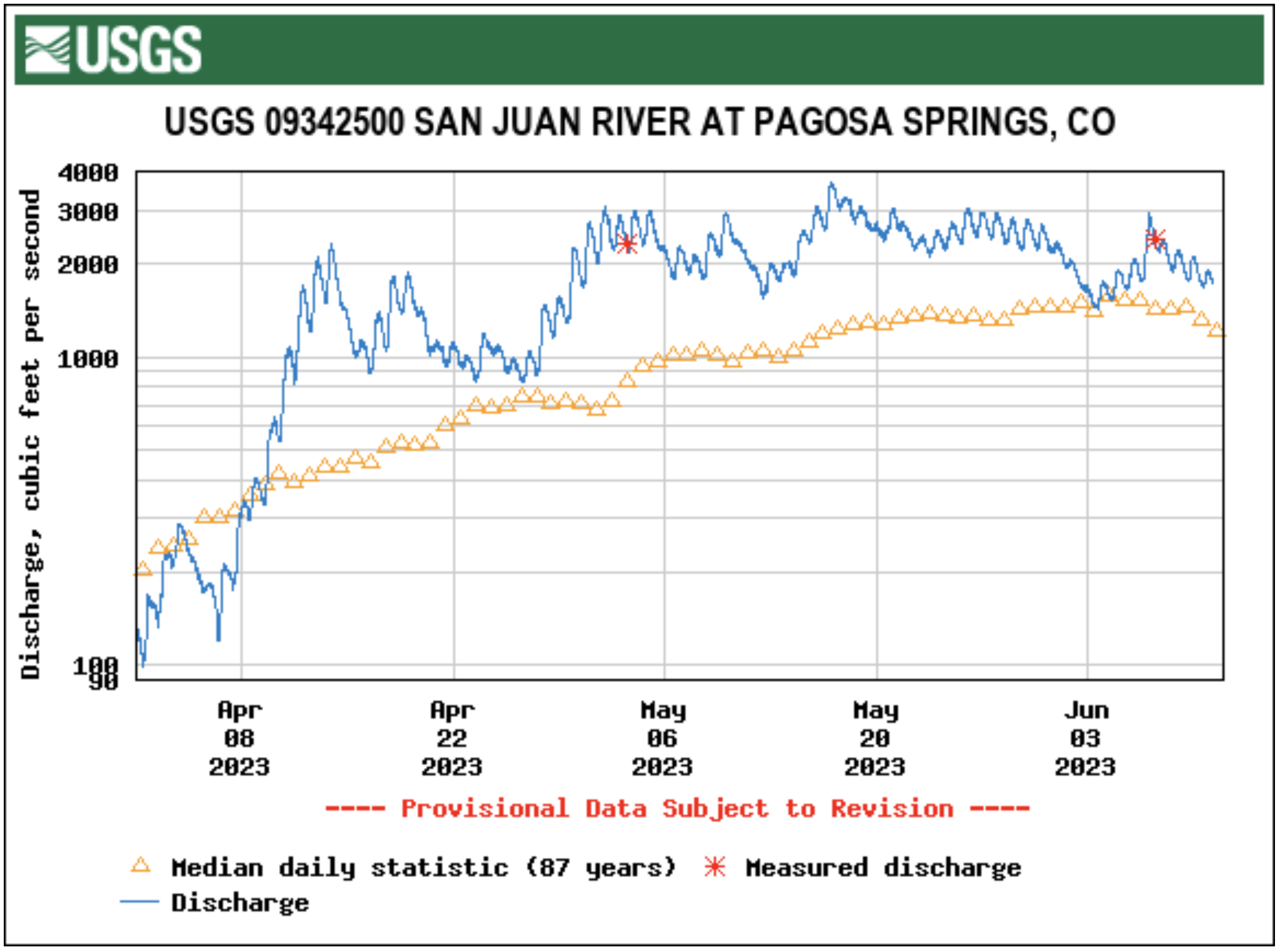

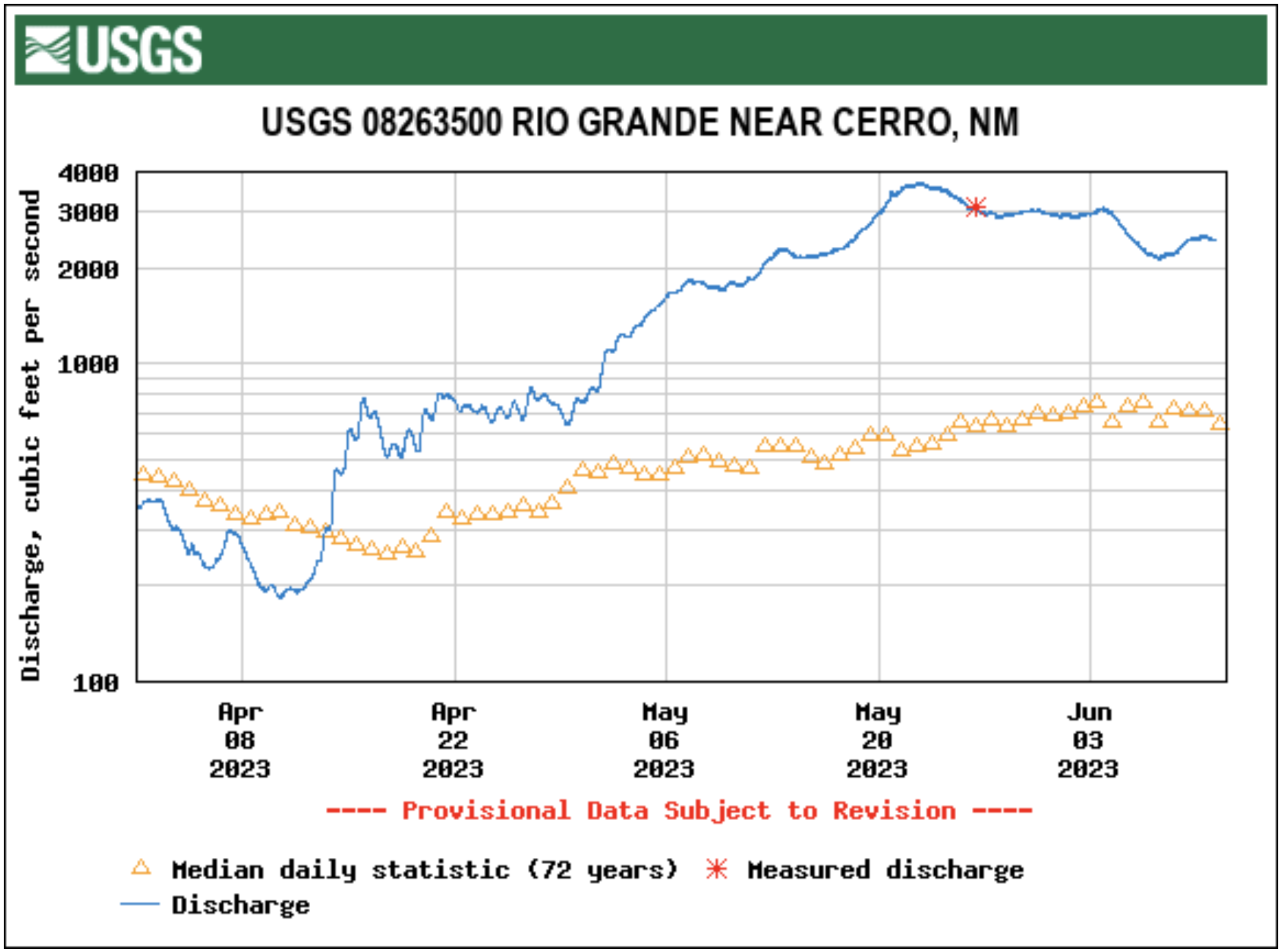
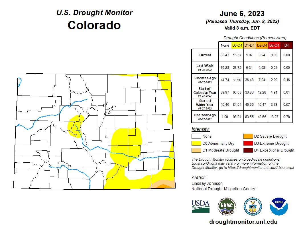


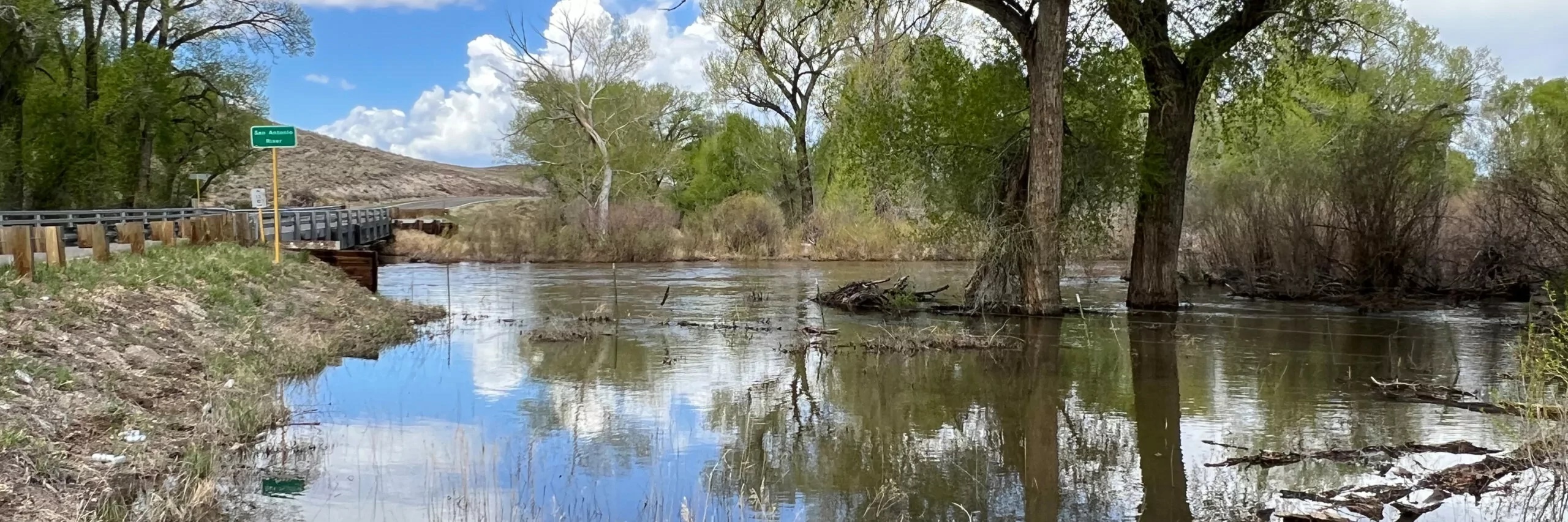
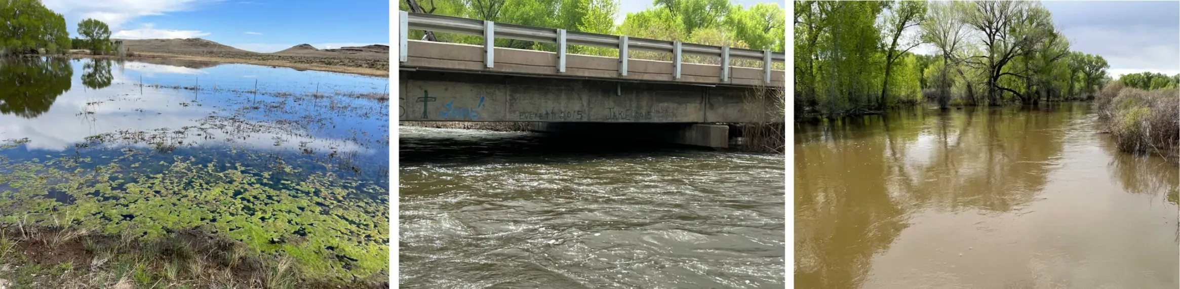


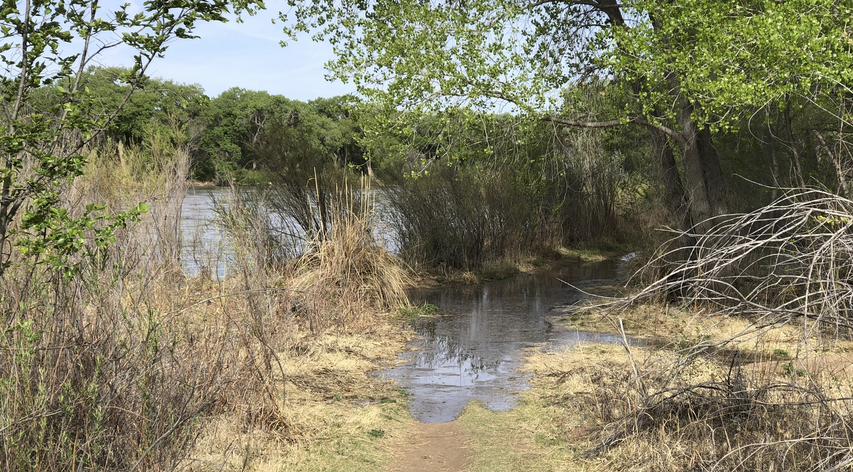


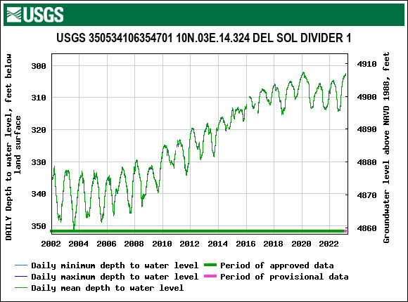
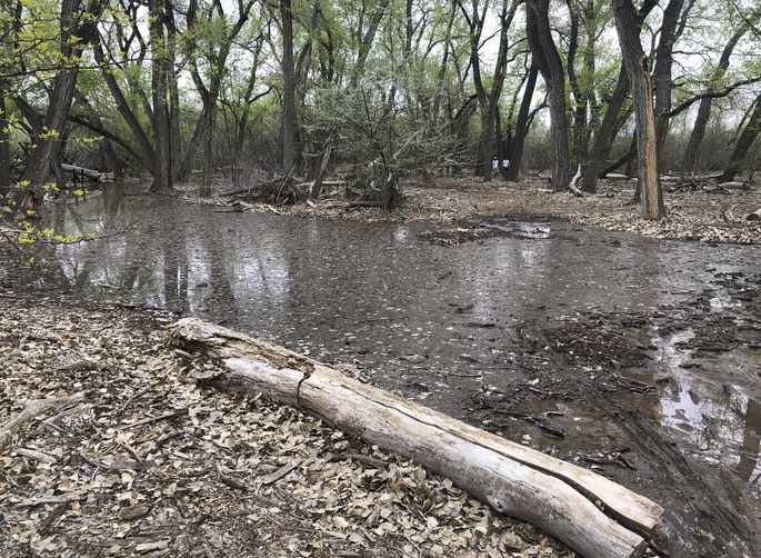


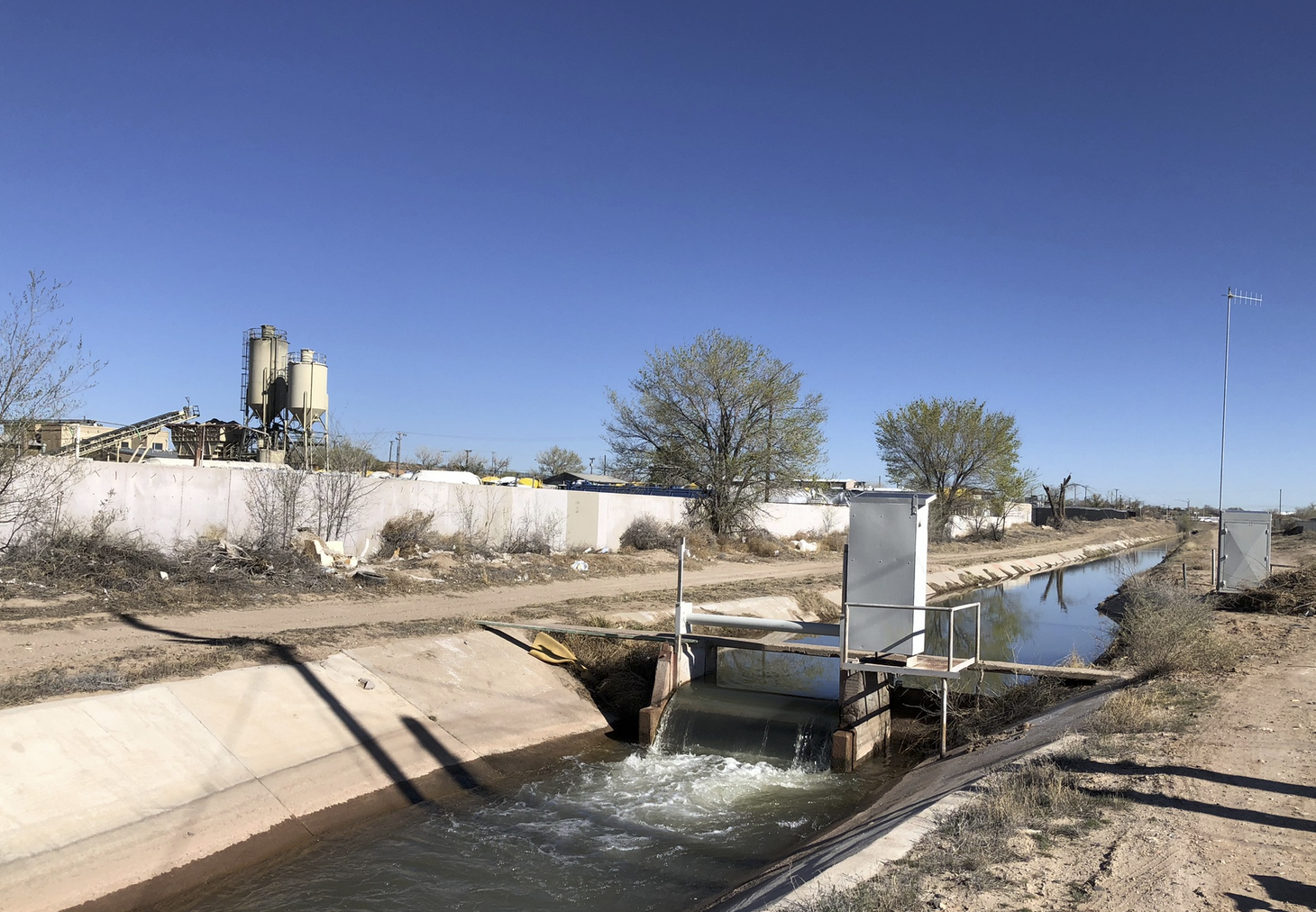

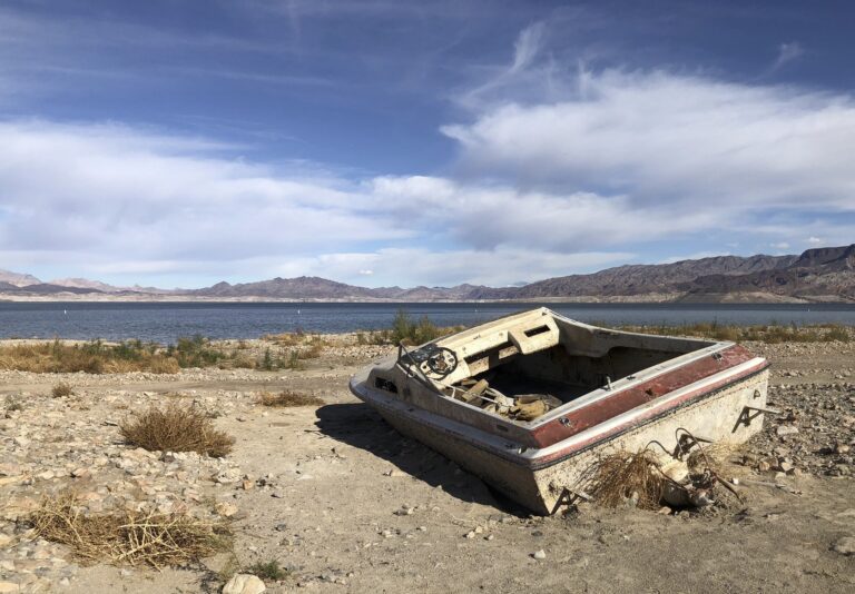
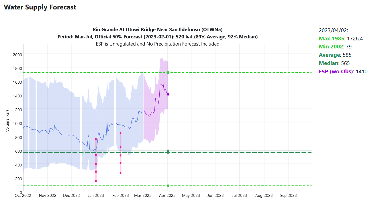


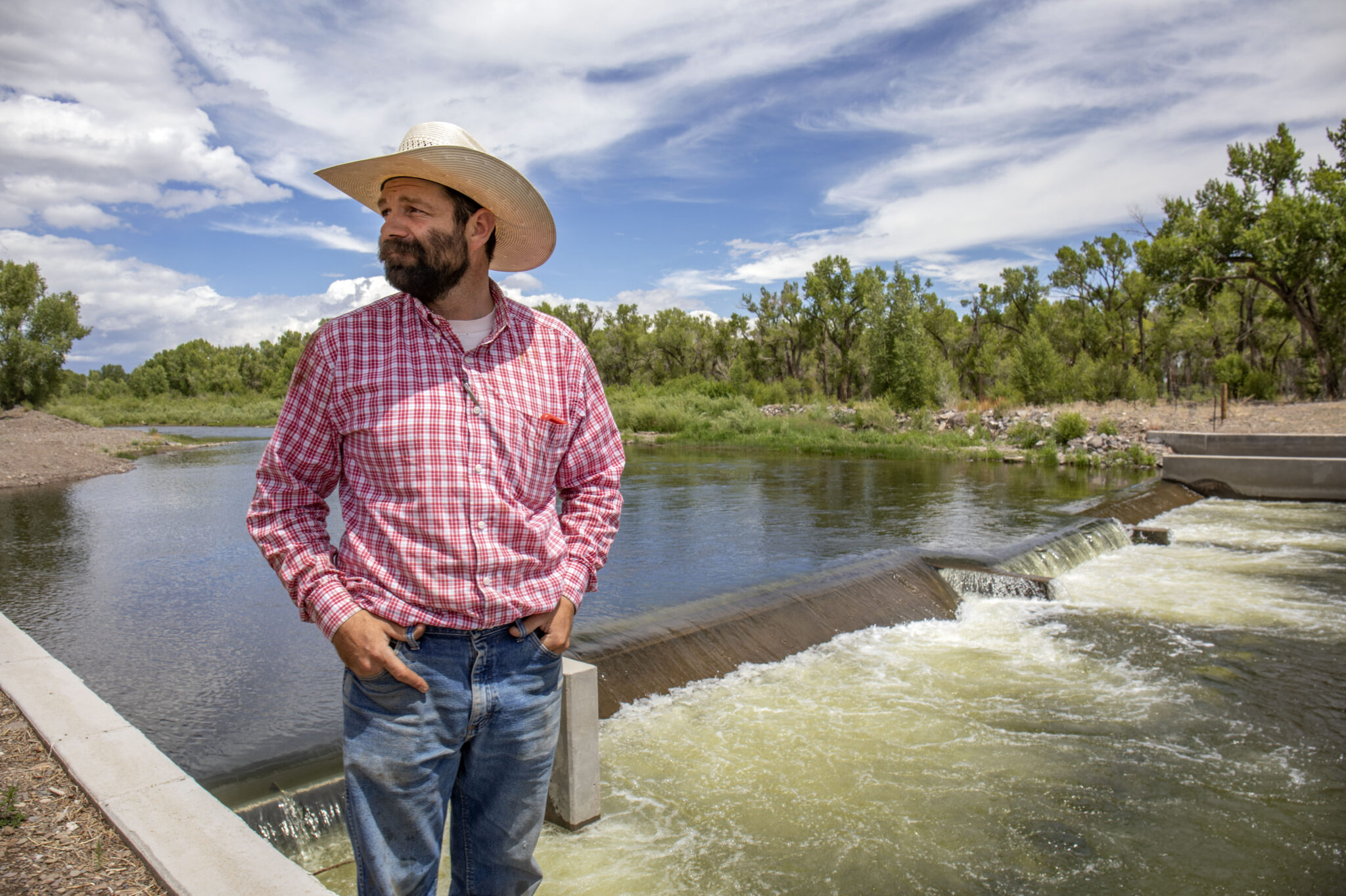
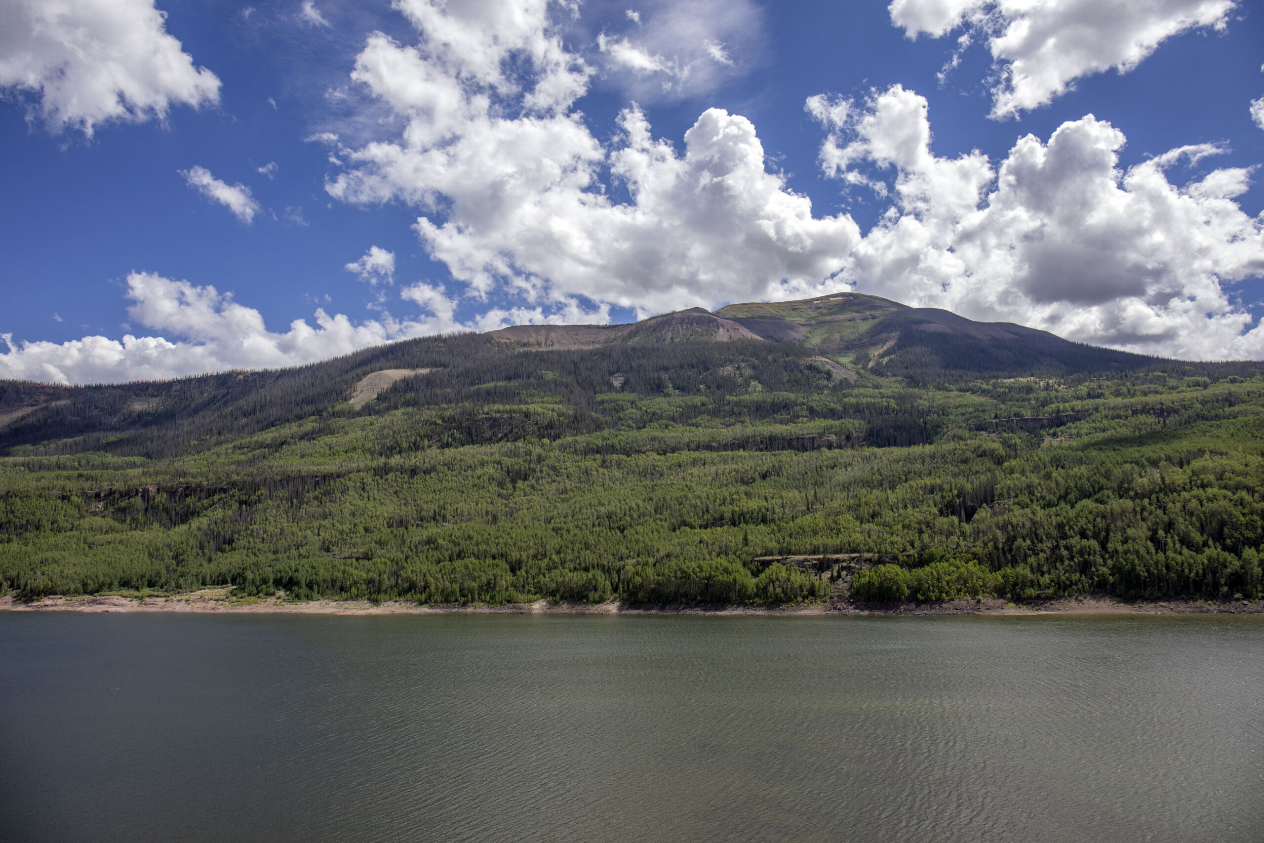


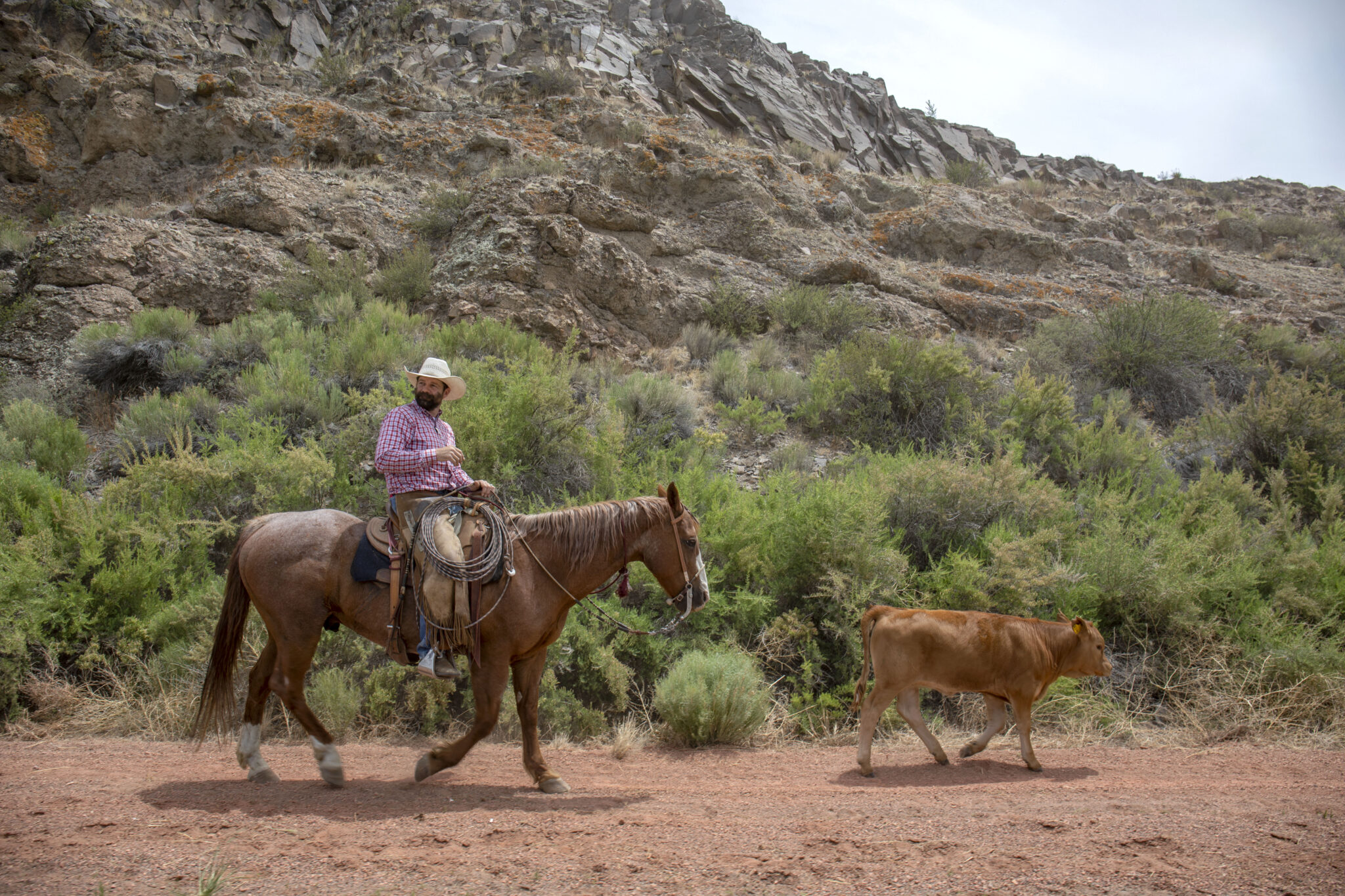
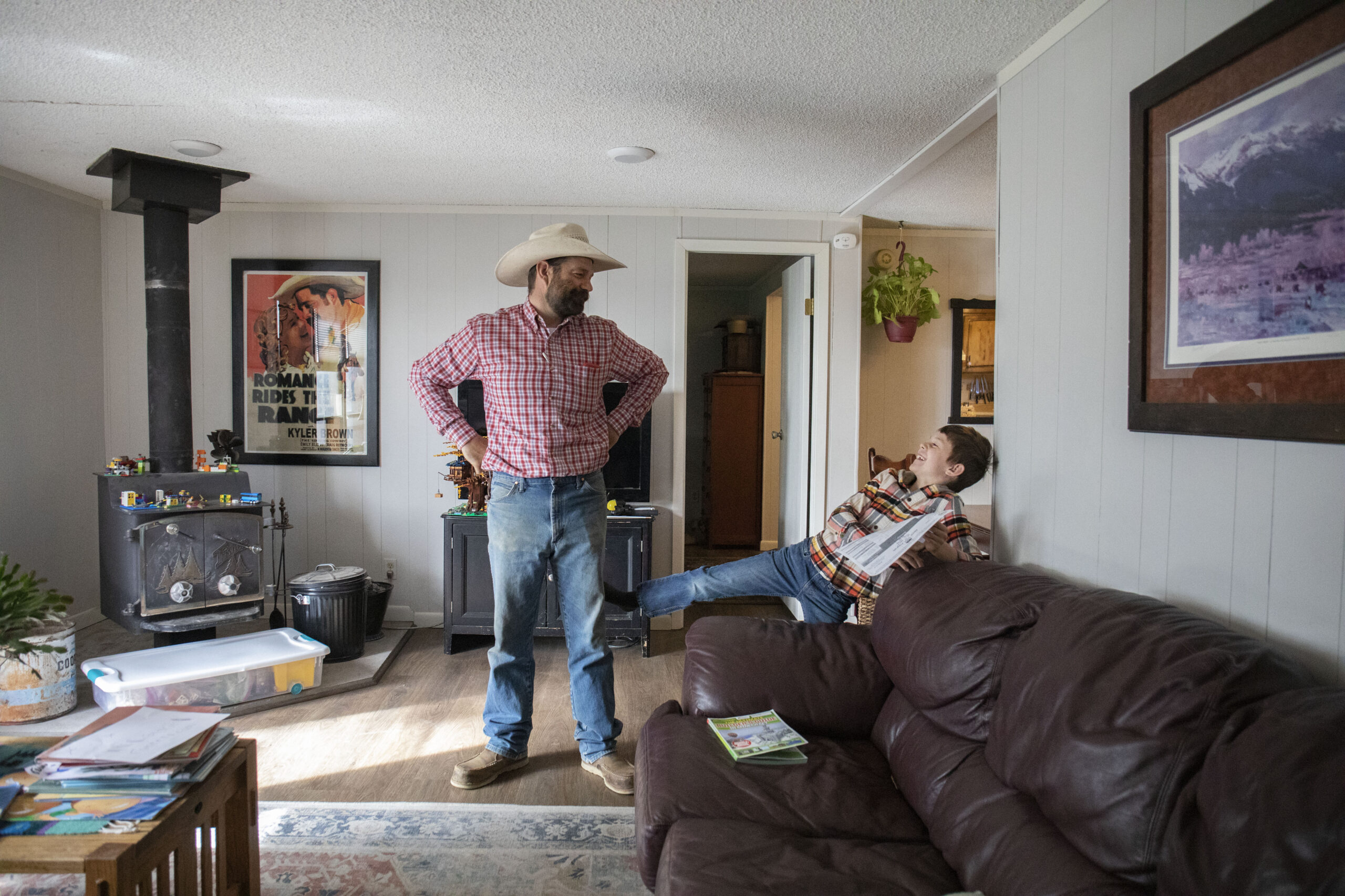
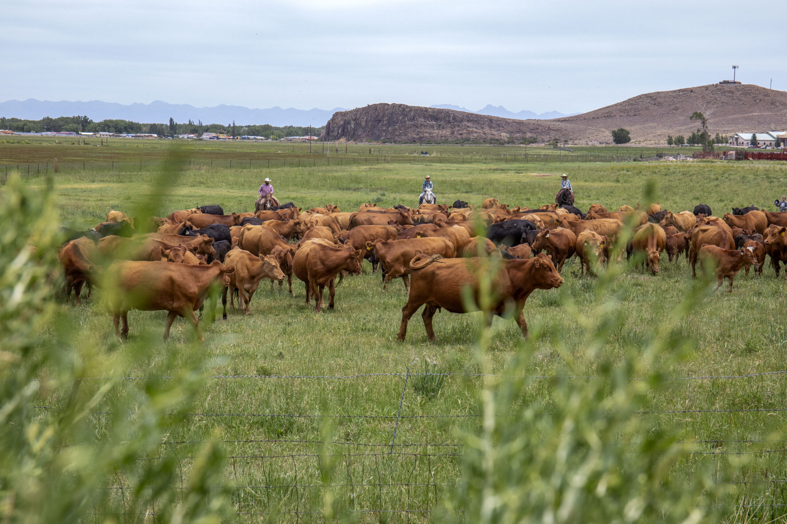
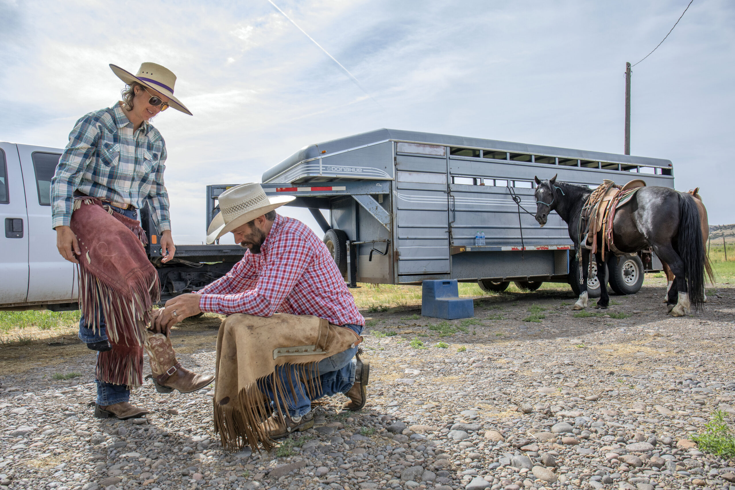
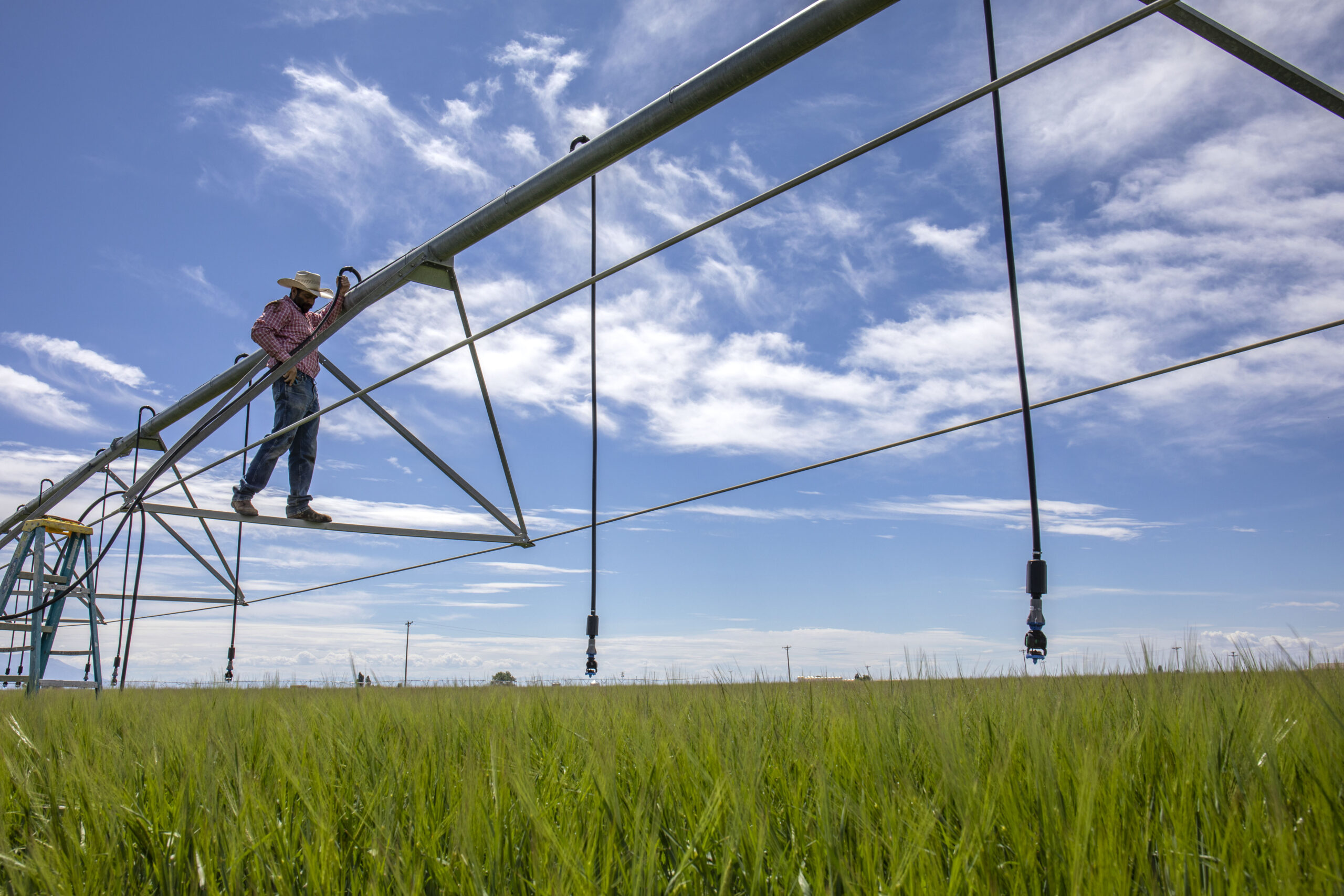
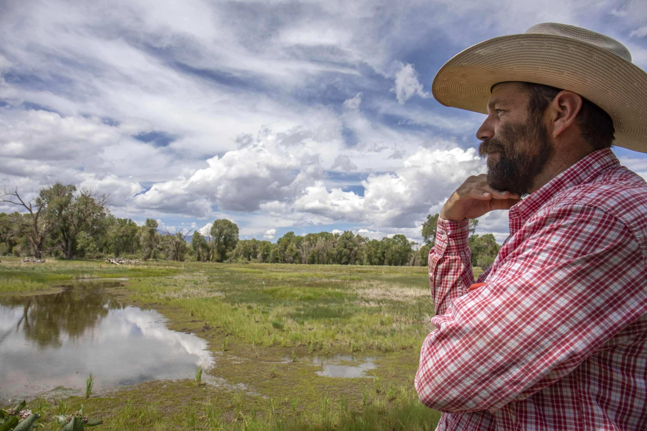
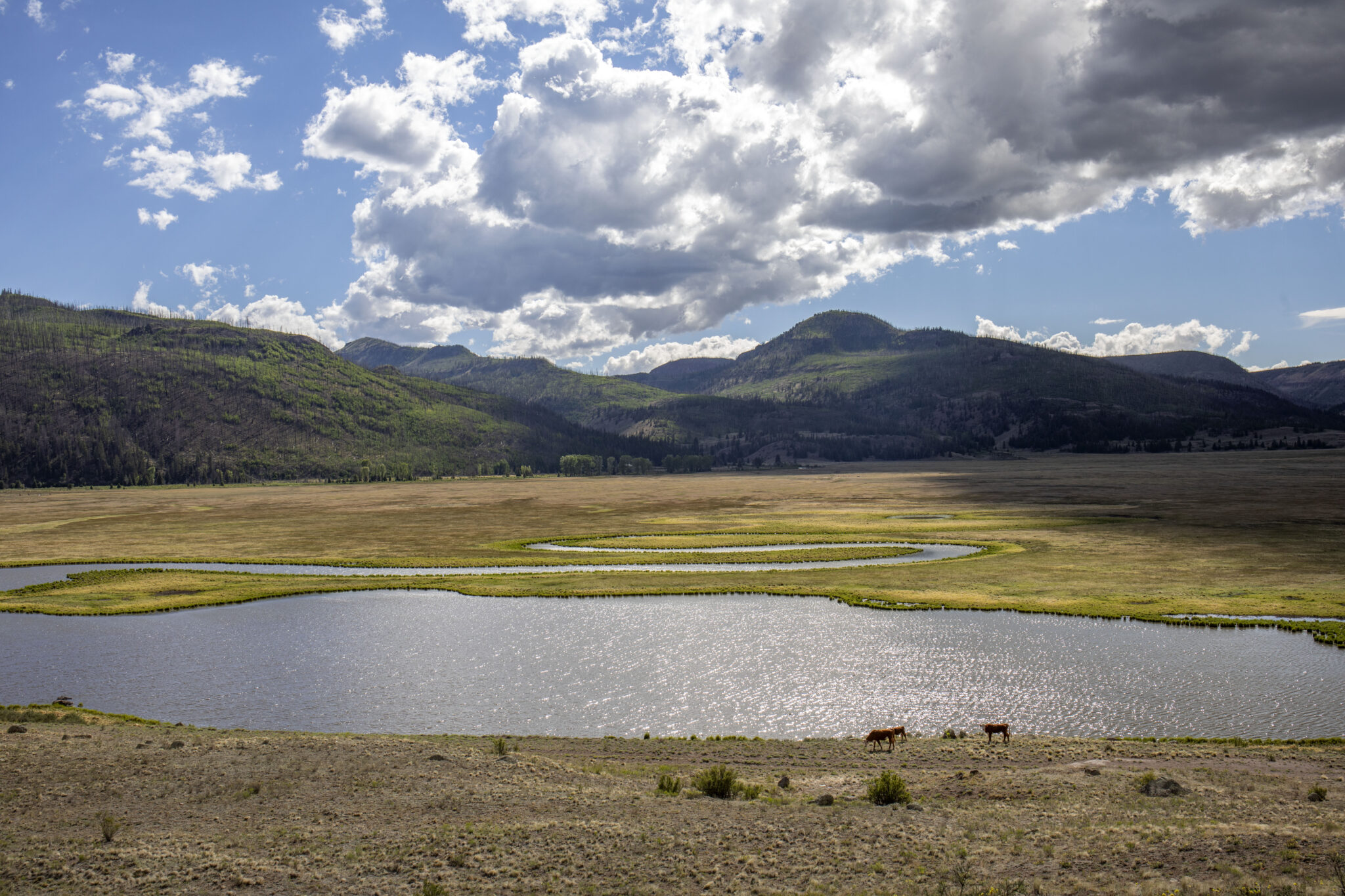

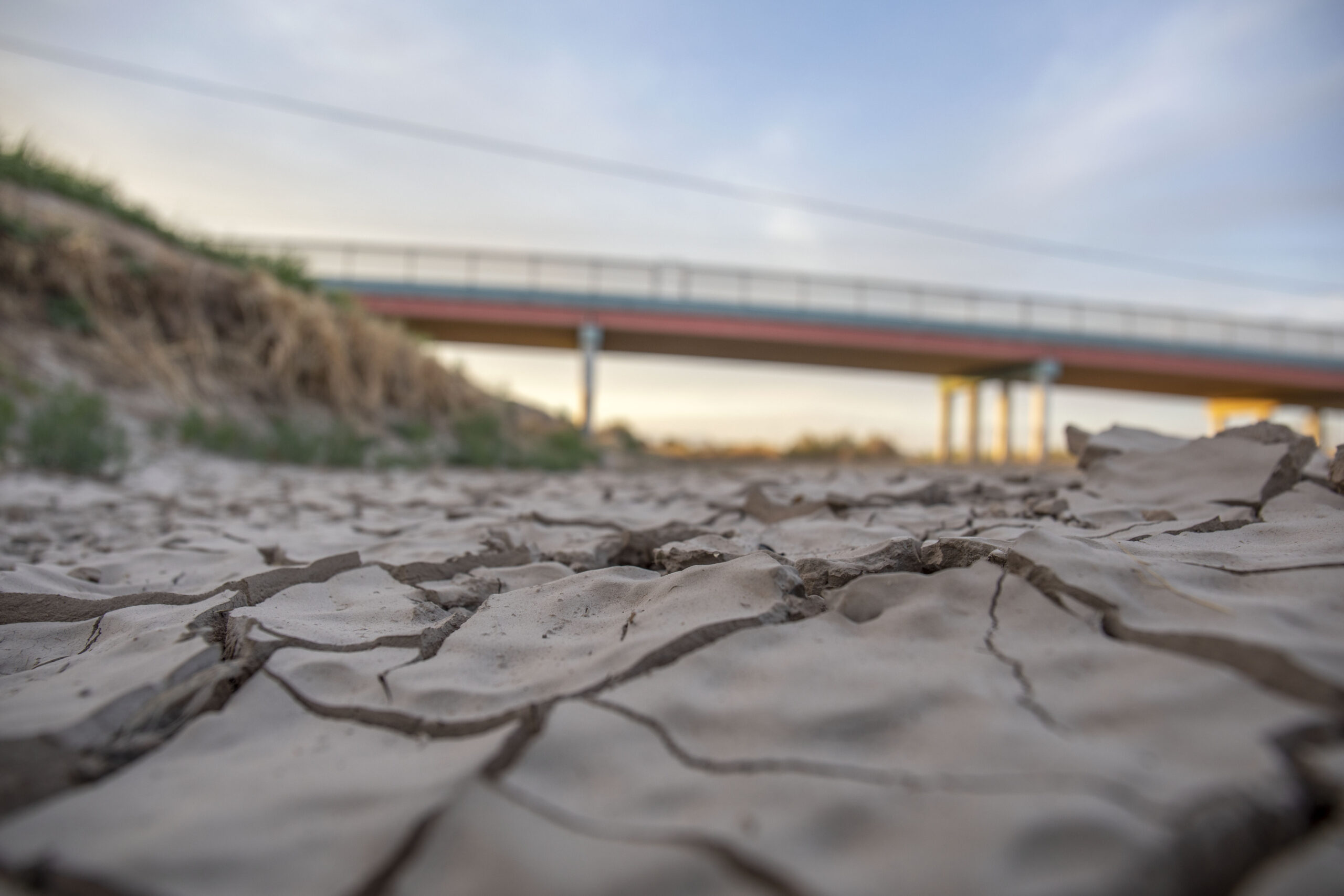
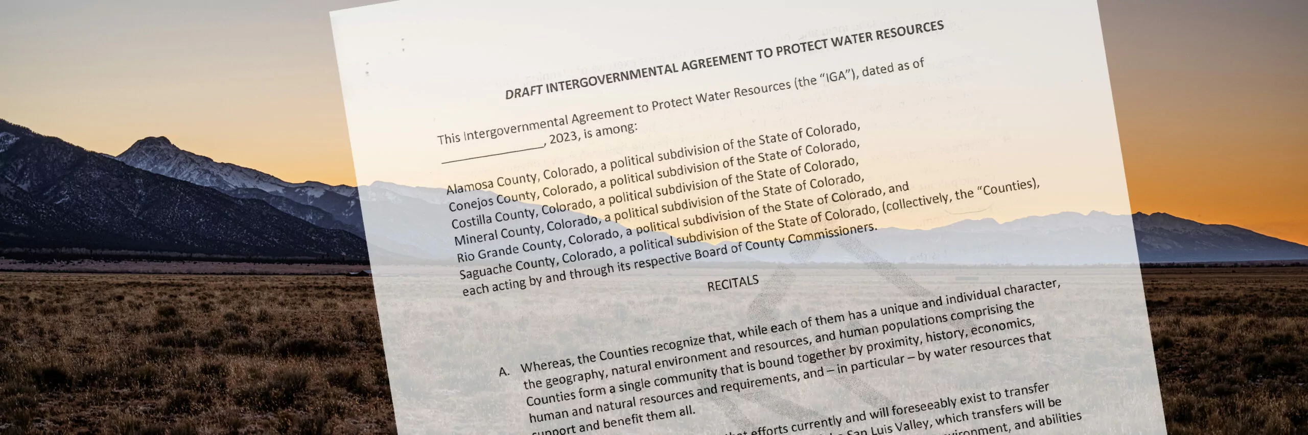


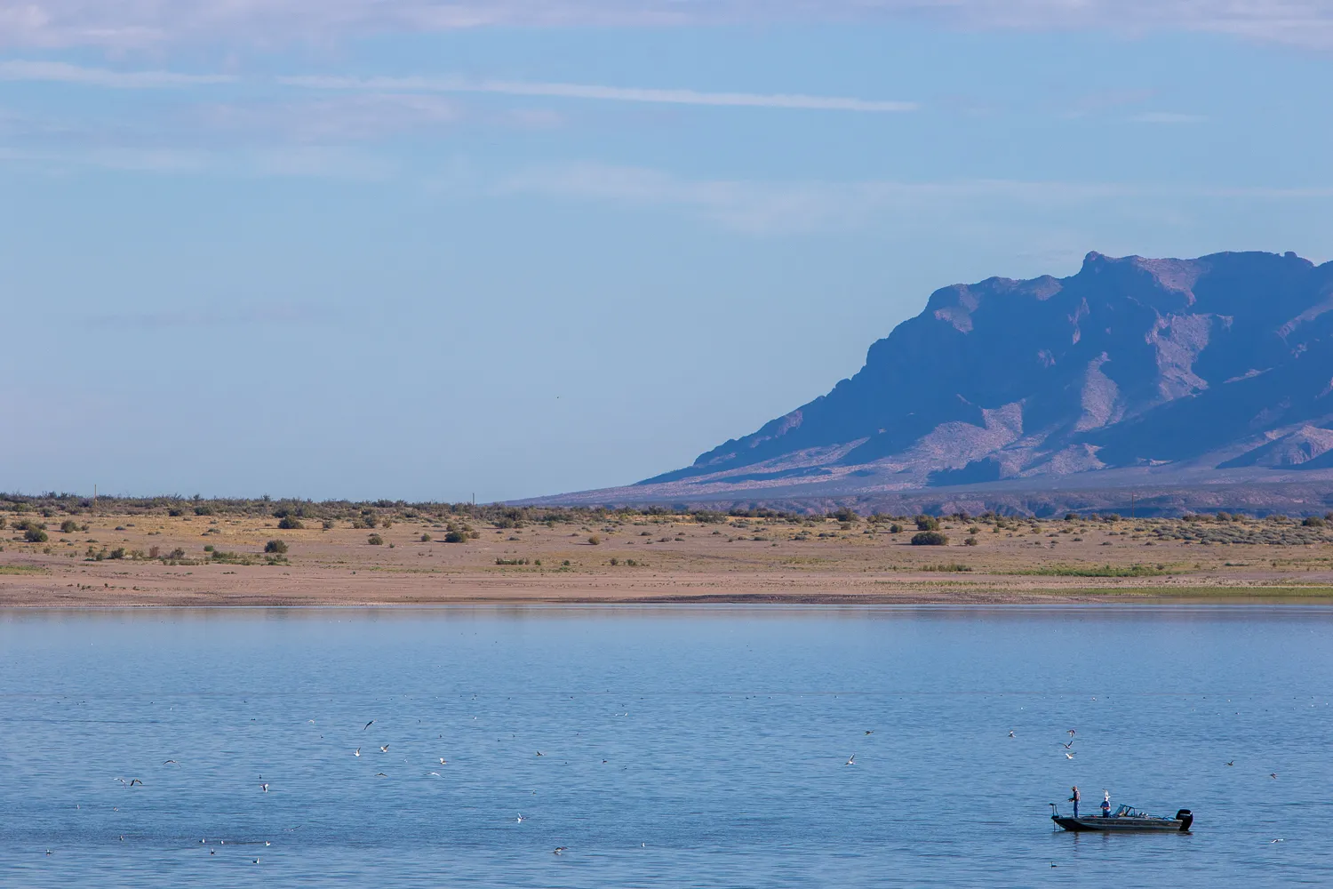
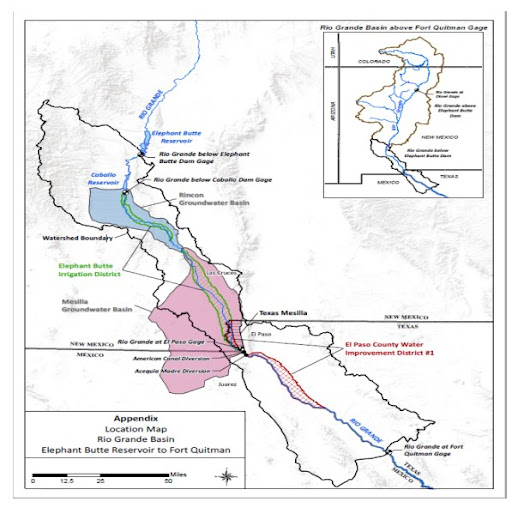


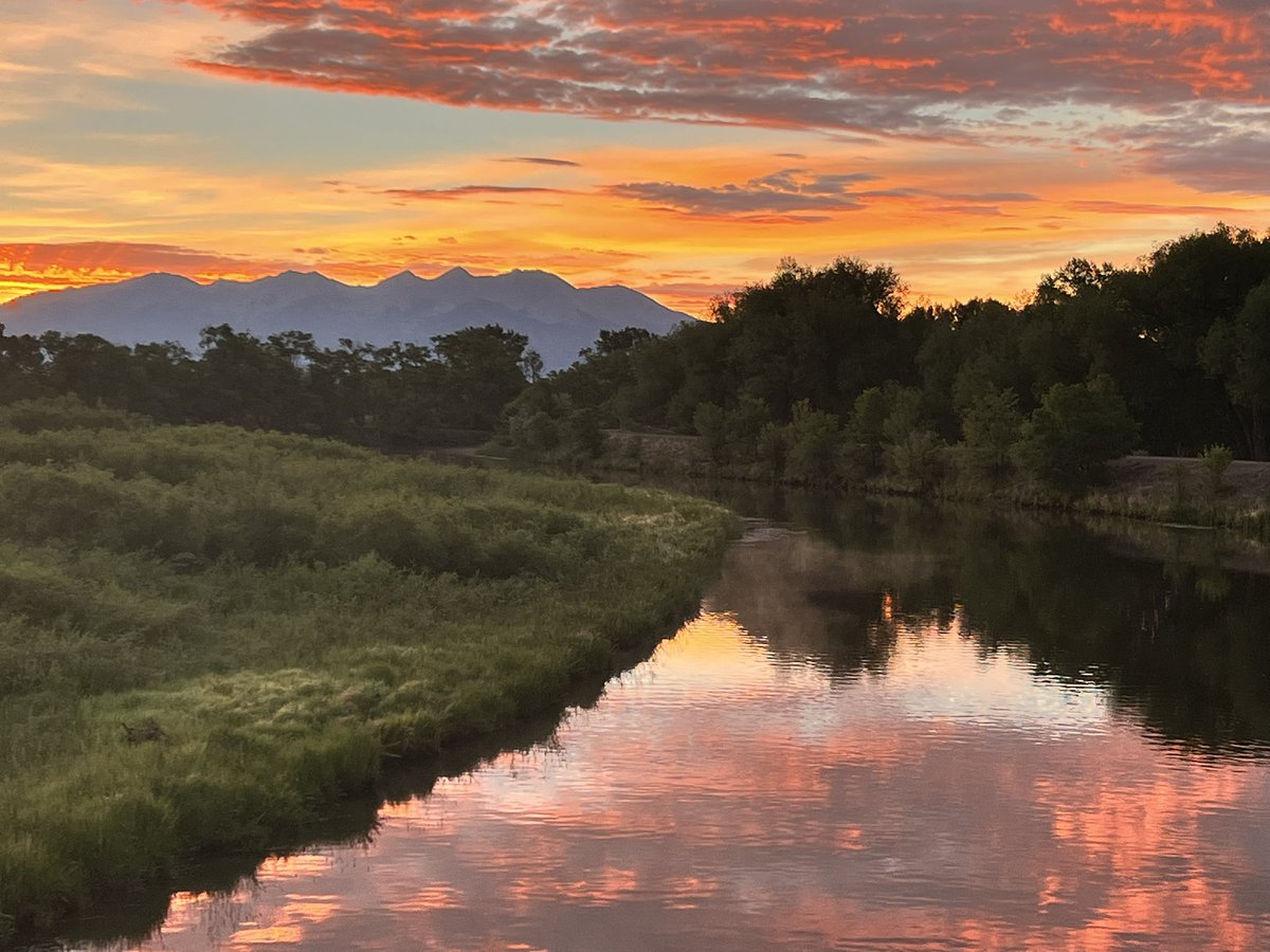

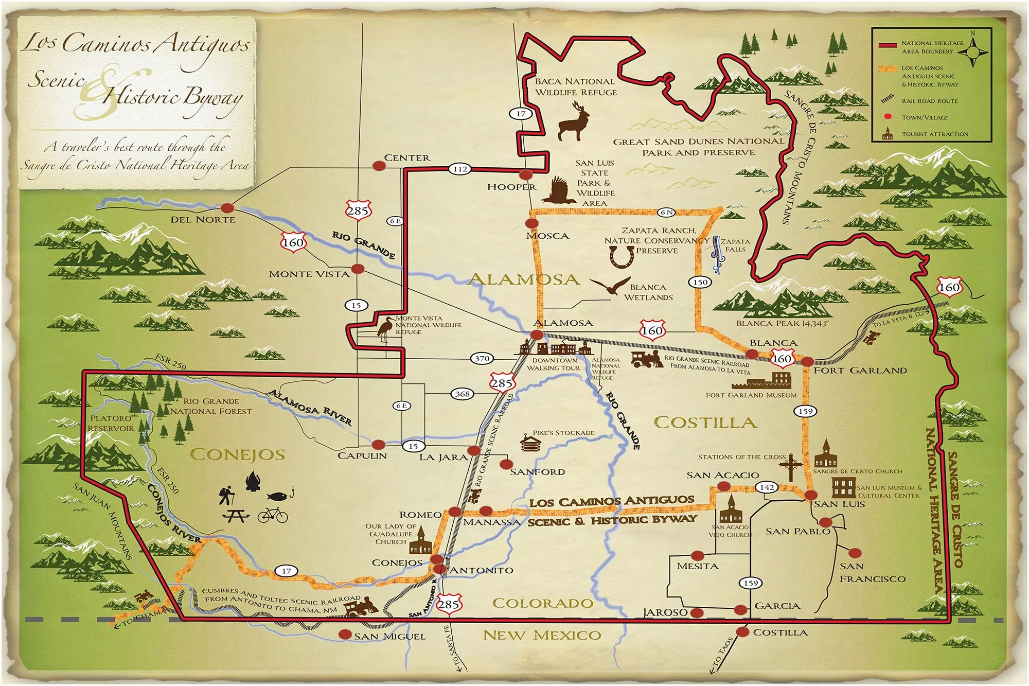

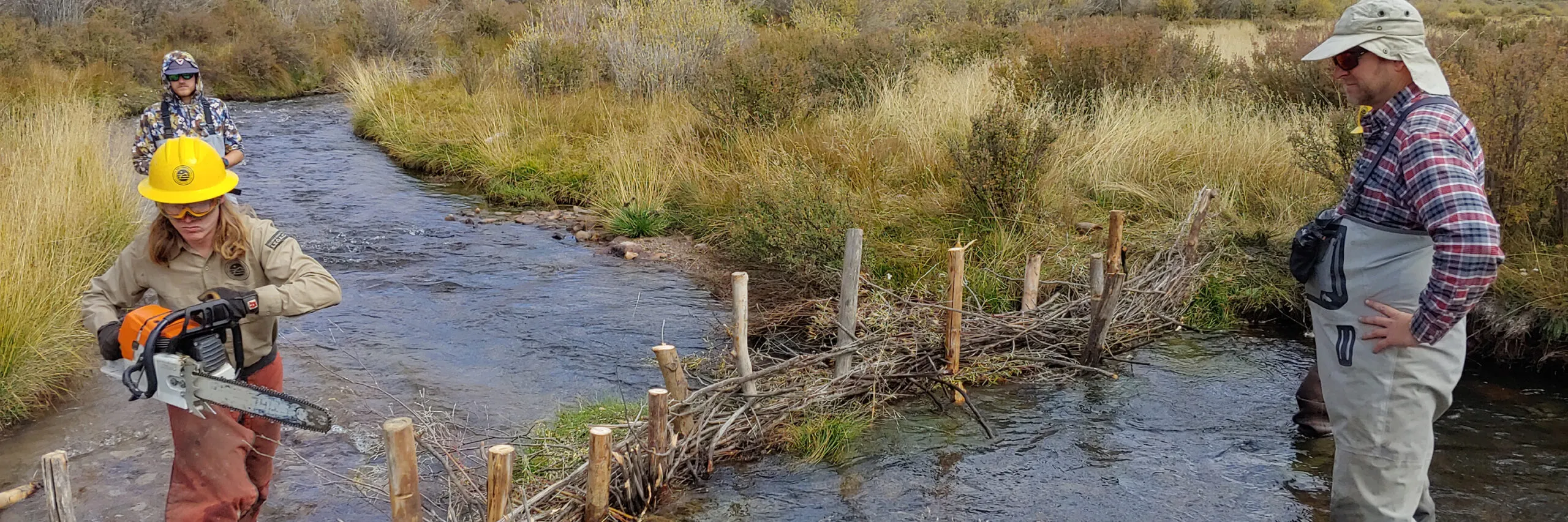

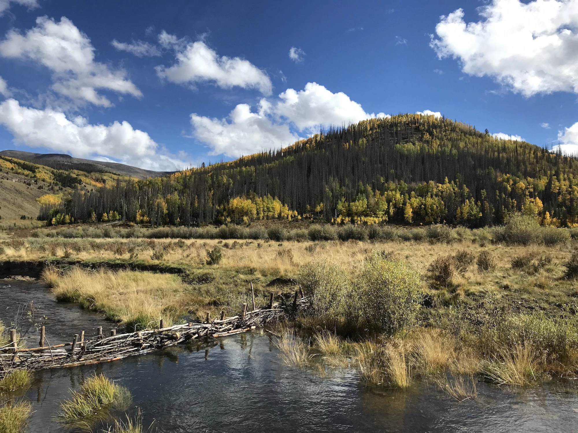


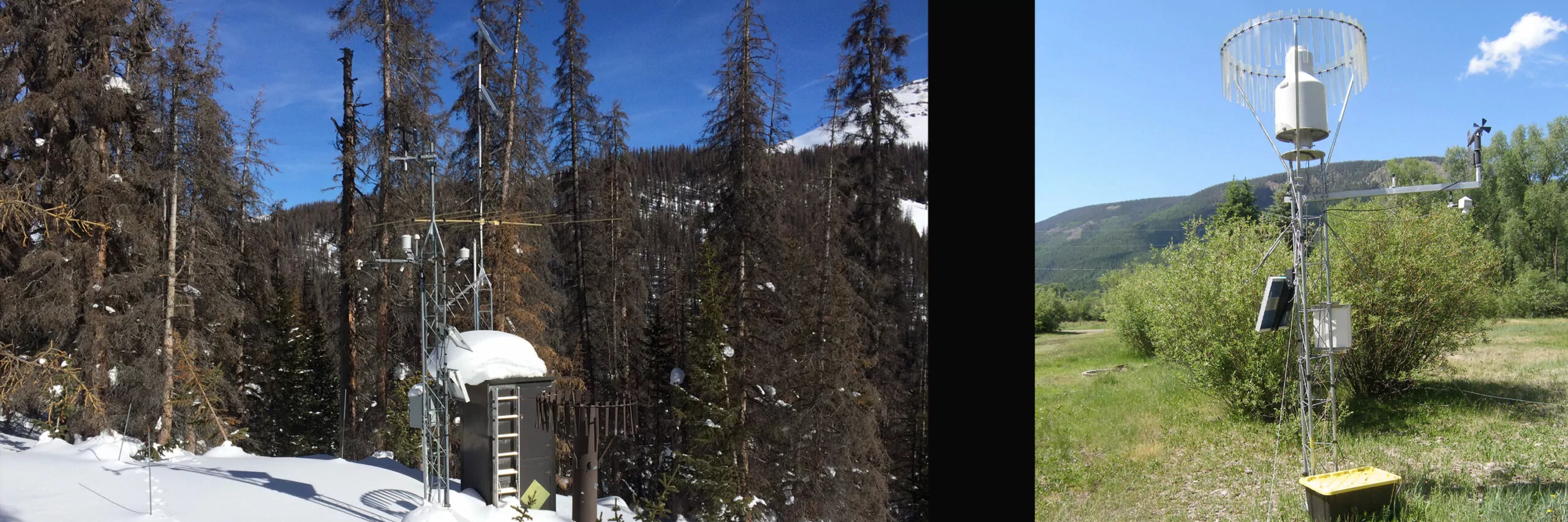
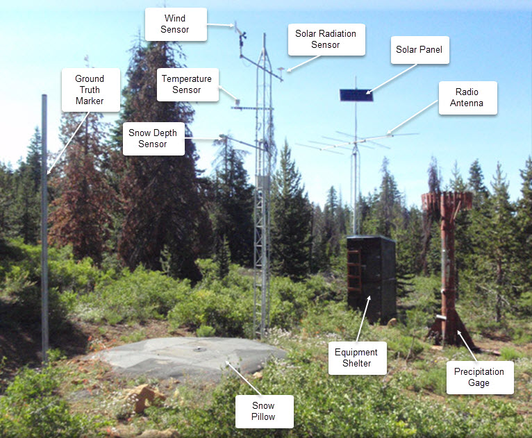

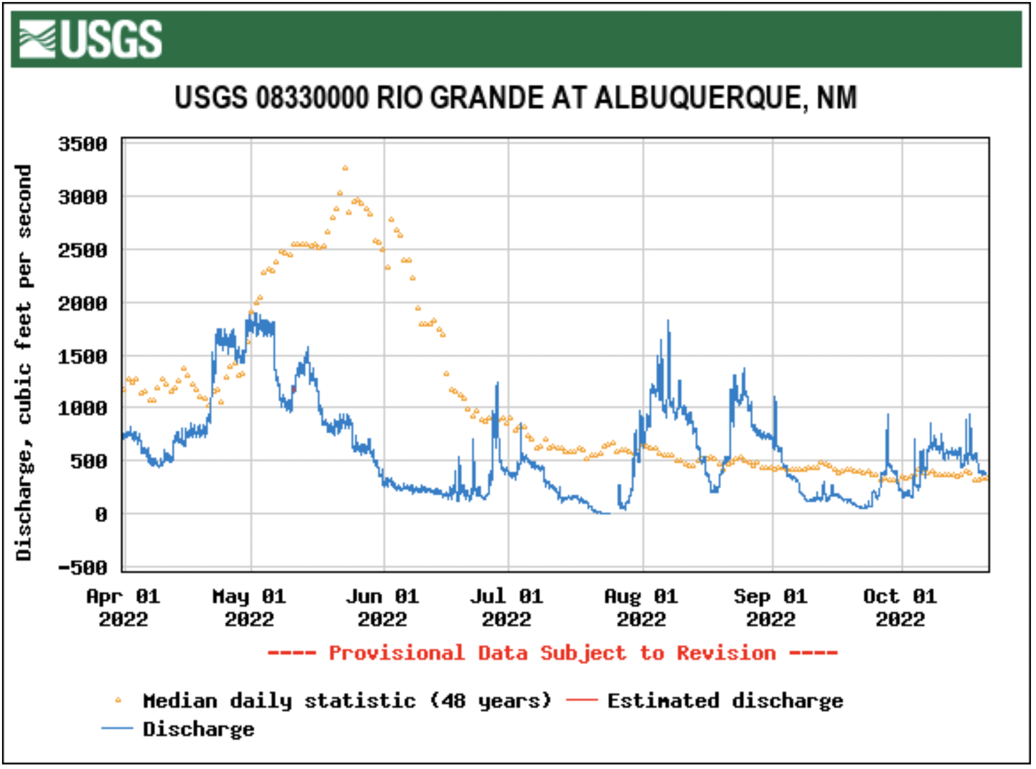
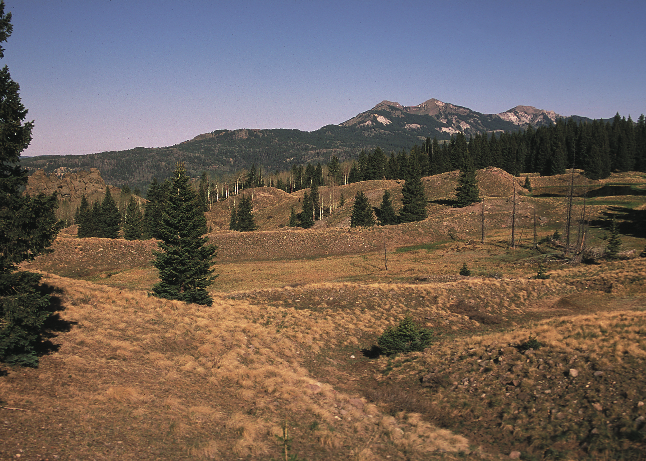
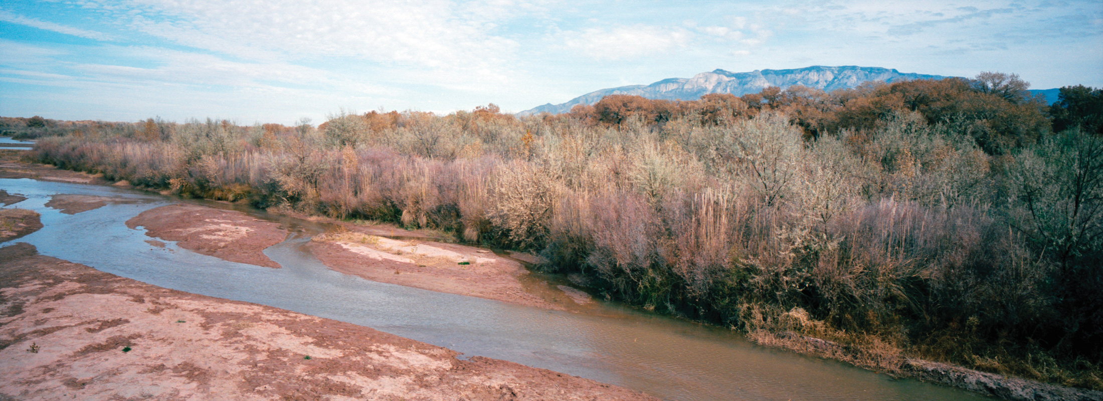


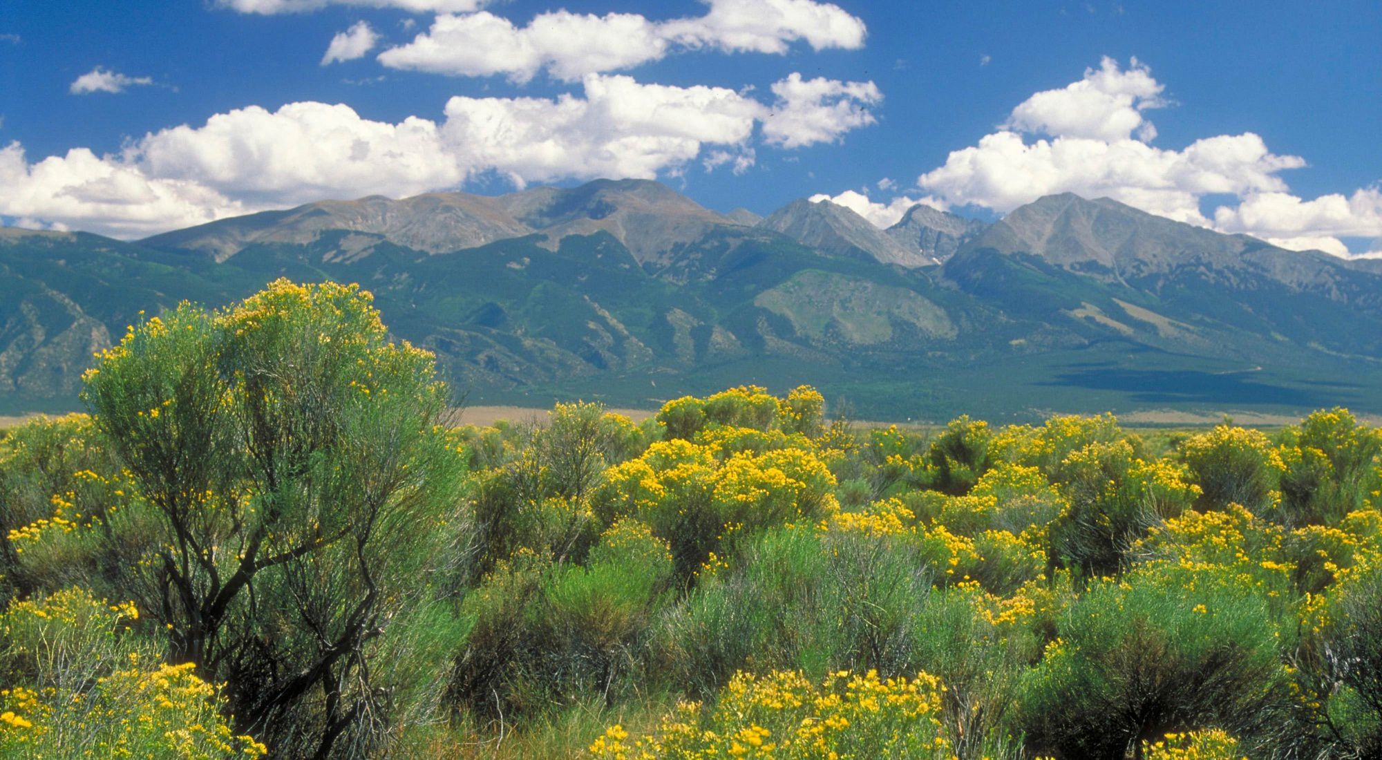
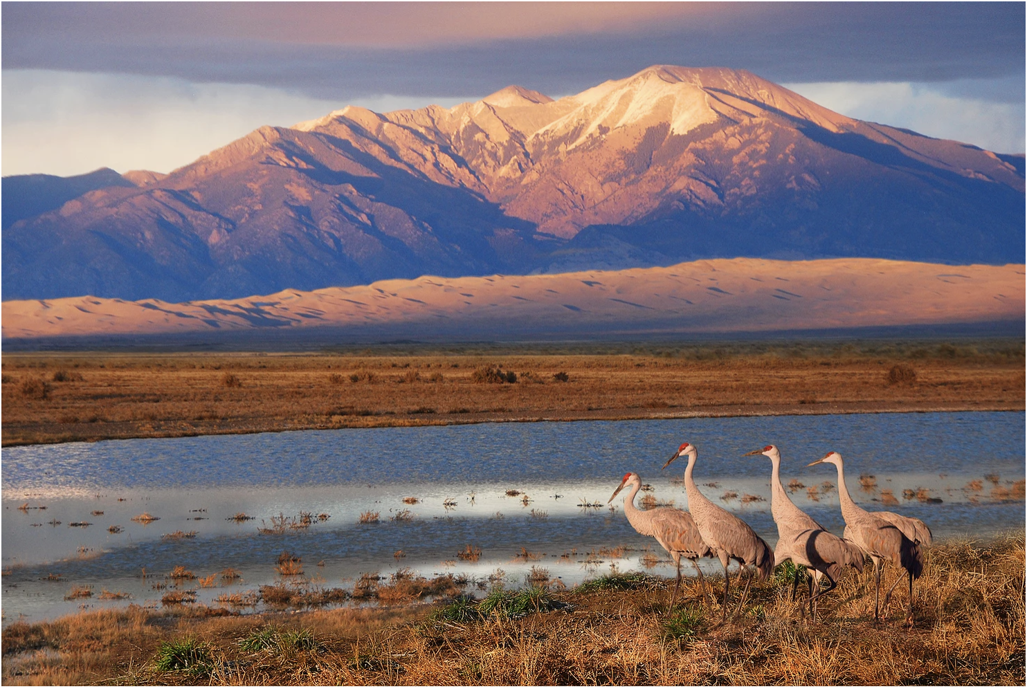
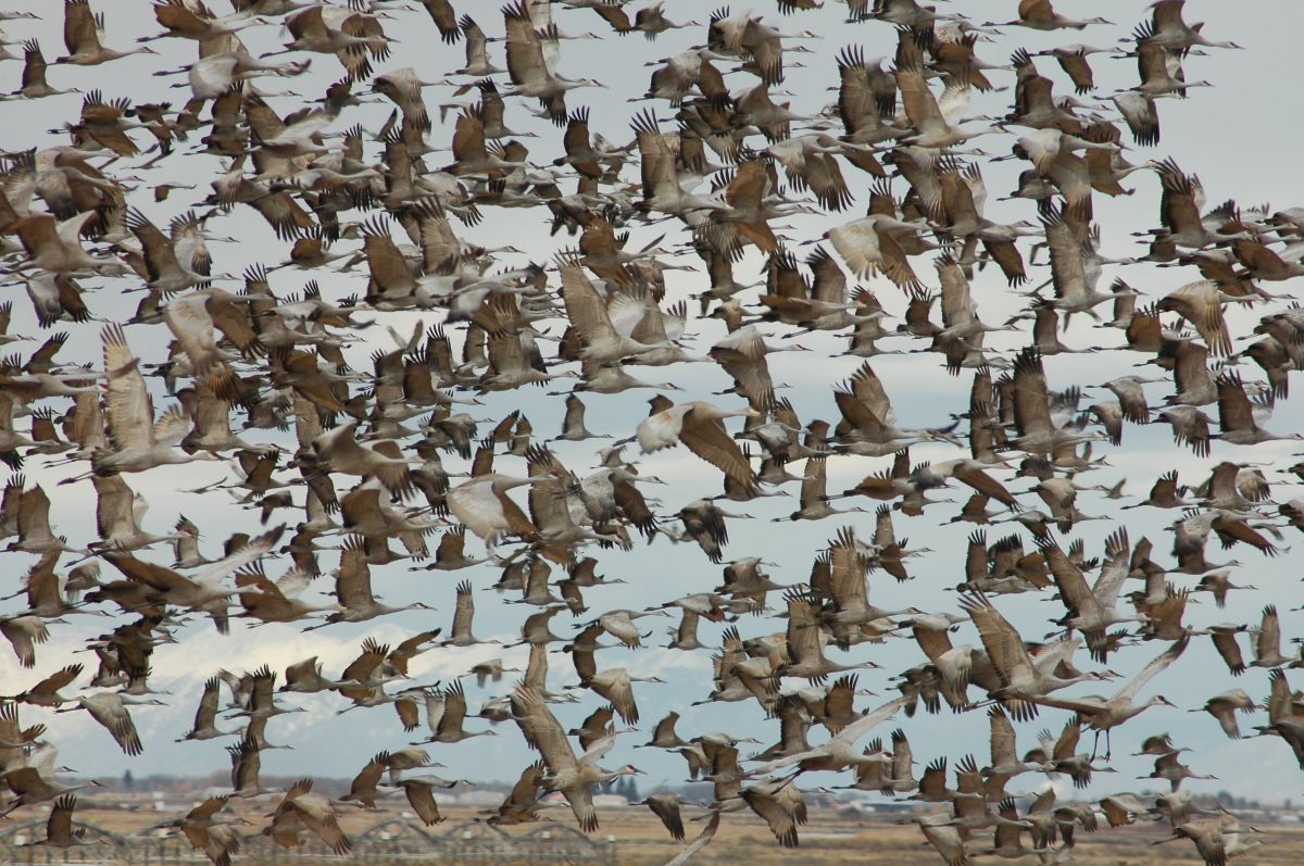
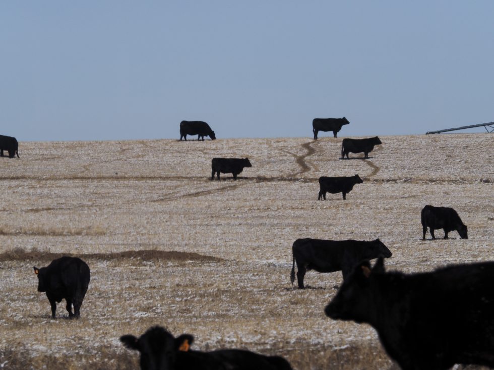

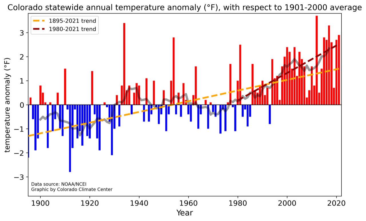


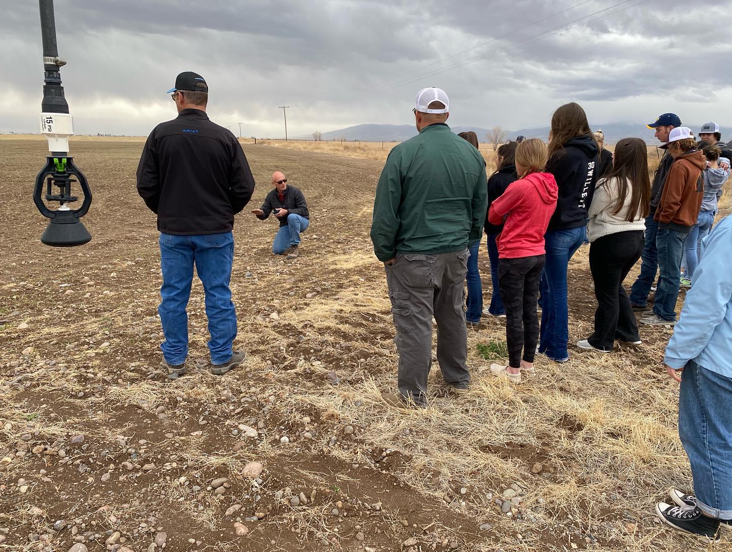
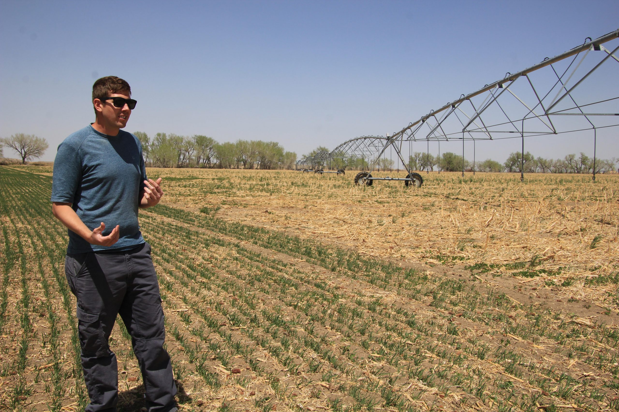

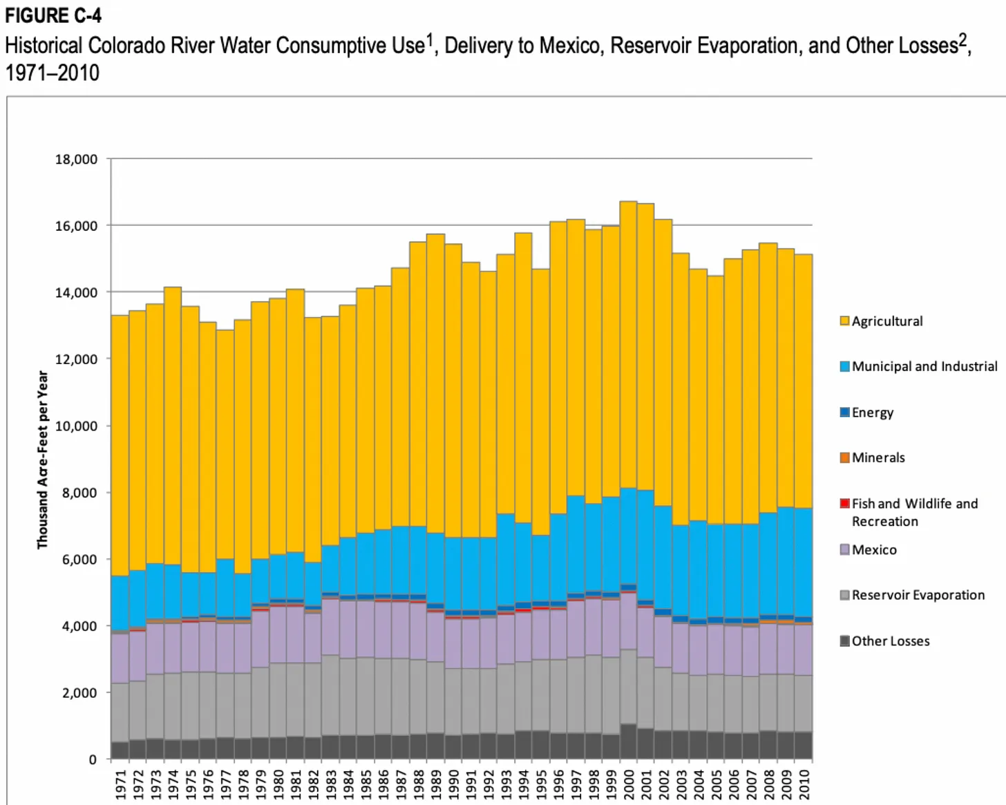
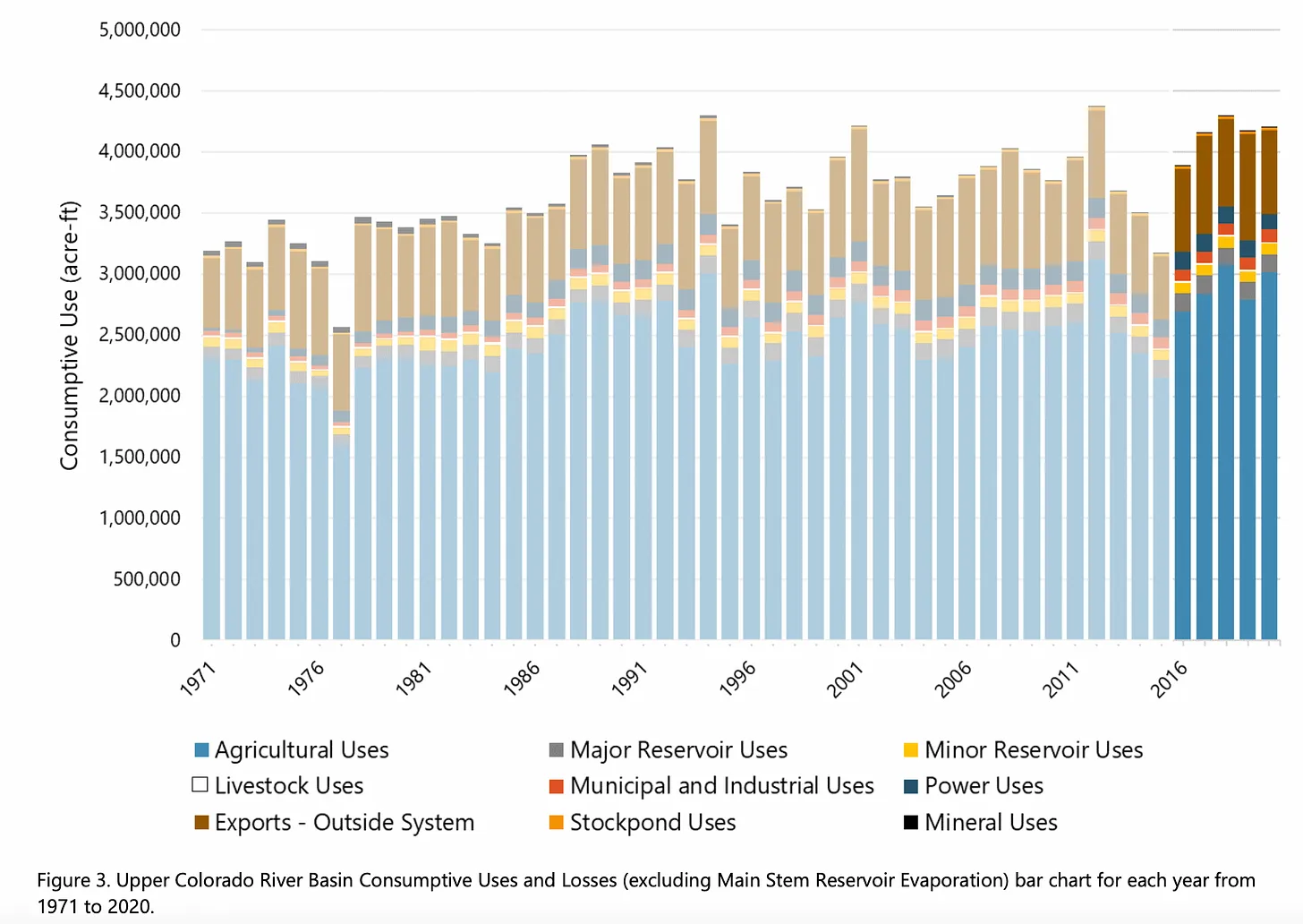
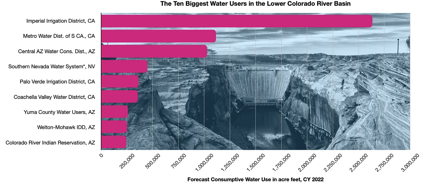
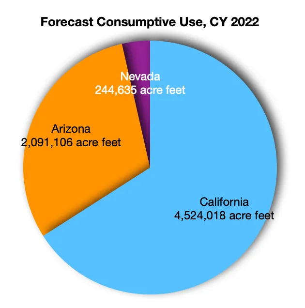
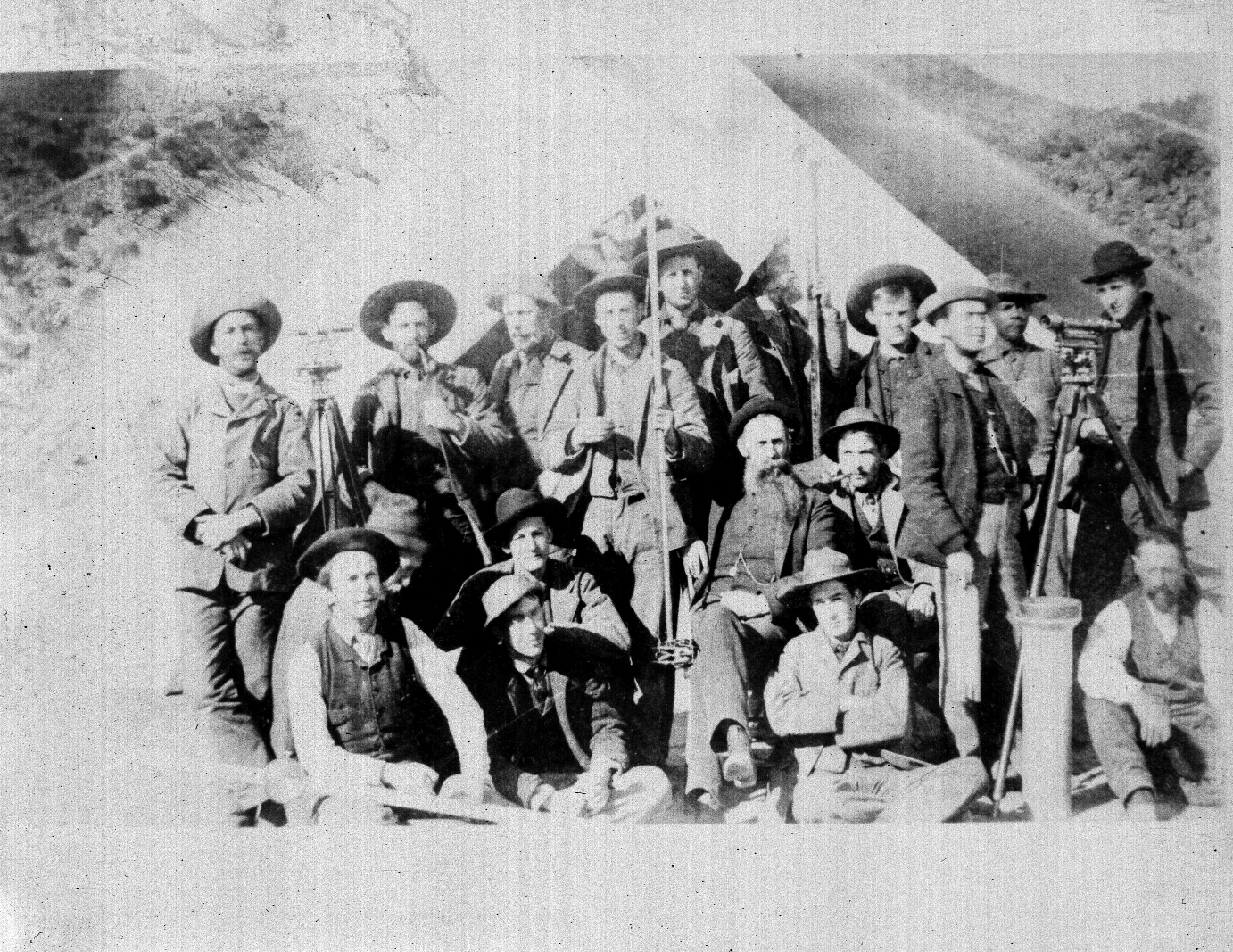
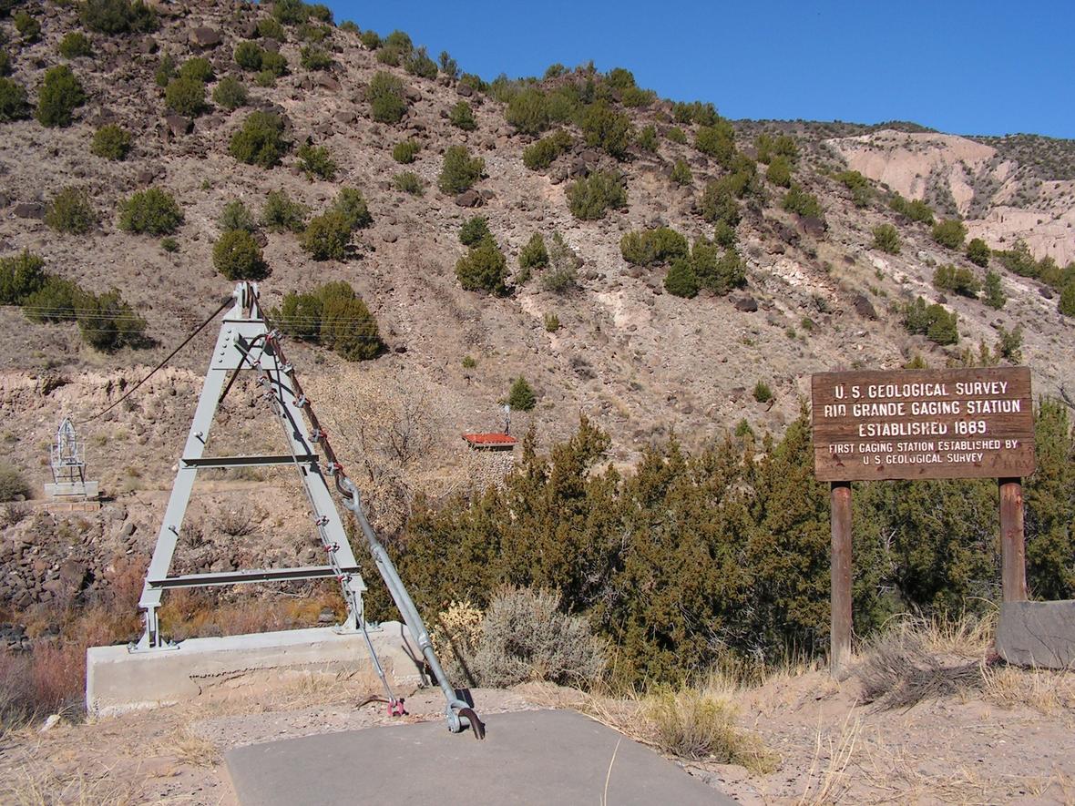
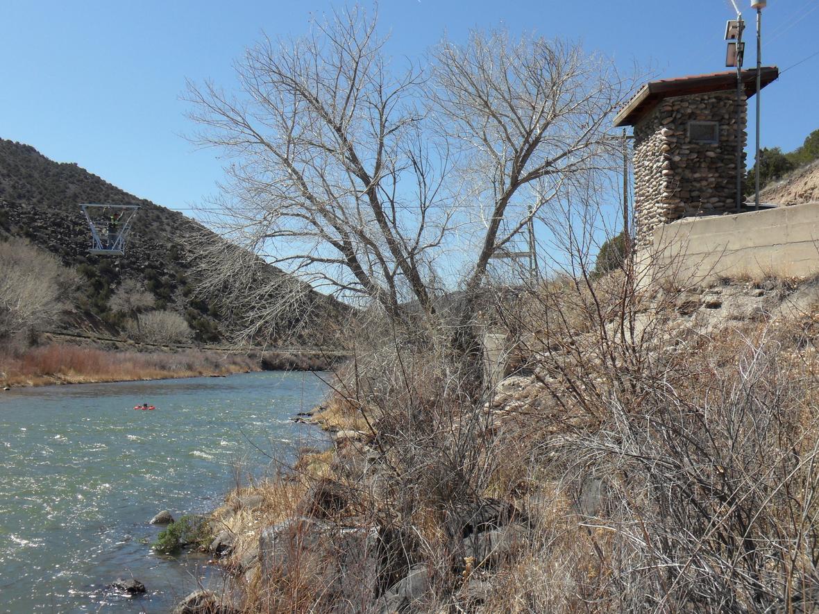
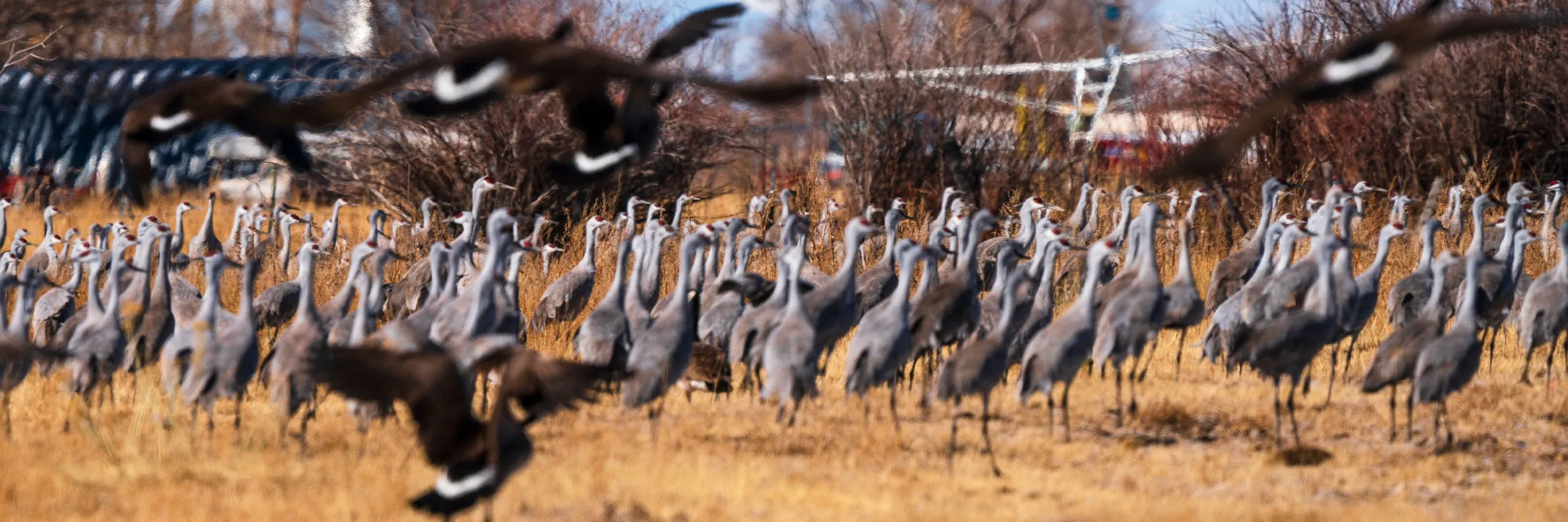
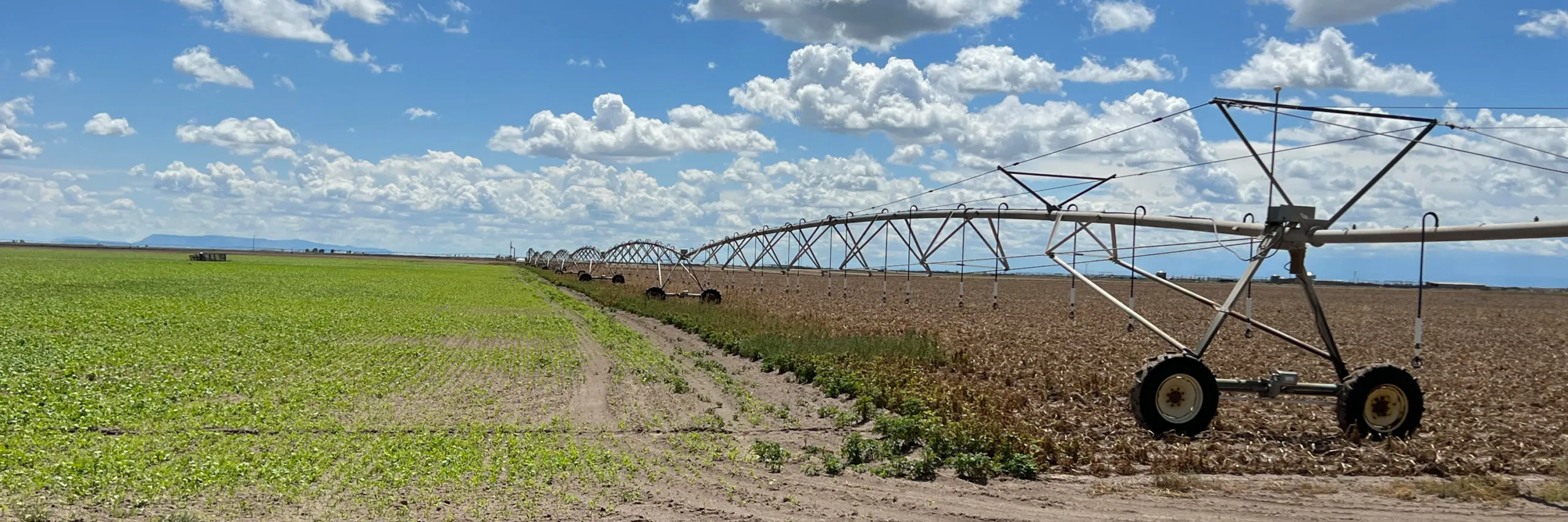

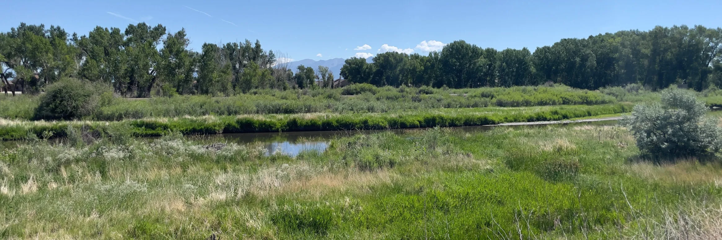


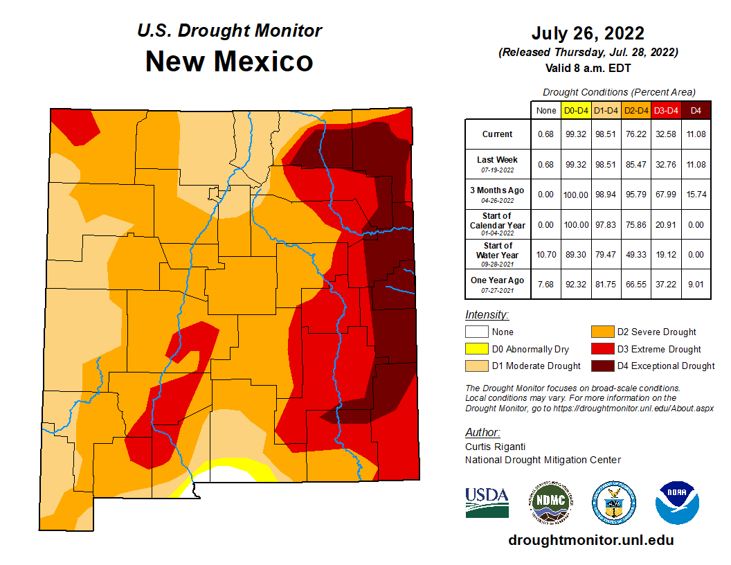


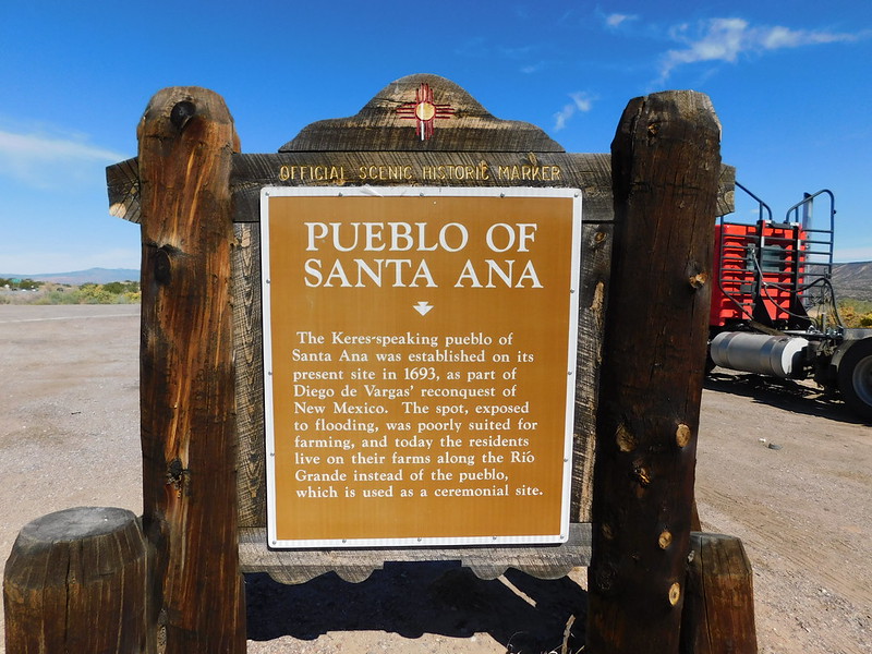


