Runoff news: It looks the runoff may have peaked across the state

A picture named glenwoodwave.jpg

From The Aspen Times (John Stroud):

The one factor that could push river levels even higher is if temperatures get hot enough this week to significantly increase the pace of the remaining high country snowmelt, according to Aldis Strautins, a hydrologist with the National Weather Service in Grand Junction.

“We have seen the rivers come back down a little bit, and things seem to have stabilized as far as the flood threat,” Strautins said Monday.

“We are looking at the snowpack levels, and we’re still indicating that we have some up there yet,” he said. “A warming trend toward the middle of this week may bring river levels back up, but we’re not expecting to see a crest quite as high as what we saw last week.”

On Tuesday, June 7, the Colorado River at Glenwood Springs rose to 25,640 cubic feet per second (cfs) and a depth of 10.8 feet…

The Roaring Fork River at Glenwood Springs, just above the confluence with the Colorado, crested at a little more than 8,100 cfs and 6.8 feet on June 7. The Roaring Fork on Monday was running at 5,880 cfs and just shy of 6 feet…

With about 27 percent of the snowpack in the Colorado River Basin yet to come down, it’s not out of the question that there could be a new peak. “We’re about three-quarters melted out at the sites we’re monitoring,” said Mike Gillespie, snow survey supervisor for the National Resources Conservation Service. “So, we are past the majority of the snowmelt, but we’ve still got some snow up there. By next week, we should be pretty much melted out at those sites.”

Officials are expecting Colorado River levels to remain above normal for the next few weeks, with some fluctuation depending on temperatures and weather patterns.

Meanwhile, here’s the runoff event of the week, Geese surf the Glenwood Wave.

Colorado River basin: Can the Colorado River Compact survive the predicted water short future?

A picture named coloradoriverbasin.jpg

From the Colorado Independent (Alan Best):

[Douglas Kenney], director of the law school’s Western Water Policy Program, last winter released the first part of a several-tiered study of challenges to administration of the river. Obscured by drought that had left Lake Mead, near Las Vegas, reduced to its lowest level since 1938, demand had quietly crept up and overtaken supply during the last decade, he said. Despite occasional wet years such as the current one, climate-change projections foresee significantly hotter temperatures and perhaps a 9 percent decline in water volume during coming decades, according to the newest study issued this spring by the U.S. Bureau of Reclamation…

Some people believe earlier spring, warmer temperatures, and the extended drought of the last decade are harbingers of what lies ahead. “For those of us on the ground, trying to manage supplies, the reality is that things are changing,” said Jim Lochhead, chief executive of Denver Water. “We need to deal with them, because that’s the reality.” Denver, he added, already has a climate scientist on its staff, to help identify its supply-side options…

Summing up the conference, Don Ostler, of the Salt Lake City-based Upper Colorado River Commission, again stressed the perception that the 1922 compact has been proven to be flexible. But, he added, it will needed to be even more flexible because, “you haven’t seen nothing yet.”

More Colorado River basin coverage here.

USGS Study Finds Recent Snowpack Declines in the Rocky Mountains Unusual Compared to Past Few Centuries

A picture named plowingsnowtrailridge.jpg

From the Colorado Independent (David O. Williams):

U.S. Interior Secretary Ken Salazar, a former Colorado senator, issued this statement on the USGS report:
“This scientific work is critical to understanding how climate change is affecting western water supplies,” Salazar said. “It helps land managers adapt to changing conditions on the ground, assists water managers with planning for the future, and gives all of us a better understanding of the real impacts that carbon pollution is having on our resources and our way of life.”

The news is apparently nearly as bad in the southern Rockies. A separate report recently produced by the U.S. Bureau of Reclamation in conjunction with seven states that rely on the Colorado River Basin (including Colorado), found water supplies in the basin may decline by up to 20 percent by the middle of this century. That’s produced a lot of hand wringing by water policymakers over the future of the 1922 Colorado River Compact, as chronicled today by veteran water reporter Allen Best of Mountain Town News.

More Colorado River basin coverage here.

Restoration: Should there be a ‘Good Samaritan’ exemption to the Clean Water Act?

A picture named coloradoworstabandonedminesacidminedrainagedp.jpg

From the Associated Press via The Denver Post:

U.S. Senators Mark Udall and Michael Bennet are asking the Environmental Protection Agency to clarify the EPA’s ability to help unaffiliated groups that want to clean up abandoned hardrock mines. The third-party groups have no connection to or responsibility for the mining activities or resulting pollution but want to clean up these sites to mitigate damage to watersheds and public health, but they’re worried about legal liability.

More water pollution coverage here.

More Good Samaritan exemption coverage here.

Fryingpan-Arkansas Project update: 475 cfs in the Fryingpan River below Ruedi Reservoir

A picture named fryingpan.jpg

From email from Reclamation (Kara Lamb):

Run-off into Ruedi Reservoir has really started to come up the last few days. As a result, we are increasing the release from the dam by 100 cfs [June 13]. It will be done in two 50 cfs increments.

The first change was about an hour ago, raising the release from Ruedi to the lower Fryingpan from around 375 to 425. With the Rocky Fork’s current contribution of around 75 cfs, there is about 500 now flowing down the ‘Pan past the Ruedi gage.

Our second change will be around 6 p.m. tonight. That will bump the release from the dam from 425 to 475 cfs. With the Rocky Fork continuing to run at this current level, the Ruedi gage below the dam should wind up reading close to 550 cfs by this evening.

More Fryingpan-Arkansas Project coverage here.

Runoff/snowpack news: Water providers in the lower basin states are all smiles for a change

A picture named coloradoriverhooverdam.jpg

From the Albuquerque Journal (John Fleck):

Parched New Mexico won’t see much of that water [ed. northern Rocky Mountain snowpack] directly. Most of it fell to the north of the watersheds that feed the San Juan and Rio Grande, New Mexico’s two largest rivers. But we will nevertheless benefit in important ways, [Estevan López, head of the New Mexico Interstate Stream Commission] said, as the extra water from this year’s snowpack buys time to work on long-term problems in the Colorado Basin.

The problem for the past decade has been drought on the river system that supplies a significant amount of the water supplies used by seven Western states, including New Mexico. For us, the San Juan River, a tributary, supplies drinking water to Albuquerque and Santa Fe via the San Juan-Chama project. The San Juan also supplies water to meet the Navajo Nation’s water rights, as well as irrigating farms in the state’s northeastern corner.

The question lingering throughout the conference is how reliable that supply might be in the long run, for us as well as the six other U.S. states and Mexico that also rely on the Southwest’s largest river system. And if the Colorado gets less reliable – if, in the long run, it has less water to offer even as we keep growing and trying to use more of it – who will take the hit? Whose share of the limited resource will be reduced? A new federal study released in conjunction with the conference forecast that the Colorado could have 9 percent less water on average by 2050 as a result of climate change, with persistent drought growing more common…

And that is where the real benefit to New Mexico in the giant snowpack lies, López said. “This big snowpack in the basin has bought us some time to work on those issues.”

From The Denver Post (Analisa Romano):

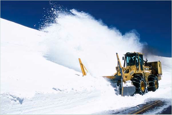
Michael Lewis, who manages water data at the U.S. Geological Survey’s Water Science Center in Lakewood, said cooler temperatures over the weekend have resulted in a steadily melting snowpack instead of a dramatic peak, as was expected last week. Snowpack is still about 239 percent of the average for this time of year, which means rivers could flow at higher levels into the first week of July or longer in some areas, Lewis said…

Meanwhile, restrictions on inner tubes and air mattresses will remain in place for the Colorado River until June 24, and the Yampa and Poudre rivers until early July, officials said. Because of less dramatic water flow this week, Clear Creek and Boulder Creek do not have any restrictions in place.

From the Associated Press (Cristina Silva):

The [Lower Basin states] can thank the heavy and, in some cases, unprecedented snowpack in Wyoming, Utah and Colorado. The ripe June sun is sending snowmelt into the Colorado River, its tributaries and Lake Mead, the nation’s largest reservoir located outside Las Vegas. “This is obviously really welcome, great news,” said Jeffrey Kightlinger, CEO of the Metropolitan Water District of Southern California, which serves 19 million people. “It’s been a godsend.”

The water comes at a crucial time for the Southwest. After 10 years of receding water levels that threatened a regional water shortage, this year’s melting snows are expected to grow Lake Mead, the chief source of water for the three states and Mexico, by 40 feet or more. The jubilation in California, Arizona and Nevada is not a case of wishing neighbors ill, only the reality of nature’s polarizing impact in the water-poor West. Brutal, prolonged winters in the north produce robust, life-giving water flows in the south…

Roughly 96 percent of Mead’s water comes from melted snow in the upper Colorado River basin states: Colorado, Utah, New Mexico and Wyoming. By November 2010, the water in the reservoir had fallen to 1,081 elevation feet, a historic low and a mere six feet above the point that would trigger a large reduction of Arizona and Nevada’s share of the Colorado River. If that trend had continued, Arizona and Nevada could have had to begin water rationing this year. That outlook changed during late winter as snowstorms blanketed Western mountains from the Rockies to the Sierra Nevada. By June, there was more cumulative snow than ever in the upper basin states that feed into the Colorado River, said Kevin Werner, a hydrologist for the National Weather Service’s Colorado Basin River Forecast Center. As a result, Lake Mead is expected to grow to up to 1,126 feet by December. At full stage, the lake registers at more than 1,200 elevation feet. For public water utilities, the engorged river will buy officials more time to plan for the possibility of a future without Lake Mead, a nightmarish prospect across the Southwest. Some researchers believe long-term drought, climate change and an ever increasing demand for water could leave the lake dry by 2021.