
Click on the thumbnail graphic for the February 2013 precipitation departure from normal map from the Regional Climate Centers.
From The Denver Post (Brandon Swedlund):
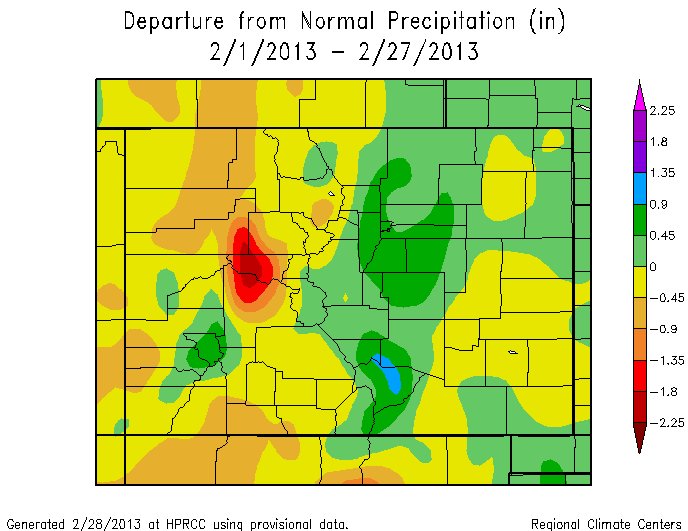
The unseasonably mild temperatures from January continued into the first week of February. However, a major shift in the jet stream brought colder temperatures and beneficial snowfall to Denver and much of northeastern
Colorado during the last half of the month. Thanks in large part to 9.1 inches of snow on Sunday, the total snowfall for the month will be well above the average of 6.1 inches. As of Wednesday, the unofficial total snowfall at Denver International Airport was 14.1 inches.
Heading into March, a variable weather pattern is expected to continue, as wet storms from the Pacific clash with a cold and drier air mass from the Arctic. This can result in the weather being highly variable, even in just one day. An example of this occurred on March 8, 1992, when thunderstorms and hail during the day gave way to blizzard conditions that night.
On average, March is Denver’s snowiest month at 9.6 inches. However, this snow does not often stay on the ground for very long, due to the variable weather pattern and temperatures.
Where’s the #snow today? 5″ of fresh @breckenridgemtn & 4″ @vailmtn . 24-hr totals. #cowx #COsnow #celebratewinter
— Snow.com (@snowdotcom) March 2, 2013