Eric Kuhn paints a big picture of changing realities in the Southwest
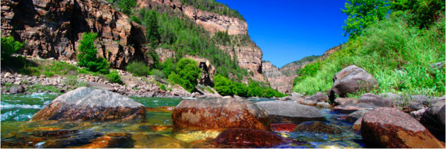
rom his office in Glenwood Springs overlooking the Colorado River, Eric Kuhn has become one of the West’s most prominent thinkers about the intersection of water, climate change, and allocations for farms, factories and cities, including ski towns.
He joined the Colorado River Water Conservation District as an engineer after working in the private sector as a nuclear engineer. He has been manager of the water district since 1996. The district encompasses all of the Colorado River drainage in Colorado upstream from Fruita. As such, the district is a primary source of water not just for the bulk of Colorado ski towns and Front Range cities but also downstream farms and cities, including Phoenix, Los Angeles, and San Diego.
Mountain Town News collaborated with Kuhn on a reader-friendly Q&A to probe the growing evidence that warming temperatures have started upsetting the apple cart of Colorado River operations.
Eric Kuhn along the banks of the Colorado River in Glenwood Springs, general manager of the Colorado River District. Photo via the Grand Junction Daily Sentinel.
Was it a good snow year in the upper Colorado River Basin? It varied, of course, but generally it was average to a little above average in the Gunnison, Yampa, Green and other basins of the upper Colorado River.
Does that mean the reservoirs in the Colorado River Basin are filling? We’ve been hearing a lot about declining levels of Lake Powell and Lake Mead, the two giant reservoirs on the Colorado River. Water runoff is a more complicated story than snowpack. This year, for example, the runoff reached about 94 percent of average. So, average or above-average snowpack but below-average runoff.
The best way to understand snowmelt is to study the inflow into Lake Powell. You can call this reservoir the savings account for the Upper Colorado River Basin. It is this savings account that allows the upper division states of Colorado, Utah, Wyoming and New Mexico to consistently meet water supply obligations to the Lower Basin at Lake Mead as spelled out by the Colorado River Compact of 1922. The lower division states are California, Nevada, and Arizona.
There is no such thing as an average snow year—nowhere, no place. Snowpack varies wildly from year to year. That said, in an average water year, about 10.7 million acre-feet flows into Powell. Three-fourths of that occurs during April through July.
Colorado River Basin, USBR May 2015
Average snowpack but below-average runoff? That poses an obvious question. But first, would you explain this savings account more? The 1922 compact requires the upper division states to not deplete the flows downstream to Lake Mead below a certain volume. Powell most often releases 8.23 to 9 million acre-feet, as required by the 2007 interim agreement among the seven basin states and the federal government, a side agreement to the compact. But ordinarily, because of evaporation, that means the effective demand on Powell is 8.6 to 9.4 million acre-feet.
What this means is that in any year with an 85 percent of average runoff, Lake Powell just about breaks even. In other words, water levels are not gaining but neither are they declining.
For local supply reservoirs in most of Colorado, we can get by with an 85 percent or better inflow year without too many concerns.
So nothing to worry about in the upper basin?We’re meeting our obligations, end of story? We are OK for now and probably for the immediate future, but if the current conditions transition into a drought over the next several years, as happened after the 1998 El Niño event, we could be in serious trouble because unlike in 1998-99 when system reservoirs were plumb full, today they’re only about half full.
How much of the water in Lake Powell and Lake Mead comes from upstream of Grand Junction (or Moab)? And how much of that originates as snow in places like Steamboat Springs, the Eagle Valley, and the San Juan Mountains? Most of the run-off in the upper basin originates from about 20 percent of the land: those watersheds above about 9,000 feet in elevation, where snowpack accumulates and sticks through the snow season.
The Green River drainage contributes 36 percent of the flow into Lake Powell, the Colorado mainstream 36 percent, the San Juan 24 percent, and the others 4 percent, according to the U.S. Bureau of Reclamation. This is the long-term average.
We’ve heard a lot about drought in the 21st century. Are we still in drought? Colorado as a whole is definitely not in a drought. From the entire Colorado River Basin perspective, it depends on the period one looks at. From 1906 through 2015, the mean annual flow at Lee’s Ferry (between Lake Powell and the Grand Canyon was 14.8 million acre-feet (maf). From 1930 forward, it’s been less, 13.9 maf, according to the National Flow Data Base kept by the U.S. Bureau of Reclamation (available on its website)
For the period of 2000 though 2015, the mean natural flow was 12.4 maf. That’s well below average. During the first part of the century, from 2000 through 2004, it was even less, just 9.4 maf.
Bottom line here: Nearly all the water in the Colorado River comes from upstream of the Grand Canyon, and the average in the 21st century has lagged below the longer-term averages of the 20th century.
Why are Lake Powell and Lake Mead continuing to decline? The recent declines in Mead have been caused by annual demand levels that exceed supply. By the end of 2016, I expect that total storage in Lake Powell and Lake Mead will be close to what it was at the end of 2005. Keep in mind that the major decline in runoff and hence storage was from 2000 through 2004.
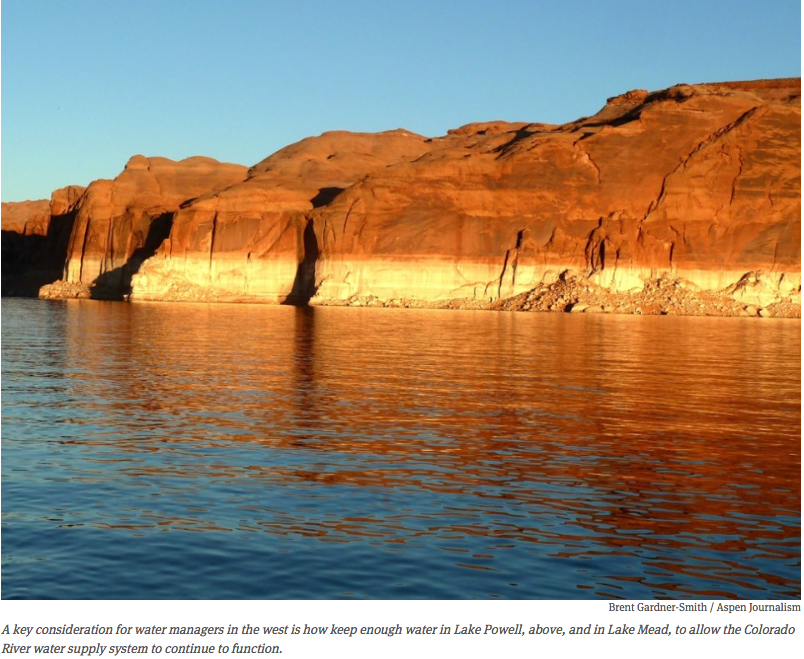
Lake Powell via Aspen Journalism
That’s scary. Some decent snow years in the Rocky Mountains, where most of the Colorado River water comes from, but yet the storage in Mead is declining. Why the decline in Lake Powell?Lake Powell has actually gained a little bit of storage since 2013 and is well above the low point it reached in the winter of 2005. But because of obligations to deliver a little extra water to Lake Mead and because of OK-but-not-great inflows of 90 to 95 percent, the storage is not going up as rapidly as the snowfall in the Rocky Mountains suggests it should.
People talk about a “structural deficit.” What do they mean by that? The structural deficit is the difference between inflow to Lake Mead and demands at Lake Mead when Lake Powell is delivering a “normal” 8.23 maf/year. The math works this way: 8.23 maf from Powell plus native inflow between Powell and Mead of about 700,000 acre feet gives a total inflow of about 9 maf. Demands are 7.5 maf for the three Lower Basin states plus 1.5 maf for Mexico plus about 1.2 maf of evaporation and system losses for a total of 10.2 maf. Thus, the structural deficit is about 1.2 maf. Evaporation varies based on Lake Mead levels. When Lake Mead is fuller, evaporation plus system losses can be as high as 1.5-1.6 maf.
In a recent paper, you cited evidence that warming regional temperatures have turned above-average or abundant precipitation into just average runoff, kind of a reverse alchemy. How can this happen, turning more into less? Temperature is a major variable in the hydrologic cycle. As temperatures go up, evaporation goes up, crops and native vegetation consume more water (transpiration), and the runoff occurs earlier, which exposes native vegetation earlier. The net result is lower stream flows for the same precipitation levels. Brad Udall suggests that about one-half of the reduction in flows we’ve seen since 2000 in the Colorado may be due to temperature alone.
Good snow years means so-so water years in the Colorado River? Wow, that seems to have a lot of so-what! What do you think are the most important so-whats? For water supply purposes, it’s more than a so-what. If temperatures continue their upward trajectory (with year to year variability, of course), we may be in for a new normal. That normal may not have a ground floor.
I like statistics. Does one statistic leap to mind that illustrates what’s going on in the Colorado River Basin? Yes, the number is 1.2 million acre-feet, the amount that the Lower Basin (and Mexico) must reduce their demands if they are to stabilize levels in Lake Mead—at least for the moment. If temperatures continue to warm, they may have to reduce their demands even more.
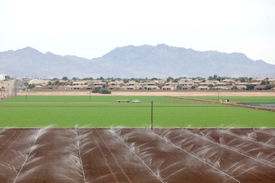
Spray irrigation on a field in the Imperial Valley in southern California. This type of irrigation is a lot better than the extremely water inefficient type of flood irrigation that is popular in this region. Still, in the high temperatures of this desert region a lot of the water evaporates, leaving the salts, that are dissolved in the Colorado River water that is used, on the soil.
Why do California, Arizona and Nevada have to cut back—and we in the headwaters area don’t. The 1922 Colorado River Compact gave the upper basin states 7.5 million acre-feet, and the lower-basin states 8.5 maf. It was always assumed that California, in particular, but also Arizona would develop more rapidly, and they did, while the upper-basin states would be slower to put their allocated water to use. But, by the 1970s California was using far more than its 4.4 million acre-foot allocation. Since then, they have been reducing their diversions, but they remain above their allocation.
What are the implications for the headwaters in Colorado and Wyoming? We could continue to see good snow years and decent regional water supply conditions, but due to increasing regional temperatures and system-wide demands that exceed supplies, the Colorado as a whole may continue to be in crisis. There is an old saying that water flows uphill toward money. My biggest concern is that the continuing supply deficit may trigger efforts that will impact our quality of life, especially upper basin agriculture, which may be seen as the “low-hanging fruit.”
In your recent paper, you issue a warning. What is that warning—and is more than just one exclamation mark justified? My warning is that often, but not always, after we’ve had big El Niño years, in the next year, or two (or even three), we end up with drought in Colorado. 1997-98 and 1957-58 are good examples.
In Colorado, we need to quit talking about continuing drought and acknowledge that conditions in much of the state since the fall of 2013 have been wet (the Southwest and Rio Grande have not been as lucky). This means we need to be prepared for the NEXT drought. As (Colorado Water Conservation Board director) James Eklund says “wishing for the drought to end is not a successful strategy.”
For the basin as a whole, we need to be prepared to survive another 2000-2004 period. The difference is that in 1999 reservoirs were full to the brim. Now, they’re at levels of 40 to 50 percent of capacity.
It sounds like we will really need to rethink our use of water from Colorado and Wyoming to Arizona and California. Who’s in charge of this Plan B? The good news is that many entities are actively engaged in seeking solutions. The State of Colorado has just issued a water plan, for the first time ever. The lower division states appear to be on track to implement significant additional water savings if Mead levels continue to decline. Nobody is really in charge. The U.S. Secretary of the Interior has a significant role because of her authority over the operation of the major projects, but the states, affected water users, environmental groups, and the Native American tribes are all at the table.