Join the Colorado Foundation for Water Education and Colorado Water Congress with support from CoBank on August 16th from 12:00 to 1:00pm, for a timely interactive webinar that explores some of the promising creative funding options available to pay for Colorado’s water future. Learn more about the funding gap, and creative funding mechanisms as discussed by the state finance committee and the Colorado Water Conservation Board. Then dive into options, tips and examples of financing through P3s and cooperative partnerships; venture capital and impact investing; and philanthropic donations and investment. We’ll hear about these very real financing ideas and provide a forum to engage in discussion with experts.
In the face of population growth, Colorado communities are solidifying the work outlined in Colorado’s Water Plan around water storage, infrastructure, education, conservation, and more. Amid new growth, we also face an era of repair, with emerging needs in infrastructure replacement and recovery, environmental and stream management and recovery, recreational needs, and the continued viability of water for agriculture. The water needs of the future may be far different, with more financing needs than we’ve seen to date.
Where will Colorado find the billions of dollars necessary to fund its water future and pay for what’s ahead?
Webinar Panelists:
Eric Hecox, South Metro Water Supply Authority
Ben McConahey, Hydro Venture Partners
April Montgomery, The Telluride Foundation and CWCB Board Member
In a one-year retrospective released Monday by the EPA, the federal agency is careful to underscore how the state was involved in planning that led to the blowout, which turned the Animas mustard yellow and deposited heavy metals.
“Throughout the winter and spring of 2015, EPA and CDRMS (Colorado Division of Reclamation, Mining and Safety) developed plans … During the 2014-2015 investigatory process with CDRMS, the EPA team concluded the GKM (Gold King Mine) adit was likely only partially full of water,” the report says…
The state has attempted to distance itself from planning that led to the blowout.
“DRMS did not have any authority to manage, assess, or approve any work at the Gold King Mine,” former Natural Resources Director Mike King wrote in a Sept. 2, 2015, letter to the EPA, just a week after an EPA internal report was released.
The issue is likely to be highlighted as the state defends itself against a lawsuit filed by New Mexico in the U.S. Supreme Court. The state has until Aug. 22 to respond…
The account does not offer much new information, largely recounting the circumstances that led to the Aug. 5, 2015, blowout, which the EPA described as an “inadvertent” release.
“EPA recognizes the impact that the GKM release had on the people of the Four Corners region,” the retrospective states. “The Agency has worked with affected residents, small businesses, universities, local governments, states and tribes in an extensive effort to assess and address the immediate and potential long-term impacts of the release on water quality in a region adversely impacted by a legacy of contaminated mine-influenced waters from abandoned and unstable hard-rock mines.”
It goes on to encourage Congress to approve a fee on the hard-rock mining industry to help cover costs associated with cleanups. The Republican-controlled Congress has expressed concerns with the proposal.
The EPA has dedicated more than $29 million to respond to the Gold King Mine spill and to provide monitoring in the area. A Superfund listing – which is likely to be approved as early as the fall – would inject millions more into cleanup efforts.
A new State of the Climate report confirmed that 2015 surpassed 2014 as the warmest year since at least the mid-to-late 19th century.
Last year’s record heat resulted from the combined influence of long-term global warming and one of the strongest El Niño events the globe has experienced since at least 1950. The report found that most indicators of climate change continued to reflect trends consistent with a warming planet. Several markers such as land and ocean temperatures, sea levels, and greenhouse gases broke records set just one year prior.
These key findings and others are available from the State of the Climate in 2015 report released online by the American Meteorological Society (AMS).
The report, led by NOAA National Centers for Environmental Information, is based on contributions from more than 450 scientists from 62 countries around the world and reflects tens of thousands of measurements from multiple independent datasets. It provides a detailed update on global climate indicators, notable weather events, and other data collected by environmental monitoring stations and instruments located on land, water, ice, and in space.
“This ‘annual physical’ of Earth’s climate system showed us that 2015’s climate was shaped both by long-term change and an El Niño event,” said Thomas R. Karl, LHD, Director, NOAA National Centers for Environmental Information. “When we think about being climate resilient, both of these time scales are important to consider. Last year’s El Niño was a clear reminder of how short-term events can amplify the relative influence and impacts stemming from longer-term global warming trends.”
The report’s climate indicators show patterns, changes, and trends of the global climate system. Examples of the indicators include various types of greenhouse gases; temperatures throughout the atmosphere, ocean, and land; cloud cover; sea level; ocean salinity; sea ice extent; and snow cover.
The State of the Climate in 2015 is the 26th edition in a peer-reviewed series published annually as a special supplement to the Bulletin of the American Meteorological Society. “The State of the Climate report continues to be critically important as it documents our changing climate. AMS is proud to work with so many from the science community to make this publication happen,” said Keith Seitter, Executive Director of AMS. The journal makes the full report openly available online (link is external).
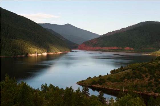
Sunrise at Ruedi Reservoir October 20, 2015. Photo via USBR.
From email from Reclamation (Peter Soeth):
The Bureau of Reclamation has scheduled the annual public meeting for Ruedi Reservoir Water Operations.
August 11: Basalt Town Hall, 101 Midland Avenue, Basalt, Colo., 7 to 8:30 p.m.
The meeting will provide an overview of Ruedi Reservoir’s 2016 projected operations for late summer and early fall, which are key tourist seasons in Basalt. The meeting will include a public question and answer session.
For more information, please contact Tim Miller, Hydrologist, Eastern Colorado Area Office, by phone or e-mail: (970) 962-4394, or tmiller@usbr.gov.
Jim Lochhead, the CEO and manager of Denver Water, said Tuesday that building new dams in the Colorado River basin is not at the top of his to-do list. Nor, for that matter, is drying up farms to provide water for Colorado’s growing cities.
But he says Colorado still needs to have hard conversations about how to flexibly manage its water. In particular, he wants farmers to be able to share water with Denver and other cities without worrying that they may lose their water rights.
Speaking at the annual Western Water Symposium at Colorado State University, Lochhead credited the 2015 Colorado Water Plan as being a useful “compendium of the issues” but said it highlighted relatively easy solutions without fully addressing the harder challenges.
“I don’t think the solution is $20 billion of new water projects for Colorado, but that’s an easy thing to go look for,” said Lochhead, head of the state’s largest water utility that supplies 1.4 million people, and stores nearly 40 percent of its water in Summit County’s Dillon Reservoir.
A coordinated plan is needed, Lochhead said.
“We’re not there yet with the state water plan to develop any kind of coordinated principle vision for the future, much less how to get there,” he said.
Lochhead, who took the helm of Denver Water in 2010, described Colorado’s historical approach to water as a zero-sum game where there had to be a winner and a loser.
That zero-sum game lost its moorings in the second half of 20th century as a result of new federal and state laws, court decisions and political fights, Lochhead said.
He said that two decades have brought more collaboration between diverse interests, including those on both sides of the Continental Divide, and it is reflected in such projects as Wolford Mountain Reservoir near Kremmling.
Both Denver Water and the Colorado River Water Conservation District have an interest in Wolford Reservoir, with Denver Water on track to soon own 40 percent of the water in the reservoir. The water has many benefits, among them providing late-summer water to meet needs of four endangered fish species in the Colorado River near Grand Junction.
Another collaborative effort has been launched in the Winter Park area. There, Denver plans to increase diversions from the Fraser and Williams Fork rivers, but is doing so with the blessing of local authorities, thanks to a collaborative “learning by doing” effort in Grand County that seeks to reduce streamflow impacts from both new and existing diversions.
But Lochhead believes Colorado must still dramatically change its water allocation methods as it faces population growth. Demographers project that Colorado’s 5.4 million population will double within a few decades. If we seek to provide the water for the additional residents the way we provided for the first 5 million, he said, “we won’t like the outcome very well.”
Gore Canyon rafting via Blogspot.com
The river itself
A second challenge is the Colorado River itself, the fountain that supplies at least part of the water for 40 million people, from corn farms in northeastern Colorado to San Diego. And despite some good snow years, the two big reservoirs on the lower Colorado River, Lake Powell and Lake Mead, are both low enough to keep a ballroom full of water experts up at night.
It could get worse. And, according to projections of climate models, it likely will.
Laurna Kaatz, an in-house climate expert at Denver Water, recently told the Metro basin roundtable it’s still not clear if it will be hotter and drier, or hotter and wetter in Colorado in the future, but there is little doubt it will be hotter.
More major dams on the Colorado River are not the solution, Lochhead said. Evaporative losses would result in more loss than gain, he said, although he did allow for the possibility of relatively small dams.
Denver Water is, however, studying the potential for putting water into aquifers beneath the city, creating underground storage — storage that could, in theory, hold water from the Western Slope.
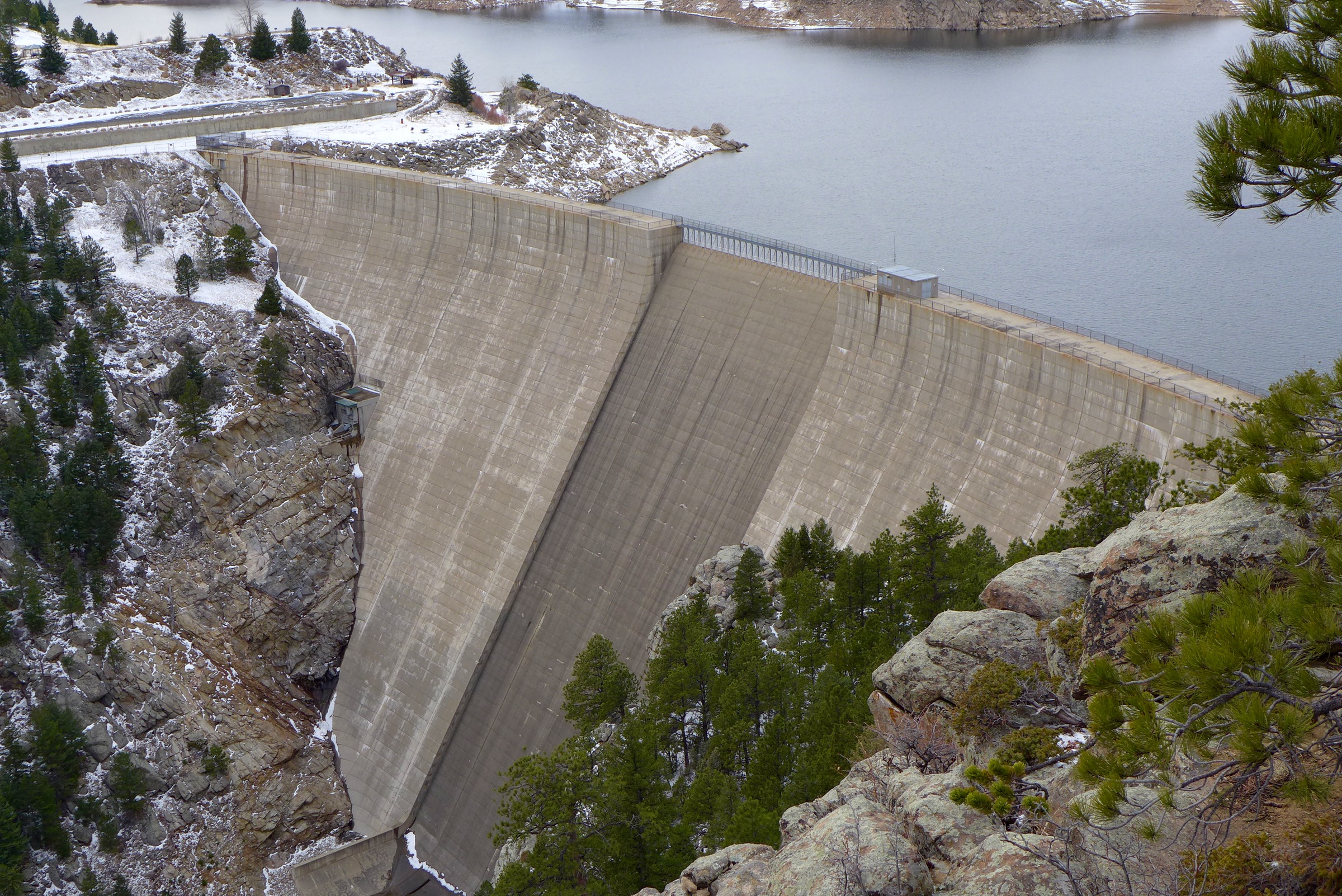
And Denver Water is looking to store up to an additional 15,000 acre-feet of Western Slope water in an expanded Gross Reservoir, southwest of Boulder. The $360 million project seeks to raise the elevation of the dam by 131 feet, which would increase the capacity of the reservoir by 77,000 acre-feet, bringing it up to 119,000 acre-feet.
Flexibility needed
Lochhead said that Colorado needs more flexible water management options that allow for greater sharing of the resource.
About 85 percent of water in Colorado is used by agriculture and ranchers and farmers tend to have the oldest and most senior water rights.
Water rights are private, said Lochhead, “but you can’t really do anything with that property right except what you are currently doing with it unless you go to water court. And by going to water court you put that entire water right at risk.”
In Colorado’s water courts, objections to changes in uses of water rights are often filed. The process can be lengthy and expensive for those seeking to make changes.
“You need a safe process where you don’t have to put your water right at risk, and you understand that you don’t have to spend years negotiating,” he said.
And Lochhead thinks Colorado also needs another conversation about conservation, where the emphasis is not about sacrifice but about innovation.
Denver Water intends to demonstrate what is possible as it redevelops its 35-acre headquarters campus along Interstate 25 near downtown Denver. There, planners think they can reduce demand for potable water by more than 50 percent.
In water reuse, said Lochhead, Colorado is “way behind the curve” as compared to some world cities, including Amsterdam and Sydney.
Editor’s note: Aspen Journalism and the Aspen Daily News are collaborating on the coverage of water and rivers. The Daily News published this story on Friday, July 29, 2016.
The Gold King Mine Spill has exposed a bigger problem whose solution seems incredibly complex. Hundreds of abandoned mines in southwestern Colorado have leached tainted water into nearby streams for decades. The EPA has been trying to get a handle on the issue for years. That’s why the agency had crews working at Gold King Mine last August.
It’s emblematic of a much larger problem that exists across the Western United States. One GAO report estimates 33,000 hard rock abandoned mines are causing environmental problems. And one year after the Gold King Mine spill, many experts say the country is no closer to a solution.
The proposed Bonita Peak Mining District contains 48 mining-related sites in the region. But local officials said it wasn’t easy getting on board with the Superfund idea.
“There was a lot of sleepless nights,” said Willy Tookey, San Juan County administrator. For more than a decade, the government here shied away from Superfund status.
The two biggest concerns for local leaders was that a listing would cause a drop in property values and a drop tourism.
Tookey said intense negotiations with the EPA over this past year led to new confidence. And assurances.
“Because of the circumstances I think we were able to get these answers that we weren’t able to before,” he said.
The EPA expects to make a final decision on whether Superfund status will be approved this fall. From that point, it could take years for the agency to approve a work plan and funding.
There were two weak monsoon surges from late June through July, said Joe Ramey, a meteorologist at the National Weather Service office in Grand Junction. The stronger, third surge this week could hold the potential for flash flooding.
One such storm materialized about 3 p.m. Monday over Durango. It brought a mix of rain, hail and lightning that started a small wildland fire and flooded some businesses, including south City Market, where the back half of the store from aisles 1 to 6 was soaked.
The city of Durango reported some culverts were plugged, but no major flooding. The deluge centralized over the city, said Butch Knowlton, director of La Plata County’s Office of Emergency Management…
The monsoon is a seasonal phenomenon in which winds start coming from the south instead of the west. Then, as high pressure sets up in the Southwest, winds help pull water into the region from the gulfs of Mexico and California. Because of solar heating, a thermal low develops over the desert Southwest, which helps to pull even more rain into the region. As these two events interact, the familiar, seasonal pattern of almost daily thunderstorms ensues.
Where’s La Niña?
This year’s weather has been influenced by the El Niño phenomenon, which brought heavy snow to the Four Corners this winter. El Niño has ended, according to the weather service, but with a twist this year: El Niño’s opposite effect, La Niña, is unlikely to occur. La Niña is often linked to drier winters.
“El Niño is over, but La Niña has not replaced it,” Ramey said.
El Niño occurs when temperatures in a patch of ocean off Ecuador’s coast rise by about 1 degree (0.5 degree Celsius) from three-month averages. The effect is that storms generally track in a more southerly direction across the U.S.
La Niña occurs when the patch of equatorial Pacific cools by about 1 degree from the average. It results in generally drier winters in the Four Corners as storms take a northerly track.
In June, weather service forecasters saw the ocean temperatures drop from El Niño, and reported the likelihood of a La Niña was 77 percent.
“It is now at 55 percent, so it is setting up for an ENSO (El Niño Southern Oscillation) neutral pattern,” which is neither El Niño or La Niña, Ramey said.
The neutral pattern isn’t necessarily bad news for the upcoming winter, he said, but it makes the long-term winter forecast more unpredictable.
“ENSO neutral years do not have a favorite pattern, and the storm tracks vary widely,” Ramey said. “The climate record shows these years can be dry or wet, so it is kind of a wild card.”
Since 1950, there have been 19 El Niños. Of those, in the season that followed a La Niña occurred 11 times and an ENSO neutral occurred five times.
Improving irrigation efficiency in the Lower Arkansas Valley could improve water quality and save farmers money.
Those are conclusions reached by Tim Gates, a Colorado State University- Fort Collins engineering professor who has overseen 17 years of a large-scale study of salinity of area farms.
“It’s designed to address the problems facing agriculture and the environment in the valley,” Gates told the Lower Ark board at its monthly meeting this week.
Those problems include shallow groundwater tables, or waterlogging; excessive salt buildup; crop yield reduction; and buildup of selenium, uranium and nutrient concentrations.
Studies began in 1999 to track the rate of increase and develop strategies for dealing with the problem. Those studies have been funded by state and local sponsors, including the Lower Ark district.
A new project, under the auspices of the U.S. Department of Agriculture, will address changes in irrigation that can improve conditions.
“This will make recommendations for pilot programs throughout the Arkansas Valley that will be tested,” Gates said.
Board chairman Lynden Gill asked Gates what some examples of pilot projects would be.
Gates responded that several have already been proven, including:
The Super Ditch lease-fallowing program. Letting some ground recover periodically can improve its productivity over time.
Improving technology, such as adding sprinklers or drip irrigation.
Sealing canals with PAM, which can reduce seepage by 30-80 percent.
Management of fertilizer to avoid excessive amounts.
Improving riparian corridors, which can act to filter out contaminants.
The district has a new goal of improving water quality in the Lower Arkansas Valley. This could improve crop production and wildlife habitat. It also might fend off future legal challenges by Kansas over water quality.
The auction room was packed with bidders, but only 13 — including the City and County of Broomfield — emerged from the Larimer County Fairgrounds with a piece of the Reynolds portfolio. Municipalities, developers and farmers all grabbed some units of Colorado-Big Thompson water, while developers and growers signed deals for land.
The auction was of high interest, given the land’s location in the path of northern Front Range development and the large amount of water attached to it.
Although the numbers are still preliminary, Hall and Hall Auctions partner Scott Shuman said 276 CB-T units brought in the largest chunk of money, about $7.6 million or an average of $27,356 each. The CB-T units, already trading for high sums, were expected to be the most pricey given their scarcity and the ability to use the water for uses such as agriculture, development and industrial processes, including oil and gas extraction.
According to Pat Soderberg, finance director for Broomfield, the city and county placed a bid for 120 shares at $26,000 per share, plus a 4 percent processing fee.
That puts Broomfield’s purchase at $3.24 million, with a 10 percent down-payment of $324,480. The balance will be paid at closing, Soderberg said.
But on a per-share basis, the 15.75 Highland Ditch shares stole the show, averaging $148,900 each for an estimated total of $2.3 million. All the shares were sold to farmers or investors.
Although CB-T water got most of the attention prior to the auction, Shuman said the ditch shares provide more acre-feet of water than CB-T and are not limited to a specific geography. CB-T water, which is conveyed from the headwaters of the Colorado River near Grand Lake, can be used only within the boundaries of the Northern Colorado Water Conservancy District.
The politics of water in the West was the theme of the second annual Western Water Symposium, held at the end of July at Morgan Library on the Colorado State University campus. More than 130 attendees heard from a series of water experts that the politics of water in the West transcends party affiliation — and there’s probably not a more divisive issue, even in this election year.
Pat Mulroy via The Earth Institute at Columbia University
Among the speakers was Pat Mulroy, senior fellow at the William S. Boyd School of Law at the University of Nevada Las Vegas, who said the federal regulatory system of water management in the West is “broken.” Mulroy said leadership and creative solutions are needed to “reform the federal regulatory rigidity.”
She focused much of her talk on the Lower Colorado River Basin, which stretches through Nevada and Arizona – and forms Lakes Mead and Powell – before running into southern California and supplying the thirsty Los Angeles and San Diego markets. Mulroy said it would be necessary for those in the Lower Colorado River Basin to “redefine their relationship to water, and do more with less in the future.” Otherwise, she said there will be nothing for the region but “hydrologic leftovers.”
Hank Brown
Action, not inaction
Former Colorado U.S. Senator Hank Brown also addressed the gathering. Brown, who helped to negotiate the state’s only wild and scenic designation on the Cache La Poudre River west of Fort Collins, said the designation would not have come about had there not been compromises and the desire to develop a “great thing from action, not inaction.”
That inaction, according to Brown, comes at the federal level with numerous regulations, environmental impact statements and layers of bureaucracy. He said that the U.S. Army Corps of Engineers, the agency primarily responsible for overseeing approval of water projects, should change its focus because “doing away with water storage has nothing to do with controlling growth,” especially along the fast-growing Colorado Front Range.
Instead, Brown said that preparing for future growth and infill should be a task that the state and communities coordinate and work together on now, so that plans could be made for preserving open space, creating dedicated traffic corridors, and planning for additional water storage.
Jim Lochhead — photo via Westword (Alan Prendergast)
Water distribution is monolithic, linear
Colorado allocates its water through a complex scenario based on prior appropriation, decrees and interstate compacts. Jim Lochhead, CEO and manager of Denver Water, said the “first in time, first in right” approach creates some winners and some losers, and that the current system of distributing water in the West is “monolithic and linear, but politics is driving the system.” And that it will take “leadership to get past the ‘zero-sum-gain’ approach.”
Lochhead, like Brown, was wary of several federally enacted laws, such as the Endangered Species Act, Clean Air and Clean Water Acts, but said these regulations served as a wake-up call to the water community. Water providers, such as Denver Water, were seeing not only the prohibition of new projects, but limitations being placed on expansion of existing projects.
He said confrontation was replaced with community building, reaching out to local groups and communities to create a level of trust. Lochhead said that has resulted in better relations between urban and rural water interests, Western slope and Front Range providers, and upper basin and lower basin users.
The Western Water Symposium also featured D.C. Jackson, a noted professor of history at Lafayette College, who provided a glimpse into the integration of dam engineering in the West and politics during the 1920s.
Symposium benefits Water Resources Archive
The symposium benefits the Water Resources Archive, a joint effort between Morgan Library and Colorado Water Institute. The Archive centralizes historically important water-related collections, documenting the role that water has played in the development of Colorado and beyond. In all, more than 100 collections related to water resources throughout Colorado, the Western U.S., and from around the world are housed there, with about 5 percent of the total holdings available online at http://www.lib.colostate.edu/water.
On Friday, Sunnyside – now owned by international mining conglomerate Kinross Gold Corp. – called for New Mexico’s lawsuit over the Gold King Mine spill’s impact to the state to be dismissed.
“We see no basis for us even being named in this litigation,” Sunnyside spokesman Larry Perino wrote in an email.
In May, the state of New Mexico, seeking compensation for environmental and economic damages, filed a lawsuit in U.S. District Court in New Mexico, naming the Environmental Protection Agency and its contractor, as well as Sunnyside and its parent company, as responsible parties for the Aug. 5, 2015, mine blowout.
In the complaint, New Mexico state officials claim the “root cause” of the disaster dates back more than 20 years to Sunnyside’s attempt to block waste water drainage by building bulkheads in tunnels below the vast Sunnyside Mine network north of Silverton…
In its July 29 motion to dismiss, Sunnyside argued that installing the American Tunnel bulkhead was done at the direction of the state of Colorado, and that New Mexico officials “point to no facts to support that historic discharges from the Sunnyside Mine pool in Colorado, unrelated to the Gold King Mine blowout, somehow impacted New Mexico.”
The motion further alleges New Mexico has no personal jurisdiction over Sunnyside; the state of Colorado is a required party in the case and is not named (Colorado was sued by New Mexico in the U.S. Supreme Court); and New Mexico is not entitled to punitive damages.
Sunnyside has long dismissed claims that water backed up behind the American Tunnel has seeped to other mine workings, though most experts in the region suspected the opposite.
Regardless, as a result of the proposed Superfund listing, the EPA plans to enter the mine and investigate, which should provide clarity, EPA officials previously said. It is unclear if those efforts have started this summer.
And Sunnyside’s involvement does not end with the New Mexico lawsuit, as the company has emerged high atop the list of potentially responsible parties that the EPA would seek financial costs from should a Superfund be declared.
Though Sunnyside claims an agreement with the state of Colorado to install three bulkheads in the 1990s would release the company of further liability for pollution in the district, officials familiar with the Superfund process say otherwise.
“It’s a different law,” Doug Jamison, of the Colorado Department of Public Health and Environment, said in a previous interview. “(Sunnyside) was relieved of their liability from a discharge permit under the Clean Water Act. It has nothing to do with Superfund liability.”
It’s been a convoluted, and expensive, quarter century since the company last hauled gold, silver, copper and other precious metals from the highly mineralized mountains surrounding San Juan County.
After the mine shut down in 1991, a number of remedial efforts began, with Perino estimating about $15 million has been directed to cleaning up sites around the basin.
Still, ever since Sunnyside’s water treatment plant shut down in 2004 (a result of a sale to local Steve Fearn, who was evicted by current Gold King Mine owner Todd Hennis), water quality in the Animas River has degraded.
The town, too, felt the departure.
“It was a wrenching time,” Silverton native Bev Rich said.
Rich said nearly 150 workers lost high paying jobs. The only school in the small mountain hamlet of about 600 full-time residents went from 150 students to about 50, and San Juan County lost $300,000 – about one third – of its annual budget.
Meanwhile the U.S. Attorney General’s office has launched a criminal investigation into the August 2015 Gold King Mine spill. Here’s a report from Jesse Paul writing for The Denver Post. Here’s an excerpt:
Federal authorities have confirmed for the first time that a criminal investigation into the 2015 Gold King Mine spill is underway, saying their probe involves the U.S. Attorney’s Office and came at the request of members of Congress.
The announcement Monday came from the Environmental Protection Agency’s Office of Inspector General (OIG) as it released letters sent to lawmakers about the status of its work to analyze the disaster. Documents reviewed by The Denver Post on Monday indicate the probe has been in progress for nearly a year.
Jeffrey Lagda, spokesman for the inspector general’s office, said the OIG is working with the U.S. Attorney’s Office on the criminal investigation. It was “based on requests from several members of the House and Senate,” he added…
In a June 29 letter to Colorado Sen. Cory Gardner, the inspector general’s office said a number of investigations into the spill “have been underway.”
Gardner said Monday in a statement that he appreciates the criminal review and urged the expedited release of a full report on the disaster. He added: “I look forward to a response to my questions surrounding EPA’s insufficient and untimely recovery efforts immediately following the spill.”
In recent letters to members of Congress, the OIG wrote: “There is investigative material that we cannot reveal in any report about our program evaluation until the investigation reaches a point where the U.S. Department of Justice and the EPA’s OIG’s Office of Investigations inform us that we may do so. Many of your questions to us, including those that go to the heart of what you asked us to address, directly implicate and will have to be answered in part by investigative results that are not currently releasable.”
[…]
Also Monday, the EPA released a 23-page retrospective report on the Gold King and its efforts since the incident to restore and protect impacted communities.
The agency said that as of July 15 it has dedicated $29 million in response efforts and for continued water quality monitoring. Officials say they are also evaluating more incident-related expenses and that they are working to expedite the distribution of those funds.
“We have been responsive in terms of doing the cleanup and demonstrating how we’ve done the cleanup,” Mathy Stanislaus, EPA’s assistant administrator, told The Post in an interview Monday.
He added that 68 claims that have been filed against the EPA, which include a mixture of individuals, businesses and local and state governments, are pending review…
The National Wildlife Federation on Monday proclaimed “no meaningful effort has been made” since the Gold King spill to address the ongoing threats from hundreds of mines across the country. Jim Lyon, the federation’s vice president of conservation policy, called for legislation to stop the clock from ticking toward another similar catastrophe.
Stanislaus said the universal problem is broader than the EPA and is being examined from many federal levels.
“I think the EPA can only take on an extremely small subset of the abandoned mine situation,” Stanislaus said. “We only get involved in the highest risk situations where you have this high risk (to) ecological and public health.”
This image was taken during the peak outflow from the Gold King Mine spill at 10:57 a.m. Aug. 5. The waste-rock dump can be seen eroding on the right. Federal investigators placed blame for the blowout squarely on engineering errors made by the Environmental Protection Agency’s-contracted company in a 132-page report released Thursday [October 22, 2015]
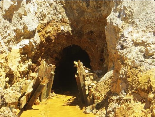
In a July 22 interview with the Telluride Daily Planet, Hays Griswold, speaking of a cleanup project set to begin at a mine near Ophir, cautioned residents there that work might cause some discoloration in the Howard Fork of the San Miguel River.
“You may see some yellow water. Don’t get excited like they do in Durango,” Griswold said.
EPA press secretary Melissa Harrison wrote in an emailed response that Griswold’s comments do not reflect the views of the agency. Requests for an interview with Griswold were ignored, and independent attempts to reach him Thursday were unsuccessful…
Griswold last August was charged with taking over cleanup efforts at the Gold King Mine north of Silverton while the EPA’s permanent on-scene coordinator, Steve Way, was on vacation.
Just days into his command, Griswold gave the EPA’s contracted crews orders to dig into the loose pile of dirt and rock that covered the entrance to the mine – despite clear instructions left by Way to postpone any such work due to the inherit risk of a blowout…
Griswold is now tasked with cleaning up 15,000 cubic yards of mill tailings at the Carribeau Mine, west of Ophir, according to the Telluride Daily Planet. He will not, however, be touching the mine’s adit, which is leaking anywhere from 600 to 800 gallons of mine drainage a minute.
The EPA’s Harrison wrote that the remediation plan for Carribeau Mine is under review by the regional office, and no final decisions have been made about the work.
The EPA’s efforts in the Silverton mining district, now proposed for Superfund listing as the Bonita Peak Mining District, are under the direction of Rebecca Thomas, remedial project manager.
At the urging of congressional leaders, the EPA’s Office of Inspector General is investigating the rupture from the Gold King Mine above Silverton, Colorado, that fouled waterways in three states and Native American lands, the agency said in a statement.
“Based on requests from several members of the House and Senate, the OIG is conducting both a program evaluation and a criminal investigation of the Gold King Mine spill,” the EPA said in a statement.
The OIG is an independent office that audits, investigates and evaluates the agency’s activities, the EPA statement said…
Jeffrey Lagda, a spokesman for the EPA’s Inspector General, told Reuters that the probe has been ongoing for some time, and that investigators are working with prosecutors at the U.S. Attorney’s Office in Denver.
On April 7, 2016, the Environmental Protection Agency proposed adding the “Bonita Peak Mining District” to the National Priorities List, making it eligible for Superfund. Forty-eight mine portals and tailings piles are “under consideration” to be included. The Gold King Mine will almost certainly be on the final list, as will the nearby American Tunnel. The Mayflower Mill #4 tailings repository, just outside Silverton, is another likely candidate, given that it appears to be leaching large quantities of metals into the Animas River. What Superfund will entail for the area beyond that, and when the actual cleanup will begin, remains unclear. Eric Baker
The city of Aspen is hosting a public open house on the municipality’s conditional water rights on Castle and Maroon creeks on Thursday from 5 to 6:30 p.m. in the Pitkin County library community meeting room.
City representatives will provide background information and host a dialogue with the public with the goal of asking for input and ideas.
Since 1965, the city has maintained conditional water rights for a reservoir on Castle and on Maroon creeks to plan for the community’s future water needs, a press release says. To keep these rights, Aspen must submit a diligence filing this October.
Aspen Journalism reported in June that, if built as currently described by the city’s plans, which were first presented to a water court judge in 1965, the Maroon Creek reservoir would store 4,567 acre-feet of water behind a 155-foot-tall dam just below the confluence of East Maroon and West Maroon creeks.
But the release issued Monday by the city says the diligence filing is a routine one that occurs every six years.
And it is not a proposal to actually build the reservoir, the city says.
“A conditional water right is a place holder in Colorado’s priority system for water rights,” the release says.


![This image was taken during the peak outflow from the Gold King Mine spill at 10:57 a.m. Aug. 5. The waste-rock dump can be seen eroding on the right. Federal investigators placed blame for the blowout squarely on engineering errors made by the Environmental Protection Agency’s-contracted company in a 132-page report released Thursday [October 22, 2015]](https://coyotegulch.blog/wp-content/uploads/2015/10/goldkingminespill1057am08052015viaepa.png)

