From The Las Cruces Sun-News (Diana Alba Soular):
The snowpack is “bleak” at this point, said Gary Esslinger, manager of the Las Cruces-based Elephant Butte Irrigation District. He noted it’s still early in the winter, but said the outlook isn’t rosy.
“It looks like it’s just going back into a stronger La Niña, which means less snowpack in the southern Rockies,” he said.
The La Niña pattern, characterized by cooler water in the Pacific Ocean, tends to mean drier winter weather for the Southwest, including the mountains of southern Colorado and northern New Mexico that feed runoff to the Rio Grande.
La Niña conditions strengthened in November and have an 80 percent chance of lasting through the winter, according to an advisory from Climate.gov.
“It is expected to continue in full force for at least the winter months,” said Larry Walrod, senior meteorologist with the National Weather Service’s Pueblo, Colorado office. “For the spring months, it’s a little more uncertain.”
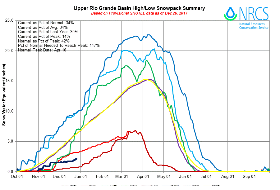
Snowpack is lagging behind average at peaks throughout southern Colorado that feed into the Rio Grande, Walrod said.
At one of the high-elevation sites known as Wolf Creek Summit, there would normally be about 14 inches of water contained in the snowpack at this point in the winter, Walrod said. But there is only 5.3 inches — 38 percent of normal. Other high-elevation sites are posting similar percentages.
Lower-elevation mountains are seeing very low amounts of snow, Walrod said. In addition to less snow falling due to La Niña, any snow that does fall is more likely to melt because of warmer weather.