
Click the link to read the article on The Land Desk website (Jonathan P. Thompson):
May 3, 2024
🥵 Aridification Watch 🐫
What a difference a warm, dusty month can make.
In early April, the Land Desk reported that the snowpack in most of the Southwest was at or above normal, and appeared to be peaking right on schedule, presaging a normal spring runoff. But April turned out to be the cruelest month, after all, sending snowpack levels into a free-fall and dashing hopes for a strong spring runoff on most of the region’s streams.
Take the Gunnison River watershed: Snow water equivalent levels peaked on April 9 at a slightly higher than median level — or about 107% of normal. Within a week, the levels had dropped below normal; and by May 1 were at about 75% of the median level for that date, putting it just about even with 2021, which was a horribly dry year. (More charts and graphs below the text).
A similar pattern is seen throughout Colorado, with northern areas (such as the Yampa) generally faring better than those in the southern part of the state (e.g. the Animas and Dolores). There are exceptions: Snowpack in the high La Plata Mountains in southwestern Colorado is still at about 90% of the median and isn’t falling as quickly as in other areas, which is good news for the La Plata River and the “Dryside” farmers who rely on it for irrigation.
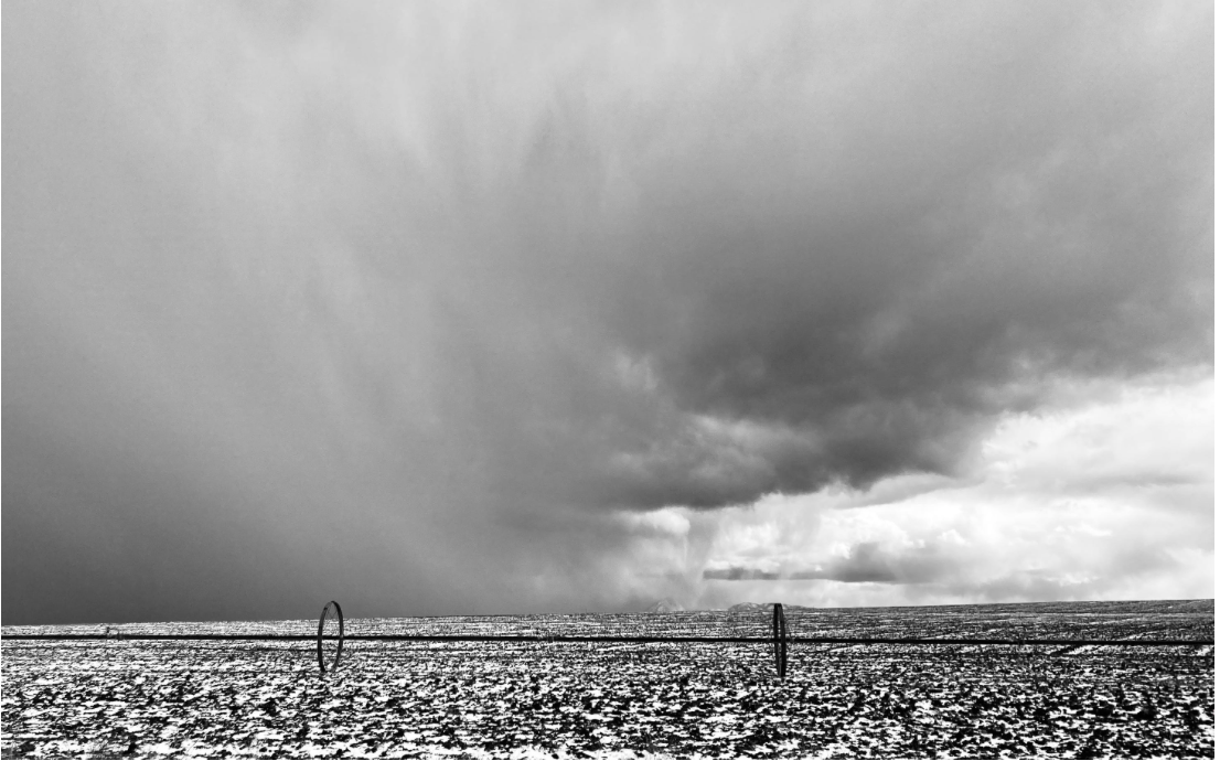
Part of the problem was that the spigot from the sky, after spewing generously for much of March, seemed to shut off in mid-April, with the exception of a single good storm near the end of the month. But a bigger factor was the combination of unusually high temperatures throughout the winter along with relentless spring winds and a series of dust events.
Overall, the United States experienced its warmest meteorological winter(Dec 1 – Feb. 29) on record, and Western states had unusually high temperatures. A sampling of average daily temperature data from individual and river-basin SNOTEL sites reveal that in most cases they were above median for the period of record (which usually reaches back to the late 1980s).

Hastening the snowmelt have been a series of dust events in the late winter and early spring. The Center for Snow and Avalanche Studies, in its April 22 statewide report, observed dust layers across the Colorado mountains, with severe dust in the McClure Pass and Roaring Fork region, and with Wolf Creek Pass having the heaviest dust in the San Juan Mountains. “Perhaps, besides the Roaring Fork region, overall dust severity is in the ‘average’ category,” wrote CSAS director Jeff Derry, “but don’t believe, combined with the weather, it can’t have drastic affects on snowpack ablation. Without some meaningful precipitation snowmelt season could be over quickly.”

In early April, the Dolores Water Conservancy District noted that it was unlikely they’d release enough water from McPhee Reservoir to enable boating in the Lower Dolores River — even for a short period of time. The deteriorating snow situation makes the prospect of raftable flows above the confluence with the San Miguel River highly implausible. As I write this, the river’s flow below the dam is barely more than a trickle at 50 cubic feet per second (and around 500 cfs above the reservoir).
At the beginning of April, the Bureau of Reclamation predicted Lake Powell’s surface level would increase by about 30 feet from late March levels during spring runoff in June, before subsiding back to about 3,563 feet by the end of the year (It was at 3,560 feet on May 1). The agency hasn’t released it’s end of April projections yet, but they’re likely to be less optimistic now.
The Animas River in Durango, where the water runs free and flows are influenced entirely by snowmelt, hit 1,600 cfs on April 25 before cooler temperatures brought it back down to 736 cfs. We can get a sense of when and how big peak runoff will be by considering that on May 1 of last year, the snow levels in the basin were about twice what they are now, and the river peaked at 4,500 cfs at the end of May.
My guess: The Animas River will peak on May 18 at 2,400 cfs. What do you think? Leave your guess in the comments below.


⛏️ Mining Monitor ⛏️
NEWS: Utah’s state engineer approves Blackstone Minerals’ (aka A1/Anson) proposal to withdraw about 13,755 acre-feet of water from groundwater wells near Green River, Utah, clearing the way for what would be the Four Corners region’s first direct lithium extraction project.
CONTEXT: Australia-based Anson Resources and its subsidiaries — A1 Lithium, Blackstone Minerals, and Blackstone Resources — have staked more than 1,000 federal mining claims, acquired private land, and secured Utah state land leases in and around southeastern Utah’s Paradox Formation over the last several years. They appear to be working on several projects, with their Paradox direct lithium extraction project the furthest along.
Anson plans to drill 8,000- to 9,000-foot-deep wells just north of the town of Green River, pump brine to the surface, and use resin beads to extract the lithium from the water, without evaporation ponds. After the lithium is extracted, Anson claims they’ll inject the same amount of water back underground, which if true would mean their consumptive water use — or the amount withdrawn minus the amount returned to the aquifer — will be zero. Last year Anson applied for the right to withdraw water year-round at a rate of 19 cubic feet per second — or about 12 million gallons per day — for non-consumptive use.
But concerned residents, advocates, and even federal and state regulators have expressed skepticism and concern. Not only is the zero-consumptive use claim somewhat dubious, but pumping that much groundwater could have an adverse effect on the Green River or freshwater aquifers. Plus, the wells will be drilled adjacent to a former uranium mill and current disposal site for radioactive and otherwise contaminated materials, and within the Department of Energy’s “area of concern” surrounding the site. And they will drill through an aquifer contaminated by those activities.

The state, however, felt that Anson adequately addressed these concerns, and granted the water right. It did, however, indicate that if Anson’s water use was not 100% non-consumptive, the company would be subject to enforcement and fines. The Great Basin Water Network and local residents have called for public meetings with regulators to address their concerns.
Also…
- Congress has passed legislation banning low-enriched uranium importsfrom Russia, sending it to President Biden’s desk for signing. While the U.S. does not import large amounts of the reactor fuel from Russia, the ban likely will cause uranium prices to rise and bolster efforts to reopen uranium mines in Utah, Colorado, New Mexico, and Wyoming. (World Nuclear News)
- Navajo Nation leaders urge the Biden administration to block a mining company from shipping uranium across tribal land from the Pinyon Plain mine near the Grand Canyon to the White Mesa mill in southeastern Utah. (KNAU)
- Anfield Energy applies for state and federal permits to reopen its Velvet-Wood uranium mine in the Lisbon Valley of southeastern Utah. (news release)
- Anson Resources (yes, the lithium folks) is launching a uranium exploration project at its Yellow Cat claims just north of Arches National Park in a historically mined area. (proactive)
- Don’t forget to the visit the Land Desk Mining Monitor Map for more info on mining activity in the Four Corners Country.