Laramie: State legislator wants the state to buy 11,000 acres over the aquifer that waters the city

laramiewyomingforeignpolicyblog.jpg

From the Associated Press (Ben Neary) via the Wisconsin Rapids Tribune:

Nonetheless, Wyoming Water Development Commission Director Michael K. Purcell told Gov. Matt Mead in December that development of other land outside the proposed acquisition area could still affect the quality of the city’s well water.

“Basically, the acquisition would only provide a portion of the insurance policy,” Purcell wrote.

In a recent interview, Purcell said residential development itself may not be a concern.

“You wouldn’t want a power plant or a mine, or a refinery up there, but typically just the normal rural development shouldn’t be a problem,” Purcell said. “A lot of water comes through that recharge area.”

Sen. Phil Nicholas, R-Laramie, has pushed state acquisition of the property. He is co-chairman of the Legislature’s Joint Appropriations Committee, which last month voted in favor of his recommendation to spend up to $15 million to acquire the land if it becomes available.

Nicholas said opinion among hydrologists and other experts in the Laramie area is split on whether development of the land would likely pollute the aquifer.

More North Platte River basin coverage here.

Drought news: Lincoln County designated as the primary disaster area in Colorado by the USDA

usdroughtmonitor01312012

From The Fort Morgan Times (Dan Barker):

Lincoln County in particular had little precipitation since last summer, and farmers there can now apply for emergency loans and other aid due to drought conditions.

On Monday, the USDA said Lincoln County was designated as the primary disaster area, but qualifying growers in adjacent counties can apply, too. That includes Washington, Arapahoe, Cheyenne, Crowley, Elbert, El Paso, Kiowa, Kit Carson and Pueblo counties.

American Strategic Minerals Corp. hopes to get the stateside uranium industry moving

olduraniumsitesincolorado.jpg

From the Montrose Daily Press (Katharhynn Heidelberg):

Nucla-based American Strategic Minerals Corp. hopes to soon operate eight mines in the Uravan Mineral Belt and eastern Utah. Two of the mines are located in western Montrose County, where Energy Fuels has been fighting to build a uranium and vanadium mill.

AMICOR generated more than $5.3 million in startup costs from gross proceeds of its common stock by selling more than 10.6 million shares at 50 cents per share. The company also has an option agreement with Sagebrush Gold Ltd. for more uranium-producing assets. Sagebrush has properties in California, Wyoming, Arizona and North Dakota and received AMICOR shares in exchange for the uranium assets.

Historic drilling data from the eight mine sites here and in Utah leave Glasier hopeful he can help rebuild the uranium industry in the U.S.

More nuclear coverage here and here.

NRCS Colorado Snow Survey and Water Supply News Release

nrcssnowpackstorageprecipfebruary2012

Click on the thumbnail graphic to the right for the snowpack and reservoir storage picture for February 1.

Here’s the release from the Natural Resources Conservation Service (Mage Skordahl):

January saw the Pacific jet stream finally begin to shift southward; by mid January it had positioned itself over southern Wyoming and northern and central Colorado bringing much needed precipitation to basins west of the Continental Divide. In a reversal of conditions earlier this season, basins east of the Divide saw very little snowfall during this period. Unfortunately these storms were not enough to boost the statewide snowpack significantly. Recent snow surveys conducted by the Natural Resources Conservation Service (NRCS) show that Colorado’s snowpack continues to track below the long-term average according to Phyllis Philipps, State Conservationist, with the NRCS.

Colorado’s statewide snowpack was 72 percent of average as of February 1 and 62 percent of last year’s readings at this same time. The increased snowpack totals across western Colorado were somewhat offset by decreased snowpack’s across the southern and eastern basins. This has resulted in nearly the same statewide snowpack percentage for two consecutive months.

With typical La Nina precipitation and snowfall patterns returning to Colorado in January, the southern and southeastern basins saw significant decreases in their snowpack’s after a stellar start to the season. The Arkansas basin was at 81 percent of average on February 1 down from 94 percent at the beginning of January. The greatest decrease was measured in the Upper Rio Grande basin whose snowpack percentage was down 15 percentage points from January 1. January storms boosted the snowpack in west central Colorado. As of February 1, both the Gunnison and Colorado basins snowpack percentages increased by 9 percentage points from where they were on January 1. The Yampa, White, and North Platte basins did not gain much during these storms. The basins are reporting nearly the same snowpack percentage as last month; 65 percent of average as of February 1.

Statewide the snowpack remains well below what was measured last year on February 1. This is most apparent in the Yampa and White river basins which boasted well above average snowpack’s this time last year. The combined basins snowpack was measured at 60 percent of average on February 1, just 48 percent of what was measured at this same time last year. Forecasts for spring and summer water supplies in these basins reflect the below average snowpack. Reservoir storage across the state continues to remain in good condition which should help ease potential shortages this season.

Colorado State Forest Service: Funding Available for Forest Restoration Projects

trailcreekrestorationworkoctober2011

Here’s the release from Colorado State University (Kimberly Sorenson):

Colorado landowners and communities wanting to protect forested areas from severe wildfire or other forest health concerns that ultimately impact water supplies may be eligible for grant funding from the Colorado State Forest Service.

Through March 8, the CSFS is accepting proposals for the Colorado Forest Restoration Pilot Grant Program, which helps fund projects that demonstrate a community-based approach to forest restoration. Proposals must address the protection of water supplies or related infrastructure, as well as the restoration of forested watersheds.

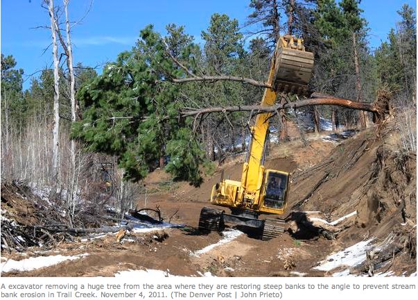
Projects are encouraged to utilize forest products, and where feasible, involve the Colorado Youth Corps Association or an accredited Colorado Youth Corps to provide labor. Projects also should mitigate threats that affect watershed health, such as the build-up of wildland fuels that increase the risk for a severe wildfire. Large, intense wildfires negatively impact watersheds through increases in runoff and erosion, diminished water quality and accelerated loss of snowpack.

ā€œThis program encourages local stakeholders to work together to develop forest restoration proposals that address diverse forest health challenges, including community and water-supply protection, ecological restoration, forest product utilization and wildfire risk reduction,ā€ said Jeff Jahnke, state forester and director of the CSFS.

Colorado landowners and anyone with legal authority to contract for work on relevant properties are eligible to compete for grant funding. The state can fund up to 60 percent of each awarded project; grant recipients are required to match at least 40 percent of the total project cost through cash or in-kind contributions, including federal funds. Proposed projects must be located in communities with a CSFS-approved Community Wildfire Protection Plan.

An interdisciplinary technical advisory panel, convened by the CSFS in partnership with the Colorado Department of Natural Resources, will review project applications. The CSFS will notify successful applicants by this summer.

Applications and additional information about the Colorado Forest Restoration Pilot Grant Program are available at local CSFS district offices or www.csfs.colostate.edu.

The CSFS is a service and outreach agency of the Warner College of Natural Resources at Colorado State University.

More restoration coverage here.

Snowpack news: Big storm hits the San Juan and Sangre de Cristo mountains, the South Platte basin is up to 82% of average

snopackcolorado02062012

It looks like there is about three inches of new snow here at Gulch Manor. Eldora ski area is reporting five inches of new snow this morning and Telluride is reporting eleven inches in the past 24 hours.

Here’s a report from Matt Hildner writing for The Pueblo Chieftain. From the article:

A storm that moved into the San Juan Mountains on Sunday had dropped 1.5 feet of snow by midday Monday. Wolf Creek Ski Area reported 18 inches of snow from the storm by 2 p.m… Snow falling on the valley floor Monday was much lighter with an inch reported near Crestone and less than half an inch near Del Norte and Alamosa.

From the Glenwood Springs Post Independent (Janet Urquhart):

The snowpack in the Roaring Fork River basin stood at 56 percent of average at the close of December, based on data dating back to 1971. As of Monday, the average for the basin was a far more respectable 72 percent, though it will take considerably more snow for the remainder of the winter and spring to bring conditions back to normal, according to Mage Skordahl, assistant snow survey supervisor for the Natural Resources Conservation Service in Denver. ā€œThe thing is, when you start out that low, you have to have above-average conditions for a long period of time to catch back up,ā€ she said. ā€œHistorically, it has happened before. I wouldn’t discount spring storms.ā€[…]

January brought improvement with a change in the weather pattern and the first real powder days of the season. Snowmass picked up 50 inches of snow up top during the month, which is 11 percent above average, according to Aspen Skiing Co. spokesman Jeff Hanle. Snowfall at Buttermilk was 9 percent above average for the month, while Aspen Mountain and Aspen Highlands saw about 90 percent of their average snowfall for January, he said…

According to the service’s SNOTEL data at sites around the Roaring Fork basin, the snowpack ā€” actually a measurement of the water equivalent of the snow ā€” was at 64 percent of average on Independence Pass, east of Aspen, on Monday. It was at 72 percent on McClure Pass, south of Carbondale, and at 73 percent at Nast Lake in the upper Fryingpan Valley. The depth of the snow at the Independence Pass site stood at 34 inches on Jan. 26, according to the NRCS.

Sportsman for Responsible Energy Development is calling for federal hydraulic fracturing disclosure rules

gelledhyrdraulicfracturingfluid.jpg

From the Associated Press via The Columbus Republic:

Sportsmen for Responsible Energy Development is calling on the Bureau of Land Management to make sure water, fish and wildlife are protected when oil and gas wells are developed on public lands. The proposed federal rules would require public disclosure of the chemicals in fracking fluids used in drilling.

Here’s the link to the report, Hunting and Fishing Imperiled.

More oil and gas coverage here and here.

On Thursday CDPHE is hosting the first public meeting for decommissioning the Cotter Mill near CaƱon City

cottermillcontaminationconcerndenverpost10232011

From The Pueblo Chieftain (Tracy Harmon):

The meeting, to be hosted by the Colorado Department of Public Health and Environment, is scheduled from 6 to 8 p.m. at Garden Park High School, 201 N. Sixth St. The meeting will focus on the conceptual design for a new evaporation pond, on-site soil excavation, soil remediation criteria and groundwater characterization…

Cotter officials indicate in their report that preliminary assessment of radiological soil cleanup criteria designed to meet the higher standards could mean the potential of cleanup of vast amounts of uneven soils, environmental degradation across much of Cotter property, negative environmental impacts to adjacent lands, increased risks to public health and excessive cost. In relation to the groundwater characterization, Cotter proposes to use 10 water monitoring wells, one of which is at the neighboring Shadow Hills Golf Course, to test contamination levels.

The reports to be focused on at the meeting can be downloaded at www.cdphe.state.co.us/hm/cotter/index.htm or at the Royal Gorge Regional Museum and History Center, 612 Royal Gorge Blvd. which is open from 10 a.m. to 4 p.m. Wednesday through Saturday.

For those who cannot attend the meeting, written public comments will be accepted through Feb. 17 and can be mailed to Steve Tarlton, CDPHE, 4300 Cherry Creek Drive South, Denver, CO 80246 or emailed to steve.tarlton@state.co.us.

More Lincoln Park/Cotter Mill superfund site coverage here and here.