
From The Durango Herald (Jessica Pace):
As of Wednesday, Durango has received 0.24 inches of precipitation this month, which is about three-quarters of an inch drier than usual, [Dennis Phillips] said. Last February, Durango had 1.17 inches of precipitation.
A dry period is common for El Nino years, but it typically occurs in January. Phillips said the lag was just how the system unfolded.
But if March follows tradition, the dry slump will come to an end.
“We’re still expecting a wet period in March,” Phillips said. “We’ll continue to build snowpack through much of March and into April. And by melting some of the low elevation snowpack, it eases the river flows and can help with some of the flooding concerns later on.”
Joe Lewandowski, spokesperson for Colorado Parks and Wildlife’s southwest region, said concern won’t set in unless warm and dry weather perpetuates for the next two months…
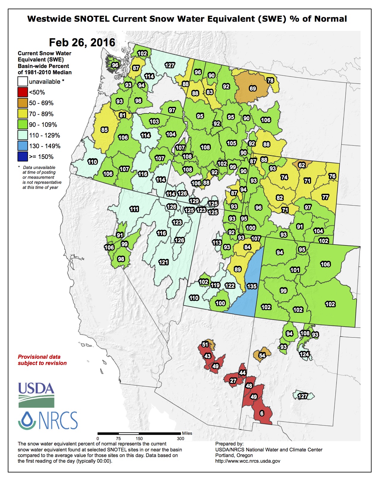
Other western regions have fared worse from the February dry spell.
Sierra Nevada snowpack, which supplies more than 60 percent of California’s water supply, has hit a five-year high due to a strong El Nino year. But because of this month’s warmth and dryness, snowpack fell below average in mid-February.
Things are more stable for Colorado, where the statewide snowpack has remained stable.
Marcee Bidwell, executive director of Mountain Studies Institute, said because woodland trees like ponderosa rely on snowpack for moisture, winter is an important signal for the summer fire season.
“The big El Nino year flattened out,” Bidwell said. “We started with a lot of snow, which puts us ahead of some of our drier years, but it’s still not the trend we were hoping for.”