
From The High Country News (Jonathan Thompson):
Indigenous activists try to quell a rising tide of oil and gas exploration in Chaco Canyon.
Editor’s note: On March 1, the Interior Department canceled the sale of oil and gas leases that would have impacted the Chaco Canyon area. The department received hundreds of protests of the sale, before it was cancelled. This story explores the fight of organizers trying to halt that sale and others like it.
On the warm, pre-monsoon night of July 11, 2016, fire broke out among a cluster of six newly drilled oil wells near the small Navajo community of Nageezi, New Mexico. The residents of nearby homes fled to the highway, where they watched huge curdling balls of orange flame boil up into the vast bowl of dark sky above their corner of the Greater Chaco Region.
When someone texted Kendra Pinto, who lives several miles away, she raced to join the frightened spectators and watched, stunned, as the conflagration engulfed all of WPX Energy’s equipment, setting off a series of explosions that shook the earth and sent up thick clouds of burnt hydrocarbons.
“I saw the flames … black smoke streaking into the sky,” Pinto told me as we sat in the dappled shade of a small cottonwood outside the Counselor Chapter House just over a year later. Wearing denim shorts, a tank top and beaded earrings, she recalled how, in the years before the fire, she had gotten involved in the effort to rein in oil and gas development, joining a ragtag group of regional and local environmentalists, archaeologists and tribal officials working to protect the Navajo communities of Nageezi, Lybrook and Counselor, and the millennia-old cultural landscape that radiates out from Chaco Culture National Historic Park.
Like her grandmother before her, Pinto, who is in her early 30s, grew up here, in an area of bone-white sandstone cliffs, fragrant piñon and juniper forest, sagebrush and sensuous, deep-purple and gray badlands, a landscape that Georgia O’Keeffe once described as “a beautiful, untouched lonely-feeling place — part of what I call the Far Away.” The surrounding San Juan Basin had seen successive natural gas frenzies since the 1920s, but this part of it had mostly been spared in more recent times, its oil deposits thought to be tapped out. Then, around 2012, high oil prices and drilling and fracking advances sparked new interest in the Chaco region. First came the landmen with their leases and promises of fat checks, at least for those who owned land allotments and mineral rights. Then drill rigs and fracking apparatus sprang up in the places where Pinto’s grandmother had gathered herbs and piñon nuts. And Pinto watched sadly as a steady stream of tanker trucks kicked up plumes of dust on the once-quiet caliche roads.
Then the fire erupted in 2016, burning for four days and consuming 36 tanks of crude oil and produced wastewater. No one died in the fire; it didn’t even significantly hinder production. Yet it left a lasting scar on the collective psyche of the people around here, Pinto said. And it injected a sense of urgency into her community: “That’s when I said, ‘They can’t treat us this way.’ ”
Pinto had been inspired by other causes that summer, particularly the effort led by five tribes, including the Navajo Nation, to save the area known as Bears Ears in southeastern Utah. And she had traveled to one of the Standing Rock resistance camps in North Dakota, where she and her comrades hoped to stop a crude oil pipeline from crossing Lake Oahe. Pinto dreamed of bringing some of that activist energy back to the Chaco struggle, which some media outlets touted as the “next Standing Rock.”
Chaco, however, is far more complicated than those other fights. Though the threats to the environment and communities from energy development are arguably greater here than at Standing Rock or Bears Ears, Chaco has not attracted the same kind of attention. There are no movie stars or major politicians going to jail for blocking the tanker trucks’ paths, no outdoor gear corporations pouring money into slick videos to stop the battalions of drill rigs from overrunning Indigenous homelands.
Yet that hasn’t discouraged the Chaco resistance. If anything, this scrappy, underfunded, sometimes shaky alliance is gaining momentum, forging its own way through a thicket of complicated relationships that stretch back hundreds of years and that have always favored industry, even under the most progressive administrations in Washington, D.C.
To understand what’s going on in the Greater Chaco Region, you have to start with the land, 2,000 square miles of high desert located in the hydrocarbon hot spot known as the San Juan Basin. Because of the pattern of land ownership — a hodgepodge of federal, tribal, state, private and Indian allotment land — it’s called the Checkerboard, but it’s actually more chaotic, like a patchwork quilt stitched together by a nearsighted drunkard. It is that way by design, the outcome of a century-long systematic land grab.
After the Pueblo people moved on from the communities and structures they had built and lived in for hundreds of years, the Diné, or Navajo, moved into the Four Corners country, establishing a 40,000-square-mile homeland bounded by four sacred peaks. At the heart of this civilization was Huerfano Peak, within the Chaco region and just a dozen miles north of Nageezi.
The Spanish and then Mexican colonizers who appeared centuries later were not gentle; they attacked Navajo homes and kidnapped thousands of Navajo and other Native American children and held them as slaves. But it wasn’t until the white American miners, ranchers, settlers and soldiers arrived that any concerted effort to rob the Diné of their land began. And when that happened, it was brutal.
In 1863 Kit Carson, then serving as a field commander for the U.S. Army, led troops across Navajo country, slaughtering sheep and goats, hacking down peach orchards and torching cornfields, starving the people into surrender. Army troops then forced some 9,000 survivors on the infamous “Long Walk” to Bosque Redondo in southeastern New Mexico, a barren swath of alkali dirt that was more concentration camp than reservation. Brig. Gen. James Carleton, who planned Carson’s campaign, laid out the rationale for the killing and oppression in 1864: “By the subjugation and colonization of the Navajo tribe, we gain for civilization their whole country, which … by far the best pastoral region between the two oceans, is said to abound in the precious as well as the useful metals.”
Bosque Redondo was a disaster — captives fell ill and died and mass incarceration cost the federal government dearly. So in 1868, the Indian Peace Commission sent Lt. Gen. William Tecumseh Sherman to come up with a solution. After listening to a Navajo leader named Barboncito wax eloquently about his people’s existential yearning for their homeland, Sherman decided to let the Navajo people go.
The rectangular reservation laid out in the Treaty of 1868 was only about one-eighth the size of the original homeland. It included very little arable land and left out important religious sites. Though the treaty ordered the people to live only on the reservation, Sherman’s instructions to the headmen were more ambiguous, and perhaps muddled in translation. But the message the Navajo received was simple: You are free to go home.
So hundreds of families returned to the land beyond the reservation’s eastern boundary, an area now known as the Greater Chaco Region. Federal officials on the ground repeatedly urged the president to extend the reservation boundaries to encompass this land and the holy sites. But New Mexico politicians, pressured by white stockmen hungry for more land, successfully lobbied against them. As a concession, the feds eventually suggested that individual Navajos claim 160-acre plots on the public domain under the 1887 General Allotment Act. Typically, this law was applied to reservation land, where tribal members got first dibs on parcels before the rest of the reservation was opened up to homesteading — an insidious form of land grab that fractured tribal communities.
Here in Chaco, however, the Navajos competed head-to-head with white homesteaders to hold on to tiny parcels of their own homeland. And the game was rigged: If a family was away at summer herding camp when the Indian agent came to their winter hogan to process an allotment claim, they lost the opportunity to file. And when Navajos did make claims, white homesteaders managed to get them nullified by alleging that they weren’t making the proper “improvements” on the land in question.
As a result, untold numbers of Navajo people ended up living as “unauthorized occupants” on public domain land in the Chaco region, considered squatters on their own ancestral territory. Over time, the Navajo Nation acquired much of those lands through purchases and swaps, and today the descendants of those earlier occupants live on tribal (albeit not reservation) land. Those parcels share boundaries with some 4,000 disparate Indian allotments covering a total of 600,000 acres, which themselves are scattered against a backdrop of federal Bureau of Land Management acreage. Allotments are “private,” but are in federal trust indefinitely, and cannot be sold, gifted or willed to anyone. When the original allottee dies, ownership — along with mineral rights — are divided up, or fractionated, between all of his or her heirs.
Today, jurisdiction over oil and gas development on this fractured landscape is as confounding as the surface ownership patterns. Most of the tribal land is “split estate,” meaning the Navajo Nation owns the surface, but the federal government controls — and gets royalties from — the oil and gas underneath. The allottees receive royalties from extraction of minerals under their lands, but all leases must go through the Bureau of Indian Affairs. Because today’s oil wells can extend two or more miles horizontally, the oil they extract is often a combination of allotment and federal minerals — known as a unit or pool. That means multiple agencies are involved in permitting and oversight.
“It’s a real problem, because when you don’t know who’s in charge it leads to a total lack of accountability,” Pinto says. “Who’s really watching the oil companies and oilfield workers?”
TThe official answer to Pinto’s question is: The Farmington Field Office of the BLM, which sits at the top of this jurisdictional layer cake. Though the agency has no say over leasing of allotment or tribal lands, it does handle permitting on those lands, along with leasing and permitting of all federal lands and minerals. It is currently working on a new environmental analysis of drilling in the Chaco region, due out next year, but right now it’s still operating under a plan that’s 15 years old, a fact that concerns people like Pinto.
The 2003 plan — an analysis of the impacts caused by full-field development — was created under George W. Bush, when the always-porous line between industry and regulatory agencies in the New Mexico energy patch was more of a sieve. Natural gas prices were skyrocketing, and industry was eager to drill for coalbed methane on the mostly federal land north of the Checkerboard. The feds were just as eager to hand it over to them. Steve Henke, then-BLM district manager, issued a plan that opened the door to 9,942 new wells. (Henke was later caught accepting golf tickets and other gifts from local energy companies. He left the BLM in 2010 and promptly became president of the New Mexico Oil and Gas Association, the advocacy group for the industry’s big players.)
Soon thereafter, oil companies started poking around in the Gallup play, the oil-bearing shale formation in the Chaco region, south of the old natural gas hotspots. Acknowledging that the horizontal drilling and multi-stage hydraulic fracturing required here would be far more intensive than anything the region had seen before, the BLM in 2014 launched a multi-year process to amend the 2003 plan for Chaco-specific development. Around the same time, Henke, on behalf of the state oil and gas group, donated $800,000 to the state BLM office to hire more staff in order to speed permitting. Henke then wrote to his Farmington colleagues, urging them not to “run from the 2003 document nor to ignore the job you are doing on site specific analyses.”
It appears that the BLM heeded Henke’s request. Since 2010, the field office has leased out more than 50,000 acres and issued more than 500 drilling permits, mostly in the Chaco area. In early 2017, the BLM leased 842 acres on four parcels, despite the fact that development could affect 314 cultural features and a mesa known as Sis Naateel, home of Navajo deities, a sacred spring and ceremonial deer-hunting grounds. This March, the BLM planned to lease 25 additional parcels covering nearly 4,500 acres around Chaco, in an area where more than 90 percent of the land is already leased.
Agency officials told me that since the 2003 plan specified “no geographical horizon,” and denying permits to leaseholders would be a “violation of property rights,” the BLM could continue to permit thousands of new wells on a case-by-case basis before it hits the limit — with or without the new analysis.
“I don’t think the Farmington BLM is making the decisions; industry is,” said Mike Eisenfeld of the San Juan Citizens Alliance, who is perhaps the only professional environmentalist residing in Farmington. “They are being manipulated. And under Trump, it will be exacerbated. They’ll try to lease everything.”
On a hot day last August, as thunderheads raced across the sky like schooners, former Navajo Nation tribal council delegate and citizen watchdog Daniel Tso, wearing boots, a big silver belt buckle, wire-rimmed glasses and a straw cowboy hat, his gray hair pulled back in a traditional bun, showed me how these industry-friendly practices played out on the ground. My little car was clearly no match for the rain-slicked roads, so I hopped into his truck and we ventured into the sagebrush ocean south of Nageezi.
Soon, we reached one of the new wells permitted under the 2003 plan. The Cyclone Rig No. 32, a hulking baby-blue beast, loomed over low hills and a doublewide home about 600 feet away. Like a retro-sci-fi monster, the rig can “walk” across a drill pad, and just days after Tso and I visited, the two dozen workers here set a world drilling-speed record, churning through 8,370 feet of shale in just 24 hours.
It’s a supersized version of a scene that has played out thousands of times over the last century in the San Juan Basin, where no one is immune to the effects of oil and gas extraction. Shiny distilling columns loom over a Catholic cemetery near Bloomfield, pumpjacks grace the Farmington golf course sand traps, and the horse track sits next to a Superfund site. It is all part of a grand transaction between the communities and industry. Locals live with the industrialization of their neighborhoods. In return, oil and gas companies pay royalties and taxes and provide jobs, which result in better infrastructure, reduced economic inequality, low property taxes, and, at least in Farmington, three Starbucks, two Walmart Supercenters and a baseball team called the Frackers. It’s a lopsided transaction, especially when the booms bust, but a transaction nonetheless.
Down here in the Chaco Region, however, the deal feels more like outright theft. Oil companies still pay taxes and royalties and employ people, but nearly all the cash generated by the wells is, like the oil they extract, piped far away. Tax revenues on drilling and production go to Santa Fe, then get redistributed statewide to communities that have the resources to pursue them. Rig and fracking crews are often contractors, based in Wyoming, Texas or Colorado. They’ll stay and eat in Farmington or Bloomfield, not here, where there are no hotels or grocery stores, not even a laundromat.
This WPX Energy well, like the nearby ones that blew up in 2016, is on Navajo allotment land, and is targeting oil in the 12,800-acre West Lybrook pool, a mingling of federal and allotment minerals. About 900 people share ownership of the 35 allotments in this pool. In order for the oil companies to secure leases, a majority of each allotment’s owners must sign off. “When the landman or his liaison shows up and says, ‘Sign on the line and you’ll get a fat check,’ and when you’ve got 60 to 80 percent unemployment, you say, ‘Sure,’ ” Tso said.
Terms of allotment leases are not public. But if rates are on par with those on nearby federal lands, then a single allotment could bring in a signing bonus of $480,000 or more, which would then be divided equally between the owners. Because many allotments are highly fractionated, each owner might only get a few thousand dollars, though a lease can yield a hefty chunk of change if the owners are few. Once the wells start producing, the allottees receive royalty checks, too. According to state records, WPX Energy grossed some $30 million from the allotment portion of the West Lybrook pool in 2016, and paid out an average of $4,680 per allottee — some got a lot less, others more. While the checks will increase along with oil prices, they will also decrease over time as production diminishes.
Even on the lower end, the payments can make a big difference. A grandmother may, for the first time in her life, get a floor in her home that isn’t dirt, a roof that doesn’t leak, electric lights, a vehicle that can navigate the rutted roads. Yet allotment checks are as likely to be sent to Albuquerque or Phoenix mailboxes as to ones in Lybrook or Nageezi. And even if it’s the latter, the cash doesn’t linger locally. That’s because, unlike in Farmington or Aztec, there’s no economic infrastructure to capture the wealth and benefit the community as a whole.
An allottee family might live next door to one living on tribal land. Both will bear the burden of hosting a nearby well, yet only the allottee will receive any benefits. “It creates a system of haves and have-nots,” said Gloria Chiquito, whose parents are allottees. “It’s separating families. … Families are fighting one another.” Stories abound of grandchildren swindling grandparents, of envy-fueled burglaries, violence — even murder.
Despite the economic incentives, some allottees are among the most outspoken opponents of development. Residents worry about livestock drinking out of unfenced waste pits, speeding trucks hitting animals, and the ubiquitous moon dust that rises into the air behind vehicles and settles on every nearby surface. People near wells complain about burning eyes, scratchy throats, dizziness and nausea — symptoms associated with prolonged exposure to low levels of benzene and hydrogen sulfide, which occur naturally in oil and natural gas and can seep into the air during every step of extraction and processing, even from tanker trucks.
Tso and I followed a stream of those trucks along dusty roads in the direction of the spectacular pueblos of Chaco Canyon, some 15 miles distant. We saw men in grimy coveralls wrestling with giant drillbits, and orange flares burning off methane, nitrogen and other byproducts from recently drilled wells. One tanker stopped, the door swung open and the driver hopped out of the truck, long black hair spilling out from under her hardhat. She looked Navajo; Tso said that locals are often hired as truck drivers because they know the roads. She yanked at a valve on the back of her rig, releasing a thick stream of liquid onto the side of the road.
We arrived at another roaring complex of tanks and pipes, a fracking job in process. A smell like that of a hot, dirty car engine wafted on the air as the workers pumped millions of gallons of nitrogen gel and water, along with tons of sand and a soup of chemicals, miles into the earth at pressures so high that it shattered the rock, freeing the oil that had been locked inside there for millions of years.
I tried to imagine what this place looked like a thousand years ago, when it was populated by a society of Pueblo farmers and hunters and thinkers and builders. And I wondered what future archaeologists would make of all this. Will they puzzle over the practical applications of this byzantine assemblage of tanks? Or theorize that it was a monument — perhaps a memorial — to an insatiable hunger for a resource that by then will be long tapped out?
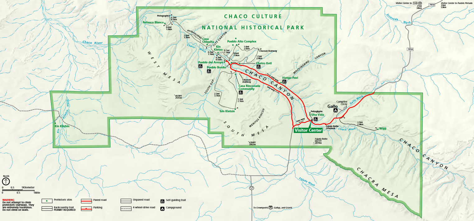
When President Theodore Roosevelt wielded the brand-new Antiquities Act in 1907 to create Chaco Canyon National Monument, he drew the boundaries around what is now known as “downtown Chaco,” a handful of structures including the 800-room Pueblo Bonito, constructed between the ninth and 12th centuries by ancestors of today’s Pueblo people. That was merely the center of the Chacoan world, however, which extended over 100 miles across the Four Corners region and is represented by more than 200 outliers, or great houses, that share architectural traits with Pueblo Bonito. No one knows if this was a political empire, a religious or cultural society, or simply a school of architecture. But it’s clear that outliers — along with thousands of smaller sites, shrines and architectural features, their functions still unknown — did not exist in isolation. They were part of a vast cultural tapestry woven into the natural landscape.
On a cloudless, scorching August afternoon, I made my way to the Pierre’s Site outlier, about 10 miles north of the park’s boundary, by car and then on foot via a maze of oil-patch roads. It was a surreal and lonely journey, my only companions pumpjacks bobbing up and down in the sea of sage and a small herd of horses, their manes shiny in the sun.
Once there, I climbed onto the “Acropolis,” an aptly named flat-topped butte upon which three of the structures in the complex sit. Unlike the buildings in Chaco Canyon, these haven’t been excavated or stabilized, so at first glance they appear to be amorphous piles of rock. But, on closer inspection, the outlines of old walls, kivas and rooms became visible, like the curves of a body under a thick blanket.
Various layers of protection cover Chacoan sites. The park itself is off-limits to all oil and gas development. Pierre’s Site and several other outliers are part of the Chaco Culture Archaeological Protection Sites Program, and all sites on federal land are shielded by the Archaeological Resources Protection Act and Section 106 of the National Historic Preservation Act, which requires oil companies to conduct a cultural inventory of all land in the path of development. If the surveyors happen upon a “significant” site, the well pad or road or pipeline must be relocated, a process known as “identify and avoid.”
Thanks to these laws, the major structures at Pierre’s Site have remained unmarred by development. The ambience has not. Ruth Van Dyke, a professor of anthropology at Binghamton University, cataloged the impacts of oil and gas development on the sound- and view-scapes at Pierre’s. “I found that, despite the due diligence agencies have exercised to protect the ground footprint of Pierre’s, there have been significant impacts,” she wrote. Twelve pumpjacks are visible from the Acropolis. When I was there, the whir-pop-pop-whir of the machines was irritatingly audible, affirming Van Dyke’s observation: “Rather than a sacred landscape and part of a UNESCO World Heritage Site, the Pierre’s community had the feeling of an industrial park.”
The drilling threatens more than aesthetics. Taking cues from their Native American colleagues, archaeologists are increasingly going beyond analyzing just the material remains of cultures. Rather, they are, as Van Dyke puts it, trying “to understand an ancient sense of place … particularly sensory dimensions of place.” That’s not easy when machinery is noisily grinding away all around you.
Meanwhile, “identify and avoid,” the only real protection for a vast majority of sites, is hardly comprehensive. “That’s how ancient landscapes get fragmented,” says Paul Reed, a longtime Chaco scholar. For a pipeline, the inventory follows a narrow swath along the right of way, and nothing else. The project is steered to avoid disturbing ancient structures, but it could still end up bisecting a village, says Reed, or plowing through an ancient cornfield or networks of “other super-subtle things going on that are part of understanding that landscape.”
Pierre’s lies along the Great North Road, which stretches directly north of Chaco Canyon for 30 miles or more. It may have been a symbolic path through time, connecting old worlds with new, or a reminder of the power Chaco-central wielded over its outliers. Reed calls it “a landscape monument on a large scale.” Similar “roads” appear all over the Chaco world. A cultural inventory could easily miss segments that aren’t readily apparent, or other features that appear to be natural but served a cultural function, like a stone monolith that served as a shrine.
“Even though agencies try to mitigate the impact, it isn’t enough, because you’ve literally destroyed the context in which those things exist,” says Theresa Pasqual, former director of Acoma Pueblo’s Historic Preservation Office, and a descendant of the Pueblo people who occupied the Four Corners for thousands of years. “Most of our pueblos are still transmitting their migration history through oral means. So when you have development that begins to impact many of these sites — that range in size from the grandeur of Chaco Canyon or Mesa Verde to very small unknown sites that still remain un-surveyed and unknown to the public — they are literally destroying the pages of the history book of the Pueblo people.”
“We need to go beyond ‘identify and avoid,’ ” Reed says. “But we’re not gonna draw a big circle around everything and say, ‘No more development.’ ” It’s simply too late for that here. So Reed and his allies, including the National Parks Conservation Association and Pueblo tribal leaders, asked the BLM to implement a master leasing plan for the area, an approach introduced by the Obama administration to bring more public input into what had been a “sight-unseen” leasing process. The proposal would put about a half-million acres directly surrounding the park, along with the rest of the Great North Road, off-limits to future leasing. Existing leases in the protection zone could still be developed, but only on the condition that quiet, darkness and viewsheds are preserved.
But such a plan is not on the table for the current administration. And it has its own drawbacks: It wouldn’t apply to allotment lands, so even more development could be pushed onto the Navajo communities of Lybrook, Nageezi and Counselor. That prospect has unearthed old tensions — between advocates for the past and those fighting for modern-day residents — that echo those from the original designation of the Chaco monument, when Navajos who lived there were evicted and had their allotments cancelled.
But Marissa Naranjo, co-founder of the Diné-Pueblo Youth Solidarity Coalition, emphasizes that despite divisions, the fight to save ancestral Pueblo homelands and the fight to protect current Navajo homelands are one and the same. “It’s not just about protecting cultural resources,” says Naranjo, a community organizer from Santa Clara Pueblo, east of the Navajo Nation. Like Pinto, she’s part of what may be the most vital branch of the Chaco movement: young, Native American women. “The attack on our homelands necessitates solidarity with the Diné. They are the caretakers of that land. They are on the front lines every day, dealing with health and social impacts. … That whole landscape connects us.”
Last August, prior to our oil-patch tour, Tso invited me to the front lines to witness the “power base” of the movement firsthand. It was neither a protest camp nor the headquarters of an environmental group, simply a regular meeting of the Ojo Encino Chapter.
Chapters were introduced to the Navajo Nation in 1927, four years after the federal government, needing a sole entity to sign off on oil leases on tribal land, instituted the centralized tribal government that endures today. But they hark back to the pre-Long Walk days, when the tribe was divided into units of a dozen or more families, each governed by naataanii, or headmen.
Today, there are 110 chapters, the most local political subdivision of the Navajo Nation. The Ojo Encino meeting was similar to many county meetings I’ve attended, except for the kids selling meat-and-potato burritos, fry bread and sno-cones from a window in the back. And while the officers ran the meeting, the entire audience voted on every action item, from a resolution to approve college scholarships to requests by residents to get solar panels installed at their homes.
Like many rural Western county commissioners, who feel that D.C. bureaucrats ignore their concerns, members of far-flung chapters feel invisible to the tribal government in Window Rock, Arizona. “The people out here are the same as the people in Tuba City or Kayenta,” said Chapter President George Werito, a slim man with a ready smile in a red Ojo Encino Day School Braves shirt. “But they (the Navajo Nation leaders) don’t even know where we are. They give us no help.”
Hoping to amplify their chapters’ individual voices, the Ojo Encino, Torreon and Counselor chapters came together to form the Tri-Chapter alliance in 2014 at the height of the oil boom. Drilling has hit Counselor hard, and Torreon and Ojo Encino may be next. “It’s coming this way, so we’ve got to get ready for it,” Werito said.
Ultimately, they’d like to bring all the chapters in the region together to create legally binding regulations — greater setbacks from homes, impact fees for fixing roads, a more equitable system of revenue sharing — on oil and gas development. Getting Window Rock’s backing, however, hasn’t been easy. Fossil fuels have long been the Navajo Nation’s prime source of income, and though it receives very little revenue from oil development on the Checkerboard because of the land-use mishmash, many delegates are leery of opposing drilling or coal mining.
Looming threats may change their tune, however. The Department of Interior’s evisceration of environmental protections that “burden domestic industry” could hit Chaco and the surrounding San Juan Basin — home to 40,000 oil and gas wells and the Four Corners Methane Hot Spot — especially hard. On the chopping block are new hydraulic fracturing regulations, master leasing plans and the land-use designation that keeps rigs off much of the Great North Road. If the 2016 well pad fire was the spark that ignited the Chaco resistance, then the Trump administration’s drive to achieve “energy dominance” is like gasoline, further enflaming the broad-based effort.
Still, this is no Standing Rock. The issues here are more nuanced, the beauty and intrinsic value of the San Juan Basin of a harsher, more subtle sort than the serpentine canyons of the Bears Ears area. The Chaco movement is unlikely to ever explode onto the national stage, but that’s just fine with its leaders.
“I was very inspired by the energy, that momentum, at Standing Rock,” says Naranjo. “But we also realize that this movement to protect Chaco is very, very different. That (Chaco’s) entire landscape is sacred. There are outlier sites, prayer sites; it’s alive, it’s active. We’ve been very careful not to initiate an occupation movement there because that would be extremely disrespectful to our ancestors there.”
With so many wells already in place, the coalition is focusing not on shutting down industry, but on fighting new leases and ensuring compliance and enforcement of regulations. Last year, Pinto testified before Congress in favor of keeping the Obama-era methane rule that would have reduced emissions, not only of the potent greenhouse gas, but also benzene, volatile organic compounds and hydrogen sulfide. It would have also yielded more royalties for the federal government and the allottees. The Senate agreed to keep the rule in place, but Interior Secretary Ryan Zinke is now trying to scrap it.
Late last year, the National Congress of American Indians joined the All Pueblo Council of Governors, the entire New Mexico Democratic congressional delegation, and even Navajo Nation President Russell Begaye in calling for a moratorium on all new leases in the Chaco region, at least until the new environmental analysis is complete. And in January, a coalition of environmental groups filed a formal protest against the March lease sale, joining more than 400 others in speaking out against it, including Acoma Pueblo, the Tri-Chapter alliance and the Nageezi Chapter. In March, the Interior Department cancelled the sale, citing “uncertainty about cultural impacts.”
The chapters have been one of the most significant, and unique, components of the movement. “This has always been a group effort,” Tso said, as he stood up before the Ojo Encino audience and, in Navajo and English, summarized resolutions supporting air-quality and health-impact monitoring in the oil patch. Pinto and others have been sampling air near facilities, and a coalition of affected chapters launched a Hozhoogo Na’adah assessment — a Diné-centered research model — to gain a more holistic understanding of how residents are affected by oil and gas development.
Tso talked about the Church Rock spill of 1979, about 80 miles west of here, where a uranium mill tailings dam busted, sending 1,100 tons of radioactive tailings and toxic effluent into the Rio Puerco of the West, contaminating countless water wells on the southern portion of the Checkerboard. “We don’t want that to be our story,” he said. Both resolutions passed resoundingly.
After the meeting adjourned, as I picked at the crumbs of alkaan — a sweet and smoky corn and flour cake that someone had brought — I considered what I had just witnessed. This is no explosive movement, scoring dramatic, if temporary, victories. It’s a slow and rumbling and lasting upswelling of protest truly rooted in the land, led by the people who call this place home. “There is a constant effort and movement to protect those places,” Pasquale says. “And while they may seem small and incremental, they do lead to larger movements to protect these places that are important not just to the Pueblo people, but all of the people, all of the public, because it belongs to the greater story of all of us, of all of the human race.”
As I turned to leave, I caught a glimpse of a poster hanging on the wall. It portrayed a young Navajo woman wearing a squash-blossom necklace and a gas mask: “Don’t Just Walk In Beauty,” the bold lettering said. “Protect It! Hózhó (Beauty) Starts With You.”
Jonathan Thompson is a contributing editor at High Country News. He is the author of the new book, River of Lost Souls: The Science, Politics, and Greed Behind the Gold King Mine Disaster.