
Click here to read the current assessment. Click here to go to the NIDIS website hosted by the Colorado Climate Center. Here’s the summary:
Summary: June 9, 2020
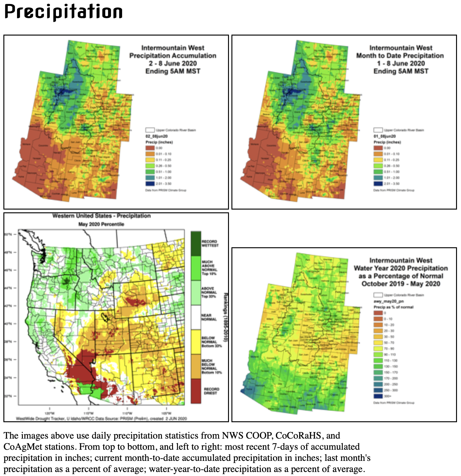
Last week, the northern portions of the Intermountain West received half an inch or more of precipitation (with high elevations even getting snow). On the 30-day timescale, standardized precipitation index (SPIs) are a mixed bag of conditions. But the longer time scales show many negative SPIs, often less than -1.5, throughout Wyoming, Utah, and Colorado, with wetter SPIs in Arizona and southern New Mexico.
Snowpack has mostly melted out for most locations and streamflows are nearing, or have past, their peak flows for the season. Dry soils are evident throughout the IMW, and VegDRI shows severe dry conditions throughout WY, UT, and CO.
In the past week, hot temperatures and high winds really picked up, greatly increasing evaporative demand. Daily reference ET at our eastern plains CoAgMET stations showed much above average anomalies over the past few days.
While this week started with some cooler, wet weather, we will have a quick return to hot and dry conditions. Temperatures on the plains will return to the 90s and there is not much precipitaiton in the 7-day forecast.