‘Sterling Ranch appears to be a water-conservation model that will be emulated in the future’ — Highlands Ranch Herald

chatfieldstatepark.jpg

The Highlands Ranch Herald comes down on the side of Douglas County’s approval of the Sterling Ranch Project. Here’s an excerpt from their editorial:

District Court Judge Paul King ruled that commissioners had erred in allowing Sterling Ranch to prove water availability at each phase of construction, rather than for the entirety of the project. King’s ruling was a response to a lawsuit against the board of commissioners filed by the Chatfield Community Association. The ruling, which the county says it will appeal, is rooted in a 2008 state law. It is easy to find out what HB 08-1141 says. It is much more difficult to discern what it means. And we find that to be a problem. Some interpret the law to mean developers must show adequate water through build-out. To others, the legislation gives local governments discretion to do what Douglas County did in allowing Sterling Ranch to show proof of water a phase at a time.

State Rep. Frank McNulty, R-Highlands Ranch, opposed the measure. He says as written, it is open to “multiple reasonable interpretations” and that it is a hindrance to responsible development.

If the law is to be strictly interpreted to mean all of a development’s water must be secured from the outset, it creates a daunting climate for Colorado developers…

Developers who have the foresight to incorporate land and water conservation into their plan should be rewarded, not punished. Sterling Ranch appears to be a water-conservation model that will be emulated in the future, and it provides water taps to established neighboring developments whose wells are running dry.

It would be ironic and a shame to allow a cloudy water law to hinder this project with a bright future.

More Sterling Ranch coverage here.

Weekly Climate, Water and Drought Assessment of the Upper Colorado River Basin #CODrought #CORiver

wyutcoprecipitation1021thru10272012ccc.jpg

Click here for the summaries from the Colorado Climate Center. Click on the thumbnail graphic for the precipitation summary.

More Colorado River Basin coverage here.

Colorado Water 2012: A look at the basins of Southwestern Colorado

sanjuan.jpg

Here’s the latest installment of the Valley Courier’s Colorado Water 2012 series, written by Bruce Whitehead. Here’s an excerpt:

Southwestern Colorado’s rivers are unique in that many of the rivers and tributaries flow from north to south and are administered as independent river systems.

This is due to the fact that many, such as the Navajo, Blanco, Piedra, Pine, Florida, Animas, La Plata, and Mancos Rivers, are tributary to the San Juan River in New Mexico or just upstream of the state line. The Dolores River flows from north to south, but makes a “U-turn” near Cortez and heads back to the northwest and joins the Colorado River in Utah. The San Miguel River originates just above Telluride, and flows to the west where it joins the Dolores River just above the Colorado-Utah state line.

The southwest basin has many areas that are under strict water rights administration on a regular basis, but there is still water available for appropriation and development pursuant to Colorado’s Constitution and the Colorado River Compact. The region is also known for its beautiful scenery and recreation opportunities, which is the basis for the establishment of the Weminuche Wilderness area as well as nearly 150 reaches of streams with in-stream flow water rights. Over 50 natural lake levels are also protected by the state’s In-Stream Flow and Natural Lake Level Program.

Water leaders have been active for many years in the basin and recognized early on that in order to meet agricultural and municipal demands storage would need to be developed. The Southwestern Water Conservation District was formed in 1941, and has been responsible for the planning, development, and water rights acquisition for many of the federal projects in the region. Reservoirs such as McPhee (Dolores Project), Jackson Gulch (Mancos Project), Ridges Basin a.k.a Lake Nighthorse (Animas-La Plata Project), Lemon (Florida Project), and Vallecito (Pine River Project) provide for a supplemental supply of irrigation and municipal water in all but the driest of years. The delivery of these supplemental supplies assists with keeping flows in many critical reaches of river that historically had little or no flow late in the season due to limited supplies and water rights administration.

Southwest Colorado is also home to two Sovereign Nations and Indian Reservations that were established by treaty in 1868. Under federal law the Ute Mountain Ute Tribe and Southern Ute Indian Tribe were entitled to federal reserved water rights, which had the potential to create conflicts with Colorado water law and non-Indian water users in the basin. After nearly a decade of negotiations, a consent decree was entered with the water court that settled the tribal claims. The Tribal Settlement included some early dates of appropriation for the tribes, and a water supply from some of the federal storage projects including the Dolores, Animas-La Plata, Florida, and Pine River Projects. This landmark settlement is evidence that both tribal and non-Indian interests can be provided for with water storage and cooperative water management.

More Colorado Water 2012 coverage here.

Environment Colorado: ‘The Costs of Fracking The Price Tag of Dirty Drilling’s Environmental Damage’

groundwatermovementusgs.jpg

You can download a copy of the report here. Here’s the executive summary:

Over the past decade, the oil and gas industry has fused two technologies—hydraulic fracturing and horizontal drilling—to unlock new supplies of fossil fuels in underground rock formations across the United States. “Fracking” has spread rapidly, leaving a trail of contaminated water, polluted air, and marred landscapes in its wake. In fact, a growing body of data indicates that fracking is an environmental and public health disaster in the making.

However, the true toll of fracking does not end there. Fracking’s negative impacts on our environment and health come with heavy “dollars and cents” costs as well. In this report, we document those costs—rang- ing from cleaning up contaminated water to repairing ruined roads and beyond. Many of these costs are likely to be borne by the public, rather than the oil and gas industry. As with the damage done by previous extractive booms, the public may experience these costs for decades to come.

The case against fracking is compelling based on its damage to the environment and our health alone. To the extent that fracking does take place, the least the public can expect is for the oil and gas industry to be held accountable for the damage it causes. Such accountability must include up-front financial assurances sufficient to ensure that the harms caused by fracking are fully redressed.

Fracking damages the environment, threatens public health, and affects communities in ways that can impose a multitude of costs:

– Drinking water contamination – Fracking brings with it the potential for spills, blowouts and well failures that contaminate groundwater supplies.

– Health problems – Toxic substances in fracking fluid and wastewater—as well as air pollution from trucks, equipment and the wells themselves—have been linked to a variety of negative health effects.

– Natural resources impacts – Fracking converts rural and natural areas into industrial zones, replacing forest and farm land with well pads, roads, pipelines and other infrastructure, and damaging precious natural resources.

– Impacts on public infrastructure and services – Fracking strains infrastructure and public services and imposes cleanup costs that can fall on taxpayers.

– Broader economic impacts – Fracking can undercut the long-term economic prospects of areas where it takes place. A 2008 study found that Western counties that have relied on fossil fuel extraction are doing worse economically compared with peer communities and are less well-prepared for growth in the future.

The environmental, health and community impacts of fracking are severe and unacceptable. Yet the dirty drilling practice continues at thousands of sites across the nation. This report recommends that wherever fracking does occur, local, state and federal governments should at least comprehensively restrict and regulate fracking to reduce its environmental, health and community impacts as much as possible. They should also ensure up-front financial accountability by requiring oil and gas companies to post dramatically higher bonds that reflect the true costs of fracking.

More oil and gas coverage here and here.

WaterSMART Water and Energy Efficiency Grant Funding Available for Projects That Conserve Water or Address Water Sustainability

pumpedstoragehydroelectricschematic.jpg

Here’s the release from the U.S. Bureau of Reclamation (Peter Soeth):

The Bureau of Reclamation is seeking proposals for its WaterSMART Water and Energy Efficiency Grant funding opportunity. Projects that are eligible must conserve water or result in other improvements that address water supply sustainability in the West.

The funding opportunity announcement is available at http://www.grants.gov using funding opportunity number R13SF80003.

Applications may be submitted to one of two funding groups:

– Funding Group I: Up to $300,000 will be available for smaller projects that may take up to two years to complete. It is expected that a majority of awards will be made in this funding group.

– Funding Group II: Up to $1,500,000 will be available for larger, phased projects that will take up to three years to complete. Applicants may not request more than $750,000 in federal funds within a given year to complete each phase. This will provide an opportunity for larger, multiple-year projects to receive some funding in the first year without having to compete for funding in the second and third years. The second and third year of funding is dependent upon future appropriations.

Projects submitted for funding should seek to conserve and use water more efficiently, increase the use of renewable energy and improve energy efficiency, protect endangered and threatened species, facilitate water markets or carry out other activities to address climate-related impacts on water or prevent any water-related crisis or conflict.

This funding opportunity is also available for water management improvements that complement other ongoing efforts to address water supply sustainability. Through the WaterSMART Basin Study Program, for example, Reclamation is working with State and local partners, as well as other stakeholders, to comprehensively evaluate the ability to meet future water demands within a river basin. Partners who have completed a basin study may apply for cost-shared funding to implement adaptation strategies that meet the eligibility and other requirements of this funding opportunity.

In addition, funding is available for water delivery system improvements that will enable farmers to make additional on-farm improvements in the future, including improvements that may be eligible for Natural Resources Conservation Service funding.

Entities that are eligible for funding include states, Indian tribes, irrigation districts, water districts or other organizations with water or power delivery authority in the 17 western states, American Samoa, Guam, the Northern Mariana Islands and the Virgin Islands.

Reclamation awarded $11 million to 32 projects in 2012. These projects expect to save more than 58,000 acre-feet of water annually, which is enough water for more than 227,000 people. Combined with the non-federal cost-share, the projects selected will complete $32.4 million in improvements.

The WaterSMART Program focuses on improving water conservation and sustainability and helping water resource managers make sound decisions about water use. It identifies strategies to ensure that this and future generations will have sufficient supplies of clean water for drinking, economic activities, recreation and ecosystem health. The program also identifies adaptive measures to address climate change and its impact on future water demands. Through WaterSMART and other conservation programs funded over the last three years, more than 580,000 acre-feet of water per year is estimated to have been saved.

Proposals must be submitted as indicated on http://www.grants.gov by Jan. 17, 2013, 4 p.m. MST. It is anticipated that awards will be made this spring.

To learn more about WaterSMART, please visit www.usbr.gov/WaterSMART.

More conservation coverage here.

‘The court had made it absolutely clear our main priority was to replace depletions, keep the river whole’ — Steve Vandiver

riogranderiverstateengineersoffice.jpg

Here’s a recap of day one of the water court trial over the implementation plan for groundwater sub-district #1 down in the San Luis Valley, from Ruth Heide writing for the Valley Courier. Click through and read the whole article. Here’s an excerpt:

The plan spells out how the sub-district would replace injurious depletions from well users to surface water rights this year, the first full year of operation for the sub-district, which covers about 3,000 wells in portions of Alamosa, Rio Grande and Saguache Counties.

Two of three anticipated witnesses took the stand on Monday: Steve Vandiver, general manager for the sub-district’s sponsoring district, the Rio Grande Water Conservation District (RGWCD); and Allen Davey, district engineer for the water district. Expected to testify today is State Engineer Dick Wolfe who approved the sub-district’s annual operating plan for 2012…

Tim Buchanan, attorney for San Antonio, Los Pinos and Conejos River Acequia Preservation Association and Save Our Senior Water Rights, LLC, objectors to the sub-district plan, explained that since this was the first year for the operating plan he and other attorneys representing senior water users initially brought up every possible issue they thought might need to be addressed because they were concerned about being foreclosed from addressing them in the future if they did not.

He added the counsel for objectors and supporters have come to an agreement on general stipulations regarding most of those issues, but two remained as the subject of the abbreviated trial before Judge Swift this week:

1) Whether the sub-district’s amended plan approved by the water court in 2010 authorized the inclusion of augmentation plan wells.

Buchanan argued, “The annual plan must comply with the terms of the amended plan. The inclusion of the augmented wells in the amended plan is not an issue within the amended plan. The amended plan does not address that.”

2) Whether Closed Basin Project water is a logical source of supply to replace depletions caused by wells in the sub-district.

Closed Basin Project water was used this year to replace sub-district depletions. Buchanan said since the series of wells that comprise the project supplies were appropriated in 1963, they are extremely junior water rights to his clients’ senior water rights and were not an appropriate source of water to replace depletions…

Vandiver reminded the court of the sub-district’s goal to replace injurious depletions from the wells in the sub-district to surface senior water rights and stabilize the Valley’s aquifers. He outlined the sub-district’s historical timelines from the trial court’s decree in 2010 to the Supreme Court’s affirmation of the lower court in December 2011; the court order to begin assessing fees of irrigators in the sub-district; the acquisition of water supplies to cover depletions; and the development of first the sub-district plan and more recently the annual operating plan or ARP. When asked from whom he acquired replacement water, Vandiver replied “anybody who would listen to me.”

He said he was able to acquire transmountain water and negotiated one-year agreements from private individuals and entities, with future plans for permanent sources. He said this year he needed to obtain water that was readily available in a short time to meet the sub-district water replacement requirements. “The court had made it absolutely clear our main priority was to replace depletions, keep the river whole … eliminate injuries to senior water rights,” Vandiver said…

Vandiver also testified about the Closed Basin Project, a federal water salvage project operated by the RGWCD and Bureau of Reclamation. The project includes 170 shallow wells designed to capture water that would otherwise be lost through evaporation. Vandiver testified that the project was constructed to help Colorado meet its Rio Grande Compact obligations to downstream states, mitigate impacts of the project on wetlands, repay Colorado’s indebtedness and sell water to entities in the Valley if there was water available. The project is expected to deliver 11,500 acre feet of water this year. The sub-district is using 2,500 acre feet as a replacement water source this year.

More San Luis Valley groundwater coverage here and here.

CMU weekly seminar recap: ‘We’re going to be stressing major reservoirs’ — Eric Kuhn #CORiver

uppercoloradoriverbasinstatesultimatum09011925denverpost.jpg

From the Grand Junction Daily Sentinel (Gary Harmon):

The unfounded optimism that underlaid the structure of the 1922 Colorado River Compact might soon take a toll on Colorado and the other sparely populated mountain states that send water south and west to more arid, and more populous states downstream, said the general manager of the Colorado River Water Conservation District.

The upper basin states of Colorado, Utah and Wyoming are obligated under the 1922 agreement governing the management of the river to deliver 75 million acres feet of water at Lee’s Ferry in Arizona every 10 years, or 7.5 million acre feet every year, on a rolling average. There is a distinction and it could be significant because of the lower basin states of Arizona, California and Nevada, Eric Kuhn said Monday at the Colorado Mesa University “Natural Resources of the West: Water and Drought” weekly seminar.

The upper-basin states are at most risk because their uses of water would have to be curtailed to meet requirements of downstream states, Kuhn said. In the future, “We’re going to be stressing major reservoirs” as they are emptied to meet downstream needs, he said.

Worse, the compact makes no provision for a simple lack of water, Kuhn said, leaving the upper basin on the hook to deliver, no matter whether there was enough runoff to meet the requirement. That’s because the framers of the original compact based the allocation of water on what had been a high-flow series of years, Kuhn said. That led to the optimistic plan to reconsider the compact in 1962, when the states would better know how to divide up the surplus water they anticipated would be better understood over the next four decades. That meeting never took place as it slowly became clear that the Colorado River historically carried less, not more, water than had been assumed.

A study by the U.S. Bureau Of Reclamation to be released next month will make it clear that even under the 20th century understanding of hydrology, “The demands on the Colorado River exceed its supplies,” Kuhn said. The fact that the lower-basin states are using less water and upper-basin states using more will have political implications, he said.

In the meantime, however, changing climate, receding waters in the Colorado and other changes could lead officials to re-evaluate some assumptions about the way the river should be managed, Kuhn said, noting that a 1944 agreement on the river introduced the phrase “extraordinary drought” without defining it. It might be that such a circumstance is more dire than even today’s conditions, Kuhn suggested. “If the future is going down (as in the level of the river) then is that a new drought?” he asked, “Or is that a new normal?”

More Colorado River Basin coverage here and here.

Fountain Creek: ‘Clearly, our work is not done’ — Helen Migchelbrink (Colorado Springs Public Works)

fountaincreekwatershed.jpg

From The Pueblo Chieftain (Chris Woodka):

Last summer’s Waldo Canyon Fire may rearrange funding priorities for stormwater containment in El Paso County, but downstream interests still are pushing Colorado Springs to honor its past commitments. A stormwater task force formed in August is trying to sort out funding resources and needs throughout the Fountain Creek watershed by January, in an effort to begin addressing massive needs that total more than $500 million.

“Clearly, our work is not done,” said Helen Migchelbrink, Colorado Springs director of public works. “Next year, we have $28 million worth of work to do. We’re going to be looking at more creative solutions.” The Waldo Canyon Fire, which burned more than 18,000 acres, has increased potential flood severity on both the Upper Fountain and Monument Creek.

That’s a good start, said Pueblo County Commissioner Jeff Chostner, who attended the task force meeting to make sure that past commitments by Colorado Springs are not simply shifted into the stormwater category. He also urged the task force to coordinate its efforts with the Fountain Creek Watershed Flood Control and Greenway District. “How does this fit in with the Pueblo County 1041 permit for Southern Delivery System?” he asked at the meeting.

Gary Bostrom, chief of water services for Colorado Springs Utilities, assured Chostner the $75 million for sewer line fortification and $50 million for flood control on Fountain Creek remain separate commitments.

Colorado Springs on Friday released a broad outline of $27.7 million in projects next year that involve stormwater control or planning. That follows the task force’s line of reasoning in getting all El Paso County communities to identify resources.

The group also is looking back, trying to determine what the nowdefunct stormwater enterprise accomplished — watershed planning, project priorities and maintenance activities — when it was funded from 2007­09.

More coverage from Amy Gillentine writing for the Colorado Springs Business Journal. Here’s an excerpt:

The money ($27.7 million) will be spent on:

– $ 2 million in capital projects funding, including the Mirage channel near Rampart High School and Cottonwood creek grade-control structures between Academy and Union.

– $2.09 million transferred from the now-defunct Springs Ranch General Improvement District. The money will be used for two detention ponds north of Woodmen Road.

– $3 millionfrom a pre-disaster mitigation grant for the Greencrest Channel. The project will stabilize the channel in order to allow the Austin Bluffs project to move forward. Widening Austin Bluffs west of Academy will be paid for through money from the Pikes Peak Regional Transportation Authority.

– $3 million pre-disaster mitigation grant for Cottonwood Creek at Vincent Drive. The project will stabilize the creek, protecting the Vincent Drive bridge upgrade.

– $509,500 for street division operations and maintenance.

– $980,000 for salaries and benefits for the public works and city engineer’s stormwater staff.

– $592,315 for public works and city engineering stormwater operations, including expenses.

In addition, the city will use money from grants related to the Waldo Canyon fire to mitigate stormwater issues in the burned area:

– $461,547 National Resources Conservation Service – Emergency Watershed Protection Program grant for Navigators.

– $75,000 National Resources Conservation Service – Emergency Watershed Protection Program grant for Flying W Ranch.

– $30,000 2012 fire relief fund grant for debris racks south Douglas Creek.

– $25,000 2012 fire relief fund grant for the spillway at Autism Pond.

– $24,795 Colorado Post – Wildfire Flooding Early Warning Grant (Camp Creek).

Colorado Springs Utilities (CSU) proposed 2013 budget items related to Stormwater Management:

– $6.2 million for storm runoff mitigation for fire impacts.

– $2.7 million to protect utilities infrastructure.

– $1.5 million for proactive watershed management.

Update: From The Pueblo Chieftain (Chris Woodka):

Last summer’s Waldo Canyon Fire has pulled in resources for dealing with stormwater in Colorado Springs, but more needs to be done for impacts of development on Fountain Creek, an area water leader said Thursday.

“Colorado Springs is about to learn what sediment is, but those of us downstream have been dealing with it for 100 years,” said Jay Winner, manager of the Lower Arkansas Valley Water Conservancy District. “We will do everything we can to help with the impacts of the Waldo Canyon Fire, but Colorado Springs has to live up to its commitments on Fountain Creek.”

Lower Ark and Colorado Springs officials plan to meet next week to talk about resolving differences between the two entities dating to 2005. Both have been in contact with the Bureau of Reclamation regarding the Lower Ark’s request in August to reopen an environmental impact statement on the Southern Delivery System. The original EIS, as well as Pueblo County’s 1041 permit for SDS, included.

More stormwater coverage here and here.

The Central Colorado Water Conservancy District is asking voters to approve a $60 million water bond issue

southplattealluvialaquifer.jpg

From The Greeley Tribune (Eric Brown):

Fall is always a hectic time of the year for Randy Knutson, but the LaSalle­area farmer has spent more time away from home during this harvesting season than probably any other.
In addition to rounding up matured crops in his fields and also managing operations for Zabka Farms near Greeley, Knutson in recent weeks has been trekking across the area to convince fellow producers and other residents that approving a $60 million bond issue is in their best interest.

His long hours are well worth it, as far as he’s concerned.

Without the bond issue and the water that would be purchased with the millions of dollars, harvests of future autumns could be minimal in Weld County, he says, with the local economy suffering as a result.

Knutson and others are asking taxpayers of the Central Colorado Water Conservancy District to approve Measure 4A — the $60 million bond issue that would be used for more water storage and buying water rights.

Residents in Central’s district will vote on that measure as part of next week’s election. “Without the water, you’re going to see agriculture go away in Weld County,” said Knutson, who serves on the board of directors for Central and serves as chairman of the voluntary Yes For Water group that’s been promoting and raising funds for Measure 4A. “And now is the time we need to be going out to get the water we need.”

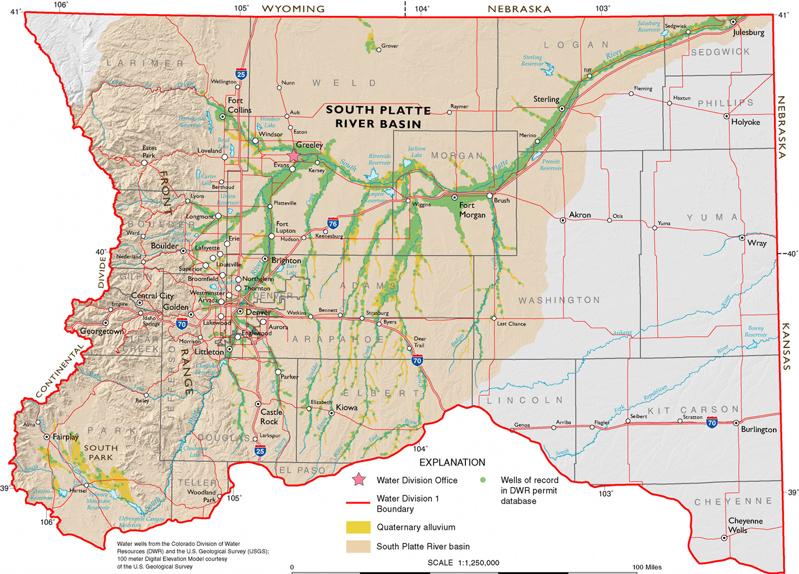
Central oversees two subdistricts that provide augmentation water to farmers in the LaSalle and Gilcrest areas and other parts of southern Weld County. The two subdistricts — the Groundwater Management Subdistrict (GMS) and the Well Augmentation Subdistrict (WAS) — also stretch into Adams and Morgan counties.

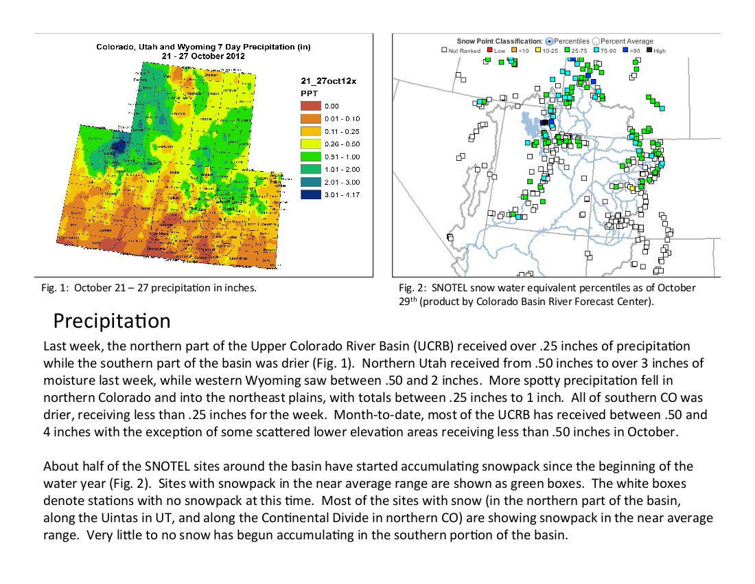
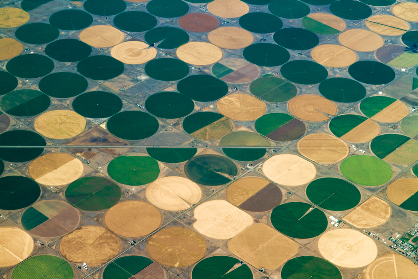
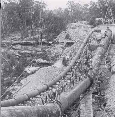
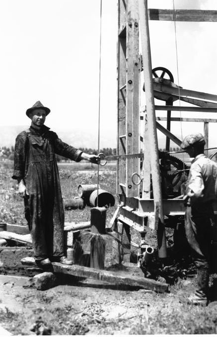
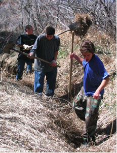
Augmentation water is needed to make up for depletions to the aquifer caused by pumping water out of the ground. All together, Central’s two subdistricts provide augmentation water for more than 100,000 acres of irrigated farmground, according to Randy Ray, executive director of the Central Colorado Water Conservancy District. The additional augmentation water is needed since many of the wells in Central’s subdistricts were either curtailed or shut down back in 2006, when the state determined the pumping of those wells was depleting stream flows in the South Platte River Basin. As part of those decisions, the state made augmentation requirements more stringent. Many farmers haven’t been able to use their wells since then because they haven’t had the necessary amount of augmentation water to do so.

Knutson, himself, has three wells he still can’t use. Those wells are needed in dry years like this one, when flows in the rivers are low, bringing little water to irrigation ditches, Knutson said.

Also, Knutson said, cities in the region are growing rapidly and need more water, causing supplies to get tighter and more much expensive. For example, one unit of water from the Colorado­Big Thompson project, one of the largest water projects in the region that supplies supplemental water for municipal and agricultural uses all over northern Colorado, now costs about $10,000. It was only about $7,500 three years ago, according to Brian Werner, a spokesman for the Northern Colorado Water Conservancy District.

“It’s only gong to get more expensive the longer we wait,” Knutson said. Knutson, Ray and others say the additional water and the bond measure are needed because Central Water relies heavily on leased water from cities to supply its farmers, and, as Front Range cities grow, those cities will lease out less water.

The $60 million in bonds would pay for three of Central Water’s endeavors.

The district is one of 15 water providers looking to take part in the proposed Chatfield Reservoir Reallocation Project, a $184 million undertaking that would raise the Denver­area lake by as much as 12 feet and provide an additional 2,849 acre­feet of water to Central Water. Central Water officials also are considering the construction of gravel pits for an additional 8,000­9,000 acre­feet of storage, and buying 1,000 acre­feet of senior water rights.

If the bond measure is approved, taxpayers within Central Water’s boundaries would pay an additional $1.13 each month per $100,000 in property value for the next 25 years, Knutson said.

The district recently sent out a survey to about 18,000 residents, which it said showed about 75 percent of respondents favored the bond issue. The district encompasses nearly 20,000 households.

There’s no organized group opposing the project, but some have questioned why they need to pay additional taxes for water they couldn’t personally use.

“To be completely honest, I still don’t know which way I’m going to vote,” said Dave Dechant, a Weld County farmer.

Public meetings on the bond issue held this summer grew heated at times.

In response to those residents, Ray said he hopes they’ll still support the project, since the additional water would go toward strengthening the local agriculture economy, which benefits the entire area. Ray said Central Water also might lease some of the water to residential or other users.

Some who would benefit directly from the additional water also expressed frustration at the meetings because they’ve been paying taxes to the district for several years and have yet to see any additional water. Ray said those previous taxes have paid for the legal and engineering fees that have now given Central rights to 68,000 acre­feet of additional water.

The $60 million bond issue would pay for the infrastructure to finally put some of those water rights to use, Ray explained.

More 2012 Colorado November election coverage here.

Drought news: Yampa River streamflow up some, due to recent snow #CODrought #COSnowpack

snowpackcolorado10262012.jpg

From Steamboat Today (Tom Ross):

The 1.48 inches of precipitation, much of it in the form of snow, that has fallen in the Upper Yampa River Basin in October has had a positive effect on the river where it flows through Steamboat Springs. But the Yampa is still flowing below its historic range. The U.S. Geological Survey reports that the Yampa River beneath the Fifth Street Bridge in Steamboat jumped from just above 80 cubic feet per second on Oct. 23 to more than 100 cfs on Oct. 25 and remained at 103 cfs Monday.

Commerce City will test residents’ (with AquaKlene installations) treated water supply at no cost to the homeowner

aquakleenproducts.jpg

Precisely the reason I stay home and keep an eye on plumbers when I’ve hired them. Here’s a report from Jason Pohl writing for The Denver Post. Here’s an excerpt:

The city on Monday warned 151 homeowners by mail that improperly and illegally installed water-softener systems may be contaminating their drinking water with raw sewage. Residents who have had a softener installed can get a free inspection if they’re worried about potential contamination…

Denver lawyer Dan Caplis, who represented the Cattaneos, said he fears the issue could reach beyond Commerce City.
“We have every reason to believe that, at this point, there are a lot (of cases) out there,” he said. “The risk we’re talking about here is a very serious risk.” Caplis said that homeowners may not notice a smell or problem with their water, but they should still get an inspection because the problem could worsen at any time.

Water in Commerce City is provided by the South Adams County Water and Sanitation District. “At no time was the district’s water system compromised because of the problem identified,” district spokeswoman Pam Droesch said in an email.

Update: From Law Week Colorado (James Carlson):

In its post-verdict state, the case has turned what were legal partners into potential opponents. Less than two weeks before trial, Aquakleen’s insurance carrier, CNA, who had hired attorneys for Aquakleen, made it clear in a court filing that it doesn’t think it should pay any of the damages. In its declaratory judgment action, CNA said the policy held by Aquakleen doesn’t cover damages caused by fungi, mold or microbes.

Also at issue is whether CNA acted in good faith earlier in the case when it refused to accept a plaintiffs’ settlement offer within the $2 million policy limits – the type of decision one local attorney called a “poker game.”

Colorado River Basin: ‘The water use for oil shale is quite modest’ — Jeremy Boak (School of Mines)

oilshaledepositsutwyco.jpg

Many eyes are on the Colorado River hoping that water in the basin won’t be developed past the carrying capacity of the river. Here’s an article about the concerns over oil shale exploration and production from Dennis Webb writing for the Grand Junction Daily Sentinel:

The county that’s home to Las Vegas, Nev., is supporting a proposed downscaling of federal land available for possible oil shale leasing and calling for thorough analysis of potential water impacts of commercial oil shale and tar sands development. Clark County’s recent, unanimously passed resolution comes as several other elected officials in Nevada and Arizona also have been sending letters to Interior Secretary Ken Salazar regarding oil shale, expressing concerns about the need to protect Colorado River water quality and quantity. The officials also back a Bureau of Land Management proposal to sharply reduce acreage available for possible leasing in Colorado, Wyoming and Utah.

“We believe that a comprehensive study of the cumulative impacts of oil shale development to the Colorado River basin should be conducted before the BLM considers commercial leasing of public lands,” says a letter signed by Nevada state lawmakers Peggy Pierce and Tick Segerblom, Arizona House Minority Whip Anna Tovar and Commissioner Paul Newman of the Arizona Corporate Commission, which oversees utility and transportation matters. The writers, all Democrats, also cited a Government Accountability Office estimate that industrial-scale oil shale development could require water equivalent to that used by 750,000 households.

Arizona’s House Minority Leader, Democrat Chad Campbell, sent a similar letter, as did Democratic Nevada lawmaker Maggie Carlton, Democratic Nevada state Sen. Mark Manendo and Las Vegas City Council member Bob Coffin. The writers generally urge Salazar to take a balanced approach to oil shale development. In an archived video on Clark County’s website, commissioners there indicated they weren’t trying to tell Colorado what to do or interfere with its economy. Commissioner Chris Giunchigliani said the county simply wants to make sure that due diligence to protect water quality from any oil shale development occurs, to ensure “that what’s coming downstream is appropriate for the valley.”

The Colorado River provides water to 2.5 million people in the county. The commissioners also indicated they were trying to adopt a resolution that wouldn’t interfere with sensitive, ongoing interstate negotiations over Colorado River water.

Chris Treese, a spokesman for western Colorado’s Colorado River Water Conservation District, said if Clark County’s concerns are about water quality, that’s “curious.”

“They’re not going to see any change in their water quality — none,” said Treese, citing the pollution-control regulations that would apply to the industry and amount of dilution that would occur by the time water reaches Las Vegas.

Front Range water entities that rely on Colorado River water also have raised concerns about oil shale’s potential impacts on water quality and the resource’s future availability. The Front Range Water Council sent a letter to the BLM regarding its draft environmental impact statement analyzing a range of alternatives for how much land should be made available for possible leasing. The council said that study’s “analysis of impacts to water supply, water quality, and water development is inadequate, in part because it does not analyze the range of impacts associated with various technologies used by oil shale developers.” The council represents utilities for Denver, Colorado Springs, Pueblo, Aurora and other communities collectively meeting the water demands of about 80 percent of the state’s population.

The council says increased population and energy use related to oil shale development would have water ramifications, and the BLM also needs to assess how such development would affect efforts to protect endangered fish in the Colorado River in Colorado. The BLM says the fish impacts would be analyzed for individual leasing authorizations.

Jeremy Boak, director of the Center for Oil Shale Technology and Research at the Colorado School of Mines, said some companies pursuing efforts to develop oil shale in place underground by means such as heating are working in geological zones isolated from groundwater, minimizing chances of contamination. Shell, which has been researching the use of a freeze-wall to protect surrounding groundwater, has shown the ability to use a steam process to clean groundwater within the freezewall before the wall is removed, he said.

As for water consumption, Boak believes an oil shale industry might use 2 percent of Colorado’s water, compared to about 80 percent currently for agriculture. “The water use for oil shale is quite modest,” he said.

More oil shale coverage here and here.

Fort Collins: A low winter snowpack, remaining effects of the High Park Fire may lead to restrictions

snowpackcolorado10262012.jpg

From the Fort Collins Coloradoan (Brian Janonis):

The city of Fort Collins has two main water sources: the Cache la Poudre River and water from Horsetooth Reservoir (through partial ownership in the Colorado-Big Thompson Project), both originating from snowmelt. Fort Collins Utilities continuously evaluates how much to draw from each source for treatment. Flexibility is key to maintaining high-quality drinking water, particularly in the aftermath of fire. Due to our strict adherence to treatment regulations and state-of-the-art water treatment processes, the city’s drinking water quality has not been affected by summer fires.

Fort Collins Utilities, in cooperation with the city of Greeley, surrounding water districts (known as the Tri-District), Colorado State University and other organizations, are focused on the health of the Poudre River in the aftermath of the fire. In June, we stopped taking water from the river and installed automated monitoring systems to alert staff to water quality conditions and storm events. Mulching operations were completed in more than half of the highest-priority public lands in the watershed, and additional mitigation will occur in the spring. This helps retain moisture, prevent mudslides, and allows seeds to germinate and regenerate vegetation to stabilize hillsides. It also helps prevent large amounts of sediment and debris from running off burned slopes and into the water supply.

Record hot temperatures in 2012, combined with low snowpack (30 percent of average) and the fires, impacted the water supply because we were not able to maximize our water rights on the Poudre River. Fortunately, water restrictions were not required, due to a high water allocation from Horsetooth Reservoir and a limited ability for Utilities to store saved water for use in 2013.

However, given the uncertainty of water quality impacts to the Poudre River and the potential of drought conditions persisting, water restrictions in 2013 may be necessary. It’s uncertain what this winter’s snowpack will bring, how much water Utilities will be able to draw from the river, and the amount of water to be allocated through the Colorado-Big Thompson system. In the last decade, Utilities customers have reduced water use by about 25 percent; the need for wise water use remains.

More South Platte River Basin coverage here and here.

U.S. House majority leadership may allow a vote on the farm bill after the election

irrigatedagriculture.jpg

The plan is to gut the farm bill in the name of austerity. Here’s a report from a Colorado point of view, from Matt Hildner writing for The Pueblo Chieftain:

Efforts to reduce groundwater pumping in the San Luis Valley could get a shot in the arm when Congress resumes for its lame­duck session following the November elections. U.S. House Majority Leader Eric Cantor told the Idaho Statesman newspaper during a campaign stop Thursday that the farm bill would go to the floor of the House for a vote when Congress returns.

That’s good news for a group of groundwater irrigators in the north­central part of the valley. They were counting on the Conservation Reserve Enhancement Program to help retire farm ground as a means of reducing groundwater use. Tim Davis, a consultant for the Rio Grande Water Conservation District, said farmers can’t enroll in the program until the farm bill is reauthorized or a new one is put in place.

Subdistrict No. 1, which takes in more than 300,000 acres of irrigated ground in the north­central part of the valley, did temporarily fallow more than 9,000 acres last summer, although the effort was done entirely with the subdistrict’s funds. The subdistrict’s management plan calls for the fallowing of up to 40,000 acres within a decade.

The Senate passed a new farm bill earlier this year. The House Agriculture Committee also passed a version, but leadership in the lower chamber never brought the measure to the floor [ed. emphasis mine].

While the fallowing program is an important component of the subdistrict, its primary purpose is to compensate senior surface water rights holders for the harm caused by groundwater pumping. A trial that may have a say in how and with what sources of water that compensation may occur is scheduled to start Monday in Alamosa.

More coverage from The Hill (Erik Wasson):

House Majority Leader Eric Cantor (R-Va.) caused a stir on Thursday when he seemed to indicate that a standalone farm bill would come to the House floor after the Nov. 6 election. But lobbyists said the remarks mean, at best, that a modified farm bill could be wrapped into a lame-duck bill dealing with expiring tax cuts and automatic spending cuts.

“I’m committed to bring the issue to the floor and then to see a way forward so we can get the votes to pass (a bill),” Cantor said at a campaign event in Idaho.

Senate Agriculture Chairwoman Debbie Stabenow (D-Mich.) seized on the remarks, saying, “I’m very pleased to hear that Majority Leader Cantor is now committed to bring the Farm Bill to the floor immediately after the election.”

Republican aides, however, quickly made clear that Cantor was not expressing any new support for moving the farm bill as reported out of the House Agriculture Committee this summer.

Washington farm lobbyists said that in the wake of Cantor’s comments, the last best hope for the 2012 farm bill to pass will be if it is riding on fiscal cliff legislation.

“People on both sides of the aisle have made it clear to me that the only way it will be passed is as part of the fiscal cliff bill, if there is one,” one lobbyist said.

Snowpack news: Northern Colorado doing OK, San Miguel, Dolores, Animas and San Juan = 3% of average #COSnowpack

snowpackcolorado11012011.jpg

snowpackcolorado10262012.jpg

Click on the thumbnail graphics for the current statewide map and the statewide map from last year on November 1. Remember, at this time of year one good storm can send the percent of average way up.

From the Summit County Citizens Voice (Bob Berwyn):

The October dustings did help alleviate drought conditions in the northern part of the state, where snowpack as of Oct. 26 was close to average, but along and south of I-70, the snowpack is barely limping along at 60 percent of average in the Colorado River Basin, 70 percent of normal in the Arkansas River Basin and just 20 percent of normal in the Gunnison Basin. In the southwestern and south-central mountains, the snowpack is only at 3 percent of normal in the San Miguel, Dolores, Animas and San Juan Basin, and 4 percent in the Upper Rio Grande Basin. Some SNOTEL sites are already reporting a settled snowpack ranging from a couple of inches to as high as 13 inches at the Deadman Hill SNOTEL site, at 10,220 feet in northern Larimer County. The Copper Mountain SNOTEL site is reporting 3 inches, Grizzly Peak (near A-Basin), 6 inches, and Loveland Basin, 8 inches.

The CWCB approves a $500,000 grant for the La Plata Archuleta Water District pipeline project

pipeline.jpg

From The Durango Herald (Dale Rodebaugh):

A Colorado Water Conservation Board grant will cover $475,000, with the remainder coming from the Southwest Basin Roundtable’s share of the Water Supply Reserve Account. Ground breaking is scheduled Nov. 13. Water will be available for the district’s first customers next year, Steve Harris, the district’s engineer, said Friday. Long­range plans envision serving 400 square miles, first in southeast La Plata County and later southwest Archuleta County…

The pipeline will follow Bayfield Parkway from the roundabout on County Road 501 to County Road 509, then south along County Road 509 to County Road 510, where it will turn west…

The district’s water will come from the city of Bayfield treatment plant, the capacity of which is to be expanded from 1.5 million gallons a day to 2.5 mgd. The plant currently treats 900,000 gallons a day…

The first two miles of pipeline will be 14 inches in diameter to accommodate several laterals, Harris said.
“Once we get into the rural area, we’ll use 8­inch pipe,” Harris said.

More infrastructure coverage here.

USFS is undertaking a study of the Bear Creek Watershed near Colorado Springs — comments sought

greenbackvscorivercutthroat.jpg

From the Colorado Springs Independent (J. Adrian Stanley):

The Indy ran an extensive article on the greenback, its fascinating history, and the current controversy over its preservation here.

The Forest Service study is the first step in offering better protection to the fish. The study will look at the current condition of the watershed, and how current activities — such as motorcycling — are affecting the health of the area.

When the study is complete, the Forest Service will use it to make recommendations for changes to the area that could include, for instance, moving trails further from the creek.

Next, the Forest Service will do a National Environmental Policy Act study, which will determine if proposed changes are, indeed, the best move for the watershed and what effects they will have. The NEPA will ultimately determine if the changes will happen and how they will take place.

The two studies could take years to complete, and there are plenty of opportunities for public comment along the way.

More endangered/threatened species coverage here.

Conservation groups raise issues with fast-tracking the Moffat Collection System Project

grossdam.jpg

Here’s the text of a letter from the Colorado Environmental Coalition, et. al., to the EPA and Army Corps of Engineers:

We write to express our serious concerns with the permitting process for the Moffat Collection System Expansion Project proposed by Denver Water. Governor Hickenlooper has submitted a letter calling for the permitting process to be expedited, and our understanding is that finalizing the Environmental Impact Statement has been put on a fast track for completion. While we certainly support the agencies in working promptly and efficiently on this project – indeed on any of their permitting work – the desire for speedy completion should not come at the expense of completing the studies and analyses needed to accurately assess and disclose impacts, and to honestly determine the “Least Environmentally Damaging Practicable Alternative” pursuant to the Clean Water Act.

The Governor’s letter touts the benefits of the Colorado River Cooperative Agreement between Denver Water and west slope interests as an important factor in moving Moffat permits forward. We agree that the Cooperative Agreement takes many important steps in addressing the current challenges facing the Upper Colorado River watershed. What it does not do is address the impacts of the new Moffat Collection System Expansion Project. Any suggestion that the Cooperative Agreement has somehow reduced or eliminated concerns about the Moffat Collection System Expansion Project or the need to rigorously evaluate its impacts and design mitigation is simply wrong. Our constituencies are not satisfied with Moffat Collection System Expansion Project moving forward without significant further environmental disclosure and mitigation requirements.

Our organizations remain gravely concerned with the potential impacts on the Fraser and Williams Fork watersheds and the Upper Colorado River due to the depletions proposed under the Moffat Collection System Expansion Project. Specific concerns which have been raised previously in the public process surrounding this project include:

Temperature. Already sections of Ranch Creek, the Fraser River, and the Upper Colorado exceed water quality standards for temperature and are listed on the Colorado 303(d) list of impaired waters. Further flow depletions during the summer months, as proposed under the Moffat Collection System Expansion, cannot help but extend and worsen these problems absent operational restrictions (such as curtailment of diversions during periods of elevated temperature) or strong mitigation (channel reconfiguration, riparian restoration). The Draft EIS can, at best, be said to have given short shrift to this issue – particularly since it is a water quality issue where the affected environment is already experiencing water quality standard violations.

Sedimentation. This issue was similarly given a dismissive treatment in the Draft EIS. However, as evidenced by a sediment transport study completed by Dr Brian Bledsoe (previously submitted to you and shared with us by Trout Unlimited) – and as is obvious to all of us who have spent time in the Fraser River and seen the evidence of excessive sediment building up with our own eyes – sedimentation is a significant issue and one that will be worsened by the loss of flushing flows under the Moffat Collection System Expansion. As with temperature, operating requirements (such as mandatory flushing flows) or mitigation measures (such as channel reconfiguration to promote sediment transport at a lower flow) are needed.

Impacts to Recreation and Tourism. The river-based recreation and tourism economy of Grand County and the Colorado River basin are highly dependent on predictable and sufficient streamflows to attract visitors to the area seeking world-class rafting, kayaking, and float-fishing opportunities. In the Upper Colorado River, commercial rafting alone contributes nearly $10 Million dollars in economic benefit, and is enjoyed by over 32,000 visitors a year. Our concern is that not enough analysis has been made of how the Moffat Collection System Expansion will reduce streamflows that support this important industry. The impacts from additional depletions out of the Fraser and Colorado River Systems on existing river-based recreation have not been adequately disclosed, nor have the project proponents made available to the public the models of how future streamflow conditions are likely to change – attributable to the Moffat Collection system solely. Changes in streamflow, and the potential loss of a sustainable recreation economy in Colorado is very concerning to us, and we feel deserves a more substantive review.

Adaptive management. Even if the Corps and EPA were able to complete thorough impact studies that gave adequate guidance to disclose impacts and design mitigation for temperature and sedimentation – a premise that we fear may in itself be flawed given the rush to move forward a Final EIS – there will still be major uncertainty about the impacts associated with Moffat Collection System Expansion. Simply put, there is a real risk that diversions at the level proposed for the Fraser – with a cumulative total of 75% of water being removed from the environment – may cause unanticipated adverse effects. Scientists call these “nonlinear” responses, points where passing a certain threshold can lead to dramatically increased impacts.

Front Range Impacts. In addition we remain seriously concerned about impacts that would occur on the Front Range, namely in Boulder County where Gross Reservoir and dam would be dramatically increased in size. These impacts—and the concerns of County property owners— have not be adequately addressed yet either.

In light of these unpredictable impacts, coupled with the apparent desire to quickly complete analysis of even more predictable impacts, we urge you to include strong monitoring and adaptive management requirements in any permit for Moffat Collection System Expansion. These should include monitoring of the physical, chemical and biologic conditions of the streams affected by the project and require implementation of measures to prevent degradation of aquatic and riparian ecosystems, to be paid for by the project beneficiary—Denver Water. Monitoring must be broad and thorough enough to determine changes in fish, aquatic invertebrate, and plant populations, as well as assessing water quality, and particularly water temperature as indicators of degradation.

While these efforts should be coordinated with the “Learning by Doing” effort from the Cooperative Agreement, they must be a specific and separate requirement of the permit. Learning by Doing – like the rest of the Cooperative Agreement – was not designed to address the impacts of the new Moffat Collection System Expansion, indeed by its own terms it does not address mitigation. It is the job of the Corps and EPA to ensure mitigation as a condition of any approved permit, and a robust adaptive management plan should be required. Given the inherent difficulty of predicting impacts at such high levels of diversion from a river, and in light of the Governor’s stated desire to expedite permitting for Moffat Collection System Expansion, a program by which river health continues to be monitored and Denver Water remains responsible for mitigating the actual effects of their project – not just those that can be accurately predicted in the current EIS process – offers the best opportunity for moving the project forward while ensuring that water quality and ecosystem health can be protected for the future.

In short “fast tracking” this process will only undercut the good work that has been done to date. Any assurances you have heard that “everyone” is on board with the Moffat Collection System Expansion proceeding without the required review and mitigation are simply not true. Our organizations and the more than 180,000 members we represent remain deeply concerned about what the Moffat Collection System Expansion will mean for the health of the Fraser, Williams Fork and Upper Colorado watersheds. We support the permitting process moving forward only if it includes thorough assessment and mitigation to address temperature and sedimentation concerns, and a robust monitoring and adaptive management requirement.

As Colorado moves forward in planning for our water supply future we must ensure that we “do it right”. This is both an enormous opportunity as well as an incredible responsibility. Let’s work together to ensure that the river, our communities and our state are not short-changed in an effort to move quickly.

The letter was signed by: Becky Long, Colorado Environmental Coalition; Bart Miller, Western Resource Advocates; Steve Glazer, Rocky Mountain Chapter of the Sierra Club; Nathan Fey, American Whitewater.

Update: A thousand pardons. I left three signatures off in the list above: Gary Wockner, Clean Water Action; Jen Bock, High Country Citizens Alliance; Matt Rice, American Rivers.

Thanks to Coyote Gulch reader Doug Pflugh for the heads up.

More coverage from Bob Berwyn writing for the Summit Daily Voice. Here’s an excerpt:

“We’re worried that that we’re going to hit fast forward and miss some things,” said Becky Long, water caucus coordinator with the Colorado Environmental Coalition, explaining why several groups recently wrote a letter to the U.S. Army Corps of Engineers and the EPA, reiterating their concerns about water temperatures and sediment loading in the Colorado River and its tributaries.

The fast-tracking was requested by Colorado Governor John Hickenlooper back in June. In a June 5 letter to President Barack Obama, Hickenlooper touted a far-reaching water agreement as “removing” West Slope opposition to the Moffat project, and urged the Corps to release a final Environmental Impact Statement by the end of 2012, followed by a formal decision in early 2013.

The letter illustrates the governor’s fundamental misunderstanding of the NEPA process, which requires agencies to take a “hard look” at impacts and alternatives. It shows that, despite claims to the contrary, the Colorado water establishment is still focused on the folly of more water development and storage as the primary answer to the state’s drought woes. It also shows that state leaders still don’t understand that Colorado could easily — and much less expensively — use basic conservation measures to save as much or more water than would be stored by the Moffat project.

And while it’s true that institutional West Slope water users agreed to not oppose the Moffat Project — a devil’s bargain to some — the environmental community still has serious concerns about the increased diversions.

On top of all that, Long said rumors have circulated that the conservation community is OK with the Moffat project and the mitigation measures that have been proposed during the early phases of the review process. The letter to EPA regional director Jim Martin and Corps of Engineers regional commander Joel Cross was sent partially to refute those rumors.

More Moffat Collection System coverage here and here.

Commerce City: Aquakleen ordered to pay $927,000 to family for improper installation of water softener

aquakleenproducts.jpg

From The Denver Post (Jason Pohl):

California-based Aquakleen Products, Inc. notified the city of the potential problem in the middle of September, Commerce City spokeswoman Michelle Halstead said. She said the city then informed the company that it had 30 days to correct the issue. The South Adams County Water and Sanitation District manages water in Commerce City but was unavailable for comment Saturday.

Aquakleen last week was ruled to pay a total of $927,000 to Nick and Roxanne Cattaneo, for claims of emotional distress and injuries sustained after drinking tainted water, according to court records. The connection for their home’s clean water was connected to the sewage line, which was then allowed to back up into the drinking water system.

Halstead said homeowners should examine their system if they are at all concerned. Additional inspections from the building safety division will available as the city and company address the issue in the coming weeks, she said.

More infrastructure coverage here.

Weld County: Free well testing available for county residents concerned with oil and gas development

drillingawaterwell.jpg

From the Fort Lupton Press:

County residents concerned about the impact from oil and gas drilling on their wells are now able to get free ground-water testing from the county’s Department of Public Health and Environment laboratory.

The lab, according to a Weld County news release, has a new gas chromatograph and mass spectrometer instrument to conduct testing. Chemist Mark Thomas said it’s an exciting addition to the lab. “We are talking about testing parts per billion,” Thomas said. “That is like saying we can measure something that is as small as one eyedropper drop of water in an Olympic-sized swimming pool.”

Thomas said water samples will be analyzed for volatile organic compounds (VOCs) and a report will tell how prominent they are — if at all — in the water. “We anticipate that individuals in the county who use well-water will want to take advantage of this test so they can have base-line information to which they can compare future tests.”

Before the chromatograph and spectrometer was acquired, residents had to pay private labs or the state for VOC testing. Weld County received a grant from the Federal Mineral Lease Board last spring that made the purchase possible. “Weld County chose to use that grant funding for the purchase of this instrument in order to provide a water-testing service for our residents” said Commissioner Dave Long. The cost of the instrument was approximately $145,000.

More water pollution coverage here.

‘I don’t think we’ll ever have enough climate data to where we’ll know all of the answers to our water issues’ — Brad Udall

southplatteriverbasincgs.jpg

Here’s a recap of last week’s South Platte Forum from Eric Brown writing for The Greeley Tribune:

Multiple rounds of drought caused South Platte River flows from 2000 to 2012 to be lower than any other 13­ year period in the previous century, while 2012 saw more water lost to evaporation than any other year on record due to increased wind and record heat. A panel of climate experts shared those figures during a presentation this week at the two­day 2012 South Platte Forum. The experts said Colorado, like other areas, is likely to see more of these extreme conditions down the road — so water providers and users should plan accordingly.

Colorado State climatologist Nolan Doesken, Jack Morgan with USDA’s Agricultural Research Services and Jeff Lukas with Western Water Assessment served as a panel of experts during the climate discussions. They told the engineers, municipal and agricultural water providers and others attending that evidence suggests a future with increased temperatures, which, among other things, will affect the amount of water available to cities and agriculture.

During his presentation, Doesken recapped the “wild” weather of the past year and a half, and, in looking ahead to this winter, said temperatures are expected to be above­average once again. But he said predicting precipitation amounts is still a guessing game.

On a broader and longer­range scale, Morgan said the future is predicted to be decidedly warmer across the globe. He referred to climate data that forecast Colorado’s temperatures to increase by about 5 degrees by the end of the century, with the most extreme change in the U.S. taking place in the northern part of Alaska — predicted to be as much as 10 degrees warmer. That rise in temperatures is likely to result in more extreme rainfall events, as well as more frequent droughts, a change in the timing of the world’s climate and longer growing season, among other effects.

The climate models to which he referred also predict that Colorado at the end of the century could see a 5 percent to 15 percent decrease in precipitation during the winter, spring and fall months, while areas farther north, like Canada and Alaska, will experience large increases in rain.

While there’s belief that the climate change is caused by C02 emissions, Morgan explained the benefits that increased CO2 levels have had on plant life. He also said those benefits could help mitigate some of the future effects of climate change. He said eventual temperature increases and extreme drought will likely get to a point where they overcome any potential positive CO2 effects. Lukas pointed out during his presentation that undepleted annual flows in the South Platte River in 2002 were estimated to be the lowest among Western Water Assessment’s 378 years of data.

Western Water Assessment examines trees in order to attain river flow data that dates back to 1634, measuring the plants’ tree rings to determine its annual growth and what the river flows would have been each year. Western Water Assessment has nine data points in the South Platte River Basin. Using that method, Western Water Assessment estimates that undepleted South Platte River river flows this year are the 10th lowest since 1634.

The panel of experts and others agreed Thursday that using this historic data in combination with predictions of future climate change could help in knowing how later droughts and other weather events could affect the region’s river flows and availability of water, “reducing the element of surprise,” as Lukas put it.

“I don’t think we’ll ever have enough climate data to where we’ll know all of the answers to our water issues,” Bradley Udall with Western Water Assessment said during his keynote speech at lunch. “But the more we know, the better.”

More coverage of the forum from Eric Brown writing for The Greeley Tribune:

Finding ways to recycle water used in fracking and reducing truck traffic on roadways should be top priorities in the region’s oil and gas operations, a diverse panel of experts said during a forum Thursday. Addressing the crowd at the 2012 South Platte Forum, Weld County Commissioner and farmer Doug Rademacher, Ken Carlson with the Colorado Energy Water Consortium, Sarah Landry of the Colorado Oil and Gas Association and Laura Belanger of Western Resource Advocates all agreed the efficiency of water use and other aspects in the state’s petroleum production could improve, but also noted that Colorado has been a leader so far in regulation and oversight of its oil and gas exploration. The two ­day forum drew about 150 water experts and providers, among others, and covered the history of water use in the region, how existing systems work, the area’s changing climate and other issues.

Weld County dominated much of the oil and gas discussion Thursday, since Weld has about 19,000 total oil and gas wells, more than Saudi Arabia, Rademacher said, and accounts for 53 percent of the state’s 2,992 wells constructed in 2011, according to Belanger.

Rademacher explained to the crowd how Weld County has benefited from the petroleum industry, bringing in about $52 million last year in tax revenue from oil and gas companies alone. Those dollars have helped the county continue to lower its mill levy for taxpayers, keep Weld debt­free and assist financially with needed infrastructure upgrades. Rademacher said one of the biggest concerns that has come with the increased oil and gas production has been increased truck traffic on county roads, specifically large rigs hauling water to drill sites.

However, he added that some of the 32 companies operating in Weld are looking at piping water to where it’s needed, along with taking other measures that “will eventually take thousands of trucks of the roads,” he said. “We’re seeing that companies in Weld County are being very proactive in addressing the issues at hand,” he said.

The panel acknowledged that the 2.8 million gallons of water used for each horizontal fracking well sounds like a lot, but further explained to those in attendance that oil and gas operations still only accounts for 0.08 percent of the state’s total water use.

Agriculture remains the largest water user in Colorado, using 86 percent of the state’s water, they added.
Carlson, an engineer who has been researching how water is used in oil and gas production, pointed out that drillers can produce much more energy per gallon of water through horizontal drilling than with vertical drilling, even though the latter method requires less water.

The panel also explained the standards to which oil and gas companies in Colorado are held, such as having to use layers of steel and cement casing with each fracking well to keep it from interacting with underground aquifers. Additionally, each well’s casing is tested before fracking fluids are used in operations.

They added that no reports of contamination in fracking have been reported in the state — although they agreed that more data is needed going forward, and they are in favor of more oversight to make sure that all companies are following all regulations.

More South Platte River Basin coverage here and here.

Colorado Springs plans to spend $28 million on stormwater next year, critics do not see a long-term committment

fountaincreek1999floodcwcb.jpg

From The Pueblo Chieftain (Chris Woodka):

Colorado Springs plans to spend $28 million next year on stormwater issues, but local critics say it’s mainly a reaction to last summer’s devastating Waldo Canyon Fire and not a long­term fix for future damage. “It’s a start, but they still need to find a sustainable revenue stream in the future,” said Jay Winner, manager of the Lower Arkansas Valley Water Conservancy District.

City Councilwoman Brandy Williams shared the list of projects with the Fountain Creek Watershed Flood Control and Greenway District board Friday.

Among the projects are $2 million for the Mirage Channel, which has attracted attention in Colorado Springs media; $2 million in transferred funds from a defunct improvement district; $6.6 million in federal grants, matched by $2.2 million in local funding for stabilizing tributaries; $2 million for street and stormwater staff and programs and $12.8 million for Colorado Springs Utilities fire mitigation or stream fortification projects. About $7 million directly addresses Waldo Canyon drainage stabilization.

“This is a beginning to a continuous process,” said Pueblo County Commissioner Jeff Chostner, who chairs the Fountain Creek board. “As commissioners, we’ve tried to talk to (Colorado Springs) Mayor Steve Bach about the stormwater issues, but he hasn’t met with us to explain anything.”

Chostner plans to attend a meeting of the El Paso County stormwater task force next week, as it reviews area responses to stormwater needs.

Winner said it appeared Colorado Springs is shifting city functions like streets, utilities infrastructure and response to the Waldo Canyon Fire into stormwater, rather than strictly addressing issues once covered by the nowdefunct stormwater enterprise.

“As I look through the list, I don’t think it’s a solution to fix Fountain Creek for the benefit of Pueblo,” Winner said. “I hope in the future they are as concerned with the downstream stormwater needs as they are their own.”

Pueblo County and the Lower Ark district have asked for annual Colorado Springs stormwater funding levels of at least $15 million.

More coverage from Daniel Chacón writing for The Colorado Springs Gazette. Here’s and excerpt:

The city and the public utility issued a joint news release Friday outlining their proposed stormwater-related expenditures in 2013. The funding includes $7 million to address impacts caused by the Waldo Canyon fire and $980,000 in salaries and benefits for employees who work explicitly on stormwater projects.

“I am pleased that our staff has been able to find additional resources for the city’s critical stormwater needs and will be coordinating with Colorado Springs Utilities to ensure their funding is also directed at the most urgent stormwater needs,” Mayor Steve Bach said in a statement.

For months, Bach advocated Utilities’ financial involvement in funding stormwater, which the four-service utility said it was already doing.

Helen Migchelbrink, the city’s public works director and city engineer, said the stormwater spending for 2013 was released in anticipation of a meeting Tuesday of a task force that will look at stormwater funding regionally…

Chairman Anthony Nuñez and Commissioner John Cordova said they wanted to review the city’s list of projects before saying whether the funding was sufficient. But both said Colorado Springs has a long way to go.

Utilities obtained a permit from Pueblo to build the Southern Delivery System water pipeline with the promise to address stormwater needs.

“I realize it’s tough times, but with $500 million worth of needs … it seems a little shy,” Cordova said.

From The Pueblo Chieftain (Chris Woodka):

Jane Green, who owns property on Fountain Creek south of Fountain, has become a regular at meetings of a district designed to fix the troubled waterway. She’s spoken to the board several times since a flood washed out a levee protecting her home in September 2011, without many clear­cut suggestions about how to go about fortifying the bank before the next wave of water hits. But Friday, the Fountain Creek was moved to begin taking action to help her and other landowners who experience erosion or flooding from sudden storms on the creek.

“I think we can move forward on this,” said Richard Skorman, a Colorado Springs businessman who sits on the board of the Fountain Creek Watershed Flood Control and Greenway District.

Ferris Frost, another woman who owns land in the creek channel and a member of the district’s citizens advisory committee, showed the board slides of her own property. A logjam 100 feet wide by a quarter­mile long clogged an irrigation headgate last year. The creek has cut away 50­foot cliffs over the last three decades. “Jane Green has been to the district three times this year, and found no one to help,” Frost said. “It should be one of our functions.”

The district did tell her to contact the Corps of Engineers and Natural Resources Conservation Service for help in repairing the levee, and got a permit to do work in the stream, but she had to line up her own materials. The concrete chunks thrown in the creek as a stop­gap measure go against the plans, which were developed during years of meetings leading up to the formation of the district in 2009.

Jay Winner, manager of the Lower Arkansas Valley Water Conservancy District, said state funds for stream stabilization projects went unused last year. The funds are available for public entities like the Fountain Creek district, but not landowners. Board chairman Jeff Chostner set up a special committee to look into options for grants and programs the district can use to help landowners.

From The Pueblo Chieftain (Chris Woodka):

A board dedicated to fixing Fountain Creek took a few more baby steps toward finding permanent funding last week, tempering the desire to get things done with finding the right approach to voter approval. “As I said before, let the discussion begin,” said Pueblo County Commissioner Jeff Chostner, chairman of the Fountain Creek Watershed Flood Control and Greenway District. “There are going to be a lot of nuances.”

Chostner has prodded the board throughout the year to talk about the timing of asking voters for a mill levy. The district’s funds are dwindling, and the only funding in sight is a one-time payment of $50 million to the district in 2016, if Southern Delivery System is online by that time. The district also must ask voters to suspend Taxpayer’s Bill of Right provisions on revenue growth to receive even that money, said general manager Larry Small. Under the 2009 legislation creating the district, which includes all of Pueblo and El Paso counties, the district can assess a tax of up to 5 mills. There are also provisions for subdistricts — a potential way to fund stormwater, for instance — in just parts of the area that would not affect the mill total, Small said.

The board got some more tools to work with as its discussions continue:

– The Trust for Public Land agreed to provide advice and technical assistance in a survey of voters regarding the timing and wording of a ballot issue.

– Sample language for a ballot issue, including stating the district’s objectives, was presented. Flood prevention, water quality, drainage, open space, recreation and wildlife were included.

– Financial projections show the assessed valuation is $6.32 billion in El Paso County, and $1.56 billion in Pueblo County, or $7.88 billion total. Each mill would raise $7.88 million, representing an annual payment of about $20 for a $250,000 home, or $145 for a $500,000 business.

More stormwater coverage here and here.

San Luis Valley irrigation season ends on November 1

sanluispeoplesditch.jpg

From email from the Division of Water Resources (Matt Hardesty):

The Division Engineer for Division 3 of the Colorado Division of Water Resources has announced that the irrigation season will end on November 1, 2012 for irrigation structures within the following water districts: Water District 20, which is the drainage area of the Rio Grande; Water District 25, which is the drainage area of San Luis Creek; Water District 26, which is the drainage area of Saguache Creek; Water District 27, which is the drainage area of La Garita and Carnero Creeks; and Water District 35, which is the drainage area of Trinchera Creek. The irrigation season will end on November 9, 2012 for irrigation structures within Water District 21, which is the drainage area of the Alamosa and La Jara Creeks and Water District 24, which is the drainage area of the Culebra Creek.

This announcement is to comply with the State Engineer’s policy number 2010-1 regarding the setting of an irrigation season in Division 3.

Future announcements will be made regarding the end of the irrigation season for the Conejos River drainage area.

If you have any questions, please contact the Division of Water Resources at (719) 589-6683.

More Rio Grande River Basin coverage here and <a href="

Denver Water receives award for exceptional performance

morninggloryspillwaydillonreservoir.jpg

Here’s the release from Denver Water (Stacy Chesney/Travis Thompson):

Denver Water was one of four water utilities from around the nation to receive the Association of Metropolitan Water Agencies gold award for exceptional utility performance. The award recognizes outstanding achievement in implementing nationally recognized attributes of effective utility management.

Denver Water received the award for its commitment to delivering a high-quality product, operating with excellence and efficiency, developing employees’ skills and using specific metrics to track performance.

The association also noted other achievements that attributed to the gold award, including Denver Water’s comprehensive watershed protection efforts and asset management programs. Denver Water uses scenario planning to evaluate potential water supply futures and collaborates with federal, state and local officials to prevent, prepare for and recover from emergencies.

Additionally, Denver Water partners with regulatory agencies to ensure it uses practical approaches to protect public health and the environment. And, the utilities financial position is strong, with solid cash reserves and excellent credit ratings.

The award is another mark in demonstrating Denver Water’s commitment to delivering safe, clean water to every customer.

More Denver Water coverage here.

Glenwood Springs: The next meeting of the Flaming Gorge Task Force is October 30

flaminggorgepipelineearthjustice.jpg

Here’s the agenda for the meeting.

More Flaming Gorge Task Force coverage here.

The EPA launches new webpage for nutrient pollution information

bluegreenalgaebloom.jpg

Click here for the website.

More Environmental Protection Agency coverage here.

San Luis Valley: Groundwater sub-district #1 trial update: Use of closed basin water still a sticking point

artesianwellduttonranchalamosa1909.jpg

From the Valley Courier (Ruth Heide):

When the afternoon was concluded, objectors and supporters had agreed in concept to the 2012 annual replacement plan (ARP) for the sub-district and the underlying methodologies and technologies used to develop that plan. That made one of the remaining motions to strike expert witnesses and their reports a moot point because there is now no longer the need for a number of witnesses to present extensive testimony.

Proponents now plan to call only three witnesses, Rio Grande Water Conservation District Manager (RGWCD) Steve Vandiver, RGWCD engineer Allen Davey and Colorado Division of Water Resources State Engineer Dick Wolfe.

This first sub-district, which was designed to repair injurious depletions from well pumping to surface water rights and reduce the draw on the aquifer, operates under a management plan that is effectuated each year through an annual replacement plan. The annual plan spells out how depletions will be replaced…

The sponsoring water district approved the annual plan, as did the state engineer. Objectors challenged it and asked the judge to prohibit wells from pumping in the sub-district boundaries until those challenges were resolved this year. She denied that motion.

Objectors subsequently asked for their claims to be withdrawn and the October trial to be vacated. Judge Swift told objectors they could either withdraw their challenges to the 2012 replacement plan on the condition they could not bring those challenges back again or withdraw them with the opportunity to re-file them only if they paid the supporters’ costs for preparing for trial. They chose the first option, except for Schwiesow whose client the Costilla Ditch Company chose not to withdraw its claims.

One issue still remaining for trial is the use of Closed Basin Project water as one of the sources to replace depletions. Davey in particular will testify to that issue next week. He will also testify about augmentation wells, another issue still pending before the judge…

One of the controversial topics before the judge on Wednesday revolved around the possibility of challenging sub-district water plans in the future. Proponents said they would like some definitive rulings from the judge regarding the foundation of the water plan so they would not have to go through all the time and effort they did this year every year to defend the sub-district’s plan.

“We want the court to be in a position to be able to make factual determinations about the adequacy of the replacement plan because it was so broadly challenged,” [David Robbins, attorney for the Rio Grande Water Conservation District ] said.

[Attorney for the objectors Tim Buchanan] said the objectors raised broad issues “because we didn’t want to be foreclosed in the future from raising those issues.”

More San Luis Valley groundwater coverage here and here.

Paonia Reservoir: Look out Northern Pike, Rotenone is on the way

paoniareservoir.jpg

Here’s the release from Colorado Parks and Wildlife:

Colorado Parks and Wildlife will take advantage of the extremely low water levels this fall to restore the fishery at Paonia Reservoir.

When the reservoir starts filling again next spring, the reservoir will be stocked with catchable-size rainbow trout.

The reservoir, which is primarily used for agricultural irrigation, was drained significantly this summer. In late October the reservoir will be lowered further and the water will be treated with Rotenone, an organic chemical that will kill all the fish remaining in the reservoir. The chemical — derived from the root of a tropical plant — is fast acting, works only on aquatic species, leaves no residue and degrades quickly in the environment. Parks and Wildlife agency biologists will then neutralize the chemical through application of an oxidizing agent.

No water will leave the reservoir until it has been determined that it is free of the chemical.

“Rotenone is widely used in Colorado and throughout the nation for fisheries management projects,” said John Alves, senior aquatic biologist for the southwest region of Colorado Parks and Wildlife. “It is a safe and effective chemical.”

Paonia Reservoir is a poor fishery because of the extreme annual fluctuation of the water level. Northern Pike are present in the reservoir in small numbers and they are small in size. The species holds little appeal to the majority of recreational anglers. Also, pike pose a substantial threat to native fish that live downstream in the Gunnison River.

“The reservoir will be managed for angling recreation, and the majority of Colorado anglers prefer fishing for trout,” Alves said.

Paonia State Park is located on the south side of the reservoir and attracts anglers, campers and day-users.

The treatment of the reservoir is planned for the week of Oct. 29.

More restoration/reclamation coverage here.

Pagosa Area Water and Sanitation board meeting recap: Total expenditures in the draft budget = $1.3 million

pagosahotsprings.jpg

From the Pagosa Sun (Lindsey Bright):

During the meeting, the board reviewed the 2013 draft proposed budget for the first time during a regular meeting. This was an initial discussion on the budget, and no action was taken.

The General Fund total revenue in the 2013 draft proposed budget is $968,490, down from $991,102 in 2012.

The total expenditures in the draft budget is $1.3 million, up from $1.25 million in 2012. This increase is due to several incremental climbs in a variety of line items as well as the addition of three line items: Transportation Equipment, $18,000; Office and Administration Equipment, $11,500; and Administrative Building Remodel/SCAN Network, $50,433.

In the Water Enterprise Fund, the total budgeted revenue for 2013 is $4.54 million, down from $4.7 million in 2012. The total expense for Work in Progress in 2013 is $1.3 million, up approximately $500,000 from 2012. The areas where it increases most are: reservoirs/watersheds, $220,000; water treatment plant upgrade, $75,000; and distribution system upgrades, $703,772.

Total maintenance is proposed to be $151,959 in 2013, and total administration is proposed to be budgeted at $371,691.

Debt Retirement and Transfers is $1.07 million.

In the Wastewater Enterprise fund, the total revenue for 2013 is budgeted at $2.2 million, down nearly half from $4.1 million of the 2012 amended budget.

The biggest increase for the Wastewater Enterprise is in the Work in Progress category, where the Pagosa Springs Sanitation General Improvement District Pumping Project is budgeted at $1.24 million.

Total Wastewater Treatment for 2013 is budgeted at $401,000 with the biggest increase seen in line item Operator Salaries, rising to $82,623 from $38,200.

Total WasteWater Maintenance is budgeted at $73,444 for 2012, only a slight increase from the $68,946 in the 2012 amended budget.

More San Juan River Basin coverage here and here.

Drought news: Sparcity of irrigation water has dried up some open space ponds in Boulder County #CODrought

usdroughtmonitor10232012.jpg

From CBS4Denver.com:

In Boulder County, hundreds of ponds and lakes that are part of the open space network are about half full on average. Teller Lake has nearly gone completely dry.

Each pond and lake is unique with water levels varying greatly depending on the streams and ditches that feed it. Another determining factor is how much of that water goes to local farmers and growers for their crops.

“Everywhere the water has been lower. Not just the ponds and lakes but all the streams and the creeks. It’s definitely noticeable,” said lake visitor Liz Negrey…

The lake drained drastically in the past month, leaving the fish that live in the lake to slowly die in shrinking pools of water. The herons and sea gulls feasted on the dying fish…

The lake ran dry after there wasn’t enough water running in the ditch that feeds it. Most of the water was used for emergency irrigation to help nearby farm land.

From Steamboat Today (Tom Ross):

The Colorado River District’s Jim Pokrandt confirmed in an email Tuesday that [Wolford Reservoir] on Muddy Creek, which flows off the east side of Rabbit Ears Pass, is at its lowest point since 2002 and well beneath its capacity of 65,872 acre-feet. The water behind the dam now stands at about 26,000 acre-feet, still above the 20,000 acre-feet low point it reached in the drought year of 2002…

It would be difficult for travelers on their way from Steamboat to Silverthorne or Denver to fail to notice how low the reservoir is.

Pokrandt said irrigators from the Grand Valley near Grand Junction were making calls on water from Wolford Mountain Reservoir right up until Tuesday.

Pokrandt said a major factor in the drawdown of the reservoir is its mission of offsetting water taken by Denver Water out of Dillon Reservoir near Frisco.

Denver Water controls 40 percent of the water in Wolford Mountain Reservoir, or about 28,000 acre-feet, Pokrandt said. It has an agreement to augment the amount of water stored in Green Mountain Reservoir to offset water it holds back from the Blue River before it can reach Green Mountain farther downstream.

The Upper Colorado River Endangered Fish Recovery Program also called upon 5,600 acre-feet of the 11,412 acre-feet it controls in Wolford this summer, Pokrandt said.

From Reuters (Carey Gillam):

Roughly 61.79 percent of the contiguous United States was suffering from at least “moderate” drought as of October 23, down from 62.39 percent a week earlier, according to Thursday’s Drought Monitor, a weekly compilation of data gathered by federal and academic scientists.

The portion of the United States under “exceptional” drought – the most dire classification – held steady at 5.84 percent and was mostly in western Kansas and Nebraska.

In the High Plains, which include Kansas, Nebraska and the Dakotas, severe or worse drought levels covered 84.90 percent of the region, improved from 87.42 percent the prior week. An estimated 27.44 percent of the region was still in the worst level of drought, unchanged from a week earlier.

Nebraska is the worst hit state in the country, with fully 77.58 percent of the state classified in exceptional drought, unchanged from a week earlier. Winter wheat farmers who have planted or are wrapping up planting their new crop will need significant rainfall and/or snow to provide enough moisture to grow a healthy crop.

In Kansas, the largest hard red winter wheat producing state, “extreme” drought, the second-worst level, held steady at 77.80 percent of the state, while the worst level held steady at 39.68 percent of the state.

Areas that saw good improvement over the last week included Illinois, Missouri, Minnesota and Iowa, due to a slow-moving rainstorm through the Midwestern region.

Good rains were also seen in the west, over northern California, the Pacific Northwest and the northern Rockies.

Some of the heaviest rain and snow fell in areas that were already drought free, although precipitation chipped away at dryness and drought in a few areas, according to the Drought Monitor report. Meanwhile, dry conditions prevailed across the southern half of the West, the report said.

Colorado River: Say hello to the Grand Valley Riparian Restoration Collaborative #coriver

2009coloradorivercleanupdaycmu.jpg

From the Grand Junction Free Press (Shannon Hatch):

The Tamarisk Coalition is excited to announce the formation of a new partnership to protect and improve habitat along rivers and streams in the Grand Valley of western Colorado.

Participants in this partnership include: Mesa County, City of Grand Junction, Town of Palisade, City of Fruita, Grand Junction Audubon, Colorado Riverfront Commission, Water Center at Colorado Mesa University, US Fish & Wildlife Service, Colorado Parks & Wildlife, Natural Resources Conservation Service, Colorado Watershed Assembly, Mesa Land Trust, Clifton Sanitation District, Western Colorado Conservation Corps, Bureau of Land Management, US Bureau of Reclamation, and private landowners.

Although it is still in its infancy, the Grand Valley Riparian Restoration Collaborative (GVRRC), as it is informally being called, already has a number of projects on tap for the coming year. Thanks to generous funding from the Colorado Basin Roundtable and Statewide Water Supply Reserve Account, administered by the Colorado Water Conservation Board, the GVRRC will be implementing five on-the-ground projects in 2013…

Specific on-the-ground projects that the collaborative will be working on in 2013 include:

• Bank stabilization and revegetation work at Riverbend Park in Palisade.

• Cottonwood fencing from beaver predation and wildlife browsing at the Ela Preserve, managed by Grand Valley Audubon.

• Tamarisk and Russian olive removal, secondary weed treatment, and revegetation at several different areas, including the Jarvis Property, Watson Island, and Las Colonias Park, owned by City of Grand Junction; Redlands Parkway property, managed by Mesa County and the City of Grand Junction; and Connected Lakes State Park, managed by Colorado Parks & Wildlife…

More information about the collaborative can be found at the following website: https://sites.google.com/a/tamariskcoalition.org/grand-valley-riparian-restoration-collaborative/.

More restoration/reclamation coverage here.

Weekly Climate, Water and Drought Assessment of the Upper Colorado River Basin

wyutcoprecipitation1014thru10202012.jpg

usdroughtmonitor10232012.jpg

Click on the thumbnail graphics for the precipitation summary from the Colorado Climate Center. Here’s the link to all the summaries.

I’ve also posted the current U.S. Drought Monitor map.

From Governor Hickenlooper’s office:

Gov. John Hickenlooper announced today he extended an Executive Order that authorizes transports of large baled hay or baled livestock feed which may exceed lawful maximum height.

The governor signed the original Executive Order on Sept. 21. Since then, the Colorado Department of Transportation has issued 13 permits to nine different applicants.

The Executive Order suspended rules that prevent the State from issuing single-trip, extra-legal permits for divisible loads of “baled hay” or “baled livestock feed” of heights ranging from 14 feet, 6 inches to 15 feet.

“Large areas of Colorado have experienced devastating damage from drought. This has severely impacted the ability of Colorado livestock producers to acquire the requisite amount of feed for their animals,” the Executive Order said. “As winter approaches, such restrictions put Colorado livestock in severe danger and producers require immediate assistance to meet their feed requirements.”

The governor announced the Executive Order last month during the inaugural Pedal The Plains event on the Eastern Plains. The extension signed Monday is good for 30 days.

First Colorado Congreso de Acequias recap: ‘Water was not considered property, but a communal shared resource’ — Ed Vigil

cleaningacequias.jpg

From the Valley Courier (Lauren Krizansky):

This year’s presenters included Costilla and Conejos Counties’ own acequia irrigators, southern and eastern neighbors, politicians, lawyers, scholars, mothers and youth. Topics included regional challenges, legal challenges, women and youth, lessons from northern New Mexico, the coming Colorado Acequia Governance Handbook and the future of Colorado’s acequias.

Alongside the host, the Sangre de Cristo Acequia Association, agencies present included Colorado Open Lands, the Natural Conservation Resource Service (NRCS), both co-sponsors; the Division of Water Resources; the National Park Service; the National Heritage Area and the Farm Service Agency.

Rep. Ed Vigil (D) opened and closed the ceremonies, and received special recognition for taking the lead on the Colorado Acequia Recognition Law.

“Everybody has an equal portion and a chance of surviving,” Vigil said in the midst of an acequia history lesson. “Water was not considered property, but a communal shared resource. People were always happy with what they could get. We survived well. That history is going to be gone and the technology is going to dwindle it down until it disappears.”[…]

The Congreso united acequia irrigators from Conejos, Costilla, Huerfano and Las Animas through an opportunity to compare and contrast systems. An uncertainty in the law and the changing environment – both natural and commercial – were echoed in each presentation.

“There are differences that we have across the river,” said Lawrence Gallegos, a Conejos County irrigator. “Some problems started back in the 1920s and 1930s when they established the Rio Grande Compact. We are still subject to that compact.”

He added, “It is a sustainable way of agriculture what we are doing today in the San Luis Valley. Mining the water, pumping the water is not sustainable.”[…]

From across the mountains, Jack Chavez, Las Animas County, and Amos Mace, Huerfano County, divulged another series of problems including greed, water quality, unclaimed water rights, taxes, natural resource development and pollution.

More water law coverage here.

‘Agriculture cannot be sustained in the Southern High Plains’ — Judy Reeves (Cirrus)

highplainsogallalaaquiferboundary.jpg

From Think Progress (Peyton Fleming):

“Agriculture cannot be sustained in the Southern High Plains,” Judy Reeves, senior hydrogeologist at Texas-based Cirrus Associates said flatly, speaking at the Society of Environmental Journalists (SEJ) conference in water-stressed Lubbock, Texas where drought is still a daily topic. “We really need to start talking about the next economy here.”[…]

…what can water managers in West Texas and elsewhere in the arid West do to navigate these dire water challenges? Some interesting — and surprising — answers were provided at last week’s SEJ workshop, “Squeezing Blood from a Desert.”

Reality-based water pricing is a critical first step. Western water has historically been under priced, in large part because the federal government financed most of the region’s expensive water infrastructure, including pipelines and dams. But, as Sharene Leurig, water program manager at sustainability advocacy group Ceres said, “the era of federal largesse has passed.” That means Western utility water rates and revenues will need to be aligned with short- and long-term expenses. That means higher water rates.

But tools are available to curb water price inflation. Among the most appealing are strong demand management programs. By using carrots and sticks to reduce water use — especially for water-sapping lawns and landscaping — utilities can avoid having to finance expensive new water supplies…

More infrastructure coverage here.

Glenwood Springs is hosting tours of new $22.3 million wastewater treatment plant

wastewatertreatmentprocess.jpg

Lucky Glenwood Springs residents. From the Glenwood Springs Post Independent (John Stroud):

The city is offering a series of public tours this week and next to show off the new, 1.9-million-gallon-per-day wastewater treatment plant located at the old Chatfield Ranch near the municipal operations center on Wulfsohn Road.

The $22.3 million treatment plant, lift station, sewer pipeline and related facilities have been under construction for the past two years and were completed this past summer. The new plant replaces the old facility near the confluence of the Roaring Fork and Colorado rivers on Seventh Street.

Three tours per day will continue on Thursday, and again on Oct. 30 and 31…

During the tour, Tipton describes the wastewater treatment process, from the collection center at the new lift station on Seventh Street, through three miles of pipeline along Midland Avenue to the treatment plant, and into a multi-stage treatment process. In the end, the more than 90 percent pure water is returned to the Colorado River.

In the laboratory near the end of the tour, the city’s longtime wastewater lab technician Lee Jones compares two beakers of water, one containing sewer water coming into the plant and the other containing the treated water that will go out of the plant into the river.

The latter is as clear as drinking water. In fact, recent readings at the plant indicate 99 percent removal of solids from the treated water.

To get to that stage, after being pumped from the lift station, the water first enters the plant’s headworks building. There, a grit sorter removes the larger sand and grit.

“We want to get as much of the grit out as fast as we can,” Tipton said. “Through this process, we will eliminate 80 to 90 percent of the larger material.”

This is also the most volatile stage of the process, as raw sewer water can produce large amounts of methane gas. The headworks building is “explosion proof,” meaning there are no exposed electrical outlets or other potential sources of ignition. Methane gas detectors and other safety devices will also shut the system down if dangerous levels are detected.

The air ionization system that controls the plant odors is also contained in the headworks building.

From there, it’s on to the oxidation ditches, or ponds, where oxygen is added to the partially desolidified wastewater. Large, submerged paddles in the 20-foot-deep pools keep the water churning constantly.

It’s also during this stage that ammonia and nitrogen are removed from the water. The water flow continues into the “secondary clarifier” ponds, where a rubber scraper continues to remove the remaining suspended solids, which are recirculated back through the system…

An operations lab includes a main computer monitoring station, where plant operators can observe the entire process from beginning to end and can remotely open and close valves and check meters.

Before going into the river, the treated water goes through a final ultraviolet disinfection system. Meanwhile, the biosolids are sent to the digester, and the sludge is eventually hauled away.

More wastewater coverage here and here.

Drought news: Jackson Gulch Reservoir at lowest level in 10 years #CODrought

jacksongulchoctober2012.jpg

From The Mancos Times (Jeanne Archambeault):

…according to the [Mancos Water Conservancy District] who keeps track of precipitation each year, there was slightly less this year than in 2002. There was a total of 12.39 inches in the 2011/12 winter, and 12.98 inches in 2002. In the last 10 years, they were the two lowest precipitation years. The highest was 2005 with 23.22 inches…

At the moment, the level of the Jackson Gulch Reservoir is “just shy of 15 percent,” [superintendent Gary Kennedy] said. The average for the shutdown, which was Sept. 20 this year, is usually 40 percent. “We let the water out of the reservoir about a month early,” he said.

Kennedy is adamant about the fact that without the reservoir being here in the Mancos Valley, the Mancos River would have been dry in June and the town would have had to take water from the river. The next step, he said, is for the town to lease water.

What a beautiful rain/snow today, so far: 63 hundredths near Brighton by nine this evening #WinterIsBack

urbandrainage24hratninepm10252012.jpg

Click on the thumbnail for the Denver Metropolitan Area precipitation totals from Urban Drainage at about 9:00 PM. I just got home from my second soaking ride in one day on my bike. Curse of the bicycle commuter.

Environmental Stewardship: ‘We Get It’ — Denver Water

eisenhowerfishing.jpg

From Denver Water:

Denver Water recently earned a spot on The Climate Registry’s list of Climate Registered organizations, one of many steps the utility is taking to reduce its impact on the environment.

The Climate Registry is a nonprofit organization that operates a greenhouse gas registry, supported by states, provinces, territories and tribes throughout North America. Currently, 141 organizations are Climate Registered.

To become Climate Registered, Denver Water had to measure its electric, natural gas and fuel consumption, among other data, have it verified by a third party and report it to The Climate Registry.

Taking stock of greenhouse gas emissions helps Denver Water look at cost-effective ways to reduce its environmental impact. It also helps Denver Water prepare for possible greenhouse gas emission regulations, which are being considered at the state and federal level.

More Denver Water coverage here.

El Paso County and the COGCC reach agreement for groundwater testing

groundwatermovementusgs.jpg

From The Colorado Springs Gazette (Bob Stephens):

Commissioners clashed with the commission over the past year and in January adopted strict regulations for water testing before and after drilling. Threatened with a lawsuit by the state attorney general, commissioners amended and softened county regulations —they still required groundwater testing — but insisted the state was not strict enough.

They met in the middle with a memorandum of understanding, which the state commission is expected to approve Nov. 15.

“The regulations are going to be stricter than any others in the state of Colorado,” said senior assistant county attorney Diana May.

She said Ultra Resources and Hilcorp “are 100 percent behind these requirements.”

Meanwhile Darryl Hannah was at the Frack Free Colorado Rally Today according to a report the Associated Press via the Huffington Post. Here’s an excerpt:

Jakob Dylan of The Wallflowers, actress Daryl Hannah and others ended the four-hour Frack Free Colorado rally by singing “Stand By Me” on stage together. Co-organizer Allison Wolff said the roughly $45,000 rally was meant to push for the acceleration of clean-energy alternatives and to educate the public on what Wolff called the dangers of hydraulic fracturing…

Colorado overhauled its oil and gas drilling regulations in 2008 and is working to update rules for how far wells must be from homes and other buildings. In Longmont, voters are being asked this November whether hydraulic fracturing should be banned.

Daniel Rodriguez of the Nederland-based band Elephant Revival, which also attended the rally, said, “I want people, including myself, to become more aware of how we use energy and how it’s sourced.”

More oil and gas coverage here and here.

Acequia project provides students an introduction to water basics, research methods

acequiadelcerro.jpg

Here’s the release from Metropolitan State University of Denver (Cliff Foster):

The law in Colorado and the West generally awards the greatest control over a water source to the person who first puts it toward a “beneficial use.” As for everyone else―stand in line.

But, as a research team of students, faculty and administrators from MSU Denver learned, a much different system governs the water delivered to farms in the San Luis Valley and other places settled well before Colorado became a state.

The team made three trips to the Valley in September and this month to interview farmers about acequias, community-operated irrigation ditches introduced by settlers from colonial Mexico. Acequias not only deliver water but are part of the cultural, civic, economic and historical heritage of communities in southern Colorado and northern New Mexico.

The research fits nicely with the upcoming visit to MSU Denver by Devon G. Peña, this year’s Richard T. Castro Distinguished Visiting Professor and the University’s new One World, One Water Center for Urban Water Education and Stewardship. Peña, a professor of American ethnic studies, anthropology and environmental studies at the University of Washington in Seattle, is also secretary of the Sangre de Cristo Acequia Association in Colorado and a leading expert on acequias.

Peña’s testimony before the Colorado Legislature contributed to the passage of a 2009 bill that recognizes acequia practices, including defining water as a communal asset, allocating water distribution based on equity and not just priority and sharing of scarcity in times of drought.

The University research, supported by funding from the Sangre de Cristo Acequia Association and the OWOW Center, and information about the law will be presented at the 2012 Colorado Congreso de Acequias this week in San Luis. The research results will also likely be woven into a book sponsored by MSU Denver’s Department of Chicana/o Studies based on the papers of Castro, the late civil rights activist and MSU Denver graduate and instructor, who served five terms in Colorado’s House of Representatives.

Four students took part in the acequia project. Tom Cech, director of the OWOW Center, led the first trip to communities in the San Luis Valley; Adriana Nieto, assistant professor of Chicana/o studies, the second, and research assistant Richard Gould the third.

Specifics about the research, including the names of the participating students, are confidential. Nieto said students interviewed farmers about issues such as who uses which acequias, the condition of the ditches and their knowledge of water rights. Most of the farms have been family owned for generations and vary in size from a few acres to hundreds, Nieto says.

The project benefitted students in several ways, she says. They received a crash course in water basics, research methods and the ethics of “parachuting” into a community and asking sensitive questions. Nieto recalls suggesting the students could present their findings to the Undergraduate Research Conference in May. “They were like, ‘Yeah that would be great but what do these people get out of it’? They’re asking really probing questions that most people don’t even start asking until they’re doing Ph.D. research.”

Ramon Del Castillo, chair and associate professor of Chicana/o Studies, says research such as the acequia project provides essential information about the contributions of Latinos.

“For too long our cultural customs and traditions haven’t been respected,” he says. The research, he adds, “enhances the understanding of cultural and historical systems that have been in place a long time. So, maybe there are pieces of that acequia system that should be emulated as we fight over this drought and over water.

“We really do have something to offer if people are willing to look at it.”

More education coverage here.

Clean Water Act 2.0: Rights of Waterways — Linda Sheehan

effluent.jpg

From the Huffington Post (Linda Sheehan):

Over the last 40 years [ed. since the Clean Water Act was passed], progress has undeniably been made — but it has also undeniably stalled. Over half of monitored rivers and streams nationwide, and almost 70 percent of lakes, reservoirs and ponds, still cannot meet one or more established beneficial uses such as swimming, fishing or habitat. Water flows are also increasingly compromised, with fish and even whales disappearing as water diversions increase. Climate change also is threatening waterways; in the recent opening days of the 67th Session of the U.N. General Assembly, Secretary General Ban Ki-moon called for urgent action on climate change to ensure water and food security world-wide…

The 40th anniversary of the Clean Water Act calls for reflection on next steps. While the Act’s vision was laudable, it has in effect legalized pollution and extraction, with slowed but ongoing degradation. Our other environmental laws similarly have fallen short in protecting people and planet, their limitations evident from growing, global problems such as spreading species extinctions and accelerating climate change impacts.

One of the key reasons our environmental laws are falling short is that they accept without question the overarching assumption that the natural world can and should be manipulated and degraded for short-term financial profit [ed. emphasis mine]. Our laws fail to reflect the fact that we are inextricably intertwined with the natural world, and that what we do to the Earth, we do to ourselves. We must modernize our laws to correct this fundamental misunderstanding and guide us on a better path.

Thanks to @downstream2012 for the link.

More water pollution coverage here and here.

Drought news: Breckenridge city council ends watering restrictions #CODrought

breckenridgevailresorts.jpg

From the Summit Daily News (Caddie Nath):

With the summer season over, and the drought conditions that plagued Colorado after last year’s dry winter less of a concern, the Breckenridge Town Council voted unanimously to remove the restrictions…

A decade-old law, adopted during Colorado’s last major drought in 2002, allows Breckenridge officials to authorize water restrictions when the Blue River’s inflows to Goose Pasture Tarn, the town’s water storage facility, are expected to drop below 20 cubic feet per second (cfs). The river’s flow dropped to about that level in July, a significant decrease from the year before. The Blue River peaked at more than 400 cfs in the summer of 2011, following heavy precipitation and an above-average snow year, town staffers said.

Arkansas Valley Super Ditch: ‘There is no reviewable decision to appeal at this time’ — Judge Schwartz

arkbasinditchsystem.jpg

From The Pueblo Chieftain (Chris Woodka):

Opponents of the Super Ditch pilot program jumped the gun when filing a complaint, Division 2 Water Judge Larry Schwartz ruled Monday. In June, Prowers County water users filed the complaint against State Engineer Dick Wolfe and the Arkansas Valley Super Ditch, saying the state did not have authority to approve a substitute water supply plan for Super Ditch. But the plan never was given final approval, because Super Ditch could not meet all of the conditions that were outlined, Schwartz said in the decision.

“There is no reviewable decision to appeal at this time,” Schwartz said.

The pilot program set out to lease 500 acre­feet of water from the Catlin Canal to Fountain and Security. Water would be taken from dried­up acres and released to the river over time through recharge ponds. An exchange would move the water to Lake Pueblo, where it could be used by the cities through the Fountain Valley Conduit. After a public meeting in January and two technical meetings with objectors, Wolfe cut some farms from the plan and the amount of the program in half. Because of the drought and conditions put on the plan, it was never approved or carried out.

Amity Mutual Irrigation Co., District 67 Irrigating Canals Association, Lower Arkansas Water Management Association and Tri​State Generation and Transmission Association filed the court case in May, saying Wolfe lacked authority.

Super Ditch eventually plans to move larger amounts of water from as many as seven canals that take water from the Arkansas River in Pueblo and Otero counties, but has not filed an application for change of water rights, the opponents contend. Super Ditch officials say the pilot program must come first to work out details of how the full program would operate.

More Arkansas Valley Super Ditch coverage here and here.

‘The point is every stream flows out of the State of Colorado has an interstate compact obligation’ — Jeris Danielson

arkansasriverbasinwikipedia.jpg

From The Trinidad Times (Steve Block):

A recent meeting in Trinidad hosted by the Purgatoire River Water Partnership provided information about those water rights issues, specifically the compact established by state legislation in 1950, often known as the Kansas Compact, that determines how much of the available water each state is entitled to. The partnership was put together within the last year to try to explain water rights, and how to avoid conflicts between states over water.

Jeris Danielson, State Engineer and Director of the State Division of Wildlife Resources from 1979 to 1992, was on hand to give a brief history and interpretation of the Kansas Compact and what it means for water rights in this region. Now a private consultant and manager of the Purgatoire River water Conservancy District, Danielson gave a Power Point demonstration of interstate water rights in general, and those that directly impact Colorado…

“The point is every stream flows out of the State of Colorado as an interstate compact obligation,” Danielson said. “He described an interstate compact as, ’An agreement between two or more states to settle particular difficulties involving the adjustment of political rights not susceptible to Federal Action alone.’”

Danielson showed an image of the multiple compacts Colorado has, then described how those contracts were put into place. He said each compact first requires the approval of the state legislatures of the affected states, followed by approval from Congress and then from the president…

Eve McDonald is an expert on water rights and Federal Indian water rights law. McDonald is counsel to the State Division of Engineers and to the staff of the Colorado Water Conservancy Board (CWCB). She said that when an interstate stream is divided between two states, a 1907 U.S. Supreme Court ruling in a dispute between Colorado and Kansas established the principle of ‘equitable apportionment.’

“That’s a division of water based on need,” McDonald said. “That means one state has to prove to the Supreme Court that the other state has substantially infringed on its need for the water. That’s usually based on how much use and reliance on the water has already been established and how many acres are already being irrigated. Instead of litigating it, the nice thing to do is enter a compact, because the doctrine, if you’re litigating it and not deciding by contract between two states through Congress, the doctrine led to a tendency to hurry up and use the water and develop the water lines so that you’re equitable apportionment would be greater than the other state’s.”

McDonald said compacts allow states to agree on present and future water needs. The agreements can be enforced only through the states. She said no individual rights supersede equitable apportionment, even if they date from before the date the compact was created. She said two state agencies, the CWCB and the State Engineer’s Office, have responsibility for enforcing water compacts. She said that as water supplies are reduced for various reasons, that can impact the water compacts themselves.

More water law coverage here.

Colorado River: Water managers manage to keep 500 cfs in the river at Palisade for endangered fish #CODrought #coriver

ucefrp4speciesuppercoloradomap.jpg

From the Summit County Citizens Voice (Bob Berwyn):

While the Upper Colorado River Endangered Fish Recovery Program wasn’t able to meet its dry-year flow goals of 810 cubic feet per second at Palisade, Grand Valley and upstream water managers worked cooperatively to maintain an average flow of 500 cfs this summer, well above the flows during Colorado’s last significant drought in 2002.

And warm temperatures in the river, while not optimal for non-native trout, may have helped some of the young endangered fish like the Colorado Pikeminnow put on a bit of extra weight, a key factor to surviving their first winter, said Tom Chart, director of the interagency recovery effort.

“Everybody breath a sigh of relief when September came around,” Chart said. “We were in a better position with upstream reservoir storage … and we managed to limp through.”

First results from late-summer monitoring in the Lower Colorado River and the Green River suggest that spawning numbers and initial survival rates for Colorado pikeminnow were near average, despite drought conditions, Chart said, adding that the size of the young fish was above average — good news for the fish going into the winter…

“After two decades of effort by Recovery Program partners to construct these fish screens, fish passages and water management facilities, it was gratifying to see all water users working together collaboratively to minimize the impacts of the extreme drought conditions,” said Brent Uilenberg, technical services division manager for Reclamation’s Western Colorado Area Office.

From the Grand Junction Daily Sentinel (Dennis Webb):

The U.S. Fish and Wildlife Service is praising the voluntary efforts of several private water organizations in the area for their efforts in helping endangered fish during a year of drought.

The agency has sent letters of acknowledgement to entities that have assisted in the efforts of the Upper Colorado River Endangered Fish Recovery Program.

On the Colorado River, three private organizations helped boost flows to support endangered Colorado pikeminnow, razorback sucker, bonytail and humpback chub in 15 miles of critical habitat from Palisade to the confluence of the Colorado and Gunnison rivers, Fish and Wildlife said in a news release.

The Orchard Mesa Irrigation District operated a check structure in the Grand Valley Power Plant discharge canal to make water available for the Grand Valley Irrigation Company, an action that preserved stored water in the upstream Green Mountain Reservoir for future use.

The Orchard Mesa district also continued work to implement an automation project that will help conserve water when completed in 2015.

Fish and Wildlife also recognized the Grand Valley Irrigation Company for taking advantage of low flows to remove a cobble bar that was deposited in the river during last year’s high flows. The cobble bar prevented operation of a screen that keeps fish from becoming trapped in the irrigation canal.

Fish and Wildlife credited the Grand Valley Water Users Association for managing to intermittently operate a fish screen on its canal despite low flows. In addition, the association operated the Grand Valley Water Management Project, a collaborative project with the Recovery Program that improves the efficiency of the canal system to conserve water.

While Fish and Wildlife wasn’t able to meet its recommended dry-year flow target for endangered fish of 810 cubic feet per second at Palisade this year, Grand Valley and upstream water managers worked cooperatively to maintain an average flow of 500 cfs this summer. That compares with just 171 cfs on the same stretch of river during the drought of 2002.

Fish and Wildlife also credited the Palisade Irrigation District for taking advantage of low flows to repair extensive 2011 high-water damage to the fish passage at the Price-Stubb Diversion Dam.

In addition, it recognized the Redlands Water and Power Co. for operating its fish passage and fish screen from April through September, with the help of the Bureau of Reclamation’s operations of upstream dams on the Gunnison River. As of early August, more than 9,000 fish had used the passage, Fish and Wildlife Service said. Of those, 90 percent were native fish, including 10 Colorado pikeminnow.

More endangered/threatened species coverage here.

Check out this cool interactive water history of Colorado from Patricia Rettig and the Colorado Water Institute

grandriverditchlookingupstream.jpg

Click here for a great interactive timeline of Colorado’s water history from Patricia Rettig and the Colorado Water Institute.

Thanks to Colorado Water 2012 (@ColoWater2012) for the link:

More education coverage here.

Drought news: NOAA expects the drought to persist, Managing Drought Workshop on Dec. 11-12 in Wray, #CODrought

usseasonaldroughtoutlook10182012to01312013noaa.jpg

Click on the thumbnail graphic for the October 18 Drought Outlook from NOAA.

From the Sterling Journal-Advocate (Sara Waite):

The U.S. Seasonal Drought Outlook map from NOAA for Oct. 18, 2012 through Jan. 31, 2013, shows drought persisting or intensifying across much of the Midwest and West during that time frame, while drought development is considered likely in the Northwest.

Recent moisture has lowered the drought severity in southern Logan County from exceptional to extreme, and parts of Colorado have improved to moderate drought conditions over the last few weeks. However, precipitation levels for 2012 remain far below average in Logan County — as much as 50 percent of normal — according to the High Plains Regional Climate Center.

Area reservoirs are showing the effects of the drought and corresponding high demand for irrigation water. According to the end-of-month reservoir readings from Brent Schantz of the Colorado Division of Water Resources, North Sterling Reservoir had virtually no water in it at the end of September. Prewitt and Jumbo reservoirs were each 17 percent full. That marks a steep decline from the end of May, when North Sterling was 82 percent full, Prewitt was 87 and Jumbo was at 96 percent…

Northeast Colorado livestock producers concerned about drought impacts are invited to attend a Managing Drought Workshop on Dec. 11-12 in Wray, hosted by the Yuma County Conservation District and Natural Resource Conservation Service. The workshop series will include sessions on online resources, such as a spreadsheet that can calculate profit estimates based on a number of variables, as well as drought indicators, plant drought response and drought planning. Ranchers may attend any part or all of the workshop sections.

For more information about the workshop, visit ycconservation.com.

From The Greeley Tribune (Analisa Romano):

Despite warmer weather this month — and still no sign of the first snow in Greeley — many residents complied with city officials’ pleas to stop watering their lawns by Oct. 1 instead of the city’s usual recommendation to stop by Oct. 15. The result was a savings of 96 million gallons of water, said Natalie Stevens, spokeswoman for Greeley’s water department…

“You can tell a lot have stopped watering,” [Natalie Stevens, spokeswoman for Greeley’s water department] said. “We knew citizens are water efficient and would step up to the plate when it’s needed, so we weren’t surprised. But we are happy.”[…]

Compared with water demand last year, Greeley used 111 million fewer gallons of water this season, Stevens said…

If Greeley continues to see little precipitation, it’s still a good idea for residents to water their trees and shrubs, experts say. Old or new trees, or stressed trees such as those that suffered in last year’s heavy snowstorms, tend to be more susceptible to winter kill, according to Greeley’s water and sewer department.

University of Wyoming Student to Help Researchers Map Hydrology of Colorado River Basin #coriver

uppercoloradoriverbasinusbrprojects.jpg

Here’s the release from the University of Wyoming:

This past summer, Nels Frazier taught computational science concepts to high school and middle school students around the state. This fall, the University of Wyoming fifth-year undergraduate from LaGrange will receive some supercomputing education of his own.

Frazier, who double majors in computer science and mathematics, is part of a team of UW researchers that will use the NCAR-Wyoming Supercomputing Center (NWSC) to map the hydrology of the Colorado River Basin.

“We are doing something that hasn’t been attempted before — taking the Upper Colorado River Basin and putting it into a computer model,” Frazier says. “It wouldn’t be possible without the supercomputer. We want to take this massive amount of data and make it into something usable.”

A comprehensive model of the upper Colorado River Basin — at a resolution 100 times higher than currently available — will be created. The physics-based hydrologic model will be applicable over large areas to help assess long-term impacts of water policy and resource management decisions, natural and man-made land-use changes, and climate variability — with an emphasis on the Rocky Mountain west region.

Fred Ogden, the Cline Distinguished Chair in the Department of Civil and Architectural Engineering, and Haub School of Environmental and Natural Resources, and Craig Douglas, SER professor of mathematics and director for the Institute for Scientific Computation, will head the project, titled “CI-Water Petascale Computational Model for the Upper Colorado River Basin.”

The CI-WATER project is a joint collaboration among UW, the University of Utah, Utah State University and Brigham Young University. Cooperators include the United States Army Corps of Engineers and NCAR.

The CI-WATER project is funded with an EPSCoR Research Infrastructure Improvement Program (RII) Track-2 cooperative agreement. Distributed through the National Science Foundation, these cooperative agreements provide research funding to states, including Wyoming, that typically receive lesser amounts of NSF research and development funding.

Ogden was looking for a couple of undergraduate students familiar with a UNIX computing environment and with experience using C or C++ programs, says Frazier, whose background includes programming and systems administration.

Frazier’s role, which began this past summer, includes setting up a campus computer lab and systems administration, as well as plan how to build the software needed to run the computer model on the supercomputer. The U.S. Army Corps of Engineers has provided model-building software for the project.

“We’re taking that source code from that software and we have to figure out if it’s capable of working with the models we want,” Frazier says. “We’re using what they already have so that we don’t have to reinvent the wheel. We’ll add to their software to get our job done.”

Before the project will be modeled on the supercomputer, the work will be scaled and tested using Mount Moran, the on-campus Advanced Research Computing Center (ARCC) located in the IT Data Center.

The large amount of data needs to be broken down into manageable sections of the basin that can be computed before the segments are brought back together to develop a comprehensive view of the data for the supercomputer, Frazier says.

“One of the big problems we have to solve is how to get high resolution images (of watersheds) at higher altitudes and lower resolution images at lower altitudes,” he says. “A lot of modeling doesn’t take that into account. We want to take these resolutions and put them into something we can understand.”

During the summer, Frazier says he put in up to 30 hours a week on the project. During the school year, he is limited to 18 hours a week because of academic demands, he says.

“My skills fit with this project. As I learned more about the project, I got more excited,” he says. “I’ve taken things I’ve learned and I am using them. This may help my graduate school prospects.”

The NWSC was unveiled Monday (Oct. 15) during a ceremonial opening dedication in the North Range Business Park in Cheyenne.

The NWSC will contain one of the world’s most powerful supercomputers (1.5 petaflops, which is equal to 1.5 quadrillion mathematical operations per second) dedicated to improving scientific understanding of climate change, severe weather, air quality and other vital atmospheric science and geo-science topics. The center also will house a premier data storage (11 petabytes) and archival facility that holds historical climate records and other information.

Including Frazier’s project, the National Science Foundation has chosen seven UW research projects — ranging from planet formation from star debris to fluid dynamics of wind turbines — that will use the NWSC this fall.

More Colorado River Basin coverage here and here.

Colorado college students get a birds eye view of oil and gas development in NW Colorado

roandrillingoilgaswesternresourceadvocates.jpg

From the Craig Daily Press (Joe Moylan):

On Thursday, five students representing Colorado Mountain College, the University of Colorado and Colorado Mesa University flew over Craig as part of an educational program exploring the relationship between energy development and water conservation.

The program, organized by EcoFlight, an Aspen-based environmental nonprofit, blends airborne- and ground-based education designed to inform college students about current conservation issues from a broad range of perspectives…

In addition to flying over Craig Station and learning about oil and natural gas development in Moffat County while in the air, the students participated in a discussion at the Tin Cup Grill in Craig about local environmental issues with Luke Schafer, Western Slope campaign coordinator with the Colorado Environmental Coalition.

Schafer covered a lot of ground during his hour-long talk, bouncing from topic to topic and presenting his opinions on everything from water conservation, the Front Range’s thirst for Western Slope water, balanced and sustainable energy development and sage grouse.

Schafer told the students that sage grouse could be an environmental game changer because they are considered an indicator species…

Although the students were captivated by Schafer’s views on sage grouse, they were stunned to discover he also was an avid hunter.

“It’s easy to demonize people, especially hunters, but I want you all to know that’s me,” Schafer said. “People often forget that the conservation movement, the environmental movement or whatever you want to call it, traces its roots back to a group of hunters who wanted to protect that (Dinosaur National Monument) out there.

“No other group does more for conservation than hunters, but we do get a bad rep because not every hunter is quick to pull out their checkbook and contribute.”

More education coverage here.

Colorado Mountain College hopes to get in the high altitude flora business

leadville.jpg

From The Pueblo Chieftain (Chris Woodka):

Colorado Mountain College wants to start a high-country nursery near Leadville that could help provide trees for fire-damaged areas or plants to use in wetlands projects.

The college wants to set up a solar greenhouse, a shade house to harden plants and an outdoor nursery to grow native forest and wetlands plants. It is seeking $200,000 from the Colorado Water Conservation Board for the project. Mike Simon, CEO of the Leadville CMC campus, and Nephi Thompson, a biology instructor, presented the plan to the Arkansas Basin Roundtable earlier this month. The roundtable agreed to refer the project to the state. The operation would be located at Hayden Ranch, south of Leadville. The ranch, founded in 1859, was purchased by Aurora for water rights in 1998. Most of the land was sold to the Bureau of Land Management and State Parks or donated to Lake County. The 36-acre homestead site was sold cheaply to Colorado Preservation Inc., and is used as a laboratory by CMC.
“With advance notice, we can adjust operations to meet demand,” Simon told the group.

The college officials acknowledged that the size of the operation — a 7,500 square-foot greenhouse, 3,450 square-foot shade house and 3 acres of outdoor plots — would not be enough to restore large areas, such as those burned by wildfires this year. But the plants grown in Leadville would have a better chance of survival for smaller projects, and provide an example of how high-country greenhouse operations could be set up. The project would also include classrooms and learning opportunities for students. “Seed grown at altitude has a better chance of survival with the cold, drought, sun and wind you experience in the mountains,” Thompson said. Plants grown at lower elevations have a high mortality rate when used in mountain restoration projects, she explained.

More restoration/reclamation coverage here.