Colorado Aquifer Management Conference day one recap: Data collection vital for administration statewide

groundwatermovementusgs.jpg

From The Greeley Tribune (Eric Brown):

Progress has been made, but a better understanding of the region’s aquifer remains critical for the future in the South Platte River Basin — parts of which have been labeled by the federal government as “highly likely” to see a “potential water­supply crises by 2025.”

That was the general consensus among groundwater experts who spoke during the first day of the Colorado Aquifer Management Conference on Wednesday.

Much of the discussions during the two­ day meeting will focus on the relationship between groundwater and surface flows in streams and rivers — particularly how well­pumping, usually done for agricultural uses, affects surface flows needed downstream by senior water rights owners.

The experts agreed that a better scientific understanding of that relationship could lead to better management practices and help “maximize beneficial use” of the region’s water.
Many of the presentations focused on new methods of measuring the timing of how well­pumping affects surface flows, and to what extent. Experts said they’re gaining a better understanding of the aquifer from those new methods and models, but added that the complex mathematical equations and other techniques can’t take into account the geohydrology, surrounding vegetation, proximity to the river, weather extremes and other factors that make most wells different from one another.

Colorado Supreme Court Justice Gregory Hobbs, the keynote speaker of the day, was among those who emphasized the need for more analysis and data. He said it’s needed to make sure the state manages its water as well as possible.

Some groundwater pumpers, including a number of Weld County farmers, favor making changes to how the state manages its aquifers. They believe the state’s requirements for augmentation plans — an approved plan to make up for surface­flow depletions caused by groundwater pumping — are too stringent.

Some farmers can’t afford enough augmentation water to get their wells pumping again.

Thousands of wells are now curtailed or shut down, and some believe the build­up of groundwater in the basin — 10 million acre­feet of water, according to some estimates, which is eight times more water than is in all of the South Platte Basin’s surface reservoirs — could be put to a more beneficial use.

Those farmers were big supporters of a South Platte Basin groundwater study that was approved during last spring’s legislative session and is under way. The Colorado Water Institute at Colorado State University is doing the study, which is expected to be complete by the end of 2013.

Hobbs and others stressed that data is also needed to prevent any over­pumping of groundwater in the state.

On more than one occasion, experts brought up the fact that about 40,000 acres of farmground in the San Luis Valley have been taken out of production in efforts to replenish the aquifer there that’s been depleted from over­pumping.

More groundwater coverage here and here.

Drought news: South Platte River Basin snowpack drops (42% of avg) below minimum of record/2002 levels #CODrought

southplattebasinhighlow11292012.jpg

Click on the thumbnail for the current Basin/High Low ogive from the Natural Resources Conservation Service.

The snowpack is eerily similar to the winter of 2002-2003 on the Front Range. A monster snowstorm around St. Patrick’s Day in March of 2003 saved the day (and water year).

From the National Weather Service — Pueblo:

With just over a month left in the year, 2012 looks to go down as one the warmest and driest years on record across south central and southeast Colorado. Unless there is a major change in the weather pattern over the next month, 2012 will likely be the warmest year on record in Colorado Springs, and possibly the warmest year on record in Pueblo and Alamosa. In addition, 2012 will likely be the second driest year on record in Pueblo; the third or fourth driest year on record in Colorado Springs; and the twelfth driest year on record in Alamosa.

From the Grand Junction Free Press (Hannah Holm):

The situation varies around the state, but doesn’t look good anywhere. Snowpacks in the Colorado, Gunnison, Yampa/White, Upper Rio Grande and San Miguel/Dolores/Animas/San Juan River Basins are all registering between 40-47% of average, while the Arkansas is at a mere 30%. The South and North Platte River Basins are in the best shape, at 50% and 52% of average.

This doesn’t necessarily mean that we’ll have another drought year, since Colorado tends to get a large share of its snowfall in a few big storms later in the season. It bears watching, though, since statewide reservoir levels are already low: 66% of average for this time of year, and at 37% of their total capacity. Graphs shown by State Climatologist Nolan Doesken at Colorado Mesa University on Nov. 26 showed levels at Lake Dillon, Blue Mesa Lake and Lake Powell dropping between April and June of this year, a time when they normally refill.

Doesken pointed out that severe and widespread droughts are regular occurrences in Colorado, and the last one we have long-term data for (2002) was pretty short compared to droughts in the 1930s and 1950s. It’s worth noting that there were a lot fewer people in Colorado during those droughts.

Currently, the US Drought Monitor is reporting that over 90% of the state is in at least a “severe” drought, with a wide swath in the northwest corner (including Grand Junction) in “extreme” drought, and a large section of the southeastern part of the state in “exceptional” drought, the worst category. The US Drought Monitor also forecasts that drought conditions will persist or intensify in Colorado and all surrounding states over the next three months…

It’s entirely possible that we’ll get a big storm or two that will make skiers happy (even below 10,000 feet), and water users across the state will breathe sighs of relief. But the historical record (never mind climate change) tells us we won’t dodge the bullet forever. At some point we’ll face a severe multi-year drought again, so it’s not too soon to start thinking about how to adapt.

Fountain Creek: Stormwater needs through Colorado Springs and El Paso County could total $1 billion

fountaincreekwatershed.jpg

From The Pueblo Chieftain (Chris Woodka):

Stormwater needs in the Colorado Springs area could total more than $1 billion, while less than $10 million annually in funding is available from year to year. “This is not going to get done overnight,” said Springs Councilwoman Brandy Williams. “It took 30 years to get here, and I hope it won’t take 30 years to get out.”

An El Paso County stormwater task force Thursday reviewed a partial list of about 500 capital projects in the Fountain Creek watershed with a price tag of more than $760 million, along with annual estimated maintenance needs of $7.5 million annually. The list includes incorporated areas and military bases, and does not factor in a possible $180 million more in projects in unincorporated El Paso County. It will be finalized at the task force’s final meeting in January. Colorado Springs has the greatest need, with $684 million in capital projects and $4.9 million in annual maintenance, while Fountain needs $46 million and the Air Force Academy $24.5 million in construction.

“We will have identified $1 billion in needs and have only about $10 million budgeted,” said Tim Mitros, stormwater engineer for Colorado Springs. “What we’re going to have to look at in phase II is where the money is coming from.” Some concrete structures are more than 50 years old and reaching the end of their usefulness. New methods of controlling flooding are being explored, he added.

The meeting also addressed the need for Colorado Springs to control its stormwater in order to turn on the $986 million Southern Delivery System. When SDS was approved by the Bureau of Reclamation and Pueblo County commissioners, a stormwater enterprise was in place. Stormwater funding is just one part of the requirement, said Mark Pifher, a Colorado Springs Utilities executive. The other major piece is a drainage criteria manual, which should be completed by the city of Colorado Springs next spring. “Our hope is that the drainage criteria manual will allow no increase in flows from new development, which would assure that conditions of the permit are met,” Pifher said.

More coverage of Colorado Springs’ rehab work required by the Waldo Canyon Fire, from Chris Woodka writing for The Pueblo Chieftain:

Colorado Springs Utilities will spend about $12 million reinforcing pipelines below Rampart Reservoir, already starting to wash out because of the Waldo Canyon Fire last summer. “Flood flows out of the area are greater than they were before the fire,” said Mark Shea, watershed planning supervisor for Colorado Springs Utilities. He made his comments at a stormwater task force meeting Thursday.

The severity of flooding is 4 to 10 times worse, even for small storms and swells dry creeks to the point where they overflow their banks. Roads and bridges can be washed out as additional sediment clogs drainages.

A back­up water supply main runs from Rampart Reservoir, north of the city, where 80 percent of Colorado Springs water is stored. While the reservoir itself will need some rehabilitation, the supply line is of paramount importance, Shea said. Another $25 million to $50 million will have to be spent to protect other parts of Colorado Springs where mud flows are likely in the wake of the fire.

Ultimately, the sediment would find its way into Monument and Fountain creeks, creating problems for Colorado Springs at its wastewater treatment plant, landowners on Fountain Creek and Pueblo County. The ash from the fire already has caused water quality problems for downstream water users.

The fire started June 23 and burned more than 18,000 acres, destroyed 350 homes and took two lives before it burned out in July. About 10,600 acres suffered moderate to high damage. Threequarters of the land is in the National Forest, but the impacts of flooding will be felt by area property owners.

Based on the experience of the Hayman Fire in 2002, it could be years before the worst effects of the fire show up. So far, mulch of straw and wood chips has been spread on the most damaged hillsides to try to stem erosion.

More Fountain Creek Watershed coverage here and here.

Senate should pass hydropower improvements — U.S. Representatives Diana DeGette and Cathy McMorris Rodgers

hydroelectricdam.jpg

From Politico.com:

As Congress faces tough questions about our fiscal future, we also have a unique opportunity to advance bipartisan energy policy that will create jobs. Putting Americans to work by expanding the nation’s access to clean, affordable hydropower is a solution on which the House of Representatives already found consensus. Indeed, when we passed the Hydropower Regulatory Efficiency Act earlier this year, we acted unanimously — the only example of unanimity on an energy issue in this Congress. That is why we urge the Senate to take up and pass this hydropower legislation before the end of the year…

The Department of Energy reports that more than 12 gigawatts of capacity could be installed at our nation’s existing non-powered dams. That’s the equivalent of 12 nuclear power plants. In fact, only 3 percent of the country’s 80,000 dams currently have generation facilities. Many developers are also exploring smaller applications, including construction in engineered irrigation conduits.

The potential of hydropower to create jobs is also enormous. A 2010 study conducted by the National Hydropower Association revealed that by utilizing currently untapped resources, the U.S. could add approximately 60,000 megawatts of new hydropower by 2025, creating up to 700,000 jobs in the process. It is estimated that for every megawatt of new small hydropower installed at existing dams without hydropower, 5.3 jobs are created (including direct, indirect and induced jobs). With jobs still scarce for too many Americans, we should be looking at every opportunity to put Americans back to work.

More hydroelectric coverage here and here.

Denver Water/USFS ‘From Forests to Faucets’ partnership update

haymanburnarea.jpg

Here’s a guest column, written by Jim Lochhead and Dan Jirón, that’s running in The Denver Post. Here’s an excerpt:

We can’t prevent fire from occurring, but healthy forests can reduce the threat of catastrophic fire, like we experienced this year. Denver Water and the U.S. Forest Service have for decades worked side-by-side to care for the watersheds that provide water to Colorado citizens and Denver Water’s customers. Two years ago we forged a partnership — called “From Forests to Faucets” — to work in high-priority watersheds to accelerate forest health treatments that promote healthier, more resilient forests, reduce wildfire risks, restore burned areas and lessen erosion into reservoirs.

Last week, Denver Water and the U.S. Forest Service signed the third annual commitment of funds in support of this partnership. Together, we are focused on treating and restoring 38,000 acres of National Forest System lands in five priority watersheds including the Upper South Platte, South Platte headwaters, Colorado River headwaters, St. Vrain and Blue River. Since the From Forests to Faucets partnership began in 2010, we are currently treating nearly 17,000 acres.

More restoration/reclamation coverage here.

Drought news: So far 2012 is the second dryest year on record, statewide snowpack = 39% of avg #CODrought

snowpackcoloradobasinhighlow11272012.jpg

Click on the thumbnail for the current Statewide Basin High/Low ogive. The NRCS statewide map that I usually show is out of sync with the graph. They are working on it, according to Mage Hultstrand. She told me via email:

The High Low graph is using the “old” 1971-2000 averages and includes all the SNOTEL sites in the basin (with averages).

The statewide update map has already been switched over to the “new” 1981-2010 normals. We have not yet completed the calculations of these new normals for all of our sites; as a result this map does not include all the sites across the state or in the South Platte basin yet. That’s why I showed the high low graph instead of the map at the [Water Availability Task Force] meeting. For right now it is the more accurate representation of conditions across the state.

We plan to have all the new calculations done by January 1 and then the two products will both be updated with the new averages and should match.

Here’s the recap of the November 20, 2012 Water Availability Task Force Meeting from the Colorado Water Conservation Board.

With ten consecutive months of below average precipitation, the 2012 water year, which ended on September 30th, saw just 75% of normal precipitation. November has continued on a below average trend; although a storm around Veteran’s day brought beneficial moisture to the mountains, slightly boosting statewide precipitation from 54% on November 1st to 58% as of the 19th. At this early stage in the snow accumulation seasons, snowpack is at 45% of average. Despite a cooler October, November temperatures are above seasonal averages. Currently, this calendar year ranks as the 2nd warmest on record (1895-2012) with a statewide average temperature of 51.7 degrees Fahrenheit.

 As of the November 20, 2012 US Drought Monitor, 100% of Colorado is experiencing some level of drought classification. D2 (severe) and D3 (extreme) cover nearly 79% of the state, while 13% of the state is experiencing exceptional drought (D4), isolated to the eastern plains. This is a slight decrease in D4 classification since the start of the water year on October 1, 2012.

 Many municipalities that had implemented both voluntary and mandatory watering restrictions earlier in the year will keep these in place throughout the winter. Through the irrigation season Colorado Springs Utilities (CSU) saw consumption increase to the highest levels since 2002; consequently reservoir levels are the lowest since 2002. Other communities are closely watching the situation and have some concern should the drought conditions persist for another year.

 Statewide reservoir storage is at 66% of average and 37% of capacity. The highest storage levels are in the Yampa/ White River Basin, at 96% of average while the lowest storage in the state is the Rio Grande River basin at 47% of average. All other basins range from 61% to 73% of average and 17% to 52% of total capacity.

 Many basins that were able to rebound following the 2002 drought are reporting reservoir levels that have not been seen in nearly a decade; while others that were not able to fully rebound to normal levels post the 2002drought continue to report below average reservoir levels.

 Surface Water Supply Index values have improved in some areas (Huerfano, Cache La Poudre & Big Thompson) and deteriorated in others. The central portions of the state as well as the southwestern corner have seen the largest decline. This is largely due to decreased stream flows and decreased storage levels. During this time of the year the SWSI is calculated using observed, rather than forecasted, stream flow volumes.

 For the first time in nine years ENSO-neutral conditions are likely to dominate through the winter months. Without El Nino or La Nina influencing weather patterns, it is difficult to determine when the current drought regime will be broken in Colorado. The latest long term experimental forecast, issued November 19th, shows below-normal chances of moisture from January to March throughout much of Colorado. This is based largely on other factors such as a cold north Pacific (PDO) and a warm North Atlantic (AMO).

From The Pueblo Chieftain (Chris Woodka):

Colorado snowpack through November is only 43 percent of normal, raising concerns that a statewide drought may be entering its second year.

The statewide water availability task force, meeting last week in Denver, pointed to several indicators that drought is continuing. The most extreme drought is in the Lower Arkansas Valley — Crowley, Otero, Kiowa, Bent, Las Animas and Prowers counties — where the drought could be entering its third year. Despite a widespread storm on Veterans Day, snowpack is at 43 percent of normal statewide. The Arkansas River basin is in the worst shape at 26 percent, while the Colorado River basin, which supplies supplemental water to this basin, is at 44 percent.

The Rio Grande basin snowpack is at 43 percent.

Early snow levels are not a good indicator of water availability for 2013, since most of the snow in Colorado falls in March and April. Coupled with last year’s subpar snowpack, however, a dry winter could spell trouble.

Statewide reservoir storage is at two­thirds of average and just 37 percent of capacity. were able to rebound following the 2002 drought are reporting reservoir levels that have not been seen in nearly a decade,” said Taryn Finnessey, of the Colorado Water Conservation Board and co­chair of the task force.

Some cities are extending outdoor water restrictions into winter months.

Pueblo did not put restrictions in place, but was forced to draw down water held in storage to meet increased demand.

The task force also noted that temperatures in November were again above normal, as 2012 has been the second warmest year on record. The warmest was 1934.

Long­term forecasts call for drier than normal conditions through March.

From the Vail Daily (Lauren Glendenning):

In recent memory, the 2007-08 season started off dry and ended up wet. Last season — one of the worst snow years on record — started out snowy. You can never tell what December and the rest of the season will bring based on November weather, but that doesn’t help local hotels waiting for December bookings to fill up.

The sunny skies are unsettling, said Meteorologist Joel Gratz, who runs the powder forecasting site www.opensnow.com.

Gratz points out that weather, or storm tracks, often gets stuck in a pattern. Over the last decade or so, he said those patterns have tended to persist for 2 to 4 weeks and then they change. Last season, however, the pattern never really flipped, Gratz said.

“That was the first time I had seen that in a long, long time,” he said. “We were on the wrong side of the storm track and nothing really shifted, and the last few weeks we’ve been on the wrong side of the storm track and nothing has really shifted. … It’s unsettling to see this now. I don’t know if it’s going to change or not. I have no clue.”[…]

Sites like www.accuweather.com predict weather a month in advance. That site shows the Vail area turning to a colder, snowier pattern around mid-December, but Gratz said you just can’t scientifically predict weather that far in advance.

He does see a storm heading toward Colorado around Monday, but he only expects 2-4 inches out of that storm, if that.

It’s still a bit too early to pin down the exact timing or amounts, but the models are somewhat consistent with this storm hitting Colorado, so I’ll jump on the band wagon,” Gratz wrote in his Tuesday forecast. “At this point I wouldn’t expect much more than a 2-4 inch event, but maybe if we get lucky there could be talk of six inches.”

Gratz has looked at some historical data over the last 30 years and said there have been maybe 2 to 4 seasons that had an equally slow start like this season. Half of those seasons turned out about average, and half turned out below average, he said.

Frederick: Water rates to rise

fredericktownhallnowminersmuseum.jpg

From the Longmont Times-Call (Scott Rochat):

The town’s board voted Tuesday to raise household trash collection rates by a dollar (to $10.65 a month) and overall water rates by 20 percent. The trash charge passed unanimously; the water increase passed 4-1 with Trustee Rafer Burnham against and Trustee Jim Wollack absent. Burnham said he knew rates needed to go up, but that he wanted to see a discount for those who conserved water, and not just higher rates for heavier users…

Frederick hasn’t raised its water rates since 2005. Town manager Matt LeCerf said the town needed to catch up on accumulating expenses and to start saving toward its share of the Northern Integrated Supply Project, a project to bring 40,000 acre-feet of water to 15 partners in the northern Front Range, including Dacono, Firestone and Frederick. The town plans to pay $6.2 million toward NISP design and engineering.

Without the increase, LeCerf said, the water utility fund will be in the hole by 2017. “We’re getting behind the ball, so to speak,” he said.

More infrastructure coverage here.

Colorado Foundation for Water Education: The Fall edition of Headwaters Magazine is hot off the press

https://i0.wp.com/coyotegulch.blog/wp-content/uploads/2012/11/headwatersmagazinefall2012.jpg?resize=64%2C83

Click here to get started reading it online, or better yet, become a member of the Colorado Foundation for Water Education. You can stay current on CFWE activities by subscribing to Your Water Colorado Blog, as well.

Here’s the pitch:

Farmers play a critical role in Colorado. To support the food and fiber they provide to the rest of us, agriculture receives more than 85 percent of the state’s water deliveries. Read the latest issue of Headwaters to learn about the value of water for Colorado agriculture, how water is managed during drought years, the innovation that farmers make to survive and much more.

More Colorado Foundation for Water Education coverage here.

CMU Natural Resources of the West seminar recap — ‘Are we really ever at average? Probably not’ — Nolan Doesken

usdroughtmonitor11202012.jpg

seasonaldroughtoutlook11152012thru2282013.jpg

From the Grand Junction Daily Sentinel (Dave Buchanan):

The warm temperatures and dry conditions facing ski resorts and water managers are discouraging but not unprecedented, and no one can say if it’s part of a longer trend.

There’s little anyone can do except look to the skies and hope the drought ends soon, but memories are long.

Many veterans of the state’s ski industry still shudder when recalling the winter of 1976-77, a year when the April 1 snowpack peaked at 46 percent of long- term average, making that year the driest in memory.

This year’s unexpectedly warm temperatures and bare slopes have many people this winter already comparing it to last winter, when many resorts didn’t see significant snowfall until January, too late for the important Christmas-New Year’s holiday.

While the expansion of snowmaking in the last 25 years has helped save at least part of a dry ski season, it’s not enough to save the entire season.

Vacationing skiers disappointed in the holiday snowpack fail to return later in the season, even after snow conditions improve.

It’s no coincidence that snowy years mean more skiers.

According to the National Ski Areas Association, the record-breaking snows of 2010-11 attracted an estimated 60.54 million skier/rider visits nationwide, the highest total ever.

One year later, the 2011-12 season saw the lowest national average resort snowfall since 1991-92 and the nation as a whole saw skier and rider visits drop to 51 million, the lowest total since 1991-92 (50.8 million).

A forecast reminiscent of last winter is in the works this year, with the National Weather Service’s 90-day outlook calling for above average temperatures and little certainty in improved precipitation patterns.

How could the state go from record snows to drought in a year? Why can’t we just be average for a while?

“There are such huge variations in year-to-year precipitation patterns, it’s hard to say what’s ‘average,’ ” state climatologist Nolan Dosken said Monday at Colorado Mesa University. “Are we really ever at ‘average’? Probably not.”

Doesken, who addressed “Drought History in Colorado” as part of CMU’s Natural Resources of the West: Water and Drought series, said there is little sense and even less pattern in tracking the state’s drought history.

“It’s all over the place,” he said. “Temperature fluctuation is like this (making tiny wiggles with his fingers) while precipitation is like this,” waving his arms up and down.

“Except for the mountains, the state is already pretty dry much of the time.”

That makes ski resorts de facto water managers, their slopes providing a part of the summer runoff, key to water supplies across the state.

Likewise, water managers are thinking of last year, when the snowpack tied for second lowest (with 2002) at 52 percent of average.

Only in 1977 was the snowpack less.

What might be of concern is four of the eight lowest years have come in the past 12.

“We’ve been closely monitoring water releases as much as possible and we’re certainly looking at the forecast,” said Dan Crabtree, lead hydrologist for the Bureau of Reclamation in Grand Junction. “You look at the NOAA forecast and it doesn’t really give you much hope things are going to change.”

What role does global climate change play?

“There’s nothing to base that decision on,” said Doesken, emphasizing he was speaking from a personal view. “But do I see enough of a (warming) trend to concern me? Oh, yeah.”
Crabtree said resource managers recognize the state is coming off a “lousy water year.”

“The more the sun shines and the more we have 50-degree days in November really causes us concern,” he said.

More education coverage here.

Bear Creek: Judge rejects settlement statement for lawsuit to protect the only pure greenback population

cutthroattrouthistoricranges.jpg

From The Colorado Springs Gazette (R. Scott Rappold):

Last week, attorneys for the environmental group and the Forest Service signed a settlement, with the agency agreeing to ban dirt bikes on trails 665, 668, 701 and 720 and part of trail 667. Officials agreed to install signs and barriers within 10 days of the court approving the settlement and to keep the trails closed until an ongoing watershed assessment is complete. They also agreed to get approval from the U.S. Fish and Wildlife Service before reopening the trails to vehicles.

But Monday, U.S. District Court Judge John L. Kane rejected the settlement. At issue is a provision saying if there is a dispute over the implementation of the document, neither side can be found in contempt of court. The judge ruled that provision exceeds the authority of the two sides and could lead to them not reporting violations of the court order.

Tim Ream, attorney for the environmental group, called it a “very esoteric point” and said negotiations continue on reworking the settlement.

Dirt bike groups, who have funded and carried out maintenance work on the trails for years, have blasted the lawsuit as unfairly singling out dirt bike riders from hikers, mountain bike riders and others they say also impact the creek.

“We are not satisfied with the process to date,” said Don Riggle, president of the Colorado Springs-based Trails Preservation Alliance. His is one of three groups representing motorized vehicle riders that have joined the lawsuit as intervenors.

More endangered/threatened species coverage here.

Garden City: The next meeting of the Arkansas River Compact Administration is December 6

gardencitykansas.jpg

From the Associated Press via The Denver Post:

The Arkansas (ahr-KANZ’-uhz) River Compact Administration meets in Kansas next week to review operations at the John Martin Reservoir in Colorado.
The panel’s annual meeting takes place Dec. 6 in Garden City. Also on the agenda are a compliance update, committee reports, and other developments from state and federal agencies.

The group administers provisions of the Kansas-Colorado Arkansas River Compact, including operations at the John Martin Reservoir. The compact was negotiated in 1948 between Kansas and Colorado to settle disputes and remove sources of future controversy over water in the Arkansas River.

More Arkansas River Basin coverage here.

Aspen: City council is considering an annual lease for 400 acre-feet of water from Reclamation via Ruedi Reservoir

fryingpanarkansasproject.jpg

From the Aspen Daily News:

The city of Aspen is considering buying water from Ruedi Reservoir, which would give it more long-range flexibility if climate change curtails the natural streamflow of area rivers.

In a rare opportunity, the U.S. Bureau of Reclamation, which manages Ruedi allotments, is putting the available water up for sale.

The city is considering spending around $500,000 on the rights for 400 acre feet per year. Controlling that amount of water would mean that, in a dry year, the city could would have a cushion if downstream users on the Colorado River that have rights senior to Aspen’s “call out” water rights. This happens when water is too scarce to meet everyone’s needs.

Aspen City Council heard information on the proposal at Monday night’s meeting, and is expected to vote on the matter at a meeting next week.

Phil Overeynder, former utility department head who works on a consulting basis with the city, said that acquiring the water rights would essentially provide a hedge against global warming.

While current conditions in Maroon and Castle creeks, and also some groundwater wells the city uses, are adequate to supply the town with water in historically dry years, that may not be the case in the future, because of changes in snowpack and runoff patterns that may result from climate change, Overeynder said.

If less water is available, it might harm the city’s ability to pursue things like runoff-capturing ponds and a system that would take water from the sanitation district facility and pump it back up the hill to the golf course.

More Fryingpan-Arkansas Project coverage here.

Loveland: Council looks to bond new treatment plant, rates will go up to cover debt service

lakeloveland.jpg

From the Loveland Reporter-Herald (Tom Hacker):

Loveland water bills will rise. A lot. Maybe they will triple within eight years. But among 18 Colorado Front Range communities, the city’s water rates are the lowest…

Councilors have spent a year, including nearly four hours on Tuesday night, pondering how to pay for about $50 million covering water treatment plant expansion and replacement of old water lines that leak so often that crews do little else but patchwork. After yet another session with the city’s water managers, they listened to chairmen of public boards who have unanimously recommended courses of action. The conclusion of the Loveland Utilities Commission: Sell bonds that have a 30-year term, raising $16 million to take care of immediate needs…

Councilors in December will buckle down to the business of setting water rates to cover whatever solution they agree upon.

Meanwhile the Fort Collins-Loveland Water District raised tap fees last week. Here’s a report from Kevin Duggan writing for the Fort Collins Coloradoan. Here’s an excerpt:

The Fort Collins-Loveland Water District, which provides water to much of the area south of Harmony Road, north of Loveland and west of the Larimer-Weld county line, last week raised the cost to connect water to a new home from $16,000 to $18,000.

The bump will go into effect gradually, with an extra $1,000 to cover the cost of acquiring water beginning Feb. 1 and an additional $1,000 to support the district’s water delivery infrastructure beginning June 1.

The higher fees are needed to cover the rising expense of water and the demand for new service in the district’s coverage area, said Mike DiTullio, the district’s longtime manager.

The district has provided about 500 new connections — called taps — this year, he said. About 200 have come from the Timnath area; other hotspots are around Provincetowne and Observatory Village in south Fort Collins.

More infrastructure coverage here.

Colorado Gives Day — December 4: Donate some dough to the organizations that are there to keep our waters safe and full of trout

roadteasttolaplatas032004.jpg

Here’s the link to the Colorado Gives website. You’re done sending money to politicians this year, right? Dig deep for the environment.

Grays and Torreys peaks at moonrise

graysandtorreysbobberwyn11272012.jpg

Bob Berwyn took a terrific photo tonight up in Summit County. Click here to see it.

I have a Grays and Torreys story.

The day I climbed both mountains we got to the top of Torreys and there were maybe a dozen or so climbers on top with us.

That was back in my cub scout leader days so I was used to the whole “let’s sing some songs” thing.

I said to the crowd, “Let’s sing America the Beautiful.” A woman with a good singing voice got us started. I think everyone on top at that time sang along. No kidding.

Weekly Climate, Water and Drought Assessment of the Upper Colorado River Basin #CODrought

wyutcoprecipitation1118thru11242012.jpg

Here’s the link to the summaries from the Colorado Climate Center.

Rio Grande cooperation aids irrigation and wildlife

sanluisvalleyearlywinterriograndeinitiative.jpg

Here’s the release from Colorado Parks and Wildlife:

A cooperative agreement among water users in the San Luis Valley this summer helped assure that water was delivered to agricultural producers and domestic users, and that river and stream flows were maintained for the benefit of wildlife and recreationists.

The Rio Grande Cooperative Project, a public-private partnership between Colorado Parks and Wildlife and the San Luis Valley Irrigation District, proved crucial during 2012 because snowpack reached only 15 percent of average in the mountains of south central Colorado.

“The agreement was critical because it enhanced flows in the Rio Grande and provided water during the critical low-flow period during October,” said Steve Baer, a state water commissioner in the San Luis Valley.

During 2010 representatives of the two agencies started discussions on how they could use their storage facilities to make water supplies in the area more reliable. The result was the formation of the Rio Grande Cooperative Project and plans were implemented for the first time last summer. The project is being supported by the Colorado Water Conservation Board.

Moving water around effectively in the upper San Luis Valley has always been a complex exercise and water users have always cooperated when possible. But the work done this summer shows that water can be used, stored and delivered more effectively than in the past.

“This agreement has opened the door wider for Colorado Parks and Wildlife to make a variety of exchanges,” said Rick Basagoitia, area wildlife manager in Monte Vista.

In previous dry years, agricultural and domestic users have had to divert all surface water and engage in extensive pumping of ground water. That often left the flows in numerous streams and the Rio Grande extremely low. Water experts from Parks and Wildlife and the irrigation district determined that their water could be shared more effectively for mutual benefit.

The irrigation district owns Rio Grande Reservoir high in the drainage which has a capacity of 54,000 acre feet.

Parks and Wildlife owns water rights throughout the Rio Grande drainage, including trans-basin supplies that are diverted from west of the Continental Divide. In all water years in the Rio Grande basin storage occurs in a complex of small reservoirs, some of which are owned by other users. However, secure storage and timely releases of water at Rio Grande Reservoir in harmony with Beaver Park Reservoir are essential to ensuring the most effective and efficient use of the diverse menu of rights owned by Parks and Wildlife and those of other water users.

Normally, the small reservoir owners, through agreements with Parks and Wildlife, keep their reservoirs full. In exchange, Parks and Wildlife releases replacement water from Rio Grande Reservoir and Beaver Park Reservoir to supply irrigation needs of the small-reservoir owners.

But this year because Beaver Park Reservoir–which is owned by Parks and Wildlife–is drawn down due to problems with the dam, the agency stored more water in Rio Grande Reservoir and released the replacement water from that location. Consequently, water needed for wildlife throughout the valley was maintained while Parks and Wildlife was able to supply agricultural and domestic users with water from its reliable sources.

Because of the complexity of water right holdings in the San Luis Valley, the Rio Grande Cooperative Project now makes achieving exchanges easier than in previous years.

“Through these agreements we were able to coordinate water releases to improve conditions for fish and wildlife through the drought, and we were able to deliver water to other users who needed it throughout the valley,” Basagoitia said.

Colorado Parks and Wildlife is a major water-rights owner in the valley. By working closely with other owners, water can be used more efficiently to enhance agriculture, domestic supplies and wildlife resources.

Tom Spezze, recently retired from Colorado Parks and Wildlife as the southwest regional manager, has worked for years on water issues in the San Luis Valley. He said that cooperation is vital to everyone in the area.

“The Rio Grande Cooperative Project exemplifies a new way for Colorado Parks and Wildlife to conduct its water business,” Spezze said. “In one of the most water-critical times in our state’s history, we can’t afford to do business as usual. We have to be collaborative and more willing than ever to think outside the box. We can manage our collectively diverse water rights in the Rio Grande Basin as business partners in a way that is creative, transparent and responsible.”

More Rio Grande River Basin coverage here.

Forecast news: ‘Atmospheric River’ to hit California this weekend, Colorado to stay warm and dry #CODrought

Here’s the link to the NOAA model animation.

Here’s the lowdown on atmospheric rivers via the NOAA and YouTube (2 minutes or so).

Fort Collins: Watershed screening December 4 #CORiver

coloradoriverbasin.jpg

From email from Save the Colorado.

Great News! We are hosting Robert Redford’s new documentary film, the”Watershed Movie”, about the Colorado River at the Lincoln Center on Dec. 4th at 7:00pm. Come meet the producer, Robert’s son James Redford, and see this great movie! Fort Collins gets half of its water from the Colorado River, so come learn what you can do to make a difference to protect this great river for future generations.

It will fill up fast! Details below and sign up here: http://www.facebook.com/events/165621126917420/.

More Colorado River Basin coverage here and here.

Colorado-Big Thompson Project update: Lake Estes lowered for winter maintenance

estespark.jpg

From the Estes Park Trail-Gazette (John Cordsen):

The bureau stopped diverting water through the Adams Tunnel into the lake on Nov. 5, as well as moving water from Lake Estes through the Olympus Tunnel to the southern power arm of the Colorado-Big Thompson water diversion, storage and delivery project, of which Estes, Marys and East Portal are a part. This was in preparation for some regular maintenance projects on that section.

Water that would normally hit the three power plants between Lake Estes and the mouth of the Big Thompson Canyon was instead released directly from Olympus Dam to the Big Thompson River. That bumped flows in the canyon up to around 150 cubic feet per second where they stayed for about a week.

“With the 150 cfs being released from Lake Estes, but no water coming in, the water level elevation at Estes dropped a little over a foot a day until it reached the elevation it is currently at now: 7460 feet, or about 15 feet down from full,” said Kara Lamb, the Bureau of Reclamation public information officer. “Then, we curtailed the releases back to native inflow and are now holding steady. Our plan is to keep Lake Estes at this elevation until mid-December.”

Lamb said the bureau, the agency that manages the lake, drops the water level down to this elevation every two to three years for regular maintenance projects.

More Colorado-Big Thompson Project coverage here.

Pagosa Springs: Increased focus on water loss yields results

pagosahotsprings.jpg

From the Pagosa Springs Sun (Lindsey Bright):

During Tuesday afternoon’s PAWSD board of directors’ meeting, the directors looked at the gallons of water being produced both at Hatcher and Snowball.

At Hatcher, in the time since new meters were installed and monitored, Nov. 6-8, the plant produced 174,000 gallons of water, with 124,310 gallons sold — a loss of 49,690 gallons in the three-day period.

The Snowball treatment plant, which has one meter left to be installed, produced 10,951,611 gallons of water, with 7,697,100 sold between Sept. 29 and Oct. 28, making for a monthly loss of 3,254,511 gallons of water.

PAWSD District Manager Ed Winton said one area of water loss was discovered when PAWSD and Bartlett and West engineers, “shot elevations.” During the process, engineers realized the Reservoir Hill and Cemetery water tanks are not at the same elevation, as had been thought — there is a 38-inch disparity. Since the two tanks work together, when one is being filled, instead of filling completely, it fills part way and the other tank overflows.

Director Roy Vega asked how much of the overall water loss can be attributed to the tank overflowing.

Winton said he could not answer that, but did say that just fixing the tanks would not solve the overall water loss problem.

By the next regular meeting in December, all the new water meters should be installed at the treatment plants, which should provide accurate monthly numbers.

More Pagosa Springs coverage here and here.

CWCB: Water-Energy Nexus workshops, December 10, 12, 13

longspeak.jpg

Here’s the link to the announcement on the Colorado Water 2012 Facebook page.

Details for the workshops: December 10 — Glenwood Springs; December 12 — Berthoud; December 13 — Colorado Springs.

More CWCB coverage here.

Colorado Springs: Council takes up issue of discounted water rates for city parks, city reserves to be tapped to cover shortfall

pikespeak.jpg

From The Colorado Springs Gazette (Daniel Chacón):

“I think there’s a strong assumption, at least by the executive branch and maybe some others, that there should be a municipal rate as it relates to parks,” Chief of Staff Laura Neumann told council members.

The idea was floated even before Bach was mayor. It came up a few years ago when the city cut parks watering to balance the budget. Utilities, which offered the city a water conservation rate pilot program that has saved more than $1 million, says a discounted water rate would mean that ratepayers would absorb the costs.

“At the end of the day, we’re talking about other people’s money,” Utilities CEO Jerry Forte told the council. “We’re talking about ratepayer dollars, and if we were to find opportunities to reduce costs, that money belongs to ratepayers first.”

After a long debate Monday, a council majority decided to tap the city’s reserve to balance the budget and to direct Utilities to work with the city on a water rate solution before irrigating kicks into high gear.

The city’s proposed budget is up for first reading Tuesday, and the council’s decision to dip into reserves is likely to trigger a mayoral veto.

“I believe I can say confidently that (Bach) does not believe we should dip into the general fund reserves and so if that is the direction of council, I believe he will veto that,” Neumann said.

The council can override a mayoral veto with six votes.

Council President Scott Hente said the Bach administration’s assumption that Utilities would cover the $545,000 gap was unreasonable.

“In making that assumption, you’ve put us between the proverbial rock and a hard place,” Hente said. “If — and this is a big if — if we were to accept that, now all of a sudden we have a $545,000 problem on the Utilities side of the equation.”

Council President Pro Tem Jan Martin said the city was asking for a “special subsidy” for parks…

Leigh said the debate about discounted water rates for parks highlights the “inherent conflict of interest” with council members also serving as members of the Utilities Board.

“I think the real important point is we could resolve this as City Council. We can override Utilities Board. They are subservient to us, so we could resolve this very quickly if we chose to,” [Councillor Tim Leigh] said.

More Colorado Springs Utilities coverage here and here.

‘SNOTEL uses meteor burst communications technology to collect and communicate data in near-real-time’ — Mage Hultstrand

seasonaldroughtoutlook11152012thru2282013.jpg

Here’s a primer on the NRCS’s SNOTEL network from Mage Hultstrand writing for the Valley Courier’s Colorado Water 2012 series. Here’s an excerpt:

The Natural Resources Conservation Service (NRCS) installs, operates, and maintains an extensive, automated system to collect snowpack and related climatic data in the Western United States called SNOTEL (for SNOwpack TELemetry.)

The system evolved from NRCS’s Congressional mandate in the mid-1930’s “to measure snowpack in the mountains of the West and forecast the water supply.” The programs began with manual measurements of snow courses; since 1980, SNOTEL has reliably and efficiently collected the data needed to produce water supply forecasts and support resource management activities.

Climate studies, air and water quality investigations, and resource management concerns are all served by the modern SNOTEL network. It may also be the best way to track changing climate over time. The high-elevation locations and broad network of the sites provide data analysis opportunities to researchers, water managers, and emergency managers for natural disasters such as floods.

SNOTEL uses meteor burst communications technology to collect and communicate data in near-real-time. Radio signals are reflected at a steep angle off the ever present band of ionized meteorites existing from about 50 to 75 miles above the earth. Satellites are not involved as the NRCS operates and controls the entire communication system.

More Colorado Water 2012 coverage here.

‘5 Charts About Climate Change That Should Have You Very, Very Worried’ — The Atlantic

greenlandtoplayermeltingfourdaystheatlantic11262012.jpg

From The Atlantic (Christopher Mims/Stephanie Gruner Buckley):

Two major organizations released climate change reports this month warning of doom and gloom if we stick to our current course and fail to take more aggressive measures. A World Bank report imagines a world 4 degrees warmer, the temperature predicted by century’s end barring changes, and says it aims to shock people into action by sharing devastating scenarios of flood, famine, drought and cyclones. Meanwhile, a report from the US National Research Council, commissioned by the US Central Intelligence Agency (CIA) and other intelligence agencies, says the consequences of climate change–rising sea levels, severe flooding, droughts, fires, and insect infestations–pose threats greater than those from terrorism ranging from massive food shortages to a rise in armed conflicts.

More coverage from the Summit County Citizens Voice (Bob Berwyn):

“A 4-degree warmer world can, and must be, avoided. We need to hold warming below 2 degrees,” said World Bank President Jim Yong Kim. “Lack of action on climate change threatens to make the world our children inherit a completely different world than we are living in today. Climate change is one of the biggest single challenges facing development, and we need to assume the moral responsibility to take action on behalf of future generations, especially the poorest.”

From the Associated Press (John Helprin) via The Denver Post:

The main global warming pollutant reached a record high level in the air in 2011, the U.N. weather agency said Tuesday. Concentrations of heat-trapping carbon dioxide in the atmosphere averaged 390 parts per million during the year. That is up 40 percent from before the Industrial Age, when levels were about 280 parts per million, the World Meteorological Organization said.

More Climate Change coverage here and here.

Snowpack news: ‘Snowpack shrinking, mainly warm and dry conditions forecast for the coming week’ — Bob Berwyn #CODrought

snowpackcolorado11212012.jpg

From From The Summit County Citizens Voice (Bob Berwyn):

In a concerning sign for water managers, Colorado’s snowpack is shrinking at a time of year when it usually grows steadily. Through late November, the statewide snowpack is tracking well below the historic average and just barely above the all-time minimum. Late fall and early winter snow tends to freeze into a solid base layer that melts slowly in the spring to sustain spring runoff. Below-average snowpack this time of year could foreshadow a second subsequent below-average runoff season, with little relief for the state’s depleted rivers and reservoirs…

The SNOTEL site at Vail Mountain, (10,300 feet) for example, has dwindled to just 1 inch of snow on the ground, with Copper Mountain (10,500) at 3 inches, and Grizzly Peak, (11,100 feet) near Arapahoe Basin, at just 5 inches…

For now, the overall outlook from the National Weather Service remains dry for the next seven days, but the models are hinting that the pattern could start to change in early December, with short wave bits of energy starting to break down the western high pressure ridge, potentially cracking open the storm door.

Drought news: Winter looks dry #CODrought

seasonaldroughtoutlook11152012thru2282013.jpg

usdroughtmonitor11202012.jpg

From The Greeley Tribune (Eric Brown):

Current water conditions

The water providers and experts at Tuesday’s Water Availability Task Force Meeting discussed the state’s current snowpack and reservoir levels, among other issues.

Snowpack across the state, as of Tuesday, was 52 percent of the historic average for Nov. 20. That’s an improvement from where the state ended its 2012 snow year. Snowpack for Colorado back on June 1 was only 2 percent of average — tying a record­low, set on June 1, 2002.

In the South Platte River basin, snowpack on Tuesday was at 53 percent of historic average. On June 1, snowpack in the South Platte basin was 3 percent of the historic average for that date.

The state’s lowest snowpack levels are in the Arkansas River basin, standing at 36 percent of average.

Statewide reservoir levels on Nov. 1 stood at 66 percent of the historic average for that date, and were filled to 37 percent of capacity. On Nov. 1, 2011, statewide reservoir levels were 103 percent of historic average.

In the South Platte basin, reservoir levels were at 73 percent of historic average and 44 percent filled to capacity. On Nov. 1, 2011, the basin’s reservoir levels were at 118 percent of average…

Climatologist Klaus Wolter opened his presentation Tuesday with, “Don’t kill the messenger,” and ended it by saying, “I hope I’m wrong.”

Needless to say, the weather forecast he provided between his opening and closing remarks isn’t the kind that water providers, farmers and ranchers want to hear.

Wolter, a research associate with National Oceanic and Atmospheric Administration in Boulder, told his audience that current weather patterns, combined with climate models and historical data, don’t bode well for Colorado receiving average snowfall amounts this winter.

Before and after Klaus’ presentation, the 25 water experts at the Water Availability Task Force Meeting, hosted by the Colorado Water Conservancy Board, all stressed how much snow is needed this winter to refill reservoirs that were depleted during this year’s drought.

In recent weeks, Klaus’ forecasts for this winter had been more optimistic.

But now, a potential El Niño pattern has “fallen apart,” he said Tuesday, and that, along with other factors, has tilted his predictions toward dryness for Colorado during January, February and March. Other states in the Southwest U.S., too, are expected to be drier than normal.

Klaus added there’s still the possibility of storms this winter dumping much more snow than expected — which has occurred in recent years in Colorado. Those “freak” occurrences are difficult for climatologists to predict, he added.

Klaus’ other glimmer of hope, he said, stems from a warm spot over the Pacific Ocean, west of the International Date Line, which, if pushed by westward winds, could eventually bring weather patterns to the region favorable for snow this winter.

However, those needed bursts of wind are typically south of the equator by this time of the year, he noted.

On more than one occasion during his presentation, Klaus talked about the uniqueness of current weather patterns, but also pointed out they share similarities with those that led up to the winters of 1953­54 and 2003­04 — neither of which brought good water years to Colorado.

In recent weeks, forecasters, including state climatologist Nolan Doesken in Fort Collins, had already predicted that this winter’s temperatures would be above­average.

Like the water experts who attended Tuesday’s meeting, local water providers and farmers and ranchers have stressed the need for snow this winter. Because 2012 brought record heat and record­ low precipitation, ag producers and residents depended heavily on stored water from reservoirs to grow their crops and irrigate their lawns.

That water usage dropped many reservoirs to historically low water levels.

Coming into 2012, reservoirs in the region had plenty of water to offer, thanks to record snowfall in the winter and spring of 2011.

But now, another dry winter would spell trouble for the next growing season, everyone says.

Water experts have said the region doesn’t need record snowfall like that of 2011 to meet the needs of next year’s growing season — just average snowfall this winter would do the trick.

However, Klaus’ updated weather forecast puts into question whether the region will get even that.

From the The La Junta Tribune-Democrat:

Do you manage drought? Or is it managing you?

Ranchers: What would you give to know 30, 40 or 60 days ahead of time that your livestock herd was going to run out of grass?

Would you give 1½ days of your time?

Would you like to learn a totally unique approach to drought management that has never been available before?

Then this workshop is for YOU! Mark your calendar for Tuesday and Wednesday, Dec. 11 and 12, and plan to attend a unique and comprehensive Managing Drought Workshop series in Wray, Colo.

This workshop series begins with a session Tuesday afternoon Dec. 11 and a separate session Tuesday evening. A final session on Wednesday, Dec. 12 will wrap up the series. Anyone may attend any part or all of the workshop sections.

There is no registration fee to attend the workshop series but preregistration by Dec. 5 is required to insure your meal.

Meet Matt Stockton on Tuesday afternoon at 2 p.m. at the Wray City Hall. Registration will begin at 1:30. Matt is an economist with UNL who has a high energy entertaining style that will make this subject understandable and enjoyable. He will lead us through the thought processes of drought and the value of understanding the impact of the different choices on the ranch business using a tool known as the “Calf Cost Cow-Q-Lator”.

One of the hardest things to do is to know that a drought is happening. This is where the Cow-Calf Cost Cow-Q-Lator can be helpful. This Excel spreadsheet helps you look at your expected profit (or loss) given current and expected conditions. Variables in this tool include but are not limited to, hay and range cost, amount of feed fed, calf weaning size, and price. The spreadsheet results give the profit estimates ranging over 500 possible outcomes given producer supplied numbers. Attendees will go through an example using this worksheet as a group. This example will be reflective of attendees’ local conditions and prices. This tool is available on the Web as a free download.

After a provided dinner, the workshop series will continue at 6:30 at the USDA Service Center with an introduction to various Web resources led by Pat Reece. Pat is a highly sought after speaker who was a research scientist and range specialist for many years with the University of Nebraska Panhandle Research and Extension Center. Pat will explain why ranchers should know how to use website resources to gain information vital to making informed drought plan decisions. Attendees will have hands-on opportunity with each of the websites so they can go home and use them. Computers will be available, or you may bring your own WiFi ready laptop. The Service Center is located near the Sandhiller Motel just north of the railroad tracks off of Highway 385.

On Wednesday, we will meet again at the Wray City Hall with registration, coffee and rolls at 8:30. The workshop will begin at 9 a.m. and close at 3:30 p.m. Pat Reese will teach attendees about drought indicators, plant drought response, and drought planning.

Attendees will learn how to answer critical questions including:
– How much moisture do we need?
– How do I decide how many animals I can run next summer?
– When can I decide?

Wednesday’s workshop will empower attendees to take drought “by the horns” by making a drought plan for their ranch.

Plan to attend this workshop series whether you own rangeland and cattle, you are a landlord who leases range, or you are leasing the range for your cattle operation. The youth are particularly invited to attend.

For more information or to register, go to the Yuma County Conservation District website at http://www.ycconservation.com or email Julie.Elliott@co.usda.gov. If you prefer to talk to a live person, call (970) 332-3173, ext. 3 between 7 a.m. and 4 p.m. MST. You may also call anytime to leave a message and receive a return phone call.

Pre-registration by Dec. 5 is required to insure an accurate count for meals.

This workshop series is sponsored by the Yuma County Conservation District and the Natural Resources Conservation Service.

Thornton: Water and sewer rates to increase

sanitarysewerinfiltration.jpg

From the Thornton Sentinel (Darin Moriki):

City Council unanimously approved a 3 percent water and 6 percent sewer rate increases Nov. 13. Thornton finance director Chuck Seest said both the sewer and water fees will flow into two designated sewer and water funds used to “maintain adequate cash reserves and debt service coverage based on expected future operating and capital costs.” In all, he said the water fund increase will generate about $1 million in additional revenue, while the sewer fund increase will generate an additional $500,000.

Seest said water rates are increased every two years in response to customer demands, regulatory requirements and inflationary costs. He said the looming increase is lower than the recent 4 percent inflation measurements taken over the past two years.

While the ordinance will allow for a 3 percent water rate increase next year, no rate increases are reflected for 2014. Seest said this adjustment will result in a slight average summer residential water bill increase from $50.01 to $51.49 and an average winter residential water bill increase from $19.59 to $20.17.

The second part of the ordinance, which calls for a 6 percent sewer rate increase and no rate increase for solid waste, was attributed to an 8 percent rate increase imposed by the Metro Wastewater Reclamation District for treatment services charged to the city. Seest explained these sewer rates are adjusted annually based on rate increases charged by the wastewater treatment facility. He said Metro Wastewater Reclamation District rate increases must be passed onto customers, because about 72 percent of the sewer fund’s operating costs is dedicated to paying these rates.

More infrastructure coverage here.

Colorado Parks and Wildlife is installing a fish screen in Rifle Creek

riflegap.jpg

Here’s the release from Colorado Parks and Wildlife:

Colorado Parks and Wildlife has started work on a construction project to install a long-sought fish screen in Rifle Creek and officials say it will be complete and operational by spring of 2013. Fed by Rifle Gap Reservoir, the creek is a tributary to the Colorado River and is located northeast of the city of Rifle.

Partners involved in the project include Colorado Parks and Wildlife, the Silt Water Conservancy District and the U.S. Bureau of Reclamation. A majority of the funding for the project came from sportsmen’s dollars, generated from the sale of fishing and hunting licenses.

Once it is functioning under all expected operating conditions, the screen will prevent non-native fish that have escaped from Rifle Gap Reservoir and into Rifle Creek from progressing downstream to the Colorado River where they can be harmful to native fish populations.

“This is a win-win project all the way around; we are protecting native fish populations downstream, while simultaneously having the opportunity to improve a combination, cool-warmwater fishery within Rifle Gap Reservoir,” said Lori Martin, aquatic biologist for Colorado Parks and Wildlife in the northwest region. “We are answering the call of our anglers who are seeking more warmwater fishing opportunities but also keeping in mind the concerns of our partners within the Upper Colorado River Endangered Fish Recovery Program.”

The Recovery Program is a multi-state and multi-agency effort headed by the U.S. Fish and Wildlife Service with a goal to recover four, endangered fish found only in the Upper Colorado River system – the Colorado pikeminnow, razorback sucker, bonytail chub, and humpback chub.

Brent Uilenberg of the Bureau of Reclamation agreed that the project would help both sport fishing and endangered fish downstream. Uilenberg says that the project will not affect reservoir operations and water supplies.

According to the USFWS, the 100-year floodplain of the Colorado River – downstream from the bridge over Interstate 70, at exit 90 – is critical habitat for the Colorado pikeminnow and the razorback sucker.

Current recovery efforts include removing non-native predators from sections of the upper Colorado River system, and preventing escapement from lakes and reservoirs where non-natives are thriving, often with the use of fish screens.

The existing cool-warmwater fishery of smallmouth bass and walleye in Rifle Gap Reservoir has been self-sustaining since the 1960s when the former Colorado Division of Wildlife stocked both species, prior to the inception of the recovery program. Currently, trout are the only fish that can be legally stocked into Rifle Gap Reservoir.

After the fish screen is in place, Colorado Parks and Wildlife managers will begin drafting a new, lake management plan for Rifle Gap Reservoir before submitting it to the USFWS and other Recovery Program partners for final approval.

Colorado Parks and Wildlife gathered initial input for fishery management within Rifle Gap Reservoir, including the installation of the fish screen, during a public meeting held in August 2010. The agency plans additional meetings in the coming months to provide the public with additional opportunities for input as the agency drafts the final lake management plan.

Warmwater fishing has become increasingly popular in western Colorado; however, opportunities are currently limited due to concerns with the threat that some non-native fish species can pose to native fishes.

Despite those concerns, state wildlife officials continue to look for effective ways, including the installation and maintenance of approved fish screens, to satisfy angler’s requests for additional warmwater fishing without compromising native fish recovery efforts.

“Coldwater fisheries in western Colorado are famous world-wide,” said Sherman Hebein, senior aquatic biologist in the northwest region. “But we also have a core of dedicated anglers that appreciate warmwater alternatives and we are working hard to provide them as much opportunity as we are able, given some of the obstacles and limitations we must take into consideration.”

More coverage from Dave Buchanan writing for The Grand Junction Daily Sentinel:

An expanded fishery at Rifle Gap Reservoir got another step closer when Colorado Parks and Wildlife recently began construction of a fish screen in Rifle Creek below the reservoir. The screen, which is expected to be operational by next spring, will prevent non-native fish that may escape the reservoir from going down Rifle Creek to the Colorado River where the non-native fishes might harm native fishes.
It’s all part of the Upper Colorado River Endangered Fish Recovery program and the only way the state legally could stock and manage non-native warmwater fish in Rifle Gap. “This is a win-win project all the way around,” said Lori Martin, aquatic biologist for Colorado Parks and Wildlife. “We are protecting native fish populations downstream, while simultaneously having the opportunity to improve a combination, cool-warmwater fishery within Rifle Gap Reservoir.”

Martin said the agency is responding to anglers seeking more diversity while also adhering to the tenets of the endangered fish recovery program. Partners involved in the screen project include Parks and Wildlife, the Silt Water Conservancy District and the U.S. Bureau of Reclamation.

A majority of the funding for the project came from funds generated from the sale of fishing and hunting licenses. Total dollar amounts were not available this week from Colorado Parks and Wildlife. The existing smallmouth bass and walleye fishery in Rifle Gap Reservoir has been self-sustaining since the 1960s when the then-Division of Wildlife stocked both species, prior to the inception of the recovery program. However, the recovery program mandates only trout can be legally stocked into Rifle Gap Reservoir. After the fish screen is in place, and a new lake management plan has been approved by the Fish and Wildlife Service and other recovery program partners, Colorado Parks and Wildlife will be able to stock and actively manage such fish as smallmouth bass and walleye.

The recovery program is a multi-state, multi-agency effort headed by the Fish and Wildlife Service with the goal of recovering four endangered fish found only in the Upper Colorado River system ​— the Colorado pikeminnow, razorback sucker, bonytail chub, and humpback chub. Current recovery efforts include removing non-native predators from sections of the upper Colorado River system, including stretches of river in and around Grand Junction where state and federal crews have been working for several years. The recovery program also includes building ponds for raising native fish, such as those recently finished along the Colorado River south of Fruita.

More endangered/threatened species coverage here.

‘One of the things we don’t know about climate change is where it stops’ — Bill Geer

coalfiredpowerplant.jpg

From The Pueblo Chieftain (Matt Hildner):

Bill Geer believes climate change will dramatically change life for fish and big game and the sportsmen who love them. But the former director of the Utah Fish and Game Department didn’t ask the more than 70 people he spoke to Thursday night to back a policy or a political candidate.

Instead, Geer, who now works on climate change issues for the Theodore Roosevelt Conservation Partnership, presented the impacts species have suffered. The partnership’s research found that spring runoff in Colorado has become more erratic and the precipitation regime now includes a greater amount of rain than snow. And it sited a U.S. Geological Survey study that found snowpack in the Rocky Mountains since the 1980s has seen the biggest decline in history. Earlier runoff has made life tough for fish in Colorado’s mountain streams, particularly in August when dwindling stream flows and higher water temperatures can kill fish. Geer’s presentation focused on the dangers those conditions pose to Colorado River cutthroat trout in the northwestern part of the state. His talk did not focus on the Rio Grande basin.

But Jon Harp, the owner of Conejos River Anglers, echoed the concerns with late summer conditions. “There’s no question that the last 10 or 15 years it always seems to be an issue,” he said. Harp, who guides anglers on streams all across the southern San Juan Mountains, said last year’s early runoff would have resulted in widespread fish kills come August had the month not seen steady rains. He said the trout population has seen its most consistent decline in the tributaries of the Conejos, such as the Rio de los Pinos and La Jara Creek, and the lower Chama River in New Mexico. “The los Pinos, if you look at it in May and June and July, it looks like a fantastic trout stream,” he said. “You go in August and it’s just a warm bath.”

But the conservation partnership’s information on elk yielded less clear conclusions. Beetle-killed trees and warmer temperatures in the state’s high-elevation forests will clear forest canopies and allow for more grass and forbs, which would benefit elk.

And while Geer told those who were convinced of climate change’s impacts that they should act, he held out another thought for the unconvinced. “One of the things we don’t know about climate change is where it stops,” he said.

More Climate Change coverage here and here.

The SECWD pulls applications for increased storage in Lake Pueblo and Turquoise Lake

turquoiselake.jpg

From The Pueblo Chieftain (Chris Woodka):

Two water court applications, filed in 2000, claiming storage rights in Lake Pueblo and Turquoise Lake are being pulled because federal legislation has stalled. “Because we don’t have the federal legislation on (dam) enlargement, we wouldn’t be able to meet the can­andwill provisions of state law,” said Jim Broderick, executive director of the Southeastern Colorado Water Conservancy District.

The district filed for the storage rights after its Preferred Storage Options Plan was completed. The plan identified enlargement of Lake Pueblo and Turquoise Lake as the best ways to increase storage in the Arkansas River basin. But after 12 years, PSOP looks increasingly unlikely.

The district sought federal legislation to study enlargement of the reservoirs, which were built as part of the Fryingpan­Arkansas Project, but hit its first snag when it opposed Aurora’s inclusion in storage plans. A revised version of PSOP included Aurora, which made certain concessions to the Southeastern district in 2003. New agreements were reached with the city of Pueblo in 2004 that would have allowed PSOP to progress.

Ken Salazar, D­Colo., attempted to broker a settlement among 11 entities that would have allowed PSOP to progress in 2007, but those efforts failed when the Lower Ark sued the Bureau of Reclamation over its storage contract with Aurora.

Since then, Aurora has dropped its insistence to be included in the legislation.

Meanwhile, the “reoperations” of Lake Pueblo — another part of PSOP that defines how nonproject water is stored — have moved ahead through long­term excess capacity contracts for the Pueblo Board of Water Works, Aurora and the Southern Delivery System. The Bureau of Reclamation also is considering a master contract sponsored by the Southeastern district. Southeastern continues to fund studies related to reservoir enlargement, with $132,000 included in next year’s proposed budget, to be adopted in December.

More Preferred Storage Option Plan coverage here and here.

Loveland: City council and utilities commission disagree on funding supply improvements

lakeloveland.jpg

From the Loveland Reporter-Herald (Tom Hacker):

Members of the Loveland Utilities Commission and the Loveland City Council agree that the city’s aging water treatment plant needs to be expanded, and that crumbling water lines need to be replaced. But a philosophical argument has brewed over whether long-term borrowing through sale of bonds is the best way to fund those projects. The utility board, unanimously, says yes. City councilors, or some of them, lean the other way.

The council will hear again on Tuesday their utility advisory board’s advice to issue bonds in the amount of $16 million, with 30-year terms, to raise the capacity of the treatment plant to meet rising demand and fix half-century-old water lines that are breaking with alarming frequency.

The solution contradicts a long-held philosophy by city councilors that Loveland should remain debt-free, paying for civic projects with current income.

More infrastructure coverage here.

The Forest Service closes Bear Creek to motorized vehicles, greenbacks were seen doing backflips of joy at the news

greenbackvscorivercutthroat.jpg

From the Summit County Citizens Voice (Bob Berwyn):

Colorado’s only population of native greenback cutthroat trout got a measure of protection this week, as the U.S. Forest Service agreed to ban motorized use on several trails near Bear Creek to protect the small stream near Colorado Springs from sediment…

“We’re so glad the Forest Service agreed to do the right thing and protect the only place in the world where greenback cutthroat trout still live in the wild,” said attorney Tim Ream. “This endangered fish has been hanging on by a thread for decades. The last thing it needs is motorcycles tearing through its only home and filling the creek with sediment.”

A DNA study earlier this year determined that Bear Creek hosted the last pure and wild population of the fish. For years, though, off-road vehicles have been severely eroding Bear Creek Canyon’s steep slopes. The runoff harms water quality and is filling in deep pools that the fish use to hide from predators and survive winters and droughts.

From the Associated Press via The Denver Post:

The Forest Service will close the trails around Bear Creek in the Pike National Forest to settle a lawsuit filed by the Center for Biological Diversity. The suit said erosion from motorcycles damages fish habitat.

More restoration/reclamation coverage here.

Drought news: ‘…conditions certainly aren’t encouraging that it will be wet’ — Nolan Doesken

seasonaldroughtoutlook11152012thru2282013.jpg

usdroughtmonitor11202012.jpg

From The Durango Herald (Dale Rodebaugh):

In its latest report that covers December through February, the National Oceanic and Atmospheric Administration said the absence of El Niño conditions has thrown forecasters for a loop…

El Niño, which usually peaks in December, was starting to form but stopped, Nolan Doesken, director of the Colorado Climate Center at Colorado State University, said Tuesday. It’s in one of its rare neutral positions, he said.

As a result, NOAA maps available online show that there are equal chances that precipitation from December through March in Southwest Colorado will be normal, above-normal or below-normal.

As for temperatures in the region, NOAA maps predict December will have a 40 percent chance that temperatures will be above-average. The chances for above-average temperatures rise to 50 percent from December through February. Looking further out, the outlook for January through March is again a 40 percent chance of above-average temperatures…

Farmers and ranchers in La Plata and Archuleta counties face a grim future if the weather outlook proves accurate, Ronnie Posey, executive director of the U.S. Department of Agriculture’s Farm Service Agency in Durango, said Tuesday…

Closer to home, the snow level in the Animas, San Juan, Dolores and San Miguel basins is 45 percent of average for this time of year.

Doesken heard a report Tuesday from Klaus Wolter, a University of Colorado climatologist.

Wolter, who sits on the State Water Availability Task Force, said the climate outlook is highly uncertain, but he is leaning in the direction of a dry winter, Doesken said.

From Steamboat Today (Edith Lynn Beer):

109 million gallons of water in its snowmaking operations, which translates to 2,500 acre-feet of snow (1 foot of snow over an acre). “We’re not limited on how much water we take from the river, only the rate at which we can take it, which is 4,200 gallons per minute,” Allen says.

Of the water they use for snowmaking, 22 percent is considered sublimation or evaporation and 78 percent returns to the watershed. To lower the evaporation rate, the nozzles often are placed higher, which requires less compressed air and reduces the rate to 18 percent.

As for the duration crews can make snow, Mother Nature calls the shots. To make snow, the temperature has to be 26 degrees or below. Once started, the guns can continue to make snow up to 30 degrees. The biggest enemy is wind, which can blow it away from the needed area.

“If we’re lacking snow in February and temperatures are favorable, we’d make it,” Allen says. “But last February, we had made as much snow on our snowmaking trails as necessary, and it actually snowed, as well.”

They’ve made snow in March before with disappointing results, Allen says. Melted natural snow mixed with fine-particle man-made snow forms large, frozen granular particles, known as corn, which inhibit consistent sliding. In layman’s terms, it puts the brakes on your skis or board as soon as you hit the man-made snow. “It’s not a great surface to ski on,” Allen says.

Durango is set to double sewer rates over 2013

durango.jpg

From The Durango Herald (Jim Haug):

The plan is to double residential and commercial rates by the end of next year. Based on usage of 2,000 gallons of water, the monthly residential rate would double to $15.64 and the commercial rate would similarly increase to $21.84. Beginning in January 2013, consumers would have to pay for only a 50 percent increase because the full implementation of the rate increases would be delayed until December. So residential consumers in January would start out paying a fee of $11.75 while commercial consumers would pay $16.40 a month.

More Animas River Watershed coverage here.

Idarado and Telluride find their way to a settlement agreement

bridalveilfallstelluride.jpg

From The Telluride Watch (Samantha Wright):

If council approves the settlement agreement, which it anticipates doing at its next meeting on Tuesday, Dec. 11, it will put an end to a decades-long legal battle between the town and Idarado (Idarado’s parent company is the Newmont Mining Corporation) over the town’s water supply, and streamline the path toward constructing the new Pandora Water Treatment Plant, ensuring Telluride a plentiful municipal water supply well into the future…

Telluride Town Attorney Kevin Geiger described the process of reaching the settlement agreement as “one of the more intensive engineering and legal efforts the town has ever undertaken…

The agreement addresses ways in which the Bridal Veil Water System can be improved and enhanced so that yield can be increased for the benefit of the Town of Telluride and Idarado.

One of the key issues it resolves is the timing of how the town can operate its projected Pandora Water Treatment Plant to meet the its demands and still be sensitive to environmental concerns Idarado continues to address with the State of Colorado, including keeping zinc levels in the San Miguel River at acceptable levels.

Basically, the town has agreed to take less water (.8 cubic feet per second, or about a half-million gallons per day) from Bridal Veil Basin in the winter months. This amount of water can be supplemented with water from its current municipal water treatment plant at Mill Creek, which has a maximum capacity of 1.5 cfs.

If the town’s demand is still not met, it retains the right to go back to Bridal Veil Basin to satisfy the rest of its demand. In the winter months, peak demand in Telluride currently spikes at about 1.1 cfs so the town would still be drawing 70 to 80 percent of its water out of Bridal Veil Basin…

Idarado, meanwhile, has given the town greater flexibility to draw basically as much water as it needs out of Bridal Veil Basin to meet its summer demand which currently peaks at 1.9 cfs.

One of the benefits Idarado is offering the town in exchange for the timing restrictions is a million dollars’ worth of infrastructure improvements to maximize the efficiency of the historic Bridal Veil Water System, some components of which date back to the 1880s. Idarado has also agreed to assume full responsibility for maintenance of upper reaches of the system above the Bridal Veil Powerhouse.

Idarado is also allowing the town to incorporate a hydroelectric element into its new Pandora Water Treatment Project. Previously, the company did not consent to the proposed hydro design. Now, under the terms of the settlement agreement, Idarado has given a thumbs-up to hydro as a permitted use, and has also given authorization to combine its own water with the town’s, to double the amount of water going through the system and generate more electricity at no cost to the town.

The term of the agreement is 20 years, but after year 10, there are mechanisms in the settlement agreement to increase the town’s draw on water if it experiences a spike in demand. These mechanisms are not tied to Idarado’s zinc compliance issues…

The crown jewel of the Bridal Veil Water System is Blue Lake, a pristine mountain lake that is 330 feet deep and holds 6,000 acre feet of water. The water flows into the Bridal Veil Hydroelectric Plant via a network of historic pipelines, diversion and conveyance structures associated with the senior water rights that Idarado and the town now share at a ratio of about 60/40.

Telluride obtained extensive water rights in Bridal Veil Basin from the Idarado Mining Co. in the 1992 settlement of a lawsuit arising out of the contamination of wells in Town Park. Over the course of a decade of legal wrangling, the town won the approval to convert these historic industrial water rights to municipal use. These senior water rights, which include a portion of the tremendous water storage capacity of Blue Lake, enabled Telluride to eventually develop the Pandora Water Treatment System now under construction which is capable of delivering pristine mountain water to its citizenry.

More coverage from Katie Klingsporn writing for The Telluride Daily Planet. Here’s and excerpt:

The water dispute is rooted in a long history of settlements, environmental mandates, water rights and expansion plans.

In the late ‘80s, the state of Colorado brought a lawsuit against Idarado related to environmental issues left from its past mining activities. In a settlement reached in that case, Idarado was required to perform certain environmental remediation activities and keep the water in the San Miguel River to certain standards.

Around the same time, the town noticed pollution in Town Park wells and also asserted claims against Idarado. In 1992, the town and Idarado entered into a settlement agreement. In an effort to put to bed the potential town lawsuit and to seek the town’s approval of the settlement with the state, Idarado offered to provide the town water rights and water structures in Bridal Veil basin as an alternative municipal water supply.

In 2005, the two parties entered into another agreement. This time, Idarado offered to convey a two-acre site near the Pandora Mill to the town, which the town is planning to use for the site of its new water treatment plant. The plant is part of a years-long plan to ensure that the town has a enough water to meet its future needs.

But around 2007, Idarado began expressing concerns about how the town’s proposed water draws for the treatment plant would impact its ability to comply with the state’s water quality standards. The water draw, according to Idarado, could adversely impact its compliance, triggering significant and costly obligations for the company.

That issue has been at the center of the town’s negotiations with Idarado. And after two years of extensive talks, the two parties have chiseled out a settlement…

“It basically sets up a priority system,” [Town Attorney Kevin Geiger] said.

More San Miguel River Watershed coverage here.

Poudre River: The High Park Fire has caused Fort Collins’ treatment costs to escalate by $1 million

highparkfiredenverpost06142012.jpg

From the Fort Collins Coloradoan (Bobby Magill):

After the summer’s fires incinerated large swathes of the Poudre River watershed, tons of ash and debris washed into the river during rainstorms, wreaking havoc with one of Fort Collins’ main sources of drinking water.

Standing on a layer of ash caked on the pebbly shore of the Poudre River, Lisa Voytko, city water production manager, said the High Park Fire could cost Fort Collins Utilities $1 million a year for the next two years just to keep the additional sediment out of the city’s tap water.

The city has a major water diversion operation in Poudre Canyon, the source of about half of the city’s water in most years.

At the Fort Collins-Loveland, North Weld County and East Larimer County water districts’ water intake and diversion dam a few miles upstream of Gateway Natural Area, it’s not hard to understand why the fire might cost the city so much.

A massive layer of ash and debris several feet thick has accumulated behind the dam since the fire. Once it reaches the river, the sediment becomes suspended in the water and ends up in the city’s water intake at Gateway Natural Area…

It’s unknown both how much water will be flowing down the Poudre next spring and, as the drought continues, how much water the city will be allowed to take from the Colorado-Big Thompson Project, or C-BT, and Horsetooth Reservoir, Fort Collins water resources engineer Donnie Dustin told City Council on Tuesday.

The city, he said, is looking for ways to increase the amount of C-BT water it has access to, and that means the city may decide not to rent water to farmers, reducing Fort Collins Utilities’ revenue by $700,000 in 2013.

“Restrictions are likely to be implemented early in the spring as a precaution,” he said, adding that farmers that rely on Fort Collins for water are going to hurt next year.

“These conditions could persist for a few years,” he said.

From the Fort Collins Coloradoan (Steven Meyers):

Like a farmer devoted to his crops, Robert Breckenridge is hoping and praying for precipitation. The owner of A1 Wildwater in Fort Collins for the past 31 years, Breckenridge prays for heavy snow to fall in the high country through April. Because, like the ski industry, rafting is a fickle business…

Combine a low snowpack year, a severe drought, and the worst fire Northern Colorado has ever seen, and you wind up with a disaster recipe for the Fort Collins rafting business.

More Poudre River Watershed coverage here.

Drought news: A Very Dry November and Year So Far — NWS/Pueblo

From their release:

November has been a generally warm and dry month, so far, across south central and southeast Colorado. With little in the way of measurable precipitation in the forecast for the next 7 days, November of 2012 looks to be one of the driest on record for south central and southeast Colorado. Pueblo has recorded a trace of precipitation for the month, thus far, which will likely make November of 2012 tied as the driest November on record in Pueblo. Colorado Springs has recorded 0.02 inches of precipitation through the month, thus far, which will likely make November of 2012 tied as the 9th driest November on record in Colorado Springs. Alamosa has received 0.08 inches of precipitation, thus far, which will likely make November of 2012 tied as the 20th driest on record in Alamosa…

In addition, Pueblo, Colorado Springs and Alamosa have only tallied 4.70, 7.85 and 4.77 inches of precipitation, respectfully, since January 1st. If there is no more precipitaion recorded through the end of the year (38 days), 2012 would be the second driest year on record in Pueblo, the 4th driest year on record in Colorado Springs and the 13th driest year on record in Alamosa.

Drought news: ‘Devastating drought forecast to persist through winter’ — USA Today

usdroughtmonitor11202012.jpg

From USA Today (Doyle Rice):

For a massive portion of the nation — in almost every state west of the Mississippi River — drought is forecast to continue throughout the next several months: “The drought is likely to persist through the winter,” reports Weather Underground meteorologist Jeff Masters.

Beyond the winter, the forecast gets murky: “We’re expecting persistence of the drought through the winter months and through early spring, and with the climate signals being relatively weak … it’s very difficult to really say how the spring will materialize with regard to the drought outlook,” said Jon Gottschalck, a meteorologist with the Climate Prediction Center…

Parts of every state west of the Mississippi, except for soggy Washington state, are seeing some level of drought conditions. All of six states — Oklahoma, Kansas, Nebraska, South Dakota, Colorado and Iowa — are entirely in a drought…

Other drought facts:

– In order for parts of Oklahoma and Arkansas to come out of their drought, they would need more than a foot of rain, according to the Climate Prediction Center.
– So far this year, Nebraska and Wyoming are enduring their driest year on record, according to the National Climatic Data Center.
– NOAA reported that a drought severity index for the primary hard red winter wheat area (located mainly in Oklahoma, Nebraska and Kansas) last month reached its worst reading since the 1950s.

From the Associated Press via NBCNews.com:

While more than half of the continental U.S. has been in a drought since summer, rain storms had appeared to be easing the situation week by week since late September. But that promising run ended with Wednesday’s weekly U.S. Drought Monitor report, which showed increases in the portion of the country in drought and the severity of it. The report showed that 60.1 percent of the lower 48 states were in some form of drought as of Tuesday, up from 58.8 percent the previous week. The amount of land in extreme or exceptional drought — the two worst classifications — increased from 18.3 percent to 19.04 percent…

“What’s driving the weather? It’s kind of a car with no one at the steering wheel,” [Richard Heim, a meteorologist with the National Oceanic and Atmospheric Administration’s National Climatic Data Center] said. “None of the atmospheric indicators are really strong. A lot of them are tickling around the edges and fighting about who wants to be king of the hill, but none of them are dominant.”[…]

The biggest area of exceptional drought, the most severe of the five categories listed by the Drought Monitor, centers over the Great Plains. Virtually all of Nebraska is in a deep drought, with more than three-fourths in the worst stage. But Nebraska, along with the Dakotas to the north, could still see things get worse “in the near future,” the USDA’s Eric Luebehusen wrote in Wednesday’s update. The drought also has been intensifying in Kansas, the top U.S. producer of winter wheat. It also is entirely covered by drought, and the area in the worst stage rose nearly 4 percentage points to 34.5 percent as of Tuesday. Much of that increase was in southern Kansas, where rainfall has been 25 percent of normal over the past half year.

The Eagle River Watershed Council is looking for restoration opportunities on the Colorado River in Eagle County #CORiver

coloradorivereaglecounty.jpg

From the Grand Junction Free Press (Tambi Katieb):

The Colorado River Restoration & Conservation Project is focused on identifying and implementing restoration and conservation projects on the Upper Colorado River reach in Eagle County. Identified projects will be ranked by ecological priority combined with community support.

The “blueprint” for the Colorado River project was the 2005 Eagle River Inventory & Analysis, also by CSU, which resulted in implementation of many habitat restoration, rehabilitation and conservation projects to the benefit of the ecological health of the Eagle River Watershed.

Literally, millions of dollars of investment have since been leveraged as a result of that work. Perhaps its most significant identified project — the restoration of the channelized Upper Eagle River through Camp Hale — has also just begun and already includes nearly 100 identified project stakeholders.

Field work for the Colorado River Restoration & Conservation Project began this fall to inventory and assess the state of the river, its tributaries, and surrounding riparian area. Data so far collected includes water quality and temperature, macroinvertebrates, and riparian plant survey. The Eagle River Watershed Council has held several stakeholder meetings and is finding that interest in the potential restoration projects continues to expand, especially in light of the many challenges the Upper Colorado River faces as it continues to serve often competing demands.

The project has received broad support including from the Colorado River Basin Roundtable, Colorado Water Conservation Board, Eagle County and its Open Space Program, and Colorado State University. The total project cost is $188,577. With the recommendation of the Colorado River Basin Roundtable, $90,000 of the funding is coming from the Colorado Water Conservation Board through the state’s Water Supply Reserve Account.

While it is still too early for any preliminary results and recommendations of candidate restoration projects, data collection and analysis is well underway under the supervision of Dr. Brian Bledsoe.

More Colorado River Basin coverage here and here.

‘At the Kansas state line, the Arkansas River has been reduced to just a trickle’ — Chris Woodka

Arkansas River Basin via The Encyclopedia of Earth

From The Pueblo Chieftain (Chris Woodka):

Flows in the Arkansas River are lower than usual this fall because of drought conditions and reservoir operations. In the Upper Arkansas River, flows are about half of normal for this time of year because the Bureau of Reclamation is not running the usual amount of water from Turquoise and Twin Lakes to free up space for storage of transmountain flows next spring. The reservoirs were drawn down this year in anticipation of refilling during spring runoff. But drought on both sides of the Continental Divide meant that the reservoirs did not fill to average levels.

Lake Pueblo was also drawn down throughout the summer months as water stored in accounts for both farms and cities was released. Winter water storage, which allows canals to store Arkansas River flows from Nov. 15­March 15, will begin to refill Lake Pueblo, but has not affected the flow below Pueblo Dam as much as it would in a typical year.

The river has been at minimal flows since late June.

“Our goal is to maintain 75 cubic feet per second below Pueblo Dam through the winter water program. That’s a little lower than usual, but those are the circumstances,” said Steve Witte, state Water Division 2 engineer.

The flow, measured by releases from the dam and at the state fish hatchery, usually would be targeted for 100
cfs.

All exchanges of water into Pueblo from Fountain Creek are being curtailed.

The reusable return flows from Colorado Springs are being stored through the Colorado Canal in Lake Meredith. Winter water that normally would be stored on Holbrook or Fort Lyon systems also is being stored in Lake Meredith.

Some winter water also is being stored in John Martin Reservoir, both for the state program and under the Arkansas River Compact.

At the Kansas state line, the Arkansas River has been reduced to just a trickle

From The Pueblo Chieftain (Chris Woodka):

Pueblo should be able to weather another year of drought, but was forced to draw down its storage in 2012.

“We’re in a good position if there is a continued drought,” said Alan Ward, water resources manager. “Water that is normally leased will be put in storage next year.”

Pueblo had 27,500 acrefeet in storage in mid­October, compared with about 43,600 acre­feet at the same time last year.
“It’s the lowest storage level we’ve had since May of 2005, but the lowest in October since 2003,” Ward said. “It’s still twice what we had in 2002.”

The difference is Fryingpan­Arkansas Project water. The water board had not used its 10 percent allocation of Fry​Ark imports prior to 2002. About two­thirds of the water that remains in storage is from Fry­Ark allocations over the past decade.

The Fry­Ark project brings water to the Arkansas River basin from the Colorado River, and provides 31,200 acre­ feet of storage space for the water board in Lake Pueblo.

So far this year, snowpack is 23 percent of average in the Arkansas River basin, and 28 percent in the Colorado River basin. It’s still too early in the snow season to determine what kind of year is ahead, however.

While the water board plans to fill long­term contracts for leased water next year, it will not offer spotmarket water leases. The long­term contracts have higher rates, partially offsetting the revenue loss from the spot leases.

More Arkansas River Basin coverage here and here.

Arkansas River Basin: Project hopes to show that Kansas v. Colorado consumptive use calculations are too low

lysimeter.jpg

From The Pueblo Chieftain (Chris Woodka):

While a research project is attempting to determine better information on how much water crops use, its results are not directly applicable to farming realities in the Arkansas Valley. “There is a stark difference between irrigation on the lysimeter and the surrounding fields,” said Allan Andales, extension specialist for Colorado State University.

The lysimeter project at the Colorado State University Research Center at Rocky Ford uses a scale to weigh a 10­by­10­foot block of soil 8 feet deep to determine how much water is consumed by crops planted on it. So far, alfalfa has been the only crop tested.

The state is funding the project in an attempt to prove that consumptive use of water by Arkansas Valley crops is higher than assumed in the model adopted by the U.S. Supreme Court in the Kansas v. Colorado case over the Arkansas
River Compact. That would mean well owners would have to repay less water.

The model adopted in the case relies on information from field tests in Idaho.

Area farmers are encouraged that the results have shown that nearly all of the water is consumed. This could also affect the model used in 2010 surface irrigation rules by reducing the amount of return flows in the state’s assumptions. In a presentation Wednesday to the Lower Arkansas Valley Water Conservancy District, Andales compared the lysimeter to a “flower pot” that has little interaction with the surrounding fields. Like plants grown in pots, it is likely the alfalfa grown on the lysimeter has become root­bound. Watering on the lysimeter is 99 percent efficient, because there is no way for the water to drain, as it does in the open fields. The efficiency in the fields is roughly 50 percent.

The lysimeter plants are watered at an optimal level, using a hose, while the furrow irrigation in the surrounding fields only captures about 64 percent of water running in the ditch, Andales added.

The lysimeter also fails to account for groundwater tables. Roots of alfalfa plants can use water 10 feet or deeper. Still, alfalfa grown on the lysimeter shows a consumptive use of up to 58 inches of water annually, more than twice what area farmers are able to apply in many years. At that rate, the yield would be about 8 tons per acre, dry weight — productivity that has rarely been seen in the valley. “It’s amazing that alfalfa can use almost 60 inches of water in a year,” Andales said.

Happy Thanksgiving

wildturkeys.jpg

I hope you’re planning to feast with family and friends today.

Hellchild is flying in this morning from her houseboat on the Mississippi River. Goober will bike over later. Beaver and the family dog, Mabel, are in Kansas City with friends for the holiday.

I may go straight for Mrs. Gulch’s pumpkin pie. The pie started out as white pumpkin seed last spring. We watered it up with Upper Colorado River deliveries to Gulch Manor from Denver Water.

I’m thankful that I live close enough to the office to bicycle most days.

That leads to being thankful for good health.

Thank you to the readers of Coyote Gulch. I feel honored when someone tells me that they take time out of their busy day to come by for water news.

Happy Thanksgiving to all.

What does 42,300 CFS look like? River-level view from this week’s high-flow experiment at Glen Canyon Dam

Drought news: Anyone remember Denver’s Thanksgiving blizzard in 1983? #CODrought

klauswolterwinter20122013.jpg

I’ve now been reduced to reminiscing and dreaming about atmospheric rivers.

I remember that storm and newly elected Mayor Peña’s travails in dealing with it. He had run against, and beat, former Mayor McNichols. Ironically McNichols’ handling of the Christmas 1982 blizzard played a big role in his loss.

It used to snow in Denver and Colorado (as recently as water year 2011).

Here’s a blurb from the Old Farmer’s Almanac’s Historic Thanksgiving Storms:

November 25, 1983
The Great Thanksgiving Weekend Blizzard
This storm hit Denver, Colo., and produced 21.5 inches of snow in 37 hours, closing Stapleton Airport for 24 hours. The snow and wind closed interstate highways around Denver.

Click on the thumbnail graphic for Klaus Wolter’s winter forecast from yesterday’s Water Availability Task Force Meeting. There wasn’t a dry eye in the place.

Here’s a report about the meeting from Bobby Magill writing for the Fort Collins Coloradoan. Here’s an excerpt:

Odds are, this winter will be dryer than normal in Northern Colorado, according to Klaus Wolter, a climatologist for the National Oceanic and Atmospheric Administration in Boulder, who updated his seasonal forecast for Colorado water managers on Tuesday…

Over the next few weeks, Thanksgiving will remain dry, but cold and snowy weather moving toward Colorado next week may have a difficult time getting here, Wolter’s forecast says. Beyond that, a cold North Pacific Ocean and a warm North Atlantic Ocean will conspire to keep a large number of snowflakes away from Colorado through March.

CWT Request for Water program recap: ‘We needed senior water rights that would still yield some water even in a really dry year’ — Zach Smith #CODrought

stagecoachreservoir1.jpg

From KUNC (Aspen Public Radio and Marci Krivonen):

The so-called “Request for Water” initiative called on water rights holders to voluntarily give up unused water for the health of streams.

“We needed senior water rights that would still yield some water even in a really dry year, and we didn’t know how many people would be willing to do it because we’d never really done anything like this before,” says Colorado Water Trust staff attorney Zach Smith.

The Colorado Water Trust jump-started the water leasing program from a 10-year-old, never-used law. Extreme drought conditions this year forced down stream flows and warmed up water, threatening fish. So, the group came up with a solution…

The Upper Yampa Water Conservancy District offered to lease 4-thousand acre feet of water from a nearby reservoir…

The Water Trust paid for the water ranchers, districts and other entities that stepped up to offer. Overall, the program added water to more than 190 stream and river miles this summer.

More water law coverage here.

Drought news: ‘Don’t shoot the messenger…I hope I’m wrong’ — Klaus Wolter #CODrought

usdroughtmonitor11132012.jpg

Diverters present at yesterdays CWCB Water Availability Task Force heard a gloomy forecast from Klaus Wolter. He mentioned that the conditions for this year (ENSO-Neutral after a double-dip La Niña) had only one adjunct in the past 100 years, 1953, “and we all know what the snowpack did that year.” In the business we know that year as part of the 50s drought, a multiple year event that had water utilities and irrigators reeling.

Here’s a report from Bob Berwyn writing for the Summit County Citizens Voice. Here’s an excerpt:

Even after hearing a gloomy outlook on winter precipitation, big municipal utilities said they’re in a wait-and-see mode — and hoping for snow. But there’s no reason to expect a particularly snowy pattern. In fact, all indications are that precipitation may end up below average once again, barring an some anomalous storm event this winter.

“Don’t shoot the messenger,” said meteorologist Klaus Wolter, with NOAA’s Earth Systems Research Laboratory in Boulder. “Most of the information I have is dry. I hope I’m wrong,” Wolter said, offering a seasonal outlook for a state water availability task force.

Wolter said that, based on current atmospheric and ocean patterns, he’s fairly confident of his dry winter outlook, with history suggesting a “pretty high” forecast skill for the January to March period. With El Niño no longer in the picture, the key ingredients in Wolter’s outlook are colder than average water in the North Pacific (negative PDO) and warmer than average water in the northeastern Atlantic. In the past, that combination has spelled trouble for Colorado, Wolter said.

Relief could come from an anomalous storm — a wet river of air from the Pacific that sometimes works its way inland to Colorado, Wolter said, adding that the lack of early season snow is particularly worrisome from a water supply standpoint.

Snow in the late fall and early winter sets up a solid base to the snowpack that melts slowly in the spring and contributes disproportionately to spring runoff…

Temperatures the last couple of months have been near average, which means Colorado might not quite break the all-time average high annual temperature, set in the Dust Bowl year of 1934. But average temperatures have again been edging upward in November, said state climatologist Nolan Doesken, adding that 2012 will almost certainly end up as one of the three warmest years on record.

I live-tweeted the meeting here.

Colorado River Basin: ‘We [the U.S. and Mexico] have chosen cooperation over discord’ — Ken Salazar #CORiver

hooverdamaerial.jpg

Here’s the release from the U.S. Department of Interior (Blake Androff/Rose Davis):

Secretary of the Interior Ken Salazar today joined U.S. and Mexico delegations in San Diego, California, at an official signing ceremony of Minute 319 to the 1944 Treaty with Mexico – an historic binational agreement to guide future management of the Colorado River through 2017. The agreement was developed and facilitated by the U.S. and Mexico Sections of the International Boundary and Water Commission (IBWC).

“The Colorado River is the lifeblood of local communities from the peaks of Rocky Mountain National Park to the mouth at the Sea of Cortez, supplying water for millions of Americans, irrigating our farms, and helping to power our cities and towns,” said Salazar. “The Department of the Interior recognizes the many challenges facing the Colorado River, and this binational agreement demonstrates our shared commitment to cooperation and partnership to protect and promote its future.”

As part of the ongoing dialogue on Colorado River issues, delegations from the United States and Mexico have been working over the past three years to reach an agreement on a set of cooperative measures for management for the next five years. Salazar joined principals to the agreement from the seven Colorado River Basin states, representatives from the U.S. Department of State and the U.S. Department of the Interior, U.S. IBWC Commissioner Edward Drusina, Mexico IBWC Commissioner Roberto F. Salmon, and U.S. Bureau of Reclamation Commissioner Michael L. Connor to commemorate the effort.

“After years of discussions, Minute 319 demonstrates our common commitment and the potential opportunities for future cooperation between the United States and Mexico on water conservation, system operations, environmental restoration, and new water sources projects,” said Commissioner Connor. “Today’s action builds on our past collaborative efforts and is a true testament to the power of patience and persistence.”

The five-year agreement approved by both governments provides for a series of joint cooperative actions between the United States and Mexico. Elements of the agreement include:

– Implementing efforts to enhance water infrastructure and promote sharing, storing, and conserving water as needed during both shortages and surpluses;
– Establishing proactive basin operations by applying water delivery reductions when Lake Mead resorvoir conditions are low in order to deter more severe reductions in the future;
– Extending humanitarian measures from a 2010 agreement, Minute 318, to allow Mexico to defer delivery of a portion of its Colorado River allotment while it continues to make repairs to earthquake-damaged infrastructure;
– Establishing a program of Intentionally Created Mexican Allocation (ICMA) whereby Mexico could temporarily reduce its order of Colorado River water, allowing that water to be delivered to Mexico in the future; and
– Promoting the ecological health of the Colorado River Delta.

Signed by all parties today, Minute 319 becomes effective immediately. Many of the projects and programs outlined in the agreement will be implemented through the U.S. Department of the Interior’s Bureau of Reclamation, Lower Colorado Region. The Lower Colorado Region manages the final 688 miles of the Colorado River on behalf of the Secretary of the Interior.

Here’s a link to video of the signing ceremony.

From The Pueblo Chieftain (Chris Woodka):

Arkansas River basin water providers who depend on imports from the Colorado River will benefit from an agreement signed Tuesday between the United States and Mexico. For the Arkansas River basin, the agreement brings another level of certainty for diversions from the Colorado River, said Alan Hamel, the basin’s representative on the Colorado Water Conservation Board, which participates in compact negotiations.

“It’s timely to have this international agreement and it has positive impacts for Southern “There was always some doubt that deliveries to Mexico could affect diversions.”

The Southeastern Colorado Water Conservancy District, Pueblo Board of Water Works, Colorado Springs Utilities and Twin Lakes all manage projects, which bring water into the Arkansas River basin each year. Pueblo West owns Twin Lakes water rights.

The five­year agreement — five years in the making — allows Mexico to store water in Lake Mead and curtail its allocation during drought years, along the lines of a 2007 plan outlined by the seven states in the Colorado River Compact. Mexico would also be able to sell water to water providers in California, Arizona and Nevada.

Environmental and business groups hailed the plan because it will help restore ecosystems in the Colorado River delta and boost Lake Mead levels.

U.S. Interior Secretary Ken Salazar called the agreement the most important international accord on the Colorado River since a 1944 treaty.

“We have chosen cooperation and consensus over discord,” he said.

The 1922 Colorado River Compact details how the river will be shared by Arizona, California, Nevada, Colorado, New Mexico, Utah and Wyoming, but only addresses conditions where there is ample water to meet all needs.

The 2007 agreement, a response to prolonged drought, details how shortfalls in allocations would be shared by all states by regulating the levels of Lake Powell and Lake Mead through 2026.

From the Associated Press (Elliot Spagat) via The Denver Post:

The far-reaching agreement gives Mexico badly needed water storage capacity in Lake Mead, which stretches across Nevada and Arizona. Mexico will forfeit some of its share of the river during shortages, bringing itself in line with western U.S. states that already have agreed how much they will surrender when waters recede. Mexico also will capture some surpluses when waters rise. Also under the plan, water agencies in California, Arizona and Nevada will buy water from Mexico, which will use some of the money to upgrade its canals and other infrastructure.

The agreement, coming in the final days of the administration of Mexican President Felipe Calderon, is a major amendment to a 1944 treaty considered sacred by many south of the border. The treaty grants Mexico 1.5 million acre-feet of river water each year — enough to supply about 3 million homes — making it the lifeblood of Tijuana and other cities in northwest Mexico.

The pact represents a major departure from years of hard feelings in Mexico about how the U.S. manages the 1,450-mile river, which runs from the Rocky Mountains to Mexico. In 2001, U.S. states established rules on how to divide surpluses but set aside nothing for Mexico. Several years later, the U.S. government lined a border canal in California with concrete to prevent water from seeping through the dirt into Mexican farms…

California’s largely agricultural Imperial Irrigation District, the largest single recipient of Colorado River water, refused to sign the agreement because it felt it should have been allowed to buy some of the water from Mexico. U.S. officials said they hoped to address those concerns…

Colorado Water Conservation Board director Jennifer Gimble, called the agreement “monumental” and said it’s important to Colorado for furthering the state’s ability to work collaboratively with the entire river basin – including Mexico – “to use our water resources in an equitable and appropriate manner pursuant to the Law of the River.”

“It is important because the agreement recognizes the finite resources of the Colorado River but it is monumental because it allows both countries, along with the states and other entities in both countries to work together and use infrastructure to allow the finite resources to be shared during surplus conditions and reduced in times of shortages,” Gimbel said.

From the Summit County Citizens Voice (Bob Berwyn):

…even though the deal is getting good reviews, it’s important to remember that the Colorado River is not healthy. Massive diversions and storage projects have choked off native flows that helped maintain riparian habitat. Those same projects have pushed four native fish species to the brink of extinction…

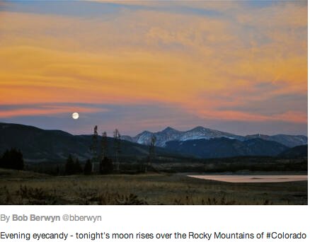
The agreement has implications all the way upstream to the Colorado River headwaters in Summit County. Colorado water managers said the agreement shows that both countries recognized that managing growing demands for the river’s water requires creativity and flexibility…

The agreement, known in treaty parlance as “Minute 319,” also includes a water conservation demonstration project, salinity management language, potential opportunities for Mexico to release its storage for environmental flows in Mexico and the opportunity for Mexico to store some of its treaty allocation for delivery in subsequent years…

Recreation on the river is estimated to generate $26 billion in economic output annually and supports a quarter million American jobs in the Colorado River basin. The economic value it provides for Arizona is immense, where the direct spending tied to river recreation equals $3.79 billion every year. Additionally, 53,508 Arizona jobs are directly dependent on Colorado River recreation.

“This landmark measure shows that we do not have to choose between using the Colorado River’s water and maintaining the life of the river itself,’” said Molly Mugglestone, Project Coordinator for business coalition Protect the Flows. “We must continue to implement this smart approach to river policy to protect the Colorado River recreation industry that generates $26 billion in economic output annually and supports a quarter million American jobs. We now encourage Secretary Salazar to focus on how we can designate healthy river flows in other strained stretches of the Colorado River system throughout the Southwest U.S.”

From the Huffington Post (Peter Gleick/Michael Cohen):

The river, which flows through some of the most arid regions of the continent, has never been very large. Now it is so over-tapped that it usually dries up completely some 80 river miles north of its mouth atop the Gulf of California. The river’s once-lush delta — memorably described in Aldo Leopold’s eloquent “Green Lagoons” — has been tamed and tilled and converted to irrigated agriculture, or else lies desiccated and barren, deprived of the water and sediment the river once carried in abundance…

After more than 15 years of research and advocacy to get water back in the river, this remarkable achievement is a huge step forward for the embattled Colorado River delta. It is incredibly satisfying to think that the dedicated efforts of so many people, over so many years, have led to this historic moment. It is a long overdue end to the incredibly destructive 20th Century notion that not a drop should be left instream and it is a major step to more sustainable management of the Colorado River — the lifeblood of the Southwest.

From the BBC:

The US and Mexico signed a treaty in 1944 governing the allocation of resources from the Colorado River, which supplies seven US and two Mexican states. But in the ensuing decades, population growth, increased industry and farming, as well as droughts have put pressure on the river.

The latest accord, which runs until 2017, is a major amendment of the original treaty. This stipulated that the US must send a set amount to Mexico, enough to supply some three million homes, no matter how low the river level. But now, Mexico will forgo some of its share during drought, a practice already followed by the states of California, Arizona and Nevada.

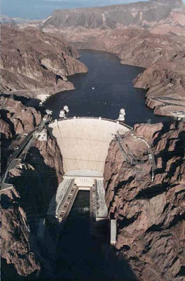
In return, Mexico, which has little storage capacity, is allowed to store water in times of surplus in Lake Mead, a vast reservoir by the Hoover Dam on the Arizona-Nevada border. Mexico will also get $10m to repair irrigation channels damaged during a 2010 earthquake. There will also be funding to restore the Colorado River delta, which has largely dried up.

More coverage from National Geographic (Jennifer Pitt):

…on November 20, 2012, Mexico and the United States turned a new page in their relationship to the Colorado River, joining together to restore flows to the Colorado River Delta. Leaving behind unilateralism, the two countries united to sign the most important bilateral Colorado River agreement since the 1944 Treaty. The term of the agreement is short – five years– but the framework it sets and the tools it provides are exactly the kind of innovations that will be needed for both the river and the communities who use it to weather the impacts of climate change.

Moreover, there is every expectation that if that agreement works as hoped, the commitments will be renewed. The agreement signed today provides water for the delta, as well as a system to share water surpluses in times of plenty and shortages in drought. It allows Mexico to store water in Lake Mead, benefitting Mexico and the U.S. states dependent on this vital reservoir, and it commits the two countries to cooperative investments in water conservation, with benefits accruing both to water users and the environment…

There are many heroes in this story, most of them dedicated bureaucrats working for myriad agencies in both countries whose names will never be recorded in the history books, but whose patience, persistence, and belief that there is a better way resulted not only in increased certainty for water users on both sides of the border, but also in the prospect of a Colorado River that runs all the way to the sea. Working together, Mexico, the United States, and the river’s many users can restore the Colorado River Delta.

More Colorado River Basin coverage here and here.

South Platte River Basin: BLM delays oil and gas leases in South Park

uppersouthplattebasin.jpg

From The Denver Post (Bruce Finley):

The Bureau of Land Management released environmental-assessment documents that cited concerns about water resources, state parks, critical wildlife habitat, recreation, tourism and visual factors as reasons for deferring action on six South Park parcels that were to be offered for lease in February.

The leasing of the parcels would let companies drill for possible oil and gas.

“The parcels will not be offered in February. They could be offered at subsequent lease sales or never offered for sale,” BLM spokesman Steven Hall said. “Concerns about water quality, fracking, impacts of development on the South Park quality of life and impacts to wildlife habitat were all cited by those opposed to oil and gas leasing.”

More South Platte River Basin coverage here and here.

Recreation Industry Praises High Flow Release at Glen Canyon: Target maximum release is 42,300 cfs #CORiver

Here’s the release from Protect the Flows (Molly Mugglestone):

Today, the U.S. Department of the Interior triggered the first “high-flow experimental release” at Glen Canyon Dam since 2008.

According to Interior, the release, which will last nearly five days, is part of a new long-term protocol to meet water and power needs, allow better conservation of sediment downstream, and better control the non-native fish population from preying on other species. The high release flows are geared to mimic historical pre-dam spring floods and runoffs.

Protect the Flows member George Wendt, President and CEO of OARS Outdoor Adventure River Specialists, which has been providing Grand Canyon rafting experiences since 1969, made the following statement in response:

“The water released this week is the first in a long term plan that will help to build new camping beaches in the Grand Canyon, and ultimately, will improve the canyon experience for boaters supporting a $26 billion recreation economy that depends on the Colorado River. We applaud the Department of Interior for taking these important steps that take into consideration the long term use of the canyon by boaters. This release shows an attempt at good stewardship of the area and is an example of how the conservation community and those who love to recreate on the river worked together with the Department of Interior on a solution that both fish and rafters will benefit from for years to come.”

Here’s the release from the U.S. Department of Interior (Blake Androff/Lisa Iams):

Secretary of the Interior Ken Salazar today triggered the first “high-flow experimental release” at Glen Canyon Dam, under a new experimental long-term protocol to better distribute sediment to conserve downstream resources, while meeting water and power needs and allowing continued scientific experimentation, data collection, and monitoring on the Colorado River.

The new protocol calls for experimental releases from the dam through 2020 to send sediment downstream to rebuild sandbars, beaches, and backwaters. The rebuilt areas will provide key wildlife habitat, enhance the aquatic food base, protect archeological sites, and create additional camping opportunities in the canyon.

“This is truly an historic milestone for the Colorado River, Grand Canyon National Park, and the United States Bureau of Reclamation,” said Salazar. “It was an honor to open the door to a new era for Glen Canyon Dam operations and the ecology of Glen Canyon National Recreation Area and Grand Canyon National Park – a new era in which we realize that the goals of water storage, delivery and hydropower production are compatible with improving and protecting the resources of the Colorado River.”

The new protocol is built on more than 16 years of scientific research and experimentation conducted under the Glen Canyon Dam Adaptive Management Program. The Department translated the research into a flexible framework that enables scientists to determine, based on the best available science, when the conditions are right to conduct these releases to maximize the ecosystem benefits along the Colorado River corridor in Glen Canyon National Recreation Area and Grand Canyon National Park.

With the Glen Canyon Powerplant running at full capacity, Secretary Salazar opened the river outlet tubes at noon, releasing additional flows that will increase throughout the day until a maximum release of approximately 42,300 cubic-feet-per-second is reached. These releases will continue for nearly five days based on the parameters specified in the protocol and the volume of sediment deposited by the Paria River since late July, which scientists estimate is approximately 500,000 metric tons, enough to fill a football field 230 feet deep.

Through the foundation laid by the protocol, annual experiments can be conducted through 2020 to evaluate the effectiveness of multiple high flow experimental (HFE) releases in rebuilding and conserving sandbars, beaches, and associated backwater habitats that have been lost or depleted since the dam’s construction and operation. The protocol identifies the conditions under which a high flow release will likely yield the greatest conservation and beneficial use of sediment deposited by inflows from Colorado River tributaries as a result of rainstorms, monsoons, and snowmelt.

“Favorable sediment conditions in the system only occur periodically, so the ability to respond quickly and make the best use of those deposits when the time is right is essential,” said Anne Castle, Assistant Secretary of the Interior for Water and Science. “Today’s experimental release under the new protocol represents a significant milestone in our collective ability to be nimble and responsive to on-the-ground conditions for the benefit of downstream resources.”

HFE releases simulate natural flood conditions that suspend and redeposit sand stored in the river channel to provide key wildlife habitat—including habitat for the endangered humpback chub, protect archaeological sites, enhance riparian vegetation, maintain or increase recreation opportunities, and improve the wilderness experience along the Colorado River in Glen and Grand canyons. Single experimental releases were conducted in 1996, 2004, and 2008, and included extensive scientific research, monitoring, and data collection by the U.S. Geological Survey’s Grand Canyon Monitoring and Research Center, the Bureau of Reclamation, the National Park Service, and the U.S Fish and Wildlife Service.

“These high-flow releases, a new paradigm in water management, recognize that there are hugely beneficial impacts to river ecology from releasing the requisite water needed downstream in large pulses, rather than uniformly throughout the year,” said USGS Director Marcia McNutt. “In the arid West, non-uniform flow better mimics the natural environment in which the plants and animals flourished.”

This scientific process will continue and the knowledge gained from today’s experimental high flow will be used to make further refinements in determining the optimal timing, duration, frequency, and conditions for future releases as well as to inform other management actions on the river.

“As the 1992 Grand Canyon Protection Act emphasizes, the resources of the Grand Canyon are fragile, and conservation of those resources can only be achieved through wise management by today’s leaders,” said National Park Service Director Jonathan B. Jarvis. “Today’s event marks the beginning of the next generation of wisdom for managing this special place. We have only one Grand Canyon. We want to thank the Secretary for his leadership and conservation of this special place now and into the future.”

The protocol represents one of two important milestones in the history of the Colorado River. The second, a program to control non-native fish species, provides a framework for actions and research to protect native endangered fish in the river downstream of the dam. The finalization of both efforts involved extensive government-to-government consultation with Native American tribes to ensure implementation of the programs in a manner that respects tribal perspectives.

“The Bureau of Indian Affairs supports the cooperating tribes’ active involvement in the Glen Canyon Dam Adaptive Management Program,” said Assistant Secretary for Indian Affairs Kevin Washburn. “Many of their insights were incorporated into the process leading to the HFE event. Their strong connections to the Grand Canyon, including their cultural, historic and religious ties, give them a unique perspective on this national treasure. I want to thank the tribes for their long stewardship and their full participation in this important effort to conserve and protect the Colorado River ecosystem.”

The additional water released as part of the HFE is part of the annual water delivery to the Lake Mead. “The volume of water we are releasing during this high flow experiment does not change the overall volume of water delivery in the 2013 water year,” said Reclamation Commissioner Michael L. Connor. “The current operations plan based on forecast data calls for releasing 8.23 million acre-feet of water from the dam to meet delivery obligations to the Lower Colorado River Basin and Mexico. The experimental flows are included in that total annual volume and will be offset by adjustments to the monthly release volumes throughout the rest of the water year.”

“This new protocol developed by Reclamation will protect both the Grand Canyon and the delivery of water for communities, agriculture and industry,” Salazar noted. “We are taking a practical approach. If, for any reason, the new high-flow experiments do not yield the positive results we anticipate, we have the ability to change and adjust future flows.”

In addition to the opportunities for HFE releases made possible under the protocol, Secretary Salazar has initiated the first comprehensive analysis of Glen Canyon Dam operations since 1996. The Glen Canyon Dam Long-Term Experimental and Management Plan Environmental Impact Statement will build on information obtained through the Adaptive Management Program and activities conducted under the protocol to analyze a broad scope of dam operations and other related activities. The goal is to determine specific alternatives that could be implemented to improve and protect downstream resources while adhering to applicable laws. Reclamation and the National Park Service are jointly developing the LTEMP EIS, which will ultimately integrate and further refine actions conducted under the protocol.

Here’s a technical description of what the USGS hopes to accomplish (Jack Schmidt/Barbara Wilcox). Here’s an excerpt:

“Throughout summer and fall 2012, the USGS research team developed, and continually revised, estimates of the total amount of sand and of mud delivered by the Paria River, as well as estimating the fate of that fine sediment as it was transported further downstream through the Grand Canyon,” said Jack Schmidt, chief of the USGS Grand Canyon Monitoring and Research Center. “These data are the scientific foundation on which the planned high-flow experiment is based. Without the estimates of the amount of sand and mud delivered from tributaries, it would not have been possible to implement the Protocol for these high flow experiments. The entire program of utilizing small controlled floods to rehabilitate the Grand Canyon ecosystem depends on state-of-the-science monitoring efforts by the USGS to measure sediment transport rates in real time and to provide those data to the Bureau of Reclamation and to other agencies.

“The USGS program of measuring and reporting sand and mud transport in real time and in such a challenging environment is unprecedented in the scientific management of rivers,” Schmidt said.

USGS data show that the Paria River delivered at least 593,000 tons of sand to the Colorado River between late July and the end of October 2012 – enough to fill a building the size of a 100-yard NFL football field about 24 stories high. Long-term measurements show that this amount is about 26 percent less than delivered by the Paria in an average year, but is still sufficient to trigger a small controlled flood intended to rehabilitate the downstream ecosystem.

From the Associated Press via Las Vegas Review-Journal:

Interior Secretary Ken Salazar opened the river outlet tubes at noon and called it “an historic milestone” and “a new era in which we realize that the goals of water storage, delivery and hydropower production are compatible with improving and protecting the resources of the Colorado River.” The peak flow will last 24 hours from Monday night into Tuesday, and the river will run high for five days…

The experiment could hurt next year’s fishing – and complicate hydropower production and water storage – in the name of a more environmentally correct river…

Previous experiments in 1996, 2004 and 2008 were one-time fact-finding missions instead of fundamental shifts in river management.

“This (Obama) administration can be patted on the back and thanked for doing what we’ve been trying to do, seriously, for 15 years,” Lash added.

The previous experiments yielded mixed results, partly because a return to up-and-down flows timed partly to regional summer hydropower needs wiped out many of the new beaches and sandbars.

Advocates hope the effects will be longer lasting if these floods come more regularly and if a longer-term Interior Department planning effort leads to steadier flows through the summers.

But critics say that there’s little environmental benefit and that it comes at a cost.

In comments submitted to the Interior Department before the decision to go forward with regular flushes, the Colorado River Energy Distributors Association, a group of nonprofit energy utilities, noted that previous springtime flood experiments helped boost the population of non-native trout that feed on the endangered humpback chub.

More Colorado River Basin coverage here and here.