
From the Grand Junction Daily Sentinel (Dave Buchanan):
The warm temperatures and dry conditions facing ski resorts and water managers are discouraging but not unprecedented, and no one can say if it’s part of a longer trend.
There’s little anyone can do except look to the skies and hope the drought ends soon, but memories are long.
Many veterans of the state’s ski industry still shudder when recalling the winter of 1976-77, a year when the April 1 snowpack peaked at 46 percent of long- term average, making that year the driest in memory.
This year’s unexpectedly warm temperatures and bare slopes have many people this winter already comparing it to last winter, when many resorts didn’t see significant snowfall until January, too late for the important Christmas-New Year’s holiday.
While the expansion of snowmaking in the last 25 years has helped save at least part of a dry ski season, it’s not enough to save the entire season.
Vacationing skiers disappointed in the holiday snowpack fail to return later in the season, even after snow conditions improve.
It’s no coincidence that snowy years mean more skiers.
According to the National Ski Areas Association, the record-breaking snows of 2010-11 attracted an estimated 60.54 million skier/rider visits nationwide, the highest total ever.
One year later, the 2011-12 season saw the lowest national average resort snowfall since 1991-92 and the nation as a whole saw skier and rider visits drop to 51 million, the lowest total since 1991-92 (50.8 million).
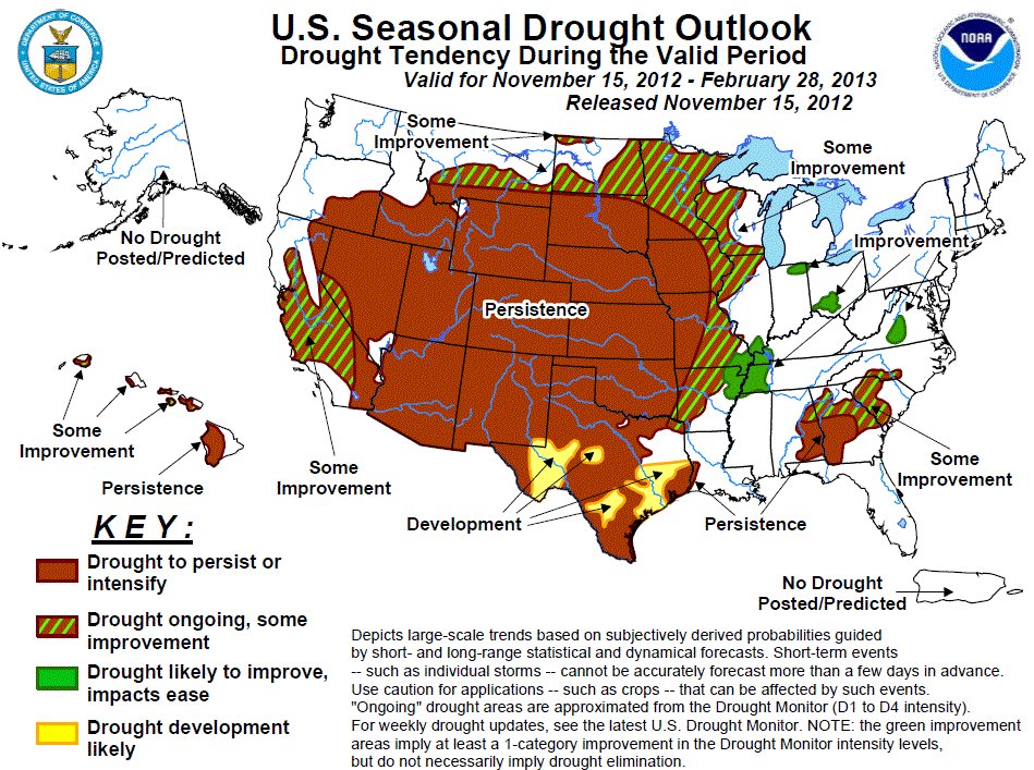
A forecast reminiscent of last winter is in the works this year, with the National Weather Service’s 90-day outlook calling for above average temperatures and little certainty in improved precipitation patterns.
How could the state go from record snows to drought in a year? Why can’t we just be average for a while?
“There are such huge variations in year-to-year precipitation patterns, it’s hard to say what’s ‘average,’ ” state climatologist Nolan Dosken said Monday at Colorado Mesa University. “Are we really ever at ‘average’? Probably not.”
Doesken, who addressed “Drought History in Colorado” as part of CMU’s Natural Resources of the West: Water and Drought series, said there is little sense and even less pattern in tracking the state’s drought history.
“It’s all over the place,” he said. “Temperature fluctuation is like this (making tiny wiggles with his fingers) while precipitation is like this,” waving his arms up and down.
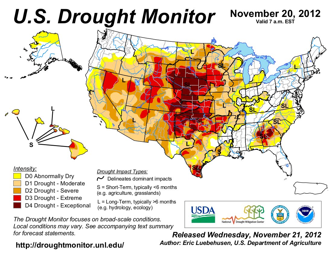
“Except for the mountains, the state is already pretty dry much of the time.”
That makes ski resorts de facto water managers, their slopes providing a part of the summer runoff, key to water supplies across the state.
Likewise, water managers are thinking of last year, when the snowpack tied for second lowest (with 2002) at 52 percent of average.
Only in 1977 was the snowpack less.
What might be of concern is four of the eight lowest years have come in the past 12.
“We’ve been closely monitoring water releases as much as possible and we’re certainly looking at the forecast,” said Dan Crabtree, lead hydrologist for the Bureau of Reclamation in Grand Junction. “You look at the NOAA forecast and it doesn’t really give you much hope things are going to change.”
What role does global climate change play?
“There’s nothing to base that decision on,” said Doesken, emphasizing he was speaking from a personal view. “But do I see enough of a (warming) trend to concern me? Oh, yeah.”
Crabtree said resource managers recognize the state is coming off a “lousy water year.”“The more the sun shines and the more we have 50-degree days in November really causes us concern,” he said.
More education coverage here.