
Click here to cast your vote for the MTV vma 2017 awards.
Day: August 7, 2017
Death Valley had hottest month ever in Western Hemisphere in July #ActOnClimate

From The Las Vegas Review-Journal (Henry Brean):
The famously fiery national park 100 miles to the west set an unpleasant record in July with an average temperature of 107.4 degrees. That ranks as the hottest month ever measured in the Western Hemisphere, according to the National Weather Service.
Christopher Burt thinks it might be a world record as well.
The weather historian for Weather Underground said he only knows of one monthly average that’s higher — 107.44 degrees recorded in July 2014 at a military base in northern Saudi Arabia — but that measurement has been discredited because it apparently didn’t include overnight temperature readings.
“So far nobody’s come up with another figure that’s higher than Death Valley’s,” Burt said.
Andy Gorelow, a meteorologist with the National Weather Service in Las Vegas, said unusually hot conditions at night were largely responsible for the new monthly record in Death Valley.
The average low at the park’s official weather station in Furnace Creek, California, was 95.1 in July, the warmest of any month on record by more than a full degree.
By comparison, Gorelow said, “the highs really weren’t that high.”
That’s relatively speaking, of course.
The average high in Death Valley last month was 119.6 degrees. July 7 was the single hottest day, with a high of 127. The temperature never dropped below 89 all month.
@KHayhoe: “On Being a Climate Scientist in Texas”
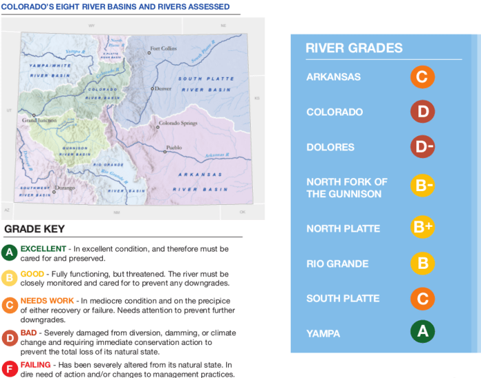
@ConservationCO rates Arkansas River = “C”
Here’s a guest column from Beau Kiklis writing in The Pueblo Chieftain:
My organization, Conservation Colorado, just released a report card that looks at the state of our rivers and how we can work to protect them. In it, we evaluate and grade the health of eight major rivers in Colorado, based on factors including water quality, the presence of dams and how much water is diverted out of the river and sent to be used elsewhere.
Here in the Arkansas River Basin, the Arkansas River received a “C” grade, meaning it is in mediocre condition and needs our attention.
The Arkansas River Basin is the largest basin in Colorado, making up nearly a third of the state’s total land area. Cities including Pueblo and Colorado Springs are located in the basin and get their water from this critically important river.
A tributary to the Mississippi River, the Arkansas is born from snowmelt high in the rugged Sawatch Mountains above Leadville. It serves several states as it cascades east and eventually spills into the Gulf of Mexico. The wild upper section of the Arkansas River is famous for containing Colorado’s longest stretch of gold medal trout fishing waters, spectacular scenery and thrilling whitewater boating opportunities through the Numbers and Browns Canyon National Monument.
However, up in the mountain headwaters, human impacts have marred this river, mainly due to pollution from the area’s more than 150-year legacy of hardrock mining. Mining pollution taints the water quality in the Arkansas and while various remediation and clean-up efforts have improved the river from its previous state of poor water quality, the work is not done — many abandoned mine sites continue to pollute the river today.
While much of the upper stretch of river has improved over time, the lower Arkansas faces its own unique challenges, mainly the need to provide water for the bustling cities of Pueblo and Colorado Springs, as well as an established agricultural economy. Today, the Arkansas River Basin has the second-highest percentage of urban and commercial water use in the state, leaving farmers downstream struggling to irrigate their crops with limited water.
As the trend of urban growth prevails, it is critical that we manage our water with the future of our agricultural and recreational economies in mind. Consider this: average flows on the Arkansas River have decreased by 17 percent over the last 10 years. While this cannot be attributed to any one thing, it would be hard not to point to the cities outside of the Arkansas River Basin that buy up agricultural water rights to meet their own demands. When water is moved outside of the basin, it contributes heavily to decreasing river flows.
Luckily, the Arkansas River is an excellent example of how collaboration and innovation can provide solutions to the issues facing our rivers.
For example, some Arkansas River irrigators are choosing to take part in water conservation programs and are advocating for even more tools to improve flexibility for sharing and leasing their water without compromising their water rights. These new ideas avoid drying up farmland and help our water supply go further. And it can stretch even further if cities and towns also work to improve the efficiency of their own water use.
It’s important to note that recreation and tourism contribute $1 billion to the economy of the Arkansas River Basin every year and therefore we should put time and effort into fostering them.
Out of the eight rivers we assessed in our report card, only one received an “A” grade, while four received a grade of “C” or less. In short, our Colorado rivers face significant challenges, but there are many ways that we can make a difference for them. If we work together to save water, prioritize safe drinking water, and implement innovative policy solutions, we can ensure a future where our rivers are clean and flowing.
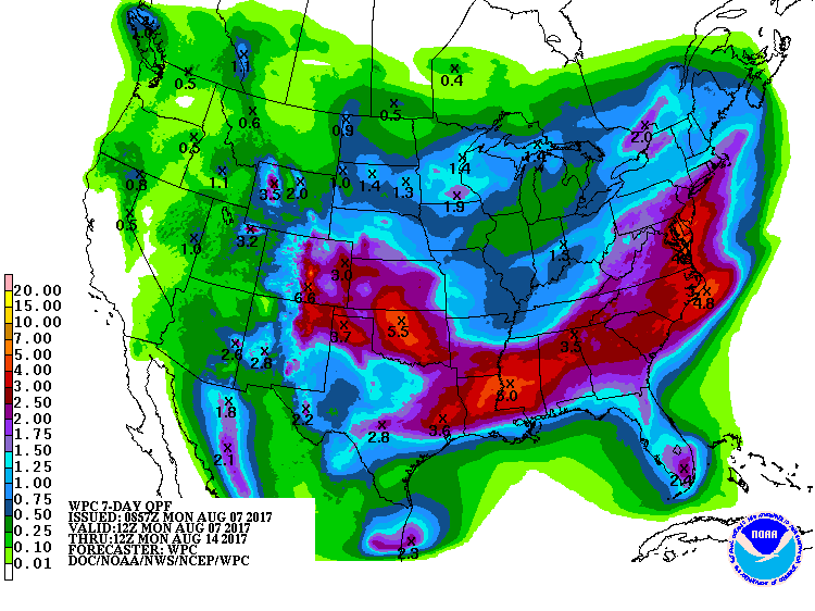
#Monsoon2017 brings cooler temperatures to Front Range
From Denverite (Andrew Kenney):
“It looks like we’re tapping a rich vein. We’ve got the right flow patterns, unless we continue to be unlucky,” said Jeff Lukas, research integration specialist for the Western Water Assessment at CU Boulder.
Here’s a quick review of our summer weather and what may happen for the rest of the month. As a bonus, I made Lukas explain thunderstorms.
Why it was so hot:
“In July, the northern Front Range and most of the rest of Northeastern Colorado just got unlucky,” Lukas said.
In the summertime, a lot of Colorado’s moisture blows in from the Gulf of Mexico, which is to our southeast.
That monsoon wasn’t reaching Colorado for much of June, leaving the state dried out. It blew better in July, delivering storms to Castle Rock and points south, but few reached Denver.
And without cloud cover to absorb sunlight, temperatures were running up to 4 degrees above normal in June and 2 degrees above normal in July, recently maxing out at 102 degrees, Lukas said.
“You’re not getting the moisture in the soil and the vegetation that acts as kind of a swamp cooler for summer days in Denver,” Lukas said.
But while it was hotter than normal, he said, it was “nothing like the record hot summers we’ve had,” referring to 2000 and 2012 in particular.
Denver as of this week was still “abnormally dry,” according to the U.S. Drought Monitor.
What’s happens next:
The monsoon has put much more moisture over the Front Range in the last 10 days, returning the southern part of the metro to average or above-average precipitation, Lukas said.
“Sterling has been getting hammered in the last week,” he explained. Still, “the flow is just not quite fully getting to all parts of the front range.”
Boulder, Denver and Arapahoe counties have remained relatively dry over the last week, though they’ve certainly had more clouds and rain.
“Even when the flow pattern’s really good, the storm may not quite hit,” Markus said. But if the current trend holds, we’ll at least have more chances for rain.
The national Climate Prediction Center forecasts that August will see below-normal temperatures and above-normal rain in August.
How storms move:
I was a bit confused when Markus mentioned that the monsoon wind blows from the southeast to the northwest. Don’t thunderstorms and snowstorms both roll in from the western mountains out onto the plains?
They do! But it’s more complicated than that. The moisture flow tends to come in at a really low level, Markus said. If you’re standing on a reservoir, the wind at the surface might indeed be blowing in from the east.
That moisture starts to accumulate into storm clouds as it reaches the higher terrain. “The thunderstorms will build — and once they get 10,000, 15,000 feet up, they’ll hit the westerly flow at upper levels and start drifting to the east,” Markus said.
“By the time they get out to I-25, you can start getting some more mature thunderstorms.”
In other words, the wind higher up is still blowing from west to east, and it carries the rising thunderstorms back from the mountains out onto the plains.
What about winter?
The CPC’s three-month projections, running through October, show somewhat hotter temperatures and more rain than normal for most of Colorado.
However, climate models get pretty bad once you try to go more than a couple weeks out. The first decent estimates should arrive around September or October, Markus said — but even then, they’re unlikely to accurately predict the kind of topsy-turvy shifts we saw last year.

The effects of #ClimateChange during summer 2017 #ActOnClimate #KeepItInTheGround
Here’s a guest column from Malin Moench that’s running in The Salt Lake City Tribune:
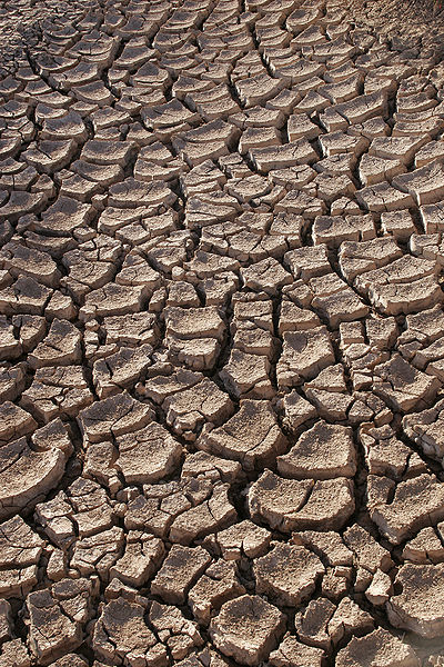
This summer, Salt Lake City has already suffered a dozen days over 100 degrees with August still to come. This spate of hot, stagnant air has left us breathing ozone and fine soot that are twice the health limits set by the EPA.
If you think this weather is nothing to worry about because it is atypical, think again. This summer is a preview of the new normal for Utah and the American Southwest. Currently, Salt Lake City averages six 100-degree days per year. Climate scientists estimate that Salt Lake will average 58 100-degree days per year by the end of this century if CO2 continues to build up in the atmosphere at current rates. The resulting heat and drought predicted by the year 2100 will turn the Salt Lake and Utah valleys to blowing dust.
The media used to be filled with claims that our climate is not actually warming. Because the last 19 years include 17 of the hottest years on record, few now deny the warming trend. However, many still deny that the trend has a human cause.
Climate scientists have a different view as 99.5 percent of them now say that the predominant cause of climate change is the massive amount of fossil fuel that been burned since the world began to industrialize in the mid-19th century.
The basics physics that explains why rising CO2 warms the climate is simple. Sunlight is mostly short-wave radiation (visible light). When it reaches the earth’s atmosphere, CO2 molecules scatter it, rather than absorb it. When this short-wave radiation strikes the surface of the earth, however, it converts to long-wave radiation (infrared, or “heat”). When heat is reflected back into space, CO2 absorbs it like a sponge.
This is the physics in a nutshell: The CO2 molecule holds two oxygen atoms loosely on either side of the carbon atom. The two oxygen atoms are able to flex around the carbon atom like the wings of a bird. This flexing allows the CO2 molecule to absorb infrared radiation. This greenhouse effect is powerful. Without it, climate scientists agree that the earth’s entire surface would be freeze solid.
As carbon dioxide accumulates, it puts those who live in the American West in great peril. In 2015, scientists from NASA, Cornell and Columbia University applied a 1,000 years of climate-history data to 17 independent climate models. Those models consistently predicted that at current rates of CO2 build up, increased heat and reduced precipitation in America’s Central Plains and Southwest will drive much of the remaining moisture out of these regions’ soil.
The study calculates that there is an 80 percent chance that, before the end of this century, Utah and the American Southwest will experience a drought deeper than the 10-year Dust Bowl of the 1930s, but lasting three times as long.
Such a drought will cripple agriculture in the nation’s breadbasket, cut the flow of the Colorado River in half, transform the forests of the Rocky Mountains into dead kindling, and increase their burn area by 500 percent. In other words, it will bring both environmental and economic ruin to America’s Central Plains and Southwest.
President Trump only appoints people to federal policy positions who ignore or deny the basic physics of climate change described above. He is hastening the day that Utah becomes uninhabitable because he plans to extract and burn every last ton of America’s dirty energy reserves, saying that this will make America great again.
One has to wonder how great America will be when its western half becomes an uninhabitable dust bowl and most of its residents have become climate refugees.
Malin Moench, Holladay, has degrees in law and economics from the University of Utah. After 37 years of legal analysis and econometric modeling work for the federal government, he now volunteers for the Citizens Climate Lobby.
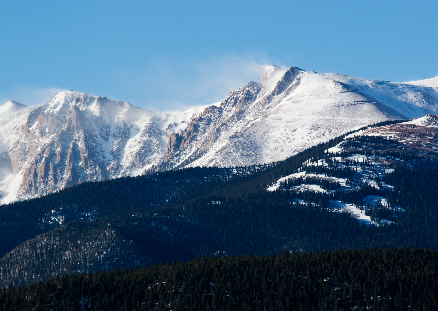
#Snowpack = #Colorado water supply
Credits: iStock
From TheDenverChannel.com (Eric Lupher, Kevin Krug):
“If you go to your tap, four out of every five glasses of water you will fill up will have originated as snow,” said hydrologist Keith Musselman of the National Center for Atmospheric Research (NCAR).
Musselman says the most sobering thought is that we are so reliant upon the resource.
“It’s that reliance and the increase in population here on the Front Range and in many cities across the west where we need to know exactly how much water there is in any given year,” he said.
Snow survey supervisor Brian Domonkos of the U.S. Department of Agriculture uses data collected at Snotel sites around the state to keep an eye on how much water is in Colorado’s snowpack.
“During the winter we want snow. During the summer, we want an appropriate amount of rain,” he said.
Domonkos agrees that water is increasingly important here in Colorado, but points out that what happens in Colorado impacts everyone downstream as well.
“There’s a lot that goes into it on top of making sure that all of your water users down below are getting the water they need,” Domonkos said. “Providing that water to them as well as making sure you’re retaining in stream flows and meeting all your compacts for downstream water users, downstate… it’s extremely complex.”