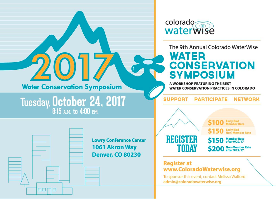
Join us for the 9th Annual Colorado WaterWise Water Conservation Symposium in Denver, Colorado! We have a great program being created that will appeal to many audiences.

Join us for the 9th Annual Colorado WaterWise Water Conservation Symposium in Denver, Colorado! We have a great program being created that will appeal to many audiences.

Here’s the release from NCEI:
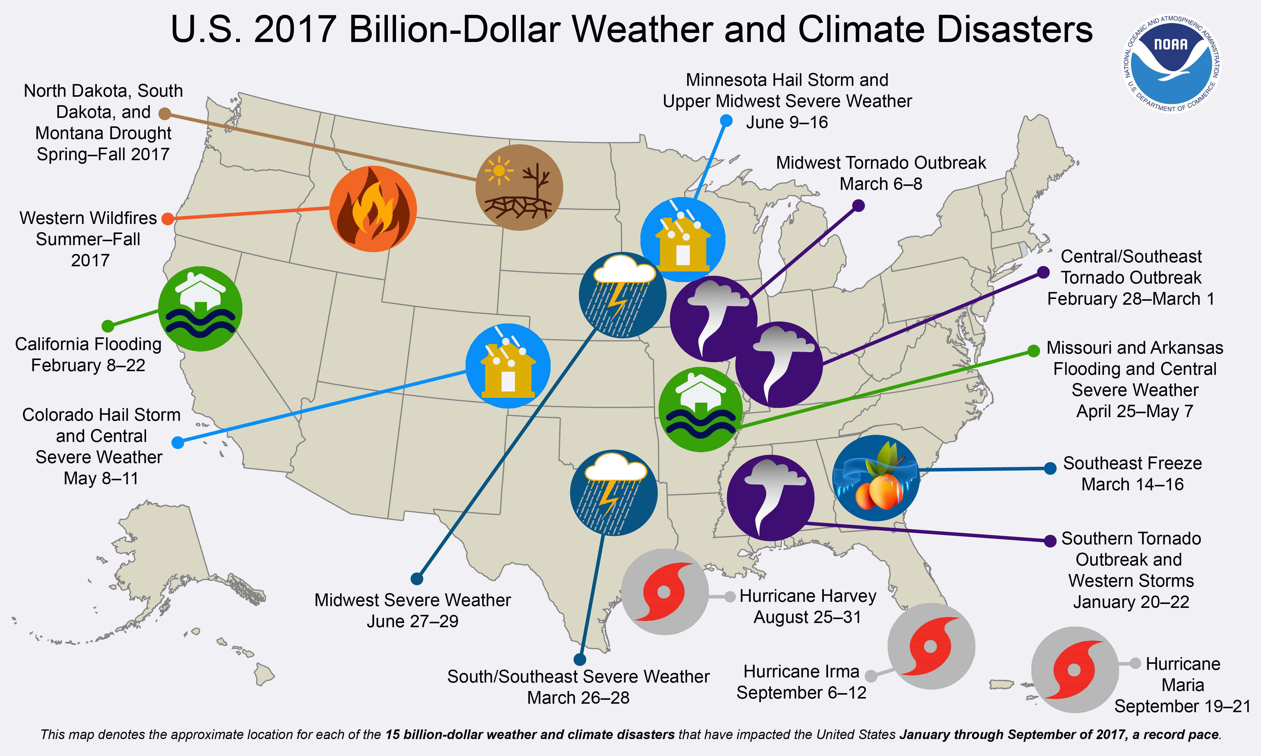
7 things to know about NCEI’s U.S. billion-dollar disasters data
Drought, floods, freezing temperatures, severe storms, tropical cyclones, wildfires, winter storms—every year since 1980, these weather and climate disasters have claimed countless lives and caused billions of dollars in damages in the United States. And, it is NCEI’s job to chronicle these disasters and document their impacts to the Nation.
1. Why study the cost of weather and climate disasters?
NCEI is the Nation’s scorekeeper in terms of addressing severe weather and climate events in their historical perspective. As part of our responsibilities of monitoring and assessing the climate, we track and evaluate climate events in the United States that have great economic and societal impacts.
NCEI’s U.S. billion-dollar disaster analysis seeks to bring the best public and private disaster loss data together in a systematic approach. To that end, we maintain a consistent record of weather and climate disasters with costs equaling or exceeding $1 billion in damages (adjusting for inflation) using high-quality data sources and peer-reviewed methods. This enables us to provide historical context to these events when they occur while quantifying their total, direct costs.
Our data and information are used to examine past events and gauge future risk. The National Hurricane Center, the reinsurance industry, and catastrophe modelers incorporate such information into their assessments, to contextualize risk and loss potential for communities across the Nation.
NCEI currently monitors and assesses the costs and impacts of:
-Hurricanes
-Drought
-Inland floods
-Severe local storms
-Wildfires
-Crop freeze events
-Winter storms2. What are the most costly weather and climate disasters?
In short, tropical cyclones are the most costly of the weather and climate disasters. Since 1980, the U.S. has sustained at least 218 weather and climate disasters where overall damages/costs reached or exceeded $1 billion (including Consumer Price Index adjustment to 2017). The total cost of these 218 events exceeds $1.2 trillion. However, this total does not include the costs for Hurricanes Harvey, Irma, and Maria, which are substantial and are still being assessed.
Not including hurricanes Harvey, Irma, and Maria, 35 tropical cyclones have caused at least $583.5 billion in total damages—with an average of $16.7 billion per event. Accounting for just under a fifth (17 percent) of the total number of events, tropical cyclones have caused almost half (47 percent) of the total damages attributed to billion-dollar weather and climate disasters since 1980. These numbers will dramatically rise once the 2017 hurricanes costs are included.
Following tropical cyclones, the most costly event types are:
1. Drought, with an average cost of $9.4 billion per event
2. Flooding, with an average cost of $4.3 billion per event
3. Freezes, with an average cost of $3.4 billion per event
4. Winter storms, with an average cost of $3.1 billion per event
5. Wildfires, with an average cost of $2.5 billion per event
6. Severe storms, with an average cost of $2.2 billion per eventFor more information on the distribution of damage from these billion-dollar disaster events, see our summary statistics.
3. Has every state experienced a billion-dollar disaster?
While each region of the United States faces a unique combination of weather and climate events, every state in the country has been impacted by at least one billion-dollar disaster since 1980. Over 94 of these disasters have affected at least some parts of Texas, while only one event has impacted Hawaii (Hurricane Iniki in 1992).
Wildfires are most common west of the Plains states and in several Southeastern states. Inland flood events—not caused by tropical cyclones—often occur in states near large rivers or the Gulf of Mexico, which is a warm source of moisture to fuel rainstorms. Drought impacts are mostly focused in the Southern and Plains states where crop and livestock assets are densely populated. Severe local storm events are common across the Plains, Southeast, and Ohio River Valley states. And, winter storm impacts are concentrated in the Northeastern states while tropical cyclone impacts range from Texas to New England but also impact many inland states.
In total, the Central, South, and Southeast regions typically experience a higher frequency of billion-dollar disasters than other regions.
To visualize the the frequency and cost of billion-dollar disasters, check out our mapping tool.
4. How do you calculate a disaster’s price tag?
In calculating the cost assessments, we receive input from a variety of public and private data sources including:
– Insurance Services Office
– Federal Emergency Management Agency
– U.S. Department of Agriculture
– National Interagency Fire Center
– Energy Information Administration
– U.S. Army Corps
– State agenciesEach of these data sources provides key pieces of information that capture the total, direct costs—both insured and uninsured—of weather and climate events. These costs include:
– Physical damage to residential, commercial, and government or municipal buildings
– Material assets within a building
– Time element losses like business interruption
– Vehicles and boats
– Offshore energy platforms
– Public infrastructure like roads, bridges, and buildings
– Agricultural assets like crops, livestock, and timber
– Disaster restoration and wildfire suppression costsOne of the key transformations is scaling up insured loss data to account for uninsured and underinsured losses, which differs by peril, geography, and asset class.
However, these loss assessments do not take into account losses to natural capital or assets, health care related losses, or values associated with loss of life. Therefore, our estimates should be considered conservative with respect to what is truly lost, but cannot be completely measured.
5. How long does it take to calculate the price tag?
The scale and complexity of a disaster greatly influence the length of time to assess the losses. We’re seeing this with Hurricanes Harvey, Irma, and Maria right now. Hurricanes are particularly challenging, because it takes time to better understand the wind versus water damage losses across a variety of assets (like homes, businesses, boats and vehicles, infrastructure, and agriculture) and how much of this damage is insured versus uninsured. In contrast, with more localized events—like a Colorado hail storm—where property is highly insured, we can more quickly capture the losses.
6. Are billion-dollar disasters becoming more frequent?
The increases in population and material wealth over the last several decades are an important factor for higher damage potential. These trends are further complicated by the fact that many population centers and infrastructure exist in vulnerable areas like coasts and river floodplains, while building codes are often insufficient in reducing damage from extreme events. Climate change is also playing a role in the increasing frequency of some types of extreme weather that lead to billion-dollar disasters.
7. Has the U.S. experienced more flooding events in recent years?
Billion-dollar inland—non-tropical—flood events have increased in the United States. Most notably, four separate billion-dollar inland flood events occurred in 2016. This doubled the previous record since no more than two of these events had occurred in a year since 1980 until last year.
So far in 2017, two non-tropical inland flood events have affected the country (in California and Missouri/Arkansas). Also, we experienced historic rainfall from Hurricane Harvey, which is tropical-cyclone related flooding. This perhaps should be expected, as heavy rainfall events and their ensuing flood risks are increasing because warmer temperatures are “loading” the atmosphere with more water vapor. Over time, this increases the potential for extreme rainfall events. And, where we build and how we build determines our resilience to the increasing risk of flood events.
For more information on how the different types of billion-dollar disaster events have changed over time, see our time series.
Here’s the release from the EPA Region 8 office (Lisa McClain-Vanderpool):
Wyoming Game and Fish and the University of Wyoming are wetlands grant recipients
The Wyoming Game and Fish Department and the University of Wyoming have each received $112,500 in grant funding from the U.S. Environmental Protection Agency (EPA) to develop protect, manage and restore wetlands in the state of Wyoming. The EPA Wetland Program Development Grants announced today are awarded through a competitive process and are intended to support state and local efforts to increase the quantity and quality of wetlands in the U.S. by conserving and restoring wetland acreage and improving wetland condition.
“Wetland restoration is key to capturing pollutants that impact Wyoming’s natural resources,” said EPA Administrator Scott Pruitt. “Understanding the current health of wetlands and where restoration efforts are most needed will help the many groups working on making the state’s rivers, lakes and streams healthy.”
The Wyoming Game and Fish Department will receive $112,500 to develop a voluntary wetland restoration and protection program and develop plans for critical wetlands throughout the state. Project partners include Ducks Unlimited, the Wyoming Governor’s Big Game License Coalition, and Wyoming Wetlands Society.
“We are excited to receive this funding,” said Steve Tessmann, a biologist with the Wyoming Game and Fish Department. “The grant is supporting a much-needed jump-start of a voluntary wetland restoration and protection program in Wyoming. The effort will also include preparation of plans to manage and improve wetlands located on several State wildlife habitat areas.”
The University of Wyoming is also receiving a $112,500 EPA wetlands grant to carry out a multi-year project to improve the effectiveness of monitoring and assessment methods related to aquatic resources. These improvements will be achieved by developing, testing, and calibrating Wyoming-specific protocols to assess wetland condition and value. This project will support state priorities for wetland monitoring, protection, and conservation, focusing on the effects of climate change in highly managed basins. Project partners include The Nature Conservancy, the Wyoming Game and Fish Department, and the Wyoming Department of Environmental Quality.
“Many people don’t realize that even though the area of marshes, ponds, and streamside forests in Wyoming is small, those wetlands have a large impact on biodiversity and other ecological services,” said Teresa Tibbets, a freshwater ecologist at the University of Wyoming. “Wetlands also often overlap with areas important for agricultural production. Our goal is to develop assessment methods that can inform how we can better manage our water resources to balance the needs of wetland habitats and people.”
EPA Wetlands Program Development Grants assist state, tribal, and local government agencies in building programs that protect, manage, and restore wetlands and aquatic resources. Partners are encouraged to develop wetlands program plans, which help create a roadmap for building capacity and achieving long-term environmental goals. These plans also help prioritize projects and funding needs and ensure that EPA is providing strategic support for states and tribes as they pursue their environmental goals.
For more information visit: https://www.epa.gov/wetlands/wetland-program-development-grants
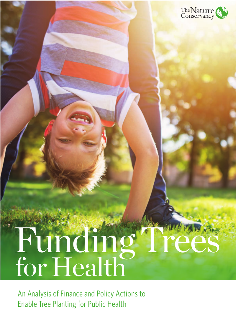
Click here to go to the Nature Conservancy website to read the white paper:
Imagine if there were one simple action that city leaders could take to reduce obesity and depression, improve productivity, boost educational outcomes and reduce incidence of asthma and heart disease among their residents.
Urban trees offer all these benefits and more.
Yet American cities spend less than a third of a percent of municipal budgets on tree planting and maintenance, and as a result, U.S. cities are losing 4 million trees per year.
A new white paper, written by The Nature Conservancy with input from The Trust for Public Land and Analysis Group, identifies street trees as one of the most overlooked strategies for improving public health in our cities.
“For too long, we’ve seen trees and parks as luxury items, but bringing nature into our cities is a critical strategy for improving public health,” said Rob McDonald, lead scientist for global cities at The Nature Conservancy and first author of the white paper.


Here’s a guest column from Pete Wadden that’s running in The Vail Daily:
One of the few things that almost all people can agree on is the calming effect of flowing water. Waterfront property is highly sought after and, as a result, is typically sold at a premium. People often landscape their waterfront property to create an unobstructed view of the river or creek in their backyard.
UNINTENDED CONSEQUENCES
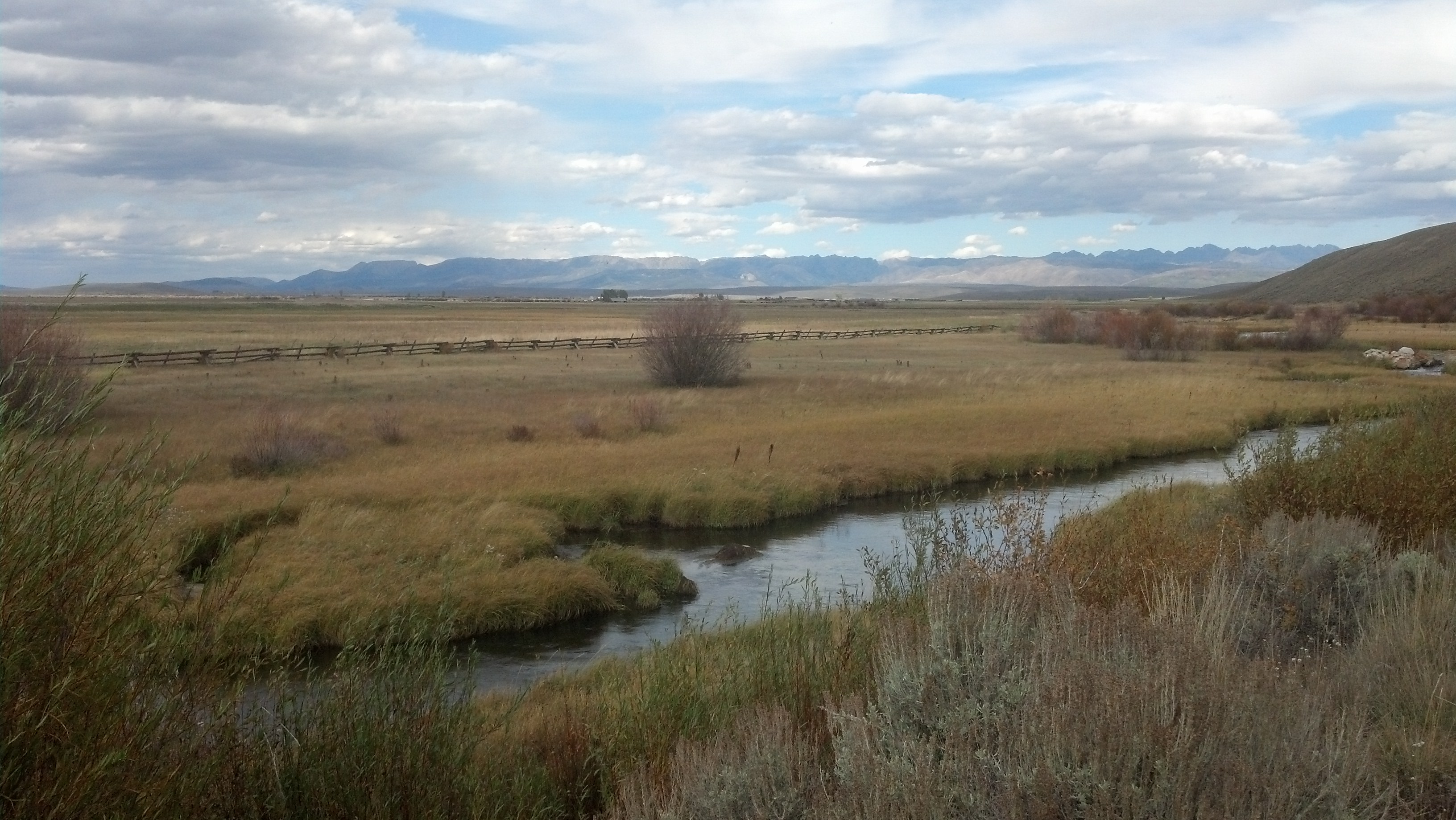
In many places in Colorado, our desire for easy access to the water is having unintended consequences. It may not be surprising to most readers that there is a web of interaction between waterways and the ecosystems that surround them. Riparian corridors, the swaths of water-loving plants that grow along creeks or rivers, protect those waterways from pollution and erosion and provide shade, nutrients and habitat for aquatic animals. When riparian buffers disappear, rivers and creeks suffer.
In the town of Vail, the loss of riparian habitat has had a measurable impact on Gore Creek and several of its tributaries. In 2012, the Colorado Department of Public Health and Environment listed Gore Creek for failing to meet Environmental Protection Agency standards for aquatic life. Other rivers and creeks in Eagle County and across Colorado are beginning to show a similar pattern of decline.
NATURAL FILTRATION SYSTEM
As wetlands and forests are replaced with pavement and turf lawns, services provided by those natural ecosystems are lost. Pavement directs rain and snowmelt into storm drains that flow directly into the creek. The shallow roots of turf lawns do not filter pollution from groundwater the way the roots of willows and other native shrubs do.
The town of Vail sees the impaired health of Gore Creek as a serious issue and has undertaken several programs to try to reverse the creek’s declining water quality. In 2017, the town completed several major riparian restoration projects along Gore Creek. The goal of those projects was to restore native vegetation along creek banks in order to better filter runoff and prevent erosion while maintaining access to the creek for anglers and other users.
PROJECT RE-WILD
The causes of Gore Creek’s recent decline are diverse and widespread. As such, this is not a problem that the town can solve on its own. In order to encourage private property owners to restore riparian habitat on their land, the town of Vail has unveiled Project Re-Wild, a public-private cost-share to assist private property owners with the design of riparian restoration projects. Interested property owners along Gore Creek or its tributaries can learn more about this exciting opportunity under “Programs” at lovevail.org or by calling me at 970-479-2144.
Aquatic health is an issue that impacts the whole community, and the responsibility for maintaining our rivers and creek lies with all of us. Please consider joining the town of Vail in its efforts to Restore the Gore.
Pete Wadden is the town of Vail watershed education coordinator. Contact him at pwadden@vailgov.com, or visit lovevail.org to read more about the town of Vail’s environmental and sustainability efforts.
Click here to go to the website from Arizona State University:
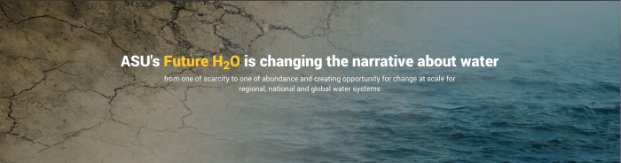
Vision: abundant water to feed and power sustainable economies
The Earth is literally drenched in water. However, conversations about the resource often center around scarcity, vulnerability and risk. While it’s true that getting water to the right place at the right time with adequate quality can be a challenge, we still see a bright future.
ASU’s Future H2O seeks to change the narrative about water from scarcity to abundance. Our goal is to create opportunity for change at scale in regional, national and global water systems. We envision wiser design principles, new data and algorithms for better water governance and business outcomes, and scalable, nature-inspired technologies. In choosing this new path, we will become nimbler in the face of a changing climate and rise to the challenge of water security.
How do we get there? By calling on the creative capacity of the largest student body in the United States. By translating knowledge into action through innovative partnerships with public utilities and the private sector. And by starting the conversation about a more abundant and resilient water future on the Blue Planet.