Beetle infestations widespread across #Colorado #ActOnClimate

From Colorado Public Radio (Michael Sakas):

The State Forest Service does a yearly flyover to track and map the damage. Dan West is an entomologist with the state, and said one notable finding from the 2018 survey is the continued spread of the spruce beetle. ..

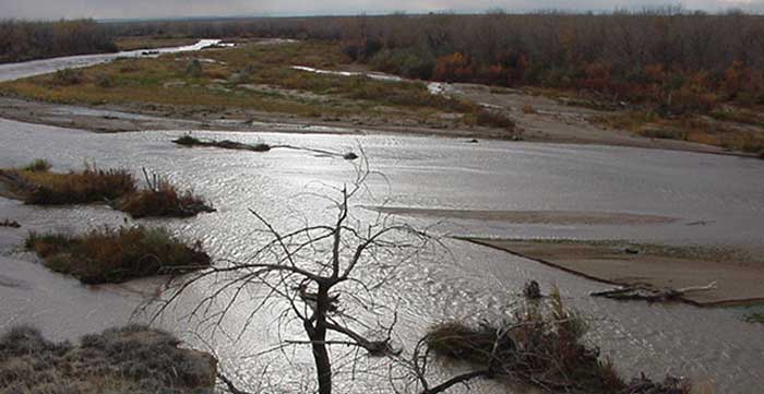
The bug is different from the mountain pine beetle, known for its damage to lodgepole pine. West said the spruce beetle has been the most widespread and destructive forest pest in Colorado for seven consecutive years.

“About 40 percent of our spruce fir forests have been affected by spruce beetle since the year 2000,” West said.

The most damaged areas are in and around Rocky Mountain National Park, and parts of the San Juan Mountains, West Elk Mountains and the Sawatch Range. West said record-warm temperatures and record-low precipitation help the beetle thrive.

“That means there’s much fewer water resources that are available to these trees, which they use as a defense mechanism against attacking bark beetles,” West said. “So if it’s warmer and dryer in the near future, those prolonged drought events and warm periods cause these bark beetles to emerge earlier, have longer periods to be able to attack trees, and have fewer defenses that they’re fighting.”

From TheDenverChannel.com (Jackie Crea):

Currently, it’s the spruce beetle hitting the trees the worst. The spruce beetle is responsible for the death of more spruce trees in North America than any other natural agent. Lester and his team just finished studying the health of our forests and mapping out how much bark beetles have gotten to. He told Denver7 more than 5 million acres have been damaged.

“If you look at these beetles, most of them are native. And what kept them in check historically, is really cold weather,” said Lester.

Warming temperatures keep more bark beetles alive, he said. They burrow inside the trunks, blocking water from the tree, ultimately killing it. The problem multiplies because more dead brush leads to more wildfire fuel.

“…When they do burn, they’re really hard to manage and hard to predict their fire behavior,” said Lester.

Wildfires, in turn, bring other dangers, as they can move the soil, affecting our resources.

“If you’re a water utility, you’re gonna be filling your reservoir with silt instead of water, so we need to look at the areas that are more susceptible and focus our efforts there,” said Lester.

So how do we manage them? Lester told Denver7 it starts with this study, then spreading the word. They also help private landowners take care of their own trees, too, because the forest service can’t do it all alone.

El Paso County water master plan warns about Denver Basin Aquifer depletions

Denver Basin Aquifer System graphic credit USGS.

Click here to go to the El Paso County website for the project.

From The Colorado Springs Gazette (Rachel Riley):

The document says the county’s current water supply is about 146,000 acre-feet per year, but demand is expected to increase to about 160,000 acre-feet per year by 2040 and 206,000 acre-feet per year by 2060…

The plan, prepared by Englewood-based engineering firm Forsgren Associates Inc., makes a variety of recommendations for closing the gap, including monitoring groundwater well levels, exploring ways to reuse water, finding new water sources and considering changes to the county’s land use approval process.

The county is home to more than 21,300 permitted groundwater wells and roughly 70 water providers, from small districts to municipal departments, according to the plan.

Water providers in once rural parts of the county, such as Monument, face mounting concerns about how to ensure that residents have enough water as the population continues to rise.

The primary water source for areas that are not served by Colorado Springs Utilities is the Denver Basin. Experts say it’s hard to pinpoint the rate at which water levels are falling in the system of aquifers, which were filled by precipitation over many years.

By 2060, the county’s current annual supply would be enough to serve a little more than half of the projected population, according to the plan. More residents could potentially be served by Denver Basin groundwater, but only if it’s still economical to pump, the plan states.

Per state law, county commissioners generally decide if there’s sufficient water to serve a new development during final platting, the stage of the land use approval process in which lots are created, said Mark Gebhart, deputy director of the county Planning and Community Development Department.

But the plan suggests that the county consider changing its rules so that determination can be made earlier, such as when a preliminary plan or zoning change is approved, to help ensure that new developments are planned with water supply in mind.

The plan also recommends that the county re-evaluate a subdivision regulation that requires developers to prove that they have a 300 years’ supply of water. The requirement, three times as stringent as a state standard that requires proof of 100 years’ supply, could be waived if developers agree to conservation-minded practices, such as reuse of captured wastewater to offset demands, the plan suggests…

The plan also advises that the county encourage water providers to find more reliable water sources that are replenished regularly by precipitation, rather than deep groundwater sources that are slow to recharge. One possibility might be importing water from the Arkansas River, the plan states.

Lower Ark board meeting recap

Fountain Creek photo via the Fountain Creek Watershed Flood Control and Greenway District

From The La Junta Tribune-Democrat (Bette McFarren):

Peter Nichols, an attorney for the Lower Arkansas Valley Water Conservancy District, at the agency’s meeting Wednesday, updated the board on the long-standing controversy with Colorado Springs concerning water quality in Fountain Creek…

A lawsuit filed by the Environmental Protection Agency in November 2017 alleges the City of Colorado Springs’ stormwater system degraded the creek on its way to Pueblo and, eventually, the Arkansas River. The Pueblo Board of County Commissioners and the LAVWCD were permitted to intervene in the case, on the side of the environmental agency.

On Nov. 9, Senior Judge Richard P. Matsch ruled that Colorado Springs violated its permit that regulates stormwater discharges into Fountain Creek.

Following Matsch’s decision, the parties asked the judge to put the litigation on hold for three months, to see if they could agree how to remedy the city’s violations. That request was granted.

The post-trial settlement conferences were scheduled for Dec. 6, 2018; Jan. 10 (which was cancelled because of the federal government shutdown); Feb. 7, March 7, April 11 and May 9.

Republican River Rules filed in water court — The Yuma Pioneer

Republican River Basin. By Kansas Department of Agriculture – Kansas Department of Agriculture, Public Domain, https://commons.wikimedia.org/w/index.php?curid=7123610

From The Yuma Pioneer:

The Office of the State Engineer has filed the proposed Republican River Compact Water Use Rules with Water Court Division 1 in Greeley.

The filing was made last Friday, January 11.

The process for developing the rules included several public meetings with a special advisory committee. It was comprised of volunteers representing users and interests throughout the Republican River Basin. The meetings took place within the basin, and the last one was last August.

As drafted, the rules allow the state to administer surface water and groundwater wells for compliance with the 1942 Republican River Compact.

It includes the state engineer’s ability to curtail wells, which means issuing a cease and desist.

However, Deb Daniel, the general manager for the Republican River Water Conservation District, noted that wells that are within the Republican River Domain and have an augmentation plan are protected from curtailment.

That means all wells located with the Republican River Water Conservation District are protected, due to the district’s augmentation efforts such as the compact compliance pipeline, purchasing surface water rights, and providing financial incentives for well owners to voluntarily retire their wells, such as through CREP and EQIP conservation programs.

However, the Republican River Domain boundary is different than the RRWCD boundary, so there are some wells that currently are not protected from the potential curtailment. There is legislation currently before the Colorado State Legislature that will expand the RRWCD’s boundary to including all of the Republican River Domain.

Division 1 Water Court will have to rule on the proposed rules before they go into effect.

Well owners can make filings for or against the proposed rules with the water court. The case number is 2019CW 3002.

One can learn more about the rules at the Colorado Division of Water Resources website, http://water.state.co.us.