The entrance to the popular Gates of Lodore stretch on the Green River, not far downstream from where Aaron Million of Ft. Collins has proposed to divert 55,000 acre-feet of water from the river each year and pipe it to the Front Range. There’s plenty of opposition to the idea, but there is also interest in the water in eastern Colorado.
It has been called speculative, foolhardy and overly expensive, but Aaron Million’s plan to pump water from the Utah-Wyoming border to Colorado’s Front Range just won’t dry up.
Million, a Fort Collins-based entrepreneur, has pushed different versions of the pipeline for more than a decade, and the number of killed ideas and revisions has earned the project the nickname, the “Zombie Pipeline.”
Now seeking water rights from the Green River in Utah for a new version of his plan, Million thinks he has fashioned a winning proposal to feed Colorado’s thirsty, growing population.
While Million’s proposal has drawn criticism from environmental groups and government agencies, some Front Range water suppliers have expressed interest in water from the pipeline.
The Central Colorado Water Conservancy District, based in Greeley and serving Weld, Adams and Morgan counties, has re-affirmed its interest in the project, which it first expressed in 2009.
And the state of Colorado has taken a neutral stance.
Million, under the banner of a new business, Water Horse Resources LLC, is now proposing a project that would divert 55,000 acre-feet of water each year from the Green River in eastern Utah, below Flaming Gorge Reservoir near Brown’s Park and above Dinosaur National Monument. (See application and map, and click to zoom in on map).
An acre foot of water is roughly equivalent to a foot of water covering an entire football field, and enough to satisfy two small families’ yearly demands.
With 55,000 acre feet, the project, if it ever comes to fruition, could serve 110,000 families each year. It could also satisfy more than 10,000 acres of flood-irrigated farmland.
The water, up to 76 cubic feet per second, would travel in a pipeline that heads northeast out of Utah, cuts across a corner of Colorado, traverses 500 miles through Wyoming and over a low point in the Continental Divide, and then drops back into Colorado.
Because the pipeline would ultimately descend about 3,800 vertical feet, the water could power turbines that would generate about 70 megawatt hours of power per year.
For the project’s second phase, Million hopes to build pumped-storage facilities, which could fill with water during the day when energy is in low demand and release water through a turbine when demand is high, generating an additional 500 to 1,000 Mwh of power annually.
Aaron Million testifying on the application from Water Horse Resources LLC at a State of Utah hearing on Nov. 11, 2018 in Salt Lake City.
Front Range interest
The project’s opponents have pointed out problems for endangered fish, recreation and water availability. To bolster their claims many have pointed out that Million has yet to reveal a buyer for his water, and say that’s evidence that there is no interest in Green River water in Colorado.
But Million claims to have a buyer on the Front Range interested in purchasing the entire water supply, and other Front Range water providers have expressed their willingness to consider water from the pipeline.
For his water rights application, Million presented 17 letters of interest to Utah’s state engineer. Most of these letters were from a different pipeline application in 2010, but there was one from January from the Central Colorado Water Conservancy District, or CCWCD.
The CCWCD serves about 550 farmers, but because the district is short of water, it is able to make only about half of its deliveries.
In November, voters passed a $48.7 million bond issue for the district to buy new supplies, and the CCWCD said it would consider water from a Flaming Gorge pipeline.
“I think it’s false that there is no interest for additional water supplies,” said Randy Ray, the district’s executive director, in a recent interview. “Our board is supportive of any methods to bring water to our area. We will evaluate just about everything.”
According to Million’s testimony before the State of Utah’s Division of Water Rights on Nov. 11 the CCWCD has joined his project’s advisory board.
“They have a huge demand-supply imbalance on the South Platte in Colorado they are looking at,” Million said.
Randy Ray, executive director of the Central Colorado Water Conservancy District, stands on top of the grate protecting a ditch that runs from an artificial recharge facility near Gilcrest. The CCWCD has expressed interest in water being piped into the Front Range.A detail of a map produced by Water Horse Resources, and published by the state of Utah, showing a pipeline in relation to the service of several Front Range water providers. The numbers below the names of the water providers correspond to amounts of water, in acre feet, that may of interest to various water providers, according to Aaron Million.
Birth of a concept
One night in 2003, Million stumbled across an old map in the library at Colorado State University, where he was a graduate student in resource economics.
He focused on the northwest corner of the state where the Green River comes down from Wyoming into Utah and then comes in and out of Colorado in a sweeping oxbow before traveling down to meet the Colorado River in Canyonlands National Park.
Free from the clutter of roads, this 1920s map made the thick, blue squiggle so obvious that it suddenly gave Million an idea to bring that water to the Front Range.
“I thought that surely someone had thought about that,” Million said.
The project became his master’s thesis and, later, a proposal for a real project. The original concept looked at importing nearly 250,000 acre-feet of water from a point of diversion in Wyoming.
He filed applications for different versions of his concept under the companies Million Conservation Resource Group Inc. and Wyco Power and Water Inc. Both applications were dismissed by government agencies for a lack of information earlier this decade.
The new plan scales back the amount of water to be drawn from the river and includes an emphasis on hydropower along with water delivery.
The company has not released a detailed cost estimate to the public, but Million says estimates range from $860 million to $1.1 billion. He also says private consultants have put the project’s ultimate value at more than $30 billion.
With these new pieces in place, Million believes this project has a better chance, but he’s facing opposition on many fronts, permit challenges and a daunting environmental-impact study.
A section of the Green River near Browns Park close to where Aaron Million of Ft. Collins has proposed diverting 55,000 acre-feet of water and piping it to Colorado. The Central Colorado Water Conservancy District has expressed interest in the water.A detail of a map produced by Water Horse Resources, and published by the state of Utah, showing the proposed diversion point on the Green River, between Flaming Gorge Reservoir and the Gates of Lodore in Dinosaur National Monument. The red and white line represents a pipeline that heads northeast out of Utah, across a corner of Colorado, and into Wyoming, where it joins an alignment of another potential pipeline that is connected to the Green above Flaming Gorge.
Interest in the water?
Million’s latest filing for water rights in Utah, in January, drew 28 protest letters, from environmental groups, concerned citizens and water districts, as well as from U.S. Bureau of Reclamation and the Department of the Interior.
A Nov. 7 hearing on the proposal in Utah led to a headline in the Salt Lake City Tribune that said, “Environmentalists, feds, and Utahns agree: Don’t send Green River water to Colorado.”
Many of the presentations against the water project cast doubt on whether there was even any water in the Colorado River system left to take.
“If you’re going to develop more water, you are going to threaten current uses,” said Jim Pokrandt, director of community affairs for the Colorado River District in Glenwood Springs, which opposes the project. “This might be the proverbial straw that broke the camel’s back.”
Still, the most common concern was that Million had not released a signed contract that showed someone would buy the project’s water.
At the project’s water-rights hearing at the Utah state engineer’s office in November, several groups pointed to fields on Million’s application where the purpose and place of use were left as “TBD,” or to be determined.
“That just smacks of speculation,” said Ariel Calmes, a staff attorney for Western Resource Advocates, which is also opposing the project.
“This is a water grab,” Calmes said. “It’s not a reasonably thought-out plan to get water resources to benefit a specific community.”
But while Million and his team have struggled against public backlash and weathered claims that there was no interest in Green River water, other water entities in Colorado have quietly picked up his idea.
In 2006, just as Million was getting his initial idea off the ground, the South Metro Water Supply Authority — a group of water suppliers south of Denver — launched studies for an almost identical project, and another group near Colorado Springs released a study into a Flaming Gorge pipeline in 2013.
The governor’s water advisers also took note of Million’s plan, and Colorado’s 2010 Statewide Water Supply Initiative included a Flaming Gorge pipeline as one of four possibilities for new water supplies for the state.
That same report found that the South Platte Basin, which includes all of northeastern Colorado, would need as much as 330,000 acre-feet more water to meet demand projections by 2050.
While the state has not come out firmly in support of Million’s project, the Colorado Water Conservation Board said in a July 7 letter that it did not oppose the Utah application. The letter indicated that the Colorado state engineer would need to weigh in on the proposal if the Utah water rights were secured.
Million is quick to swat away arguments that his project is speculative, noting that water demand in Colorado has only grown since he first conceived of the pipeline. He also claims an entity with “large ranching and municipal interests” has already agreed to take all the water at a specific price.
He also said he is in preliminary conversations about a power-purchase agreement for the renewable energy that the pipeline would generate.
Due to continuing negotiations and a nondisclosure agreement, Million said he would not reveal either of the two interested parties at this time.
But scrutiny of Million’s latest plan is increasing.
A map filed by Water Horse Resources LLC with the state of Utah, showing a diversion point on the Green River, between Flaming Gorge Reservoir and the Gates of Lodore. Million said the spot was chosen because a number of existing oil and gas pipelines already cross the river at this location.A detail of a map produced by Water Horse Resources, and published by the state of Utah, showing two pipelines from the Green River, one above Flaming Gorge Reservoir and one below, plus a connecting pipeline between the two. The map is on a Utah state website with a note saying it was “left at hearing” on Nov. 11, 2018.
On the water horse
On Dec. 10, the Utah state engineer’s office requested additional information from Million to evaluate his application.
The request asked Million to prove that water was available in the Colorado River system and that water taken from his pipeline would come from Colorado, not Utah’s, share of the river.
The requests also sought further proof of feasibility, but did not request additional proof of demand or a contract for the purchase of the pipeline’s water.
Water Horse Resources has until Feb. 8 to supply the new information.
Million is confident that his project, this time around, will move forward. He says the protests and the noise from the public don’t get to him anymore.
“You saddle the horse,” he said, “You do what you think is right and you move on with it.”
Editor’s note: Aspen Journalism is collaborating with the Greeley Tribune on coverage of regional water issues. The Tribune published a version of this story on Sunday, Dec. 30, 2018.
Click on a thumbnail graphic to view a gallery of snowpack data from your favorite basins.
Colorado statewide basin-filled snowpack map December 31, 2018 via the NRCS.
Statewide Basin High/Low graph December 31, 2018 via the NRCS.
Upper Rio Grand River Basin High/Low graph December 31, 2018 via the NRCS.
South Platte River Basin High/Low graph December 31, 2018 via the NRCS.
San Miguel, Dolores, Animas, and San Juan Basin High/Low graph December 31, 2018 via the NRCS.
Laramie and North Platte Basin High/Low graph December 31, 2018 via the NRCS.
Yampa and White Basin High/Low graph December 31, 2018 via the NRCS.
Upper Colorado River Basin High/Low graph December 31, 2018 via the NRCS.
Gunnison River Basin High/Low graph December 31, 2018 via the NRCS.
Arkansas River Basin High/Low graph December 31, 2018 via the NRCS.
All the graphs are heading in the right direction. The SW basins have a long way to go. Maybe El Niño will save the day.
Here’s the 7-day quantitative precipitation forecast from NOAA. Looking good in central Arizona and the Colorado San Juan Mountains. Don’t go near Mississippi unless you’re in a boat.
Crippling drought this year has caused more than $1 billion in damage. As it has played out, anyone affected by the drought or trying to manage it has turned to a once obscure map that has become key to understanding what’s happening: the U.S. Drought Monitor.
That includes water planners who decide resource allotments. Farmers who need water for their livelihood. Federal bureaucrats who use the map to calculate aid for the Livestock Forage Disaster Program.
And then there are citizen scientists like Dave Kitts outside of Sante Fe, N.M.
“I think it’s a little obsessive, but I check it every Thursday,” says Kitts, who has lived on the same 2-acre spread in New Mexico for decades. Dry years like this past one can crust the soil and kill his pinyon trees.
“It’s just upsetting and depressing to me,” he says. “And when it moves the other direction, it definitely lifts my spirits.”
Scientist Mark Svoboda started the drought map 20 years ago, when Congress took an interest after drought struck Washington, D.C. He directs the National Drought Mitigation Center at the University of Nebraska, Lincoln.
“We’re covering everything,” he says, “from groundwater, stream flow, temperature.”
In bad drought years like this one, the map has patches of crayon yellow, orange and red that show the levels of drought. Right now, there’s a deep crimson bull’s-eye in the hardest-hit area of the southwest, where Colorado borders Utah, Arizona and New Mexico…
A mix of art, science and farmer wisdom
The Drought Monitor map is updated weekly, often taking into account input from hundreds of people — in addition to scientists. Ranchers and farmers from across the country also send missives to state and national offices, making the map a mix of art, science and farmer wisdom. But it starts with recommendations from state climatologists on any potential changes.
Assistant Colorado Climatologist Becky Bolinger says she has been “feeling a little bit more hopeful” about recent rain and snow, as it could mean a smaller crimson blotch in the southwest. At least that’s what her data suggested.
But Bolinger wanted more context, so she asked for field reports from Colorado’s farmers and ranchers.
ANS mitigation Navajo Lake June 6, 2018. Photo credit: Colorado Parks and Wildlife
Here’s the release from Colorado Parks and Wildlife (Joe Lewanowski):
In order to keep destructive quagga and zebra mussels out of lakes and reservoirs in Colorado, boaters will help to provide crucial funding for the state’s Aquatic Nuisance Species Inspection Program starting in 2019.
“Colorado is one of just a few states in the country that doesn’t have an infestation of adult zebra or quagga mussels in any of its waters,” said Elizabeth Brown, invasive species program manager for Colorado Parks and Wildlife. “That’s directly attributable to our watercraft inspection and decontamination prevention program that’s been in place since 2008.”
Earlier this year, the Colorado General Assembly approved a bill that requires those who operate motorboats and sailboats on waters of the state to purchase an ANS stamp annually. The cost of the stamp for Colorado residents is $25. For boaters coming to Colorado from other states or provinces the stamp will cost $50. The stamp fee is separate from the annual boat registration permit but will be included in the cost of registration for in-state boats. The stamp and registration is currently available for residents at CPW offices and the agency website. Boaters coming from other states can buy their stamp online, at CPW offices or at any sales location beginning January 1, 2019.
Quaggas on sandal at Lake Mead
Mussel infestations cause a variety of major problems. Because mussels consume plankton they disrupt the food web and out-compete sport fish and native fish. Mussels clog infrastructure, including reservoir dams, outlet structures and distribution systems that carry water for irrigation, municipal and industrial uses. Mussels also infest boats and damage engines.
Mussels have caused billions of dollars in damage, especially in the upper Midwest and Lower Colorado River. Nearby states where mussel infestations exist include Utah, Arizona, Kansas, Nebraska, Texas and Oklahoma.
Since the ANS program started in Colorado in 2008, CPW staff and other entities have completed 4.4 million boat inspections, more than 90,000 boats have been subject to decontamination procedures and 195 vessels with confirmed mussel infestations have been intercepted and decontaminated. The threat of boats transporting mussels also appears to be growing: This year 51 boats with adult mussels were found at inspection stations, far more than the previous record of 26 boats in one year.
The new fee will cover half of the cost of the inspection program. The remainder will be paid by CPW and a variety of stakeholders, including federal agencies, local governments, water providers and other partners.
“We appreciate that Colorado boaters have been very cooperative with CPW on the ANS inspection program. And we all need to continue to be vigilant,” Brown said.
Click here to read the newsletter. Here’s an excerpt:
TRIBAL WATER STUDY RELEASED
The Bureau of Reclamation and the Ten Tribes Partnership have released the long-awaited Tribal Water Study, which you can access here. The study documents how the tribes in the partnership currently use their water in the Colorado River Basin, projects future water development, and describes potential effects of tribal water development on the Colorado River System.
Many Indian reservations are located in or near contentious river basins where demand for water outstrips supply. Map courtesy of the Bureau of Reclamation.
The San Juan Water Conser- vancy District (SJWCD) Board of Directors formally approved its budget for 2019 at a meeting on Dec. 12. The budget shows a beginning balance of $150,659 for 2019 and that revenues will be $78,775, with total available resources being $229,434.
As of Dec. 12, total revenues for 2018 were listed at $77,456, and that amount is expected to remain the same at year-end.
The district is anticipated to have $250,708 on hand at the end of 2018. Within the revenue section, the largest total within the 2019 budget falls under the general property taxes section. That line item totals $70,789, which is a slight increase over 2018’s amount of $68,041.
The majority of line-item ex- penses for SJWCD do not total over $5,000. Those that do include $7,000 for audit expenses, $12,000 for legal and $12,000 for support services.
Anticipated 2018 year-end ex- penses for an audit total $2,656, while year-end expenses for legal fees are $33,375. Year-end expenses for support services total $13,696.
Total expenditures budgeted for 2019 come in at $78,775, while anticipated year-end expenditures for 2018 total $99,739.
At its meeting on Dec. 13, the Pagosa Area Water and Sanitation District (PAWSD) Board of Directors approved the district’s 2019 budget.
The three members of the board present — Jim Smith, Glenn Walsh and Gordon McIver — unanimously approved the document.
“The Final Budget, presented for discussion, meets debt service requirements; projects improved but moderate growth and reflects the increased service charges prescribed by the Stantec Rate Study,” an agenda summary sheet on the budget states.
“It’s a great budget,” Walsh said, adding later, “Great job.”
For the General Fund, the bud- get estimates revenues totaling $1,953,015 and expenditures of $1,117,436.
For the Debt Service Fund, esti- mated revenues are $1,213,490 and expenditures are $1,182,826.
For the Water Enterprise Fund, budgeted revenues are $11,876,559, while budgeted expenditures are $5,922,874.
For the Wastewater Enterprise Fund, estimated revenues total $5,527,668, while estimated expen- ditures total $2,434,229.
Before its approval, Comptroller Aaron Burns outlined the changes in the budget since the draft was presented in the fall:
• The San Juan water treatment plant’s UV project, at a cost of $706,000, is completely funded without debt.
• The budget for line replacement increased to $350,000.
• There was a $7,000 decrease to the budget for large maintenance
• The budget for capital decreased by $14,000.
• Water rate revenues were brought more in line with history since 2018 was a drought year.
Walsh also pointed out that the deficit is down in the General Fund, as well as the fact that there are no cost-of-living adjustments, fewer employees and merit-based in- creases.
According to the agenda summary sheet, the operating budget includes 27 full-time equivalents for 2019.
For a long time, many people thought that it was a mistake to use the weather as evidence of climate change. Weather patterns contain a lot of randomness. Even as the earth warms and extreme weather becomes more common, some years are colder and calmer than others. If you argue that climate change is causing some weather trend, a climate denier may respond by making grand claims about a recent snowfall.
And yet the weather still has one big advantage over every other argument about the urgency of climate change: We experience the weather. We see it and feel it.
It is not a complex data series in an academic study or government report. It’s not a measurement of sea level or ice depth in a place you’ve never been. It’s right in front of you. And although weather patterns do have a lot of randomness, they are indeed changing. That’s the thing about climate change: It changes the climate.
I wanted to write my last column of 2018 about the climate as a kind of plea: Amid everything else going on, don’t lose sight of the most important story of the year.
I know there was a lot of competition for that title, including some more obvious contenders, like President Trump and Robert Mueller. But nothing else measures up to the rising toll and enormous dangers of climate change. I worry that our children and grandchildren will one day ask us, bitterly, why we spent so much time distracted by lesser matters.
The story of climate change in 2018 was complicated — overwhelmingly bad, yet with two reasons for hope. The bad and the good were connected, too: Thanks to the changing weather, more Americans seem to be waking up to the problem.
I’ll start with the alarming parts of the story. The past year is on pace to be the earth’s fourth warmest on record, and the five warmest years have all occurred since 2010. This warming is now starting to cause a lot of damage.
In 2018, heat waves killed people in Montreal, Karachi, Tokyo and elsewhere. Extreme rain battered North Carolina and the Indian state of Kerala. The Horn of Africa suffered from drought. Large swaths of the American West burned. When I was in Portland, Ore., this summer, the air quality — from nearby wildfires — was among the worst in the world. It would have been healthier to be breathing outdoors in Beijing or Mumbai.
Amid all of this destruction, Trump’s climate agenda consists of making the problem worse. His administration is filled with former corporate lobbyists, and they have been changing federal policy to make it easier for companies to pollute. These officials like to talk about free enterprise and scientific uncertainty, but their real motive is usually money. Sometimes, they don’t even wait to return to industry jobs. Both Scott Pruitt and Ryan Zinke, two now-departed pro-pollution cabinet secretaries, engaged in on-the-job corruption.
I often want to ask these officials: Deep down, do you really believe that future generations of your own family will be immune from climate change’s damage? Or have you chosen not to think very much about them?
As for the two main reasons for hope: The first is that the Trump administration is an outlier. Most major governments are trying to slow climate change. So are many states in this country, as well as some big companies and nonprofit groups. This global coalition is the reason that the recent climate summit in Poland “yielded much more,” as Nat Keohane of the Environmental Defense Fund said, “than many of us had thought might be possible.”
The second reason for hope is public opinion. No, it isn’t changing nearly as rapidly as I wish. Yet it is changing, and the weather seems to be a factor. The growing number of extreme events — wildfires, storms, floods and so on — are hard to ignore.
Only 40 percent of Americans called the quality of environment “good” or “excellent” in a Gallup Poll this year, the lowest level in almost a decade. And 61 percent said the environment was getting worse. In an NBC News/Wall Street Journal poll, 66 percent of Americans said they wanted to see action to combat climate change. Some polls even suggest that Republican voters are becoming anxious about the situation.
The politics of climate change remains devilishly hard, especially because so many people around the world feel frustrated about their living standards. France’s “gilet jaune” protests, after all, were sparked by a proposed energy tax. Compared with day-to-day life, the effects of climate change have long felt distant, almost theoretical.
But now those effects are becoming real, and they are terrifying. To anyone who worries about making a case for climate action based on the weather, I would simply ask: Do you have a better idea?
Current climate is represented in (a), and a warmer climate in (b). As the climate warms, the mean vertical gradient in water vapor (blue) increases. Tropospheric temperature (orange shading) will also increase more than the lower atmosphere. Credit: Eric Maloney/Colorado State University
Here’s the release from Colorado State University (Anne Manning):
Every month or two, a massive pulse of clouds, rainfall and wind moves eastward around the Earth near the equator, providing the tropics their famous thunderstorms.
This band of recurring weather, first described by scientists in 1971, is called the Madden-Julian Oscillation. It has profound effects on weather in distant places, including the United States. Atmospheric scientists have long studied how the Madden-Julian Oscillation modulates extreme weather events across the globe, from hurricanes to floods to droughts.
As human activities cause the Earth’s temperature to increase, reliable, well-studied weather patterns like the Madden-Julian Oscillation will change too, say researchers at Colorado State University.
Eric Maloney, professor in the Department of Atmospheric Science, has led a new study published in Nature Climate Change that attributes future changes in the behavior of the Madden-Julian Oscillation to anthropogenic global warming. Maloney and co-authors used data from six existing climate models to synthesize current views of such changes projected for the years 2080-2100.
Separating precipitation, wind
Their analysis reveals that while the Madden-Julian Oscillation’s precipitation variations are likely to increase in intensity under a warmer climate, wind variations are likely to increase at a slower rate, or even decrease. That’s in contrast to the conventional wisdom of a warming climate producing a more intense Madden-Julian Oscillation, and thus an across-the-board increase in extreme weather.
“In just looking at precipitation changes, the Madden-Julian Oscillation is supposed to increase in strength in a future climate,” Maloney said. “But one of the interesting things from our study is that we don’t think this can be generalized to wind as well.”
Atmospheric science relies on weather patterns like the Madden-Julian Oscillation to inform weather prediction in other areas of Earth. For example, atmospheric rivers, which are plumes of high atmospheric water vapor that can cause severe flooding on the U.S. west coast, are strongly modulated by certain phases of the Madden-Julian Oscillation.
According to Maloney’s work, the Madden-Julian Oscillation’s impact on remote areas may gradually decrease. Degradation in the oscillation’s wind signal may thus diminish meteorologists’ ability to predict extreme weather events. In particular, preferential warming of the upper troposphere in a future, warmer climate is expected to reduce the strength of the Madden-Julian Oscillation circulation.
Next steps
Maloney and colleagues hope to continue studying the Madden-Julian Oscillation using a broader set of climate models to be used in the next Intergovernmental Panel on Climate Change assessment.
Co-authors of the Nature Climate Change study are Ángel Adames of the University of Michigan and Hien Bui, a CSU atmospheric science postdoctoral researcher.
Bonita Mine acid mine drainage. Photo via the Animas River Stakeholders Group.
From the University of Denver Water Law Review (Haley McCullouch):
There are three laws that generally govern mining law in the United States: the 1872 Mining Law, the Clean Water Act, and the Comprehensive Environmental Response, Compensation, and Liability Act (CERCLA). These laws lack concrete measures to prevent mine spills from occurring as well as reliable methods to ensure that all mines receive the necessary attention in the case of a spill (or better yet, to prevent one). In addition, these laws can create liabilities and disincentives on parties who might otherwise be willing to come in and remediate the mine on their own. However, some states are turning towards a non-traditional form of legislation: Good Samaritan laws, in which citizens, companies, and organizations would be not liable in the case they decide to take on the task of cleaning up acid mine drainage.
The abandoned mine problem in the United States is striking. Specifically, hard rock mines (including metals like gold, silver, iron, copper, and zinc) are predominant in the West as a result of the discovery of gold and silver during the era of western expansion. Up until the 1970s, the federal government engaged in little oversight on mining across much of the West. During the mining era, there were few expectations about environmental safeguards, and as a result, historic mining operations often went largely unregulated. Before the 1970s, it was common for mining companies to abandon mine sites after mineral extraction was completed or no longer profitable. The land was often left exposed, with waste materials in piles or dumped into mine cavities and pits. At the time, mining companies had no requirement to restore mine lands to their original condition. Today, it is almost impossible to hold these mine owners financially responsible because records of original ownership have been lost and accountable individuals have long passed away. There are over 500,000 abandoned hardrock mine sites across the nation, and the cost for cleaning up these inactive mines is estimated to be between $33 and 72 billion dollars. Today, these abandoned mines are capable of polluting adjacent streams, lakes, and groundwater with high volumes of toxic waste. In doing so, contamination from spills has the potential to—and often does—harm marine ecosystems, poison local drinking water, and pose serious health risks to local communities.
An elaborate fountain in Las Vegas. One of the biggest water meetings of the year takes place every December in Las Vegas, which has driven down water use down by paying people to remove thirsty turf and grass. Photo credit: Brent Gardner-Smith/Aspen Journalism
Water managers and officials said some riveting things in the last half of 2018 about the increasingly dry conditions in the Colorado River system, and the falling water levels at Lake Powell and Lake Mead.
Many of the most hair-raising remarks heard at water meetings were made while water officials and managers were discussing “drought contingency planning,” or DCP.
The effort, a response to an 18-year drought, includes a series of agreements — among various regional, state and federal entities — that are designed to bolster water levels at Powell and Mead.
The two giant reservoirs are fed by the tributaries of the Colorado River system, including the Roaring Fork, Fryingpan and Crystal rivers, so changes in the sprawling river basin can ripple all the way upstream.
Below is a sampling of what’s being said out there.
Attendees react to a rare light moment at a meeting of the Upper Colorado River Commission, on Dec. 12 at Caesars Palace, as part of the Colorado River Water Users Association, in Las Vegas. During most of the meetings that week, water managers and officials heard a series of remarks about the state of the Colorado River that did not prompt smiles or laughter. Photo credit: Brent-Gardner Smith/Aspen Journalism
Tough talk ahead
“After experiencing the fourth driest year on record last year, Lake Powell and Mead’s combined storage sits today at 46 percent. That is the lowest level since 1966, when Lake Powell was initially filling and cutting off water supplies down south. To put it in more personal terms, these are the lowest reservoir levels in my lifetime.” — Brenda Burman, commissioner of the U.S. Bureau of Reclamation, on Dec. 13, at the annual meeting of the Colorado River Water Users Association at Caesars Palace in Las Vegas.
“If we were to have a repeat of the 2000-to-2005 drought, with current demands and current levels of operations, we would essentially drain Lake Powell. It would go down to nothing.” — Eric Kuhn, former general manager of the Colorado River District, on Sept. 14, at the district’s annual seminar in Grand Junction.
“It does not look good. It is a real and present danger for us to be facing the hydrology that we have today, and the 24-month outlook for that.” —Peter Nelson, chairman of the Colorado River Board of California, on Dec. 13 at a CRWUA meeting.
“Today’s level of risk is unacceptable, and the chance for crisis is far too high.” —Burman, on Dec. 13 at a CRWUA meeting.
Brenda Burman, commissioner of the Bureau of Reclamation, after a panel discussion at the Colorado River Water Users Association on Dec. 14, at Caesars Palace, in Las Vegas. Earlier at the conference, Burman gave water managers in Arizona, California and Nevada until Jan. 31 to reach consensus on a set of regional agreements designed to bolster water levels in Lake Powell and Lake Mead. Photo credit: Brent Gardner-Smith/Aspen Journalism
Painful conversation
“We’ll be in crisis mode if DCP isn’t completed.” —Pat Tyrrell, state engineer for Wyoming and commissioner on the Upper Colorado River Commission, on Dec. 13, at a CRWUA meeting.
“It’s not a drought-contingency plan, it’s a survival plan due to current conditions.” — Bill Hasencamp, manager of Colorado River resources for the Metropolitan Water District of Southern California, on Aug. 22, at the summer meeting of the Colorado Water Congress in Vail.
“It’s important to understand that we are looking at giving up a very large amount of Colorado River water in central Arizona, nearly half. That’s a painful conversation. And, of course, everyone thinks that their own water use is justified and no one else’s is.” — Kathryn Sorensen, director of City of Phoenix Water Services, on Dec. 13 at a CRWUA meeting.
“We are teetering on the brink of a shortage today, and we see real risk of rapid declines in reservoir elevations, particularly at Lake Mead in the very near future.” — Burman on Dec. 13 at a CRWUA meeting.
Andy Mueller, the general manager of the Colorado River District, speaking at the district’s annual seminar on the Colorado RIver, on Sept. 14 in Grand Junction. Muller expressed concerns about how the state of Colorado might deal with falling water levels in Lake Powell and Lake Mead. Photo credit: Brent Gardner-Smith/Aspen Journalism
Curtailed supply
“If we have the worst-case hydrology, it is possible that our state may need to move to an involuntary (water-curtailment) system. But we want that done through a public process. We want the stakeholders at the table.” — Andy Mueller, general manager of the Colorado River District, on Sept. 14 at a district seminar.
“To me, the best way of conserving water is not to use it, is not to grow, is not to continue to drain the Colorado River. But realistically looking at it, that is not going to happen.” — Keith Moses, vice chairman of the Colorado River Indian Tribes, on Dec. 13 at a CRWUA meeting.
“As we get hot and dry, we just have less available water and we see more demand.” — Taryn Finnessey, senior climate change specialist for Colorado on Aug. 24, at a CWC meeting.
“(The water entities in Arizona) have grasped that concept — that we’re going to be in a drier future with less water.” — Thomas Buschatzke, director of the Arizona Department of Water Resources, on Dec. 13 at a CRWUA meeting.
A panel of officials from the lower basin states at the Colorado River Water Users Association in Las Vegas, on Dec. 13, 2018. From left, Thomas Buschatzke, director of the Arizona Department of Water Resources; Ted Cooke, General Manager, Central Arizona Project;Peter Nelson, chairman, Colorado River Board of California; and John Entsminger, General Manager, Southern Nevada Water Authority.
Act, if needed
“We see this train that’s coming at us at 5 miles an hour, and if it hits us, it’s our own damn fault, because you can just see that reservoir level going down.” — Jim Lochhead, CEO of Denver Water, on Aug. 23 at a CWC meeting.
“We will act, if needed, to protect this basin.” — Burman, on Dec. 13 at a CRWUA meeting.
“The law of the river isn’t carved on stone tablets.” — John Entsminger, general manager of the Southern Nevada Water Authority, on Dec. 13 at a CRWUA meeting.
“Someone’s going to have to use less water.” — Kuhn on Sept. 14 at a Colorado River District seminar.
Editor’s note: Aspen Journalism covers rivers and water in collaboration with The Aspen Times and other Swift Communications newspapers. The Times published this article on Saturday, Dec. 29, 2018.
From the Associated Press (Michael Biesecker and Kim Tong-Hyung) via The Washington Post:
“Typically, infrastructure has multi-decadal lifespans,” said Katharine Hayhoe, a climate scientist and director of the Climate Science Center at Texas Tech University. “So, if we build a natural-gas plant today, that will impact carbon emissions over decades to come. So those are the critical and crucial decisions that are being made today. Do we increase access to and use of fossil fuels, or do we make decisions that limit and eventually reduce access to fossil fuels?”
From the Water Education Foundation (Gary Pitzer):
Western water in-depth: Climate report and science studies point toward a drier basin with less runoff and a need to re-evaluate water management
Upper Lake Mead dawn patrol. Photo: Brent Gardner-Smith/Aspen Journalism
As stakeholders labor to nail down effective and durable drought contingency plans for the Colorado River Basin, they face a stark reality: Scientific research is increasingly pointing to even drier, more challenging times ahead.
The latest sobering assessment landed the day after Thanksgiving, when U.S. Global Change Research Program’s Fourth National Climate Assessment concluded that Earth’s climate is changing rapidly compared to the pace of natural variations that have occurred throughout its history, with greenhouse gas emissions largely the cause.
For the American Southwest, the report said that increased temperatures induced by climate change “have significantly altered the water cycle in the … region,” causing decreased snowpack, earlier spring runoff and more rain instead of snow. Those factors “exacerbate hydrological drought” and “suggest the need for flexible water management techniques that address changing risks over time, balancing declining supplies with greater demands.”
Brad Udall, senior water and climate research scientist at Colorado State University and one of the authors of the National Climate Assessment, said the mountain of evidence regarding the potential impacts of climate change in the Colorado River Basin points to the need for a re-evaluation of current water management.
Senior water and climate research scientist at Colorado State University and one of the authors of the National Climate Assessment. Photo credit: Colorado State University Water Institute
“We need to look really hard at basically everything we are doing here,” he said. “We need to plan on a river that has 12 million, 11 million, 10 million acre-feet. We need to assume the worst is going to happen just because we have already seen some very substantial impacts. We need to look at all aspects of water management and figure out how to build a robust system with potentially one-third less flow by 2050.”
With water levels dropping in key reservoirs, the seven Colorado River Basin states have been embarked on a rigorous process to ink drought contingency plans that would pledge them to additional conservation measures in advance of any declared shortage, an increasingly likely possibility. Five of the seven Basin states have signed on to drought contingency plans, and the Bureau of Reclamation is pressing the other two – California and Arizona – to finalize their plans by Jan. 31, 2019, to avoid federal intervention.
If implemented, the plan would cover a period to 2026 and address the near-term threat of a shortage declaration. In 2020, talks will begin toward addressing longer range concerns on the river’s sustainability as part of the renegotiation of the shortage sharing guidelines adopted in 2007.
Those who live with Colorado River management every day believe the science points to the need for a re-oriented version of how the seven Basin states proceed.
“We have to take our infrastructure and our management techniques and our policies and our law and examine how those function and how they don’t function, and how they have to be strengthened or supplemented in a way that does account for the new reality, which is warmer temperatures,” said James Eklund, Colorado’s representative to the Upper Colorado River Commission.
“There is something going on in the world and we have to keep relying on scientists to continue to do the good work they are doing and bring us the information that all water managers need, whether you are in the Colorado River Basin, the Sierras or other portions of the western United States,” he said.
Stakeholders in the Colorado River Basin have to be all-in on addressing the situation because of the consequences of inaction, Eklund said.
“If we don’t do anything, we know that for a fact it’s going to be a much harder row to hoe if we keep getting the hydrology that the climate models suggest we might get,” he said.
Sizing up a ‘new normal’
The National Climate Assessment is the latest entry in a growing body of research about the present and projected effects of climate change, including what’s expected to happen in the Colorado River Basin – the source of water for 40 million people. Udall co-authored a 2017 study with Jonathan Overpeck that for the first time linked the Colorado River’s declining flows since 2000 to climate change.
A 2018 article by Udall and University of California, Los Angeles co-authors Mu Xiao and Dennis Lettenmaier said streamflow in the Upper Colorado River Basin (which produces about 90 percent of the river’s entire runoff) declined by 16 percent between 1916 and 2014, despite a slight increase in annual precipitation during that time. The 1922 Colorado River Compact allocated 15 million acre-feet of water from the mainstem river, plus an additional 1.5 million acre-feet in Arizona.
Published in the September edition of Water Resources Research, the article said that “pervasive warming” has reduced snowpack and enhanced evapotranspiration during the last 100 years and that more than one-half of the long‐term decline in runoff is associated with the general warming.
Udall said the rate of warming “was quite large, over 3 degrees Fahrenheit” between 1916 and 2014, and that “when you put those three factors together – declining flow, no change in precipitation and increasing temperature — they strongly suggest that temperature has caused at least some of the flow decline and that’s exactly what we found.”
“What we have right now is not a drought, it’s aridification,” he said. “Drought implies a return to a previous world that we will not see. What we are seeing is the long-term drying of the Basin.”
‘We learn stuff every day’
Lake Mead December 2017. Photo credit: Greg Hobbs
Eklund, an attorney with Squire Patton Boggs in Denver and former director of the Colorado Water Conservation Board, said reports such as the National Climate Assessment and Udall’s studies “are helpful in that they underscore some of the things we have long talked about and assumed to be true, such as we are likely in a new normal now.”
“The new droughts that we are experiencing now are the products of warmer temperatures and it’s important to understand that dynamic because that means the infrastructure we created to deal with this entire system … all of it was predicated on the river behaving a certain way and what the models tell us is that’s not something you can take for granted and in fact it’s unlikely to happen,” Eklund added. “History can’t be used to predict the future.”
Drought regularly happens in the Colorado River Basin, but the effects in the last 20 years or so have been particularly pronounced, leading its major water users to regularly caucus in search of immediate and long-term management solutions to preserve the two anchors of the storage and delivery system — Lake Powell and Lake Mead.
In its 2012 Colorado River Basin Water Supply and Demand Study, the Bureau of Reclamation projected a wide range of potential long-term imbalances between supply and demand by 2060, with a median figure of 3.2 million acre-feet. The study noted that the amount of water available and the changes in demand during the next 50 years are “highly uncertain” and that the potential impacts of future climate change and variability “further contribute to these uncertainties.”
Udall believes it is time to recalculate the 3.2-million-acre-foot imbalance estimate.
“There were lots of assumptions that went into that and I think we are going to be recalculating it effectively every few years because we are seeing unprecedented changes. Our ability to project out to 2060 with certainty is just too difficult,” he said. “We learn stuff every day, every few months and of course we should look at this imbalance on a regular basis.”
University of Arizona Professor Gregg Garfin, one of the authors of the National Climate Assessment, said despite the size and scale of the Basin study, many of its aspects need to be revisited as new information comes to light.
“Updated climate change projections are one change, but there have been other changes since the 2012 release of the study,” he wrote in an email. “If one views this as a sort of adaptive management process, then it is critical to reassess assumptions, infuse new scientific findings, and evaluate various indicators of change (or progress) through monitoring. If I were the director of the Bureau of Reclamation, I would see Basin studies as an ongoing investment in ensuring that society can effectively balance water demand and supply.”
Lake Powell, and an increasingly familiar bathtub ring. Photo credit: Aspen Journalism/Brent Gardner-Smith
Accounting for and incorporating the latest scientific information is part of Reclamation’s strategy for helping to manage resources in the Colorado River Basin, said David Raff, Reclamation’s science adviser and scientific integrity officer.
“As new information has been brought to the table … the Bureau of Reclamation’s approach has always been to try to include as much information as possible in a risk context and work with the stakeholders in the Basin to try to analyze the risk and address it the best way possible,” he said.
Raff said the emphasis should be on the immediate actions designed to manage the river and avoid critically low reservoir levels.
“I think the focus has been on what types of options exist in the Colorado system to address future constraints relative to supply and demand,” he said. “Things like [U.S.-Mexico shortage sharing] and the efforts associated with drought contingency planning … are probably the best investment of time and resources, as opposed to updating any specific quantitative analysis as was done in 2012.”
Because the breadth of scientific work on the Colorado River Basin covers so many different aspects — things such as dust on the snowpack, runoff and climate change — scientists note that no one element tells the entire story.
“It’s a very large, complex system that has all sorts of drivers to it and demands on it and therefore it’s far more complex than any one shift being a story into and of itself,” Raff said. “Certainly aridification, or a lack of water, is a big driver but certainly not one even by itself to be taken independently from the rest of the system.”
Considering the Basin’s Future
Much of what is expected to happen in the Colorado River Basin is couched by several variables, including changes in water demand and the rate of greenhouse gas emissions. According to the National Climate Assessment, under certain scenarios, higher temperatures would cause more frequent and severe droughts in the Southwest, including megadroughts — dry periods lasting 20 years or more.
“Snowpack supplies a major portion of water in the Southwest, but with continued emissions, models project substantial reductions in snowpack, less snow and more rain, shorter snowfall seasons, earlier runoff, and warmer late-season stream temperatures,” the climate assessment said. “The combination of reduced river flows in California and the Colorado River Basin and increasing population in Southern California, which imports most of its water, would increase the probability of future water shortages.”
Eklund said the climate assessment’s release “was incredibly well-timed” considering the present focus on drought contingency discussions. He extolled the candor of the report’s authors.
“It said, this is not political. We are just telling you the facts and the facts are we have missed the window to do some things, but we still have an opportunity,” he said. “Yes, it’s bad and we have known it’s bad and that crises are looming, but there are things we can do to mitigate the impacts.”
Harris with the Colorado River Board said it behooves stakeholders to take a more far-sighted and proactive approach to what the science is saying instead of a “knee-jerk reaction to a problem because that tends to result in duct tape and baling wire patches than more adaptive and long-term solutions.”
Many people view the drought contingency planning effort as “maybe one of our first steps in the renegotiation of what the next set of operational guidelines might be for the Colorado River system,” Harris said.
In the meantime, those dependent on the Colorado River will keep looking at ways to tighten their belt and become more creative.
“When it comes to projected reduced Colorado River flows, we will continue to be doing more projects and activities in the areas of water conservation, water augmentation and use of banked groundwater,” said Mohammed Mahmoud, senior policy analyst with the Central Arizona Project.
Raff with Reclamation said the issue goes beyond the climate assessment and the controversy associated with its political ramifications. “Future climate consideration is a major aspect of how we consider the Colorado River Basin,” he said.
Despite the new information, Raff said he believes the findings of the 2012 Basin Study showing an imbalance between supply and demand remain valid.
“An imbalance, even with the newest available information, is likely to exist where it was identified in 2012.”
Improvements are needed in precipitation modeling for the Basin as well as the ability of scientists to give decision-makers the best possible information upon which to proceed. Projecting temperature and precipitation into the future is uncertain and the science community and policymakers need to continue to work together to find the best ways to achieve that, Raff said.
Udall echoed the need for better, more informative data, saying that scaling global climate models down to the regional level remains problematic and that science needs to come up with “realistic, believable” future flow scenarios to aid officials in their decision-making.
“We have really struggled to come up with projections of hydrology that are believable, that track with what we are actually seeing as the years go by and represent the system in a realistic and credible way,” he said.
Then there is the need to better understand and anticipate how much precipitation can be expected in such key places as the headwaters of the Colorado River as autumn segues into winter.
“Subseasonal to seasonal is a huge area of research, and something that can be highly informative, given that we are probably in a place where projections out 30 years to 100 years will be incrementally improved in the next generations of modeling efforts,” Raff said. “If we focus on doing the best we can with near-term forecasts, that would put us in a much better position.”
While the science improves, stakeholders getting ahead of the curve is a good development, Udall said.
“A drought contingency plan that’s approved is really a climate change plan, so I would argue that is a good first step,” he said. Stakeholders “are really going to have to look at even lower flows and even higher shortage amounts and we need to be ready for some quite extreme changes.”
However, merely approving a drought contingency plan isn’t a guarantee of success, Eklund said.
“Predictions are tough in this business,” he said. “I wouldn’t say that if we get this all passed and if our contingency plans are put in place that we are out of the woods by any stretch. We can have those things adopted and have those tools at the ready, but if we don’t use them effectively, if it’s operator error on the utilization of the tools, then we can still find ourselves in a crisis or predicament that we don’t want to be in.”
Compared to last year’s lackluster winter and poor runoff this spring, many of the basins are reporting good numbers for the percentage of “snow water equivalent” that has accumulated compared to the median.
As of Wednesday, the Bear River area sat at 89 percent, Weber-Ogden River was at 96 percent and the Provo River-Utah Lake-Jordan River clocked in at 98 percent.
Southeast Utah is not doing as well, sitting at 66 percent as one of the most drought-stricken regions of the state continues to experience water-related challenges.
Southwest Utah, too, sits at 72 percent…
According to the Natural Resources Conservation Service’s Utah Snow Survey, some Utah regions have snow water equivalent above the median, such as the Price River San Rafael Region at 112 percent and Duchesne River basin at 107 percent.
By 8 a.m. Wednesday, the Bountiful bench had picked up 4 inches of new snow and Salt Lake City, at an elevation of 5,088 feet, received 7.5 inches.
Powder Mountain Ski area in Weber County reported it had received 8 new inches of snow in two days’ time and a Ski Utah snow report released Wednesday said 11 inches of new snow was adding to a 40-inch base at Brian Head.
…as Colorado’s drought intensifies and the state grows desperate to increase snowpack, a new study is helping create buzz around cloud seeding. And for the first time, Colorado is stepping up its game and plans to try cloud seeding not just from generators on the ground, but by airplane.
Cloud seeding, or weather modification, is mentioned multiple times in the Colorado Water Plan.
And a drought contingency plan approved this month by half of the seven states that make up the Colorado River Basin coalition includes three key components: reducing water consumption, managing reservoirs and “augmenting” the water supply through cloud seeding and removal of water-sucking tamarisk, or salt cedar trees.
“By itself, cloud seeding is not a drought buster, but it is one proven method to use along with demand management and reservoir operations,” said Dave Kanzer, deputy chief engineer for the Colorado River District, based in Glenwood Springs.
A breakthrough study of cloud seeding by aircraft involving University of Colorado and University of Wyoming researchers took place in 2017 in the mountains of southwest Idaho. It captured attention after its results were published this year in the Proceedings of the National Academy of Sciences. For the first time, researchers — in a second aircraft flying near the cloud-seeding plane — could see silver iodide enter the clouds and form snow crystals.
“We unambiguously can show it works in the atmosphere,” said Dr. Katja Friedrich, a professor of atmospheric and oceanic sciences at CU and one of the study’s authors. “That was very revolutionary.”
In the experiment, funded by the National Science Foundation with support from Idaho Power Co., the cloud-seeding airplane passed through the clouds dropping flares of silver iodide, a compound that attaches to water molecules and forms crystals. The turboprop soaring above the Payette Basin also flared silver iodide from its wings as it flew through clouds rich with supercooled water droplets, ripe for seeding.
The research plane flew near the seeded clouds and was able to record via radar that silver iodide caused the water molecules in the clouds to freeze. The researchers’ radar detected water molecules inside clouds becoming “glaciated” and growing heavier after they were seeded with silver iodide, forming snow.
Now that they’ve proved cloud seeding works, follow-up work is needed to determine how much snow it actually produces and whether it’s an efficient way to increase snowpack, Friedrich said. Cloud seeding in Colorado is a $1.2 million annual operation, and according to the best estimates of researchers, can increase snowfall anywhere from 2 to 15 percent per storm…A turboprop plane, a King Air C90 owned by Weather Modification International, recently began seeding clouds in southern Wyoming. Now the North Dakota-based company is working with Jackson County, Colorado, on plans to boost snowfall in the lower Medicine Bow Range northwest of Fort Collins.
Snowpack from that mountain range ends up in the headwaters of the North Platte River and Walden Reservoir, northeast of Steamboat Springs. Jackson County water officials have filed permits for the project with the state Department of Natural Resources and final approval is only a matter of paperwork..
The CAP board’s vote last week caps five months of intense politicking over the plan, which was many times in serious jeopardy. In the last few weeks, oft-squabbling interest groups and agencies finally began to coalesce around basic principles for a plan.
As a sign of how much the debate has calmed, CAP’s board endorsed a plan introduced only a week earlier by the head of the Arizona Department of Water Resources, with which CAP was at war a year ago. CAP board members also dropped plans to push four amendments to the state’s proposal that were unpopular with other water users. The board did, however, condition that approval on making sure that developers and farmers achieve “certainty” about their access to water supplies that would compensate for the plan’s proposed cutbacks in CAP deliveries.
The drought-contingency plan would leave one-third to one-half of the CAP’s annual supply in Lake Mead from 2020 through 2026, without causing immediate, major economic disruption.
This bit of hydrologic alchemy would be accomplished by replacing some water supplies that would be cut with “mitigation” supplies from other sources. To make the drought plan even more complex, some of those mitigation sources are also controversial, which has forced planners to find still more sources to offset their environmental impacts.
The plan has gained strong support from a U.S. Bureau of Reclamation official, Leslie Meyers. She runs the bureau’s Phoenix office and sits on the 40-member steering committee representing water interests that is reviewing this plan.
More importantly, U.S. Reclamation Commissioner Brenda Burman is pleased with Arizona’s progress and believes the state has met her goal of producing a plan by the end of this year, Meyers said. “While it’s probably not perfect, it’s close. It’s good,” Meyers said.
It’s questionable at best whether the plan can be finalized by the end of the year, since everyone agrees that unsettled issues raised by the plan still need discussion. But the blueprint approved by the CAP board almost certainly will be the guts of whatever plan is approved.
Drought in Colorado has a widespread impact on an economy where tourism and recreation play important parts, with money-drawing activities like rafting, fishing and skiing. But when it comes to agriculture – a $40 billion industry that generates $7 billion in revenue for the state, ultimately a fraction of Colorado’s GDP – Colorado is a state divided. Some counties have no ties to ranching and farming, but those that do rely on it heavily for taxes, jobs and revenue.
That divide has meant that many Colorado residents sailed through the summer mostly free of drought concerns, while ranchers and farmers faced a significantly different picture. With nearly all of Colorado experiencing some level of dryness or drought, many farmers opted not to plant at all due to lack of water, creating an economic shortfall.
“I am certain that the dry conditions that we saw up to July — the warm and dry conditions — will have an impact on the economy,” said Peter Goble, a drought specialist with the Fort Collins-based Colorado Climate Center. “We saw plenty of crops fail.”
The decisions to cut back on planting have Colorado high on the list of states that had to abandon acres this planting season, with more than 152,000 that weren’t planted due to lack of water. State officials are expected to release early next year an exact tally of economic losses wrought by this year’s drought, but stories and numbers from around the state suggest that they will be noticeable.
Farmers around Colorado have been forced to sell off cattle they couldn’t afford to feed, according to reports given to state officials. In southeastern Colorado, Baca, Kiowa, Otero and Prowers counties had, in total, tens of thousands of acres that went unplanted due to fears that the crops would fail, otherwise known as “prevent planted” acres. The USDA declared a drought disaster in 47 of 64 counties in Colorado, making farmers eligible for federal aid. As hay prices climbed at the end of the summer, Gov. John Hickenlooper issued an executive order easing regulations on hay transport in an effort to reduce the cost of hay for ranchers.
To be sure, Colorado farmers planted nearly 4 million acres of crops this year, and the losses might be significantly less than what farmers faced in 2013, another severe drought year, when more than 340,000 acres were prevent planted and as twice as many acres failed. But in the past, even losses of many thousands of acres have cost agricultural communities hundreds of millions of dollars.
Since 2002, drought has affected Colorado’s urban and rural residents differently. While Front Range and mountain residents have grappled with major wildfires, Colorado’s agricultural communities have ridden a roller coaster of good years and bad. Farmers, for instance, have prevent planted hundreds of thousands of acres over the past six years, even as vast networks of reservoirs have allowed Front Range cities to keep their residents largely free of water restrictions. This year’s summer drought was no exception…
Too little water in the Arkansas River meant that Otero County, home to the famous Rocky Ford cantaloupes and a major corn and wheat producer, lost nearly half its corn crop this year, according to U.S. Department of Agriculture records. Nearby Prowers County lost thousands of acres of wheat, sorghum and corn. And just a little bit further north, Elbert County rated 100 percent of its crop this fall as poor quality, state officials reported.
Otero County, with nearly 15,000 unplanted acres, is the among the top five counties in Colorado where farmers chose not to plant this year due to drought, according to the USDA. Farmers there typically plant 20,000 acres of corn a year, but this year nearly 9,500 acres went unplanted, records show…
Insurance will offer farmers some protection, but it can’t make up for having a crop. Other insurance policies, administered through the federal Farm Service Agency, require farmers to lose half their crop to be eligible for coverage. Those policies do not take into account losses from acres that were fallowed, that is, remain unplanted, Hanagan said.
The economic damage has been done, but farmers are already looking forward to next season with hopes for a better water year. While a lack of precipitation stunted summer planting, the state’s winter wheat crop, which has a fall growing season, got a good start with plenty of moisture.
But a lot depends on the winter and spring weather cycles, said Taryn Finnessey, the senior climate change specialist with the Colorado Water Conservation Board.
State officials, meteorologists and farmers are expecting an El Niño cycle, which originates over the Pacific Ocean and tends to bring wet winters to Southern Colorado. In a place like Otero County, where farmers are heavily dependent on river water and snowmelt, that’s good news.
“We are hoping that we can get an El Niño,” said Finnessey. “We just don’t know when that is going to materialize. Or if it will materialize.”
Joel Evans, an outdoor writer and angler from Montrose, holds the first tiger trout caught at the new Cerro Summit State Wildlife Area located east of Montrose. He caught the fish on Sept. 29. Fishing at the area is catch-and-release only. Photo credit Colorado Parks & Wildlife
The Montrose City Council voted unanimously, during its Dec. 18 meeting, to award a contract change order to RJH Consultants for $72,100 in the redesign of Cerro Reservoir.
The original amount of $270K had to be increased as “surprises in the reservoir’s design showed a lot of unforeseen layers,” said City Engineer Scott Murphy to the councilors on Dec. 18.
The dam at Montrose Reservoir on Cerro Summit needed major repairs earlier this year, which required the lake to be drained over the summer, as previously reported…
The city has been trying to figure out dam conditions there for some time and was more recently able to send divers down a 15-foot opening in the dam works for inspection, Murphy said.
This inspection confirmed it was time to replace the outlet works for the 1912 dam.
The outlet works consist of an 8-inch pipeline that runs through the dam’s foundation and below the western embankment; the pipe is about 50 feet below the crest of the dam and dates back to the original dam construction…
He added the city is currently working on its contract bid with Colorado Division of Water Resources.
“Something with this class goes through a pretty thorough review process with the state,” Murphy said, estimating the city should be awarded the contract in the next two months.
Shortly afterward ground will be broken in early February, he said. The construction will then start later that month and finished end of 2019.
The reservoir is tentatively planned to be filled in the spring of 2020.
The struggle to preserve the Salton Sea rages on as its shoreline retreats.
During migration season, birds pack the wetlands at the edge of the Salton Sea. Ducks dive, pelicans skim across the water’s surface, and hundreds of other species stalk the shores and bob on the surface of California’s largest, and most unusual, lake.
The Salton Sea is a vast, shallow body of water percolating in the hot desert inland of San Diego and a key stopover point for many birds migrating along the Pacific Flyway. Over the years, as other wetlands along the flyway have been lost to development, drought, or other causes, it has taken on an outsized importance for migrating birds. Nearly all of California’s population of eared grebes, for example, stop over at the lake, and at least a third of all the white pelicans living in North America dip in and out of its waters on their migratory travels.
Caption: Imperial Valley, Salton Sea, CA / ModelRelease: N/A / PropertyRelease: N/A (Newscom TagID: ndxphotos113984) [Photo via Newscom]
But the Salton Sea is shrinking. Because of a host of reasons climate-related, agricultural, and political, less and less water ends up trickling into the lake each year, while the hot desert sun keeps evaporating its water away. And a year ago marked the end of some state-mandated inputs of extra water that had been keeping the Salton Sea relatively full for about 15 years. Without that extra water, the lake’s shrinking will start to accelerate—making it saltier, smaller, less welcoming to the birds that rely on it during migration, and more harmful to the people who live near its shores…
Southern Pacific passenger train crosses to Salton Sea, August 1906. Photo via USBR.
The Salton Sea took on its modern mien about 100 years ago, when an irrigation canal full of water from the nearby Colorado River broke open. It took nearly two years for the breach to be fixed, and in the meantime, Colorado River water gushed down into the Imperial Valley. The valley, as it happened, had no outlet, so the water pooled in a depression near its northern end, in the hollows left behind from lakes that had filled and dried that region many times over the geologic past. Eventually, the waters ballooned out, forming a vast, glistening inland lake covering over 350 square miles. And thus was born the modern Salton Sea.
But the lake was in a hot, dry part of the world where summer temperatures routinely hover far above 100F. Left to its own devices, it would have quickly evaporated away in the beating desert sun. But in the 1920s, locals decided to use the lake as a place to divert all the water that ran off the farms that carpet the surrounding valley. In essence, they put the lake on long-term life support. The district had rights to vast quantities of Colorado River water, and agriculture was booming in the valley, so in those early decades plenty of runoff went rolling downhill into the lake.
Wild birds quickly flocked to this new oasis in the middle of a desert. In 1930, a wildlife refuge was established in its fringing wetlands, and it quickly filled with birds and bird watchers. Over the years, over 400 species of birds have been spotted along the shores of the lake—nearly half of all species observed in the entire U.S…
The new reality—and the debate about solutions
The full extent of the new reality for the Salton Sea hasn’t yet fully manifested, says Bruce Wilcox, a secretary with the California Natural Resources Agency who oversees Salton Sea policy. The lake’s surface has dropped about twice as much this year as it did the year before, but it will take some time to really feel the impacts, he says.
But the future is going to be challenging under the best of circumstances, Wilcox warns. Over the next decade, the lake is projected to shrink by thousands of acres each year, exposing nearly 100 square miles by 2028, and nearly triple its current salinity—unlivable for most things that live in water and inhospitable to anything else along its shores.
The loss of the water was not a surprise: some variant on this plan has been in the works for decades. Shoreside debates have raged over how to manage the shrinking lake. Some want to fill it back to its mid-century depths, in an attempt to recapture its glitz and glamour. Others want to do whatever it takes to keep the wetlands habitat intact.
Currently, the state has a plan in place to reconstruct wetlands over about half of the area that will be exposed in the next decade. But so far, the plans have been stalled, with only one project on the southern end of the lake inching forward.
But all it will take is action, says Cohen. “It’s a pretty straightforward concept,” he says. “Once you put up the water and build the wetlands, the birds respond quickly; there’s a huge explosion of biological activity.”
And at the same time, the costs to human health from a shrinking lake have grown more obvious. As the lake recedes, it leaves behind vast swaths of playa, full of fine-grained material that had collected on the lake bottom over the last century. Wind kicks up dust from the playa, which irritates lungs and is loaded with all the compounds and materials that have run off from agricultural lands over the years. Exactly what’s in the playa dust and what that does to human lungs is not yet fully known, but it could include a slew of organic compounds and minerals that exacerbate the already high asthma rates in the county.
“We think there is something else besides the mineral composition that’s causing health impacts,” says Roya Bahreini, an atmospheric scientist at the University of California, Riverside, who has been studying the dust from the region. “But we don’t know what it is yet.”
All plans to deal with the shrinking lake focus heavily on tamping down the playa dust. “Now, this is a desert, so we will never stop dust from blowing,” says Wilcox. But many different strategies—from dumping water on the surface to building landforms that interrupt the winds’ path over the dusty playas—are being tested and, hopefully, implemented soon, says Wilcox.
The whole project is a mess of urgent needs, says Wilcox. “It’s like a big envelope of Jello,” he says. “If you push in one area it pokes out in another area.”
But something has to be done, says Lucia Levers, a water researcher at the University of Minnesota whose research has focused on the Salton Sea. The replacement wetlands being built to make sure the migrating birds still have their stopover spot are better than nothing, she says—at least they’re some kind of substitute for the key habitats that are being lost as the lake shrinks and gets saltier. But the bird populations are already fragile, since they’ve lost so much of their other habitat along the flyway. So if the replacement wetland habitat doesn’t get built, and soon, well—”there’s no substitute for the substitute. This is the end of the line,” she says. “And if this spot goes, it’s all going to go.”
In early December, Xcel Energy, a sprawling utility that provides electricity to customers in eight states, including Colorado and New Mexico, announced that it planned to go carbon-free by 2050. In what has been a rough year for climate hawks, this was welcome news. After all, here was a large corporation pledging to go where no utility of its scale has gone before, regardless of the technical hurdles in its path, and under an administration that is doing all it can to encourage continuing use of fossil fuels.
At the Dec. 4 announcement in Denver, Xcel CEO Bob Fowkes said that he and his team were motivated in part by the dire projections in recent reports from the Intergovernmental Panel on Climate Change and the U.S. government’s Fourth National Climate Assessment. “When I looked at that and my team looked at that, we thought to ourselves, ‘What else can we do?’ ” Fowkes said. “And the reality is, we knew we could step up and do more at little or no extra cost.”
Xcel committed to 100 percent carbon-free power generation by 2050 through solar, wind, nuclear and hydropower plants like Shoshone Generating Station (middle left of photo). Fossil fuel burning may still be part of the mix if they use carbon capture and sequestration technology. Shoshone Falls, Idaho. By Frank Schulenburg – Own work, CC BY-SA 4.0, https://commons.wikimedia.org/w/index.php?curid=71359770
It was a big step, and apparently inspiring. A couple of days later, the Platte River Power Authority, which powers four municipalities on Colorado’s Front Range, pledged to go carbon-free by 2030. Here are seven things to keep in mind about Xcel’s pledge:
Xcel is going 100-percent carbon-free, not 100 percent renewable. There’s a big difference between the two, with the former being far easier to accomplish, because it allows the utility to use not only wind and solar power, but also nuclear and large hydropower. It can also burn some fossil fuels if plants are equipped with carbon capture and sequestration technology.
No current power source is truly clean. Solar, wind, nuclear and hydropower plants have zero emissions from the electricity generation stage. However, other phases of their life cycles do result in greenhouse gas emissions and other pollutants — think uranium mining, solar panel manufacturing and wind turbine transportation. Even the decay of organic material in reservoirs emits methane. But even when their full life cycles are considered, nuclear, wind, solar and hydropower all still emit at least 100 times less carbon than coal.
Carbon capture and sequestration techniques don’t do a lot for the big picture. Even if all of the carbon emitted from a natural gas- or coal-fired power plant is captured and successfully sequestered without any leakage — and that remains a big “if” — huge amounts of methane, a potent greenhouse gas, are released during the coal mining and natural gas extraction, processing and transportation phases.
Even though carbon sequestration qualifies as “clean energy,” Xcel is unlikely to utilize the technology on any large scale with coal because of the cost. Even without carbon capture, coal is more expensive than other power sources, so why spend all that money just to keep burning expensive fuel? On the other hand, natural gas is relatively cheap, so it makes more sense for Xcel to continue burning the fossil fuel with carbon capture.
Economics play as much a role in this decision as environmentalism. Even as Xcel was making its announcement, executives from PacifiCorp, one of the West’s largest utilities, were telling stakeholders that more than half of its coal fleet was uneconomical, and that cleaner power options were cheaper. So even without the zero carbon pledge, Xcel likely would have abandoned coal in the next couple of decades, regardless of how many regulations the Trump administration rolls back. Meanwhile, renewable power continues to get cheaper, making it competitive with natural gas. And without some kind of big gesture, Xcel risked losing major customers. (The city of Boulder, Colorado, defected from Xcel, a process that has been going on for the last several years, because the utility wasn’t decarbonizing quickly enough.)
Xcel’s move, and others like it, will pressure grid operators to work toward a more integrated Western electrical grid. A better-designed grid would allow a utility like Xcel to purchase surplus power from California solar installations, for example, or the Palo Verde nuclear plant in Arizona, and to sell its wind power back in that direction when it’s needed.
Xcel needs better technology to meet its goal. Xcel admits that “achieving the long-term vision of zero-carbon electricity requires technologies that are not cost-effective or commercially available today.” It is banking on the development of commercially viable utility-scale batteries and other storage technologies to smooth out the ups and downs of renewable energy sources. If Xcel is serious about its goal, though, it will need to embrace approaches that don’t necessarily boost the bottom line. That could mean incentivizing efficient energy use, promoting rooftop solar, and implementing rate schedules that discourage electricity use during times of peak demand. It will also need to get comfortable with paying big customers not to use electricity during certain times.
Xcel’s pledge is a big step in the right direction, and it has the potential of becoming a giant leap if other major utilities follow suit. But it also underscores a sad fact: While our elected officials twiddle their thumbs and play golf with oil and gas oligarchs, the very corporations that helped get us into this mess are the ones who are left to take the lead on getting us out.
Jonathan Thompson is a contributing editor at High Country News. He is the author of River of Lost Souls: The Science, Politics and Greed Behind the Gold King Mine Disaster. Email him at jonathan@hcn.org or submit a letter to the editor.
Less than a week before the midterm elections, U.S. House Rep. Raúl Grijalva, D- Arizona, released a report detailing how the U.S. House Committee on Natural Resources, on which he has served for 14 years, stacked its hearings with industry interests. “Under Republican leadership,” he wrote, “hearings have disproportionally included witnesses who pad their profits by degrading public lands.”
Now that Democrats have won a majority in the House, Grijalva will have his chance, as the committee’s new chairman, to change the direction of the governing body that oversees federal lands and energy and water resources. Grijalva’s committee will also oversee and investigate the Interior Department, employing the system of checks and balances that Grijalva thinks his predecessors neglected.
[The week of November 28, 2018], High Country News spoke with Grijalva about his priorities and what his leadership could mean for climate change policies and resource management in the West. This interview has been edited for clarity and length.
High Country News: As you assume chairmanship, what do you hope to do differently than (outgoing chairman) Rep. Rob Bishop (R-Utah)?
Raúl Grijalva: We have an opportunity to take this committee and its priorities and its policies and legislative initiatives and steer it in a different direction. Under our jurisdiction, we have issues that have to be dealt with — tribal sovereignty, education, health care, historical and cultural resource preservation.
The other issue is climate change. It touches every issue that we deal with, and the fossil-fuel extraction industries are making such a rush for resources in our public lands. This administration, in two years, has made every effort to suppress science and dumb down the issue of climate change. We want to elevate that again to the status it deserves in decision-making.
HCN: How will you do that?
RG: We will begin to look at ways in which our jurisdiction can help mitigate the effects of climate change. We’ll do that legislatively, by holding hearings and introducing policy initiatives. My committee will revisit all of the rules that have been changed by this administration that have to do with climate change and science, the Endangered Species Act, the Wilderness Act, and responsibility over our federal waters and waterways. The list goes on and on.
HCN: How effective can you realistically be in changing the direction of the committee?
RG: The prerogatives of the current administration will limit our authority. With this administration, we have had no oversight hearings. Our request for accountability and inquiries for information have been ignored. But I’m going to re-establish a co-equal status.
I have a list of every inquiry the committee has made — many went unanswered by the Interior Department. We are going to send those inquiries again. We want answers to all of these questions. If we get the information, we proceed from there. If we are ignored again, we are in a realm where we need to use legal authority. We, as the majority, have options that we didn’t have as a minority. That includes subpoena.
HCN: How will you change the committee’s posture toward climate change and wildfire now that we’re seeing much longer fire seasons?
RG: There is no way to deny it. The planet is getting hotter, it is getting drier, and one of the things we need to do is confront the issue of these wildfires and other natural catastrophes that are happening — and confront them with the urgency that they demand. The president doesn’t think climate is the reason. That denial is embedded in Interior and this administration. We need to elevate the importance of addressing climate change.
Our response has been reactive. We have always dealt with the fire issue as a budgetary issue, and we should, but it’s more than that. The issue of climate change cannot be denied. We need to look at how we change building standards and where we decide it’s OK to build homes. In some cases, denial (of building permits) is a good thing.
HCN: How do you plan to handle the scandals and lawsuits facing Interior Secretary Ryan Zinke?
RG: There are 14 Inspector General investigations looking into Interior Secretary Ryan Zinke and the Department of Justice is taking a look at him. (Editor’s note: So far, investigators have yet to confirm any wrongdoing.) At some point, those dogs start nipping at your heels. We’ve reached a point that Zinke needs to move on. [ed. Zinke has resigned]
There’s no question that the extractive industries have had a free rein under Zinke. It’s no coincidence that Grand Staircase-Escalante National Monument was shrunk because of coal deposits. Bears Ears (National Monument) was shrunk because of nearby uranium deposits. The criteria of making decisions on how to best conserve and have a multi-use philosophy for our public lands and assets has been skewed in one direction and one direction only.
The extractive industries are protecting Zinke. He’s curried favor with them, and they are protecting him. He has a responsibility to protect the multi-use philosophy of the department. He’s failed. Resources are there not just for extraction.
Paige Blankenbuehler is an assistant editor for High Country News. Email her at paigeb@hcn.org or submit a letter to the editor.
Light precipitation at best (to 0.5 inch in spots) kept dryness and drought unchanged in the northern Plains. Farther south, the dryness farther to the south and east began to encroach on Kansas, but D0 expansion was only expanded into a small section in the southwestern part of the state this week. Moisture deficits have been increasing elsewhere across the southern tier of the state, and the region will be closely monitored for the possible expansion of D0 next week.
Farther west, only spotty light precipitation was observed across Wyoming and Colorado, keeping the large areas of dryness and drought there intact. Much of the D3 and D4 areas in Colorado have accumulated precipitation deficits of 9 to over 15 inches in the last 6 months, and substantial shortfalls date back more than a year in most of those regions…
Most areas in the region recorded little precipitation and no change in abnormally dry and drought areas, including the area of protracted drought affecting much of the eastern sections of Arizona and Utah. At least light precipitation fell on most areas north and west of the central Great Basin, with moderate to heavy amounts exceeding 1.5 recorded in much of the Idaho Panhandle, a few spots farther southeast from eastern sections of Washington and Oregon into central Idaho, the higher elevations and northwestern coast of California, and areas of Washington and Oregon from the windward Cascades westward. From northern California to the Canadian border, the heaviest precipitation (3.5 to locally over 8 inches) pelted the immediate coast and the Cascades. But despite the heavy precipitation, reductions in the Drought Monitor depiction were conservative, with D0 eroded from parts of western Washington and northeastern Oregon, plus a few patches of 1-category improvements across the western half Oregon. Despite the heavy precipitation this week, many areas from southwestern Washington thru northwestern California remain 1 to locally 2 or more feet below normal for the calendar year, and only 50 to 75 percent of normal has been measured across large parts of Oregon and some adjacent areas…
Light to moderate precipitation dampened the eastern half of Tennessee, but only light precipitation at best was measured in the western half of the state and portions of the Lower Mississippi Valley, and little or none fell farther west.
The continued dryness in parts of Deep South Texas, the Texas Panhandle, and Oklahoma prompted the expansion of D0 conditions westward through Zapata County in Deep South Texas, and northeastward to cover the central and eastern Texas Panhandle, the Oklahoma Panhandle, and approximately the northwestern half of the remainder of Oklahoma. Most of these areas reported near or less than half of normal precipitation since late October, and deficits of 2 to 4 inches accumulated in north-central and northeastern Oklahoma during this period.
Dryness and drought have been most prolonged in northeastern Oklahoma and adjacent Arkansas, where the depiction was not changed. Many sites reported 6 to locally 12 inches less precipitation than normal since early summer…
Looking Ahead
During the next 5 days (December 26 – 31, 2018), heavy snow with localized blizzard conditions are expected in the short-term from eastern Colorado and adjacent New Mexico northeastward through the Plains and across the upper Mississippi Valley and northwestern Great Lakes Region. Moderate rain is expected farther south and east. Of the Nation’s dry areas, the snowstorm will likely only impact the D0 in northwestern Minnesota and (to a lesser extent) the eastern Dakotas. Farther south, light to moderate precipitation (0.5 to 1.5 inches for the 5 days) should dampen much of the dry areas across New Mexico, The Oklahoma Panhandle, and portions of the Texas Panhandle and the eastern two-thirds of Oklahoma. Moderate to heavy precipitation (1.5 to 3.0 inches) is forecast across the northern tier of Washington along the immediate western coastline and the windward Cascades, with lesser amounts (0.5 to 1.5 inches) expected farther south into the orographically-favored areas of Oregon. Light precipitation at most is forecast for other existing areas of dryness ad drought, including the upper Northeast and southern Florida
For the CPC 6-10 day extended range outlook (January 1-5, 2019) shows enhanced chances for above-normal precipitation along the northern tier of the Plains and upper Mississippi Valley, much of New Mexico, western and southern Texas, the Southeast, and the Alaskan Panhandle. Subnormal precipitation is favored in most areas from the Rockies westward, and across the central Plains and middle Mississippi Valley.
US Drought Monitor one week change map ending December 25, 2018.
From the Glenwood Springs Post Independent (Matt Annabel and Sara M. Dunn):
Sustainable agricultural production requires responsible stewardship and financial stability. Since 1976, Colorado has provided a mechanism for landowners to perpetually protect their lands and associated water rights, while enjoying financial benefits through the grant of a conservation easement. The landowner retains ownership of the property after a conservation easement is conveyed.
Conservation easements can be created only by a voluntary agreement between the landowner and a government entity or a charitable land trust created for that purpose. The landowner selects the governmental entity, such as Colorado Parks and Wildlife, or a land trust that best suits their goals, objectives and interests to hold the conservation easement. The Aspen Valley Land Trust and the Colorado Cattlemen’s Agricultural Land Trust hold many conservation easements in our area.
Aspen Valley Land Trust was organized in 1967 and is the oldest land trust in Colorado. To date, AVLT has conserved over 41,000 acres that protect local agriculture, rivers, wildlife habitat, recreational access, and outdoor educational opportunities in the Roaring Fork and Colorado River valleys. Roughly half of AVLT conserved lands lie within the greater Roaring Fork Valley, and half between Glenwood Springs and the Flat Tops north of De Beque.
The Colorado Cattlemen’s Agricultural Land Trust was formed in 1995 to help Colorado’s ranchers and farmers protect their agricultural lands and encourage the intergenerational transfer of ranches and farms. CCALT focuses on agricultural easements and encourages traditional activities such as farming, grazing, hunting, fishing and recreation on the land.
The first step in conserving a property is identification of the property values that the landowner wants to preserve and the rights they are willing to relinquish in order to conserve the property. Landowners have flexibility in selecting which property rights they are willing to give up in exchange for a conservation easement.
In instances where farming and ranching are identified as the conservation values of a property, easements can be used as a tool to compensate landowners for tying their water resources to the land, defining stewardship obligations and permanently restricting development. This preserves the land for agricultural production while maintaining the scenic landscapes and wildlife habitat that draw recreation and tourism dollars to our communities.
When an easement is granted, the current use and management of the land is usually maintained resulting in very little impact on daily activities. Public access is not a requirement for conveying a conservation easement, although the property owner is required to grant the land trust access for monitoring visits.
Conservation easements are typically monitored on an annual basis and visits are coordinated with the landowner. The annual visit to the property is to ensure that the terms of the easement are being met, to continue to build relationships with the landowners, and to resolve stewardship issues that may arise.
Conservation easements can generate financial benefits for the landowners. Conservation easements are valued through an appraisal process which considers the value of the property without the conservation easement vs. the value of the property in its restricted state subject to the conservation easement. The difference between the two appraisal values is the conservation easement value which is used to calculate how much the landowner will be compensated for conserving their land.
Most conservation easements are donated, in which case the landowner is compensated through federal and state tax incentives. In some rare situations, grants may be available to compensate the landowner for a portion of the conservation value
A typical conservation easement takes approximately one year to complete. There are associated fees which vary greatly depending upon the circumstances. The fees cover a baseline inventory report, appraisals, title work, environmental assessments, mineral reports and the drafting of the legal documents necessary to create the conservation easement.
Landowners interested in more information on conservation easements can contact AVLT at http://www.avlt.org or 970-963-8440. The local Conservation Districts will be holding an Ag Expo on Feb. 2, 2019 from 9 a.m. to 3 p.m. at the Garfield County Fair Grounds in Rifle where additional information regarding conservation easements can be obtained. Registration is required to attend the Expo. More details can be found at: http://www.bookcliffcd.org/.
Water Law Basics appears monthly in the Post Independent in cooperation with the area conservation districts. Matt Annabel is communications and outreach director for the Aspen Valley Land Trust, and Sara M. Dunn is district supervisor for the Bookcliff Conservation District.
Douglas Creek, Colorado Springs. Photo credit: Pam Zubeck/Colorado Springs Independent
Here’s the release from the City of Colorado Springs:
Thanks to grant funding totaling $4.6 million awarded through FEMA to the State of Colorado, work will soon begin on two separate mitigation projects in Colorado Springs to restore a severely degraded drainage channel along Douglas Creek and Pine Creek.
The first grant, for $2,612,325, will fund a bank stabilization project along a 1,100-foot stretch of Douglas Creek, just south of Garden of the Gods Road that is threatening I-25, Sinton Road, major utilities and surrounding business property. This area eroded during 2013 and 2015 flood events, continues to erode today and was identified as a finding in the 2013 EPA audit of the City’s MS4 permit.
When complete, this stretch of Douglas Creek will be designed to withstand a 100-year flood event. It will function as a natural stream corridor, build resilience in future events by restoring floodplain function, and will help downstream communities by reducing sediment in the Fountain Creek watershed.
The second grant, for $2,005,125, will fund restoration and stabilization along a 1,750 foot section of Pine Creek that has experienced signification erosion and bank failure since the 2013 flood. This project will use natural channel construction to reconnect with the natural floodplain and will utilize an upstream detention pond to be constructed separately by the City. The stabilization of this area will protect adjacent properties and significantly reduce a heavy sediment load currently impacting downstream areas.
FEMA’s grant represents 75 percent of the total cost for the project; total cost is approximately $3,483,100 for Douglas Creek and approximately $2,673,500 for Pine Creek. The 25 percent match will come from the City.
The 25 percent local grant match funding was made possible through a provision in the City’s Inter-Governmental Agreement with Pueblo that earmarks funds that can be leveraged toward grants for much larger projects.
Federal funding is provided through FEMA’s Pre-Disaster Mitigation Grant Program, which is designed to assist states, U.S. territories, federally-recognized tribes, and local communities in implementing a sustained pre-disaster natural hazard mitigation program. The goal is to reduce overall risk to the population and structures from future hazard events, while also reducing reliance on federal funding in future disasters.
City officials announced last week that the Federal Emergency Management Agency will provide a $4.6 million grant from a pre-disaster mitigation program, designed to reduce risk and spending from future disasters.
FEMA is paying 75 percent of the cost of two projects to stabilize creek banks and stop erosion caused by flooding in 2013 and 2015.
The city will use $2.6 million of the grant on a section of Douglas Creek, below Sinton Road and south of the interchange at Interstate 25 and Garden of the Gods Road.
Erosion at that location is affecting two adjacent commercial properties, has already damaged some utility lines and could eventually undermine Sinton Road.
The city will use the remaining grant on a similar project in Pine Creek, near the intersection of Briargate Parkway and Chapel Hills Drive.
Homes line both sides of the creek but are closer on the north side, where some work has been done to improve drainage and reduce erosion.
The Pine Creek project will include an upstream retention pond to prevent flash flooding and erosion by holding runoff during heavy storm events and gradually releasing it later.
The actual cost of both projects is $6.1 million but the city is paying 25 percent to qualify for the 75 percent match from FEMA.
Synopsis: El Niño is expected to form and continue through the Northern Hemisphere winter 2018-19 (~90% chance) and through spring (~60% chance).
ENSO-neutral continued during November, despite the continuation of above-average sea surface temperatures (SSTs) across the equatorial Pacific Ocean. The latest weekly SST indices for all four Niño regions were near +1.0C. Positive subsurface temperature anomalies (averaged across 180°-100°W) weakened slightly, but above-average temperatures persist at depth across the central and eastern equatorial Pacific Ocean. However, the atmospheric anomalies largely reflected intra-seasonal variability related to the Madden-Julian Oscillation, and have not yet shown a clear coupling to the above-average ocean temperatures. For the month as a whole, atmospheric convection remained close to average near the Date Line and suppressed over Indonesia. Also, the low-level and upper level winds were mostly near average across the equatorial Pacific. The equatorial Southern Oscillation index (SOI) was negative, while the traditional SOI was near zero. Despite the above-average ocean temperatures, the overall coupled ocean-atmosphere system remained ENSO-neutral.
The majority of models in the IRI/CPC plume predict a Niño3.4 index of +0.5C or greater to continue through the winter and spring. The official forecast favors the formation of a weak El Niño, with the expectation that the atmospheric circulation will eventually couple to the anomalous equatorial Pacific warmth. In summary, El Niño is expected to form and continue through the Northern Hemisphere winter 2018-19 (~90% chance) and spring (~60% chance; click CPC/IRI consensus forecast for the chance of each outcome for each 3-month period).
Northern Water allottees and other water efficiency partners within our delivery area are invited to join us on Jan. 15 in Berthoud.
The 2019 Winter Water Efficiency Stakeholder Meeting – which will take place at Northern Water’s headquarters (220 Water Ave. in Berthoud), and run from 9 a.m.-1 p.m. – serves as an opportunity for all to learn and share innovative tools, techniques and policies needed for identifying, structuring and financing efficiency projects.
Our goal is to equip you with options to plan for and implement water efficiency, and attendees will also have the opportunity to share projects they have underway. We hope this will be a fun, informative and collaborative event. A schedule of the day’s events is listed below.
Lunch will be provided.
Be sure to RSVP by Jan. 8, which you can do by clicking here.
If you have any questions, please contact Lyndsey Lucia at llucia@northernwater.org, or at (970) 622-2342.
For 2019, the City Council passed an increase in the fees for water plant investment fees and water plant investment fees for new taps in 2019. From taps ¾-inch to 6-inch meters, the overall fee increase for wastewater and water plant investment fees will total by about 42 percent. Considered separately, the wastewater plant investment fees will increase about 29 percent and the water plant investment fees about 53 percent, for ¾-inch to 6-inch meters. For 8-inch meters, Rheem only provided the water plant investment fee information, which also will increase 53 percent in 2019.
Comparing fees in other towns and cities nearby, Rheem said they did not anticipate these fee increases to have an impact on economic development, considering the high quality of water within Fort Morgan. Mayor Ron Shaver characterized this and the other wastewater increases as ‘necessary evils’, and he and other Council members also noted the water quality factor in Fort Morgan.
Two winter storms expected to slam into Durango in the past few days split and puttered through the region, a weather pattern that could repeat for a storm later this week.
The past two storm systems forecast to dump dozens of inches of snow across the San Juan Mountains did not quite reach Durango as expected – a natural and common disturbance in the systems split the storms and sent most of the snow to New Mexico, said Chris Cuoco, a meteorologists with the National Weather Service in Grand Junction.
“The northern half of the storm is starved for energy and doesn’t dump much snow,” Cuoco said.
West of Durango did see some snow flurries, with up to 8 inches dropping in the foothills north of Cortez on Tuesday night and Wednesday morning, Cuoco said. Durango, however, was spared. Mancos received 5 inches from the system by Wednesday morning.
On Nov. 15 Wyoming started using small airplanes to flare silver iodide into snowstorms that roll into the Sierra Madre and Medicine Bow mountains, north of the Colorado-Wyoming border. North Dakota-based Weather Modification Inc. operates the planes. Since starting this fall, WMI has seeded clouds over southern Wyoming four times.
Now, the Jackson County Water Conservancy District wants to expand the practice near the headwaters of the North Platte River in northern Colorado. The district is seeking a permit from the state’s Water Conservation Board to begin aerial seeding during winter storms.
Recent studies have shown cloud seeding can marginally increase snowpack in theory. But a 2018 study from researchers at the University of Wyoming and the University of Colorado said big questions still remain regarding the practice’s effectiveness.
If the state approves the permit, this would be Colorado’s first aerial cloud seeding program.
Wyoming’s program costs the state roughly $425,000, with Cheyenne’s water utility contributing $45,000. The state also oversees cloud seeding towers in the Wind River mountain range, which are partially paid for by water agencies in Arizona, California and Nevada.
Some of Colorado’s cloud seeding operations receive funding from the same states, all in the Colorado River’s lower basin. Earlier this year, water managers in the seven basin states signed a new agreement to continue cloud seeding operations in the southern Rockies, allocating up to $2 million annually. The practice was included as a way to increase water supplies in Drought Contingency Plans being negotiated now, and recently approved by Colorado’s top water authority, the Colorado Water Conservation Board.
Aerial seeding in northern Colorado could begin later this month.
Click here to read the report. Here’s the release from the Bureau of Reclamation (Patti Aaron):
Bureau of Reclamation Commissioner Brenda Burman announced today the release of the Colorado River Basin Ten Tribes Partnership Tribal Water Study that was conducted collaboratively with the member tribes of the Ten Tribes Partnership.
The study documents how Partnership Tribes currently use their water, projects how future water development could occur and describes the potential effects of future tribal water development on the Colorado River System. The study also identifies challenges related to the use of tribal water and explores opportunities that provide a wide range of benefits to both Partnership Tribes and other water users.
“We face a prolonged drought that represents one of the driest 20-year periods on the Colorado River in the last 1,200 years,” said Commissioner Burman. “This study is an important step forward that furthers our understanding of the challenges facing the Colorado River Basin and the actions we can take to collaboratively address them.”
While not all federally-recognized tribes in the basin are members of the Ten Tribes Partnership, the Partnership Tribes have reserved water rights, including unresolved claims, to potentially divert nearly 2.8 million acre-feet of water per year from the Colorado River and its tributaries. In many cases, these rights are senior to other uses.
The study is the outcome of a commitment between Reclamation and the Partnership Tribes to engage in a joint study to build on the scientific foundation of the Colorado River Basin Water Supply and Demand Study, published by Reclamation in 2012.
“Reclamation recognized the need for additional analyses and work following the 2012 Colorado River Basin Study,” said Reclamation Lower Colorado Regional Director Terry Fulp. “Working together, the Ten Tribes Partnership and Reclamation have produced a valuable reference that is the first of its kind in the Colorado River Basin.”
The study highlights tribal observations and concerns, including lack of water security, incomplete distribution systems and regulatory and economic challenges to developing water systems in geographically diverse areas.
“In light of the importance of tribal water rights in the Colorado River Basin, the Partnership and Reclamation collaborated to contribute crucial tribal-specific information to the discussions regarding Colorado River management,” said Lorelei Cloud, Chairman of the Ten Tribes Partnership. “Without the hard work and dedication of Reclamation, tribal leaders, and tribal staff, this critical project would not have been possible.”
The Ten Tribes Partnership was formed in 1992 by ten federally recognized tribes with federal Indian reserved water rights in the Colorado River or its tributaries. Five member tribes are located in the Upper Basin (Ute Mountain Ute Tribe, Southern Ute Indian Tribe, Ute Indian Tribe, Jicarilla Apache Nation and Navajo Nation) and five are in the Lower Basin (Fort Mojave Indian Tribe, Colorado River Indian Tribes, Chemehuevi Indian Tribe, Quechan Indian Tribe and Cocopah Indian Tribe).
The changes were negotiated earlier this year by Rep. Raul Ruiz, D-Palm Desert, and California Sens. Dianne Feinstein and Kamala Harris, both Democrats. The bill’s inclusion of the Salton Sea could also nudge California closer to approving a Colorado River drought contingency plan.
Officials said for the first time the Salton Sea now has access to guaranteed federal funding to help clean up environmental and public health issues caused by farming and water withdrawals. The sea, the state’s largest lake, is rapidly drying and releasing toxic dust clouds…
State officials have allocated a minimum of $10 million for a first phase program to build ponds and wetlands to cover growing stretches of dusty lake bed. The federal programs could provide matching funds or more.
The bill could also indirectly help with seven-state drought contingency plans to conserve Colorado River water.
The Imperial Irrigation District, which is entitled to the largest share of the river water, has signaled their support for one plan, but set conditions for signing it, including an ironclad guarantee of funding for the shrinking Salton Sea…
During talks in Las Vegas last week on the drought plans, Bureau of Reclamation chief Brenda Burman said, “I would caution folks … not to add unrealistic demands.”
IID president Jim Hanks fired back at her comments at a board meeting on Monday.
“It’s one thing to make bold statements from a Washington D.C. office or the luxurious Caesar’s Palace hotel ballroom. It’s something entirely different to see the shrinking sea or widening shoreline with your own eyes, or to witness a child or grandchild struggling to breathe due to their worsening asthma,” he said. “A shrinking sea … will blow untold quantities of fine dust in the air. … Matching federal funding for the Salton Sea makes up one-tenth of one percent of the $900 billion 2018 Farm Bill. That seems entirely reasonable.”
Photo credit San Luis Valley Heritage.
Meanwhile, down in the San Luis Valley the farm bill is welcome. Here’s a report from the Valley Courier via the Center Post Dispatch:
On Wednesday, Dec. 12, the House of Representatives passed the 2018 Farm Bill 369-47. The Senate passed the bill on Tuesday 87-13.
The Farm Bill, which among other provisions removes hemp from the list of federally controlled substances, now moves to the president’s desk for signature. The San Luis Valley is one of the areas in Colorado embracing hemp as a viable crop, and Colorado was the number-one hemp producing state in the nation last year with more than 10,000 acres.
Corbett Hefner, vice president of Research and Development for Power Zone Agriculture, a Valley company that has designed farm equipment to accommodate hemp production, said, “As an innovator developing hemp fiber-specific manufacturing technology, Power Zone is thrilled to see clarification at the federal level on industrial hemp in this Farm Bill. Thanks to this key step, we can take our business to the next level in rural Colorado and across the nation.”
Colorado State Senator and hemp producer Don Coram said, “As the sponsor of establishing hemp regulations in 2013 and actually becoming a hemp grower in 2017, I am thrilled that Colorado is leading the nation in this burgeoning new industry. The lack of clarity for hemp in federal law has long stalled the hemp industry from taking off. I appreciate Senator Bennet’s work on behalf of Colorado hemp growers to fully legalize the cultivation of industrial hemp. Colorado’s hemp industry will certainly benefit from this provision.”
Other agricultural leaders were also pleased with the passage of the Farm Bill.
For example, San Luis Valley resident and Colorado Farm Bureau President Don Shawcroft said, “The passage of the 2018 farm bill is welcome news for Colorado farmers and ranchers. Not only will it ensure the safety net for producers, maintain and expand environmental stewardship programs, promote international trade and provide needed support to disadvantaged families, it removes future uncertainty for an industry struggling amongst low commodity prices.”
[…]
Colorado Potato Administrative Committee Executive Director Jim Ehrlich said, “The new Farm Bill continues to make great investments for specialty crop producers in the research arena, including fully funding the Specialty Crop Research Initiative at $80 million annually, and reauthorizing the Specialty Crop Block Grant program. The potato industry has truly benefited from these programs. In addition, the bill provides important trade promotion funding through the Market Access Program and Technical Assistance for Specialty Crops program. Twenty percent of the U. S. potato crop is exported annually so a healthy trade environment is vital to the industry.”
Ehrlich added, “There are other provisions in the bill that will have potential positive impacts on the Valley as a whole, including making hemp legal nationally and eligible for crop insurance, and enhancements to the conservation title. In my opinion it represents a job well done by congress and how congress should function.”
Zoila Gomez, lead coordinator at San Luis Valley Local Foods Coalition’s Cooking Matters, said, “The reauthorization of the Farm Bill only strengthens our commitment in The San Luis Valley and across the state to continue to educate and motivate our participants to make healthy and physical activity choices within a limited budget through the Cooking Matters Campaign by Share Our Strength. We are grateful for all of those who advocated and voted for the Farm Bill … In an era of social media, people do love learning about nutrition, cooking healthy meals and dining together. The passing of the Farm Bill allows us to continue to bring together more people and move on with our mission.”
“On behalf of beef cattle producers in Colorado, we support the hard work toward passage and the outcomes of the 2019 Farm Bill, Colorado Cattlemen’s Association President Mike Hogue said. “The bi-partisan legislation will continue the meaningful work of ranches and farms in conserving our natural resources while opening up the world to our high-quality foods, like beef. Furthermore, CCA is pleased with funding that will go toward protecting our livestock from foreign animal diseases through additional research and preparedness. These points and others contained in the 2018 Farm Bill support the global approach to food security and stewardship our producers have.”
U.S. Secretary of Agriculture Sonny Perdue said, “The passage of the 2019 Farm Bill is good news because it provides a strong safety net for farmers and ranchers, who need the dependability and certainty this legislation affords. This Farm Bill will help producers make decisions about the future, while also investing in important agricultural research and supporting trade programs to bolster exports. While I feel there were missed opportunities in forest management and in improving work requirements for certain SNAP recipients, this bill does include several helpful provisions and we will continue to build upon these through our authorities. I commend Congress for bringing the Farm Bill across the finish line and am encouraging President Trump to sign it.”
Colorado Commissioner of Agriculture Don Brown said, “The passage of the 2018 Farm Bill is more than a success for U.S. farm and ranch families; it’s a powerful win for all Americans. This country relies on a strong, abundant supply of the food, fiber, and fuel provided by America’s agricultural community. The programs within the 2018 Farm Bill provide true value to the people of Colorado, including expanding the Conservation Reserve Program acreage and legalizing hemp to help create more consistent programs as a U.S. crop. In particular, adjusting the Agriculture Risk Coverage/Price Loss Coverage program provides a vital safety net for producers.”
Colorado Parks and Wildlife Director Bob Broscheid said, “Colorado’s wildlife and agriculture will both benefit from the 2018 Farm Bill; it’s a win-win. A long list of Colorado’s wildlife and recreation depends on working agricultural landscapes for food and cover, and the farm bill has several provisions that provide substantial incentives for farmers and ranchers to invest in practices that maintain wildlife habitat, as well as voluntary public access programs. Private lands are critical to Colorado’s quality of life, and this farm bill will provide the funding needed to ensure continued conservation of our soil, water, and wildlife.”
FromThe Grand Junction Daily Sentinel (Dennis Webb):
The possibility of using existing pipelines rather than having to build new ones entirely is one tack Million is taking in arguing in favor of the economic feasibility of his idea.
Financial viability is one of the issues that Utah State Engineer Kent Jones is pressing Million on as Million pursues a Utah water right for the project.
Jones heads the Utah Division of Water Rights, which last month heard from Million and numerous project opponents before deciding that it needed more information from Million.
On Dec. 10, Jones wrote to Million, asking for a detailed engineering cost-estimate for conveying the water to the Front Range that demonstrates the cost would be physically and economically feasible.
Million said Monday that he can’t speak in details about possible use of existing infrastructure due to a nondisclosure agreement, but said several pipelines cross the Green River at his proposed diversion point, and an existing pipeline goes to north of Greeley…
In his letter, Jones also asks Million for information on why Jones should believe there is water available, physically and under interstate Colorado River compacts, for diversion. Jones pointed to existing downstream water rights and approved applications to appropriate water, endangered-fish needs, and potential federal reserved water rights for Indian tribes and for national parks, monuments and recreation areas…
“This information is being requested since the state engineer has already established by policies adopted for this area a belief that the amount of water proposed under the application is not available for beneficial use as your application proposes,” Jones wrote to Million.
Million said a recent federal environmental review found a surplus of water beyond environmental, recreation and other needs in the stretch of the Green River where he proposes his diversion, upstream of where it is replenished by the Yampa River.
Million said his understanding is that Utah is concerned that a proposed pipeline project from Lake Powell would use some of its remaining compact allocation.
But he said that doesn’t mean there isn’t a surplus available for other states, and his project would count against Colorado’s allocation.
Sand and silt are piling up on the Colorado River above Lake Powell, as water levels continue to fall due to persistent drought and encroaching aridification. Water managers from San Diego to Wyoming are working to find ways to keep the river’s reservoirs, and water delivery systems, functioning.
Glen Canyon Rediscovered chronicles a 350-mile, sea-kayak-based journey to the remote and lost wonders of Glen Canyon, the “place no one knew.” As a result of climate change and an over-tapped Colorado River, Lake Powell is receding and the intricate side canyons, resurrected desert beauty, and forgotten cultural wonders of Glen Canyon are emerging from the depths of the reservoir.
The film investigates the history of Lake Powell’s creation and explores the young teams’ relationship to the changed world of Glen Canyon as it seeks to inspire other young people to pursue adventure and take an active role in managing and conserving their natural resources.
…the state is using money from a national settlement with Volkswagen to build fast-charging stations at 33 sites across Colorado to give electric-vehicle drivers the confidence they can travel anywhere in the state.
Colorado received $68.7 million from the deal between Volkswagen and the federal government over allegations that the auto company modified computer software to cheat on federal emissions tests. In addition to adding charging stations, the state proposes using the money to convert medium- and heavy-duty trucks, school, shuttle and transit buses, railroad freight switchers and airport ground support equipment to alternative fuels or replace them with electric vehicles.
Along with a spending plan, the state has a road map for electrification of its transportation sector. The state electric vehicle plan looks at “electrifying” key travel corridors and touts the ensuing economic, health and environmental benefits.
In 2017, Gov. John Hickenlooper signed an executive order on promoting clean energy that directed the air quality council, state energy office, Colorado Department of Public Health and Environment and the Colorado Department of Transportation to work together on developing the statewide electric vehicle plan and taking feedback from the public. The health department is the lead agency on overseeing how the Volkswagen funds are distributed.
How near is the future?
Is the dream of 1 million electric vehicle replacing gas-burners too big? State Sen. Kevin Priola doesn’t think so. The Adams County Republican sees the transition to electric vehicles as the next chapter in the history of monumental, and inevitable, societal changes.
“Once wood and coal were used for heating houses and transportation. Then people realized natural gas and petroleum were cleaner and more efficient,” Priola said. “Once people realize that electricity produced and stored from solar panels and wind farms is much more efficient, cleaner and better for transportation, it will be adopted.”
For Priola, the future is now. He owns a Tesla sedan and has solar panels on his house. His electric utility, United Power, gives customers a break for using electricity during slow times so he charges the car overnight. He figures he ends up paying 2 cents a mile to run his car.
As early as 2020, hydrologists forecast that the level of Lake Mead, the largest reservoir on the Colorado River, could drop low enough to trigger the first water shortages in its downstream states of Arizona, Nevada and California.
The three states in the river’s Lower Basin have long feared shortages. But the continued decline of Lake Mead reflects a reality they can no longer ignore: Demand for the river’s water, which supports 40 million people from Wyoming to California, has long outpaced the supply. On top of that, the supply is shrinking, as the spring snowmelt that once filled reservoirs becomes less reliable, and historically high temperatures evaporate the water that remains. Booming populations, drought and climate change will continue to compound the imbalance. The river’s flow has declined by nearly 20 percent in the last 15 years alone, and it could plummet another 55 percent before 2100, according to climate scientist Brad Udall at the Colorado Water Institute.
Detailed Colorado River Basin map via the U.S. Bureau of Reclamation.
Now, to stave off catastrophic shortages and win-or-die legal battles that could leave some communities high and dry, the seven states in the river’s Upper and Lower basins are close to finalizing a deal to prepare for a much drier future. The so-called Drought Contingency Plans would distribute the pain of the coming cutbacks between the Upper Basin states, where most of the water originates, and the Lower Basin ones, which use more than half of the river’s water, sustaining cities and agriculture in the nation’s most arid landscapes.
At the moment, scarcity isn’t as much of an issue in the Upper Basin, which still has plenty of water but lacks an adequate system for storing it. That has historically encouraged Upper Basin water users to use as much of their share as possible and send as little water as necessary on to Lake Powell.
Lake Powell sits just upstream of Lake Mead. Its main function is to ensure that the Upper Basin can meet its annual obligation to deliver water to the Lower Basin. Just how much the Upper Basin states have to send to Lake Mead, though, depends on Lake Powell’s water level. That matters because if the Upper Basin keeps using its entire allotment, and the overall supply keeps shrinking, Lake Powell could drop to levels that will deliver yet another hit to the Lower Basin’s already fragile supply.
For the Lower Basin states, then, the drought-planning process is an exercise in self-protection. It’s intended to show that they’re starting to address their overuse — and convince the Upper Basin states to help protect them from catastrophic loss.
The Lower Basin has been trying to hash out a plan to reduce water use for a few years now. Arizona and California have yet to fully resolve major internal conflicts over how much water to conserve and where to do it. But once they do, the three Lower Basin states will sign a joint agreement to begin leaving more water in Lake Mead. The long-term goal here is to correct the reservoir’s so-called “structural deficit.” To halt its decline, in other words, the Lower Basin states need to stop taking out more water than flows in each year. For their part, the Upper Basin states — Wyoming, Colorado, New Mexico and Utah — have already finalized a collective agreement to keep Lake Powell above the critical levels that would trigger smaller annual releases to Lake Mead.
Once both basins’ agreements are final, all seven states need to ratify the entire package. They have until Jan. 31 to iron out the final details and bring the package to the U.S. Congress for a final vote. Should they fail, the federal government has threatened to step in and impose its own plan.
As negotiations enter their final stages, here’s an overview of the dynamics in each state — and the questions that still need to be resolved.
Flaming Gorge Dam. Photo credit: USBR
Wyoming has more water than it needs.
A few things to know: Wyoming is the least-populated state in the country, and its water use is unlikely to rise dramatically anytime soon. In the drought agreements, the state agrees to keep more water than it has in the past in the Flaming Gorge Reservoir, Wyoming’s largest reservoir. That water can then be used to help regulate the level of Lake Powell.
Colorado farmers are weary of sacrificing water to prop up Lake Powell.
A few things to know: Colorado claims the largest share of the Upper Basin’s total allocation of Colorado River water — about 60 percent. Despite growth in Denver and on the rural Western Slope, water use in Colorado is actually trending downward. That’s partly because of the success of conservation efforts, which Colorado has pledged to continue. Releases from its largest reservoirs, Blue Mesa and Navajo Lake, will help keep Lake Powell filled when necessary. The sticking point comes from agricultural interests on the Western Slope, who say they will oppose a final agreement that forces them to use less water in order to boost Lake Powell. They believe such contributions should be voluntary, and that Colorado should stipulate this.
Utah has plans to grow, and it wants more water to do it.
A few things to know: Conservation efforts in Utah pale in comparison to Colorado, Nevada and California, where booming populations have proactively curbed water use. But Utah would rather just expand its water use to support its growing population. Washington County, in the southwest corner — home to St. George, the state’s fastest growing metro area — is driving plans to begin taking all the Colorado River water Utah is entitled to. It hasn’t done this yet because it hasn’t needed to, nor does it have the infrastructure to move all that water to places like Washington County. The state is now trying to build a massive pipeline from Lake Powell to southern Utah, where lush lawns and golf courses are multiplying in the red rock landscape. State officials say the project is necessary, but they haven’t figured out how to fund it. And if the Colorado River gets low enough in the future, there might not be water to fill it.
How exactly New Mexico will contribute to the drought plan is a mystery.
A few things to know: The Colorado River does not flow through New Mexico, but some of its main tributaries do. Even though the state is a relatively small player in the basin, the Colorado has been crucial to its development: Sixty percent of the water used by New Mexico cities and industries, as well as 15 percent of the water used for farming, comes from the Colorado River Basin. New Mexico has signed onto the drought contingency agreement, but state water managers are strangely silent about what exactly the state has agreed to do to reduce its water use, as required by the Upper Basin agreement.
Arizona is holding up the basin-wide plan because it can’t agree on how and where to cut its water use.
A few things to know: Arizona, the major holdout in the planning process, has struggled to resolve internal political disagreements over exactly how — and how much — it should conserve. The state has the basin’s most junior water rights, making the stakes of the drought plan especially high here. Technically, when water is scarce, more senior rights holders can take all their water before delivering any to junior users, and so Arizona is being asked to make deeper sacrifices than Nevada or California to keep Lake Mead from plummeting. That’s forcing cities, tribes and agricultural communities to compete for water and make extremely difficult decisions. Large agricultural economies in central Arizona, in particular, stand to lose. Arizona does now have the basic outlines of a plan in place, which by state law must be approved by the Legislature. Officials hope to deliver a plan to the Legislature by the end of the year.
Las Vegas Lake Mead intake schematic, courtesy SNWA.
Nevada has offered a generous contribution to Lake Mead — but only in the event of a shortage.
A few things to know: Nevada is frequently touted as one of the West’s biggest water conservation success stories. Indeed, after the punishing 2002 drought, water managers instituted aggressive policies to reduce water use, such as offering residents money to convert grassy lawns to less thirsty desert xeriscaping. The Las Vegas Valley reduced its water consumption by 36 percent between 2002 and 2017, despite adding 660,000 new residents. Nevada has volunteered to forgo about 10 percent of its Colorado River allocation when Lake Mead’s levels drop below 1,045 feet, triggering a shortage declaration that would reduce water deliveries to Nevada, Arizona and California.
Caption: Imperial Valley, Salton Sea, CA / ModelRelease: N/A / PropertyRelease: N/A (Newscom TagID: ndxphotos113984) [Photo via Newscom]
In California, a battle is brewing between Imperial Valley agriculture and the coastal cities.
A few things to know: California has the largest entitlement to Colorado River water. One outstanding issue in the current negotiations is California’s Imperial Irrigation District, which gets 3 million acre-feet of water a year, most of which goes to farms. That’s nearly 70 percent of California’s share of the river, and more than the entire states of Nevada and Arizona get. Because it’s the single largest water user in the basin, the Imperial Irrigation District needs to help the state make sure it doesn’t take more water than it should under the Drought Contingency Plan. But growers are concerned that potential restrictions could violate their historical water rights and limit their future use.
Paige Blankenbuehler is an assistant editor for High Country News. Email her at paigeb@hcn.org or submit a letter to the editor.
Utah’s Wasatch Mountains are famous for having “The Greatest Snow on Earth.” Snow-seekers in pursuit of world-class skiing and snowboarding contribute over a billion dollars annually to the economy. Snowmelt also provides the majority of water to rapidly growing populations along the Wasatch Front, including Salt Lake City. Understanding what controls snowmelt timing and magnitude is critical for Utah.
It’s more complicated than warming air temperatures; the sun’s energy and longer daylight hours in the spring are the main drivers of snowmelt. Like wearing a black shirt on a hot day, anything that darkens the snow surface—such as dust—will absorb more sunlight and accelerate melting. As humans continue to alter landscapes, dust is more likely to blow onto nearby peaks. Yet scientists are just beginning to understand the impact of dust on snow.
A new University of Utah study analyzed the impacts of dust deposition at an alpine study plot in Alta, Utah in the Wasatch Mountains. For the first time, researchers measured dust in the air and in the snow simultaneously. They found that a single dust storm on April 13, 2017, deposited half of all dust for the season. The additional sunlight absorbed by the dust darkened the snow surface, and led to snow melting a week earlier.
PHOTO CREDIT: McKenzie Skiles via USGS LandSat The Great Salt Lake has been shrinking as more people use water upstream.
Using computer simulations, the team modeled where the dust originated. They found that first, ahead of the storm, dust came from the south, but then shifted to the west. The westerly winds brought dust from “hot spots” in the Great Salt Lake’s dry lake bed, a relatively new dust source due to historically low lake levels.
“What’s important about the Great Salt Lake is that there are no water rights, no policy to maintain lake levels. As the lake declines, dust events are projected to become more frequent,” said McKenzie Skiles, assistant professor of geography at the U and lead author of the study. “Anything that impacts snowmelt could have economic and hydrologic consequences. And now one of the dust source regions is right next door. Could we could do something about it by enacting policy that maintains a minimum lake level?”
PHOTO CREDIT: Skiles et. al. 2018. Enviro Res Letters From snow properties and dust concentrations at Atwater Study Plot, researchers estimated the acceleration of melt due to dust. They found that the dusty snowpack melted about a week earlier.
Skiles and her team observed five dust events during the spring of 2017, but focused on a single storm on April 13 because it deposited the largest volume of dust, and because the dust seemed to be coming from the Great Salt Lake dry lake bed. The team collected data at the Atwater Study Plot, near Alta Ski Resort in Alta, Utah. They collected data in three ways. First, they sampled the size and number of air-borne particles. Second, they excavated pits to analyze the snow’s properties and sample dust concentrations. Third, they used computer simulations to estimate where the dust came from, and where it would be expected to go. They were confident in the simulations because they captured the patterns in samples from the air and snow.
To measure how the dust impacted the snow, Skiles calculated the difference in energy absorption between snow darkened by dust, and the same snow if it had remained dust free. The equation incorporates snow properties such as snow grain size, snow density, depth and aerosol mixing. The overall impact from dust was to accelerate melt by 25 percent.
PHOTO CREDIT: McKenzie Skiles McKenzie Skiles (right) measures snow density, which is used to estimate the amount of water in the snowpack.
They found that most of the dust was deposited about an hour after the actual storm passed through, in the so-called “post-frontal” winds. Sources such as the Great Salt Lake Deseret were the largest dust emitters; dust from the dry lake bed hotspots accounted for about 10 percent of deposited dust. However, the computer simulations suggest that much of the dust blew north of the study plot. Without snow observations in the region, the researchers were unable to verify higher dust deposition but they hypothesize that the impact was likely greater in the northern Wasatch.
“In most people’s minds, dust is a natural aerosol. But the magnitude and frequency of airborne dust is impacted by human activity, altering landscapes makes dust more likely to get picked up by wind,” Skiles said. “We know that since settlement of the West, the amount of dust in the air has increased. And at the same time, due to upstream water withdrawals, lake levels are also declining, exposing even more dust.”
Dust is a global problem
PHOTO CREDIT: Skiles et. al. 2018. Enviro Res Letters Dust from the dry lake bed of the Great Salt Lake did deposit at Atwater Study Plot. The majority of the dust from the April 13-14 dust event, though, blew north of the site, suggesting that the impact of dust on snowmelt was bigger in the northern Wasatch Mountains
In October, Skiles co-authored a paper that reviewed literature on the growing global issue of “light absorbing particles” on snow in the journal Nature. The climate-science community has recognized the impact of aerosols that are clearly linked to human activity, like soot, but have yet to consider other particles that make snow darker and speed up melting.
“Globally snow is in decline and it’s not just from a warming climate—it’s more complicated than that— snow is also getting darker,” said Skiles. “We know that in some places aerosols are impacting water resources, and it’s having this long-term climactic impact. We also know that deposition levels are unlikely to decrease in the future. While we don’t yet understand the exact magnitude of impact, we know that dust warrants more attention.”
Skiles has studied dust on snow in the Colorado Rockies, but wants to continue to look at other mountainous areas.
“I’m interested in looking in Wyoming, Montana and here in Utah because we need the regional perspective—we know that dust has a dramatic impact on snowmelt in Colorado, but what’s the impact like in other places? If dust isn’t as important in these regions, then what is controlling changing snowmelt patterns?” she asked.
This study was co-authored by Derek A. Mallia, A. Gannet Hallar, John C. Lin, Andrew Lambert, Ross Peterson in the U Department of Atmospheric Sciences and Steven Clark of the U Department of Geography. Clark also works for the Utah Department of Transportation.
“A former full-time farm worker, Kate brings substantial experience in agriculture and a strong vision for the future,” according to a news release.
As part of her work for the National Young Farmers Coalition since 2013, Greenberg organizes young farmers, advocates for supportive policy and promotes land, water and climate stewardship.
Denver Water is seeking approvals from the U.S. Army Corps of Engineers, the U.S. Fish and Wildlife Service, and the state of Colorado to expand Gross Reservoir, which is southwest of Boulder. The 77,000 acre-foot expansion would help forestall shortages in Denver Water’s water system and offer flood and drought protection, according to Denver Water.
On Wednesday a collection of six environmental advocacy groups – Save the Colorado, the Environmental Group, Wildearth Guardians, Living Rivers, Waterkeeper Alliance Inc. and the Sierra Club – filed a lawsuit in Colorado’s federal district court against the proposed Gross Reservoir Expansion Project, alternately called the Moffat Firming Project…
The legal process surrounding Gross Reservoir has deep significance to Grand County. The county serves as the source for much of the water Denver Water relies upon, which is transported out of the county through the Moffat Tunnel near Winter Park Resort. The county is also party to a collaborative water management group called Learning By Doing. The group looks to improve river habitat in Grand County by conducting environmental water projects and through other means.
The lawsuit filed by the environmental groups does not name Denver Water and instead is directed at the US Army Corps of Engineers, the Department of the Interior and the US Fish and Wildlife Service. The 57-page complaint lays out 32 separate specific claims related to alleged violations of the National Environmental Policy Act, the Clean Water Act and the Endangered Species Act.
The alleged violations claimed by the environmental groups cover a wide range of technical issues related to the formal processes by which large construction projects, such as the Gross Reservoir Expansions, are approved by federal agencies. Many of the claims made by the environmental groups revolve around allegations that the Corps of Engineers, Interior Dept. and US Fish and Wildlife failed to exercise independent judgment related to claims made by Denver Water about the project.
“Denver Water’s proposal to build the largest dam in Colorado history will hurt the 40 million people in six states and two countries who depend on the Colorado River – a critical but disappearing, resource – for their water supply,” said Daniel E. Estrin, general counsel and advocacy director at Waterkeeper Alliance. “Waterkeeper Alliance stands united with our many Colorado River Basin Waterkeepers who are fighting to protect their waterways and their communities from this senseless and destructive water grab.”
For their part officials from Denver Water said the court filing did not surprise them.
“We expected it,” Jim Lochhead, CEO of Denver Water, said. “This is a really critical project for Denver Water. In the last 15 years we have come close to running out of water a couple of time at the north end of the system.”
Lochhead noted that those two incidents came in 2002 and 2013.
While Denver Water is not directly named in the lawsuit Lochhead said the organization will be entering the lawsuit to “provide our own perspective on the adequacy of the approvals.”
“We are confident the federal agencies follow regulations and federal law,” Lochhead said. “I think a court will uphold the findings by those agencies.”
When asked whether he believed Denver Water and the environmental groups who oppose the Gross Reservoir Expansion Project could reach some form of compromise agreement Lochhead answered, saying, “I think their position is pretty clear.”
Arizona has worked over the course of several years with the other States in the Colorado River Basin and the United States to develop an interstate Drought Contingency Plan to protect Colorado River supplies. Within Arizona, stakeholders have been working to develop an Implementation Plan, a series of agreements that will govern the way that certain terms of the DCP will be implemented within Arizona once the DCP is effective.
The Implementation Plan is nearly in place. However, we’re not yet able to say it’s “done.”
Last week, U.S. Bureau of Reclamation Commissioner Brenda Burman announced a deadline of January 31, 2019, for the states to complete their work on the DCP.
“To date, (the Department of) Interior has been very supportive and extremely patient with the pace of progress on the DCP,” said the Commissioner at the annual meetings of the Colorado River Water Users Association. “But delay increases the risk for us all.”
“I am here today to tell you all that we will act if needed to protect this basin.”
So, what needs to happen for Arizonans to officially say “the plan is done?” And further. . . then what?
AZDCP Implementation
Arizona’s participation in the interstate DCP requires a resolution by the Arizona State Legislature authorizing the Director of ADWR to sign the necessary interstate agreements. To facilitate a smooth legislative process, some additional discussion regarding the Implementation Plan is needed. To that end, ADWR and the Central Arizona Water Conservation District (the CAP) are in the process of outlining agreements necessary to turn the Implementation Plan into action. With about six weeks to go, the timing is tight, but all agree it’s “doable.”
Several interstate agreements must be signed to effectuate the DCP. Those agreements include:
Lower Basin DCP
Parties in Arizona, California and Nevada will sign the LBDCP agreement, which includes a document known as the Lower Basin Drought Contingency Operations. In combination with guidelines adopted in 2007, the LBDCP agreement will control operations in the Lower Basin.
Upper Basin DCP
The Upper Colorado River Commission, which includes representatives of Colorado, New Mexico, Utah and Wyoming, has approved the Upper Basin documents – the Upper Basin Drought Response Operations Agreement and the Upper Basin Demand Management Storage Agreement. This means that, as a group, the Upper Basin states are prepared to sign the DCP.
The “Companion Agreement”
A Companion Agreement will bind the Upper Basin and Lower Basin agreements together.
Federal legislation will be required authorizing the Secretary of the Interior to sign the interstate DCP agreements as well.
The AZDCP Steering Committee will meet again to discuss the AZDCP Implementation Framework at a meeting to be held from 1 to 3 p.m., Tuesday, Jan. 8, at CAP headquarters, 23636 N. 7th St., Phoenix.
Native American tribal leaders attended the Colorado River Water Users Association conference and spoke on opportunities and challenges for tribal communities.
“The Colorado River Indian Tribe was blessed with senior water rights on the river so what our purpose is in this is to offer whatever help or assistance we can to the state of Arizona because we all live together in this area,” said Keith Moses, vice chairman for the tribe in La Paz County in western Arizona. “Everything that we do affects each one of us be it our tribe or those around us.”
Moses said his community is working with people including farmers in the Yuma area to mitigate any impact of water cutbacks.
During a session at a Caesar’s Palace ballroom, leaders from the Jicarilla Apache and Navajo nations and the Cocopah and Fort Mojave Indian tribes applauded the long awaited release of a tribal water report.
“The tribal study has come to fruition and it will be a resource to learn about the tribes’ diversity, tribal water rights and what we plan to do in order to be a good community partner and help with the drought contingency plan when that comes into play,” said Rosa Long, a councilwoman for the Cocopah.
The Ten Tribes Partnership, which took part in the Las Vegas conference, was formed in 1992 by 10 federally recognized tribes with federal Indian reserved water rights in the Colorado River or its tributaries. Among these tribes are the Ute Indian Tribe and the Quechan Indian Tribe in southwestern Arizona.
A final deal will require federal legislation and approval by Arizona’s legislature before it can be put in action.
From Audubon (Karyn Stockdale). Be sure to follow the links to learn about the birds:
Touring the last great wetland of the Colorado River Delta.
Recently, our Audubon Western Water team traveled across the Mexican border to visit the Colorado River Delta and what remains of Aldo Leopold’s green lagoons at the Ciénega de Santa Clara – a birder’s paradise less than 50 miles from the U.S. border. Some 75 percent of the endangered Yuma Ridgway’s Rail (among other species) rely on the Cienega de Santa Clara for food, nesting, and their life cycle.
We crossed at San Luis, Ariz. and were pleased to find that the bombast and hype around this border didn’t seem to phase folks living there. As with many international borders, there’s a sister town on each side that links families, friends and economies.
We toured with our local partners from Pronatura Noroeste, and learned about successful restoration efforts on the Rio Colorado. In just a few short years, native cottonwoods and willows planted and watered by local workers have taken hold in the restored river channels and wetlands. They created mini nurseries in this arid land to grow native plants and bring back wildlife. Walking through the rows and rows of irrigated trees, the Yellow-rumped Warblers, Blue-gray Gnatcatcher, and Gila Woodpecker were a delight.
We toured another Colorado River site, called Chausse, where partners Restauremos el Colorado worked similar restoration magic—a birder’s Big Day was taking shape when we saw the Osprey, Belted Kingfisher, American Kestrel, Northern Harrier Hawk, Spotted Sandpiper, and Red-winged Blackbird. Under the shade of some old remnant cottonwoods on the banks of the river, our partners wowed us with a cookout feast of grilled carne asada tacos, roasted chilis and onions, and guacamole. Heaven.
I didn’t think our trip could get any better, but then we found ourselves at the Ciénega de Santa Clara at sunset. This 40,000 acre wetland sits in the Colorado River’s abandoned deltaic floodplain, close to the Sea of Cortez—and it’s full of bird life. From the little dock, the turquoise boat, and up on the nearby watch tower, we spotted White-faced Ibis, American Avocets, American Coots, Common Gallinules, American White Pelicans, Great Blue Herons, and more. With our Mexican birding friends, we had a good laugh at the American naming emphasis for so many of these birds. Perhaps the most memorable bird was the Least Bittern—they called for hours eluding our binoculars and then flushed through the cattails right in front of us as we turned to leave.
The Ciénega de Santa Clara is alive and needs our help to protect it for future generations. There’s more work to be done in the Colorado River Delta, but we are witnessing the positive change envisioned years ago that is bringing back the river and birds that depend on these riparian and wetland habitats. Maybe next trip you’ll join us birding, eat some tacos, and find inspiration too. I returned back to my desk with my head and heart full of hope for our future.
Policies that save bird species will also save the planet.
Martha Gomez-Sapiens, a monitoring team member and postdoctoral research associate in the UA Department of Geosciences, stands on a riverbank next to willows and cottonwoods that germinated as a result of the pulse flow. (Photo: Karl W. Flessa/UA Department of Geosciences)
Arizona has six weeks to finalize its plan to deal with looming shortages on the Colorado River. Otherwise, the federal government will step in.
At a major water conference in Las Vegas last week, Bureau of Reclamation Commissioner Brenda Burman told the Colorado Basin states that they needed to get it together by January 31…
Last year, the Bureau of Reclamation pushed states to finish their plans by the end of the month and spell out how they will deal with cuts to their supply of Colorado River water. The Upper Basin states of Colorado, New Mexico, Utah, and Wyoming have already done so.
Of the Lower Basin states, only Nevada has settled on a plan. Arizona and California have not…
If they don’t finalize their plans by the end of January, the Department of Interior will ask states to recommend actions that it could take before August 2019. That is the soonest Interior would declare a shortage that would lead to cuts in states’ supply of Colorado River water.
“If Arizona doesn’t act, it seems to me that the other six states, or the Lower Basin, will sit down with the Secretary and put together a secretarial order of administering cuts to Arizona,” said former Arizona Governor Bruce Babbitt, who served as Secretary of the Interior under President Bill Clinton. “That’s never a good idea.”
Here are some of the key issues that Arizona has to figure out, or else:
Number one: Who will sign for Arizona?
The board of the Central Arizona Project, which operates the 336-mile canal bringing water from Lake Mead to Maricopa, Pima and Pinal counties in central Arizona, has insisted it should be able to co-sign. It has an elected, 15-member board representing those three counties, and it has set aside $60 million to help pay for the Drought Contingency Plan.
Not so fast, says the Arizona Department of Water Resources, which represents the state and is currently the signing designee.
This turf war, which goes back decades, won’t be resolved in the next six weeks. But the CAP board, the Department of Water Resources, and the Bureau of Reclamation have been working on an agreement that will satisfy CAP’s demands…
Number two: Where will the money come from to help Pinal County farmers?
If a shortage is declared on the Colorado River, Arizona will lose at least 512,000 acre-feet of the 2.8 million acre-feet of water it takes from the river each year. One of the groups that stands to lose the most water, and first, is farmers in Pinal County.
As drought negotiations lurched through the fall, the question loomed of how to compensate farmers for the water they would lose. For several different reasons, no one could agree.
But the plan that was proposed November 29 offered a solution that most Arizona water negotiators could get behind. In a best-case scenario, for the first two years of the Drought Contingency Plan, farmers would receive water that CAP had stored in Lake Mead. That water would be phased out starting in 2022, to be replaced by groundwater…
Number three: The legal stuff
Water might be fluid, but in Arizona, moving it from one place to another is not simply a matter of putting it in a pipe and letting it flow. A ridiculously complex legal framework governs what water can go where and for what and to whom.
For example, Arizona takes surface water directly from the Colorado River. Much of that is used immediately, but some of it is stored below ground. Not all users are legally allowed to store water underground. Those who do can receive credits to withdraw the same amount of water in the future.
This system is so complex that not even the state’s own drought negotiators are clear on how all of this will be worked out. What is clear, however, is that Arizona’s Drought Contingency Plan will require some legislative changes, because part of the way the plan would compensate farmers and other users, including cities and tribes, is through an exchange of credits.
Pinal County agricultural districts were hoping that some cities could be persuaded to store some of their water in Pinal County, Orme said. But those cities wanted to be sure they could store water in the Pinal area and still receive credit in their own areas.
Arizona’s Water Banking Authority, which holds credits in all areas, could facilitate that exchange, but “that requires some legislation,” Orme said.
Another needed law change has to do with a statutory definition called WaterBUD, which is shorthand for “Water that cannot reasonably Be Used Directly.” It essentially prohibits users from taking Colorado River water and storing it underground in order to obtain credits if the water could have been used right away. The mitigation plan put forward in November would require a partial repeal of WaterBUD.
Otondo said she would love to see the legislature vote on the Drought Contingency Plan at the beginning of session, in mid-January. “But I just don’t see the language being there and all the details hashed out.” She hoped things would be clearer after Christmas.
Click on a thumbnail graphic below to view a gallery of drought information from the US Drought Monitor.
US Drought Monitor December 18, 2018.
West Drought Monitor December 18, 2018.
Colorado Drought Monitor December 18, 2018.
Click here to go to the US Drought Monitor website. Here’s an excerpt:
Summary
This week, another strong storm system crossed the southern continental United States, delivering moderate to heavy precipitation from parts of Texas and Oklahoma east and northeastward through the Ohio Valley and Southeast to the Atlantic Coast. Moderate to heavy precipitation also occurred from the central California coastline northward to the Canadian border, and in the interior northwest in northeast Oregon, eastern Washington, and the Idaho Panhandle. Elsewhere, little to no precipitation fell. With the exception of southern Texas, Louisiana, Mississippi, Alabama, Florida, northern New England, and a few pockets in the Intermountain West, most of the continental United States experienced warmer than normal weather this week. The warmest conditions with respect to normal occurred in the central and northern Plains and Upper Midwest. Relatively minor changes were made to the drought depiction this week. Abnormal dryness expanded over much of the southern Plains in response to increased short-term precipitation deficits and windy conditions. Areas of the South and Southeast that were in drought were adjusted in response to where the moderate to heavy rain fell and missed this week. Any changes to the map in the Northwest have been deferred to next week, when the effects of recent precipitation on meteorological and hydrological drought in the region can be more thoroughly evaluated. Moderate drought was added to the leeward sides of some of the Hawaiian Islands, where short-term dryness and windiness led to agricultural impacts. Abnormal dryness expanded in Puerto Rico, where soil moisture, streamflow, and short-term precipitation deficits worsened. Precipitation in the Alaska Panhandle this week was insufficient to improve any of the areas experiencing short- and long-term drought or abnormal dryness…
Warm and dry conditions dominated the region this week, with the warmest weather compared to normal occurring in the Dakotas. Dry conditions continued this week in southern Kansas, which led to the introduction of abnormal dryness where 1- to 2-month precipitation deficits increased and high winds increased evaporative demand. Outside of southern Kansas, no changes to the drought depiction were made this week…
Widespread heavy rain and snow fell along much of the Pacific Coast this week, from central California northward to the Canadian border. As much of this precipitation fell around the data cutoff for this week, any changes to the drought depiction are being deferred to next week’s map, when the effects of this precipitation on ongoing meteorological and hydrological drought can be more thoroughly evaluated. Elsewhere in the region, precipitation also fell in northeastern Oregon, eastern Washington, and much of the Idaho Panhandle. Above-normal temperatures were common this week in the West, particularly in eastern Washington and Oregon, while near or cooler than normal temperatures occurred in northern Utah, southeastern Wyoming, northeastern Nevada, and southeastern New Mexico. Low snowpack is evident in some of the mountainous regions of central Idaho, northwestern Montana, and the region around Yellowstone National Park, though overall conditions in these areas were not sufficient for degradation this week. Short-term and long-term precipitation deficits in the Sangre de Cristo mountains and adjacent foothills and high plains in northeastern New Mexico had improved enough for small improvements to the drought depiction here. Abnormal dryness was also slightly expanded near Laramie, Wyoming. Elsewhere, no changes to the drought depiction were made…
Widespread moderate to heavy precipitation from this week’s storm system occurred from central Oklahoma eastward through Arkansas into Tennessee and northern Mississippi. Western north Texas, east Texas, and Louisiana also received moderate to heavy precipitation, while the dry slot of the storm system kept precipitation amounts minimal from central Texas to the Dallas-Fort Worth area. Generally warm conditions prevailed from the Texas Panhandle eastward through Tennessee this week, while more moderate temperatures and a few areas of below-normal readings were common in southern Texas, Louisiana, and Mississippi. With continuing dry conditions on short and long timescales, abnormal dryness expanded from the Amarillo area to cover more of the Texas Panhandle. Continued dryness in the 1- to 2-month timeframe in western Oklahoma and the Texas and Oklahoma panhandles, combined with very high winds associated with this week’s strong storm system increasing evaporative stress, led to the introduction and expansion of abnormal dryness over parts of western Oklahoma and the panhandles. The short-term dryness and depleted soil moisture here is beginning to apply stress to wheat, and fires are starting to become a concern in the region too. Adjustments to moderate drought and abnormal dryness were made in central and northeastern Oklahoma in response to where the heavy rain fell and where it missed this week. Areas that missed out on the heavier rains saw status quo or degradations as short- and long-term precipitation deficits increased, while deficits decreased and conditions improved in areas that received more rainfall. Short-term dryness also continued in the Lower Rio Grande Valley, where abnormal dryness expanded.
Looking Ahead
For the rest of this week, the National Weather Service Weather Prediction Center is forecasting widespread moderate to heavy precipitation, with the highest amounts generally confined to an area ranging from eastern Texas northeast to the Atlantic Coast. Moderate to heavy precipitation is also forecast in the Pacific Northwest. Primarily warmer than normal temperatures are also expected in the Lower 48 this week.
US Drought Monitor one week change map through December 18, 2018.
Climate change will hammer the U.S. economy unless there’s swift action to rein in greenhouse gas emissions from burning fossil fuels, according to the latest National Climate Assessment report.
But [the] President…has dismissed this forecast, even though his own administration released a comprehensive synthesis of the best available science, written by hundreds of climate scientists and other experts from academia, government, the private sector and nonprofits. Like most opponents of policies aimed at slowing the pace of climate change, he has long wanted actions to reduce these emissions off the table because, in his opinion, they are “job-killing.”
As an environmental economist who is studying the relationship between regulations and employment, I find this question vitally important both economically and politically. What does the research on this question say?
THE ARGUMENTS
Opponents of climate regulations embrace a straightforward and long-standing argument. In their view, anything the government forces businesses to do will negatively affect their ability to employ workers. To them, everything from safety regulations to raising taxes makes it costlier and harder for businesses to operate.
[The President] has taken this philosophy to heart by pledging to eliminate what he calls “job-killing regulations” across the board.
Some supporters of strong climate policies counter that the costs of climate change are high enough to justify climate policies even though they might negatively affect workers.
They base this argument on observations that environmental rules and clean energy can benefit public health, even by saving lives. They also point out that these policies could counter the economic damage the National Climate Assessment forecasts.
The U.S. is the second-largest producer of coal in the world, thanks in part to massive surface mines like this one in Wyoming. Photo courtesy BLM.
EVIDENCE
What about those jobs, though?
The evidence on how environmental policies affect unemployment is generally mixed. The book “Does Regulation Kill Jobs?,” edited by University of Pennsylvania professor Cary Coglianese, covers regulations generally. It concludes that “regulation overall is neither a prime job killer nor a key job creator.”
Michael Greenstone, a University of Chicago economist, found that 1970s-era environmental regulations, which in some ways resemble the climate-related rules debated today, led to the loss of more than half-a-million manufacturing jobs over 15 years.
Another team of researchers, which reviewed the impact of environmental policies on four heavily polluting industries, found that environmental regulations have no significant effect on employment.
But this mainly has to do with two other factors. Due to increasing automation, it now takes far fewer workers to mine coal than it used to.
And a drilling boom has increased not just oil output but natural gas production. The increased natural gas supply cut prices for that fuel, prompting a raft of coal-fired power plant closures. It also eroded coal’s market share for electricity generation while creating new jobs in other energy industries.
GREENER JOB GROWTH
A weakness I often see in the standard regulations-kill-jobs argument is a focus on the regulated industries that ignores the fact that those same regulations tend to spur growth in other industries.
In this case, climate policies are proving to be a boon for jobs in renewable energy industries like wind and solar, as well as in efficiency efforts like weatherization.
For example, the stimulus bill enacted during the Great Recession included provisions designed to bolster renewable energy.
That spending helped spur the creation of millions of new jobs. The Bureau of Labor Statistics, a federal agency, predicts that the number of solar panel installers will increase by 105 percent and the number of wind turbine technician jobs will rise by 96 percent between 2016 and 2026, making those the nation’s two fastest-growing professions.
One study concluded that retraining all coal workers to become solar panel installers is feasible and in fact would mean a raise for most of these American workers. More than twice as many Americans work in the solar energy industry than in the coal industry.
THE WHOLE EMPLOYMENT PICTURE
So what is the net effect on jobs when some energy industries shrink and others grow?
Resources for the Future, a think tank that researches economic, environmental, energy and natural resource issues, has developed complex computational models of the economy that clarify the whole picture on the connection between regulations and jobs.
The nonprofit, nonpartisan group assessed the impact on unemployment, something that – believe it or not – these large-scale economic simulations usually don’t do.
The think tank predicts that a hypothetical $40 per ton carbon tax, which would translate into an increase of about 36 cents per gallon of gasoline, would increase the overall unemployment rate by just 0.3 percentage points. The effect is even smaller, at just 0.05 percentage points, if the government were to uses the carbon tax’s revenue to cut other tax rates.
This effect is one-third as large as previous estimates, such as a 2017 study from NERA Economic Consulting, a global firm, that were not as detailed in their unemployment modeling.
Some studies have even detected a net gain in jobs from climate policies.
For example, University of California, Berkeley researchers found that California’s efforts to cut emissions have bolstered the state’s economy and created more than 37,000 jobs. And the University of Massachusetts, Amherst Political Economy Research Institute has determined that every $1 million shifted from fossil fuel-generated power to “green energy” creates a net increase of 5 jobs.
Based on my review of the research, I see little evidence that policies to reduce pollution from fossil fuels have or will likely result in widespread job losses.
DIFFERENT OPTIONS
Different types of policies can have different effects – and some can minimize labor market disruption more than others.
A carbon tax, like other revenue-raising policies such as cap-and-trade systems with auctioned permits, has the advantage of generating revenue that can be used to offset any economic harm from job losses. Policies that do not generate revenue, such as renewable portfolio standards, which require utilities to get a set proportion of their electricity from renewable energy, lack this advantage.
The evidence suggests that climate policies will cause some industries to lose workers, while others will employ more people and that the overall employment effects are modest. But what is going on with displaced workers? Are solar and wind companies hiring all the jobless coal miners?
My current research is examining how easy – or hard – it is for workers to move between industries due to changes brought on by these regulations. So far, my colleagues and I are finding that when we account for the costs of workers switching jobs, unemployment rates rise slightly more than predicted when ignoring those costs, but the overall effect on unemployment is still just 0.5 percent.
A suit filed against three U.S. government agencies seeks to stop the expansion of Denver Water’s Gross Reservoir in Boulder County…
Gross Reservoir provides water to 1.4 million Front Range customers. The expansion would divert more water from Colorado River headwater tributaries during wet years. In a nutshell, the project seeks to raise the height of the existing dam by 131 feet; storage capacity would increase by 77,000 acre feet.
The environmental groups who sued say the U.S. government permitting process inadequately evaluated the impact of the large project on streamflows. There are also concerns about how construction would affect wildlife.
“We went above and beyond mitigation of environmental impacts under the permits,” Denver Water CEO Jim Lochhead said. “We sat down with Grand County, Eagle County… and a host of agencies across Western Colorado, and developed a series of environmental enhancements to the streams of Western Colorado.”
Trout Unlimited is one such group that has supported the Gross Reservoir expansion, citing successful stream augmentation programs along the Fraser River…
Revving up the legal gears could pose a setback for Denver Water, which has spent years securing the necessary permits. Now that it has those in place, environmental groups are seeking to stop construction.
Denver Water’s collection system via the USACE EIS


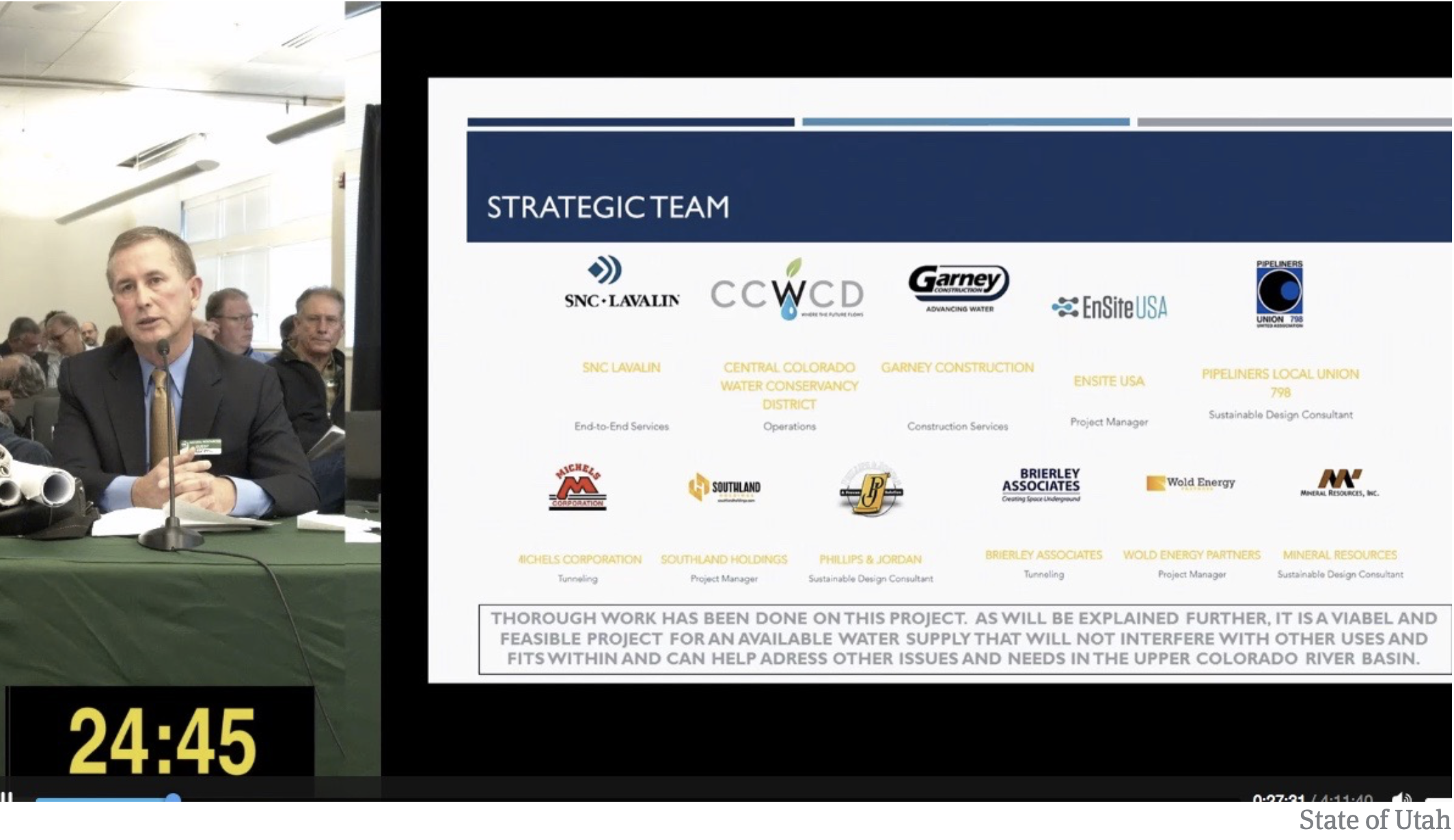
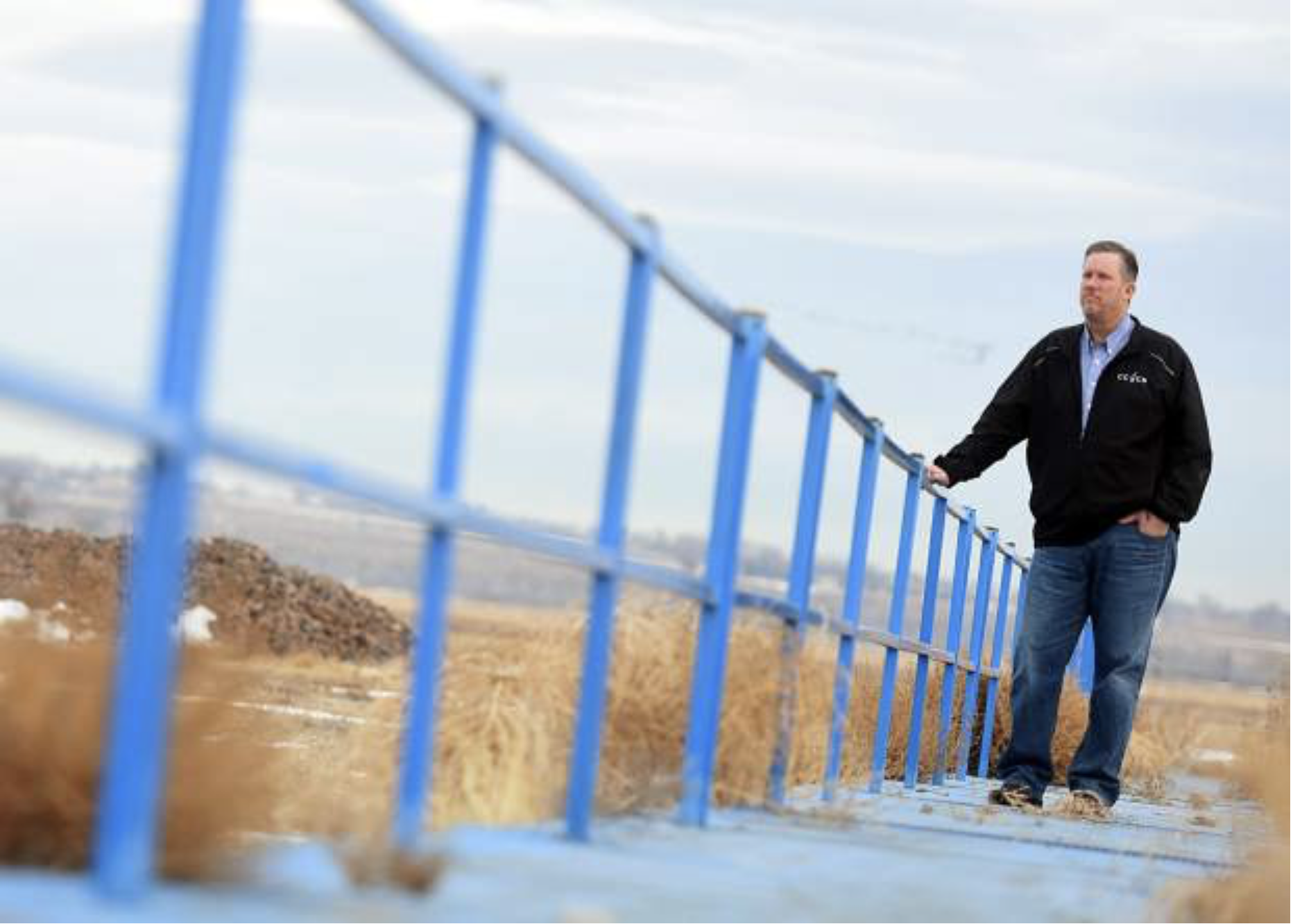
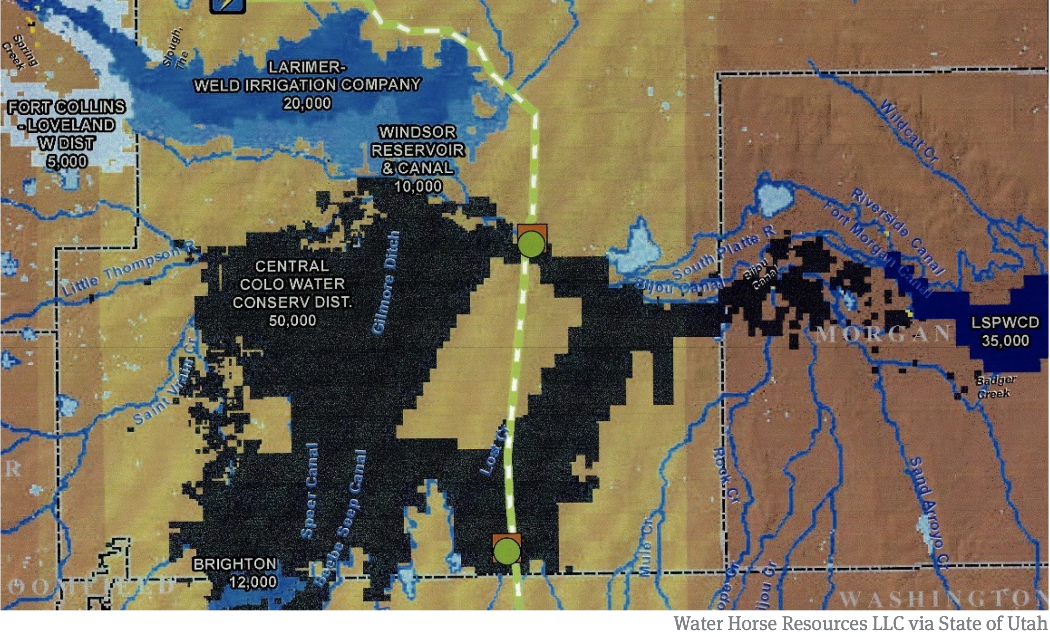
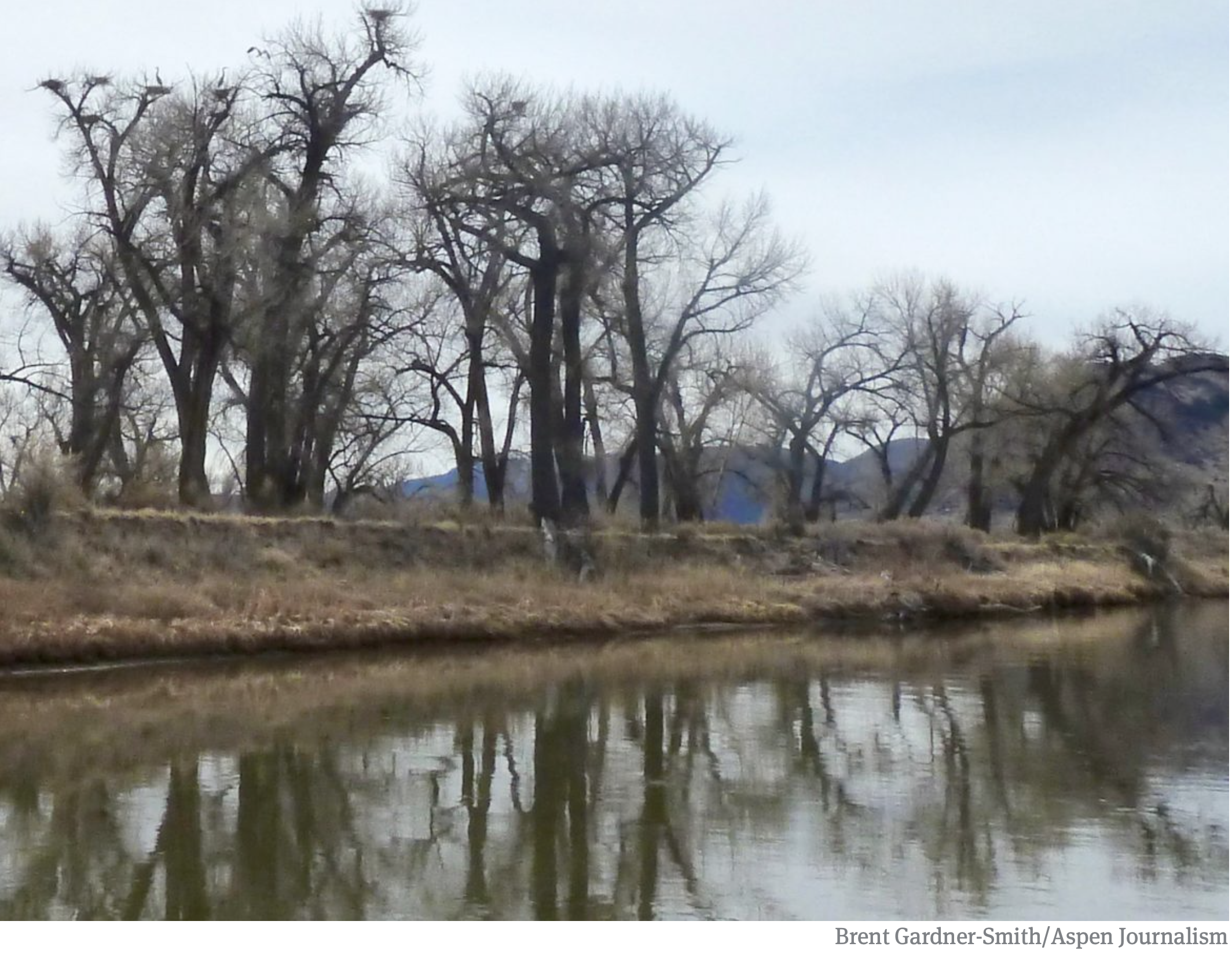
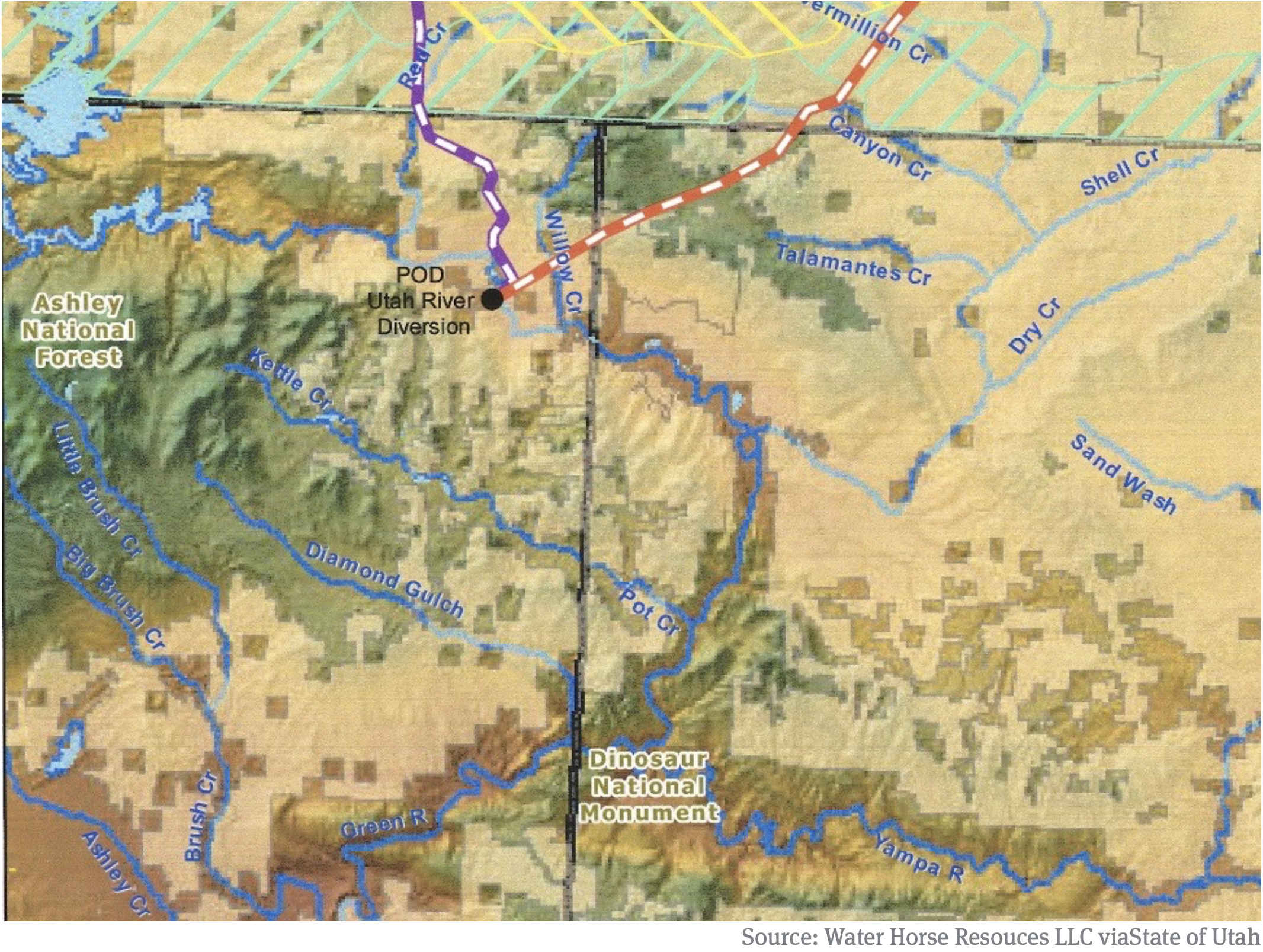
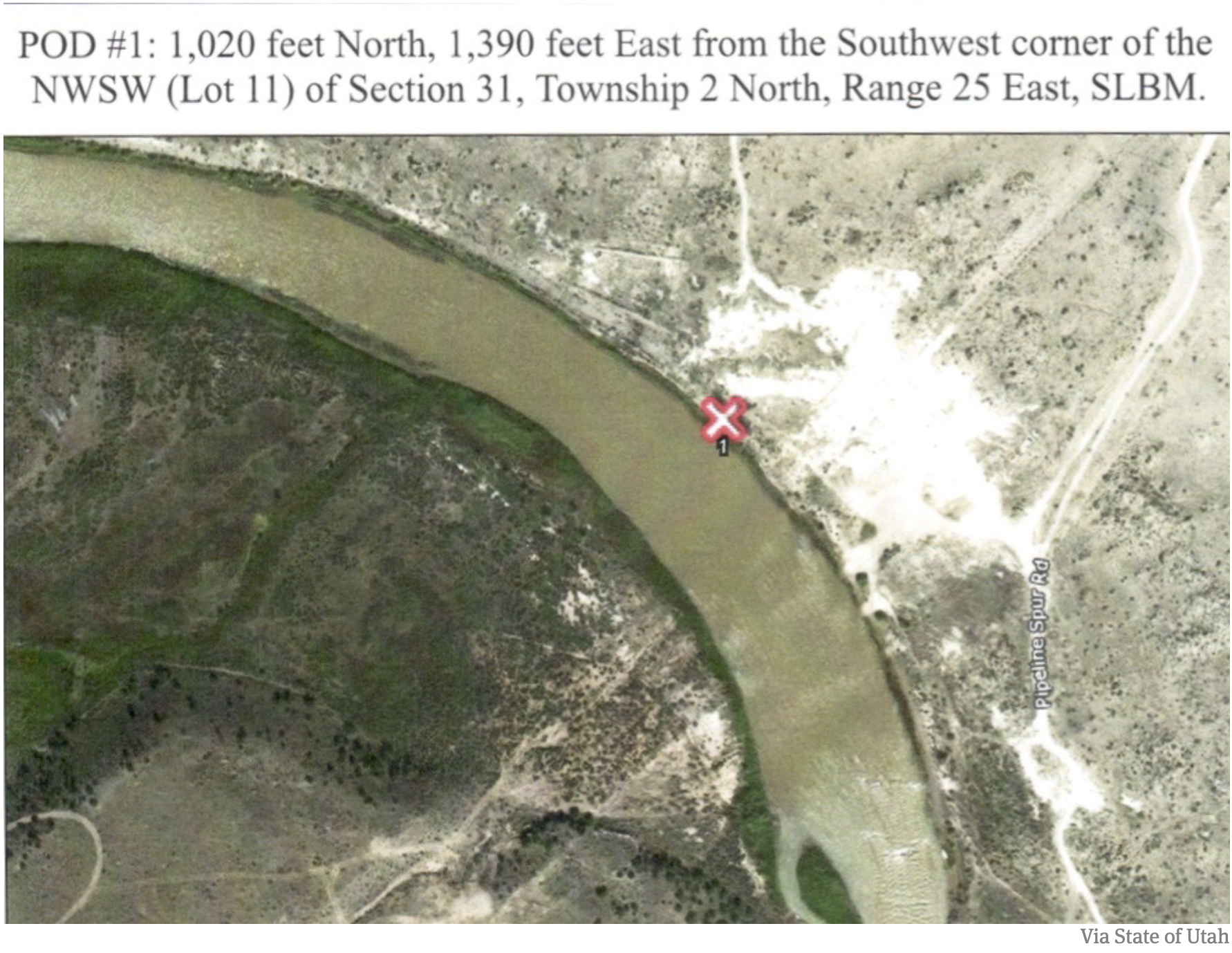


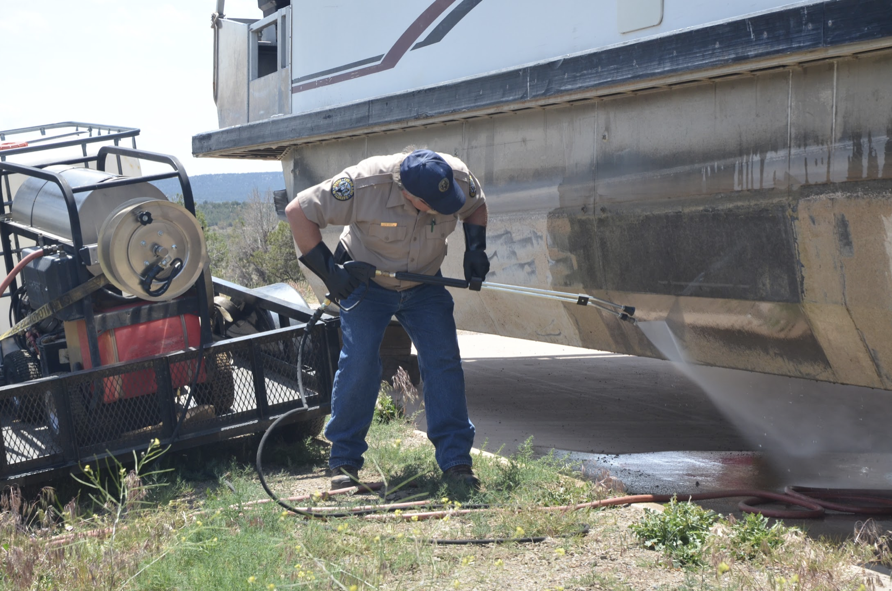
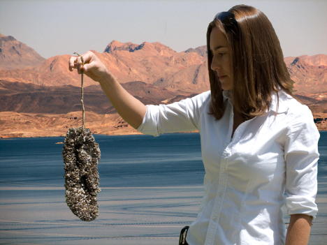


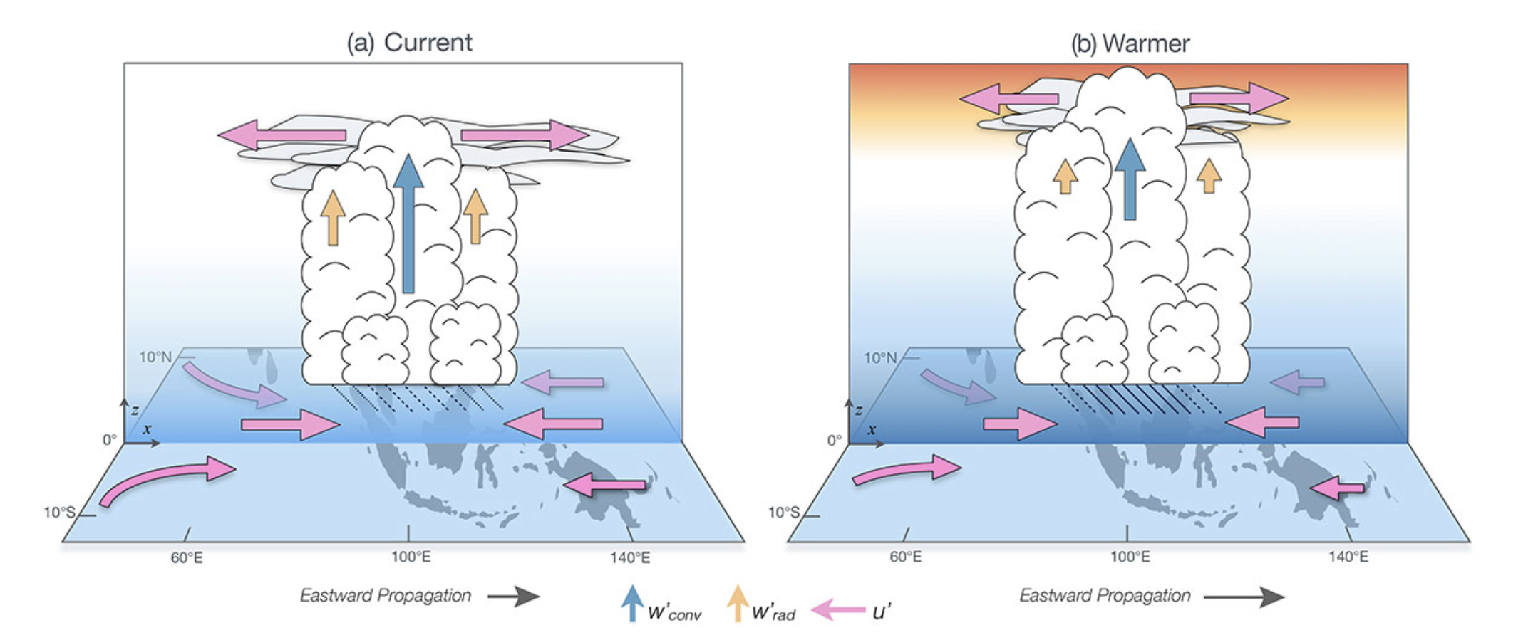

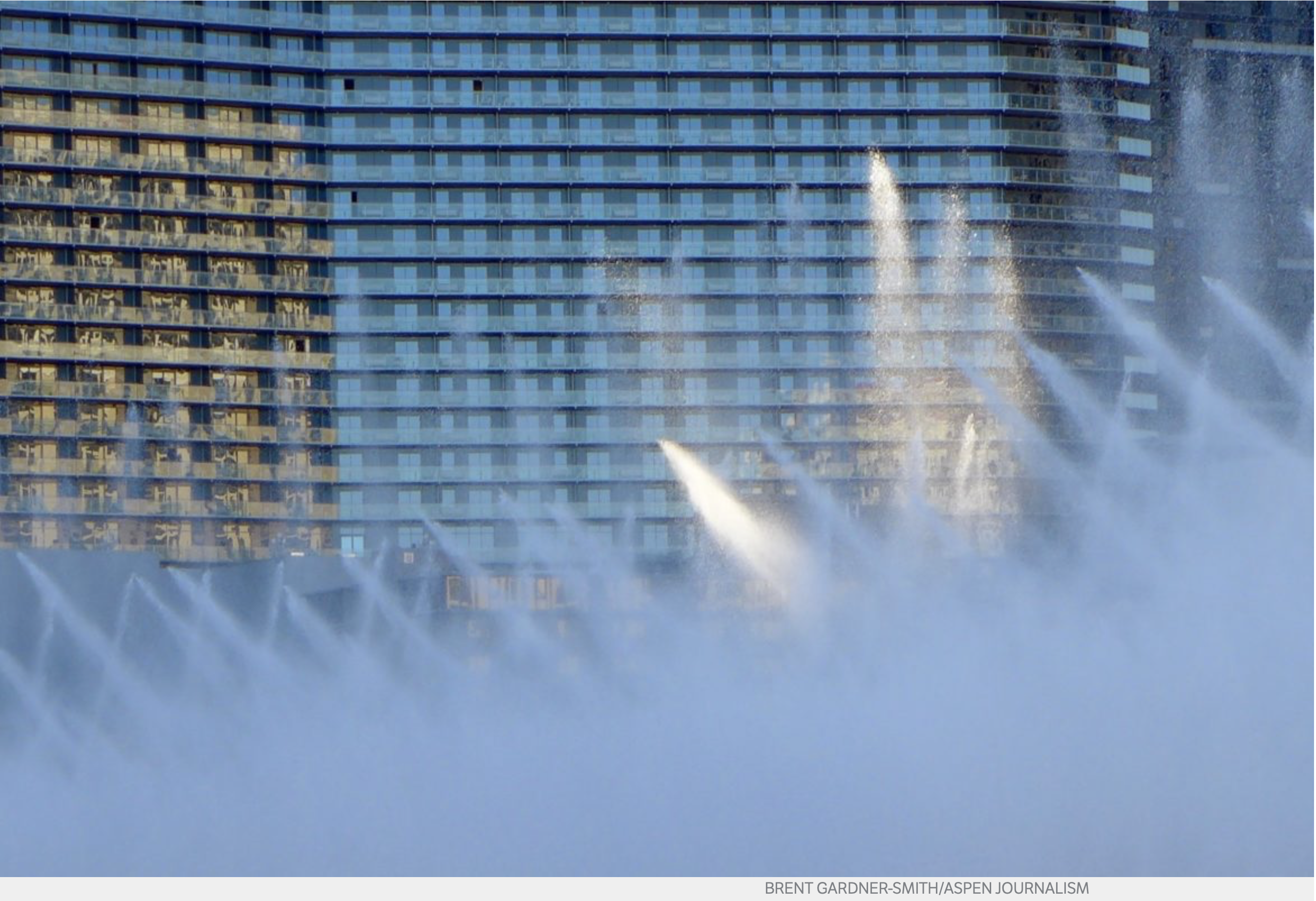

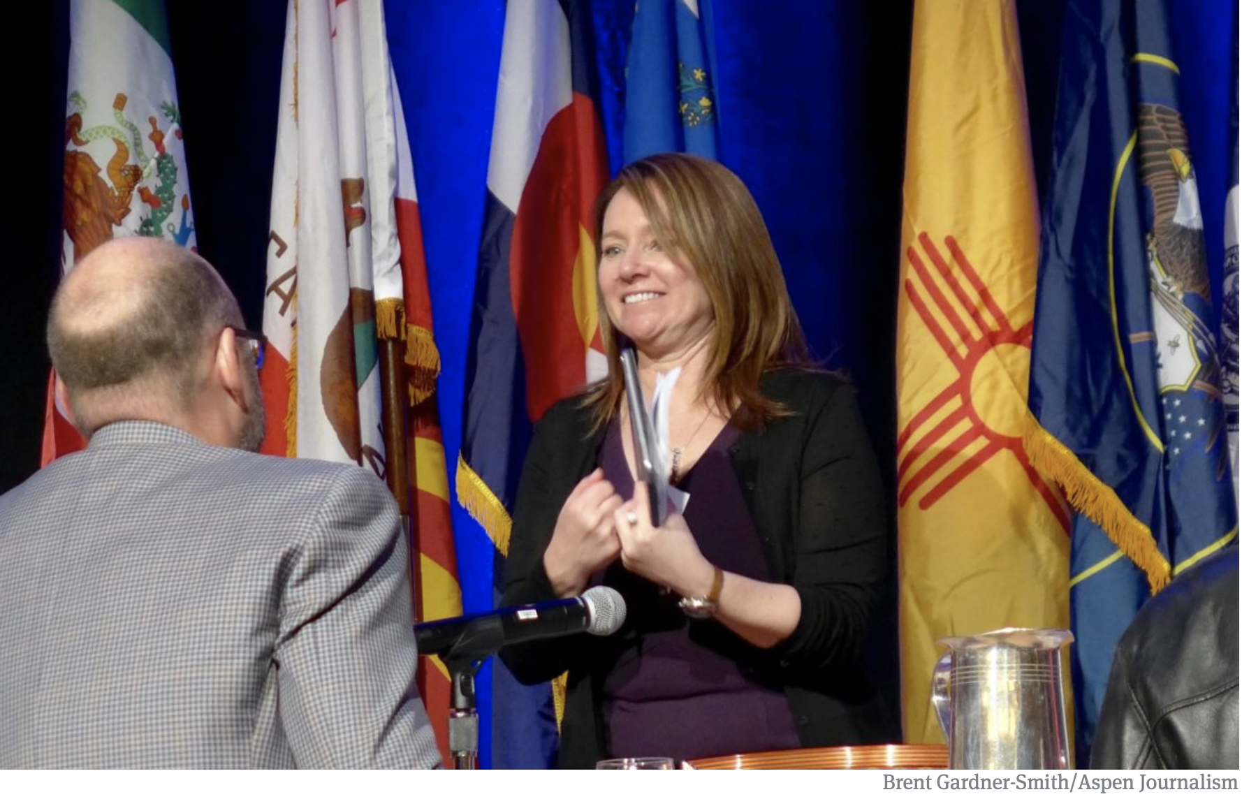
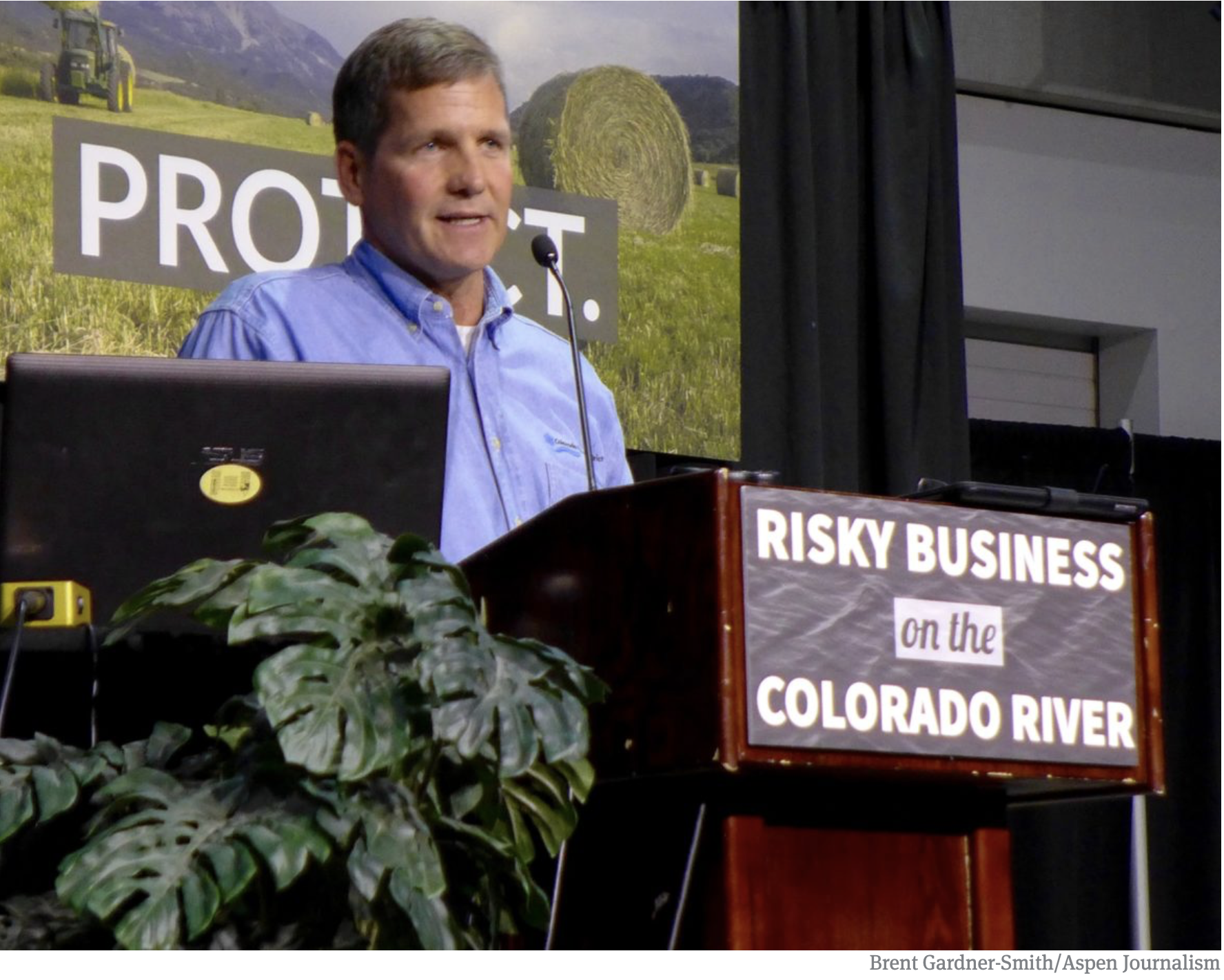
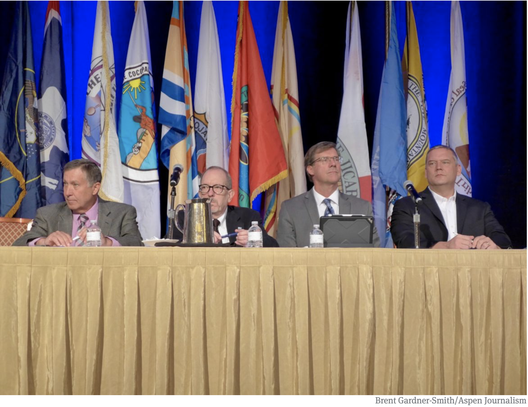

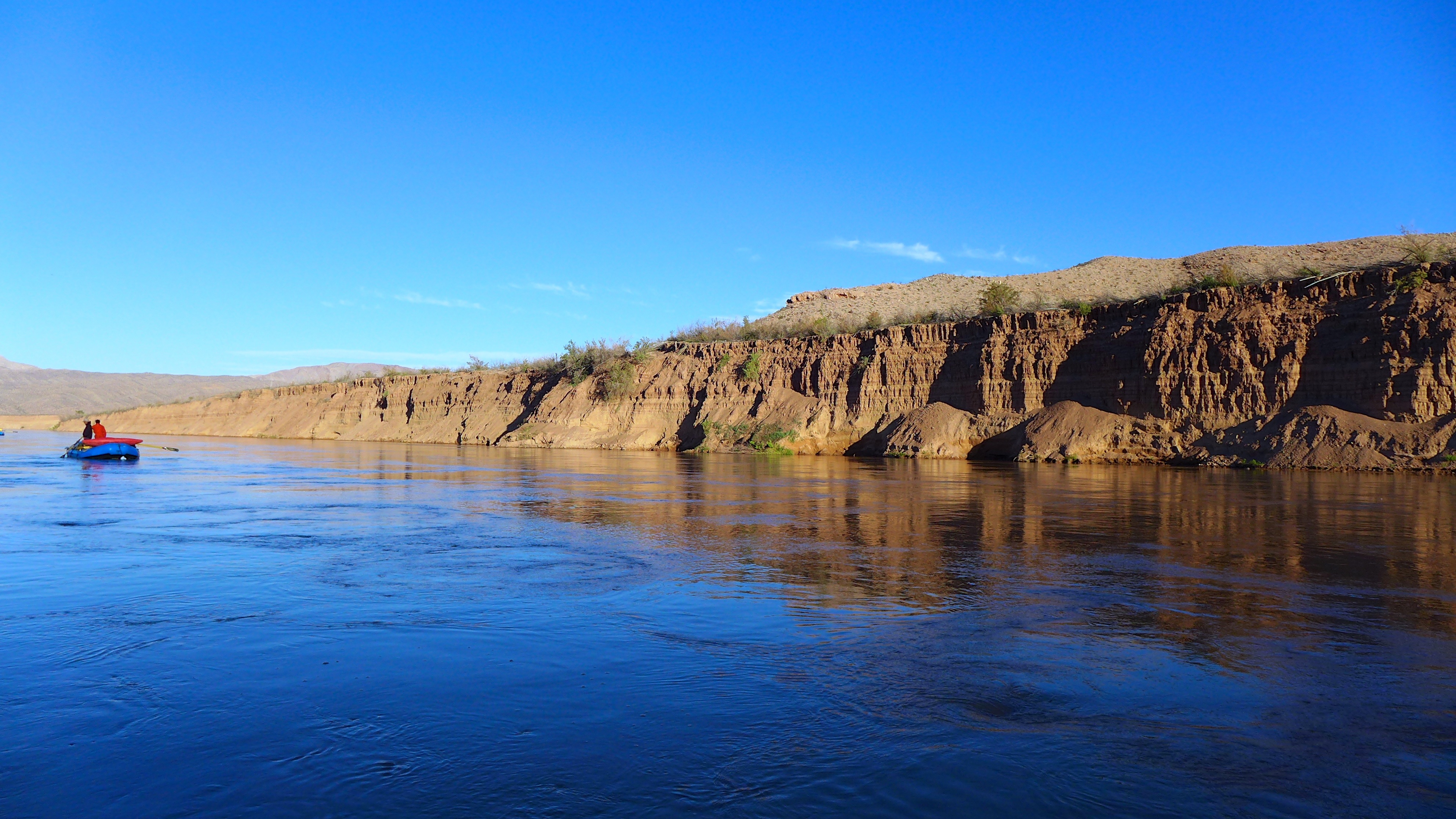
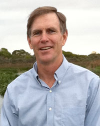

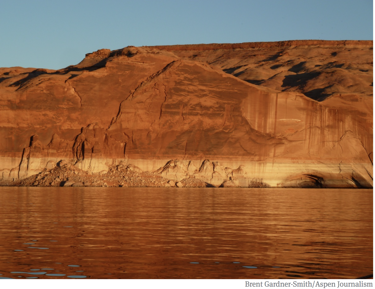
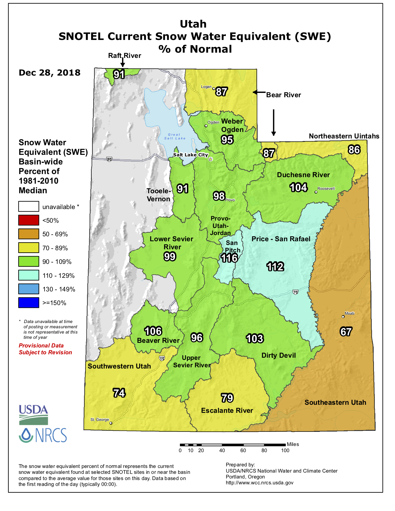


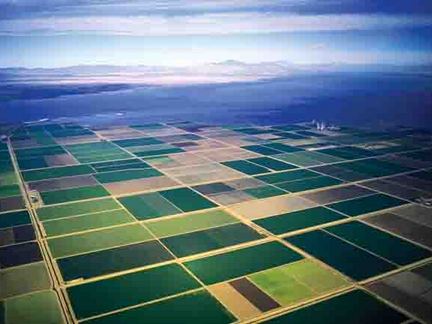


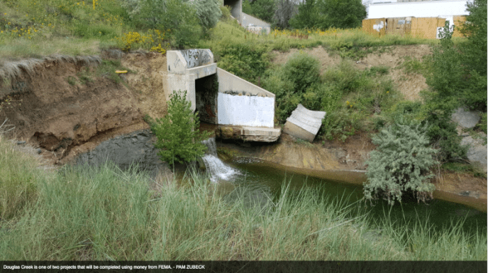


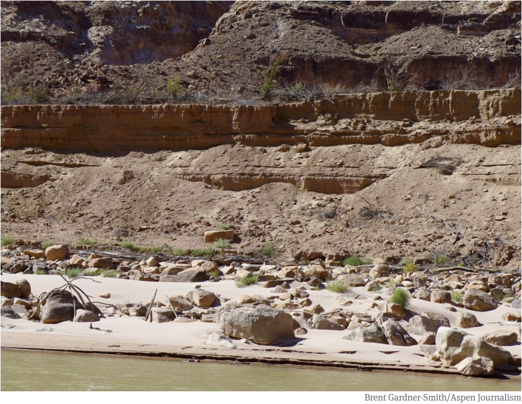
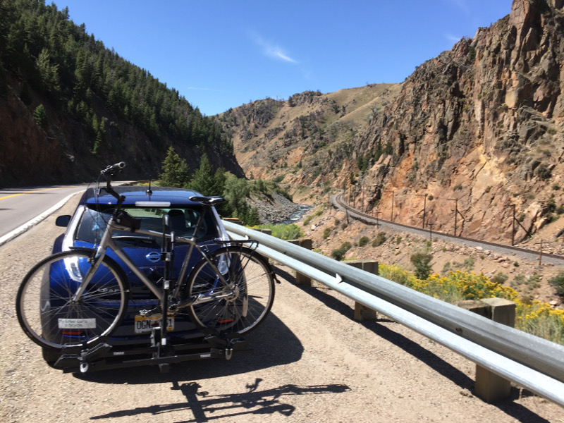

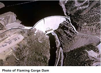

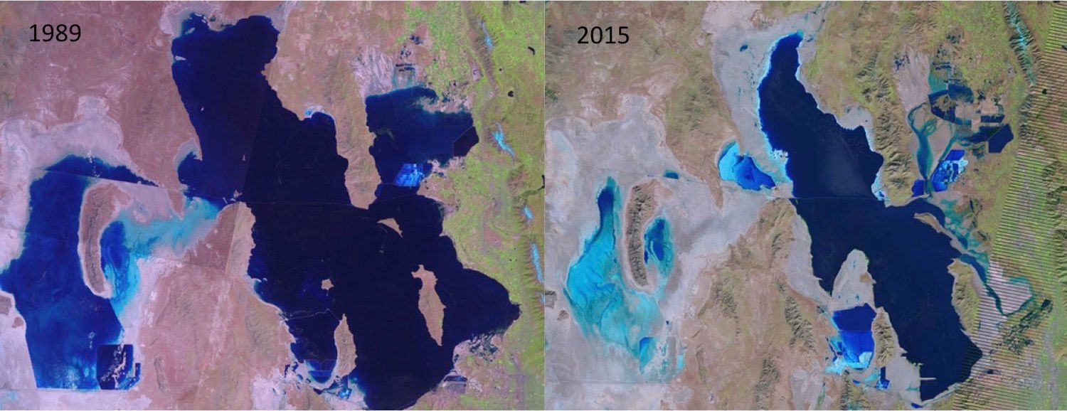
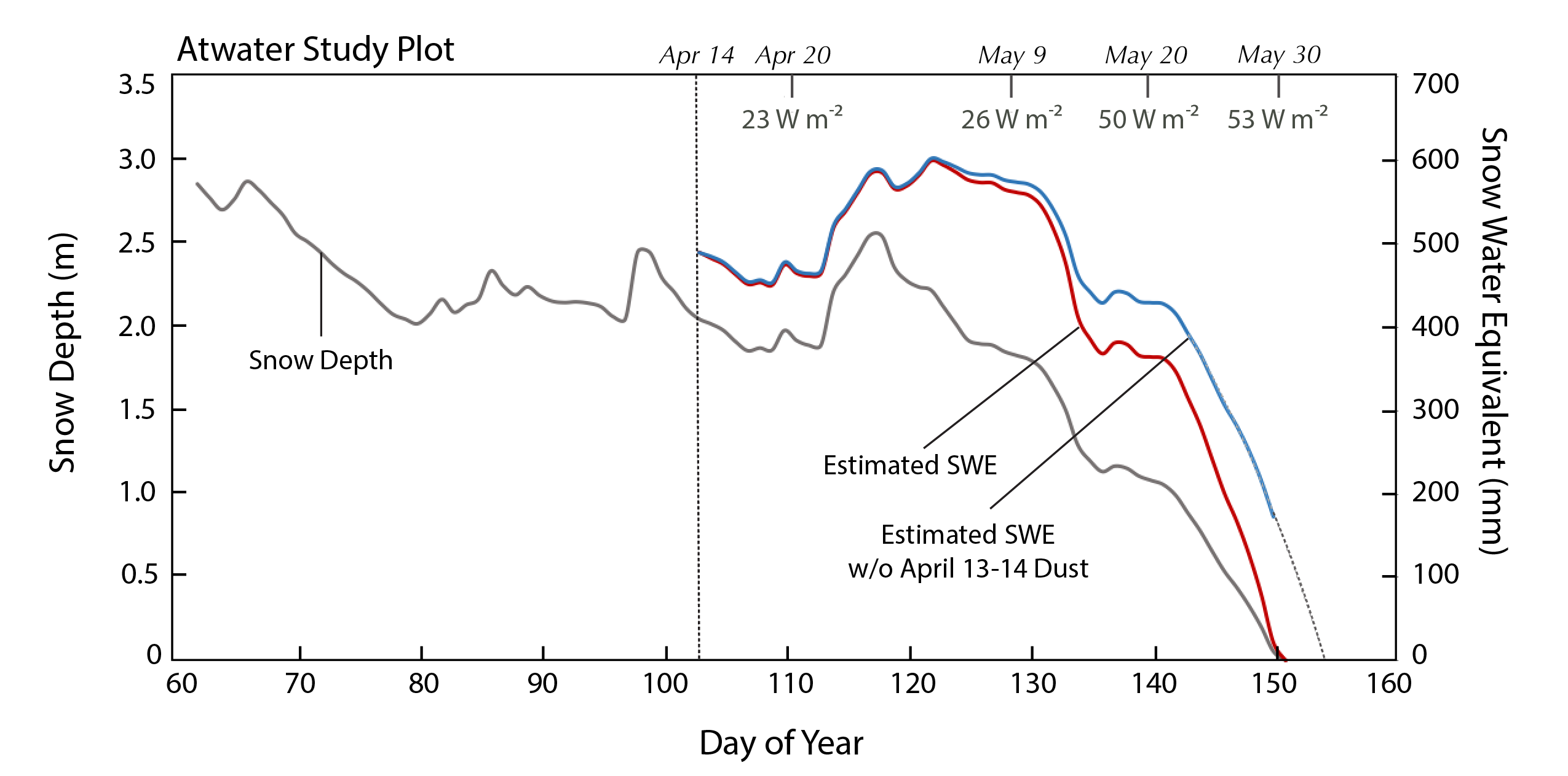
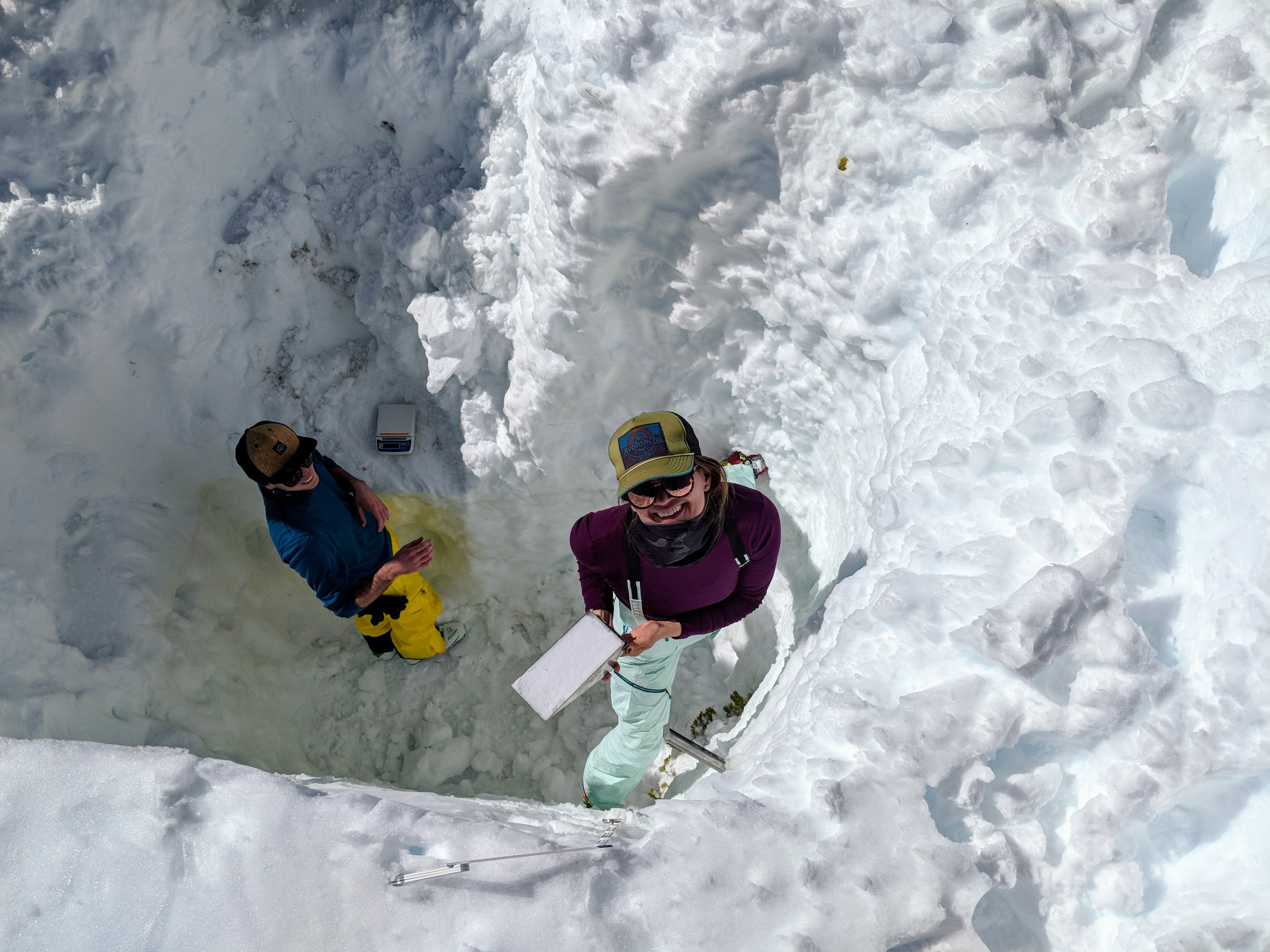
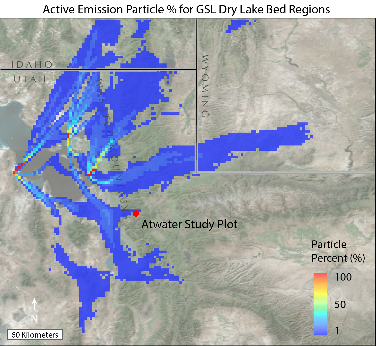
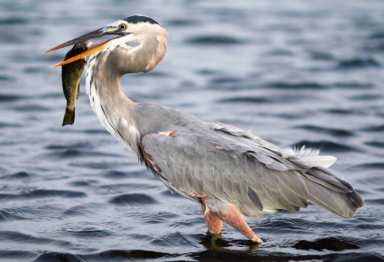


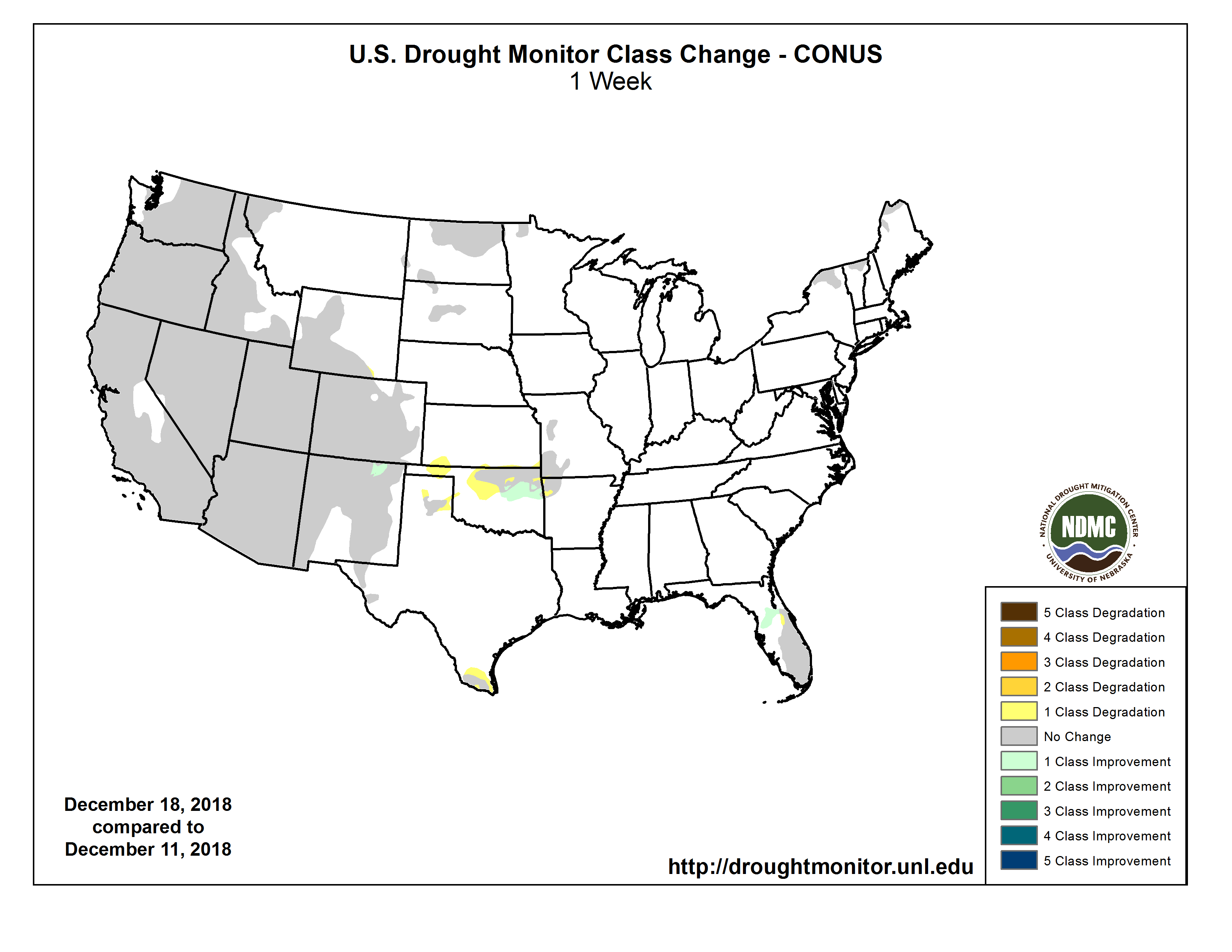
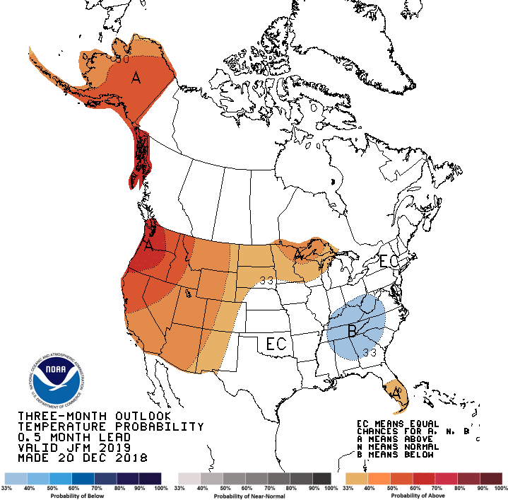
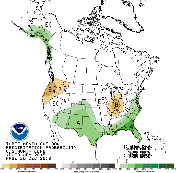
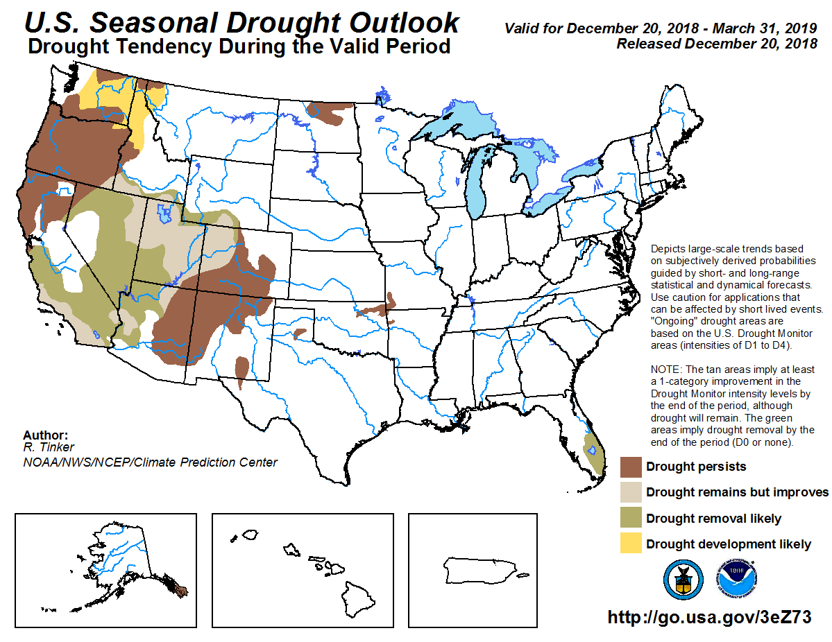
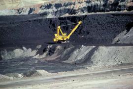
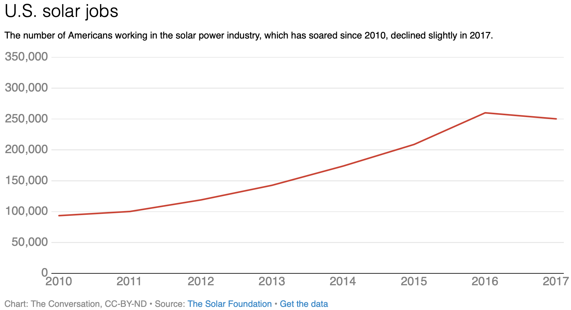
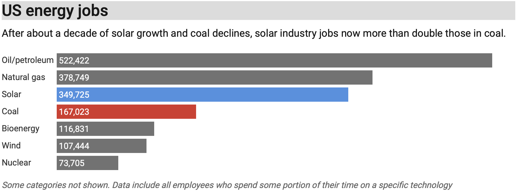
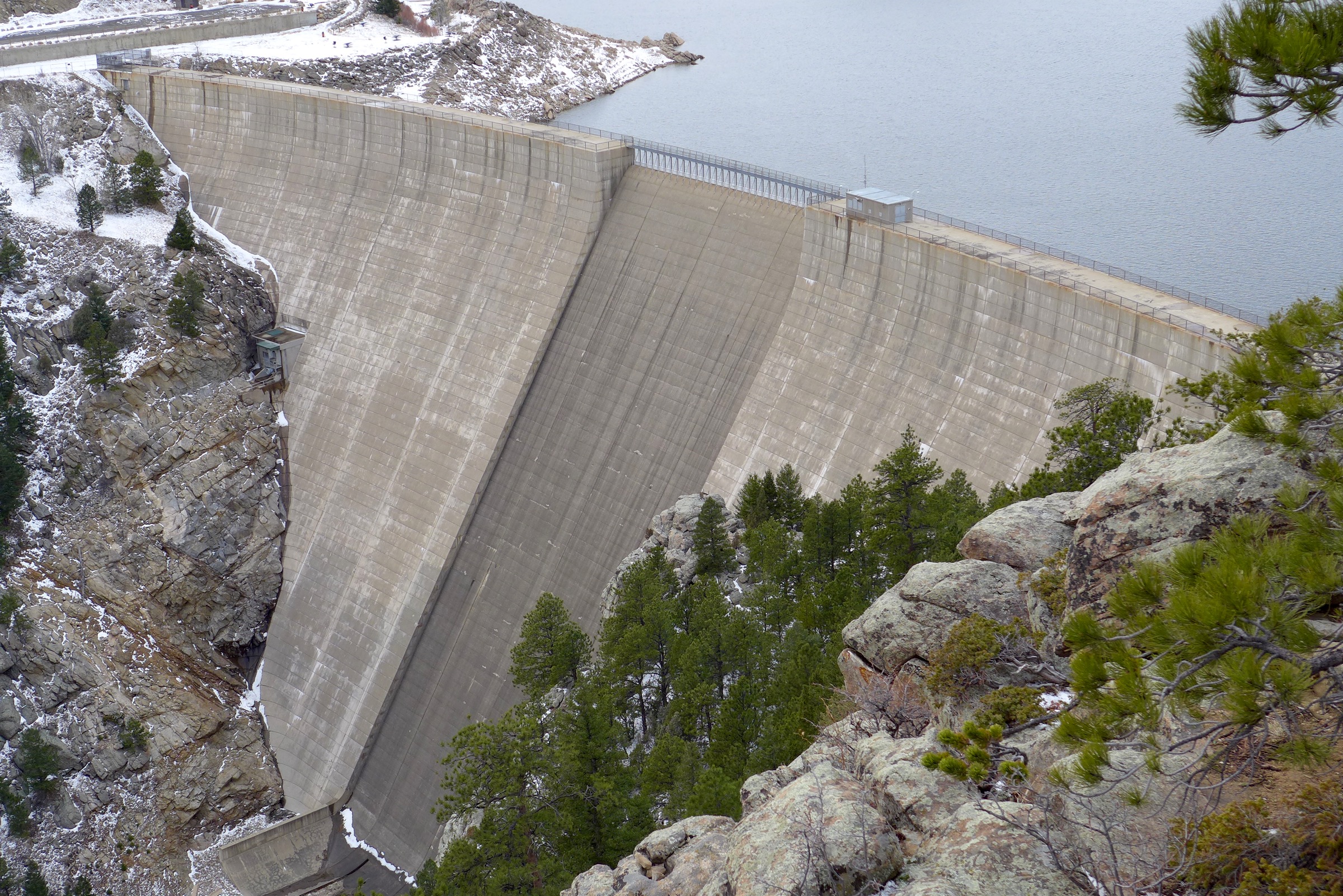
