According to research unveiled last week, mega-droughts may no longer be history. On Thursday, a team of climate scientists argued that the American West may currently be experiencing its first mega-drought in more than 500 years. A record-breaking period of aridity set in around the year 2000 and continues to this day, they said.
“The last 19 years have been equivalent to the worst 19 years of the worst mega-droughts on record,” said Park Williams, a professor of bioclimatology at Columbia University, at a presentation of the work. Only three recent mega-droughts—in the late 800s, the mid-1100s, and the late 1500s—were worse than the current period, he added.
Climate change seems to be driving a good chunk of the problem. “The current drought is substantially worse than it would have been without global warming,” Williams said. The drought was 62 percent more severe than it would have been, he said, due to human-caused climate change.*
Williams presented the results to a standing-room-only session at the American Geophysical Union’s fall meeting, the year’s largest planetary-science conference. The work has not yet been peer-reviewed. While it’s a common practice to share preliminary work at a scientific meeting, Williams didn’t comment directly for this article; academic norms discourage researchers from publicly discussing a study before its formal publication.
But other scientists told me that the work makes sense, saying it was “quite plausible” that the American Southwest is in a mega-drought right now. And no matter what, it’s clear that the region is in the middle of a far-reaching climatic transformation.
“The definition of mega-drought technically is open to debate,” said Jonathan Overpeck, a climate scientist at the University of Michigan. Two decades ago, he and the climate scientist Connie Woodhouse coined the term mega-drought in a paper, specifying that such a drought must last 20 years or more.
“The drought in the Southwest is now in its 19th year. So it’s right on the cusp of technically being a mega-drought,” Overpeck told me.
The current drought is “relentless,” he said, with consequences that reverberate across the West. “It’s reflected in the levels of Lake Mead and Lake Powell, the two largest reservoirs in our country … You see it in the way the forests are outright dying in some places, in big insect outbreaks as [plants] are weakened by a lack of moisture in the soil, in more catastrophic wildfires. There’s a lot of signs this drought is unusual.”
He said that two different events seem to be driving the crisis. First, the region is receiving less rain than normal. Second, the Southwest as a whole is systematically warming up and drying out. It’s becoming a more desertlike place, a process that scientists call aridification. “Most of the work points to aridification being dominant” in driving the modern drought, Overpeck said.
The new work from Williams and his colleagues may support the same idea. They began by looking at the climatic record preserved in tens of thousands of tree rings across the American West. By using a simple form of machine learning on that data and calibrating it to modern weather records they pieced together the past 1,200 years of soil moisture in the West. (Williams’s team includes Ed Cook, who practically invented the modern study of tree rings.)
Consulting this record, they found that the current drought does not perfectly resemble historic mega-droughts. While previous droughts were concentrated in just one or two places in the West, the current drought covers almost half of the country. Climate models suggest that this huge territorial extent may be caused by the extreme heat and dry air that’s plagued western states in the past few decades. “What may have just been a drought in the Southwest is now a drought across the entire study region,” Williams said at the conference…
Woodhouse, who coined the term mega-drought with Overpeck, told me that this effect may be the most important finding of the new paper. “The current 19-year period is different [from] 19-year periods in the past for the simple reason that it is occurring under warmer temperatures,” she said in an email. “In essence, a garden-variety drought (in terms of precipitation deficits) + warming = a much more severe drought.”
Overpeck agreed. “The warming is having a huge effect—a huge effect on water resources and a huge effect on forests,” he said. “People knew there would be an effect, but we didn’t know it would come this big, and this fast.”
Click on a thumbnail graphic to view a gallery of US Drought Monitor maps from around this time of year since 2009.
A gate mechanism on the dam that forms Lost Man Reservoir on a tributary of the upper Roaring Fork River. Diversions from the Colorado River basin could be curtailed if water shortages continue, either on a voluntary or involuntary basis. Photo credit: Aspen Journalism/Brent Gardner-Smith
If water managers in Arizona and California are able to finalize agreements on drought-management plans by Jan. 31 — as the head of the Bureau of Reclamation on Thursday directed them to do — and if required federal legislation is passed, it will give water managers in Colorado, Wyoming, Utah and New Mexico a green light to develop voluntary water-use reduction plans in each state.
Such plans, which water officials call demand-management programs, are meant to send as much as 500,000 acre-feet more water downstream to Lake Powell to meet the water-delivery obligations that the four upper-basin states have to the three lower-basin states — the third is Nevada — under the 1922 Colorado River Compact.
Representatives of the upper-basin states serving on the Upper Colorado River Commission voted [December 12, 2018] to approve agreements that are intended to set up a new legal pool of water in Lake Powell, one that can be purposely filled with water that otherwise would have been used to grow crops, primarily hay and alfalfa.
If water levels in Lake Powell fall below an elevation of 3,490 feet, hydropower production ceases and then less and less water can be sent downstream through the outlets in Glen Canyon Dam.
However, the broad agreements approved this week by the upper-basin states did not set up any specific demand-management programs, just a “framework” for such programs.
The agreements say that each of the upper-basin states must figure out a water-use reduction plan that not only works for their particular state but also meshes with each of the other states’ plans.
A key common consideration is making sure that the conserved, or saved, water — that which is not consumed by crops in fallowed fields — is actually reaching Lake Powell, which is fed by water running down the Colorado, Green and San Juan river basins.
About 600 cfs of water from the Roaring Fork River basin flowing out of the east end of the Twin Lakes Independence Pass Tunnel on June 7, 2017. On June 14, the water would flow toward the Gulf of California, not the Gulf of Mexico. Photo credit: Aspen Journalism/Brent Gardner-Smith
Coming soon?
No deadline or schedule has been agreed upon by the upper-basin states to develop their water-use reduction plans, which are supposed to be “voluntary, temporary and compensated.”
John Stulp, the special adviser to Colorado’s governor on water issues, said Friday he did not think the demand-management programs would be ready for the irrigation season in 2019, but they may be ready by 2020.
Stulp also said Friday that officials in all the upper-basin states have been thinking a lot about how demand-management programs will work and that a recently concluded four-year pilot effort — the System Conservation Pilot Program — provides a good working model on which to build.
He also suggested that the process to set up such a plan, at least in Colorado, could be as important as some of the details in the plan itself.
“I think it’s going to be important that we have a process that is really transparent and that folks feel like they know what is going on and that the right people are at the table,” Stulp said Friday. “(Western Slope and Front Range) interests, anybody that touches in any way the Colorado River system needs to be able to know what’s going on there.”
Stulp said he expected that the directors of the Colorado Water Conservation Board, a state agency charged with managing the Colorado River Compact, would discuss a process for setting up a demand-management program at their January board meeting.
“I think it is important that we start right away,” he said.
Stulp was asked about the potential demand-management plans at the end of a three-day regional water meeting in Las Vegas, where a panel discussion on demand management, which featured the four commissioners on the Upper Colorado River Commission, took place.
Pat Tyrrell, the Wyoming commissioner who also serves as the state’s water engineer, was asked whether it was in the upper-basin states’ best interests to voluntarily cut back on water use to avoid violating the 1922 compact, which could lead to mandatory curtailment of water diversions.
“If headgates are going to be off anyway, if the pipelines are going to be off anyway due to shortage, why not do it in a way that lays the most lightly on our people?” Tyrrell said. “That’s what demand management does, that’s what the drought contingency plan does — it allows us to maintain those uses and maintain compliance with that important ’22 document.”
Tyrrell also said he was surprised how enthusiastic ranchers in Wyoming were about the System Conservation Pilot Program, which ran from 2015 to 2018.
“Water rights, especially the old ones, are often viewed, essentially, in religious terms in many of the upper-basin states,” Tyrrell said. “It’s anathema to these people to hear ‘Don’t use your water right, let the water go.’”
Tyrrell said even if the pilot program wasn’t perfect, “we have to kick the training wheels off and turn it into a demand-management program that is fully fledged.”
All four commissioners acknowledge that there are technical and legal challenges in setting up water-use reduction programs that work across state lines, including verifying how much water is not used, securely “shepherding” the water past downstream diversions to Lake Powell and finding funds to compensate irrigators for fallowing their fields.
Funding may be the biggest challenge, Colorado’s Stulp said.
But he pointed to the significant funding — $100 million — that is coming together in Arizona (from its water districts and state government, from the federal government and from philanthropists) as a sign that a water-use reduction program is worth trying in Colorado.
“The worse-case scenario — the fallback of all this — is a curtailment without compensation,” Stulp said. “Nobody wants to go there.”
Editor’s note: Aspen Journalism covers water and rivers in collaboration with The Aspen Times and other Swift Communications newspapers. The Times published this story on Saturday, Dec. 15, 2018.
The images above use daily precipitation statistics from NWS COOP, CoCoRaHS, and CoAgMet stations. From top to bottom, and left to right: most recent 7-days of accumulated precipitation in inches; current month-to-date accumulated precipitation in inches; last month’s precipitation as a percent of average; water-year-to-date precipitation as a percent of average. Maps via the Colorado Climate Center.
Click here to read the current assessment. Click here to go to the NIDIS website hosted by the Colorado Climate Center.
As the owners of the largest coal-burning power plant in the West map out the details of closing in the next two years, the Navajo Nation has taken its next step in its energy development by starting operations at a new 27-megawatt solar farm not far from the source of the coal that fuels Navajo Generating Station. The Kayenta solar project, owned by the Navajo Tribal Utility Authority and operated by First solar, is the first large-scale solar energy facility on the reservation. The electricity is sold to the Salt River Project for distribution. The project’s 120,000 photovoltaic panels sit on 200 acres and are mounted on single-axis trackers that follow the movement of the sun. It provides enough electricity to power approximately 7,700 households. The tribe entered a lease agreement with NTUA in 2015 for the location, a groundbreaking ceremony was held in April 2016, followed by six months of construction that started last September. The $60 million facility was built using a construction loan from the National Rural Utilities Cooperative Finance Corporation.
The month of December 2018 is probably going to go down in history as the month when all things climate and energy truly and irreversibly changed for the better in the American West.
From bold carbon reduction commitments by big utilities to the fact that the economics of renewables are unbelievably great (and seem to be getting better by the day), this month has been a watershed moment.
Given this, we thought it’d be useful to dive in more deeply and really explore what all these announcements mean. Below, our top ten takeaways from these latest developments:
10. Xcel Energy Will be Shutting Down all its Remaining Coal-fired Power Plants in Colorado
The big news in early December was Xcel Energy’s announcement of its goals to reduce carbon emissions 80% by 2030 and to become completely carbon-free in its generation of electricity by 2050.
Bold. There’s no other way to put it. Xcel Energy is not only the first utility in the nation to commit to becoming carbon-free, but did so even as the company currently generates power from many coal-fired power plants.
This was not an announcement from some flaming progressive utility. This was an announcement from a utility that still generates huge amounts of power from carbon-intensive fossil fuels. In fact, Xcel still generates more than 50% of its power from coal in Colorado.
And in the wake of this bold commitment, there’s really no escaping the real implications. If Xcel has any chance of reducing carbon emissions 80% by 2030 and going carbon-free by 2050, the company is going to have to shutter all of its remaining coal-fired power plants in Colorado.
That includes the Hayden power plant outside of Steamboat Springs, the Pawnee power plant northeast of Denver, and the entirety of the Comanche 3 plant in Pueblo.
And in all likelihood, to meet their 2030 goal of reducing carbon emissions 80%, it means these plants are going away by 2030.
It may seem drastic, but there’s really no other viable option. As Xcel’s CEO commented, this is about doing something for the climate. And as the economics of coal worsen, Xcel will surely soon be followed by other utilities looking to shed the mounting liabilities of fossil fuels.
9. Platte River Power Authority Will be Shutting Down its Coal-fired Power Plant north of Fort Collins, as well as Divesting its Share of Craig
Xcel’s announcement was big, but Platte River Power Authority’s was bigger.
The Colorado power agency, which serves Fort Collins, Loveland, Longmont and Estes Park, announced its goal of eliminating 100% of its carbon emissions by 2030.
While that’s an astounding goal that almost puts Xcel’s commitments to shame, what’s more significant about Platte River Power Authority’s announcement is that will mean a wholesale transformation in the utility’s generating portfolio.
Currently, nearly 90% of Platte River Power Authority’s electricity is generated by coal or natural gas. And of its fossil fuel-generating portfolio, more than half is provided by the Rawhide power plant north of Fort Collins and a portion of the Craig power plant in northwest Colorado.
Transmission towers near the Rawhide power plant near Fort Collins, Colo. Photo/Allen Best
The utility’s announcement all but guarantees the Rawhide plant will be shut down and that it will divest of its ownership in the Craig plant, all by 2030.
Coupled with Xcel’s plans, it means that Colorado will be virtually coal-free by 2030.
8. Pacificorp Has no Economic Choice but to Retire a lot of Coal
Pacificorp, a Portland, Oregon-based utility, owns all or portions of 10 coal-fired power plants in Arizona, Colorado, Montana, Utah, and Wyoming (they used to own 11, but shut down an aging plant in Utah in 2015).
To boot, they own coal mines in both Utah and Wyoming.
Yet even this captain of coal in the American West is coming to terms with the reality that its massive fossil fuel enterprise makes no economic sense.
Earlier in the month, the company released a report showing that 60% of its coal-fired generating units are more expensive to operate than developing new alternative sources of power, namely renewable energy.
However, that was just the headline. A closer look at Pacificorp’s report actually reveals that, taken together, all of the company’s coal-fired units are not remotely cost-effective.
Under a base scenario, while some of the company’s coal-fired units are cheaper to operate than alternatives, the savings from retiring uneconomic units would actually offset the costs of retiring the utility’s entire fleet of coal.
Pacificorp has made no decisions or announcements yet. However, in the wake of Xcel Energy’s carbon-free commitment, it seems inevitable the utility will make a similarly bold proclamation in 2019.
Ultimately, we’re likely to see Pacificorp make a big move away from coal in the very near future. Because of the company’s massive coal footprint in the American West, this move promises a massive move to renewable energy in the western U.S.
7. People Served by Colorado Springs Utilities Should be Worried
Colorado Springs Utilities serves the City of Colorado Springs, Colorado and surrounding communities. And while the municipal utility seems innocuous, they generate more than 40% of their power from coal from two coal-fired power plants, including one—Martin Drake power—right in the middle of the City’s downtown.
For years now, residents and ratepayers have sounded the alarm over the Martin Drake power plant, which sours the skies with toxic emissions.
Equally alarming is the fact that Martin Drake is one of the least efficient and most expensive municipally owned power plants to operate in the United States.
In spite of this, the utility seems to have no plans for addressing the rising costs of power except a vague and unenforceable commitment to retire Martin Drake by 2035. What’s more, the utility seems to have no plans to retire its other coal-fired power plant, the Ray Nixon plant located south of Colorado Springs.
So, while other utilities in Colorado are making big moves away from coal, Colorado Springs Utilities is staying firmly committed, at least for the time being, to costly coal.
It’s no wonder why people in Colorado Springs are increasingly incensed over their utility’s inaction.
The unrest will only grow as Colorado Springs Utilities delays providing its customers with cleaner and more affordable power.
6. This is the Beginning of the End for Tri-State Generation and Transmission
Tri-State Generation and Transmission is a utility company that provides wholesale power to 43 member rural electric cooperatives in Colorado, Nebraska, New Mexico, and Wyoming.
And while Tri-State has a noble goal of energizing rural communities within its service area, the company is facing growing resistance over rising costs.
The reason for rising costs: the company’s heavy reliance on coal-fired power, as well as Tri-State’s investments in coal mines.
Because of this, the utility is facing the prospect of a mass exodus of its customer base.
In 2016, one of its former members, the Kit Carson Electric Cooperative in northern New Mexico, bought out its contract with Tri-State. This month, another member, the Delta Montrose Electric Association in western Colorado, filed a complaint with state utility regulators to do the same.
Not only that, but other members, including the United Power Cooperative, La Plata Electric Cooperative, and the Poudre Valley Electric Cooperative, all of which are major revenue generators for Tri-State, are also exploring alternatives to the utility company.
Coupled with the fact that Tri-State’s utility partners, including co-owners of the Craig coal-fired power plant in northwestern Colorado, are moving away from coal, the company is facing a bleak future.
As its members and partners bail, Tri-State’s business model seems doomed to collapse.
That’s not all bad news. As Tri-State declines, its members stand to enjoy more energy freedom and to reap the economic rewards of local renewable energy development.
5. Salt River Project and Arizona Public Service Likely to be Next to Announce Big Moves from Coal
Salt River Project and Arizona Public Service are both large utilities primarily serving Arizona. And both utilities know that the economics of coal simply aren’t worth it.
As the primary owner of the Navajo Generating Station in Arizona, the largest coal-fired power plant in the American West, Salt River Project decided to shutter the facility by the end of 2019.
Arizona Public Service, is also getting out of the Navajo Generating Station after retiring portions of the nearby Four Corners power plant in northwest New Mexico.
Navajo Generating Station. Photo credit: Wolfgang Moroder.
So far, neither Salt River Project nor Arizona Public Service has made any further announcements to move away from coal. However, given that both of the utilities are clearly seeing the reality of coal costs, we should see some additional major shifts away from coal in the west.
Arizona Public Service also owns a portion of the Cholla coal-fired power plant in Arizona. The other owner of Cholla is Pacificorp. And with Pacificorp already seemingly making a move away from coal, it’s hard to believe Arizona Public Service won’t follow.
Salt River Project owns portions of the Hayden and Craig power plants in western Colorado, as well as portions of the Four Corners power plant in New Mexico and Springerville power plant in Arizona. They also fully own the Coronado power plant in Arizona.
Every one of these power plants has been identified as economically costly and risky by financial analysts.
Given all this, it’s hard to believe that Arizona Public Service and Salt River Project will continue to maintain their investments in coal.
4. New Utilities Emerging, Giving Old a Run For Their Money
This is beyond huge.
With the decline in renewable prices, new utilities are actually emerging in the American West.
At the forefront is Guzman Energy, whose stated goal is to “transition an outdated energy economy into the renewable age.”
And just last week, Guzman released a request for proposals to build 250 megawatts of renewable energy in the American West, including 200 megawatts of wind and 50 megawatts of solar.
3. This isn’t Just a Climate Opportunity, it’s a Huge Economic Development Opportunity
More renewable energy means more economic development, particularly in rural communities.
Already in Colorado, the state’s move away from coal to more renewable energy promises more jobs, more local revenue, and overall a huge net economic benefit.
It’s really a no-brainer when you think about it.
For one, developing renewable energy means developing more distributed generating sources, including rooftop solar, wind, and batteries, which are ideally situated in the communities they serve.
For another, as more renewable energy takes hold, energy prices stand to stabilize, if not decline, saving communities in the long run.
Colorado rural electric cooperative Delta Montrose Electric Association’s effort to break free from Tri-State is in fact being driven by the prospect of greater economic prosperity. As the co-op’s CEO stated:
“The decision to separate from Tri-State allows for significant economic benefit for our members – including stabilized rates, development of diverse and low-cost local energy, and the creation of new local jobs.” – Jasen Bronec, chief executive officer, Delta Montrose Electric Association
As utilities throughout the American West make the transition to clean energy, it will inevitably open the door for more economic opportunity.
Rural communities in particular stand to reap big rewards as more generation is built locally, sustaining affordable energy, creating jobs, and creating new revenue.
2. No New Gas is on the Horizon
Don’t think natural gas is getting a pass in all this.
The reality is, in the face of utilities’ carbon-free announcements and acknowledgment of economic truths, there does not seem to be a future for this fossil fuel.
It’s telling that although Xcel Energy announced in 2017 plans to construct new natural gas-fired generating facilities in Colorado, the company ultimately abandoned that plan and instead forecasts a decline in natural gas burning.
It’s no wonder. While the economic of coal are the worst, the economics of natural gas aren’t far behind. Xcel’s own data showed that gas simply couldn’t compete with renewables.
Although natural gas is often thought of as a “bridge” from coal to renewables, it seems the whole notion of a bridge is absurd at this point.
And with the economics being what they are, it seems that utilities are going to start shutting down existing gas plants, effectively demolishing the bridge.
That’s great news for the climate. Despite the assertion that natural gas is cleaner than coal, it actually has an outsized carbon footprint largely because of methane releases associated with fracking.
Methane has 86 times more heat-trapping capacity than carbon dioxide, making it a potent climate pollutant.
1. There’s a Good Chance the American West Will be Coal-free by 2030
Given that all the American West’s most significant coal burning utilities are making or will very likely make big near-term moves away from coal, there’s no doubt that we are likely to see a coal-free American West within a decade.
Sure, not every utility has stepped up to announce bold climate action or a move toward more renewable energy. However, the writing on the wall seems very clear that if utilities don’t go down this path, it could mean their demise.
Tri-State Generation and Transmission is already staring at a bleak future due to its unwillingness to move beyond coal.
Other coal burning utilities in the western U.S., including Deseret Power Electric Cooperative, Utah Associated Municipal Power Systems, Basin Electric, Idaho Power, Black Hills Corporation, and others are undoubtedly be staring at the same future. Their failure to move beyond coal could very well be their undoing.
That means whether they like it or not, utilities face the prospect of their coal going away and soon.
And that’s why the American West is very likely to be 100% coal-free as early as 2030.
Epilogue: What About Natural Gas Systems?
Amidst the big energy announcements, there’s a conspicuous lack of focus on utilities’ natural gas services. Xcel, Pacificorp, and others aren’t just electricity providers, they also provide gas to homes, businesses, and industry for heating, cooking, and other uses.
While natural gas systems are more distributed and less high profile than huge, filthy coal-fired smokestacks, they’re equally destructive and disconcerting from a climate standpoint.
In fact, from the point of fracking to the point at which natural gas is consumed, massive amounts of carbon emissions are released from our natural gas systems.
While nationwide, methane leaks and combustion at natural gas well and processing plants release more than 200 million metric tons of carbon annually in the U.S., the consumption of natural gas at homes, businesses, and factories releases nearly 800 million metric tons.
In total, carbon pollution associated with natural gas production and consumption in non-power plant sources accounts for more than 15% of all U.S. climate emissions.
Cleaner electricity generation is critical to saving our climate. However, utilities can’t ignore their overall carbon footprints. That means Xcel, Pacificorp, and others need to start paying attention to natural gas.
And who better than to take action to help our nation move away from natural gas than our electric utilities?
They, more than anyone else, have the means to develop the renewable energy to generate the power needed to run electric furnaces, stoves, ovens, hot water heaters, and other appliances.
Truly, utilities like Xcel and others can transition their customers from gas to electricity and ultimately, be as lucrative as ever.
What a month it’s been. Here’s hoping for more progress for the climate, for 100% fossil fuel-free, and for real economic prosperity in the American West. Stay tuned for more!
A boater, John Dufficy, makes his way down the lower end of the San Juan River toward the take-out, in 2014. Low flows on the San Juan can make exiting the river a tricky proposition due to the growing sandbars, but it’s not clear if potential releases of water from Navajo Reservoir to boost flows in Lake Powell will do much to change that. Photo Credit: Aspen Journalism/Brent Gardner-Smith
Tell experienced river runners that 2 million acre-feet of water — as much water as in 20 Ruedi Reservoirs — is going to be released from reservoirs and sent down the Green, Gunnison and San Juan rivers to boost falling water levels in Lake Powell, and they will likely have some good questions.
Will peak spring releases from Flaming Gorge Reservoir down the Green River turn Hell’s Half Mile in the Gates of Lodore into a raging maelstrom?
Will early-spring and late-summer releases out of Navajo Reservoir on the upper San Juan River make it easier to float over the growing sandbars in the river below Grand Gulch?
Will releases from Blue Mesa Reservoir run down the Gunnison River and into the Colorado River and make it likelier that flows past Skull Rapid in Westwater will stay longer in the “terrible teens,” or at flows over 13,000 cubic feet per second?
For now, there are no definitive answers to such questions, but one federal official suggests boaters may hardly notice the release of water from the three reservoirs.
An agreement was approved last week in Las Vegas by the Upper Colorado River Commission that sets up a process for Colorado, Utah, Wyoming and New Mexico, and the federal Bureau of Reclamation, to develop a plan to release about two million acre-feet of water from the three reservoirs, but it is, at this point, only an agreement to make a “drought operations” plan, when necessary.
“The agreement, importantly, doesn’t itself include a plan. Rather, it sets forth a process for establishing a plan based on modeling projections of Powell elevations,” Amy Haas, the director of the UCRC said during a presentation here last week at a meeting of the Colorado River Water Users Association.
Still, boaters want to know, where might the water come from under such a plan. When it will come? And will it make a difference on the river?
The answer to the last question, at least, is something akin to “no, not really.”
“I really don’t think it is going to be noticeable, because we see quite a bit of fluctuation in the upper basin in all of these systems, when we have abundance and when we have drought, and this fits within those bands,” said Brent Rhees, the regional director in the upper Colorado River basin for the Bureau of Reclamation, which operates Flaming Gorge, Blue Mesa and Navajo reservoirs, as well as Lake Powell.
It also says water will be released from all three reservoirs, though not necessarily at the same time, and an effort will also be made to balance hydropower needs.
The agreement gives regional water managers “sufficient flexibility to begin, end or adjust operations as needed based on actual hydrologic conditions” and retains Reclamation’s current authority to release water as it sees fit, within existing approvals, if there is an “imminent need to protect the target elevation at Lake Powell.”
A boater, Steve Skinner, makes his way toward Skull Rapid in Westwater Canyon. Future potential releases of water from Blue Mesa Reservoir down the Gunnison River and into the Colorado River could alter flows in Westwater, and boost water levels in Lake Powell. Photo credit: Aspen Journalism/Brent Gardner-Smith
Back-up buckets
Flaming Gorge, Navajo and Blue Mesa reservoirs were built, in large part, to serve as backup buckets to Lake Powell, but they have yet to be called upon for such duty.
Of the three reservoirs, Flaming Gorge is the largest, with a capacity to hold 3.8 million acre-feet of water behind its dam, which is in Utah near the Wyoming border.
Navajo Reservoir, which is in northern New Mexico, on the San Juan River, holds 1.7 million acre-feet.
And Blue Mesa Reservoir, one of three dams on the Gunnison River that make up what’s called the Aspinall Unit, holds 940,800 acre-feet.
Of course, before water can be released from reservoirs, they must have water in them — and that’s no longer a given.
Today, according to the Bureau of Reclamation, Blue Mesa is only 30 percent full, holding 248,220 acre-feet of water; Navajo is 52 percent full, holding 883,737 acre-feet; and Flaming Gorge is 88 percent full, holding 3.3 million acre-feet. (Please see “teacup” graphic, with current reservoir levels).
The water to be released, if needed, from the three reservoirs is meant to help maintain a target elevation for the surface of Lake Powell — as measured at the upstream face of Glen Canyon Dam — of 3,525 feet above sea level.
Today, Lake Powell is at 3,584 feet, or 59 feet above the target elevation. A year ago, the lake was at 3,623 feet, or 39 feet higher than it is today. (Lake Powell is 42 percent full, holding about 10.4 million acre-feet of water.)
So, if very dry conditions persist in the upper basin and the reservoir level keeps falling more than 30 feet a year, it’s possible that the critical elevation of 3,525 could be reached within two dry years.
A fleet of rafts makes its way down the Green River toward its confluence with the Yampa River. Future potential releases of water out of Flaming Gorge Reservoir to boost levels in Lake Powell shape the flows on the Green River, although it’s not clear how the releases may change flow levels. Photo credit: Aspen Journalism/Brent Gardner-Smity
Scary hydrology
The most recent 24-month forecast — issued by the Bureau of Reclamation on Wednesday — “projects Lake Powell elevation will end water year 2019 (at the end of September) near 3,571.23 feet with approximately 9.21 million acre-feet in storage,” or at 38 percent of capacity.
That means by October, Lake Powell is already projected to be 13 feet lower than it is today and only 46 feet above the target elevation of 3,525 feet.
Nothing physically occurs at Glen Canyon Dam at 3,525 feet, but it’s seen by regional water managers as an alarm bell on the way to the reservoir falling to 3,490 feet, or minimum power pool, which is when water can no longer be sent down intake tubes to the turbines in the dam.
At elevations below 3,490, when the reservoir is heading toward “dead pool,” it becomes ever harder to release water downstream through the dam’s outlets, which could mean the upper-basin states would fail to meet their collective obligation to send enough water to the lower-basin states (California, Arizona and Nevada) under the 1922 Colorado River Compact.
Although violating the compact was once seen as a far-off, distant possibility, it’s not seen that way anymore.
“In water year 2018, unregulated inflow volume to Lake Powell was 4.6 million acre-feet (43 percent of average), the third-driest year on record above 2002 and 1977,” says the Bureau of Reclamation’s latest forecast, issued Wednesday.
It also says that inflows into Lake Powell have been above average in only four of the past 19 years.
“The latest hydrology is sobering,” Bureau of Reclamation Commissioner Brenda Burman said last week during remarks at the water conference. “It is time for us to pay attention. We are quickly running out of time.”
Editor’s note: Aspen Journalism covers water and rivers with The Aspen Times. The Times published this story on Monday, Dec. 17, 2018.
Here’s the release from the University of Arizona (Mari N. Jensen):
Researchers have now mapped exactly where in the Western U.S. snow mass has declined since 1982.
A University of Arizona-led research team mapped the changes in snow mass from 1982 to 2016 onto a grid of squares 2.5-miles on a side over the entire contiguous U.S.
A person could practically find the trend for their neighborhood, said first author Xubin Zeng, a UA professor of hydrology and atmospheric sciences. Grid size for previous studies was about 40 miles on a side, he said.
“This is the first time anyone has assessed the trend over the U.S. at the 2.5-mile by 2.5-mile pixel level over the 35-year period from 1982 to 2016,” Zeng said. “The annual maximum snow mass over the Western U.S. is decreasing.”
In the Eastern U.S., the researchers found very little decrease in snow mass.
Even in snowy regions of the West, most of the squares did not have a significant decrease in snow. However, some parts of the Western U.S. have had a 41 percent reduction in the yearly maximum mass of snow since 1982.
UA co-author Patrick Broxton said, “The big decreases are more often in the mountainous areas that are important for water supplies in the West.”
Snow mass is how much water it contains, which is important in regions where winter snows and subsequent snow melt contribute substantially to water resources. Snow melt contributes to groundwater and to surface water sources such as the Colorado River.
Snow is also important for winter sports and the associated tourism, which is a multi-billion-dollar industry in the U.S.
If all the squares in the Western U.S. that had a 41 percent reduction in snow mass were added up, the combined area would be equal in size to South Carolina, said Zeng, who holds the Agnese N. Haury Chair in Environment. He and his team looked at the interannual and multidecadal changes in snow mass for the contiguous U.S.
Zeng’s team also found over the period 1982-2016, the snow season shrank by 34 days on average for squares that, if combined, would equal the size of Virginia.
“The shortening of the snow season can be a late start or early ending or both,” Zeng said. “Over the Western U.S. an early ending is the primary reason. In contrast, in the Eastern U.S. the primary driver is a late beginning.”
Temperature and precipitation during the snow season also have different effects in the West compared with the East, the researchers found.
In the West, the multidecadal changes in snow mass are driven by the average temperature and accumulated precipitation for the season. The changes in the Eastern U.S. are driven primarily by temperature.
Previous estimates of interannual-to-multidecadal changes in snow mass used on-the-ground, or point, measurements of snow height and snow mass at specific stations throughout the contiguous U.S.
One such network of data is the National Weather Service Cooperative Observer Program (COOP), in which more than 10,000 volunteers take daily weather observations at specific sites throughout the U.S.
The other is the U.S. Department of Agriculture’s Snowpack Telemetry, or SNOTEL, network, an automated system that collects snowpack and other climatic data in the mountains of the Western U.S. However, for many locations, such measurements are unavailable.
Zeng and his colleagues used an innovative method to combine data collected by COOP and SNOTEL with a third data set called PRISM that gives temperature and precipitation data over all of the lower 48 states and is also based on on-the-ground measurements.
The result is a new data set that provides daily information about snow mass and snow depth from 1982 to the present for the entire contiguous U.S.
Developing the new dataset has allowed the UA-led research team to examine the changes in temperature, precipitation and snow mass from 1982 to 2016 for every 2.5-mile by 2.5-mile square in the contiguous U.S, as well as to study how snow can affect weather and climate.
“Snow is so reflective that it reflects a lot of the sunlight away from the ground. That affects air temperature and heat and moisture exchanges between the ground and the atmosphere,” said Broxton, an associate research scientist in the UA School of Natural Resources and the Environment.
Zeng is now working with NASA to figure out a way to use satellite measurements to estimate snow mass and snow depth.
Here’s the release from the Western Governors’ Association:
Western Governors formally approved four policy resolutions at the Western Governors’ Association 2018 Winter Meeting in Hawaii: Foreign Visitor Preclearance; Cybersecurity; Compensatory Mitigation; and Health Care in Western States.
WGA Policy Resolution 2019-01 Foreign Visitor Preclearance: In 2016, Western Governors adopted Policy Resolution 2016-02 Foreign Visitor Preclearance. It noted Governors’ support for expanded use of air preclearance operations at foreign airports to streamline legitimate international travel, further protect the safety and security of American citizens and international travelers, and ease burdens placed on small or rural airports that accept a significant number of international travelers. The updated resolution includes updated estimates of airport wait times and locations where preclearance agreements are in place. Read, download the resolution.
Policy Resolution 2019-02, Cybersecurity: The cybersecurity of their states and the nation is a high priority for Western Governors. In this new resolution, Western Governors encourage Congress and the Administration to fully fund state election security measures and to work cooperatively with states in developing election security legislation. The resolution also provides recommendations for increasing the cybersecurity workforce, addressing supply chain issues, improving cross-agency and cross-sector coordination, discouraging cyber intrusions of nation-state actors, incentivizing information-sharing and innovation, and preparing for attacks through real-world simulations. Read, download the resolution.
Policy Resolution 2019-03, Compensatory Mitigation: Mitigation plays an important role in wildlife management and conservation, and Western Governors utilize mitigation programs and policies in developing and executing species conservation strategies. In this new resolution, Western Governors call on federal agencies to adopt and implement state-supported compensatory mitigation programs and policies. This resolution also notes that mitigation of development impacts to habitat or natural resources must account for a level of risk and uncertainty that compensatory mitigation actions may fail to adequately offset adverse impacts to fish, wildlife and habitat and proposes several objectives to guide development of federal mitigation policy. Read, download the resolution.
Policy Resolution 2019-04, Health Care in Western States: Access to quality health care services is an important factor in maintaining and enhancing the quality of life in western states. This new resolution identifies health care challenges affecting western states, including health industry personnel shortages and access to behavioral health and substance use disorder services. It also outlines the Governors’ policy to address these challenges, including the deployment of broadband to promote telehealth and telemedicine access, and the importance of strong state-federal collaboration to ensure that all layers of government are working in the best interests of the West’s citizens. Read, download the resolution.
Western Governors enact new policy resolutions and amend existing resolutions on a bi-annual basis. All of WGA’s current resolutions can be found on our Resolutions Page.
With the water level in Lake Mead hovering near a point that would trigger a first-ever official shortage on the Colorado River, representatives of California, Arizona and Nevada are trying to wrap up a plan to prevent the water situation from spiraling into a major crisis.
The plan is formally called the Lower Basin Drought Contingency Plan. But at an annual Colorado River conference this week, many water managers stressed that it’s merely a stopgap plan to get the region through the next several years until 2026.
It might also rightly be called a temporary rejiggering of the rules, a quick fix to stave off a reckoning, or an initial step toward planning for a future with less water.
Looming over the negotiations is a long-term issue that is intensifying the strains on the river: climate change.
Some of the water wonks at the Colorado River Water Users Association conference called the proposed drought plan a temporary “bridge” solution, or a first step toward larger efforts to address the river’s pattern of over-allocation and adapt to climate change in the seven states that depend on the river.
“It will be a short-term solution to stave off the immediate impacts of the problems that we’re seeing,” said Cynthia Campbell, a water adviser for Phoenix. “Lake levels are going down just too fast.”
The idea is simply to stop the free-fall, she said, and provide a short window of time to begin to plan bigger steps…
The river has long been overused to supply farmlands and cities across the West. And during the past few decades, rising global temperatures have added to the strains.
The higher temperatures have shrunk the average snowpack in the mountains, reduced the flow of streams, and increased the amount of water that evaporates off the landscape.
Since 2000, the amount of water flowing in the Colorado River has dropped 19 percent below the average of the past century. Scientific research has found that about half the trend of decreasing runoff from 2000-2014 in the Upper Colorado River Basin was the result of unprecedented warming.
At this week’s meetings in Las Vegas, managers of water agencies said there is widespread recognition that the Colorado River system needs long-term adjustments to adapt as rising temperatures increasingly sap the river’s flow and lead to longer, more intense droughts…
Even with the reservoir’s dire situation hanging over the negotiations, finishing a drought plan has proven difficult.
Pressing for Arizona and California to sign on to the proposed three-state drought agreement, federal Bureau of Reclamation Commissioner Brenda Burman has given the states a deadline of Jan. 31.
She announced the deadline on Thursday, saying if the states fail to meet that deadline, the federal government will get involved and step in to prevent the reservoirs from falling to critically low levels.
Arizona’s top water officials say they’re optimistic they will be able to finish nailing down the details of agreements in the state to take a plan to the Legislature for approval in January.
This set of agreements would enable the state to join the larger three-state pact by spreading around the impacts of the water cutbacks, providing “mitigation” water to farmers in central Arizona, and paying compensation to other entities that would contribute water.
A few details remain to be worked out, including proposed funding to help farmers in Pinal County who face some of the biggest cutbacks in water deliveries.
Paul Orme, a lawyer who represents four agricultural irrigation districts in the area, said the growers are seeking $15 million to $20 million in funding from the state Legislature and the Central Arizona Project, as well as matching funds from the federal government.
That money would help drill between 40 and 50 new wells and pay for pumps and other infrastructure to help the farmers start to use more groundwater to partially replace the Colorado River water they’re going to lose…
Jennifer Pitt, the Colorado River program director for the National Audubon Society, said a great deal is at stake in the talks on the Drought Contingency Plan, because if the collaborative approach fails, decisions on how the river is managed could start to be made in more disruptive ways by the courts or federal officials.
“The most worrisome future is we don’t have the framework, we don’t have the collaboration, and the hydrology continues to tank, and it seems like the problems multiply,” Pitt said. “The Drought Contingency Plan is the key to avoiding really catastrophic problems for people and wildlife and birds in the Colorado River Basin.”
One of four studies discussed there, in which two University of Arizona researchers were co-authors, found that total snowpack in Colorado River Basin mountain ranges declined by 41 percent from 1982 to 2016. That’s the same rate as the overall decline that the study found in the worst-hit areas of the Western U.S. over the same period…
A second study found clear connections between declining snowpack in the West and increased wildfires in high-mountain forested areas dominated by trees such as ponderosa pine and Douglas fir.
A third study, looking globally, concludes that declining snowpack could put the water supplies of more than one-sixth of the world’s population at risk.
A fourth study found that the U.S. West’s snowpack seasons are being squeezed at both ends, with fall starting later and summer starting earlier.
“Our winters are getting sick,” that study’s author, Amato Evan of the Scripps Institution of Oceanography in La Jolla, California, said at Wednesday’s annual American Geophysical Union conference in Washington, D.C.
“If you gauge the health of winter on how normal snows in the mountains look, it’s reasonable to come to (that) conclusion,” said Evan, an associate professor of atmospheric and climate science, in a telephone interview Friday.
Evan and two other scientists who discussed their research at the conference, including UA professor of hydrology and atmospheric sciences Xubin Zeng, said they believe global warming and other forms of global climate change are at least partly responsible for the snowpack declines.
“We know the reason why — it has to do with global warming. It’s rising temperatures. It’s the only logical explanation for what is happening,” said Evan, an associate professor of atmospheric and climate science.
For one, he said, climate change is the most simple explanation for the declining snowpack, “and usually in questions like this the simplest answer is the correct one.” Second, there have been many climate model simulations forecasting snowpack declines over this century, and “more alarming, these are the changes we already see,” Evan said.
Warming temperature is an important factor in the decline of snowmass, which represents the weight and depth of snowpack, Zeng added. That’s because it decreases the percentage of precipitation that falls as snowfall and increases snow sublimation, a process in which snow transforms into ice and then into water vapor without first melting, he said.
Warming weather over the period Zeng studied, from 1982 to 2016, is linked by itself to about 25 percent of the total snowpack declines found in the study, concluded Zeng and his colleagues. The rest is due to changes in precipitation, in part caused by the fact that more precipitation today falls as rain instead of snow. Because an unknown amount of the precipitation change is also caused by warming, the total impact of warmer weather on snowpack declines actually exceeds 25 percent…
Details of the studies’ findings:
• Zeng and two other researchers concluded that snowpack had declined 41 percent between 1982 and 2016 on 13 percent of the West’s total land area.
The snow season was shortened by an average of 34 days over this period, on about 9 percent of the entire U.S.. Most of the declining area was concentrated in the West. The co-authors are Patrick Broxton, a UA associate research scientist in the School of Natural Resources and Environment, and Nicholas Dawson of the Idaho Power Company.
The researchers studied snowpack levels in areas of the U.S. broken into individual squares measuring 6.25 square miles. They looked at four kinds of snowpack data, including U.S. government-run monitoring stations. Their findings were just published in the journal Geophysical Research Letters.
• Evan said based on his study, the weight of the snowpack, commonly called snowmass, has dropped up to 50 percent at monitoring stations around the West from 1982 to 2018.
Generally, the snowpack seasons at high elevations are starting to resemble those at lower elevations, signaling declines at the more important high elevations, his study found. It was published in the Journal of Applied Meteorology and Climatology.
• Speaking of the wildfire study, still unpublished, author Donal O’Leary said, “We’re 95 percent confident there’s a significant relationship between wildfire and snowpack.”
[…]
Snowfall’s proportion of all annual precipitation is dropping more than 4 percent per decade in some key high mountain areas on the western Tibetan Plateau, middle-east Asia, northern Canada and on the Greenland Sea, he said. But it’s increasing about 2 percent every decade in oceans surrounding the Antarctic region.
Temperatures increased across almost all of the Southwest region from 1901 to 2016, with the greatest increases in southern California and western Colorado. This map shows the difference between 1986–2016 average temperature and 1901–1960 average temperature.23 Source: adapted from Vose et al. 2017.23. Map credit: The National Climate Assessment 2018
Well, #COP24 wrapped up with a commitment to implement the Paris Accords, but not before young Swede Greta Thunberg delivered a scolding message to the folks who are not treating Climate Change like the crisis it is.
“”We can no longer save the world by playing by the rules,” says Greta Thunberg, “because the rules have to be changed.” — Greta Thunberg
Striking her mark at the COP24 climate talks taking place this week and next in Poland, fifteen-year-old Greta Thunberg of Sweden issued a stern rebuke on behalf of the world’s youth climate movement to the adult diplomats, executives, and elected leaders gathered by telling them she was not there asking for help or demanding they comply with demands but to let them know that new political realities and a renewable energy transformation are coming whether they like it or not.
“Since our leaders are behaving like children, we will have to take the responsibility they should have taken long ago,” said Thunberg, who has garnered international notoriety for weekly climate strikes outside her school in Sweden, during a speech on Monday.
Thunberg said that she was not asking anything of the gathered leaders—even as she sat next to UN Secretary General António Guterres—but only asking the people of the world “to realize that our political leaders have failed us, because we are facing an existential threat and there’s no time to continue down this road of madness.”
Thunberg explained that while the world consumes an estimated 100 million barrels of oil each day, “there are no politics to change that. There are no politics to keep that oil in the ground. So we can no longer save the world by playing by the rules, because the rules have to be changed.”
“So we have not come here to beg the world leaders to care for our future,” she declared. “They have ignored us in the past and they will ignore us again. We have come here to let them know that change is coming whether they like it or not. The people will rise to the challenge.”
“On climate change,” said Kevin Anderson, professor of energy and climate change at the University of Manchester, the teenage Thunberg “demonstrates more clarity and leadership in one speech than a quarter of a century of the combined contributions of so called world leaders. Wilful ignorance and lies have overseen a 65 percent rise in CO2 since 1990. Time to hand over the baton.”
Watch Thunberg’s full remarks:
The climate crisis, she said, “is the biggest crisis humanity has ever faced. First we have to realize this and then as fast as possible do something to stop the emissions and try to save what we can save.”
Climate science tells us that 1.5°C is likely to become the most important number in human history
There is nothing in the laws of physics and chemistry to prevent humanity from stopping global heating getting out of control. Yet there is also no historical precedent for the scale and pace of the political and economic transformation that is needed to achieve that goal. This was the message of the the Inter-governmental Panel on Climate Change’s(IPCC) ‘Special Report on Global Warming of 1.5°C’ (SR1.5), released earlier this year.
While at the climate talks in Poland this week the leaders of the USA, Russia and Saudi Arabia have been explicitly arguing against using science to inform inter-governmental decisions, showing unprecedented levels of cynicism and irresponsibility, cities and their networks are clear: we welcome the clarity of the global climate science community and thank the IPCC for their fundamental work. C40, indeed, has adopted 1.5°C as our only science-based target since December 2016.
It is indeed in the world’s greatest cities that our collective fate on this planet will be determined.
As Al Gore has pointed out, the current generation of leaders are the first to benefit from unequivocal science and data on climate change. Those in office today are also likely to be amongst the last who are in a position to make decisions that will prevent global heating accelerating past 1.5°C.
It is a big responsibility but also a huge opportunity to achieve change that will reap numerous immediate rewards, as well as incalculable benefits for generations to come.
The Summary makes it clear that the only “science-based” target for humanity’s long-term future, is to limit global heating below 1.5°C and sets out that:
Allowing global warming to reach 2°C or higher will massively increase food insecurity, water shortages, poverty and take a devastating toll on human health.
We are not on track: current commitments by national governments will deliver between 2.9 and 3.4 °C of average global warming by the end of the century. This is potentially devastating for human society.
To achieve a 2 in 3 chance of limiting global warming to 1.5 °C we must reduce our global CO2 emissions to zero within the next two decades.
Even if this is achieved, significant investments in adaptation are likely to still be required to reduce risks and impacts. However, adaptation has limits. Exceeding 1.5°C will lead us into a highly uncertain world where not all systems can adapt, and not all impacts can be reversed.
Realistically, a 1.5°C world can only happen if major policy decisions are taken in the next four to five years. Each year we delay the start of emission reductions that the science makes clear we need, the window to reach zero emissions on a pathway to 1.5°C is reduced by two years. Each year, the task becomes more difficult and more expensive.
Action in towns, cities and regions
The IPCC identifies crucial areas of action in urban areas that will be key to national governments meeting their targets and unlocking a 1.5°C future for us all. Many C40 cities have already made action commitments across these areas, which could form the basis of global targets for all towns and cities:
Buildings and energy: New urban construction everywhere must consume near-zero energy by the 2020s. In the Global North, 5% of all buildings must be retrofitted every year from 2020. The C40 action commitment on Buildings, signed by 22 cities, 12 global businesses, and 4 states/regions is to make all new buildings net zero carbon by 2030. A sub-set of cities have also committed to only own, occupy or lease buildings that are net zero by the same deadline.
Transport and urban planning: To hit the necessary emissions reductions from transport systems will require a major transformation in how citizens move around cities. Millions more journeys will need to be on foot or bike or avoided all together. Urban transport will need to run on electricity from a grid powered by renewable energy. The C40 action commitment, signed by 26 cities, is to make a major area of the city a fossil-fuel free zone, maximising cycling and walking, by 2030; and to only purchase zero-emission buses from 2025 at the latest.
Green infrastructure: Trees, parks, green roofs and water features must come to dominate the urban landscape, helping reduce climate risks whilst also bringing down GHG emissions.
Sustainable and resilient land use: Cities will be increasingly exposed to climate related floods, heatwaves wild fires and sea level rise. Planning decisions made today must help reduce those risks and prepare for those consequences.
Sustainable water management: Waste water recycling, storm water diversion, and smart urban design can reduce the risks of climate related flooding and reduce demand for fresh water.
Whilst prepared for urban policy makers, the Summary is clear that city governments cannot do this alone. Action from regional and national governments is vital to enable cities to deliver the necessary transformations. In particular, to keep global heating to a minimum of 1.5°C will require:
1. Energy grid decarbonization: Renewables will need to supply 70–85% of electricity by 2050. Cities and urban areas can only deliver their fair share of emissions reductions if the electricity grid is decarbonised.
2. Accountable multi-level governance: Local action and participatory processes are most effective when local and regional governments are supported by national governments.
3. Finance: To stay below 1.5°C, we can expect the level of investment to be orders of magnitude greater than previously thought. In the energy sector alone, it is estimated that we will need an investment of US$2.4 trillion annually between 2016 and 2035 to keep to the target.
Getting to 1.5°C: A call to action
The sobering conclusion of the Summary for Urban Policymakers is that we need to pursue aggressive strategies to limit global heating to 1.5°C, while preparing our towns, cities for the climate impacts that are already happening.
We have also seen in recent weeks that it is very easy to get climate action wrong. President Macron’s combination of tax cuts for the wealthy, along with fuel duty rises which have disproportionately effect those on lower incomes, has provoked a strong reaction across France. As a result, climate action is wrongly tainted as being unfair and reducing the social and economic well-being of the majority, while the one percent can afford to carry on polluting.
Instead, climate justice and social justice need to go hand and hand. That is why we need inclusive and just climate action that delivers for all citizens in every part of the globe. Without urgent action, continued progress will become incredibly challenging. In this sense, action on climate change is development.
Citizens are increasingly demanding action and changing their own lifestyles. Mayors can take heart from this and engage with communities to drive bigger changes. The Global Climate Action Summit in San Francisco this year showed the huge latent potential for regional government, business and cities to work together, whatever their respective national governments’ levels of ambition.
Therefore, 1.5°C is likely to become the most important number in human history.
It is already the target adopted by C40, since 2016, as the level of ambition needed to be part of our network. I am looking forward to working with C40 mayors and all our partners in 2019 to redouble our efforts to make this transformation a reality.
Last-minute rows over carbon markets threatened to derail the two-week summit – and delayed it by a day.
Delegates believe the new rules will ensure that countries keep their promises to cut carbon.
The Katowice agreement aims to deliver the Paris goals of limiting global temperature rises to well below 2C.
“Putting together the Paris agreement work programme is a big responsibility,” said the chairman of the talks, known as COP24, Michal Kurtyka.
“It has been a long road. We did our best to leave no-one behind.”
What did the delegates focus on?
The summit accord, reached by 196 states, outlines plans for a common rulebook for all countries – regulations that will govern the nuts and bolts of how countries cut carbon, provide finance to poorer nations and ensure that everyone is doing what they say they are doing.
Sorting out the rulebook sounds easy but is very technical. Countries often have different definitions and timetables for their carbon cutting actions.
Poorer countries want some “flexibility” in the rules so that they are not overwhelmed with regulations that they don’t have the capacity to put into practice.
The idea of being legally liable for causing climate change has long been rejected by richer nations, who fear huge bills well into the future.
A deadlock between Brazil and other countries over the rules for the monitoring of carbon credits threatened to derail the talks.
Brazil had been pushing for a weaker set of rules on carbon markets, despite strong opposition from many other countries. These discussions have now been deferred until next year.
Further tensions emerged last weekend, scientists and delegates were shocked when the US, Saudi Arabia, Russia and Kuwait objected to the meeting “welcoming” a recent UN report on keeping global temperature rise to within the 1.5C limit.
The report said the world is now completely off track, heading more towards 3C this century.
In a compromise, the final statement from the summit welcomed the “completion” of the report and invited countries to make use of it.
Is this enough?
Laurence Tubiana, a key architect of the Paris agreement, and now with the European Climate Foundation, said the agreement was a big boost for the Paris pact.
“The key piece was having a good transparency system because it builds trust between countries and because we can measure what is being done and it is precise enough,” she told BBC News on the sidelines of this meeting.
“I am happy with that. Nobody can say that’s not clear, we don’t know what to do, or that it’s not true anymore. It’s very clear,”
She said that countries like Russia- which had refused to ratify the Paris agreement because it wasn’t sure about the rules – could no longer use that excuse.
However some observers say the deal is not sufficiently strong to deal with the urgency of the climate problem.
In the words of one delegate, “it’s what’s possible, but not what’s necessary”.
What about cutting carbon faster?
There has been a big push for countries to up their ambition, to cut carbon deeper and with greater urgency.
Many delegates want to see a rapid increase in ambition before 2020 to keep the chances of staying under 1.5C alive.
Right now, the plans that countries lodged as part of the Paris agreement don’t get anywhere near that, described as “grossly insufficient” by one delegate from a climate vulnerable country.
Business is also looking for a signal from this meeting about the future.
“Companies are ready to invest and banks are ready to finance,” said Carlos Salle from Spanish energy conglomerate, Iberdrola.
“So we need that greater ambition in the policy to enable business to move further and faster.”
“There is No silver bullet, as they say, but there is plenty of silver buckshot” — Katherine Hayhoe
A heron on a big sandbank in upper Lake Powell, above Hite. As the big reservoir recedes due to almost 20 years of drought in the Colorado River basin, new sights are emerging. Photo credit: Aspen Journalism/Brent Gardner-Smith
Prompted by years of drought and mismanagement, a series of urgent multi-state meetings are currently underway in Las Vegas to renegotiate the use of the Colorado River. Seven states and the federal government are close to a deal, with a powerful group of farmers in Arizona being the lone holdouts.
The stakes are almost impossibly high: The Colorado River provides water to 1-in-8 Americans, and irrigates 15 percent of the country’s agricultural products. The nearly 40 million people who depend on it live in cities from Los Angeles to Denver. The river supports native nations and industry across the vast desert Southwest — including 90 percent of U.S.-grown winter vegetables. Simply put: The region could not exist in its current form without it.
Decades of warming temperatures have finally forced a confrontation with an inescapable truth: There’s no longer enough water to go around. This past winter was a preview of what the future will look like: A very low amount of snow fell across the mountains that feed the river, so water levels have plummeted to near-record low levels in vast Lake Mead and Lake Powell — the two mega-reservoirs that are used to regulate water resources during hard times.
Since then, the news has only gotten worse.
Water managers project that Lake Powell, which straddles the Arizona-Utah border, is on pace to lose 15 percent of its volume within the next 12 months. Lake Mead, which feeds hydroelectricity turbines at the Hoover Dam and is the region’s most important reservoir, will fare even worse — falling 22 percent in the next two years, below a critical cutoff point to trigger mandatory water rationing.
“Within Arizona, we must agree to share the pain,” Governor Doug Ducey said at a meeting of state water managers in Phoenix this week. For many reasons, Arizona is going to suffer first. The state relies on the river for 40 percent of its water — and some cities, like Tucson, are entirely dependent on it. The prospect of near-term shortfalls, according to Ducey, means there’s “no time to spare.”
[…]
To be clear: There is no remaining scenario that does not include mandatory cutbacks in water usage along the Colorado River within the next few years. The long-awaited judgement day for the Southwest is finally here.
A September morning along the Green River this year was scenic, but the river was low, and has been for several Septembers in a row. Water managers in Utah, Wyoming and Colorado and working to put more water into both the Green and Colorado rivers in an effort to bolster water levels in Lake Powell. Photo credit: Aspen Journalism/Brent Gardner-Smith
The Upper Colorado River Commission voted unanimously Wednesday to execute three agreements designed to bolster Lake Powell’s and Lake Mead’s water levels, which have been falling due to persistent drought and encroaching aridification in the Colorado River system.
The members of the commission, established in 1948 to help administer the Colorado River Compact, include representatives from the “upper basin” states of Colorado, Utah, Wyoming and New Mexico, as well as a federal representative.
The three agreements — and a set of companion agreements still being worked out in the “lower basin” states of California, Arizona and Nevada — are contingent upon federal legislation, which the involved parties hope to obtain during the current “lame duck” session of Congress.
Before the vote, James Eklund, who represents Colorado on the commission, said the set of “drought contingency planning” agreements were “historic” in their importance.
Asked after the meeting to put that into context, Eklund said, “I think we’re going to look back at this moment and realize that this was the opportunity we had to stand some tools up to keep the river system from crashing, or at least mitigate the impacts of it crashing.”
The first agreement OK’d by the commission allows the upper basin states to coordinate with the Bureau of Reclamation on releasing water from Flaming Gorge, Blue Mesa and Navajo reservoirs to send downstream to Lake Powell, currently 43 percent full and at a surface elevation of 3,585 feet above sea level.
If Lake Powell, a huge reservoir formed by Glen Canyon Dam, falls to an elevation of 3,525 feet, then the “coordinated reservoir operations” agreement will kick in and water will be released from the three big upstream reservoirs to ensure that Lake Powell does not fall to 3,490 feet, which is the “minimum power pool” level when the dam’s hydropower generation ceases.
It’s also the level at which it becomes harder to release enough water from the dam to meet the upper-basin states’ obligations, under the terms of the Colorado Compact, to annually deliver more than 8 million acre-feet of water to the lower-basin states.
The second agreement approved Wednesday sets up a program where water can be stored in Lake Powell without the water being subject to a 2007 agreement that seeks to equalize the water levels of Lake Powell and Lake Mead, which today is 38 percent full. Under the terms of the compact, Lake Mead is considered to be in the lower basin.
The water eligible under the agreement to be stored in Lake Powell, which would not be subject to being sent down to Lake Mead, must come from “conserved consumptive use,” or water that otherwise would have been mainly used in the growing of crops — such as alfalfa and hay — in the upper basin.
Such a water-use-reduction effort is called a “demand management” program, and the details of programs in each of the upper-basin states still need to be worked out. But the second agreement approved Wednesday will create a way for the upper basin to securely store such “conserved” water in Lake Powell.
The Colorado Water Conservation Board, which manages water-supply planning in the state, recently adopted a policy saying it is committed to setting up a demand-management program that is “voluntary, temporary and compensated,” although there are fears, especially on the Western Slope, that such a program could become mandatory, long-term and uncompensated.
The second agreement approved Wednesday allows for as much as 500,000 acre-feet of water to be stored in a demand-management pool in Lake Powell. By comparison, Ruedi Reservoir, above Basalt, holds 100,000 acre-feet of water.
The third agreement is a “companion agreement” to a set of agreements that are still being negotiated in the lower basin that provide for water entities in California, Arizona and Nevada to reduce their water use and store the water in Lake Mead in an effort to keep operational that reservoir, formed by Hoover Dam.
Patrick Tyrrell, who represents Wyoming on the upper-basin commission, echoed Eklund’s sentiments about the nature of the drought-management agreements, saying before the vote that “it is necessary and important to get this done at this time.”
Tyrrell said the upper-basin states were going to keep urging the lower-basin states, especially Arizona, to come to terms on their draft agreements, as it was important for all the entities that depend on the river.
Lake Powell, and an increasingly familiar bathtub ring. Photo credit: Aspen Journalism/Brent Gardner-Smith
Not ‘done done’
The approval of the three agreements happened in Las Vegas, the location of the annual meeting of the Colorado River Water Users Association, where it is customary for water managers from both the upper basin and lower basin to meet for three days in mid-December in the conference center at Caesar’s Palace.
There has been intense pressure for months on the lower-basin states to approve their set of “drought-contingency planning” documents during the conference, as the upper-basin states did Wednesday, but there are still complicated issues to be worked out among water entities in Arizona.
Terry Fulp, the regional director of the Bureau of Reclamation in the lower Colorado River region, on Wednesday told the ballroom full of water managers from the upper basin that the lower-basin entities were making progress and were closer than ever to reaching consensus.
He also said he’s learned to distinguish between agreements that are “done” and those that are “done done,” or truly finalized.
“We’re definitely not ‘done done,’” Fulp said of the lower basin. “And we’re probably not ‘done,’ but we’ve come a long way.”
He also said that over the past three months, the process has managed to step over any number of stumbling blocks that could have set back the entire process.
“It’s within our power to keep ourselves on the trajectory that this basin has been on for two decades,” Fulp said, referring to the overall Colorado River basin. “And that trajectory is one of collaboration and problem solving and doing it together, and not waiting until the secretary of the Interior, or someone, has to come in and solve it for us.”
Sand and silt are piling up on the Colorado River above Lake Powell, as water levels continue to fall due to persistent drought and encroaching aridification. Water managers from San Diego to Wyoming are working to find ways to keep the river’s reservoirs, and water delivery systems, functioning.
Federal deadline
Fulp’s boss, Brenda Burman, is the commissioner of the Bureau of Reclamation, which is part of the Interior Department.
If the upper- and lower-basin states can’t find a way to keep Lake Powell and Lake Mead functioning, it’s up to Burman to intervene.
On Thursday, Burman spoke to the attendees at the Colorado River Water Users Association meeting and set a Jan. 31 deadline for parties in Arizona and California to approve the proposed drought contingency agreements.
“It is high time to wrap up these efforts,” she said.
If the parties have not do so by then, Burman said Reclamation will publish a notice in the federal register and give the parties 30 days to submit proposals to the Secretary of the Interior on what next steps he should take to avoid a crisis in the basin.
“We will act, if needed, to protect this basin,” Burman said.
The possibility of direct federal intervention on the Colorado River system is something that many water managers in the seven basin states want to avoid.
Burman said the combined level of storage in Lake Mead and Lake Powell is at 46 percent, the lowest combined level since 1966, when Lake Powell was filling for the first time.
“It is time for us to pay attention,” Burman said. “We are quickly running out of time.”
She praised the upper basin states for reaching agreement, and she challenged the entities involved in California and Arizona to “step up, compromise and contribute.”
She also said just getting close to an agreement was not the point.
“Close isn’t done, and we are not done,” she said. “Only done will protect this basin.”
Editor’s note: Aspen Journalism covers water and rivers in collaboration with The Aspen Times, the Glenwood Springs Post Independent and other Swift Communications newspapers. The Post Independent published a version of this story on Thursday, Dec. 12, 2018. This version was updated on Thursday to include Commissioner Burman’s comments.
Federal Reclamation Commissioner Brenda Burman set a firm deadline for Western states to finish a set of Colorado River drought agreements, telling Arizona and California they need to sign on by Jan. 31.
If states fail to meet that deadline, Burman said, the federal government will get involved and step in to prevent reservoirs from falling to critically low levels.
“We are quickly running out of time,” Burman told water managers from across the West at an annual Colorado River conference. “Today’s level of risk is unacceptable and the chance for a crisis is far too high.”
She pointed out that Lake Powell and Lake Mead, the river’s two main reservoirs, are together at their lowest level since Glen Canyon Dam was built and Powell was filled in 1966.
“To put it in more personal terms, these are the lowest reservoir levels in my lifetime,” Burman said. “We are teetering on the brink of a shortage today, and we see real risk of rapid declines in reservoir elevations, particularly at Lake Mead, in the very near future.”
[…]
Burman’s remarks met resistance in Arizona, where legislative leaders cautioned against rushing into action and said they wanted time to study the final version of the agreement…
“Close isn’t done, and we are not done. Only done will protect this basin,” Burman said. “It is high time to wrap up these efforts.”
[…]
She said based on current trends, the level of Lake Mead, which now stands at an elevation of 1,079 feet, is projected to fall about 30 feet, below 1,050 feet, by the summer of 2020 — a level that would put the biggest reservoir in the country deep into a shortage.
“It is time for us to pay attention,” Burman said. She said she’s encouraged by recent progress in the negotiations, and Arizona has made “remarkable progress” in developing the outline of an agreement for the state to participate in the larger three-state deal with California and Nevada.
She warned, though, that the Interior Department can’t wait much longer for the Lower Basin Drought Contingency Plan, or DCP, until it takes action.
The Central Arizona Aqueduct delivers water from the Colorado River. Photo credit: U.S. Bureau of Reclamation
Commissioner Brenda Burman said she would take unspecified actions to protect Lakes Mead and Powell and the river itself if the states don’t approve drought contingency plans by the end of January. Acknowledging that both states are close to approving plans, she emphasized, “almost is not done.”
While it’s unclear what she would ultimately do, officials of the basin states have long speculated that Reclamation would order specific cuts in river supplies to individual states to keep the reservoirs from crashing.
The states have their own legal allocations to water supplies from the river due to the 1922 Colorado River compact, which all basin states have signed. But given federal control over management of the entire river basin, state water officials have long feared such federal intervention if they couldn’t come up with their own drought plans to adapt to river flows that have steadily declined since 2000.
Burman’s statement and a subsequent talk she gave Thursday at a Colorado River conference in Las Vegas focused on the ailing reservoirs, Lakes Mead and Powell. They store drinking water and generate electric power for the basin states. Mead stores water for the Central Arizona Project that is Tucson’s main source of drinking water.
Burman noted that Colorado, New Mexico, Utah, Wyoming and Nevada have all adopted drought contingency plans although Arizona and California have not.
“This is not the (Reclamation) department’s preferred course of action, but action must be taken to protect the basin,” said Burman, who received a University of Arizona law degree and worked in the past for Sen. Jon Kyl of Arizona and for the Phoenix-based Salt River Project.
Reaction to Burman’s warning was very favorable from many Arizona water officials, experts and activists.
“Right on Commissioner Burman! That’s what she should be doing — keeping the pressure on,” said former Arizona Department of Water Resources director Kathy Ferris.
This isn’t the first time the feds have threatened a takeover of river management to prod the states into action on drought plans. But Burman’s threat is more specific and more imminent than those made during the George W. Bush and Barack Obama administrations.
Looming in the background of her comments was Lake Mead. As nearly two decades of drought and overuse has strained water supplies, the country’s largest reservoir — impounded by the Hoover Dam about 30 minutes outside of Las Vegas — has dropped to nearly 38 percent of its capacity. That means less water stored for users at farms and cities across the arid Southwest.
“We are teetering on the brink of a shortage today,” said Burman, after offering a sobering hydrologic assessment. “It is time for us to pay attention. We are quickly running out of time.”
Even before Jan. 31, Lake Mead will feel the effects of not having a drought plan in physical and concrete ways. The Metropolitan Water District of Southern California plans to begin taking stored water out of the reservoir starting in January, said its general manager, Jeff Kightlinger.
The district, a wholesale water provider for Southern California cities, currently stores surplus water in Mead to keep reservoir elevations above a shortage level. With a drought plan in place, it would not be able to access that water in times of shortage. Because of uncertainty with the drought plan, Kightlinger said his staff is planning to begin removing the water in early January. That would further lower the reservoir level, making a shortage at Lake Mead even more likely.
“That’s not what we want to do,” he said, noting that the district needed to protect access to its water but that it could put the water back in the reservoir when a drought plan is agreed to.
“This is not something we do lightly,” he said. “But I don’t want to jeopardize my constituents.”
[…]
During a panel Thursday, Southern Nevada Water Authority General Manager John Entsminger applauded the commissioner for “laying down the gauntlet” to get a drought plan completed.
“I think the states need it,” Entsminger said. “I think this is the appropriate juncture to have it.”
But Entsminger said the Drought Contingency Plan was still the preferred approach. When Lake Mead slips into shortage, that plan would require the states to take additional cuts in their river allocations, which were set forth in the Colorado River Compact of 1922. Because of conservation, the water authority has long argued that it would be able to weather the cuts in its supply.
The idea is that by taking voluntary cuts, the states can avoid even more severe cuts in the future or cuts that might be required by the federal government if it took unilateral action.
The water authority approved the drought plan in November, as have most large-scale users in California (with stipulations to see the final approvals). The primary holdout is Arizona, where cuts in the drought plan would be the most significant for agriculture and some developers.
Arizona negotiators Tom Buschatzke, the head of the state’s Department of Water Resources, and Ted Cooke, the general manager of the Central Arizona Project, said they are close to a deal. But echoing the theme of the Colorado River conference, they both said close is not done.
Unlike in Nevada and California, where state negotiators like Entsminger can sign on behalf of the state, any Arizona drought plan must receive approval from state legislators, making an already complex problem of water law an even more complex problem involving state politics.
In a joint interview after the morning panel, Buschatzke and Cooke said they are working to execute side agreements with stakeholders to ensure that there is enough political support among cities, tribes and agricultural interests to convince the Legislature to pass a resolution…
Kathryn Sorensen, the director of Phoenix Water, said that what Arizona is going through is a challenging discussion of how to lose less water in a basin where that is a reality amid drought and climate change. There is more water on paper than there is actual water to go around.
“Central Arizona is looking at losing potentially half of its [Colorado River] water supply through the [drought plan],” she said. “Every single drop of water is accounted for and being used. So of course, those are really difficult conversations. So we have to come up with a way to make those reductions in a collaborative manner because everyone holds veto power over everybody else in some fashion. And plus, you want to look at the equity of the proposition as well.”
In Arizona, agricultural interests have pushed for the state and federal government to provide funding to offset the water they would lose under the drought plan. Under the plan, farmers would receive water for three years and then be required to switch to groundwater. The state and federal government plan to commit funding to help farmers make that transition to wells…
What concerns Entsminger and others is the forecast that federal water managers are likely to declare a Lake Mead shortage as early as 2020. Such a declaration would be unprecedented, and water managers have stressed that they want to be prepared before a shortage, not after.
“I don’t think responsible water managers can go into Water Year 2020 without a plan,” he said…
James Eklund, the negotiator for Colorado, said the approval was a big deal for the states. But he noted that a full drought plan would not be complete until the Lower Basin states signed on. Even though the short-term plan to use less water across the Colorado River is attempting to address drought, Eklund said that it is, in some ways, also addressing climate change.
For nearly 20 years, the Colorado River Basin has faced a drought that has challenged the assumptions that the watershed would be able to provide the amount of water that states are legally allowed to take from it. Studies have linked warm temperatures with reduced streamflow in the river and have predicted that climate change to continue drawing down future supplies.
“It is inextricably linked with climate,” Eklund said. “There is an existential question on this river about how we deal with climate. It’s not so much climate itself. It’s how we respond — if we respond. And the Drought Contingency Plan is an answer, but it is unlikely to be a panacea, a silver bullet that fixes this for all time. But we have to do what we can when we can.”
Officials from the federal government and seven states are meeting in Las Vegas this week to discuss the future of the Colorado River. The original plan was for the states to unveil an unprecedented set of drought contingency plans to adapt to continually dropping Colorado River levels. But due to protracted negotiations within California and Arizona, that isn’t happening.
Instead, the U.S. Bureau of Reclamation warned everyone that if all drought contingency plans are not submitted by January 31, 2019, the federal government will prepare to potentially mandate cuts in 2020. How might this affect Nevada, how are we preparing for prolonged drought becoming permanent “aridification”, and how might we have to change to ensure we’re never left high and dry?
At last year’s Colorado River Water Users’ Association (CRWUA) annual conference, newly confirmed U.S. Bureau of Reclamation Commissioner Brenda Burman encouraged all seven Colorado River states (Wyoming, Colorado, New Mexico, Utah, Arizona, Nevada, and California) to present their drought contingency plans (DCP’s, or comprehensive agreements that include voluntary water cuts) by December 2018. Federal and state officials then prepared to present all seven states’ DCP’s here in Las Vegas this week.
That’s not happening. Though California may be close to finalizing their own DCP, Arizona stakeholders continue to debate what exactly will constitute their DCP, from Phoenix’s City Council at a stalemate over a water rate hike to pay for infrastructure improvements to the Arizona Legislature preparing to debate the overall DCP when they convene next month. The Arizona officials who spoke at the conference claimed all sides have made considerable progress in nearing a final agreement, a sentiment that Burman herself also expressed today.
In June, High Country News’ Emily Benson wrote about how the word “drought” is no longer the most accurate way to describe the Southwest’s ongoing dry spell. Instead she used the word “aridification”, and Esquire‘s Charlie Pierce followed suit this week as he described the tension that’s led into this year’s CRWUA Conference. Due to that (not-so-little) thing called climate change, this frightening terminology is becoming less of a far-off “worst-case scenario” and more of a clear and present danger that must be solved right here and now.
So how does this aridification affect our already very arid expanse of Southern Nevada? According to Southern Nevada Water Authority (SNWA) General Manager John Entsminger, it’s something they’ve already been preparing for: “Anyone who has lived in Southern Nevada has seen Lake Mead declining. The drought contingency plan […] makes sure more water stays at Lake Mead, but it also gives users flexibility to make sure our supplies are sufficient.”
Unlike Arizona, Nevada has already approved its DCP, as Nevada only needed the SNWA board’s approval and the Nevada Colorado River Commission‘s approval. So what exactly does this DCP entail? According to Entsminger, “For Nevada, that contingency plan requires us to leave more water at the lake at certain levels. It also gives us more tools to bring water into the lake, and take it out when we need it.”
And how exactly will Nevada make this work? For Entsminger, this is why it’s made sense to “stay water smart”. As he put it, “Our community has done a fantastic job with conservation. As a result, we have extra water to leave at the lake. This deal will allow us to leave water in the lake for future use.”
“When you live in the driest state in the union, everything is on the table […] But again, if we can take care of the conservation, we’re not going to need to worry about new sources of water for decades to come.” – John Entsminger, SNWA
So what else can we do? For Entsminger, removing more ornamental lawn grass and reaching the goals set by the conservation standards we already have on the books will make a huge difference: “I believe that removing the 5,000 acres of nonfunctional turf [grass] from the valley and enforcing the rules we have on the books will guarantee us a safe and reliable water supply for the next 50 years.”
To a gilded Caesars Palace conference room of more than 1,000 attendees of the annual Colorado River conference, the message from U.S. Bureau of Reclamation commissioner Brenda Burman was simple: Finish these deals before the federal government is forced to step in.
“We are teetering on the brink of shortage today,” Burman said. “And we see real risk of rapid declines in reservoir elevations.”
“We all know it is high time to wrap up these efforts,” Burman added.
Out of the seven U.S. states that pull water from the river, Arizona has struggled the most to figure out which water users would see cutbacks first, by how much and under what conditions. The debate has pitted farmers against the cities, home builders and tribes who rely on deliveries of Colorado River water from a 336-mile canal.
Completion of the plans became more urgent after the record hot and dry conditions within the Colorado River Basin this past year, Burman said. Portions of Colorado and Arizona experienced their record hottest and driest summer during 2018. Snowpack this winter is hovering around average levels.
A final deal will require federal legislation and approval by the Arizona Legislature before it can be put into action.
From the Associated Press (Ken Ritter) via The Denver Post:
Burman identified California and Arizona as the holdouts.
“Close isn’t ‘done,’ ” she told a standing-room crowd at the Colorado River Water Users Association conference at a Las Vegas Strip resort. “Only ‘done’ will protect this basin.”
The river that carries winter snowmelt from the Rocky Mountains to the Gulf of Mexico is plumbed with dams to generate hydropower and meter water releases. It provides drinking water to 40 million people and cities including Los Angeles, San Diego, Denver, Phoenix and Las Vegas. It irrigates crops in wide areas once deemed as reclaimed desert in the U.S. and Mexico.
The keys to contingency plans are voluntary agreements to use less water than users are allocated from the river’s two largest reservoirs, Lake Powell behind the Glen Canyon Dam on the Arizona-Utah state line and Lake Mead behind Hoover Dam just east of Las Vegas…
Indian tribes also are involved, and Burman on Thursday announced publication of a report called the Colorado River Basin Ten Tribes Partnership Tribal Water Study . It charts water claims and use by tribes that hold rights to divert almost 20 percent of the water in the river.
A drought-shortage declaration next year would cut 11.4 percent of Arizona’s usual river water allocation beginning in 2020, and 4.3 percent of Nevada’s share. That amount of water, combined, would serve more than 625,000 homes. California would voluntarily reduce its Colorado River use by about 6 percent…
In California, the largest municipal suppliers have signed on, including the Metropolitan Water District of Southern California serving some 19 million people.
However, the sprawling Imperial Irrigation District, which holds some of the largest and oldest rights to river water, has so far granted only tentative approval. James Hanks, board president, said in an interview the district wants to be last to sign so it can see what others agree to.
It also wants government help to save the Salton Sea, a briny shallow desert lake east of Palm Springs, California, that is fed primarily by agricultural irrigation runoff. Dusty hot winds blowing across exposed former shorelines are blamed for asthma by area residents who also complain of sometimes brackish smells…
“Everyone thinks their own water use is justified and no one else’s is,” observed Kathryn Sorensen, Phoenix city water services director.
Keith Moses, vice chairman of the Colorado River Indian Tribal Council in Arizona, offered what he saw as a key to complex water questions.
“To me, the best way of conserving water is not to use it,” he said before adding that he knew that would mean limiting growth so as not to continue to drain the Colorado River.
“Realistically,” he added, “looking at it, that’s not going to happen.”
Click here to go to the US Drought Monitor website. Here’s an excerpt:
Summary
Over the past week, moderate to heavy precipitation fell over much of the southern tier of the United States. The highest amounts occurred from eastern Texas through the Carolinas, and relatively high amounts also fell in southern California and southwestern Arizona. Elsewhere, precipitation also fell in the Coastal Ranges from northern California to the Canadian border. Cooler than normal weather occurred over most of the United States east of the Continental Divide, while warmer conditions were found in parts of California, Arizona, and southeastern New Mexico. Improvements in drought conditions occurred in the Mojave Desert regions of California and Arizona, from San Francisco Bay into the Central Valley. Drought developed or worsened in central Nevada, northwestern Oregon, from northeastern Oklahoma into southwestern Missouri, and in the Florida Peninsula…
Weather across the High Plains this week was generally dry, with cooler weather taking place in Nebraska and Kansas, and more variable temperatures occurring in the Dakotas and in the high plains sections of Colorado, Wyoming, and Montana. Abnormally dry conditions improved in north-central Montana, as long-term precipitation deficits had lessened such that conditions were no longer abnormally dry. Elsewhere, the drought depiction was unchanged…
Moderate to heavy precipitation fell in the Mojave Desert region of California and Arizona, giving some of these areas 10-25% of their annual precipitation. This lessened long-term deficits in southeastern California and parts of southwestern Arizona, leading to widespread one-category improvements. Moderate drought also was removed from the San Francisco Bay to the Central Valley area, where short- and long-term precipitation deficits had been reduced enough to bring them out of moderate drought. Despite some recent precipitation in northwestern Oregon, short- and long-term precipitation deficits were large enough and surface and groundwater shortages severe enough to expand the footprint of extreme drought in this area. In central Nevada, moderate drought was introduced where precipitation deficits grew on multiple time scales and streamflow conditions worsened. Abnormally dry conditions expanded through parts of the mountains of central Idaho and in mountainous regions of northwestern Montana, where low snowpack existed and short-term precipitation deficits grew…
Moderate to heavy precipitation took place this week from western Texas through southern Oklahoma and central and southern Arkansas, into the Southeast. Slight improvements were made in southwestern Texas, where recent heavy rain was enough to lessen the extent of abnormally dry conditions since short-term precipitation deficits improved here. North of where the precipitation fell, abnormally dry conditions and moderate drought were expanded in north-central and northeastern Oklahoma. Elsewhere, given the widespread precipitation that fell, no changes were made to the drought depiction…
Looking Ahead
Next week, a strong storm system is forecast to develop over the southern Plains and move eastward across the United States. Moderate to heavy rain, perhaps mixed with some snow, is forecast in north Texas, and this precipitation is expected to move eastward to the southeastern U.S. coast. Windy conditions are likely in the southern Plains on Thursday and Friday as this storm system moves across the region, which may lead to increased evaporative demand in the region. Generally warmer than normal conditions are also forecast in much of the continental U.S., though short periods of cooler than normal weather may occur from Texas eastward to the Atlantic Coast.
Drought Monitor one week change map through December 11, 2018.
The plan to impound 10,000 acre feet of water on the West Fork of Battle Creek barely survived a legislative roadblock earlier this year when the Wyoming House stripped $40 million from a water bill that had been earmarked for the project. A compromise with the Senate saw $4.7 million in appropriations restored, but with caveats requiring further legislative approval for expenditures and pro-rata financial participation from potential beneficiaries in Colorado.
Dam backers are not for the moment returning to Wyoming’s financial well. Neither of two draft 2019 water bills that propose more than $28 million for water planning and development statewide include funding for the project, according to a review of draft bills posted online. But two water districts — one in Colorado and one in Wyoming — are asking for a total of $1.2 million from the U.S. Department of Agriculture to conduct environmental reviews of the dam and reservoir that would be constructed in the Medicine Bow National Forest, officials say.
Meantime, dam backers failed to win full-throated support for the $80 million project from a water coalition in Northern Colorado. Instead, members of the Yampa-White-Green Basin Roundtable said they supported further evaluation of the proposed dam, but not yet construction of the facility itself (see letter below).
Dam backers also must figure out whether Wyoming and Colorado’s new governors — both of whom were elected in November — will support the project and to what degree. Wyoming Water Development Office Director Harry LaBonde said he continues to work with his counterpart in Colorado to obtain support and money but the election means dam backers have to undertake a new round of lobbying.
“Every time there’s a new governor, all those conversations start over,” he said in a telephone interview.
Show-me tour wins tepid Colorado support
To build Colorado support, Wyoming officials took members of the Colorado roundtable on a tour of the dam site and surrounding area last summer. LaBonde drafted a letter of support that the Colorado group could consider signing its name to in late November, group chairman Jackie Brown said. “We require[d] that,” she said of the draft correspondence.
It proposed that the roundtable, a coalition of water users that includes irrigators, municipal interests, and recreation representatives, write the following; “We would like to offer this letter of support for the project and look forward to working with your office to continue to move this project forward for the mutual benefit of water users in both states.”
LaBonde’s version stated that the project would have $92 million in benefits. It said the Wyoming Legislature has already appropriated $11.3 million to build the dam and that Colorado irrigators could have a chance to buy some of the stored water. The $11 million figure comes from a $7 million planning appropriation, very little of which was used, plus the conditional $4.7 million appropriation earlier this year.
“As the project is currently configured approximately 4,000 – 5,000 acres of irrigated lands in Colorado would be potentially eligible to purchase supplemental irrigation water from the project,” LaBonde’s draft said.
The Colorado roundtable adopted most of the proposed language. But “the group stopped short of supporting the project,” LaBonde said, backing an investigative process only.
“At our November 14th meeting, the Roundtable unanimously approved the support for the process of reviewing a reservoir at the west fork of Battle Creek,” the final roundtable letter, dated Nov. 27, reads. “The membership would like to be clear that this is not support of the reservoir itself, only the process of the exploration, as approval of a reservoir would need to come before the membership in a final format, after [National Environmental Policy Act analysis] has been completed.”
The roundtable also dropped proposed language that stated it “would like to continue … identifying other funding opportunities for this project.” Instead, the Colorado group said it “supports the development of water resource in the basin and would be happy to work with local water users in Colorado and Wyoming and the State of Wyoming.”
The proposed dam on the West Fork of Battle Creek would serve 67 to 100 irrigators, studies commissioned by the Water Development Office say. The most likely beneficiaries in Colorado would appear to be members of the Pot Hook Water Conservancy District that joined the Savery-Little Snake district in applying for the $1.2 million federal grant.
That district appears to be relatively small. In 2017 it held a successful election to impose a four-mill property tax that would raise $12,831.48 in 2018, and similar amounts in subsequent years. The tax money will “meet the future needs of landowners within the district” and “proactively protect … existing water rights,” according to a description of the measure. It passed on a 13-7 vote.
O’Toole agreed with LaBonde that the fresh administrations in Cheyenne and Denver will require a renewed effort securing support — support that backers couldn’t find in their home House of Representatives. “I’m going to watch and see who gets picked for positions and go from there,” O’Toole said.
Among the considerations is the announced retirement of Wyoming State Engineer Pat Tyrrell who has held the cabinet-level position since 2001. A gubernatorial appointee who’s considered the state’s water czar, his office resolves conflicts among users and represents Wyoming during inter-state negotiations. When Tyrrell retires in January, he will have served under four governors.
Meantime, conditions in the Little Snake River Basin are deteriorating, O’Toole said, as a 19-year-drought is forcing water users to plan for shortages. “We saw the [Little Snake] River in a state I’ve never seen,” he said. This summer, for the first time ever, there was a call for regulation on Colorado’s Yampa River as water users asked state regulators to enforce prior appropriation doctrine and law. Those ensure that during low flows the holders of earlier water rights get their allocation before holders of more recent rights can divert river flows.
Backers want federal funds but not oversight
West Fork Dam supporters want a land exchange that would give Wyoming some 100 acres of federal property in the Medicine Bow National Forest to construct the proposed dam and impound the reservoir. Such a deal would exempt the project from some aspects of the demanding NEPA process, likely making it easier to accomplish. So far, the federal agency hasn’t received any formal requests for development, forest spokesman Aaron Voos said in a telephone interview from forest headquarters in Laramie.
I love this conference. The networking opportunities blow me away. I’ll be up front in the sessions live-tweeting the goings on. Stop by and introduce yourself.
Colorado River “Beginnings”. Photo: Brent Gardner-Smith/Aspen Journalism
Lower Green River Lake
Looking upriver at the confluence of the Green and Colorado rivers in late September, one of the driest years on record for the Colorado River system. Water managers in both the upper and lower basins are working to get more water to this point in order to bolster the low level of Lake Powell, which is not far downstream.
Glen Canyon Dam
Crystal Rapid via HPS.com
US Flag at Hoover Dam as the Olympic Torch passed over the dam in 1996
The All American Canal carries water from the Colorado River to farms in California’s Imperial Valley. The Imperial Irrigation District holds more rights to Colorado River water than any other user in the basin. Photo credit: Adam Dubrowa, FEMA/Wikipedia.
Of the traumatic consequences of climate change, scientists consider increasingly ferocious wildfires to be one of the most starkly apparent
…the Camp fire is comfortably the deadliest in California history, with 85 confirmed deaths and a few dozen people unaccounted for. More than 50,000 others were scattered into refugee tent encampments, hotels, relatives’ couches. “We are a town in exile,” said Michael Orr, a Paradise resident now living on an air mattress at his in-laws’ house in Chico.
Nine in 10 homes in Paradise have been reduced to clumps of ash, mixed with twisted metal, as if the settlement has been carpet-bombed by a brutal invader. Chimneys, like tombstones for a lost town, are the only things left standing. The birds fled along with the humans leaving Paradise an eerily quiet place with a lingering smell of charcoal.
The visceral trauma of having a town wiped off the map is the nadir in an astonishing burst of recent wildfires – of the 10 most destructive fires in California’s recorded history, five have occurred since October last year.
“The landscape is changing into the appropriate climate zone that we are moving towards,” said LeRoy Westerling, a climate change and fire expert at the University of California, Merced, who attempts to work out how wildfires will spread as temperatures continue to rise. “The fires seem to be outpacing our predictions. The Camp fire shocked me by how fast it was.”
California is in the grip of what its governor, Jerry Brown, calls the “new abnormal”. The past five years have been the hottest on record in the state, which is in stuttering recovery from its worst drought in a millennium. The state has received just a fifth of its normal rainfall so far in 2018, with a record 1.6m acres of grassland, forest and urban area, an area larger than Delaware, burning this year.
Of the multifarious consequences of climate change, scientists consider increasingly ferocious wildfires to be one of the most starkly apparent. Rising atmospheric heat – average minimum temperatures in California are 2.3F warmer than a century ago – is drying out trees and shrubs, drawing moisture away from the soil and shrinking the snowpack. Dampening rains are becoming erratic, or, like this year, not materializing at all.
This creates a tinderbox for wildfires, which can ignite from actions as simple as sparks flying from a trailer dragging on the road or a faulty power line. There’s also evidence that climate change will help southern California’s autumn winds, known as Santa Anas or Diablos, fan wildfires. A 2016 study found climate change has doubled the total area burned in the western US since the 1980s.
Something on the scale of the Camp fire, where a funnel of flame seared through a town in a few hours, could’ve conceivably occurred 50 years ago but it would’ve involved a “very unlikely sequence of climate events you wouldn’t see again”, Westerling said.
“Now we are seeing it happen again and again, year after year,” he added. “The climate will continue to warm and will continue to surprise us. No one alive today will ever see a stable climate system again. This is going to be changing for the rest of our lives.”
The Fountain Creek Watershed is located along the central front range of Colorado. It is a 927-square mile watershed that drains south into the Arkansas River at Pueblo. The watershed is bordered by the Palmer Divide to the north, Pikes Peak to the west, and a minor divide 20 miles east of Colorado Springs. Map via the Fountain Creek Watershed Flood Control and Greenway District.
Negotiations are underway between Pueblo County, a water conservancy district and environmental protection agencies on one side, and Colorado Springs on the other side, to resolve disputes of many years regarding that city’s defiling of Fountain Creek.
The Pueblo Chieftain has obtained court documents stating that the parties in a two-year-old lawsuit are trying to reach an agreement to settle it, instead of pursuing it further in the U.S. District Court for Colorado.
Both sides have met three times in recent weeks “to discuss potential resolution of the (lawsuit) without further litigation,” states a court document filed last week at the court in Denver. It was filed by Pueblo County commissioners, the Lower Arkansas Water Conservancy District, the U.S. Environmental Protection Agency and the state Department of Public Health and Environment.
Those four entities sued Colorado Springs in 2016, claiming the city violated clean water laws by discharging excessive stormwater and pollutants into the creek, which flows through Pueblo County into the Arkansas River at Pueblo.
After a trial, the judge overseeing the case decided on Nov. 9 in favor of the four entities that sued. Senior Judge Richard P. Matsch ruled Colorado Springs violated its permit that regulates stormwater discharges into Fountain Creek.
The four entities in the court fight with Colorado Springs state in the new court document that the discussions so far “were productive.” They and the city asked the judge to put litigation on hold for three months, to see if they can agree how to remedy the city’s violations.
From the Associated Press (Ken Ritter) via the Wyoming Tribune-Eagle:
“There will be cuts. We all know the clock is ticking. That’s what a lot of the difficult negotiations have been around,” said Kim Mitchell, Western Resource Advocates water policy adviser and a delegate to ongoing meetings involving the Arizona Department of Water Resources, Central Arizona Project, agricultural, industrial and business interests, the governor, state lawmakers and cities including Tucson and Phoenix.
In Arizona, unlike other states, a final drought contingency plan must pass the state Legislature when it convenes in January.
Federal water managers wanted a deal to sign at the annual Colorado River Water Users Association conference beginning Wednesday in Las Vegas, and threatened earlier this year to impose unspecified measures from Washington if a voluntary drought contingency plan wasn’t reached.
However, Bureau of Reclamation Commissioner Brenda Burman is signaling that the agency that controls the levers on the river is willing to wait. She is scheduled to talk to the conference on Thursday.
“Reclamation remains cautiously optimistic that the parties will find a path forward,” the bureau said in a statement on Friday, “because finding a consensus deal recognizing the risks of continuing drought and the benefits of a drought contingency plan is in each state’s best interest.”
[…]
After 19 years of drought and increasing demand, federal water managers project a 52 percent chance that the river’s biggest reservoir, Lake Mead behind Hoover Dam, will fall low enough to trigger cutbacks under agreements governing the system.
The seven states saw this coming years ago, and used Colorado River Water Users Association meetings in December 2007 to sign a 20-year “guidelines” plan to share the burden of a shortage.
Contingency agreements would update that pact, running through 2026. They call for voluntarily using less to keep more water in the system’s two main reservoirs, lakes Powell and Mead.
Lake Powell upstream from of the Grand Canyon is currently at 43 percent capacity; Lake Mead, downstream, is at 38 percent.
Colorado, New Mexico, Utah and Wyoming, the river’s Upper Basin states, aim to keep the surface of Lake Powell above a target level to continue water deliveries to irrigation districts and cities and also keep hydroelectric turbines humming at Glen Canyon Dam.
The Lower Basin states of California, Arizona and Nevada aim to keep Lake Mead above a shortage declaration trigger point by using less water than they’re legally entitled to.
If Lake Mead falls below that level, Arizona will face a 9 percent reduction in water supply, Nevada a 3 percent cut and California up to 8 percent. Mexico’s share of river water would also be reduced.
Water officials in most states — from the Southern Nevada Water Authority in Las Vegas to the Colorado River Water Conservation District in Glenwood Springs, Colorado — have signed off on plans in recent weeks.
In Arizona, the board governing the Central Arizona Project irrigation system approved the Lower Basin plan on Thursday.
In California, the sprawling Metropolitan Water District of Southern California, which serves some 19 million people, is set to approve it Tuesday.
Board members there were reminded the agreements are only a short-term fix.
According to a board briefing, the Bureau of Reclamation, seven basin states and water contractors will begin negotiating again beginning no later than 2020.
“That process is expected to result in new rules for management and operation of the Colorado River after 2026,” the board briefing said.
UN summit urged to end all coal burning and introduce substantial taxes on emissions
Global investors managing $32tn issued a stark warning to governments at the UN climate summit on Monday, demanding urgent cuts in carbon emissions and the phasing out of all coal burning. Without these, the world faces a financial crash several times worse than the 2008 crisis, they said.
The investors include some of the world’s biggest pension funds, insurers and asset managers and marks the largest such intervention to date. They say fossil fuel subsidies must end and substantial taxes on carbon be introduced.
Ministers arrive at the UN climate summit in Katowice, Poland, on Monday for its crucial second week, when the negotiations on turning the vision of the Paris agreement into reality reach a critical point, with finance for fighting global warming a key area of dispute.
“The long-term nature of the challenge has, in our view, met a zombie-like response by many,” said Chris Newton, of IFM Investors which manages $80bn and is one of the 415 groups that has signed the Global Investor Statement. “This is a recipe for disaster as the impacts of climate change can be sudden, severe and catastrophic.”
Investment firm Schroders said there could be $23tn of global economic losses a year in the long term without rapid action. This permanent economic damage would be almost four times the scale of the impact of the 2008 global financial crisis. Standard and Poor’s rating agency also warned leaders: “Climate change has already started to alter the functioning of our world.”
Thomas DiNapoli, of the $207bn New York State Common Retirement Fund, another signatory, said taking action on global warming not only avoided damage but could boost jobs and growth. “The low-carbon economy presents numerous opportunities and investors who ignore the changing world do so at their own peril.”
Lord Nicholas Stern, of the London School of Economics said: “The low-carbon economy is the growth story of the 21st century and it is inclusive growth. Without that story, we would not have got the 2015 Paris agreement, but the story has grown stronger and stronger and is really compelling now.”
The Omaha District will hold a public meeting on Wednesday, December 12, 2018 from 6-8 p.m. to provide an update on the Cherry Creek Dam Safety Modification Study and seek public input on necessary
As of Dec. 6, winter snowfall measured 11.8 inches, compared with eight inches for the entire 2017-18 season…
Cortez was at 103 percent of normal for total seasonal snowfall. The seasonal average through December is 11.4 inches.
The Four Corners and Southwest Colorado remain in the worst category of exceptional drought, according to the U.S. Drought Monitor, but the area of exceptional drought is shrinking, Andrus said.
Natural Resource Conservation Service Snotels, a group of monitors that measures snowfall at various elevations in the San Juan Mountains, showed the combined Dolores and San Miguel river basins at 96 percent of normal as of Dec. 7. The Animas River Basin was at 96 percent of normal.
The overall Colorado River Basin above Lake Powell was at 115 percent of normal.
The 30-day forecast shows the Four Corners with above-normal precipitation, according to the National Oceanic and Atmospheric Administration.
Ski areas are off to a good start.
Purgatory on Friday reported 26 inches of snow at the base and 32 inches at the summit. It has six of 12 lifts open. Telluride has a 34-inch base, and eight of 17 lifts are open. Wolf Creek has 42 inches at the base, 47 inches at the summit, and eight of 10 lifts open.
Colorado River headwaters tributary in Rocky Mountain National Park photo via Greg Hobbs.
Here’s a roundup of water news fromH2O Radio. Click through to listen to the whole podcast, “This week in water.” Here’s an excerpt from the transcript:
WOTUS Roll Back in Offing
And speaking of those strategies, it’s expected that this coming week the Trump administration will propose severe restrictions on which bodies of water are covered under the Clean Water Act and regulated by the EPA. The Intercept reports that the proposed definition of waters of the U.S., also called WOTUS, will eliminate protection for streams and wetlands that are not physically connected to larger waterways. One estimate shows that at least 60—and up to 90 percent of streams and wetlands would no longer be covered.
While the policy has not yet been released, leaked information says that streams which are wet only after rain events would be excluded and only wetlands that are adjacent and physically connected to other larger waters would be protected. Jane Goodman of the Cuyahoga River Restoration organization said that by lifting the protections for certain waterways, the administration was disregarding the science that shows their interconnectedness. She said, “It’s like keeping protections for your kitchen sink and for the sewer in the street but taking them away from all the plumbing in between.”
Assistant to the Secretary for Rural Development Anne Hazlett today announced that USDA is investing $1.2 billion (PDF, 509 KB) to help rebuild and improve rural water infrastructure for 936,000 rural Americans living in 46 states.
“Access to water is a key driver for economic opportunity and quality of life in rural communities,” Hazlett said. “Under the leadership of Agriculture Secretary Sonny Perdue, USDA is committed to being a strong partner to rural communities in building prosperity through modern water infrastructure.”
USDA is providing financing for 234 water and environmental infrastructure projects through the Water and Waste Disposal Loan and Grant program. The funding can be used for drinking water, stormwater drainage and waste disposal systems for rural communities with 10,000 or fewer residents.
Eligible communities and water districts can apply online on the interactive RD Apply tool, or they can apply through one of USDA Rural Development’s state or field offices.
Below are some examples of the investments USDA is making:
In Pennsylvania, the Municipal Authority of the Borough of Berlin is receiving a $2.5 million loan to replace the primary water transmission line for the Berlin Municipal Water System. The line was constructed in 1979, is in poor condition, has experienced numerous breaks resulting in boil water notices, and has inadequate water pressure to fight fires. The investment will also help replace water meters. This system serves nearly 1,100 users in Berlin and in Brothers Valley township in Somerset County.
The Todd County Water District in Kentucky will receive a $3.2 million loan and a $390,000 grant to construct two miles of water line and a 500,000-gallon water storage tank. The upgrades will provide up to one million gallons per day for a new industrial site just outside of Guthrie. Novelis Industries plans to build an automotive aluminum sheet manufacturing facility that will create approximately 125 jobs. The Todd County Water District serves 3,500 customers.
The Bond Water Association Inc. in Winston County, Miss., will use a $1.4 million loan to upgrade its water system. It will build a 300-gallon-per-minute well and replace 28,200 feet of distribution lines. Also, new radio read meters will be installed, and the two water treatment plants will be rehabilitated. These improvements will serve 470 customers.
USDA is making investments in rural communities in: Alaska, Alabama, Arkansas, Arizona, California, Colorado, Connecticut, Delaware, Florida, Georgia, Hawaii, Iowa, Idaho, Illinois, Indiana, Kansas, Kentucky, Louisiana, Maine, Maryland, Massachusetts, Michigan, Mississippi, Minnesota, Missouri, Montana, North Carolina, North Dakota, Nebraska, New Jersey, New Mexico, New York, Ohio, Oklahoma, Oregon, Pennsylvania, South Carolina, South Dakota, Tennessee, Texas, Utah, Virginia, Vermont, Washington, Wisconsin and West Virginia.
In April 2017, President Donald J. Trump established the Interagency Task Force on Agriculture and Rural Prosperity to identify legislative, regulatory and policy changes that could promote agriculture and prosperity in rural communities. In January 2018, Secretary Perdue presented the Task Force’s findings to President Trump. These findings included 31 recommendations to align the federal government with state, local and tribal governments to take advantage of opportunities that exist in rural America. Increasing investments in rural infrastructure is a key recommendation of the task force.
USDA Rural Development provides loans and grants to help expand economic opportunities and create jobs in rural areas. This assistance supports infrastructure improvements; business development; housing; community services such as schools, public safety and health care; and high-speed internet access in rural areas. For more information, visit http://www.rd.usda.gov.
Central Arizona Project map via Mountain Town News
Here’s the release from the Central Arizona Project (DeEtte Person):
At its Dec. 6 board meeting, the Central Arizona Water Conservation District (CAWCD) took action that provides a clear path forward for the interstate (Lower Colorado River Basin) and intrastate (Arizona) drought contingency plans. This action allows Arizona to attend next week’s Colorado River Water Users Association (CRWUA) meeting with the AZDCP Implementation Plan in hand and sets the stage for the Arizona legislature to consider action when it reconvenes in early 2019.
The CAWCD board took the following actions:
Approved the Lower Basin Drought Contingency Plan and directed the CAWCD board president to execute the appropriate agreements
Supported key elements of the AZDCP Implementation Plan presented at the Nov. 29 AZDCP Steering Committee meeting
“After a comprehensive and transparent process, I’m proud to say the board has taken these actions today,” says Lisa Atkins, CAWCD board president. “This plan essentially ‘shares the pain’ amongst those who must bear the brunt of shortage. This reflects how Arizonans typically work together to address water challenges and opportunities – through a collaborative process involving many parties and a tremendous amount of complexity and flexibility. This was no small feat and involved literally hundreds – if not thousands – of hours on the part of many, including the board and our own Central Arizona Project staff, the Arizona Department of Water Resources and countless stakeholder groups. To all those involved, we extend our thanks.”
Here’s the exact language approved by the CAWCD board:
Approve the Lower Basin DCP Agreement and the Companion Agreement and to authorize the Board President or her designee to execute the appropriate agreements, provided those documents protect the board’s capacity to enforce all parties’ obligations under the DCP in court if necessary.
Support the key provisions of the AZDCP Implementation Plan presented at the Nov.29th Steering Committee meeting, recognizing the need for additional discussions to address remaining issues, including certainty for the CAP Ag Pool and the Developer Pool, and subject to approval by the Board of agreements necessary to implement CAWCD’s commitments to the AZ DCP Implementation Plan and consistent with the Board’s action taken at the November 15, 2018 special Board meeting.
To learn more about Arizona’s Drought Contingency Planning process, visit CAP’s website. Further details will continue to be shared there regarding next steps.
From the Water Education Foundation (Gary Pitzer).:
Western Water Notebook: since late 2017, women have taken leading roles at Reclamation, DWR, Metropolitan Water District and other key water agencies.
The 1992 election to the United States Senate was famously coined the “Year of the Woman” for the record number of women elected to the upper chamber.
In the water world, 2018 has been a similar banner year, with noteworthy appointments of women to top leadership posts in California — Karla Nemeth at the California Department of Water Resources and Gloria Gray at the Metropolitan Water District of Southern California.
On the national level, Jayne Harkins was appointed in September to lead the U.S. Section of the International Boundary and Water Commission (IBWC) for the United States and Mexico. And in July, Amy Haas was named executive director of the Upper Colorado River Commission, the first woman to hold that title in its 70-year history. They followed Brenda Burman’s appointment in late 2017 to become the first female commissioner of the U.S. Bureau of Reclamation in its 116-year history.
Women have had their hands in water issues for a long time, but their presence has been spotlighted by those key appointments and the understanding that in what’s traditionally been a male-dominated field, women are seizing the opportunity to contribute to the discussion and have their voices heard.
“Since 2001, when I arrived in California, I’ve met so many great women doing impactful work at the local, state and national levels, both in agencies and in the nonprofit and business sectors,” said Ellen Hanak, director of the Public Policy Institute of California’s Water Policy Center. “What’s really striking now is how many women are in leadership positions — a trend I hope to see continue.”
Women engaged in water policy issues say their work is a tribute to those who entered the field previously.
“There is a trend of more women going into the field of water policy/law because of a sustained effort by women who have pioneered going into this field to reach back and pull more women with them,” said Kim Delfino, California program director with Defenders of Wildlife and former California Water Commission member. “I think that the trajectory has been always pointed toward an increase in women coming into this field. It is now more noticeable because the numbers have finally added up to a more substantial showing. Further, social media makes it easier to communicate and show the numbers of women in the field of water.”
Click through for the great photo gallery timeline highlighting women in water.
From wind power maintenance to energy efficiency upgrades, clean energy job opportunities outnumber fossil fuel work in much of the rural Midwest.
A new report from the Natural Resources Defense Council shows the extent to which clean energy is contributing jobs to the rural economies of 12 Midwestern states. It also reflects what the rural Midwest stands to lose from Trump administration actions that harm clean energy, such as its recent call to eliminate subsidies for renewable energy, its tariffs on solar energy equipment, and its plan to weaken the Obama-era Clean Power Plan.
The authors say the numbers underscore the need in the Midwest for government policies that are supportive of clean energy instead.
In 2017, the latest data in the report, clean energy employed about 158,000 people in the rural Midwest, according to NRDC. While a larger number of clean energy jobs overall were in urban areas, the rural clean energy jobs stand out for making up a bigger percentage of the overall rural economy…
Fossil fuel industries have faded as major employers in most of the rural Midwest, despite a history in some states closely tied to coal, oil and natural gas production, the report shows. Ten of the 12 states have more rural clean energy jobs than rural fossil fuel jobs. The exceptions are North Dakota, which has the Bakken oil field, and Kansas, where the numbers are close…
In 2017, the Midwest added 31 gigawatts of wind and solar power plants, 24 gigawatts of which are located in rural areas, according to government data cited by NRDC. For some perspective, the country’s largest coal-fired power plants are 2 or 3 gigawatts each. A growing number of cities, including Cleveland and Cincinnati, have committed to transitioning to 100 percent renewable energy, and much of that power will likely be produced in rural areas.
Board members of the Central Arizona Water Conservation District passed a motion saying they support “key provisions” of the plan, which they’re calling Arizona’s implementation plan for the proposed three-state Drought Contingency Plan.
There are still some details yet to be worked out.
In the motion, the board members said they recognize “the need for additional discussions to address remaining issues.”
But the vote appears to indicate that the main players in Arizona’s long and difficult negotiations are pretty much on the same page about what an agreement would look like. And with this vote behind them, Arizona water officials will now have the framework of a state plan in hand as they join other water managers from across the West in Las Vegas next week for the annual Colorado River Water Users Association conference, where federal officials have said they hope to wrap up a Drought Contingency Plan.
The plan still will have to be approved by Arizona’s Legislature in January once some additional details have been ironed out.
Those details include ensuring what the CAP board described in its motion as “certainty” for two groups of water users known as the ag pool and the developer pool. That phrase referred in part to securing funding to help Pinal County farmers pay for new wells and infrastructure to start pumping more groundwater to make up for cuts in Colorado River water.
Scientists described the quickening rate of carbon dioxide emissions in stark terms, comparing it to a “speeding freight train” and laying part of the blame on an unexpected surge in the appetite for oil as people around the world not only buy more cars but also drive them farther than in the past — more than offsetting any gains from the spread of electric vehicles.
“We’ve seen oil use go up five years in a row,” said Rob Jackson, a professor of earth system science at Stanford and an author of one of two studies published Wednesday. “That’s really surprising.”
Worldwide, carbon emissions are expected to increase by 2.7 percent in 2018, according to the new research, which was published by the Global Carbon Project, a group of 100 scientists from more than 50 academic and research institutions and one of the few organizations to comprehensively examine global emissions numbers. Emissions rose 1.6 percent last year, the researchers said, ending a three-year plateau.
Worldwide, carbon emissions are expected to increase by 2.7 percent in 2018, according to the new research, which was published by the Global Carbon Project, a group of 100 scientists from more than 50 academic and research institutions and one of the few organizations to comprehensively examine global emissions numbers. Emissions rose 1.6 percent last year, the researchers said, ending a three-year plateau.
Fryingpan-Arkansas Project via the Southeastern Colorado Water Conservancy District
Here’s the release from the Southeastern Colorado Water Conservancy District (Chris Woodka):
Southeastern District approves $22.3 million budget
The Southeastern Colorado Water Conservancy District Board of Directors Thursday approved a $22.3 million budget for 2019 that includes payments for the Fryingpan-Arkansas Project, support for the Arkansas Valley Conduit and the anticipated opening of a hydroelectric generation plant at Pueblo Dam.
Most of the budget comprises pass-through payments to the U.S. Bureau of Reclamation.
Fry-Ark Project costs total $8 million, which includes $1.46 million for repayment and $6.54 million for operation and maintenance. An amendment to the repayment contract this year established a fixed rate of repayment, and a maintenance fund for the project. The project includes Pueblo Dam, Twin Lakes, Turquoise Lake and a Western Slope collection system that brings water from the Colorado River basin into the Arkansas River basin.
Fountain Valley Authority payments total $5.36 million. The Fountain Valley Authority includes Colorado Springs, Fountain, Security, Widefield and Stratmoor Hills. Its water supply comes from Pueblo Dam through a pipeline constructed in the 1980s.
The District also will pay $272,382 on behalf of participants in the Excess Capacity Master Contract at Pueblo Reservoir. The contract was established in 2016 to allow participants to store water in the reservoir when space is available.
The budget projects $350,000 for spending in support of the Arkansas Valley Conduit. Reclamation has $6.8 million available for AVC-related activities as well.
The $20.3 million hydroelectric plant at Pueblo Dam is expected to come online in early 2019. The plant is nearing completion and was financed with a $17.3 million loan from the Colorado Water Conservation Board, and a $3 million loan from the District’s Enterprise Fund. Power will be sold to the city of Fountain and Fort Carson through Colorado Springs Utilities. Revenues are expected to total $900,000 in 2019.
The District mill levy for the coming year will by 0.944 mills, which is not substantially different from previous years. The District covers parts of nine counties from the Arkansas River headwaters to the Kansas state line.
Click here to go to the US Drought Monitor website. Here’s an excerpt:
Summary
During the U.S. Drought Monitor week ending on December 4, 2018, a powerful storm system impacted much of the continental United States. The storm delivered heavy rain and mountain snow to the West, snow and wind to parts of the Plains and upper Midwest, and severe weather and tornadoes to the mid-Mississippi valley and Southeast coast. The precipitation with this storm brought improvements to drought areas in parts of the Sierra Nevada and Central Valley and helped to relieve long-term deficits in parts of the Intermountain West and Plains. With the exception of the Florida Peninsula, all remaining drought areas east of the Mississippi River have been eliminated. Degradations this week were limited to an expansion of abnormally dry conditions in Texas…
Moderate to heavy precipitation from this weekend’s storm, in the forms of rain and wind driven snow, fell roughly from the western reaches of the Dakotas to the northern half of Kansas. The precipitation allowed for the removal of moderate drought in east-central Kansas. While last week’s snowfall in the Dakotas was near normal for this time of year, long-term precipitation deficits have shown recovery, resulting in the removal of moderate drought in South Dakota and reductions in North Dakota. Moderate drought and abnormal dryness remain in those areas still experiencing low groundwater levels, soil moisture shortages, and long-term precipitation deficits…
Widespread rain and snow fell across the region over the past week. Heavy snowfall in the Sierra Nevada and precipitation in the Central Valley led to improvements in these areas. These changes were made in coordination with local experts and supported by improvements in a number of indicators, including precipitation indices, snow water equivalent, and soil moisture. The drought depiction in northern California was changed to “SL” as signals for drought are now apparent in both short and long term data. Recent precipitation in the Intermountain West improved current snowpack and long-term precipitation deficits, resulting in widespread improvements to long-term drought conditions in Utah, Colorado, and northeast Arizona…
Rainfall from this weekend’s storm affected parts of eastern Oklahoma, Arkansas, Mississippi, Tennessee, and Louisiana, which allowed for a slight reduction in moderate drought in northeast Oklahoma and northwest Arkansas. Other than this moderate drought area, no other changes to drought were made, and the region remained drought free with the exception of the Texas Panhandle and northeast Oklahoma…
Looking Ahead
Over the next week, cold air is expected to remain entrenched across parts of the central and eastern United States. One storm system is forecast to traverse the southern US from late this week through the weekend. With ample amounts of moisture available, the National Weather Service quantitative precipitation forecast calls for moderate to heavy precipitation in the form of rain, snow, and some areas of a wintry mix from parts of the Southern Plains eastward into the Southeast. Elsewhere, another storm system is expected to move in from the Pacific early next week, bringing additional precipitation to the west coast states. In between these two storm systems, a ridge in the jet stream will deliver dry conditions to the Plains and Midwest.
US Drought Monitor Change Map November 27 compared to December 4, 2018.
The Central Arizona Aqueduct delivers water from the Colorado River to underground aquifers in southern Arizona. UT researcher Bridget Scanlon recommends more water storage projects like the aqueduct to help protect against variability in the river’s water supply. U.S. Bureau of Reclamation.
Under the deal, the Gila River Indian Community would supply the district, often referred to as CAGRD, with up to 830,000 acre-feet of desperately needed water over the next 25 years, starting in 2020. The board of the Central Arizona Project, which governs CAGRD, approved the deal in a meeting at the beginning of November.
The deal would help ensure that developers in Arizona can continue to build well into the future…
“We believe our action today helps build momentum to have Arizona approve DCP and protect Lake Mead, but at the same time ensure that water supplies are available for an important sector of Arizona’s economy,” Gila River Indian Community Govenor Stephen Roe Lewis said in a statement Wednesday.
But, in a strategic move as DCP negotiations continue, Lewis has not yet signed the deal between the Gila River Indian Community and CAGRD.
That moment will have to wait until Arizona’s DCP is passed by the Arizona Legislature and signed by the state. In other words, if the DCP doesn’t happen, neither does the CAGRD deal.
Lewis alluded to this contingency in his statement Wednesday, as he explained how the negotiations for the CAGRD deal had proceeded in recent months.
“The Community had been very concerned that DCP might not happen and was re-examining whether these agreements were the best use of our water supplies in times of shortage,” he said. “As a result, we had been waiting to see whether DCP was a realistic possibility or whether we should wait and perhaps move in a different direction.”
In the contentious world of Arizona water politics, the CAGRD deal is closely linked with ongoing DCP discussions, in which Arizona water users are working out how they’ll distribute expected cuts in the state’s supply of Colorado River water…
Under the deal, Gila River Water Storage, a water-storage company formed jointly by the Gila River Indian Community and Salt River Project, will sell 445,375 acre-feet of long-term storage credits to CAGRD. An acre-foot is roughly 326,000 gallons.
Long-term storage credits are crucial to CAGRD, an entity that helps developers meet requirements under the 1980 Groundwater Management Act to show that their water supply is secure for at least the next 100 years. If developers don’t have 100 years’ worth of water wherever they’re developing, they can enroll in CAGRD and gain access to this future supply.
They can do this because of long-term storage credits. Water users earn these credits when they store water underground for more than a year. The credits, which can be transferred, give whoever holds them the right to recover that water in the future.
Without the deal with the Gila River Indian Community, if a drought were declared on the Colorado River, CAGRD’s supply of long-term storage credits for Phoenix is project to hit a shortage in the year 2028 and to run out completely by 2030.
With the deal, CAGRD would have enough water to meet all of its obligations, even if there is a shortage on the Colorado River. Based on current environmental conditions, the federal Bureau of Reclamation projects that a shortage has a 57 percent chance of occurring in the year 2020.
The deal also creates a way for the Gila River Indian Community and CAGRD to swap supplies of water stored underground with surface water from the Colorado River. The infrastructure for that exchange would cost $2.5 million. The deal allows CAGRD to lease Colorado River water from the Gila River Indian Community.
The Central Arizona Project plans to pay for this plan by increasing the cost of water deliveries in Phoenix and potentially in Tucson.
Starting in 2020, rates would increase 11 to 15 percent over the next two or three years. That translates to a total average increase of $3.11 per month, per home, by the end of the third year. After that, the impact on rates would be “small,” according to CAP.
The board of the Central Arizona Water Conservation District meets Thursday in yet another high-stakes moment in the state’s effort to agree on a drought plan for the Colorado River.
The board could vote — or not — on a drought framework described last week in a meeting of the Arizona Lower Basin Drought Contingency Plan Steering Committee.
The state’s plan has the backing of Gov. Ducey, Native American tribes and Valley cities, but was greeted with skepticism by Pinal County farmers and home builders.
A proposed “Friendly Amendment” to the plan, introduced to the Steering Committee last week by CAWCD board member Karen Cesare, asked for 21,000 acre-feet of water to mitigate developers, spread out over three years.
It would also re-apportion some of the water that the Colorado River Indian Tribes in Western Arizona would provide through a farm fallowing program. Instead of storing it all in Lake Mead to keep the level healthy, some would go towards the state’s required water cutbacks under the basin-wide DCP. That change could potentially make more water available for developers and Pinal County farmers who are at the end of the line for Colorado River water (and therefore, the first to be cut).
The idea, however, is unlikely to pass muster with on-river water users in Yuma and Mohave Counties. Those communities are against any on-river allocation being redirected to central Arizona, something Department of Water Resources Director Tom Buschatzke wrote in a letter to CAWCD Board President Lisa Atkins and Cesare.
At least one development group, Valley Partnership, thinks the amendment isn’t needed because a separate deal between the Gila River Indian Community and the Central Arizona Groundwater Replenishment District will come through.
Click here to read the report. Here’s the executive summary:
Executive Summary
In response to the Gold King Mine (GKM) release on August 5, 2015, EPA mobilized field crews to sample water, sediment, and biological data from river segments impacted by the plume. Rivers downstream of the GKM release included the Animas River near Silverton, CO to its confluence with the San Juan River in Farmington NM, and the San Juan River from the Animas confluence to Lake Powell in Utah. A detailed examination of the water chemistry and sediment data collected from the Animas and San Juan rivers is presented in the EPA ORD report Analysis of the Transport and Fate of Metals Released from the Gold King Mine in the Animas and San Juan Rivers (EPA/600/R-16/296).
In this report, EPA presents its analysis of available biological data collected from the Animas and San Juan rivers to assess how the aquatic life responded to the GKM release. Biological communities provide a measure of water quality and aquatic habitat quality by responding to extreme events, such as the GKM release, and integrating stressors over time. Data gathered for this analysis include the EPA near-term (post-GKM release fall 2015) and long-term (fall 2016) biological monitoring of 30 locations, as well as biological data collected by federal, state, and tribal partners. The sampling and analysis approach was designed to evaluate potential changes in the species compositions, population abundance, and the concentration of metals in the tissue by comparing the post-GKM release data to the pre- release conditions.
Cement Creek aerial photo — Jonathan Thompson via Twitter
The upper Animas River immediately below the confluence with Cement Creek experienced the highest metal concentrations, the greatest number of water quality standards excursions, and the greatest deposition of GKM sediment, during and immediately following the GKM release. A significant increase in copper and decreases in manganese concentration were observed in benthic macroinvertebrate tissue in the near-term 2015 samples. Although these conditions existed, the pre- and post-GKM release analyses did not reveal any clear changes in the aquatic community. The lack of a biological response is largely because the aquatic life in this section of the river has been impacted for decades by legacy contamination from historic mine ore processing and ongoing acid mine drainage contamination. The sensitive macroinvertebrate and fish species that would be expected to respond to the GKM release were already extirpated from the upper reaches of the Animas River.
In the middle Animas River, we also did not observe a clear loss of, or change in the more sensitive macroinvertebrate and fish taxa that start to appear as one moves away from the concentrated historic mining operations in the headwaters. Our review of the Animas River adult fish population data collected by Colorado Parks and Wildlife near Durango agrees with existing state analyses, reports, and press releases that concluded fish were not exposed to acutely toxic concentrations in 2015. Naturally reproducing fish species (suckers and sculpin) and trout fry continue to be found in the Animas River at pre-release abundance levels weeks after and a year following the GKM release, however small bluehead suckers less than <200 mm were not observed in the 2016 data. The lack of a substantial biological response in this section of the river can be attributed to dilution of the plume, the dominant form of the metals was particulate rather than dissolved, and exposure duration was short, which resulted in fewer excursions of water quality standards.
Our analysis of fish tissue data collected by New Mexico Department of Game and Fish showed that many metals were significantly elevated in bluehead sucker and flannelmouth sucker liver and speckled dace muscle tissue samples collected in weeks after the GKM release in the lower Animas River. The degree of metal accumulation in liver differed by species, sampling location, and among the metals, with aluminum, cadmium, lead and manganese exhibiting the greatest concentrations. Cadmium and mercury in liver tissue and selenium in muscle were greater in the San Juan than in the Animas. When fish were sampled the following spring and fall in 2016, the concentration of metals in muscle/filet samples were similar to pre- release concentrations and were low throughout both rivers. For the most part, the elevated liver concentrations in 2015 did not translate to elevated muscle concentrations. Metal concentrations in muscle tissue never triggered human health consumption advisories. There were no fish population data available from this section of the Animas River to help us understand if the metal concentrations in fish tissue were sufficiently high to adversely affect the fish populations.
By the time the GKM plume reached its confluence with the San Juan River, total metal concentrations had declined by three orders of magnitude from what they were when the plume entered the Animas because of the combined effects of the dilution, chemical reactions, and deposition. The excursions of aquatic life water quality criteria in the San Juan were limited to metals that are also naturally high in the sediment and water.
The U.S. Fish and Wildlife Service fish population data for the San Juan River show that fish abundance in 2015 and 2016 was generally within pre-release levels. The exception to this was the abundance of bluehead sucker, flannelmouth sucker, and speckled dace in the middle reaches of the San Juan River. These species had historically low abundance in this area in both 2015 and 2016. The razorback sucker, Colorado pikeminnow and channel catfish, however, had high abundance in 2015 and 2016, which are potential predator/competitor species. We cannot conclude that changes in the physical (i.e., release from the Navajo dam resulting in a short duration of increased flow) and chemical conditions in the San Juan River during and after the plume contributed to changes in species abundance as, the aquatic life water quality criteria excursions were limited and the flow increase was similar to a moderate-sized storm event. It is as plausible that a combination of ecological (increase of predator/competitor species) and physical interactions, and/or fisheries management actions (stocking of razorback and pikeminnow), contributed to the observed changes.
With respect to metals accumulated in biota one-year post-GKM release, metal concentrations measured in benthic macroinvertebrate tissue and fish tissue generally track the gradient of concentrations measured in sediment and water through the watershed. The highest metal concentrations in tissue were typically observed in the upper Animas and the lowest concentrations were observed in the San Juan. Localized high metal concentrations were observed in the post-release tissue data; however, the location at which the high concentrations were observed was not consistent among years highlighting the high intra- and inter- site variability in tissue concentrations. In fall 2016, many metals were elevated in benthic macroinvertebrate tissue when compared to the pre-release concentration; however, the high concentrations were also observed in the upstream and tributary samples suggesting that something other than the GKM release contributed to the concentration change. Likely explanations include differences in sample collection methodologies between years and taxonomic differences between sampling locations. A comparison of pre- and post-GKM fish muscle data among data provider showed similar concentrations that did not exceed human health consumption screening advisory levels.
The EPA 2016 sampling was the first effort to obtain biological data that covered the entire Animas and San Juan rivers in a single sampling event with consistent sampling methods. Our ability to conduct a watershed-scale analysis of data collected by all partners was limited by the different sampling and analytical methods and revealed the need for a consistent sampling approach. This was especially true for studies focusing on bioaccumulation of metals. Future watershed-scale monitoring efforts should include the development of consistent sampling methods when an objective is to compare results to data collected from other areas of the watershed.
The EPA last week released a “Biological Response Report” that shows the agency’s analysis of the Gold King Mine spill…
Based on data from before and after the spill, the EPA “concluded there was no measurable changes to fish populations and bottom-dwelling organisms” after the Gold King Mine blowout.
The EPA said aquatic life in the river near Silverton had already been killed off from decades of legacy contamination from historic mine ore processing and ongoing acid mine drainage contamination.
In Durango, where aquatic life does exist, populations were not affected because the spill had been diluted, the metals were not toxic and the time of exposure was relatively short, the EPA said.
The EPA said that while some fish accumulated metals after the mine release, water quality returned to normal when samples were taken the next spring.
The study highlights what many researchers in the watershed have known for some time: The Gold King Mine spill’s tangible effect on the environment has been relatively small.
Just days after the Aug. 5, 2015, spill, Colorado Parks and Wildlife placed more than 100 hatchery fish along the Animas River. None of the fish died.
In August, San Juan Basin Public Health released the results of a three-year water-quality study, also finding the Gold King Mine spill had no lasting impacts.
Mountain Studies Institute, which has extensively monitored the river since the spill, has long maintained aquatic life had not been seriously affected. Recently, the group released a study that showed the 416 Fire runoff was by far more impactful.
This image was taken during the peak outflow from the Gold King Mine spill at 10:57 a.m. Aug. 5. The waste-rock dump can be seen eroding on the right. Federal investigators placed blame for the blowout squarely on engineering errors made by the Environmental Protection Agency’s-contracted company in a 132-page report released Thursday [October 22, 2015]
Grand Junction back in the day with the Grand Mesa in background
FromThe Grand Junction Daily Sentinel (Amy Hamilton):
Councilors unanimously voted 7-0 during their public meeting to approve the city’s budget for next year, a plan which is $12.6 million more than the city’s 2018 approved budget…
Sales tax revenues have increased by an average 8 percent this year, thanks to a rebounding economy, that has revealed a tight labor market and a low unemployment rate, said Greg Caton, Grand Junction’s city manager…
Water rates will increase $1.14 a month from $19 to $20.14 for the minimum water usage of 3,000 gallons per month…
Step rate increases for water are based on a 10-year plan based on financial needs and intended to increase slowly over time instead of hitting ratepayers with large increases, the city said in its report.
Brad McCloud, a public relations specialist with EIS Solutions, told the Sterling City Council Tuesday evening that the Logan County Water Conservancy District is shifting its focus away from a single large project to a series of smaller ones.
“There have been a lot of changes over the past two years, so (LCWCD) has re-devined their mission and taken a new direction,” McCloud said. “We’re in the process of developing a master plan to take (the district) to the next level.”
McCloud said the “major project” of building a flood-mitigation dam across Pawnee creek isn’t completely off the table, but it probably won’t be done in the foreseeable future…
The conservancy district was formed in 2000 after flash flooding of Pawnee Creek in the spring of 1997 caused widespread damage in the Sterling area. The district was formed specifically to mitigate flooding in the Pawnee Creek drainage area of Logan and Weld Counties.
The centerpiece of the district’s efforts at that time was a proposed dam 131 feet high and 6,800 feet long across the Pawnee about a mile north of where the creek passes under Colorado Highway 14, 11 miles west of Sterling. In the case of a flood along the order of the 1997 event, which flooded southern parts of Sterling, the dam would hold back about 90,000 acre-feet of water.
During an interview Tuesday, prior to the city council meeting, McCloud and LCWCD General Manager Shane Miller said the “big project” simply isn’t feasible and may not be for some time. While they weren’t specific about what other projects should be done, Miller said the district will shift its focus to smaller projects that will mitigate flooding in the immediate future…
McCloud said the LCWCD hopes to work closely with the Lower South Platte Water Conservancy District, which is looking into water storage possibilities in the basin. Although LCWCD isn’t legally allowed to store water for irrigation or recreational uses, McCloud said some of its work may fit with projects that would be proposed by Lower South Platte.
LCWCD also will work closely with the sponsors of the South Platte River Master Plan, which was developed in 2017 to find ways to mitigate flooding damage on the river in Morgan, Washington, Logan and Sedgwick counties.
Drilling deeper wells may not be a good long-term solution to compensate for increasing demands on groundwater, report UA hydrologist Jennifer McIntosh and colleagues.
The U.S. groundwater supply is smaller than originally thought, according to a new research study that includes a University of Arizona hydrologist.
The study provides important insights into the depths of underground fresh and brackish water in some of the most prominent sedimentary basins across the U.S.
The research by scientists from the University of Saskatchewan, the UA and the University of California, Santa Barbara was published Nov. 14 in Environmental Research Letters.
“We found that potable groundwater supplies in the U.S. do not go as deep as previously reported, meaning there is less groundwater for human and agricultural uses,” said Jennifer McIntosh, a University of Arizona Distinguished Scholar and professor of hydrology and atmospheric sciences.
Drilling deeper wells may not be a good long-term solution to compensate for increasing demands on groundwater.
“We show that there is potential for contamination of deep fresh and brackish water in areas where the oil and gas industry injects wastewaters into – or in close depth proximity to – these aquifers,” McIntosh said. “These potable water supplies are already being used up from the ‘bottom up’ by oil and gas activities.
“Groundwater is the primary source of domestic water supply for about half of the people living in the U.S. About 40 percent of all of the water used in the U.S. for irrigated agriculture comes from groundwater,” McIntosh said. “In Tucson, Arizona, about half of our drinking water comes from groundwater.”
Many rural areas in Arizona and other parts of the U.S. rely exclusively on groundwater for both agricultural and domestic use, she said.
To find out how deep potable groundwater extends, the scientists analyzed water chemistry data from the U.S. Geological Survey for 28 key sedimentary basins in the U.S. and looked at the correlation between water well depths and the depth to the transition between fresh and brackish water.
Until now, the focus has been on monitoring dropping water tables, said lead author Grant Ferguson, principal investigator of the University of Saskatchewan-led Global Water Futures project.
In parts of the western U.S. known to geologists as the Basin and Range Province, fresh groundwater extends down an average of 3,400 feet, McIntosh said. The province includes Nevada, southern Arizona and New Mexico, and extends into parts of California, Utah, Oregon and Idaho.
The new research found the average depth of transition from fresh to brackish groundwater in the U.S. overall is about 1,800 feet, which contradicts previous studies suggesting that fresh groundwater extends down to 6,500 feet.
Especially in parts of the eastern U.S., the team found the transition from fresh to brackish water occurs at less than 1,000 feet. In such regions, drilling deeper wells is not a long-term solution to the need for additional fresh water, the team wrote.
“There are a number of cases where potentially you could go a kilometer or so deep for fresh groundwater, but there are other areas of the United States where in maybe a maximum of 200 or 300 meters you would run into saline groundwater – essentially you would be done in terms of water resources,” said Ferguson, an associate professor at the University of Saskatchewan in Saskatoon, Canada.
In addition, the injection of water, chemicals or sand that occurs with hydraulic fracturing, or “fracking,” or the injection of wastewater may drive waters containing hydrocarbons into adjacent areas that contain potable water.
Co-author Debra Perrone, assistant professor of environmental studies at the University of California, Santa Barbara, said, “In some basins, injection wells are installed shallower than the transition from fresh to brackish water.”
Addressing how much separation between groundwater resources and oil and gas activities is needed to protect groundwater will require additional research, the team writes.
Based on their findings for the U.S., the authors suggest the amount of fresh groundwater available globally may also be less than previously thought. They note that an estimated more than five billion people live in water-scarce areas, many of which rely on groundwater and where, in some cases, significantly more water has been taken out of a groundwater basin than is coming in.
The authors studied the U.S. because the needed data was more readily available than in Canada or other countries.
The research paper by Ferguson, McIntosh, Perrone and Scott Jasechko of the University of California, Santa Barbara, “Competition for shrinking window of low salinity groundwater,” is available here: http://iopscience.iop.org/article/10.1088/1748-9326/aae6d8/meta
The Natural Sciences and Engineering Research Council of Canada, the U.S. National Science Foundation, the Canada First Research Excellence Fund and the W. M. Keck Foundation funded the research.
he 2018 Annual Meeting of the Arkansas River Compact Administration (ARCA) will be held on Friday, December 7, 2018, commencing at 9:00 A.M. CST (8:00 A.M. MST) at the Clarion Inn, Garden City, Kansas. The meeting will be recessed for lunch at about 12:00 P.M. and reconvened for the completion of business in the afternoon as necessary.
The Engineering, Operations, and Administrative/Legal Committees of ARCA will meet on Thursday, December 6, 2018, also at the Clarion Inn, starting at 1:00 PM. CST (12:00 P.M. MST) and continuing to completion. The public is invited to attend the Committee meetings.
Meetings of ARCA are operated in compliance with the federal Americans with Disabilities Act. If you need a special accommodation as a result of a disability please contact Stephanie Gonzales at (719) 688-0799 at least three days before the meeting.
Here’s the release from the Bureau of Reclamation (Brock Merrill):
The Bureau of Reclamation has released the Final Environmental and Biological Assessment (EA) and signed the Finding of No Significant Impact (FONSI) for the Platte River Recovery Implementation Program, Proposed First Increment Extension. Reclamation, working with the states of Wyoming, Colorado, and Nebraska, water users, and environmental and conservation organizations, proposes to extend the First Increment of the basin-wide, cooperative Recovery Implementation Program by 13 years. Reclamation participates in the Program to meet its obligations under the Endangered Species Act.
The purpose of this action is to continue implementing Program projects in order to accomplish the following:
Reduce flow shortages in the Platte River aimed at conforming with U.S. Fish and Wildlife Service target flows
Continue land management activities necessary to provide habitat for target threatened and endangered species
Continue integrated monitoring, research, and adaptive management, in order to assess the progress of the Program and inform future management decisions
The final EA and FONSI evaluates and discloses the potential impacts of the proposed 13 year extension of the Program’s First Increment. The final EA and FONSI does not represent the final decision of the Secretary of the Interior, in cooperation with the Governors of the states of Colorado, Nebraska, and Wyoming, to extend the Program. The final EA and FONSI informs the Secretary that the potential impacts of the proposed extension do not warrant the preparation of an Environmental Impact Statement. The formal decision by the Secretary regarding whether or not to extend the Program in cooperation with the Governors will occur at a later date.
The Platte River is formed in western Nebraska east of the city of North Platte, Nebraska by the confluence of the North Platte and the South Platte Rivers, which both arise from snowmelt in the eastern Rockies east of the Continental Divide. Map via Wikimedia.
To address unprecedented drought conditions and provide long-term protection of Southern Nevada’s primary water storage reservoir—Lake Mead— the Southern Nevada Water Authority constructed a third drinking water intake capable of drawing upon Colorado River water at lake elevations below 1,000 feet (above sea level). Intake No. 3 ensures Southern Nevada’s access to its primary water supply if lake levels continue to decline due to drought conditions. It also protects municipal water customers from water quality issues associated with declining lake levels. Photo credit: Southern Nevada Water Authority
It is hard to fathom, but there is a possible future in which this section of the river — the source of water for millions of Americans from farmers in the Imperial Valley to residents of Phoenix — could dry to a trickle.
That doomsday scenario, if it happens, is still far away. But without cutbacks to water use across the Southwest, it could one day play itself out, especially under drier hydrologic conditions driven by climate change. And it’s scary enough for Las Vegas, which gets 90 percent of its municipal water from the Colorado River, that the city has been spending big money to hedge its bets.
“You have a lot of people in Vegas who are very good at making bets,” said Jonathan Overpeck, a dean at the University of Michigan’s environmental school and a Colorado River researcher. “[The Southern Nevada Water Authority] is making a bet that it should spend $1.3 billion so that it can get [it’s full allocation], even at dead pool. So I would say that it is a possibility, then.”
[…]
That water users would let the system crash to dead pool is unlikely. To let the once wild river stop at the dam’s edge would be a political and ecological disaster.
“My gut feeling is we never get there. A whole lot of institutional systems would have to fail to get the lake that low,” said John Fleck, a professor at the University of New Mexico who wrote a book about the Colorado River. “At that point when we get the lake that low, we have huge problems across the West. I am confident that we never get to the point where the lake gets that low, because I am confident that the water management community will never let that happen.”
But the improbable scenario is still one Las Vegas is working to secure itself against.
On Tuesday, thousands of yards upstream and about 300 feet below the reservoir’s surface, water authority contractors continued working underground on a pumping station that would protect the city from dead pool if Lake Mead ever dropped to that point. Experts who study Colorado River politics have said that the infrastructure project has changed Las Vegas from one of the least secure cities on the river to one of the most secure cities. When it is completed in 2020, Las Vegas would be the only water user in the lower Colorado River basin that could get water under dead pool conditions.
“This project is drought driven,” Erika Moonin, a project manager for the water authority, told reporters Tuesday before a tour of the pumping station. “It will allow us to have continued access to our community water supply even if the lake levels get to very extreme low levels.”
The pumping station will connect to the water authority’s so-called third intake, a straw that allows for access to water deep in the reservoir. Together both projects are expected to cost about $1.35 billion and will give the water authority the ability to pump water below dead pool. But the worst-case scenario is not the only reason the water authority wanted the intake.
There are other advantages.
Chief among them is that the water authority’s current pumping infrastructure — at 1,000 feet above sea level — will become inoperable even before the reservoir hits dead pool, which will occur at 895 feet above sea level. The reservoir’s surface currently sits at about 1,078 feet. The station will also allow the agency to access colder, higher-quality water in the reservoir, which is easier to treat.
Before the third intake was completed, Las Vegas was at risk of having nearly its entire water supply cut off if the reservoir fell below 1,000 feet. That meant no water to a metropolitan area of more than 2 million. Now with the completion of the pumping station, Las Vegas will have a security that no other Lake Mead water user has: the ability to take out water at dead pool.
“Our delivery mechanism is guaranteed under all hydrologic conditions,” John Entsminger, the water authority’s general manager, said in an interview with The Nevada Independent in August. “That’s not true for anyone downstream of us. From a physical water security standpoint, Las Vegas is better off than any other metropolitan area that takes water from the Colorado River.”
[…]
On Tuesday, about 300 feet below Lake Mead’s current elevation, pumps cleared groundwater that was seeping into the cavern. The hot water, in an area with high thermal activity, has scored the sides of the cave with calcium and iron deposits as it has dripped down the cave’s 40-foot walls.
In the coming weeks, construction crews plan to remove those pumps, allowing groundwater to fill the area at a rate of roughly 500 gallons per minute. Then, using a submarine, the contractor will remove a bulkhead holding back water from the reservoir, a key milestone. But the site will still not be operable for many months until pumps are installed and a substation is built.
South of Lake Mead, water still flows out of Hoover Dam and downstream. If the worst-case scenario played itself out and water one day stopped snaking past the dam, river-dependent cities and Southwest agriculture would not be the only collateral damage. Dead pool would cripple the environment to the south, adding the absolute insult to injury for many environmentalists who already decry dams as unnatural obtrusions.
“You can almost see the Colorado River and Lake Mead as a microcosm for the way that we have treated the environment, particularly in the Western United States, by corralling and controlling resources to achieve an ideal,” said Patrick Donnelly, the Nevada state director for the Center for Biological Diversity. “[Lake Mead is] an emblem to control the West.”
The site of the potential Maroon Creek Reservoir, just below the confluence of East and West Maroon creeks. Photo: Brent Gardner-Smith/Aspen Journalism
A water court judge last week said the city of Aspen needed to supply more information to the court before he could find the city has met the legal standards for “diligence” and “need” concerning its conditional water-storage rights tied to potential reservoirs on upper Castle and Maroon creeks.
The judge’s request for more substance in the court record could be a setback for the city in its two ongoing diligence cases, which began in 2016, and are now being heard together as one case.
If that were to occur, the city would next file a change application in water court to move the rights from Castle and Maroon creeks to five other potential locations. All opposing parties in the cases have agreed not to fight the city’s effort to do so.
The potential reservoir locations, where the city says it will store as much as 8,500 acre-feet of water, are the city-owned golf course, the Maroon Creek Club’s golf course, the Cozy Point open space, the gravel pit in Woody Creek and a city-owned vacant land by the gravel pit.
During a public case-management conference Thursday with most of the water attorneys in the case, Boyd said he had reviewed the record and had concerns about several issues, including fundamental questions of diligence and need.
Boyd told the city’s water attorney, Cynthia Covell of Alperstein & Covell, that there wasn’t sufficient evidence in the court record for him to conclude that there was a “substantial probability that the project will ultimately reach fruition.”
He asked Covell to file with the court “either a supplemental factual record, a legal brief or just a new proposed decree, or any combination of those” by Jan. 18, if possible.
Asked after the conference call what she thought of the judge’s request, she said “I think the judge is being thoughtful and conscientious about this. I think he’s saying, ‘These are a couple of things that I would like to see more in the record on in order to sign off on this decree.’”
Boyd also asked the city to provide the court with its current long-range water-supply plan.
“In terms of filling in that factual record, there is a reference in the applications to Aspen’s long-range plan to maintain a reliable water supply, which at least invites the possible conclusion that there is a single document that is the plan, and if there is, it seems to me, perhaps it should be part of the record in this case,” Boyd said. “Or perhaps it is something other than a single document.”
Covell said the city’s water plan is in a series of documents.
Berries in the meadow near the Maroon Bells that would be flooded by a Maroon Creek Reservoir. Photo credit: Brent Gardner-Smith/Aspen Journalism
Evolving rights
The city first filed for the conditional water rights in 1965, informing the state it intended to build a 155-foot-tall dam on Maroon Creek that would store 4,567 acre-feet of water, and a 170-foot-tall dam on Castle Creek that would store 9,062 acre-feet of water.
The city obtained conditional decrees for the two reservoirs in 1971. Since then, it has submitted to the state periodic diligence applications, saying each time that it “can and will” someday build the two reservoirs, if necessary.
In current proposed decrees now in front of Boyd, the city is seeking a right to store 8,500 acre-feet in Castle Creek Reservoir, down from 9,062 acre-feet.
It’s also seeking a right to store the original 4,567 acre-feet in Maroon Creek Reservoir, even as it plans on moving both those rights, according to the settlement agreements, and forever walking away from the original locations.
In the settlement agreements, the city also has said it will seek to store no more than 8,500 acre-feet of water, in some configuration, at one or more of the five new locations.
The 8,500 acre-feet of water could come from both Castle and Maroon creeks, in some combination, or it could all come from Castle Creek.
On Thursday, Judge Boyd said he had questions about the city’s estimated storage needs.
“In terms of the obligation to show a need for the water — at least as I review the record — I have an engineering report that contemplates a need of 8,500 acre-feet of storage, which is, of course, the exact size proposed for one of the reservoirs, but the two reservoirs in combination total over 13,000 acre-feet,” Boyd said, “and there is nothing in the record to really explain why that’s an appropriate number for the court to approve, and I think I may need some record to support that.”
He also said the proposed decrees “are completely silent about that contemplated relocation of these reservoirs, and there is really no information in the record about the ability, under the ‘can and will’ doctrine, to put these reservoirs in the new locations that are suggested as possible alternatives,” Boyd said. “So I don’t know if I have any information, really, in the record for me to make the finding that as part of a diligence decree, or diligence burden of proof, of a substantial probability that the project will ultimately reach fruition, so it seems to me I may need some additional actual record to support that conclusion.”
The property next to the Elam gravel pit and the Woody Creek raceway that the City of Aspen has put under contract. The city is investigating the site as a place for potential water storage, either underground or above ground.
Unusual request
Boyd also said it’s the first time he has seen a request such as the city’s, which involves moving conditional rights out of their original location, but only after first obtaining a diligence finding for the water rights in their original locations.
“If it goes forward at all, it will be in a different location,” he said, “and I think that needs to be articulated more clearly in the decree and, as well, give me enough information to conclude it meets the standards for reasonable diligence.”
The Castle and Maroon creek decrees have nearly identical terms, other than size. In fact, they’re often referred to as one decree.
It’s not the first time in the case that the state has asked the city to provide more information.
In a January 2017 “summary of consultation” between the division engineer and the water court’s so-called “referee,” the state said the city must show “a specific plan is in place to develop the subject water rights,” must demonstrate “substantiated population growth in order to justify the continued need for these water rights,” and must show it is “not speculating with the subject water rights.”
The city responded, but not in a way that satisfied the referee.
In August, more than a year and a half after the summary of consultation, the referee, Susan Ryan, sent the city’s two cases to Boyd for him to resolve.
She had noted that outstanding issues in both cases “will require water judge adjudication of the facts and/or rulings of law.”
Editor’s note: Aspen Journalism covers rivers and water in collaboration with The Aspen Times. The Times published this story on Monday, Dec. 3, 2018.


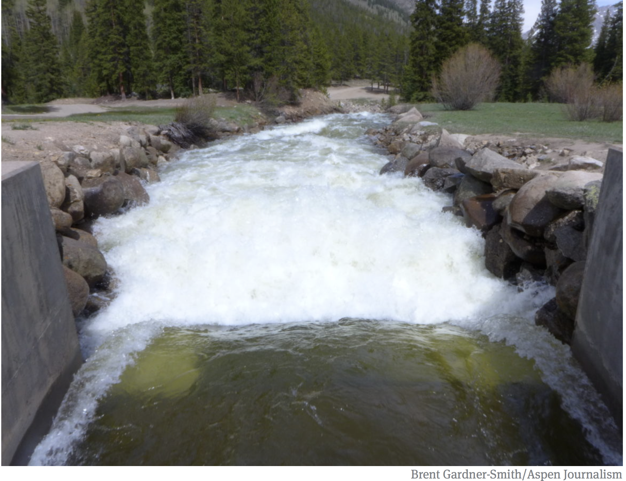

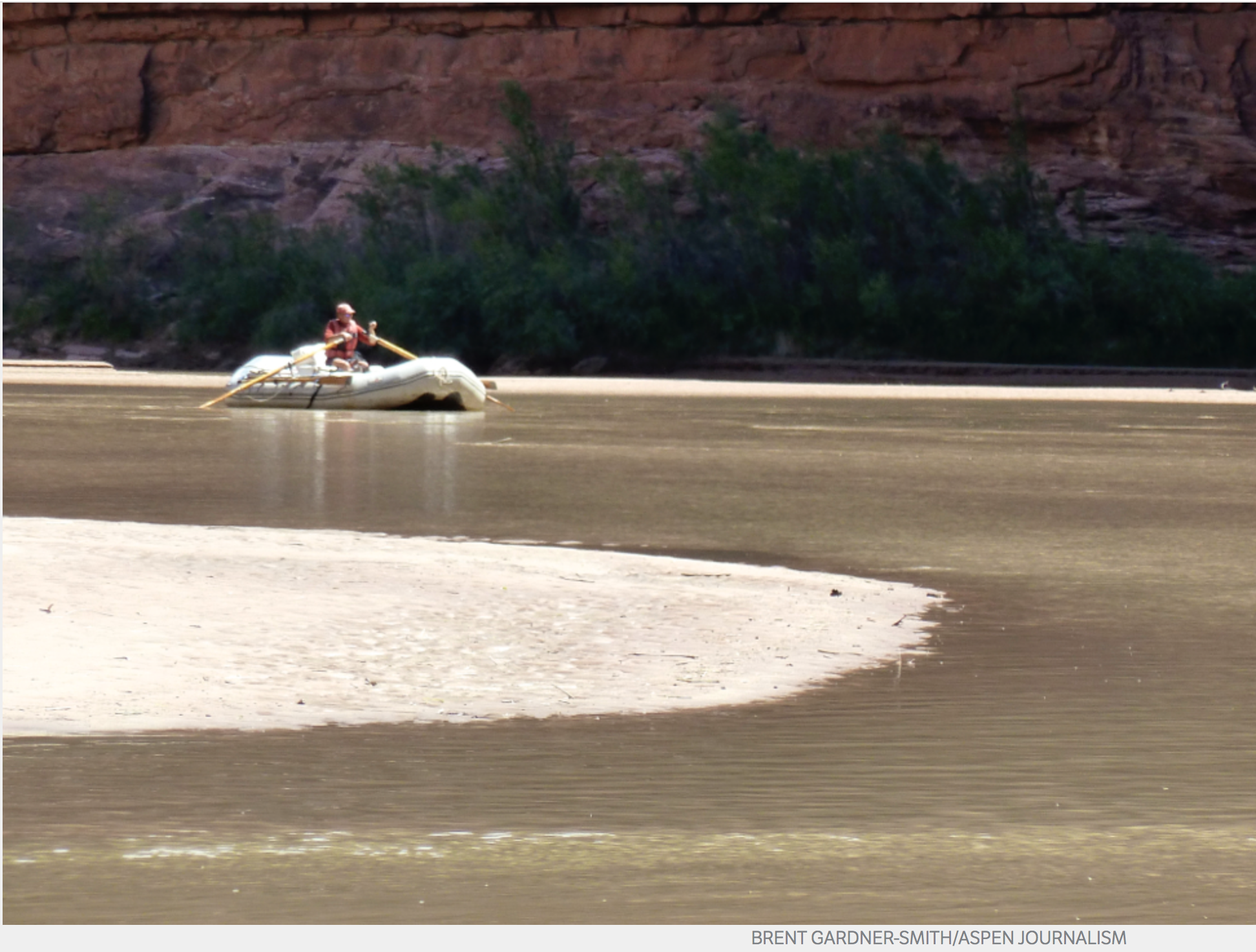
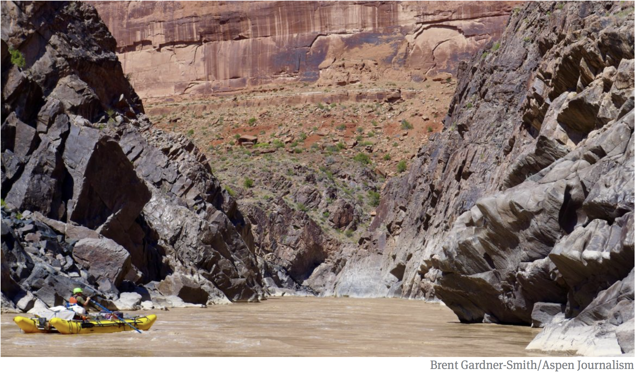
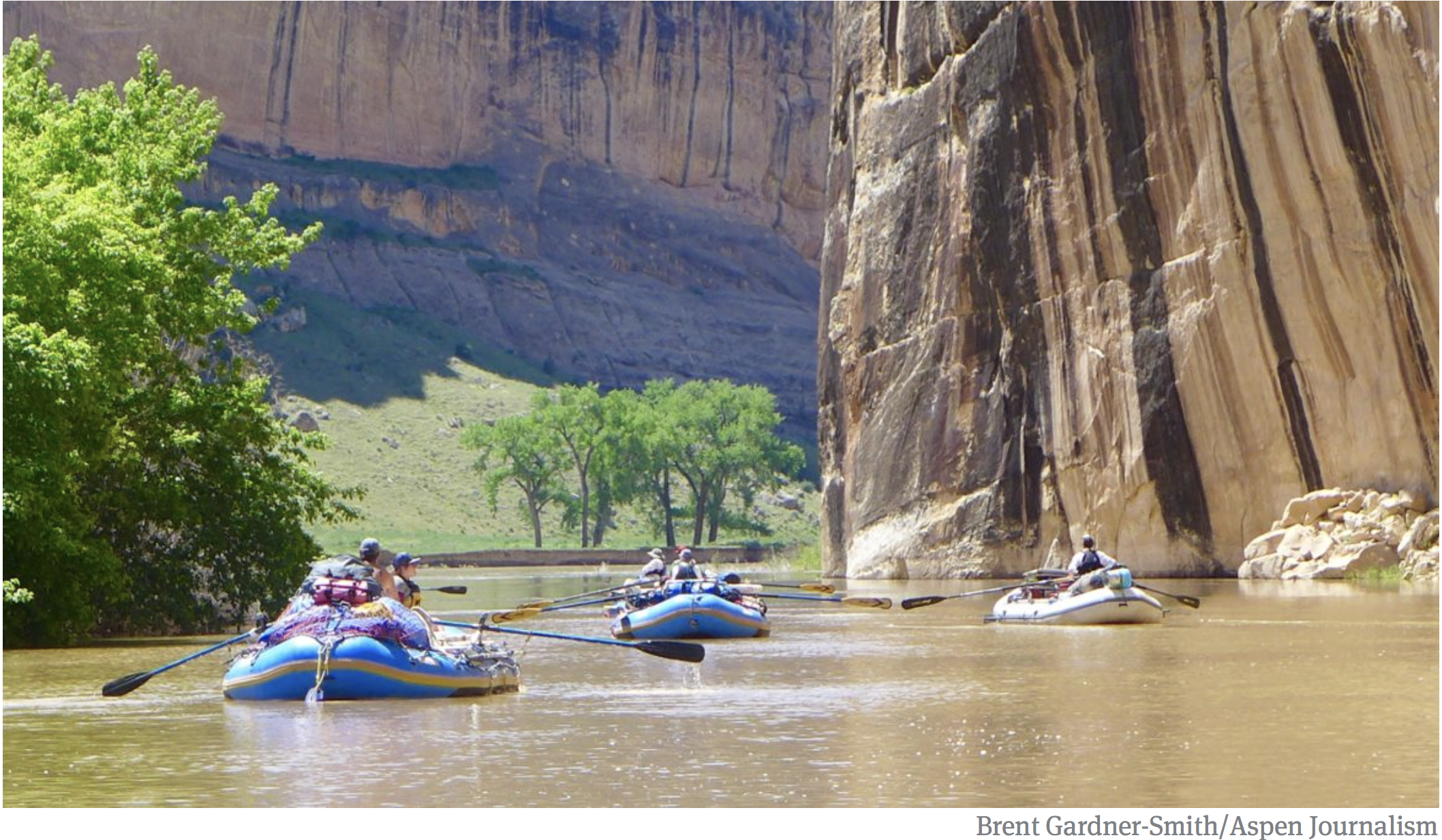
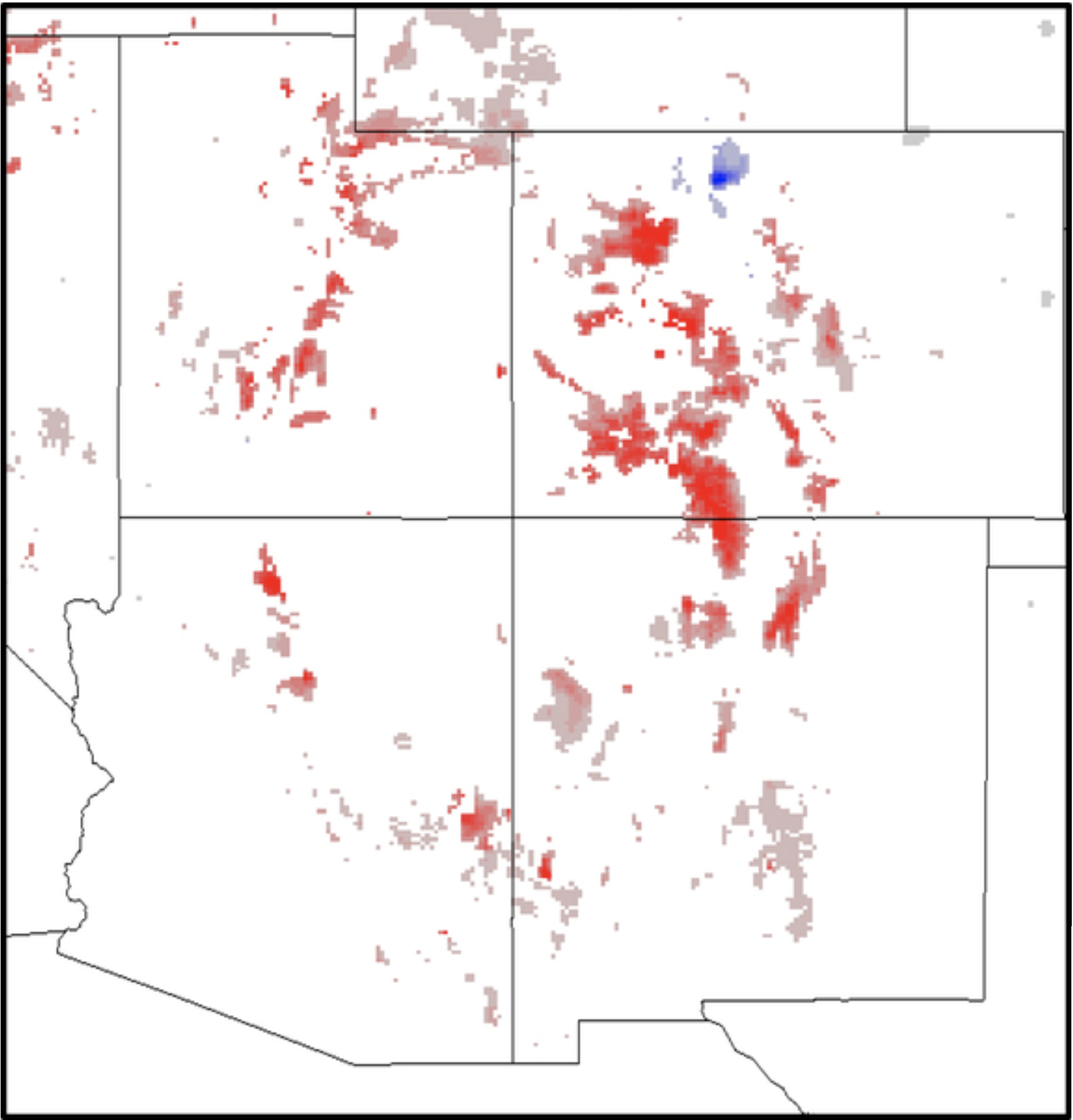


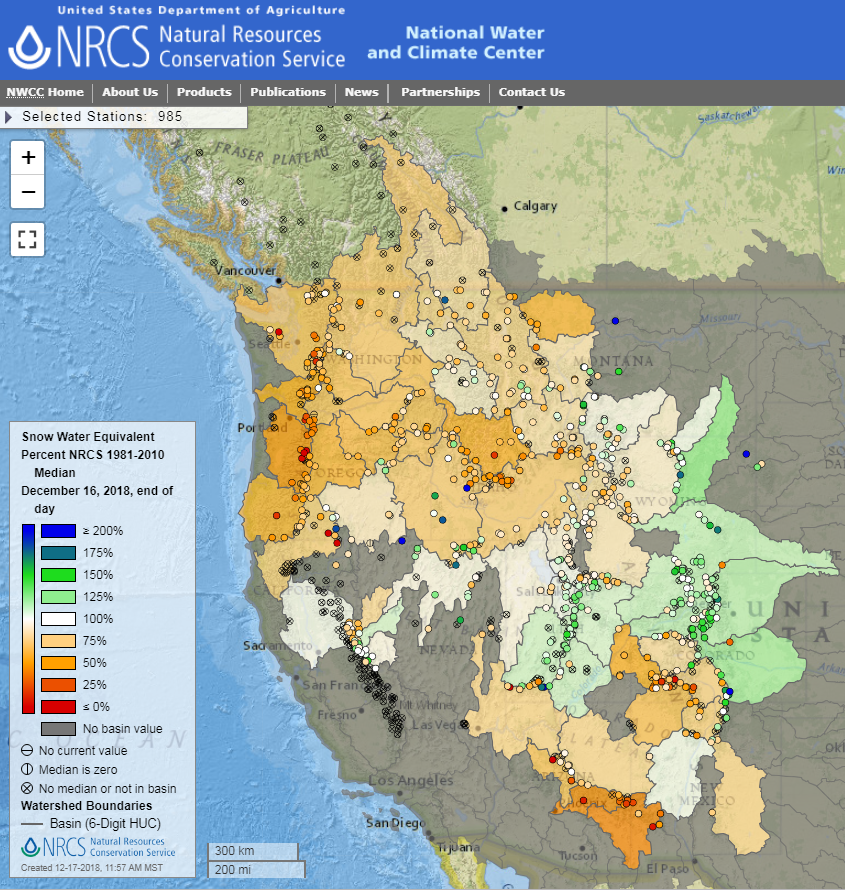
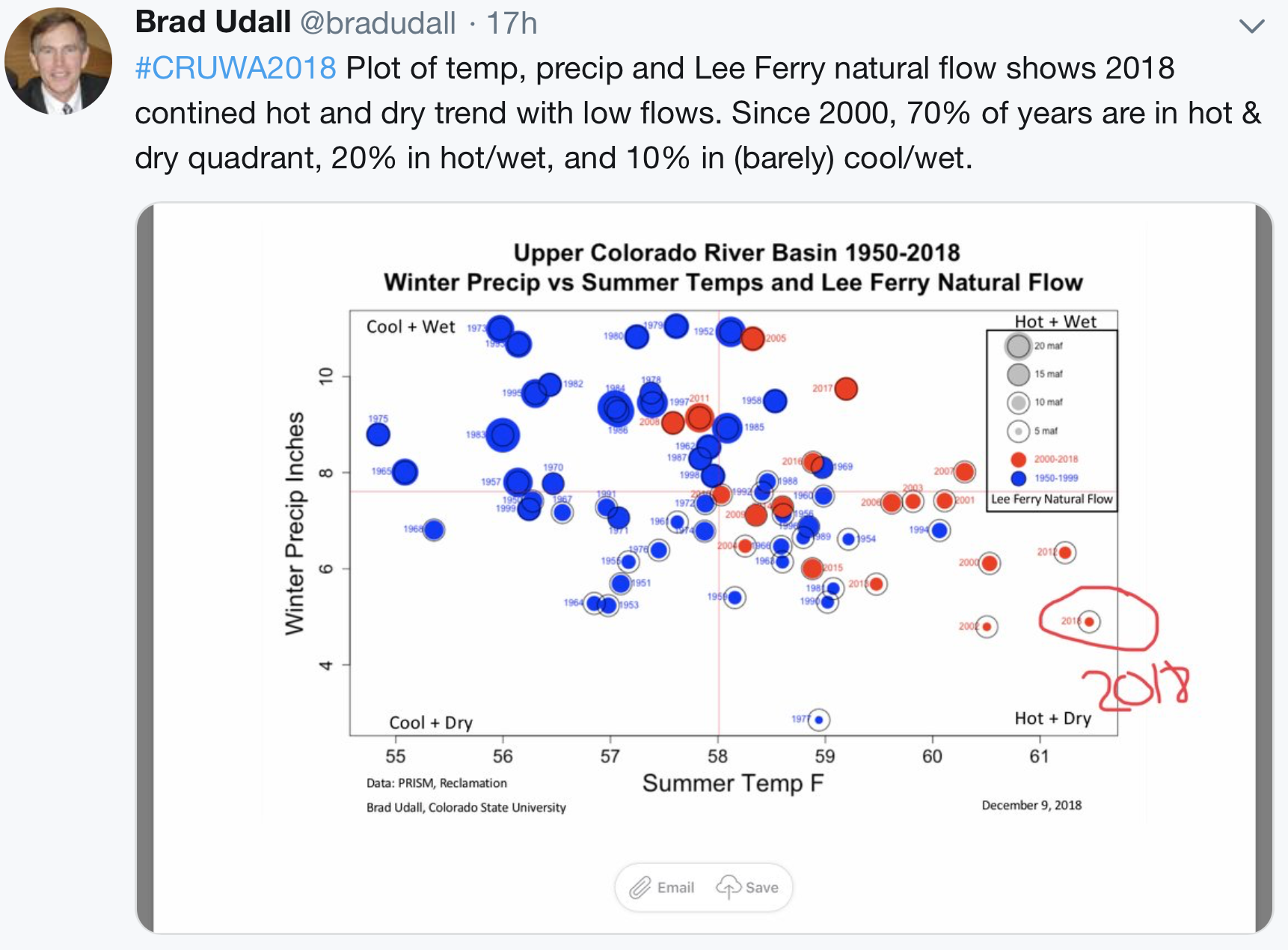
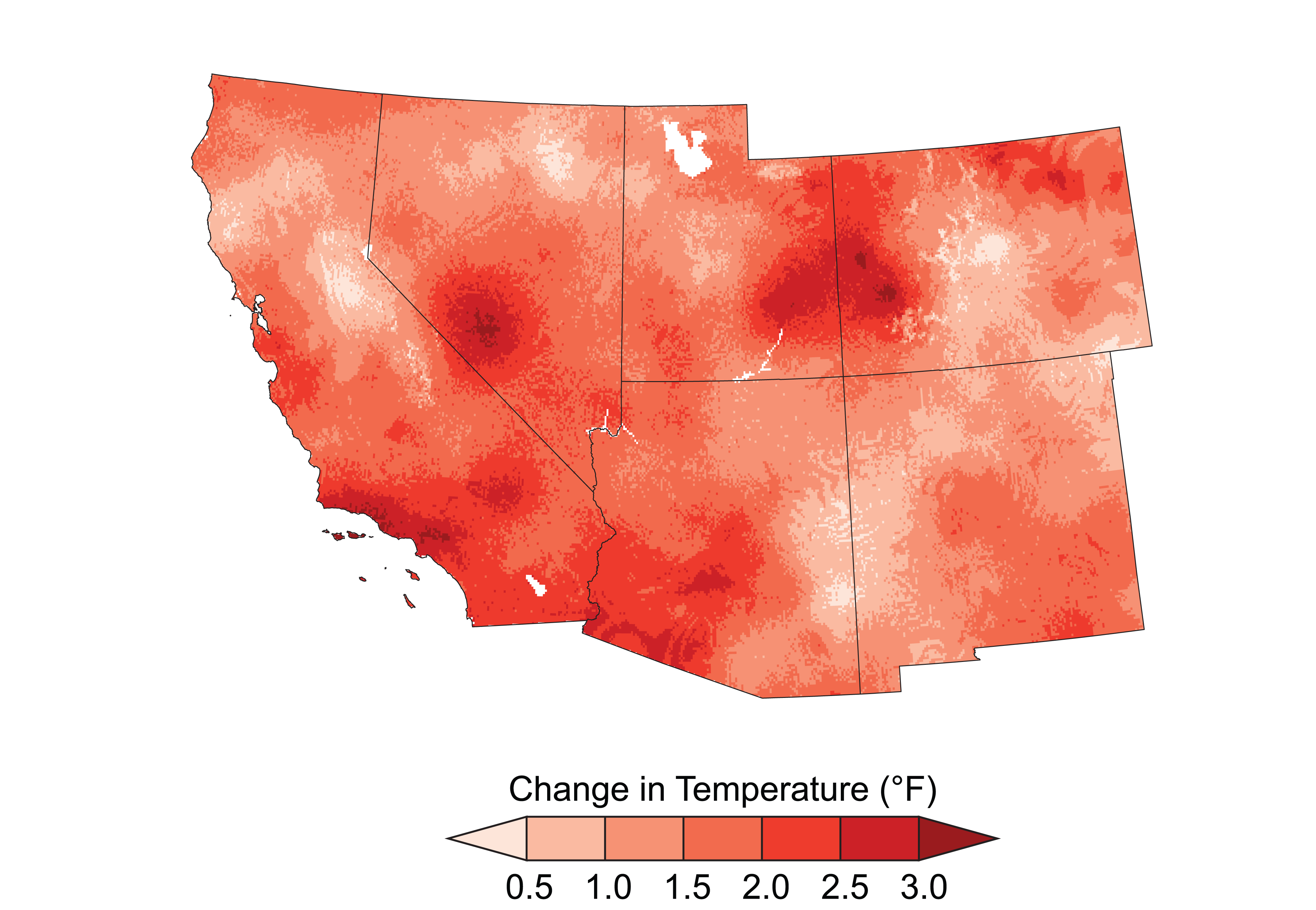

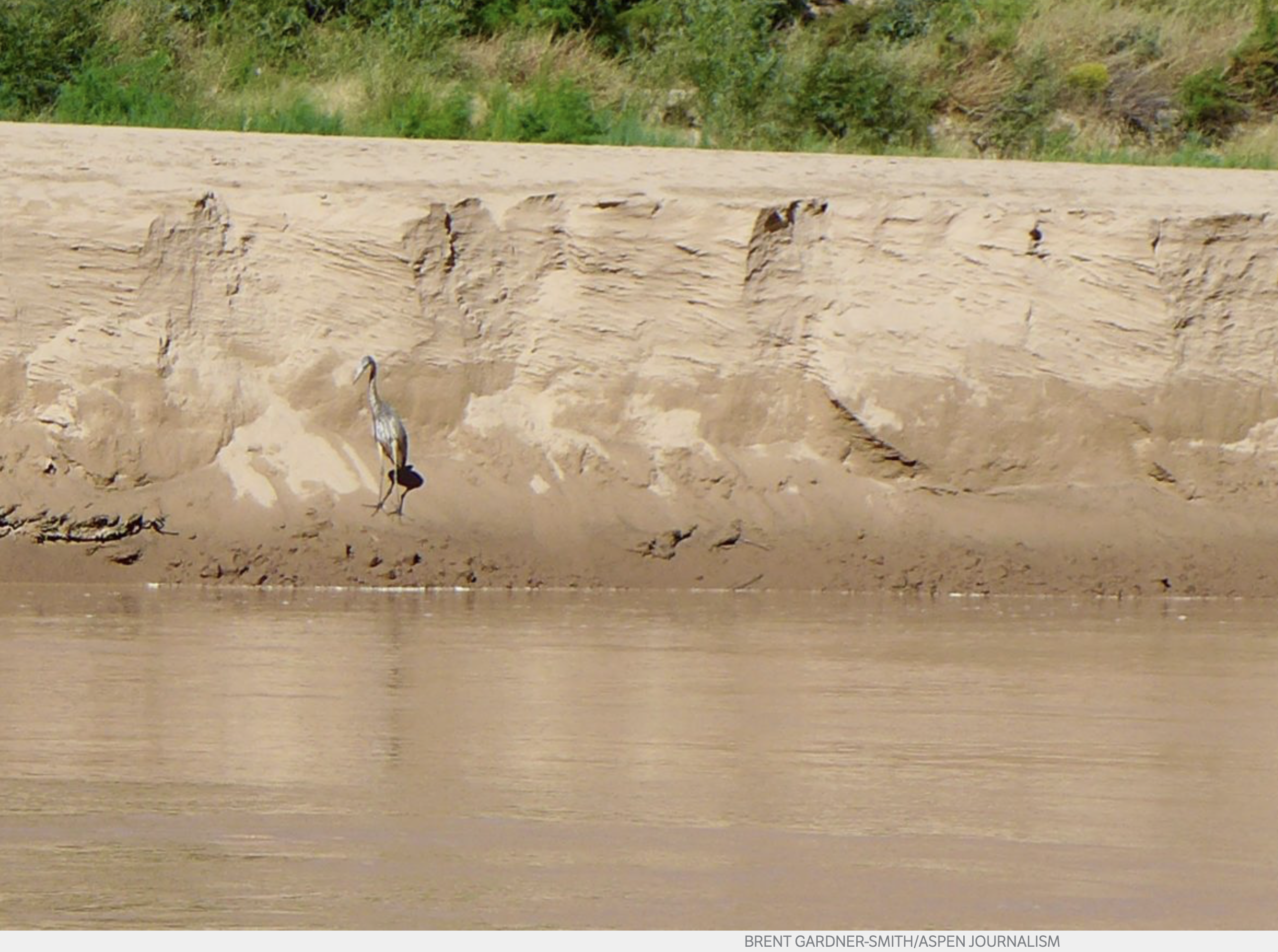
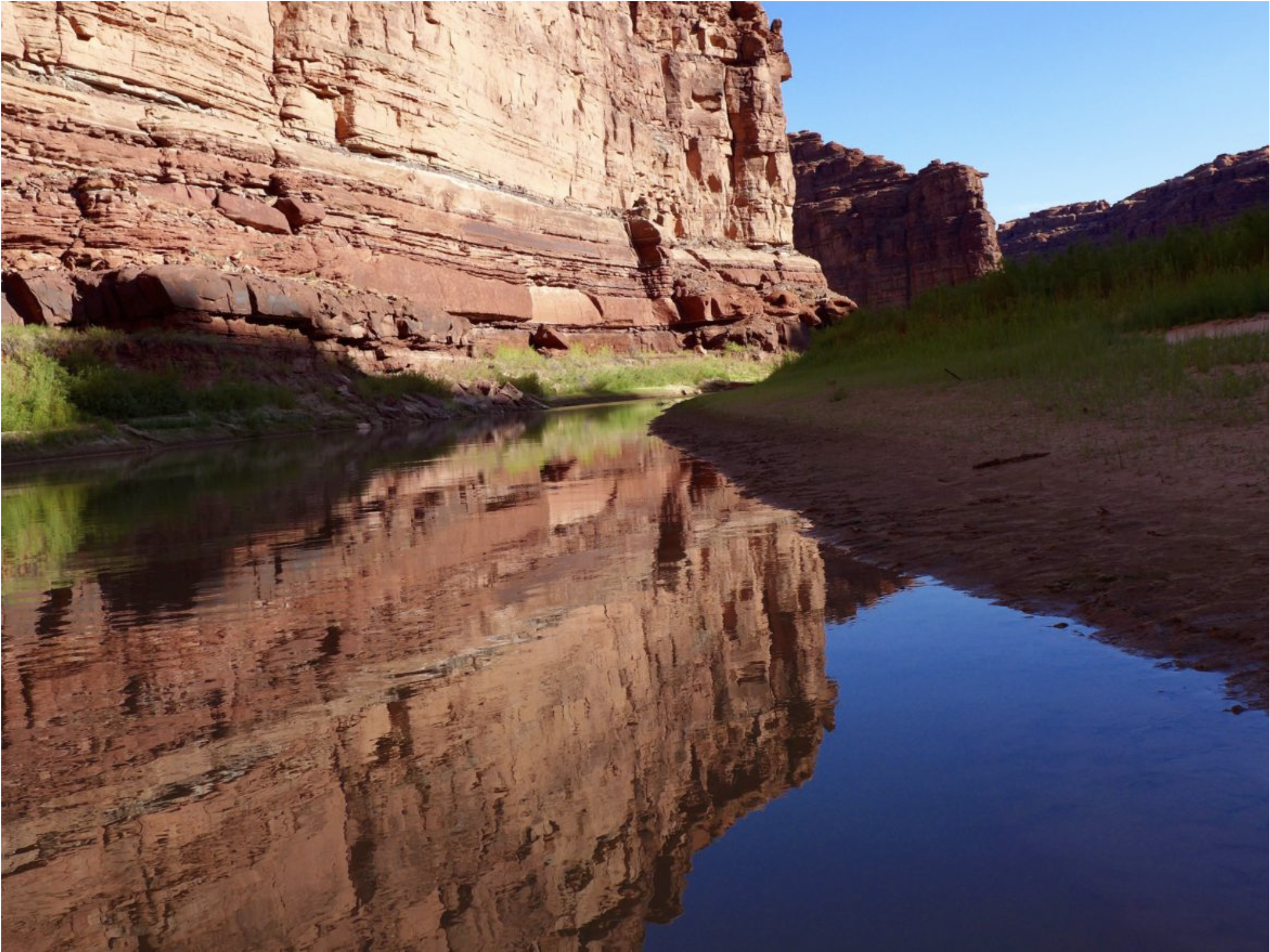
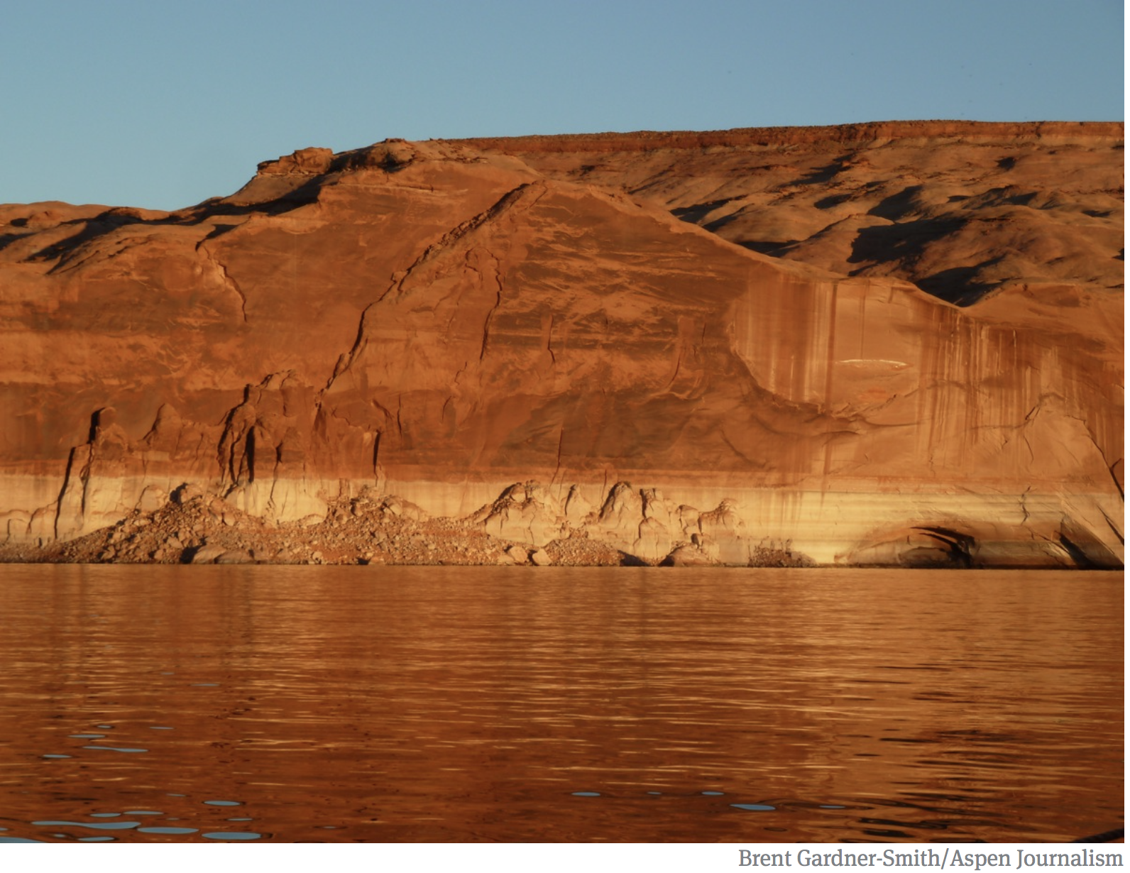
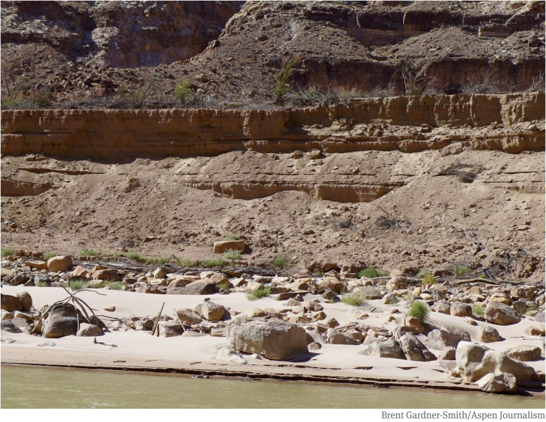

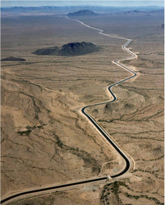
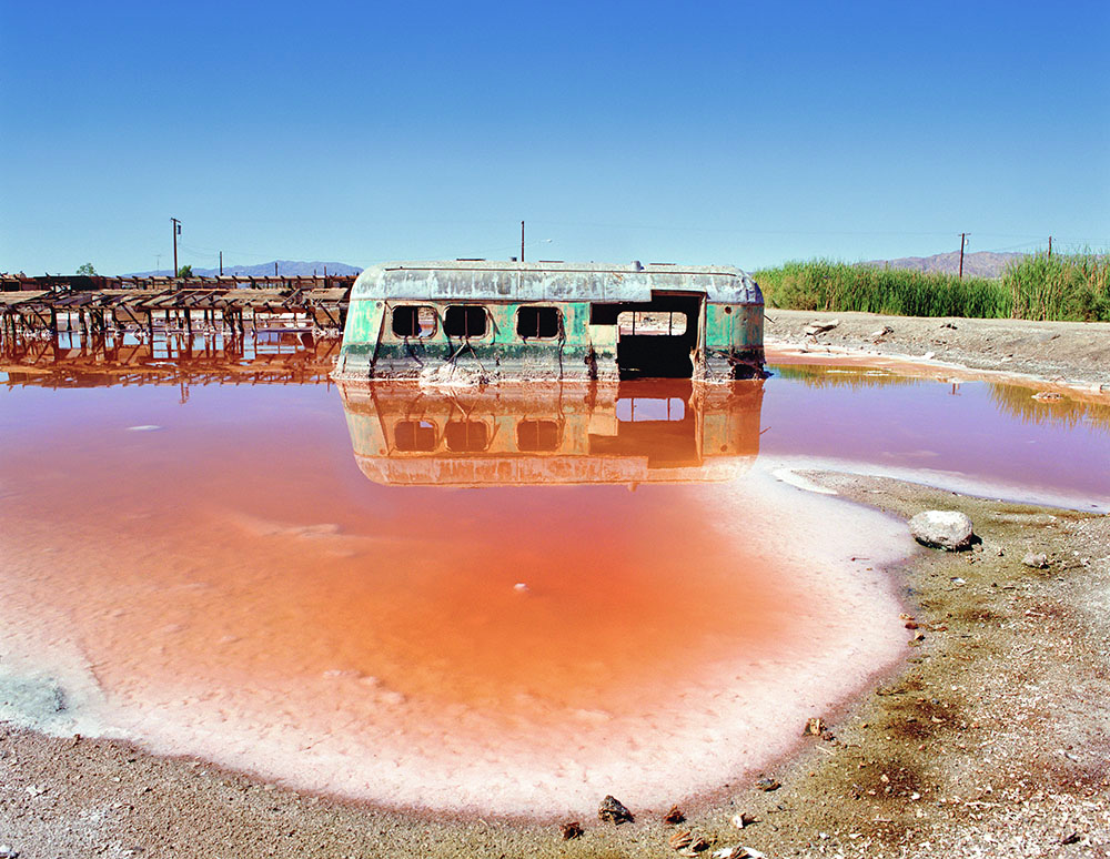


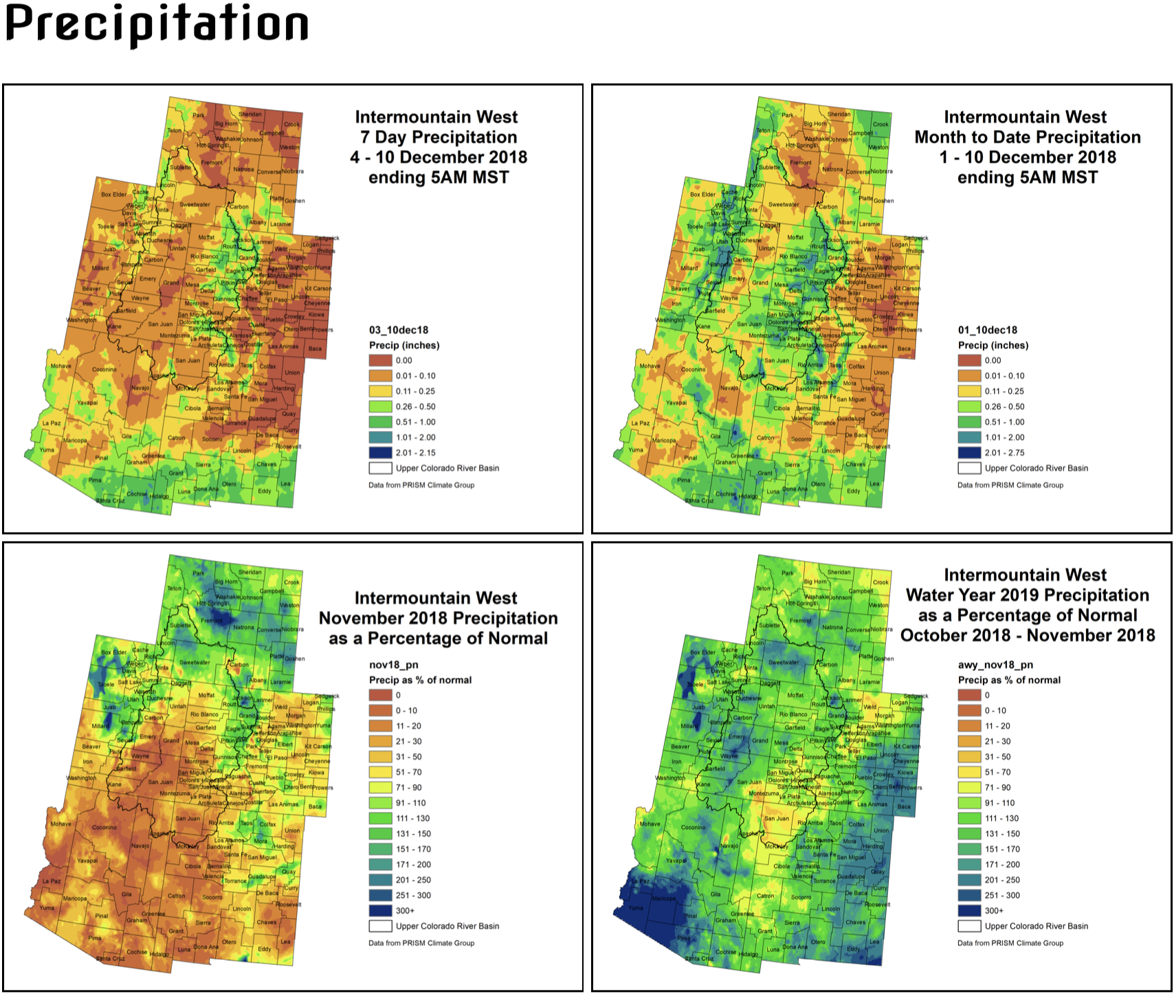
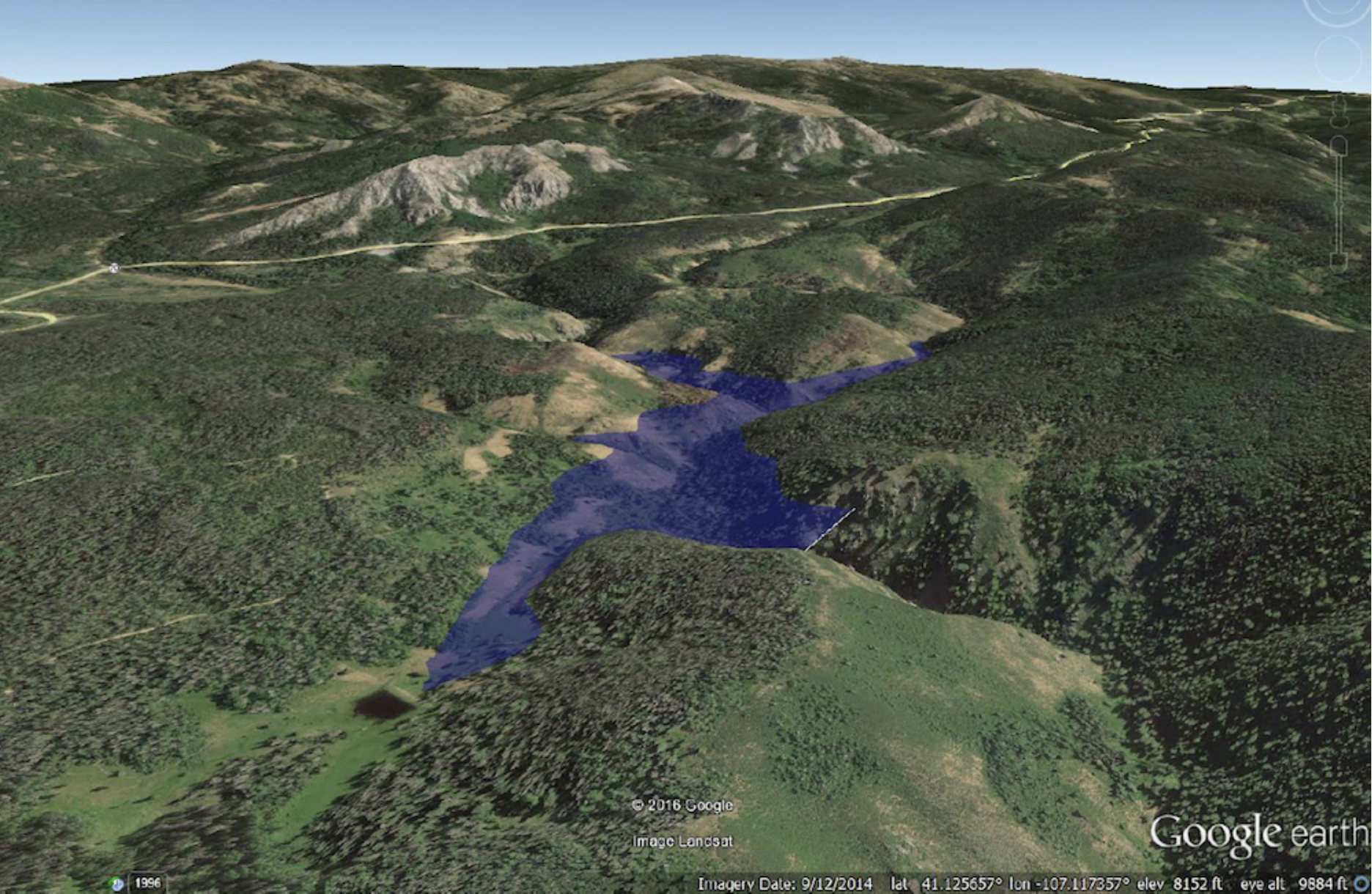


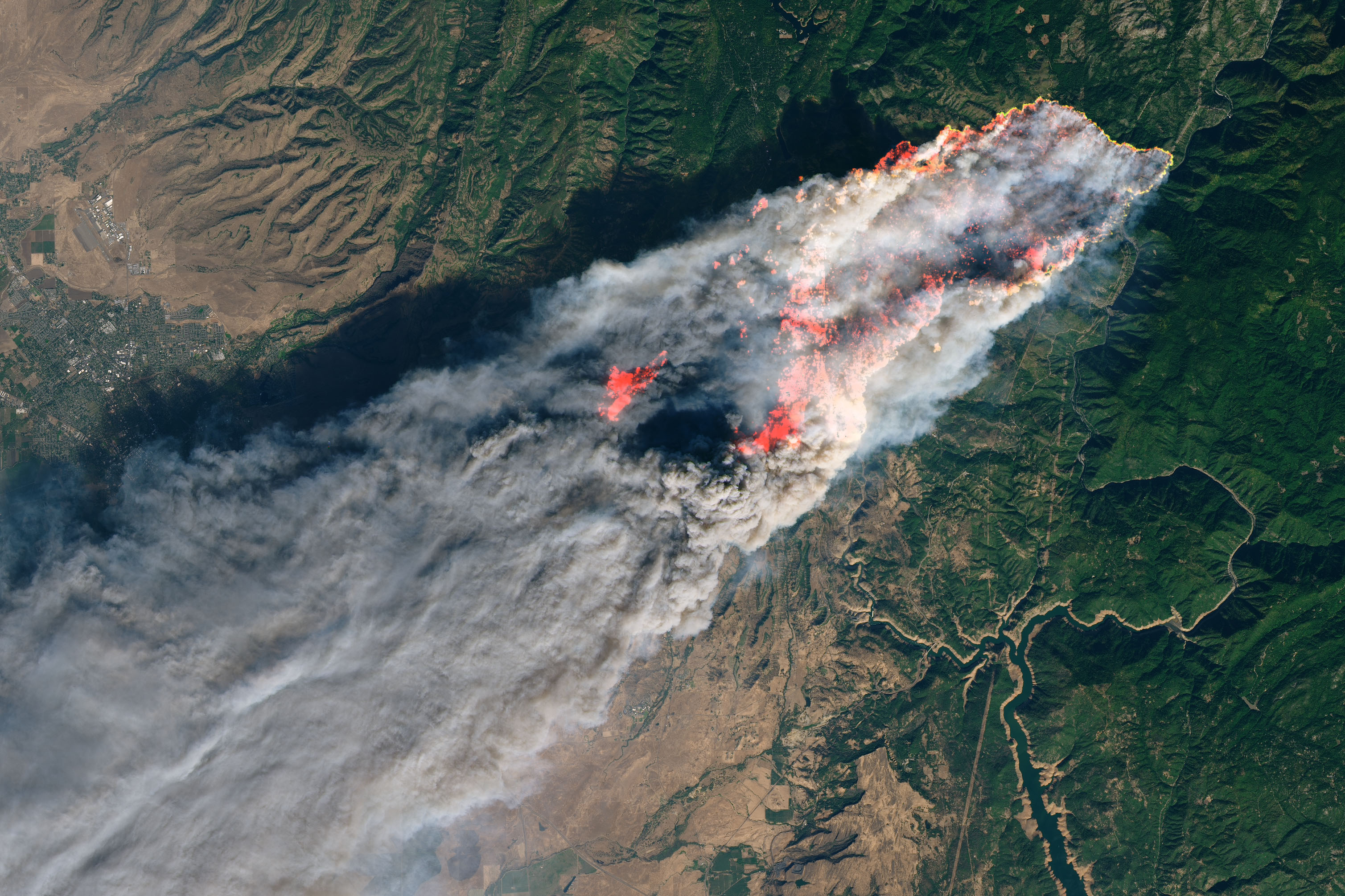
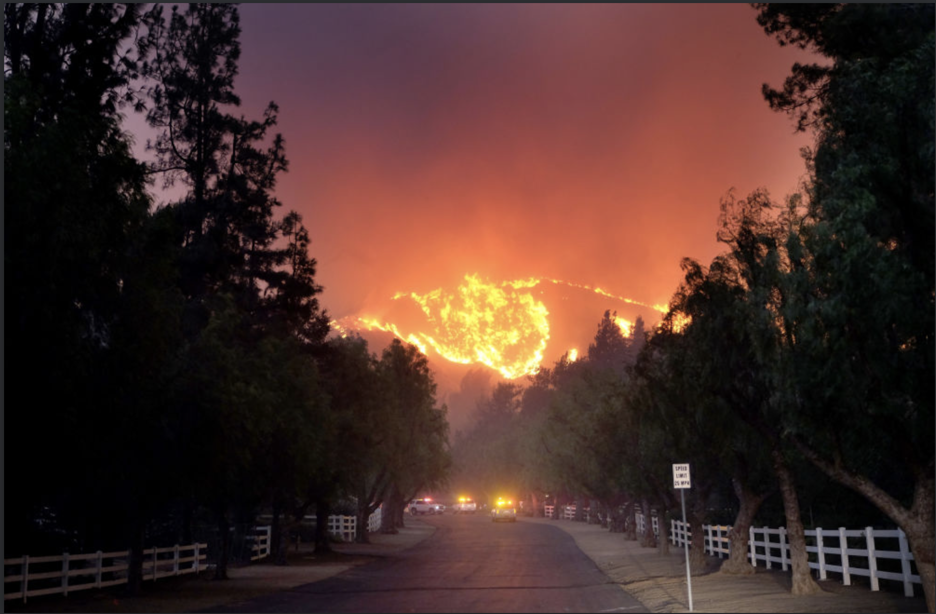


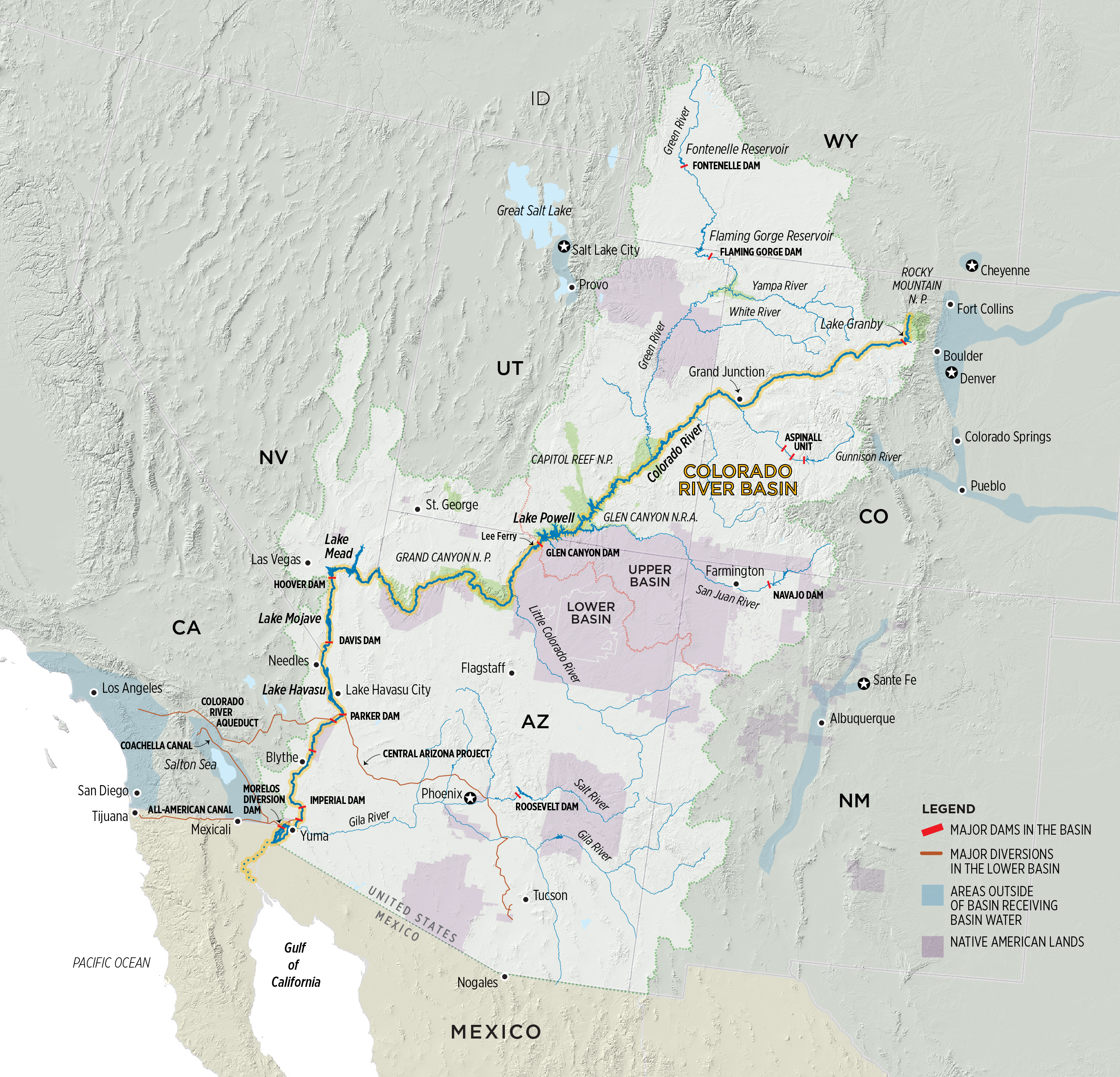


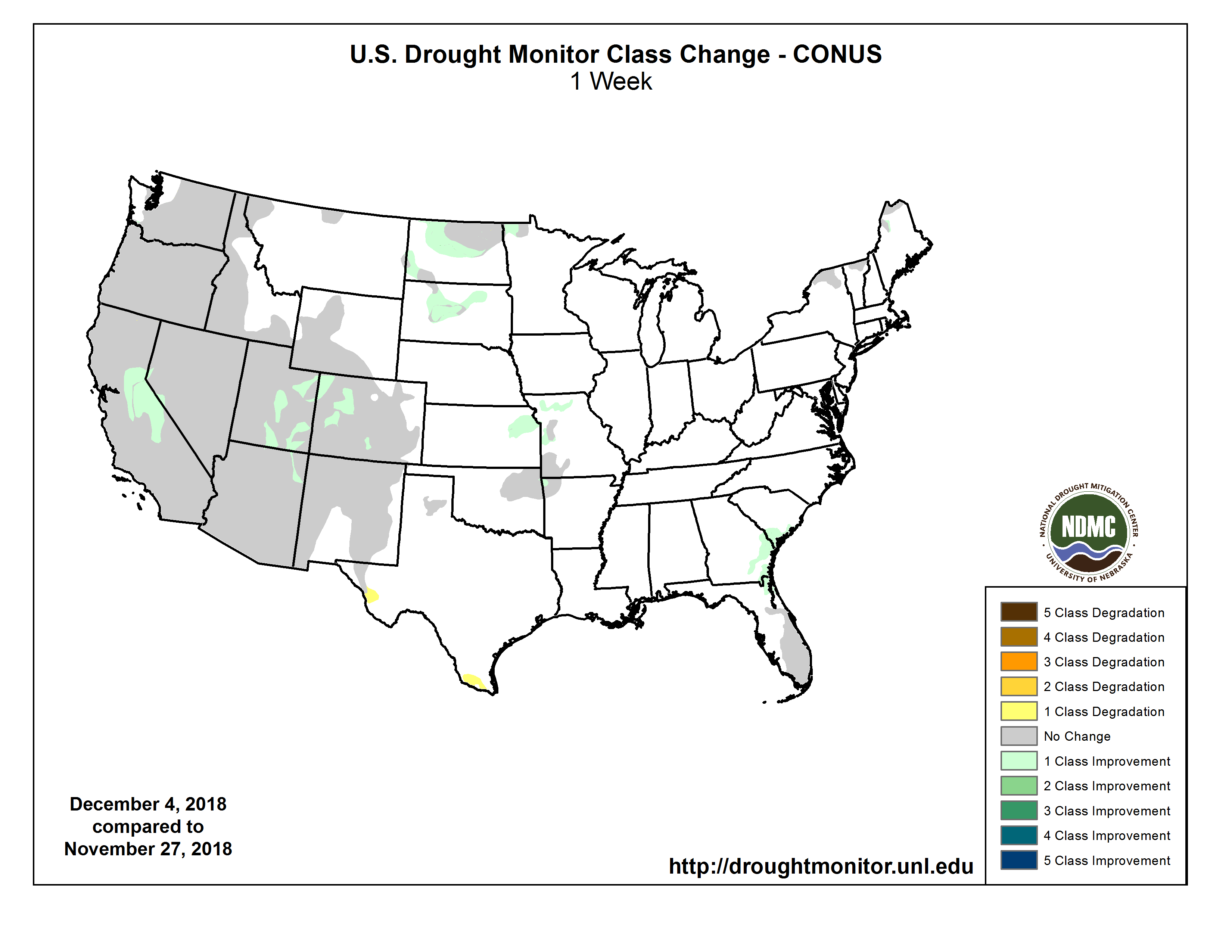


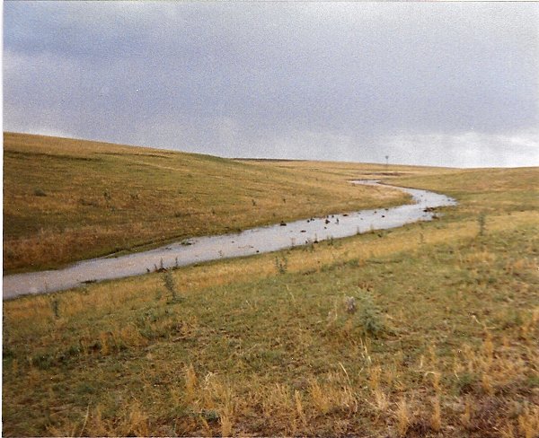


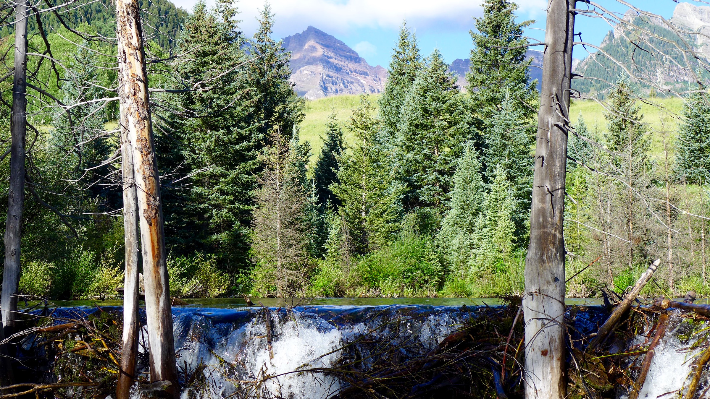