Whitewater park for Longmont?

longmontwhitewaterparkproposeddecember2011

Here’s the release from the City of Longmont (Bill Powell):

The City of Longmont’s Concept Paper, the initial step in a full grant application to Great Outdoors Colorado (GOCO), has been approved to move to the final application step. It was one of 21 concept papers that were approved for this next step in the grant process by GOCO.

The City is planning a 65 acre river based district park along the banks of the St Vrain River within the Pavlakis Open Space in the heart of Longmont. The park will feature various amenities including a whitewater park on the St Vrain creek. The project is slated to begin design in early 2012.

The City is looking for partners from the community to assist in the grant process. Project partners are critically important in the final approval for grant funding. Partners would ideally provide financial participation. Support of any amount would be welcome!

More coverage from the Longmont Times-Call (Pierrette J. Shields) via the Boulder Daily Camera. From the article:

City planners hope to nab $500,000 in grant funds from Great Outdoors Colorado for a $3.1-million, 65-acre district park along the St. Vrain Greenway between Main and Martin streets south of the D-Barn. Planned amenities include a white-water course with five drops, a fishing pond, pond observation deck, river overlooks and habitat improvements along the greenway on the Pavlakis Open Space property…

Similar white-water courses are available in Lyons and Boulder, but Fitzgerald said Longmont’s more moderate course likely will be more family friendly because of lower water levels through the city.

Salida wastewater treatment plant update: Project is on schedule for completion in 2013

From The Mountain Mail (Callie McDermott):

Switching the old plant to the new one will be done in stages and handled “with kid gloves,” [Randy Sack plant manager] said, because “we’re changing the way we treat wastewater.”

Sack said the new system, activated sludge process, will replace the existing method of secondary treatment. Pre-treatment and digestive process will remain, but rotating biochemical contactors will be removed, he said. Activated sludge process, also known as Ifast, will speed the purifying process and ammonia won’t be used anymore, he said. A phosphorous filter isn’t yet required for wastewater treatment. However, Sack said it will be required in about four or five years, so it is being added. He said officials are “thinking ahead of the game” with the new treatment plant. Ultraviolet light will be the new disinfection method, replacing the use of chlorine gas and sulfa dioxide…

Included in plans are an office complex, workshop, conference room, showers and a reception area…The laboratory where water samples are tested for the plant, and for more than five other small plants in the area, will be expanded. A sprinkler system and about 150 new trees and shrubs will be added to enhance the landscape around the plant, he said.

More wastewater coverage here.

Snowpack news: South Platte basin is at 85 percent of average, C-BT reservoirs storage sitting at 77 percent of average

snowpackcolorado12302011

From the Loveland Reporter-Herald (Pamela Dickman):

The basins that water officials watch for the Colorado-Big Thompson supply — the Upper Colorado and the Poudre basins — are running about 35 percent below average water content for the end of December. “It is really early, so there’s no beads of sweat on our foreheads yet,” said Dana Strongin, spokeswoman for Northern Water.

But the reservoirs holding water from the past two years are at 77 percent, which is high for this time of year, said Strongin…

Some are more full than others, adding up to the 77 percent. Horsetooth Reservoir is 72 percent filled. Carter Lake is at 55 percent because the level was lowered for maintenance. Lake Granby, the largest in the Colorado-Big Thompson system, is at 85 percent.

From the Associated Press (Dan Elliott) via the Vail Daily:

The snowpack statewide was 73 percent of the long-term average as of midweek. It ranges from 90 to 98 percent in the south and southeast parts of Colorado to just 63 percent in the northwest corner. The jet stream has been steering snow to the south of Colorado and cold weather to the north, despite La Nina conditions that would normally bring the storms over Colorado, said Kyle Fredin, a National Weather Service meteorologist in Boulder…

Klaus Wolter, a climatologist at the University of Colorado and the National Oceanic and Atmospheric Administration, said Colorado won’t see a repeat of last season, which brought record snowfall to some parts of the mountains. The last four to six weeks have been dry, but Colorado has had five snowstorms since October, he said. “That’s a pretty good pace,” Wolter said. “I’ve seen bigger, but it’s pretty respectable.”

From the Summit Daily News (Caddie Nath):

“There’s a lot of snow season yet to go,” National Weather Service (NWS) meteorologist Kyle Fredin said. “That area has four solid months of snow coming up. The weather sometimes flips around, and I wouldn’t be surprised if (you’re) right back to near normal.”

Normal, for the end of December in Breckenridge, would be 64.4 inches of snow, but this season had produced a mere 32.7 inches from September through Wednesday…

So far this season, the mountains east of the Divide and even the Front Range have fared better than Summit County in terms of snowfall. Denver’s weather reporting station near Denver International Airport had seen 29.5 inches of snow as of Wednesday, ahead of its season-to-date average of 21 inches and on par with Breckenridge’s 32.7 inches thus far. Boulder, to the north of Denver and closer to the foothills, has had 53.4 inches so far this season, trouncing both Breckenridge’s year-to-date total and its own typical 28.4 inches this time of year.

Sand Creek: Suncor groundwater contamination prompts additional measures from the CDPHE

oilwatermap11292011suncorsandcreekwesternresourceadvocates.jpg

From The Denver Post (Bruce Finley):

State health officials ordered additional measures on Friday afternoon to minimize environmental harm and prevent people from ingesting contaminated water. Those measures include posting of “Drinking Water Warning” signs at the refinery. Benzene levels in Sand Creek are fluctuating but reached 670 parts per billion on Dec. 22 — 134 times higher than the 5 ppb national drinking water standard. An anonymous tip from a Suncor employee Thursday alerted state health officials to contamination in tap water on the refinery property…

Denver Water authorities, notified around noon Friday by the Colorado Department of Public Health and Environment, immediately began testing the city’s water system for benzene, which can cause anemia, blood problems and cancer. Denver Water reviewed data from recent tests for benzene and found no elevated levels, utility spokeswoman Stacy Chesney said…

Over the past several weeks, however, monitoring along the creek found that petroleum is entering the creek directly without surfacing, said Warren Smith, a state health spokesman. “The dissolved material is coming in through the bottom of the channel, not through a seep on the bank,” Smith said. The state order requires installation of “an air sparging system” in Sand Creek — similar to a fish tank aerator — by Jan. 6. This is meant to help benzene and other contaminants in the creek evaporate into the air, instead of flowing into the South Platte.

The order also requires Suncor to install a soil vapor extraction system and dig a second “interceptor trench” by Jan. 31 to try to trap hydrocarbons floating in groundwater before they enter Sand Creek. Suncor has tried to make the first trench work better and is providing bottled water to workers, Smith said. Company contractors also have tested 50 of 57 buildings at the adjacent Metro Wastewater Treatment Plant for toxic vapors, finding problems in two. Toxic vapor removal systems have been installed along with a filter and a ventilator on other buildings, he said.

More Sand Creek spill coverage here. More oil and gas coverage here and here.

Mike Gillespie retires from the NRCS leaving behind a legacy of reliable water data collection

Manual collection of snowpack data

Here’s a profile of Gillespie from John Ingold writing for The Denver Post. From the article:

“It’s pretty evident that this is one of the drier years,” Gillespie said. “It’s not looking like a good start at all to the year.”

Gillespie, who started doing snow surveys in Wyoming 31 years ago, has the experience to know. But Thursday was the last survey he will do. As of the end of today, Gillespie is retired.

That is a substantial loss of institutional knowledge in the obscure but important world of Colorado snowpack analysis. Gillespie’s snowpack measurements are closely watched by Colorado water managers, who use them to determine how much water will be available in the spring and summer.

Gillespie said his analyses can predict the amount of water in the spring runoff within about 10 percent.

Every year, Gillespie has overseen an effort to manually measure snowpack at more than 100 high-altitude “snow courses” across the state. He also has been instrumental in expanding the state’s use of automated snowpack sensors, which now number about 110 and provide daily snowpack updates…

Nolan Doesken, the state climatologist, said Gillespie brought a sense of competence to the high stakes of water-supply prediction and an aura of calmness to often panicky meetings about drought or flooding. “He was just always steady and reliable,” Doesken said. “You could always count on the data.”

I’ve heard Mike’s presentations on snowpack many times over the years. I’ll miss his sharp wit and steady focus on framing and interpreting the data his team collects.

Mike says, in email today, “On to bigger, and hopefully better, things.”

‘Denver Water is still committed to the Colorado River Cooperative Agreement, and we are ready to sign,’ — Stacy Chesney

coloradorivercooperativeagreementmap.jpg

From the Summit County Citizens Voice (Bob Berwyn):

All the key stakeholders remain committed to the overall agreement, pending resolution of the complex water rights issues.

“Denver Water is still committed to the Colorado River Cooperative Agreement, and we are ready to sign,” spokesperson Stacy Chesney said via email.

“The parties are working together on finalizing the attachments and detailed wording in the agreement. Denver Water has filed water rights applications in Grand County for the environmental flows provided for in the agreement … (and) making progress with the state related to the operations of Green Mountain Reservoir and Dillon Reservoir – related to the Blue River decree,” Chesney said.

More Colorado River basin coverage here.

Snowpack news: Colorado River basin — 63 percent of average, Rio Grande basin — 95 percent of average

snowpackcolorado12292011

Click on the thumbnail graphic to the right to view the current snowpack map from the Natural Resources Conservation Service.

Meanwhile Boulder snowfall is doing just fine. Here’s a report from Eric Metzler writing for the Boulder Daily Camera. From the article:

[A] Weak La Niña pattern, other oscillations mean more snow for Front Range, less for mountains…

Boulder has received more snow already this season than it did all last season and is well above average, despite this being another La Niña year in which many meteorologists expected similar patterns to prevail…

Boulder has received 53.4 inches of snow so far this season and 33.3 inches in December alone, according to meteorologist Matt Kelsch. In a typical year, Boulder will receive 34 inches by the end of December and 88.6 inches by the end of the snow season…

This year’s La Niña is weaker than last year’s, and weather patterns also are being affected by two other oscillations — the Arctic Oscillation and the Madden-Julian Oscillation — that are less predictable and that fluctuate more rapidly.

One of the effects has been to push storms to the south, with southeastern Colorado getting walloped by several blizzards already this year and New Mexico and Arizona seeing above-average snowfall, [Joel Gratz, of opensnow.com] said.

Kelsch said weather patterns in the Atlantic also have affected the west-to-east flow of storms coming in from the Pacific. Last year, storms sped through and dropped most of their moisture on the mountains, leaving only winds for the Front Range. This year, storms have moved more slowly, with counterclockwise winds that leave more snow on the eastern slopes, Kelsch said.

More coverage from John Ingold writing for The Denver Post. From the article:

The first manual snow sampling of the season Thursday confirmed what automated sensors have been suggesting for weeks: that the water available in Colorado’s snowpack is about a quarter below average. Statewide, snowpack is 73 percent of normal. That ranks as the fourth-driest measurement in the last 30 years, according to the conservation service.

No year in the last three decades that has started this far below average has recovered to record normal snowpack by the start of spring, said Mike Gillespie, the snow survey supervisor for the service. “It’s pretty evident that this is one of the drier years,” Gillespie said. “It’s not looking like a good start at all to the year.”[…]

The snowpack measurements are closely watched by Colorado water managers, who use them to determine how much water will be available in the spring and summer. Gillespie said one bright note this year is that last season’s glut of snow kept reservoirs full throughout the summer and fall — providing water suppliers with extra cushion for a dry year.

The Aspen Art Musuem is evaluating geothermal potential at new building site

geothermalenergy.jpg

From the Aspen Daily News (Curtis Wackerle):

With excavation and construction for the 30,000-square-foot building set to begin this spring, museum officials are trying to determine if they can tap a geothermal energy source to make the structure more efficient and environmentally friendly…

In the case of the art museum site, the contractor is drilling down to about 425 feet. Drilling is expected to take a week, and contractors should know within a few weeks whether there is any geothermal potential, according to museum officials.

“The use of geothermal technology is a key tactic in our overall efforts to construct an environmentally sensitive and sustainable building,” museum director Heidi Zuckerman Jacobson said in a statement. “We look forward to reporting on our findings from this initial testing, and on our overall progress toward these goals.”

More geothermal coverage here.

2012 Grand County budget includes nearly a million bucks for water rights protection

granbyreservoirindianpeaks.jpg

From the Sky-Hi Daily News (Tonya Bina):

The Water Protection budget of the county’s Dec. 13-approved 2012 budget reflects $927,954 set aside. Nearly half of that total is for legal fees, the rest for monitoring, “learning by doing,” and engineers.

The water budget reflects “the board’s determination to stay in the game and continue to be counted as a key player” in water negotiations, said Grand County Manager Lurline Underbrink Curran.

More Colorado River basin coverage here.

National Ski Areas Association promises lawsuit over USFS rule intended to keep water rights with the land on ski hills

coppermountainsnowmakingcoskicountry.jpg

From ESPN (Jason Blevins):

After intense lobbying — which included stern letters from a host of congressman and senators — last week the Forest Service rebuffed the calls for a moratorium and issued the new rule as an 18-month moratorium. The resort industry, led by the 121-resort National Ski Areas Association, answered with a promise to sue the agency, which hosts nearly 90 percent of all U.S. ski areas.

“This has to do with water rights in general and how water rights are treated,” said Michael Berry, president of the NSAA. “We believe they have crossed the rubicon and this has the potential to be very, very impactful. We have no guarantee that they will continue to use the water for purposes of ski area business.”

Since 2004, the Forest Service has co-owned water rights secured by ski areas operating on federal land. Before that, under the 1986 National Forest Ski Area Permit Act, ski area water rights on public land were owned by the federal government. So really, said Jim Pena, acting chief of the Forest Service, “this isn’t new.”

“This permit clause is intended to clarify some of the gray areas,” Pena said. “This was a result of lots of discussion with the ski industry over the last year. This requires that water rights on National Forest System land remain with the federal government so we don’t sever that resource from the land.”[…]

Pena said his agency has already issued three new operator permits — in Colorado, Washington and California — with the new clause and those were accepted without any problems. “If a permittee develops water for the activity on (state) public land, they are required to develop that water in the name of the state. It’s the same with National Parks and the Fish and Wildlife Service as well,” Pena said. “It all goes back to wanting to make sure those public resources are kept together and we want to provide that stability for the long term.”

More coverage from Katie Klingsporn writing for The Telluride Daily Planet. From the article:

The NSAA represents hundreds of ski areas across North America, Telluride Ski Resort among them…

“Water rights in the West are part of the asset base of the ski areas that they have acquired in the marketplace and they are an important part of the balance sheet of a ski area,” Association president Michael Berry told the AP.

The Telluride Ski Resort operates under a permit from the USFS, but it currently has a 40-year permit and so is not in imminent danger of the effects of the USFS clause, said Dave Riley, CEO of Telluride Ski & Golf (Telski).

However, Riley said Telski supports NSAA’s efforts to reverse the measure…

Pena said the clause, issued as an interim directive, can be adjusted before it’s finalized and the Forest Service would work with permit holders to ensure it “works for everybody.”

Berry wasn’t persuaded.

“We have no guarantee that they will continue to use the water for purposes of ski area business,” he said. “The government could decide to use the water and apply it to other uses or even sell it to urban water systems.

More water law coverage here.

USGS: New Study Lends Insight to Decreasing Denver Basin Groundwater Availability

denverbasinaquifersandconfiningunitsandsprings.jpg

Here’s the release from the United States Geological Service (Heidi Koontz):

A newly released U.S. Geological Survey study of decreasing groundwater resources in the Denver Basin aquifer provides information on water movement within the system and how it responds to changes in climatic and human activities.

The 3-D computer model of groundwater flow in the Denver Basin aquifer system was constructed to quantify and offer a “big picture” view of the hydrologic system. It will serve as a useful tool for analyzing past and present groundwater conditions, predicting future aquifer response to continued development, and guiding hydrologic monitoring and assessment in the Front Range urban corridor of Colorado.

The Denver Basin aquifer system is an essential water resource for growing municipal, industrial, and domestic uses. Continued population growth along the Front Range and the resulting increase in pumping for additional water supplies has resulted in water-level declines and storage depletion in the aquifer system.

“The Denver Basin aquifers are a critical, but declining, drinking water resource for tens of thousands of residents along the Front Range in Colorado,” said Anne Castle, Assistant Secretary for Water and Science at the U.S. Department of the Interior. “This model and the associated data sets are essential tools for local governments and water suppliers to achieve sustainable water supplies in the future.”

Developed by scientists at the USGS, the groundwater flow model will provide a better understanding about the effects of continued pumping and climate variability on groundwater availability and storage depletion in the Denver Basin. A professional paper detailing the Denver Basin groundwater flow model and study results, “Groundwater Availability of the Denver basin aquifer system, Colorado,” is available online.

“Many communities rely on groundwater resources for municipal, industrial, and agricultural water supplies, and yet unlike the situation with streams and reservoirs, citizens cannot readily assess for themselves whether they are unsustainably depleting this valuable resource,” said USGS Director Marcia McNutt. “Studies such as this by the USGS provide important information on the current status of the groundwater aquifer and its future potential so that communities can plan for their long-term water needs.”

To develop the model, scientists compiled information on aquifer geometry, aquifer properties, land use, pumping history, and climate from 1880 through 2003. Among their findings:

For predevelopment (pre-1880) conditions, recharge, or water entering the aquifer, from precipitation and agricultural irrigation return flows was the primary source of water (94 percent of inflow) to the Denver Basin bedrock aquifers, and evapotranspiration was the primary component of groundwater discharge from the bedrock aquifers (72 percent of outflow). Flow between the bedrock aquifers, the alluvial aquifer, and streams accounted for the remaining components of the predevelopment water budget.

Changes in land and water use have altered the groundwater flow system compared to predevelopment conditions. The expansion of urban/suburban land use and/or irrigated agriculture since the 1950s has increased water use on the landscape, which has increased recharge, evapotranspiration, and streamflow in connection with shallow parts of the aquifer system.

Groundwater pumping was estimated for the period 1880-2003 on the basis of permitted wells using previously published methods. About 55,000 permitted pumping wells were included in the analysis, of which about 44,000 wells were completed in the bedrock aquifers and about 8,000 wells were completed in the alluvial aquifer.

Groundwater pumping from the bedrock aquifers has increased steadily since the 1950’s, primarily in response to increased municipal water-supply needs, which has reduced natural discharge from the aquifer, lowered water levels in the bedrock aquifers, and removed water from aquifer storage.

The model developed by this study is a necessary tool for evaluation of groundwater resources in the Denver Basin. The results provide quantitative estimates of system changes through time consistent with a conceptual model of limited groundwater resources. However, ongoing monitoring and updates to the model are considered necessary for continued assessment of groundwater availability

The report was funded by the USGS Groundwater Resources Program, and information derived from this and future studies of more than 30 regional aquifers will provide a collective assessment of U.S. groundwater availability.

Here’s the abstract from the report:

The Denver Basin aquifer system is a critical water resource for growing municipal, industrial, and domestic uses along the semiarid Front Range urban corridor of Colorado. The confined bedrock aquifer system is located along the eastern edge of the Rocky Mountain Front Range where the mountains meet the Great Plains physiographic province. Continued population growth and the resulting need for additional water supplies in the Denver Basin and throughout the western United States emphasize the need to continually monitor and reassess the availability of groundwater resources.

In 2004, the U.S. Geological Survey initiated large-scale regional studies to provide updated groundwater-availability assessments of important principal aquifers across the United States, including the Denver Basin. This study of the Denver Basin aquifer system evaluates the hydrologic effects of continued pumping and documents an updated groundwater flow model useful for appraisal of hydrologic conditions.

More Denver Basin Aquifer System coverage here and here.

Palmer Lake: 2012 budget includes a seven percent increase in water rates and includes a ten percent capital improvement fee

chemistryglassware.jpg

From the Tri-Lakes Tribune (Norma Engelberg):

The council’s water trustee Max Stafford explained that, starting Jan. 1, a 7 percent increase will be added to the base rate every water customer pays regardless of their amount of usage.
“We’re sorry that people didn’t know about the increase but it isn’t a secret process — it is part of the budget process we go through every year,” he said. “We (the water fund) barely broke even in 2011 and we have a lot of expensive testing coming up in 2012. We have to prove to the state that the new plant performs as it was engineered.”

Stafford said that water bills will also include a 10 percent capital improvement fee.

“The capital improvement fund is based on water-tap sales but the town is basically built out and the fund is dwindling every year,” he said. “We have pipes that were installed in the 1930s and our dam is 100 years old. … It makes more sense to fix things as we go instead of waiting until they break.”[…]

He assured residents that water money stays in the water plant. “The water fund is not a cash cow for the town,” he said.

Another worry that has to be planned for is a continuous drop in the local water table. “Think of it as an underground river that more and more people are tapping into,” he said. “Our city well is 1,000 feet deep, almost at bedrock at the edge of the aquifer. If the underground river dries up, we’re going to feel it first.”

More infrastructure coverage here.

American Water has developed a twelve lesson water education kit for young people

studentslesherjhsamples.jpg

Here’s their pitch from their website:

A lot goes into providing high-quality and reliable water and wastewater services around the clock. Behind the scenes, scientists, environmentalists, and water quality experts are working hard to make sure our customers have the high-quality water they need and expect.

Learning about water – where it comes from, how it is treated and delivered, and what is required to keep it flowing – is key to understanding the value of water and the expert level of service that American Water customers receive every day.

We invite you to download and use our Education Toolkit in classrooms, at community events or even in your own home. The toolkit consists of 12 lesson plans to help teach young people about the importance of water in their lives and how to conserve it for future generations.

Teachers and parents, we’ve developed a package of information just for you. It was created specifically for educating kids about water and what goes into its treatment and delivery. It’s educational and fun.

Thanks to the American Water Twitter Feed (@amwater) for the heads up.

More education coverage here.

Did the EPA ignore their own sampling criteria and cry wolf about Pavillion Oil Field contamination?

wolf.jpg

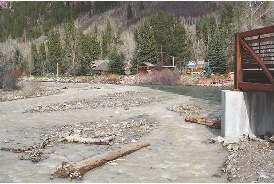
From the Casper Star-Tribune (Jeremy Fugleberg):

The testers zipped the bottles tightly in clear plastic bags, surrounded them with ice in two small coolers, and shipped them overnight to the agency’s laboratory in Golden, Colo., for analysis.

There, the samples waited as the deadline neared for them to be accurately tested. By the time the samples were tested, the EPA-mandated hold times had come and gone.

“Maintenance of the laboratory floor” caused the hold, according to the EPA’s lab data report on the April 2011 samples.

The overdue analysis of those samples was part of the data that underpinned the EPA’s eventual conclusions, released in a draft report in early December. The agency’s key conclusion: Natural gas wells in the area, most developed using hydraulic fracturing, might have harmed groundwater.

The report was quickly slammed by the oil and gas industry but trumpeted by environmental groups. Yet the EPA’s own data — including details not mentioned in the draft report — indicates the agency’s conclusions are partially based on improperly analyzed samples from six private drinking-water wells and two EPA-drilled deep monitoring wells in Pavillion.

The EPA also found contamination in pure water control samples, didn’t purge the test wells properly before gathering samples and didn’t mention in its report whether it tested water carried by a truck used in well drilling, say officials with the Wyoming Water Development Commission who, because of their expertise on water wells, reviewed the EPA’s publicly available information…

“EPA’s analysis is that the best explanation for the chemical signature seen in monitoring wells is the release of hydraulic fracturing fluids into the aquifer above the production zone,” said EPA spokesman Rich Mylott in an email. “Hydraulic fracturing fluids were injected directly into the deeper part of the aquifer. The synthetic substances found in monitoring wells are known to be used in hydraulic fracturing fluids, are not naturally occurring, and many of them were used in the Pavillion field.”

Substances found in the samples from the monitoring wells — including acetone, tert-butyl alcohol, trimethylbenzenes and glycols — weren’t from materials used by the EPA in constructing the wells, Mylott said.

Here’s a guest column, penned by Donovan Schafer (The Independence Institute), that is running in the Summit Daily News. From the article:

The Wyoming report found contamination in two deep monitoring wells that were drilled specifically to detect contamination. But in addition to these wells, the EPA tested 51 domestic wells (the wells people actually use), and not a single one of these wells showed any signs of contamination that could be linked to fracking.

Strangely, this information is not made clear in the EPA report. Instead, it is buried in the lab data. There are literally thousands of “ND” (Not Detected) entries for every imaginable compound and chemical that the EPA thought it could link to fracking. Yet these results, for all 51 domestic wells, are not discussed or presented anywhere in the EPA’s sensation-seeking report.

While the deep monitoring wells do appear to link fracking to groundwater contamination, they do not link fracking to drinking water contamination. It’s misleading when the EPA report says that an Underground Source of Drinking Water (“USDW”) was contaminated, because the EPA’s definition of USDWs is so ambiguous that the entire 3,000-foot-thick Wind River Formation (the one beneath Pavillion) is lumped into a single USDW, even though it has more than 30 separate freshwater zones…

Geologically speaking, the ground beneath Pavillion is a mess. Most regions have multiple clay-rich layers that spread uniformly throughout the area and act as impenetrable barriers between fracking and groundwater. Pavillion has none of these layers, and therefore represents a worst case scenario by which we can test the safety of fracking. As the 51 domestic wells show, fracking does indeed pass this test.

Meanwhile, Sara Castellanos catches us up on opposition to hydraulic fracturing in Aurora in this article from The Aurora Sentinel. Here’s an excerpt:

With a Texas oil company planning to drill several dozen wells near some swank subdivisions on Aurora’s northeastern edge, local lawmakers have organized town hall meetings to educate the public about what they should expect…

Texas-based Anadarko Petroleum Corp. applied in August to drill up to 36 wells in a 30-square-mile patch of land near Aurora’s eastern edge. The area stretches from Gun Club Road east to Watkins Road and from East Yale Avenue north to East Colfax Avenue. Anadarko also hopes to drill as many as 24 other wells around rural Arapahoe County. Arapahoe County is set to finalize its own regulations concerning oil and gas drilling – which mostly mirror state laws – on Jan. 3.

More coverage from the Mountain Valley News (Lindy J. Gwinn)

Brad Robinson, President of Gunnison Energy Corporation said, “I have been a proponent of disclosing frac ingredients for years. GEC has listed, or at least described them, on our website for years as well.”

He went on to say, “Most folks don’t understand the industry is really made up of several different industries. The companies like GEC who drill, complete and then produce oil and gas wells generally favor disclosure. However, the service companies like Halliburton, Calfrack, BJ, and Baker Hughes etcetera, who provide drilling mud, frac fluids, and completion services generally do not like to disclose. This is because they spend millions of dollars developing new drilling techniques and ingredients and don’t want to give competitors information on their new products so that other companies can copy them.”

According to Lee Fyock, also from GEC, “The general feeling when we were all at the table talking about these new fracing regulations is that we understand people’s concerns and want to find a way to relieve those concerns. Producers are glad to have the disclosure in place.”

Here’s a twenty minute radio show about Front Range hydraulic fracturing from Marketplace Sustainability (Kirk Siegler).

Finally, here’s a report from Mireya Navarro writing for The New York Times. From the article:

But conventional vertical and horizontal drilling has its safety issues as well. In Chemung County, where gas companies have been drilling in the Trenton Black River rock formation, a group of 15 residents filed a lawsuit last winter against Anschutz Exploration, a company based in Colorado, over drilling operations at two gas wells that they claim contaminated their drinking water.

The law firm shepherding that suit, filed in State Supreme Court in Elmira, N.Y., is Napoli Bern Ripka, which recently won a settlement of nearly $700 million with the City of New York and its contractors on behalf of more than 10,000 workers saying that they developed respiratory illnesses as a result of their rescue and recovery work at ground zero after 9/11. One of the lawyers, Marc J. Bern, said that the firm has cases pending over natural gas drilling operations in Pennsylvania, Colorado, West Virginia and now New York.

Mr. Bern said he doesn’t take sides in the debate over whether hydrofracking should be allowed — he just argues that “it can be done in a much better way.”

“The industry itself believes that things can be done safer, but they want to do it in the most expeditious and cheapest way and deal with the environmental costs and the contamination later,” he said.

More oil and gas coverage here and here.

Snowpack news: Statewide 74%, Rio Grande and Arkansas basins in the average range, South Platte basin at 88%

snowpackcolorado12272011

Click on the thumbnail graphic to the right for yesterday’s Colorado snowpack map from the Natural Resources Conservation Service.

Fort Collins plans rehab of Michigan Ditch facilities

transmountaindiversionscoloradostateengineer2011

From the City of Fort Collins (Brain Janonis) via the Fort Collins Coloradoan:

During the winter 2011, record snowfall accumulated in the region. While the snowfall created plentiful water supplies for the northern Front Range, the snow’s depth and weight resulted in structural damage to reaches of the 6-mile Michigan Ditch. Two projects were planned on the ditch this summer, but heavy snow accumulation delayed the start of construction. Snow melted slowly this spring and the condition of the pipe was difficult to evaluate until mid-summer.

Once our city staff, engineers and consultants completed their evaluation, crews moved quickly to stabilize the damaged structure before late summer snow began to fall again.

Several phases of repair and stabilization will be required to prevent or minimize future damage and protect the Michigan Ditch. More work will be completed in the next few years, and city water customers will benefit from the use of this asset for decades to come.

More Cache la Poudre River coverage here and here.

La Luz de Nuevo México: Rituals of Seasonal Change in Acequia Communities

acequiadelcerro.jpg

Here’s a look at acequia communities’ winter traditions from David F. Garcia writing for the New Mexico Acequia Association. Acequia communities in the San Luis Valley here in Colorado hold the most senior water rights in the state. Here’s a excerpt:

The solstice, though not specifically celebrated in these communities, marks the time when the earth’s northern hemisphere is tilted furthest away from the sun. Following this day the earth’s tilt reverses and the hours of the day grow longer until the next summer solstice. In many land based communities in the northern hemisphere these natural occurrences coincide with important celebrations during last month of the calendar year.

Though many Acequias lay dormant during the winter months it is a time of planning and observation of the natural world. The mountain snows are among the most scrutinized phenomena on this high desert landscape. In addition, it is an important time for Acequias communities to process many ritual foods that were harvested during the year. Among the most commonly prepared indigenous foods during this time of year are tamales, pozole, and chile con carne. In addition there are many fine desserts such as pastelitos de calabaza, molletes, and bizcochitos. The preparation and consumption of these foods are enmeshed in the ritual significance of religious observances.

Low numbers for aquatic life prompts the CWQCD to designate the Blue River for monitoring and evaluation

blueriver.jpg

Here’s a report from Bob Berwyn writing for the Summit County Citizens Voice. Click through and read the whole article. Here’s an excerpt:

The sampling results prompted the Colorado Water Quality Control Division to propose listing the Blue River as impaired under a relatively new rule that sets thresholds for aquatic life use…

Water experts from Summit County and other jurisdictions challenged the initial move to list the Blue River and other stream segments as impaired, claiming that the state-set thresholds — adopted after 10 years of study — may not be applicable in rivers below reservoirs.

For example, Aurora officials questioned whether or not the data collected below a dam should be evaluated as being representative of an entire stream segment. They suggested that changes in natural temperature alterations, low dissolved oxygen, sediment, nutrient composition and hydraulic modifications may alter the biological community below reservoirs.

More Blue River coverage here and here.

New USFS rules that would keep water rights with the land at ski areas are spawning a lawsuit

winterpark.jpg

From the Associated Press via The Aspen Times:

The Denver Post reported Saturday that the 121-resort National Ski Areas Association plans the lawsuit because it objects to a new permit clause that assigns water rights at a resort on federal land to the federal government.

The industry argues that the change takes away tens of millions of dollars in private water rights. “Water rights in the West are part of the asset base of the ski areas that they have acquired in the marketplace and they are an important part of the balance sheet of a ski area,” said Association president Michael Berry.

The Forest Service, which has already issued three new ski-area permits with the new water clause, contends the clause protects the long-term viability of ski areas by keeping water resources tied to the land, not the operator. The new clause changes a 2004 agreement reached between the agency and the industry that allowed for co-ownership of water rights inside a ski area’s permit area. “If they establish water rights on the national forest, those rights need to remain with the federal government to protect the public’s right to the land,” said Jim Pena, acting chief deputy for the Forest Service.

More water law coverage here.

New EPA rules for coal-fired electrical generation plants may reduce mercury in waterways

mercuryincoloradodp.jpg

From the Colorado News Connection (Kathleen Ryan) via The Durango Herald:

David Ellenberger, Rocky Mountain regional coordinator with the National Wildlife Federation, says the scrubbers will reduce mercury pollution by at least 91 percent. He adds that cleaner air translates into cleaner water for Colorado’s lakes and rivers. “It’s absolutely a huge step forward in protecting public health, our children and our wildlife from these aspects of this hazardous air pollution.”[…]

Elemental mercury finds its way into lakes and reservoirs from prevailing winds, precipitation and runoff. It is converted to toxic methylmercury by microorganisms, the bottom of the food chain. Arsenic and selenium also contaminate fish but to a lesser degree than mercury…

Some utilities criticize the new rules as too onerous, especially as they pertain to older coal plants that may not be suitable for scrubber retrofits. The EPA estimates meeting the standards will cost utilities about $11 million nationwide. Ellenberger claims the savings in health-care costs more than make up for the expense. “The EPA estimates that for every dollar the utilities are about to spend on pollution controls at their coal-fired power plants, public health is going to benefit by about $13, which is pretty impressive,” he said.

More mercury pollution coverage here.

CWQCD’s proposed stricter wastewater treatment plant effluent standards for nitrogen and phosphorus will be costly

bluegreenalgaebloom.jpg

From The Grand Junction Daily Sentinel (Charles Ashby):

Officials with the Colorado Water Quality Control Division say the new rules are needed to prevent even stricter ones from being imposed on the state by the federal government. At the same time, local wastewater experts say the proposed rules, known as Regulations 31 and 85, will do little to nothing to clean the state’s waterways.

The issue centers on the amount of nutrients that end up in the state’s rivers and lakes. Having too many nutrients — nitrogen and phosphorus — causes algae to grow. That, in turn, saps oxygen from the water, creating so-called dead zones, places where nothing can grow and fish can live, said Steve Gunderson, executive director of the water division.

While the U.S. Environmental Protection Agency isn’t mandating what Colorado is considering, the federal agency ultimately will impose something even more stringent if the state doesn’t act on its own, he said. “The EPA has been pushing for states to do something for quite a few years,” Gunderson said. “It is one of the nation’s biggest water quality challenges. (The nutrients) causes a water body to get choked. It will rob the water body of oxygen, and it will raise the pH, the level of corrosivity, in the water. It can adversely impact aquatic life.”[…]

The division has filed about 600 pages worth of rules and other accompanying documents with the Colorado Water Quality Control Commission that call for lowering phosphorus and nitrogen levels to virtually zero over the next 10 years. The commission is holding a public hearing on the rules in the spring, with an expectation of having them go into effect by June 1…

Local wastewater experts…say there’s no scientific evidence that shows all wastewater treatment plants are releasing too many nutrients, and have asked for more time to research the matter…

The commission is to vote on the proposed rule in March, but the city only has until Jan. 20 to file a prehearing statement if it intends to challenge any part of it…

So far, officials from 32 local entities have signed a letter complaining about the proposed rules, including the Clifton and Orchard Mesa sanitation districts, the Grand Valley Drainage District, the Battlement Mesa Metropolitan District and the towns of Rangely, Cedaredge, De Beque and Nucla. In the letter that is to be sent to Gov. John Hickenlooper by the end of the week, the officials say the regulations will cost all of them about $2 billion to be in compliance, and ask that he delay it until more scientific research can be done…

Meanwhile, state Sen. Steve King, R-Grand Junction, said he plans to introduce a bill when the Legislature reconvenes next month calling for a five-year moratorium on the rule, to give local communities more time to study its impact…

Gunderson said all this may be much a-do about nothing. He says the division already has limited the scope of the proposed regulation only to larger plants, and is willing to limit it even further to include specific areas of the state.

More wastewater coverage here.

Snowpack news: Dry west and in the average range east of the Great Divide, last Thursday’s beautiful snow really helped

snowpackcolorado12232011

We’re in the time of year where one good storm, like the one last Thursday, can really move the snowpack as a percent of average. Here’s the graph for the South Platte River Basin. Here’s the 24 hour precipitation map for Jefferson County for December 22, 2011 from CoCoRaHS.

Click on the thumbnail graphic to the right for the snowpack map from last Friday.

The Colorado River Basin is at 67% of average. Statewide is 78%. Dry in the Fraser River headwaters.

Here’s a look at the Madden-Julian Oscillation which is overpowering La Niña right now — according to the staff at the National Weather Service in Boulder — from Bob Berwyn writing for the Summity County Citizens Voice. From the article:

The resulting weather pattern has looked much more like an El Niño phase of the Pacific cycle, but the good news (for Colorado) is that the Madden-Julian phase has weakened. That means that a more typical La Niña pattern — with a storm track out of the northwest — may once again begin to dominate Colorado weather.

In fact, a series of small and fast-moving storms is starting to line up in the Pacific Northwest, with a chance of snow in the northern mountains Wednesday night and the potential for a few more disturbances to cross the area on and off through the end of the week.

The Madden-Julian oscillation is a 30- to 60-day cycle featuring an eastward progression of large regions of both enhanced and suppressed tropical rainfall, observed mainly over the Indian Ocean and Pacific Ocean.

Restoration: South Suburban Parks and Recreation is planning a four million dollar project on the South Platte River south of Denver

placingrocks.jpg

Increased opportunity to fish for trout? I’m in. Here’s a report from Bruce Finley writing for The Denver Post. From the article:

The $4 million project run by South Suburban Parks and Recreation, with support from Arapahoe County and Littleton, would scoop a deeper channel into a 2.4-mile stretch of the river south of central Denver. A “riparian terrace,” planted with native willows, dogwoods, berries, wild plums and buffalo grasses, would fall away toward the river. In the waterway, a dozen or so riffles and pools where fish can escape heat would be created, and eroding banks would be stabilized with buried rip-rap rocks…

Today, the South Platte “no longer functions as a natural river system” that can support a riparian corridor, according to a report commissioned by Littleton planners. The state’s reclassification of the South Platte shifted its status from “cold water” to “warm water class 1” — which is defined as capable of sustaining a wide variety of sensitive species “but for correctable water-quality conditions.”

Point-source polluters — such as the Littleton/Englewood Water Treatment Plant, just east of the river between Yale and Hampden — now have greater flexibility in the discharges they are allowed to release into the river. The problem with cleaning up discharges is that plant upgrades will require more money than Littleton and Englewood can afford, Brinkman said.

More restoration coverage here.

Reclamation Issues a Lease of Power Privilege to Develop Hydropower at Ridgway Dam

ridgwaydamusbr.jpg

Here’s the release from the U.S. Bureau of Reclamation (Steve McCall/Justyn Hock):

Reclamation announced today that it will issue a Lease of Power Privilege (LOPP) to the Tri-County Water Conservancy District to develop hydropower resources at Ridgway Dam, a feature of the Bureau of Reclamation’s Dallas Creek Project located near Ridgway, Colo.

Reclamation will issue the LOPP based on the final environmental assessment (EA) and Finding of No Significant Impact (FONSI) for the proposal. These documents have been completed in compliance with the National Environmental Policy Act to address the effects of the construction and operation of hydropower facilities. The FONSI concludes that the proposal will not significantly affect the human environment

The final EA and FONSi are available at: www.usbr.gov/uc/ under environmental documents or a copy can be received by contacting Steve McCall with Reclamation in Grand Junction.

More hydroelectric coverage here and here.

Next CWCB board meeting January 23-24

mclellanreservoir.jpg

From email from the Colorado Water Conservation Board:

Notice is hereby given that a meeting of the CWCB will be held on Monday January 23, 2012, commencing at 8:00 a.m. and continuing through Tuesday, January 24th, 2012. This meeting will be held at the Hyatt Regency Denver Tech Center located at 7800 E Tufts Ave, Denver, CO 80237.

More CWCB coverage here.

Colorado River Basin: What are the reasonable water management options and strategies that will provide water for people, but also maintain a healthy river system?

coloradoriverbasin.jpg

Here’s a guest commentary written by Eric Kuhn, David Modeer and Fred Krupp running in The Denver Post. The trio are issuing a call to arms of sort, asking for input for the Colorado River Basin Study. Here’s an excerpt:

Management of the Colorado River is a complex balancing act between the diverse interests of United States and Mexico, tribes, the seven basin states, individual water users, stakeholders, and communities. The challenges posed by new growth and climate change may dwarf anything we faced in the past. Instead of staring into the abyss, the water users, agencies, and stakeholder groups that make managing the Colorado River responsibly their business are working together, using the best science available to define the problem, and looking for solutions.

We’re calling our inquiry the Colorado River Basin Study, and we want your help. As Colorado River management professionals, we have a lot of knowledge and ideas, but we know that we don’t have them all. We want ideas from the public, from you, but we need your input by February 1. You can submit your suggestions by completing the online form at: http://on.doi.gov/uvhkUi.

The big question we need to answer is: What are the reasonable water management options and strategies that will provide water for people, but also maintain a healthy river system? We don’t believe there’s a single silver bullet that will resolve all of our challenges. We want to continue to explore the benefits and costs of every possibility, from conservation to desalination to importing water from other regions.

The West was built on innovation and hard work, and that spirit is still strong. Our landscapes and communities are unparalleled in their beauty, resilience, and character. The economic well-being of our rural and urban communities in the Colorado River basin is inextricably linked to Colorado River and its environmental health.

That’s why we are asking for the public’s input to help us craft a study showing a path forward that supplies our communities with the water they need to thrive and protects the health of the Colorado River-and the ecosystems and economies it supports.

More Colorado River basin coverage here.

Colorado-Big Thompson Project update: Reclamation plans to start filling Mary’s Lake on December 26

maryslakepowerplantncwcd.jpg

From email from Reclamation (Kara Lamb):

As we near the Holidays, we near the wrap up of annual maintenance on the Colorado-Big Thompson Project. Immediately following Christmas, we will begin bringing water back through the east slope of the C-BT system.

Marys Lake, which has been drawn down for annual maintenance at the power plant, will begin to fill again starting December 26.

Operations at Lake Estes, which has maintained average water level elevations through most of December, will be unchanged.

Next week, the Pole Hill Canal, which helps bring water from Lake Estes to the C-BT’s southern power arm, will start to water up again, in stages. Our contractor on that project has finished work early and we will be testing the canal the last week of the year. Check out the news release announcing the project’s completion.

As Pole Hill Canal waters up, the water level at Pinewood Reservoir will slowly start to rise.

The water elevation at Carter Lake has continued to slowly drop as we have run Unit #3 in reverse to generate hydro-electric power and also send water down the canal towards Horsetooth. Next week, Unit #3 will be on and off as a power generating unit. On December 30, however, we have scheduled to switch back to pump mode and water will once again pump up to Carter Lake.

A little bit of water will continue going to Horsetooth Reservoir via the Charles Hansen Feeder Canal. Horsetooth is still high in water elevation for this time of year. It is currently at an elevation of about 5408 and did not drop below 5400 in 2011. That is unusual.

Broomfield water history

broomfield.jpg

From the Broomfield Enterprise (Joe Rubino):

The Turnpike Land Co. launched development on Broomfield Heights, a precursor to incorporated Broomfield, in 1955 along the north side of the recently built Denver-Boulder Turnpike, completed in 1952. The city’s water originally came from a pair of lakes on the family farm land of Adolph Zang, ditch water rights and three large wells, according to local historian Silvia Pettem’s 2001 book, “Broomfield: Changes Through Time.”

By May 1955, work had begun on a water main from nearby Great Western Reservoir, which was fed by Clear Creek through the Church Ditch. It would be Broomfield’s main source of water for its first decade as a city.

In 1970, as Broomfield’s population grew to more than 7,000, the city, under the leadership of a then recently hired City Manger George Di Ciero, used federal funding to purchase an 11-million-gallon-per-day allotment from Denver Water. According to Pettem’s book, a Daily Camera article that ran in 1970 referred to the purchase as “all the water (Broomfield) will ever need.”

That proved short-lived, as it was just three years later that radioactive contamination was first found in Great Western Reservoir. The terrifying revelation that the nearby Rocky Flats Nuclear Weapons Plant had leaked contaminants into city drinking water sent many locals running out to buy bottled water, Pettem wrote.

After a 1989 FBI raid on Rocky Flats, Broomfield spearheaded regional efforts to protect area water supplies and eliminate Great Western Reservoir as a primary water source. In 1989, Di Ciero dispatched crews to dig a diversion ditch to prevent water from Rocky Flats from getting into the reservoir. Those efforts were joined by surrounding downstream cities, such as Westminster and Thornton.

“That was a monumental effort and Broomfield, I would have to say, took the lead on it,” Joyce Hunt, Thornton assistant city manager, said of the diversion ditch and ensuing battle to curb pollution form Rocky Flats.

After that, with the support of Colorado Rep. David Skaggs and $52 million from Rocky Flats manager, the U.S. Department of Energy, Broomfield sold some of its water rights and bought an allotment of Windy Gap water from Boulder. After the construction of a pipeline from Windy Gap storage spot Carter Lake and a new water treatment facility near West 144th Avenue and Lowell Boulevard, Broomfield at last had a clean, safe water supply.

“The new water supply was key to securing water for our future,” [Kirk Oglesby, Broomfield’s code enforcement manager and unofficial town history resource] said.

While Broomfield is always looking for ways to firm up its water supply, the drought that struck Colorado in the mid-2000s demonstrated the city was prepared to handle shortages, Oglesby said. While neighbors Lafayette and Louisville were forced to stop lawn watering in the city limits or fall back on Boulder for support during the drought, Broomfield’s supplies held firm, Oglesby said, and the city “didn’t experience much difficulty at all.”

More South Platte River basin coverage here.

The U.S. Forest Service declines to impose a moratorium on new rule designed to keep ski area water with the land, lawsuit in the wings

coppermountainsnowmakingcoskicountry.jpg

From The Denver Post (Jason Blevins):

The ski industry plans to sue the U.S. Forest Service to stop a new water-rights clause in ski-area permits that resorts argue is a federal taking of tens of millions of dollars in private water rights. “This was inevitable,” said Michael Berry, president of the 121-resort National Ski Areas Association, speaking of the lawsuit. “We have worked very hard to avoid it, but there hasn’t been a willingness on the part of the (Forest Service).”[…]

The industry and a consortium of legislators, including U.S. Sens. Mark Udall and Michael Bennet, both Colorado Democrats, and Rep. Scott Tipton, a Colorado Republican, have urged the Forest Service to suspend implementation of the controversial new clause. The agency this week declined to issue a moratorium.

More water law coverage here.

Cloud-seeding: Frank Kugel — ‘There’s no other place to find water for $11 an acre-foot’

cloudseedingexplained.jpg

From The Denver Post (Jason Blevins):

“Even if we see 10 percent increased snowfall that the consultant has projected, it’s an incredibly beneficial investment,” [Upper Gunnison River Water Conservancy District district manager Frank Kugel] said. “We took a long, hard look, but in the end my board felt the bang for the buck was worth it. There’s no other place to find water for $11 an acre-foot.”[…]

Water districts in Nevada, Arizona and California have joined eight districts that make up the Front Range Water Council and a few ski areas in funding Colorado’s cloud-seeding program in a widespread effort to load passing winter storms with moisture-wicking silver iodide molecules.

The 111 cloud-seeding cannons — or ice nuclei generators — positioned across the state are today powered by a wider-than-ever array of interests. In previous years, cloud-seeding efforts were driven largely by the state’s two thirstiest entities, Denver Water and Colorado Springs Utilities. This year, Aurora Water, the Northwest Colorado Water Conservation District, the Twin Lakes Reservoir and Canal Co., the Southeast Colorado Water Conservancy District and the Pueblo Water Works have joined the state’s water-slurping heavyweights under the Front Range Water Council banner to support cloud seeding…

“They are primarily interested in . . . reducing the potential for Compact curtailment,” said Maria Pastore, whose Grand River Consulting Corp. in Glenwood Springs is administrating the new cooperative program, replacing Denver Water in the supporting role for Colorado cloud- seeding programs. Since 2006, the Southern Nevada Water Authority, the California Six Agency Committee and the Central Arizona Conservation District have funded about half of the state’s cloud-seeding efforts, matching the nearly $1 million the Colorado Water Conservation District has paid since launching its formal cloud-seeding grant program in 2004.

“I think the (district) boards down there are impressed,” said Joe Busto, who manages the state’s cloud-seeding operation for the Colorado Water Conservation Board, or CWCB. “The strategy there is to try to boost the low three-year averages on the Colorado River. It’s a tool to intentionally keep the flows up and stay out of conflict with other users.”[…]

Newer, more-efficient machines — designed by Nevada’s Desert Research Institute and funded in part by the CWCB — were installed this fall in the Fraser River Valley on the Grand Mesa and in the southern San Juans. The new, remotely controlled generators seed silver iodide at a much heavier rate, sending up as much as 28 grams of the molecules an hour versus a typical six grams an hour. And the new machines — two of which are positioned around Winter Park ski area, which is paying $22,000 of the new machine’s $59,000 cost — are located at higher elevations, enabling easier seeding of passing clouds.

More cloud-seeding coverage here and here.

R.I.P. Senator Fred Anderson

lakeloveland.jpg

Here’s the obituary from the Loveland Reporter-Herald (Pamela Dickman). Here’s an excerpt:

Anderson was instrumental in integrating ground and surface water rights and restructuring the state water laws in 1969, which Eric Wilkinson, general manager of Northern Water, called “a milestone in Colorado history.” He also helped achieve in-stream flow water rights, which affect water supply in Colorado today. “There are 8,000 miles of streams in Colorado protected by that,” said Wilkinson.

Anderson, whom his wife called Freddie, was a fourth-generation Lovelander…

Services will be held 10 a.m. Tuesday, Dec. 27, at Trinity Lutheran Church, 33rd Street and Duffield Avenue, in Loveland. A second memorial service will be held in Denver next month.

Longmont calls hydraulic fracturing time-out for 120 days

hydraulicfracturing.jpg

From the Longmont Times-Call (Scott Rochat):

“Decisions on hydraulic fracturing are too important to be rushed,” resident Judith Blackburn told the council. “We tonight have a window of opportunity to do the prudent thing.” TOP Operating of Lakewood has plans to establish five consolidated drilling sites near Union Reservoir and Sandstone Ranch, but no application had been put forward yet.

State law does not allow a city to completely ban drilling within its boundaries, though it can set standards on how and where the operations are conducted. It has been about 10 years since the city drafted its own regulations, which senior planner Brien Schumacher said would rate only a 3 or 4 on a scale of 1 to 10. Schumacher noted that several communities have begun tightening their own laws on the issue — including requirements on water monitoring — displaying a columned chart showing X’s for each community’s restrictions.

More coverage from The Denver Post. From the article:

Longmont’s vote follows votes by Colorado Springs and El Paso County governments placing temporary limits on fracking. Commerce City on Monday agreed to take 30 days to study a proposed six-month moratorium on fracking within city limits. Aurora has drafted a six-month moratorium, but the ordinance has not yet been introduced.

More coverage from Cathy Proctor writing for the Denver Business Journal. From the article:

Longmont currently has 12 producing wells within its city limits, Leal said via email.
But the council took action for two primary reasons, he said.

• It’s anticipating more applications from the oil and gas industry in the future, and

• There’s lots of public concern over environmental impacts.

Longmont plans to use the 120-days to update its existing oil and gas rules, which were put into place in 2000. City planner Brien Schumacher gave the existing regulations “only a 3 or 4 on a scale of 1 to 10,” according to the Longmont Times-Call.

More oil and gas coverage here and here.

Leadville: The Parkville Water District is raising rates ten percent starting January 1

fountainpavementdrawing.jpg

From the Leadville Herald Democrat:

Parkville board members and management unanimously agreed to the rate increase at the Dec. 8 board meeting. The largest single reason for the increase is to help finance the construction of a new well, pump and pipeline to bring water from the Canterbury Tunnel into the Parkville system, said Greg Teter, general manager. Estimated cost of this project is more than $2.5 million dollars. Although several significant grants were secured for the project, the bulk of the money will be in the form of a low-interest loan, Teter said. During 2011, Parkville also had several other equipment failures that required capital spending. The pump station at the Elkhorn shaft had to be completely rebuilt this past summer after 60 years of service, at a cost of more than $50,000. One of the main pumps at the Arkansas Wells also failed and had to be replaced. All of these projects will help reduce the number of frozen water lines in the winter by providing additional groundwater that is much warmer than the surface water in Evans Creek. “Also Parkville will not be facing the annual water shortages in late winter that we have had to deal with every winter since the Canterbury Tunnel caved in,” Teter explained.

More infrastructure coverage here.

Jim Pokrandt: ‘The River District’s [motion to intervene] also cites the [Flaming Gorge pipeline] as speculative with relatively small demands’

coloradoriverbasinusgs.jpg

From email from the Colorado River District (Jim Pokrandt):

Update: Here’s the release from the Colorado River District website.

The Colorado River District is opposing a proposed Flaming Gorge Reservoir pipeline project through a motion to intervene with a federal regulatory agency that is reviewing the plan to pump water from the Wyoming reservoir to the Front Range of Colorado.

Fort Collins, Colo., businessman Aaron Million is proposing a 560-mile pipeline, the Regional Water Supply Project (RWSP), which would carry up to 250,000 acre feet of water. It is under review by the Federal Energy Regulatory Commission for its power-generating aspects. The River District’s motion to intervene says, “The volume of water at issue would adversely impact existing users of Colorado’s entitlement to the waters of the Colorado River, and could usurp the remainder of the state’s compact allocation.”

Although the water would be taken out of the Colorado River system from the Green River, a tributary with Wyoming headwaters, under the Colorado River Compact of 1922, the amount still counts against Colorado’s limited ability to use the river.

The River District’s motion also cites the RWSP as “speculative” with “relatively small demands – nowhere near the volume claimed by the RWSP. Moreover, none of the projected water users have demonstrated the ability to pay for the enormous cost of the project.” The RWSP also threatens the ability of the Colorado River District, the state of Colorado and other public entities to plan for the development of the state’s remaining entitlement to the Colorado River in a “responsibly conservative matter,” the motion states.

Other objections include:

– The need first for the Colorado Water Conservation Board to complete its Colorado River Water Availability Study;
– The need for the U.S. Bureau of Reclamation to complete is Colorado River Basin Water Supply and Demand Study;
– The need for Colorado’s West Slope to finalize its own consumptive and nonconsumptive studies; and
– The need for there to be interstate and intrastate agreements on how the water would be managed under the Prior Appropriation System.

More coverage from the Associated Press via The Billings Gazette. From the article:

Colorado River District officials are telling regulators the cost for the pipeline, which would stretch more than 500 miles, will be “enormous.” They also say the proposal could cause Colorado to use up its allocation of Colorado River system water under a multistate compact and hurt existing users of that water. Million contends there’s enough water available for his proposal. Federal and state studies on Colorado River water availability aren’t complete yet.

More coverage from Ken Green writing for the Denver Examiner. From the article:

The Center for Biological Diversity said that “online action alerts” issued by it and another environment advocacy group, Earthjustice, prompted the flood of public comments to the Regulatory Commission from members of the public who oppose construction of the 500-mile pipeline they claim would be “disastrous” to the ecosystem of the Green River, including the Colorado pikeminnow, the humpback chub and razorback sucker, as well as damage the communities whose economy is based on the river…

The current proposed project would require Wyco to construct natural-gas fired pumping stations (“at least nine”, said the Center) to pump the water over the Continental Divide. The Center claims that even Wyco officials acknowledge that the energy needed to pump the water over the divide would be greater than the project might create through hydropower

From the Summit County Citizens Voice (Bob Berwyn):

According to the River District’s motion, the project is speculative and, thus far, none of the projected users have shown an ability to pay for the expensive project…

“The volume of water at issue would adversely impact existing users of Colorado’s entitlement to the waters of the Colorado River, and could usurp the remainder of the state’s compact allocation,” the River District wrote in its motion to intervene. Although the water would be taken out of the Colorado River system from the Green River, a tributary with Wyoming headwaters, under the Colorado River Compact of 1922, the amount still counts against Colorado’s limited ability to use the river.

The River District also said the pipeline threatens the ability of the Colorado River District, the state of Colorado and other public entities to plan for the development of the state’s remaining entitlement to the Colorado River in a “responsibly conservative matter.”

More Flaming Gorge pipeline coverage here and here.

Green Mountain Reservoir operations update: 300 cfs in the Blue River below the dam

greenmountainreservoir.jpg

From email from Reclamation (Kara Lamb):

Earlier this week, we increased the releases from Green Mountain from 200 cfs to 300 cfs. The change was made in four installments of 25 cfs increases: two on Monday and two on Tuesday. Because the Shoshone Power Plant maintenance work is diminished, the lower release from Green Mountain is not necessary. As a result, we will be releasing around 300 cfs through the Holidays.

More Colorado-Big Thompson Project coverage here.

Aspen files preliminary paperwork with FERC for the proposed Castle Creek hydroelectric generation plant

microhydroelectricplant.jpg

From the Summit County Citizens Voice (Bob Berwyn):

The filing is the first step in a formal review process that eventually could enable the town to produce about 8 percent of its needed electricity from a clean and local source — but the project is not without controversy, as some critics claim that the power generated by the facility isn’t worth the potential harm it could cause to Castle and Maroon creeks by reducing stream flows.

For the town, the Castle Creek project is a key component in providing renewable energy sources to the Aspen community. According to the town’s website, the energy center will not only provide power, but serve as a renewable energy model, education center and museum, reducing CO2 emissions by about 5,000 tons. The turbine and generator convert the force of water falling from 325 feet, from the Thomas Reservoir, into electric power. The water will travel a 42 inch penstock (pipe) which will supply the plant with approximately 52 cubic feet per second of head and double as an emergency drain line for the Thomas Reservoir if the reservoir walls are breached. The electricity will be placed on the City of Aspen electric grid to power the Water Treatment campus, and may potentially produce hydrogen for fuel cells and hydrogen vehicles.

More hydroelectric coverage here and here.

Taylor McKinnon: ‘Burning fossil fuels to pump river water across 500 miles to feed urban sprawl is a ludicrous idea — and that’s what the public told the Federal Energy Regulatory Commission this week’

flaminggorgedamusbr.jpg

Here’s a release from the Center for Biological Diversity (Taylor McKinnon/McCrystie Adams):

More than 5,000 public comments were sent to the Federal Energy Regulatory Commission this week opposing the proposed Flaming Gorge Pipeline, which would pump more than 250,000 acre-feet of water annually over 500 miles from Flaming Gorge Reservoir to Colorado’s Front Range. The project would suck massive amounts of water out of the Green and Colorado rivers in Utah, unleashing disastrous impacts on those river ecosystems, four species of endangered fish — the Colorado pikeminnow, humpback chub, razorback sucker and bonytail chub — and human communities dependent on those rivers. The commission is currently evaluating whether to grant a preliminary permit for the project.

“Burning fossil fuels to pump river water across 500 miles to feed urban sprawl is a ludicrous idea — and that’s what the public told the Federal Energy Regulatory Commission this week,” said Taylor McKinnon of the Center for Biological Diversity. “It’s hard to imagine a worse proposal for the already over-allocated Colorado River system that’s beset by a warming climate, declining flows and disappearing native fish populations.”

This week’s public comments come on the heels of formal intervention in the commission’s process filed last week by the Colorado River Protection Coalition — a coalition of 10 conservation groups, including the Center. The coalition asserts that the Flaming Gorge Pipeline is unlikely to be permitted because it would likely violate the Endangered Species Act and adversely affect four national wildlife refuges; part of the project would be located in a U.S. Forest Service roadless area. The coalition also argued that the permit should be denied because the applicant, Wyco, failed to meet several requirements during a previous attempt at permitting a nearly identical project with the U.S. Army Corps of Engineers.

The new batch of comments this week came from online action alerts created by the Center for Biological Diversity and Earthjustice.

“The opposition to this project is amazing,” said McCrystie Adams of Earthjustice. “The pipeline would devastate the Green River and severely harm the Colorado River downstream — the public is strongly speaking out against this pipeline scheme.”

Wyco previously sought a permit for the pipeline from the U.S. Army Corps of Engineers. In July 2011 the Corps terminated its review of the project because Wyco missed multiple deadlines and did not provide information requested by the Corps. A few months later, Wyco redesigned the project to include some incidental hydropower components and requested review through the Federal Energy Regulatory Commission. Despite the modifications, the project remains an energy hog — at least nine air-polluting, natural gas-fired pumping stations would be required to pump the water uphill across Wyoming and over the Continental Divide. Wyco’s president has acknowledged that pumping the water uphill would use more energy than the project would create through hydropower.

Since its inception, the Flaming Gorge Pipeline has met with opposition in Colorado, Wyoming and Utah. The water would go to the Front Range of Colorado, which is projected to double in population in the next 50 years. Colorado is already a parched state with severely depleted rivers, while the majority of the water in Colorado’s cities is used to keep lawns green for three months in the hot, dry summer across sprawling suburban landscapes.

The coalition’s intervention comments can be downloaded here.

More coverage from Kathy Gilbert writing for the Green River Start. From the article:

The coalition contends that the project cost could reach as much as $9 billion and that Million has failed to demonstrate a need for the water with customers committed to paying for it if it could be delivered.

They also say preventing that much water from flowing into the Green River would hurt wetlands, birds, fish and the recreation economies of surrounding communities.

The coalition believes the pipeline is extremely unlikely to be permitted because it would likely violate the Endangered Species Act, would adversely affect four national wildlife refuges and part of the project would be located in a U.S. Forest Service roadless area…

“The water in the Green River is essential for the operation of many of Sweetwater County’s major industries including four trona mines and the Jim Bridger Power Plant,” the county’s letter states. The power plant relies on a constant stream of water piped from the Green River for use in its four cooling towers.

The county asserts that the Regional Watershed Supply Project and the effects it would have on the water supply in the Green River, would “dramatically impact Sweetwater County’s industrial base.”

The county also states 38,769 or the county’s 43,806 population rely on the river to provide potable water and fire suppression supplies.

Finally, the county suggests its tourism industry would be impacted because the Flaming Gorge Reservoir is the basis of a multi-million dollar tourism industry…

In the Wyoming Game and Fish Department’s filing, they’re intervening with the purpose of ensuring its interests, including the protection of all Wyoming wildlife, is considered during the FERC process.

More Flaming Gorge pipeline coverage here and here.

A beautiful snow in the Denver Metro area — eight inches at Gulch Manor

snowstorm12222011

Using the tried and true method of sticking a ruler in the snow in the backyard at Gulch Manor this morning I measured eight inches and it was still snowing lightly. Beautiful snow.

Check out this photo slidshow from 9News.com.

U.S. Senators Bennet and Udall, et al., pen letter to the USFS asking them to suspend new rule that would tie water rights to the land at ski areas

winterpark.jpg

From the Colorado Independent (Troy Hooper/Scot Kersgaard):

“Our interest is in maintaining the ability to provide ski areas with water into the future and to protect the public’s interest by making sure that communities, often small rural communities, that are linked to ski areas can rely on that into the future,” Jim Pena, acting deputy chief for the national forest system, told the Colorado Independent on Wednesday.

Nonetheless, Sens. Mark Udall and Michael Bennet, both Democrats, along with John Barrasso, R-Wyo., and James Risch, R-Idaho, penned a Dec. 1 letter to the Forest Service asking it to suspend a new clause in the permitting process that essentially transfers water rights — potentially worth tens of millions of dollars — after 2004 from joint ownership between ski resorts and the federal government to just the latter. “Without going into the merits of the water clause itself, it is apparent to us that a careful review of the practical implications of the clause to ski area operations and the changes that would occur under this new clause would prove beneficial to all parties involved,” the letter states.

The water wrangling harkens back to the National Forest Ski Area Permit Act of 1986, which originally conceded the water rights to the federal government. Then in 2004, the National Ski Areas Association lobbied the Bush administration to amend the law so resorts obtained a stake in water rights within ski area boundaries. But when the Forest Service tried to convey water rights under the 2004 joint-ownership policy, its lawyers discovered that state laws wouldn’t allow it. Thus, after working with the ski industry for nearly a year to clarify the intent of the 2004 joint-ownership clause, the Forest Service recently implemented a new interim directive that federal officials believe clarified ambiguities in its water policy. The directive is only valid for 18 months and, foresters said, it can be modified if there is evidence that demonstrates financial harm to the resorts.

More water law coverage here.

Snowpack news: Dry east and west of the Great Divide, statewide snowpack 76% of average

snowpackcolorado12212011

wyutcoprecipitationdecember1to172011

Nearly two months into water year 2012 the snowpack is well below average across the state. We’re still in the time of year where one good dumping can make a big difference but the long range forecast does not bode well. Click on the thumbnail graphics to the right for the current snowpack map from the NRCS and the latest precipitation map from the Colorado Climate Center.

Deadline for Comments on Flaming Gorge Pipeline Closes with One Positive Note out of More Than 5,000 Objections

greenutriverbasin.jpg

Here’s the release from Western Resource Advocates (Jason Bane):

If official public support for the ‘Flaming Gorge Pipeline’ (FGP) is any indication of its future potential, the project to pump water from Wyoming to Colorado won’t become a reality any time soon. Public comments and objections regarding the FGP were due to the Federal Energy Regulatory Commission (FERC) by Monday, Dec. 19, and out of more than 5,000 submissions, only 1 (one) was supportive of the idea.

“The question here is obvious: If virtually nobody took the time to argue here that the pipeline is a good idea, why is any federal agency even considering a permit for this proposal?” said Western Resource Advocates Water Attorney Robert Harris. “Finding a supporter in the FERC filings is about as difficult as getting a perfect score on your SATs.”

Aaron Million, President of Wyco Power and Water, Inc., is seeking a federal permit from FERC to review his FGP proposal to pump water more than five hundred (500) miles from the Green River in Wyoming to the Front Range of Colorado. More than 5,000 comments from citizens, governments and non-profit organizations were formally submitted to FERC by Dec. 19, and only 1 comment – from a private citizen in Casper, WY – was supportive of the proposal. That comment represents roughly the same odds (.0002%) as an American high school student getting a perfect score on the SAT test.

Western Resource Advocates (WRA) submitted formal objections last week along with the Colorado Environmental Coalition and the National Parks Conservation Association. Wyoming Gov. Matt Mead formally objected to the proposal, saying: “This project would cut a vast swath across southern Wyoming, with the potential for huge impacts in many significant sectors of our economy and aspects of critical resources to Wyoming and Colorado.”

Additional objections included those from:

– City of Rock Springs, WY
– City of Green River, WY
– Sweetwater County, WY
– Wyoming Game and Fish Department
– Upper Yampa Water Conservancy District, CO
– City of Colorado Springs, CO
– City of Ft. Collins, CO
– Daggett County, UT
– Utah Rivers Council
– Colorado River District
– Colorado River Outfitters Association

Public comments and ‘Motions to Intervene’ can be found at: http://elibrary.ferc.gov (docket # P-14263).

BACKGROUND INFORMATION
On September 1, 2011, Mr. Aaron Million of Wyco Power and Water, Inc. applied to FERC for a permit application for the Regional Watershed Supply Project proposal (generally referred to as the Flaming Gorge Pipeline, or FGP). Two months earlier, the U.S. Army Corps of Engineers terminated its review of the project, citing Million’s failure to meet required deadlines to provide information. Wyco applied to FERC under the premise of reclassifying the FGP as a hydropower project, but because it is primarily a water-delivery system, FERC only has limited jurisdiction and cannot approve the entire project.

The FERC deadline for public comments and ‘Motions to Intervene’ is December 19, 2011. If FERC eventually decides to consider permitting for the FGP, it would begin a 3-year study period of the project. Before the FGP could begin to be constructed, Wyco would almost certainly need a permit from multiple additional federal agencies, such as the Forest Service and the Bureau of Land Management. At some point, Wyco would also likely need to resubmit an application to the U.S. Army Corps of Engineers.

For More Information on the Flaming Gorge Pipeline, go to:
http://www.westernresourceadvocates.org/water/pipeline/million.php

To access FERC Submissions/Filings directly, go to:
http://elibrary.ferc.gov/idmws/file_list.asp?accession_num=20111013-5035

A footnote from the release reads: “The Center for Biological Diversity submitted 3,388 individual public comments, and Earthjustice submitted 1,706 public comments”

More Flaming Gorge pipeline coverage here and here.

Restoration: Crystal River tributary, Coal Creek, is on the Roaring Fork Conservancy’s radar

coalcreekcrystalriverdrainageaspentimes.jpg

From The Aspen Times (Janet Urquhart):

The Basalt-based Roaring Fork Conservancy hopes to launch a multi-agency effort to clean up Coal Creek, a tributary of the Crystal River, with a grant from the Pitkin County Healthy Rivers and Streams Fund to get things started.

The board that oversees the fund has recommended spending $48,269 from county tax revenues devoted to water quantity and quality in the Roaring Fork River watershed; the expenditure is on the county commissioners’ agenda today.

In part, the funds will go toward analysis of existing water-quality data for Coal Creek, which tumbles out of Coal Basin west of Redstone, and a technical workshop in the spring that draws together experts to review the data and discuss options to clean up a creek that regularly dumps large quantities of sediment into the Crystal River. The Crystal in turn flows north to Carbondale, where it joins the Roaring Fork.

“Basically, nine times out of 10, if the Crystal is that ashy color, it’s Coal Creek that’s putting it in there,” said Rick Lofaro, executive director of the Roaring Fork Conservancy. Coal Creek flows through a basin still healing from years of mining for high-grade coal.

More Crystal River watershed coverage here and here.

The Commerce City council delays vote on moratorium for hydraulic fracturing for thirty days

hydraulicfracturingrulisonhaliburtonap04152009

From The Denver Post:

Instead of considering an emergency ordinance, which would have kicked in immediately, the council passed a regular ordinance on first reading. The final reading will come in 30 days.
Commerce City spokeswoman Michelle Halstead said the timeout will allow the city to get input from the Colorado Oil and Gas Conservation Commission as well as from industry representatives before the council decides what to do longterm. “We look forward to working with all interested parties to provide thoughtful discussion and increase awareness and education on this important topic,” Councilman Dominick Moreno said in a written statement.

More oil and gas coverage here and here.

Flaming Gorge pipeline: Mesa County Commissioners vote to oppose the project, Wyoming Game and Fish files motion to intervene with FERC

flaminggorgepipelineearthjustice.jpg

From the Associated Press via The Columbus Republic:

Mesa County commissioners in Colorado have joined those opposing a proposal to build a pipeline to carry water from the Flaming Gorge Reservoir in Wyoming to Colorado…

Mesa County commissioners voted 2-0 Monday, with a third commissioner out sick, to oppose the idea. The Daily Sentinel reports commissioners said the idea is ill-conceived, expensive, and could cause Colorado to use more water than it has been allocated under a multistate compact divvying up water in the Colorado River system.

Meanwhile, here’s a release Wyoming Governor Matt Mead outlining his opposition to the pipeline. Thanks to Sagebrush Sam’s (@SagebrushSam) Twitter feed for the link:

Governor Matt Mead sent a letter to the Federal Energy Regulatory Commission (FERC) today. That letter expresses the Governor’s deep concern about the proposed water pipeline from the Green River in Wyoming to Colorado’s Front Range. Governor Mead’s comments are meant to protect Wyoming’s economy and resources and show the project is not feasible.

“This project would cut a vast swath across southern Wyoming, with the potential for huge impacts in many significant sectors of our economy and aspects of critical resources to Wyoming and Colorado,” Governor Mead wrote. He added, “The proponent has stated this project will cost $3 billion to construct but little is known about the future cost to consumers or others from such a massive project.”

FERC is considering a preliminary permit for this project, which is now billed as a hydroelectric endeavor. It had been before the U.S. Army Corps of Engineers until the Corps withdrew the application earlier this year. The project applicant then took it to FERC. Governor Mead expressed concern that FERC is not the correct entity to review this proposal, “The proponent has, by all appearances, shifted federal permitting venues to short-circuit the regulatory process and/or sidestep fundamental issues. I do not believe FERC should be the lead or initial permitting agency for this project.”

In terms of Wyoming’s water rights, Governor Mead wrote that the Upper Colorado River Basin Compact must be given full consideration because no project can disrupt Wyoming’s potential to develop its remaining appropriation under that Compact. While most of the water for this project would supposedly come from whatever Colorado’s unused portion of the compact is Governor Mead noted, “The applicant is proposing use of 25,000 acre feet of water per year from Wyoming’s undeveloped allocation under the Compact, and Wyoming has not agreed to this allocation.”

Governor Mead also raised concerns about the impact on recreation opportunities in the Flaming Gorge and the Green River as well as impacts on endangered species recovery programs in the Green and Colorado Rivers.

Wyoming Game and Fish Department has also filed a notice of intervention with FERC.

More coverage from Jake Nichols writing for the JH Weekly. From the article:

“Although in its proposal a hydroelectricity angle has been attempted, it is important to note that hydroelectric production is a minor purpose of the project,” Mead wrote. “The project first, foremost and always is a water supply project.”

Wyoming Game and Fish Department, along with a host of environmental groups including the Sierra Club, Earthjustice and Utah Rivers Council have joined Mead in urging that FERC deny Million’s application.

More coverage from Bobby Magill writing for the Fort Collins Coloradoan. From the article:

[John] Stokes, director of the Fort Collins Department of Natural Resources, said entrepreneur Aaron Million’s Regional Watershed Supply Project, also known as the Flaming Gorge Pipeline, would be “highly detrimental” to the 22,000-acre Soapstone Prairie and nearby 26,500-acre Meadow Spring Ranch. Both are located near the Wyoming border.

Million, however, believes his own proposal showing the pipeline threading through those lands is a mistake which will be corrected.

In a letter to the Federal Energy Regulatory Commission, or FERC, which is permitting the pipeline, Stokes wrote last week that Million’s company, Wyco Power and Water, plans to construct the pipeline, hydroelectric power facilities and major electric transmission lines across Soapstone Prairie and Meadow Spring Ranch…

…FERC received about 200 comments or motions to intervene in the pipeline permitting process.

Of those, few supported the project, and the most vehement objections came from cities along the pipeline corridor, environmentalists and federal and local government agencies warning that the pipeline would have a tremendous impact on the Colorado and Green rivers, endangered species, national forests and natural areas such as Soapstone Prairie.

“The magnitude of disturbance from installing an underground pipeline and transmission lines across several miles of SPNA and MSR would be great, both in the short term and longer term,” Stokes said…

On Monday, Million said the map in the proposal submitted to FERC showing the pipeline routed through Soapstone Prairie and Meadow Springs Ranch was an error. “That’s an artifact of GIS,” he said. “We have no intention of going through the natural area. John (Stokes) asked it to be moved, and I said I would.”[…]

Robert Stewart, an environmental officer for the U.S. Department of Interior, urged officials to determine if climate change will reduce the water flow in the Green River before the pipeline is built. He added that water diversions out of the Colorado River Basin, of which the Green River is a part, have altered the flow downstream, and water diversions for the Flaming Gorge Pipeline could further harm four endangered fish species in the Colorado River…

In his letter of opposition, Green River, Wyo., Mayor Hank Castillon joined a chorus of Wyoming counties and towns objecting to the project, because, he said, “the Regional Watershed Supply Project will profoundly and negatively affect every citizen and business in this community.”

Other major organizations objecting to the pipeline include the Glenwood Springs-based Colorado River Water Conservation District, the Upper Yampa Water Conservancy District of Steamboat Springs, the Colorado River Outfitters Association, the Wyoming-based Coalition of Local Governments, several counties in Utah and Wyoming and a host of environmental groups, including Trout Unlimited, Save the Poudre, the Sierra Club and others.

More Flaming Gorge pipeline coverage here and here.

San Miguel River: CWCB instream flow right filing prompts Montrose County to make a defensive water rights filing on the river

sanmiguelriver2006aerialmontrosedailypres.jpg

From the Montrose Daily Press (Katharhynn Heidelberg):

To protect future growth, Montrose County needs to secure water rights against an instream flow claim on a 17.4-mile stretch of the San Miguel River, officials say…

The Colorado Water Conservation Board determined it’s in the state’s interest to file for the instream flow. Its study determined there is enough water for appropriation on the river between the Calamity Draw Confluence, a few miles west of Nucla, and the confluence of the Dolores River to “preserve the natural environment to a reasonable degree without limiting or foreclosing the exercise of valid, existing water rights.”

The county is not so certain of that, at least, not when it comes to future needs.

Montrose County was able to file in December 2010 for rights ahead of the CWCB’s Oct. 31 filing this year, thanks to the board’s decision to delay its own application. The county wants approximately 25,600 acre-feet per year. There are ongoing costs associated with the filing — about $476,000 between this year and last. Its claim is being heard in water court.

More San Miguel River coverage here and here.

The Colorado Supreme Court affirms water court ruling for the first groundwater sub-district in the San Luis Valley

slvdischargerecharge.jpg

From The Pueblo Chieftain (Matt Hildner):

The ruling, written by Justice Greg Hobbs, declined to uphold any of the eight objections to the plan and cleared a path for the valley’s first groundwater subdistrict, which could be followed by as many as six others. “This truly is a historic moment in the San Luis Valley,” said Steve Vandiver who is manager of the Rio Grande Water Conservation District and also spent more than three decades in the valley working for the engineer’s office.

The efforts of Subdistrict No. 1 mark the first large-scale effort by groundwater users to compensate senior surface water rights owners who draw water from the valley’s streams, all of which are hydrologically connected, in varying degrees, to the valley’s two main aquifers. Subdistrict No. 1, whose management plan was modified then approved in two local water court decisions, takes in roughly 174,000 acres of irrigated farmland and roughly 3,000 groundwater irrigation wells.

Its plan imposes fees on its members to buy replacement water. It also calls for the retirement of up to 40,000 acres of farm ground with the help of the federal Conservation Reserve Enhancement Program as a means to restore the unconfined aquifer or shallower of the valley’s two big aquifers. Most of the valley’s farmers use some combination of surface water and groundwater, relying on the latter to finish off potato, barley and other crops late in the season.

Here’s the letter from State Engineer Dick Wolfe to the San Luis Valley Advisory Committee Members:

I hope this finds you and your families well in this holiday season. I wanted to give another update on the progress we are making in the rulemaking process. As always, my goal continues to be to advance the many earlier efforts in Division No. 3 water administration with the promulgation of the Rules Governing the Withdrawal of Ground Water in Water Division Three (“Rules”).

As you all know, one of the most important aspects of our rulemaking efforts centers on continuing to refine the data used in the RGDSS ground water model (“Model”), to ensure it is updated with the best and most accurate data available. We have spent a significant amount of work and effort in the past few months on evaluating and updating data inputs, which are pivotal to calculating depletions from ground water pumping in the San Luis Valley. The RGDSS Peer Review Team (PRT) has met 18 times since January 2011. At these meetings, the PRT has made headway in evaluating and refining various data sets including irrigated acreage assessments, water level and artesian pressure data from San Luis Valley wells, crop characteristics and coefficients, farming practices relying on subirrigation, winter diversions, sprinkler efficiencies, return flows, rim recharge, and the geology underlying the Valley.

These efforts have called for the input of many experts, such as agronomists, geologists, computer specialists, and farmers from the San Luis Valley with “boots on the ground” irrigation experience. Our experts want to assure that we include as much new and/or upgraded data as possible, so that the Model reflects ground water movement in the San Luis Valley as closely as possible. These refinements in the data that are uploaded to the Model give us more calibration data points, which in turn, give us more confidence in the accuracy of the predictive capacities of the model. The members of the RGDSS PRT continue to meet and work out the final details on the Model. Once these refinements are completed, our experts will re-run and calibrate the Model. Then we plan on making model pumping impact runs. Pursuant to the San Luis Valley Advisory Committee Member’s (“Committee”) stated desire, we plan to schedule our next meeting when the impact results are available for review. As with any project that combines the efforts of many people, we do not currently have an exact “end” date.

Our team has also been actively exploring the ideas of defining the metrics of a “sustainable” water supply. Currently we are looking at water levels and artesian pressures found in the wells across the San Luis Valley to establish sustainable water supply baselines. We are looking closely at well data logs and creating overlying maps for both the confined and unconfined aquifers to determine areas of correlation. This will assist us in creating “trigger points.” You may recall from previous Committee meetings that these are the points at which we consider the aquifer to be sustainable, less than sustainable, and not sustainable, triggering different degrees of administration. We are also considering the many good ideas on sustainability that have come from the Committee, by way of letter or other communication.

At our last meeting in May 2011, we asked for volunteers to help assist us in defining the important benchmarks, or tasks, which need to be accomplished for the creation of a subdistrict, an augmentation plan, and/or a substitute water supply plan. Examples of “benchmarks” include estimating the time it would take to circulate a petition to form a subdistrict, or the steps involved and the necessary time to nominate and form a Board of Managers for a new subdistrict. A small Benchmark Subcommittee was formed to assist us in this exercise. My staff identified all the statutory time requirements that are involved in these processes, and worked to determine the reasonable time it takes to accomplish each of these tasks. This information was presented to the Benchmark Subcommittee on September 8, 2011. At that meeting, the Benchmark Subcommittee provided insight and recommendations on “real life” steps that are not reflected in the statutes. This gave my staff a more accurate timeline for accomplishing the formation of one of these three methods, by which individuals can replace injurious depletions. Steve Vandiver from the RGWCD also provided insight into what Subdistrict No. 1’s experience has been in setting up the first groundwater management plan. Collectively, these meetings and benchmark exercises will help us craft the section of the rules that addresses the time necessary for a subdistrict to get up and running.

We are working very diligently to finalize the refinements to the Model and to present the results to the Committee. As always your input on these issues is essential, so any thoughts you have are welcome.

Thank you for your patience. I wish you and your family a happy holiday season.

More coverage from Ruth Heide writing for the Valley Courier. From the article:

“The General Assembly has adopted a series of statutes applicable to confined and unconfined aquifers within the San Luis Valley and Water Division No. 3, empowering the subdistrict to adopt and implement the plan. The plan as approved and decreed adequately addresses the replacement of well depletions that injure adjudicated senior surface water rights, along with restoring and maintaining sustainable aquifer levels in accordance with the applicable statutes,” the court stated in its Dec. 19 decision.

“The subdistrict bears the burden of going forward and the burden of proof to demonstrate that annual replacement plans prevent material injury to adjudicated senior surface water rights caused by ongoing and past well depletions that have future impact…

“Because the subdistrict must replace all injurious depletions, and bears the burden of proof of non-injury, we expect the subdistrict, in order to avoid needless controversy, will replace all predicted injurious depletions … If the subdistrict does not adhere to the plan, or the plan is not preventing material injury to senior surface water rights, the State Engineer must curtail groundwater withdrawal in the subdistrict as necessary to prevent material injury to senior surface water rights, even in the absence of rules and regulations.”

At the conclusion of its 70-page decision the Colorado Supreme Court acknowledged the work of the San Luis Valley residents, including objectors to the plan, who had a hand in shaping the final plan and the General Assembly that developed statutes specific to the Valley’s unique hydrology, “accomplishing a balancing of land and water resources.”

Sponsored by the Rio Grande Water Conservation District (RGWCD), the sub-district was set up to replace injurious depletions to surface water users by well pumping, ensure Rio Grande Compact obligations to downstream states and help restore the San Luis Valley’s aquifer…

With the court decision in place, one of the few remaining pieces of the sub-district puzzle now is the groundwater modeling efforts, which are still being finalized. The model will be crucial to determining how much water groundwater irrigators must pay back. Vandiver said a couple more peer review sessions will probably be held between now and the end of the year, and hopefully soon after the first of the year the model will be fully operational. The first sub-district’s board of managers meets the second week of January, and the sponsoring RGWCD board meets on January 17…

Those appealing the case to the higher court were: San Antonio, Los Pinos and Conejos River Acequia Preservation Association; Save Our Senior Water Rights, LLC.; Richard H. Ramstetter; and Peter D. Atkins. Objectors alleged trial court failures to abide by Colorado statutory and case law applicable to augmentation plans…

Referring to the late Ray Wright who as RGWCD board president spearheaded the sub-district efforts for years, Vandiver said, “he ought to be dancing on his grave this morning.”

More San Luis Valley groundwater coverage here and here.

Drought news: Be careful what you ask for, Baca County gets inundated by blizzard, three foot drifts in the area

snowflakesbentley.jpg

From The Pueblo Chieftain (Anthony A. Mestas/Tracy Harmon/Matt Hildner):

With snow piling up and 51 mph winds blowing, some wondered if the storm could be the beginning of back-to-back blizzards in late 2006 and early 2007 that buried the region and killed several cattle. Baca County received the brunt of the storm with about 9 inches of snow falling before 5 p.m. and 2-foot snow drifts. A foot of snow was reported in Springfield…

A weather spotter said that about 6 inches of snow fell in Lamar by 5 p.m. but the readings were hard to calculate because of blowing snow…

Chad Ricken, of Ricken Land and Cattle in La Junta, said he had sheds put up for his cattle. “You just have to get feed in front of them and keep them warmed up. They are in there kind of bunched up,” Ricken said. Ricken said ranchers also have made windbreaks out of rubber tires and tin for cattle. Ricken reported about 3-foot snowdrifts on his property…

About 8 inches of snow fell by 5 p.m. in Trinidad, Beulah and Rye. Weather spotters in Aguilar, Walsenburg and Cuchara said about 5 inches of snow fell by 5 p.m. with blizzard conditions looming into the night. Officials in Trinidad said parking and lodging were full in town. In Kiowa County, officials reported heavy snow and wind as well…

Although snow had begun to fall on Wolf Creek Pass by late afternoon, only 5 to 9 inches were expected there by this morning. In the Upper Arkansas Valley, the snowy weather hit Custer County the hardest. By 9 p.m. snowfall totals measured 8 to 10 inches in Wetmore…

The National Weather Service predicted anywhere from 11 inches to 19 inches of snow on La Veta Pass by this morning.

From The Pueblo Chieftain (Jeff Tucker):

By 7 p.m., 3.5 inches of snow had fallen on Pueblo and around 8 inches had accumulated at the county’s mountain communities. Rye reported 7.5 inches while Beulah was at 8.

Science Daily asks the question: ‘What Are the Prospects for Sustaining High-Quality Groundwater?’

groundwatermovementusgs.jpg

From Science Daily:

Intensive agriculture practices developed during the past century have helped improve food security for many people but have also added to nitrate pollution in surface and groundwaters.

More groundwater coverage here and here.

2012 Colorado Water Congress Annual Convention: ‘The Year of Water Celebration, Our Stories, Our Work, Our Vision,’ January 25 to 27

acequiadelcerro.jpg

From email from the Colorado Water Congress (Doug Kemper):

The 54th Colorado Water Congress Annual Convention will be a celebration of the anniversaries of the Colorado Water Conservation Board (CWCB), Colorado River Water Conservation District, Northern Water, President Kennedy signing the Fryingpan-Arkansas legislation, the creation of the Parker Water and Sanitation District, and the construction of Rio Grande Reservoir.

Governor Hickenlooper will be declaring 2012 “The Year of Water”. Our Annual Convention will be the kick-off of a series of educational and public involvement events that will occur throughout next year in a program sponsored by many of our members called Water2012. Additional information on these activities may be found at http://www.water2012.org/

In a break with recent tradition, there will be no concurrent sessions during the main convention. Technical presentations will be at a minimum as we focus on learning about our common history, celebrating the work that we do, and preparing for the future. Several noted historians and authors will be making presentations throughout the convention.

We will have our usual breakfasts on Thursday and Friday mornings. On Thursday, our Legislative Breakfast, hosted by the Water Congress State Affairs Committee, will feature legislators discussing the 2012 legislative session – predicted by many insiders to be very contentious. On Friday, our Federal Affairs Committee will host a presentation by the Assistant Secretary of Water and Science, Anne Castle.

We encourage everyone to plan to attend the workshops on Wednesday. On this day only, we will have an interactive educational experience that is unlike anything you may have experienced before – The Geodome. To get a concept of what this experience is all about, click on the following link: http://geodome.info/. Our new Professionals Outreach, Networking, and Development (POND) Committee will be hosting a special networking event in the late afternoon that we hope you will make a point of attending.

Commerce City: The city council is going to consider a six month moratorium on hydraulic fracturing tonight

marcellushydraulicfracturing.jpg

From The Denver Post (Monte Whaley):

If the council approves the moratorium, the city would join Colorado Springs and El Paso County in moving to temporarily limit the use of the controversial oil-field technique.

The hiatus would allow the city to review its land-use standards and policies as they relate to oil and gas exploration, city spokeswoman Michelle Halstead said. “This is for our education,” Halstead said. “We just want to see where we are in this process.”[…]

The Colorado Oil and Gas Association has issued an alert to members asking representatives to attend tonight’s meeting to protest the moratorium. “Please let your City Council members know that it is time to learn more about the state regulatory structure and continue to allow responsible oil and gas exploration in Commerce City,” the alert said.

More oil and gas coverage here and here.