Gov. Hickenlooper, Sen. Udall, et al., urge Secretary Jewell to approve Roan deal

Drilling rig above waterfall Roan Plateau via The Grand Junction Daily Sentinel

From The Grand Junction Daily Sentinel (Dennis Webb):

Gov. John Hickenlooper, U.S. Rep. Scott Tipton and both of Colorado’s U.S. senators on Wednesday [October 22] called in a joint letter for federal approval of a proposed settlement to the Roan Plateau drilling dispute, in the latest indication of coalescing support for the deal.

The agreement offers “a unique opportunity” for resolving the controversy, Sens. Mark Udall and Michael Bennet joined Hickenlooper and Tipton in stating in the letter to Interior Secretary Sally Jewell, as they asked her to take prompt action to finalize the deal.

“This proposed settlement would resolve the ongoing lawsuit and end the uncertainty that has plagued the local communities and industry,” they wrote. “This agreement represents the collaboration of the oil and gas industry, environmental organizations, many local governments, the state of Colorado and our respective offices.”

The deal would settle a lawsuit stemming from a Bureau of Land Management decision to lease some 55,000 acres on the plateau outside Rifle in 2008. The status of the leases remains up in the air following a 2012 federal judge’s ruling that found fault with the BLM management plan leading to the lease sale.

The ruling came in a lawsuit brought by conservation groups, and was appealed by Bill Barrett Corp., which owns the leases on the plateau top. The ruling prompted the BLM to launch a supplemental environmental review.

Talks between the Interior Department, Bill Barrett Corp. and conservation groups reportedly would result in the company giving up certain leases on the plateau in return for compensation, while keeping some leases, and would let companies with leases along the base of the plateau proceed with developing them.

Tipton previously had voiced support for the deal as long as no costs associated with it would be borne by local governments that shared some of the proceeds of the Roan Plateau lease sale through federal mineral lease distributions. Hickenlooper’s office subsequently agreed to support holding local governments harmless through state budgetary action by the legislature.

The state received about half of the nearly $114 million from the Roan lease sale. It would likely repay any lease payments related to a settlement through a reduction in future federal mineral lease distributions. The state shares its portion of such distributions with local governments.

The deal anticipates that royalty, severance and other revenue to the federal and state government from drilling on the base of the plateau would more than offset the cost of reimbursement of leases on the top.

“While the settlement requires a temporary drawback of state and federal funds, collaborators and the state of Colorado have committed to ensuring that local governments will not ultimately lose any resources they realized through the initial lease sale that prompted the litigation. With this last important condition, the local governments in question support the proposed agreement,” Wednesday’s letter to Jewell says.

Both Garfield and Mesa counties have voiced support for the deal, as have Ursa Resources and WPX Energy, which own some of the plateau base leases tied up in the litigation.

Garfield Commissioner Tom Jankovsky said Wednesday said the county is behind the deal “100 percent.”

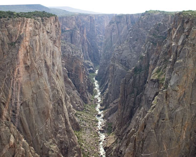
The letter from the Republican Tipton and Hickenlooper, Udall and Bennet, all Democrats, says the land beneath the plateau contains natural gas resources, while the plateau “also contains important habitat for elk, mule deer, and native Colorado cutthroat trout.”

The proposed settlement would “protect the most ecologically sensitive parts of the Roan, while providing for the orderly development of the area’s natural gas resources,” the letter says.

Udall spokesman Mike Saccone said Udall thinks the settlement is a good way to end the long-running controversy. Wednesday’s letter “is just building on some of the recent support for this,” he said.

But he believes it’s significant in that it comes jointly from the governor and from the two U.S. senators and the congressman who all represent the area that includes the Roan Plateau.

Said Duane Zavadil, a senior vice president of Bill Barrett Corp., “We’re gratified to see an expression by the U.S. delegation, by our local governments, by folks in state government, a bipartisan sort of recognition of what’s good for Colorado. It’s gratifying and encouraging to see folks kind of put those politics aside — one of those moments even during election season when people are willing to do the right thing for the state of Colorado and implore the Department of Interior to try to make this thing work.”

He said it’s important to note the deal isn’t complete, but he has “real hope” of it getting accomplished, and the letter’s reason was to “help compel parties to see the benefit in getting this done.”

The BLM hasn’t been commenting on the settlement talks while they continue. The Interior Department couldn’t be reached for comment after the letter’s announcement late Wednesday afternoon. Zavadil said the deal conceivably could be completed “in a matter of weeks.”

Mike Freeman, an attorney with the group Earthjustice who represents conservation organizations in the Roan litigation, said he continues to be unable to discuss negotiations while they’re still ongoing. But he said the conservation groups “really appreciate the support” that’s being expressed for the proposed settlement.

More oil and gas coverage here.

Op-ed: US weather forecasting system is fragile, needs investment

DeBeque (Kobe) pipeline project will supply oil and gas operations and irrigators #ColoradoRiver


From The Grand Junction Daily Sentinel (Dennis Webb):

A water project that had its beginnings three decades back in connection with possible oil shale development has been revived and repurposed for another kind of energy production involving shale rock.

The pipeline project in the De Beque area also will provide additional benefits including serving up irrigation water to meet the region’s needs and reducing truck traffic related to getting water to and from energy development operations.

The $8 million project is being paid for by Black Hills Exploration & Production and is part of a large infrastructure project that will aid in the company’s efforts to use horizontal drilling and hydraulic fracturing to produce from the Mancos shale formation. But the water intake facility on the Colorado River and a short portion of a 24-inch-diameter water pipeline now being extended date back to the 1980s.

Getty Oil built the intake for an oil shale project that never came to fruition, said Dave Merritt, a board member of the Colorado River Water Conservation District, which leased the water rights to Getty. The river district continues to hold those rights today.

“It shows the importance of holding on to water rights,” said Merritt, who has been involved with the project since 1985, having had a longtime career for the river district as an engineer.

“It wasn’t until a few years ago that we were able to come up with an agreement to fully implement this project,” he said.

The 1980s saw an end to the region’s last oil shale boom, as companies couldn’t economically mine and heat the vast reserves of kerogen in northwest Colorado’s Green River shale formation to produce oil.

Instead, energy developers largely turned their attention locally to using hydraulic fracturing to produce gas from wells drilled into the Williams Fork sandstone. And now Black Hills and other companies are using fracking and horizontal drilling to explore and produce gas and liquids from the deeper Mancos and Niobrara shales, just as companies have pursued projects to drill and frack in shale across the country.

The De Beque pipeline project, also known as the Kobe project, will help supply the water Black Hills needs for its Mancos fracking via the 24-inch pipeline that will feed water pumped from the Colorado River to eight, 500-barrel tanks at a terminal northwest of De Beque. But only about 5 cubic feet per second of water will go for industrial uses. Fifteen cfs will be used for irrigation, including by the town of De Beque, which will be able to access it via a ditch.

The town has water rights that are senior to a number of ranchers in the area, so providing more water to the town should reduce the need for calls on water that otherwise would go to others.

“This last summer I was pretty well cut off for most of the time,” said Marty Holt, a rancher up Roan Creek.

Holt serves on the board of the Bluestone Water Conservancy District, which is working jointly with the river district on a project that is getting done at no cost to taxpayers due to Black Hills’ involvement.

“Water for energy development is extremely valuable,” Merritt explained. “They’re much more willing to pay for it.”

The larger infrastructure project also involves installation of a 12-inch-diameter gas pipeline that uses the same corridor as the water pipeline and extends farther west to places Black Hills is drilling. In addition, Black Hills will be repurposing an 8-inch-diameter gas pipeline in the corridor for use in transporting produced water from drilling operations. The company will be operating a facility that will let it recycle water from wells and use it to fracture other wells.

That facility will be operated adjacent to a recently constructed Summit Midstream gas processing plant that is supporting drilling in the area and is capable of handling 20 million cubic feet of gas a day. It’s a cryogenic plant that cools the gas to allow liquids to be stripped from it and sold separately. The new 12-inch gas line will tie into that plant.

In a brief statement Black Hills issued in a request for comment on the project, it said work on the pipeline infrastructure began in late July and is expected to be completed by year’s end. It also pointed to various approvals it had to obtain, including from the Bureau of Land Management and Mesa and Garfield counties. The pipeline corridor also crosses private property, much of it owned by Chevron.

The $8 million part of the project pertains only to work associated with installing and putting into operation the plastic water line that also will meet irrigation needs. While the overall project cost hasn’t been made public, it has involved as many as 300 workers during peak periods, said Brock Degeyter, general counsel for Summit Midstream, which is the project’s general contractor.

Due to rugged terrain and the challenges of locating multiple pipelines in a single, narrow right of way, crews have used horizontal boring rather than open trenches to install many pipeline segments. Ray Tenney, deputy chief engineer for the river district, said as many as nine boring crews have been on site, and pipes haves been pulled through bores as long as 1,180 feet.

Degeyter said such techniques aren’t unusual in mountainous areas.

But he added, “We do think it’s a great example of really state-of-the-art construction techniques, for sure.”

He called the project “a coordinated effort.”

“A couple different parties are getting some significant things done that will ultimately help, I think, consumers — consumers of water, gas, etc. — all at the same time, which is obviously a good, efficient use of resources,” Degeyter said.

“I think it is going to wind up being a very successful and efficient project for us,” he said.

The project also could serve other energy companies besides Black Hills, and it is being hailed as a means of reducing truck traffic through the De Beque area, partly through the movement of water via pipeline to the terminal northwest of town. The tanks at the terminal could provide contract deliveries for trucks serving energy development.

Black Hills’ use of the new produced water line also will cut down on traffic. Mesa County Commissioner John Justman, who also serves on the river district board, notes that reducing truck traffic was a big selling point when Black Hills’ water recycling plant went through Mesa County’s permitting process.

He added that in a time of drought, “recycling the water and reusing it is another big deal.”

New Mexico Supreme Court allows state to continue review of 140-mile groundwater pipeline proposal – Albuquerque Journal

Snowpack news (There really isn’t any)

My blog friend from Albuquerque, John Fleck, tells us, “Don’t freak out, Colorado, it’s only Oct. 29. It could still snow.”

Drought news #COdrought #drought

Click here to go to the US Drought Monitor website. Here’s an excerpt:

Summary

Over the last 7 days, much of the country has been dry, with the most significant precipitation occurring over the coastal regions of Washington, Oregon, and northern California. The first Nor’easter of the season made its way up along the east coast, bringing with it some significant precipitation to portions of New England. Other areas receiving lighter precipitation were in the northern Rocky Mountains and portions of the Midwest. Temperatures for the week were generally above normal for most of the country, with the greatest departures from normal over the plains states. On the plains, temperatures were 9-12 degrees Fahrenheit above normal for the week. The coolest temperatures were over the Gulf Coast in the southeast, where departures from normal were 3-6 degrees Fahrenheit below normal…

The High Plains

A warm week over the High Plains brought with it temperatures that were 6-12 degrees Fahrenheit above normal, with the warmest conditions in Kansas and the Dakotas. Areas of eastern Nebraska, northeast Kansas, western Nebraska, north central Colorado, northwest Wyoming and southeastern South Dakota did see precipitation amounts up to 200% of normal for the week. It was observed that the dry and warm weather has started to impact the winter wheat in the region. In northeast South Dakota, D0 was expanded and a small area of moderate drought was introduced based upon the dryness over the last 2-3 months…

The West

As with the trend over most of this year, the temperatures in the western United States were above normal this week. Some areas of northern and central California as well as southern Oregon did see temperatures that were slightly below normal. Most areas were 3-6 degrees Fahrenheit above normal for the week. A series of storms moved across the Pacific Northwest, bringing with them welcomed precipitation. Most of the precipitation was in and along the coastal regions of Washington, Oregon, and northern California, but some of this moisture did make it into Idaho and Montana. Even as some areas picked up several inches of precipitation and snows were falling in the upper elevations, the long-term issues continued over the west. Categorical improvements were made over southwest Oregon, where D0 and D1 conditions were improved. D0 was removed from the Olympic Peninsula of western Washington and D0 and D1 conditions were improved over western Washington. In southwest Montana, D0 and D1 conditions were improved based on the recent wet pattern, and some D0 was removed over the eastern panhandle of Idaho…

Looking Ahead

The outlook over the next 5-7 days shows a continuing chance of precipitation from the southern plains up into the Ohio River Valley, with amounts generally projected to be less than 2 inches. An active pattern along the coast of the Pacific Northwest ushers in more precipitation during the next 7 days. Some areas along the Washington coast could receive up to 5 inches of rain for the period. Dry conditions dominate the southwest into the northern Plains. Temperatures during this time are forecasted to be above normal for the central and northern plains as well as the northern Rocky Mountains. Cooler than normal temperatures are expected over the eastern half of the country as well as along the west coast into the Great Basin.

The 6-10 day outlook shows a trend of above-normal temperature chances continuing over most of the United States. The highest probabilities of above-normal temperatures will be over the northern tier of the country. The greatest probabilities of above-normal precipitation will be from the southern plains into the Midwest as well as the Pacific Northwest, which is a continuation of what is expected in the 5-7 day outlook. The probability of dry conditions is greatest over the central and northern plains, southwest, and into California.

We’re damming up biggest rivers on Earth. Why that is a bad idea. — American Rivers

Muddy Mine Waters Spill into Sneffels Creek in Ouray County

WISE One Step Closer to Delivering Water

WISE System Map September 11, 2014

Here’s the release from the South Metro Water Supply Authority, Denver Water, and the East Cherry Creek Valley Water and Sanitation District (Russ Rizzo/Stacy Chesney/Andy Cohen):

WISE One Step Closer to Delivering Water

  • Purchase of East Cherry Creek Valley Water and Sanitation District pipeline by South Metro Water Supply Authority and Denver Water finalized
  • Water delivery to begin in 2016 following additional infrastructure build-out
  • Partnership represents new era in regional cooperation and water efficiency
  • The southern suburbs of Denver took a significant step forward in shifting to a water system that makes use of renewable water supply on Oct. 21 when members of the South Metro Water Supply Authority and Denver Water purchased the East Cherry Creek Valley Water and Sanitation District’s Western Waterline. The pipeline purchase is a significant milestone in WISE (Water Infrastructure and Supply Efficiency), a partnership between 10 of the South Metro members, Denver Water and Aurora Water to share water supply and infrastructure.

    Using Aurora’s Prairie Waters system, Aurora Water and Denver Water will provide water through the Western pipeline to participating South Metro members on a permanent basis. WISE will also provide a new emergency supply for Denver Water, and offset costs and stabilize water rates for Aurora.

    “The purchase of ECCV’s pipeline makes WISE and the sharing of water supplies possible,” said Eric Hecox, executive director of the South Metro Water Supply Authority. “This is a significant milestone for the WISE Partnership and moves communities throughout the South Metro area one step closer to a secure and sustainable water future,” he said.

    The 20-mile east-west pipeline along E-470 and C-470 has capacity to deliver 38 million gallons of water a day to Douglas and Arapahoe counties.

    “Our sale of this pipeline is mutually beneficial for all the parties involved,” said O. Karl Kasch, president of the ECCV board. “Under the purchase and sale agreement, ECCV will still have the capacity we need in the pipeline, while also supporting a regional solution to one of the most important water challenges facing the Denver metro region. We have always viewed the Western Waterline as an infrastructure asset from which the entire South Metro community can benefit, and that’s what will be accomplished.”

    Under the agreement, Denver Water and Aurora Water will sell an average of 7,250 acre-feet of water a year to South-Metro water suppliers beginning in 2016 with the option to increase to 10,000 acre-feet in future years.

    “We’re thrilled to be moving forward with the WISE Partnership,” said Dave Little, director of planning for Denver Water. “This agreement will create more system flexibility and increase the reliability of our water supply system, leading to a more secure water future for communities throughout the region.”

    WISE water is expected to begin flowing through the ECCV pipeline in 2016, once the remaining infrastructure, such as system interconnects, are complete.

    For additional details on the WISE project and updates, visit http://www.southmetrowater.org/storage-WISE.html.

    More coverage from Bruce Finley writing for The Denver Post:

    Denver and south metro suburbs have taken a $34 million step toward water-sharing to wean the suburbs off dwindling underground aquifers.

    The South Metro Water Supply Authority and Denver Water announced Wednesday they bought a 20-mile pipeline — built for $44 million in 2004 by the East Cherry Creek Valley Water and Sanitation District — to carry excess Denver and Aurora water to 10 suburbs including Castle Rock, Centennial and Parker.

    This east-west pipeline is seen as the spine of a new distribution system to move an average of 7,250 acre-feet of water a year to suburbs that, in some cases, remain totally dependent on the finite Denver Basin aquifer.

    “This allows them to change the way they are using the aquifer,” said Eric Hecox, director of the South Metro Water Supply Authority, which represents the suburbs. “It won’t get them off the aquifer completely. It will allow them to use it as a backup supply.”

    Denver Basin aquifer system
    Denver Basin aquifer system

    Colorado has let developers tap aquifers to serve multiplying new homes, but pumping the underground water is becoming more difficult and costly with water tables falling in some areas by 1 to 3 feet a year.

    About two dozen utilities between Denver and Colorado Springs together pump more than 30,000 acre-feet of water a year from about 440 municipal wells, according to water suppliers.

    This Water Infrastructure and Supply Efficiency project, if it works as envisioned, would take advantage of water already used by Denver and Aurora, cleaning it fully in Aurora’s state-of-the-art water treatment plant.

    More pipeline connections must be built, but buying the ECCV pipeline is a major step, Hecox said.

    South Metro paid 85 percent of the $34 million. Denver Water paid $4.7 million.

    The pipeline runs under the 470 beltway and can carry up to 38 million gallons a day. ECCV can keep moving up to 8 million gallons a day to its southeast metro customers.

    “Without that pipeline, we cannot deliver the water,” Aurora Water spokesman Greg Baker said. “Now we can start moving forward toward delivering water.”

    From the Denver Business Journal (Cathy Proctor):

    Denver Water and the South Metro Water Supply Authority, which represents more than a dozen water utilities in the southern edges of the metro area, on Oct. 21 agreed to pay $34 million to buy the pipeline from the East Cherry Creek Valley district. The South Metro water districts is an 85 percent owner of the pipeline and Denver Water paid $4,725,000 for its 15 percent ownership, Bennett said.

    “We found a way between Denver, the South Metro districts and East Cherry Creek to share the capacity of the pipeline, so it will now be used to deliver water to the south metro entities,” said Dave Bennett, a water resource project manager with Denver Water.

    Denver Water, which serves more than 1 million customers in Denver and some surrounding suburbs, also will be able to use the pipeline to capture water and reuse it in its systems, Bennett said.

    “Instead of going out and building a new, duplicate pipeline, we found a way to share that existing infrastructure,” Bennett said.

    The pipeline is crucial to the Water Infrastructure and Supply Efficiency (WISE) partnership, which includes 10 southern water districts, Denver Water and Aurora Water. Under the WISE agreements, treated water that’s been used once by Denver and Aurora and added to the South Platte River will be recaptured at a spot along the river north of Denver. Then, via Aurora’s 34-mile Prairie Water pipeline, the water will be shipped back to the Peter D. Binney Water Purification Facility near the Aurora Reservoir. After it’s treated at the plant, the Western Waterline pipeline will be crucial for moving the treated water to the southern suburbs.

    “The purchase of ECCV’s pipeline makes WISE and the sharing of water supplies possible,” said Eric Hecox, executive director of the South Metro Water Supply Authority. “This is a significant milestone for the WISE Partnership and moves communities throughout the South Metro area one step closer to a secure and sustainable water future.”

    Under the WISE agreement, Denver Water and Aurora Water will sell an average of 7,250 acre-feet of water a year to south-metro water suppliers beginning in 2016 with the option to increase to 10,000 acre-feet in future years. One acre-foot of water equals 325,851 gallons, enough to support 2½ families of four for a year.

    Karl Kasch, president of the East Cherry Creek Valley board of directors, said the sale of the district’s pipeline was beneficial for all parties. The district retained ownership of 8 million gallons per day worth of capacity on the pipeline, which can carry 38 million gallons of water per day.

    “Under the purchase and sale agreement, ECCV [the district] will still have the capacity we need in the pipeline, while also supporting a regional solution to one of the most important water challenges facing the Denver metro region,” Kasch said.

    “We have always viewed the Western Waterline as an infrastructure asset from which the entire South Metro community can benefit, and that’s what will be accomplished,” he said.

    More work needs to be done to connect the pipeline to Aurora’s water treatment plant, connect it to Denver Water’s system, and connect the southern water districts to the pipeline, but that’s expected to be done in the next few years, Bennett said.

    More WISE Project coverage here.

    Water Lines: Water Forum at Colorado Mesa University Nov. 5-6; workshops Nov. 4

    Colorado Mesa University
    Colorado Mesa University

    From the Grand Junction Free Press (Hannah Holm):

    Declining water supplies and increasing demands have been in the news frequently over the past several years, and discussions both within Colorado and across state lines have centered on how to get supply and demand back in balance with as little trauma as possible.

    That central challenge forms the backdrop of the fourth annual Upper Colorado River Basin Water Forum in CMU’s University Center on November 5-6. The theme of the forum is “Seeking a Resilient Future.”

    Dozens of top water researchers, policy makers and managers from around Colorado and the other states that share the Colorado River will gather on campus to discuss scientific, management and policy elements of that challenge. Keynote addresses will be given by former Las Vegas water agency head Pat Mulroy and William Hasencamp, manager of Colorado River Resources for the Metropolitan Water District of Southern California. Pat Mulroy’s dinner address will be Nov. 5 at 6:15 p.m.

    The forum will be preceded on Nov. 4 by half-day workshops on how to do augmentation plans under Colorado Water Law and the Colorado Data Sharing Network. Attorney Aaron Clay will offer the augmentation plan workshop. Lynn Padgett, coordinator of the Colorado Data Sharing Network, will provide training in how to use the network to store, manage and share water quality data.

    The forum, workshops, and dinner with Pat Mulroy can all be registered for individually or together. Full details can be found at http://www.coloradomesa.edu/watercenter/UpperColoradoRiverBasinWaterForum.html.

    NOV. 5 FORUM SESSIONS

    On Nov. 5, the forum will feature a panel of top water policy makers from Wyoming, Utah, New Mexico and Colorado on state water planning efforts, as well as sessions on tribal water claims, potential impacts of climate change, agricultural irrigation efficiency, and technical and policy tools for adapting to water scarcity. Sessions will also take a look back at water history and discuss lessons learned in the first year since new nutrient monitoring regulations were adopted in Colorado.

    NOV. 6 FORUM SESSIONS

    On Nov. 6, panels will provide scientific and policy perspectives on a trio of cooperative efforts relating to water management in the Colorado River Basin; the Grand County enhancement and mitigation plan to address impacts from trans-mountain diversions; returning water to the Colorado River delta in Mexico; and managing Lakes Mead and Powell. The lunch keynote address will be provided by William Hasencamp, manager of Colorado River Resources for the Metropolitan Water District of Southern California.

    The Upper Colorado River Basin Water Forum and related events are being organized by the Water Center at Colorado Mesa University.

    More Colorado River Basin coverage here.

    @aguanomics argues federal hydro revenue at $300m per year higher if Hoover Dam electricity was auctioned #ColoradoRiver

    More hydroelectric/hydropower coverage here.

    CDPHE extends Durango’s wastewater treatment compliance deadline by 6 years

    Durango
    Durango

    From The Durango Herald (Mary Shinn):

    While all the estimated $55 million upgrades will have to be made, the state health department agreed to extend the city’s deadline until 2023, City Manager Ron LeBlanc announced Tuesday night.

    As a result, the city will be able to rethink its steep 2015 sewer-rate increases. City Council had been told the plant would need 80 percent more revenue in 2015 to fund all the needed projects and to finance a bond issue.

    “The pressure to rush to an 80 percent increase has now been alleviated,” LeBlanc said.

    Under the law, if the wastewater-treatment plant did not meet all the new regulations by December 2017, the plant would face consent order. Under this order, the city would not be allowed to issue more sewer taps and could face hefty fines.

    Under the extension, the city will have to adhere to a schedule to come into compliance and limit the amount of phosphorous and nitrogen in the water. These two chemicals need to be reduced to curb imbalances in the environment.

    Also, the city now will have more time to consider potentially relocating the plant further south away from town or another location. Councilor Christina Rinderle has been encouraging her peers to consider this alternative.

    “It’s an opportunity to really think through these major investments,” LeBlanc said.

    More wastewater coverage here.

    Weekly Climate, Water and Drought Assessment of the Upper #ColoradoRiver Basin

    wyutcowateryearfederal2014precipitationasapercentofnormal
    Click here to read the current assessment. Click here to go to the NIDIS website hosted by the Colorado Climate Center.

    More Colorado River Basin coverage here.

    Arkansas Headwaters Recreation Area celebrates 25 years #ArkansasRiver

    arkansasheadwatersrecreationarea
    Here’s the release from Colorado Parks and Wildlife (Abbie Walls):

    The public is invited to celebrate the 25th Anniversary of the Arkansas Headwaters Recreation Area (AHRA) with Colorado Parks and Wildlife, the Bureau of Land Management and the U.S. Forest Service. Join us for the festivities from 10:30 a.m. to 1:30 p.m., Nov. 7 at the Salida SteamPlant Ballroom, courtyard and the nearby Salida boat ramp.

    “It’s only appropriate that the AHRA extend an invitation to the entire Upper Arkansas Valley community to help us celebrate our 25th Anniversary,” said AHRA Park Manager, Rob White. “They are the ones that helped establish the AHRA and it’s these citizens, along with local officials, employees and volunteers, who continue to make the AHRA the success that it is today.”

    For 25 years CPW has worked together with the BLM and USFS to provide residents and visitors alike with some of the best recreational opportunities found in the country, while continuing to safeguard the significant natural resources of the upper Arkansas River Valley.

    “The AHRA partnership has been instrumental in developing the Arkansas River into the gem that it is today,” said John Nahomenuk, BLM’s river manager. “The resources along the river are in better condition today than at any point since the inception of AHRA.”

    Bring the family and try some of the activities that make the AHRA so popular! Youth activities will be open to the public from 10:30 a.m. to noon at the SteamPlant and the surrounding area. Activities include gold panning, fly fishing lessons, wildlife and geology touch tables and OHV demonstration rides. Refreshments will be served in the SteamPlant Ballroom at noon, followed by presentations from former Gov. Roy Romer and other state and local officials, including CPW Director Bob Broscheid and BLM State Director Ruth Welch.

    WHAT: AHRA 25th Anniversary Celebration

    WHERE: Salida SteamPlant Ballroom, 220 W Sackett Ave., Salida

    WHEN: 10:30 am – Noon: Youth Activities
    Noon – 12:30 pm: Light Refreshments
    12:30 pm – 1:30 pm: Formal Presentations

    WHO: You! Bring the whole family for a day of fun!

    ###

    Fun Facts about AHRA:

  • The AHRA manages 152 miles of the Arkansas River and claims first place for providing more commercial whitewater trips than anyplace else.
  • AHRA offers a choice of six campgrounds and 102 campsites along the Arkansas River.
  • The Arkansas River through the AHRA is Colorado’s newest Gold Medal Waters Fishery
  • The Arkansas River within the AHRA, between Granite and Lake Pueblo, has almost 100 named rapids, Class II-V, with names like: Pea Shooter, Zoom Flume, Gosh Awful, Lose Your Lunch, Sledgehammer and Piglets Nightmare.
  • There are 14 mountains over 14,000 feet bording the western side of the AHRA. This is more than 25% of the 14ers in the entire state of Colorado and the most that can be found in any one location.
  • AHRA visitors can enjoy fishing, hiking, camping, picnicking, wildlife watching, mountain biking, rock climbing, off-highway vehicles and even gold panning!
  • For more information contact Abbie Walls (CPW) at 719-227-5211 or Kyle Sullivan (BLM) at 719-269-8553.

    More Arkansas River Basin coverage here.

    Dry October for Colorado #COwx

    From InkStain (John Fleck):

    Most of the way through October, it’s been a dry start to the 2014-15 “water year”, the season in which we build the snowpack to feed the rivers of the southwestern United States.

    “As groundwater contamination problems go, the stuff leaking from septic systems isn’t terribly sexy” — John Fleck

    Septic system
    Septic system

    From the Albuequerque Journal (John Fleck):

    That, says University of New Mexico engineering professor Bruce Thomson, is precisely the problem.

    “It’s groundwater contamination that’s happening all around us, and we’re not paying any attention,” said Thomson, an expert in treating human waste who delights in describing his academic specialty as “turd mechanics.”

    Septic systems drain away household waste into settling tanks, with the water spilling out into drain fields and the natural filtration of the soil doing the cleanup work. But when they don’t work – because homes are packed too closely together, or the systems are old or poorly maintained, contamination can result. The key problem is nitrates, which can render water dangerous to infants…

    The Carnuel neighborhood, located in Tijeras Canyon, is a good example of the problem that septic systems can cause. Homes in the area depend on wells for their water and use septic tanks to dispose of their waste. Measurements of water quality taken in the area show the problem, Thomson said. The higher up the hill you are, the lower the levels of nitrates. But for residents downstream from the clusters of septic systems, the contamination from uphill neighbors has left well water of questionable quality.

    It’s a classic example of what economists would call an “externality” – when the actions of one person impose costs on someone else.

    “You have an area where the groundwater is essentially undrinkable because of contamination from septic systems,” Hart Stebbins said of Carnuel. When that happens, taxpayers are often on the hook for coming in and helping fix the problem by providing piped-in clean water. That is what is happening in Carnuel, where the Albuquerque Bernalillo County Water Utility Authority is now building a water distribution system extension to serve the community.

    More water pollution coverage here.

    “We need rivers like the Yampa – to remind us how rivers are supposed to function” — Matt Rice #YampaRiver

    Here’s a post about the Yampa River from Matt Rice writing for The River Blog. Click through for the photos and video. Here’s an excerpt:

    There are simply not that many wild rivers in the Colorado River Basin. By wild I mean rivers that are not controlled or diverted to other basins – rivers that fill with torrents of raging muddy brown water during spring floods providing nourishment to valleys below – rivers that provide a varied, unique and unparalleled recreational experience.

    In the Colorado River Basin, there is one river that stands above them all. It is a river that sustains a vibrant agricultural community while providing for world class whitewater boating and trophy trout fishing. Downstream its turbid waters provide life for endangered fish, wildlife, and plants. It is a natural model – a living classroom – a poster child for balance, community heritage, and livability. Despite being the second largest watershed in Colorado, very few people outside of the state know about this river and its importance to the Colorado River Basin, all the way down to Lake Powell.

    The wild Yampa River rises in the Flat Top Mountains above Steamboat Springs, Colorado. While it would certainly not be accurate to characterize the Yampa as “undammed” because there are two relatively small storage reservoirs that capture its water in the headwaters, it functions as a wild, free-flowing river. The reservoirs are high in the basin and do not have the storage capacity to capture its powerful spring flows. From Steamboat it meanders through rangeland, past the rural agricultural towns of Hayden, Milner, Craig, and Maybell. Below Maybell, the river flows through the Class V whitewater of Cross Mountain Canyon and into Dinosaur National Monument.

    We recently teamed up with our partners at Friends of the Yampa, American Whitewater, and OARS to support a film created by the talented group of artists at Rig to Flip. The film documents the history of Warm Springs rapid, the unique role the Yampa River played in creating the modern river conservation movement, and the importance of keeping the Yampa wild and free.

    Click here to view the trailer.

    Click here to view the full film.

    We need rivers like the Yampa – to remind us how rivers are supposed to function, to demonstrate that it is possible to sustain vibrant agriculture while conserving endangered fish and recreation, and to help us improve the management of other rivers in the Colorado Basin. Unfortunately, because of its abundant water, increased demand, and diminishing supplies in the Colorado River basin due to climate change, the Yampa River will continue to be a target for diversion. This is why American Rivers is actively working with partners across the basin to find solutions that will safeguard the Yampa for generations to come. We will always stand up for the wild Yampa River.

    More Yampa River Basin coverage here.

    Aspinall Unit update: Uncompahgre Water Users scheduled to turn off Friday

    Gunnison Tunnel via the National Park Service
    Gunnison Tunnel via the National Park Service

    From email from the US Bureau of Reclamation (Erik Knight):

    “Releases from Crystal Dam will be decreased from 950 cfs to 450 cfs on Friday, October 31st between 10:00 AM and 2:00 PM. The Uncompahgre Valley Water Users Association will be shutting down diversions at the Gunnison Tunnel on Friday. Flows in the lower Gunnison River are currently above the baseflow target of 1050 cfs. River flows are expected to stay above the baseflow target for the foreseeable future.

    Pursuant to the Aspinall Unit Operations Record of Decision (ROD), the baseflow target in the lower Gunnison River, as measured at the Whitewater gage, is 1050 cfs for September through December.

    Currently, diversions into the Gunnison Tunnel are around 550 cfs and flows in the Gunnison River through the Black Canyon are around 350 cfs. After this release change Gunnison Tunnel diversions will be zero and flows in the Gunnison River through the Black Canyon will be around 450 cfs.

    Finding Durable Foul-Release Coatings to Control Invasive Mussel Attachment Highlighted in Bureau of Reclamation Study

    Here’s the release from the US Bureau of Reclamation:

    The Bureau of Reclamation has released a report summarizing six years of testing coatings to control the attachment of quagga and zebra mussels to water and power facilities. Since the study began in 2008, Reclamation has tested more than 100 coatings and materials.

    “Controlling attachment of invasive quagga and zebra mussels on Bureau of Reclamation facilities is important to ensure water delivery and hydropower generation,” principal researcher Allen Skaja said. “Though we have tested many different coatings, three durable foul-release coatings are showing promise in managing mussels.”

    The Silicon Epoxy allowed mussels to attach but were easily cleaned for the first 12 months of exposure. Two experimental formulations prevented mussel attachment for the first 18 months. These three durable foul release coatings will be tested further.

    Silicone foul release coatings are the most promising for deterring mussel attachment in flowing and static water. Though aquatic vegetation and algae may provide a surface for attachment, the coatings can be easily cleaned with no measurable force. Unfortunately, silicone foul release coatings are soft and are easily damaged.

    The testing was conducted at Parker Dam on the Colorado River. Invasive mussels at this location reproduce year-round and have a high growth rate. Each coating system was tested in static and flowing water conditions at the dam. Each coating system was evaluated approximately every six months, about every May and November.

    The research was funded by Reclamation’s Research and Development Office where research is conducted to develop and deploy successful solutions to improve water management practices, increase water supply and ensure cost-effective power generation operations.

    To view the report, please visit Reclamation’s Quagga and Zebra Mussel Website.

    Clean water is always good. And a Colorado company is creating a system to provide it to #Ebola stricken countries — Denver Business Journal

    A River In Peril: Documenting Damage On The #RioGrande — FronterasDesk.org


    From FronterasDesk.org (Lorne Matalon):

    …one man wants to advance the conversation about watershed loss beyond platitudes.


He thinks prospective attempts to rescue this vital watershed are stymied by a lack of information, that the general public doesn’t consider the Rio Grande’s fate with the same intensity as it does other major rivers such as the Colorado River.

    Colin McDonald calls it a long shot, but he wants to change that perception.
 
The lanky 33-year-old is on a trip funded by a fellowship from the University of Colorado. 


    There are parts of the riverbed that are dry to the point some writers have dubbed it ‘rio sand.’


McDonald wants to gather information that he hopes might frame a substantive discussion on the near-term future of a river that provides water to millions of people in the United States and Mexico.

    That data he’s collecting include taking water and soil samples and speaking with people on both sides of the river along the way.


    The report concludes that a third of the Rio Grande’s water will be gone by the end of the century.

    The U.S. and Mexico have squabbled about the Rio Grande’s water since the creation of the binational International Boundary and Water Commission, which had its genesis in the Treaty of Guadelupe Hidalgo in 1848.

    And in the U.S., Texas is grumbling that New Mexico is diverting water it should be sending downstream. Texas has asked the U.S. Supreme Court to rule on the issue.

    McDonald says climate change and drought are hurting the Rio Grande. But he believes the choices humans make about the river also cause damage.

    “By far the biggest influence on this river are the decisions we make on how much water comes out and how it’s used,” he said while paddling at a furious pace near the end of day that began in the darkness of early morning and ended at sunset.

    “The vast majority is taken out for agriculture, which is what the values were when those dams were built,” McDonald said.

    He’s referring to dams such as Elephant Butte in New Mexico built in 1916.

    “Endangered Species Act wasn’t even an issue,” he said referring to a controversial law
    passed in 1973.

    “Ecology wasn’t a word,” he added.


    Since then, the population has grown exponentially and that reality has exacerbated the effects of prolonged drought.

    Then there’s the Rio Grande’s status as a border.


He thinks immigration and border security are on the front burner in Washington and Mexico City. And that that preoccupation dilutes any urgency to rescue the Rio Grande.


    Then he mentions the Hudson River in New York.

    “You mess with the Hudson?” he asked rhetorically. “There are a lot of people that are upset. 
You mess with the Rio Grande? I mean, there’s still raw sewage being dumped into this river.”


    Results of water samples he is taking are being sent to the EPA’s National Assessment Database. The river receives raw sewage from the U.S. and Mexico in certain spots.

    On the Mexican side, Sergio Ramirez said he used to catch a lot of fish. But he says those days are long gone.

    Ramirez is an alfalfa farmer. He says he doesn’t understand how decisions are made to hold or release water. 


    “I have no idea who control the dams. I’m not sure which country holds authority on this water,” he said in Spanish.


He said he only knows he can’t make a decent living without steady water.


    Allen Standen is a hydrologist who has studied the Rio Grande for years. He’s joined McDonald for part of the trip.

    “We’ve been floating for probably three hours now. And with the exception of seeing some egrets, we haven’t seen virtually any mammals in this river. We haven’t seen any turtles or anything,” Standen said.

    McDonald is also alarmed. And he’s worried that the issue’s been clouded by high-profile disputes that focus on the legal distinctions between ground and surface water. He says these distinctions don’t matter.

    “If somebody sucks the aquifer dry, there won’t be water in the river. If someone sucks this river dry, there’ll be less water underground. It’s hard to model and to map. But the physical reality is that it’s the same water,” he said.

    That water is the prize in a series of legal disputes. He believes until those local cases are resolved, there won’t an opportunity to craft a truly regional effort to save the Rio Grande.


    More Rio Grande River Basin coverage here.

    [#COWaterPlan] “is either silent or pays short shrift to the issues of paramount importance to the West Slope” — Dan Birch #ColoradoRiver

    Colorado Water Plan website screen shot November 1, 2013
    Colorado Water Plan website screen shot November 1, 2013

    From The Grand Junction Daily Sentinel (Dennis Webb):

    A Western Slope water official wants to make sure that even if a draft state water plan doesn’t solve conflicts over Colorado River basin issues, it at least fully acknowledges their existence.

    Dan Birch, deputy general manager of the Colorado River Water Conservation District, made the request in an Oct. 10 letter to the Colorado Water Conservation Board. He contended in the letter that in large part the draft plan language “is either silent or pays short shrift to the issues of paramount importance to the West Slope” as articulated in plans prepared by groups representing each river basin. The two largest of these are the related issues of a potential new transmountain diversion of Colorado River water to the Front Range, and the possible implications of such a diversion for complying with the Colorado River Compact, Birch wrote.

    That compact governs allocation of the river’s water between its upper- and lower-basin states.

    The CWCB is scheduled to act on the draft plan in November before passing the draft on to the governor’s office. Birch said about 80 percent of the draft language is complete and has been posted on the CWCB’s website.

    In his letter, he wrote that the plan, “if it is to be true to the stated goal of being a ‘bottoms-up’ plan, needs to be true to the spirit and substance” of all the basin plans.

    “The draft plan falls short of this goal, at least with respect to the West Slope basins,” he wrote.

    In his letter, Birch wrote that at this stage, while all the draft basin plans around the state “share many common goals, there are vital components that simply cannot be reconciled. The issue of a new transmountain diversion is of course paramount among those differences. We believe that the plan must plainly and accurately recognize these conflicts.”

    In an interview, Birch didn’t rule out the possibility that such conflicts might eventually be resolved, but said he just didn’t want them being “papered over.” “We might get there,” he said of a resolution, “but we’re not there now.”

    Birch told the river district board at its meeting Tuesday that he thinks that his concerns have been well-received by the state and that some changes in the draft will be made by the time the CWCB takes action.

    More Colorado Water Plan coverage here.

    Aspinall Unit operation update: 350 cfs in Black Canyon

    Black Canyon via the National Park Service
    Black Canyon via the National Park Service

    From email from Reclamation (Erik Knight):

    Releases from Crystal Dam will be decreased from 1050 cfs to 950 cfs on Monday, October 27th at 10:00 AM. The Uncompahgre Valley Water Users Association will be decreasing diversions at the Gunnison Tunnel Monday morning. Flows in the lower Gunnison River are currently above the baseflow target of 1050 cfs. River flows are expected to stay above the October baseflow target for the foreseeable future.

    Pursuant to the Aspinall Unit Operations Record of Decision (ROD), the baseflow target in the lower Gunnison River, as measured at the Whitewater gage, is 1050 cfs for September through December.

    Currently, diversions into the Gunnison Tunnel are around 700 cfs and flows in the Gunnison River through the Black Canyon are around 350 cfs. After this release change Gunnison Tunnel diversions will be around 600 cfs and flows in the Gunnison River through the Black Canyon will still be around 350 cfs. Current flow information is obtained from provisional data that may undergo revision subsequent to review.

    @westgov: Dairy factory just opened by @Nestle in western Mexico is the globe’s only zero-water plant

    The Middle Colorado Watershed Council E-Newsletter for October 2014 is hot off the presses #ColoradoRiver

    coloradorivereaglecounty
    Click here to read the newsletter. Here’s an excerpt:

    Drinking Water Well Workshop Follow-Up

    The September 3rd private drinking water well workshop attracted a number of well owners curious to learn how to monitor and maintain their drinking water systems to insure safe delivery at the tap. Paul Rutledge of Sopris Engineering addressed the basics of well construction, siting, and quality influences. Morgan Hill of Garfield County discussed the what and hows of water quality monitoring along with information on lab testing services. Perry Cabot, a CSU Extension researcher, walked the participants through the steps of chlorine dosing as an annual maintenance measure. Copies of all presentations can be accessed here.

    More Colorado River Basin coverage here.

    EPA awards CU $4 million grant for research of drinking water purification

    The water treatment process
    The water treatment process

    From CUIndependent.com (Gabriel Larsen-Santos):

    In early September, the U.S. Environmental Protection Agency granted $4 million to CU Boulder’s engineering department to establish a national center to improve drinking water treatment facilities for small towns and rural communities.What do you think?

    Known as DeRISK, or Design of Risk Reducing, Innovative Implementable Small System Knowledge Center, this new center will develop sustainable methods to reduce water contaminants.What do you think?

    “In order to create more natural and cost-efficient water treatment systems, we’re focused on improving how these systems are implemented, as well as developing technologies that don’t require any chemical addition,” said Professor R. Scott Summers, director of DeRISK and an engineering professor at CU.What do you think?

    Hundreds of various contaminants are legally discharged into rivers and aquifers across the United States every day, causing harmful chemicals to flow into drinking water.What do you think?

    “This center will facilitate public health for the rural communities that don’t have access to low-cost treatment options,” Summers said.What do you think?

    DeRISK has two major focuses — a front end of outreach and ease of communication, and a back end of developing non-conventional technologies for public use.What do you think?

    “Part of what we’re doing is evaluating sustainability,” said Elizabeth Shilling, a 22-year-old graduate student researcher and environmental engineering major. “This includes the cost of building facilities, the ongoing cost of operations, and also environmental factors — waste and emissions management.”What do you think?

    It’s more difficult for rural communities to afford the scientists and technicians that larger urban water treatment facilities employ. But other resources, such as cheaper and more plentiful land, put some rural communities in a unique position over cities to benefit from non-conventional water purification systems.What do you think?

    Examples of non-conventional systems that minimize overall costs include using the sun’s ultraviolet radiation to purify water in ponds, or using bacterial filters that reduce chemical contaminants. Conventional water treatment includes methods like water chlorination, which may be right for some communities, but produces chemical byproducts.What do you think?

    Most importantly, DeRISK is developing a uniformed approach to make it simpler and more affordable for rural communities to implement the water treatment technology that suits their environment. Small towns might have miles of pipeline between two houses, so water quality is more likely to degrade in rural areas as it stagnates in the pipes and develops bacterial contaminants.What do you think?

    “In order to make it easier for smaller drinking water plants to figure out the best treatment system for their parameters, we’re developing a sustainability index,” Shilling said. “Basically, it will show these small town facilities which technology would be best for them in terms of long term costs and environmental impacts.”What do you think?

    One of the many goals of DeRISK is to develop technologies that can be installed in the distribution systems themselves, instead of in centralized water treatment facilities, which is the solution typically utilized across the United States. This would ensure that water remains drinkable no matter how far it travels from the primary treatment center.What do you think?

    “We see it as a service to public health,” Summers said. “So that when you stop at a gas station someplace out in the country and you drink from the water fountain, you won’t have to worry if the water’s safe to drink, because that gas station could double as a water treatment facility.”

    More water treatment coverage here.

    [Clean Water Act] Rule critical for Colorado — Alfonso Abeyta

    Lily Lake via Rocky Mountain National Park
    Lily Lake via Rocky Mountain National Park

    Here’s a guest column in support of the Environmental Protection Agency’s rule-making to clarify jurisdiction under the Clean Water Act, written by Alfonso Abeyta that’s running in The Pueblo Chieftain:

    As a fifth-generation rancher/farmer, business owner and advocate of Colorado’s rural economy, I know first-hand the importance of clean, reliable water to our way of life. That’s why I believe the 42nd anniversary of the Clean Water Act in October represents an important milestone for Colorado’s water resources.

    If water is the lifeblood of agriculture, as is commonly pronounced, clean water would have to be its backbone. After all, it’s not just abundant, reliable water resources that we count on for our livelihoods, economy and health. That water must also be clean and safe.

    Underscoring how far we’ve progressed as a state and nation on our water challenges, when the Clean Water Act was passed in 1972 a full two-thirds of our waterways were too toxic for fishing and swimming — let alone drinking.

    Some of our rivers, such as the Cuyahoga in Ohio, were so polluted from the chemicals and toxins being thoughtlessly dumped into them that they were literally catching on fire. Obviously no one wants to live near or rely on such waters. As such, the Clean Water Act passed Congress with bipartisan support to tackle these critical challenges.

    Thanks to the Clean Water Act, we now have half as many polluted bodies of water as we did in the 1970s. Today most of us are able to drink from the tap and fish or swim the local river or lake without having to think too much about the safety of the water.

    But we still have further to go.

    Despite the success of the Clean Water Act, we have real water challenges ahead of us. For instance, one-third of American waterways are still too polluted for fishing, swimming or drinking. These toxic waterways are located in all regions of the country, including right here in Colorado.

    One key to improving this situation is addressing critical loopholes in our water policies.

    For instance, the Supreme Court severely hampered the effectiveness of the Clean Water Act in 2001 and 2006 rulings that limited protections just to waterways deemed “navigable.” As a result, countless miles of tributary and seasonal streams, rivers, wetlands — bodies of water that feed directly into our water supplies — have gone unprotected.

    The politically motivated Supreme Court rulings are clearly against the spirit and intent of the Clean Water Act, and our water resources have suffered as a result. Adding insult to injury, as it turns out, such arbitrary water policies that are not based on logic, common sense or real-world realities are darn near impossible for agricultural water users to follow.

    The good news is that the Environmental Protection Agency (EPA) has recently targeted this harmful loophole, with its “Waters of the United States” rule. Under this proposal, the Clean Water Act will again account for the tributary, seasonal and adjacent bodies of water that feed directly into our water resources.

    The new rule also maintains helpful exemptions for ranchers and farmers irrigating crops. Win-win landowner actions that lead to cleaner water, more sustainable farming practices and increased profits would also be incentivized.

    Following the closing of the extended public comment period on the clean water rule on Nov. 14, Colorado’s congressional delegation should commit to ensuring that the EPA and the White House finalize the rule without delay.

    Agricultural producers, rural communities and diverse water users across America are counting on it.

    Alfonso Abeyta is a fifth-generation rancher and farmer born and reared on his family farm on the Conejos River near Antonito. He is the founder of Conejos County Clean Water, an advocacy group.

    More Environmental Protection Agency coverage here.

    EPA Announces Partial Deletion of California Gulch Superfund Site from National Priorities List

    From The Targeted News Service (Joann Vista) via 4-Traders.com:

    The Environmental Protection Agency has issued a final rule announcing the deletion of the Operable Unit 4, Upper California Gulch; Operable Unit 5, ASARCO Smelters/Slag/Mill Sites; and Operable Unit 7, Apache Tailing Impoundment, of the California Gulch Superfund Site located in Lake County, Colorado, from the National Priorities List (NPL). This final rule is effective on Oct. 24…

    This partial deletion pertains to the Operable Unit 4, Upper California Gulch (media of concern–waste rock and fluvial tailing piles); Operable Unit 5, ASARCO Smelters/Slag/Mill Sites (media of concern–slag and soil); and Operable Unit 7, Apache Tailing Impoundment (media of concern–tailing and soil), of the California Gulch Superfund Site (Site). Operable Unit 2, Malta Gulch; Operable Unit 8, Lower California Gulch; Operable Unit 9, Residential Populated Areas; and Operable Unit 10, Oregon Gulch were partially deleted by previous rules. Operable Unit 1, the Yak Tunnel/Water Treatment Plant; Operable Unit 3, the Denver & Rio Grande Western Railroad Company Slag Piles/Railroad Easement/Railroad Yard; Operable Unit 6, Starr Ditch/Penrose Dump/Stray Horse Gulch/Evans Gulch; Operable Unit 11, the Arkansas River Floodplain; and Operable Unit 12 (OU12), Site-wide Water Quality will remain on the NPL and is/are not being considered for deletion as part of this action. The EPA and the State of Colorado, through the Colorado Department of Public Health and the Environment, have determined that all appropriate response actions under CERCLA, other than operation, maintenance, and five-year reviews, have been completed. However, the deletion of these parcels does not preclude future actions under Superfund.”

    For more information, contact Linda Kiefer, Remedial Project Manager, EPA, Region 8, 1595 Wynkoop Street, Denver, Colorado; 303/312-6689, kiefer.linda@epa.gov.

    More California Gulch coverage here and here.

    Republican compact agreement gives full credit for Nebraska’s river augmentation projects — The Kearney Hub

    Republican River Basin by District
    Republican River Basin by District

    From The Kearney Hub:

    An agreement approved Wednesday by the Republican River Compact Administration gives Nebraska 100 percent credit for groundwater that natural resources districts are using to augment river flows for compact compliance. It also ensures that water stored in Harlan County Reservoir for compliance won’t go to waste, according to a press release from Upper Republican NRD officials in Imperial.

    They said it is hoped the agreement will lead to a similar deal for 2015 and to a new, positive working relationship between Kansas and Nebraska that benefits water users in both states.

    “The resolution approved by the RRCA allows water now being held in Harlan County Reservoir to be released to Kansas during the 2015 irrigation season when it can be beneficially used, without compromising Nebraska’s ability to maintain compact compliance,” Nebraska Department of Natural Resources Deputy Director Jim Schneider said. He chaired the meeting in Denver. “The ability of the states to work together in resolving these issues is a significant step forward.”

    There are two augmentation projects: Rock Creek Augmentation Project in Dundy County operated by the URNRD and Nebraska Cooperative Republican Platte Enhancement project in Lincoln County operated by the Upper, Middle and Lower Republican NRDs, along with the Twin Platte NRD.

    Combined, the projects will add about 63,500 acre-feet of water to the Republican River system for 2014. Without the agreement, Nebraska’s credit would have been 37,000 a-f.

    Nebraska officials have said that without the augmentation projects to ensure adequate flows into Kansas for compact compliance an alternative could be shutting down irrigation on more than 300,000 crop acres in Nebraska.

    URNRD General Manager Jasper Fanning said Wednesday’s agreement “should provide Nebraskans assurance that water being added to streams in 2014 effectively prevented a shutdown of more than 300,000 irrigated acres in the basin this year and that we aren’t being required to do more than what we should under the agreement.”

    He said it benefits water users in both Kansas and Nebraska…

    The agreement approved by representatives of the compact states, Colorado, Nebraska and Kansas, means Kansas water users could get 20,000-25,000 a-f next year and the balance could be used by Nebraska Bostwick Irrigation District irrigators downstream from Harlan County Dam.

    The agreement follows last week’s oral arguments before the U.S. Supreme Court on a special master’s recommendation on penalties for Nebraska’s overuse of compact water in 2005 and 2006…

    A final decision by the court is expected by the end of June.

    More Republican River Basin coverage here.

    Drought news: Below normal precipitation predicted for the southwest US through November 1

    Click here to go to the US Drought Monitor website. Here’s an excerpt:

    Summary

    The major weather system that affected much of the nation’s midsection last week left abundant precipitation this week from the mid-Atlantic up into New England. Hurricane Ana lost strength as it approached Hawaii and Tropical Storm Ana passed south of the Hawaiian Island dumping up to 10 inches of rain in its path…

    The Plains

    Heavy rain moved through the Plains last week and improvements in drought conditions were reflected then. This week was a relatively dry week in the region. There was some slight improvement in Abnormal Dryness (D0) in Kansas to line up more precisely with the beneficial precipitation of last week. Conversely, there was a slight expansion of Extreme Drought (D3) and Abnormal Dryness (D0) in Texas during this Drought Monitor week as areas of the Texas panhandle and central Texas have missed the beneficial rains…

    The West

    Moisture fell in areas of the extreme Southwest and in the coastal areas of the Pacific Northwest this Drought Monitor week. As a result, areas of Moderate (D1) and Severe Drought (D2) were reduced in southwest New Mexico around Hidalgo County. Likewise the area of Extreme Drought (D3) was reduced in the northeast part of the state near San Juan County. There are numerous reports of improvement in pasture and grassland conditions but longer-term deficits remain over much of the state, resulting in conservative improvements. The same is true in the Pacific Northwest. Despite recent rains along the coast, long-term deficits are still being felt so improvement was held in check for another week. The rain has reduced the fire danger. As of October 17, only two large fires are burning in the country and they are both in California. To date, there have been 41,790 wildfires in 2014 that burned 3,070,737 acres. This is well below the 62,864 fire and 6,796,329 acre average of the last ten years (source: National Interagency Fire Center)…

    Looking Ahead

    During the October 22- 27, 2014 time period, precipitation is expected in the Pacific Northwest, southern Florida, and New England. Warmer than normal temperatures are expected throughout most of the interior of the nation.

    For the ensuing 5 days (October 28- November 1, 2014), the odds favor normal to above-normal temperatures across country with the exception of southeast Alaska. Above-normal precipitation is likely from the Pacific Northwest into the northern Great Plains and Upper Midwest, as well as in southern Florida and northwest Alaska. Below-normal precipitation is expected in a wide area from the Southwest through the Southern Plains and Southeast and up through the Lower Midwest and into the Mid-Atlantic and New England, as well as southeast Alaska.

    Water Resources interim committee update #COleg

    Taylor Reservoir location map via The Durango Herald
    Taylor Reservoir location map via The Durango Herald

    From The Pagosa Springs Sun (Ellen Roberts):

    Traveling around my district for meetings and events is always a scenic journey and the fall colors have been spectacular. Seeing more of the mountaintops with snow is also beautiful.

    That snow making an appearance at higher elevations gives me hope that winter in the southern half of Colorado will bring more moisture than we had last year. Rains in the late summer and early fall have helped, but they also bring the rapid growth of the forest understory that dries out, becoming a wildfire’s kindling.

    Water and wildfire issues continued to dominate my work over the last month as the interim committees on these topics wrapped up our Denver meetings. New bill ideas came out of those committees and I’ll be carrying a few of those as the Senate sponsor.

    The water resources interim committee also completed its task of holding public hearings in each of the state’s water basins on the idea and contents of a state water plan. We held these hearings in Gunnison, Glenwood Springs, Durango, Alamosa, Pueblo, Steamboat Springs, Walden, Fort Collins and Denver.

    While the conversations were spirited and strong concerns raised on different points, we legislators were welcomed in each area by the basin roundtables and general public. Much appreciation was expressed for our outreach to hear the viewpoints.

    The many miles on the road in attending all of the water hearings was valuable time spent for me and reinforced how different the water basins are across our state. Accessing water supplies, whether from the ground’s surface or from underground aquifers, is a challenge nearly everywhere, but the dynamics are different in each region. For example, some aquifers are being depleted at an alarming rate while, in the upper northeast corner of the state, basements and farmers’ fields are being flooded by groundwater.

    That Colorado can do more on water conservation on the individual and municipal levels was raised by the public at each hearing. Some spoke to this having moved here from other dry, western states and suggestions for improvements were abundant. During the roundtable discussions and in the public comment period of each hearing, attendees mentioned that sufficient water availability in their homes, but also in the environment, directly impacts the quality of life values they hold dear as Coloradans.

    Not surprisingly, there’s much concern from Western Slope residents that their communities will be dewatered for the benefit of Front Range urban populations. Another theme raised, statewide, was the importance of keeping food production nearby, recognizing that would only be possible if farming and ranching remain viable pursuits, with sufficient water needed for that food production.

    More storage was also repeatedly mentioned at these hearings as a way for Colorado to address the water supply gap. It was recognized that this could mean expansion of existing reservoirs, but also likely would require the construction of new storage projects.

    The recent dedication of the new Taylor reservoir in La Plata County is encouraging to many as this storage will help Colorado meet its water delivery requirements to New Mexico and make available more water to that area’s agricultural community. This project was completed with the participation and financial assistance of the Ute Mountain Ute tribe, support from the Southern Ute tribe and the state of Colorado, which is also encouraging.

    More 2015 Colorado legislation coverage here.

    Denver Water is close to 100 years old! Take a look at our very first employees, from 1918

    Colorado Water Toolkit: Live Like You Love It! — Colorado WaterWise

    ColoW LLYLI Release final

    Tomorrow at the Colorado WaterWise Water Conservation Summit, Colorado WaterWise will launch an educational water toolkit to raise awareness about the value of water in Colorado. Colorado Water: Live Like You Love It, provides communication tools and resources for water stakeholders to help communicate the importance of water, focusing on conserving water, caring about water quality and committing to learn about this critical resource.

    Six water and environmental organizations sponsored the development of the toolkit including Loveland Water and Power, The City of Greeley Water Conservation Program, Colorado Springs Utilities, Northern Water, One World One Water and Western Resource Advocates. Colorado WaterWise initiated the toolkit when research revealed the need to educate the public, particularly young adults about how we get our water, the scarcity of the resource and the importance to care for water quality.

    As a headwaters state, Colorado water is the topic of great discussion as 18 states plus Colorado depend on it. With the Colorado population alone expected to double by 2050, the need to Live Like You Love It is more important than ever. By utilizing the professionally created tools available in the toolkit, water organizations and other interested stakeholders can easily spread the word about protecting this finite resource, doing our part to conserve and committing to learning about water issues. The toolkit includes tips, videos, fact sheets and a communications plan to help Colorado to Live Like You Love It. An organization must be a member of Colorado WaterWise at the $300 level and agree to terms of use to use the materials.

    “With the state of Colorado embarking upon creating its first water plan, we believe on of the findings will undoubtedly be that there is a need for more education in our state about the value of our water,” said Alyssa Quinn, the Colorado WaterWise committee chair. “This toolkit provides stakeholders with materials and messaging to educate the public, particularly the millennial age group, about the value of water. Customers in that age group are going to be the generation making key and sometimes tough decisions about our water. They need to be informed.”

    To join the movement and Live Like You Love It, Like Love Colorado Water on Facebook or follow it on Twitter at @LoveCOWater. To find out more about the toolkit, visit Colorado WaterWise at http://coloradowaterwise.org.

    AG Suthers opposes EPA “Waters of the US” clarification

    beaverbrook

    From The Durango Herald (Peter Marcus):

    “Contrary to their claims, the EPA and Army Corps of Engineers’ proposed revisions to the definition of ‘Waters of the United States’ poses a significant threat to state sovereignty and an economic threat to businesses and local governments in Colorado,” Suthers said. “I join with the multitudes of other interested parties in asking the federal government to abandon this proposed rule.”

    The Environmental Protection Agency has proposed a rule that would clarify regulatory authority over streams and wetlands. Two U.S. Supreme Court decisions have clouded the agency’s regulatory powers, and so environmental officials are seeking to secure their authority.

    The joint rule-making with the U.S. Army Corps of Engineers comes as polluters have escaped fines for violations because the EPA has been uncertain that its authority would hold up in court.

    But some see the rule as an overreach by the federal government. They worry that the proposal would give federal regulators broad authority over small bodies of water on private property, including puddles, despite EPA assurances that would not be the case.

    Suthers worries that an expansion of EPA jurisdiction over waters in Colorado could have economic impacts for farmers, water providers, small businesses and local governments because of the expense of complying with the increased regulation.

    He also suggested that the proposed rule infringes on the states’ authority to protect and manage water resources.

    “The extension of Clean Water Act jurisdiction to include water with a significant nexus to navigable waters will certainly result in added regulation over actions that have not previously been subjected to regulation,” Suthers wrote in his letter to the EPA. “The economic impacts of such a jurisdictional expansion will be very significant for those impacted.

    “Under the Clean Water Act, Congress preserves the states’ traditional authority to regulate and manage the development and use of land and water resources,” he said.

    Not all farmers, however, agree with the attorney general’s position. Smaller family farmers have been supportive of the proposal, including the Rocky Mountain Farmers Union.

    The organization launched a “They Don’t Speak for Me” campaign to demonstrate its support for the recommendation, suggesting that clean water is key to a farmer’s success.

    With an abundance of farms and ranches in Southwest Colorado, the issue hits close to home.

    “It sounds to me like it’s the same rhetoric as everybody else that opposes the rule,” Bill Midcap, director of external affairs for the Rocky Mountain Farmers Union, said of Suthers’ statement. “We really think this rule is vital for the success of our nation’s farmers, energy development and the health of our communities.”

    Midcap disagreed with Suthers’ position on water rights and sovereignty, adding, “the Clean Water Act had nothing to do with water rights. It’s all about the quality of our water.”

    But U.S. Rep. Scott Tipton, R-Cortez, said the rule is a direct assault on water rights. He has been at odds with the EPA over the proposed rule for months.

    “It is an expansion of the EPA’s regulatory scope without any authority to do so, that disregards state law and privately held water rights,” Tipton said. “This proposed rule could have devastating impacts on water users across Colorado and the nation and restrict their ability to access or put to use their privately held water rights.”

    More Environmental Protection Agency coverage here.

    Half a million abandoned mines in the US?

    Too much of a good thing — The Pueblo Chieftain #RioGrande

    Rio Grande and Pecos River basins
    Rio Grande and Pecos River basins

    From The Pueblo Chieftain (Matt Hildner):

    Too much water has become a bad thing in the Rio Grande basin. That might seem like nonsense in a region that has seen below-average stream flows for most of the last 12 years, but inaccurate stream forecasts coupled with the demands of the Rio Grande Compact have put water managers and users in a pinch. The compact governs how much water Colorado must send downstream and includes separate delivery schedules for the Rio Grande and Conejos River.

    Those deliveries run on a sliding scale with the highest demands in wet years and the lowest ones in dry times. Each spring, the state engineer’s office relies on stream forecasts from the Natural Resources Conservation Service to balance how much runoff can be diverted by irrigators with how much must go to New Mexico.

    The service draws that forecast partly from the eight automated snow gauges and a string of manual snow survey sights in the basin. But this year’s projections were low by roughly 50,000 acre-feet on the Conejos and almost 150,000 acre-feet on the Rio Grande, Division Engineer Craig Cotten said. That has left Cotten and his staff in the position of curtailing or limiting the amount of water that irrigators would otherwise be entitled to according to their respective water rights.

    “The most senior water rights on both rivers are being curtailed dramatically in order to meet the compact,” Steve Vandiver, director of the Rio Grande Water Conservancy District told the basin’s roundtable earlier this month.

    Moreover, the service’s snow measurement and forecasting program may have an uncertain future. Last year, the service proposed eliminating 47 of the 110 manual snow survey sites in Colorado to meet agency budget cuts. While those sites were saved, the threat of future funding cuts along with the inaccuracies plaguing the forecast have led officials in the Rio Grande basin to look at other options.

    The Conejos Water Conservancy District is in the middle of a $237,000 project that will install a temporary radar system, six weather stations and a string of new stream flow gauges. The aim is to get a more accurate forecast that will reduce curtailments for water users. In 2012, the Conejos district estimated that those curtailments cost water users in the basin up to $13,000 per day.

    “We can’t realistically blame Craig because it’s the forecasting error,” said Nathan Coombs, the district’s manager. “We don’t have anything else that helps us.”

    The Conejos basin is home to two of the automated snow gauges run by the service.

    The radar, which will be located either at Antonito or Alamosa, will give officials a clearer picture of where storms are happening, while the six weather stations will allow them to determine how much the storms are depositing.

    Moreover, the project will add flow gauges to key tributaries of the Conejos such as Elk Creek and the South Fork of the Conejos.

    “If we can start measuring better what these tributaries are doing, that will give us an indication of what these sub-basins are looking at,” Coombs said.

    The snowpack and stream flow data gathered by the district will be turned over to researchers at the National Center for Atmospheric Research and the National Severe Storms Laboratory. In turn, those researchers will try to use that data to create a forecasting model. Coombs said the district will stack up that end product with the service forecasts.

    “If there’s enough discrepancy to pursue it, that’s how we’ll go,” he said.

    The Colorado Water Conservation Board played a role in funding the Conejos project and also has pursued the use of satellite technology to help increase the accuracy of snowpack measurement.

    “We’ve had this conversation a lot,” Travis Smith who represents the Rio Grande on the board, told The Chieftain. “Forecasting drives our compact decisions.” Smith, who has been heavily involved in fire recovery issues in the Rio Grande’s headwaters, said temporary radar near Wolf Creek Pass that’s been installed to warn of late summer and fall monsoon storms, may end up playing a role for winter snowstorms as well.

    But moving state officials toward improved forecasting can be difficult given that two of the biggest water management organizations in the state — Denver Water and the Northern Colorado Water Conservancy District — do their own forecasting independent of the service.

    Still, Smith sees a potential ally in the Arkansas River basin, where water managers are dependent on service forecasting for its voluntary flow management program and reservoir operations.

    Mike Gibson is chair of the Rio Grande Basin Roundtable, which also divvies up state funds for water projects and funded a portion of the Conejos pilot project. He wants all options left on the table.

    “I personally feel we need to pursue all avenues available until we come up with a better system than we have now,” he said.

    More Rio Grande River Basin coverage here.

    CFWE: Transbasin Diversion Webinar Series November 12, December 10, January 14

    Colorado transmountain diversions via the State Engineer's office
    Colorado transmountain diversions via the State Engineer’s office

    From email from the CFWE:

    The Colorado Foundation for Water Education and Colorado Water Congress are working together to bring you a series of webinars focusing on Transbasin Diversions in Colorado. The webinars will include a diverse range of panelists and presenters to expand upon CFWE’s newest Citizen’s Guide to Colorado’s Transbasin Diversions and coming blog series. Stay tuned for speaker information and details.

    Click here to register.

    More Colorado Foundation for Water Education coverage here.

    Aspinall Unit update: 350 cfs in Black Canyon

    Blue Mesa Reservoir
    Blue Mesa Reservoir

    From email from Reclamation (Erik Knight):

    Releases from Crystal Dam will be decreased from 1150 cfs to 1050 cfs on Wednesday, October 22nd at 10:00 AM. The Uncompahgre Valley Water Users Association will be decreasing diversions to the Gunnison Tunnel Wednesday morning. Flows in the lower Gunnison River are currently above the baseflow target of 1050 cfs. River flows are expected to stay above the October baseflow target for the foreseeable future.

    Pursuant to the Aspinall Unit Operations Record of Decision (ROD), the baseflow target in the lower Gunnison River, as measured at the Whitewater gage, is 1050 cfs for September through December.

    Currently, diversions into the Gunnison Tunnel are around 800 cfs and flows in the Gunnison River through the Black Canyon are around 350 cfs. After this release change Gunnison Tunnel diversions will be around 700 cfs and flows in the Gunnison River through the Black Canyon will still be around 350 cfs. Current flow information is obtained from provisional data that may undergo revision subsequent to review.

    More Aspinall Unit coverage here.

    #ColoradoRiver District 2014 Water Seminar videos available

    Colorado Springs Utilities named “WaterSense Partner of Year” — Monica Mendoza

    From The Colorado Springs Gazette (Monica Mendoza):

    Colorado Springs Utilities is the winner of the 2014 “WaterSense Partner of the Year” award. The team celebrated Wednesday at the Colorado Springs Utilities Board meeting.

    The award comes from the U.S. Environmental Protection Agency, which publicly recognized Utilities was honored in Las Vegas at the WaterSmart Innovations Conference.

    Utilities was presented the award for its “commitment to water efficiency and efforts to educate Americans about WaterSense during 2013.”

    By producing and promoting WaterSense labeled products, new homes and programs, WaterSense partners helped Americans save 271 billion gallons of water in 2013 alone —enough water to supply all U.S. homes for 26 days, Utilities officials said. More than 1,500 utility, manufacturer, retail, builder and organizational partners participated.

    Colorado Springs Utilities was honored as a 2014 WaterSense Partner of the Year for helping low-income and non-profit housing providers improve efficiency with WaterSense retrofits, supporting apartment owners and managers in property upgrades, helping builders incorporate WaterSense Home certification and educating customers through events, classes, and its WaterSense product demonstration at its Conservation and Environmental Center.

    “WaterSense is a crucial venue to discuss conservation and performance,” said Ann Seymour, Utilities water conservation manager. “By leveraging the WaterSense program, we can reach our conservation goals, as well as help customers save water, energy, and money. It’s a true example of win-win.”

    EPA Region 8 calls for comments from water managers in West’s arid climate on “Waters of the US”