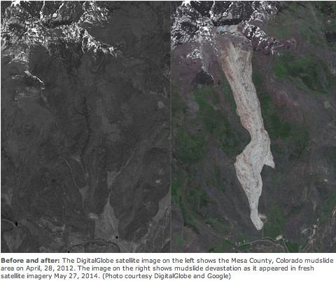
Last year a block of earth twenty times the size of Coors Field slid downhill at upwards of 80 mph, bowling over a forest and killing three Coloradans near Collbran. Two decades prior, and not too far away, a football-field-sized chunk of Interstate 70 heaved upward 14 feet, making the roadbed more suited to monster trucks than Camrys.
As the nation’s cradle for steep slopes and high mountains, Colorado experiences more than 1,000 mass movements of earth each year. Should we be concerned?
Most of these are as small as your backyard, but some are the size of towns. Although there are many names to describe different types of downslope earth movements, we can lump them together as “landslides.” Landslides are to dirt and rock as avalanches are to snow, except landslides are a year-round affair.
Fortunately there is some predictability to such events. Many are triggered by rainfall — whether from a hovering storm system or an afternoon downpour. And those wildfires we’ve had in recent years? They just exacerbate the situation. Vegetation-less landscapes slough off curtains of loose sediment, turning rainy runoff into walls of moving mud.
Water infiltration, which peaks when snowmelt slides its way down into cracks and pores in the earth, is another big cause of Colorado landslides, generating hillside slumps, rock slides and embankment failures. These types of landslides can lag behind their triggering event, sometimes occurring months after a snowmelt or late summer monsoon because it can take a long time for the pores and cracks in soils and rock to become filled with slowly infiltrating meltwater. Not only does the water-saturated dirt become heavier, but water also reduces the frictional characteristics of the soil, inhibiting its ability to “hold” its place on a slope.
Colorado’s large daily temperature variations are another cause of landslides. Think of those days when you walk the dog with morning frost on the ground but later step out for lunch on a sunny 50-degree afternoon. These temperature fluctuations cause expansion and contraction of rock and soil as water in pore spaces and rock fractures repeatedly freezes and thaws, triggering downslope movement of unstable earth. It’s the same thermal process that causes so many potholes to form in our roads.
Not surprisingly, high-elevation communities are in the belly of the landslide-producing beast, much as they are for avalanches. Just pick your favorite pass. Loveland, Red Mountain, Slumgullion — they teem with downward-moving rock and dirt. Ditto for Colorado’s high parks and mesas, where slides are catalyzed by flood-and-furrow agricultural irrigation practices together with our bad habit of lopping off the toes of slopes during development.
The Front Range? Western Colorado Springs is a classic example. Much of the Springs was developed over the past few decades with builders siting houses on ancient landslides or slide-prone surfaces. It’s like a perfect storm. Grade some of these sites, exuberantly irrigate the turf and add a wet winter or two and — kasloosh! — landslides let loose. Ponder that next time you’re sipping chai at the Broadmoor.
Surprisingly, Colorado doesn’t require all builders, municipalities or agencies to assess risk before commencing development. Moreover, just because a property (home, road, business, farm) was platted back in the day doesn’t mean it was ever assessed for geohazards like landslides, underground faults, abandoned mines or swelling or collapsible soils.
There’s a saying among landslidologists: “Some landslides you fix and others you name.” Fixing landslides includes buttressing the earth, holding it back using soil- or tie-back anchors and making it less heavy by drying it out or removing weight or earth from atop it. And the landslides that get named? Usually we address them by avoiding them and/or monitoring them with devices that notify authorities when their rate or distance of movement changes markedly.
The good news? Fatalities from these geohazards are extremely rare. Also, Colorado has a bunch of dedicated scientists who’re embedded in places that count.
Like the study of earthquakes, the study of landslides has moved from reactive to proactive in the past few decades.
With new laser-based scans of ancient and current landslides, Colorado’s landslide science could soon be predictive, employing risk-based asset management principles to protect people and property.
View along Main Street in early Montrose (between 1905 and 1915). Shows a horse-drawn carriage, bicycles, and two men talking. Signs include: “The Humphries Mercantile Co. Dry Goods, Clothing, Hats & Shoes” “Montrose National Bank” and C. J. Getz, Pharmacist, Druggist.” via http://photoswest.org
Click here to register for the forum. From the Western Colorado Food and Farm Forum website:
The conference has a wide array of breakout sessions which convey vital, regionally specific agricultural information in areas including maximizing crop and livestock production, innovative agricultural marketing and management strategies, and specialty crops. Please join us in improving the sustainable production, marketing and consumption of local food.
The conference is for anyone with an interest in the future of agriculture, including: ranchers, farmers, gardeners, students, and ag professionals. Whether you’re looking to improve or innovate on your existing practices, the forum has myriad resources and networking opportunities.
Maurice Strong, a Canadian who made a fortune in oil and then went on to organize the Earth Summit in Rio de Janeiro in 1992—a direct forerunner of the climate change negotiations held in Paris this month—died just before Thanksgiving. He was 86.
At least initially, his passing got little attention in the national and international press. Somewhat belatedly, the UK’s The Telegraph had this observation:
“A very odd thing happened last weekend. The death was announced of the man who, in the past 40 years, has arguably been more influential on global politics than any other single individual. Yet the world scarcely noticed.”
The column, “Farewell to the man who created ‘climate change,’” by Christopher Booker, described Strong as “the man who created ‘climate change’ and drew a direct link to news of today: “And all along it has been Strong’s ideology, enshrined at Rio in “Agenda 21,” which has continued to shape the entire process, centered on the principle that the richer developed countries must pay for a problem they created, to the financial benefit of all those ‘developing countries’ that have been its main victims.”
Maurice and Hanne Strong with Graca Marcel and Nelson Mandela
The Telegraph writer wasn’t fond of Strong, and others in conservative websites similarly reported no sorrow. “Maurice Strong, father of the global eco-control movement,” reported LifeSite USA.
Dig a little deeper, and you can find Strong linked to the Aspen Institute and, of course, Al Gore and then other nefarious people, ideas, and schemes.
People in the San Luis Valley might not have marked his passing with regrets, either—if they even took note. “Maurice who?” asked a waitress at Bliss, an organic restaurant in Crestone, a town at the foot of the Sangre de Cristo Range.
She was perhaps 25, so still a baby when Strong’s plan for exporting water from an aquifer underlying the San Luis Valley to Denver’s rapidly expanding suburbs, located about four hours away, was in the news. That was in the early 1990s.
The idea, if now significantly downsized, hasn’t entirely died.
Born into poverty
Strong was born into poverty in Manitoba during the Great Depression and graduated from high school at age 14. He then hopped a train for Vancouver, B.C., working for a year in the merchant marine but soon learned geology. By age 25, he was vice president of a petroleum company in Calgary, Alberta, and by 31 was president of the Power Corporation of Canada. See this short biography from his website.
Early on, he also developed an interest in environmental issues, and by 1972 was involved in putting on a major conference in Stockholm under the auspices of the United Nations. Later that year he was appointed by the UN to launch the Environmental Programme, and he moved to Kenya for several years, as it was based in Kenyatta.
In 1978, by then a billionaire, Strong bought the 200,000-acre Baca Ranch in the San Luis Valley. The ranch was part of an old Spanish land grant (Luis Maria Baca Grant No. 4) located between the Great Sand Dunes National Park and the old mining town of Cretonne.
A Buddhist stupa is located on the Baca Ranch, about two miles from Crestone, with the Sangre de Cristo peaks in the background. Photo/Allen Best
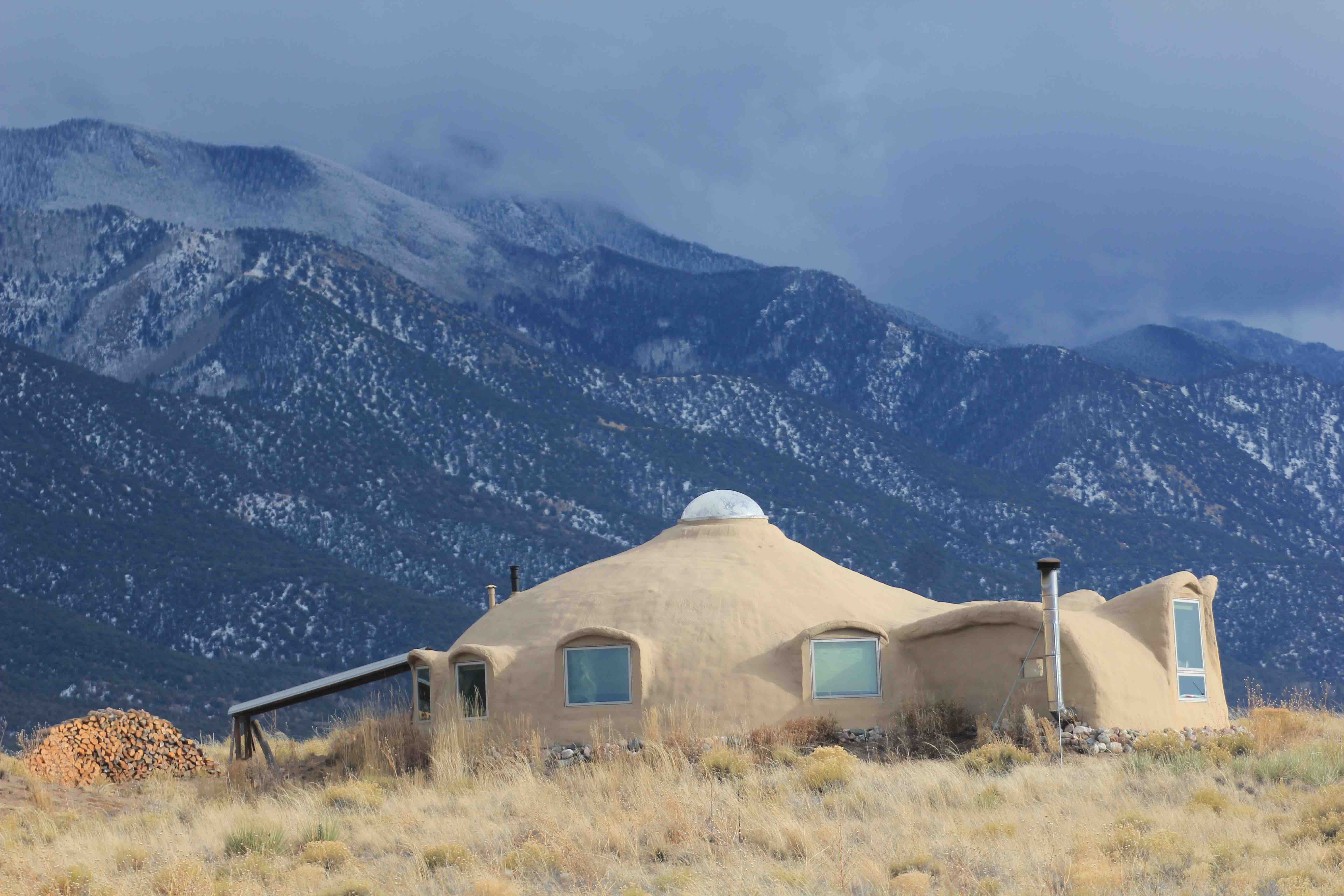
On the ranch, Strong’s Denmark-born wife, Hanne, created a multi-faith spiritual center. To this day, it has two Buddhist stupas amid the pinyon and juniper, along with houses of worships for other religions, plus scores of houses. The ranch is also a real estate development, but the houses tend toward the unusual, many emphasizing environmental-friendly features. It should be noted that many are also for sale. It’s a better place to go once you’ve made money than a place to make money.
The backdrop is so dramatic, though, that you just might be willing to forego a few paychecks. These are mountains that grip your eyes. They rise from the valley floor, at about 8,000 feet in elevation, with a string of 14,000-foot peaks immediately behind Crestone and the Baca Ranch, with only slight hesitation in their ascension. In the Rocky Mountains, only Wyoming’s Teton Range has greater visual drama.
Lying underfoot
With his geological training, Strong saw opportunity to make money from what lay under his ranch.
In an October 1998 article in Colorado Central, the late Ed Quillen explained the geology. The San Luis Valley is drained by the Rio Grande, but the northern half is geologically separate, with no drainage. Instead, water in this 3,000-square-mile Closed Basin percolates into what is called the Confined Aquifer, with bedrock as much as 30,000 feet below the surface.
By some estimates this aquifer has 50 times the volume of water as the combined capacities of Lake Powell and Lake Mead, or about 200 times the annual flow of the Colorado River.
“The Confined Aquifer is a magnificent water supply that seems to make people go crazy,” Alex Prud’homme observed in his 2011 book, “The Ripple Effect: The Fate of Freshwater in the Twenty-First Century.”
Strong, with others, including former Colorado Gov. Dick Lamm, formed AWDI, with the intent of exporting up to 200,000 acre-feet a year to cities along Colorado’s Front Range.
Houses on the Baca Ranch tend toward environmental principles and eccentric designs. A great many are also available for sale. Photo/Allen Best
How much is 200,000 acre-feet? By way of comparison, the total of all of the 25 transmountain diversions in Colorado—including those from near Aspen, Vail, Summit County, Winter Park, and Grand Lake—ranges from 400,000 to 650,000 acre-feet in any given year. In other words, a vast amount.
In the San Luis Valley, though, the plan was hated. The pumping plan was rejected by water courts and in 1991 Colorado Water Court upheld the rejection. In time, The Baca Ranch became protected as the Baca National Wildlife Refuge, and with it the water underneath
Strong moved onto other global save-the-environment advocacies, including the Rio conference, but the idea was taken on by Gary Boyce, a native son of the San Luis Valley.
In the late 1990s, Boyce failed in his water-export proposal and The Nature Conservancy stepped in and gained title to the ranch, ceding a portion to the National Park Service for an enlarged (and new) Great Sand Dunes National Park. It had previously been a national monument. That meant water under the Baca Ranch was off limits—but not the even more northerly part of the valley, from around Villa Grove.
It’s back…
Boyce has now returned with another, down-sized proposal. He now proposes to develop 35,000 acre-feet of water. His new business, Sustainable Water Resources, owns 25,000 acres of deeded ranch lands with senior water rights and will purchase remaining water rights from other sources, explains The Crestone Eagle, in a November 2015 story.
In addition, Boyce and his backers have sweetened the pot for locals: $50 million to be donated over the course of 25 years in Saguache County, one of the nation’s most sparsely populated and most impoverished counties.
The same story said that Boyce had approached the Rio Grande Water Conservation District last year in seek of support, offering $150 million “to buy their cooperation,” in the words of David Robbins, the district’s attorney. The board said no.
In October, Boyce’s group went before the Saguache County commissioners seeking assurances the commissioners would not oppose the water export. They took no position.
Does this new idea have any legs whatsoever? I asked that of a prominent farmer from the San Luis Valley that I sat next to at a water meeting in Denver.
“No,” he said, but did not elaborate.
As for Strong, he may be remembered as a great figure who helped alert us to unsustainable environmental follies. He did a great many things with the United Nations and, for a time, was thought to be a possible candidate for the secretary-general.
In an article several decades ago, The New Yorker almost deified him. “The survival of civilization in something like its present form might depend significantly on the efforts of a single man,” it said.
The National Review saw Strong far less favorably. A 1997 article, “Who is Maurice Strong,” described him as somebody who would advance a world government meddling in local affairs, as with “World Heritage Site” at Yellowstone National Park. A 2013 article about environmentalism, “Our Climate Change Cathedral,” unfavorably discussed his influence on global warming activism.
In Colorado, though, he’ll likely be remembered for the big pipeline that didn’t happen—at least not yet.
This story is from the Dec. 10, 2015, issue of Mountain Town News. Subscriptions are $45 a year.
FromThe Grand Junction Daily Sentinel (Melinda Mawdsley):
Clifton Water customers will see a rate increase next year to help pay for all operating and maintenance costs for the district.
The rate increases will take effect Jan. 1, 2016.
Customers who use the base minimum of 3,000 gallons or less a month will pay $1.50 more per month.
Customers at the next level of 3,001 to 10,000 gallons per month will notice a monthly increase of $1.90. Customers who use more than 10,000 gallons monthly can also expect a rate increase.
The increases were approved by the district’s board of directors earlier this month. In addition, the board approved an increase in the cost of a new water tap from $5,000 to $5,500.
Although monthly water rates have slowly gone up in recent years, this is the first new water tap increase since 2004, District Manager Dale Tooker said.
The Clifton Water District does not receive any tax revenue, so the funds it takes in are exclusively from rates charged to existing water users and tap fees for new users, Tooker added.
The Clifton Water Distrist uses the money to pay for operation costs, as well as rehabilitation and replacement issues such as replacing damaged or aging water lines or maintaining the water storage tanks north of Interstate 70.
This year marks a major milestone for the district with the completion of its $16 million Water Treatment Plant Improvement Project developed to utilize “a state-of-the-art Micro/Ultra Filtration process.”
An open house is planned for next year.
“We have employed a high amount of technology and treatment processes that are different,” Tooker said.
None of the improvements the district has made and will continue to make “could have been implemented without the customers participating in the rate structures,” Tooker said. “Water sales pays for the operation of our facility.”
Clifton Water District, formed in 1951 with 321 customers, now serves nearly 13,900 customers, producing more than 1 billion gallons of water a year that it takes and treats from the Colorado River, Tooker said.
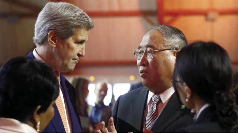
U.S. Secretary of State John F. Kerry, left, talks with China’s special representative on climate change Xie Zhenhua prior to the opening of the COP21 conference in Le Bourget, France on Saturday. (Francois Mori / AP)
FromThe Los Angeles Times (Julie Makinen and Chris Megerian):
Even as smog levels in Beijing often turn the sky a smoky gray, one thing was clear at the global climate change talks in Paris: China, once a laggard, emerged as a key player in the battle to help avert the worst effects of global warming.
The shift, by the world’s largest emitter of greenhouse gases, helped pave the way for the commitment by nearly 200 nations to reduce emissions. “You had a developing country and somebody who had been leading the efforts against us,” said Secretary of State John F. Kerry, “that opened the door.”
[…]
Obama and Chinese President Xi Jinping appeared side by side at the start of this year’s Paris climate change talks. And on Saturday, as global leaders congratulated themselves on reaching an agreement, the U.S. was singling out China for praise for its constructive engagement.
Asked after the vote to cite the most important steps along the way that enabled the deal, Kerry immediately pointed to China’s willingness to “build a working partnership” with Washington and jointly announce national emissions-reduction targets in advance.