Report: The Mining Burden — Center for Western Priorities

theminingburdencenterforwesternpriorities

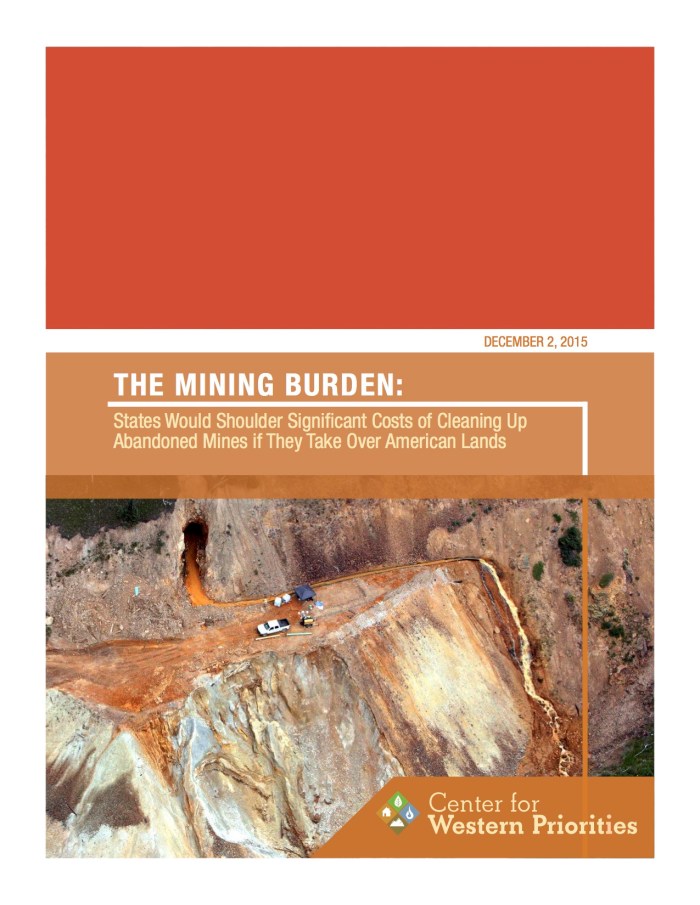
Click here to read the report.

From The Denver Post (Bruce Finley):

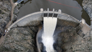
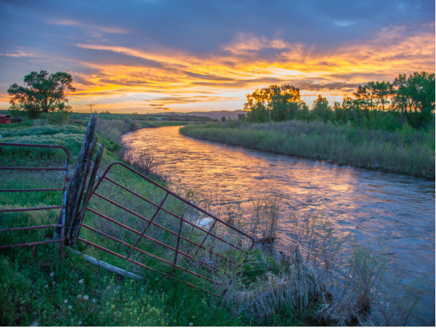
Tens of thousands of defunct mines poisoning waterways around Colorado and the West present, beyond environmental harm, a multi-billion dollar financial burden.

An analysis unveiled Wednesday counting abandoned mines located just on federal public lands pegged cleanup costs at up to $21 billion, including more than $1 billion in Colorado.

That’s a burden falling primarily to taxpayers and the federal agencies that manage public lands. It represents a portion of overall cleanup costs, estimated as high as $71 billion, that include tens of thousands of mines on privately-owned land.

“We need policies now that can help us address these issues,” said Jessica Goad of the Denver-based Center for Western Priorities, an advocacy group that conducted the analysis using Government Accountability Office data.

“We need our elected officials to pay attention to this problem,” Goad said. “The abandoned mines are not just an environmental time-bomb but also a financial time-bomb.”

The analysis draws on a GAO investigation that counted 99,737 abandoned mines on Bureau of Land Management and U.S. Forest Service federal land in western states, with 5,105 in Colorado. U.S. Rep. Doug Lamborn of Colorado Springs requested the 2011 GAO look into inactive mines located on public land. Center for Western Priorities analysts also relied on a 1993 Mineral Policy Center study that calculated cleanup costs.

Under federal superfund law, the Forest Service and BLM can be liable for disasters caused by and cleanup of those abandoned inactive mines.

Center for Western Priorities staffers said they are motivated to show that notions floated by politicians of states taking over management of federal lands likely would foist heavier burdens on state taxpayers. Federal and state government data on inactive mines has been scattered.

Center analysts gathered the best available estimates of the number of abandoned mines on BLM and Forest Service land in 13 western states. They melded these with average costs of cleaning up various contaminants to estimate low and high-end costs of cleaning up the mines on BLM and Forest Service land in each state.

As Colorado’s Population Booms, Are We Ready For The Change? — KUNC

From KUNC (Bente Birkeland):

“Colorful Colorado” may one day need to be referred to as “Crowded Colorado,” given the number of people expected to soon move here.

Weld County’s population is expected to double to half-a-million – and El Paso County will still be the largest county. It’s not just the Front Range; A Rocky Mountain PBS I-News analysis of data from the state demographer and the U.S. Census Bureau shows seven of the 10 fastest growing counties will be on the Western Slope, including Eagle, Garfield and Routt.

The numbers show an estimated 7.8 million people will call Colorado home by 2040. All that growth will take a toll on the state’s infrastructure as well as water and other natural resources.

“Colorado continues to attract those in the 24-35 year age group and that means there’s jobs here and young people are coming from all over the country to fill those jobs,” said Mark Radke, with the Colorado Municipal League.

Moon set over the Tenmile Range via The Summit County Citizens Voice

#AnimasRiver: Owner of Gold King Mine feels victimized by EPA — The Durango Herald

From The Durango Herald (Jonathan Romeo):

Todd Hennis, owner of the Gold King Mine, was vacationing at a remote lake in upstate New York when a friend sent him images of the Environmental Protection Agency-contracted crew’s triggered blowout on his property, effectively turning the Animas River into an orange spectacle. He was speechless and horrified, but not surprised…

Hennis, for his part, has long maintained increased flows from the Gold King Mine are a result of groundwater seeping from the vast, adjacent Sunnyside Mine network after it was plugged, first in 1996.

“I went up to the Sunnyside offices that were in Gladstone at that point and said, ‘I’d like to talk about the discharge,’” he said. “They denied everything, and have been denying it ever since.”[…]

He acquired his first mine in a back-taxes sale in 1995 – the Mogul, which he estimates still holds 5 million tons of ore. In 2005, he picked up Gold King Mine and a few other scatterings of claims throughout the district. And just this past September, he closed on a sale of the old Howardsville Mill site.

When all was said and done, Hennis had an appealing mining package for anyone interested in the still-mineral-rich Silverton caldera. He has never mined the property, and said he never had that intention.

Historically “dry” mines – both the Mogul and Gold King – began discharging shortly after the state and Sunnyside agreed to bulkhead the American Tunnel in the late 1990s. And in 2014, the EPA decided pollution had gotten so bad, the agency began its own remediation project in the district.

“(The EPA) decided it was too big a job for that year, so they piled many, many tons of earth and rock on the portal to, quote, prevent a blowout during the winter,” he said. “In doing so, they created the blowout conditions this year.”

In the aftermath of the Aug. 5 blowout, Hennis said he gave the EPA the keys to his land for an immediate cleanup response. But since, he claims the federal agency has enforced a complete takeover of his property.

Cement Creek aerial photo -- Jonathan Thompson via Twitter
Cement Creek aerial photo — Jonathan Thompson via Twitter

“…forests play a crucial role in our lives” — the Nature Conservancy #Colorado

This link showed up on the Nature Conservancy Twitter feed today. From their website:

Colorado Restoring our Forests

From the water we drink and the air we breathe, to the jobs and products we depend on, forests play a crucial role in our lives.

After several devastating wildfire seasons, it’s clear the pace of forest restoration in Colorado must increase. Six million acres of our forests urgently need restoration.

Poor forest conditions have caused uncharacteristically large and severe wildfires as well as insect and disease epidemics. These conditions pose an ongoing wildfire risk, threatening lives, property, wildlife habitat and forested watersheds that filter and supply drinking water for most Coloradans. Conditions are expected to get worse as Colorado gets hotter and drier.

At The Nature Conservancy, our long-term vision is to restore Colorado’s forests to a more resilient and healthy condition, preserving wildlife habitats, ensuring clean drinking water, and providing recreational and many other benefits for people long into the future.

Click here to read about their efforts at restoring forests in Colorado.

Longmont councilors approve exempting low-income customers from monthly service charge

Water hauler early Longmont via the Longmont Times-Call

From the Longmont Times-Call (Karen Antonacci):

The Longmont City Council on Tuesday unanimously approved expanding a pilot water-bill discount for some low-income people in the coming year.

The city has an existing program that knocks roughly 28 percent off the average water bill for senior citizens who meet low-income requirements.

This pilot program would exempt low-income Longmont residents — with no age requirement — from the monthly service charge, which for the average bill is about a 15 percent discount.

The discount program is only available to people who live in single-family homes. Because apartment buildings or other multi-family buildings have one meter for several households, the city is unable to offer individual discounts to residents of those buildings.

Barb McGrane, the business services manager for Longmont public works and natural resources, said Tuesday the program should be ready to launch in the first quarter of 2016.

To qualify for the new program, residents would need to meet income limits based on state numbers for a property tax/rent/heat credit rebate. To qualify for Longmont’s new water bill rebate pilot program, a single resident would need to make less than $12,720 in a year or a married couple would need to earn less than $17,146 in a year.

Those are the most recent income limits available, but McGrane said she expects the state will soon release new limits for the coming year.

USGS Webinar: How to Prioritize Key Areas for Conservation Efforts in a Changing Climate — A Look at “Climate Refugia”

Ground Squirrel photo credit Toni Lyn Morreli (Northeast Climate Science Center)

Speaker(s): Toni Lyn Morelli, Northeast Climate Science Center

Presentation Date: Tuesday, December 8, 2015

Presentation Time: 3:00 PM EST

Registration: Registration is required for this webinar.

Please Register Here
(Video will be posted online one to two weeks after the presentation date.)

Documents & Resources
Speaker Bio
Ground Squirrels & Drought
Refugia in the Northeast (Related Project)

Project Summary
When making important resource management decisions in the face of accelerating impacts from climate change, managers and conservation practitioners must prioritize areas for adaptation actions. “Climate refugia” are often highlighted as potential target areas for conservation because they are buffered from climate change and therefore can help to ensure greater protection of wildlife and resources.

In this presentation, Toni Lyn Morelli will summarize the physical processes that create climate refugia, discuss a new framework for locating and managing them, and use examples to illustrate ways to identify and verify climate refugia. She will highlight her research using historical comparisons, genetic data, and surveys of Belding’s ground squirrels in the Sierra Nevada to conduct a rare test to determine which montane meadows are acting as refugia to buffer wildlife populations from climate change. Focusing on climate refugia could be an important strategy to help managers prioritize habitats for conservation in a changing climate.

This research was supported by the California Landscape Conservation Cooperative and the Northeast Climate Science Center.

Weekly Climate, Water and Drought Assessment of the Upper #ColoradoRiver Basin

Click here to read the current assessment. Click here to go to the NIDIS website hosted by the Colorado Climate Center. Below is the month to date precipitation map through November 29, 2015.

Upper Colorado River Basin November 2015 month to date precipitation November 1 through November 29, 2015

Denver Water’s “Water News” for December 2015 is hot off the presses

Click here to read the news. Here’s an excerpt:

Looking back, some of the 2015 highlights include:

  • A glorious rig. We placed a temporary siphon in Dillon Dam’s Morning Glory Spillway, and it was a glowing success. The siphon kept water flowing out of Dillon Reservoir, so fishing and boating could continue during the months crews worked to upgrade the facilities below the surface.
  • Liquid knowledge. We made magic happen in May, when we called on water professionals from throughout the state to share a dose of knowledge with more than 1,200 sixthgraders at the second annual Denver Metro Water Festival.
Strontia Springs Reservoir started spilling on May 2.
  • Bountiful fills and spills. May showers brought enough precipitation to set new records at three of our reservoirs, and a fourth saw its second-highest water levels in history. Then we got the thrill of seeing reservoirs spill, which is a beautiful thing when it comes to water supply. Water-wise weather watchers. May marked the second wettest month Denver-area residents have seen in 40 years. And customers clearly kept their eyes on the skies instead of watering blindly. Their decision to leave sprinklers off saved more than 2 billion gallons of water. Water use was the lowest since 1961 — when the population count was half a million people less than today.

Protecting large swaths of land requires perseverance and creativity — The Nature Conservancy

Roan Cliffs Aerial via Rocky Mountain Wild

This link popped up yesterday in the Nature Conservancy’s Twitter feed (@Nature_Colorado):

Colorado’s landscapes are spectacular, but areas that are important to people and nature are at risk.

In the Yampa River Basin in northwest Colorado, sage grouse, elk and ranchers all share one thing in common: they depend on large, unbroken tracts of land. Development in the region threatens to divide this landscape into pieces. The result? Habitats and water supplies are stretched thin.

In eastern Colorado’s grasslands, you’ll find one of the largest expanses of intact prairie left in the United States. Pronghorn, migratory birds, fossils, Native American history—they’re all part of this spectacular landscape. So, too, are the ranchers, farmers and communities that depend on the landscape for their way of life.

At The Nature Conservancy, our long-term vision is to protect important places that are large enough to sustain nature and resilient enough to withstand climate change and ongoing development.

Click here to go to the website and learn more about the Nature Conservancy’s successes in Colorado.

The Yampa River flows through the Carpenter Ranch. Photo courtesy of John Fielder from his new book, “Colorado’s Yampa River: Free Flowing & Wild from the Flat Tops to the Green.” -- via The Mountain Town News
The Yampa River flows through the Carpenter Ranch. Photo courtesy of John Fielder from his new book, “Colorado’s Yampa River: Free Flowing & Wild from the Flat Tops to the Green.” — via The Mountain Town News

Proposed Basalt whitewater park public meetings start Monday

Proposed Basalt whitewater park via the Aspen Daily News

From Pitkin County via Glenwood Springs Post Independent:

Pitkin County and Basalt will kick off a series of public meetings Monday to see what type of streamside improvements people want alongside a proposed whitewater wave park in the Roaring Fork River in Basalt.

The Basalt Town Council approved Pitkin County’s plan for the whitewater park in September with the condition that meetings be held to solicit public opinion on streamside amenities. The council also wanted to give the fishing industry a chance to learn more about the plan and comment.

The open house meeting will start Monday at 5:30 p.m. at the Basalt Regional Library. A brief overview will be presented at 6 p.m.

The whitewater wave feature will be constructed about halfway between Fisherman’s Park and the 7 Eleven Bridge in Basalt in fall 2016. Features will be placed in a 450-foot stretch of the river “for the purpose of creating a kayaking, tubing, rafting, and fishing recreation area,” according to the county’s permit from the U.S. Army Corps of Engineers. The site is upstream from the confluence with the Fryingpan River. County officials identified that stretch as most suitable for a whitewater park because of the flow rate there.

The stream bank adjacent to the river in that stretch is narrow and steep. County and town officials want to collect public comment on amenities that would enhance the experience along the play wave. Ideas include an overlook and seating area, additional parking along Two Rivers Road, direct access to the play area from the street, a pedestrian trail and an interpretative-educational zone.

Pitkin County pursued a special water right called a Recreational In-Channel Diversion so it could make a call for water and maintain seasonal stream flows.

“The kayak play wave is an incidental amenity of what the Healthy Rivers Board was really trying to accomplish and that was securing an important water right for this critically de-watered zone of the Roaring Fork River,” said Andre Wille, chairman of the Healthy Rivers board of directors. “The man-made wave will not only be fun for kayakers, but it will help maintain healthy river ecology throughout the upper Roaring Fork.”

The Colorado Water Conservation Board and Colorado water court have already ratified the special water right.

The Healthy Rivers website said the county will construct two play-wave features with adjacent eddies. “It will be a fun and convenient mid-valley surf spot and a place for teaching/learning whitewater skills,” the website said.

More information on the county project can be found at http://www.pitkincountyrivers.com/healthy-rivers-project—basalt-co.html.