@USBR/@USGS/@GrandCanyonNPS: Macroinvertebrate Production Flow this summer at Glen Canyon Dam #ColoradoRiver #COriver

Macro Invertebrates via Little Pend Oreille Wildlife Refuge Water Quality Research

Here’s the release from the Bureau of Reclamation:

The Department of the Interior will conduct a second Macroinvertebrate Production Flow this summer at Glen Canyon Dam under its Long-Term Experimental and Management Plan. This experiment, also known as a Bug Flow, aims to improve egg-laying conditions for aquatic insects that are the primary food source for fish in the Colorado River. The experiment will begin on May 1 and continue through August 31, 2019.

“Last year’s experiment was a big success, so we’re excited that a second year of testing will occur,” said Scott VanderKooi, Chief of the U.S. Geological Survey’s Grand Canyon Monitoring and Research Center, which monitors Colorado River ecosystem response to all Glen Canyon Dam flow experiments. “By directly experimenting with flows, we were able to learn a lot about the aquatic ecosystem in Grand Canyon. More importantly, preliminary results show that many different resources may have benefitted from last year’s experimental flows.”

This year’s Bug Flows will slightly modify release schedules and flow rates from Lake Powell through Glen Canyon Dam, but will not affect total annual, monthly or weekly release volumes. Flows during the experiment will include relatively low, steady weekend water releases while maintaining routine hydropower production flows on weekdays. Weekday flows will be higher than normal, but hourly changes in release rates will remain unchanged. Steady weekend flows are expected to provide favorable conditions for aquatic insects to lay and cement their eggs to rocks, vegetation and other materials near the river’s edge at a low enough level that the eggs will not dry out as flows fluctuate during the week. Casual recreational river users are unlikely to notice the changes in water levels.

Preliminary findings show that caddisflies, an aquatic insect that has been extremely rare in the Grand Canyon over the past several decades, increased nearly four-fold during last year’s Bug Flow experiment. Non-biting midges, another type of aquatic insect that is a key food source for fish and other wildlife, were up to 800% more abundant on weekends when flows were steady compared to weekdays when flows fluctuated for hydropower production. Data collected by the Arizona Game and Fish Department showed that fishing also improved, with the average angler catching around 18% more rainbow trout at Lees Ferry during weekend steady flows compared to weekdays when flows fluctuated.

The decision to conduct this experiment was based on input from a collaborative team, including the Department of the Interior’s Bureau of Reclamation, National Park Service, U.S. Geological Survey, U.S. Fish and Wildlife Service, and Bureau of Indian Affairs; the Department of Energy’s Western Area Power Administration; the Arizona Game and Fish Department, Upper Colorado River Commission and all seven of the Colorado River Basin States. Experiments are designed to optimize benefits to the Colorado River ecosystem through the Grand Canyon while meeting water delivery requirements and minimizing negative impacts to hydropower production.

Insects expected to benefit from this experiment are an important food source for many species of fish, birds, and bats in the canyon. Beyond expected resource benefits, this experiment will also provide scientific information that will be used in future decision making.

#Snowpack/#Drought news: The drought of 2018 comes to an end (mostly)

Statewide snowpack basin-filled map April 30, 2019 via the NRCS.

From The Vail Daily (Scott Miller):

The Eagle River Water & Sanitation District looks at three key areas to measure snowpack: Vail Mountain, Copper Mountain and Fremont Pass. The latter two sites are the nearest measurement sites to the headwaters of Gore Creek and the Eagle River, respectively.

The snowpack, as measured in “snow water equivalent” at Copper Mountain and Fremont Pass are both very good — more than 130 percent of the 30-year median.

Different at Vail

Vail Mountain is a different story. There, the snowpack peaked March 25 — 30 days earlier than the normal peak. It plateaued for a couple of weeks, then started to decline April 14.

Despite a very good snow season, Vail Mountain’s peak was only 92 percent of the 30-year median. As of April 25, Vail Mountain’s snowpack was 78 percent of normal. The warm weather in Vail dropped the snowpack even farther in a matter of days.

Vail’s snow water equivalent peaked at 20.8 inches — again, this is the amount of water in the snow — and sat at 17.6 inches April 25. But there was another one-inch drop from April 26 to April 26, and the measurement site showed a four-inch decline over just 10 days.

The measurement sites at Copper and Fremont had better news. At Copper, snowpack peaked April 14 — two weeks sooner than normal. But the peak was 132 percent of the 30-year median.

As of April 25, the snowpack at Fremont Pass hadn’t yet begun to decline, and was at 135 percent of the 30-year median.

While this water season is setting up to be a good one — depending on a combination of temperatures, speed of the runoff and the arrival of summer rains — Diane Johnson of the Eagle River Water & Sanitation District noted that one good season doesn’t make up for nearly two decades in some sort of drought.

The current cycle has lasted long enough that some climate watchers have stopped using “drought” and are now calling this the “aridification” of the mountain west.

What that means, Johnson said, is that water system customers need to think about water use in new ways.

“People need to change their habits,” Johnson said, particularly regarding landscaping and irrigation. While most water used indoors eventually returns to local streams, most irrigation water soaks into the soil and doesn’t return to streams.

As local streams reached critically low levels in 2018, the Eagle River Water & Sanitation District issued hundreds of letters to people who were using far more water than they should, almost of all of which went to landscape watering.

Johnson said the district issued on “a couple” of substantial fines, adding that most customers voluntarily complied with orders to use less water.

But using less water needs to become the rule, not the exception, Johnson said.

“There are ways to be efficient and still have beautiful landscapes,” Johnson said. “It means being much more thoughtful in what you plant and how it’s designed. There are all sorts of beautiful, cool things that can be done.”

From Colorado Public Radio (Grace Hood):

The drought that parched crops, crunched ranchers and drained reservoirs across Colorado in 2018 has quietly come to an end, a new map from the U.S. Drought Monitor shows.

Just 1 percent of the state is still in drought, compared to more than 50 percent earlier this spring.

“This is the best year that you could have after what we had last year,” said Colorado assistant state climatologist Becky Bolinger.

Colorado Drought Monitor April 23, 2019.

Massive February snowstorms and a March bomb cyclone helped bring the statewide snowpack to 122 percent of average. In southwestern Colorado, conditions are so wet that some farmers can’t get to their fields to plant crops.

“It is crazy from before,” said Montezuma County hay producer Brian Wilson with a chuckle. He estimated he’s about two weeks behind schedule.

As Wilson waits for conditions to dry out, he’s purchased more fertilizer and supplies. He expects to grow more hay this than in 2018. But he also worries because he’s spent more money than usual.

“There’s always a gamble, yes,” Wilson said. “We’re hoping to at least break — even make a little bit — to recoup some of the losses we’ve had.”

Wilson and other farmers depend on water from nearby McPhee Reservoir in southwestern Colorado. In early February it was 7 percent full. Now it’s a quarter full and expected to fill up all the way.

“[February and March] just came on like gangbusters,” said Mike Preston, general manager at Dolores Water Conservancy District. “The probabilities are that we’ll fill the reservoir, and we’ll have some excess water.

For Preston, that means letting extra water run down the river for boaters and recreators. That water will travel into the Colorado River system and help fill Lake Powell, a key part of the Colorado River Basin storage system…

This year won’t be easy for farmers, either: Some face declining crop prices while others struggle to find workers to harvest crops. And of course, there’s no telling when another dry year like 2018 might come along. The expectation is that it will get worse as the climate warms.

“What we do know is that if it’s hotter, there will be more evaporation, less recharge and less runoff,” said Reagan Waskom, director of the Colorado Water Institute at Colorado State University. Waskom said CSU is making great strides in developing seeds and technologies that may help farmers in the future. Colorado will likely see more swings like what happened over the past year, and new research won’t get rid of that white-knuckle emotional rollercoaster for farmers.

“So we may have drier drys and wetter wets and hotter hots,” he said. “We’ll figure out how to deal with climate. But it’s those weather extremes — drought, flood, hail — that are really hard to cope with.”</blockquote<

Rifle Creek Spring Planting Day — Middle #Colorado Watershed Council

Here’s the release from the MCWC:

We would love your help May 11th! 9am-4pm

The Middle Colorado Watershed Council is partnering with the Colorado Natural Heritage Program and NRCS to plant native vegetation along the banks of Rifle Creek. This is an effort that will improve water quality, benefit fish and wildlife, and restore ecosystem function. We have already planted over 800 willow and cottonwood cuttings! We will continue this effort by planting a wide variety of different native rooted plants that will hopefully get this stretch of Rifle Creek back towards what it should be.

This event includes lunch, snacks, and camaraderie! It will be 9am to 4pm, come for all or part of the day!

To sign up send an email to ReviveRifleCreek@gmail.com. Also, you can give an RSVP on Facebook.

The goal is for local community members, students, master gardeners’, natural resource buffs, local landowners, and anyone interested to involved and then be able follow the results of the these efforts for years to come. So come help us get 1,400 native plants in the ground on May 11th! Well… and there is always that free lunch!

Tell your friends, send them this flier!

@CWCB_DNR: April 2019 #Drought Update

Click here to read the update (Taryn Finnessey):

Persistent moisture and near normal temperatures throughout March resulted in significant drought improvements across the region. While April has seen warmer temperatures and decreased precipitation, water year to date precipitation remains above average statewide. This is helping to reduce the ​threat of large wildfires​. We will continue to monitor throughout the snow melt season to determine inflows to reservoirs, streamflow levels. Post wildfire flooding remains a concern and will be closely monitored. The daily flood threat bulletin can be accessed May 1 through September 30 ​HERE​.

Colorado Drought Monitor April 23, 2019.
  • As of April 23, a mere one percent of the state remains in moderate drought and an additional 22 percent is abnormally dry. This represents a 71 percent reduction in D1-D4 conditions since the start of the water year.
  • El Niño conditions are now present, and a weak event is likely to continue through summer (65 percent chance) and possibly fall (50-55 percent chance) of this year. Historically spring & summer during an El Niño are more likely to be wet than dry, and the NOAA Climate Prediction Center outlooks for May, and for the May-June-July period show increased chances of wetter-than-average conditions.
  • SNOTEL snow water equivalent statewide is 120 percent of median with all basins near or above normal. The highest snowpack is in the Southwest basins of the San Miguel, Dolores, Animas & San Juan at 157 percent of median, while the lowest is the Yampa-White at 100 percent of median.
  • Statewide reservoir storage as of April 1, is 84 percent of normal but is expected to increase as the runoff season begins. The South Platte, Arkansas, Colorado, and Yampa-White, are all above 90 percent of average, while the Upper Rio Grande basin has 79 percent of normal storage. The Southwest basins of the San Miguel, Dolores, Animas & San Juan, and Gunnison remain the lowest in the state at 58 and 67 percent of normal, respectively.
  • Streamflow forecasts are near to above normal statewide. Snowpack in the southwestern corner of the state is driving streamflow forecasts greater than 150 percent of average in the Dolores, Surface Creek and Saguache-San Luis Basins. Above average streamflows can help to replenish reservoir storage in these regions of the state.
  • The surface water supply index (SWSI) has improved in recent months with the majority of the state trending to the wetter conditions, this is in part due to strong streamflow forecasts.
  • #Aspen responds to judge’s request in Castle/Maroon dam cases — @AspenJournalism

    The City of Aspen holds conditional water rights tied to a potential 155-foot-tall dam that would flood a scenic meadow with dramatic views of the Maroon Bells. The city is seeking a diligence ruling on those rights, which it then intends to transfer to other locations. Photo credit: Brent Gardner-Smith/Aspen Journalism

    From Aspen Journalism (Brent Gardner-Smith):

    The question of whether the City of Aspen has valid conditional water-storage rights tied to the potential Castle and Maroon creek reservoirs — rights the city now wishes to move to other locations — remains unresolved before state water court.

    The latest activity in the two water-court cases about the Castle and Maroon water rights took place April 19, when water attorneys for the city responded to a judge’s request to provide more information about two key legal questions: whether the city has been diligent in its efforts to develop the reservoirs and whether it has a legitimate need for the amount of water it is claiming.

    It’s not yet clear whether the information the city submitted to the court April 19 will be enough to satisfy Judge James Boyd, who is overseeing both cases — one involving the Castle Creek Reservoir water right and the other involving the Maroon Creek Reservoir water right — in Division 5 water court in Glenwood Springs.

    A case-management conference call in the case was slated for Thursday morning — and that may have provided some insight into how the judge viewed the city’s latest information — but another ongoing trial required the judge to reschedule the conference call about the Castle and Maroon water rights for May 8.

    Boyd in November told the city’s water attorney, Cynthia Covell of Alperstein and Covell, that he needed more information on both diligence and need.

    “I don’t know if I have any information, really, in the record for me to make the finding that as part of a diligence decree, or diligence burden of proof, of a substantial probability that the project will ultimately reach fruition, so it seems to me I may need some additional actual record to support that conclusion,” Boyd said in November.

    Regarding the city’s stated need for up to 13,000 acre-feet of water between the two potential reservoirs, he also said, “There is nothing in the record to really explain why that’s an appropriate number for the court to approve, and I think I may need some record to support that.”

    The city is seeking a ruling from the judge that it has been diligent in developing the two potential reservoirs.

    The city has told the court that, after obtaining a positive diligence finding, it intends to try to transfer the location of the conditional water-storage rights, which carry a 1971 adjudication date and 1965 appropriation date, from the original locations in upper Castle and Maroon creeks to locations closer to the Roaring Fork River.

    The locations include the city’s golf course, the Maroon Creek Club golf course, the Cozy Point open space, the Woody Creek gravel pit operated by Elam Construction and an empty parcel of land next to the gravel pit now owned by the city.

    A look into the deep hole in Woody Creek at the gravel pit operated by Elam Construction. The City of Aspen has included this location on its list of potential locations it might move the water rights from the Castle and Maroon creek reservoirs to, along with an undisturbed parcel next door to the gravel pit. Photo credit: Brent Gardner-Smith/Aspen Journalism

    Briefly

    In the information submitted to the court April 19, in both cases, Covell made the city’s case in succinct fashion, submitting a six-page, revised proposed decree and a four-page supplement to an earlier motion to approve the proposed decree.

    The city has previously told the court that it has been diligent in its efforts to develop the reservoirs and that it does, in fact, need the water to meet future demands, especially given climate change.

    And it said so again April 19 — but without adding much, if any, new information to the existing court record.

    “Aspen needs the Maroon Creek Reservoir water right,” the city said in the April 19 filing. The city also told the court that it “has exercised reasonable diligence in the development of the Maroon Creek Reservoir water right.”

    It made similar statements regarding the water right tied to a potential Castle Creek Reservoir.

    Under Colorado water law, decisions about whether an applicant has been reasonably diligent in pursuing the development of a given water project are made by a judge on a case-by-case basis.

    The court cases began when the city filed a diligence application with the water court in October 2016 seeking to maintain its conditional water-storage rights for both reservoirs, which the city first filed for in 1965.

    Ten parties — Pitkin County, the U.S. Forest Service, American Rivers, Wilderness Workshop, Colorado Trout Unlimited, Western Resource Advocates and four private property owners — filed statements of opposition in response to the city’s 2016 diligence applications.

    Two years later, in October 2018, the city announced it had reached agreements with all of the opposing parties in the two cases and submitted those agreements to the court, along with a request that the court issue a new decree finding that the city has been diligent and that the conditional water-storage rights are valid for at least another six years.

    The new decree also incorporates the terms of the agreements reached with the opposing parties.

    The agreements say the city will not build the Maroon and Castle creek reservoirs in their decreed locations and, instead, will seek to move the location of the conditional water storage rights out of the two pristine valleys.

    The city also is now limited to storing no more than 8,500 acre-feet of water in the new locations, instead of potentially storing more than 13,000 acre-feet under the original decrees. The water for the 8,500 acre-feet of storage could come from both Castle and Maroon creeks under the agreements.

    Today, the city’s water supply comes primarily from Castle Creek, but the supply is supplemented with water from Maroon Creek. The city has senior water rights for those diversions that are not tied to the conditional water storage rights.

    The opposing parties also agreed not to challenge the city’s anticipated request to change the location of the conditional storage rights, but other outside parties may still do so.

    Notably, in the latest information submitted by the city, there is a sentence in each case that seems to contradict the city’s agreed-upon position that it no longer intends to build either the Castle or Maroon creek reservoirs.

    A sentence in the supplement to an earlier motion in the Maroon Creek case says, “Aspen intends to construct the Maroon Creek Reservoir to provide a legal, reliable water supply to its customers.”

    In the Castle Creek case, a similar sentence says, “Aspen intends to construct the Castle Creek Reservoir … .”

    Asked about the sentence in the Maroon Creek Reservoir case, which seems at face value to indicate that Aspen still intends to build a big dam within view of the iconic Maroon Bells, Covell said, “They intend to construct the reservoir. They intend to construct it at a different location.”

    Aspen Journalism covers rivers and water in collaboration with The Aspen Times and other Swift Communication newspapers. The Aspen Times published this story on Friday, April 26, 2019.

    The #BlueRiver through Breckenridge is clearing up

    Colorado abandoned mines

    From The Denver Channel (Russell Haythorn):

    Experts say the discoloration came from heavy rains on Friday, causing mine waste and mud from a beaver dam upstream to break free.

    Red White and Blue fire chief Jim Keating says tests show there was never any hazard to public health or to the wildlife.

    “What we’re seeing here is honestly, mostly mud,” Keating said. “Red mud.”

    The discoloration was certainly concerning.

    “It had a lot of people freaked out,” Keating said. “Particularly – I think – the most calls I got were people who fish the area.”

    By Monday things had mostly cleared up…

    With snowpack well above average and more snow and rain in the forecast this week, experts say this could be a common theme this mud season.

    “While we are vigilant, we’re not terribly concerned right now,” Keating said.

    The City of Steamboat Springs has supply enough for new development on the W. side of town

    Fish Creek Falls. By Roy Brumback – Own work, CC BY-SA 3.0, https://commons.wikimedia.org/w/index.php?curid=4099590

    From Steamboat Today (Eleanor C. Hasenbeck):

    “The city is confident, based upon volumes of analysis, that it has adequate water supply to provide West Steamboat Neighborhoods, even in dry years,” city Water Resources Manager Kelly Romero-Heaney said…

    According to a water demand study conducted by the developers, at full build-out, homes in the neighborhood will require a total of 203.9 acre-feet of additional water…

    The addition of a school and commercial developments increase this demand to 255.3 acre-feet, Romero-Heaney said…

    Between 2006 and 2017, the city of Steamboat Springs used an average of 1,344 acre-feet each year, according to Romero-Heaney.

    In 2012, one of the driest years on record in the Yampa River Basin, according to the Natural Resource Conservation Service, about 7,800 acre-feet of water was available to the city from Fish Creek, Romero-Heaney said. The Yampa River added another 2,000 acre-feet.

    She estimated that 93% of the water the city uses comes from Fish Creek, with the remaining 7% coming from the Yampa River. The city is working to expand its Yampa River water intake to provide an additional water source should Fish Creek become unusable.

    Funding additional water infrastructure

    Before the first home is built, West Steamboat Neighborhoods will be required to do the following under the annexation agreement:

  • Pay $292,000 to a newly established water-firming fund to pay for additional water infrastructure
  • Install a “water distribution system” either by extending a water main along U.S. Highway 40 that currently ends near Snow Bowl Plaza, by connecting to and extending from water lines in the neighboring Overlook Park development or by building a storage tank in the development
  • Install pressure-relief valves and boosters
  • Brynn Grey will be required to pay $15,000 to the water-firming fund upon the closing of each market-rate home. There will be an additional $11,200 payment to the fund on closing when selling homes with secondary units. This amount will be adjusted for inflation according to the Engineering News-Record Construction Cost Index.

    This payment is in addition to standard tap fees Brynn Grey will pay when it receives a building permit for each home. Water tap fees equate to about $6,800 for a 1,500-square-foot, two-bath, single-family home.

    The developer’s total contribution to the water-firming fund is expected to be more than $4.67 million at full build-out, according to the city.

    The water-firming fund would be used to eventually build an additional water-treatment plant and purchase additional water rights, which would be necessary should the city annex land beyond West Steamboat Neighborhoods, Romero-Heaney said.

    The city also will build a new water tank on the west side of town within two years of the proposed annexation agreement taking effect. In 2018, the city budgeted $3.82 million for the project.

    Watershed: It’s not a building for storing water – News on TAP

    Denver Water celebrates Arbor Day with a tribute to Mother Nature’s own water filtration process.

    Source: Watershed: It’s not a building for storing water – News on TAP

    #AnimasRiver: The @EPA hopes to improve aquatic life in four reaches

    Silverton, Colo., lies an at elevation of 9,300 feet in San Juan County, and the Gold King Mine is more than 1,000 feet higher in the valley at the left side of the photo. Photo/Allen Best

    From The Durango Herald (Jonathan Romeo):

    The Environmental Protection Agency has named four areas in the Animas River basin where it plans to focus on improving water quality for aquatic life.

    The EPA recently released a study assessing risks in aquatic habitats, a result of years of sampling and testing water quality in the Animas River basin around Silverton.

    Andrew Todd, an aquatic toxicologist for the EPA, said the study confirmed many suspicions throughout the watershed: In areas where water had low pH and elevated metals, fish and other aquatic life populations were highly impaired or non-existent.

    But the study also helped inform the EPA about what areas the agency could focus on with cleanup projects, he said, where marked benefits, such as restoring aquatic populations, could be achievable.

    The areas include:

  • The Animas River just below the confluence of Elk Creek, about 5 miles downstream of Silverton.
  • The upper Animas River from Howardsville to just above the confluence with Cement Creek.
  • The south fork of Mineral Creek.
  • Upper Mineral Creek from Mill Creek to just above the confluence with the middle fork of Mineral Creek.
  • […]

    Christina Progress, Bonita Peak Mining District Superfund site manager, said a final decision on the EPA’s quick-action plan that seeks to address 26 mining sites over the next five years or so should be announced in the next month or two.

    Progress said the cleanup projects in the proposed plan are in line with the EPA’s four identified priority areas.

    Weather permitting, Progress told The Durango Herald, the EPA plans to conduct four or five projects this summer. The low water year in 2017-18 and the high water year in 2018-19 are also allowing the EPA to get a better idea of the hydrology of the mountains.

    Because Cement Creek has never been known to support aquatic life, it was not considered in this part of the EPA’s process, Progress said. The mines draining into upper Cement Creek are considered some of the worst loaders of heavy metals in the basin.

    “We need a lot more understanding of the groundwater system to understand how best to address those (mine) sources,” she said. “We know it’s a significant area of contamination and prohibitive to our overall success.”

    Progress said the EPA’s human health risk assessment should also be released in the next month or so. A terrestrial health risk assessment is expected this fall, she said.

    #Snowpack/#Runoff news: Nice timing for a widespread precipitation event, SWE is dropping across #Colorado

    Click on a thumbnail graphic to view a gallery of snowpack data from the NRCS.

    From The Colorado Sun (Dan England):

    Colorado’s snowpack is reaching historic proportions this spring, and that leaves fans of whitewater excited — and a bit nervous. Last year’s slim snowpack threatened to run river rafting companies out of business, especially in southern Colorado, where rafters were left scrounging for trickles of water. This year, enthusiasts see opportunity, as all rivers look ready to run wild. In fact, it’s hard to pick where to go first…

    All over Colorado, river forecasters with the National Oceanic and Atmospheric Administration are seeing snowpacks of up to 200 percent of average in…southern Colorado, with those same snowpacks in the top three of the past 30 years. Snowpacks over the rest of Colorado are still great but more moderate, more like 120 percent of median statewide as of Friday, ranks that put them in the top 10 of the past 30 years. That still leaves room for excitement.

    “The snowpack is just … huge,” said Lee Crowley, a senior hydro meteorologist and water supply forecaster for the Arkansas-Red River Basin for the NOAA, which handles the Arkansas River. “But everyone there knows that.”

    […]

    Fast melt turns rivers dangerous

    If summer does get in a hurry, especially several days in a row, much of the snow can melt, sending a rush of water downstream. If those huge piles of snow still haven’t melted until then, the rush of water could turn fun rivers into angry, frothing rides of terror.

    People die when that happens, and Colorado leads the nation in river deaths since 1975. There were 77 people killed in Colorado whitewater from 1975-2005 and 78 killed since then, a rise attributed to the rise in popularity of kayaking, as well as family rafting trips, according to American Whitewater. More than 80 percent were people rafting on their own, not under the watch of an outfitter.

    Westwide SNOTEL basin-filled map April 29, 2019 via the NRCS.

    Clean River Design Challenge — The Greenway Foundation

    From The Greenway Foundation:

    The Water Connection is serving as a lead voice for The Greenway Foundation (TGF) on the issue of urban waterway trash. Despite the significant evolution in the health of the South Platte River, the reality of trash and other forms of pollution continue to be an ongoing challenge to the River. In response to this reality, TGF is engaging higher education students in developing designs for urban waterway trash removal devices.

    The third iteration of this competition will host student teams from Metropolitan State University of Denver, Colorado School of Mines, and University of Denver. Other project partners include the Flood Control District, the U.S. Bureau of Reclamation, Denver Department of Public Health and Environment, and representatives of Denver’s professional engineering sector.

    For the 2018-2019 competition, student teams focused on the section of the South Platte River, just upstream of the confluence with the Cherry Creek. Five teams spent the first semester developing a preliminary design, which was presented to a panel of judges in early December and the top three designs were selected.

    Round 1: Design Phase
    First Place: Team Trash Trouts from Colorado School of Mines
    Second Place: River Guardians from Colorado School of Mines
    Third Place: Team Black-Crowned Night Herons from Metropolitan State University of Denver

    Four teams continued onto Round 2, to build a scaled model of their design and test it in a specialized flume at the U.S. Bureau of Reclamation. The top three designs were selected based on a variety of criteria: design, impact on the river corridor, amount of trash collected, cost, etc.

    Round 2: Design Phase

    It was another great year of innovation– Thank you to everyone who participated in this competition!
    Click here to watch the story on the competition from Channel 4 CBS Denver.

    Acid mine drainage turns the #BlueRiver orangish at Breckenridge

    From The Summit Daily (Deepan Dutta):

    The Blue River turned orange in Breckenridge on Saturday afternoon. The river’s water went from its natural blue-green hue to a bright, burnt orange within a few hours, with emergency officials believing the discoloration to be runoff from an area above Illinois Gulch known to cause similar discoloration in the past.

    After investigating, fire officials determined that the runoff came from a mine located on private property at the corner of Boreas Pass Road and Bright Hope Circle. The water runoff at the source appeared as a thick, muddy orange stream with no obvious unique odor or taste. Fire officials said that the location has been the source of orange mine runoffs in the past…

    Red, White and Blue Fire District issued a press release Saturday evening stating that first responders were alerted about discolored water in the Blue River at 3:15 p.m. Multiple fire companies and a specialty HAZMAT unit responded. The fire district determined that the source of the orange water was a known release point on Boreas Pass Road. Initial testing done by fire district personnel found the water to not be an immediate danger to human health. The fire district also said there is no immediate corrective action possible from first responders. Typically, this kind of orange mine runoff lasts about 24 hours.

    “Given the rainfall that occurred last night, it is not surprising that we are seeing this type of activity today,” said RWB batallion chief and incident commander Drew Hoehn. “We realize the optics of the run-off are in stark contrast to what folks are normally used to seeing in the Blue River, but we are confident in the assessment and assurance of the public’s welfare in this particular situation.”

    Summit County’s director of environmental health, Dan Hendershott, also sought to downplay concerns about the health impact of the orange water.

    “Based on previous similar releases that have occurred, we don’t have reason to believe this event poses a risk to the public’s health,” Hendershott said. “However, out of an abundance of caution, we recommend that people and pets avoid contact with this water. Untreated surface water should never be consumed, and that would certainly be the case here, too.”

    Authorities are still investigating the incident and all local water districts have been notified. The Blue River is one of the primary sources for the Dillon Reservoir, which provides drinking water for hundreds of thousands of people on the Front Range.

    Prior to mining, snowmelt and rain seep into natural cracks and fractures, eventually emerging as a freshwater spring (usually). Graphic credit: Jonathan Thompson

    Photos: Climate-Change Protests Around the World — The Atlantic #ActOnClimate

    From Greta Thunberg’s Twitter feed April 26, 2019.

    From The Atlantic (Alan Taylor). Click through to view the photo gallery:

    Since the beginning of the year, large numbers of protests against government inaction on issues of climate change have been taking place in cities worldwide. Most of the movement has taken place in Europe, is largely student-led, and was inspired by the Swedish teen activist Greta Thunberg, who has been speaking out and demanding action from leaders since last year. On March 15, thousands of environmentally concerned students in 80 countries held a “Fridays for Future” strike, marching through the streets with signs. This past week, parts of London were brought to a standstill by protesters from Extinction Rebellion, who have called on the British government to negotiate with them and to prioritize environmental protection.

    #Renewables Cheaper Than 75 Percent of U.S. #Coal Fleet, Report Finds — @YaleE360 #ActOnClimate #KeepItInTheGround

    Comasche Solar Farm near Pueblo April 6, 2016. Photo credit: Reuters via The Climate Reality Project

    From the Yale School of Forestry & Environmental Studies:

    Nearly 75 percent of coal-fired power plants in the United States generate electricity that is more expensive than local wind and solar energy resources, according to a new report from Energy Innovation, a renewables analysis firm. Wind power, in particular, can at times provide electricity at half the cost of coal, the report found.

    By 2025, enough wind and solar power will be generated at low enough prices in the U.S. that it could theoretically replace 86 percent of the U.S. coal fleet with lower-cost electricity, The Guardian reported.

    “We’ve seen we are at the ‘coal crossover’ point in many parts of the country, but this is actually more widespread than previously thought,” Mike O’Boyle, the co-author of the report for Energy Innovation, told The Guardian. “There is a huge potential for wind and solar to replace coal, while saving people money.”

    Using public financial filings and data from the U.S. Energy Information Agency, O’Boyle and his colleagues analyzed the cost of coal-fired power plants compared with wind and solar options within a 35-mile radius. The report found that North Carolina, Florida, Georgia, and Texas have the greatest amount of coal capacity currently at risk of being outcompeted by local wind and solar. By 2025, Indiana, Michigan, Ohio, and Wisconsin will be in a similar situation.

    “Coal’s biggest threat is now economics, not regulations,” O’Boyle told CNN Business.

    Coal currently makes up just 28 percent of total U.S. power generation, down from 48 percent in 2008. Renewables, meanwhile, now account for 17 percent of electricity generation, dominated by hydro and wind, with solar capacity quickly growing.

    Colorado executes about-face on Clean Water Act, but not everyone agrees — @WaterEdCO

    Colorado Rivers. Credit: Geology.com

    From Water Education Colorado (Jerd Smith):

    Colorado is asking the U.S. Environmental Protection Agency to significantly alter new Clean Water Act rules proposed by the Trump Administration, saying the new rules will leave thousands of miles of streams with fewer protections than they have had in nearly 50 years.

    In comments submitted to the EPA last week, Colorado Attorney General Phil Weiser called for a halt to any rollback of protections for streams and wetlands, and said the new rules threaten Colorado’s ability to manage safely the waters that originate here in mountain headwaters and which eventually flow to 19 other U.S. states and Mexico.

    “We don’t hate everything that is in the new rule,” Weiser said, such as the affirmation that states need to control their own waters and ongoing protection for farmers. “But these comments reflect critical concerns that need to be addressed.”

    Weiser’s actions represent another major shift in Colorado’s relationship with the 1972 Clean Water Act (CWA).

    In 2015, shortly after the Obama Administration approved a controversial expansion of the CWA, Colorado’s then-Attorney General Cynthia Coffman, a Republican, sued to stop the rules, along with 11 other states, winning an injunction that remains in place.

    Now, under Democrat Weiser, the state has reversed course, pulling out of that 2015 lawsuit and seeking to stop the Trump Administration from dismantling key parts of the CWA and removing what they believe are important protections.

    Dozens of environmental and policy groups in Colorado, fearful that the new rules will wipe out more wetlands and negatively impact thousands of small streams and aquatic areas which are crucial to the state’s watersheds, support Weiser’s actions. Among them are Trout Unlimited, Conservation Colorado, the Northwest Colorado Council of Governments, and the Theodore Roosevelt Conservation Partnership (TRCP).

    Melinda Kassen is a longtime Colorado water attorney who now serves as general counsel to the TRCP. “Our constituents, hunters and anglers specifically, are about the most pro clean water of any constituency you could have. They want those habitats to be protected and clean and still there,” Kassen said.

    Some water utilities and agriculture groups, however, are backing the 2019 proposed rules, though they believe more clarity will help make the act easier to administer.

    “It’s huge for us,” said Taylor Szilagyi, spokeswoman for the Colorado Farm Bureau. “It’s not perfect, but generally we’re very supportive of it.” Szilagyi said the newly proposed rules remove much of the uncertainty that farmers have been forced to deal with over the years, including whether their irrigation ditches and canals are subject to the act.

    The Colorado Water Congress, which represents some 400 water utilities and farmers and ranchers, also backs the proposed rules, anticipating they will make the water project permitting process faster, more predictable and less costly for members.

    “The CWC is concerned with the predictability and certainty of whether a water body is subject to the Clean Water Act and in reducing costs and delays in obtaining CWA permits. The changes reflected in the proposed rules are generally welcome, but additional clarification is required…to achieve fully the predictability and certainty our members seek,” the Colorado Water Congress wrote in a letter submitted to the EPA on April 15.

    The CWA has been legally hamstrung for years over murky definitions about which waterways fall under its jurisdiction, which wetlands must be regulated, what kinds of dredge and fill work in waterways should be permitted, what authority the CWA has over activities on farms and western irrigation ditches, and what industries and wastewater treatment plants can discharge to streams.

    Administered by the U.S. Army Corps of Engineers and the EPA, the CWA is credited with making U.S. waters some of the cleanest in the world. But it has also been, at times, fiendishly difficult to administer, in part because the U.S. is home to widely different geographies.

    Go to the East or Midwest, and massive rivers, such as the Ohio and Missouri, are filled with barge and shipping traffic and are clearly “navigable.” That was the term early courts used to determine how water would be regulated. If a stream was navigable, it was subject to federal law.

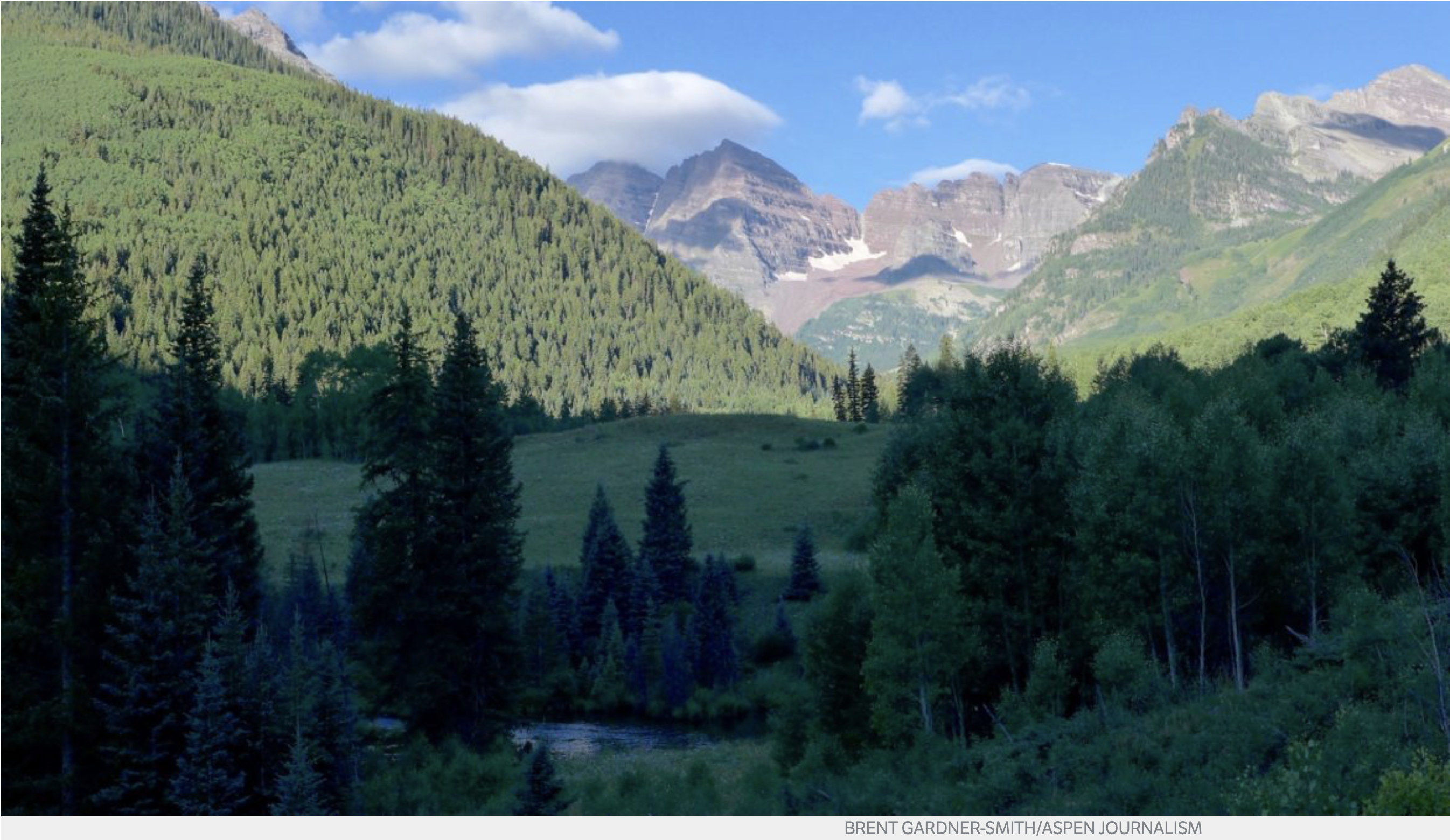
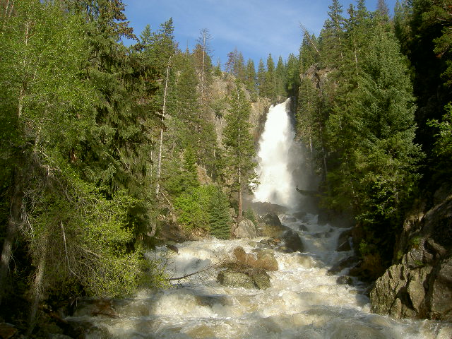
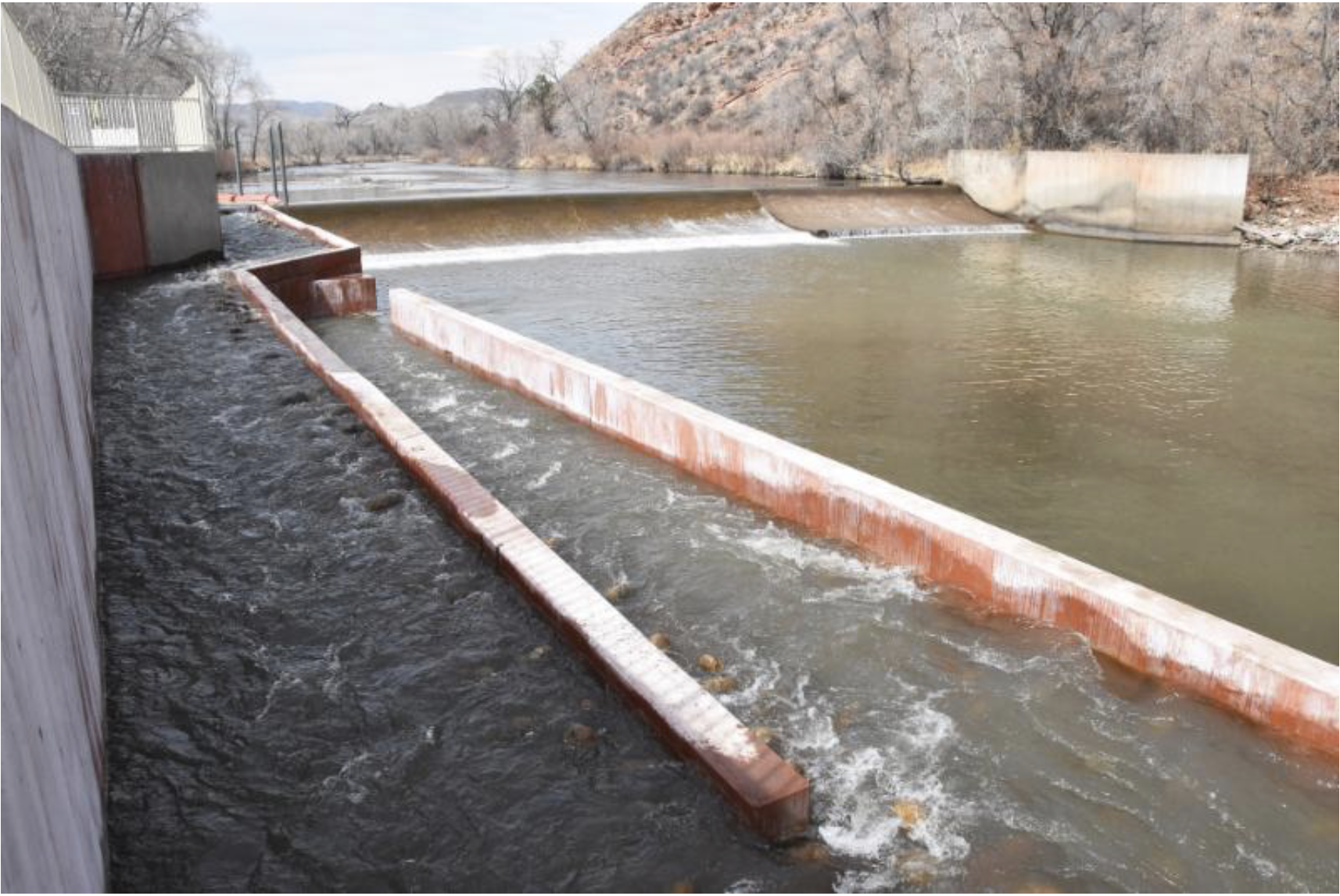
    But Colorado and other Western states rely on shallow streams that don’t carry traditional commercial traffic. The United States Geological Survey estimates that 44 percent of Colorado’s streams are intermittent, meaning they are sometimes dry, and 24 percent are ephemeral, meaning they can be dry for months or years and appear only after extraordinary rain or snow. Just 32 percent of Colorado streams are classified as being perennial, meaning they flow year round.

    Under the new rules, only perennial and intermittent streams, or those deemed navigable, would be regulated, meaning that thousands of miles of streams in Colorado and other Western states would no longer be protected under the law.

    Arriving at definitions that apply consistently across the country has been a tortured, and some believe, unsuccessful process. Still, by 2008 the EPA had arrived at a set of policy definitions, known as the 2008 guidance, that established better standards for defining when a stream was perennial, when it was intermittent, and when it was ephemeral. The same was true for better guidelines for wetlands. But significant inconsistencies within that guidance, due to conflicting legal opinions, remained, opening the door for the Obama Administration to simplify the act, and in doing so, include more waters and wetlands under the act’s protection.

    Within months, industry groups successfully sued to stop the 2015 rules from being implemented.

    The big question now is where to go from here. The Colorado Water Congress would like to see the newly proposed 2019 rules remain in place, with additional work done to clarify key aspects and obtain more consensus among the competing interests, according to Executive Director Doug Kemper.

    Colorado is hopeful the EPA and Corps will, at the urging of many states, go back to using the 2008 guidance, rather than adopting the much looser guidance now being proposed. But few believe that will happen under the Trump Administration.

    As a result, environmental groups expect they will be forced to sue to stop the new rules from taking effect, just as industry groups sued to stop the 2015 Obama Administration rules from being implemented.

    “We will be part of the fight to try to stop any rules that leaves the duck factory and the prairie potholes of the central Midwest and headwater streams across the West and elsewhere unprotected,” Kassen said.

    “But what we really need is change that can withstand political swings. The 2015 rules did not assuage critics, and it did not build lasting change,” she said.

    Weiser isn’t ready to say whether Colorado would join a new lawsuit challenging the 2019 proposed rules.

    “This regulatory system requires a difficult balancing act that addresses a range of interests and is mindful of the role of federal and state authorities,” he said. “It is really important that the Corps of Engineers and EPA take their time and think about the relevant issues and develop an approach that can last.

    “If we end up moving back to the 2008 rules, which we would urge, I would hope it would be lasting because the extent of litigation and uncertainty around these rules isn’t healthy for anybody,” he said.

    Jerd Smith is editor of Fresh Water News. She can be reached at 720-398-6474, via email at jerd@wateredco.org or @jerd_smith.

    @POTUS’s infrastructure order threatens local right to protect the environment — @HighCountryNews #ActOnClimate #KeepItInTheGround

    From The High Country News (Carl Segerstrom):

    Washington blocked a coal terminal under the Clean Water Act. New rules could subvert that authority.

    At nearly 17 million acres, the Tongass National Forest in Southeast Alaska is part of the largest intact temperate rainforest in the world. Meanwhile, about a thousand miles south in Longview, Washington, on the banks of the Columbia River, decades of industrial waste mar the proposed site for the largest bulk coal terminal in North America.

    On the surface, these places may not have much in common, but they’re both part of a simmering nationwide conflict over state and federal power. In the Tongass, that means the Administration deferring to Alaska’s desire to rewrite federal rules to promote logging, while in Longview, that looks like an executive order designed to limit a state’s ability to block fossil fuel projects — including the Millennium coal export terminal.

    A recently signed executive order looks to fast-track permitting for coal terminals. Photo credit: Peabody Energy, Inc./Wikipedia Commons

    The [President’s] administration’s treatment of these areas demonstrates its all-in support for extractive industries. In the name of energy dominance, the federal government is looking to curtail state environmental reviews and promote fossil fuel exports. By doing so, it’s wading into an ongoing fight between coastal and Interior West states over permit denials for export facilities on the West Coast. Where the administration stands on that battle — and its apparent willingness to trample on some states’ regulatory authority — exposes the uniquely flexible nature of its support for states’ rights: It appears interested in shifting power to states only when the goal is less environmental protection.

    [The President’s] April 10 executive order was part of a package of directives designed to pave the way for infrastructure like the Millenium coal terminal. In the order, [the President] asked the Environmental Protection Agency to rewrite the policies for how Section 401 of the Clean Water Act is implemented. That section of the linchpin federal law gives states and tribes authority over whether to permit facilities that release pollution into federally protected waters within their borders. [The President’s] directive declares that the current process “cause(s) confusion and uncertainty, leading to project delays, lost jobs, and reduced economic performance.”

    While it’s unclear exactly how the EPA will change the guidelines, environmental lawyers are skeptical that the executive branch has the authority to weaken state and tribal oversight. That’s because the right of states to protect their rivers, lakes and coastal waters is fundamental to the Clean Water Act, and the 401 certification process gives affected communities a voice in that process. Andrew Hawley, a lawyer with the Western Environmental Law Center, put it bluntly: “To undermine that goes straight to the heart of the Clean Water Act.”

    The orders come as states are battling over export infrastructure along the Pacific Coast. Fossil fuel-producing states in the Interior West — frustrated that local and state governments in Washington, Oregon and California have stymied a string of projects — see [the President’s] directives as a crack in the coast’s green wall. “I stand with governors across the land in asserting our states’ rights to access markets foreign and domestic,” said Wyoming Gov. Mark Gordon, R, following the orders’ announcement. “The states along the West Coast have abused their authority under section 401 of the Clean Water Act to unfairly discriminate against Wyoming coal.”

    Gordon blamed the blocking of export facilities on climate politics, but Washington denied the Longview permit because of local impacts, not big-picture threats. In a summary of the decision, the state’s Department of Ecology wrote that the project “would cause irreparable and unavoidable harm to the Columbia River,” by driving hundreds of pilings into the riverbed, destroying nearly 30 acres of wetlands and aquatic habitat, increasing ship traffic on the Columbia River by 1,680 trips a year, and impairing tribal access to protected fishing sites.

    Elsewhere, the…administration has sought to shift power to the states — so long as the end result would slash environmental protections. In the past couple years, the Interior Department has implemented policies that defer wildlife management to states, thus allowing controversial hunting practices like killing coyotes and wolves during denning season on national wildlife refuges in Alaska. And the Forest Service is working with Utah and Alaska to weaken restrictions on carving roads into roadless forests. That would mean major changes in areas like the Tongass, where most of the forest is inaccessible to industry.

    As some Western states get more leeway to weaken environmental safeguards, green activists are left wondering how far the federal government will go to subvert state regulatory authority in their communities. Diane Dick, who lives just outside the Longview city limits, has spent the better part of a decade fighting the Millenium coal terminal. From the beginning, she said, the fight over the terminal felt bigger than just one project; she’s watched it become a poster child for a national debate over energy infrastructure. Now, as the executive branch tilts the scales against local environmental protection, Dick sees a larger question looming: When and based on what can a community protect itself?

    Longview, Washington, residents gather to protest the coal terminal project. The community has been fighting the proposed terminal for years. Photo credit: Power Past Coal

    Carl Segerstrom is an assistant editor at High Country News, covering Alaska, the Pacific Northwest and the Northern Rockies from Spokane, WA.

    #Runoff news: #RioGrande streamflow is above average through Albuquerque

    From The New Mexico Political Report (Laura Paskus):

    This time last year, the riverbed of the Rio Grande south of Socorro was sandy, the edges of its channel strewn with desiccated fish. Even through Albuquerque, the state’s largest river was flowing at just about 400 cubic feet per second, exposing long sandbars and running just inches deep.

    This year, the Middle Rio Grande is booming, nearly ten times higher than it was last April—and it’s still rising. Running bank-to-bank, the river’s waters are lapping up over low spots along the bank, nourishing trees and grasses, replenishing groundwater and creating much-needed habitat for young fish and other creatures.

    This year’s high flows through the Middle Rio Grande come thanks to a mix of natural conditions, like snowpack, and also manipulation of the river’s flows from dams, diversions and interstate water-sharing agreements.

    “These late spring storms are really the icing on the cake heading into the spring runoff,” said Mary Carlson, a spokesperson for the U.S. Bureau of Reclamation’s Albuquerque Area Office. “The snowpack is far above average and we expect a few months of really good flows on the Rio Chama and Rio Grande.”

    This month, Reclamation released its 2019 operating plan for the Middle Rio Grande and the stretch of the river below Elephant Butte Dam. In southern New Mexico, the federal agency plans to move water from Elephant Butte Reservoir to Caballo Reservoir beginning on May 3. Then, on May 31, they’ll begin sending water from Caballo downstream to irrigators in southern New Mexico and Texas.

    Combined storage in Elephant Butte and Caballo is about 324,000 acre feet as of Thursday, or roughly 14 percent capacity. Last fall, storage in the two reservoirs dropped below three percent.

    Levels in those two reservoirs matter not only to downstream water users, but also those upstream along the Rio Grande.

    Since last May, New Mexico has had to abide by Article VII of the Rio Grande Compact of 1938. When combined storage in Elephant Butte and Caballo reservoirs drops below 400,000 acre feet, Colorado and New Mexico can’t store water in any of the upstream reservoirs built after 1929. This includes Heron, El Vado and Heron reservoirs in New Mexico.

    Now, water managers expect that New Mexico will be out of Article VII restrictions in mid-May.

    Once that happens, the Middle Rio Grande Conservancy District, which supplies water to irrigators in the Albuquerque area, can start holding water in upstream reservoirs. They’re expecting to store about 40,000 acre-feet of water before water levels drop again later this year.

    And, Reclamation expects that New Mexico will remain out of Article VII until late August or early September.

    Rio Grande Silvery Minnow via Wikipedia

    ‘Umbrella species’

    The river’s spring flows will also give a boost to endangered species, including the Rio Grande silvery minnow.

    Biologists are already finding eggs, though spawning will peak later in the spring as the temperature rises.

    “The water’s not quite warm enough all day, so it will probably be another three weeks before there’s a huge peak in the number of fish that are spawning,” said Thomas Archdeacon, a fish biologist with the U.S. Fish and Wildlife Service’s New Mexico Fish and Wildlife Conservation Office. “I’d guess in a year like this, there could be a two-month long spawning period.”

    The slow, backwater habitat created by the rising river is good for the fish, allowing eggs and larvae to survive. And what’s good for endangered species is good for the rest of the river’s ecosystem, said Archdeacon.

    Later this spring and summer, the river will shift again. Runoff will decline and once the state is out of Article VII, water will be stored in upstream reservoirs instead of passing through the Middle Rio Grande to Elephant Butte. Plus, irrigators will pull more water from the river during the summer months.

    And biologists like Archdeacon will keep an eye on what happens to endangered species.

    “I like to call it the umbrella species,” Archdeacon said of the silvery minnow. Protecting species like the minnow means protecting all the other species as well, he said, and protecting the cottonwood galley.

    Livingston Ranch in Kit Carson County receives the 2019 Colorado Leopold Conservation Award — The Sand County Foundation

    The soil’s health rebounded as it retained organic matter left on the land as crop residue. This reduced the need for fertilizer, and resulted in higher yields from their wheat, milo, corn and hay fields. Photo credit: Sand County Foundation

    Here’s the release from the Sand County Foundation:

    Mike and Julie Livingston of Kit Carson County have been selected as the recipient of the 2019 Colorado Leopold Conservation Award®.

    Sand County Foundation, the nation’s leading voice for private conservation, created the Leopold Conservation Award to inspire American landowners by recognizing exceptional farmers, ranchers and foresters. The prestigious award, named in honor of renowned conservationist Aldo Leopold, is given in 13 states.

    In Colorado the award is presented annually by Sand County Foundation, Colorado Cattlemen’s Association, Colorado Cattlemen’s Agricultural Land Trust, Tri-State Generation and Transmission Association, and USDA Natural Resources Conservation Service.

    The Livingstons [were] presented with the $10,000 award on Monday, June 17 at the Colorado Cattlemen’s Association’s 2019 Annual Convention held at the Steamboat Grand in Steamboat Springs.

    Agricultural conservation practices have given Mike and Julie Livingston and their land the resiliency to overcome adversity.

    When they bought their ranch near Stratton in 2003, its weed-filled landscape had been abused by years of over-grazing, severe erosion and drought. When rain did fall on barren spots of land, sediment would wash into nearby rivers and aquifers.

    “We had owned the property for three years, and each year we reduced our cow numbers because the grass wasn’t recovering. What we were doing wasn’t sustainable,” Mike recalls.

    Other challenges loomed on the ranch’s horizon. In 2009 a multi-state lawsuit took away their access to water for irrigation, and three years later a historic drought took hold. Their backs against the wall, they enrolled in the Ranching for Profit School. Mike said the “life-changing experience” opened his mind to agricultural conservation practices like cover crops, no-till and planned grazing.

    Not tilling the soil and keeping it covered year-round with specialty crops soon led to better rainwater utilization and less soil erosion and runoff. The soil’s health rebounded as it retained organic matter left on the land as crop residue. This reduced the need for fertilizer, and resulted in higher yields from their wheat, milo, corn and hay fields.

    Mike and Julie, who farm and ranch with their children, Kari and Justin, and their families, also embraced conservation practices that benefitted their beef cattle and created wildlife habitat.

    They implemented a planned grazing system with assistance from the Natural Resources Conservation Service. Inefficient watering systems were replaced with 100,000 feet of new pipeline. Miles of new fencing replaced the configuration of 36 old pastures, with 119 pastures that are grazed less often. The extended rest period, coupled with planting cool season grasses meant two more months of green grass.

    In addition to a 120-acre wildlife sanctuary the Livingstons created, hundreds of additional acres are left ungrazed from summer through winter to provide additional habitat for turkeys, prairie chickens, pheasants, bobcats, and herds of whitetail and mule deer. Hay fields are harvested with wildlife protection in mind, and cattle watering stations were designed for access and safety for birds, bats and other wildlife.

    The Livingstons share what they’ve learned with fellow ranchers, academic researchers, business and youth groups.

    Through hard work, holistic management, and perseverance, the Livingstons have built a ranch that is sustainable for generations to come.

    “The 2019 Leopold Conservation Award nominees featured an impressive array of families and operations from around the state. The Colorado Cattlemen’s Agricultural Land Trust is proud of the conservation accomplishments of each of the applicants,” said Erik Glenn, Colorado Cattlemen’s Agricultural Land Trust Executive Director. “These applicants showcase the diversity of agriculture in Colorado and the dedication that farming and ranching families have to the lands they steward, their communities, and their families. We are particularly proud of this year’s recipient the Livingston Ranch and the entire Livingston family.”

    “Agriculture producers feed a growing society, domestically and abroad, through sustainable production practices that produce more by using less. This approach is the very backbone of stewardship that the Leopold Conservation Award honors,” said Mike Hogue, Colorado Cattlemen’s Association President. “Congratulations to the Livingston family on their well-deserved recognition, and being leaders in Colorado’s conservation and ranching industry.”

    “The Natural Resources Conservation Service has proudly partnered to support the Leopold Conservation Award in Colorado for more than 10 years. The families that are nominated each year illustrate the commitment Colorado farmers and ranchers have to implementing sound conservation practices. The NRCS congratulates the Livingston family for their conservation ethic and land stewardship,” said Clint Evans, NRCS State Conservationist.

    Among the many outstanding landowners nominated for the award were finalists: Cory Off of Del Norte in Rio Grande County, and Gregg, Chris and Brad Stults of Wray in Yuma County.

    The 2018 recipient was Beatty Canyon Ranch of Kim, Colorado.

    The Leopold Conservation Award in Colorado is made possible thanks to the generous contributions from Colorado Cattlemen’s Association, Colorado Cattlemen’s Agricultural Land Trust, Tri-State Generation and Transmission Association, USDA Natural Resources Conservation Service, Stanko Ranch, Gates Family Foundation, American AgCredit, The Bird Conservancy of the Rockies, The Nature Conservancy in Colorado, and McDonald’s.

    Sand County Foundation presents the Leopold Conservation Award to private landowners in 13 states for extraordinary achievement in voluntary conservation.

    For more information on the award, visit http://www.leopoldconservationaward.org.

    #ArkansasRiver Basin Water Forum recap

    Arkansas Valley Conduit Comanche North route via Reclamation

    From The Pueblo Chieftain (Peter Roper):

    Pushing the…administration to continue financial support for the Arkansas Valley Conduit pipeline is a priority, Colorado Sen. Cory Gardner told an audience of water district officials here Wednesday.

    The 130-mile pipeline — which would run from Lake Pueblo to Lamar — was first authorized in 1962 but was unfunded until 2009, when Congress began authorizing planning funds for the long-awaited project.

    Speaking to the Arkansas River Basin Water Forum in Pueblo, the Republican senator said he recently met with officials of the Bureau of Reclamation earlier this month to press the administration to support the pipeline project.

    “I won’t let the federal government walk away from its obligation to the communities along the project,” he told the audience of several hundred water district officials at the Pueblo Convention Center.

    Most recently, the federal bureau completed a feasibility study of the project.

    Headwaters of the Arkansas River basin. Photo: Brent Gardner-Smith/Aspen Journlaism

    From The Pueblo Chieftain (Peter Roper):

    [Colorado and Kansas] are working together now on how to share a river that is lifeblood to eastern Colorado and western Kansas farmers and ranchers, according to experts at the 25th Arkansas River Basin Water Forum here this week.

    The states have been to the U.S. Supreme Court seven times since 1902, most often because Kansas officials charged that Colorado was overusing the river. That wasn’t an empty claim, lawyer Matt Montgomery told the audience Thursday.

    “The river essentially runs dry every summer near Dodge City because of its heavy use by agriculture in Colorado and Kansas,” he said.

    Of course, it resurfaces further east and continues its way to the Mississippi River.

    The historic source of the water feud was the fundamental clash in water philosophy. Colorado’s landowners and Legislature believed in an appropriated system of awarding water rights. People with the most senior water rights on the river get water before any junior rights are recognized.

    Kansas, which was settled earlier, had a more land-based view. Owning land next to a river granted the landowner automatic water rights. The problem was the Arkansas might be used up before it reached some Kansas landowners.

    Also, Colorado farmers were quick to drill wells in the valley. More than 1,000 new ones were installed after World War II, Montgomery said.

    When states fight, it’s the U.S. Supreme Court that has primary jurisdiction. The court ordered the two states to reach some accommodation — and they created the Arkansas River Compact in 1949.

    John Martin Reservoir back in the day

    To help regulate water flow in the river, John Martin Reservoir was built in the 1940s near Lamar.

    “But then Lake Pueblo and Trinidad Reservoir were built (in the 1970s), and that triggered the last lawsuit from Kansas, that Colorado was storing too much water,” Montgomery said.

    But the two new lakes weren’t the problem; it was the additional wells that were depleting the river, he noted.

    Today, the two states monitor the river use — and in Colorado, water courts require augmentation to the river before new wells are added.

    noosa yoghurt and Morning Fresh Dairy named Northeast Region Partner of the Year — #Colorado Parks and Wildlife

    Water courses through the new fish passage at Watson Lake State Wildlife Area. The passage allows fish to swim up and down the river past a diversion dam. Photo credit: Northern Water

    Here’s the release from Colorado Parks and Wildlife:

    The Graves family, owners of Morning Fresh Dairy and noosa yoghurt, was honored Thursday night with the Colorado Parks and Wildlife Northeast Region Partner of the Year Award for 2019.

    The award was announced at the annual Partners in the Outdoors Conference awards dinner held at the Beaver Run Resort & Conference Center.

    The Graves’ were nominated by CPW Assistant Area Wildlife Manager Jason Surface. Rob and Lori Graves were on hand at Thursday’s dinner and banquet to accept the award.

    “The entire Graves family, and Rob in particular, deserve this award for their unwavering commitment to the natural resources of Colorado and the mission of CPW,” Surface said. “Through all facets of his life, Rob has recognized the importance of connecting all Coloradoans, including his employees, children, grandchildren and community members to their natural resources and building successful partnerships.”

    Rob Graves is co-founder of noosa yoghurt and the Graves family owns a sixth generation dairy farm, Morning Fresh Dairy, in Bellvue, Colo.

    The Graves family epitomizes a CPW partnership and has improved the state’s natural resources through stewardship, education, and monetary contribution.

    The recently completed fish ladder at the Watson State Wildlife Area and Watson Lake is one recent project that exemplifies their commitment and generosity, and it will be on display next week with the ribbon cutting ceremony to showcase the project’s completion. Graves has been heavily involved with the project from its inception in 2016, funding the conceptual design in 2017 and his leadership and contributions were instrumental in moving the habitat improvement project a reality.

    The Watson Lake fish ladder is reconnecting over two river miles on what was a fragmented Poudre River. The stretch there at Watson Lake contains important spawning habitat and deep pool that provides refuge for aquatic life.

    “The Graves family have been and continue to be a great partner to CPW and truly help us achieve the goals laid out in both our Strategic Plan and Statewide Comprehensive Outdoor Recreation Plan (SCORP),” Surface said.

    “Both of these plans emphasize the importance of wildlife conservation, outdoor stewardship and connecting people to the great outdoors by providing sustainable access and opportunities to outdoor recreation. These are goals they believe deeply in and he has made these a priority for not only himself, but his family, employees and the community of Bellvue as well.”

    There are many arenas where the Graves’ family plays a hand in sharing the mission of CPW through conservation and community enhancement.

    They develop and make outdoor stewardship ethics a priority, organize volunteer work and maintenance on our public lands, particularly at the Watson State Wildlife Area that they have adopted as their own. They organize and host events like the Pleasant Valley Days, which is focused on bringing the community together and getting people of all ages outdoors.

    The ribbon cutting event for the Watson Lake fish ladder is taking place on Wednesday, May 1, 2019, at 11 a.m.

    Earth Optimism: Reasons to Feel Positive in 2019 — The Nature Conservancy #ActOnClimate #EarthOptimism

    Climate news is not all gloom and doom. Here’s a report from the Nature Conservancy (Justine E. Hausheer/Matthew L. Miller). Click through and read the whole article. Here’s an excerpt:

    If you’re a fan of nature documentaries, you’ve probably heard about the unsettling images in Netflix’s new series, Our Planet. In one episode, the lack of sea ice forces walruses to rest on a steep cliff face… where many fall to their deaths.

    This disturbing image is emblematic of so many environmental stories: not only are they dreary, but they suggest that we are heading for the cliff. All of us.

    Earth Day originated as a way to bring attention to environmental issues. But it’s also fundamentally about hope. There has been great progress made on many conservation issues. While we need to be realistic about the challenges ahead, we can’t lose sight of what we have achieved so far. You can help make a difference.

    Here is a selection of stories to feel optimistic about his Earth Day. Check out the Earth Optimism movement, and follow #EarthOptimism on Twitter for many more.

    Pop-Up Wetlands Provide New Habitat for Migrating Shorebirds

    Foraging shorebirds. Photo © David Ledig / USFWS

    Migrating shorebirds can’t afford to be choosy about where they stop — whether the right habitat is there or not, they can only fly so far and so long.

    In California’s Central Valley, flocks of 20-40 million waterfowl once used the plentiful wetlands to rest and refuel. But today those flocks are a mere fraction of their former numbers, as more than 90 percent of these wetlands and riparian areas have been converted to agricultural fields.

    TNC’s California program came up with a creative solution to help the birds and benefit farmers. By temporarily flooding rice fields, they can provide “pop-up” habitat when the birds need it most. Now, science shows that this ingenious method is working, yielding the largest average shorebird densities ever reported for agriculture in the region…

    Congress Reauthorises the LWCF

    Every March, thousands of Sandhill cranes stop in #GreatSandDunes National Park & Preserve on their way to their northern breeding grounds. The fields and wetlands of #Colorado’s San Luis Valley provide excellent habitat for these majestic #birds. With the dunes and mountains nearby, they dance and call to each other. It’s one of nature’s great spectacles. Photo @greatsanddunesnps by #NationalPark Service.

    In 1964 the Land and Water Conservation Fund (LWCF) became law, allocating a tiny fraction of federal royalties from oil-gas leases to fund habitat protection, public access, public recreation, and historical preservation.

    LWCF quickly became America’s main tool for protecting and restoring historic sites, like battlefields, and for providing matching grants to states for urban and suburban recreation facilities, like ballfields.

    Most importantly, it became a tool for acquiring wildlife habitat and public access — through purchase and conservation easements — to be managed and improved by states, the National Park Service, Forest Service, Fish and Wildlife Service and Bureau of Land Management.

    That history of conservation success appeared to end last September, when Congress declined to reauthorize LWCF and it expired. Luckily, due to action by Nature Conservancy members and many others, that setback was temporary. In January, Congress permanently reauthorized LWCF, a major victory for both wildlife conservation and public recreational access.

    Gib Hazard retires after 31 years on Southeastern #Colorado Water Conservancy District Board

    Bill Long with Gib Hazard. Photo credit: Southeastern Colorado Water Conservancy District

    Here’s the release from the Southeastern Colorado Water Conservancy District (Chris Woodka):

    The second-longest serving director of the Southeastern Colorado Water Conservancy District Board, Gibson Hazard Jr., retired [April 18, 2019] after 31 years of service.

    Gibson Hazard Jr., of Colorado Springs, joined the board on April 21, 1988. At his last meeting, fellow board members gave him a rousing send off.

    “To put that in perspective, Ronald Reagan was president when you joined the board and gas was 98 cents,” quipped Bill Long, district president. “Since the district was formed (in 1958), we’ve had 72 board members and Gib has served with 47, which is quite an accomplishment. This includes our longest serving board member, (the late) Frank Milenski.”

    Hazard served as secretary of the board, and represented El Paso County.

    “You worked for the good of the district, which was always important,” Long told Hazard.

    Hazard was raised on a ranch in southern Arizona, and graduated from Colorado College in Colorado Springs. He was a founding member of the Colorado Water Protective and Development Association, which is now the largest water augmentation group in the Arkansas Valley.

    Hazard also served as manager of the 5,000-acre King-Barrett Ranch and Farm operation in Crowley County before it was sold to the Foxley Cattle Co.

    The District presented Hazard an Excellence of Service award.

    El Paso County has five members on the 15-member board. Members are appointed by district judges.

    “We want to understand the impacts of retreating glaciers, degradation of permafrost and changes in snowpack” — Heidi Steltzer

    San Juan wildflowers.

    From The Durango Herald (Jonathan Romeo):

    Heidi Steltzer, an associate professor of biology at FLC, said the study is headed by the International Panel on Climate Change, an intergovernmental arm of the UN that assesses the risks and impacts of climate change around the world and possible response actions.

    “We want to understand the impacts of retreating glaciers, degradation of permafrost and changes in snowpack,” she said. “It’s pretty significant in any ecosystem to be snow-covered or not snow-covered, and we want to attribute changes in the mountains directly to those three things.”

    For this report, there was no on-the-ground research, Steltzer said. Instead, statements and conclusions have to be supported by a peer review scientific publication from the past five years. She has enlisted the help of two FLC students in gathering all the information.

    “Ultimately, the goal is to find as many papers as possible that are review articles that show a pattern,” she said. “So we can show it’s not just happening in one mountain region. It’s happening in many.”

    Steltzer has been a mountain scientist since 1994. She earned her Bachelor of Science in biology at Duke University and a doctorate in ecosystem ecology from the University of Colorado-Boulder. She joined the FLC faculty in 2009 and has led field studies in Colorado, Greenland and Alaska.

    She said living in the San Juan Mountains and being able to study the environment firsthand has helped her understanding of climate change’s impact on the ecosystem.

    “We grow our intuition in science by living where we do our research,” she said.

    Across Colorado, snowpack has declined 20% to 60% since the 1950s, according to the Center for Snow and Avalanche Studies, with the snow season now 34 days shorter than historic norms…

    Just last summer, during the extreme drought in Southwest Colorado, Steltzer went out to see how the absence of snowpack affects wildflowers. By early July, most flowers had already bloomed, she said, and were past their peak far too early.

    #Drought news: D1 (Moderate Drought) erased from most of #Colorado but is still hanging on along the #NewMexico border, one category improvements across most of #NM

    Click on a thumbnail graphic to view a gallery of drought data from the US Drought Monitor.

    Click here to go to the US Drought Monitor website. Here’s an excerpt:

    This Week’s Drought Summary

    A series of storm systems moved quickly across the lower 48 States until reaching the East Coast as a strong ridge of high pressure over the western Atlantic Ocean blocked their eastward progression. Due in part to this slowdown, severe weather and heavy rainfall occurred in portions of the southern Great Plains, lower Mississippi Valley, Southeast, and mid-Atlantic during April 17-19. Moderate to heavy precipitation (1.5-4 inches) also occurred over the western Great Lakes region, Tennessee and central Ohio Valleys, parts of New England, and northwestern Washington. Light to moderate precipitation (0.5-2 inches) was widespread in the Northwest, eastern Great Basin, northern and southern thirds of the Rockies, northern Plains, and the eastern third of the Nation. Only portions of the Southwest, central Rockies and Plains, and western Corn Belt saw little or no precipitation. Weekly temperatures averaged above-normal for much of the contiguous U.S., except for subnormal readings across the Southeast and western and southern Alaska. Light to moderate precipitation along the southern and southeastern Alaskan Coast and light showers on the windward side of the Hawaiian Islands maintained conditions in both states. Changes were made in Puerto Rico as spotty heavy showers provided some relief to short-term D0 and D1 areas, but where the rains missed, some deterioration occurred.

    With near- to record wetness in many parts of the country this winter and in 2018, the April 16 USDM had the lowest percent of area in drought (D1-D4) for the lower 48 States (3.73%) and all 50 States (3.78%) since the inception of the U.S. Drought Monitor in 2000, surpassing the previous low drought standard of May 23, 2017. In fact, no dryness/drought (D0-D4) in both the lower 48 (85.88%) and all 50 States (87.06%) also set record low values last week. With more wet weather over D0-D2 areas this week, new USDM record lows will most-likely be set…

    High Plains

    A fairly large area of light to moderate precipitation (0.5-1.5 inches) was observed across most of Montana, southern North Dakota, western and southeastern South Dakota, Wyoming, and western and northeastern Nebraska. Southern Kansas also received some decent rains (0.5-2.5 inches), as did southern Colorado (0.5-1.5 inches). The precipitation in Colorado was enough to improve D1 to D0 (see West summary with respect to New Mexico). In southwestern Wyoming, the additional precipitation boosted WYTD average basin precipitation and SWE to 112% and 123%, respectively, thus D1 and D0 was shrunk. In northern Wyoming, 0.5-1.5 inches of precipitation was enough to create WYTD and YTD surpluses near the northern and southern D0 edges, thus erasing some of the D0. However, the D1 in the Bighorn Mountains remained intact as both WYTD basin average precipitation and SWE still stayed around 75% of normal. In contrast, extreme northern Montana and North Dakota have missed out on the precipitation, and at 60-days, only 25-50% of normal precipitation has fallen, leading to deficits of 0.5-1.5 inches. In addition, a rapid snow melt during mid-March left much of the water to run off instead of percolating into the still frozen subsoil, thus D0(S) was added. Longer time periods were wet, but since this is the start of the wet season, it is critical that timely and adequate rains fall during the next few months for agricultural interests. Short-term (2-3 months) deficits in central Kansas were also accumulating, but large longer-term surpluses have kept D0 from developing so far…

    West

    Additional Pacific moisture spread across the Northwest, dropping light to moderate amounts (0.5-1.5 inches) on coastal Washington, the Cascades, northern Rockies, and the central Great Basin (eastern Nevada, western and northern Utah). As a result, some D0 was erased from central Oregon, northern Olympic Peninsula (Washington), and extreme northwestern Washington, while a bit of D1 (west edge) was improved in the extreme northern Cascades. From field reports of excessive moisture & standing water in northwestern and northeastern Utah (since station data can be scarce), D1 and D0 was improved by 1-category in the state and adjacent southwestern Wyoming. WYTD basin average precipitation and SWE are both well above normal as of April 23. Even New Mexico (and southern Colorado) received beneficial precipitation (0.5-2 inches) late in the period. For New Mexico, a reassessment was made based upon short-term (WYTD) wetness vs long-term (several years) drought, plus this week’s precipitation. With many SNOTEL WYTD basin average precipitation and SWE above normal, and most USGS stream flows at or above normal with good inflows into reservoirs, 1-cat improvements were made across most of the state, with the lone D2 area remaining in the northwest where ground observations confirmed worse conditions than the rest of the state. Although this WY has been quite favorable for New Mexico, multi-year strong summer monsoons and additional wet winters will be needed to make a full hydrologic recovery…

    South

    Two different storm systems brought welcome precipitation to the South. Early in the period, central and eastern Texas and the lower Mississippi and Tennessee Valleys received widespread moderate to heavy rains (1.5-3 inches, locally to 6 inches) that erased much of the short-term D1 and D0 in central Texas, eastern Louisiana, and southwestern Mississippi. The few areas that received less than an inch of rain, or where 60- to 90-day significant deficits still remained, were left unchanged. In contrast, parts of west-central Texas (Edwards Plateau) missed out on the rain, and some slight D1 and D0 expansion was made here, and additionally in northern Webb County. The second system which occurred late in the period dropped beneficial precipitation on the southern Rockies (New Mexico mountain snows) and south-central Plains (Texas Panhandle and west-central Oklahoma), easing dryness and drought there (see West for New Mexico). Some short-term (2-3 months) dryness was found in northern and central Oklahoma, but longer-term wetness has kept D0 development at bay so far. Elsewhere in the South, overall wet conditions prevailed…

    Looking Ahead

    During the next 5 days (April 25-29, 2019), two systems are expected to provide precipitation to the lower 48 States. One system will track from the southern Rockies northeastward into New England, bringing moderate to heavy rain(1-4 inches) and severe weather to the southern Plains, lower Mississippi, Tennessee, and Ohio Valleys, and Northeast, with another system moving southeastward out of southwest Canada across the northern Rockies and Plains, Midwest, and eastern Great Lakes region, dropping light to moderate totals (0.5-2 inches). Little or no precipitation is expected in the Far West, Southwest, south-central Plains, far upper Midwest, and along the southern Atlantic Coast. Temperatures should average below-normal across the northern third of the U.S., near normal in the Southeast, and above-normal in the Southwest.

    The CPC 6-10 day extended range outlook (April 30-May 4, 2019) favors above-normal precipitation odds across much of the central U.S., from the Rockies eastward to the Appalachians, in western and northern Alaska, with subnormal totals likely along the West Coast and in southeastern Alaska, with near-normal chances elsewhere. Subnormal temperatures are likely in the North-Central States while chances of above-normal readings are favored in the Southeast and western Alaska.

    Here’s the one week change map from the US Drought Monitor.

    One week change map through April 23, 2019.

    Photo gallery: Durango and Silverton railroad clears path for first ride May 4

    Photo credit: http://riveroflostsouls.com

    Ride along with Jonathan Romeo from The Durango Herald to see what the operators of the Durango narrow gauge railroad are working against to clear the route to Silverton. Here’s an excerpt:

    The Durango & Silverton Narrow Gauge Railroad, with the help of Durango-based Bonds Construction, has cleared the 45-mile track from Durango to Silverton.

    Bonds Construction posted to its Facebook page this week that crews plowed through 42 avalanche/slide areas over the course of 14 miles in the past few weeks. As a result, the tracks were cleared two weeks ahead of schedule…

    The D&SNG’s route from Durango to Silverton doesn’t encounter true avalanche danger until it reaches Cascade Canyon, about 26 miles north of the train station in Durango. From there, north to Silverton, eight to 10 avalanche paths can reach the railroad tracks.

    But this year, crews saw avalanche paths slide that had never been witnessed running before. One particular avalanche was near Needleton, which put 60 feet of debris on the tracks.

    By all accounts, the D&SNG will be ready to make its first round-trip from Durango to Silverton on May 4.

    Colorado Parks and Wildlife: Ribbon cutting at Watson Lake fish ladder rescheduled for May 1

    Water courses through the new fish passage at Watson Lake State Wildlife Area. The passage allows fish to swim up and down the river past a diversion dam. Photo credit: Northern Water

    Here’s the release from Colorado Parks and Wildlife:

    The ribbon cutting ceremony for the completion of the fish ladder at Watson Lake has been rescheduled and will now take place on May 1 at 11 a.m.

    It was originally set for April 12, but due to inclement weather during that week, was postponed.

    Watson Lake is located in Bellvue, Colo., just west of Laporte, on Rist Canyon Road.

    More Information:
    Colorado Parks and Wildlife (CPW) along with funding partners noosa yoghurt, Northern Water, Morning Fresh Dairy, Poudre Heritage Alliance and Trout Unlimited will celebrate the completion of the fish ladder at Watson Lake.

    The collaborative project is helping to reconnect a fragmented Poudre River. The stretch contains important spawning habitat and deep pools that provide refuge for aquatic life. This Watson Lake fish ladder is reconnecting over two river miles. The group hopes this will be one of many ladders along the Poudre River that will allow fish to travel freely upstream and downstream, improving the health of the fishery and the ecosystem without impacting water delivery.

    Noosa yoghurt has been heavily involved with the project from its inception in 2016, funding the conceptual design in 2017. The vision for noosa has always been to give back to the community in a meaningful way.

    “The Poudre River is a treasure in Northern Colorado,” said Stephanie Giard, community outreach coordinator for noosa yoghurt. “The project area is frequently visited by neighbors in the Pleasant Valley for fishing, birdwatching, or just enjoying nature. It is our responsibility to protect this valuable resource in our community.”

    Watson Lake Diversion Structure is a channel spanning structure that represented a complete barrier to all upstream fish movement in the Poudre River. The structure delivers water to the Watson State Fish Hatchery and is owned and operated by CPW. The new fish ladder allows for passage through the diversion for all species present within the river reach including longnose dace, longnose suckers, white suckers, brown trout, and rainbow trout.

    Designed by OneFish Engineering and built by L4 Environmental, the fish ladder at the Watson Diversion was completed in record time. Biologists and engineers from across CPW came together to work with OneFish Engineering to find the optimal design to provide upstream fish movement through the diversion structure. The construction project started in November at the end of the irrigation season. It had to be completed before spring runoff, which can start as early as March. The project was blessed with ideal weather for construction this winter.

    “This project will improve river connectivity and benefit the aquatic resources by allowing fish to move freely back upstream as they wish,” CPW Aquatic Biologist Kyle Battige said. “Outside of the benefits to aquatic life, this project is important as it showcases the feasibility of fish passage at these large diversion structures and will hopefully further momentum for these types of projects. It also serves as an example of the collaboration and team effort from multiple entities that these large-scale conservation projects will have to have in order to be successful in today’s world.”

    Northern Water General Manager Brad Wind said this project will be an example of future cooperative efforts on the river.

    “This will be the first of several projects like these to create a healthier Poudre River for generations to come,” he said. “Northern Water and the NISP participants are proud to have been part of the cooperative effort to get this project completed.”

    “This is a first step in improving the health and resiliency of the Poudre River,” said Rob Graves, owner of Morning Fresh Dairy and co-founder of noosa yoghurt. “Through collaboration, we can preserve and protect this critical natural resource that flows through our community.

    “The river has played an important role in our business and in our family for over 100 years and we want to protect it for generations to come. We hope this project and future projects will be the legacy of our family and Morning Fresh Dairy.”

    Southern #Colorado officials and volunteers prepare for rain on the #SpringFire burn scar

    A firefighting helicopter flies in the foreground while the Spring Creek Fire (August 2018) rages behind it. Photo credit: El Paso County

    From The Colorado Sun (Sue McMillin):

    Even a quarter inch of rain pouring onto those devastated slopes could bring a new disaster to hundreds of homes and businesses in the Cucharas River valley, including the towns of La Veta and Walsenburg.

    The 1,000 residents of La Veta could have as little as 30 minutes warning of a flash flood, and in a worst-case scenario the town could lose 70 percent of its structures.

    “We believe we’re going to lose homes,” La Veta Mayor Douglas Brgoch said. “We believe we’re going to lose access and so forth. We don’t want to lose any people.”

    Walsenburg’s 3,000 residents would have more warning time, but the potential for devastation also is severe — as many as 600 homes could be flooded along with City Hall and the county’s emergency operations center (a backup location has been secured).

    The La Veta town hall also is in “the crosshairs of where flooding would be.” Officials would move to the water treatment facility that is on high ground, Brgoch said.

    Town and Huerfano County websites are chock full of flood preparation information. Sirens and stream gauges have been installed, channels cleared and sandbags filled.

    In La Veta, residents who live uphill from flood danger have signed up to be “flood buddies,” offering their homes as refuge to friends and neighbors whose homes are most endangered.

    Army of volunteers help keep resources focused

    About 160 people have put in more than 2,000 volunteer hours with the La Veta Trails organization to clear debris and brush from the banks of the Cucharas River where it runs through town…

    Volunteers with Walsenburg’s newly hatched Green Leaf Committee have been doing the same thing along the river banks in that town.

    Numerous government and nonprofit agencies are pitching in, coordinating through a post-fire flood task force. Huerfano County Emergency Manager Larry Sanders tried to tick off a list of those who’ve contributed money or services or both: Natural Resources Conservation Service, AmeriCorps, U.S. Forest Service, Army Corps of Engineers, Colorado Department of Natural Resources, U.S. Geological Survey, National Weather Service, Colorado Department of Transportation, water districts, local nonprofits. His voice trails off…

    Given the potential for a life-threatening flood — not just this year, but for several — Sanders said everyone keeps pushing to complete as much preparation as possible before monsoon season, typically mid-July to September. But they’ve also warned residents that any spring storm with heavy rain could lead to flooding.

    The region got a taste of the potential after the fire last summer, with 13 flood warnings and a “few” events that caused some damage. They lost some cattle, barns and other out buildings and a couple of county roads washed out, he said.

    But he anticipates much worse flooding from the burn scar.

    “It’s not if and not even really when, but how many times,” he said.

    Burn scars statewide are prone to flooding for years

    The residents of Huerfano County are not alone. Hundreds of thousands of acres in Colorado have burned in wildland fires this century, often leaving burn scars prone to flooding for years.

    A mud and rock slide from the 2002 Missionary Ridge fire near Durango recently closed a county road. Flash flood warning signs dot some canyon roads through the 2002 Hayman Fire burn area, where charred tree trunks stand starkly on the landscape. Closure gates and flash flood warning signs on U.S. 24 through Ute Pass are a reminder of the deadly flash floods that followed the 2012 Waldo Canyon Fire.

    Depending on the intensity and size of the fire, the steepness of the slopes and its proximity to watersheds and population areas, the results can be catastrophic.

    Weston Toll, a watershed program specialist with the Colorado State Forest Service, said burn scar runoff can be devastating to reservoirs, agricultural land and rivers downstream as well as to homes and other structures. Special Burned Area Emergency Response (BAER) assessments are completed to help predict post-fire flooding risks.

    The intensity of a fire is key because it is so hot that the soil is sterilized, regrowth — and therefore erosion control — takes much longer. Nearly a quarter of the Spring Creek Fire acreage burned at high intensity, according to the BAER report.

    #Snowpack/#Runoff news: Mid-March forecasted inflow to Blue Mesa Reservoir = 950,000 acre-feet (142% of 30 year average)

    Click on a thumbnail graphic to view a gallery of snowpack data from the NRCS.

    From The Greeley Tribune (Adam Poulisse):

    Recreation officials in northern Colorado say the above-average snowpack — one of our primary sources of water to drink, water our fields and play in — will be a boon for outdoor activities like whitewater rafting, paddleboarding, agriculture and fishing.

    As long as the snowpack melts slowly and [doesn’t] cause flooding…

    Each of the state’s eight basins have a snowpack greater than 100% of their historical average, Kuhn said. The South Platte (116 percent of normal) and Arkansas (135 percent) river basins are the primary rivers in the Front Range, with the other six flowing to the west…

    Even snowpack in the upper Colorado River basin, with all of its water concerns, is sitting at 131 percent of normal, according to data maintained by the USDA Natural Resources Conservation Service Colorado.

    Blue Mesa Reservoir

    From email from Reclamation (Erik Knight):

    The mid-March forecast for the April – July unregulated inflow volume to Blue Mesa Reservoir is 960,000 acre-feet. This is 142% of the 30 year average. Snowpack in the upper Gunnison River basin is currently 150% of average. Blue Mesa Reservoir current content is 247,600 acre-feet which is 30% of full. Current elevation is 7437.6 feet. Maximum content at Blue Mesa Reservoir is 829,500 acre-feet at an elevation of 7519.4 feet.

    Black Canyon Water Right
    The peak flow and shoulder flow components of the Black Canyon Water Right will be determined by the May 1 forecast of the April – July unregulated inflow volume to Blue Mesa Reservoir. If the May 1 forecast is equal to the current forecast of 960,000 acre-feet of runoff volume, the peak flow target will be 7,012 cfs for a duration of 24 hours. The shoulder flow target will be 955 cfs, for the period between May 1 and July 25. The point of measurement of flows to satisfy the Black Canyon Water Right is at the Gunnison River below Gunnison Tunnel streamgage at the upstream boundary of Black Canyon of the Gunnison National Park.

    Aspinall Unit Operations ROD
    Pursuant to the Aspinall Unit Operations Record of Decision (ROD), the peak flow and duration flow targets in the lower Gunnison River, as measured at the Whitewater gage, will be determined by the forecast of the April – July unregulated inflow volume to Blue Mesa Reservoir and the hydrologic year type. At the time of the spring operation, if the forecast is equal to the current forecast of 960,000 acre-feet of runoff volume, the hydrologic year type will be set as Moderately Wet. Under a Moderately Wet year the peak flow target will be 14,350 cfs and the duration target at this flow will be 10 days. The duration target for the half-bankfull flow of 8,070 cfs will be 20 days. The criteria for the drought rule that allows half-bankfull flows to be reduced from 40 days to 20 days have been met.

    Projected Spring Operations
    During spring operations, releases from the Aspinall Unit will be made in an attempt to match the peak flow of the North Fork of the Gunnison River to maximize the potential of meeting the desired peak at the Whitewater gage, while simultaneously meeting the Black Canyon Water Right peak flow amount. The magnitude of release necessary to meet the desired peak at the Whitewater gage will be dependent on the flow contribution from the North Fork of the Gunnison River and other tributaries downstream from the Aspinall Unit. Current projections for spring peak operations show that flows in the Gunnison River through the Black Canyon could be near 7,000 cfs for 10 days in order to achieve the desired peak flow and duration at Whitewater. With this runoff forecast and corresponding downstream targets, Blue Mesa Reservoir is currently projected to fill to an elevation of around 7508 feet with an approximate peak content of 728,000 acre-feet.

    From The Cortez Journal (Jim Mimiaga):

    A two- to four-week whitewater release from McPhee Dam into the Dolores River is “very likely” and is expected to begin in late May or early June, reservoir managers told a gathering of 40 boaters Thursday at the Dolores Community Center.

    Snowpack in the Dolores Basin is 144 percent of average, enough to fill the nearly empty reservoir and provide recreational and ecological downstream flows.

    “Our first priority is to fill the reservoir and provide water for our users,” said Robert Stump, of the Bureau of Reclamation in Cortez. “The exciting part for boaters is the predicted runoff provides an opportunity for a downstream release.”

    But how long the dam release will last, and the exact date it will begin is unclear as most of the snowpack is still in the mountains, said Greg Smith, a hydrologist with the Colorado River Basin Forecast Center.

    Runoff quantity and timing also depend on temperature and how much will be absorbed into the soil. When soil moisture is below 50 percent average, it knocks 5% to 15% off the runoff forecast.

    Snowpack totals and runoff forecasts are extrapolated with modeling that relies on a series of snowpack measuring devices, called Snotels, in the Dolores Basin. The units have historical data from 1981 to 2015.

    This year, there is the additional “wild card” of having a record dry winter last year and a wet winter this year that is expected to fill it back up, plus excess.

    “This is not something we have experienced, and we’re not 100 percent sure how that will impact the runoff this year,” he said.

    Reservoir and river managers use probabilities to inform boaters on the likelihood of a dam release.

    According to the River Forecast Center, there is a 70% probability that Dolores River runoff will produce 40,000 acre-feet beyond what the reservoir can hold. That equals an approximate two-week whitewater release. Flows would be around 1,000 cubic feet per second, and peak flows would be would between 2,000 and 2,500 cfs.

    A 50% runoff probability shows 130,000 acre-feet beyond what the reservoir can hold, according to the Forecast Center, enough for a approximate four-week whitewater release beginning in early May.

    “A spill looks very likely,” said Ken Curtis, a reservoir engineer. “I’d plan for an early June raft trip, subject to change.”

    […]

    Even without a dam release, melt-off from above-average low-elevation snows have charged the popular Slick Rock to Bedrock section of the Dolores River with boatable flows.

    Here’s the Westwide SNOTEL basin-filled map for April 24, 2019 from the NRCS.

    Westwide SNOTEL basin-filled map April 24, 2019 via the NRCS.

    #Denver Completes Divestment From #FossilFuel Companies — Westword #ActOnClimate #KeepItInTheGround

    From Westword (Chase Woodruff):

    A spokesperson for Denver’s Department of Finance confirmed that the city’s fossil fuel investments have been sold. As of earlier this year, its various portfolios had included about $50 million in corporate bonds issued by fossil fuel giants Exxon Mobil and Chevron, though in previous years that figure had been higher.

    “This is a powerful statement to our children, grandchildren and future generations that we care about them and want to invest in their future,” said 350 Colorado boardmember Barbara Donachy.

    @ColoradoClimate: Weekly Climate, Water and #Drought Assessment for the Intermountain West

    Click here to read the current assessment. Click here to go to the NIDIS website hosted by the Colorado Climate Center.

    Pueblo Dam Hydro plant named for Jim Broderick

    Jim Broderick. Photo credit: Southeastern Colorado Water Conservancy District

    Here’s the release from the Southeastern Colorado Water Conservancy District (Chris Woodka):

    A hydroelectric generation plant at Pueblo Dam was named for longtime executive director Jim Broderick of the district which is building the facility.

    The Southeastern Colorado Water Conservancy District Board Thursday unanimously passed a resolution naming the plant the James W. Broderick Hydroelectric Power Facility at Pueblo Dam when it is completed.

    “Jim always takes a proactive approach through strategic planning and forward thinking in addressing the many and complex challenges that confront the Southeastern District, seeking solutions that are fair and equitable, and that protect and conserve the water resources of Colorado and the Southeastern District,” Board President Bill Long in proposing the resolution.

    Broderick has led the team constructing the hydro plant through the initial steps for obtaining a Lease of Power Privilege from the Bureau of Reclamation to the eventual construction.

    After obtaining final Reclamation approval to construct the hydro plant in 2017, the District signed a design-build contract with Mountain States Hydro of Sunnyside, Wash. Construction began in September of 2017, and is now substantially completed. Testing of the equipment at the plant is underway, and should be completed in May, when flows on the Arkansas River will increase to optimal levels for power production.

    The $20.3 million hydro plant will use the natural flows released from the North Outlet at Pueblo Dam to the Arkansas River without consumption of any water. The plant uses three turbines and two generators individually or in combination to produce up to 7.5 megawatts of electricity at flows ranging from 35 to 810 cubic feet per second.
    Based on historic averages, the hydro plant will be able to generate an average of 28 million kilowatt-hours annually, or enough electricity to power 2,500 homes.

    The plant was funded by loans from the Colorado Water Conservation Board and the District’s Enterprise Activity.

    “This is an important step for the District,” Broderick said. “We envision this as a long-term revenue source for Enterprise programs, such as the Arkansas Valley Conduit. Equally important will be the new source of clean power we have created.”

    Power from Pueblo Dam Hydro will be sold to the city of Fountain, and to Fort Carson, through a separate agreement with Colorado Springs Utilities for the first 10 years of generation. For the next 20 years, Fountain will purchase all of the power generated by the plant.

    “We’re very excited,” said Curtis Mitchell, utilities director for Fountain, and vice-president of the Southeastern Board. “This provides us with a source of clean electric power, and it has the added benefit of saving money for our ratepayers.”

    Interior of the new Broderick Power Plant. Photo credit: The Southeastern Colorado Water Conservancy District

    Yampa River call in 2018 shuts down senior rights without measurement infrastructure

    The Yampa River had almost no flows at Deerlodge Park, at the entrance to Dinosaur National Park, when this photo was taken in mid-August, 2018. Photo/Erin Light via The Mountain Town News

    From Steamboat Today (Eleanor C. Hasenbeck):

    When the Yampa River went on call for the first time last year, 65% of water users on the river had to cut back or stop using their water because they didn’t have a measuring device or headgate on their diversion.

    In light of that, Colorado Division of Water Resources Division 6 Engineer Erin Light sent water users on the Yampa a notice earlier this year, requiring that they install these devices.

    Water users must install headgates
    “We know we had a problem with measuring devices … but because of this call and this recognition of a problem of having so many structures without measuring devices, I made the decision to send out notices for the installation of headgates and measuring devices,” Light told the audience at the annual State of the River presentation in Steamboat Springs earlier this month.

    Light is asking users to install devices by July 31 or ask for more time. If someone does not comply with the notice or receive an extension, they’ll receive an order to install these devices. Not complying with the order can result in a locked headgate, which means a user can’t use any of their water, or a $500 fine per day for every day a user continues to divert water without a headgate.

    These structures are required by law, but the Yampa River is still the Wild West when it comes to water use. The Yampa was among the last, if not the last, large rivers in the state to go on call. The area also is among the last in the state to have so many diversions without headgates.

    When the river went on call, even water users who had senior water rights and were using less water than they were legally entitled to were not allowed to use their water because their ditches didn’t have measuring devices that count how much water is used.

    That’s means about 65% of the devices Light and her staff track in the Yampa River basin — about 850 — were shut off.

    A similar notice and order was issued after the Elk River was placed on call in 2010.

    Measuring for the future
    These devices are important, Light said, because, in the state’s eyes, the value of a water right is based on the record of how much water that crops, livestock and people consume.

    Without a way to measure the water, this record is an estimate, with water commissioners — the people charged with monitoring water rights on the ground — taking an educated guess at how much water is flowing based on how quickly a dandelion head floats downstream.

    And how the state values a water right is becoming increasingly important as water managers start to plan for the possibility of an interstate call under the Colorado River Compact, which would require Colorado to cut back use as a state in order to send water downstream. Water managers are already working to balance increased demand for water with less available water…

    The Upper Yampa Water Conservation District, which includes much of Routt County, offers mini-grants for up to half of the project cost or $500 to assist water users with the cost of installing water control and measuring devices. Each device can earn a grant, so if a producer is installing a headgate and measuring device, they can receive up to $1,000, Upper Yampa General Manager Kevin McBride said.

    More information can be found online at http://www.upperyampawater.com/projects/grants.

    ID sues to halt #ColoradoRiver #drought plan signed by @POTUS, says officials ignored #SaltonSea — The Palm Springs Desert Sun #DCP #COriver #aridification

    Salton Sea screen shot credit Greetings from the Salton Sea — Kim Stringfellow.

    From The Palm Springs Desert Sun (Janet Wilson):

    The petition, filed in Los Angeles Superior Court, alleges violations of the California Environmental Quality Act by the Metropolitan Water District of Southern California, and names the Coachella Valley, Palo Verde and Needles water districts as well. It asks the court to suspend the Lower Basin Drought Contingency Plan until a thorough environmental analysis has been completed.

    “The logic in going forward without (us) was that the (drought plan) couldn’t wait for the Salton Sea,” Henry Martinez, IID general manager, said in a statement. “This legal challenge is going to put that logic to the test and the focus will now be where it should have been all along — at the Salton Sea.”

    Martinez said in an interview that the district also had to act because of the continuing threat of possible mandatory water cuts, especially to farm districts like IID, if Metropolitan and others can’t meet their obligations. MWD committed to keep 2 million acre feet of water in the reservoirs under the plan, and its general manager, Jeffrey Kightlinger, has said his staff concluded this year’s healthy precipitation meant they could do it.

    But Martinez said that was a short-term fix. “When you go through a drastic drought, you have to keep cutting back and cutting back. It is our opinion that Met cannot supply all of the water … that would be required,” he said. If mandatory cuts were ordered, “politically, urban water users are the heavyweights at the end of the day. … Humans will beat out plants.”

    IID’s petition alleges that MWD wrongly committed to enter into agreements on behalf of itself and all other California contractors.

    In a statement, Kightlinger said, “We are disappointed that the Imperial Irrigation District is using litigation as a tool to block implementation of the Drought Contingency Plan. Parties on the Colorado River need to collaborate during this time of crisis, not litigate.”

    […]

    IID was cut out of the drought plan after MWD stepped in and said it would contribute its rural neighbor’s required share of water in drought years. The districts had previously signed contracts technically making the swap possible.

    In his statement, MWD general manager Kightlinger said, “During our negotiations on the Drought Contingency Plan, it was our goal to find an approach that had no adverse impacts on the Salton Sea. That goal was achieved — the contributions to Lake Mead that will be made by Metropolitan and others will not decrease water going to the sea.”

    Reclamation and state water officials, including California, signed a joint letter to Congress requesting the drought plans be approved on March 19, without IID. The legislation passed rapidly and overwhelmingly, and was signed into law by Trump on Tuesday. Mexico will also be a party per a previous agreement. State representatives now need to finalize their approvals.

    The ripples of IID’s lawsuit were felt in the Arizona legislature on Wednesday, where top water officials gave an update on the drought plan to the Senate Committee on Water and Agriculture. Arizona Department of Water Resources Director Tom Buschatzke testified that although the potential impact of the lawsuit was unknown, he doesn’t see it affecting much. He is encouraging more dialogue to bring IID back into the deal.

    “They’re choosing right now to go down this path, but from my perspective, this will not prohibit us in moving forward and signing the Drought Contingency plan,” he said.

    Buschatzke said the focus is on implementing the Drought Contingency Plan as is. If MWD doesn’t sign as a result of the litigation, others will “assess where we’re at” then.

    IID’s Martinez said that the timing of the lawsuit the same day as Trump signed the legislation was coincidental. The district was up against a deadline to act once Metropolitan’s board voted to approve taking on IID’s share of water, he said.

    Here’s the release from the Metropolitan Water District of Southern California (ebecca Kimitch/Maritza Fairfield):

    Jeffrey Kightlinger, general manager of the Metropolitan Water District of Southern California, issues the following statement on Imperial Irrigation District’s legal challenge alleging violations of the California Environmental Quality Act.

    “During our negotiations on the Drought Contingency Plan, it was our goal to find an approach that had no adverse impacts on the Salton Sea. That goal was achieved – the contributions to Lake Mead that will be made by Metropolitan and others will not decrease water going to the sea. Moving forward, we remain committed to working with our partners on the Colorado River and with the federal government to secure funding and lasting solutions to the challenges of the Salton Sea.

    “The Drought Contingency Plan will help stabilize Colorado River supplies for seven states and Mexico for the next eight years while we find lasting solutions in the basin that ensure the people, crops and ecosystems that rely on the river have a reliable water supply for generations.

    “We are disappointed that the Imperial Irrigation District is using litigation as a tool to block implementation of the Drought Contingency Plan. Parties on the Colorado River need to collaborate during this time of crisis, not litigate.”

    10 years and 9.5M tons later, radioactive Moab tailings pile shrinking — The Deseret News

    From The Deseret News (Amy Joi O’Donoghue):

    This month marks the 10th anniversary of the first rail shipment of radioactive tailings from the “Pile” near the banks of the Colorado River, with an estimated 9.5 million tons buried 30 miles away.

    The U.S. Department of Energy announced that roughly 6.5 million tons of the uranium mill tailings remain.

    In February, the government began a stepped-up schedule of removal, doubling weekly train shipments to Crescent Junction, where the disposal cell is located.

    Each train can haul up to 144 containers and carry approximately 4,700 tons of mill tailings.

    The accelerated schedule added 23 new employees to the project, which sits on 480 acres near the west bank of the river. The tailings cover 130 acres.

    Once the site is fully remediated, community leaders say it could be home to numerous amenities such a trails, an outdoor event center, a community park or a welcome center.

    The mill was built in 1956 outside Moab and closed in 1984. The site is monitored continuously for groundwater contamination and with air monitors. A portion of the site has been contoured to protect against flood events.

    #Colorado studies options after @POTUS signs #drought contingency plan — @AspenJournalism #DCP #ColoradoRiver #COriver #aridification

    A view of the Colorado River flowing into the still waters backed up by Glen Canyon Dam at the top of Lake Powell. The reservoir is now 37 percent full, but is expected to rise this year as an above-average snowpack turns into an above-average runoff in the Colorado River basin. Photo credit: Brent Gardner-Smith/Aspen Journalism

    From Aspen Journalism (Brent Gardner-Smith):

    [The President] tweeted this week that he “just signed a critical bill to formalize drought contingency plans for the Colorado River.”

    It was the first time that Trump had ever mentioned the Colorado River in a tweet.

    And the drought contingency planning, or DCP, bill the president signed Tuesday had been whisked through Congress in just six days.

    For water managers used to working in slow-moving “water time,” it was a surprise to see the federal legislation necessary to implement the DCP agreements happen so fast, and compelling for the Colorado River to be in President Trump’s hands, however briefly.

    “That did go through fairly quickly, and in a relatively non-confrontational manner,” Andy Mueller, the general manager of the Colorado River Water Conservation District, told the district’s board of directors Tuesday morning during a quarterly meeting.

    And by the end of the meeting, Mueller was announcing that Trump had just tweeted about signing the bill.

    The brief DCP bill authorizes the Interior secretary, now David Bernhardt of Rifle, to implement the DCP agreements negotiated by water managers in the upper basin states of Colorado, Utah, Wyoming and New Mexico and the lower basin states of California, Arizona and Nevada.

    Perhaps less surprising to regional water managers was that the Imperial Irrigation District, which is the biggest user of water in the lower basin, wasted no time and filed a lawsuit Tuesday in an effort to halt, or at least influence, the DCP agreements. The district is seeking funding to help restore the shrinking Salton Sea and had been vocal in its dissent when the DCP bill was before Congress.

    It is not clear yet how Imperial’s lawsuit will affect the still unfolding DCP process, but James Eklund, who represents Colorado on the Upper Colorado River Commission and would sign the DCP agreements for Colorado, said Tuesday he was still optimistic the agreements would be signed this month.

    If the DCP agreements are finalized, it means Colorado and the upper basin states could store up to 500,000 acre-feet of conserved water in Lake Powell, and other upper basin reservoirs, and do so in a new regulatory framework that shields the water from the current operating guidelines dictating how Lake Mead and Lake Powell are operated.

    Those guidelines, which sunset in 2026, seek to balance the levels of the two big reservoirs, which have been falling due to a 19-year drought, of which this past snowy winter was a welcomed exception. (The Bureau of Reclamation announced Monday that it was forecasting runoff into Lake Powell would be 112 percent of average, up from 43 percent of average in 2018.)

    In balancing the levels of Lake Powell and Lake Mead, the upper basin states feel that the guidelines require the release of too much water from Lake Powell, and they want to create a savings account they control in the big reservoir to raise the surface level and protect against a violation of the Colorado River Compact, which requires the upper basin to deliver a set amount of water to the lower basin.

    With the passage of the DCP legislation, that savings account in Lake Powell is almost a reality, as is authorization for the Bureau of Reclamation to release water from Flaming Gorge, Blue Mesa and Navajo reservoirs down the Green, Gunnison and San Juan rivers to help keep Lake Powell above minimum power pool.

    And next comes the part where the upper basin states each have to figure out a demand management, or water-use reduction program, to fill their new water savings account.

    The conserved water is supposed to come from the reduction of consumptive use, which in Colorado means it will mainly come from applying less water to fields, pastures and urban lawns.

    In Colorado, it is the job of the Colorado Water Conservation Board to figure out how, and if, to start up a demand management program.

    To investigate its options, the state agency plans to create eight small working groups to tackle various aspects of demand management, and officials have given people until the end of day Friday to express interest in serving on the various work groups, which are expected to meet throughout the year.

    Mueller, the manager of the Colorado River District, has informed the CWCB that the district wants to place a staff member on every one of the eight work groups, given the importance of the potential demand management program to the 15 Western Slope counties the district covers.

    The River District’s board wants to ensure that a demand management program is voluntary, temporary, compensated and equitable for water users across the state.

    And while the CWCB has adopted a policy that includes those goals, it has confirmed that the state also is studying how an involuntary reduction in water use might happen if necessary to avoid violating the Colorado Compact.

    “The state has been working on a study that evaluates the legal elements of compact compliance,” CWCB Director Rebecca Mitchell said Thursday. “This is being done through a variety of evaluations that focus on avoiding the need for compact compliance and for options that the state engineer may want to take into consideration in case administration of the compact is necessary to address a compact deficit on the Colorado River.”

    Aspen Journalism covers rivers and water in collaboration with The Aspen Times and other Swift Communications newspapers. The Times published this story on Friday, April 19, 2019.

    Taking care of Mother Nature, one day at a time – News on TAP

    When it comes to protecting our most precious resource, every day is Earth Day.

    Source: Taking care of Mother Nature, one day at a time – News on TAP

    Denver’s ‘green’ water utility – News on TAP

    Denver Water’s sustainability ethic started decades before the first Earth Day celebration in 1970.

    Source: Denver’s ‘green’ water utility – News on TAP

    Getting runoff ready in Summit County – News on TAP

    Dillon Reservoir’s role in the mountains and why residents should be prepared for high river flows every spring.

    Source: Getting runoff ready in Summit County – News on TAP

    ‘Purple Rain’ treatment of endangered Boreal toads by CPW biologists produces ‘very positive’ results

    A submerged Boreal toad. Photo courtesy Colorado Parks and Wildlife / Melissa Butynski

    Here’s the release from Colorado Parks and Wildlife (Bill Vogrin):

    After enduring long days last summer slogging through a Chaffee County wetland capturing tiny, newly metamorphed Boreal toads and bathing them in an experimental antifungal bacterial wash, Colorado Parks and Wildlife biologists spent anxious winter months awaiting preliminary results of their collaborative efforts with the McKenzie Lab at the University of Colorado-Boulder.

    Did bathing the endangered toads in the treatment, dubbed “Purple Rain” due to its color, protect them from the skin fungus that is killing amphibians? Or will biologists have to keep looking for new methods to protect the toads, which live 10 to 12 years and once thrived in alpine wetland systems of Colorado?

    While biologists can’t say if the treatment is completely effective, early results show it looks very promising.

    CPW’s Paul Foutz, native aquatic species biologist based in the Southeast Region in Colorado Springs, led a team of biologists who made trips up the South Cottonwood Creek west of Buena Vista to assist PhD student Tim Korpita, and Dr. Valerie McKenzie and their research team from CU-Boulder in treating the toads.

    “We are proud to be partners in this wildlife conservation fieldwork,” Foutz said. “It’s critical we find a cure to this deadly skin fungus that is killing our amphibians.”

    Biologists collect and record data at a field laboratory as they bathe 35 Boreal toads captured on South Cottonwood Creek, west of Buena Vista, on Sept. 6, 2018. Photo courtesy Colorado Parks and Wildlife.

    This is the third year of a CPW-funded research project to investigate the use of bacterial treatments, a project Foutz describes as “a potential game-changer for Colorado’s endangered Boreal toad, not to mention having the potential to impact amphibian populations worldwide.”

    It’s a critical time in the project. In their laboratory, Korpita and McKenzie increased toad survival by 40 percent after bathing the toads in the native fungus-fighting bacterial wash called a probiotic treatment. CPW’s work on South Cottonwood Creek was the first attempt to see if the lab results can be reproduced in wild populations.

    Since wild amphibians can’t easily be given vaccines or antifungal drugs, Korpita and McKenzie turned to the probiotic wash as a solution.

    Scientists hope the fungus-fighting bacteria will be absorbed into the amphibian skin and protect the toads. They use bacteria that are native to the local biological community and naturally found on toads, and increase the abundance of these protective bacteria during a vulnerable life stage of the toads.

    Korpita is now reporting that the preliminary results from the last summer “look very promising.”

    “We are finding that the probiotic is successfully persisting on the toads for longer than expected,” Korpita said. “We are also learning that the specific life stage in which the toads are treated matters a great deal.”

    In 2019, the team will re-survey their sites and recapture toads from last year’s experiment to check up on them. Korpita hopes to find lots of surviving yearling toads this summer to lend more swab samples to the team. The CPW and CU-Boulder team also plans to treat captive toads that are slated for 2019 reintroductions into historic habitats in an effort to establish new populations.

    “We are very excited to be doing this research, and we are extremely grateful to CPW for their support and collaboration. CPW truly is a forward-thinking group of wildlife biologists,” McKenzie said.

    Boreal toads are listed by Colorado Parks and Wildlife as an endangered species.

    #Snowpack/#Runoff news: #Colorado has likely hit the peak SWE for water year 2019

    Click on a thumbnail graphic below to view a gallery of snowpack data from the NRCS.

    Here’s the Westwide SNOTEL basin filled map for April 22, 2019 from the NRCS.

    Westwide SNOTEL basin-filled map April 22, 2019 via the NRCS.

    Streamflow is looking normal and above for those gages that are reporting. Below is a screenshot of the USGS Water Watch website from this morning.

    Happy Birthday John Muir (April 21, 1838 – December 24, 1914)

    John Muir, 1902. By unattributed – Library of Congress, Public Domain, https://commons.wikimedia.org/w/index.php?curid=40843989
    Yosemite National Park. Photo credit: YosemiteWay.com

    #EarthDay2019 – Protect Our Species: “In nature, nothing exists alone” — Rachel Carson, 1962

    Click here to go to EarthDay.org:

    Nature’s gifts to our planet are the millions of species that we know and love, and many more that remain to be discovered. Unfortunately, human beings have irrevocably upset the balance of nature and, as a result, the world is facing the greatest rate of extinction since we lost the dinosaurs more than 60 million years ago. But unlike the fate of the dinosaurs, the rapid extinction of species in our world today is the result of human activity.

    The unprecedented global destruction and rapid reduction of plant and wildlife populations are directly linked to causes driven by human activity: climate change, deforestation, habitat loss, trafficking and poaching, unsustainable agriculture, pollution and pesticides to name a few. The impacts are far reaching.

    If we do not act now, extinction may be humanity’s most enduring legacy. Here are some quick facts on the current wave of extinction and additional information about this problem here.

    All living things have an intrinsic value, and each plays a unique role in the complex web of life. We must work together to protect endangered and threatened species: bees, coral reefs, elephants, giraffes, insects, whales and more.

    The good news is that the rate of extinctions can still be slowed, and many of our declining, threatened and endangered species can still recover if we work together now to build a united global movement of consumers, voters, educators, faith leaders, and scientists to demand immediate action.

    Earth Day Network is asking people to join our Protect our Species campaign. Our goals are to:

  • Educate and raise awareness about the accelerating rate of extinction of millions of species and the causes and consequences of this phenomenon.
  • Achieve major policy victories that protect broad groups of species as well as individual species and their habitats.
  • Build and activate a global movement that embraces nature and its values.
  • Encourage individual actions such as adopting plant based diet and stopping pesticide and herbicide use.
  • Click here to view our library of resources.

    Sandhill Cranes in flight via Colorado Parks and Wildlife

    Click here to go to the NOAA website for their, “15 great reads for your Earth Day week: Our ‘click list’ of cool science stories has something for everyone:

    It’s that time again to reaquaint yourself with the health and well-being of our planet. We know what you’re thinking … but it’s not all bad news. NOAA scientists are using their expertise and innovation to help to solve Earth’s biggest challenges.

    #ColoradoRiver #drought plan could improve local drought #resilience — Hannah Holm #COriver #aridification #DCP

    Detailed Colorado River Basin map via the U.S. Bureau of Reclamation.

    From The Grand Junction Daily Sentinel (Hannah Holm):

    Even as successive snowstorms obliterated drought conditions in the state of Colorado, the states that share the Colorado River put the final touches on a plan to use less water. On March 19, representatives from California, Arizona, Nevada, Utah, New Mexico, Wyoming, Utah and Colorado asked Congress to approve their “Drought Contingency Plan.” Congressed obliged, and [the President] added his signature on April 16.

    The lightning speed with which the Drought Contingency Plan was approved in contentious Washington, D.C. reflects the plan’s importance. Over the past two decades, water use from the river has regularly exceed inputs from snow and rain, leading water levels in Lakes Mead and Powell to drop perilously low.

    The risk is most acute for the downstream states, because if water levels get too low at Lake Mead, no one but Las Vegas will be able to get any of their Colorado River water out. Las Vegas has spent billions on an intake at the bottom of the lake, just in case. Because of that risk, the lower basin portion of the plan has a detailed schedule of delivery cuts triggered by different lake elevations. Until the snowstorms really picked up this year, the first trigger was expected to come in 2020.

    Here in Colorado and the other upstream states, we catch whatever water falls from the sky on its way to Lake Powell. Water in Lake Powell is mainly useful to us for generating hydropower (and money from hydropower, which is spent on infrastructure and environmental projects) and for keeping us out of trouble with our obligations to the downstream states.

    Releases to the lower basin have always met or exceeded the requirements in the 1922 compact between the states, and the obligation is calculated on a 10-year rolling average. The threat of having to cut upper basin water uses to comply with the compact is therefore somewhat distant and shrouded in both hydrologic and legal uncertainties.

    Because the upper basin risk is less immediate, the upper basin portion of the Drought Contingency Plan is less tangible. It is a “plan to plan,” outlining processes for making extra releases from upstream reservoirs under certain conditions, and for developing a special account in Powell for conserved water. Water in this special account would be protected from releases to Mead under normal operations to balance water levels in the reservoirs.

    The conserved water pool in Powell can’t be used unless a “Demand Management” plan is developed and unanimously agreed to by all four upper basin states. Colorado officials are currently gathering input on what such a plan should look like. Based on what they’ve already heard, fundamental criteria are that any Demand Management Plan would be based on voluntary, temporary and compensated water use reductions: no one would be forced, no uses would be permanently retired, and whoever participates will get paid for it.

    It seems obvious that it’s a good idea to start building a savings account little by little through modest, deliberate, compensated water use cuts in order to avoid large, mandatory, uncompensated cuts in the future. But important concerns have been raised about how water use cuts would be balanced between the West Slope and East Slope, between urban and agricultural users, and between different West Slope basins. Since agriculture is the biggest user of Colorado River water, it is almost certain that under any Demand Management Plan, agricultural water use will decline, even if cities are roped into sharing some of the burden. That’s a tough pill for a lot of people to swallow.

    It sometimes seems like proactively cutting water use is just too unpleasant and complicated, and maybe doing nothing would be better. But the Drought Contingency Plan was developed for a reason. There’s less water in the river than there used to be, and our long-term warming trend suggests that there will be even less in the future.

    Last year’s miserable snowpack showed us our vulnerabilities. If the snow hadn’t come back this year, even Grand Valley farmers served by big ditches with senior rights and reservoir storage upstream would have been forced to cut their water use over the coming summer, despite a lack of compact compliance problems. And no one would have paid them for it.

    At some point, we will get two really bad snow years in a row. Participation in a voluntary, temporary, compensated Demand Management program may, if done right, help fund investments in technology and crop alternatives that enhance local farmers’ ability to stay viable when less water is available. This will benefit our entire community, regardless of whether the shortage results from downstream obligations or nature’s failure to provide.

    How to Cut Your Water Use in Half: These water-saving products and practices will save you money, too — Consumer Reports #EarthDay2019

    Xeriscape landscape

    From Consumer Reports (Mary H.J. Farrell):

    California’s seven-year dry spell may be over, but there will be another drought somewhere in the country this year—and every year.

    In fact, water managers in 40 states say that even under normal weather conditions, they expect water shortages in some part of their state over the next decade. That’s according to WaterSense, the water conservation partner of the Environmental Protection Agency.

    There are lots of water-saving ideas floating around, but two of the best ways are to replace water-wasting appliances and fixtures and to modify your lifestyle and habits.

    Neither is easy. Updating appliances requires an up-front expense, and creating new habits a long-term commitment. But do both and you can cut your usage in half or more. That’s as good for your budget as it is for Earth.

    Outdoor watering accounts for almost 30 percent of your water use, according to WaterSense. And toilets (24 percent), showers (20 percent), faucets (19 percent) and washing machines (17 percent) also use substantial amounts. Then there’s the 12 percent of water lost to leaks that you might not even know about. (To find and detect leaks, read “Is Your Toilet Running Up Your Water Bill?”)

    Here are some ways to save water and reduce your water bill from the experts at Consumer Reports, Energy Star, and WaterSense. We’ll take you room-by-room and then outside.

    Save Water in the Bathroom
    More water flows through the bathroom than any other room in the house. In fact, bathrooms account for more than half of all indoor water use.

    But advances in plumbing technology mean that newer faucets, showers, and toilets use significantly less water than older models and still deliver the rinse, spray, and flush you expect.

    Water-saving bathroom fixtures that meet federal WaterSense standards carry the WaterSense label. Here are the water-saving steps you can take:

    Replace your old toilets—all of them. Older toilets use as much as 6 gallons per flush; new WaterSense toilets do the job with 1.28 gallons or less. With new toilets, the average family can reduce water use by 20 percent per toilet.

    Take short showers, limiting them to 5 minutes. (And take showers instead of baths.) If you’re brave, turn off the water when lathering up or shampooing. And shut off the water when brushing your teeth or shaving.

    Replace your old showerhead. Standard showerheads use 2.5 gallons of water per minute. WaterSense showerheads use no more than 2 gpm. The difference really adds up.

    Replace your old faucets. Replacing leaky or inefficient faucets and aerators with WaterSense models can save the average family 500 gallons of water per year.

    Don’t use your toilet as a garbage can. It wastes water and can clog your pipes. Toilet paper is designed to disintegrate. Tissues, most wipes, and dental floss are not.

    Save Water in the Kitchen
    When it comes to wasting water in the kitchen, the dishwasher isn’t the culprit—it’s probably you.

    Too many people rinse their dishes clean before putting them in a dishwasher designed to do that very job—and do it better than you can. Here are the water-saving steps you can take:

    Don’t prerinse your dishes. An old kitchen faucet can use 7 gallons of water a minute when running full blast.

    “The Energy Star dishwashers we test use 4 to 6 gallons per cycle,” says Larry Ciufo who oversees Consumer Reports’ dishwasher tests. Water savings aside, your dishwasher will perform better loaded with dirty dishes, as CR explains in “Don’t Bother Prerinsing Your Dishes.”)

    Replace your old dishwasher. Energy Star dishwashers are about 15 percent more water-efficient than standard models. Bonus: They’re quieter, too.

    Wash only full loads of dishes. For maximum efficiency, load your dishwasher according to the instructions in your owner’s manual, which will make the most of the sprays in your machine.

    Refrigerate your drinking water instead of running the tap until it’s cool. Designate one glass or water bottle per person for the day so that it only needs to be washed once.

    Give pots and pans a soak instead of scrubbing them under running water.

    Install a WaterSense aerator on the kitchen faucet to reduce flow to less than 1 gallon per minute. It’s a cheap fix that costs only pennies. Avoid running the garbage disposal, and the water it requires, by composting your food scraps.

    Save Water in the Laundry Room
    The worst washing machines in our tests use more than twice as much as miserly Energy Star models, which use 10 to 12 gallons for an 8-pound load. Front-loaders are the most water efficient, followed by high-efficiency (HE) top-loaders and agitator top-loaders.

    Here are the water-saving steps you can take:

    Replace your old washer. Energy Star washing machines use about 40 percent less water than a regular washer. Bonus: Because high-efficiency models spin faster, the clothes need less drying time.

    Pick the appropriate water level setting—often called small, medium, large—for the load if that’s how your machine works. Front-loaders and most HE top-loaders have auto-load sensing, and a few of the latest agitator top-loaders have it, too. That feature automatically determines the load size and the amount of water needed.

    Measure laundry detergent and use HE detergents for HE machines. Regular detergents are too sudsy, and using too much can cause HE washers to use more water by extending the rinse cycle.

    Do only full loads, but don’t overstuff. Using cold water whenever possible helps save on energy costs.

    Pick the right soil setting for the load. Choosing the heavy-duty setting can use more water and extend wash time. The normal setting works for most loads.

    Save Water Outdoors
    Lawns soak up more water than any other plant in your yard, and homeowners tend to overwater their grass to keep it green.

    An established lawn needs only 1 inch of water per week in the growing season, so pouring on the water can actually harm your turf, as well as your budget.

    Here are the water-saving steps you can take:

    Let the grass grow longer by raising your lawn mower’s cutting height. Longer blades of grass help shade each other, reducing evaporation, so keep your grass between 3 and 4½ inches tall.

    Stop fertilizing; it only promotes new growth. When you mow, leave grass clippings on the lawn to retain moisture and add nitrogen. If you use a sprinkler, direct the spray to the grass and garden and not the sidewalk and street.

    Don’t use water to clean off your driveway, steps, or deck. Sweep them instead or use a leaf blower. Wash your car with water from a bucket or go to a commercial car wash that recycles water.

    When it rains, collect the water in barrels or install gutters and downspouts that direct the runoff to your plants and trees.

    Reduce the size of your lawn. Consider replacing grass with mulch, ground cover, drought-tolerant plants, or ornamental grasses. Weeds compete with other plants for water, so weed regularly. And ditch any water features unless they use recycled water. To find the best plants for your region, consult your county cooperative extension or a local nursery.

    Use soaker hoses or drip irrigation, if watering is permitted, to apply water slowly and evenly. Buy a hose nozzle with an automatic shutoff. Water early in the day when evaporation rates are low and more water is absorbed.

    Erie population growth is driving wastewater plant expansion

    Erie Town Hall. By Bahooka – Own work, CC BY-SA 3.0, https://commons.wikimedia.org/w/index.php?curid=32826717

    From The Longmont Times-Call (Anthony Hahn):

    Trustees earlier this month approved the foundation for such change, an expansion master plan for the site that could run the town nearly $25 million in construction costs over the next few years, and an additional $2 million for consultants to steer the early stages.

    Several factors — ranging from the predictable to the esoteric — are driving the need for the facility’s expansion, according to Adam Parmenter of HDR, Inc., the firm charged with shepherding the town through the project.

    According to Colorado Department of Health regulations, towns must begin to make expansion plans when their facilities reach 80% capacity; at 95%, construction must begin. Delays could get state regulators to slap communities with growth restrictions.

    In 2017, Erie’s North Water site hit about 81% capacity, processing roughly 1.58 million gallons of wastewater per day. By 2020, that number is expected to hit 95% of the facility’s processing capacity, equivalent to 4 ½ Olympic swimming pools…

    If Erie’s projected growth keeps pace (and with current trends, there’s no reason to expect otherwise), Parmenter said the facility’s liquid capacity would be exceeded by 2021.

    Consultants are recommending a plan out to 2028, expanding the plant into a 3.03 million gallons per day system, a 50% capacity increase from what the existing facility does now.

    The expansion will take place in steps, however, over the next decade, according to Erie Public Works Director Todd Fessenden.

    “We will be in design over the course of the next year for the expansion of the plant” he said, “then we’ll be in construction late next year or early 2021.

    “The master plan is really just laying out the next 20 years so we can have a schedule to look at,” he added, “whether that be regulatory milestones or looking at certain capacity stages, a lot of those things you have to be planning ahead for before those things hit.”

    Another of the drivers, and perhaps a more pressing matter, is the plant’s solid operations. Whereas the plant’s liquid-stream processing is more of a straightforward capacity issue, dealing with the deluge of solids on a daily basis is often rooted in the quality of the science.

    In order to get the solids that come through the plant to the designation of “Class A Biosolids” — a standard that meets EPA guidelines “for land application with no restrictions,” meaning reclaiming it to a point where it can legally be used as fertilizer or compost — the plant’s technology needs to perform a specific set of tasks.

    As it stands now, the North Water site is essentially at capacity for processing solid waste, Parmenter said, and the “system isn’t running the way it was originally designed to create Class A Biosolids.”

    Without changes, the system’s current process — which includes trucks having to move solids off-site — would cost the town roughly $1 million per year in hauling costs.

    According to officials, the costs of the expansion project will be footed by the town’s growth through its existing tap fees.

    Colorado Parks & Wildlife, the San Juan National Forest, and Trout Unlimited are partnering to repopulate Wolf Creek with San Juan Cutthroat trout

    Courtesy Photo This trout is one of a new pure genetic strain of cutthroat trout (San Juan cutthroat) found recently by Colorado Parks and wildlife biologists. This photo was taken at CPW’s Durango fish hatchery via the South Fork Tines.

    From The Pagosa Springs Sun (John Finefrock):

    The San Juan cutthroat trout, a fish native to the San Juan Wa- tershed and once thought to be extinct, will be reintroduced to the area in a project administered by Colorado Parks and Wildlife (CPW ) and the San Juan National Forest…

    In 1874, naturalist Charles E. Aiken collected and preserved samples of the San Juan cutthroat in Pagosa Springs, one of which has been stored in the Smithsonian Museum of Natural History in Washington, D.C., since the late 1800s.

    The San Juan cutthroat was believed to have gone extinct about 100 years ago.

    About 10 years ago, samples of a cutthroat were collected, but scien- tists didn’t, or couldn’t, prove that it was the same genetically pure San Juan cutthroat that originated in the San Juan Watershed and was collected in 1874.

    “There were a couple populations identified around 10 years ago,” Hanks said. “People started looking at ‘em and saying, ‘Hey, what’s the deal with these, there might be something special about these. But, the consensus was that they were just some sort of hybrid.”

    Last year, modern genetic test- ing was done on the fish samples collected 10 years ago that prove a genetic match between the recent samples and the Smithsonian samples from the late 1800s. “Now we know, without a shadow of a doubt, that those fish we’ve always wondered about are indeed the San Juan lineage cutthroat trout. They are not a hybrid, they are native to the San Juan Basin,” said Hanks.

    Now, CPW, the San Juan National Forest and Trout Unlimited are partnering to breed and reintroduce the San Juan cutthroat, in abundance, to the area around Pagosa Springs…

    The project, currently under- way, will breed the San Juan cut- throats in the Durango hatchery and ultimately release them into Wolf Creek, near Wolf Creek Pass…

    Hanks explained that Wolf Creek was chosen as the site of the proj- ect because “it’s a very productive fishery.”

    The San Juan cutthroat bred in Durango will be released into Wolf Creek around the summer of 2022.

    “In our view, #biodiversity loss and #climatechange must be addressed as one interconnected problem with linked solutions” — Greg Asner #ActOnClimate

    From The Conversation (Greg Asner). Click through and read the whole article. Here’s an excerpt:

    Today nature is suffering accelerating losses so great that many scientists say a sixth mass extinction is underway. Unlike past mass extinctions, this event is driven by human actions that are dismantling and disrupting natural ecosystems and changing Earth’s climate.

    My research focuses on ecosystems and climate change from regional to global scales. In a new study titled “A Global Deal for Nature,” led by conservation biologist and strategist Eric Dinerstein, 17 colleagues and I lay out a road map for simultaneously averting a sixth mass extinction and reducing climate change.

    We chart a course for immediately protecting at least 30% of Earth’s surface to put the brakes on rapid biodiversity loss, and then add another 20% comprising ecosystems that can suck disproportionately large amounts of carbon out of the atmosphere. In our view, biodiversity loss and climate change must be addressed as one interconnected problem with linked solutions.

    Sasata – Own work
    Sampling of fungi collected from summer, 2008 foray in Northern Saskatchewan mixed woods, near LaRonge In this photo, there are a few leaf lichens, probably Icelandmoss (Cetraria Icelandia), a couple of mosses or liverworts… (Bryophytes), peatland moss, (Sphagnum) as well as mushrooms. Online references in regards to lichens… CalPhotos: Cetraria islandica; Iceland Moss Cetraria (Iceland Moss) GETTING TO KNOW YOUR PRAIRIE LICHENS GETTING TO KNOW YOUR BOREAL LICHENS Medicinal Lichens”, by Robert Rogers Identifying North American Lichens–A Guide to the Literature

    Early warning for wildland fires? There could be an app for that —

    Infrared images from the weather satellite GOES show the Camp Fire spreading during the four hours after ignition on Nov. 8, 2018, during which time it burned through the town of Paradise. Such images, downloaded quickly, could be used to alert fire, police and residents of developing wildland fires. (Image courtesy of Jeff Chambers)

    From UC Berkeley (Robert Sanders):

    While state and federal officials are looking ahead and worrying about the coming fire season and how to more quickly get in front of fast-moving blazes, a University of California, Berkeley, professor argues that the tools for rapid detection are already here.

    A weather satellite, GOES 17 (GOES West), sits above California taking photos every five minutes that can show hot spots throughout the West. If visible light and infrared data from this geostationary satellite are downloaded quickly enough, a computer program could easily be written to search for hot spots and alert emergency responders within as little as 15 to 30 minutes.

    Wildfire early warnings could even be delivered via a mobile phone app, just as apps today deliver weather alerts and, someday soon, earthquake early warnings.

    “You could build today a fire warning app that would wake you up in the event of a nearby fire and help you decide if you need to flee,” said Jeff Chambers, a UC Berkeley professor of geography. “You could create an algorithm that would bring in all the data, detect the fire, calculate the direction it is moving and project what the fire is burning toward, maybe 30 minutes or an hour or two out. There is nothing to inhibit us from building that now.”

    Chambers and a group of graduate students downloaded GOES 17 data days after the Camp Fire devastated the town of Paradise on Nov. 8, 2018, and were able to reconstruct the fire’s advance every five minutes for four hours after ignition. The images are low-resolution — each pixel is 2 kilometers square — but they could be used to quickly spot and track the spread of a large blaze almost in real time.

    A close-up view of the residential and commercial structures in Paradise that were engulfed in flames as of 10:45 a.m. on Nov. 8. (Landsat data analysis and Google Earth overlay courtesy of Jeff Chambers)

    Another Earth-orbiting satellite, Landsat 8, takes photos of the Western United States every 16 days and just happened to snap a photo of the Camp Fire four hours after ignition, which by that time had burned halfway through Paradise. Chambers later downloaded those images, as well, and, with the help of Google Earth Engine and the algorithms he wrote, he could clearly identify the buildings that had already burned and see the rapidly leapfrogging flames.

    “At the time of the Camp Fire, we hadn’t yet built the tools to quickly synthesize all these data streams into a single application, but we’re there now,” he said.

    Today’s wildfires move quickly — at one point, the leading edge of the Camp Fire was advancing over an area of 200 football fields every minute — so a 15- to 30-minute delay in accessing and analyzing satellite data would be too long to forewarn those near the fire front. But 30 minutes of advance warning could jump-start fire and police response and allow those downwind of the fire to evacuate much earlier, Chambers said.

    Even better, he says, would be a geosynchronous land observation satellite dedicated to wildland fire detection, ideally with higher resolution than GOES. A dedicated fire satellite would not only enhance wildfire detection and monitoring, but could also track drought impacts, contribute to agricultural optimization efforts and assist with observation of land use and biomass change for carbon accounting, he said. Such a platform could help reduce impacts to the built environment and communities, while expanding the technology available to address today’s complex ecological and environmental challenges.

    A UC Berkeley team proposed just such a satellite five years ago, dubbing it FUEGO (Fire Urgency Estimator on Geosynchronous Orbit). That group, led by astrophysicist Carl Pennypacker, estimated a cost of more than $200 million, high enough to require state and/or federal assistance or private investment.

    The Camp Fire at 10:45 a.m. on Thursday, Nov. 8, four hours after it broke out, likely at the easternmost edge of the burn (right). (Landsat data analysis and overlay courtesy of Jeff Chambers)

    Chambers’ analysis of the Landsat 8 and GOES satellite data from the Camp Fire clearly showed a fast-moving wildland fire, but not a forest fire, he said. Many trees survived the fire and looked green and healthy in satellite images taken weeks later, whereas chaparral and grasslands were completely consumed by the fire.

    “This fire was moving so fast through the city that, in many cases, it burned right through the understory, and there wasn’t enough contact to get the flames up into the crowns of trees,” he said.

    Any home or business surrounded by dry vegetation or downed or dead trees or that had gutters full of dry pine needles or leaves was vulnerable to catching fire, however. More than 10,000 structures burned in the Camp Fire.

    In an article posted online today and submitted to PeerJ, Chambers described the sources of data that he employed to study the Camp Fire and that could assist in detecting future fires, now that the data analysis tools are available.

    “Just months ago, this was not possible,” he said. “These tools are enabling science we couldn’t have done before, making fire information an important part of the news cycle. Part of our goal as scientists is to provide useful information to the public using available data streams and analysis tools.”