During 2017 Summit County made progress mitigating dredge mining in the Swan River floodplain

Photo credit: Summit Magazine

From Summit County:

The ongoing Swan River Restoration Project logged another successful year of undoing the damage of dredge mining, which took place a century ago. Revegetation work wrapped up in November on more than 30 acres of riparian and upland areas adjacent to the recently restored river. This work was supported by $100,000 in grant funding from Colorado Parks and Wildlife and the Colorado Water Conservation Board. OST staff and Rocky Mountain Youth Corps assisted in planting thousands of willows, upland shrubs and mature trees across the site. Gravel removal commenced upstream of the recently restored section of the Swan River, with over 70,000 tons of material leaving the site.

“We estimate that this is roughly one-quarter of the total material that needs to be removed before the next phase of stream channel restoration work can begin,” Lederer said. “The contractor also imported about 8,500 cubic yards of soil, which will be critical for completing riparian and upland restoration.”

Gravel removal operations have ceased for the winter and will resume in 2018. The Swan River Restoration Project is occurring in collaboration with numerous partners, including the Town of Breckenridge and the U.S. Forest Service. Additional information is available at http://www.RestoreTheSwanRiver.com and http://www.SummitCountyCO.gov/SwanRiverBlog.

Summit County’s abandoned-mine cleanup efforts in the Peru Creek drainage took another step forward in 2017. On the heels of a successful multi-year effort at the Pennsylvania Mine, Summit County coordinated with the U.S. Environmental Protection Agency to address contaminated water draining from the Jumbo Mine into Peru Creek, a major tributary to the Snake River above Keystone. Summit County purchased the land surrounding the abandoned Jumbo Mine in early 2016 for public open space, setting the stage for EPA’s cleanup work. OST also facilitated efforts to reclaim two settling ponds near the Wellington Neighborhood in Breckenridge, to improve safety and aesthetics and create a transit bus turnaround.

#LakeMead ends 2017 not in shortage — @JFleck #ColoradoRiver #COriver

Lake Mead December 2017. Photo credit: Greg Hobbs

From InkStain (John Fleck):

Lake Mead ends 2017 at elevation 1,082.5, almost two feet above last year at this time. Lake Powell ends the year at 3,623, up more than 20 feet from a year ago. Combined storage in the two primary Colorado River reservoirs ends the year up more than 2 million acre feet.

This is in part the result of a good snowpack in the winter of 2016-17, but is more than that. Excess runoff into Powell this year from that snowpack was 1.14 million acre feet. The only way you get from there to an increase in storage of 2 million acre feet is by using less water. And that is perhaps the most remarkable piece of Colorado River news as we end 2017.

In the lower basin states of Arizona, Nevada, and California, this year’s preliminary estimate of total use – 6.77 million acre feet – is the lowest since 1987.

@WaterCenterCMU: The latest E-Newsletter is hot off the presses from the Hutchins Water Center

No Name Rapid, Class V, mile 10, Upper Animas River, Mountain Waters Rafting.

Click here to read the newsletter. Here’s an excerpt:

PLANNING FOR LOWER FLOWS
So far, 21st century flows in the Colorado River are on average significantly lower than 20th century flows. Updates on how climate change is reducing flows in the Colorado River and “drought contingency plan” negotiations are provided in this recent article in The Desert Sun and this KUNC story.

Record high temperatures in Denver in 2017 = 14, record low temperatures = 0 #ActOnClimate

From The Denver Post (Danika Worthington):

Denver saw 14 record highs this year and no record lows, according to the National Weather Service. Those numbers include three monthly highs for February, September and November.

The metro area hasn’t set a record low since last year on Dec. 17. Official temperatures for the metro area are recorded at the Denver International Airport.

5 awareness tips on stormwater pollution

Barr Lake State Park photo via Colorado Parks and Wildlife.

From the University of Colorado at Boulder:

State and federal agencies task the office of Environmental Health and Safety at CU Boulder with ensuring everyone on campus does their part to keep our water clean by preventing chemical waste and other pollutants from being disposed of into storm drains and sanitary sewer lines.

As a large, eco-conscious community at CU Boulder, we have the great opportunity to become educated and work together to reduce our impact on stormwater. Small amounts of contaminants from all over the landscape add up to cause pollution in our water. It is important to remember even the little things matter. You will make a difference, no matter how small, if you can adopt simple habits and change the way you look at water quality.

A few important tips to keep in mind include:

  • Do not dispose of chemicals down the drain.
  • Report anything suspicious or unusual around stormwater.
  • Clean up after your pets, and do not litter.
  • Do not maintain or wash your car in public areas, where runoff will easily flow to storm water.
  • Be aware.
  • #NewMexico: Gov. Susana Martinez appoints Jack King to Interstate Stream Commission.

    New Mexico water projects map via Reclamation

    From Governor Martinez’s office via The Taos News:

    Gov. Susana Martinez announced Friday (Dec. 22) she had appointed Jack King, a Lincoln County rancher, to the Interstate Stream Commission. Three of the commission’s nine members resigned in October, citing issues with the commission’s legal ability to manage the state’s water.

    King is also a retired chief of the New Mexico Environment Department Environmental Health Bureau.

    The governor also appointed John Cyle Sharp of Clovis to the state’s Soil and Water Conservation Commission. “He is a rancher and board member of the National Association of Conservation Districts,” the press release states.

    Water leaders across Colorado stepping up efforts to educate public about resources

    Members of the Colorado River basin roundtable raise their hands during a tour of the Windy Gap Reservoir in September. Water education, on both the Western Slope and the Front Range, often involves tours of water storage and transport facilities.

    By Heather Sackett, Aspen Journalism

    COLORADO RIVER BASIN – Developed by the Colorado Water Conservation Board and presented to the governor in November 2015, the state water plan recommended creating a data-based water education plan, creating a new outreach, education and public engagement grant fund, and improving the use of existing state education resources.

    While many water professionals are beginning to understand the importance of education, one Colorado River Basin Roundtable member has long understood the importance of an education and communications strategy. At-large roundtable representative Diane Johnson is also the communications and public affairs manager for the Eagle River Water & Sanitation District.

    In this position, she works in a variety of ways to engage the community, including through weekly spots on local radio station KZYR to talk about things like the preventive maintenance of drain cleaning, safe drug disposal (not flushing them down the toilet) and other issues the district faces. The district also staffs a water station at the farmers market, which Johnson said is a fantastic opportunity to talk with people about how the district brings safe drinking water to the masses.

    “We all have much more ability to get our message out to people directly via social media or to your inbox,” Johnson said. “It’s great to have the e-news thing, but you’re not growing the engagement pie. So that’s the whole thing. You get that by having your voice in different places.”

    A group of rafters in Fruita preparing for a river trip on the Colorado River this summer. Many water professionals in Colorado are working to educate people about water, and many people’s interest in the subject is formed on recreational river trips.

    Communicating with the public

    The Colorado River Basin Roundtable, which meets in Glenwood Springs, has not formally “gone pro” in terms of hiring a specialist. Johnson said she sees the benefits of the Colorado roundtable having a position focused on education, but there are currently no plans to hire anyone. The roundtable is working on launching and updating a website as a means to get information to the public about its message, goals, and projects.

    “I certainly understand why you would want to have someone that [education] is their focus and will keep getting information out about all this work and conversations that are going on every month,” Johnson said. “So much information is competing for our attention, and we know people care about things they are connected to, so whatever we can do to get more people to care, it just creates an informed citizenry in the state.”

    The nine basin roundtables were established in 2005 to facilitate discussions on water management and encourage local solutions. While there is information about each basin roundtable on the Colorado Water Conservation Board website, some roundtables have created their own website, including the Gunnison and Arkansas roundtables.

    Two Front Range roundtables have created a position that will help implement their education action plan, their basin implementation plan, as well as Colorado’s Water Plan.

    The South Platte and Metro roundtables, which meet in Longmont and Denver, respectively, joined forces this fall and hired Lacey Williams as their first-ever education coordinator. The two basin roundtables (the Metro Basin is located entirely within the South Platte Basin) first combined their resources in 2014-’15 to provide educational outreach activities, but this is the first time a position has been dedicated solely to education.

    Williams, who has worked with the Rocky Mountain Water Environment Association and American Water Works, will provide information on water projects and studies and encourage community and stakeholder participation in discussion of issues and solutions.

    “Most people don’t know where their water comes from, so they take it for granted,” Williams said. “They don’t necessarily always use it carefully or appreciate or value it. We’ve got to be cognizant of the future and planning appropriately to handle the supply gap that is coming.”

    Williams will be paid $44,000, and her contract runs through 2018. A Water Supply Reserve Fund grant provided by the Colorado Water Conservation Board and administered through the Colorado Watershed Assembly funded the position.

    Executive director of the Colorado Watershed Assembly, Casey Davenhill, said the sheer number of new people moving to the Front Range is a main reason the education coordinator position is needed.

    “I think most of the roundtables have come to see that the task of engaging the public and keeping a robust volunteer group functioning at a high level requires some extra work,” Davenhill said. “New people coming into the community from outside Colorado may not understand about how [water] is used and how important it is and how they can be engaged in decisions that are made around water.”

    Casey Funk, the senior water attorney at Denver Water, speaking in Grand Junction this summer about the Colorado River Cooperative Agreement, a copy of which he is holding in his arms, during a water education tour put on by Colorado Mesa University. The agreement took years to negotiate between Front Range and Western Slope interests and is one key to understanding how water is managed in Colorado.

    Water Education Colorado

    The statewide, nonprofit group Water Education Colorado is also prioritizing the importance of educating the public and has rebranded itself to help achieve that. Created by the state Legislature in 2002, the organization was previously called the Colorado Foundation for Water Education. In October, it rolled out the new name to match its new ambitions.

    “Colorado Foundation for Water Education was very long, people can’t remember the acronym, and the word ‘foundation’ was tripping people up,” said Stephanie Scott, Water Education Colorado leadership programs manager. “We wanted to eliminate that confusion. Our new brand is moving toward being a new resource in Colorado.”

    The organization has two main goals: developing skills and knowledge through its water leaders program and publishing a variety of news and information, including Headwaters magazine. The organization is looking to hire a content manager to organize all the published information from the last 15 years to make it searchable on the website, as well as a water reporter.

    “I think the water industry as a whole is starting to value what outreach can do for them,” Scott said. “This burst of education in the state is long overdue and very much needed.”

    Editor’s note:  Aspen Journalism is collaborating with the Vail Daily, the Summit Daily News, The Aspen Times, and the Glenwood Springs Post Independent on coverage of rivers and water. The Vail Daily published this story on Wednesday, Dec. 27, 2017, in both its print and online editions. The Summit Daily News published it online on Dec. 27. And The Aspen Times published it on Dec. 30.

    Aspen working to use reclaimed water on its golf course

    The turf on the city of Aspen's golf course requires 190-acre feet, or 62 million gallons, of water a year to irrigate, and the city would like to use treated water from the regional sanitation plant to meet some of that demand.

    By Brent Gardner-Smith and Allen Best, Aspen Journalism

    ASPEN – City of Aspen officials hope to begin using water reclaimed from treated effluent at the Aspen Consolidated Sanitation District to irrigate the city-owned golf course in 2018, but first the city and the district have to obtain a permit from the state.

    The city wants to use as many as 1 million gallons a day of reclaimed, or reused, water from the sanitation district to irrigate the course, freeing up more water from Castle Creek to meet other needs of customers in the city water department’s service area.

    “It does take some of the pressure off the system, giving us some flexibility in maybe using that water elsewhere,” said Margaret Medellin, utilities portfolio manager for the city of Aspen. But she also said, “This doesn’t eliminate the need for water storage.”

    It takes 62 million gallons, or 190 acre-feet, of water a year from Castle Creek to irrigate the 109 acres of turf on the city’s golf course, according to Steve Aitken, the city’s director of golf.

    Aspen filed for a water right from the state of Colorado for its reuse project in 2005. The conditional water right was granted in 2011.

    The water right allows the city to pump 3 cubic feet per second of treated municipal effluent from the sanitation district’s treatment pond 2 miles up to a 19-acre-foot lined pond on the city’s golf course.

    The water right allows for irrigation of 132 acres on the city’s golf course, 80 acres on the Maroon Creek Club’s golf course, 21 acres of open space at the Burlingame housing complex and 12 acres along Highway 82. It also allows use for snowmaking on 156 acres of terrain at the Buttermilk ski area.

    But while the city has the water right in hand, and has constructed most of the pipeline to the golf course, it lacks a required permit from Colorado Department of Public Health and Environment (CDPHE).

    Medellin is confident the city will obtain the permit, as is a consultant for the city on the project, John P. Rehring, an engineer at Carollo Engineers, a large firm specializing in water projects.

    “The engineering for this system is relatively simple, and I think there is still time to implement and begin reuse in 2018,” Medellin said. “The pieces that are more complex are the regulatory requirements and arrangements between the city of Aspen and the Aspen Consolidated Sanitation District to operate the system. The CDPHE has remained hopeful that we can complete regulatory requirements in 2018.”

    Bruce Matherly, the manager of the Aspen Consolidated Sanitation District, along with the city’s Aitken, filed a letter of intent to use reclaimed water and a user plan to comply with CDPHE in March 2016 for Aspen’s reuse system.

    Matherly and Aitken told the state that the city and the sanitation district “would like to investigate the possibility of using reclaimed wastewater produced by [the district] to irrigate the landscape associated with the [city’s] municipal golf course.”

    They also told the state “the small amount of nutrients in the reclaimed water would benefit the turf grass at the golf course” and “the reclaimed water supplied would offset the water that would otherwise be taken from side streams from the Roaring Fork River.”

    Today, the city irrigates its golf course with water diverted from Castle Creek via the Holden and Marolt irrigation ditches.

    The city of Aspen is still working on plans to pump water from this pond at the Aspen Consolidated Sanitation District treatment plant up to its golf course to use for irrigation. The water treatment plant is located on the banks of the Roaring Fork River below the Aspen Business Center.

    State concerns

    Officials at CDPHE raised some areas of concern in response to the application from the city and the district and asked for additional information.

    Maureen Egan, an environmental protection specialist at CDPHE, asked Matherly to clarify how state water-quality standards would be met and measured at the golf course pond.

    “It would be important for you to provide information demonstrating your ability to meet the E.coli limit,” Egan, wrote in an email to Matherly in April 2016.

    Egan also asked, in another email, “is the impoundment at the golf course a water hazard or are there other instances where golfers or other members of the public may have contact with water in the impoundment?”

    “The golf course pond is a water hazard as well as a private fishery,” Matherly told Egan, noting the city would like to retain both uses.

    Egan also told Matherly that reuse might pose a challenge to the status of the golf course as a “certified Audubon sanctuary.”

    “Reclaimed water, depending on nutrient content, may contribute to growth of blue green algae, which may in some instances produce toxins,” Egan wrote. “It is really difficult to predict what, if any, impact this could have on the bird population.”

    In August 2016, the city and the district pulled their application.

    “Still working on details of proposed reuse plan,” Matherly wrote in a notice of withdrawal of permit application filed with the state.

    The city of Aspen is hoping to store treated water in a pond on its municipal golf course that has been pumped up from the Aspen Consolidated Sanitation District, but has yet to secure a necessary state permit. There are a number of ponds on the golf course, and the biggest would be used to store reused water.

    Next steps

    In December 2016, the city signed an $8,000 contract with Carollo so that engineers there could study Aspen’s reuse project and prepare a new application to the state. The city is working on details for an additional contract with Carollo along with CH2M, an engineering firm.

    In May 2017, consultants with Carollo and city staff met with CDPHE officials “to discuss the next steps for securing a permit for applying reuse water on the golf course.”

    A new application is being developed, Medellin reported. Asked if there is doubt as to whether the sanitation district’s level of treatment for E. coli is sufficient to meet state standards, she did not respond. However, she did suggest that regulatory requirements of reuse are challenging.

    “Rightly so, the regulatory agencies are being thorough and robust in their reviews,” she wrote. “Additionally, as experience with reuse grows, many of the regulations and interpretations of regulations are changing.”

    Editor’s note: Aspen Journalism is collaborating on coverage of rivers and water with The Aspen Times, the Glenwood Springs Post Independent, the Vail Daily, and the Summit Daily News. The Times published this story on Tuesday, Dec. 26, 2017.

    #Snowpack news: Low elevation SWE in the #RioGrande Basin is sparse

    Westwide SNOTEL basin-filled map December 27, 2017 via the NRCS.

    From The Las Cruces Sun-News (Diana Alba Soular):

    The snowpack is “bleak” at this point, said Gary Esslinger, manager of the Las Cruces-based Elephant Butte Irrigation District. He noted it’s still early in the winter, but said the outlook isn’t rosy.

    “It looks like it’s just going back into a stronger La Niña, which means less snowpack in the southern Rockies,” he said.

    The La Niña pattern, characterized by cooler water in the Pacific Ocean, tends to mean drier winter weather for the Southwest, including the mountains of southern Colorado and northern New Mexico that feed runoff to the Rio Grande.

    La Niña conditions strengthened in November and have an 80 percent chance of lasting through the winter, according to an advisory from Climate.gov.

    “It is expected to continue in full force for at least the winter months,” said Larry Walrod, senior meteorologist with the National Weather Service’s Pueblo, Colorado office. “For the spring months, it’s a little more uncertain.”

    Snowpack is lagging behind average at peaks throughout southern Colorado that feed into the Rio Grande, Walrod said.

    At one of the high-elevation sites known as Wolf Creek Summit, there would normally be about 14 inches of water contained in the snowpack at this point in the winter, Walrod said. But there is only 5.3 inches — 38 percent of normal. Other high-elevation sites are posting similar percentages.

    Lower-elevation mountains are seeing very low amounts of snow, Walrod said. In addition to less snow falling due to La Niña, any snow that does fall is more likely to melt because of warmer weather.

    Upper Rio Grande River Basin High/Low graph December 26, 2017 via the NRCS.

    @GovofCO ready to fight feds over changing state oil and gas and other environmental rules

    Natural gas flares near a community in Colorado. Federal rules aim to lower risks of natural gas development. Photo credit the Environmental Defense Fund.

    From The Aspen Times (David Krause):

    “We’re still the only state that has such rigorous regulations. Some half-cocked official in Washington might decide they want to make an example of that and say it’s too much regulation,” Hickenlooper said. “We’ve worked hard to go through all the regulations to get rid of all the deadwood, the red tape, the bureaucracy and have lean, efficient regulation that actually helps businesses to succeed.

    “I don’t want the federal government to come in and tell us what we created between business and the nonprofit communities isn’t good anymore because it doesn’t fit their political paradigm.”

    He said states no longer can wait on the federal government for help, especially as the county grows economically and in population.

    “I’m not sure the federal government is going to be much of a partner as we look at solving all the problems of our growth,” he said. “We’re going to have to solve them ourselves.”

    […]

    From now until the next governor is inaugurated on Jan. 8, 2019, Hickenlooper said his administration will work to be a leader on the state level. After that, he just wants to be useful.

    “There is a wonderful poem by a woman named Marge Piercy called ‘To Be of Use.’ I’m going to look for a good way to be of use,” he said of life outside the governor’s office. “I’ve got another year or 370 days or something like that. We’re going to finish strong. We’re going to push on the places where we think Colorado should be a national model.

    Straw Wars: The Fight to Rid the Oceans of Discarded Plastic — @NatGeo

    Here’s a report from Laura Parker writing for National Geographic. Click through and read the whole article. Here’s an excerpt:

    The equivalent of five grocery bags of plastic trash for every foot of coastline spills into the oceans annually. Here, on a remote island in the Caribbean Sea, discarded bottles, wrappers, and straws wash ashore and cover the beach…

    Of the eight million tons of plastic trash that flow every year into the world’s oceans, the plastic drinking straw is surely not a top contributor to all that tonnage.

    Yet this small, slender tube, utterly unnecessary for most beverage consumption, is at the center of a growing environmental campaign aimed at convincing people to stop using straws to help save the oceans.

    Small and lightweight, straws often never make it into recycling bins; the evidence of this failure is clearly visible on any beach. And although straws amount to a tiny fraction of ocean plastic, their size makes them one of the most insidious polluters because they entangle marine animals and are consumed by fish. Video of scientists removing a straw embedded in a sea turtle’s nose went viral in 2015.

    “We were surprised to see that the streams were good sensors of long-term nutrient conditions” — Jay Zarnetske @michiganstateu

    The mountainous headwaters East River catchment, located in the Upper Colorado River Basin. Credit Roy Kaltschmidt (2014), Berkeley Lab.

    From Michigan State University (Layne Cameron , Jay Zarnetske):

    Scientists at Michigan State University have shown that streams can be key health indicators of a region’s landscape, but the way they’re being monitored can be improved.

    New research featured in Ecology Letters showcases how streams can be used as sensors to diagnose a watershed’s sensitivity or resiliency to changes in land use practices, including the long-term use of fertilizers. Using streams as sensors ­– specifically, near the headwaters – can allow scientists, land-use managers and farmers to diagnose which watersheds can be more sustainably developed for food production, said Jay Zarnetske, MSU earth and environmental scientist and co-author of the study.

    “We were surprised to see that the streams were good sensors of long-term nutrient conditions,” he said. “Our methods show that we can learn much from a relatively small number of samples if they are collected more strategically than current watershed management practices dictate. This understanding is critical in protecting aquatic ecosystems and ensuring human water security.”

    Human activity, especially agriculture, has polluted freshwater ecosystems across the planet, causing massive ecological and economic damage. Excess nutrients from fertilizer and fossil fuel can trigger toxic cyanobacteria blooms and expansive hypoxic dead zones, undermining the capacity of ecosystems to provide the food and water that sustains human societies, Zarnetske added.

    For the study, Ben Abbott, formerly at MSU and now at Brigham Young University, led an international team in a culturally and historically important region of France. The area, which has seen nearly a millennium of agricultural activity, serves as a model as to how increasing use of nitrogen and phosphorous fertilizers are having lasting impacts on watersheds.

    “The manipulation of phosphorous and nitrogen in the landscape is one of the greatest threats to the fate of humanity and the rest of life on this planet,” Zarnetske said. “Most people have no idea that the human manipulation of the phosphorous and nitrogen cycles is occurring, is affecting nearly every place on the planet and is one of, if not the greatest, current threat to the fate of humanity.”

    There are dramatic aerial photos of algal blooms growing at the mouth of streams flowing into bodies of water, such as Lake Erie. However, most carbon and nutrients enter waterways upstream, at the headwaters. So rather than try to diagnose problems at the mouth, a more efficient way to address the issue would be to sample many areas closer to the headwaters.

    “Basically, instead of standing in a large stream far from the headwaters and observing what flows past us through time,” Zarnetske said, “we illustrate that it can be much more informative to periodically travel around the region and grab samples from the smallest to the largest streams in the watershed.”

    The team found that each small stream’s chemistry fluctuated widely due to changes in temperature, water flow and other factors. There was order to the variability, however, as there was synchrony in the behavior of each small stream and its role in the chemistry of the larger river system.

    “That was unexpected,” Abbott said. “Somewhat surprisingly, we found that a single sampling of headwaters any time of year provides a lot of information about where nutrients are coming from and where to target restoration efforts.”

    Future research will apply these methods globally, to different agricultural watersheds and forested landscapes experiencing changing precipitation patterns. For example, Zarnetske will study headwaters in the Pacific Northwest and the rapidly warming and thawing landscapes in the Arctic.

    The new methods also can help direct efforts in selecting the most appropriate locations for sustainable agricultural land and development or identifying watershed responses to global warming, such as those in the Arctic.

    Arctic landscapes, where soils are predominantly frozen, are rapidly thawing due to rapid climatic warming. As Arctic ice and permafrost melt, they release sediment and nutrients into rivers and seas. While the effects of these increasingly turbid waters and nutrients are unknown, their new approach can develop a baseline to begin monitoring their impact.

    Additional researchers from Université de Rennes and University François-Rabelais Tours made keycontributions to this study.

    We Just Breached the 410 Parts Per Million Threshold — Climate Central

    From Climate Central (Brian Kahn):

    On Tuesday, the Mauna Loa Observatory recorded its first-ever carbon dioxide reading in excess of 410 parts per million (it was 410.28 ppm in case you want the full deal). Carbon dioxide hasn’t reached that height in millions of years. It’s a new atmosphere that humanity will have to contend with, one that’s trapping more heat and causing the climate to change at a quickening rate…

    In what’s become a spring tradition like Passover and Easter, carbon dioxide has set a record high each year since measurements began. It stood at 315 ppm when record keeping began at Mauna Loa in 1958. In 2013, it passed 400 ppm. Just four years later, the 400 ppm mark is no longer a novelty. It’s the norm.

    @RepPerlmutter: The Republican Tax Bill Will Devastate Science

    Photo credit Dave Moskovitz.

    Here’s a guest column by Rep. Perlmutter that’s running in Scientific American. Click through and read the whole article. Here’s an excerpt:

    The Republican tax bill passed by Congress this week is estimated to cost our country, at best, $1.5 trillion over the next ten years, and other estimates put that closer to $2.3 trillion. Trillion—that’s a figure with twelve zeros (000,000,000,000)—which are more zeros than most of us can comprehend. I’ve been doing a lot of math over the last couple weeks, and it turns out that amount of debt means $4,600 – $7,100 on the credit card for every man, woman and child in this country.

    It means we’re adding at least $1.5 trillion to our country’s debt rather than investing in our infrastructure, education system, environmental protection, climate change, new technologies or human space exploration, among other things. And there are serious implications and opportunity costs for exploding the debt and cutting this revenue.

    A successful country must invest early and often in scientific research. The problem this week is adding at least $1.5 trillion to the debt, which means we are hamstringing our ability to invest in the programs, researchers, and ideas to keep our country innovative and competitive in the future.

    The most consequential environmental stories of 2017 — The Washington Post #ActOnClimate #KeepItInTheGround

    March for Science, Denver, Colorado, April 22, 2017

    From The Washington Post (Brady Dennis and Darryl Fears):

    President Trump made his mark in the energy and environment world during his first year in Washington. Many of his actions aimed to undo work from the Obama era. Trump all but abandoned the nation’s efforts to combat climate change, and he shrank national monuments that President Barack Obama had established or sought to preserve. Trump scaled back regulations on the fossil fuel industry and pushed for more drilling on land and at sea.

    And in turn, much of the world pushed back. Protesters descended on Washington to oppose his policies and campaign against what they saw as an attack on science. Other nations denounced his decision to back out of an international climate agreement, leaving the United States at odds with the rest of the globe.

    Meanwhile, extreme weather nationwide wrought devastation. Hurricanes leveled homes, triggered floods and upended lives from Puerto Rico to Texas. Wildfires ravaged California, burning entire neighborhoods to ashes. It was a tumultuous year. Here are some of the most consequential environmental stories we covered along the way.

    1. Withdrawal from the Paris climate accord. “I was elected to represent the citizens of Pittsburgh, not Paris,” Trump proclaimed from the Rose Garden in June. With those words, he declared his intention to withdraw the nation from a global effort to cut greenhouse gas emissions in an attempt to fend off the worst effects of climate change. The Obama administration had led the charge for the landmark deal in late 2015, helping to persuade other world powers — and major polluters — such as China and India to pledge to reduce their emissions in coming years.

    Trump reversed course, despite widespread criticism from world leaders, claiming that the Paris accord was a bad deal for the United States that would disadvantage American workers. The United States is now the only nation in the world to reject the deal. While the U.S. withdrawal from the Paris agreement cannot officially be finalized until late 2020, the action sent a clear message: Climate action has little place in the Trump administration.

    2. A sea change at the Environmental Protection Agency. “The future ain’t what it used to be at the EPA,” the agency’s administrator, Scott Pruitt, is fond of saying. That’s certainly true. In nominating Pruitt to head the agency that Trump once promised to reduce to “little tidbits,” the president chose a man who had long been one of its most outspoken adversaries. As Oklahoma attorney general, Pruitt sued the EPA 14 times, challenging its authority to regulate toxic mercury pollution, smog, carbon emissions from power plants and the quality of wetlands and other waters.

    Now, as EPA’s leader, he has acted aggressively to reduce the agency’s reach, pause or reverse numerous environmental rules, and shrink its workforce to Reagan-era levels. He has begun to dismantle Obama’s environmental legacy, in part by rolling back the Clean Power Plan — a key attempt to combat climate change by regulating carbon emissions from the nation’s power plants. Along the way, Pruitt has become one of Trump’s most effective Cabinet members, as well as a lightning rod for criticism from public health and environmental groups.

    3. The fight over national monuments. Trump issued an executive order in April to review 27 land and marine monuments. But it was clear that two particular monuments were in his crosshairs: Bears Ears and Grand Staircase-Escalante. Utah’s congressional delegation and its governor had lobbied Trump’s inner circle to reverse the monument designations of these parks in their state even before he was elected.

    Utah Republicans called the designations by Obama and President Bill Clinton overzealous land grabs, and shortly after he took office, Trump adopted some of the same language. He promised to end what he called presidential “abuses” and give control of the land “back to the people.” In the end, Trump shrank both monuments by nearly 2 million acres last month, and Interior Secretary Ryan Zinke said the borders of other monuments in the Atlantic and Pacific oceans, as well as in the West, are being reviewed. Native American groups that had requested a Bears Ears designation are leading a wave of lawsuits against the Trump administration’s decision.

    4. Drill, baby, drill. Drilling platforms already dot the Gulf of Mexico, where the fossil fuel industry has extracted oil and gas for decades. But the Trump administration wanted to make history. In early November, it did so by announcing the largest gulf lease offering for oil and gas exploration in U.S. history: 77 million acres.

    The move was consistent with Trump’s push for “energy dominance.” He and Zinke are also opening more land to coal excavation in the West. One of Zinke’s first acts as interior secretary was to remove a bright and colorful picture of a western landscape from the Bureau of Land Management’s website and replace it with a black wall of coal. Oil prices are climbing after reaching record lows in recent years, but coal is struggling to make a comeback after the rise of natural gas. The Gulf of Mexico promises more oil, but it also might promise disaster. It’s the scene of the nation’s worst environmental disaster, the Deepwater Horizon oil spill, which fouled beaches and killed untold numbers of marine animals when oil spewed into the water for months.

    Is drilling in the pristine Arctic National Wildlife Refuge next? The Republican-controlled Congress greenlighted leases for exploration in the recently passed tax bill completely along party lines. But let the buyer beware. Royal Dutch Shell drilled a $7 billion hole in the Chukchi Sea in 2014 and has nothing to show for it.

    5. Action on the Dakota Access and Keystone XL pipelines. As winter began to fade, it became clear that camps of protesters in Canon Ball, N.D., who for months had fought a pipeline that they argued could threaten the drinking water and cultural sites of the Standing Rock Sioux tribe, had lost this particular battle. Days after Trump took office, he signed executive orders to revive two controversial pipelines that the Obama administration had put on hold — the 1,172-mile Dakota Access and the 1,700-mile Keystone XL oil pipeline, which would extend from the Canadian tar sands region to refineries on the Texas Gulf Coast.

    Oil is now flowing through the Dakota Access pipeline. And the company behind the Keystone XL this fall cleared a key regulatory hurdle in its quest to complete the northern half of the pipeline, running from Alberta to Steele City, Neb., when it received approval from the Nebraska Public Service Commission. Opponents of both projects have vowed to continue legal fights, as well as to protest any other pipelines they view as a threat to public health or the environment. But Trump shows few signs of backing down, calling his actions “part of a new era of American energy policy that will lower costs for American families — and very significantly — reduce our dependence on foreign oil, and create thousands of jobs right here in America.”

    6. Attacks on the Endangered Species Act. It is arguably one of the most powerful environmental laws in the world, credited with saving at least a dozen animal and plant species from extinction. But who will save the Endangered Species Act, which is under attack by political conservatives inside and outside Washington? Led by Rep. Rob Bishop (R-Utah), chairman of the House Natural Resources Committee, who said he wants to “invalidate” the 44-year-old act, some Republicans say the law interferes with commercial development, private landowner rights and excavation of natural resources such as coal and natural gas.

    Bishop’s committee passed five bills that would weaken protections for wolves, force federal workers who enforce the law to consider economic impact when deciding how to save animals and strip away a provision of the law that requires the federal government to reimburse conservation groups that prevail in court. The bills have set up a potentially titanic battle between wildlife advocates and lawmakers supporting farmers, housing developers and the oil and gas industry. It’s not the first time that conservatives have attempted to weaken the act, but it is the first time a presidential administration and the department that oversees the act appear willing to go along.

    7. Epic hurricanes and wildfires. Last year around this time, a strange wildfire rushed through the Tennessee mountains, killing 14 people, destroying homes and apartment buildings, and threatening a major recreation area in Gatlinburg. The 2017 fire disasters, some of which are still burning, were much more monstrous than that Great Smoky Mountain inferno. Two California fires, the Sonoma fire that burned north of San Francisco and the Thomas fire that burned north of Los Angeles, driven by fierce Santa Ana winds, have combined to kill 45 people, burn more than a half-million acres, destroy nearly 2,000 structures and cost hundreds of millions of dollars to fight. The Thomas fire appears to be finally contained near Santa Barbara after burning the second-most acreage in state history.

    But fire wasn’t even the costliest disaster this year. Hurricane Harvey’s death toll in and around Houston was nearly double the number who perished in the two fires and sent 30,000 people in search of shelter. Miami, Jacksonville and Naples, Fla., were devastated by Hurricane Irma, which immediately followed Harvey. They were followed by Hurricane Maria, which leveled much of Puerto Rico and left at least 50 people dead, but that is probably a drastic under count and the toll could be as high as 500.

    8. Criminal charges mount in the Flint water crisis. In June, Michigan Attorney General Bill Schuette charged the director of the state’s health department and four other public officials with involuntary manslaughter for their roles in the Flint water crisis, which has stretched into its fourth year. In addition to ongoing worries that thousands of young children were exposed to dangerous levels of lead in the city’s contaminated water supply, the crisis has been linked to an outbreak of Legionnaires’ disease that contributed to at least a dozen deaths. The manslaughter charges were the latest reckoning.

    According to Schuette’s office, the investigation into the decisions that led to tainted water for a city of nearly 100,000 people has resulted in 51 criminal charges for 15 state and local officials. It remains unclear how many of the charges will stick. But the cases serve as a reminder of the human toll of the tragedy and how, even today, many residents in the largely low-income, majority-minority city trust neither the water from their taps nor the public officials charged with ensuring it is safe.

    9. Climate march on Washington. It didn’t draw nearly the crowd that the Women’s March did in January. And it didn’t get as much national attention as the March for Science that came only a week earlier. Even so, on a sweltering Saturday in April, tens of thousands of demonstrators descended on Washington to mark Trump’s first 100 days in office. Their plea: Stop the rollback of environmental protections and take climate change seriously.

    Building on a massive demonstration three years earlier in New York, the People’s Climate March brought its message — and its many clever signs — to the White House. “Don’t destroy the Earth. I buy my tacos here,” one read. “Good planets are hard to find,” another read. “Make Earth Great Again!” read another. Trump wasn’t around that day to witness the protests on his doorstep, and the march’s organizers didn’t expect to change his mind. But they were gearing up for a long fight ahead. By the next morning, some participants met to discuss how to get more allies to run for public office. “It can’t just be a march,” one activist said. “It has to be a movement.”

    Seasonal outlooks from the Climate Prediction Center #ENSO #drought

    Below are the seasonal outlooks issued December 21, 2017 from the Climate Prediction Center.

    Seasonal temperature outlook through March 31, 2018 from the Climate Prediction Center.
    Seasonal precipitation outlook through March 31, 2018 from the Climate Prediction Center.
    Seasonal drought outlook through March 31, 2018 from the Climate Prediction Center.

    @USBR Continues Animas-La Plata Project Contract Negotiations with Ute Mountain Ute Tribe

    Lake Nighthorse and Durango March 2016 photo via Greg Hobbs.

    Here’s the release from the US Bureau of Reclamation (Marc Miller):

    The Bureau of Reclamation is continuing negotiations on a proposed repayment contract for the Animas-La Plata Project with the Ute Mountain Ute Indian Tribe for the Tribe’s statutory allocation of project water. The second negotiation meeting is scheduled for Thursday, January 11, 2018, at 1:30 p.m. at the Dolores Water Conservancy District office, 60 Cactus Street, Cortez, CO 81321.

    The contract to be negotiated will provide for storage and delivery of project water and provisions for payment of operation and maintenance costs of the project.

    All negotiations are open to the public as observers, and the public will have the opportunity to ask questions and offer comments pertaining to the contract during a thirty minute comment period following the negotiation session. The proposed contract and other pertinent documents will be available at the negotiation meeting, or can be obtained on our website at: http://www.usbr.gov/uc/wcao/index.html, under Current Focus or by contacting Marc Miller with Reclamation at 185 Suttle Street, Suite 2, Durango, Colorado, 81303, telephone (970) 385-6541 or e-mail mbmiller@usbr.gov.

    Delivering much more than water service – News on TAP

    Denver Water’s customer service field crew makes 90,000 house calls a year.

    Source: Delivering much more than water service – News on TAP

    “Congress needs to treat wildfires like the disasters they are” — Carlos Fernandez

    The Lodgepole fire north of Twin lakes finds plenty of fuel with the areas grass, sagebrush and lodgepole pines. Photo: Lake County Office of Emergency Management.

    Here’s a guest column from Carlos Fernandez that’s running in The Fort Collins Coloradoan:

    Devastating wildfires are burning throughout southern California adding to what has been one of the worst wildfire seasons to date. Fighting these fires comes with a hefty price tag — more than $2.4 billion so far — causing the federal government to dip into money that could instead go toward making forests healthier and less fire prone.

    Fire fighting is draining the U.S. Forest Service’s budget. This year more than 50 percent of the Forest Service budget is going to fire suppression, and they are needing to redirect money from programs that restore forests and remove brush that help to reduce the risk of fire in the first place. It’s a vicious cycle that we need to break.

    Now is the time for our federal legislators to fix this problem. As lawmakers consider a budget bill and additional disaster relief aid in response to the devastating hurricanes this past year, they should also provide further funding for fire suppression and permanently change the way the U.S. pays to fight wildfires. Congress needs to treat wildfires like the disasters they are and make disaster funding accessible for federal firefighting efforts.

    Colorado is no stranger to wildfires. Although we were spared catastrophic wildfires this season, the High Park fire west of Fort Collins was the second largest fire in recorded Colorado history. It destroyed 259 homes, cost $38 million to suppress, resulted in $113 in insurance losses and damaged our water supply filling it with ash and debris.

    In Colorado and across the West, we need to invest in making our forests healthier to reduce the likelihood of catastrophic fires and get ahead of the problem.

    To do this, The Nature Conservancy works with government agencies, businesses, homeowners, municipalities and other non-governmental organizations on forest restoration projects that mimic the natural role of fire to create a healthy ecosystem and mitigate the potential for negative impacts from large scale wildfires. Just this past year we completed a prescribed burn at the Ben Delatour Boy Scout ranch to protect the Elkhorn Creek Watershed, a tributary to the Poudre River.

    We know that wildfire fighting costs are going to continue to rise. And under the government’s current funding structure, the U.S. can’t keep up. We need to not only fight megafires, but also keep our forests healthy — and protect our nation’s land, property and people.

    To ask your member of Congress to support fire funding legislation, visit http://bit.ly/wildfirefix.

    Castle Rock: A look back at 2017

    WISE System Map via the South Metro Water Supply Authority

    Here’s a look back at 2017 in Castle Rock. Click through and read the whole article. Here’s an excerpt:

    What was Castle Rock’s biggest accomplishment in 2017?

    [Mayor Jennifer Green:] 2017 was full of a number of accomplishments in Castle Rock. The reopening of Festival Park in downtown ranks as a wonderful achievement and provides a great place for the community to gather for years to come. The town adopted a new comprehensive plan, a new transportation master plan and new water enterprise master plans — all of these plans seek to ensure a vibrant future for our town.

    What opportunity for the town are you most looking forward to in 2018?

    [Mayor Jennifer Green:] The successful completion of the WISE project in 2018 will provide a new source of renewable drinking water for Castle Rock from our water partnerships in the metro area. We anticipate the start of construction for the initial phase of the Collaboration Campus in 2018 — this innovative effort with Arapahoe Community College, Colorado State University and Douglas County School District will bring a greater variety of higher education opportunities to Castle Rock. We also have transportation improvements coming along Founders Parkway, at Allen Way and Crowfoot Valley Road, and at Wolfensberger and Coachline roads.

    2018 #COleg: Mussel Free Colorado Act, sponsored by the water resources review committee, to be introduced in January

    Quaggas on sandal at Lake Mead

    From The Loveland Reporter-Herald (Pamela Johnson):

    The Mussel Free Colorado Act, sponsored by the water resources review committee, is expected to be introduced to legislators in early 2018 and, if passed, would provide funding starting in 2019 by requiring boaters to buy an aquatic nuisance species stamp. These fees, $25 for Colorado residents and $50 for out-of-state boaters, would generate about $2.4 million per year and could increase with inflation, according to Colorado Parks and Wildlife.

    The legislation also would increase the penalties for boaters who launch on lakes and reservoirs without an inspection from $50 to $100 and continues existing severance tax appropriations for the program.

    The state’s Aquatic Nuisance Species Act, approved in 2008, required boat inspections starting in 2009 at many lakes and reservoirs across the state — a program that has resulted in more than 3.5 million boat inspections, that wildlife officials say truly has protected waters and that is a model to other states.

    In fact, those inspections kept 25 mussel-infested boats off Colorado waters in 2017, keeping at bay a threat that state officials believe will likely increase as infestations spread nationwide through boats that move from water to water.

    IRI: December Climate Briefing — New Year, Same La Niña #ENSO

    From the International Research Institute for Climate and Society:

    What’s New
    Since last month’s briefing, sea-surface temperature (SST) anomalies in the area of the central equatorial Pacific Ocean that helps define El Niño and La Niña events, called the Nino3.4 region (see map below), have held at a similar average as the month before, around -0.8ºC. This number falls in the category of a weak La Niña state, although conditions will have to persist for several months for a La Niña to be officially documented in the historical record.

    Because IRI and the National Oceanic and Atmospheric Administration’s Climate Prediction Center predict that these conditions will continue in the near-term, the ENSO alert level was upgraded last month from a La Niña Watch to a La Niña Advisory, where it remains.

    The sea-surface temperatures in the Nino3.4 region (approximated here) serve as a primary metric of El Niño and La Niña conditions. Data from the IRI Data Library. Image: IRI/Elisabeth Gawthrop

    ENSO Forecasts

    To predict ENSO conditions, computers model the SSTs in the Nino3.4 region over the next several months. The plume graph below shows the outputs of these models, some of which use equations based on our physical understanding of the system (called dynamical models), and some of which use statistics, based on the long record of historical observations.

    The average of the SST anomalies predicted by the models in this month’s forecast are very close to the predictions in last month’s forecast. Both dynamical and statistical models indicate a gradual warming over the forecast period, with both crossing into neutral ENSO territory in the March-May season. The dynamical models warm at higher rate, with conditions by next summer approaching +0.5ºC anomalies. The statistical models top out right around the 0.0ºC anomaly mark. This period at the end of the forecast, however, is past the spring predictability barrier and is highly uncertain.

    This graph shows forecasts made by dynamical and statistical models for SST in the Nino 3.4 region for nine overlapping 3-month periods. Note that the expected skills of the models, based on historical performance, are not equal to one another.
    The IRI/CPC probabilistic ENSO forecast issued mid-December 2017. Note that bars indicate likelihood of El Niño occurring, not its potential strength. Unlike the official ENSO forecast issued at the beginning of each month, IRI and CPC issue this updated forecast based solely on model outputs. The official forecast, available at http://1.usa.gov/1j9gA8b, also incorporates human judgement.

    Based on the model outputs, La Niña conditions are the most likely ENSO outcome through early 2018, with the highest odds topping 80% for the December-February season that’s already underway. This month’s forecast has La Niña conditions persisting a little longer than last month’s forecast predicted, with neutral conditions not taking over as the most likely outcome until the March-May 2018 season.

    The official probabilistic forecast issued by CPC and IRI in early December indicates a similar overall outlook but with somewhat higher La Niña odds for the next few seasons, and equal odds of La Niña and neutral conditions for the March-May season. This early-December forecast uses human judgement in addition to model output, while the mid-month forecast relies solely on model output. More on the difference between these forecasts in this IRI Medium post.

    IRI’s Global Seasonal Forecasts

    Each month, IRI issues seasonal climate forecasts for the entire globe. These forecasts take into account the latest model outputs and indicate which areas are more likely to see above- or below-normal temperatures and precipitation.

    For the upcoming January – March 2018 season, odds are moderately to strongly tipped in favor of above-normal rainfall in the Philippines and parts of Indonesia, as well as central-northern South America. Areas of northern Europe and Asia show some increased odds for above-normal precipitation, as well as parts of the interior U.S. and Alaska. The southern United States and central to northern Mexico show the strongest, most widespread probabilities for drier-than-normal conditions. Parts of South America, southern Africa, central and eastern Asia, as well as smaller, scattered areas around the world show some increased chance for drier-than-normal conditions.

    #Drought news: No change in depiction for #Colorado

    Click here to go to the US Drought Monitor website. Here’s an excerpt:

    Summary

    [A] series of storm systems tracked across the lower 48 States, dropping light to moderate precipitation on the Northwest and northern half of the Rockies, which eventually entrained ample Gulf moisture into the system while over the lower Mississippi Valley. As a result, widespread moderate to heavy rains (2-6 inches, locally to 10 inches) fell from northeastern Texas northeastward into the southern and central Appalachians, with the greatest totals reported in central Arkansas and western Tennessee. As the systems trekked farther eastward, light to moderate precipitation also fell on the Northeast and the Carolinas as frigid conditions gradually replaced the mild air from earlier in the week across the eastern two-thirds of the Nation. Dry conditions prevailed across the Southwest, southern third of the High Plains, along the Gulf Coast, and in parts of the mid-Atlantic. In Hawaii, very heavy rains (4-10 inches) during December 20-21 in the central islands (western Maui, Lihue, eastern Molokai) interrupted what had been a relatively quiet (dry) December…

    High Plains

    Like the upper Midwest, with frigid temperatures, a non-growing season, frozen soils, and a climatological dry time of year (fall and winter), conditions should remained locked in place. With that said, light snow fell across portions of the High Plains, providing a thin to medium blanket of snow across Montana, North Dakota, Wyoming, Nebraska, northern halves of Colorado and Kansas, and southern South Dakota. Snow was lacking across northern South Dakota as readings dropped below 0 degF by week’s end. In more southern locations where temperatures were somewhat warmer and soils not as deeply frozen, short-term D1 and D2 was expanded in southwestern and central Kansas in response to similar drought indices in neighboring Oklahoma. Fortunately, with longer-term conditions not as dire in Kansas as in Oklahoma, impacts were less severe in Kansas…

    West

    Significant precipitation (1-4 inches) was limited to along the Washington and Oregon Coasts, in the northern Cascades, and the northern and central Rockies. Little or no precipitation was observed across much of the Southwest, Great Basin, and southern Rockies. While the Water Year-to-Date (WYTD) basin average precipitation was near to above-normal (85-120%) across the northern half of the West, warmer temperatures have reduced the average basin snow water content (SWC) to near or slightly below normal across the Northwest (50-100%), although eastern Idaho, Montana, and Wyoming has fared better (100-150%). With the recent precipitation, some slight reduction (improvement) in the western edges of the D0 and D1 areas in northwestern Montana were made as 1.5-4 inches brought indices at or closer to normal. The rest of Montana remained unchanged as light snow and subnormal temperatures locked conditions in place for now.

    Across the southern half of the West, the WYTD precipitation and SWC have been the opposite of the north, with nearly all basins below normal (drier as one heads southward) and SWC at half of normal or less. Basin average precipitation and SWC in Arizona, southern Utah and Colorado, and New Mexico lingered below 25%, with SWC in single digits in parts of Arizona and New Mexico. In western New Mexico, dry weather during the past 90-days brought indices in line with D1 conditions. In central and eastern New Mexico, however, wet weather during late September has kept this area out of D1, but as this time period falls out of the past 90-days, D1 expansion is possible as very little precipitation has fallen since then. For example, Albuquerque, NM, has recorded 81 consecutive days without measurable precipitation through Dec. 25 (but 2.10 inches during Sep. 27-30). Across the rest of the Four Corners states, future degradation is possible due to a poor WYTD, but recent light precipitation, lower temperatures, and waiting for final December numbers and impacts staved off downgrades this week. In southern California, the Thomas Fire continued to burn, with 272,600 acres consumed as of Dec. 22.

    #COleg: HB16-1256 South Platte Storage Study recommends surface and aquifer storage

    Illustration shows water availability, in blue circles, compared with demand at various places along the South Platte River. The yellow area is the study area. (Illustration by Stantec).

    Click here to read the report.

    From The Sterling Journal-Advocate (Jeff Rice):

    The best way to meet Colorado’s growing water demand and still protect irrigation water rights is probably a combination of increased surface storage and underground, or aquifer storage. But even that combination won’t bridge the gap between water demand and supply.

    That’s the good news and the bad news from the recently-completed South Platte Storage Study Final Report, released Dec. 15. The report was written by Stantec, a Canada-based design, engineering and construction firm, and Leonard Rice Engineering of Denver.

    The study, authorized by the Colorado General Assembly in House Bill 16-1256, looked at the stretch of the South Platte River between Kersey and the Nebraska state line in an attempt to find water storage to fill a crippling water gap that is just 12 years away. According to the 2015 Colorado Water Plan, by 2030 the need for water in Colorado will exceed supplies by 560,000 acre feet, or 182 billion gallons per year, and most of that is here in the South Platte River Basin.

    Experts already have said that water conservation alone won’t bridge the gap as thirsty Front Range cities continue to grow; even legislators have made it clear that they want to see proposals for storage as much as for conservation.

    But, as with everything else having to do with water, finding and then using that storage is going to be complicated.

    According to the SPSS report, it’s estimated that the South Platte carries almost 300,000 acre feet of water per year out of Colorado in excess of the amount needed to satisfy the South Platte River Compact with Nebraska. There are, however, a lot of “buts” that need to be attached to that broad statement.

    For one thing, that’s not an average, that’s what the study authors called an “annual median.” That’s the middle number between the largest and smallest amounts that are lost; median, or “mean,” often is used instead of average because it’s a more accurate estimate of something over time.

    Actual losses over a 20-year period between 1996 and 2015 varied from a paltry 10,000 acre feet to a whopping 1.9 million acre feet. It’s important to note that stream flows during that time frame included one of the largest floods in the state’s history and a follow-up flood that did nearly as much damage in the lower reaches of the river, as well as a period of extended drought.

    The report also says that considerably more water is available at the Julesburg end of the reach than at the Kersey end, primarily because of return flows from irrigation. That indicates the need for a large reservoir to capture water before it leaves the state…

    That may not be easy; according to the report, massive amounts of water would have to be diverted.

    “Large diversion and conveyance structures would be needed to capture and convey water from the river to off-channel storage,” the study says. “At the Balzac gage near the middle of the SPSS study area, a diversion capacity of 550 (cubic feet per second) would be needed to capture 85 percent of the available water.”

    That’s as much as some of the largest diversion structures now on the river. The North Sterling Inlet Canal, for instance, was taking around 520 cfs before cold weather and icing required it to be scaled back. Prewitt Reservoir Inlet can divert as much as 600 cfs when the water’s available.

    It’s important to note the phrase “85 percent of available water.” Elsewhere in its recommendations section the report states that capturing all of the excess water is simply not feasible, and that’s not just during flood conditions.

    “No feasible storage concepts or reasonable combinations of concepts are capable of putting all the available flow in the lower South Platte River to beneficial use,” the report says. “Therefore as a general principle, more storage will always be ‘better’ in this region in terms of maximizing available supply for basin water users.”

    Still, finding and optimizing storage is a must if there is to be any hope of providing enough water to go around. The report, naturally, recommends a combination of storage methods, and even suggests that a cooperative effort of upper basin and lower basin storage concepts would be more efficient and store more water than a major “on-stem” reservoir. On the other hand, the on-stem option would be easier to build and yield more water quickly; it also faces possibly insurmountable permitting requirements.

    No water storage concept is without good-versus-bad arguments. Aquifer or “underground” storage is complicated to manage but cheaper to create, and it can be easily ramped u over time. Storage options are grater in the lower basin but they’re further from where the water will actually be needed. Underground storage is great for agricultural use but the water would have to be extensively treated for municipal and industrial use.

    The study even raised some new questions and left unanswered some old ones. For instance, abandoned gravel pits weren’t even included in the project, and the SPSS authors recommend further study of that option. They also recommend further studies of the South Platte above Kersey and of the Cache la Poudre basin.

    Ultimately, the study’s authors say, the SPSS is a “starting point” and further investigation of any of the storage methods or sites would be needed.

    “The work in the SPSS is a starting point for more specific alternative investigations,” the study says, “but substantial additional analysis will be required to test the feasibility of specific storage options based on points of diversion, intake systems, and methods of operating to meet demands.”

    @ColoradoClimate: Weekly Climate, Water and #Drought Assessment of the Intermountain West

    Upper Colorado River Basin month to date precipitation through December 26, 2017 via the Colorado Climate Center.

    Click here to read the current assessment. Click here to go to the NIDIS website hosted by the Colorado Climate Center.

    #Snowpack news: The recent storm track favored North and South Platte basins

    Click on a thumbnail graphic below to view a gallery of snowpack data from the NRCS.

    And here’s the Westwide SNOTEL basin-filled map from the NRCS.

    Westwide SNOTEL basin-filled map December 27, 2017 via the NRCS.

    #NM 2017 water year in review — @JFleck

    An acequia along the Las Trampas in northern New Mexico is suspended on a trestle. (Eddie Moore/Albuquerque Journal)

    Here’s a report from John Fleck writing on InkStain. Click through and read the whole article. The graphics John has included are worth the click. Here’s an excerpt:

    …however, we’re in remarkably good shape right now, the result of both a very good 2017, and significant water conservation and management efforts that leave our human water supply systems in decent shape to weather a bad snowpack.

    2017 runoff on the Rio Grande was outstanding – more than a million acre feet of water flowed past the Albuquerque gauge, beneath the Central Avenue bridge. But if you look at the graph to the left, you can also see how unusual a big runoff year is. This was only the third above-average year in the 21st century. “New normal” or whatever, this clearly requires an adjustment.

    As a result of the big flow year, reservoir storage is in good shape. Elephant Butte, Abiquiu, El Vado, and Heron combined (the four primary reservoirs on the Rio Grande system in New Mexico) are up a combined ~300,000 acre feet over last year at this time. “Good shape” is relative here – Elephant Butte is still only 20 percent full, far from the glory days of the 1990s. But up is still up, and the Butte is up.

    The most interesting thing, to me, is Albuquerque’s aquifer. This is the vast pool of water beneath the metro area, on which we’ve depended for much of the city’s modern life. A shift away from groundwater pumping to the use of surface water from the Colorado River Basin (via the San Juan-Chama Project), combined with significant conservation measures, have led to a rebound that seems unmatched among major urban aquifers in the western United States. Modeling done by the New Mexico Office of the State Engineer suggests aquifer storage is rising by 20,000 acre feet or more a year. Beneath my house, it’s risen more than 30 feet since our 2008 water management shift began.

    Fort Morgan Times Year in Review Part 2

    Map via Northern Water.

    From The Fort Morgan Times (Jenni Grubbs):

    Fort Morgan triggers building water pump station: Participants in the Southern Water Supply Project pipeline long knew that an eastern pump station may be needed to ensure enough water can be delivered to its farthest-out participants: Fort Morgan and Morgan County Quality Water District, the Times reported May 13.

    Fort Morgan and Quality Water both reached their capacity of Colorado-Big Thompson water multiple times in recent summers. Gravity is currently what brings the water to Fort Morgan, since Carter Lake, where it is stored, is hundreds of feet higher than Fort Morgan. But growth in use of water by the pipeline’s participants meant less and less water can reach Fort Morgan just through gravity. All of the participants in the pipeline had the right to call for a pump station to be built, as per the original agreements. The council did approve directing staff to proceed with that request to Northern Water. But getting a pump station built will be expensive for all the participants in the pipeline, since the overall project is expected to cost about $6 million. It would take about three years from its start before the pump station would be online…

    New water meter system for Log Lane: The new town water meter system will cost Log Lane Village approximately $154,520, the Times reported June 16.

    The town’s board of trustees had previously approved contracting with Aclara/HD Systems for providing a new water meter system, but the costs and details had not yet been finalized. That’s happened June 14, with the board approving the expenditure and choosing the more expensive but longer-lasting scalable option of two proposals offered by contractor.

    Interview: “Replenish” — Sandra Postel

    I finished this book a few weeks ago. Here’s an interview with Sandra Postel from Elaina Zachos writing for The National Geographic. Click through and read the whole article. Here’s an excerpt:

    Sandra Postel, director of the Global Water Policy Project and former National Geographic Society Freshwater Fellow, demystifies humanity’s obsession with water in her new book Replenish. When National Geographic caught up with her in New Mexico, she explained how people are coming up with innovative ways to conserve water before we run dry.

    The book begins in a Colorado canyon. Can you describe the scene?

    The opening of the book describes a trip up through a canyon known as the Cache la Poudre. There had been a fire in this canyon the previous year, so you could see the blackened trees. I was heading to a family wedding, an outdoor wedding, and it looked like it was going to just start to pour at any minute. I was contemplating the sky. The wedding happened OK, but this was the beginning of a deluge that produced an enormous amount of flooding. Because the trees had been burned so recently, there was just a lot of erosion and a lot of tree trunks moving down through that canyon.

    I opened the book with this story because I was there to see the canyon right before this happened but also to indicate that the combination of wildfires and flooding and drought is coming together. We’re moving into a very different period where the past is not going to be a very good guide for the future.

    “The Arctic as we once knew it is no more” — Eric Holthaus #ActOnClimate #KeepItInTheGround

    A fracturing iceberg in the Arctic Ocean. Photo/Ted Scambos and Rob Bauer, NSIDC IceTrek Web site via The Mountain Town News.

    From Grist (Eric Holthaus):

    Let it go: The Arctic will never be frozen again

    Last week, at a New Orleans conference center that once doubled as a storm shelter for thousands during Hurricane Katrina, a group of polar scientists made a startling declaration: The Arctic as we once knew it is no more.

    The region is now definitively trending toward an ice-free state, the scientists said, with wide-ranging ramifications for ecosystems, national security, and the stability of the global climate system. It was a fitting venue for an eye-opening reminder that, on its current path, civilization is engaged in an existential gamble with the planet’s life-support system.

    In an accompanying annual report on the Arctic’s health — titled “Arctic shows no sign of returning to reliably frozen region of recent past decades” — the National Oceanic and Atmospheric Administration, which oversees all official U.S. research in the region, coined a term: “New Arctic.”

    Until roughly a decade or so ago, the region was holding up relatively well, despite warming at roughly twice the rate of the planet as a whole. But in recent years, it’s undergone an abrupt change, which now defines it. The Arctic is our glimpse of an Earth in flux, transforming into something that’s radically different from today.

    At a press conference announcing the new assessment, acting NOAA Administrator Timothy Gallaudet emphasizes the “huge impact” these changes were having on everything from tourism to fisheries to worldwide weather patterns.

    “What happens in the Arctic doesn’t stay in the Arctic — it affects the rest of the planet,” Gallaudet said.

    #Snowpack news: A beautiful snow for the South Platte and Laramie/North Platte — back in the average range

    Westwide SNOTEL basin-filled map December 26, 2017 via the NRCS.

    Two trips around the Sun for the #COWaterPlan

    Colorado Water Plan website screen shot November 1, 2013

    Here’s a guest column from Drew Beckwith that’s running in The Durango Herald. Click through and read the whole column. Here’s an excerpt:

    On the second anniversary of the release of Colorado’s Water Plan, a few key facts are unchanged: A swelling population is stretching our water supplies, evidence is mounting that climate change is already reducing flows on the Colorado River and securing and sustaining Colorado’s supply of clean, safe drinking water continues to be top of mind…

    This funding imbalance is one reason why progress on implementing Colorado’s Water Plan has been lopsided. First, the good news. Communities across Colorado, like those in the Roaring Fork and Gunnison valleys, have developed stream management plans identifying specific projects to improve the health of the river and nearby communities. In 2016, the Colorado Legislature appropriated $5 million for the development of watershed plans and another $1 million for implementing environmental and recreation projects, the latter receiving requests for funding far exceeding the allotment.

    However, progress on urban water conservation, flexible water sharing, and river protection – projects that Coloradans said they value most – has been elusive and difficult to measure. Transparency is necessary so that Coloradans can see how well we are, or aren’t, doing on meeting urban conservation goals, environmental goals and other measurable objectives in the plan.

    We must address the uneven focus on water storage projects, too. The state has routinely spent tens of millions of dollars on storage and infrastructure projects over many years, while spending just a few million dollars on conservation, environmental and recreational projects – and that only recently.

    Two years in, it is clear what we need to do. We need Colorado to make smart investments in only the water projects that meet all of the criteria in Colorado’s Water Plan. We need state leaders to be more transparent about progress toward the plan’s goals. We need the Legislature to increase funding for urban water conservation, stream management plans that improve river health and innovative water agreements with agriculture.

    And, because we don’t have enough money to implement the full suite of projects needed to maintain clean, safe drinking water and protect rivers and wildlife – even with a rebalancing of existing funds – we need to secure a new source of money to move Colorado’s Water Plan over the finish line.

    #AnimasRiver: #GoldKingMine spill claims drop to $420 million

    Animas River through Durango August 9, 2015, after the Gold King Mine spill. Photo credit Grace Hood

    From The Luxora Leader:

    Farmers, business owners, residents and others initially said they suffered a staggering $1.2 billion in lost income, property damage and personal injuries from the 2015 spill at the Gold King Mine, which tainted rivers in Colorado, New Mexico and Utah.

    But the total now appears to be about $420 million. A single law firm that originally filed claims totaling $900 million for a handful of New Mexico property owners told the AP it had lowered their claims to $120 million.

    It‘s still uncertain whether the White House and Congress — both now controlled by the GOP — are willing to pay for any of the economic losses, even though Republicans were among the most vocal in demanding the EPA make good on the harm.

    Under former President Barack Obama, a Democrat, the EPA said it was prohibited by law from doing so.

    Now that they‘re in charge, Republicans have vowed to slash spending on the environment, leaving the prospects for compensation in doubt.

    #Snowpack news: Nice bump for the statewide total through yesterday morning, sorry S.W. #Colorado

    Westwide SNOTEL basin-filled map December 25, 2017 via the NRCS.

    From The Crested Butte News (Aimee Eaton):

    According to Open Snow’s Joel Gratz, five of the past 36 seasons had a snowpack within 25 percent of this season as of November 30. The snowpack during three of those five seasons ultimately went well above average, and December was a big month during two of those three seasons. Gratz added, “This year is low, but eight other years were as low or lower with snowfall from October 1 through December 17.”

    Gratz’s summary? There’s still time for a big season. “Two of those eight years had near-average snow for the rest of the season, three years had a lot of missing data, and the other three years had 50 to 70 percent of average snowfall for the rest of the season.”

    The lowest snow year on record for Crested Butte was 1976-1977, when town records reported a total of 61 inches falling, and December totals topped out at 2.8 inches. No snow was recorded in either January or February. For this year, Open Snow is reporting two inches so far in December, and Crested Butte Mountain Resort is stating 28 inches for the season.

    From Steamboat Today (Tom Ross):

    How dry has this December been so far? The snow measuring stake managed by the Natural Resources Conservation Service on the west summit of Rabbit Ears Pass reported 13 inches of standing snow on the ground Nov. 23, which settled to 12 inches as of Dec. 1. And although Rabbit Ears saw snowfalls of 1 to 2 inches Dec. 5, 6, 8 and 10, and a nice 4 inches Dec. 19, the snow on the ground had settled to a 16-inch snowpack again by Dec. 21.

    Steamboat Resort archives reflect that the month of December has been very kind to skiers over the past five ski seasons; December 2016 produced 89.25 inches at mid-mountain, and December 2015 was a banner month with 101 inches. December snowfall in 2014 and 2013 was 56.3 and 60.25 respectively. But December 2012 was another triple digit month with 105.25 inches.

    The last time Steamboat endured scarce December snowfall like this month was in 2011, when just 24.5 inches accumulated during the first full month of the ski season.

    The 20-year average December snowfall at mid-mountain is 71.64 inches, according to Ski Corp. records.

    If you’re curious, the all-time record for full-season snowfall is the 489 inches recorded in the winter of 2007/2008. And the single-month record is the 216.5 that fell in January 1996.

    From Steamboat Today:

    At mid-afternoon [December 23, 2017], Steamboat Ski Area was reporting 10.5 inches of fresh snow in the previous 24 hours, but most of that had accumulated since dawn. And at 4:30 p.m., very thick snow had been falling for two-and-a-half hours, with no sign of it letting up.

    By late afternoon, the snowstorm was beginning to have an affect on a limited number of flights at the airport. Although United Airline’s flight 5794 from Los Angeles arrived ahead of schedule at 2:25 p.m., United’s flight 1199 from Houston, due in at 2:02 p.m., was diverted to Denver, according to tracker.flightview.com. The schedule showed the estimated arrival time for the Houston flight was re-scheduled for 6:42 p.m.

    Statewide snowpack Basin High/Low graph December 24, 2017 via the NRCS.

    @AmericanRivers podcast: Rivers at a turning point — Reflections on 2017 and the year ahead

    Prior to 1921 this section of the Colorado River at Dead Horse Point near Moab, Utah was known as the Grand River. Mike Nielsen – Dead Horse Point State Park

    Here’s a look back at the world of rivers in 2017 and a look ahead at projects for 2018 from Amy Souers Kober and American Rivers. Click through and have a listen:

    2017 was a rough year for rivers and clean water, but thanks to all of you, American Rivers was able to make significant progress for the rivers that connect us all. Listen to our newest podcast “Reflections on 2017” to learn more about what we did to protect and defend rivers and clean water supplies in 2017.

    In this episode of our We Are Rivers podcast, hear from Bob Irvin, President of American Rivers and other staff about challenges and successes for rivers in 2017, and our priorities for the coming year.

    2017 brought many challenges for rivers and clean water, but thanks to you, our supporters, American Rivers was able to make significant progress for the rivers that connect us all.

    We mounted a strong defense, sounding the alarm about attacks on our clean drinking water, public lands, and the rivers that flow through our communities. American Rivers supporters sent more than 286,000 letters sent to decision makers, making their voices heard loud and clear.

    We removed 11 dams, restored more than 400 miles of rivers, and our volunteers cleaned up 2.58 million pounds of trash from local streams.

    In this new episode of our We Are Rivers podcast, hear more about the threats we’re continuing to fight, victories we achieved, and what we’re focused on in 2018.

    Poems: “Before us the River is” and “Compact with the Grand” — Greg Hobbs #CRWUA2017

    BEFORE US THE RIVER IS

    When Hopi Boatman sets off to explore
    where it is the water goes when his people need it
    to grow families, flocks and fruit trees,

    When Navajo honor male San Juan
    and female Colorado and their offspring Rainbow Children arc
    deep within the sandstone slick rock,

    When Mountain Ute warn Mountain Men
    of impassable passages between disparate worlds
    and Wesley Powell goes there,

    All return their stories full of how Storm Gods play upon
    the rocks and fade away in soft and low murmurs
    beneath heaven’s infinite blue.

    We find in joining them here
    there is only one law of the River:

    Within the limits of living together
    Is the common ground of all possibility.

    Justice Greg Hobbs, The Public’s Water Resource at 199

    This slideshow requires JavaScript.

    COMPACT WITH THE GRAND

    Upstream from Lee Ferry,
    Lake Powell,

    Downstream,
    the Grand Canyon,

    Each and both,
    chambers of the heart

    Of the great Southwest.

    Save the Grand Canyon,
    save Lake Powell,

    Tree rings teach
    flood and drought endure,

    Frequent the experience
    of every western community

    In all the western Americas.

    Ancient Andeans, Mayans,
    Hohokam, Puebloans, Hispanos,

    Praise, store, and carry
    the treasured life-giving waters

    In their time and place of need
    to live, harsh and beautiful,

    This opportunity for community.

    So the waters of the great Lake Powell
    with flood and drought fluctuate,

    As weather and the mountains will,
    warning and nurturing

    We the peoples, all the creatures,
    in common compact with the Grand:

    Preserve, conserve, sustain, and inspire.

    Justice Greg Hobbs, The Public’s Water Resource at 301

    Colorado River Water Users Association Las Vegas 12/ 12-13/ 2017

    Fort Morgan councillors OK 2018 budget

    From The Fort Morgan Times (Jenni Grubbs):

    Water Fund

    Overall, the Water Fund budget would total about $8.24 million in projected revenue, but just $6.3 million in expenditures.

    That revenue would come mainly from base rates and commodity charges from city customers, as well as some money from rural customers, interest income, the restricted Northern Integrated Supply Project fee, Colorado-Big Thompson unit income and various other water-related fees. But there also will be a large transfer in from other city funds totaling almost $1.09 million.

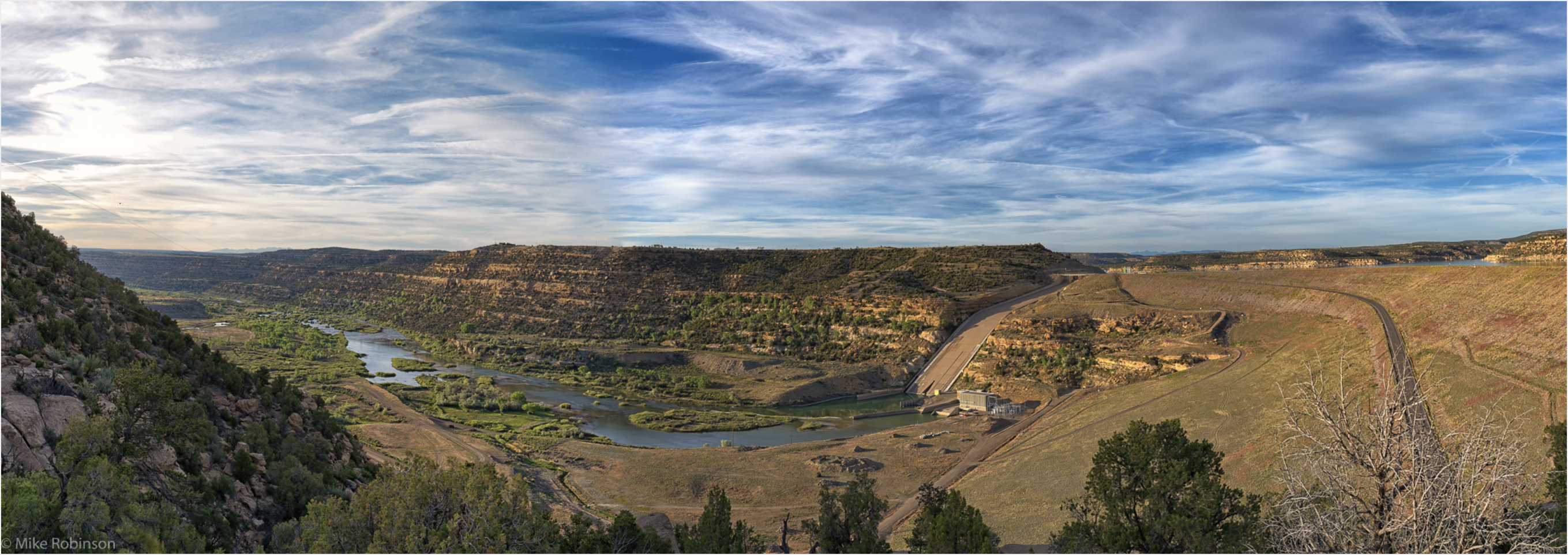
    Included in the Water Fund are the budgets for water distribution and the Water Treatment Plant and the $2.29 million debt service payment on the treatment plant.

    Water distribution

    Expenditures in the water distribution budget total almost $2.04 million, which is down some from about $2.05 million in 2017. The 2018 planned expenditures also are far below the actual expenditures of $3.92 million in 2016, which included about $1 million in plant depreciation costs.

    This budget includes: $269,143 for salaries and wages, which is up from $223,085 this year; $7,500 for overtime expenses; $350,000 for distribution system maintenance; $145,000 for wells maintenance, up by $30,000; $140,000 for meters maintenance; $2,000 for data processing; $4,500 for office supplies, down by $500 from 2017; $9,000 for fuel and oil; $15,000 for tools and equipment, down by $500; $15,000 for vehicle maintenance; $50,000 for groundwater assessments, up by $10,000; $10,000 for augmentation pond maintenance and repairs; $10,000 for Morgan County Quality Water District buyout fees; $2,000 for water conservation program; $1,800 for uncollectible accounts; $5,000 for education and training; $4,000 for engineering and consulting; $10,000 for litigation, up by $5,000 from 2017; a transfer out of $243,257 for admin support, which is up by about $1,200 from 2017; and $500,000 for replacing water meters.

    Water treatment

    Expenditures in the water treatment budget total around $3.91 million, which is down from $4.31 million in 2017. The difference is mainly coming from fewer large capital projects and half the amount of costly water purchases planned for next year.

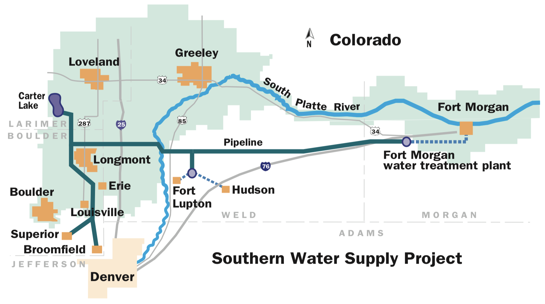
    However, the city’s NISP participation fees are more than double this year, with it set to cost $720,000 in 2018 for the city’s 9 percent stake in the project and covering the costs of Northern Water’s continued preliminary engineering work. In 2017, the city’s NISP participation cost was $360,000. City leaders have said these numbers will only go up in coming years, especially if the large water storage project does get permitted by the U.S. Army Corps of Engineers in 2019.

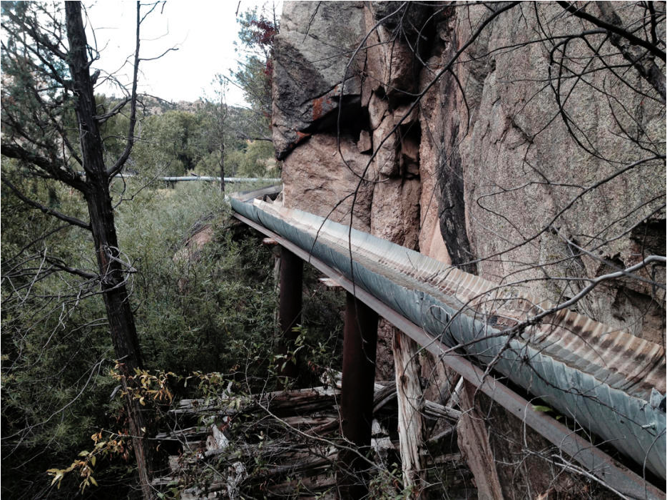
    The water treatment budget also includes: $278,959 in salaries and wages, which is up from $271,160 in 2017; $9,000 for overtime expenses, up by $3,000 from this year; a transfer for admin support of $243,438, which is up a bit from $242,262in 2017; $28,000 for outside lab services, up by $8,000 from this year; $18,000 for lab chemicals; $15,000 for data processing; $110,000 for rented water carry-over costs, down by $4,000 in 2017; $320,000 for C-BT water assessments, up by $10,000 from 2017; $200,000 for pipeline assessments, down by $6,000 from this year; $539,100 for water leases; $260,000 for treatment chemicals, up by $30,000 from 2017; $3,500 for education and training; $15,000 for dues and subscriptions; $50,000 for engineering and consulting; $500,000 for water purchases, down from $1 million in 2017; and $280,000 for participation in Northern Water building an eastern pump for the pipeline that carries C-BT water to Fort Morgan…
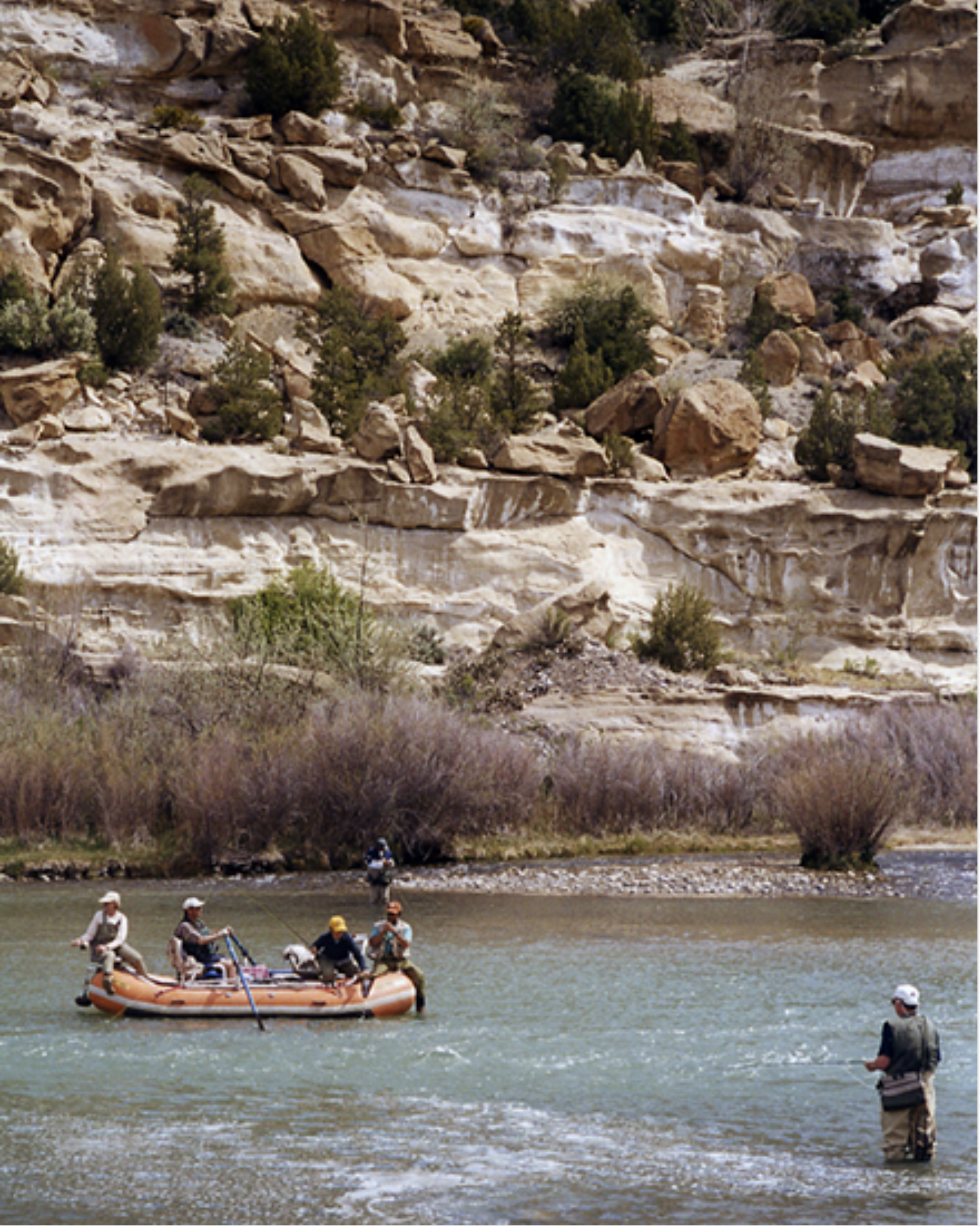
    Sewer fund

    The sewer fund totals around $2.85 million in expenditures on the same amount of projected revenue. In 2017, those numbers were $2.39 million in expenditures on about $2.42 million in revenue.

    The revenue comes mainly from city sewer rate-payers, but there are some rural rate-payers. The city also counts as sewer fund revenue the fees collected by the lab at the wastewater treatment plant, interest income, tap fees and system development fees.

    Included in the sewer fund are the budgets for the sewer/wastewater collection system and Fort Morgan Wastewater Treatment Plant. The city has paid off the treatment plant, so there are no more debt service payments to be made.

    Sewer/Wastewater Collection

    Expenditures in the sewer/wastewater collection budget total about $1.36 million for 2018, compared with about $1.07 million in 2017. The difference is mainly due to allocations for larger capital expenditures.

    This budget includes: $135,159 in salaries and wages, up slightly from $134,955 in 2017; $4,000 in overtime expenses; a transfer out of $178,165 for admin support, which is up some from $175,911 this year; $145,000 to maintain the collection system, which is down from the ramped up maintenance projects budgeted at $205,000 this year; $10,000 to maintain the lift stations; $25,000 for equipment and vehicle maintenance; $9,000 for fuel and oil; $5,000 for tools and equipment,; $20,000 for improving alley approaches; $2,500 for education and training; $2,000 for engineering and consulting; $110,000 for in-lieu of taxes costs, up from $96,000 this year; $300,000 for sewer main replacements; $60,000 toward a future specialty jet truck purchase; and $250,000 for a new sewer inspection camera and van.

    Wastewater Treatment

    Expenditures in the Wastewater Treatment Plant budget total around $1.5 million, up from $1.3 million in 2017. Contributing to that difference are increased costs for sludge removal, more expenses for testing of treated samples at an outside lab, some projected cost increase for the plant’s discharge permit and a couple of expensive capital purchases to replace some aging plant equipment.

    This budget includes: $311,003 in salaries and wages, down slightly from $312,563 in 2017; $7,500 in overtime expenses; a transfer out of $178,165 for admin support, up a bit from $175,911 in 2017; $35,000 for outside lab services, up from $22,000 this year; $30,000 for lab chemicals, up by $2,000; $20,000 for sludge removal, double the cost of 2017; $4,000 for fuel and oil, up by $1,000; $5,000 for tools and equipment; $50,000 for property maintenance; $14,800 for industrial pretreatment; $25,000 for plant chemicals; $30,000 for engineering and consulting; $3,500 for education and training; $9,000 for gauging station operation, up by $1,000; $10,000 for discharge permit, up by $1,000; $175,000 for digester aeration piping; and $250,000 to replace the plant’s east bar screen.

    Arvada water rate increase on January 1, 2018

    Water infrastructure as sidewalk art

    From The Arvada Patch (Jean Lotus):

    Water rates in Arvada will increase about 2.5 percent next year, starting in Jan., 2018, the city announced. The increase will go toward expenses running the water system in infrastructure and to bolster the city’s water supplies.

    “[Residents will] start seeing the increase on their March/April bills,” said Jim Sullivan, the city’s director of utilities in a video released by the city.

    Sullivan said the increases should add up to about 90 cents a month per average household of three-four people, totaling around $11 a year…

    The city will not be increasing rates for wastewater storm water charges, Sullivan said.

    #NE Supremes: State not liable for delivery shortages due to Republican River Compact compliance

    More than 9,000 Landsat images provide vegetation health metrics for the Republican River Basin. Credit: David Hyndman

    From The Omaha World-Herald (Joe Duggan):

    The Nebraska Supreme Court ruled Friday that the state is immune from lawsuits when compliance with the three-state river agreement reduces the amount of water available for irrigation…

    The high court upheld a district court ruling that had dismissed a lawsuit by Rodney and Steven Cappel, who own irrigated farmland in the Republican River valley in south-central Nebraska.

    The Cappels showed that from 2013 to 2015 they were blocked from using surface water by the compact because the river was too low. The landowners sued the Nebraska Department of Natural Resources, claiming a constitutional loss of property rights and violation of due process rights. They sought monetary damages and restitution.

    Hitchcock County District Judge James Doyle dismissed the lawsuit, saying the landowners did not properly state a claim for relief. The Supreme Court upheld the dismissal, although it ruled the claims couldn’t proceed because the state had not waived immunity to such lawsuits.

    #ColoradoRiver mainstem streamflow on downward trend against average in this century #COriver

    View of Lake Mead and Hoover dam. Photo credit BBC.

    From The Desert Sun (Ian James):

    After a 17-year run of mostly dry years, the Colorado River’s flow has decreased significantly below the 20th century average.

    Lake Mead, the largest reservoir in the country, now stands just 39 percent full. The level of the reservoir behind Hoover Dam has been hovering a bit above historic lows during the past year, helped by a bigger snowpack last winter and strides in water conservation.

    But with scenarios of the reservoir falling to critical lows looking very possible in the coming years, managers of water agencies in California, Arizona and Nevada have signaled their interest in finalizing a deal under which they would take less water from Lake Mead in an attempt to head off severe shortages.

    It’s not clear how much longer it might take for officials at water districts in the three states to agree on the details of the proposed Drought Contingency Plan, which they’ve been discussing since 2015. But given the enormous strains on the river, the disconnect between its flow and the amounts diverted, and the growing impacts of climate change, experts say this sort of agreement seems a necessary first step toward preparing for a hotter and drier future in the Southwest.

    “It’s great to have the structural deficit taken care of, and that’s frankly what the Drought Contingency Plan does is take care of that,” said Brad Udall, a water and climate scientist at Colorado State University. But if the flow of the river decreases more in the coming years — by say, more than 20 percent, for example — he said those measures won’t go far enough in “dealing with the conflict that will fall out of such declines.”

    In March, Udall and fellow climate scientist Jonathan Overpeck published research in which they found that reductions in the river’s flow averaged 19 percent per year between 2000 and 2014. They estimated that somewhere between one-sixth and one-half of that loss in flow was due to higher temperatures — 0.9 degree Celsius, or 1.6 degrees Fahrenheit, above the average over the previous 94 years.

    Widefield aquifer: ColoradoSPH and @coschoolofmines score grant to study health effects of aqueous film-forming foams

    Photo via USAF Air Combat Command

    Here’s the release from the Colorado School of Public Health:

    ​Researchers at the Colorado School of Public Health at the University of Colorado Anschutz Medical Campus and Colorado School of Mines received a two-year grant to investigate contamination of the drinking water in the towns of Fountain, Security, and Widefield, Colorado. Residents of these towns were exposed to drinking water contaminated with pollutants originating from aqueous film-forming foams (AFFF) used in firefighting and training activities.

    By measuring biological markers of exposure and health indicators in a sample of approximately 200 people who consumed contaminated water, this study will provide communities and scientists with an improved understanding of the biopersistence and potential health impacts of AFFF-derived poly- and perfluoroalkyl substances (PFASs). PFASs are a class of chemicals widely used in industrial and commercial applications since the 1950s.

    In July, a nine-month U.S. Air Force study verified that firefighting foam used at Peterson Air Force Base contaminated ground water and soil with PFASs at levels more than 1,000 times an Environmental Protection Agency health advisory limit for similar chemicals.

    The grant is from the National Institute of Environmental Health Sciences, a program of the National Institutes of Health. This study is being funded because of the recent discovery of the source of contamination, which has impacted the water supplies of these communities for several years.

    “This research will contribute to our understanding of the factors driving this unique exposure and how it may affect long-term health,” said Dr. John Adgate, chair of ColoradoSPH’s Department of Environmental and Occupational Health and principal investigator of the study. “We will collect the first systematic data on blood levels of these persistent compounds in this PFAS-impacted community. While exposure to PFASs has been significantly reduced due to work by the Colorado Department of Public Health and Environment and the local water utilities, our hope is that by gathering data on blood levels shortly after people’s peak exposure we can provide better answers on related health effects and potential next steps.”

    Currently, little is known about the health effects of human exposure to PFASs in areas with drinking water contaminated by AFFF, and no systematic biomonitoring has been done in these communities.

    “Because we suspect that any health effects are likely related to peak blood levels, it is important to collect the blood data and health effect information as soon as we can,” Dr. Adgate said.

    Dr. Christopher Higgins, an associate professor of civil and environmental engineering at Mines and a co-investigator for the study, will be applying advanced analytical techniques to examine the potential that a much broader suite of PFASs is present in the impacted water supplies and possibly in people’s blood.

    “By using high resolution mass spectrometry to look at both water samples and a subset of human serum samples, we hope to improve our understanding of exactly which compounds bioaccumulate in humans and how long they stick around in the human body,” Higgins said. “We will also explore the links between drinking water exposure, PFAS blood levels, and the potentially related health effects.”

    Interventions to the water system like carbon filtration and alternative water supplies recommended by state and county health departments began in early 2016 soon after discovery of the contamination. As a result, exposures to these chemicals have been significantly curtailed. One of the research team’s challenges will be to work with the water utilities and health agencies to attempt to sample water from wells representative of what people were drinking before these interventions started. The study team hopes the additional water data will be useful to CDPHE and the water utilities that have been impacted by this contamination.

    The study will also include Anne Starling, PhD​​, assistant professor of epidemiology at ColoradoSPH and Katerina Kechris, PhD​, associate professor of biostatistics and informatics​ at ColoradoSPH.

    The Fountain Creek Watershed is located along the central front range of Colorado. It is a 927-square mile watershed that drains south into the Arkansas River at Pueblo. The watershed is bordered by the Palmer Divide to the north, Pikes Peak to the west, and a minor divide 20 miles east of Colorado Springs. Map via the Fountain Creek Watershed Flood Control and Greenway District.

    From the Associated Press (Dan Elliot) via The Denver Post:

    The University of Colorado and the Colorado School of Mines said the two-year study aims to determine how much of the chemicals residents absorbed, how quickly their bodies are shedding the contaminants and what the current levels are in the water.

    The chemicals are called perfluorinated compounds or PFCs. They have been linked to prostate, kidney and testicular cancer, along with other illnesses.

    Firefighting foam containing PFCs has been used at military installations nationwide. PFCs have also been used in non-stick cookware coatings and other applications.

    The Air Force announced in 2016 it would switch to some another type of foam believed to be safer.

    PFCs were found in well water in three utility systems serving about 69,000 people in the city of Fountain and an unincorporated community called Security-Widefield south of Colorado Springs. Levels exceeded the U.S. Environmental Protection Agency’s recommended limits.

    The utilities have switched to other water sources.

    The Air Force determined the chemicals came from firefighting foam used at nearby Peterson Air Force Base.

    The new study is designed to look at large-scale impacts of the chemicals, but individual subjects will at least learn what their contamination levels are and can talk to their health care providers about it, said John Adgate, the principal investigator…

    Although the study is planned for just two years, with sufficient funding it could be turned into longer-term project, he said.

    “There are no strong studies on the long-term health effects of these compounds,” Adgate said.

    The Colorado study is funded by an initial grant of about $247,000 from the National Institutes of Health.

    Petersen Air Force Basin Colorado Springs, Colorado. Photo credit: MilitaryBases.com.

    From The Colorado Springs Gazette (Tom Roeder):

    Approval for the study of residents in Fountain, Security and Widefield was announced Thursday by the Colorado School of Public Health at the University of Colorado Anschutz Medical Campus and the Colorado School of Mines. It will examine how perfluorinated compounds, a class of chemicals contained in the foam, have impacted the health of a small group of residents…

    Water providers have added filters and have switched to untainted sources since the contamination was revealed, but perfluorinated compounds are known to stay in the human body for decades after they’re consumed…

    The $275,000 local study comes after Congress approved a wider national effort as part of a military policy bill this month. The national study will help federal officials understand contamination reported near military bases around the nation that used the firefighting foam. Used to fight fuel fires, the chemical-laden foam was finally removed from Peterson Air Force base last year.

    The Air Force had been studying its toxic qualities since the Carter administration.

    Studies by the Air Force as far back as 1979 demonstrated the chemicals were harmful to laboratory animals, causing liver damage, cellular damage and low birth weight of offspring.

    The Army Corps of Engineers, considered the military’s leading environmental agency, told Fort Carson to stop using the foam in 1991 and in 1997 told soldiers to treat it as a hazardous material, calling it “harmful to the environment.”

    In 2000, the EPA called for a phaseout of the chemicals and later declared they were “likely to be carcinogenic to humans.”

    The Air Force plans more groundwater studies at Peterson Air Force Base next year as the Colorado Department of Health and Environment considers setting a groundwater limit for the chemical in the Widefield aquifer. The limit would be 70 parts per trillion – that’s a shot glass of the chemical in 107 million gallons of water.

    From KOAA.com:

    “What’s unknown here is what are the long term health consequences of exposure to these compounds and this study will begin to look at that,” Dr. John Adgate, principal investigator of the study at the Colorado School of Public Health said.

    After drinking water was tainted in the Security, Widefield and Fountain areas a year and a half ago which reports link to Peterson Air Force Base firefighting foam, many wondered if this could make them sick.

    “The things that we’re going to look at are some live enzyme tests and also some markers of immune function,” Dr. Adgate said…

    On Thursday, his research team announced they got the green light on funding for the two-year study.

    “I’m happy, I’m excited that we get to do the work, I know people are concerned,” he said. “It’s an opportunity to do something that’s important for public health in the state of Colorado and these folks in particular in Fountain, Security and Widefield.”

    He’s hoping to find out how persistent these compounds are in a group of 200 volunteers, all people from across the three affected areas.

    “Measure both their blood levels and collect some household water and look at the relationship between that and where they live, how long they’ve lived there and some markers of health effects,” he said.

    And regardless of the outcome of the study, he says the first order of business is making sure people are no longer being exposed.

    “Trying to offer them what we can in terms of interventions that assure that and answer other questions for example, can we grow vegetables with this?” he said.

    Researchers will start looking for that pool of 200 volunteers in the first half of 2018, focusing on long-term residents.

    They’re expecting to hold more public meetings to hear from the community before they move forward with signing up volunteers.</blockquote

    Widefield aquifer via the Colorado Water Institute.

    Dacono: Benzene tainted groundwater removed at site of tank battery

    From The Boulder Daily Camera (Jennifer Kovaleski):

    According to a report to the Colorado Oil and Gas Conservation Commission, the state agency responsible for regulating the industry, Anadarko discovered the contaminated ground water and soil while trying to dig up an old pump in early December.

    Anadarko had to remove 200 barrels of tainted ground water, and lab tests found benzene 900 times the amount allowed by the state…

    A spokeswoman for Anadarko said the company is in the process of removing a tank battery at the site and that’s how they discovered the toxic ground water.

    COGCC said it is still conducting tests to figure that whether nearby water wells were contaminated, but said these types of releases usually don’t go beyond the immediate area.

    Idaho Springs approves 2018 budget — The Clear Creek Courant

    Idaho Springs photo credit by Priscila Micaroni Lalli (prilalli@gmail.com) – File:Montanhas Idaho Springs, CO.jpgFirst derivative version possibly by Dasneviano (talk).Second derivative version by Avenue (talk)., CC BY-SA 2.5, https://commons.wikimedia.org/w/index.php?curid=6871667

    From The Clear Creek Courant (Ian Neligh):

    Greenway

    The city received $2 million in Great Outdoors Colorado funding this year to put toward building a greenway trail through the city, according to Marsh.

    “Bottom line is with the $2 million grant, the greenway will be completed,” Marsh said. “When the construction is done, the greenway will be completed from exit 239 on the west end of the city all the way to the roundabout.”

    The city is planning and looking for additional grant funding to complete the greenway trail from the roundabout on the east end of town to near the Veterans Memorial Tunnels…

    Other road projects

    Marsh said other road projects the city will be taking next year include reconstructing Soda Creek Road and the portion of Miner Street near the Visitors Center, with the help of a 1 percent sales-tax boost approved by city residents in 2014.

    “This project will be the first big project we’re doing from the 1 percent street sales tax approved by voters,” Marsh said. “We’re not only just doing the street, but we’re also redoing water and sewer lines, storm sewer, and it also includes part of the project cost (that) will be offset by a ($250,000) grant we received from (the Colorado Department of Local Affairs) for the water and sewer infrastructure.”

    […]

    Additional projects

    The city is also working on expanding its wastewater treatment plant, which won’t begin construction until 2019. However, planning will begin in 2018.

    “And we’re hoping to use a combination of city funds, loans through the state and grants to make this project happen,” Marsh said.

    Clear Creek watershed map via the Clear Creek Watershed Foundation

    Comment period starts for Hanging Lake formal draft Environmental Assessment

    Hanging Lake: By Joshuahicks at the English language Wikipedia, CC BY-SA 3.0, https://commons.wikimedia.org/w/index.php?curid=3074147

    From The Glenwood Springs Post Independent (John Stroud) via The Aspen Times:

    The U.S. Forest Service has released its formal draft Environmental Assessment (EA) for the Hanging Lake area, kicking off a final 30-day public comment period before the plan is to be implemented next May, the agency announced today.

    The proposed management plan sticks to a permit-only, 615-visitor-per-day cap year round, as detailed in the preliminary plan that was released in August. It also establishes a fee-based, reservation-system shuttle service to be implemented during the peak time of year from May through October.

    Forest officials, working with the city of Glenwood Springs, the Colorado Department of Transportation and others, have bee studying ways to better manage Hanging Lake in Glenwood Canyon in the face of increasing crowds at the popular area.

    The management plan seeks to protect the natural resources and fragile ecosystem of the lake and the trail that provides access to the area from the effects of high use.

    “In 2017, we saw 184,000 visitors at Hanging Lake, which is a 23 percent increase in only one year,” Eagle-Holy Cross District Ranger Aaron Mayville said in a news release announcing the draft plan. “This data further underscores the importance of the long-term management solution, and I’m happy we’re making good progress with this Environmental Assessment.”
    He said the proposed plan would benefit the fragile ecology of the area by limiting soil compaction, improving soil health, plant viability, stream health and wildlife habit.

    #Drought news: #Snowpack suffering across the West

    Click here to go to the US Drought Monitor website. Here’s an excerpt:

    Summary

    Snow fell across most of the Northeast, but it was dry across most of the contiguous United States, with much of the country receiving less than 0.10 inch of precipitation and many areas receiving nothing at all. Part of the South, from eastern Texas to western Alabama, did receive more than an inch of rain, with locally heavier amounts, which helped improve dry conditions. Temperatures were generally below average across the eastern third of the U.S. and above average across most of the western two-thirds. Warmth was notable in eastern Montana and the Dakotas where temperatures were up to 20°F above normal. It was around 5-10°F above normal in the central U.S., an area that continued to see dry conditions this past week. In general, drought expanded across parts of the West, Southern Plains, Midwest, Southeast, and Mid-Atlantic and contracted across part of the South…

    High Plains

    Light precipitation spread across the northern-tier states as a surface front passed through southern Canada and the Northern High Plains. However, the region mostly remained dry during the week. Abnormally dry conditions continued to expand across western Nebraska, reaching into southeastern Wyoming. The entire state of Kansas was now experiencing some level of abnormal dryness or drought…

    West

    Heavy snow fell over the Cascades and, after an extended period of dry weather, widespread accumulating snow fell over the central and northern Rockies. However, other areas continued their dry pattern. With below-average precipitation, abnormally dry conditions spread farther west and northwestward in northern Utah. The dry pattern across the Intermountain West region continued to persist. Snowpack in southern Colorado has dropped below 50% of normal for the season to date, and snowpack in southern Utah, Arizona, and New Mexico was less than 20% of normal. Across the western slopes of Colorado and southern Utah, the dry conditions were a continuation of a trend since early in the summer, leading to the introduction of severe drought (D2) from the southern Wasatch Range and La Sal Range as well as the southern portion of the lower elevation in between. Moderate drought (D1) expanded eastward in western Colorado where there was generally less than 60% of normal snowpack for the cold season to date and temperatures have been much warmer than normal in November and early December. Additionally, abnormally dry conditions expanded in eastern Moffat County and Routt County, and in Summit County and southern Grand County. Snowpack for the water year to date was in the 10th percentile or below at Summit Ranch, Copper Mountain, and Berthoud Summit (Colorado). The footprint of moderate drought expanded west across La Paz County in southwestern Arizona into eastern San Bernardino and Riverside Counties in California…

    Looking Ahead

    Over the next week, beginning Tuesday December 19, a good deal of much needed precipitation is forecast to fall across much of the South and the eastern United States. A swath from eastern Texas to North Carolina, most of Kentucky, and southern Virginia are expected to receive between two and six inches of precipitation. Heavy precipitation is also forecast for the Pacific Northwest, northern Idaho, western Montana, and parts of the Northeast. Dry conditions will likely continue across the Southwest and parts of the southern Plains, where drought conditions already prevailed. Warm temperatures in the South at the beginning of the week will be replaced by cold air sliding down from the north. Looking further ahead at NOAA’s Climate Prediction Center (CPC) 6-10 day Outlook (December 24-28), the probability of dry conditions are highest in the Northwest and Midwest, while wet conditions may occur over New Mexico, southeastern Colorado, and Texas, and stretching across the much of the South and along the East Coast. During this period, below-average temperatures are expected over nearly the entire contiguous U.S., except for parts of the Mid Atlantic along the coast and the Southeast, including Florida. Looking two weeks out (December 26 – January 1), the cold temperatures are expected to continue, except in Florida and the Southwest. The probability of above-average precipitation is highest over part of Montana and Texas, while below-average precipitation is most likely in the Northwest and much of the northern U.S. from the Northeast to the eastern Dakotas.

    Westwide SNOTEL basin-filled map December 21, 2017 via the NRCS.

    How The ‘Grand’ Became The ‘Colorado’ And What It Says About Our Relationship To Nature — @KUNC

    Prior to 1921 this section of the Colorado River at Dead Horse Point near Moab, Utah was known as the Grand River. Mike Nielsen – Dead Horse Point State Park

    Here’s a report from Luke Runyon writing for KUNC. Click through and read the whole article. Here’s an excerpt:

    Until 1921, the Colorado River didn’t start in the state that bears the same name. It began in Utah, where the Green River from Wyoming and the Grand River from Colorado met. The story of how the Colorado River finally wended its way into the state of Colorado less than a century ago is a lesson in just how fickle our attitudes toward nature can be.

    The names we give to places, mountain tops, rivers and vast stretches of land shape how we feel about them. Names are full of meaning, powerful symbols to rally behind or fight against. Conflicts over the names of neighborhoods and mountains aren’t uncommon. They’re attempts to correct wrongs of the past and reflect present day realities.

    Turn of the century Democratic Colorado congressman and avowed booster Edward Taylor knew that names matter. So much so that he made the Grand River’s renaming a personal cause.

    A U.S. Bureau of Reclamation illustration shows the river’s varying names prior to 1921. The Colorado River began from the confluence of the Green River and Grand River, a fact that irked Colorado congressman Edward Taylor.
    CREDIT LIBRARY OF CONGRESS ARCHIVES

    The Grand River just didn’t cut it. Edward Taylor wanted the Colorado River — the same river that cut the Grand Canyon — to extend into his district and flow near his constituents. He wasn’t going to let Utah or Wyoming lay claim to the river’s headwaters, despite the fact that the Green River is the larger drainage basin. Undeterred, and backed up with statistics that showed the shorter Grand River contributing more water to the Colorado River, he took on the river’s renaming as a personal crusade in Washington, D.C.

    […]

    On July 25 of that year the House of Representatives made the name change official with the passage of a joint resolution. A little more than a year later, the Colorado River Compact was finalized. It’s the river’s guiding document that apportions its water to some of the driest states in the country. Without a doubt, actions taken in the early 1920s established rules, policies and naming conventions that shape how we think about the Colorado River today.

    Vestiges of the Grand River are still in place. The Grand Ditch pulls water from the Colorado River’s headwaters to the state’s eastern slope. Grand Junction, Colo. got its name from the confluence of the Gunnison and Grand Rivers. Colorado’s Grand County still bears the moniker. So does the town of Grand Lake.

    They’re remnants of an old name, a label Coloradans and members of Congress a hundred years ago discarded. And if there’s a lesson in Edward Taylor’s effort, it is that all it takes is one relentless person and a willing constituency to think of a natural space in a whole new way, and change its name.

    Dead Horse State Park panorama via the State of Utah.

    @UW: Fish to benefit if large dams adopt new operating approach

    Here’s the release from the University of Washington (Michelle Ma):

    Dams and fish have never been best friends.

    The San Juan River’s Navajo Dam and reservoir above.U.S. Bureau of Reclamation

    Thousands of dams built along U.S. rivers and streams over the last century now provide electricity for homes, store water for agriculture and support recreation for people. But they also have significant downstream impacts: They reduce the amount and change the timing of flowing water that fish rely on for spawning, feeding and migration.

    Recognizing that many large dams are here to stay, a University of Washington team is investigating an emerging solution to help achieve freshwater conservation goals by re-envisioning the ways in which water is released by dams. The hope is that “designer flows” downstream from dams can be tailored to meet the water needs of humans while simultaneously promoting the success of native fishes over undesirable invasive fish species.

    The team’s approach is described in a paper appearing Dec. 18 in Nature Communications.

    “Rapidly changing water availability demands new dam management strategies to deliver water downstream that balances human and ecosystem needs,” said senior author Julian Olden, a UW professor of aquatic and fishery sciences. “So, the question is whether designer flows can be engineered to meet human water demands, and take advantage of mismatches between native and nonnative species’ responses to flow to provide the greatest conservation benefit.”

    The Navajo Dam on the San Juan River.Photo credit Mike Robinson via the University of Washington.

    The researchers examined the designer flow concept in the San Juan River, a major tributary to the Colorado River that flows through parts of Utah, Colorado, Arizona and New Mexico. Every drop of water is significant in this arid landscape, and along the river’s roughly 380-mile length, the mighty 402-foot Navajo Dam is impossible to ignore. The river is home to at least eight native fish species, but over the years a number of invasive fish species have also taken up residence, including predatory channel catfish, red shiner and common carp.

    By integrating multiple decades’ worth of data about dam operations, river hydrology and fish species abundance into a multi-objective model, the researchers were able to identify specific water-release schedules that benefitted native fish over the invasive fish — while still ensuring that all of the domestic and agriculture needs that rely on the San Juan River’s water are met.

    “We were also pleased to discover that our model predicts that the ecological benefits of designer flow releases do not evaporate during times of drought,” Olden said.

    This method can guide water management in any river with large dams, Olden said. It’s particularly relevant in more arid regions of the American Southwest where water is at a premium, but major rivers like the Columbia or the Mississippi, which are similarly peppered with dams, also could have their dams programmed to release water in ways that aim to benefit both humans and freshwater ecosystems.

    The key to the researchers’ approach is capitalizing on the fact that invasive fishes have only a recent evolutionary history in these river systems. Consequently, important life events of invasive fishes — such as spawning and habitat use — show slightly different relationships to patterns in streamflow compared with native fishes. The designer flows in their study exploited these small differences to identify dam releases during certain times of the year that would benefit native fishes and be detrimental to invasive fishes.

    These tailored water releases are not trying to mimic the natural flow of a river before it was dammed, but rather emphasize the most important flow events for native fish in an altered river system, the researchers explained. According to their model, water releases in the San Juan River should occur in late winter, late summer and mid-autumn to get the best outcomes for native fishes over invasive ones.

    Fly fishers on the San Juan River below the Navajo Dam.U.S. Bureau of Reclamation

    While both designer and natural flows were predicted to be beneficial for native fishes, they found that designer flows could lead to double the loss of invasive fishes in the river, compared with a dam-release scenario that mimicked natural water flows, before the dam existed. Occasionally, dammed rivers will flush a deluge of water downstream, attempting to mimic natural river flows — but with mixed success for fish. This study suggests that such efforts could be better optimized.

    This work is still in the modeling phase, and the researchers want to look next at how these water-release practices could potentially benefit other aspects of dammed river systems, such as restoring shoreline vegetation, benefiting aquatic insects and even bolstering river recreation by manipulating the water releases to encourage formation of large sandbars. Ultimately, the researchers hope to test their designer flows in a real river system, in cooperation with dam operators, engineers and water users.

    “Let’s be honest: Carefully tweaking dam operations all year round to implement a designer flow regime would require a giant leap of faith, but anything new we do in water resource management involves some risk,” Olden said. “If we don’t try, we’ll never know how much better we actually could do.”

    The paper’s lead author is William Chen, a recent graduate of the UW’s School of Aquatic and Fishery Sciences and the Quantitative Ecology and Resource Management Program.

    The study was funded by the National Science Foundation’s Graduate Research Fellowship Program and Olden’s H. Mason Keeler Endowed Professorship.