Click here to go to the US Drought Monitor website. Here’s an excerpt:
Summary
Snow fell across most of the Northeast, but it was dry across most of the contiguous United States, with much of the country receiving less than 0.10 inch of precipitation and many areas receiving nothing at all. Part of the South, from eastern Texas to western Alabama, did receive more than an inch of rain, with locally heavier amounts, which helped improve dry conditions. Temperatures were generally below average across the eastern third of the U.S. and above average across most of the western two-thirds. Warmth was notable in eastern Montana and the Dakotas where temperatures were up to 20°F above normal. It was around 5-10°F above normal in the central U.S., an area that continued to see dry conditions this past week. In general, drought expanded across parts of the West, Southern Plains, Midwest, Southeast, and Mid-Atlantic and contracted across part of the South…
High Plains
Light precipitation spread across the northern-tier states as a surface front passed through southern Canada and the Northern High Plains. However, the region mostly remained dry during the week. Abnormally dry conditions continued to expand across western Nebraska, reaching into southeastern Wyoming. The entire state of Kansas was now experiencing some level of abnormal dryness or drought…
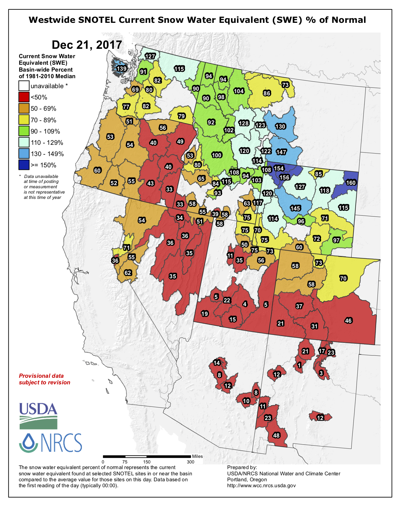
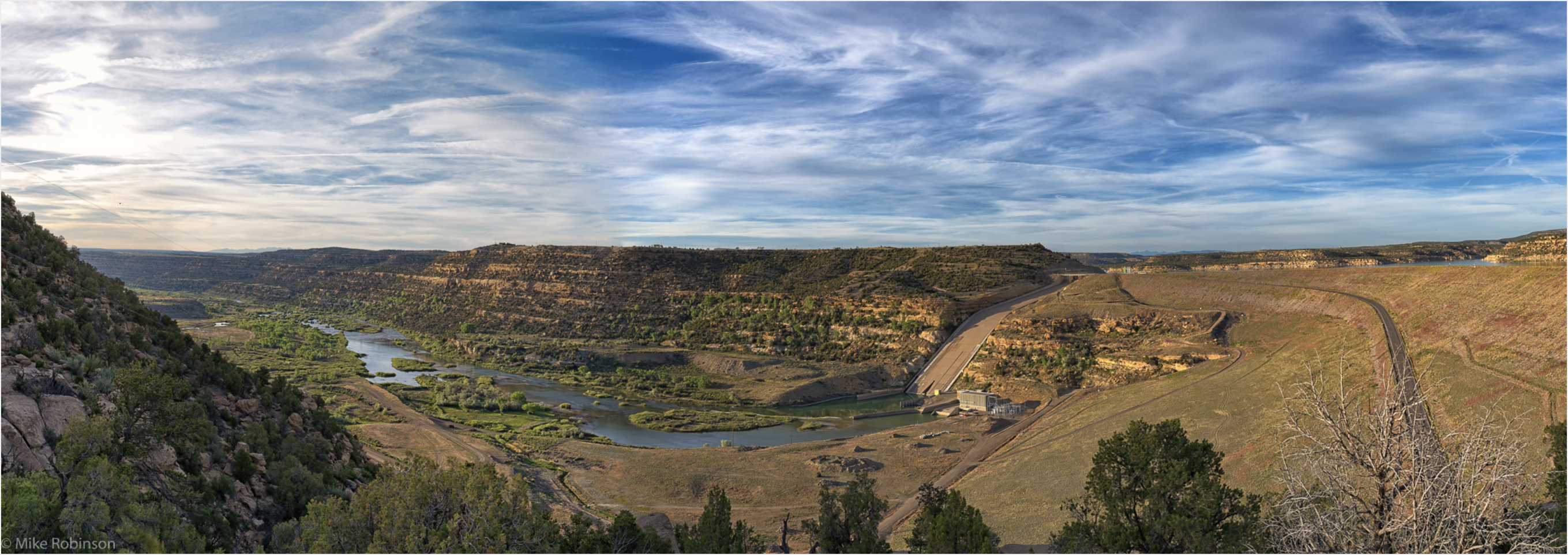
West
Heavy snow fell over the Cascades and, after an extended period of dry weather, widespread accumulating snow fell over the central and northern Rockies. However, other areas continued their dry pattern. With below-average precipitation, abnormally dry conditions spread farther west and northwestward in northern Utah. The dry pattern across the Intermountain West region continued to persist. Snowpack in southern Colorado has dropped below 50% of normal for the season to date, and snowpack in southern Utah, Arizona, and New Mexico was less than 20% of normal. Across the western slopes of Colorado and southern Utah, the dry conditions were a continuation of a trend since early in the summer, leading to the introduction of severe drought (D2) from the southern Wasatch Range and La Sal Range as well as the southern portion of the lower elevation in between. Moderate drought (D1) expanded eastward in western Colorado where there was generally less than 60% of normal snowpack for the cold season to date and temperatures have been much warmer than normal in November and early December. Additionally, abnormally dry conditions expanded in eastern Moffat County and Routt County, and in Summit County and southern Grand County. Snowpack for the water year to date was in the 10th percentile or below at Summit Ranch, Copper Mountain, and Berthoud Summit (Colorado). The footprint of moderate drought expanded west across La Paz County in southwestern Arizona into eastern San Bernardino and Riverside Counties in California…
Looking Ahead
Over the next week, beginning Tuesday December 19, a good deal of much needed precipitation is forecast to fall across much of the South and the eastern United States. A swath from eastern Texas to North Carolina, most of Kentucky, and southern Virginia are expected to receive between two and six inches of precipitation. Heavy precipitation is also forecast for the Pacific Northwest, northern Idaho, western Montana, and parts of the Northeast. Dry conditions will likely continue across the Southwest and parts of the southern Plains, where drought conditions already prevailed. Warm temperatures in the South at the beginning of the week will be replaced by cold air sliding down from the north. Looking further ahead at NOAA’s Climate Prediction Center (CPC) 6-10 day Outlook (December 24-28), the probability of dry conditions are highest in the Northwest and Midwest, while wet conditions may occur over New Mexico, southeastern Colorado, and Texas, and stretching across the much of the South and along the East Coast. During this period, below-average temperatures are expected over nearly the entire contiguous U.S., except for parts of the Mid Atlantic along the coast and the Southeast, including Florida. Looking two weeks out (December 26 – January 1), the cold temperatures are expected to continue, except in Florida and the Southwest. The probability of above-average precipitation is highest over part of Montana and Texas, while below-average precipitation is most likely in the Northwest and much of the northern U.S. from the Northeast to the eastern Dakotas.