Click on a thumbnail graphic below to view a gallery of drought data from the US Drought Monitor.


Click here to go to the US Drought Monitor website. Here’s an excerpt:
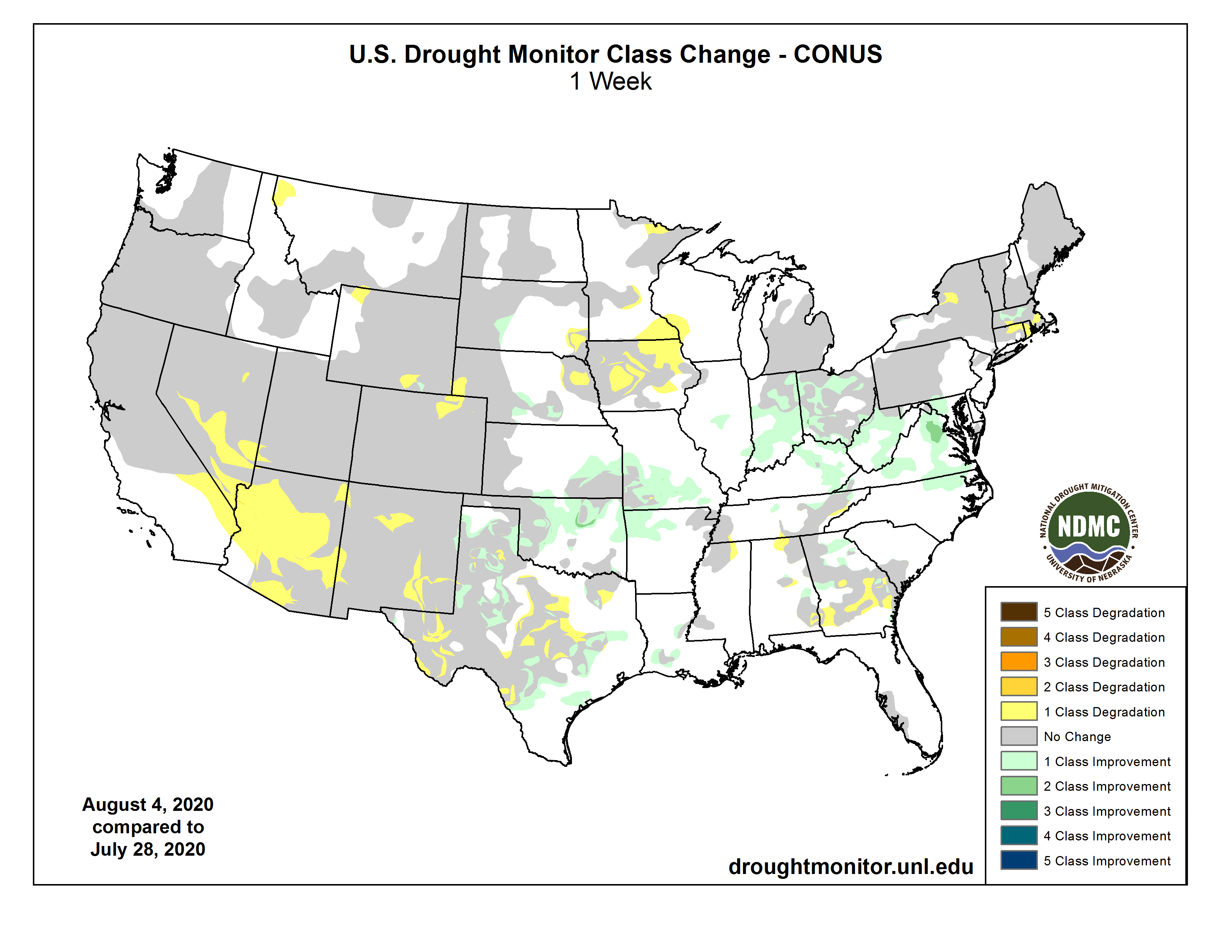
This Week’s Drought Summary
As Tropical Storm Isaias churned through the northern Caribbean and then northward along the east coast of the United States, an active pattern from the central Plains through the Midwest also brought precipitation with it. Temperatures were cooler through the center of the country, with departures of 6 to 8 degrees below normal in Kansas and Oklahoma while temperatures were well above normal in the Northwest, Southwest and from the Mid-Atlantic up into New England. Several areas broke or tied temperature records for the month: Phoenix had their all-time warmest month ever with an average temperature of 98.9 degrees and Tucson also had their warmest July ever at 91.5 degrees, breaking the previous warmest July by almost a full degree (90.6 degrees in 2005). Sitka, Alaska reached 88 degrees on July 31, tying an all-time record high originally set on July 30, 1976. Richland, Washington recorded 113 degrees on July 30, tying an all-time record high first achieved on August 5, 1961…
Cooler than normal temperatures helped to slow down some of the drought development in the region this week. Temperatures were generally 2-4 degrees below normal, with pockets in Kansas that were 6-8 degrees below normal. Precipitation was mixed as areas of eastern Kansas, eastern Wyoming, central South Dakota, south central and southwest Nebraska and far southwest Kansas all had above-normal precipitation for the week with thunderstorm activity. Improvements to the moderate drought and abnormally dry conditions were made in southeast Kansas and central Nebraska. Moderate drought was expanded in the Nebraska panhandle and northeast Colorado while abnormally dry conditions were introduced here as well. A new area of severe drought was added in eastern Nebraska in response to dryness that has lingered in the region since last fall. Moderate drought was expanded in southeast Wyoming and abnormally dry conditions were expanded in northwest Wyoming…
Well above normal and record-setting temperatures continued in the region, with many areas 2-4 degrees or more above normal for the week. Much of the region was dry for the week with only some spotty precipitation in places; the bulk of the precipitation was in eastern New Mexico and southwest Colorado as the monsoon brought some relief to this region. The hot and dry conditions allowed for a full category degradation over much of Arizona and into portions of southern Nevada and southern California. Even with the rains in New Mexico, the issues related to drought continued and further degradation was shown in the north and southeast portions of the state this week as a mix of both short and long-term issues continue…
In typical summer fashion, precipitation was spotty through the region, with Oklahoma and Arkansas and into northern Texas recording the most widespread precipitation this week. Portions of the Texas panhandle and central into west Texas as well as eastern Arkansas and into Mississippi remained dry this week. Temperatures were 2-4 degrees below normal in Arkansas, Louisiana, western Mississippi, east Texas and north Texas. Portions of central Oklahoma were 6-8 degrees below normal for the week while much of west Texas was normal to 4-6 degrees above normal. Almost a full category improvement was made from central Oklahoma into northwest Arkansas in response to both the cooler temperatures and above-normal precipitation. Areas of southeast Texas were improved with both abnormally dry and moderate drought reduced. Areas of central and west Texas had degradation with an expansion and introduction of extreme drought in this region. Continued improvement occurred over the panhandle of Texas where rains have helped local conditions while neighboring counties saw degradation. Abnormally dry conditions were improved in Louisiana but were expanded in northern Mississippi…
Looking Ahead
Over the next 5-7 days, it is anticipated that the West remains dry with only light precipitation over portions of New Mexico and southeast Arizona and into the coastal regions of the Pacific Northwest. The greatest precipitation is anticipated over the Midwest and areas from Florida north along the East coast. Temperatures during this time will be warmest over the West with departures of 3-6 degrees above normal widespread over the Southwest and into the Rocky Mountains. Cooler than normal temperatures are projected over the lower Mississippi Valley with departures of up to 3 degrees below normal.
The 6-10 day outlooks show the greatest likelihood of above-normal temperatures over the areas east of the Rocky Mountains, with the greatest probabilities over southern New Mexico and the Great Lakes. There are also above-normal chances of below-normal temperatures over the west coast and into the Great Basin. The greatest chances of above-normal precipitation are over the eastern half of the country, centered on the Midwest, and also over the Pacific Northwest. The highest chances of below-normal precipitation are centered over Colorado and New Mexico and dominating the Rocky Mountain states and into the Plains.