As pressure to regulate #YampaRiver continues, locals raise cash to aid compliance effort — @WaterEdCO #ColoradoRiver #COriver #aridification #GreenRiver

Scott Hummer, water commissioner for District 58 in the Yampa River basin, checks out a recently installed Parshall flume on an irrigation ditch. Hummer said most water users in the Yampa are complying with a state order issued nearly a year ago that requires measuring devices. Photo credit: Heather Sackett/Aspen Journalism

From the Fresh Water News (Jerd Smith):

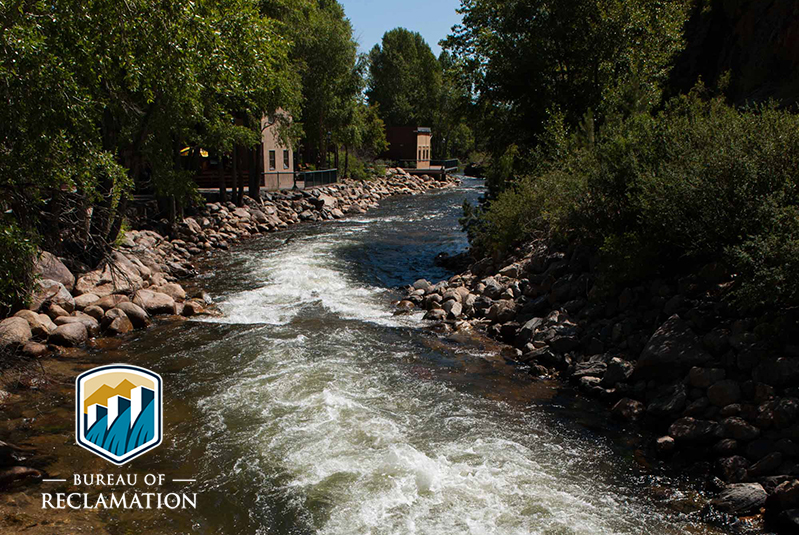
Nearly one year after the state ordered Yampa River water users to begin measuring their diversions from the iconic river, local community groups have raised more than $200,000 to help cash-strapped ranchers and others install the devices needed to comply with the law.

According to Erin LIght, the top water regulator in the region, roughly 60 percent of diversion structures, about 1,760 in total, remain out of compliance in what is known as Colorado’s Water Division 6, which includes the Yampa, North Platte, White and Green river basins.

Under state law, water users who do not measure their diversions can be subject to prosecution and have access to their water rights suspended, something the state has threatened to do but has not yet implemented.

Local groups, including the Upper Yampa Water Conservancy District and the Yampa/White/Green Basin Roundtable, have stepped up to help, creating a $200,000 grant fund to ensure those who are trying to comply can afford to do so.

“Everyone is interested in getting the best infrastructure we can into the river,” said Holly Kirkpatrick, who is overseeing the grant program for the conservancy district. “A lot of different organizations are working very hard on this.”

The Yampa River Fund, spearheaded by The Nature Conservancy, also plans to step in with funding should the need arise.

“I envision that there will be a request for funding,” said fund manager Andy Baur, “and we are here to help.”

This remote region in the northwest corner of the state for decades has had so much water that regulators rarely had to step in to ensure the rivers’ supplies were being properly distributed in accordance with state water law, something it does routinely in Colorado’s other major river basins. But as water shortages loom in the state, the Yampa is coming under increasing scrutiny.

“People need to understand that if we find ourselves in another administrative situation [where the Yampa runs dry as it did in 2018], people need to know they will be shut off,” said Light, who oversees the region for the Colorado Division of Water Resources.

The picture is much different than even 20 years ago, when Yampa Valley ranchers and other water users with water rights were often able to divert as much as they wanted whenever they wanted because the river had huge flows and relatively few demands.

Light, who oversees the Yampa and North Platte basins, as well as the Green and White river sub-basins, said the White River region has the most work to do to comply with the state’s order, with 83 percent, or 596, of its diversion structures taking water that is not being measured.

On the Yampa River, 50 percent of diversion structures, or 900, remain unmeasured, Light said. In the North Platte, 34 percent, or 190, lack measuring devices, while in the Green 74, or 69 percent, of devices remain unmeasured, Light said.

Because the White and Green sub-basins are so remote, and installing measuring devices can cost thousands of dollars, Light said she is giving water users there another year to comply with the order.

At the same time, she said she has granted more than 100 extensions to water users who are trying to comply to give them more time to find funds and get the work done.

Light said she is hopeful ranchers and others will begin to understand that measuring is no longer optional, and that those who begin recording their water use will have new opportunities as the entire Colorado River system, to which the Yampa, White and Green rivers are tributary, moves into a water-short future.

Under at least one scenario now being studied, a large, statewide conservation program called demand management would pay ranchers and others to voluntarily forego their water diversions for a period of time. Options to receive payment for suspending use would only be available to those who have diversion records that demonstrate how much water they’ve historically used.

“If someday we have an opportunity to [temporarily] dry up lands under a demand management program, their [actual water] use will be greatly in question because they have not measured their water. As demands get higher in the Colorado River, it’s going to behoove them to measure,” Light said.

Jerd Smith is editor of Fresh Water News. She can be reached at 720-398-6474, via email at jerd@wateredco.org or @jerd_smith.

Yampa River Basin via Wikimedia.

Diane Mitsch Bush touts experience in U.S. House race

From The Montrose Daily Press (Katharhynn Heidelberg):

Says her leadership can help bring jobs and tame health care costs

Congress needs to take action on soaring health care costs, a faltering economy and public lands, Democratic candidate for the 3rd Congressional District Diane Mitsch Bush said.

Mitsch Bush, a former Routt County commissioner who also served in the State House from 2013-2017, is making her second bid for the U.S. House. She faces Republican nominee Lauren Boebert, who defeated a five-time incumbent for her party’s nod.

“At the very whole-nation level, our democracy is clearly in some danger,” Mitsch Bush said Thursday. “We need for us, the people of the 3rd Congressional District, a representative who has the experience to lead. We need a representative who actually listens to us, looks at the data and the evidence, and really knows how to legislate. This is not a time to have inexperience.”

The current COVID-19 pandemic, which has killed more than 170,000 Americans and spawned an economic downturn, is only the most current crisis, she said, citing fires and the past recession. Dealing with those issues requires leadership and bipartisanship, she also said.

“I have those skills. I want to use my skills at bringing people together across the aisle,” Mitsch Bush said…

People in the 3rd District have to spend a lot to obtain health coverage and prescription medication, she said. In Montrose County, few insurance carriers offer plans on the state’s public health exchange, where people without coverage can purchase it. The exchange also provides subsidies for those who qualify.

Mitsch Bush said she will work to reduce premiums, deductibles and prescription drug costs; end surprise medical billing practices; allow Medicare to negotiate drug prices and increase coverage for mental health.

“Health care costs here are just so difficult for people. We pay some of the highest premiums in the country,” she said.

Boundaries for Colorado’s 3rd United States Federal Congressional District. By 1: GIS (congressional districts, 2013) shapefile data was created by the United States Department of the Interior. 2: Data was rendered using ArcGIS® software by Esri. 3: File developed for use on Wikipedia and elsewhere by 7partparadigm. – GIS shapefile data created by the United States Department of the Interior, as part of the "1 Million Scale" geospatial data project. Retrieved from: http://nationalatlas.gov/atlasftp-1m.html?openChapters=#chpbound, Public Domain, https://commons.wikimedia.org/w/index.php?curid=32797497

@USBR launches prize competition to improve streamflow forecasting

Streamflow Forecasting Prize Competition.

Here’s the release from the Bureau of Reclamation (Peter Soeth):

The Bureau of Reclamation is launching a prize competition to improve short-term streamflow forecasts. Evolving data science such as artificial intelligence, machine learning and high-performance computing are starting to be used in streamflow forecasting. The Streamflow Forecast Rodeo competition seeks to spur innovation using these technologies.

Reclamation is making up to $500,000 available through this prize competition.

“Streamflow forecasts are integral to managing water,” said Reclamation Commissioner Brenda Burman. “Finding improvements to forecasting will allow water managers to better operate their facilities for high flows, mitigate drought impacts and maximize hydropower generation.”

This competition delivers on the Department of the Interior and Reclamation’s commitment to improve water availability. It also supports the goals of the President’s memo on Promoting the Reliable Supply and Delivery of Water in the West.

The competition will begin with a “pre-season” in August, followed by a year of real-time forecasting beginning October 1, 2020. The pre-season will allow competitors to build and refine their forecast methods. The real-time forecasting competition will have solvers forecast streamflow for the next 10 days, updated daily at multiple locations across the West, for the duration of the competition.

Reclamation is partnering with the CEATI International’s Hydropower Operations and Planning Interest Group, NASA Tournament Lab and Topcoder on this crowdsourcing competition. Partnering with CEATI HOPIG includes a companion project that will provide benchmarks against which the competitors will be evaluated, as well as scoring of solver forecasts by RTI International. Other CEATI HOPIG members making contributions include Department of Energy’s Water Power Technologies Office, Tennessee Valley Authority, Hydro-Quebec, and Southern Company. To learn more about this competition, please visit https://www.usbr.gov/research/challenges/streamflowrodeo.html.

Reclamation conducts prize competitions to spur innovation by engaging a non-traditional, problem-solver community. Through prize competitions, Reclamation complements traditional design research to target the most persistent science and technology challenges. It has awarded more than $1,000,000 in prizes through 22 competitions in the past 6 years. Please visit Reclamation’s Water Prize Competition Center to learn more.

@Audubon Conservation Ranching Webinar: An Emerging Land Ethic, September 3, 2020 — @AudubonRockies

Western Meadowlark, Pronghorn Ranch, Wyoming, 18,000 acres enrolled in the Audubon Conservation Ranching Initiative. Photo: Evan Barrientos/Audubon

Click here register:

Thursday, September 3, 2020 7:00 PM – 8:00 PM ET

You are probably familiar with Aldo Leopold’s land ethic, but did you know that he wrote an essay in Audubon magazine in 1942 that essentially proposed the concept of market-based conservation and the power of the consumer? This webinar will look at how the Audubon Conservation Ranching Initiative seeks to turn Leopold’s bold ideas into reality, with beneficial outcomes for the land, birds, and the ranchers that bring a conservation ethic in the management of their lands. Learn how you can further the emergence of a conservation ethic through your food purchases that bear the Audubon certification seal.

Navajo Dam operations update: Releases to turn down to 900 CFS August 29, 2020 #ColoradoRiver #COriver #aridification

The outflow at the bottom of Navajo Dam in New Mexico. Photo: Brent Gardner-Smith/Aspen Journalism

From email from Reclamation (Marc Miller):

In response to a cooler weather pattern in the San Juan River Basin, the Bureau of Reclamation has scheduled a decrease in the release from Navajo Dam from 1,000 cubic feet per second (cfs) to 900 cfs on Saturday, August 29th, starting at 4:00 AM. Releases are made for the authorized purposes of the Navajo Unit, and to attempt to maintain a target base flow through the endangered fish critical habitat reach of the San Juan River (Farmington to Lake Powell).

The San Juan River Basin Recovery Implementation Program has recommended flows in the critical habitat reach as close to 500 cfs as possible for the summer of 2020. This is within their normal recommended range of 500 to 1,000 cfs. This target base flow is calculated as the weekly average of gaged flows throughout the critical habitat area from Farmington to Lake Powell.

This scheduled release change is subject to changes in river flows and weather conditions. If you have any questions, please contact Susan Behery (sbehery@usbr.gov or 970-385-6560), or visit Reclamation’s Navajo Dam website at https://www.usbr.gov/uc/water/crsp/cs/nvd.html.

#HurricaneLaura was the latest storm to strengthen fast, but is this rapid intensification really becoming more common? — The Conversation


Hurricane Laura intensified quickly over the Gulf of Mexico before making landfall on Aug. 27, 2020.
CSU/CIRA and NOAA/NESDIS, CC BY-ND

Chris Slocum, Colorado State University

Hurricane Laura blew up quickly as it headed for the Louisiana coast, intensifying from a tropical storm to a major hurricane in less than 24 hours. By the time it made it landfall, it was a powerful Category 4 hurricane with 150 mile-per-hour winds.

The Atlantic has seen several hurricanes rapidly intensify like this in recent years.

In 2018, Hurricane Michael unexpectedly jumped from Category 2 to Category 5 in the span of a day before hitting the Florida Panhandle. Hurricanes Harvey, Irma and Maria in 2017 also met the definition of rapid intensification: an increase of at least 35 miles per hour in a 24-hour period. Based on preliminary reports from the National Hurricane Center, Laura gained 65 mph in one 24-hour period and, more impressively, added 80 mph from Aug. 25 to Aug. 27.

But do all these fast-growing, powerful storms in recent years mean rapid intensification is becoming more common?

With information about hurricanes coming through social media and phone apps, that’s a question hurricane scientists like myself are hearing a lot. It’s useful to consider a few things: the history of U.S. hurricanes, why the Atlantic is currently so active, and the ingredients that allow storms to strengthen so quickly.

What makes storms blow up?

Just as a pastry chef needs all the ingredients to successfully make a cake, storms like Laura need favorable conditions to be able to form and rapidly intensify.

Three key ingredients help a hurricane rapidly intensify:

  • Warm ocean waters. Hurricanes draw energy from warm surface water, particularly when it’s at least 80 degrees Fahrenheit or warmer.

  • Ample moisture, or water content in the atmosphere, to maintain clouds.

  • Low vertical wind shear. This is a measure of how the wind changes speed and direction with height in the atmosphere. High wind shear will disrupt the clouds, making it hard for the storm to stay together.

When all of these ingredients are present, vigorous thunderstorms can form and organize, allowing a robust eyewall to develop. Large-scale changes in ocean temperature, like the El Niño–Southern Oscillation and the Atlantic Multidecadal Oscillation, can also have an impact on hurricane activity.

Because these ingredients change, the Atlantic hurricane season varies year to year. This year, as the seasonal forecasts created by Colorado State University and the National Oceanic and Atmospheric Administration warned, the ingredients are favorable for an active season with more major hurricanes. A review of storms from 1981 to 2012 found that 70% of major Atlantic hurricanes – those reaching Category 3 or higher – had gone through rapid intensification.

Why don’t all storms grow this quickly?

Just having the right water temperature and moisture won’t ensure that storms will undergo rapid intensification or become major hurricanes.

We saw that with Hurricane Marco. It swept through the Gulf of Mexico just ahead of Hurricane Laura but weakened to a tropical storm before landfall.

A big difference was the wind shear. The thunderstorms powering Marco’s core struggled to stay connected to its circulation as high wind shear in the Gulf of Mexico stripped them away.

When then-Tropical Storm Laura passed over Cuba into the Gulf, the high wind shear conditions had receded, leaving nothing but a favorable environment for Laura to develop catastrophic winds and a dangerous storm surge.

As with ice skaters who pull their arms in during a spin to rotate faster, the thunderstorms of Laura’s eyewall pulled in the atmosphere around the storm, causing the winds to accelerate into a high-end Category 4 storm. While there are additional complexities to this process, a theoretical framework for intensification that I further developed with colleauges highlights how the location of eyewall thunderstorms relative to the storm’s maximum winds triggers rapid intensification. This theory has been supported by eyewall observations collected during “hurricane hunter” flights.

So, are these events becoming more common?

This is a challenging question and an active topic of research.

Because rapidly intensifying hurricanes are fairly rare, there isn’t enough information yet to say if rapid intensification is happening more often. The hurricane research community has consistent, reliable observations of storm intensity only since the start of the satellite era and routine storm-penetrating “hurricane hunter” flights since the 1970s.

We have seen more rapid intensification events in recent years, and some scientists have concluded that the warming climate is likely playing a role. However, we’ve also had more active hurricane seasons in those years, and more work needs to be done in this area to understand global trends, such as why hurricanes are crossing ocean basins more slowly.

To try to answer this puzzle, hurricane researchers are using historical records to help refine mathematical theories and computer simulations of storms to better understand rapid intensification. The new knowledge will continue to improve forecast guidance and lead to a better understanding of how hurricanes will change in an evolving climate system.

[Deep knowledge, daily. Sign up for The Conversation’s newsletter.]The Conversation

Chris Slocum, Physical Scientist, NOAA and Cooperative Institute for Research in the Atmosphere, Colorado State University

This article is republished from The Conversation under a Creative Commons license. Read the original article.