
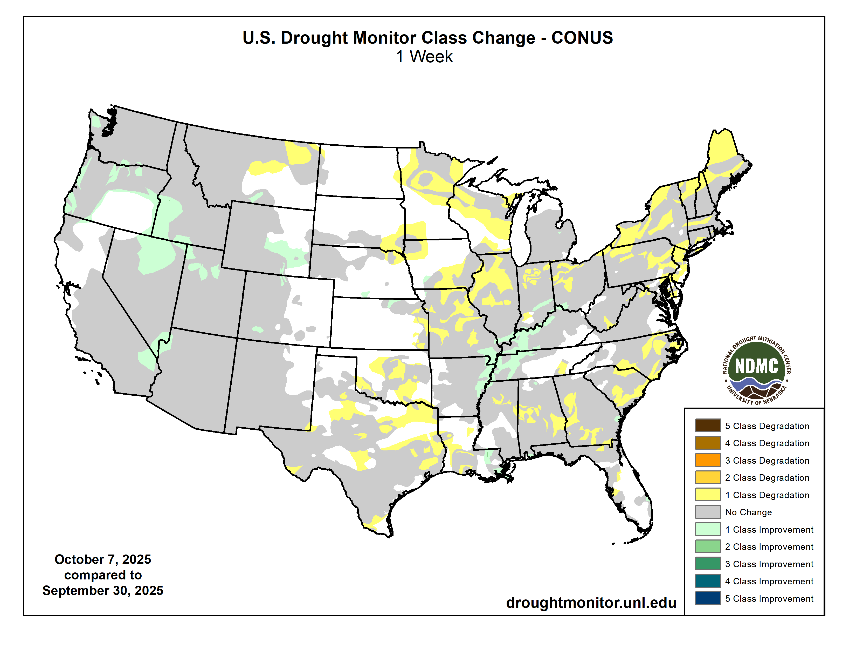
Click on a thumbnail graphic to view a gallery of drought data from the US Drought Monitor website.

Click the link to go to the US Drought Monitor website. Here’s an excerpt:
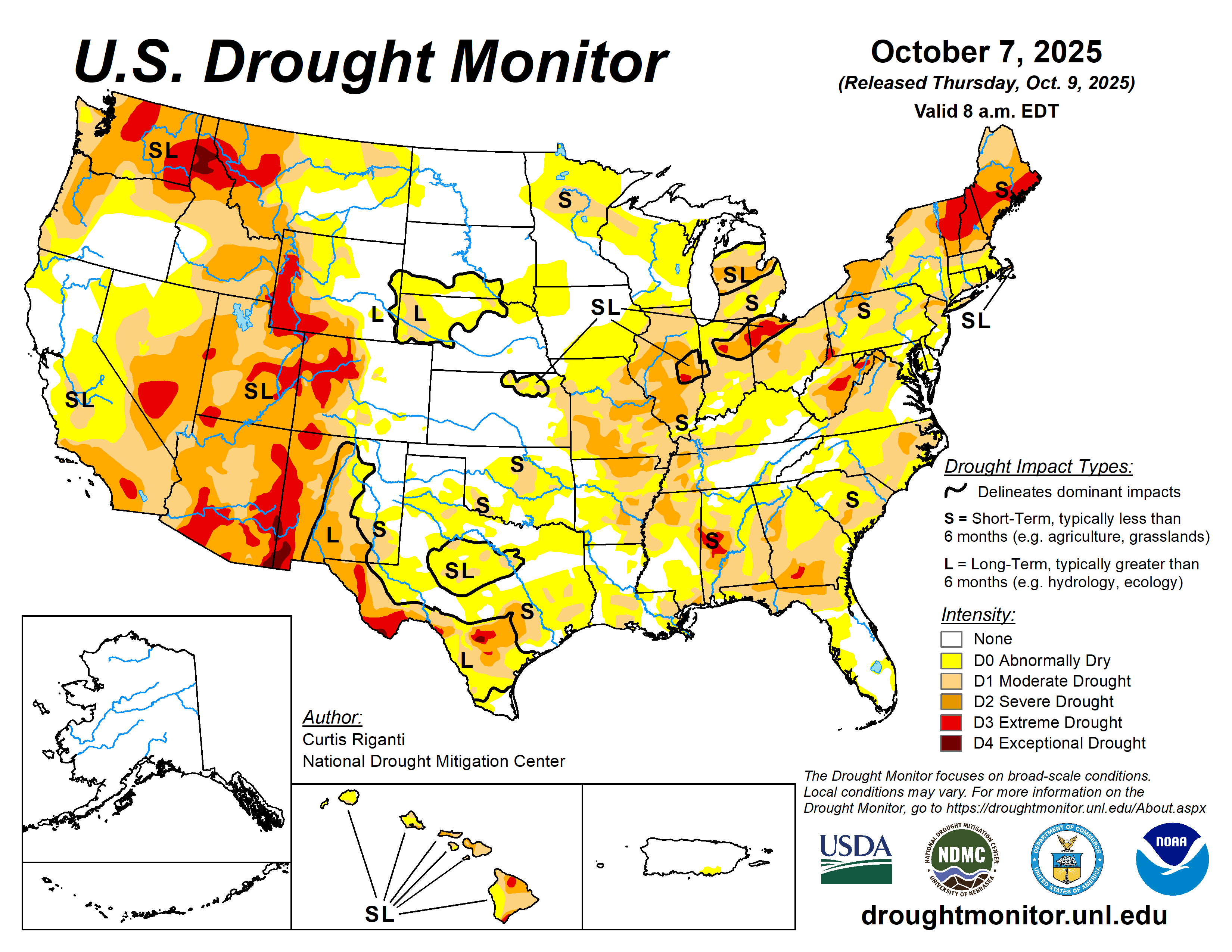
This Week’s Drought Summary
The recent pattern of numerous changes in the USDM continued with this week’s map release. Continued dry weather in the Northeast led to widespread worsening of drought and abnormal dryness there. From Missouri northward to the Great Lakes states, many locations saw drought or abnormal dryness worsen. In particular, intense short-term drought continued to worsen in parts of Missouri, Illinois, Indiana and Ohio. However, in southeast Missouri and in the Ohio River Valley and some parts of the Mississippi River Valley, welcome rains fell, locally over 3 inches, leading to widespread improvements in ongoing drought and abnormal dryness in these areas. Much of Alabama, the Carolinas and Georgia saw drier weather, with local exceptions. As such, drought and abnormal dryness also expanded across portions of these states and a few spots in nearby Florida. Very heavy rain fell in southeast Louisiana; one area received over 5 inches of rain, leading to a 2-category improvement in the USDM, surrounded by nearby 1-category improvements after the heavy rain. In west Louisiana, Oklahoma and Texas, dry weather this week led to many degradations as primarily short-term dryness intensified. A few areas of central and southwest Texas are also seeing long-term dryness and drought and saw some intensification this week. Drier weather this week in northeast Montana led to the development of moderate drought there. Recent heavy precipitation and reassessment of recent conditions led to widespread improvements in parts of the western United States, especially the Las Vegas area, northern areas of Nevada and Utah, Oregon and southwest Idaho, southeast Wyoming and a few spots in the Colorado Rocky Mountains. A wetter month of September also led to localized improvement away from abnormal dryness on the northeast coast of Kauai, though ongoing drought conditions remained unchanged elsewhere in Hawaii after a mainly drier week…
High Plains
Temperatures this week across the High Plains region were mostly 5-15 degrees above normal, with parts of central Colorado and southern and western Wyoming seeing closer to normal temperatures. Moderate to locally heavy precipitation fell in parts of the San Juan Mountains in southwest Colorado, the Rocky Mountains of northern Colorado and across much of Wyoming, northwest South Dakota and central to north-central North Dakota. Precipitation this week added to a generally wetter recent pattern in the San Juans, north-central Colorado and southeast Wyoming. In these areas, short- and medium-term precipitation deficits lessened and soil moisture conditions improved, allowing for some improvements to ongoing drought and abnormal dryness. In north-central Kansas, moderate drought improved in some areas where locally over 2 inches of rain fell. In eastern Kansas, short-term abnormal dryness and moderate drought worsened in spots where streamflow and soil moisture levels dropped along with growing precipitation shortages. In northeast Nebraska and southeast South Dakota, dry weather over the past couple of months continued this week, leading to a large expansion in abnormal dryness that also extended further into northwest Iowa and southwest Minnesota…

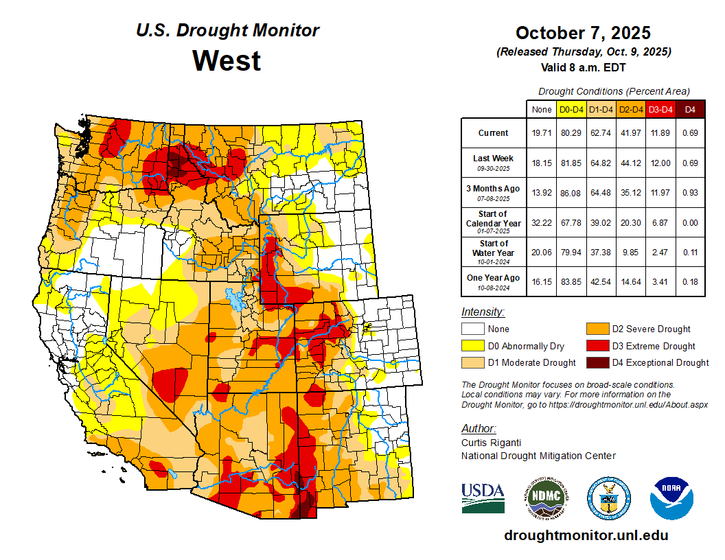
West
Cooler-than-normal temperatures prevailed in much of Oregon, California and Nevada, while the rest of the region was mostly 1-5 degrees above normal. Scattered heavy precipitation fell this week across much of the central and northern half of the region, with notable exceptions in central and eastern Washington and Oregon, southwest Wyoming, and north-central and northeast Montana. In northeast Montana, drier weather this week and temperatures that were 5-15 degrees above normal led to the development of moderate drought where short-term precipitation and soil moisture deficits grew. Recent precipitation, either from this week or the weeks preceding, led to improvements in streamflow and soil moisture and lessening precipitation deficits across much of northern and southern Nevada (and immediately adjacent parts of California and Arizona). Similarly improving conditions also occurred in northern Utah, south-central and southwest Idaho, Oregon and the Olympic Peninsula of Washington, leading to improvements in the USDM depiction in parts of these areas…
South
Short-term dryness continued to intensify in south-central and west-central Louisiana and across much of Texas and parts of Oklahoma, all of which largely saw a mostly dry and warmer-than-normal week. Very dry weather over the last month continued in parts of Oklahoma, especially from the Oklahoma City area north and in southwest Oklahoma, where adverse impacts to agriculture were reported. In central and southwest Texas, recent dry weather compounded impacts from long-term dryness and drought…
Looking Ahead
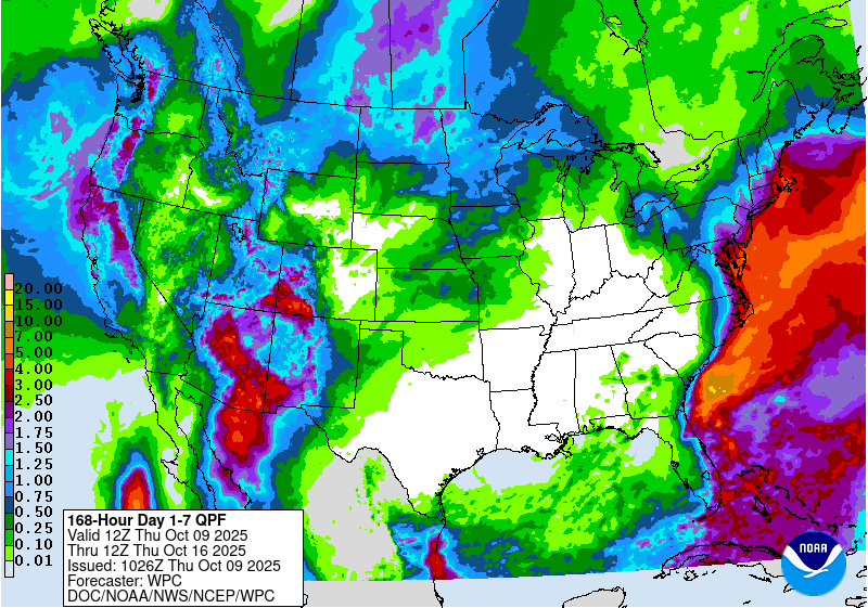
The National Weather Service Weather Prediction Center (WPC) forecast covering the period from the evening of October 8 to the evening of October 13 calls for an inch or more of precipitation from northwest California northward through northwest Washington. The WPC is also forecasting areas west of the Continental Divide in New Mexico and Colorado, as well as much of Arizona and Utah, to receive over 1 inch of precipitation, with some areas in Arizona and southwest Colorado forecast to receive over 3 inches. Forecast precipitation amounts dwindle north of Utah, though portions of Idaho and Montana may receive a half inch or more during this period. Heavy rain amounts are possible from the east coast of Florida northwards through the Atlantic Coast to southern New England. As of the afternoon of Wednesday, October 8, the east coast of Florida and the coasts of North Carolina and Virginia, as well as the Delmarva Peninsula, New Jersey appear most in line to receive at least 1.5 inches of rain, with higher amounts possible. However, given the forecasted tight gradient in rainfall amounts, small shifts in the track of the storm system may significantly impact how much rain falls in any particular location along or near the East Coast. Meanwhile, across most of the Great Plains, Midwest and South, mostly dry weather is forecast.
Looking ahead to October 14-18, the National Weather Service Climate Prediction Center forecast favors warmer-than-normal weather across most of the central and eastern Contiguous U.S., especially in the southern Great Plains and Lower Mississippi River Valley. Colder-than-normal weather is favored across much of California, Nevada, Oregon, Idaho, Washington and western Montana. Above-normal precipitation is favored across most of the West (except for northwest Oregon and most of Washington) and into the northern half of the Great Plains and western Great Lakes states. Above-normal precipitation is slightly favored in most of New England, while below-normal precipitation is slightly favored in northwest Washington. Below-normal precipitation is favored in the south-central and southeast U.S., with a slight lean toward below-normal precipitation extending northward to Lake Erie. Above-normal temperatures are strongly favored in most of Alaska, with above-normal precipitation also favored across most of the state. In far southeast Alaska, near- or below-normal precipitation is more likely. Above-normal precipitation and warmer-than-normal temperatures are favored across Hawaii.
Just for grins here’s a slideshow of early October US Drought Monitor maps for the past few years.

US Drought Monitor map October 7, 2025. 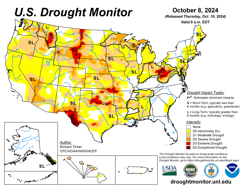
US Drought Monitor map October 8, 2024. 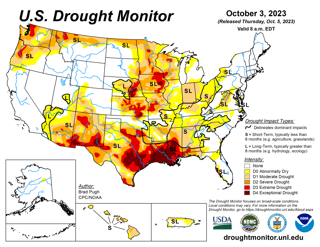
US Drought Monitor map October 3, 2023. 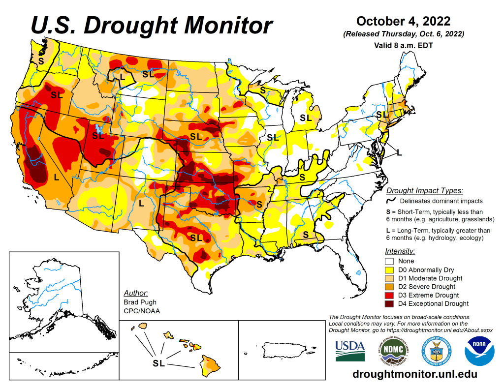
US Drought Monitor map October 4, 2022. 
US Drought Monitor map October 5, 2021. 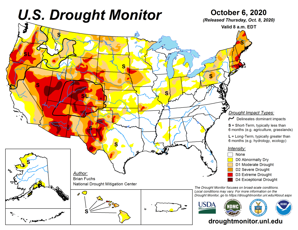
US Drought Monitor October 6, 2020. 
US Drought Monitor October 1, 2019. 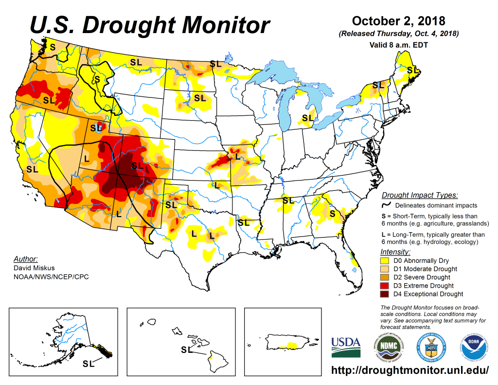
US Drought Monitor October 2, 2018. 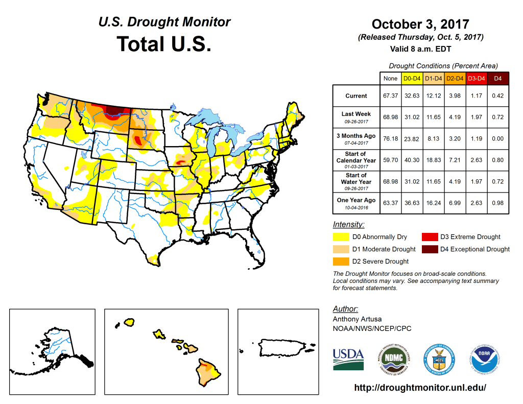
US Drought Monitor October 3, 2017. 
US Drought Monitor October 4, 2016. 
US Drought Monitor October 6, 2015 
US Drought Monitor October 7, 2014 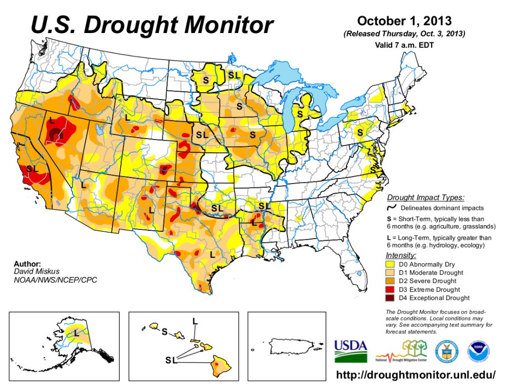
US Drought Monitor October 1, 2013 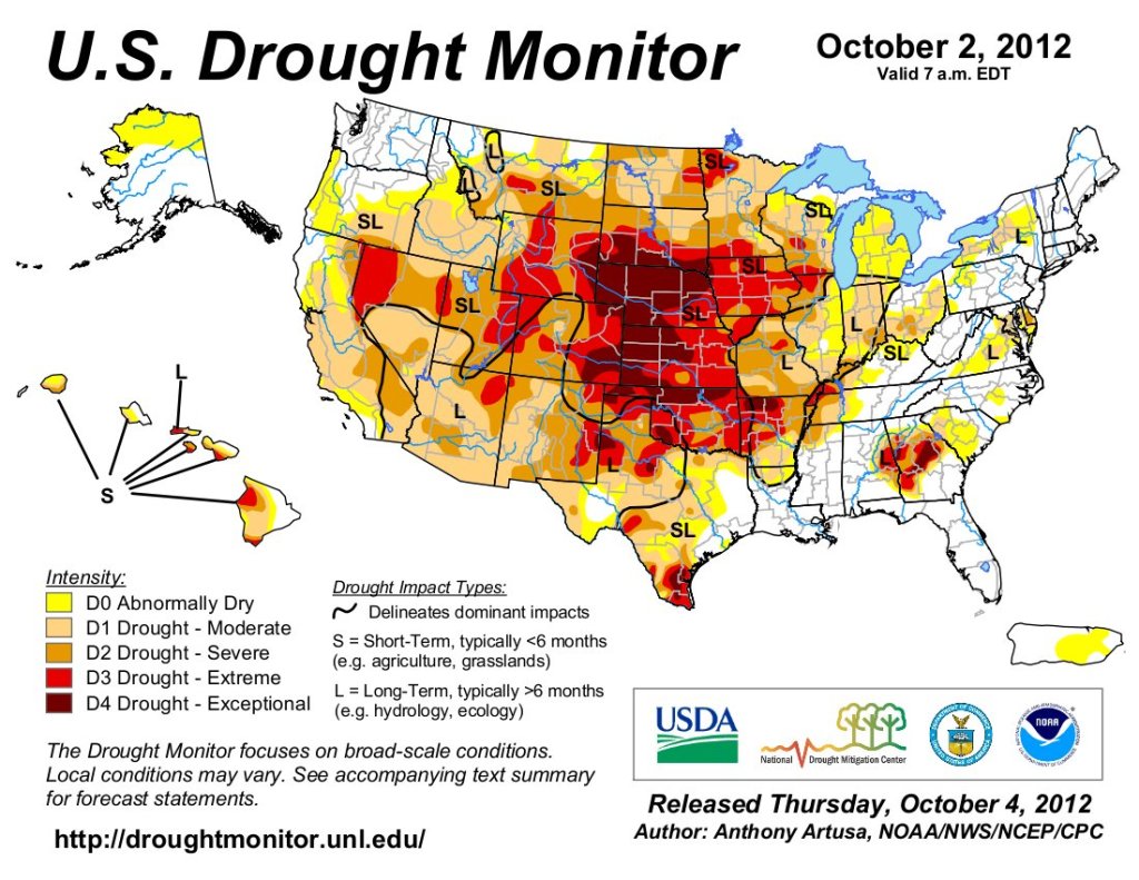
US Drought Monitor map October 2, 2012.