The Colorado Cattlemen’s Agricultural Land Trust brokered a new 2,348-acre conservation easement with the Snyder family on Fish & Cross Ranch west of Yampa.
CCALT/Courtesy photo
The Colorado Cattlemen’s Agricultural Land Trust has completed a new 2,348-acre conservation easement with the Snyder family on Fish & Cross Ranch, a working cattle ranch located at the base of the Little Flattops west of Yampa.
The ranch is in an area known as “The Gateway to the Flat Tops” where landscape-level conservation investments through the Routt County Purchase of Development Rights program have created a “stronghold of interconnected agricultural lands and habitat corridors,” according to a land trust media release.
This new conservation easement adds to Routt County’s commitment to conserve working landscape and allows the family owners to continue taking care of the agricultural lands and wildlife habitat. In exchange for county funds, the landowner grants a perpetual conservation easement, or deed restriction, on the property, protecting the land from development.
Ownership of the property remains vested with the landowner, who can use and manage the property consistent with the terms of the conservation easement.
“Their commitment to agricultural conservation will carry on to future generations of their family and continue to support the rural economy in South Routt County,” CCALT Conservation Manager Monica Shields said.
“As was evident this summer, agricultural lands not only provide important wildlife habitat and scenic views, but the hay meadows and wetlands act as critical wildfire breaks during times of drought. The Fish and Cross Ranch, nestled up against the Flat Tops Wilderness area, serves all these critical community functions,” added Shields.
Routt County Commissioner Tim Redmond noted the “property links together U.S. Forest Service, BLM and state lands, as well as existing conservation easements, to form a pristine tract that protects views and critical wildlife corridors.”
Lands within the easement include sagebrush rangelands, aspen woodlands and irrigated pastures with senior water rights along Watson Creek tied to those lands through the conservation easement. The property is utilized as part of a larger cattle and hay operation operated by the Snyders as well as natural habitat. Allen Snyder and his family purchased the ranch in 2006, and four generations currently live and work on the ranch.
“We would like to thank everyone who helped make this easement possible, from the PDR board and county commissioners to the CCALT team and Natural Resources Conservation Service,” said Tyler Snyder. “We are very blessed to be able to take a step forward in continuing to pass down the generational legacy of ranching in the Yampa Valley to generations to come.”
Since the initiation of the program in 1997, Routt County has helped fund the purchase of conservation easements on 68,535 acres for approximately $32 million. Funding for the program comes from a 1.5 mill levy in county property tax approved by voters through 2035.
The Colorado Cattlemen’s Agricultural Land Trust brokered a new 120-acre conservation easement with landowner Susan Larson on Wild Goose Ranch south of Steamboat Springs. CCALT/Courtesy photo
In addition, earlier in October the land trust and the county program worked with landowner Susan Larson to conserve 120 acres of Wild Goose Ranch south of Steamboat Springs.
The easement secures irrigated hay meadows and riparian habitat and fulfills the conservation vision of Susan and her late husband, Jim Larson. The Wild Goose Ranch is comprised primarily of irrigated hay meadows with 92% of the easement area in active hay production.
“Since our arrival in the Yampa Valley full time, our family has always felt a duty to protect the land and the water, especially here in the South Valley,” Larson said. “We have felt even more strongly about this responsibility with all the growth that has occurred in the last several years all over Colorado and notably here in Routt County.”
This protection safeguards valuable wildlife habitat for elk, mule deer, moose, black bear and species of special concern such as the Columbian sharp-tailed grouse and greater sandhill crane, while also securing scenic views along Colorado Highway 131 and U.S. Highway 40, according to a media release.
Routt County Commissioner Sonja Macys noted, “Nestled in the highly scenic South Valley floor corridor, the ranch is a vital part of the iconic landscape of working agriculture and conserved lands that residents and visitors alike enjoy when descending Rabbit Ears Pass.”
The land trust has conserved more than 820,000 acres of farmland, ranchland, wildlife habitat and open space across Colorado, including more than 83,000 acres in Routt County.
Lake Powell at Wahweap Marina as seen in December 2021. Dwindling streamflows and falling reservoir levels have made it more likely that what some experts call a Colorado River Compact “tripwire” will be hit in 2027. Credit: Heather Sackett/Aspen Journalism
When Colorado convened a working group on water speculation, its members shared stories of times in which they’d seen or thought they might have seen investment water speculation occurring — when water rights are purchased with a primary purpose of profiting from the future sale or lease of that water as demand drives up its price. On the list was the notion that buyers with no real interest in agriculture would buy agricultural land and water rights with the primary intention of enrolling in a program that pays water rights holders not to use that water.
The concern, essentially, was that programs that compensate farmers for fallowing fields like the Upper Colorado River Basin’s System Conservation Pilot Program, and nonprofits that fundraise to keep water in streams weren’t sufficiently guarded against abuse, particularly when it comes to an increasingly constrained Colorado River system.
“The impacts of drought and the risks that drought causes in the Colorado River Basin, just by way of example, attract money to the concept that money can be made from taking water out of production — conservation,” says Peter Fleming, general counsel for the Colorado River District.
“Where do you draw the line in that?” Fleming asks. “Which one is a good, socially recognized benefit that the state as a whole should support versus which one is bad because it encourages speculation in water resources, and it makes things more difficult for others, and it has adverse secondary impacts in the local economies when you take water out of production?”
A few guardrails exist to make real conservation efforts — those that serve the common good — clear. But questions remain on whether those protections can really stop investment water speculation before speculation occurs.
Little Cimarron Ranch, where a first-of-its-kind agreement allows water rights to go to irrigation in the spring and summer, and to instream flows to support river health in the summer and fall. Photo courtesy of Mirr Ranch Group
Streamflows for the Public Good
In 1973, Colorado lawmakers legally recognized instream flows, in which water is allocated to the river to maintain flows and habitat as a “beneficial use” in parallel with industries, cities and agriculture. That 1973 legislation tried to prevent speculators from prospectively appropriating instream flows and locking up the state’s water by taking measures like limiting who can operate instream flows to a single state agency, the Colorado Water Conservation Board.
“There is government oversight for specifically this reason — to prevent speculation,” says Josh Boissevain, staff attorney with the Colorado Water Trust, a nonprofit that works to secure water for streams. “Instream flow is a decreed use, so using that water for instream flow is not speculation at all, even though it’s left in the river.”
When water rights owners work with the water trust to use their water to restore flows, it takes a lot of paperwork and a close look at the web of other users affected. The process can be tedious and time-consuming, and the profits marginal.
“Nobody is doing that for the money,” Boissevain says. “They do it because they care.”
Some loopholes have been closed. For example, a 1994 change to Colorado’s water law prevents conditional water rights holders, who hold onto water rights for unbuilt projects or potential future uses, from transferring those rights to instream flows. That law blocks speculators from selling conditional water rights to the CWCB for a profit.
Shoshone Hydroelectric Plant back in the days before I-70 via Aspen Journalism
Having a perfected water right — one that is fully established and has been put to beneficial use — converted to instream flows is fine, Fleming says. The Colorado River District participates in those programs and is working to buy a water right currently used to generate 15 megawatts at Xcel Energy’s aging Shoshone hydroelectric power plant. The River District aims to convert that hydropower right to an instream flow right to ensure that this water continues to flow from the headwaters down through boating hotspots in Glenwood Canyon, regardless of the 115-year-old power plant’s future.
But Fleming, who worked on a 2021 report that reviewed Colorado’s legal sideboards on speculation, remains concerned that the lines are not clearly enough drawn between those recognizable benefits to the state and local economies, and the place where speculators could start counting on those efforts and “conserving” to make a profit. At a certain scale, the effects of taking water off farm fields could ripple out beyond bare fields to farm supply stores and gas stations, as well as the local job market in rural communities.
Perhaps the most frightening possibility that could result from profiteering is that water rights bought and steered from use in Colorado will somehow be sold to thirsty fields or towns in Arizona or Nevada. But even if both buyer and seller are willing, specific language in interstate compacts and existing law complicates the likelihood of selling water from one state to a buyer in a different state.
Meanwhile, conservation groups are also concerned about speculators cornering them out of the increasingly expensive water rights market, Boissevain says. To adapt to the current water market, the Colorado Water Trust is exploring a new acquisition model with Qualified Ventures, a consulting company based in Washington, D.C. Through this new approach, the water trust would buy land with water rights through financing from lenders. A conservation easement would protect the land as agricultural, and the tax rebate from that status would partially repay the loan. The water trust would reassess how to profitably farm that land while sharing the water rights between agriculture and environmental flows. Then the land could be sold, potentially at a reduced price, perhaps to a first-generation farmer.
“It’s another way to keep ag in production and keep water on the land,” Boissevain says. “It’s another step up in the competition against people that might try and buy [irrigated farms] for speculation or maybe even development.”
Confluence of the Cimmaron and Gunnison rivers. Photo: Brent Gardner-Smith/Aspen Journalism
The results might resemble a project on the Little Cimmaron River near Gunnison, where the Colorado Water Trust purchased 5.8 cubic feet per second of flow in the McKinley Ditch to return water to a river that was nearly dry in late summer months. The water trust partnered with a land trust to buy the water rights and land, put a conservation easement on the land, then sell the land and water rights to a private landowner. In a first-of-its-kind agreement, the water rights can go to irrigation in the spring and summer, and to the CWCB for instream flow in the late summer and fall when the river needs it most. In a very dry year, all of the water can be left in the stream protected, and in a wet year, all of it can be diverted for agriculture.
This map shows the 15-mile reach of the Colorado River near Grand Junction, home to four species of endangered fish. Map credit: CWCB
Environmental groups contend that for the environment to thrive, the entire river system needs this kind of adaptability, particularly as Colorado River Basin states renegotiate operations for Lake Powell and Lake Mead ahead of the current guidelines’ expiration in 2026.
“We want to see better, more realistic management of the Colorado River that accounts for climate change and … drastic shifts in hydrology,” says Matt Rice, Southwest regional director with American Rivers. “It’s all about creating, from our perspective, more flexibility in the system to avoid emergency action after emergency action because we’re collectively afraid to make hard decisions when we need to.”
With an eye on the prospect of a compact call or other crisis, WaterCard, a Colorado-based company, aims to leverage private market dynamics to promote water conservation in the Colorado River system. It also provides an avenue for companies and individuals to offset their water footprint.
It works like this: A person can buy a WaterCard, which gives them conservation credits linked to a quantifiable amount of water conserved on a Colorado farm or ranch. It’s like an offset. The WaterCard buyer also receives an NFT digital token as proof of purchase.
In the field, WaterCard funds are used to compensate farmers and ranchers who sign up for the program and voluntarily reduce water usage by fallowing fields for a season, decreasing irrigation, or transitioning to drought-resistant crops.
To demonstrate the concept, WaterCard founder James Eklund, who is also a working water attorney and rancher, is fallowing 66 acres of grass-alfalfa hay at his family ranch in western Colorado’s Plateau Valley. Introducing a market-based mechanism for water conservation in a headwaters state does not equate to speculation, Eklund says, because buyers are only purchasing credits tied to conserved water, not the underlying water rights themselves.
“This approach aligns fully with the anti-speculation doctrine, which I strongly support. That doctrine prohibits buying a water right, leaving it unused, and flipping it for profit — that’s speculation,” he says.
WaterCard’s model is designed to work within the Upper Colorado River Commission’s System Conservation Pilot Program (SCPP) and, Eklund hopes, eventually within a demand management framework. SCPP was designed to explore solutions to low flows in the Upper Colorado River Basin by granting funding to irrigators who voluntarily apply to conserve water for the season. If a demand management program is developed, conserved water could serve as a “savings account” in Lake Powell, helping Colorado meet future obligations to send water to downstream states under the Colorado River Compact.
By piggybacking off of the SCPP, WaterCard benefits from the SCPP’s efforts to verify conservation efforts. Therefore, producers enrolled in WaterCard must also have a project enrolled in the SCPP. WaterCard will simply boost the amount of funding those irrigators receive for conservation efforts, making SCPP participation more appealing. As of early 2025, however, it’s unclear whether the SCPP will continue. Eklund argues that this model allows private entities and individuals to play a meaningful role in preventing water crises, one $3.50 WaterCard — representing 500 gallons of water saved — at a time.
Farmers and ranchers who participate can diversify revenue sources while continuing to farm and ranch. Eklund contends that current SCPP payments are insufficient and rejects the notion that fair compensation would cause agricultural producers to abandon their livelihoods.
“That idea is insulting,” he says. However, if farmers and ranchers can derive a higher dollar value for conserved water through a market-based system, he says, that’s not speculation, that’s “market-based capitalism.”
Independent journalist Elizabeth Miller has written about environmental issues around the American West for publications including The Washington Post, Scientific American, Outside, Backpacker and The Drake.
Map of the Colorado River drainage basin, created using USGS data. By Shannon1 Creative Commons Attribution-Share Alike 4.0
Westerners Who Prefer Public Land Conservation Over Energy Development Reaches All Time High
Fifteenth annual Conservation in the West Poll reveals there is no mandate from voters in the West to roll back public lands protections or expand oil and gas development
COLORADO SPRINGS—Colorado College’s 15th annual State of the Rockies Project Conservation in the West Poll released today shows Western voters continue to support strong conservation and protection policies as a new presidential administration takes power, promising rollbacks, budget cuts, and expanded energy development.
The poll, which surveyed the views of voters in eight Mountain West states (Arizona, Colorado, Idaho, Montana, Nevada, New Mexico, Utah, and Wyoming), found Westerners prefer public land conservation over oil and gas development at the highest margins measured in the poll’s 15-year history.
Western voters continue to express concern about issues related to land, water, and wildlife. Strong majorities of Western voters – including self-identified “MAGA” voters – support policies that focus on the protection and conservation of public lands and oppose policies that would open public lands up to drilling, mining, or other development.
Given a choice between protection and development, 72 percent of Westerners prefer their elected officials to place more emphasis on protecting clean water sources, air quality, and wildlife habitat while providing opportunities to visit and recreate on public lands. By contrast, only 24 percent prefer their elected officials to prioritize the production of more domestic energy by maximizing the amount of national public lands available for responsible oil and gas production. Self-identified MAGA voters are split on the question, with 51 percent favoring an emphasis on protecting public lands and 44 percent wanting to maximize oil and gas production on public lands.
The first Trump administration reduced the size of national monuments, an unpopular decision in the West at the time. Reducing or removing national monument protections are even more unpopular now, with 89 percent of voters opposing the idea, compared to 80 percent when the question was asked in January 2017. Similarly, proposals to give state governments control over national public lands are more unpopular now, with 65 percent of Westerners in opposition, compared to 2017 when 56 percent were opposed.
“The consensus favoring public lands conservation remains consistent and strong in the West,” said Katrina Miller-Stevens, Former Director of the State of the Rockies Project and an Associate Professor at Colorado College. “Westerners do not want to see a rollback of national monument protections and there is no mandate for oil and gas development. Voters from all political ideologies are united in support of public land conservation in the West.”
Proposals to reduce protection and expand energy development on public lands are deeply unpopular in the West:
72 percent oppose removing protections for parts of existing national public lands to allow more drilling, mining and other development.
63 percent oppose reducing protections for some of the rare plants and animals under the Endangered Species Act.
60 percent oppose expanding the amount of national forest and other public lands available to private companies for logging.
Instead, Westerners are supportive of initiatives to protect public lands and natural resources from the impacts of development:
92 percent support keeping the requirement that oil and gas companies, rather than taxpayers, pay for all of the clean-up and land restoration costs after drilling is finished.
88 percent support continuing to require oil and gas producers that operate on public lands to use updated equipment and technology to prevent leaks of methane gas during the extraction process and reduce the need to burn off excess natural gas into the air.
71 percent support only allowing oil and gas companies the right to drill in areas of public lands where the likelihood of actually producing oil is high.
84 percent support maintaining or increasing the royalty rates that oil companies pay for producing oil and gas on national public lands.
89 percent support managing public lands to ensure there are more outdoor places free of light pollution to see the stars at night.
86 percent support ensuring Native American Tribes have greater input into decisions made about areas within national public lands that contain sacred or culturally significant places to their Tribes
With hiring freezes and a reduction of the federal workforce underway, Westerners are clear about who they prefer to make decisions about public lands, water, wildlife and other natural resources. 87 percent prefer these decisions be made by career professionals such as rangers, scientists, fire fighters, and other specialists in the field, compared to just 9 percent who prefer decisions be made by new political appointees.
Overall, voters gave positive marks – ranging from 61 percent approval to 86 percent approval – for the federal agencies charged with protecting public lands and the environment, including the U.S. Forest Service, National Park Service, Environmental Protection Agency, U.S. Fish and Wildlife Service, and Bureau of Land Management. Three-quarters of Western voters – including bipartisan majorities – are opposed to reducing funding to these agencies. More than two-thirds (69 percent) of MAGA voters oppose funding reductions for these federal agencies as well.
Despite 81 percent expressing serious concern about the rising cost of living, Westerners do not want to sacrifice public lands to build more housing. 82 percent of Westerners prefer building more housing within or close to existing communities, compared with 14 percent who favor selling off public lands to develop housing on natural areas.
Westerners value the natural beauty of their states, with more than three-in-ten naming nature as the thing they like most about living in the West. 67 percent of Westerners report visiting national public lands three or more times in the past year, and 24 percent visited them more than 10 times.
That connection translates into concern around the loss of habitat and natural areas, wildlife declines, pollution, and inadequate water supplies. All the land, water, and wildlife issues tested in the poll are viewed as extremely or very serious problems by more than half of Western voters, with a level of concern that is consistent with prior years.
Against that background of concern, voters support a variety of efforts to reduce or mitigate the impacts of climate change:
72 percent support the federal government taking action to reduce the carbon pollution that contributes to climate change.
71 percent support the federal government taking action to ensure the reliability of water supplies that may be threatened by climate change.
91 percent support allowing private landowners the ability to conserve their lands as working farms, ranches, natural areas, and wildlife habitat through voluntary land conservation easements.
92 percent support promoting nature-based solutions to improve water quality, such as conserving forests and lands along rivers, lakes, and streams.
94 percent support allowing trained fire teams to use controlled burns to remove growth in forests that could fuel wildfires when and where it is safe to do so
This is the fifteenth consecutive year Colorado College gauged the public’s sentiment on public lands and conservation issues. The 2025 Colorado College Conservation in the West Poll is a bipartisan survey conducted by Republican pollster Lori Weigel of New Bridge Strategy and Democratic pollster Dave Metz of Fairbank, Maslin, Maullin, Metz & Associates. The survey is funded by the William and Flora Hewlett Foundation.
The poll surveyed at least 400 registered voters in each of eight Western states (AZ, CO, ID, MT, NV, NM, UT, & WY) for a total 3,316-voter sample, which included an over-sample of Black and Native American voters. The survey was conducted between January 3-17, 2024 and the effective margin of error is +2.46% at the 95% confidence interval for the total sample; and at most +4.9% for each state. The full survey and individual state surveys are available on the State of the Rockies Project website.
About Colorado College Colorado College is a nationally prominent four-year liberal arts college that was founded in Colorado Springs in 1874. The College operates on the innovative Block Plan, in which its 2,200 undergraduate students study one course at a time in intensive three and a half-week segments. For the past eighteen years, the college has sponsored the State of the Rockies Project, which seeks to enhance public understanding of and action to address socio-environmental challenges in the Rocky Mountain West through collaborative student-faculty research, education, and stakeholder engagement.
About Fairbank, Maslin, Maullin, Metz & Associates Fairbank, Maslin, Maullin, Metz & Associates (FM3)—a national Democratic opinion research firm with offices in Oakland, Los Angeles and Portland, Oregon—has specialized in public policy oriented opinion research since 1981. The firm has assisted hundreds of political campaigns at every level of the ballot –from President to City Council—with opinion research and strategic guidance. FM3 also provides research and strategic consulting to public agencies, businesses and public interest organizations nationwide.
About New Bridge Strategy New Bridge Strategy is a Colorado-based, woman-owned and operated opinion research company specializing in public policy and campaign research. As a Republican polling firm that has led the research for hundreds of successful political and public affairs campaigns, New Bridge has helped coalitions bridging the political spectrum in crafting winning ballot measure campaigns, public education campaigns, and legislative policy efforts.
About Hispanic Access Foundation Hispanic Access Foundation, a 501(c)(3) non-profit organization, connects Latinos with partners an opportunities to improve lives and create an equitable society. Our vision is that one day every Hispanic individual in America will enjoy good physical health and a healthy natural environment, a quality education, economic success, and civic engagement in their communities with the sum of improving the future of America. For more information visit www.hispanicaccess.org.
People walk through the Red Cliffs National Conservation Area, designated during Obama administration, in Washington County, Utah. Credit: Bob Wick/BLM
Colorado College’s annual survey included residents of 8 Western states, the majority of whom identified as politically conservative or moderate.
As oil and gas production in the U.S. continues to reach record highs, the margin of Westerners who support public land conservation over increased oil and gas development also continues to climb.
In a new “Conservation in the West Poll” released today by Colorado College, 72 percent of respondents from eight Western states said they would prefer their member of Congress to emphasize protecting clean air, water and wildlife habitat while boosting outdoor recreation over maximizing the amount of public land used for oil and gas drilling.
The figure marks a two-percent increase from last year’s poll, and only 24 percent of those surveyed expressed interest in more oil and gas drilling and mining on public lands. The 48-point margin in favor of conservation is the highest in the poll’s fifteen-year history.
“The consensus favoring public lands conservation remains consistent and strong in the West,” said Katrina Miller-Stevens, an associate professor at Colorado College and the former director of the State of the Rockies Project, which runs the annual polls, in a statement. “Westerners do not want to see a rollback of national monument protections and there is no mandate for oil and gas development. Voters from all political ideologies are united in support of public land conservation in the West.”
Colorado College worked with Lori Weigel of New Bridge Strategy, a Republican pollster, and Dave Metz of Fairbank, Maslin, Maullin, Metz & Associates, a Democratic pollster, to survey 3,316 respondents, most of whom identified as politically conservative or independent. The poll, funded by the William and Flora Hewlett Foundation, included at least 400 voters each from Arizona, Colorado, Idaho, Nevada, New Mexico, Montana, Utah and Wyoming. Just under 40 percent of the survey-takers said they supported President Donald Trump’s “Make America Great Again” platform.
The results come at a time when politicians in the nation’s capital and across the West are drumming up expansive, divisive plans for public lands.
Last Friday, the Trump administration fired over 5,400 employees across the departments of the Interior and Agriculture, most of whom worked for the National Park Service and U.S. Forest Service. The date of the firings have led them to be called a “Valentine’s Day Massacre,” a reference to the murders in Chicago nearly a century ago by gangsters working for Al Capone.
Since taking office, Trump has appointed people with close ties to the oil and gas industry to lead key federal agencies overseeing public lands. His secretary of the interior, Doug Burgum, who ordered last week’s Interior Department firings, was previously the governor of North Dakota, where he joined industry lawsuits to halt or overturn Biden-era regulations on oil and gas production. The Associated Press reported that he has relationships with several oil and gas executives and lobbyists.
Lawmakers in Utah and Wyoming have demanded the federal government give control of public lands in their states, including areas protected by the National Park Service, the U.S. Fish and Wildlife Service, the Bureau of Land Management and the U.S. Forest Service, back to state legislatures. Neither initiative went very far—Utah’s was rejected by the courts and Wyoming’s failed to make it out of the state’s Senate after a series of dramatic revotes.
“A lot of the actions that the Trump administration has taken or has proposed to take are pretty far out of step with what Westerners want to see in terms of our public lands,” said Rachael Hamby, policy director at the Center for Western Priorities. “Westerners care about public lands a lot and want to see them protected.”
No more than 40 percent of residents in any of the eight states offered approval for state-based land grabs, and an overwhelming majority of Westerners—87 percent—supported career officials at various federal departments making decisions regarding public lands; only nine percent wanted to see elected representatives appoint new officials “who come from other industries and may have different perspectives” on public land, water and wildlife decisions.
Nearly three-quarters of Westerners agreed with federal efforts to combat climate change, though state-by-state levels of approval varied widely. Of the respondents from New Mexico, which has voted for Democrats in all but one presidential election since 1992, 77 percent backed federal action to combat climate change; in Wyoming, the only state where a majority of respondents said they supported President Trump’s “Make America Great Again” agenda, 52 percent of those surveyed said they agreed with federal action on climate change.
Just under 90 percent of those surveyed expressed a desire to keep national monument designations implemented in the last decade in place. The new administration has begun to review those monument designations, and Trump shrunk some of them during his first term.
Other measures enjoying broad support across the West included giving private landowners the ability to conserve their land through conservation easements, using nature-based solutions to improve water quality and allowing the use of controlled burns to thin overgrown forests and lower the threats posed by wildfires.
As a new administration sets a different direction for public lands, Hamby warned that diverging from Westerners’ preferences would carry consequences.
“If elected officials are straying too far from what their constituents want to see,” she said, “they’re going to have to answer to their voters.”
Feb. 10, 2025- A newly announced conservation easement will protect more than 7,400 acres in the North Fork Valley from development.
Landowner Peter Slaugh worked with the Colorado West Land Trust to permanently protect Scenic Mesa Ranch, which is south of Hotchkiss and near the confluence of the North Fork of the Gunnison River and the mainstem of the Gunnison River.
“Thanks to the commitment of landowner Peter Slaugh, this remarkable landscape will remain protected forever — ensuring its rich wildlife habitat, agricultural legacy, and scenic beauty continue to benefit the community for generations to come,” the land trust said in a news release.
The ranch includes miles along the two rivers, borders the Gunnison Gorge National Conservation Area and helps connect lower-elevation public land with the West Elk wilderness.
“The property’s scale, high-quality habitat, and strategic location make this an incredibly important conservation achievement,” Rob Bleiberg, executive director of the land trust, said in the release. “We are grateful to partner with Peter Slaugh to protect this incredibly important piece of Western Colorado’s wildlife and agricultural heritage.”
The mesa and the ranch’s riparian areas and canyons are home to wildlife such as eagles, river otters, elk, mule deer, bighorn sheep, mountain lions and black bears. Scenic Mesa also supports livestock grazing, irrigated hay production and dryland pastures, and the conservation easement permanently secures senior water rights, ensuring the land’s continued agricultural productivity and preservation of open space, the land trust said.
Slaugh said in the release, “We live in a dry climate where water is key to promoting healthy habitats. We feel honored to act as stewards of this ranch with a rich history. While raising cattle, we are equally committed to managing the health and survival of wildlife and their habitats. It’s important to us that this land remains a wildlife preserve and avoids development.”
Slaugh and the land trust plan to partner on restoration projects to improve aquatic and upland habitats, including river restoration work with the Western Colorado Conservation Corps.
According to the land trust, the conservation easement preserves the beauty of a mesa visible from Colorado Highway 92 and surrounding public roads. The land also is adjacent to more than 13,000 acres of conserved land and near public lands, further enhancing its value as an ecological asset.
The nonprofit Colorado West Land Trust, based in Grand Junction, has conserved more than 144,000 acres in Delta, Gunnison, Mesa, Montrose, Ouray and San Miguel counties.
Cosmos in full-summertime bloom in the North Fork Valley in October 2024. Jonathan P. Thompson photo.
As a representative for Colorado Water Trust, I often get asked if our purpose is to buy and dry up agricultural water rights and land. My response to that is Colorado Water Trust is a small but highly productive nonprofit organization with a seven-person team and a $1 million core budget. We are much too small to go around purchasing water rights. But what we can do is lease water and build relationships. Being able to consider the use of temporary solutions with our over fifty project partners every year makes our work possible and puts millions of gallons of water back in rivers today.
Also in response to that question, I provide an explanation of how the majority of our projects are temporary and voluntary solutions which aim to safeguard farmers and ranchers’ water rights and provide flexibility and economic incentive. We do sometimes have permanent projects that change water rights from irrigation to environmental flow when desired by the project partners, or permanent water sharing agreements with agriculture where we may use the water rights in the fall for environmental flow instead of irrigation. But, generally, our projects are temporary and always voluntary. I explain that we make the process of working with us an ongoing conversation and relationship – not a forever done deal. And hopefully, if I have managed to keep their attention and explain it well, they are pleased to hear about the customized and supportive approach that Colorado Water Trust takes to working with agriculture.
We have several temporary arrangements in partnership with agricultural producers today. A simple explanation of how these projects work is that they typically operate in any five years of a ten-year period after we sign an agreement (per Colorado legislation). Then in winter of each year, we follow the snow-pack to predict what the flow levels will likely be at the farm or ranch’s local stream. Depending on projections, we start our conversation early in the year to determine whether extra water will be needed in the stream and if the farmer or rancher would be open to foregoing using their water for part or all of the upcoming growing season. If so, we offer reimbursement for the water at fair market value. In some cases, we offer an additional incentive bonus for running the project and/or reimbursement for any crop loss due to halted irrigation. In either case, having this conversation early in the year allows the farmer or rancher to plan their year accordingly.
Throughout this process, Colorado Water Trust staff ensures that the water is protected in this new, temporary use against abandonment or a reduction in value through the state’s use-it-or-lose-it water administration policy. And to the extent possible, we also work to ensure that the water is protected against other diverters taking it out as it flows downstream. All of this results in us being able to restore water to their local river, often transforming a small drying stream into a cool flowing waterway. This can rescue and protect stranded fish and restore surrounding ecosystems. It’s a powerful, ongoing partnership.
Many water rights owners have been skeptical of the environmental community’s perceived intentions of buying and drying up agriculture and there, historically, has been a great deal of mistrust in these types of agreements for that reason. But, it is worth noting that in recent years, we have seen a major increase in interest in these kinds of projects. Folks we never thought would be interested in working with us when I started at Colorado Water Trust 7 ½ years ago have been reaching out to talk and ask questions this past year. It’s amazing. And to top that, we are turning these projects around much faster than ever before. Negotiations and relationship building used to take several years – our first project with agriculture back in the early 2000’s took a decade to implement. Now, at times, we can turn these around within months. I attribute this success to our increased visibility and growing reputation (people are just more comfortable working with us), our project partners touting our collective success in working together throughout their communities, and our Program Team’s expertise in customizing the right solutions for differing operations. This year, our temporary agricultural water sharing projects will restore roughly 850 milliongallons of water to Colorado’s rivers and streams. These projects can dramatically help maintain a healthy ecosystem – it’s important work and can save critical habitat and a generation of fish.
“Colorado Water Trust is doing something that benefits rural communities while creating flexibility within the legal system. Instead of looking at our water rights as something we can only keep or sell, Colorado Water Trust is helping us see them as another tool to make the water system sustainable. With their help, senior water rights can support rivers during low flows and be consumed on the ranch at other times while putting some money away in the bank, too.” – Marsha Daughenbaugh Rancher at Rocking C Bar Ranch in Steamboat Springs and Colorado Water Trust Board Member
Three generations at Rocking C Bar Ranch in Steamboat Springs, Colorado. Photo credit: Colorado Water Trust
All this to say – there is immense benefit to temporary agricultural water sharing projects. They foster an incredible amount of relationship building and help break down barriers between conservation and agriculture. This bridging of the divide between environmental nonprofits and farms and ranches cannot be underestimated. Of the water that gets diverted from Colorado’s rivers, eighty percent of it goes to farms and ranches. They are crucial partners in environmental restoration work. We also need agriculture to thrive in order to protect our local economies and access to local food, and because farmers and ranchers are some of the best stewards of our land and water because of the invaluable pulse that they keep on the health of our local ecosystems. We need each other.
Our temporary and voluntary solutions are significantly impactful. It may be difficult to understand why these solutions are important and lasting when they are not permanent. I encourage people to think outside the box and recognize the power of these kinds of temporary solutions. Not only do they prevent harmful buy and dry schemes by offering meaningful, collaborative, and flexible options to irrigators, but they are also the effective solutions that work within our current water law system. Our prior appropriation system can be complex, rigid, and difficult to navigate. But these temporary agreements between conservation and agriculture work within that system.
Consider these benefits to temporary water sharing projects with agriculture:
Lasting, collaborative relationships forged between river restoration agencies and agriculture. These temporary arrangements allow water rights owners to test the waters of environmental partnerships before committing to something more long-term.
Helping our local agricultural economies to endure through tumultuous climate changes and providing them the opportunity to do so in a way that can also benefit their local rivers.
A perpetual opportunity to impact some of our smaller streams and rivers in rural areas that can be hard to gain access to but are just as important to our overall environmental health in Colorado.
Preventing buy and dry of agriculture and the permanent acquisition of land and water by developers by supporting farms and ranches with flexible, voluntary, and economically beneficial solutions.
Guiding future legislation by showcasing how effective temporary solutions can be to encourage permanent state policies that support these kinds of agreements and offer increased flexibility for all parties.
As is often said about Colorado Water Trust – we are a do-tank, not a think-tank. We get a lot done within our current water law system. We have restored well over 24 billion gallons of water to Colorado’s rivers and streams throughout the last 23 years. We have built up our reputation among the agricultural community and are getting projects on the ground faster than ever before in ways that benefit both our farms, ranches, AND our rivers. We believe strongly in the lasting impacts of these relationships and projects. Because, with the threat of climate change upon us and a decreasing water supply, there has never been a more important time to build permanent bridges for the benefit of our people and our environment.
Milkweed, sweet peas, and a plethora of other flora billow from Farmer’s Ditch in the North Fork Valley of western Colorado. Jonathan P. Thompson photo.
The Colorado West Land Trust is looking to play a larger, more focused role in helping address the water challenges that face western Colorado. The nonprofit has developed a water protection plan that aims to help strengthen agricultural water supplies, preserve important wildlife habitat and enhance watershed health. Rob Bleiberg, the land trust’s executive director, said water is such a significant issue facing western Colorado that the organization needs to think creatively and try new things to help respond.
“This plan represents our goal of viewing water in a more systematic, comprehensive way, and increasing action that we are taking on the ground to benefit our community now and into the future,” he said.
The land trust, which operates in Mesa County and several other area counties, has worked for decades in cooperation with landowners to protect land from development through conservation easements. Bleiberg said that with ongoing drought, water scarcity problems and impacts on agricultural production and wildlife habitat in the region, the land trust felt an urgency to take a fresh look at water and not just think about what the land trust does on individual farms and ranches, but look at entire systems. He said one aspect of the plan involves looking at what opportunities exist for protecting some of the most important irrigated farmland locally in terms of the seniority of water rights, quality of soils, and economic production that is occurring and its importance to local communities. The land trust is looking at tools beyond conservation easements that it might employ. One that Bleiberg said it is already pursuing on a pilot basis and ideally wants to scale up involves buying irrigated farmland and then selling it with restrictions in place to ensure that it isn’t subdivided and developed and the water isn’t permanently separated from the land. Bleiberg said retiring farmers in western Colorado who don’t have heirs wanting to farm but want to see their land remain available for agriculture don’t have a lot of options. The land trust wants to work with such farmers, pay them a fair price for their land, implement conservation measures on the farms and then sell them, ideally to young farmers, he said.
Jasper Reservoir, in the Indian Peaks Wilderness Area in Western Boulder County, has been sold under a set of covenants will ensure it waters are available to Middle Boulder Creek during the fall, when it is driest. Courtesy: The Colorado Water Trust
Ten years ago, an anonymous benefactor approached the Colorado Water Trust intent on providing it with an interesting gift: a reservoir high in the forests of the Indian Peaks Wilderness Area in western Boulder County.
The 23-year-old nonprofit was thrilled, understanding that the ultimate sale of the gift would insure its financial future, and making sure its mission to keep water in rivers continues.
The trust set to work immediately looking for a buyer who would agree to some very tough restrictions: permanent public access for fishing, hunting and camping, keeping the tiny reservoir full during the summer, and releasing the water down through Barker Reservoir in Nederland into Middle Boulder Creek during the fall, when the 37-mile stream segment is driest. Equally important is a conservation easement that prohibits any development of the water and land around the reservoir.
“The covenants are quite strict,” said Kate Ryan, the trust’s executive director. “We’ve taken away the development potential of the reservoir, so we had to have the right person come along.”
The trust’s day job is to connect private water-right owners with threatened streams, helping set up financing and the legal agreements necessary to ensure the water can be transferred to the state, where it becomes part of the state’s environmental program leaving water in streams that would otherwise be diverted.
Jasper Reservoir/Boulder Creek. Credit: Colorado Water Trust
If that sounds like a tall order, it often is. And finding a buyer for this reservoir would prove equally daunting. It turns out there aren’t a lot of people interested in buying covenant-restricted reservoirs, even in a water-short state such as Colorado.
But in August, the trust and Boulder County’s Tiefel family finalized the deal.
“The trust wanted a partner to help manage the reservoir and run the water down Boulder Creek,” said Doug Tiefel, a real estate developer whose family farms in eastern Boulder County and also has a small reservoir of its own. The family uses its reservoir to irrigate its operations and it leases any excess water to other growers in the area when water is available.
Tiefel said the Jasper Reservoir deal fit his family’s water needs, and their environmental ethic.
“For the ecosystem it is critical to keep more water in the river in late summer and early fall, and that’s why we forged this partnership agreement,” Tiefel said.
Prior to the sale, the reservoir’s water was often leased to other entities, such as the City of Boulder, which would in turn lease it to growers east of town. But the reservoir was managed differently every year. Under the Tiefel’s management plan, the water will flow more consistently, providing Middle Boulder Creek more certainty than it has had in the past, and a continuing supply of water for growers, Tiefel said.
Kim Hutton, the City of Boulder’s senior water resources manager, said the sale is a step forward for the entire Boulder Creek watershed, especially as climate change continues to reduce stream flows.
“The benefit of this sale is to release water when stream flow is low, and that is complementary to what we’re doing,” said Hutton, referring to the city’s efforts to keep water in the creek system.
Ryan hopes the deal will be the first of many in Colorado in which permanent protective easements can be placed on water. She said she’s also grateful for the financial security it provides the nonprofit.
“The revenue gives us the certainty for years to come that we will be able to add water back into Colorado’s rivers and streams,” she said.
The U.S. Forest Service has finalized a land exchange with Mt. Emmons Mining Company located in Gunnison and Saguache counties.
Under the agreement, finalized on Aug. 29, the Forest Service exchanged 539 acres of federal land located adjacent to the Keystone Mine for 625 acres of land owned by Mt. Emmons Mining Company located within the Grand Mesa, Uncompahgre and Gunnison National Forests and Rio Grande National Forest.
Iron Fen. Photo credit from report “A Preliminary Evaluation of Seasonal Water Levels Necessary to Sustain Mount Emmons Fen: Grand Mesa, Uncompahgre and Gunnison National Forests,” David J. Cooper, Ph.D, December 2003.
The land exchange allows the Forest Service to improve wildlife habitat and recreation opportunities by reducing private inholdings and creating more contiguous public land. The parcels acquired by the Forest Service include riparian and wet meadow habitats, which are vital to various bird and aquatic species.
Additional benefits of the land exchange include an established Conservation Easement and Mineral Extinguishment Agreement, prohibiting mining and allowing for non-motorized recreation in the future. It allows Mt. Emmons Mining Company to address mining remediation efforts, including water quality and facilitated the transfer of ownership and administration of the Kebler Winter Trailhead to Gunnison County.
“We are pleased to see this momentous exchange finalized,” said Dayle Funka, Gunnison district ranger. “This project was truly a collaborative effort with local non-profits, private landowners and local and federal governments working to benefit future generations. We encountered obstacles throughout the process but found ways to move forward in the spirit of collaboration. As a result of many people’s dedication and perseverance, this land exchange will enhance public access and enable future non-motorized recreational opportunities. I commend the Mt. Emmons Mining Company for their commitment to mining remediation efforts and water quality, while honoring the values of the community.”
The paperwork officially putting a close to the Red Lady mining fight on Mt. Emmons was filed the morning of Thursday, August 29, ending a battle that has lasted almost five decades. The documents finalized a so-called Mineral Extinguishment agreement, conservation easements on Mt. Emmons, and a major land exchange agreement between the Mount Emmons Mining Company (MEMC), a subsidiary of global mining giant Freeport McMoRan, and the US Forest Service were all signed, sealed and delivered Thursday…Groups, organizations and government entities including the High Country Conservation Advocates, the town of Crested Butte, the Crested Butte Land Trust, the Red Lady Coalition, Gunnison County, the state of Colorado, US senator Michael Bennet and others, all played a role in the outcome. And so did the mining company that made the collaborative decision to work with the local community to basically walk away from its mining rights and focus on reclamation and maintaining water quality on the site that sits in the town’s watershed. The MEMC water treatment plant is on Red Lady and treats water from the old Keystone mine.
“This victory is an incredible testament to the staying power of the greater Gunnison Valley community. To say that not many mine fights end in a collaborative solution eliminating the potential to mine is an understatement,” said Julie Nania, Red Lady Program Director for HCCA.
Left to Right: Harriet Crittenden LaMair (High Line Canal Conservancy), Paula Herzmark (High Line Canal Conservancy Board of Directors), Dessa Bokides (High Line Canal Conservancy Board of Directors), Amy Heidema (Denver Water), Mark Bernstein (Denver Parks and Recreation), Diana Romero Campbell (Denver City Council), Tom Roode (Denver Water), Alan Salazar (Denver Water), Jim Lochhead (High Line Canal Conservancy Board of Directors), Steve Coffin (High Line Canal Conservancy Board of Directors), Laura Kroeger (Mile High Flood District), Lora Thomas (Douglas County Commission), Evan Ela (High Line Canal Conservancy Board of Directors), Melissa Reese-Thacker (South Suburban Parks and Recreation), Dan Olsen (Southeast Metro Stormwater Authority), Pam Eller (South Suburban Parks and Recreation Board of Directors), Earl Hoellen (Cherry Hills Village City Council), Jeff Baker (Arapahoe County Commission), Leslie Summey (Arapahoe County Commission), Shannon Carter (Retired – Arapahoe County Open Spaces), Bill Holen (Arapahoe County Commission), Carrie Warren-Gully (Arapahoe County Commission), Gretchen Rydin (Littleton City Council), Gini Pingenot (Arapahoe County Open Spaces), Amy Wiedeman (City of Centennial), Suzanne Moore (City of Greenwood Village), Brian Green (Aurora Parks, Recreation and Open Space), Nicole Ankeney (Aurora Parks, Recreation and Open Space). Credit: High Line Canal Conservancy
In a groundbreaking move to protect the historic 71-mile High Line Canal, one of the nation’s longest continuous urban trails, Denver Water announces the transfer of 45 miles of the beloved High Line Canal to Arapahoe County, and with it, a conservation easement that permanently protects the Canal as a natural open space for the region. This visionary action marks the end of a century-long stewardship by Denver Water and ushers in a new chapter for the historic water delivery system, now one of the region’s treasured urban trails meandering through 11 governmental jurisdictions.
Effective this month, the High Line Canal Conservancy will hold and manage a conservation easement for this 45-mile stretch, safeguarding it for future generations. This easement will ensure the Canal will forever be maintained as a public linear open space park and trail while protecting the Canal’s unique conservation values, including preserving the natural environmental beauty and public recreational benefits of this cherished greenway and preventing future development, while continuing stormwater management and public utility uses.
The collaborative agreement between Denver Water, Arapahoe County, and the High Line Canal Conservancy marks a significant advancement toward the community vision to honor, enhance and repurpose this landmark of our agricultural heritage, a 71-mile irrigation canal, into one of our region’s premier green spaces connecting neighborhoods, people and nature.
“This historic milestone represents a major step forward in the ongoing transformation of the High Line Canal,” said Tom Roode, Chief Operations and Maintenance Officer at Denver Water. “This very positive evolution of the Canal reflects Denver Water’s mission to advance public health and water conservation while ensuring the Canal is protected for generations to come.”
While Denver Water is transferring ownership of more than half of the Canal to Arapahoe County, the water provider will continue to own nearly 20 miles of the Canal during the transformation process. Maintenance of the corridor is a collaboration between Denver Water, the counties, local jurisdictions and the Conservancy.
“For decades, the High Line Canal has been an important and well used recreational asset for Arapahoe County residents, making this ownership transfer a natural fit for our open spaces, parks and trails portfolio,” said Arapahoe County Commissioner and Board Chair Carrie Warren-Gully. “Our work to preserve natural and legacy spaces will be greatly expanded through the conservation easement, ensuring the greenway remains a treasured asset for generations.”
Trail users will not see a dramatic difference from the ownership change; however, over time care for the natural resources will improve under county ownership. The Canal trail will always remain free to use the Canal for hiking, biking, horseback riding and enjoying the outdoors; and the Conservancy will continue to be a central point of contact for any inquiries.
“Denver Water’s protection of the Canal through a Conservation Easement demonstrates tremendous foresight and partnership. The easement is a lasting gift that will forever improve the quality of life in the Denver region for the hundreds of thousands of people who use the Canal today and for generations to come,” said Harriet Crittenden LaMair, CEO, High Line Canal Conservancy. “All of us at the High Line Canal Conservancy – our board, staff and volunteers – are so honored to accept this responsibility.”
The Conservancy, Denver Water, and Arapahoe County in collaboration with local governments spent years completing a comprehensive plan that recommends investments and management changes to support the long-term transition of the Canal from a water delivery function to a protected, regional open space and trail with multiple environmental and recreational benefits.
“Denverites already know the High Line Canal as one of the best places to run, hike, and bike. The work being done here will ensure future generations know it, as well,” said Mayor Mike Johnston. Jolon Clark, Executive Director of Denver Parks and Recreation also remarked, “With over a million users each year, the High Line Canal is a vital part of our parks and trail system within the City & County of Denver. For decades we have been deeply engaged and have invested in the preservation and enhancement of the High Line Canal. We look forward to fostering our partnerships to ensure that the High Line Canal remains a cherished recreational and natural resource for Denver residents.”
The long-term protection of the Canal will require ongoing public and private funding. The High Line Canal Conservancy is working toward that as they near the close of a transformational $33 million campaign, Great Lengths for the High Line, that is leveraging public funding for a total investment of $100 million in the Canal over 5 years.
“We are thrilled with the incredible support the Great Lengths campaign has received from across the region, including a generous $10 million investment from Denver Water and $7 million from Great Outdoors Colorado,” said Paula Herzmark, Board Chair of the High Line Canal Conservancy. “With the new ownership and conservation easement in place, Arapahoe County, the High Line Canal Conservancy, and Denver Water have collectively secured the Canal’s future. This ensures that it will be here as an essential natural open space, free and accessible to the public forever.”
Great Outdoors Colorado also provided funding to the Conservancy to support the creation of the conservation easement, including a present conditions report and the establishment of an endowment that will support ongoing monitoring and enforcement of the easement.
About Denver Water
Denver Water proudly serves high-quality water and promotes its efficient use to 1.5 million people in the city of Denver and many surrounding suburbs. Established in 1918, the utility is a public agency funded by water rates, new tap fees and the sale of hydropower, not taxes. It is Colorado’s oldest and largest water utility. Subscribe to TAP to hydrate your mind, and follow us on Facebook, Twitter and Instagram.
About Arapahoe County
Arapahoe County provides the best of everything Colorado has to offer. From babies to boomers and beyond, residents put down roots, raise families, start and run businesses, and embrace the endless opportunities and amenities that make the state unique. Arapahoe County spans 805 miles and features vibrant urban, suburban and rural communities, an unparalleled open space and trail system, major employment centers and a robust multimodal transportation network. Learn more at arapahoeco.gov.
About High Line Canal Conservancy
The High Line Canal Conservancy is a tax-exempt nonprofit formed in 2014 by a passionate coalition to provide leadership and harness the region’s commitment to enhancing and permanently protecting the High Line Canal. With support from each jurisdiction and in partnership with Denver Water, the Conservancy is leading a collaborative and region-wide effort to ensure the Canal is protected and enhanced for generations. Visit HighLineCanal.org for more information.
Click the link to read the article on the Grist website (Jake Bittle):
After a year of intense negotiations, the states along the Colorado River have reached a deal to solve one of the most complex water crises in U.S. history. The solution to this byzantine conundrum is deceptive in its simplicity: Pay farmers — who collectively use 80 percent of Colorado River deliveries — to give up their water.
Representatives from Arizona, Nevada, and California announced on Monday that they had agreed to reduce their states’ collective water usage by more than 3 million acre-feet over the next three years. That equals around a trillion gallons, or roughly 13 percent of the states’ total water usage. Under the terms of the deal, cities and irrigation districts in these so-called Lower Basin states will receive around $1.2 billion from the Biden administration’s Inflation Reduction Act, or IRA, in exchange for using less water. Most of the reductions are likely to come from farming operations.
Many had anticipated a more painful resolution to the crisis. Rather than taking mandatory cuts and losing out on billions of dollars from crop sales, irrigators in the Southwest will get millions of dollars to reduce their water usage for just three years — and will cut their usage by less than half of what federal officials demanded last year.
This rosy outcome is only possible because of a wet winter that blanketed the river basin with snow and stabilized water levels in its two main reservoirs, Lake Powell and Lake Mead. Thanks to the ample runoff, the states could lower their target enough that the federal government could afford to compensate them for almost all of it.
his deal also resolves a key dispute between Arizona and California, the two largest water users on the river, which have clashed over how to respond to the water shortage. California has argued that Arizona should take the most cuts as the most junior user on the river, while Arizona argued that the cuts should be spread more evenly between all the states. The disagreement caused negotiations to drag out for months, and it’s only thanks to the payout from the federal government that they reached an accord.
These compensated cuts are larger than anything the river states have ever implemented before, but they are temporary, a Band-Aid for a crisis that is not going away any time soon. When the three-year agreement expires in 2026, the states will have to come back to the table again and address the elephant in the room: If water use is growing, and the river’s size is shrinking, some people are going to have to make do with less — not temporarily, but for good.
“This is a step in the right direction but a temporary solution,” said Dave White, a professor at Arizona State University who studies sustainability policy. “This deal does not address the long-term water sustainability challenges in the region.”
The basic blueprint of the deal is not new. Federal and state agencies in the Colorado River basin have tried to pay farmers to use less water before, but they have had difficulty scaling up these compensation measures. That’s in part because many farmers view the measures as an affront to their industry, even when they’re compensated. When a group of states in the river’s Upper Basin relaunched a dormant conservation program earlier this year, offering farmers money to leave their fields unplanted, just 88 water users across four states ended up participating.
The other issue is that conserving water is expensive. In order to convince farmers to plant fewer acres, officials need to give them more money per acre-foot of water than they would have made from selling crops on a given field. In California’s Imperial Valley, the “salad bowl” region that grows almost all the nation’s winter vegetables, irrigation officials have paid growers to invest in technology that makes their farms more efficient. But farmers in the valley have balked at the idea of taking money to leave their fields unplanted, especially as vegetable prices have remained high.
“Water is a valuable asset, and I think people are nervous about parting with it, because it kind of suggests that you don’t really need it after all,” said George Frisvold, an extension specialist at the University of Arizona who studies agricultural policy. “I think there’s real concern that this is voluntary now, but it could come back and bite you.”
The Biden administration has resolved those issues for the moment by offering a very generous price for conservation under the new deal. The compensation arrangement in the new deal works out to about $521 an acre-foot on average — three times the price in the Upper Basin pilot program and almost twice the conservation rate in the Imperial Valley’s program.
Frisvold says these payments will be hard to maintain over the long term.
“We have a bunch of IRA money to pay for this right now,” he told Grist. “But is this going to be an ongoing thing? It’s kind of up in the air.”
Until recently, these experimental conservation programs were just that — experiments. But over the past two years, as a once-in-a-millennium drought has all but emptied out the river’s two main reservoirs, the river states have scrambled to cut their water usage and stop draining the river. It is all but impossible to do that without using less water for agriculture.
The Biden administration kicked off the scramble last summer by delivering an ultimatum to the river states. While testifying before Congress in June, a senior official from the U.S. Bureau of Reclamation ordered the states to cut their water consumption by between 2 and 4 million acre-feet, or as much as a third of the river’s normal annual flow. The administration threatened to impose unilateral water cuts if the states couldn’t reach a deal on their own.
The states tangled for months over who should shoulder the burden of reducing water usage. The so-called Upper Basin states of Colorado, Utah, Wyoming, and New Mexico pointed the finger at Arizona and California, which together consume the majority of the river’s water. Meanwhile, representatives from California insisted that legal precedent shields the Golden State from taking cuts and that Arizona should bear the pain. (It isn’t clear whether the other four states on the river’s Upper Basin will make any corresponding reductions.)
In the end it was a very wet winter rather than a diplomatic breakthrough that helped ease tension between the states. Thanks to historic snowpack in the Rocky Mountains, it’s likely that water levels at Lake Powell and Lake Mead will stabilize this summer, even if just for a few months. This plentiful runoff has made the worst-case outcomes for the river much less likely and has given the states some breathing room to negotiate smaller cuts.
The new target was just small enough to make voluntary conservation feasible with the money from the Inflation Reduction Act: In the final hours of the debate over the bill last year, Senator Kyrsten Sinema of Arizona negotiated a $4 billion tranche of funding for “drought response.” That money will anchor the deal for the next three years, but it’s unclear whether payments will continue after that.
The big question now is what happens at the end of 2026, when the conservation deal will expire and when states and tribes will gather to negotiate the river’s long-term future. At that point, the river’s water users will once again debate the big questions that this deal has allowed them to punt on: How much water use can a shrinking river support? Who should use less water to account for the river’s decline? How can the government make whole the tribal nations that still don’t have their water?
Even amid the relief surrounding Monday’s deal, some water officials were already looking ahead.
“This proposal protects the system in the short term so we can dedicate our energy and resources to a longer-term solution,” said Brenda Burman, the manager of the Central Arizona Project water authority, which delivers water to Phoenix and Tucson, in a press release. “There’s a lot to do and it’s time to focus.”
Pond on the Garcia Ranch via Rio Grande Headwaters Land Trust
Click the link to read the article on The Denver Post website (Bruce Finley). Here’s an excerpt:
A state-backed coalition of conservation groups is launching an unprecedented push that would pay private landowners to save 3.3 million acres of natural terrain from development. That’s a small portion of Colorado’s total 66 million acres, which include nearly 40 million acres of private property. Robust real estate activity and new construction, bringing high-end houses and commercial buildings to once-pristine mountain valleys, has added urgency to the effort…
Saving 3.3 million acres of private land within ten years — the goal Keep It Colorado announced Wednesday at the Denver Botanic Gardens — would match the amount of private land protected against development since 1965, according to data in a “Conserving Colorado” strategy unveiled after a $300,000, 18-month planning effort. Colorado Parks and Wildlife, the Colorado Water Conservation Board and Great Outdoors Colorado provided funding. Private land conservation increasingly is seen as essential for enduring multiple threats: cascading impacts of climate warming, including droughts, heat waves, wildfires, erosion, extreme storms; degradation of ecologically sensitive areas; water scarcity; and economic challenges that threaten to drive ranchers and farmers out of agriculture.
A Nature Conservancy analysis recently identified 16 million acres of “climate-resilient” private property in Colorado that is critical for wildlife survival under harsher climate conditions. Keep It Colorado members planned to prioritize land in river valleys that benefits existing human communities as well as wildlife.
Protecting natural terrain depends on landowners who prioritize the ecological health of their property and agree to conservation easements — agreements that block future development. Ownership stays private. Landowners receive compensation for the value of development rights they give up through state-level property tax breaks, which Keep It Colorado leaders propose to increase, along with creating new federal tax incentives and future payments to landowners for “ecosystem services.”
Click the link to read the release on the USDA website:
Colorado Natural Resources Conservation Service (NRCS) State Conservationist, Clint Evans, announced the 2023 application cut-off dates for eligible entities to participate in the Agricultural Conservation Easement Program – Agricultural Land Easement (ACEP-ALE) in Colorado. There is one signup offered for complete and eligible applications to compete for available funding. Application packages are due on Friday, February 17, 2023, by 4:00 PM Mountain Standard Time (MST) for funding. Ranking pools offered for parcel applications are General, Grasslands of Special Significance (GSS), GSS Gunnison Sage Grouse, GSS Greater Sage Grouse, and General Urban Agriculture
The purpose of the ACEP-ALE program is to (1) protect the agricultural viability and related conservation values of eligible land by limiting nonagricultural uses of that land that negatively affect the agricultural uses and conservation values and (2) protect grazing uses and related conservation values by restoring or conserving eligible land.
Applicants (eligible entities) must be a federally recognized Indian Tribe, state or local units of government, or a non-governmental organization. Applicants must have an established farmland protection program that purchases agricultural conservation easements for the purpose of protecting agriculture use and related conservation values by limiting conversion to nonagricultural uses of the land.
USDA provides up to 50 percent of the appraised fair market value of the conservation easement in this voluntary program and up to 75 percent for qualifying Grasslands of Special Significance (GSS), including projects in Sage Grouse territory. The qualified landowner retains ownership and continues to use the land for agricultural purposes.
To be eligible to receive ALE funding, eligible entity applicants must demonstrate a commitment to long-term conservation of agricultural lands; a capability to acquire, manage, and enforce easements; adequate staff capacity for monitoring and easement stewardship; and the availability of funds. All landowners of record and the land being offered for enrollment must also meet specific eligibility criteria as outlined in the application materials posted to the State ACEP website.
Fully completed application packets must be received by no later than 4:00 PM MST on an advertised signup date to be considered. Application packets may be sent to the attention of Easements Program Manager, by email (preferred) to laura.trimboli@usda.gov; by FedEx or UPS to USDA-NRCS, Denver Federal Center, Building 56, Room 2604, Denver, CO 80225; or by USPS to USDA-NRCS, Denver Federal Center, PO Box 25426, Denver, CO 80225.
Applications postmarked or time stamped after the deadline WILL NOT be accepted. Only fully completed and properly executed applications that are submitted by the signup date on the appropriate forms and accompanied by all required supporting documentation will be considered for funding in FY 2023. All qualified applications will be reviewed, ranked, and considered for funding according to the Final ACEP rule, policy, and guidance. Complete applications received after the cutoff date may be considered if another sign-up date is announced
Incomplete applications WILL NOT be considered.
For more information about ACEP-ALE, please contact Laura Trimboli at 970-403-6379 or laura.trimboli@usda.gov. You can also visit your local NRCS at your nearest USDA Service Center or visit the Colorado NRCS ACEP website.
WHEN you’re working on an enormous issue like water – in this case how to recover the Upper Rio Grande Basin and the two aquifers of the San Luis Valley – you have to stretch your mind to find new approaches.
The idea that groundwater pumped to irrigate crops could be restricted through a conservation easement is one of those moments when something that’s never been tried bubbles to the top and provides a new way to look at an urgent problem.
On Nov. 8, Valley farmer Ron Bowman signed the first-ever groundwater conservation easement to restrict the use of groundwater on his nearly 1,900-acre ranch in Mosca. The commitment also set a timeline for Subdistrict 4 of the Rio Grande Water Conservation District to purchase the ranch for $2.6 million, a deal it will be looking to close in 2023 with a loan from the Colorado Water Conservation Board.
The subdistrict’s acquisition of the entire ranch not only saves groundwater from being pumped, but importantly helps Subdistrict 4 achieve its sustainability requirements for the confined aquifer as well as offset stream depletions to nearby San Luis Creek from groundwater pumping that occurs in Subdistricts 4 and 5.
“How the law is written and works, we’ll hold those water rights and they’ll still be water rights but we won’t pump them ever again,” said Chris Ivers, program manager for Subdistrict 4 and one of the architects of the deal. “That protects those water rights from being abandoned and somebody else coming in and saying ‘Because these water rights have been abandoned, I can pump water over here.’ So we’re holding their place in line but saying, you can’t pump this water, this is our water to pump.”
Bowman’s groundwater pumping has accounted for about 10 percent of that being pumped by irrigators across Subdistrict 4. The farm has been operating with 12 center-pivot irrigation circles, growing mostly forage crops including some alfalfa.
“If by discontinuing irrigation on my farm, it means that my neighbors may be able to keep their multigenerational farms in their families, then it feels like the right thing to do,” Bowman said. He and his wife, Gail, purchased the property about five years ago.
The reduction in groundwater pumping and the fact the water is being placed in a conservation easement so it’s never pumped again creates a new way for the Rio Grande Water Conservation District and the state agencies and nonprofit land trusts it partners with to address depletion in the aquifers.
“The nice thing about a groundwater conservation easement is each one can be tailored to that property,” explains Sarah Parmar, director of conservation at Colorado Open Lands.
Parmar has been instrumental in helping create a framework for the groundwater conservation easement that Bowman entered into. She credits Cleave Simpson, the general manager of the Rio Grande Water Conservation District and state senator representing the Valley’s six counties, with the initial brainstorm.
From there it was getting other smart water people in the room, like Heather Dutton, manager of the San Luis Valley Water Conservancy District; local farmers Sheldon Rockey and Nathan Coombs; and state division engineer Craig Cotten to lend their expertise to determine if groundwater could be placed in a conservation easement.
The concept also went through a rigorous exercise with water attorneys to determine the legality of such a move, and Colorado Open Lands and the Rio Grande Headwaters Land Trust in Del Norte lent support to the project. There was also the matter of figuring out how to appraise the land given the new construct of groundwater being placed in an easement as part of a sale.
Over 20 years ago conservation easement work began to grow in the San Luis Valley largely with the establishment of the Rio Grande Headwaters Land Trust, which was formed primarily out of concern for the surface water provided by the Rio Grande and its tributaries,” Colorado Opens Lands noted. “Now through this new application of a conservation easement on the Valley’s groundwater resources, the land trust community in the Valley is reinforcing its commitment to supporting the community in protecting its most precious resource: water.”
More common in the Valley are announcements of land conservation easements, where a portion of agricultural land is placed in an easement to prevent future development and preserve the land as a natural habitat.
Now water managers like Simpson have figured out that groundwater can also be placed in a conservation easement, which creates a new way for farmers to think about their operations as they continue to reduce the amount of water they use to farm to meet the state’s groundwater pumping rules.
“We are used to keeping water rights in irrigation through conservation easements, so it feels wrong to intentionally dry a farm, but by drying this particular farm, we are ensuring that the other farms in the subdistrict are sustainable and we ensure that this groundwater stays in the aquifer and out of the hands of anyone who might want to try to move it outside of the basin,” said Parmar.
Other approaches to a groundwater conservation easement may be different, she said. Instead of a farmer putting all the groundwater in a conservation easement as Bowman did, maybe only a portion of it is conserved through an easement and the rest continues to be used for crop production.
“Our hope is to work with landowners across subdistricts to avoid the state stepping in to shut off wells,” said Parmar. “I am continually amazed by the willingness of farmers and ranchers to step up to the challenge and grateful to work with irrigators like Ron Bowman, who want to be part of the solution.”
A year after being passed, a new state law that increases the financial benefits of conservation easements has reinvigorated efforts, at unprecedented rates, of people who want to protect their land from development.
In Colorado, a conservation easement is a voluntary agreement with a property owner in which the owner agrees to limit development on the land for the preservation of scenic views, wildlife habitat and watersheds, among other values that benefit the public. While an agreement to limit development can devalue the full potential of a property, in return, the property receives a tax advantage. One such recent success story is a property known as “Weaselskin,” south of Durango on Florida Mesa, just off Highway 550. For years, the property owner, Jennifer Thurston, tried to get the land placed under a conservation easement, but the 50% tax credit just didn’t make the deal financially feasible. But the passage of HB 1233 pushed the project over the finish line. Now, 180 acres of farmland and piñon-juniper forest, an area critical for wildlife and home to untold numbers of Native American ruins, is protected under a conservation easement. And, the move is just the first of a multi-phase project to protect the larger Weaselskin property.
“We could have quit or stopped,” Thurston said. “But I said, ‘I will do this.’ Hopefully, we’ll serve as a model to show other property owners conservation easements can happen and not feel like you’re giving away the value of the land in the process.”
A vital role
In the late 1990s, Colorado started offering conservation easements, recognizing private lands play a vital role in the protection of open space and ecologically important areas, and to promote the heritage of Colorado’s rural landscape. But it wasn’t until the early 2000s that it became more popular as an option for preservation…Conservation easements, too, can take many forms. In 2016, the James Ranch family placed the bulk of its 420-acre property in the Animas Valley into a conservation easement to ensure the property continues to provide local meat and produce. In 2021, more than 700 acres northeast of Durango were conserved, mainly to protect the city of Durango’s water supply. And most recently, a Native American ruin site called Haynie, northeast of Cortez, received the designation. But the one common (and required) theme to properties that qualify for a conservation easement: they must have some public benefit quality…
But it’s not just the tax credit that’s persuading them. More than ever, landowners are feeling a sense of urgency to protect open space amid the influx of people moving to Colorado and extreme development pressures in the wake of the pandemic. James Reimann, conservation director for Montezuma Land Conservancy, which covers Dolores, Montezuma and western San Miguel counties, said he’s received six calls in just the past two weeks…Much like in La Plata County, [James] Reimann said landowners in his region want to protect their farms or ranches from development. Some hope to pass the land onto their children or the next generation. Others simply want to conserve the landscape for views or wildlife habitat.
A powerful sprinkler capable of pumping more than 2,500 gallons of water per minute irrigates a farm field in the San Luis Valley June 6, 2019. Credit: Jerd Smith via Water Education Colorado
Click the link to read the article on the Colorado Public Radio website (Michael Elizabeth Sakas). Here’s an excerpt:
Farmers and ranchers across the San Luis Valley face a deadline: Their underground water source is drying up from a combination of overuse and a decades-long drought driven by climate change. To restore a balance of supply and demand, farmers and ranchers across the valley need to drastically cut how much water they pump out of the ground, according to the Colorado Division of Water Resources. If they don’t, the state has threatened to step in and shut off hundreds of wells, which local water managers say would devastate the valley’s agriculture-driven economy…
Sarah Parmar, the director of conservation with Colorado Open Lands, a nonprofit that works to protect land from development, looks down at the brittle ground and recounts her first visit to this farm last summer.
“The farmer had a mix of peas and oats that he was growing, and they were up to his waist,” Parmar said. “It’s definitely a very productive farm.”
No food grows here now. The farmer has stopped watering these 1,800 acres. Instead, he’s working with Parmar on a deal to leave that water alone to save the area’s shrinking groundwater supply and keep other farms in operation. The farmer plans to sign a contract with Parmar to permanently end the use of his water rights to grow food here, and that rule would apply to any future owner of the property. Parmar calls the agreement a groundwater conservation easement — and said it could be the first of its kind in the country…
Once the agreement is signed, the farmer plans to sell the land to the Rio Grande Water Conservation District, which will work to revegetate the acres with native plants.
Liza Mitchell, a natural resource planner and ecologist with Pitkin County, stands near the wetlands on the North Star Nature Preserve on Aug. 26. A restoration project aims to keep water in the fen, which is habitat for many kinds of wildlife, including ducks, plovers and moose. Photo credit: Heather Sackett/Aspen Journalism
Colorado Parks and Wildlife (CPW) is pleased to announce the Colorado Wildlife Habitat Program (CWHP) 2022 Request for Proposals (RFP). The CWHP is a statewide program that supports CPW’s mission by offering funding opportunities to private or public landowners who wish to protect wildlife habitat on their property, and/or provide wildlife-related recreational access to the public.
The CWHP is an incentive-based program that funds conservation easements, public access easements, and fee title purchases to accomplish strategic wildlife conservation and public access goals.
Funding for the 2022 cycle is approximately $11 million and is made possible by revenue generated from the sale of the Habitat Stamp, hunting and fishing licenses, and through CPW’s partnership with Great Outdoors Colorado (GOCO).
To Apply
The landowner or a third party representative must complete application forms which address one or more of the following CPW’s 2022 funding priorities:
Public access for hunting, fishing, wildlife viewing
Big game winter range and migration corridors
Protecting habitat for species of concern (specifically those Species of Greatest Conservation Need, as identified in the Colorado Parks and Wildlife Statewide Action Plan)
Riparian areas and wetlands
Landscape-scale parcels and parcels that provide connectivity to conserved lands
2022 funding preferences include working farms and ranches and properties adjacent to wildlife crossings. Application materials will be available on Monday, June 13, 2022 here: https://cpw.state.co.us/cwhp.
All proposals must be received by 5 p.m. on Thursday, October 13, 2022.
Completed applications are to be emailed to: Wildlife.RealEstateProposals(at)state.co.us.
Applicants will receive a confirmation email acknowledging receipt.
The CWHP funds conservation easements held by CPW or qualified third parties. Third parties may submit a proposal on behalf of the landowner and applications must be signed by the landowner(s). It is strongly recommended that applicants contact the CWHP manager before submitting an application.
Additional Information
CPW recognizes that maintaining wildlife-compatible agriculture on the landscape is an important benefit that can be achieved through conservation easements and land management plans. All conservation easements funded through the CWHP will require a management plan. The plan must be agreed upon by the landowner and CPW prior to closing, and may include provisions for the type, timing, and duration of livestock grazing, recreational activities, and overall management of wildlife habitat.
Landowners are encouraged to develop a clear vision for the future of the property prior to submitting a proposal. Proposals are scored and ranked through a rigorous review process to evaluate strategic conservation impacts, biological significance, public benefits, and project feasibility. Local CPW staff can help describe the wildlife and habitat values accurately. Local CPW office contact information may be found here: https://cpw.state.co.us/learn/Maps/CPW_Areas.pdf.
Initial funding recommendations will be deliberated in March 2023. Final decisions on which projects will move forward is expected to be determined at the Parks and Wildlife Commission’s May 2023 meeting.
All conservation easement properties are required by law to be monitored annually. Third Party conservation easement holders will be required to submit to CPW copies of the annual monitoring report for each conservation easement funded through the CWHP.
Public access is not required for all conservation easement projects, but compensation is available for granting wildlife-related public access to CPW. Landowners are welcome to submit proposals for projects where the sole purpose is to provide hunting or fishing access through a public access easement, without an associated conservation easement.
Under Colorado law, terms of the transaction become a matter of public record after the project is completed and closed. Additionally, it is important for CPW and major funding partners to provide accurate information to the public regarding the CWHP’s efforts to protect vital habitats and provide hunting and fishing access opportunities. Applicants should be aware that after a project has closed, information about the transaction, including funding amounts, may be used by CPW for internal planning and public information purposes.
All CWHP real estate transactions are subject to an appraisal and an appraisal review to verify value. Applicants are strongly encouraged to consult their legal and financial advisors when contemplating any real estate transaction associated with the CWHP.
Contact Information
For additional information about the CWHP or application process, please contact: Amanda Nims, CWHP Manager
Colorado Parks and Wildlife, Real Estate Section 6060 Broadway
Denver, CO 80216
(303) 291-7269
Amanda.nims@state.co.us
Front row (left to right): Ryan, Adyson, Shelley, and Jack Pankey. Back row: Justin, Shea, Keith, Kevin, and Sarah Pankey. Photo credit: Sand Country Foundation
The Pankey family’s resilience was put to a test when a wildfire burned nearly half of their ranch in 2018. Among the devastating impacts of the fire was livestock and wildlife could no longer drink from ponds because they were covered in ashes.
Keith and Shelley Pankey raise beef cattle with their sons, Kevin and Justin and their families, in Moffat and Routt counties. They have a history of doing right by their land. Following the fire, they cleaned the ponds and aerially reseeded native grasses on 900 acres in the fire’s path. It’s not the first time investing in conservation practices has paid off for this family and the landscape they share with livestock and wildlife.
Keith’s great grandfather homesteaded an area of high desert known as Great Divide. The Pankeys are still able to graze cattle in the drought-prone region from spring through fall thanks to improved water distribution and rotational grazing systems.
They replaced windmill-powered wells with solar pumps. New water storage tanks and nearly three miles of natural flow pipelines were also added. By expanding the number of watering stations (from six to 12) the Pankeys increased their ability to properly graze cattle while creating wildlife habitat across the ranch.
Precipitation, range conditions, and animal performance all impact how the Pankeys plan pasture rotations and stocking rates. They analyze pasture rotations to determine which areas benefit from early, middle or late season grazing. They’ve also found that some areas benefit from longer or shorter periods of grazing, while others benefit from being grazed twice in the same season.
When cattle widely disburse themselves, the Pankeys find that grass recovers at a faster rate, and taller grass is left behind when the cattle are rotated to another pasture. The ranch’s wildlife populations have greatly increased thanks to rotational grazing and the improved water system. By working with neighbors to control noxious weeds, desirable grasses have become dominant across the ranch.
Pankey Ranch borders Colorado’s largest Greater sage-grouse lek, a breeding ground for this declining species. The Pankeys hosted Colorado State University students to study grasses, insects, and Greater sage-grouse habitat in the Great Divide range. Their study was helpful in determining which conservation practices to adopt. The Pankeys fenced off a large area around a natural spring to provide cover. They also equipped water storage tanks with overflows that provide water and prolonged green vegetation to encourage production of insects that grouse chicks consume.
The Pankeys are involved with a large-scale conservation effort led by Trout Unlimited to stabilize Elk Head Creek’s riparian corridor. They have installed rock toe and erosion control mats, and reseeded stream banks to prevent erosion. Hundreds of willow trees have been planted in corridors to preserve wetlands and fish habitat. Less erosion in the creek means cleaner water downstream in the Elk Head Reservoir and Yampa River. This family’s leadership in raising awareness of the creek’s impaired health, and commitment to on-the-ground conservation practices, is inspiring other landowners to follow suit.
The Pankeys also provide public hunting opportunities on their land. In 2011, they obtained a conservation easement on their Routt County property through the Colorado Cattlemen’s Agricultural Land Trust to ensure future agricultural uses on the land. As a longtime volunteer with the Moffat County Fair, Keith shares his land ethic and conservation practices with youth, neighbors and the general public.
Click the link to read “Pankey Ranch’s conservation efforts earn attention from Colorado Cattlemen’s Association” on the Craig Press website (Amber Delay). Here’s an excerpt:
According to the Colorado Cattlemen’s Association, the Leopold Award was created in honor of renowned conservationist Aldo Leopold to recognize farmers, ranchers and forestland owners who inspire others with their voluntary conservation efforts on private, working lands…
The Pankeys will be presented with the award June 13 at the Colorado Cattlemen’s Association Convention in Colorado Springs…
To mention a few who have contributed in addition to Trout Unlimited were: The National Resources Conservation Services, Colorado Parks and Wildlife, U.S. Fish and Wildlife Service, the City of Craig, The Yampa-White-Green-Basin Roundtable and The Lower Colorado River Habitat Partnership Program.
Click the link to access the report on the Lincoln Land Trust website (James N. Levitt and Chandni Navalkha):
As communities worldwide make protecting the climate a priority, land trusts and conservancies of all sizes and capacities are seeking greater clarity in how to address climate change through land conservation and stewardship. Policy makers and decision makers are considering how to address climate-related impacts in communities, states, and regions. Funders and donors are seeking to invest in projects and initiatives which offer durable, lasting solutions for reducing carbon emissions and improving climate resilience.
This report—written by James Levitt, a global expert and educator in land conservation, and Chandni Navalkha, an international leader in sustainable management of land and water resources—offers numerous case examples of successful initiatives along with the following guidance for stakeholders in the private and public sectors looking to boost the potential of civic organizations to implement natural climate solutions:
Empower civic-sector initiatives that are creative and ambitious in scope and scale.
Invest in initiatives with clear strategies and measurable impact.
Aim for broad collaborations.
Share advanced science, technologies, and financial engineering techniques.
Support initiatives that are built to last, able to adapt, and ready to replicate.
About the Authors
James N. Levitt is the Director of the International Land Conservation Network and leads the Sustainably Managed Land and Water Resources goal area’s Cambridge-based team at the Lincoln Institute of Land Policy in Cambridge, Massachusetts. He is also a Fellow at the Harvard Forest, Harvard University, in Petersham, Massachusetts. In addition, he holds an ongoing Fellowship at Highstead, a non-profit organization advancing land conservation in New England. Levitt focuses on landmark innovations in the field of land and biodiversity conservation, both present-day and historic, that are characterized by five traits: novelty and creativity in conception; strategic significance; measurable effectiveness; international transferability; and the ability to endure. He has written and edited dozens of articles and four books on land and biodiversity conservation. He has also lectured widely on the topic in venues ranging from Santiago, Chile to Stockholm, Sweden. Among his current efforts, Levitt plays an instrumental role in the effort to advance the mission of the International Land Conservation Network (ILCN), which is to connect organizations around the world that are accelerating voluntary private and civic sector action to protect and steward land and water resources. Levitt is a graduate of Yale College and the Yale School of Management (Yale SOM). He was named a Donaldson Fellow by Yale SOM for career achievements that “exemplify the mission of the School.”
Chandni Navalkha is the Program Manager for Land Conservation Programs within the Department of Planning and Urban Form, where she works on projects to advance and accelerate the enduring protection of land and water resources worldwide. Prior to joining the Lincoln Institute, Chandni was a fellow with the Sri Lanka Program for Forest Conservation, conducting research on the impacts of conservation on local livelihoods near the Sinharaja World Heritage Site. Chandni has worked for organizations in North America, Latin America, and South Asia supporting urban, peri-urban, and rural communities involved in voluntary land and resource conservation, and earlier in her career worked in change management for private and public sector organizations as a consultant with Accenture.
The future site of Steamboat Lake is shown here in 1949. The barn pictured was owned by the Wheeler family, one of several families who ranched the land before it was bought by brothers John and Stanton Fetcher. John Fetcher proposed the construction of Steamboat Lake, which was built in 1967 and funded by the operators of Hayden power station and the Colorado Division of Parks and Outdoor Recreation. Photo via Bill Fetcher and Aspen Journalism
Landowners in Colorado could play a major role in President Joe Biden’s efforts to conserve 30% of the nation’s undeveloped lands by 2030, and make money at the same time.
Jay Fetcher’s family has been ranching cattle since 1994. He said when his family looked into the idea of a conservation easement for their property near Steamboat Springs, his father was immediately sold.
He did not want to see the land developed for the service industry; he wanted it to remain land that produced food…
The family’s decision to conserve the land for ranching caught on, and led to Fetcher founding the Colorado Cattlemen’s Agricultural Land Trust…
Conservation efforts also are seen as critical for protecting clean-water supplies, especially during times of severe drought. Melissa Daruna, executive director of the group Keep it Colorado, said some strategies already under way could provide a path for communities across the West.
The May Ranch near Lamar, Colo., has never been plowed. Photo/Ducks Unlimited via The Mountain Town News
She pointed to local stakeholders on the Eastern Plains outside Pueblo who are taking the lead to reckon with current and future impacts of a warming climate…
In 2008, lawmakers allowed the donated value of the land set aside for conservation to be considered a state tax credit which can be resold to Colorado taxpayers with outstanding tax burdens.
“So all of a sudden, I do an easement, I can sell the value of that easement to a Colorado taxpayer,” said Fetcher. “And I get a check in my pocket. You know, we’re not going to develop the land anyway, but all of a sudden I get paid for not doing it.”
As the need to address the climate crisis grows ever more urgent, land conservationists are taking meaningful action to reduce carbon in the atmosphere and protect natural systems from the unavoidable impacts of a warming planet.
Our new Policy Focus Report documents how land trusts and conservancies are developing and implementing creative, nature-based strategies to address climate change around the globe, from the Great Plains of the United States to the high-altitude wetlands of Ecuador.
In this report, we document a dozen case examples that demonstrate how conservation organizations can help to mitigate and adapt to a changing climate.
Fresh Tracks prairie landscape in southeast Colorado. Photo credit: Colorado Open Lands
From email from Colorado Open Lands:
Colorado Open Lands is excited to once again partner with the Southern Plains Land Trust (SPLT) to add additional protections on the shortgrass prairie of southeast Colorado! SPLT’s mission is to preserve these lands for the native species – both plant and animal – that thrive on them. The Fresh Tracks easement combines several parcels owned by SPLT into one 2,559-acre addition to their wildlife preserve holdings. It also represents COL’s first easement in Baca County, bringing our total counties served to 50 out of 64!
Fresh Tracks is home to species great and small, including mountain lion, mule deer, pronghorn, Colorado Species of Special Concern ferruginous hawk and swift fox, and Colorado Threatened Species burrowing owl, as well as the rare Colorado green gentian plant.
Colorado’s agriculture industry saw COVID-19 in the rear-view mirror in 2021 and focused on securing a future for farmers and ranchers. As if low commodity prices and rising input costs weren’t enough, ag folks – especially in the livestock sector – saw themselves beset by even more challenges.
Colorado’s livestock industry staged a statewide celebration in March as thousands of Coloradans feasted on beef at an estimated 100 events across the state.
The events were held as a protest against Gov. Jared Polis’ proclamation recognizing the national MeatOut observance on March 21. MeatOut is a national movement to reduce or eliminate animal protein from Americans’ diet.
Sterling’s Meat-In event was conceived by Jason Santomaso, hosted by Sterling Livestock Commission Co. and the Santomaso family, and drew approximately 2,400 people to dine on all-beef hamburgers and bratwursts. They also bid on a wide range of items to raise funds for the Santas of Sterling Miracle Letter program. The event raised in the neighborhood of $130,000, some of which the Santas turned back to help a family in need.
At the time, Gov. Polis was already trying to mend fences after backlash from his MeatOut proclamation. On March 12 the Colorado Livestock Association was notified that Polis had signed a proclamation naming March 22 Colorado Livestock Proud Day.
The governor had another opportunity to support the livestock industry in Colorado, and didn’t hesitate to grab it. At the end of March, as if to nail down his credibility among stockmen, Polis issued a strongly-worded statement opposing the proposed Protect Animals from Unnecessary Suffering and Exploitation initiative, nicknamed PAUSE, saying it would destroy the state’s livestock industry and devastate Colorado’s economy.
Livestock producers claimed that, if passed, PAUSE would criminalize many widely accepted animal husbandry practices necessary for successful livestock production. The question, officially known as Initiative 16, passed muster with the state’s Title Board, but that decision was appealed by a coalition of agricultural organizations. In June, the Colorado Supreme Court unanimously struck down the initiative, saying it didn’t meet statutory requirements.
Landowners suffered another setback at the hands of the Colorado General Assembly when Colorado’s conservation easement fix bill failed get needed support.
Senate Bill 21-033, Sponsored by Sterling’s Sen. Jerry Sonnenberg, would have created a new state income tax credit for certain taxpayers who were denied state income tax credits for conservation easements donated between 2000 and 2013 if the IRS allowed a federal income tax deduction for the same donation.
The bill would have helped landowners who donated development rights on their properties by setting aside $149 million from the state treasury to pay for the conservation easement tax credits rejected by the Colorado Department of Revenue more than a decade ago.
Sonnenberg and his allies had shepherded the bill, seen by many as the last chance to correct a gross injustice, through six committee hearings and a Senate floor vote before it arrived in the House Appropriations Committee to be referred to the House floor for final vote. On the last day of the legislative session, however, Democrats on the committee killed the bill with a 7-4 party line vote…
Water continued to be an issue of contention in 2021 with two steps forward and one step backward. The forward steps were in the formation of a partnership between the Parker Water and Sanitation District and the Lower South Platte Water Conservancy District to develop a new water right in the lower South Platte. But a lawsuit filed against the LSPWCD, if successful, would probably end that partnership.
In September, LSPWCD and PW&SD issued a joint press release announcing the formation of the Platte Valley Water Partnership, a joint water supply project to use a new water right that the two entities own along the South Platte River near Sterling.
The project will make use of new and existing infrastructure to store and transport water for agricultural use in northeastern Colorado and municipal use along the Front Range. The partnership involves the phased development of the water right. The early phases would involve a pipeline from Prewitt Reservoir in Logan and Washington counties to Parker Reservoir, which supplies the City of Parker. Later developments would see a 4,000 acre-foot reservoir near Iliff on land owned by Parker, and a 72,000 acre-foot reservoir near Fremont Butte north of Akron. A pipeline, pump stations, and treatment facility will also be built as part of the project.
Two months later, however, a Colorado taxpayer group filed a class action lawsuit in the 13th Judicial District Court in Logan County to try to overturn a mill levy increase by the Lower South Platte Water Conservancy District. The increase was primarily to help pay the District’s share of the cost of developing a new water right and building infrastructure for the Platte Valley Water Partnership project.
The Public Trust Institute, a Colorado-based public interest law firm, and the National Taxpayers Union Foundation of Washington, D.C., filed the lawsuit on behalf of an ad hoc group of taxpayers in Logan, Morgan, Sedgwick and Washington counties. Jim Aranci of Crook, Charles Miller, Jack Darnell and William Lauck of Morgan County and Curtis Werner of Merino are listed as plaintiffs in the lawsuit. Besides the water district, the defendants include the county treasurers of the four counties, who collected the taxes and handed the funds over to the district.
The suit was filed, the plaintiffs said, because although LSPWCD voters relieved the district of the requirements of the so-called Taxpayer Bill of Rights, or TABOR, the district still promised to go to the public for a vote to raise taxes. They maintain that raising the district mill levy from 0.5 mill to 1 mill violates that promise.
The district argues that it was authorized to levy up to 1 mill when it was created in the 1960s, but had never done so because it wasn’t needed. Now that it’s needed, the district says, the 1964 statute forming the district supersedes TABOR and levying the full mill without a vote is legal.
The South Platte River Basin is shaded in yellow. Source: Tom Cech, One World One Water Center, Metropolitan State University of Denver.
An ‘ambassador’ for the larger conservation mission AVLT’s protection of historic ranch anchors a unique habitat, speaks to future open space needs. Photo credit: Aspen Journalism
The next decade is seen as perhaps the most critical yet to determine how much of the remaining unprotected lands in the Roaring Fork watershed will be preserved to support biodiversity, open space and public access, in the face of increasing pressure from climate change and development.
At 141 acres, the acquisition in August of Coffman Ranch, located east of Carbondale off County Road 100, stands out for the kind of preservation effort that the environmental community hopes to see going forward, exemplary as it is of remaining intact lands and critical conservation values.
The property, sold at a discount by longtime ranchers Rex and JoAnn Coffman to Aspen Valley Land Trust for $6.5 million, has been a working ranch for more than 100 years. Although about 80 acres of the property consists of irrigated meadows used in the spring and fall to raise cattle by local rancher Bill Fales, much of the rest of the site is more wild in character, with 35 acres of wetlands. It includes three-quarters of a mile of Roaring Fork River frontage along what AVLT Philanthropy Director Jeff Davlyn described as the most uninterrupted, biodiverse riparian corridor between the river’s confluence with the Colorado and Aspen’s North Star Nature Preserve.
An ecological inventory conducted on AVLT’s behalf lays out a total of five vegetative communities and two wetland types identified on the ranch property, supporting a wide array of plant, animal and fish species. While evidence of the impact of grazing is evident, the riparian habitat is still found to be in “excellent condition,” according to a draft of the study.
“The uniqueness of the property is the spatial distribution and mosaic of productive habitat types based upon vegetation communities and the extensive edge habitat they create,” says an ecological assessment from Carbondale-based firm DHM. “The combination of riparian forests, shrublands, grasslands/pasture and wetlands provides a surprisingly high richness of wildlife (particularly avian species) for the size of the property.”
AVLT — which remains in the midst of a yearslong fundraising campaign to secure a total of $14 million to cover the purchase price and development of a management plan, as well as to fund ongoing improvements and operations — sees Coffman Ranch as an “ambassador” for a larger conservation and public-engagement mission, according to Suzanne Stephens, director of the nonprofit.
“It’s manifest of where we are needing and wanting to go. It’s a big step,” she said of the acquisition of the site, which is located roughly 1.5 miles east of downtown Carbondale and can be accessed via the Rio Grande Trail.
The irrigated pasture of Coffman Ranch, shown here in August, has extensive and senior water rights. That’s one of the reasons Pitkin County helped fund the purchase with $2 million in open space funds. CREDIT: CURTIS WACKERLE/ASPEN JOURNALISM
Bringing the public over the fence
Although habitat protection, open space and continued agricultural production are the key values driving the acquisition, public access for limited managed recreation and educational use are also important components.
How these values and uses play out will be subject to the prescriptions of the management plan, a process expected to take at least until mid-2023. A conservation easement held by Pitkin County guarantees some form of recreation access no later than 2025. While there is currently no public access to the site pending the development of the management plan, AVLT staff is arranging tours for those interested in taking a look. Land-trust officials have discussed the potential of establishing a recreational trail that could be open for hiking and nordic skiing, accessing the river and other portions of the property, but subject to seasonal closures. It is also expected that the parcel will be used as an outdoor classroom serving 26 schools located within 15 miles of Coffman Ranch.
Coyote Gulch along the Yampa River Core Trail July 21, 2021.
FromThe Colorado Springs Gazette (Carol McKinley and Marianne Goodland):
The Colorado Water Trust is celebrating its 20th anniversary this year, with two decades of efforts to restore flows in Colorado rivers. But the trust’s next 20 years will likely face greater challenges of climate change and population growth that are already taking a toll on the state’s waterways.
The trust’s main focus is to improve instream flows, the flows and water levels in a stream or river.
Back in 1973, the Colorado General Assembly recognized the need for a statewide instream flow program. The Colorado Water Conservation Board (CWCB) was given the authority to acquire water rights, or lease them, for instream flow purposes. Instream flow water rights, one of the beneficial uses under Colorado’s water rights law, are the exclusive authority of the CWCB.
While the original purpose of the legislation was to “protect the natural environment,” the instream flow program has expanded to address “water requirements for declining, sensitive, and threatened and endangered species, and protection of macroinvertebrate populations and rare riparian vegetation assemblages,” according to the CWCB.
Since 1973, the CWCB has appropriated instream flow rights for 1,700 stream segments covering more than 9,700 miles of stream.
But the instream flow program got off to a slow start, and drought was becoming an increasing problem in Colorado. One of the first big droughts was in the winter of 1976-77, which “sent shock waves through Colorado’s economy and state government.”
There was a gap. The CWCB had the authority over junior water rights for instream flows, but nothing in place to acquire senior water rights.
Those junior rights are useful very high up in the mountains where there aren’t a lot of other rights, said Andy Schultheiss, the trust’s executive director. Senior water rights, on the other hand, are more secure, but the state needed an outside group to scout opportunities for the state to buy or lease those senior water rights.
In 2000, water engineers, water lawyers and conservationists began discussions on how to bolster the instream flow program, and that led to the formation of the trust in 2001.
Like most new water programs in Colorado, the trust faced suspicion from water rights holders early on, especially farmers and ranchers. According to the Colorado Water Exchange, 80% of the state’s water goes toward irrigation, and that’s mostly for agriculture.
“It took us eight or nine years to develop our first project,” Schultheiss said. “There’s a lot of reluctance to try anything new.”
A cyclist takes a break from their ride to wade in the Roaring Fork River near the Hooks Spur Bridge on Oct. 13, 2020. A U.S. Geological Survey stream gauge at this location said the river was running at about 350 cubic feet per second, lower than the median of 395 cfs for this time of year. Water year 2020, which ended Oct. 1, was a “miserable year from a hydrology perspective,” said Colorado River Water Conservation District General Manager Andy Mueller.
That first major project came in 2009, when Pitkin County and the CWCB signed an agreement, brokered by the trust, to allow the county to lend water for the instream flow program.
Since then, the trust has directed 13.5 million gallons of water through 588 miles of Colorado waterways.
Rancher Bryan Bernal irrigates a field that depends on Colorado River water near Loma, Colo. Credit: William Woody
The approach today works like this: The Trust goes to a rancher and says, “How about you stop irrigating, say Aug. 1, and we compensate you for the days you’re missing, and we give the rest of your water to the state to lease it to use in an instream flow reach?” That’s a classic kind of trust project, Schultheiss said.
On July 7, 2020, we closed our headgate that takes water from the Little Cimarron for irrigation. The water in the above photo will now bypass our headgate and return to the river. Photo via the Colorado Water Trust.
In an apparently groundbreaking permanent water sharing agreement in 2014, said to be the first in the West, the trust purchased a portion of the water rights on the McKinley Ditch to restore flows to a three-mile segment of the Little Cimarron River, a tributary of the Gunnison River. In spring and summer, the water is available for agricultural irrigation. Late summer and fall, the water heads down the Little Cimarron…
Pelicans hanging out at the inlet to Stagecoach Reservoir July 22, 2021.
The trust has been trying to improve instream flows on the Yampa since the 2012 drought, according to Schultheiss. In some years, the water they buy from Stagecoach Reservoir represents a third or more of the water in the river, he said.
Back in 2012, the trust recognized that there was water sitting in Stagecoach with very few customers.
“And we said, ‘Why not? Why can’t we just buy water and release water from Stagecoach? There’s an in-stream flow reach just below the dam, and then there’s the city farther down.’”
By 2021, the releases from Stagecoach have been institutionalized, according to Schultheiss. Thanks to the Yampa River Fund, a collaboration between the Steamboat Springs and the Nature Conservancy, and with a $4.5 million endowment to pay for it, the river got a record-breaking 2,000 acre-feet of water from Stagecoach. In a year with severe drought in northwestern Colorado, it was enough to keep the water temperatures down and avoid fish kills and other environmental damage…
“We are a market-based organization. … Our whole reason for being is that we participate in the market on behalf of the environment, and we need money to be able to do that.” — Andy Schultheiss
A powerful sprinkler capable of pumping more than 2,500 gallons of water per minute irrigates a farm field in the San Luis Valley June 6, 2019. Credit: Jerd Smith via Water Education Colorado
THE Colorado Water Conservation Board handed out roughly $2.8 million last week to five projects in the San Luis Valley, including a first-of-its kind conservation easement program aimed at protecting the region’s groundwater.
San Luis Valley Groundwater
Colorado Open Lands garnered $1.4 million for a voluntary conservation easement program, which would reduce groundwater pumping while allowing for continued agricultural use. The management plans accompanying the easements would draw on the experience of the Natural Resources Conservation Service. The total cost of the project is $8.2 million, the majority of which will come from the NRCS.
The Rio Grande Headwaters Restoration Project will use part of a recently awarded state grant to replace the Billings Ditch’s diversion structure and head gate, which are currently prone to debris and sediment buildup. Top photo: Daniel Boyes, program manager for restoration project, and Rick Davie and Steve Vandiver, both of whom sit on restoration project’s board, at the Ehrowitz Ditch, which will have the gravel push-up dam shown here replaced with a more efficient structure. It’s one of five irrigation ditches that will get improved diversions. Photos courtesy Rio Grande Headwaters Restoration Project. Photo credit: The Alamosa Citizen
CWCB granted $818,030 to the Rio Grande Headwaters Restoration Project for work on the Anaconda, Independent No. 2, Knoblauch, Ehrowitz, and Billings ditches. The project would improve diversions for the respective ditches, all of which are in Rio Grande County, while also including fish and boat passage. Work crews would also restore 3,960 linear feet of stream bank and enhance aquatic habitat through willow planting, channel and stream bank shaping, and the installation of rock clusters.
Farmer Erin Nissen with some of her cattle. Under Subdistrict 1’s fallowed field program, she is still able to utilize the land for grazing. Photo credit: Luna Anna Archey/High Country News
The board awarded $163,406 to the Rio Grande Water Conservation District to develop an in-basin water marketing strategy to secure the roughly 16,000 acre-feet needed by the Subdistricts to offset stream depletions. The program’s managers are eyeing tools such as temporary water leases or rotational fallowing toward that end. The Rio Grande Basin Cooperative Project, as the effort is known, also received $212,105 from the U.S Bureau of Reclamation, and roughly $163,000 from three other funders toward the $425,511 project cost.
Fig. 2. Mexican Land Grants in Colorado and New Mexico. The Baumann map depicted here mislabels these Mexican land grants as “Spanish”. Source: Paul R. Baumann 2001. SUNY-Oneonta.
The Sangre de Cristo Acequia Association received $24,500 to hold seminars around irrigation, soil health and cropping in 2022. Funds would also go toward developing a stakeholder group to implement projects and the association’s hosting of the Congreso de Acequias.
San Luis People’s Ditch spanning the long lot system
Colorado Master Irrigator, a nonprofit educational group, received $414,875 to expand trainings on water and energy conservation and other efficiency practices across the state. Part of those funds will focus on expanding offerings into the San Luis Valley through a partnership with the Colorado Ag Water Alliance and Subdistrict No. 1.
All of the funding for the Valley projects came from the Colorado Water Plan Grant Program. State lawmakers and Governor Jared Polis gave the grant program a boost in spring with $15 million from the state’s General Fund.
Rio Grande River Basin via the Colorado Geologic Survey
Screen shot from the Vimeo film, “Rio Grande Headwaters Restoration Project: Five Ditches,” https://vimeo.com/364411112
Bessemer Ditch circa 1890 via WaterArchives.org
Click here for all the inside skinny and register:
As land trusts conserve private land, they also protect water rights. Some of Colorado’s land trusts are going beyond the parcel-by-parcel approach to conservation and are tackling big water challenges in a regional way.
During this March 9 webinar, we’ll learn how land trusts work with water rights in Colorado. Then we’ll focus on two visionary projects: Colorado Open Lands and partners in the San Luis Valley are reimagining conservation easements and putting them to work to slow groundwater decline and encourage aquifer sustainability. And the Palmer Land Conservancy is protecting irrigated farmland east of Pueblo along the Bessemer Ditch with conservation easements and, thanks to a high-level landscape-scale analysis, Palmer is combatting the effects of buy and dry by keeping water on the area’s most productive ag land.
How are land trusts making these projects work? Why are they well-positioned to play such an important role in water management? Is there an opportunity for more land trusts to tackle water management challenges in these big, innovative ways? Join us to explore these questions and come prepared with your own.
With speakers:
Melissa Daruna, Keep It Colorado
Sarah Parmar, Colorado Open Lands
Ed Roberson, Palmer Land Conservancy
Presented in partnership by Water Education Colorado and Keep It Colorado
From the Colorado West Land Trust via The Grand Junction Daily Sentinel:
Meek Ranch, which covers more than 1,200 acres along the West Elk Scenic and Historic Byway, has been conserved by the Colorado West Land Trust, it announced Monday.
The ranch is located on the western slope of the West Elk mountain range and includes pasture land for cattle, as well as mountain shrublands and woodland and more than two miles of riparian habitat.
This conservation will ensure the large open spaces, ranchland and habitat will never be developed in the future.
Owners Roy and Sandy McLaughlin purchased the property in 2014 and graze livestock on it, which is how it has been managed for more than a century. The McLaughlins have worked to improve the land.
“The Meek family started ranching this land in 1915,” Sandy McLaughlin said in a statement. “To continue their legacy, we try to enhance the unique natural qualities that exist here—things like fertilizing fields and reopening old ditches to channel spring water to dry areas of land.”
The ranch is surrounded by privately owned open space and National Forest land that connects to Black Canyon of the Gunnison National Park to the southwest.
Funding for the project was provided by Great Outdoors Colorado (GOCO) and Colorado Parks and Wildlife.
“We are grateful to the McLaughlin family and our friends at Colorado West Land Trust for ensuring the permanent protection of a property that so immensely benefits Colorado’s wildlife and people,” GOCO Executive Director Chris Castilian said in a statement.
The Meek Ranch property and surrounding area provides forage, cover, breeding grounds and migration corridors for a diversity of wildlife, including big game species.
This project is part of Colorado West Land Trust’s work to conserve the natural and agricultural land in the area of the West Elk Scenic and Historic Byway.
To date it has protected nearly 9,500 acres of ranch land in that area.
“We greatly appreciate the efforts of landowners like the McLaughlins, who choose to conserve their properties so future generations can have places to farm and ranch long term,” Colorado West Land Trust Director of Conservation Ilana Moir said in a statement. “It has been a pleasure working with Sandy and Roy, and we look forward to our continued connection with them as they ranch and care for their property.”
Here at the confluence of the Big Thompson and South Platte rivers near Greeley, a new conservation effort is underway. It restores wetlands and creates mitigation credits that developers can buy to meet their obligations under the federal Clean Water Act to offset any damage to rivers and wetlands they have caused. Credit: Westervelt Ecological Services
Developers often dropped by unannounced at the Allely farm to ask if the family would consider selling their 70-acre property south of Greeley at the confluence of the Big Thompson and South Platte rivers. The answer was always no — the Allelys did not want their land, which had been in the family since in the early 1960s, to be developed, now or in the future.
So when staff from Westervelt Ecological Services first approached the Allelys about creating a habitat preservation program on their farm roughly three years ago, the family was skeptical. But over the course of many months and long conversations, they began to warm to the idea and eventually agreed.
Instead of selling their property to the highest bidder or leaving it to the next generation, the family established a conservation easement — a permanent agreement to never develop the land — and, for a fee, allowed Westervelt to create the new Big Thompson confluence mitigation bank. The project broke ground in late October.
Now, a developer who disrupts wetlands or streams elsewhere along the Front Range and in parts of eastern Colorado can offset that impact by buying credits generated from floodplain and ecosystem restoration work completed on the Allelys’ land. Purchasing credits from this new mitigation bank allows developers to meet their obligations under the federal Clean Water Act.
“It’s a very important piece of property to us as a family,” said Zach Allely, the fifth-oldest of the six children who grew up on the farm. “If there’s an opportunity for us to say, ‘No, this is a place where native fauna, native flora can thrive forever,’ we’ll take that.”
Mitigation banks, explained
Mitigation banks are not new in Colorado — there are some 21 pending, approved, sold-out or suspended throughout the state, according to the U.S. Army Corps of Engineers’ database — but this is the first new mitigation bank approved on the Front Range in 20 years.
Across the country, mitigation banks have become more popular since 2008, when the U.S. Environmental Protection Agency and the U.S. Army Corps of Engineers expressed a preference for mitigation banks (over other types of mitigation) and offered clearer guidance, standards and timelines for these projects.
Mitigation banks like this one are a byproduct of the federal Clean Water Act, first enacted in 1948 as the Federal Water Pollution Control Act and then expanded and reorganized in 1972. More specifically, they relate to Section 404 of the act, which aims to protect the country’s wetlands from the discharge of dredged or fill materials during the construction of dams, levees, highways, airports and other development projects.
Under Section 404, developers must take steps to avoid and minimize damage to wetlands and streams by adjusting the scope, location, design and type of project they wish to undertake. After avoidance and minimization, they must turn to a third mitigation type: compensatory mitigation.
Under compensatory mitigation, developers can restore, establish, enhance or preserve wetlands at the project site or somewhere else nearby. But this type of work isn’t always practical or possible, which is where mitigation banks come into play. Instead of going to all that trouble, a developer can pay for someone else to do the heavy lifting at a different, nearby location.
A mitigation banker, in this case Westervelt, pays for the upfront costs of finding a suitable piece of land, gaining approval from the right regulatory agencies, and doing the actual mitigation work. Then, depending on the scope and size of the project, the banker can sell a certain number of credits to offset the impacts of future development within the bank’s general vicinity.
Restoring historical floodplain
Today, crews are hard at work on the Allely property, re-establishing the historical floodplain to help restore the ecosystem for plants and animals and improve flood resiliency for nearby communities.
This restoration work also creates 34.76 wetland credits and 460 stream credits — released in phases — that developers, public agencies, mining companies and others can buy to help mitigate the unavoidable damage their projects will cause to other Colorado wetlands and streams.
Lucy Harrington, the Rocky Mountain region director for Westervelt Ecological Services, declined to say how much the company is charging for credits from the new 72.4-acre bank, citing variable pricing and bulk discounts.
But the Colorado Department of Transportation, which regularly buys credits from mitigation banks across the state, recently paid $200,000 for a credit from the new bank to help offset the impact of its Central 70 highway improvement project, said Becky Pierce, CDOT’s wetlands program manager.
To find potential mitigation bank sites, Westervelt staffers perform geographic information system (GIS) analyses that take into account a property’s proximity to streams, hydrology, oil and gas infrastructure, and proximity to other conserved properties, among other factors, Harrington said.
The company, which opened its newest regional office in Centennial in 2016, also looks at community-identified areas for wetland restoration and conservation, as was the case with the new Big Thompson confluence bank. Westervelt staff worked with the Middle South Platte River Alliance to understand local priorities and identify possible sites for the new bank. The alliance helped introduce Westervelt to the Allely family.
“It’s really a confluence of technical work, relationship-building and a little bit of luck, to be perfectly honest,” Harrington said.
Westervelt and other mitigation bankers often buy property outright. But in this case, Westervelt paid the Allely family an undisclosed amount to use their land for the mitigation bank and, in return, the Allelys protected the property in perpetuity with a conservation easement, which comes with its own tax benefits and incentives. Westervelt and the Allelys also established a long-term endowment for the site’s management with the National Fish and Wildlife Foundation.
After creating a detailed plan and getting approval from regulatory agencies like the U.S. Army Corps of Engineers, U.S. Fish and Wildlife Service, Colorado Parks and Wildlife and others, Westervelt began work.
Credits going fast
The company has released its first round of credits, which includes 8.69 wetland acres and 115 functional feet of stream credits. So far, the company has sold more than half of the wetland credits, Harrington said.
“Any project, whether it’s a highway widening that may cross a river, home development that may affect ephemeral or perennial drainage, a Walmart parking lot that’s expanding, a pipeline going in, any of those development items that could impact wetlands and streams, instead of having to provide a wetland offset themselves can just come to us, write a check and just walk away,” Harrington said. “We take on all the liability of the site in perpetuity.”
Meanwhile, the Allely family knows that their property will never be developed and is instead being restored to its historical conditions. They can also still access the land under the conservation easement, which is held by the nonprofit land trust Colorado Open Lands.
Staff at Colorado Open Lands say they hope the success of the Big Thompson mitigation bank will inspire other landowners to conserve their land.
“It’s just another tool, another way for us to look at getting creative about protecting open space in Colorado,” said Carmen Farmer, conservation project manager with Colorado Open Lands. “Traditionally, we protect land throughout the state using state tax credits and federal tax deductions and incentives. Sometimes the traditional model doesn’t necessarily pencil out for landowners. This is another way for us to go about incentivizing landowners to help protect their properties and make sure they’re compensated for doing so.”
Sarah Kuta is a freelance writer based in Longmont, Colorado. She can be reached at sarahkuta@gmail.com.
You are probably familiar with Aldo Leopold’s land ethic, but did you know that he wrote an essay in Audubon magazine in 1942 that essentially proposed the concept of market-based conservation and the power of the consumer? This webinar will look at how the Audubon Conservation Ranching Initiative seeks to turn Leopold’s bold ideas into reality, with beneficial outcomes for the land, birds, and the ranchers that bring a conservation ethic in the management of their lands. Learn how you can further the emergence of a conservation ethic through your food purchases that bear the Audubon certification seal.
Here’s the release from the Colorado State Forest Service:
[On July 28, 2020], The Conservation Fund, Colorado State Forest Service and USDA Forest Service announced the permanent protection of the 16,723-acre Banded Peak Ranch in Colorado’s southern San Juan Mountains. The protected land will connect a largely undisturbed forest landscape, prevent development in critical wildlife corridors and conserve an essential watershed that provides water to Colorado and New Mexico communities downstream. The federal Land and Water Conservation Fund played a critical role to permanently safeguard these private forestlands from the threat of development.
Banded Peak Ranch. Photo credit: Christine Quinlan via the Colorado State Forest Service
The completion of a conservation easement on Banded Peak Ranch is the final phase of a 30-year effort by The Conservation Fund in the Navajo River Watershed – protecting a total of 65,000 acres that connect wilderness ranches in the upper reaches of the watershed to conserved working ranches at lower elevations on the Navajo, Little Navajo and East Fork of the San Juan rivers. Permanent protection of these lands is the product of public-private partnerships involving 10 different ranches. Over the years, the Navajo River watershed project area has attracted $37 million from federal, state and private partners, including private foundations, Great Outdoors Colorado (GOCO), the federal Forest Legacy Program, which is managed in Colorado by the Colorado State Forest Service, and private landowner donations.
These privately owned lands are surrounded by some of the most remote, expansive and undisturbed national forest and wilderness lands in Colorado. As the last, large unprotected property in the upper Navajo River watershed, Banded Peak Ranch completes the protection of a wilderness watershed and preserves one of the most important wildlife migration corridors for mule deer and elk in the Rocky Mountain region.
“The headwaters of the Navajo River is one of the wildest and most pristine landscapes we have protected in Colorado. It is a majestic place that has inspired many others to join us in the effort,” said Tom Macy, Western Representative of The Conservation Fund. “If we are going to see grizzlies return to Colorado, it is likely to be here.”
Critical Water Supply, Wildlife Habitat, Working Forests
San Juan River Basin. Graphic credit Wikipedia.
The watershed has critically important benefits for downstream users in Colorado and New Mexico, providing irrigation and drinking water for 1 million people in New Mexico, including 90 percent of Albuquerque’s surface water supply. Protecting Banded Peak safeguards 33 miles of streams on the ranch, including a 5-mile stretch of the Navajo River, along with 850 acres of riparian and wetland habitat.
Banded Peak Ranch – roughly 20 miles southeast of Pagosa Springs – hosts a premier deer and elk hunting program that provides stimulus to the regional economy, while the carefully managed timber operation supports regional wood processing mills. The ranch has been an active participant in the Colorado State Forest Service’s Forest Ag program for two decades and manages its forests with the guidance of a management plan written in conjunction with the agency.
“Our family has been dedicated to land conservation and land stewardship in Colorado and elsewhere for many years,” said Karin Griscom, the family’s representative. “We were privileged to partner with The Conservation Fund, which has diligently worked with us to protect strategic lands and wildlife corridors in the Upper Navajo River watershed over the last 20 years. We also greatly appreciate the help of the U.S. Forest Service and the Colorado State Forest Service, elected officials and especially the Wyss Foundation that were all instrumental in the protection of this legacy ranch.”
‘Myriad of Ecological Values’
Navajo River Watershed map via the Colorado State Forest Service
The Continental Divide National Scenic Trail runs along the eastern border of the family’s properties for approximately 10 miles. Almost completely surrounded by 3.75 million acres of the San Juan National Forest, South San Juan Wilderness and Rio Grande National Forest, protection of the Banded Peak Ranch enhances the adjacent public lands by maintaining healthy forests, critical wetland and riparian areas, and crucial wildlife corridors. Fire modeling shows this ranch is the first line of defense in the watershed for reducing the risk and cost of wildfire.
The conservation easement on Banded Peak Ranch will be held by the Colorado State Forest Service. The two adjacent ranches – Catspaw and Navajo Headwaters – are owned by members of the same family and protected through a series of conservation easements held by the Colorado State Forest Service and Colorado Open Lands. These perpetual easements ensure that the natural richness and ruggedness of these lands will remain largely undisturbed, allowing ranch operations to continue while eliminating future subdivision for residential or commercial development.
“We’re proud to partner with The Conservation Fund, USDA Forest Service and owners of Banded Peak Ranch to conserve the myriad of ecological values on the ranch,” said Mike Lester, State Forester and director of the Colorado State Forest Service. “By protecting Banded Peak and its forests from future development, we’re ensuring the public benefits that these forests provide – from clean air and water to habitat for our iconic wildlife – persist in Colorado for generations to come.”
Support from Colorado’s Congressional Delegation
The protection of Banded Peak Ranch was made possible by $7 million from the USDA Forest Service’s Forest Legacy Program, which is funded by the Land and Water Conservation Fund (LWCF). LWCF uses offshore drilling revenue – not taxpayer dollars – to fund conservation projects across the country. The Great American Outdoors Act, a bill that has passed both the House and Senate and is on its way to the President’s desk for signature, provides full and permanent funding for LWCF and future conservation victories like this one. Colorado’s Congressional delegation, led by U.S. Senators Michael Bennet and Cory Gardner and U.S. Representative Scott Tipton, is united in its support for this program and for the protection of the Banded Peak Ranch.
“The conservation of Banded Peak Ranch is excellent news for southwestern Colorado and a testament to the work of local leaders and landowners, The Conservation Fund, the Colorado State Forest Service and the U.S. Forest Service. Thanks to this decades-long effort, the Navajo River Watershed, and its valuable wildlife habitat, will now be protected for future generations,” said U.S. Senator Michael Bennet. “Without the Land and Water Conservation Fund, projects like this simply wouldn’t be possible. I’m glad to have supported this project throughout the process, and to have secured full funding for LWCF, so that Colorado can continue to invest in public lands, wildlife habitat and our economy.”
“The Land and Water Conservation Fund is the crown jewel of conservation programs and has played a critical role in protecting public lands in Colorado and across the nation,” said U.S. Senator Cory Gardner. “Protecting the Banded Peak Ranch completes 65,000 acres of protected wilderness and watershed which will help wildlife in the area flourish. Additionally, preserving the streams at Banded Peak Ranch ensures that communities downstream, including areas in southwest Colorado, have access to clean water for drinking and irrigation.”
“The addition of the Banded Peak Conservation Easement is a welcome expansion to safeguard critical wildlife habitats in southwestern Colorado,” said U.S. Representative Scott Tipton. “I am proud to have worked to permanently authorize the Land and Water Conservation Fund so that important projects like this will continue benefitting communities in Colorado for years to come.”
Iconic Wildlife
Realizing the opportunity to protect this last piece of the headwaters of the Navajo River, the Wyss Foundation has played an essential role in the Banded Peak Ranch project, providing funds to match the LWCF dollars.
“Thanks to the determination of The Conservation Fund and support from Coloradans demanding more protections for their lands and waters, Banded Peak Ranch will be preserved forever,” said Wyss Foundation President Molly McUsic. “Collectively we must continue taking every opportunity to accelerate our conservation efforts, to safeguard imperiled wildlife and to ameliorate the worst impacts of a changing climate.”
Most of the wildlife species found along southern Colorado’s Continental Divide inhabit the Banded Peak Ranch. Elk, black bear, mountain lion, peregrine falcon, bald eagles, bighorn sheep and many others thrive in the area. Federally threatened Canada lynx also live on the property. The streams on Banded Peak Ranch support the recovery of the San Juan strain of the Colorado cutthroat trout, which was presumed extinct for 100 years, until it was rediscovered on the ranch in 2018. Grizzly bears were once present in this remote wilderness area until the late 1970s. In fact, this was the last place in Colorado to host the iconic and threatened species. Two books were written about the grizzly bears’ presence in this watershed, including Ghost Grizzlies: Does the Great Bear Still Haunt Colorado by David Petersen, and The Lost Grizzlies: A Search for Survivors in the Wilderness of Colorado by Rick Bass.
Gothic mountain shrouded in clouds behind several cabins in the Rocky Mountain Biological Laboratory in Gothic, Colorado, USA. By Charlie DeTar – Own workby uploader, CC BY-SA 3.0, https://commons.wikimedia.org/w/index.php?curid=4795644
We all may be missing visits to the Rocky Mountain Biological Laboratory (RMBL) in Gothic this summer, but a conservation easement finalized last week ensures that the 92-year-old research site will remain in perpetuity beyond just one summer season.
The RMBL site itself has been relatively quiet this summer with its usual camps, tours, cafeteria, visitor center/general store and coffee house closed to the public to protect researchers and staff from the risks of coronavirus.
But a smaller number of field scientists are conducting their own business as usual there and RMBL announced on Thursday, July 16, that its 270-acre “living laboratory” has been permanently protected under a conservation easement with Colorado Open Lands for the entire town of Gothic.
The contract will create requirements for RMBL to uphold its mission for research and science, and will in turn protect the area from development beyond those purposes…
The conservation easement prevents subdivision of and development on the land and preserves the site for education and recreation into perpetuity…
This means, as RMBL stated in a press release, “that the hundreds of scientists and students that RMBL normally hosts each year have guaranteed access to conduct field research in a large, intact outdoor environment and that tens of thousands of visitors will have unique opportunities to explore environmental science in a beautiful and informal setting.”
[…]
As RMBL executive director Dr. Ian Billick phrased it, “The community can know that the Gothic Townsite is dedicated to research and education in perpetuity.”
All of the buildings must have a primary purpose of research and education. There are several buildings outside the building envelope, which Billick explains are in an avalanche zone and will eventually be replaced by structures inside the building envelope…
In 1997, Gunnison County voters approved a 1 percent sales tax to fund the protection of open space, agriculture, wildlife habitat, wetlands and public parks and trails. With these funds, the Gunnison Valley Land Protection Fund provided a transaction costs grant to support this project. The cost was $65,000, according to Billick.
Tony Caligiuri, president of Colorado Open Lands added, “This is a unique opportunity for a land trust to conserve an entire town, and knowing that the space will be used in perpetuity to advance critical research makes it even more meaningful.”
First-of-its-kind report shows the global economy is better off with more nature protected
In the most comprehensive report to date on the economic implications of protecting nature, over 100 economists and scientists find that the global economy would benefit from the establishment of far more protected areas on land and at sea than exist today. The report considers various scenarios of protecting at least 30% of the world’s land and ocean to find that the benefits outweigh the costs by a ratio of at least 5-to-1. The report offers new evidence that the nature conservation sector drives economic growth, delivers key non-monetary benefits and is a net contributor to a resilient global economy.
The findings follow growing scientific evidence that at least 30% of the planet’s land and ocean must be protected to address the alarming collapse of the natural world, which now threatens up to one million species with extinction. With such clear economic and scientific data, momentum continues to build for a landmark global agreement that would include the 30% protection target. The United Nations Convention on Biological Diversity has included this 30% protected area goal in its draft 10-year strategy, which is expected to be finalized and approved by the Convention’s 196 parties next year in Kunming, China.
This new independent report, “Protecting 30% of the planet for nature: costs, benefits and economic implications,” is the first ever analysis of protected area impacts across multiple economic sectors, including agriculture, fisheries, and forestry in addition to the nature conservation sector. The report measures the financial impacts of protected areas on the global economy and non-monetary benefits like ecosystem services, including climate change mitigation, flood protection, clean water provision and soil conservation. Across all measures, the experts find that the benefits are greater when more nature is protected as opposed to maintaining the status quo.
The nature conservation sector has been one of the fastest growing sectors in recent years and, according to the report, is projected to grow 4-6% per year compared to less than 1% for agriculture, fisheries, and forestry, after the world recovers from the COVID-19 pandemic. Protecting natural areas also provides significant mental and physical health benefits and reduces the risk of new zoonotic disease outbreaks such as COVID-19, a value that has not yet been quantified despite the extraordinarily high economic costs of the pandemic. A recent study estimated the economic value of protected areas based on the improved mental health of visitors to be $6 trillion annually.
“Our report shows that protection in today’s economy brings in more revenue than the alternatives and likely adds revenue to agriculture and forestry, while helping prevent climate change, water crises, biodiversity loss and disease. Increasing nature protection is sound policy for governments juggling multiple interests. You cannot put a price tag on nature — but the economic numbers point to its protection,” said Anthony Waldron, the lead author of the report and researcher focused on conservation finance, global species loss and sustainable agriculture.
The report’s authors find that obtaining the substantial benefits of protecting 30% of the planet’s land and ocean, requires an average annual investment of roughly $140 billion by 2030. The world currently invests just over $24 billion per year in protected areas.
“This investment pales in comparison to the economic benefits that additional protected areas would deliver and to the far larger financial support currently given to other sectors,” said Enric Sala, co-author of this report, explorer-in-residence at the National Geographic Society and the author of the forthcoming book The Nature of Nature: Why We Need the Wild (August 2020). “Investing to protect nature would represent less than one-third of the amount that governments spend on subsidies to activities that destroy nature. It would represent 0.16% of global GDP and require less investment than the world spends on video games every year.”
The Campaign for Nature (CFN), which commissioned this report, is working with a growing coalition of over 100 conservation organizations, and scientists around the world in support of the 30%+ target, and increased financial support for conservation. CFN is also working with Indigenous leaders to ensure full respect for Indigenous rights and free, prior, and informed consent. CFN recommends that funding comes from all sources, including official development assistance, governments’ domestic budgets, climate financing directed to nature-based solutions, philanthropies, corporations, and new sources of revenue or savings through regulatory and subsidy changes. As 70-90% of the cost would be focused on low and middle income countries because of the location of the world’s most threatened biodiversity, these countries will require financial assistance from multiple sources.
From Great Outdoors Colorado via The Mountain Mail:
The Great Outdoors Colorado board awarded a $1,625,000 grant this month to Central Colorado Conservancy in partnership with The Trust for Public Land and Colorado Cattlemen’s Agricultural Land Trust to help conserve four ranches covering more than 2,400 acres in Chaffee County.
The project is part of the Heart of the Arkansas Initiative, aiming to protect water resources and diverse landscapes surrounding the Arkansas River.
The grant is part of GOCO’s Special Opportunity Open Space grant program, which funds high-value conservation projects that seek funding beyond the $1 million maximum request amount set in GOCO’s ongoing Open Space grant program.
Those projects help give outdoor recreationists places to play and enjoy scenic views, protect wildlife habitat, safeguard the state’s water supply and watersheds and sustain local agriculture.
“This GOCO grant will help match the conservancy’s easement awards received through Chaffee County’s new Common Ground Fund, which supports community-based conservation projects for local agriculture, healthy forests and managing recreation impacts,” Adam Beh, conservancy executive director, said.
“Our local communities value these ranchland conservation projects and have shown their support through generous donations to match our other fundraising efforts. We appreciate and respect the local landowners who have made the choice to help protect this beautiful valley.”
The three organizations will protect four ranches: Centerville Ranch, Arrowpoint Ranch, Pridemore Ranch and Tri Lazy W Ranch. The cattlemen’s trust will hold the conservation easement on Pridemore Ranch, while the conservancy will hold the conservation easements for the other three ranches.
This conservation work is also supported by funding from the Gates Family Foundation, Colorado Parks and Wildlife and the Natural Resources Conservation Service.
The properties boast several miles of stream and riparian corridors along the Upper Arkansas River as well as significant water rights that support agricultural production while contributing to overall watershed health. They also support outdoor recreation experiences for visitors to Browns Canyon National Monument and nearby public lands along the Arkansas River.
In conjunction with surrounding private and public lands, the properties create a continuous corridor of open space that serves as a seasonal migration route for big game species.
The riparian areas and surrounding wetlands support several species listed as “greatest conservation need” by Colorado Parks and Wildlife and birds of “conservation concern” as defined by the U.S. Fish and Wildlife Service.
Data from the Fish and Wildlife Service also indicates the landscape is suitable for several federally threatened or endangered species, including North American wolverine, Mexican spotted owl and Uncompahgre fritillary butterfly.
The properties operate as working ranches and will continue to do so after conservation easements are in place. Tri Lazy W Ranch has won numerous awards for exceptional stewardship of the land, and Arrowpoint Ranch provides natural beef to several local restaurants.
Centerville Ranch and Pridemore Ranch both feature several hundred acres of irrigated land and produce thousands of tons of hay each year.
While unrestricted public access is not permitted on any of the properties, visitors can access and fish a section of the Arkansas River that flows through Pridemore Ranch via the adjacent Pridemore State Wildlife Area.
Centerville Ranch and Arrowpoint Ranch will feature limited opportunities for guided hikes, 4-H programs and volunteer work days.
To date, GOCO has invested more than $14.2 million in projects in Chaffee County and conserved more than 3,500 acres of land there. GOCO funding has supported conservation of Steel Ranch, Buena Vista River Park, Ruby Mountain Campground and Salida River Trail, among other projects.
Great Outdoors Colorado invests a portion of Colorado Lottery proceeds to help preserve and enhance the state’s parks, trails, wildlife, rivers and open spaces.
GOCO’s independent board awards competitive grants to local governments and land trusts and makes investments through Colorado Parks and Wildlife.
Created when voters approved a constitutional amendment in 1992, GOCO has since funded more than 5,300 projects in all 64 Colorado counties without any tax dollar support. Visit GOCO.org for more information.
Arkansas River headwaters. Photo: Brent Gardner-Smith/Aspen Journalism
The Conservation Fund on Tuesday finalized its acquisition of Sweetwater Lake, getting a bargain price and marking a milestone in the effort to protect the 488-acre property long eyed for big development.
It’s been almost a year since the fund began negotiating with investors who owned the lake surrounded by White River National Forest and bordered by the Flat Tops Wilderness. The plan was to buy the property for $9.3 million and then transfer it over to the White River National Forest, which would tap the Land and Water Conservation Fund to pay back the national conservation organization.
“We knew we were taking a risk, but this is why The Conservation Fund exists; to bridge the gap between private landowners who can’t wait around all day and federal agencies who have their own processes,” The Conservation Fund’s project manager Justin Spring said. “We can’t thank the investors enough for taking a chance on conservation. Without them, we wouldn’t be here.”
[…]
As developers circled the property in 2019, The Conservation Fund and the Eagle Valley Land Trust built their plan to raise money that could bolster a bid for Land and Water Conservation Fund support. Things fell into place quickly. Eagle County pledged $500,000 to help protect the lake in Garfield County. Great Outdoors Colorado loaned The Conservation Fund money. The White River National Forest’s $8.5 million plan for Sweetwater Lake landed at No. 9 on the LWCF’s plans for the coming year. That marked the largest request on the Forest Service’s list of 36 projects. And, if approved, it will be among the largest allotments of LWCF money ever in Colorado…
The Forest Service is in a holding pattern as it awaits a final decision from Congress on LWCF project funding.
“But because of the ranking and the very strong support we feel very confident about that funding,” said White River National Forest Supervisor Scott Fitzwilliams.
There are many more steps before the Forest Service can open Sweetwater Lake to visitors. After title and appraisal work, the Forest Service will study how existing structures may fit into its overarching recreation plan. The agency is still in talks with Colorado Parks and Wildlife about a unique management partnership.
Looking westerly from a meadow on the Centerville Ranch. Photo credit: Central Colorado Conservancy via The Chaffee County Times
From Great Outdoors Colorado via The Chaffee County Times:
The Great Outdoors Colorado board awarded a $1,625,000 grant to Central Colorado Conservancy this month in partnership with The Trust for Public Land and Colorado Cattlemen’s Agricultural Land Trust to help conserve four ranches covering more than 2,400 acres in Chaffee County.
The project is part of the Heart of the Arkansas Initiative, aiming to protect the water resources and diverse landscapes surrounding the Arkansas River.
This grant is part of GOCO’s Special Opportunity Open Space grant program, which funds high-value conservation projects that seek funding beyond the $1 million maximum request amount set in GOCO’s ongoing Open Space grant program.
These projects will help give outdoor recreationists places to play and enjoy scenic views, protect wildlife habitat, safeguard the state’s water supply and watersheds and sustain local agriculture.
“This GOCO grant will help match the Conservancy’s easement awards received through Chaffee County’s new Common Ground Fund, which supports community-based conservation projects for local agriculture, healthy forests and managing recreation impacts,” said Adam Beh, executive director for the Conservancy.
“Our local communities value these ranchland conservation projects and have shown their support through generous donations to match our other fundraising efforts. We appreciate and respect the local landowners who have made the choice to help protect this beautiful valley.”
TPL, CCALT and the Conservancy will protect four ranches: Centerville Ranch, Arrowpoint Ranch, Pridemore Ranch and Tri Lazy W Ranch. CCALT will hold the conservation easement on Pridemore Ranch, while the Conservancy will hold the conservation easements for the other three ranches.
This conservation work is also supported by funding from the Gates Family Foundation, Colorado Parks and Wildlife and the Natural Resources Conservation Service.
“The Trust for Public Land has been working with the Conservancy and CCALT for nearly 13 years to help give working landowners in the valley conservation options to help them achieve their financial goals, so we don’t lose the working lands and water rights that are the lifeblood to agriculture and public recreation in the Upper Arkansas Valley,” said Wade Shelton, TPL senior project manager. “By working together, we’ve been able to achieve far more than we’d ever be able to accomplish working on our own, so we don’t lose the very things that make the Upper Arkansas Valley such a special place.”
The properties boast several miles of stream and riparian corridors along the Upper Arkansas River as well as significant water rights that support agricultural production while contributing to overall watershed health. They also support high quality outdoor recreation experiences for visitors to Browns Canyon National Monument and nearby public lands along the Arkansas River.
In conjunction with surrounding private and public lands, the properties create a continuous corridor of open space that serves as a seasonal migration route for big game species.
The riparian areas and surrounding wetlands support several species listed as “greatest conservation need” by Colorado Parks and Wildlife and birds of “conservation concern” as defined by the U.S. Fish and Wildlife Service.
Data from USFWS also indicates that the landscape is suitable for several federally threatened or endangered species, including North American wolverine, Mexican spotted owl and Uncompahgre fritillary butterfly.
The properties operate as working ranches and will continue to do so after conservation easements are in place. Tri Lazy W Ranch has won numerous awards for exceptional stewardship of the land, and Arrowpoint Ranch provides natural beef to several local restaurants.
Centerville Ranch and Pridemore Ranch both feature several hundred acres of irrigated land and produce thousands of tons of hay each year. Conservation will ensure that these lands continue to support the local economy and sustain the area’s rich agricultural heritage.
The Arkansas River provides numerous opportunities for outdoor recreation and is designated as Gold Medal waters for trout fishing.
While unrestricted public access is not permitted on any of the properties, visitors can access and fish a section of the Arkansas River that flows through Pridemore Ranch via the adjacent Pridemore State Wildlife Area.
Centerville Ranch and Arrowpoint Ranch will feature limited opportunities for guided hikes, 4-H programs and volunteer work days.
Anyone passing through the area will enjoy the exceptional views of the open land stretching between the Arkansas River and the Collegiate Peaks.
To date, GOCO has invested more than $14.2 million in projects in Chaffee County and conserved more than 3,500 acres of land there. GOCO funding has supported the conservation of Steel Ranch, Buena Vista River Park, Ruby Mountain Campground and Salida River Trail, among other projects.
Great Outdoors Colorado invests a portion of Colorado Lottery proceeds to help preserve and enhance the state’s parks, trails, wildlife, rivers and open spaces.
GOCO’s independent board awards competitive grants to local governments and land trusts, and makes investments through Colorado Parks and Wildlife.
Created when voters approved a constitutional amendment in 1992, GOCO has since funded more than 5,300 projects in all 64 counties of Colorado without any tax dollar support. Visit GOCO.org for more information.
The Trust for Public Land creates parks and protects land for people, ensuring healthy, livable communities for generations to come. Millions of people live near a Trust for Public Land park, garden or natural area, and millions more visit these sites every year.
To support The Trust for Public Land and share why nature matters to you, visit http://www.tpl.org.
The Colorado Cattlemen’s Agricultural Land Trust is a nonprofit land conservation organization whose mission is to “…conserve Colorado’s western heritage and working landscapes for the benefit of future generations.” Visit ccalt.org for more information.
Central Colorado Conservancy protects the lands, waters and quality of life of Central Colorado as our communities face pressure and rapid growth.
Through land easements, restoration efforts and connecting our communities to conservation, Central Colorado Conservancy is leading the change to preserve the places and quality of life we all love for generations to come.
Here’s a guest column from Max Ciaglo that’s running in The Colorado Sun:
Sandhill cranes have been migrating through the San Luis Valley of Colorado for thousands of years. The Rio Grande River likely attracted the first cranes to the Valley, providing the ideal habitat and abundant food resources that they required to complete their migration.
Early settlers brought agriculture to the San Luis Valley with them. To irrigate fields to grow hay, farmers diverted water from rivers onto the land, mimicking natural wetlands and effectively expanding habitat for cranes to thrive. When wheat and barley farming began in the valley in the 1900s, it also provided a high-calorie food resource that buoyed crane populations that were dwindling throughout North America.
Max Ciaglo. Photo credit: Colorado Open Lands
More than 50% of land in the valley is now publicly owned, but over 90% of existing wetlands are on private farmlands. Although these lands and the water on them are managed as part of private business operations, they provide critical habitat for sandhill cranes.
However, we in Colorado relate all too well to the sentiment that “whiskey’s for drinking; water’s for fighting.”
The battles are fought on many fronts: agricultural versus municipal users; rural towns versus urban centers. Water often flows towards money.
Water in Colorado’s rivers and streams is sometimes diverted from one river basin to meet the demands of another. These exports take water from once-productive agricultural lands and dry them up in the process, and the wildlife that depend on these lands are often left out of the discussion entirely.
In the San Luis Valley declining groundwater and extended drought have already left the land thirsty for water. But even now, as Colorado knocks on the door of a third decade of consistent drought conditions, other interests are eyeing water from the valley’s underground aquifer to export to growing cities on the Front Range of Colorado.
Farmers and ranchers across the valley have been working together with partners like Colorado Open Lands and other local coalitions for decades to protect and conserve their water. As they come together once again to fight the threat of water export, they are fighting to make sure that there is a future for agriculture in the Rio Grande Basin. And as long as there is a future for agriculture there will be a future for sandhill cranes.
Max Ciaglo is the Grain for Cranes Fellow at Colorado Open Lands, a statewide land and water conservation nonprofit. The Grain for Cranes program aims to support sandhill crane habitat by supporting agriculture in the San Luis Valley. Find out more at ColoradoOpenLands.org.
Sandhill cranes. Photo: Scott Helfrich/Audubon Photography Awards
There has been a lot of talk in the local news lately about perpetual conservation easements. What is this tool, and why should people care?
A perpetual conservation easement is a voluntary legal agreement between a landowner and a land trust or government entity to protect land — and its associated natural resources — forever.
The core goal is permanent protection. We need this tool to permanently protect Colorado’s iconic landscapes. It’s therefore critical that we protect the tool.
Melissa Daruna. Photo credit: Keep it Colorado
Since 1965, nonprofit land trusts and their partners have helped Colorado landowners conserve more than three million acres of working lands, wildlife habitat and open spaces that define our state and contribute to our quality of life.
This work is voluntary, collaborative, nonpartisan and local. More than 30 nonprofit land trusts are responsible for the stewardship of nearly 80% of the 2.2 million acres of private land conserved in this state — and they rely on perpetual conservation easements to ensure this activity continues.
To use an example of one well-known area that is permanently protected, let’s look at Greenland Ranch.
Greenland Ranch is an undeniably gorgeous eight-mile span of rolling hills, rugged overlooks and sweeping vistas that drivers see as they travel along I-25 between Denver and Colorado Springs.
Sitting on 21,000 acres, it is the oldest-operating cattle ranch on the Front Range. It’s hard to imagine that drive without the open space that, for so many, is iconic of Colorado and everything our state represents — and that draws people here in the first place.
Greenland Ranch. Photo credit: John Fielder via the Conservation Fund
And yet, given all of the growth in Colorado in recent years, it’s also easy to imagine how that view would change if dotted with subdivisions, strip malls and big-box stores. Such development would create a radically different look and feel for our Colorado.
Fortunately, that second scenario will never take place on Greenland Ranch. Urban sprawl will never define that land, thanks to a conservation easement that permanently protects it — and the commitment of land conservation partners and the landowner who shared a vision to keep the area in its natural state.
The list of properties around the state that Coloradans enjoy and that are protected by perpetual conservation easements is long — from peach orchards in Palisade, to Fisher’s Peak in Trinidad, to a mining claim now protected as open space in San Juan National Forest’s Weminuche Wilderness, to publicly accessible recreation trails in Eagle Valley; and the list goes on.
In Summit County, the Fiester Preserve adjacent to the County Commons is an example of an open space in a more urban setting that’s protected by perpetual conservation easements; its original easement was put into place to protect the property’s value as an open space, invulnerable to development.
It’s important to realize that while conservation easements are a tool designed to primarily protect private lands, they offer real public benefits — including access to clean water, unblemished views, preservation of wildlife and in many cases, access to outdoor recreation opportunities.
The rewards are also economic. According to recent studies by Colorado State University, every dollar invested in conservation through Great Outdoors Colorado and the conservation easement tax credit (which landowners can receive in exchange for their land donation) returns between $4 and $12 in public benefits.
Additionally, every dollar that has been invested in perpetual conservation easements through the Federal Farm Bill over the past decade has generated $2 of new economic activity and created more than 1,000 new jobs in Colorado — most of which were in rural areas.
Whether we’re talking about the iconic landscapes that define Colorado, or parks and open spaces in urban areas or mountain towns, it’s critical to uphold the perpetual conservation easement tool.
Without it, Colorado will look very different in the future as our population grows, and sprawl will be Colorado’s defining characteristic.
Melissa Daruna is executive director of Keep It Colorado, a nonprofit statewide coalition of land trusts, public agencies and champions for conservation in Colorado.
From the Estes Valley Land Trust via The Estes Park News:
On February 13 at 5 p.m., the Estes Valley Land Trust will host the Love Our Land Social at the Estes Valley Community Center. Drop-ins are welcome, refreshments will be provided and this event is free and open to the public.
Since 1987, the Estes Valley Land Trust, along with its partners, has preserved nearly 10,000 acres of land in and around Estes Park. “Our first 30 years were defined by major conservation successes, such as working with landowners to help them preserve Hermit Park Open Space, Meadowdale Ranch, and the Eagle Rock School,” said Jeffrey Boring, Executive Director of the Estes Valley Land Trust. “We want to continue to engage our partners and the broader community to plan the future of land conservation across the region.”
While many acres of land in the valley have already been preserved, there are more than 28,000 acres still available for development. The land trust is hosting a social event to receive public feedback on the types of land that are most important to preserve in the future.
“There is a tremendous amount of support for land conservation around Estes, but we want to know what types of land the community considers the most important to conserve,” Boring said. Lands that protect the most iconic views, lands that are critical for wildlife habitat, new outdoor recreation opportunities, or lands of historic significance are all potential conservation opportunities.
The public will be invited to complete a survey to help prioritize these conservation opportunities.
Results from the survey will be used to develop a regional Open Space and Outdoor Recreation Plan. The plan will highlight land conservation goals and include partnerships that could be formed to preserve key areas. “The Estes Valley Land Trust Board of Directors will consider the Open Space and Outdoor Plan our strategic plan and will guide our future conservation efforts,” said Boring.
The plan may also help guide the Town’s Comprehensive Land Use Plan and identify where growth and development is appropriate and where it is not. “Consideration of open space and outdoor recreation opportunities is a critical part of developing a good Comprehensive Plan,” said Travis Machalek, Town Administrator, Town of Estes Park. “The Open Space and Outdoor Recreation Plan will be a valuable source document as the community works to create an updated Comprehensive Plan for Estes Park.”
The communities of Estes Park, Allenspark, Glen Haven, Drake, and residents of unincorporated Larimer County have a long legacy of preserving land and protecting habitat. The Love Our Land Social is an opportunity to continue this legacy and chart the future of land conservation.
The Open Space and Outdoor Recreation Plan is funded by a grant from Great Outdoors Colorado and matching funds from the Town of Estes Park, Larimer County, Estes Park Economic Development Corporation and the Estes Valley Board of Realtors.
Aerial view of Lake Estes and Olympus Dam looking west. Photo credit Northern Water.
Colorado lawmakers are set to consider [SB20-135, Conservation Easement Working Group Proposals] next week that could refund hundreds of millions of dollars to people who innocently bought into the state’s conservation easement tax credit program, only to see officials dismiss the tax credits as worthless and tag them with hefty bills.
The individuals bought the credits from landowners who had received them after protecting millions of acres of property from future development, or their representatives.
But revenue officials eventually said the land wasn’t worth what the landowners claimed and negated more than $220 million in credits, leaving the buyers on the hook for the tab.
That was a decade ago.
After years of public hearings, focus groups and stakeholder conferences, Sens. Jerry Sonnenberg, R-Sterling, and Kerry Donovan, D-Vail, seek to undo the mess and ensure those individuals who unknowingly bought into the program are repaid. House co-sponsors include Dylan Roberts, D-Steamboat Springs, and James Wilson, R-Salida.
The bill is largely the result of a task force empaneled from a bill Sonnenberg successfully pushed last year. The leaders of the task force — a landowner caught in the tax-credit debacle and the director of a land trust that managed many easements — were frequently at odds on the issue but worked together to find solutions.
USDA’s Natural Resources Conservation Service (NRCS) seeks public comments on its interim rule for the Agricultural Conservation Easement Program (ACEP). ACEP is USDA’s premier conservation easement program, helping landowners protect working agricultural lands and wetlands. The rule – now available on the Federal Register – takes effect on publication and includes changes to the program prescribed by the 2018 Farm Bill.
“Through easements, agricultural landowners are protecting agricultural lands from development, restoring grazing lands and returning wetlands to their natural conditions,” NRCS Chief Matthew Lohr said. “The new changes to ACEP under the 2018 Farm Bill make it stronger and more effective and will result in even better protection of our nation’s farmlands, grasslands and wetlands.”
NRCS is investing more than $300 million in conservation easements for fiscal 2020. NRCS state offices will announce signup periods for ACEP in the coming weeks.
Changes to ACEP for agricultural land easements include:
Authorizing assistance to partners who pursue “Buy-Protect-Sell” transactions.
Requiring a conservation plan for highly erodible land that will be protected by an agricultural land easement.
Increasing flexibility for partners to meet cost-share matching requirements.
Changes to ACEP for wetland reserve easements include:
Identifying water quality as a program purpose for enrollment of wetland reserve easements.
Expanding wetland types eligible for restoration and management under wetland reserve easements
“Conservation easements have a tremendous footprint in the U.S. with nearly 5 million acres already enrolled. That’s 58,000 square miles,” Lohr said. “This is a great testament to NRCS’s and landowner’s commitment to conservation.”
Submitting Comments
NRCS invites comments on this interim rule through March 6 on the Federal Register offsite link image . Electronic comments must be submitted through regulations.gov under Docket ID NRCS-2019-0006. All written comments received will be publicly available on regulations.gov, too.
NRCS will evaluate public comments to determine whether additional changes are needed. The agency plans on publishing a final rule following public comment review.
Applying for ACEP
ACEP aids landowners and eligible entities with conserving, restoring and protecting wetlands, productive agricultural lands and grasslands. NRCS accepts ACEP applications year-round, but applications are ranked and funded by enrollment periods that are set locally.
Adam Beh. Photo credit: Central Colorado Conservancy
From the Central Colorado Conservancy via The Ark Valley Voice (Jan Wondra):
Adam Beh has joined the Central Colorado Conservancy as its new executive director, bringing more than 20 years of experience in conservation and rural development to the position. He started the job in late October, relocating from northern Colorado where he served as the Chief Conservation Officer for the Bird Conservancy of the Rockies.
Beh, an active outdoorsman, received his PhD in Human Dimensions of Natural Resources from Colorado State University (2010). He says he is always interested in exploring the social dynamics that influence success in landscape-level conservation. With a focus on applied science, land stewardship and community education, he led the Bird Conservancy of the Rockies land stewardship investments in the Intermountain West, including public-private partnerships among federal, state and nonprofit groups.
He says Central Colorado Conservancy’s focus on community involvement, including the countywide Envision process, was a strong draw in his decision to take the position. The Conservancy’s support of the agricultural community was another key facet in his decision.
“I wanted to stay focused on true community-based conservation efforts,” said Beh, adding that he is excited at the prospect of exporting the community-driven model to other places. “Not every organization out there has a rural way of life component as a driver.” He points to the Conservancy’s Hands for Lands volunteer program as a good example of reaching out to the rural community and supplying help with labor-intensive tasks such as spring ditch clearing.
He notes that the Conservancy recently began the important Forever Chaffee project. It includes conservation easements of nearly 2,000 total acres for the Centerville Ranch, the Tri Lazy Ranch property (which connects the Centerville land east to Brown’s Canyon National Monument), and the Arrowpoint Cattle Company, which lies north of the Tri Lazy W.
Beh plans to continue to grow the Conservancy’s existing programs, including restoration of the Sands Lake Wildlife Area. The project serves to restore Sands Lake to enhance the site for both wildlife and citizens of Colorado, using Natural Resource Damages settlement money from the California Gulch Mining Site. The project collaborates with Colorado Parks and Wildlife and Southwest Conservation Corps, with volunteer help from Hands for Lands.
Based on his work with birds, Beh emphasizes the importance of habitat links across the landscape. “Birds need those spaces – from Canada to Mexico. It makes you think differently.” He sees Central Colorado Conservancy as “a different type of land trust” that brings multiple resources to a property to enhance habitat, water quality and other factors that support the long-term health and beauty of the space.
He can be reached at adam@centralcoloradoconservancy.org.
This year, the U.S. Bureau of Reclamation decided to take advantage of high water levels from a strong spring runoff and create more habitat for the fish on the Middle Rio Grande.
Doris Rhodes owns 629 acres near San Antonio in Socorro County, and for years she has been advocating for her property to host a Reclamation silvery minnow project. Earlier this year, her work paid off.
Rhodes’ land is nestled on the Rio Grande near Bosque del Apache National Wildlife Refuge, making it an ideal location for restoration and conservation, according to Reclamation project manager Ashlee Rudolph.
Reclamation crews worked from January to March of this year to lower and widen the riverbank on the southern end of the property. They excavated 46,000 cubic yards of dirt to create water channels where minnows could escape the fast-moving river.
“What makes this project great is that it is a partnership between a private landowner who wanted to create habitat on her land and the federal and state agencies,” Rudolph said. “It is so rare to have that partnership.”
Slowing the river flow
Reclamation worked with the private non-profit Save Our Bosque Task Force, the U.S. Department of Agriculture’s New Mexico Natural Resources Conservation Service and the U.S. Bureau of Land Management to excavate zigzag patterns on nearly a mile of the river.
The Rhodes property is one of few remaining historic wetlands in the San Acacia Reach of the Rio Grande, a primary habitat for silvery minnow.
The property has no levees on the east side of the river, which has helped in the restoration of the area’s natural floodplain, according to Reclamation Albuquerque Area public affairs specialist Mary Carlson.
Chris Torres, who oversees river maintenance operations on the Middle Rio Grande for the Reclamation Albuquerque Area Office, said the slow-moving side channels are critical for minnow-spawning.
“Minnows like that edge habitat. It’s worked perfectly,” Torres said. “The water is backing the way it’s supposed to, and we can see fish moving down through there. As the water drops, everything returns back to the main river like it’s supposed to.”
Rudolph said that since 2016, there have been at least eight silvery minnow habitats constructed in the San Acacia Reach of the river. Reclamation is joined by the Interstate Stream Commission to create these sites and monitor the fish populations.
The new channels don’t just provide habitat for the small fish, which was listed on the federal endangered species list in 1994. Birds, deer and other wildlife are also drawn to the lowered riverbank…
Torres said the crews left native cottonwoods intact and planted New Mexico olive trees. Crews also completed the project quickly so as not to disturb the federally-endangered Southwestern willow flycatcher.
Side channels were excavated by the Bureau of Reclamation along the Rio Grande where it passes through the Rhodes’ property to provide habitat for the endangered silvery minnow. (Dustin Armstrong/U.S. Bureau Of Reclamation)
“Normally we would go through and just clear-cut everything for excavation purposes, but for this project we elected to leave the islands and leave as much of the native vegetation as we could,” Torres said…
The property has flooded at least four times since 2006 – which Rhodes says is a good thing.
“The Rhodes Property is a release valve,” she said. “When the river’s running high, water will come on to the property. It protects farmers to the north and south and also protects Bosque del Apache.”
She said that, after the minnow project is complete, her next step will likely be more removal of the invasive salt cedar and planting of native plant species.
“The more conservation that happens down here,” Rhodes said, “the more I’m convinced that this property is on the right path.”
Lex Collins purchased the Pearce Ranch, now known as the E Lazy S Ranch, with the help of a conservation easement. The easement permanently protects the ranch’s unique habitat and wildlife. Courtesy photo via the Rio Blanco Herald Times.
From Great Outdoors Colorado via The Rio Blanco Herald-Times:
Anyone who has talked to Lex Collins knows how much the E Lazy S Ranch means to him. For years Collins stewarded its landscape with former landowners, Tom and Ruth Pearce, and their daughter Denise. The ranch’s productive hayfields combined with spectacular scenery and a mile of White River frontage make it easy to see why Collins cares so deeply about this landscape. As of July 25, 2019, with leadership from Collins and in partnership with Hal and Christine Pearce and multiple conservation organizations, the E Lazy S Ranch was permanently conserved, ensuring that it will remain undeveloped forever.
Sandwiched among three existing conserved ranches, the E Lazy S Ranch was one of the largest remaining unprotected properties along the White River in an area known as Agency Park. Conservation of the ranch conserved 562 additional acres and tied together a 4,492-acre block of conserved land in the heart of the valley. The landscape is highly visible from County Road 8, also known as the Flat Tops Trail Scenic Byway, and makes up a portion of the view shed for travelers on State Highway 13.
The ranch’s meadows and forests provide crucial habitat for local elk and mule deer herds for which northwest Colorado is renowned, as well as coyote, bald eagle, greater sandhill crane and numerous small mammals. The riparian areas along the property contain a box elder-narrowleaf cottonwood/red osier dogwood forest—a forest type unique to the Yampa and White River basins of northwest Colorado.
While the E Lazy S boasts spectacular conservation values, its story of ownership and generational transfer make it unique. Formerly known as the Pearce Ranch, the E Lazy S Ranch was owned by Tom and Ruth Pearce who purchased the ranch in 1961. Tom and Ruth ran a successful agricultural operation and were honored as the commercial breeders of the year by the Colorado Hereford Association in 1987. For many years, Lex Collins managed the ranch with Tom, Ruth and their daughter Denise. In 2014, after both Tom and Ruth had passed, the ranch was left to their three children: Denise, Hal, and Christine. Tragically, Denise passed away in 2015, but not before leaving her share of the ranch to Collins. It was the goal of Hal and Christine to honor the legacy of their family by keeping the ranch intact as an agricultural entity, and they were able to work together with Collins to develop a plan to allow him to become the sole owner of the ranch, using a conservation easement as the primary mechanism to generate revenue.
“I’m trying to carry on what Denise Pearce invested her life in: the Pearce Ranch. The conservation easement is the only way that is possible. I thank everyone involved for enabling this ranch to continue forward with its true heritage,” Collins said when asked about the conservation project. Now that the E Lazy S ranch is conserved, he plans to continue to raise cattle and hay on the property, and eventually his daughter, Macy, plans to take over the agricultural operation.
“GOCO is proud to partner in this project, helping to conserve forever a ranch that contributes to a large block of conserved ranchland in the area, which is important wildlife habitat, and which also protects amazing, wide open views for those traveling along the Flat Tops Trail Scenic Byway, and State Highway 13,” said GOCO Executive Director Chris Castilian. “Our sincere thanks to all who made it possible, especially Lex Collins and the Pearce family.”
Conservation of the ranch was also supported by the Natural Resource Conservation Service (NRCS). “Conserving working agricultural lands is one of the NRCS’s highest priorities,” said Clint Evans, NRCS Colorado State Conservationist. “The Agency’s Agricultural Conservation Easement Program provides the much needed opportunities to forge and maintain valuable partnerships between organizations and landowners that make it easier for NRCS to help people help the land.” The Nature Conservancy and Trout Unlimited were also important partners for the project, providing funding to help offset the transaction costs.
“Few people have the opportunity to leave a perpetual legacy,” said CCALT’s Molly Fales, “but that is what Mr. Collins has done here. By conserving the E Lazy S Ranch, he has ensured that the Pearce family’s ranching legacy will remain, and he has cemented his own conservation legacy in the valley.”
Hal Pearce echoed these sentiments saying: “It may no longer have the Pearce name attached to it, but it’s still home. In the end it’s about the land and is really bigger than any of us.”
Pearce Ranch Conservation Legacy, $420,000 grant to Colorado Cattlemen’s Agricultural Land Trust
GOCO will help CCALT acquire a conservation easement on the two parcels making up the Pearce Ranch, totaling 620 acres. Proceeds from the easement will enable the ranch’s long-time manager to purchase the property. Conserving the property will continue its ranching legacy, in addition to protecting wildlife habitat and water rights benefiting all of the properties in the Highland Ditch system.
Picture taken 6/25/18 from the Miller Creek bridge. Algae bloom. Photo credit: White River AlgaeTechnical Advisory Group
A view of the White River foreground, and the Wolf Creek gulch, across the river. The Rio Blanco Water Conservancy District and the State of Colorado have reached a settlement for a reservoir and dam project at this site. Photo credit: Aspen Journalism/Brent Gardner-Smith
At an Arvada fire station, Polis signed into law House Bill 1279, which bans certain kinds of foam used in firefighting training. Such foam contains so-called “forever chemicals” that have contaminated drinking water in El Paso County and elsewhere…
The foam contaminated Fountain’s water supply, and it has since installed filters to deal with problem…
HB 1279 bans Class B firefighting foams that contain “intentionally added” per- and polyfluoroalkyl substances, also known as PFAS. Such chemicals were used for decades at Peterson Air Force Base in Colorado Springs and have been found in the nearby Widefield aquifer, which serves Security, Widefield and Fountain.
The foam was sprayed on the ground and used in a firefighting training area that was flushed into the Colorado Springs Utilities treatment system, which was ill-equipped to remove the chemicals. The effluent ended up in Fountain Creek, which feeds the Widefield aquifer.
The Air Force since has replaced that foam with a new version that the military says is less toxic, though it still contains perfluorinated chemicals.
Pond on the Garcia Ranch via Rio Grande Headwaters Land Trust
In Salida, Polis signed House Bill 1264, which is intended to resolve some of the long-standing problems with the state’s conservation easement program.
Landowners say the Colorado Department of Revenue revoked tax credits awarded to those who entered into conservation easements with land trusts, with more than 800 credits revoked from the 4,000 granted in the program’s first 15 years.
HB 1264 is intended to make the program more transparent, with a warning to landowners that easements are in perpetuity. The bill also requires the Division of Conservation Easements, within the Department of Regulatory Agencies, to set up a committee to determine how to repay those tax credits.
The committee is to hold its first hearing June 25, an addition to the bill made by Sen. Jerry Sonnenberg, R-Sterling.
Legislative leaders in both parties are to appoint the committee members, and lawmakers say they intend to include representatives for those who have been denied tax credits as well as other program critics.
Colorado Governor Jared Polis chose the banks of the Arkansas River in Salida as the ideal location to sign an unprecedented nine bills into law on Monday morning, June 3. The location underscored both the importance of these bills to Colorado’s rural and recreation economies, as well as highlighting Colorado’s growing preference for collaboration to get things done…
SB19-221 – CO Water Conservation Board Construction Fund Project
This bill sponsored by Donovan and Roberts, is focused on the funding of Colorado water conservation board projects, and assigns an appropriation to protect those projects…
SB19-186 – Expand Agricultural Chemical Management Program Protect Surface Water
Another bill sponsored by Donovan, Catlin, Coram and including Rep. Jeni Arndt, seeks to protect Colorado surface water from contamination by the expansion of agriculture chemical management plans.
Clint Evans, Colorado State conservationist for USDA’s Natural Resources Conservation Service recently announced applications for the 2019 Agricultural Conservation Easement Program—Agricultural Land Easement and Agricultural Conservation Easement Program-Wetlands Reserve Program—are currently being accepted on a rolling basis. Due to the new 2018 Farm Bill, Colorado NRCS will not be announcing an application deadline for either program at this time. A subsequent announcement will be made at least 30 days prior to any established deadline in 2019.
The purpose of the ACEP-ALE program is to protect the agricultural viability, grazing uses and related conservation values by limiting nonagricultural uses of the land. The purpose of the ACEP-WRE program is to protect and restore wetlands, wildlife habitat, and water quality on agricultural lands. These programs are voluntary and the landowner retains ownership of the land.
Applicants for ACEP-ALE must be a federally recognized Indian Tribe, state or local units of government, or a non-governmental organization. Individual landowners may apply for ACEP-WRE if their land includes farmed or converted wetlands that can be successfully restored or other eligible wetland type.
Completed application packets for ACEP-ALE should be emailed to Heather Foley at heather.foley@co.usda.gov or mailed to Heather Foley, easements coordinator, USDA-NRCS, Denver Federal Center, Building 56, Room 2604, Denver, CO 80225. Completed application packets for ACEP-WRE must be submitted to the local NRCS field offices located within USDA Service Centers. Application packets for either program must be submitted based on the 2018 guidelines.
For more information about NRCS easement programs, please contact Heather Foley at 720-544-2805 or heather.foley@co.usda.gov. You can also visit your local NRCS Service Center or visit the Colorado NRCS website at http://www.co.nrcs.usda.gov.
A view of Washington Avenue in Orchard, Colorado. Orchard is in Morgan County. Photo credit: Jeffrey Beall, This file is licensed under the Creative Commons Attribution 3.0 Unported license.
Morgan County resident John Yocam and Colorado Open Lands ended 2018 with a deal.
Yocam decided about a year ago that he wanted to conserve his family’s ranchland to make sure it stayed the thriving ranch land and habitat site that they had worked for many years to maintain. He approached Colorado Open Lands, a nonprofit land trust, to figure out how best to ensure the land would continue on as it has…
Yocam said in the past his land has been a site of interest by outside parties, and he wanted to ensure that it stayed the ranchland it has been. As both Yocam and Farmer explain, the land is both ranchland and an important habitat site for local and migrating wildlife…
Yocam explained some of the history of his land and why a conservation easement made sense for him.
“It’s been a long time coming actually. It started back in the ’70s when they were going to put in Centennial Wildlife Refuge here,” he said.
Yocam said the land has been in his family for about 70 years or so, since the mid-1950s, and he himself has lived there since 1976.
“Pressure has just got to so much here from different water projects, recharge projects. I’ve been in court about three times and so I just got tired of fighting off everybody,” he explained. “So I donated it into a land trust.”
[…]
‘Rare and Unusual’
Describing the recently conserved land, Yocam said with some pride, “It was deemed rare and unusual and must be protected, was the rating they gave it.”
Farmer explained how this land is valuable in many ways, more than ranchland.
“In addition to being highly productive, the ranch also provides excellent waterfowl habitat with its wetland and upland features,” she said.
The land is located outside of the town of Orchard, Farmer said, and it plays an important role for the wildlife living in the area, especially birds.
“Occurring within the ‘Golden Triangle,’ an area in Morgan and Weld counties defined by Empire Reservoir, Jackson Reservoir and Riverside Reservoir, the ranch and surrounding agricultural lands provide populations of ducks and geese with important upland/agricultural foraging grounds during their migration and over-wintering in the South Platte Basin,” Farmer explained.
For bird migration in the area, this location is critical, she said.
“This region is one of the most important wetland complexes in the South Platte Basin along the Central Flyway Migration Corridor,” Farmer said.
Yocam painted a picture of the land diversity across his property: “It’s river bottom, into a riparian habitat. I’ve got a large sub-irrigated meadow. It’s got a big chunk of wetlands on it and then it goes into the uplands.”
From the Glenwood Springs Post Independent (Matt Annabel and Sara M. Dunn):
Sustainable agricultural production requires responsible stewardship and financial stability. Since 1976, Colorado has provided a mechanism for landowners to perpetually protect their lands and associated water rights, while enjoying financial benefits through the grant of a conservation easement. The landowner retains ownership of the property after a conservation easement is conveyed.
Conservation easements can be created only by a voluntary agreement between the landowner and a government entity or a charitable land trust created for that purpose. The landowner selects the governmental entity, such as Colorado Parks and Wildlife, or a land trust that best suits their goals, objectives and interests to hold the conservation easement. The Aspen Valley Land Trust and the Colorado Cattlemen’s Agricultural Land Trust hold many conservation easements in our area.
Aspen Valley Land Trust was organized in 1967 and is the oldest land trust in Colorado. To date, AVLT has conserved over 41,000 acres that protect local agriculture, rivers, wildlife habitat, recreational access, and outdoor educational opportunities in the Roaring Fork and Colorado River valleys. Roughly half of AVLT conserved lands lie within the greater Roaring Fork Valley, and half between Glenwood Springs and the Flat Tops north of De Beque.
The Colorado Cattlemen’s Agricultural Land Trust was formed in 1995 to help Colorado’s ranchers and farmers protect their agricultural lands and encourage the intergenerational transfer of ranches and farms. CCALT focuses on agricultural easements and encourages traditional activities such as farming, grazing, hunting, fishing and recreation on the land.
The first step in conserving a property is identification of the property values that the landowner wants to preserve and the rights they are willing to relinquish in order to conserve the property. Landowners have flexibility in selecting which property rights they are willing to give up in exchange for a conservation easement.
In instances where farming and ranching are identified as the conservation values of a property, easements can be used as a tool to compensate landowners for tying their water resources to the land, defining stewardship obligations and permanently restricting development. This preserves the land for agricultural production while maintaining the scenic landscapes and wildlife habitat that draw recreation and tourism dollars to our communities.
When an easement is granted, the current use and management of the land is usually maintained resulting in very little impact on daily activities. Public access is not a requirement for conveying a conservation easement, although the property owner is required to grant the land trust access for monitoring visits.
Conservation easements are typically monitored on an annual basis and visits are coordinated with the landowner. The annual visit to the property is to ensure that the terms of the easement are being met, to continue to build relationships with the landowners, and to resolve stewardship issues that may arise.
Conservation easements can generate financial benefits for the landowners. Conservation easements are valued through an appraisal process which considers the value of the property without the conservation easement vs. the value of the property in its restricted state subject to the conservation easement. The difference between the two appraisal values is the conservation easement value which is used to calculate how much the landowner will be compensated for conserving their land.
Most conservation easements are donated, in which case the landowner is compensated through federal and state tax incentives. In some rare situations, grants may be available to compensate the landowner for a portion of the conservation value
A typical conservation easement takes approximately one year to complete. There are associated fees which vary greatly depending upon the circumstances. The fees cover a baseline inventory report, appraisals, title work, environmental assessments, mineral reports and the drafting of the legal documents necessary to create the conservation easement.
Landowners interested in more information on conservation easements can contact AVLT at http://www.avlt.org or 970-963-8440. The local Conservation Districts will be holding an Ag Expo on Feb. 2, 2019 from 9 a.m. to 3 p.m. at the Garfield County Fair Grounds in Rifle where additional information regarding conservation easements can be obtained. Registration is required to attend the Expo. More details can be found at: http://www.bookcliffcd.org/.
Water Law Basics appears monthly in the Post Independent in cooperation with the area conservation districts. Matt Annabel is communications and outreach director for the Aspen Valley Land Trust, and Sara M. Dunn is district supervisor for the Bookcliff Conservation District.
[Friday, September 14, 2018], the U.S. Fish and Wildlife Service accepted a 12.82-acre conservation easement donation in Colorado’s San Luis Valley from Western Rivers Conservancy. With the donation, the San Luis Valley Conservation Area becomes the 567th unit of the National Wildlife Refuge System, an unparalleled network of public lands and waters dedicated to the conservation of native wildlife and their habitats.
Western Rivers Conservancy has worked in partnership with the Service, state and local governments, as well as other conservation organizations to connect people and communities to this diverse ecosystem. Their donation of a conservation easement is yet another step in local efforts to conserve important fish and wildlife habitat and increase opportunities for public access. It will ultimately support increased biodiversity and recreational opportunities such as birding and hunting on nearby public and private lands.
“We are very pleased to partner with the Service to help create the San Luis Valley Conservation Area,” said Dieter Erdmann, Western River Conservancy Interior West Program Director. “The Rio Grande and its tributaries are the lifeblood of the San Luis Valley and we are committed to supporting voluntary conservation efforts that will benefit fish, wildlife and people alike.”
“By working collaboratively with our conservation partners and local communities to establish the San Luis Valley Conservation Area, we are helping ensure that the San Luis Valley continues to support some of the state’s most important fish and wildlife resources, as well as the people who live here, for generations to come,” said the Service’s Mountain-Prairie Regional Director Noreen Walsh.
In 2015, the Service approved the San Luis Valley Conservation Area Land Protection Plan, which clarified and guided the Service’s intent to continue working with partners and private landowners to establish voluntary conservation easements in this priority landscape. Easements allow landowners to retain their property rights and continue traditional activities such as livestock grazing and haying within the easement, while prohibiting commercial development. Under the plan, the Service could protect up to 530,000 acres with conservation easements donated or purchased from willing sellers.
The Conservation Area plan is designed to protect wildlife and wetland habitat in southern Colorado and northern New Mexico. Its limit is defined by the headwaters of the legendary Rio Grande, which begins its nearly 1,900-mile journey to the Gulf of Mexico in the San Juan and Sangre de Cristo Mountains that surround the San Luis Valley. Runoff from mountain snowpack creates wetlands and riparian areas in the midst of what otherwise is a high-mountain desert, providing important habitat for plants and migratory birds such as greater sandhill cranes, waterfowl and other sensitive or imperiled species. As the Conservation Area expands over time, the Service intends to protect wildlife habitat and maintain wildlife corridors between protected blocks of habitat on public and private conservation lands.
The new Conservation Area is the fifth unit of the San Luis Valley National Wildlife Refuge Complex and the ninth national wildlife refuge in the state of Colorado.
The Service’s Refuge System now encompasses 567 national wildlife refuges and 38 wetlands management districts across 150 million acres. Refuges are critical to the local communities that surround them, serving as centers for recreation, economic growth, and landscape health and resiliency. Each state and U.S. territory has at least one national wildlife refuge, and there is a refuge within an hour’s drive of most major cities.
Learn more about the National Wildlife Refuge System or the San Luis Valley Conservation Area.

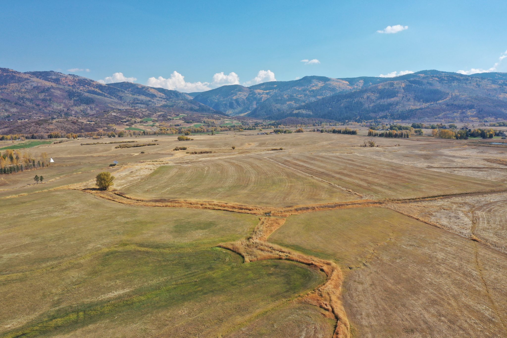


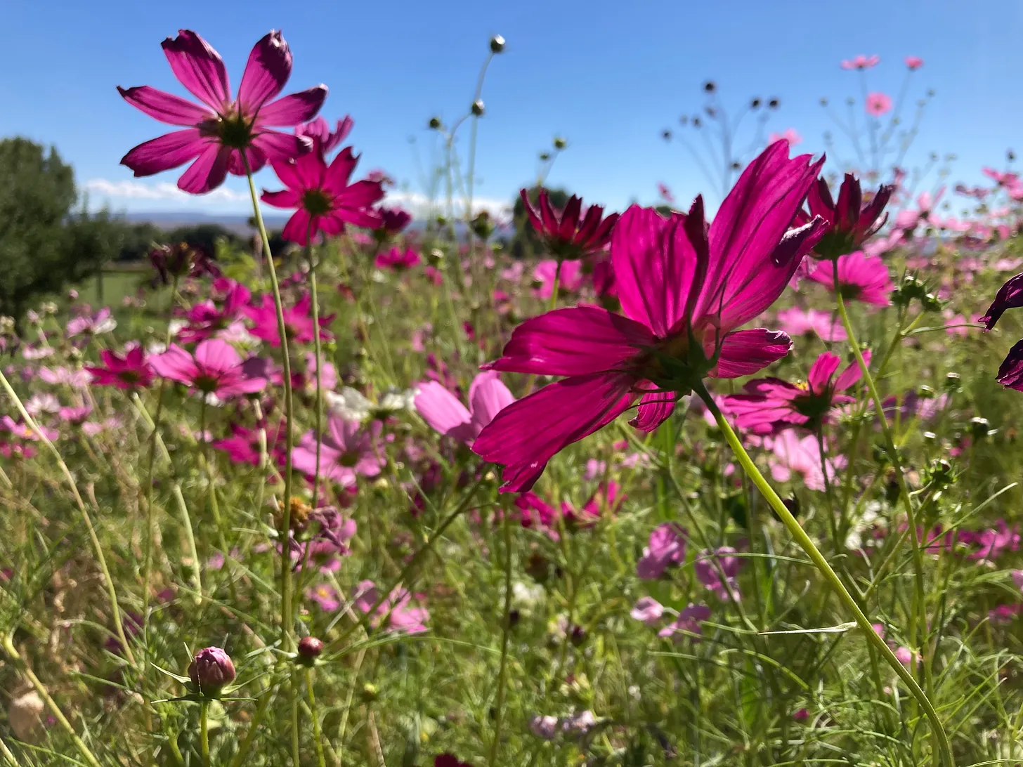


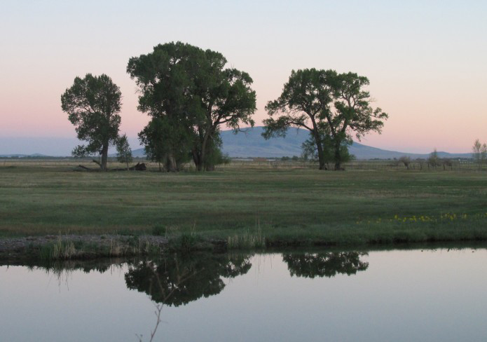


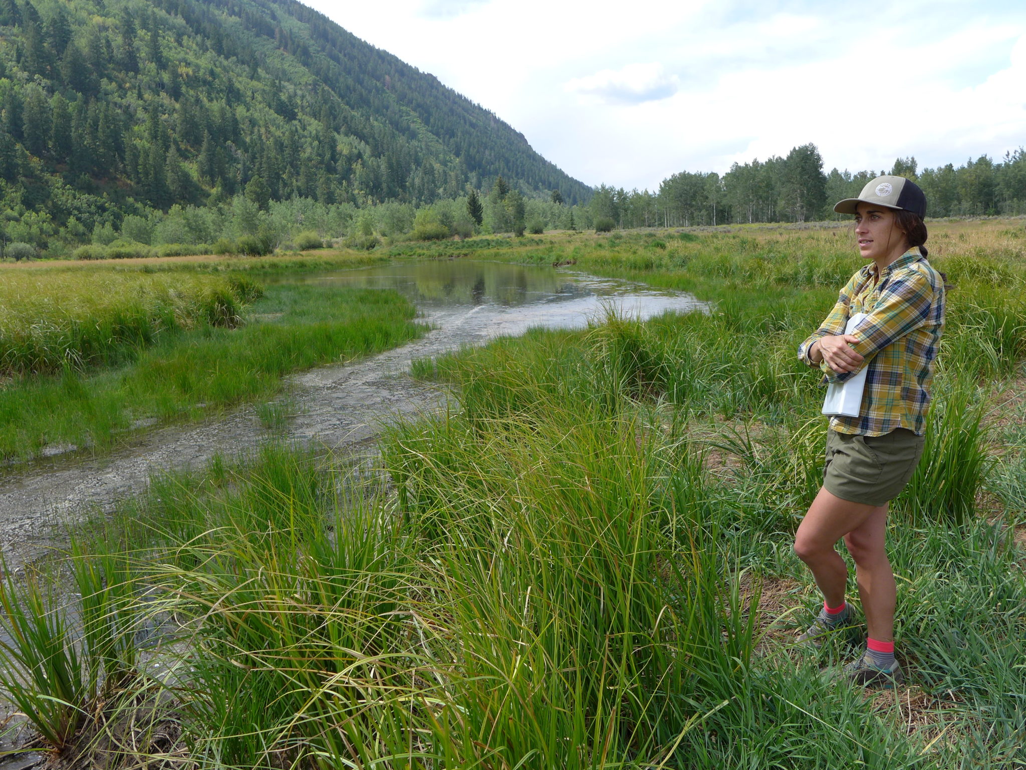
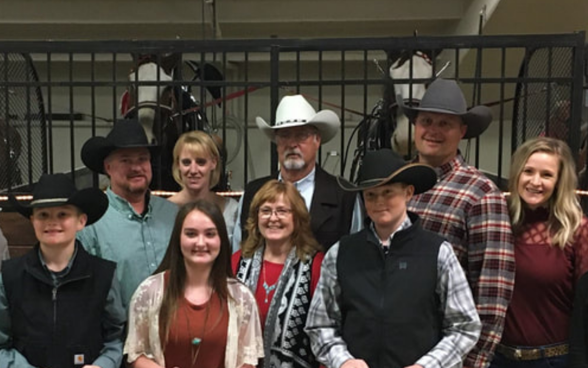
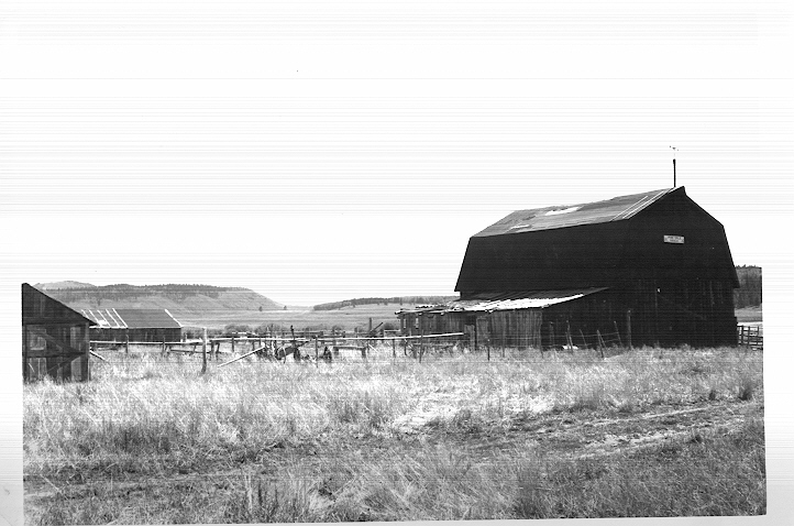

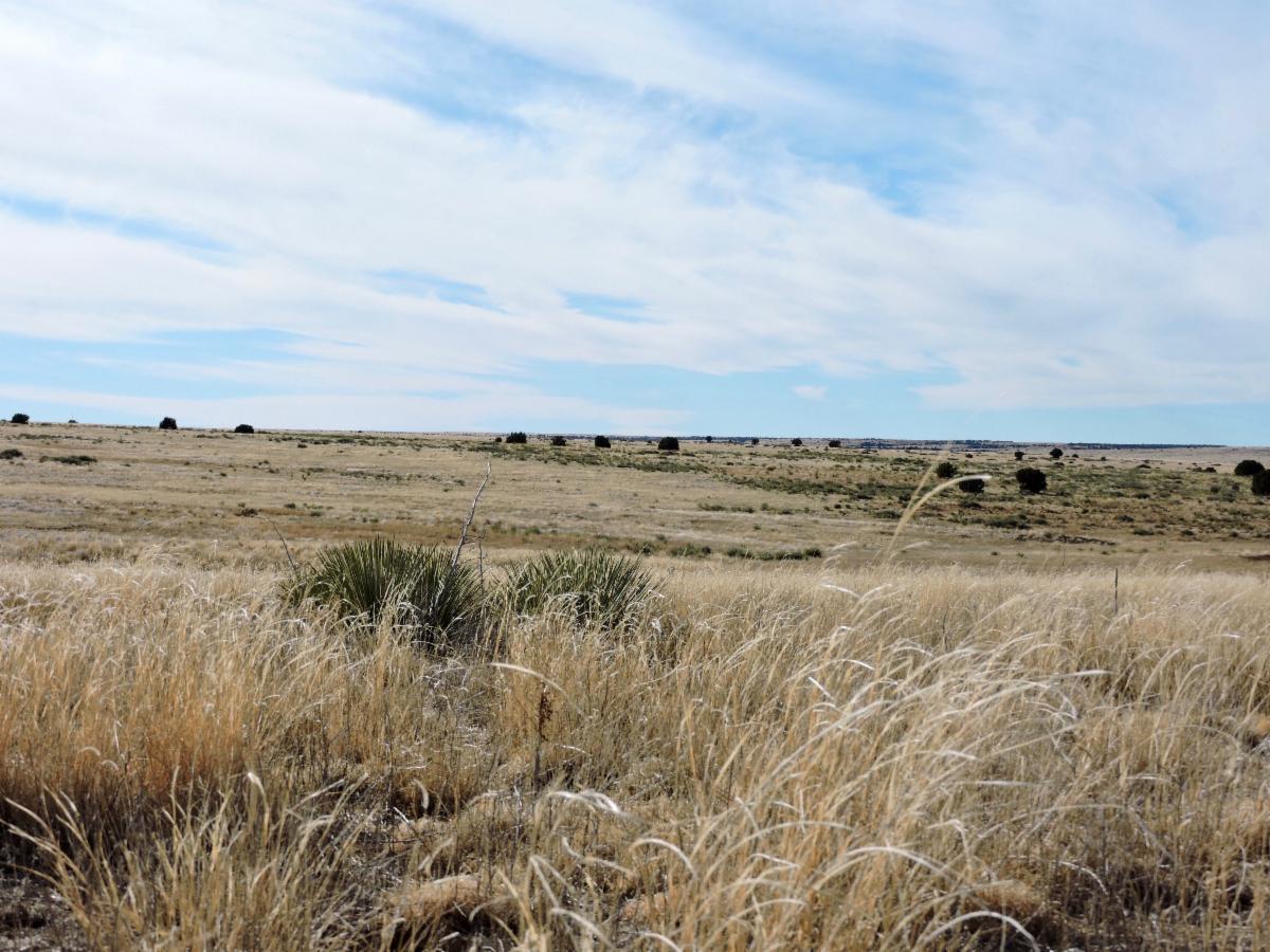
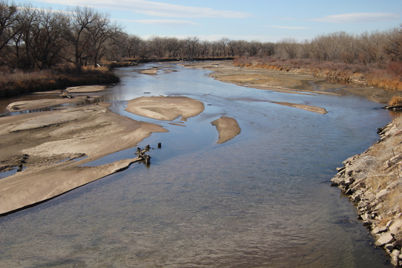


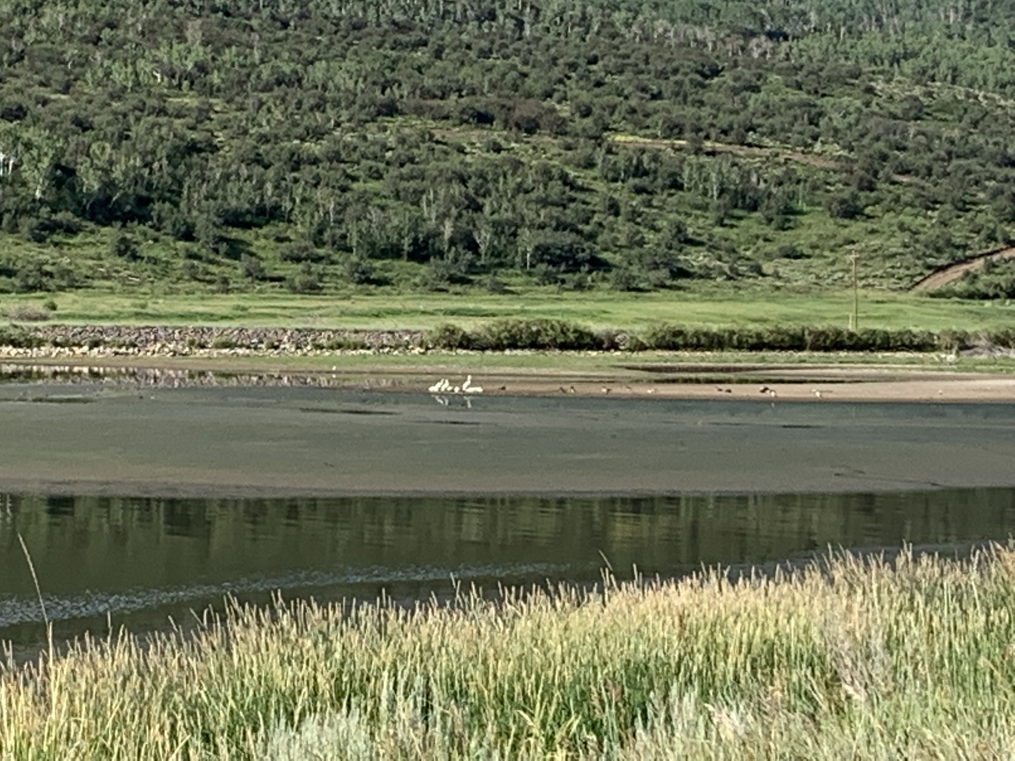


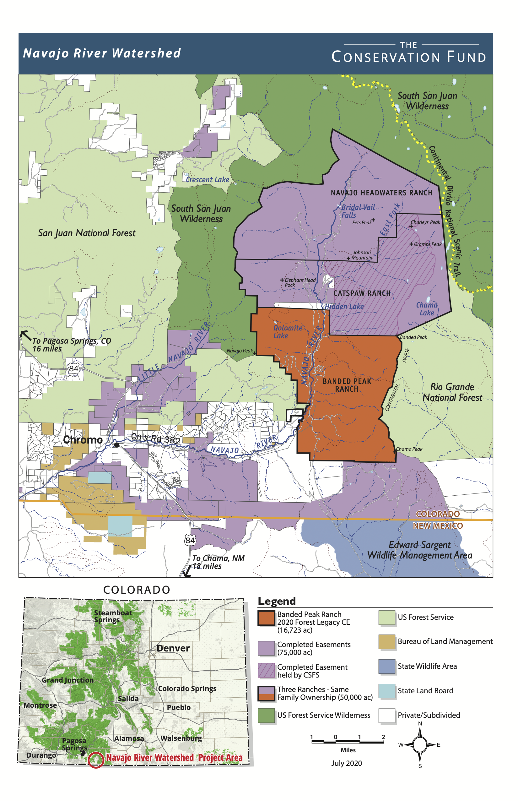

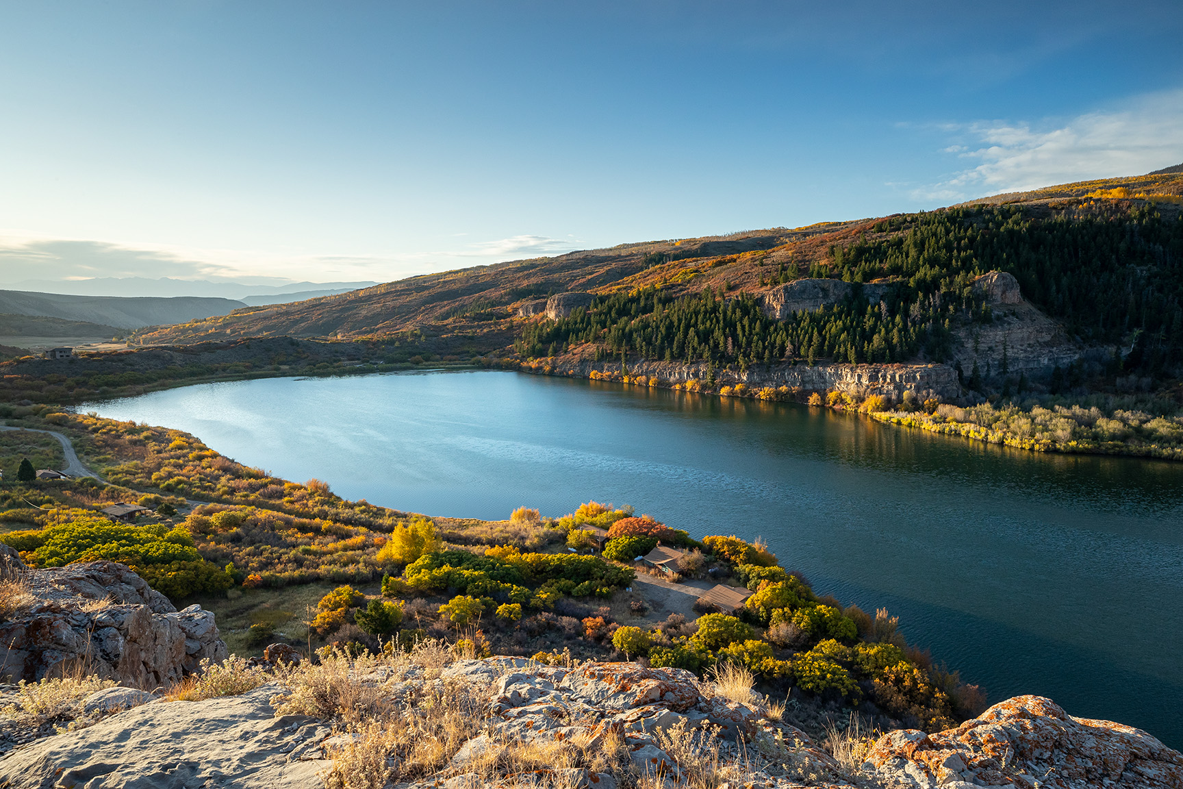
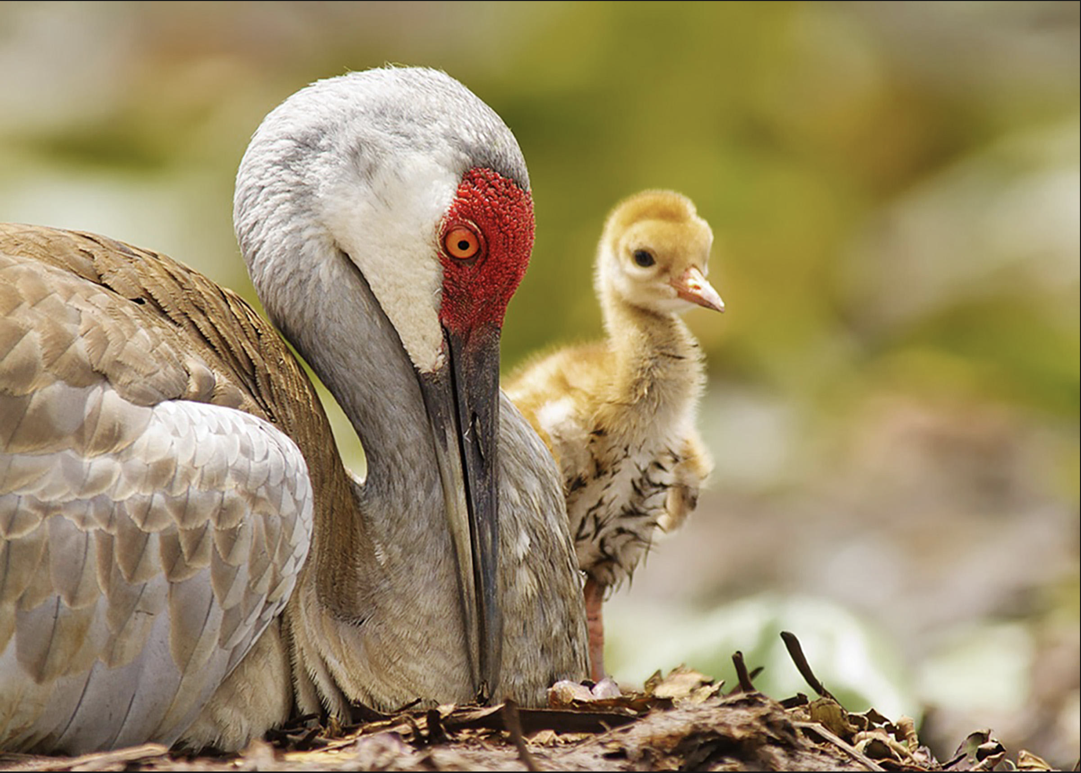
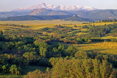
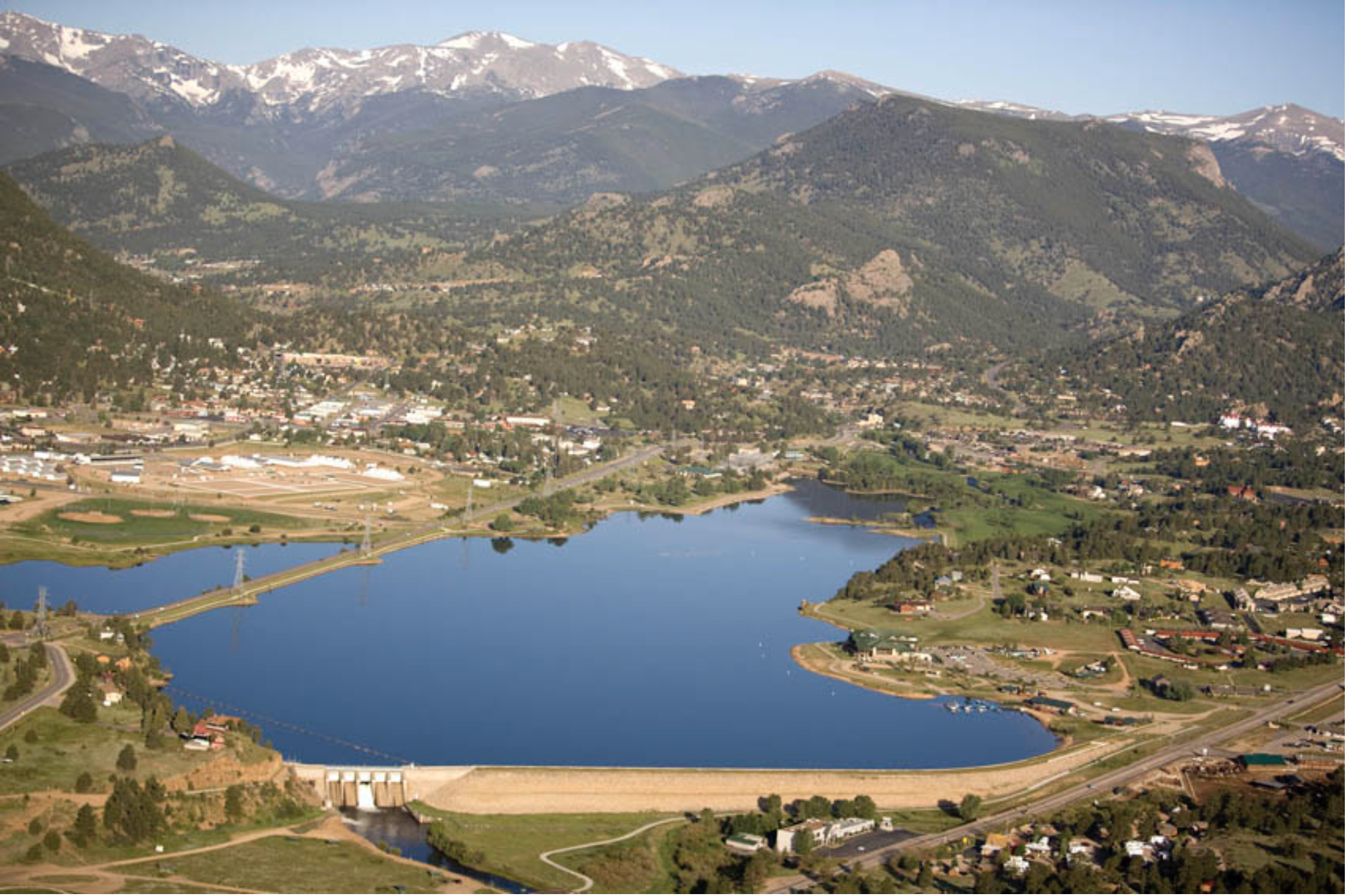


_basin_map")