Western Rivers Conservancy Land Donation Establishes San Luis Valley Conservation Area in #Colorado — USFWS

The landscape photo is of the New 13 acre easement, photo by Simi Batra/USFWS.

Here’s the release USFWS:

[Friday, September 14, 2018], the U.S. Fish and Wildlife Service accepted a 12.82-acre conservation easement donation in Colorado’s San Luis Valley from Western Rivers Conservancy. With the donation, the San Luis Valley Conservation Area becomes the 567th unit of the National Wildlife Refuge System, an unparalleled network of public lands and waters dedicated to the conservation of native wildlife and their habitats.

Western Rivers Conservancy has worked in partnership with the Service, state and local governments, as well as other conservation organizations to connect people and communities to this diverse ecosystem. Their donation of a conservation easement is yet another step in local efforts to conserve important fish and wildlife habitat and increase opportunities for public access. It will ultimately support increased biodiversity and recreational opportunities such as birding and hunting on nearby public and private lands.

“We are very pleased to partner with the Service to help create the San Luis Valley Conservation Area,” said Dieter Erdmann, Western River Conservancy Interior West Program Director. “The Rio Grande and its tributaries are the lifeblood of the San Luis Valley and we are committed to supporting voluntary conservation efforts that will benefit fish, wildlife and people alike.”

“By working collaboratively with our conservation partners and local communities to establish the San Luis Valley Conservation Area, we are helping ensure that the San Luis Valley continues to support some of the state’s most important fish and wildlife resources, as well as the people who live here, for generations to come,” said the Service’s Mountain-Prairie Regional Director Noreen Walsh.

In 2015, the Service approved the San Luis Valley Conservation Area Land Protection Plan, which clarified and guided the Service’s intent to continue working with partners and private landowners to establish voluntary conservation easements in this priority landscape. Easements allow landowners to retain their property rights and continue traditional activities such as livestock grazing and haying within the easement, while prohibiting commercial development. Under the plan, the Service could protect up to 530,000 acres with conservation easements donated or purchased from willing sellers.

The Conservation Area plan is designed to protect wildlife and wetland habitat in southern Colorado and northern New Mexico. Its limit is defined by the headwaters of the legendary Rio Grande, which begins its nearly 1,900-mile journey to the Gulf of Mexico in the San Juan and Sangre de Cristo Mountains that surround the San Luis Valley. Runoff from mountain snowpack creates wetlands and riparian areas in the midst of what otherwise is a high-mountain desert, providing important habitat for plants and migratory birds such as greater sandhill cranes, waterfowl and other sensitive or imperiled species. As the Conservation Area expands over time, the Service intends to protect wildlife habitat and maintain wildlife corridors between protected blocks of habitat on public and private conservation lands.

The new Conservation Area is the fifth unit of the San Luis Valley National Wildlife Refuge Complex and the ninth national wildlife refuge in the state of Colorado.

The Service’s Refuge System now encompasses 567 national wildlife refuges and 38 wetlands management districts across 150 million acres. Refuges are critical to the local communities that surround them, serving as centers for recreation, economic growth, and landscape health and resiliency. Each state and U.S. territory has at least one national wildlife refuge, and there is a refuge within an hour’s drive of most major cities.

Learn more about the National Wildlife Refuge System or the San Luis Valley Conservation Area.

For more information on our work and the people who make it happen, visit http://www.fws.gov/mountain-prairie/. Connect with our Facebook page at http://www.facebook.com/USFWSMountainPrairie, follow our tweets at http://twitter.com/USFWSMtnPrairie, watch our YouTube Channel at http://www.youtube.com/usfws and download photos from our Flickr page at http://www.flickr.com/photos/usfwsmtnprairie/.

The Colorado West Land Trust June News is hot off the presses

Click here to read the newsletter. Here’s an excerpt:

Kids learn about conservation and birding on conserved land

Last month East Middle School 6th graders enjoyed a morning bird-watching hike at Avant Vineyards conserved property on East Orchard Mesa. Thanks so much to Nic Korte from the Grand Valley Audubon Society for leading the hike and Neil Guard at Avant Vineyards for hosting!

Photo credit: Colorado West Land Trust

2018 #COleg: Conservation easements on Sonnenberg’s radar during the session

Pond on the Garcia Ranch via Rio Grande Headwaters Land Trust

From The Fort Morgan Times:

The perpetual concerns over the way the state has handled conservation easements also was on Sonnenberg’s radar. There were five bills this year on that issue, including a sunset review of the conservation easement oversight board. The bill, which is awaiting a signature from the governor, made changes to the board, including requiring a conflict of interest policy that would disqualify from serving any member who has a financial interest tied to conservation easements. Sonnenberg initially won support for an amendment that would address one of the program’s most controversial problems: landowners who received conservation easements tax credits from the state and the IRS, only to have those state tax credits yanked away. Hundreds of Coloradans have complained that the appraisal process has been rife with problems.

Sonnenberg’s amendment would have allowed the landowner to take back clear title to the land placed under easement, with the understanding that they would have to pay back the federal tax credits. That amendment didn’t succeed but the bill does include a requirement that the board come up with a process for making that happen.

The oversight board was extended for a year, and Sonnenberg said that meant “we kicked the can down the road a year.” But he was pleased that lawmakers got a commitment from the Attorney General’s office that they would figure out a way to “extinguish” conservation easements that have been devalued. Sonnenberg said he will carry that bill next year.

San Luis Valley wetlands are critical to wildlife

From The Valley Courier (Helen Smith):

Wetlands are a critical part of the San Luis Valley. Not only are they a key water resource, but they also provide habitat for numerous bird species and bring tourism dollars to the local economy. They are truly part of what makes the Rio Grande Basin distinct.

The San Luis Valley has three refuges that are overseen by the U.S. Fish and Wildlife Service under the direction of the United States Department of the Interior. They are the Monte Vista, Alamosa and Baca National Wildlife Refuges. The first refuge to be established was Monte Vista in 1952, followed by Alamosa in 1962, and finally the Baca in 2000. These areas make up the San Luis Valley Refuge Complex and are three in a system that consists of over 560 refuges nationwide. The Monte Vista Refuge is 14,804 acres and Alamosa comprises 12,026 acres and the Baca is 92,500 acres. The primary purpose of setting these lands aside is to protect vital wildlife corridors as well as water assets that are key to the well- being of the aquifer system that is crucial to the sustainability of the valley.

These refuges also serve as prime habitat and nesting grounds for over 200 species of birds as well as other species of native wildlife such as deer, elk, beaver, and coyotes. The Alamosa Refuge is also home to the historic Mum Well which serves as a key data collection point for Colorado and San Luis Valley Water users. The primary purpose, is to protect lands that are important and that make the San Luis Valley a beautiful place. The landscapes seen in the refuges also highlight the distinct regions of the Valley as well.

The Monte Vista Refuge was established for the purpose of protecting migratory bird species, especially the Sandhill Crane. The San Luis Valley U. S. Fish and Wildlife Service Office estimates that between 23 and 27,000 Sandhill Cranes make the San Luis Valley a rest stop during their annual migration to and from breeding grounds in the northern US.

The success of the migration north in the spring from winter habitat in New Mexico and Texas to summer habitat in Montana, Idaho, Wyoming, and Canada and south in the fall is based largely on the birds eating enough food in the SLV to complete the trek, survive winter, and arrive healthy enough to nest and raise the next generation. Grain left after harvest on privately owned fields in the SLV is a major food source necessary to complete a successful migration. Nearly the entirety of the Rocky Mountain Population of Greater Sandhill Cranes passes through Colorado during their migration. The feed from the abundant barley and rest in wetlands that the cranes get in the SLV is critical to the success of the migration and upcoming breeding, and the most important part of the migration in Colorado is the availability of grain and roost sites in the SLV.

Colorado Parks and Wildlife also protect wetland areas across the San Luis Valley. According to a 2012 report by CPW, “The value of wetlands can’t be overstated. About 125 species that are found here in Colorado are dependent on wetlands for their survival, including 98 species of migratory birds.” The species that benefit include waterfowl and 20 priority non-game species.

The agency mitigates wetlands based on a set of criteria that include hydrology, vegetation, land use and conservation. To manage the hydrology the goal is to maintain adequate width and depth (4–8 inches deep) for roosting, maintain flowing water to prevent spread of disease. Vegetation goals include monitoring for the availability of vegetation that produces food, controlling woody vegetation where needed, control encroaching coarse emergent vegetation and the use of livestock and controlled burns to maintain grass overstory.

Land use surveys look at the roosting and feeding sites, provide grit (e.g., pebbles and small gravel) at roost sites if needed, and remove unused fences. Conservation goals include monitoring harvest rates to maintain desirable population numbers and forming and maintaining partnerships between agencies agricultural producers, landowners and the public.

Like the US Fish and Wildlife Service and Colorado Parks and Wildlife, the Bureau of Land Management (BLM), National Park Service (NPS), US Forest Service (USFS) and the Natural Resources Conservation Service (NRCS) also work to protect wetland habitats. The Blanca Wildlife Habitat Area, managed by the BLM, serves as a refuge for birds, fish and other wildlife. The wetlands are a key area for birds since they provide habitat for migrating water and shorebirds. The bald eagle and the peregrine falcon also use the wetlands. Other Species of Management Priority that have been documented are American bittern, avocet, common yellowthroat, eared grebe, Forster’s tern, greater Sandhill crane, hen harrier, Savannah sparrow, snowy egret, sora rail, western grebe and yellow-headed blackbird. Shorebirds such as gulls, sandpipers and pelicans are at home in the salty environment, as well as 158 other species including a colony of breeding Snowy Plover. The Blanca Wildlife Habitat is a duck breeding concentration area, with mallards by far the most common, but good numbers of pintail and green-winged teal are also utilizing the area.

The Valleys farms and ranches also support the areas wetlands and see them as important part of the hydrologic cycle. Wetlands work as a sponge that helps to ensure that working ag lands maintain a water source in lean years and symbiotically rotationally grazed wetland remain healthier due do reduced grass overstory and less noxious weeds. San Luis Valley agriculture producers and water managers are partnering to do timed releases of water from area reservoirs to only supply irrigation water, but to insure river and wetland habitats benefit.

In the long run, wetlands provide wildlife habitat, grazing opportunities, groundwater recharge and sustainability of water resources.

Helen Smith is the Outreach Specialist for the Rio Grande Basin Roundtable.

The Economics of Conservation – Land Trusts Are Economic Drivers — @TaosLandTrust

Photo credit: Jim O’Donnell via the Taos Land Trust

From the Taos Land Trust (Jim O’Donnell):

In some ways, the impact of our work as a land trust is obvious. There is the stunning view of our valley from the overlook south of town. That is something every Taoseño treasures when coming home from a trip to Santa Fe, Albuquerque or further afield. There are the wide vistas to Taos Mountain across the fields north of Overland Sheepskin Company or the rolling forested mesas of Wolf Springs Ranch on the drive to Tres Piedras. Visually, our work protecting Taos’ landscape is kind of hard to miss.

Perhaps not quite as visible are the economic benefits that come with preserving these lands and building a connection between land and community. As Taos grows and changes Taos Land Trust aims to be a partner in bringing the positive economics of conservation to Taos.

Even though most conservation easements are placed on private land, there are huge benefits to the community as a whole. These include water supply protection, flood control, fish and wildlife habitat, hunting, fishing, hiking, bird watching and other outdoor activities, carbon sequestration, erosion control, agricultural crop production – AND economic growth. HOW?

Tax Benefits

For those who have placed land under a conservation easement with a land trust there is an upfront tax benefit. By removing the land’s development potential, the easement typically lowers the property’s market value, which in turn lowers potential estate tax. In New Mexico landowners at any income level can qualify for a tax credit worth 50% of the appraised value of the conservation easement up to a maximum of $250,000. That means money in people’s pockets that can be spent in the community or saved to enhance economic security.

Property is More Valuable

When a community protects open space, that community becomes a more desirable place to be. People enjoy vistas, parks, recreational opportunities and accessible natural areas. A trip to Kit Carson Park or Fred Baca Park on any given day will prove this point. These amenities in turn make land surrounding these protected areas more attractive.

Travel and Tourism

Tourism is a key component of the Taos County economy. In fact, we are the most tourism-dependent county in the state. There is no mystery as to why people come to Taos. From the wilderness areas in our surrounding mountains to the National Monument in our backyard, the Taos economy is built on open space recreation. All those people coming for our amazing open lands spend money on recreational equipment sales and rentals, special events, food, lodging and so on. Our open spaces and parks attract visitors and locals alike, creating revenue for local businesses.

Attracting New Businesses

Increasingly, the American economy is dominated by tech and knowledge companies. These type of businesses are not tied to a specific location as manufacturers are. These businesses have more freedom in choosing where to locate.

We all know that Taos needs more jobs. A wide range of studies show that when many businesses consider relocating they increasingly take into account the quality of life in the places where they might want to relocate. A number of studies note that these types of businesses (that typically pay well above minimum wage) seek to locate in places with open space, parks and protected lands. It is the same with retirees. Retired people bring money into communities and, again, surveys indicate that they typically to live in a place where recreation opportunities are plentiful. Communities that fail to provide recreation opportunities for retirees tend to see their tax base erode when retirees leave the community.

Beyond just open spaces and parks both tech business and retirees look for towns that are walk-able or bike-able and while Taos is not quite there yet, we are working with our partners to make bike paths, sidewalks and trails more available to Taoseños.

Reduced Costs to Town and County

The fact is that sprawl development is expensive. It costs more to hook people up to vital infrastructure like water, sewer and electricity that more they are spread out. Not to mention the road building and other transportation issues. Compact or focused development reduces state and municipal costs on road maintenance and delivery of services from water to solid waste to transit, to fire and police protection and school buses. Taos needs to protect its most valuable landscapes while increasing its densification.

Support Farming and Ranching

Land conservation supports working landscapes on which many in our county depend.

Farms and ranches are sometimes referred to as “working lands,” because they produce products and value for communities. The category also includes forests that produce timber and other wood products in a sustainable manner. The Trust for Public Land points out that:

“Lori Lynch, an economist at the University of Maryland, studied what farmers do with the money they earn from selling development rights as part of farmland preservation. Farmers in Maryland who had participated in conservation programs were more likely than other farmers to have invested in their farm over the past five years and to have attended workshops to learn new technologies and enhance their farming skills. According to the research, money paid to the farmers for the easement purchases circulated back into the local economy via debt reduction, savings or farm investment, farm operation financing , or retirement investment. Some bought more land or equipment.”

Clean Water, Clean Air

Parks and conserved lands reduce storm water by capturing precipitation, slowing its runoff, and reducing the volume of water that enters the storm water system. Think of our Rio Fernando property and how our work to restore that wetland will increase clean water in our community and better manage the flow of that water.

Many communities have to build expensive infrastructure like drainage channels and storm sewers to deal with flooding from storms or big winter runoff. There is also the question of how to pay for and deal with nonpoint-source pollution caused when water picks up chemicals and contaminants from parking lots and other impermeable surfaces. As the impacts of climate change become more severe (think of Hurricane Harvey) a resilient community will need to rely on ecosystem services to deal with increased rainfall and other severe weather events.

Trees and shrubs in parks and open spaces remove air pollutants that endanger human health and damage structures. Trees and other vegetation promote air quality by taking up pollutants through their leaves and diffusing them into their cells.

Health

We all know that one key way to incorporate exercise into daily activity is to walk or bike for errands near home. However, many towns such as ours unfortunately do not facilitate easy exercise. As mentioned before, we are working with local governments and citizens to develop land use regulations, mapping and paths to shape our community into one where Taoseños can easily integrate exercise into daily activity. And our conservation work has a role too. Some of the land we have protected can eventually be used for greenways that support hiking, biking, and other human-powered transportation.

We’re all in this together. Taos Land Trust is a partner and resource in building a resilient and thriving future – and economy! – for our northern New Mexico community.

2018 #COleg: Governor Hickenlooper signs SB18-066 (Extend Operation Of State Lottery Division)

The upper Colorado River, above State Bridge. Photo: Brent Gardner-Smith/Aspen Journalism

From Governor Hickenlooper’s office via The Loveland Reporter-Herald:

Gov. John Hickenlooper signed Senate Bill 18-066 into law Monday, reauthorizing the Colorado Lottery through 2049.

“The Colorado Lottery is the only lottery in the nation that commits nearly all of its yearly proceeds to outdoor recreation or habitat and wildlife conservation,” Michael Hartman, executive director of the Colorado Department of Revenue, said in a press release. “Coloradans can rest assured that their lottery game spending will continue to support the incredible resources that make our state so special, including supporting the capital needs of our state’s great school systems.”

According to the release, in the last five fiscal years, the lottery has distributed more than $670 million to its four beneficiaries — the Conservation Trust Fund, Colorado Parks and Wildlife, Great Outdoors Colorado and the Building Excellent Schools Today program.

Since its start in 1983 through fiscal year 2017, the Colorado Lottery has returned to more than $3.1 billion to its beneficiaries.

The money is distributed 50 percent to the Great Outdoors Colorado Trust Fund, 40 percent to the Conservation Trust Fund, and 10 percent to Colorado Parks and Wildlife. GOCO funds in fiscal year 2018 are capped at $66.2 million and funds that exceed the cap will go to the Colorado Department of Education’s Public School Capital Construction Assistance Fund, according to the lottery website.

The current structure of the primary lottery beneficiaries has been in place since 1992, when the people of Colorado voted to the amend the Colorado constitution and create the Great Outdoors Colorado Trust Fund.

Lottery funds have been used to create and restore hundreds of miles of trails, protect hundreds of miles of rivers, create thousands of jobs, add thousands of acres to the state parks system, create more than 1,000 parks and recreation areas, and protect over 1 million acres of land.

Under a reauthorization passed by the Colorado Legislature in 2002, the Lottery division was extended 15 years from 2009 to 2024. The new bill adds 25 years, authorizing the lottery until 2049.

To learn more about where the funds go, visit http://coloradolottery.com/en/about/giving-back.

Gunnison County: Trampe Ranch protection a done deal

Here’s the release from the Trust for Public Land:

Broad coalition protects more than 4,300 acres with help from the largest-ever GOCO grant

The Trust for Public Land today announced the final-stage closing in the protection of 4,377 acres of working ranchland in the scenic valleys of the Gunnison and East Rivers between Gunnison and Crested Butte. The protection effort, for land on the Trampe Ranch, was completed through three working-ranch conservation easements and with help from a $10 million grant from the Great Outdoors Colorado (GOCO) funding program, the largest single transaction grant in the organization’s history.

The easements prevent subdivision and development of scenic ranchlands stretching for 30 miles in one of Colorado’s most iconic landscapes. These lands are essential to agriculture, with Trampe Ranch generating 20 percent of Gunnison County’s agricultural economy. In addition, the conserved lands provide scenic views that attract tourists and visitors, include habitat for a wide variety of wildlife, and serve as research lands for scientists from the nearby Rocky Mountain Biological Laboratory.

“The lands and waters of the Trampe Ranch play such an important role in defining the character and sense of place of one of Colorado’s last, great mountain valleys,” said Jim Petterson, The Trust for Public Land’s Southwest and Colorado Director. “This project brought together a deep and broad partnership of individuals, governments and organizations, all allied around a shared commitment of helping local communities fulfill their visions for how they want to grow and what they want to preserve.”

Efforts to protect ranchlands and open space in the Gunnison Valley began in the 1980s in an alliance between local land trusts, national conservation groups, funders like GOCO, local governments, and agricultural landowners, including Trampe Ranch owner Bill Trampe, who has been a leader in encouraging ranchers to conserve their land with easements. With the completion of the most recent project, Trampe Ranch has more than 6,000 acres under easement.

“GOCO is proud to be one of the partners to help make this monumental land conservation effort possible, and our Board of Trustees and staff are eternally grateful to Bill Trampe for his vision, leadership, and generosity,” said GOCO Executive Director Chris Castilian. “Trampe Ranch received GOCO’s largest ever, single transaction grant award at $10 million, because conserving this iconic property means the protection of vital agricultural land and stunning scenic views for those who will recreate on beautiful, adjacent public lands for generations to come.”

“What this one very special place means to the Gunnison Valley and to our entire state cannot be overstated. Today we join our fellow Coloradans in celebrating Bill Trampe, his family, and all they have accomplished,” added Castilian.

In addition to the GOCO grant, funding for the project came from the Natural Resources Conservation Service, the towns of Crested Butte and Mt. Crested Butte, Gunnison County, The Rocky Mountain Biological Laboratory, Crested Butte Land Trust, and 1% for Open Space, a consortium of Gunnison County businesses that collects a voluntary donation of 1% of sales for its customers to fund open space conservation in Gunnison Valley. Additional private funding came from a multi-million dollar campaign. Trampe Ranch also donated a significant portion of the conservation easement value toward the project.

“This land has been the heart of our ranch for more than 100 years,” said Bill Trampe. “Conservation of our home place means this land is available forever for agriculture.”

Local partners cheered the completion of the conservation effort.

“We are very excited to see this critical step in the conservation of the East River Valley,” said Dr. Ian Billick, Executive Director of the Rocky Mountain Biological Laboratory. “Keeping the properties in ranching is one of the most important things we could do to leverage the nation’s large investment in the field research that helps us manage our water, air, and food.”

“Nothing is more important than the preservation of the natural state of Colorado and its heritage of ranching. Especially in this day and age when there seems to be a valid threat to open spaces throughout the West,” said Mayor Jim Schmidt from the Town of Crested Butte.

“We are very excited about the completion of this final conservation easement,” said Carlos Fernandez, Colorado State Director for The Nature Conservancy. “The Trampe Ranch is a spectacular property with some of the most outstanding scenery in Colorado. Conserving this iconic ranch leaves an amazing legacy for the Gunnison Valley, reminding us of Colorado’s history and landscape.”

From The Crested Butte News (Mark Reaman):

One of the most significant land preservation actions in Colorado concluded Tuesday, April 10 with the closing of the last parcel of the Trampe Ranch property in Gunnison County. The final closing puts thousands of acres of prime ranchland stretching from Gunnison to Gothic into a conservation easement that is meant to keep the property free of development and focused on agriculture in perpetuity.

This multimillion-dollar deal was broken up into three parts totaling 4,377 acres. The first step took place in February 2017 when the 1,447-acre Trampe Home Ranch was preserved. That parcel, located near Gunnison, resulted in Gunnison sage grouse habitat being protected.

“This land has been the heart of our ranch for more than 100 years,” said Bill Trampe at the time. “The meadows and pastures are the resource base for ranch production, and also provide habitat for Gunnison sage grouse and other wildlife species. Conservation of our home place means this land is available forever for agriculture and for the birds.”

The second phase of the overall effort took place in October 2017 when 284 acres were preserved in the corridor between Gunnison and Crested Butte near Jack’s Cabin. And Tuesday’s 2,647-acre closing put land primarily located in the Upper East River Valley near Crested Butte into the conservation easement.

The Nature Conservancy is the holder of the Trampe Ranch conservation easement and the Trust for Pubic Land facilitated the transactions and led the public and private fundraising campaign…

While 4,377 acres were protected in these latest three closings, in sum total, the Trampe Ranch will have close to 6,000 protected acres from prior projects near Roaring Judy Fish Hatchery.

Webinar: Request for Water Acquisitions — @COWaterTrust

Little Cimarron River via the Western Rivers Conservancy

Click here for all the inside skinny and to register:

2018 Request for Water Acquisitions Pilot Process

Are you curious about how you can help keep your local rivers and watersheds healthy, especially during this dry year? Join us and learn more!

Click here to register for the webinar.

Colorado Water Trust staff will explain the Pilot Process, available transaction tools and the protections available to water right owners who share their water with the environment.

Voluntary water sharing arrangements or voluntary acquisitions of senior water rights, on a temporary or permanent basis, are tools that – particularly in dry years – can help restore flows to rivers in need, sustain agriculture, and maximize beneficial uses of Colorado’s water.

This year, the Colorado Water Trust is partnering with the Colorado Water Conservation Board (CWCB) on a Request for Water Acquisitions Pilot Process. This Pilot Process intends to:

  • Invite voluntary water offers from willing water right owners to benefit streamflow;
  • Provide a user-friendly mechanism for water right owners to explore working with CWCB and the Colorado Water Trust on water acquisition transactions;
  • Streamline transaction processes and utilization of resources;
  • Facilitate implementation of Colorado’s Water Plan objectives, and,
  • Add flows to river segments in need while coordinating with agricultural and other uses.
  • Following the drought years of 2002, 2012 and 2013, the legislature created several new tools for water right owners to lease or loan their water for instream flow or flow restoration use without penalty to their water rights. These new tools have been successfully implemented in several river basins around the state, and benefitted water-short streams during the dry years of 2012-2013.

    This year, with streamflow forecast to be well below average in many of parts of Colorado, temporary, voluntary, compensated leases or loans of water may provide an alternate source of revenue to preserve agricultural operations and may also help sustain streams and aquatic life during critically low flows.

    Additional information about the Pilot Process, including Inquiry/Offer Forms and FAQs, can be found here on our website.

    Register now!

    The Colorado Water Trust Team

    *Presentation of this webinar is made possible by our friends at Water Education Colorado.

    The Eagle Valley Land Trust and the Eagle River Watershed Council hope that area businesses will collect 1% fee for streams

    Eagle River Basin

    From The Vail Daily (Pam Boyd):

    The 1% for Land and Rivers initiative is pretty self-explanatory. The organizations are reaching out to area merchants willing to impose a voluntary 1 percent fee on transactions, with the money going to the two sponsoring nonprofits. Participating businesses will display signs noting their participation in the program, and customers will have the option to opt out of the payment at the time of purchase.

    Jim Daus, executive director of the Eagle Valley Land Trust, was inspired to launch the program in Eagle County after studying similar efforts in the Crested Butte and Buena Vista areas. Program participants in those communities told Daus that customers were overwhelmingly supportive of their programs and, during their operation, only one or two people a year ask to opt out of paying the 1 percent fee.

    “This is a way for everyone in the community to give a little bit,” Daus said. At 1 percent, the fee is a penny on a $1 purchase, a dime on a $10 percent or a dollar and on $100.

    Every type of business is welcome to participate, and the Land Trust and Watershed Council are willing to help get the program started. In addition to providing signs for both the business front entry and cash register area that announce participation in 1% for Land and Rivers, program volunteers can work with business owners to launch the effort. Program literature notes that point-of-sale setup should be very simple, but if a merchant has issues, then the program can provide a $100 credit if a business needs to contact its bookkeeper or other professional point-of-sale representative.

    “Don’t overthink the opt-out. It is very rare that people opt out (typically less than one customer per five years). There are several simple ways other businesses handle this. For businesses that provide bids and invoices, we’ll provide sample language showcasing your support of land and rivers,” the program statement says.

    All donations received from 1% for Lands and River will be used directly by the Land Trust and the Watershed Council within the Eagle River and Colorado River watersheds to help fund their objectives of promoting clean water and responsible growth through preservation of open space, agricultural operations, fish and wildlife habitat, public recreation, scenic vistas and significant natural resources. The organizations are proud to share the work they have done with landowners and local, state and federal agencies to help identify and protect land and water with key values.

    More than 7,700 acres of Eagle County land have been placed in conservation easements, while many projects are currently underway that will significantly add to this acreage. More than 40 miles of stream banks and fish habitat have been restored and protected. Every year, more than 5,000 points of water quality data are collected and analyzed in an effort to stay ahead of threats to stream health.

    Palisade: Colorado West Land Trust nears goal of protecting 1,000 acres

    Palisade peach orchard

    From The Grand Junction Daily Sentinel (Katie Langford):

    As the Colorado West Land Trust nears a long-term goal of preserving 1,000 acres of farmland in Palisade, a new 22-acre conservation easement of peach and apricot orchards is moving the needle that much closer.

    Rob and Clare Talbott of C&R Farms have previously conserved 59 acres of orchards through the land trust, and Director of Conservation Iliana Moir said she was happy to hear the Talbotts wanted to do it again.

    The land trust has conserved approximately 800 acres of Palisade farmland through conservation easements since 2009. Conservation easements are an arrangement in which landowners agree not to subdivide their property and the land trust agrees to hold it in perpetuity. In Palisade, it means those 800 acres will only be used for farming.

    “That area is the only area in the Grand Valley that consistently produces good fruit, so it’s really important,” Moir said. “The winds that come through De Beque Canyon in the spring keep the frost from settling on the peach buds, and the area around Palisade has prime, unique soil that’s excellent for growing fruit trees. They have excellent water rights, so they can invest in long-term crops.”

    Colorado West Executive Director Rob Bleiberg said preserving Palisade’s agriculture industry is key for the future success of the Grand Valley.

    “We have been focused on the fruitlands of Palisade since our founding in 1980, and for the simple reason that the orchards and vineyards are an incredible asset for our community and an economic driver,” Bleiberg said. “They define Palisade.”

    The Talbotts started farming in 1979 and have long understood the need to preserve the farmlands of Palisade, said Rob Talbott.

    “Our family believes it’s important to preserve farming for future generations,” he said. “There is a lot of pressure on orchards to subdivide their land so homes can be built. Once these homes are built, the small orchard on the property can’t sustain the cost of the home, therefore putting the property out of reach of young farmers to purchase the property as an initial investment or an existing young farmer to expand. We want future generations who want to make farming their livelihood to have the ability to afford to do so.”

    Culebra watershed: Grant from the Trinchera Blanca Foundation will allow Colorado Open Lands to work toward the conservation of 2,000 acres

    Culebra Peak via Costilla County

    From Colorado Open Lands via The Alamosa News:

    Colorado Open Lands announced continued support from The Trinchera Blanca Foundation to protect historic water rights and increase awareness of conservation across the San Luis Valley. A generous grant from The Trinchera Blanca Foundation, an affiliate of The Moore Charitable Foundation, founded by Louis Bacon in 1992, will allow Colorado Open Lands to work toward the conservation of 2,000 acres of naturally and culturally significant land and acequia water rights in the Culebra Watershed.

    The protection of these important lands will promote working agriculture throughout the Culebra Basin. Dating back to the historic Spanish Land Grant, the Culebra Basin has the oldest water rights in Colorado and serves as a major wildlife corridor for the nationally protected Southwest Willow Flycatcher, Yellow Billed Cuckoo, and Sangre de Cristo elk herds. Conservation easements will ensure that the water rights can never be sold separately from the land. The LOR Foundation and Great Outdoors Colorado are also supporting this critical initiative.

    “We are grateful for the support of The Trinchera Blanca Foundation to help Colorado Open Lands kick off our Acequia Initiative Project and support ongoing efforts to encourage conservation leadership,” said Judy Lopez, Colorado Open Lands Conservation project manager. “Protecting these local farms and ranches and the water that irrigates them ensures they can remain in historic agricultural production, which is essential to the future of the community.”

    “Colorado Open Lands’ Acequia Initiative Project is an essential and significant effort to preserve working agriculture and the unique cultural and conservation heritage in Costilla County,” said Ann Colley, executive director and vice president of The Moore Charitable Foundation and its affiliates.

    A portion of The Trinchera Blanca Foundation grant will continue support for the “Emerging Leaders Program,” an ongoing initiative to promote conservation leadership among people with business, community, conservation and philanthropic backgrounds. The funding will help encourage individuals to champion conservation in their respective fields.

    The partnership between The Trinchera Blanca Foundation and Colorado Open Lands has helped complete important community projects, including:

    The creation of comprehensive outreach programs to educate communities of the value of conservation and urge them to participate in conservation efforts.

    Conservation Easement Acquisition in the southern San Luis Valley. To date Colorado Open Lands has completed three conservation easements, totaling about 700 acres, on acequia-irrigated lands along the Rio Culebra. This group of conservation easements have paved the way for the new and more widespread 2017 Acequia Initiative Project.

    About Colorado Open Lands

    Colorado Open Lands is a statewide land conservation organization dedicated to preserve open lands through private and public partnerships, innovative land conservation techniques, and strategic conservation tailored to the land it protects. All of Colorado Open Lands conservation easements share the same goal: permanent protection from the property being subdivided or developed. That means that all the treasures that come from the land remain: scenic views, fresh water, wildlife habitat, local food production, and Colorado’s heritage.

    About The Trinchera Blanca Foundation

    The Trinchera Blanca Foundation, the Colorado affiliate of The Moore Charitable Foundation, founded by Louis Bacon in 1992 supports organizations committed to protecting land, water and wildlife habitat in Colorado’s San Luis Valley.

    The Trinchera Blanca Foundation also supports community programs dedicated to improving quality of life in the surrounding region.

    @ColoradoStateU: Investments in conservation easements reap benefits for #Colorado

    Colorado’s diverse landscape has a rich natural and agricultural heritage that fuels the economy. Photo: Michael Menefee

    Here’s the release from Colorado State University (Mary Guiden):

    Colorado is famous for its iconic landscapes, which have helped shape the state’s identity and economy. From agriculture to recreation and tourism, from minerals and fuels to forest and wildlife, Coloradans are dependent on nature for many things that enrich our lives.

    Not surprisingly, state officials have repeatedly identified conservation of the state’s natural and agricultural lands as sound public policy. This includes providing incentives for conservation easements. These are legally binding agreements between private landowners and nonprofit land trusts or government to protect conservation values of a property.

    A new analysis from Colorado State University found that each dollar invested by the state for these easements produced benefits of between $4 and $12 for Coloradans. Public benefits include clean water and air, scenic views, access to things produced by local farms and ranches products, and wildlife habitat: all things that contribute to a high quality of life in the state. Researchers said these data show that easements are conserving land that is important for wildlife, agriculture, tourism and outdoor recreation for Colorado’s visitors and residents alike.

    Conservation easements protect specific conservation values of a property, such as wildlife habitat. Photo: Michael Menefee

    “There is a substantial return to the Colorado taxpayer on investments in programs designed to conserve the features of the Colorado landscape that are so dear to all of us,” said Andrew Seidl, one of the study authors and a professor in the Department of Agricultural and Resource Economics at CSU.

    Based on the new analysis, the CSU research team found the investments from the state programs conserve:

  • More than 114,450 acres of preliminary priority habitat for greater sage grouse
  • Nearly 300,000 acres of prime farmland
  • 250 miles along designated scenic byways
  • More than 4,100 miles of streams, creeks and rivers
  • More than 270,000 acres of habitat used by elk during severe winter conditions
  • The state programs have invested nearly $1.1 billion on conservation easements since 1995, according to the new analysis. CSU researchers — who examined data on 2.1 million acres of Colorado lands with conservation easements — said the related benefits for state residents are as high as $13.7 billion.

    The study focused on Colorado’s investments in conservation easements funded through a tax credit program and Great Outdoors Colorado. The voter-approved program uses a portion of lottery proceeds to help with efforts to protect wildlife habitat, river corridors, productive agricultural lands, iconic scenic views. It has also created trails and open spaces for Coloradans to enjoy.

    Colorado is famous for its iconic landscapes. Photo: Michael Menefee

    Study co-author Michael Menefee, an environmental review coordinator with CSU’s Colorado Natural Heritage Program, said the investments are filling a vital need for conservation of identified priorities on private lands. “An active partnership between private landowners and public policy can achieve what neither acting alone can accomplish,” he added.

    The Colorado Office of the State Auditor released an analysis in December 2016 concluding, among other findings, that it was difficult for the public and policymakers to determine the benefits from the conservation easement program. But this new study used a more robust data set from the Colorado Ownership, Management and Protection (COMaP) database, the state’s most comprehensive map of protected lands.

    COMaP started as a Geographic Information System research project in CSU’s Department of Fish, Wildlife, and Conservation Biology in 2004. Since then, it has evolved into an important tool for those around the state with an interest in privately and publicly protected lands.

    “Easements are the primary tool in Colorado for conserving these many benefits while still maintaining land in private ownership – often as working farms and ranches,” said Drew Bennett, study co-author and a postdoctoral fellow at CSU.

    The study’s authors will present their findings later this month at a hearing of the Colorado General Assembly’s Legislative Audit Committee. Committee members will review the programs and consider potential changes.

    The study was funded by Robert L. Tate, a longtime supporter of and donor to the Warner College of Natural Resources and Colorado State University.

    Opinion: Conservation easements are an investment in soils

    Saguache Creek

    From The Grand Junction Daily Sentinel (Tamera Minnick):

    Soils are vital to ecosystem health. In the U.S., we learned this the hard way in the 1930s Dust Bowl. Extreme drought was just one of the drivers of the Dust Bowl. The effects were magnified by economic, policy and land management decisions during the prior decade.

    At the end of World War I, European agriculture was in disarray and American agriculture benefited. During a few years, wheat prices were high and borrowing money was easy. The result was 5.2 million acres of marginal agricultural lands plowed to grow wheat. In retrospect, we now appreciate that these lands should have stayed as native grass.

    Once that soil was destabilized by plowing and left bare in the drought, it blew. And blew. People died of dust pneumonia — not caused by a bacteria or virus, but from the dust itself.

    In 1935, Dr. Hugh Bennett, a soil scientist, prescribed protecting and revegetating these marginal lands with grasses. When government agencies insisted that soil was a resource that could not be exhausted, Bennett replied, “I didn’t know so much costly misinformation could be put into a single brief sentence.” The main problem with Bennett’s ideas, like today, was that he had to persuade Congress to fund them.

    Congress was stubborn, but Bennett rescheduled a hearing for an afternoon in which he knew that a big duster had formed and was headed for Washington, DC.

    As the meeting began, success appeared unlikely. It suddenly grew dark. The dust storm blew in and turned day to night. Funding was approved. This was the inception of what would become the Soil Conservation Service, now the Natural Resources Conservation Service. Today, most farmers have easy access to an NRCS office.

    NRCS strives to decrease erosion by aiding farmers in adopting techniques such as low- or no-till plowing, contouring with the landscape, using buffer strips around water, and planting shelterbelts.

    Building on this success, President Ronald Reagan implemented the Conservation Reserve Program in 1985. The intent was to take marginal land, mostly land at risk for erosion, out of crop production and plant native grass. The federal government pays rent to farmers for providing this public service of stabilizing these marginal lands.

    The CRP has decreased erosion, improved wildlife habitat, and enhanced water and air quality, all while keeping the land in private ownership.

    One of the deficiencies of the CRP is the short-term nature of the contracts. For 15 or 20 years, erosion is controlled, soil organic matter gradually accumulates, wildlife populations rebound, and sites stabilize. But there can be sudden changes.

    For instance, in 2007, crop prices increased dramatically. Many marginal lands were put back into crop production. In one year, many of those public goods, paid for by taxpayers, were eliminated.

    In the late 1990s, a new conservation tool was developed — conservation easements. With conservation easements, the right to develop the land is relinquished and, in return, the owner usually is accorded significant tax credits.

    One similarity between the CRP and conservation easements is that entering into either one is voluntary. The landowner makes a personal and economic decision that the program is the right thing to do with his or her private land. Additionally, the private land remains private.

    There are some major differences between conservation easements and CRP. Under conservation easements, many land uses are allowed, including continued crop production; these are described in a contract. Also, the easement is often held by a non-profit (like our own Mesa Land Trust). The result of an easement is a substantial tax credit (which in Colorado can be transferred to others). Finally, the easement is permanent, not just a 10- or 15-year contract.

    That last point is important. At Colorado Mesa University, my colleagues, students, and I have reported that it may take our fragile western soils 50 years or more to recover to a healthy functioning status following damage (and much longer if topsoil is lost to erosion). Permanent conservation easements assure public investments will not be lost with short-term fluctuations in commodity prices.

    Another reason that conservation easements are in perpetuity? In order to gain the federal and Colorado tax credits, the easement must be permanent.

    Mesa Land Trust is phenomenally successful in our county. There is widespread support, and they have helped landowners protect, in perpetuity, over 66,000 acres. Much of this is important wildlife habitat outside of the valley, while some insures that agriculture thrives in the valley and that we have buffers between our towns to preserve the rural character of our area.

    Conservation easements are a modern tool based on our improved understanding of the science of how ecosystems function. Their perpetual nature guarantees the public’s return on this investment.

    Tamera Minnick, Ph.D., is a professor of environmental science and technology at Colorado Mesa University where she has taught soil science and sustainability. She recently renewed her membership with Mesa Land Trust. Much of the Dust bowl information came from Timothy Egan’s “Worst Hard Time: The Untold Story of Those Who Survived the Great American Dust Bowl.” Email tminnick.gjsentinel@yahoo.com.

    @COWaterTrust: RiverBank is two weeks away! (June 14, 2017)

    Lulu City with Lake Granby in the distance. Photo credit Greg Hobbs.

    Wednesday, June 14th
    5:30-8:30 pm
    Denver Botanic Gardens

    Get your tickets now!

    RiverBank is our annual fundraiser, where our wonderful supporters have a chance to connect with each other, celebrate our partnerships, and spend time with our team.

    We have an amazing evening planned, so we just need YOU!

    Join us for great food, wonderful beverages from our open bar, a fantastic silent auction, and the opportunity to recognize our David Getches Flowing Waters Award winner, Lurline Underbrink Curran! (Read more about Lurline’s accomplishments here.)

    Click here for tickets!

    Environmental Defense Fund looking for win-wins with farmers RE: groundwater depletion

    The High Plains Aquifer provides 30 percent of the water used in the nation’s irrigated agriculture. The aquifer runs under South Dakota, Wyoming, Nebraska, Colorado, Kansas, Oklahoma, New Mexico and Texas.

    [ed. Coloradans know that ranchers and farmers are key stakeholders in the preservation of habitat and water resources, and they grow our food.]

    Here’s an interview with EDF staffers from Matt Weise writing for Water Deeply. Click through and read the whole article. Here’s an excerpt:

    Environmental Defense Fund is launching a new Western water strategy that aims to solve the problems of groundwater depletion and habitat restoration by working jointly with farmers.

    FARMERS AND ENVIRONMENTALISTS have often been at odds. Farmers, for instance, rarely want it known that their land might host an endangered species, for fear regulations could come crashing down. Environmentalists are fond of regulations to protect natural resources, but rarely do much to help farmers comply.

    These old patterns are beginning to change as the two camps find they have more in common than stereotypes suggest. One group working along this path is Environmental Defense Fund, which is developing a new Western water strategy aimed at helping farmers cope with scarcity.

    The new policy, still being developed, aims to help farmers and irrigation districts comply with California’s Sustainable Groundwater Management Act (SGMA). EDF also plans to help create water markets, so farmers can sell or trade water when they have a surplus…

    To get a preview of the new strategy and how it can help both wildlife and farm economies, Water Deeply recently spoke with three EDF staffers: David Festa, senior vice president, ecosystems; Maurice Hall, associate vice president, ecosystems and water; and Ann Hayden, senior director, California habitat and Western water.

    Water Deeply: What region are you focusing on, exactly?

    Maurice Hall: Generally, we think of our problem set as the areas where irrigated agriculture is the prominent water use. That tends to correspond to the area where we have the biggest stresses on water and water scarcity issues.

    Right now, there are two really big opportunities to insert new solutions. One is California, and in large part the opportunity we have now is due to passage of SGMA. Because of the stresses that is going to add to an already stressed system, it will cause us to have do a lot of things differently.

    The second big opportunity is in the Colorado River Basin, especially in the Lower Colorado region. There are clear signs of imbalance on Lake Mead, the big storage reservoir that the Lower Basin states depend on.

    Water Deeply: You’re developing an open-source toolkit to help people comply with California’s SGMA and a series of workshops. That’s kind of unusual for an environmental group, isn’t it?

    Ann Hayden: We recognized that the responsibility SGMA was going to put on local agencies to figure this out was going to be a huge burden. Our strategy is really to target those folks in the Central Valley who seem more willing and better positioned to get out ahead of the far-off deadlines in SGMA, and figure out ways they can be credited for doing those things.

    Specifically, we’re thinking of ways we can help with groundwater recharge and developing a groundwater market. We’re focusing on where those opportunities lie.

    We also recognized that in order for this to be a sustainable solution, we really need to figure out ways in which we can get disadvantaged communities to have a seat at the table, and equip them with tools and resources to engage in decision-making. We’re working with partners on the ground in the Central Valley to establish a Water Leadership Program.

    Water Deeply: And you’re actually working on trying to incubate new water markets. How will that work?

    Hall: Consider, right now, the agriculture water users who have water rights. Because of the way we’ve built our system and the social norms and policies we have established, they have few choices of how they can use their water. They can either grow their crops or not use their water. Because if you don’t use your water, you lose the water right. So there’s an incentive to use the water whether or not it’s really economically viable, or whether it’s really what you want to do most.

    So the value of water markets, generally, is to give those who have the rights some flexibility in how they use water, so they can manage it as an asset, as opposed to just an input of their agricultural production. That opens up a lot of options. Maybe I’m growing a crop I’m barely making money on, and somebody downstream needs some water to supplement their almond orchard. And I can trade my water to them and use less on my land, and we’re both better off.

    One of the problems is that if you do that without the right sideboards in place, you can have some undesirable impacts. For instance, you might reduce the recharge to groundwater in your local areas because you’re not irrigating your field. So building water-trading programs that include those externalities is what is necessary going forward, and why we see the importance of us being involved in making this happen.

    Water Deeply: You sponsored a bill last year, AB 2304, to help launch water markets in the state. What’s the status of that bill, and what comes next?

    Hayden: We started working with the Association of California Water Agencies, which is also coming out with its policy principles on what should and could happen to improve water markets. There was a lot of common ground. Unfortunately, there’s a whole spectrum of perspectives among its members. When it came down to it, it was too challenging to gain full support of ACWA at this point to make movement on legislation. That said, we are committed to working with ACWA on other possible policy improvements, maybe those that don’t require legislation at first.

    Hall: There have been really bad examples of what ill-planned water trades can do. A dramatic example happened on the Front Range of Colorado, where pretty significant communities have been dried up through purchase of agricultural land and the water rights that go along with them – so-called “buy-and-dry” transitions that have been in the news for decades. So we recognize we have more education to do.

    Water Deeply: You also want to incentivize farmers to idle land for environmental purposes. Is this a kind of land trust?

    Festa: What we’d like to do is create the economic systems that will allow farmers and ranchers to look at the environment, essentially, as a crop. They can manage their lands in ways that produce a very specific environmental benefit and get paid to do it. The concept is a cousin to things like conservation easements and land banks, where land is taken out of production. But in a lot of those cases, not much, oftentimes, is actually done to manage it for a particular environmental outcome.

    Hayden: In the groundwater context, it is one area where we may have a nice linkage with land restoration. We’re probably going to see more land that has to go idle in order for farmers to adjust to how water supply is going to change under SGMA. We want to get out ahead of that and help farmers design good habitat on their land – and have them be paid for that. There also could be opportunities for farmers to do on-farm groundwater recharge, and ways we can design those activities that are also beneficial to creating habitat.

    Water Deeply: Any examples on the ground now?

    Hayden: We have a number of pilot projects where we have been able to test our habitat quantification tool. It’s a tool to be able to measure a habitat function on a parcel of agricultural land. It allows you to plug in different practices a farmer could implement to improve that function for a suite of at-risk species.

    The one site where we’re about to launch a restoration project is called Elliott Ranch in West Sacramento. We were able to get Proposition 1 funding from the Delta Conservancy to be able to compensate that landowner to make some changes in agricultural practices and direct deliberate restoration on the property. We’re about to start on the actual project and get shovels in the ground in the next couple of months. That’s a project that’s really focused on Swainson’s hawk.

    Groundwater movement via the USGS

    SLV projects receive $1.4 million in GOCO grants

    Pond on the Garcia Ranch via Rio Grande Headwaters Land Trust
    Pond on the Garcia Ranch via Rio Grande Headwaters Land Trust

    From Great Outdoors Colorado (Rosemary Dempsey) via The Crestone Eagle:

    The Great Outdoors Colorado (GOCO) Board awarded three grants totaling more than $1.4 million to projects across the San Luis Valley. San Luis Valley Inspire, a valley-wide coalition breaking down barriers for kids to get outside, received $1 million in funding as part of the GOCO Inspire Initiative; Rio Grande Headwaters Land Trust (RiGHT) received a $376,500 grant to permanently conserve the La Garita Creek Ranch near Del Norte; and Colorado Parks and Wildlife (CPW) received a $25,000 habitat restoration grant for Rio Grande State Wildlife Area.

    The $1 million grant is part of GOCO’s Inspire Initiative, which will invest in places, programs, and pathways to get kids outside in communities across the state. This innovative framework is being looked at as a national model, and each coalition’s approach to the unique challenges of their community will serve as examples to other rural, urban, suburban, or mountain communities across the country.

    Youth have led the charge for the San Luis Valley Inspire coalition; this funding will put their plans into action over the next three years. San Luis Valley Inspire will put GOCO funding to work in Antonito, Creede and Saguache, building the Antonito Outdoor Education Center and investing in the creation of the Antonito Adventure Program, improving connections along Creede’s Willow Creek Corridor, the Headwaters Youth Conservation Corps, the Saguache Backyard to Backcountry Program, and the Saguache Youth Conservation Corps.

    RiGHT’s grant for La Garita Creek Ranch was part of GOCO’s open space grant program, which funds public and private land conservation. Projects sustain local agriculture and economies, give outdoor recreationists a place to play (or simply enjoy the view), protect wildlife habitat, and safeguard the state’s water supply.

    La Garita Creek Ranch is a 460-acre guest ranch outside of Del Norte near Penitente Canyon, an international climbing, hiking, and mountain biking destination. The ranch is also adjacent to Bureau of Land Management (BLM) land and the Rio Grande National Forest.

    Conserving La Garita will protect critical water access and habitat for a variety of wildlife species as well as Ute pictographs and other archaeological evidence of early Native Americans. The conservation project will also create new climbing and bouldering access.

    CPW’s grant is part of GOCO’s habitat restoration grant program. In 2016, GOCO doubled funding for the program, which restores habitat through projects that remove invasive plant species, protect Colorado’s water supply, mitigate fire fuels, and perform other critical restoration work.

    Restoration of the Rio Grande in Rio Grande State Wildlife Area will protect water infrastructure, local agriculture, and wetlands that support threatened and endangered amphibians, fish, birds, and mammals.

    To date, GOCO has invested $42 million in San Luis Valley projects and has conserved more than 90,000 acres of land in the valley. GOCO funding has supported Alamosa’s ice rink and Rio Grande Farm Park, Faith Hinkley Memorial Park in Monte Vista, and Center’s Town Park, among other projects.

    Great Outdoors Colorado (GOCO) invests a portion of Colorado Lottery proceeds to help preserve and enhance the state’s parks, trails, wildlife, rivers, and open spaces. GOCO’s independent board awards competitive grants to local governments and land trusts, and makes investments through Colorado Parks and Wildlife. Created when voters approved a Constitutional Amendment in 1992, GOCO has since funded more than 4,800 projects in urban and rural areas in all 64 counties without any tax dollar support. Visit GOCO.org for more information.

    Dugan Ranch – Conserved! — Rio Grande Headwaters Land Trust

    Rio Grande River corridor near Del Norte.
    Rio Grande River corridor near Del Norte.

    Here’s the release from the Rio Grande Headwaters Land Trust:

    In 1999 the Rio Grande Headwaters Land Trust (RiGHT) was founded as the community‘s land trust, dedicated to serving the entire San Luis Valley. In 2007, RiGHT launched the Rio Grande Initiative, the landscape scale effort with many partners to protect land and water along the Rio Grande and its tributaries. One of the first ranches they protected under the Initiative is owned by Bob and Carol Lee Dugan on the river on Swede Lane, just west of Monte Vista. Now, nearly ten years later, RiGHT is proud to announce that the Dugans have protected yet another nearby ranch with a conservation easement.

    This 316-acre ranch, which combines parcels previously known as the James Ranch and the Stephens Ranch, is just south of the river between Monte Vista and Del Norte. Between the two ranches, the Dugans have now protected a total of 670 acres with conservation easements. In doing so, they have also protected the water that goes with those ranches, the wildlife habitat, the beautiful views, and the important agricultural productivity. Clearly, this represents a strong commitment to conservation by Bob and Carol Lee Dugan and they continue to recommend conservation to others, saying, “We suggest that other land owners consider preserving their ranches for the future generations of this state.”

    “We are immensely grateful to the Dugan family for their dedication to their properties along the Rio Grande,” said Nancy Butler, RiGHT’s Executive Director. “Their land ethic has helped RiGHT and our partners protect more than 26,000 acres along the Rio Grande and its tributaries. That legacy will continue far into the future and that land, water and wildlife habitat will remain intact for all to enjoy.”

    The conservation of the 2016 Dugan Ranch project was made possible through the generous support of the Natural Resources Conservation Service (NRCS), the Gates Family Foundation, the Colorado Water Conservation Board (via funding supported by the Rio Grande Basin Roundtable) and the Colorado Parks and Wildlife’s San Luis Valley Habitat Partnership Program Committee. Invaluable support has also been provided by individual donors who ensure that RiGHT’s conservation work can continue.

    As an agency of the U.S. Department of Agriculture, the NRCS’s mission is to help people help the land. Colorado’s NRCS State Conservationist Clint Evans stated that, “Protecting vital agricultural landscapes is a top priority for NRCS. Through the Agricultural Conservation Easement Program – Agricultural Land Easement (ACEP-ALE), the natural resource benefits we all enjoy derived from prime agricultural lands can be preserved.”

    “This project is an important contribution to the corridor of conservation in this area of the river, with nearly 1,500 acres already conserved nearby,” said Butler. “RiGHT has conserved four other spectacular ranches in this area, providing excellent wildlife habitat and maintaining the beautiful scenery that we all love in the San Luis Valley. Carol Lee and Bob Dugan have demonstrated immense dedication to preserving these lands in perpetuity and we are grateful that RiGHT was able to help them achieve their dreams for these special places.”

    Preserving the prairie — The Greeley Tribune

    Lower South Platte River
    Lower South Platte River

    From The Greeley Tribune (Dan England):

    Bruce Sikich didn’t like it when his boss put the land they cared for in the hands of Colorado Open Lands.

    Sikich went to school with Clyde Abbett’s son. Sikich wasn’t very nice to Abbett’s son — Sikich was a macho punk before the U.S. Navy straightened him out — but they got along. One day, while Clyde Abbett watched Sikich work next door on his stepfather’s property, Abbett asked Sikich if he wanted to farm, too. That was 30 years ago.

    Abbett became Sikich’s best friend. Sikich visited him many days in the home, trimmed his trees at his Greeley house and misses him dearly now that he’s gone.

    Sikich was upset at Abbett’s decision to put the land in a conservation trust. It seemed to go against everything they’d worked for as farmers. Farmers, he said, don’t like to be told what to do, and the organization put restrictions on the land, even beyond the obvious ones that promise to leave the land untouched by development. He can’t ride his race bike out on the farm. Workers came around and sniffed out noxious weeds on the land.

    And yet, because Sikich loved Abbett, he understood. His land abutted the South Platte River, and that drew bald eagles and a heron rookery and places full of pasture where Abbett could rest his arms on his tractor wheel and look out into the flowing water. He buried his dogs on a nearby hill.

    At times people would offer Abbett money. They said they just wanted to build a farmhouse on his land. Sikich himself advised Abbett to take the money. It was good money. Yet Abbett never trusted them. More often than not, the person secretly wanted to mine the land for gravel, and Abbett didn’t want anyone to gouge a hole in his land.

    “This farm isn’t great,” Sikich said. “The soil isn’t that good, and it lays poorly. But it’s a beautiful place.”

    It’s the kind of place Colorado Open Lands hopes to keep protected. The organization, which recently merged with the Colorado Conservation Trust, considers Weld County land — like the tract owned by Abbett’s estate and farmed by Sikich — to be some of the most important land in the state. It also appears to be coveted by developers. And now there’s a race to control it.

    “While we work statewide, I believe that Weld County is under the greatest resource pressure,” said Sarah Parmar, director of conservation of Colorado Open Lands. “We have a unique moment in time to conserve those lands in the country that are most critical to habitat, food production and community character.”

    Weld County faces three distinct development pressures that could further change the way it looks, even breathes, Parmar said, in the next decade. Many counties face one of those pressures. Weld faces all three: Mining, both gravel and oil and gas; an exploding population; and nearby municipalities thirsty for water.

    The new organization hopes to show its renewed commitment to Weld by opening an office in northern Colorado. The organization is even considering Greeley for its location, although Fort Collins also is in the mix.

    WHERE RESOURCES ARE VALUABLE

    Although it will talk to any landowner about conservation, Colorado Open Lands does not hope to conserve every piece of farmland from development. The organization maps out areas where it believes resources are the most valuable. Those resources include wildlife habitat, prime soil on agricultural land and water rights. Many areas of Weld have all those, and those pressures that Parmar mentioned above all threaten them in some way.

    Two of those pressures won’t surprise anyone who’s lived in Weld the last few years. Oil and gas development and population growth both demand a lot from our county.

    The oil and gas boom is no longer, although there are indications that it could pick back up again. But Weld still has double the next highest county’s number of active wells. And though population projections do depend a bit on oil and gas, many still have Weld doubling its residents in the next 25 years.

    The last is a bit more complicated, but it’s still important, and it shows how hot spots such as the South Platte River can be impacted even when developers don’t necessarily want to build subdivisions on its banks.

    The organization’s worked with 15 landowners in Weld County to conserve more than 18,000 acres of land and the associated water rights. Those water rights are just as important as habitat, Parmar said, because municipalities in the Denver area appear to be targeting Weld for its water. Those cities, to feed their growth, will purchase the water rights and leave the land in what many call “buy and dry” deals. Though that can still create habitat for some wildlife, the deals also leave thousands of useless acres surrounding small or mid-sized municipalities.

    Water rights often support both agricultural production and wildlife habitat. Weld has some of the best soils in Colorado, but those soils are considered prime only if they are irrigated, Parmar said. And the habitat in Weld is more valuable than many of its residents may realize.

    “The juxtaposition of native prairie and the riparian and wetland habitats, which are often created by irrigation, harbors an amazing array of species,” Parmar said. “In other words, it is the land and water together that create these stacked economic benefits and habitat values.”

    It’s already happened in Weld, and it happened long ago, in 1986, when the city of Thornton purchased nearly 20,000 acres of irrigated farmland in Weld and Larimer counties. Pierce and Ault still feel the effects of its stagnated growth from that purchase.

    The South Platte Basin is expected to take the biggest hit to irrigated agriculture in order to meet that projected water gap, Parmar said. That’s why Colorado Open Lands hopes to target more land along the South Platte such as the tract Sikich farms as well as other key areas of Weld, such as the protection of private lands surrounding the Pawnee National Grassland.

    “The South Platte is incredibly important, as all waterways are in Colorado, because they create a convergence of resources valued by people and wildlife,” Parmar said. “The development along these waterways can have a disproportionate impact on species and can create greater problems for communities when major flood events happen, as we saw in 2013.”

    Those who hope to protect those water rights — Parmar refers to her organization and others like it as the “conservation community” — do need to show the same kind of flexibility they want from municipalities and landowners, Parmar said. One way to compromise may be to tie water rights to farms but allow some leasing for municipal needs.

    REAL AND LASTING ECONOMIC BENEFITS

    Even as Parmar insists there are real and lasting economic benefits from wildlife habitat and agriculture, there’s no doubt Weld’s also benefited from the recent growth boom and the one that occurred in the early 2000s. Oil and gas filled our coffers: At one point, the county had a $100 million reserve fund. Gravel mining’s also an important part of that.

    There is some concern that conservation easements will attempt to stop oil and gas development and gravel mining. There’s already a lot of mining along the South Platte corridor, said Tom Parko, director of planning services for Weld County.

    Conservation easements naturally place restrictions on use once they’re in place, as the idea is to preserve the land in its most pristine state. Those restrictions usually include subdivisions and residential structures, and they almost always prohibit the sale of water rights.

    If an owner has the mineral rights, the organization may ask the landowner give up the right to sell them or mine them on the surface. Lateral drilling is permitted, Parmar said.

    However, most of the time, a third party owns the mineral rights in Weld County, and in that case, a conservation easement can’t prohibit oil and gas development, and the land trust works with the owner to limit the impact if any mining takes place.

    “We are not against oil and gas development, or residential development,” Parmar said. “Our goal is to work to see it done well and in the most appropriate places.”

    A GOOD FIT

    The organization does make some inquiries, but it doesn’t try to convince landowners to move into conservation easements. Not all of the land is a good fit, and it’s a commitment and a financial sacrifice, even with the tax benefits an easement provides. Landowners need to be sure it’s a good fit for them.

    But just as the old adage that once one house pops up, others follow, that can also be true of conservation easements, Parmar said. Once you get that first conservation easement, it’s easier to get others. That’s true in part because the organization does do some limited outreach to landowners, just like developers might.

    “But it’s the neighbors and others who do most of the marketing for us,” Parmar said. “Word of mouth is our best resource.”

    Still, she looks at those three pressures that Weld faces, the growth and oil and gas and the prospect of our water going to other cities, a situation unique to our county, and sees it as an opportunity for residents.

    “I’m not saying that any of these things are inherently bad, but they are all pressures on resource conversion,” Parmar said, “and for a county whose identity and economic drivers have been largely agricultural, these combined pressures provide an opportunity for the residents of Weld County to think about their vision for its land and water.”

    Sikich’s knees and hips hurt, and he recently watched his grandkids play hockey in Minnesota and enjoyed that. He misses that now. He’s 62. He probably could do another five years, maybe even seven, but he’s not sure he wants to do that. He misses his family, and he misses Abbett as well.

    “He was my purpose,” Sikich said of his close friend and boss, “and now he’s gone. Honestly without him, it’s just no fun anymore.”

    Maybe he’s now reflecting on his career, but he’s happy with Colorado Land Trust and the work it does.

    He doesn’t know how long he’ll be around to work the land. But he’s satisfied knowing Abbett would have liked knowing it will be around after he’s gone.

    Ranch on Conejos River conserved — The Valley Courier

    Rainbow Trout Ranch photo credit DudeRanchcom.
    Rainbow Trout Ranch photo credit DudeRanchcom.

    From the Rio Grande Headwaters Land Trust via The Valley Courier:

    Over a mile of the upper Conejos River is now protected forever, thanks to the commitment of the VanBerkum family. As of last week the beautiful Rainbow Trout Ranch was preserved in perpetuity through a conservation easement with the community’s Rio Grande Headwaters Land Trust (RiGHT).

    “On behalf of Linda, David, Jane and myself, we would like to express our appreciation to RiGHT and to the many individuals who have helped us in our journey to preserve this beautiful stretch of the Conejos River,” said Doug Van Berkum. “We are blessed to live in the spectacular Conejos Canyon and are honored to share the traditional western lifestyle with our guests, and to know that the natural and unspoiled beauty will be preserved for generations to come.”

    The 591-acre Rainbow Trout Ranch is a historic guest ranch that has been in operation for over 85 years. Largely surrounded by public lands, the entire ranch, including the impressive rock outcrops above the main lodge, can be seen from the scenic overlook on Highway 17 as it climbs the Cumbres/La Manga Pass. Highway 17 is designated as a Los Caminos Antigos Scenic and Historic Byway and the views of the Conejos Canyon and the ranch from the overlook are spectacular. With few privately owned parcels protected along the Conejos, the preservation of this historic and picturesque ranch is an important conservation accomplishment. “We are immensely grateful to the Van Berkum family for their dedication to this beautiful property and to the Conejos Canyon,” said Nancy Butler, RiGHT’s executive director. “As the owners of Rainbow Trout Ranch since the early ’90s, they share the ranch with over 700 guests every summer who come from across the United States and overseas to enjoy the beauty and serenity of the Conejos River valley. Protection of the ranch will help ensure that legacy continues far into the future and that the land and wildlife habitat will remain intact for all to enjoy.”

    The conservation of Rainbow Trout Ranch was made possible through the generous support of Great Outdoors Colorado (GOCO), the Gates Family Foundation, the North American Wetlands Conservation Act and the Sangre de Cristo National Heritage Area. Rainbow Trout Ranch was featured by RiGHT in their 2014 “Save the Ranch” campaign, and a total of 57 individual donors also contributed to make this project a success. RiGHT would especially like to thank: Forrest Ketchin, Duane and Susan Larson, Chris and Christy Hayes, Michael and Andrea Banks’ Nature Fund, Jim Gilmore, Tom and Pat Gilmore, Barbara Relyea, Nancy Starling Ross and Wayne Ross, and Bonnie Orkow and many others for their generous contributions to this exceptional conservation effort.

    “This project exemplifies the power of partner- ships,” said Katherine Brown, RiGHT’s development coordinator. “The support of these funders, from state and federal programs and private foundations, along with contributions from so many individuals and the Van Berkum family all came together to make this possible. We hope that everyone who drives up Forest Service Road 250 to the Platoro Reservoir or who stops at the Highway 17 overlook to take in the majestic view of the Conejos Canyon will appreciate the spectacular landscape that will remain open and connected through this conservation project.”

    As part of RiGHT’s Rio Grande Initiative to protect the land and water along the Rio Grande and Conejos Rivers, Rainbow Trout Ranch is the first conservation easement on the upper reaches of the Conejos. Bordered by the Rio Grande National Forest on three sides and La Jara Reservoir State Land Trust land to the north, the permanent conservation of the property will enhance and maintain the overall landscape. This is vital for wildlife movement as well as the preservation of the scenic beauty of the area. The property features large intact areas of Douglas fir forest and extensive riparian habitats, both important wildlife resource areas for large mammals including the federally-threatened Canada Lynx, elk, and black bear as well as migratory birds that rely on high altitude river corridors and the important fisheries of the Conejos River.

    Nearby landowner, former RiGHT board member, and renowned artist who draws great inspiration from the scenic beauty of the upper Conejos area, Jim Gilmore said of the completed easement, “I feel the Conejos Canyon is one of the most beautiful spots in Colorado. And the Rainbow Trout Ranch is one of the largest and most desirable properties along the river. It is great news that RIGHT and the Van Berkum family worked together to conserve this beautiful piece of land.”

    Conservation of this historic guest ranch also protects the history of western recreation and the cultural importance of a natural playground that generations of guests have enjoyed. First known as the Rainbow Trout Lodge, the ranch opened to guests in 1927, mainly as a fishing retreat, with horseback riding, backcountry pack trips and hiking also offered. In 1993 the Van Berkum family converted it to a full-fledged guest ranch complete with youth programs, evening activities and recreational and fishing access to the beautiful Conejos Canyon. With an emphasis on the western traditions and lifestyle, the Rainbow Trout Ranch will continue to be a place for families to experience the beauty of nature far into the future.

    For more information about the conservation work of RiGHT please visit www. riograndelandtrust.org or contact the land trust office in Del Norte at 719-657-0800 or info@riograndelandtrust.org.

    #COWaterPlan: Conservation easements are being used to protect water

    Arkansas River Basin via The Encyclopedia of Earth
    Arkansas River Basin via The Encyclopedia of Earth

    From The Pueblo Chieftain (Chris Woodka):

    Conservation easements have figured prominently in the Arkansas River Basin as a way to offer landowners incentives to retain water rights rather than selling them off the land.

    They also underpin Colorado’s Water Plan, mainly through statements in several of the basin implementation plans which fed into the final product.

    Conservation, as a term in the water plan, is often described as reducing water demand, either for urban or agricultural use, in order to protect stream flows.

    But the continued use of water on farms is an important element of the water plan in maintaining the environmental and recreational landscape that makes the state so attractive. Preserving agricultural water requires incentives to prevent it from being sold for uses that, on the surface, appear more lucrative. That’s how conservation easements fit in.

    The Lower Arkansas Valley Water Conservancy District, formed in 2002 to protect water in the Arkansas River basin, considers conservation easements one of its most valuable tools in preventing water from permanently leaving the land.

    But it’s taken a while for groups that promote conservation easements to come to the roundtables.

    The Pueblo Chieftain asked Ben Lenth, executive director of the San Isabel Land Trust, and Matt Heimerich, conservation director for the Palmer Land Trust’s Lower Arkansas Valley programs, to reflect on how their organizations will connect with Colorado’s Water Plan.

    How do we fill the gap in the Arkansas River Basin within the Colorado Water Plan and Basin Implementation Plan?

    Lenth:

    1. Financially incentivize temporary and intermittent water sharing and leasing agreements for landowners with water rights.
    2. Incentivize efficiency improvements for irrigation without penalizing the water rights holder.
    3. Prioritize water projects that have multiuse functions to benefit as many water users as possible.
    4. Continue to incentivize and/or regulate water conservation measures by municipalities and industry.

    Heimerich:
    It is important to consider that the Colorado Water Plan recognizes the importance of balancing the water needs of municipalities, agricultural and non-consumptive uses, such as recreation, and watershed health.

    As a regional organization, Palmer Land Trust is committed to preserving open spaces, outdoor recreation, and working farms and ranches. Our goals as a land trust are well-aligned with the working tenets of the Colorado Water Plan.

    Past solutions to solving water supply problems at the expense of working farms and ranches and the environment are no longer acceptable. As the state’s largest basin, it is imperative that the identified water supply gap in the Arkansas not create winners and losers over the equitable distribution of this precious resource.

    What projects do you plan to fill the gap?

    Lenth:

    1. Planning and implementing land and water conservation projects to have maximum flexibility for leasing/ sharing water over time.
    2. Water reallocation projects which benefit agriculture, municipalities, recreation and wildlife habitat.

    Heimerich:

    After an in-depth study, Palmer Land Trust made the decision to open an office in Rocky Ford with the purpose of exploring economic-based alternatives to large-scale water transfers from irrigated agricultural to municipalities. Palmer’s conservation easements use language that, in addition to tying the water rights to the land in perpetuity, allow for short-term leasing opportunities when an extended drought threatens the viability of municipal water providers.

    Palmer Land Trust is also an active participant in a coalition of farmers, water providers, locally elected officials and research institutions examining strategies on how to ensure the long-term sustainability of farming under the Bessemer Ditch as farmers face increasing competition for land and water in eastern Pueblo County.

    How do we keep the gaps for agriculture and municipalities from becoming bigger?

    Lenth:

    Integrate landuse planning and water planning. Do not allow subdivisions to be permitted without proven sources of water.

    Heimerich:

    Palmer believes that one of the ways to avert conflicts between municipalities and agriculture is to engage the urban/suburban citizen in a dialogue regarding the importance of irrigated farming to the region’s economy and cultural identity. The demand for locally-grown foods is increasing at a rapid pace.

    Drying up farms along the Arkansas River is counterproductive on many levels. Our visibility in the greater Pikes Peak Region affords Palmer a unique opportunity to help close this gap between agriculture and municipalities.

    San Luis Valley: RiGHT NiGHT at the Windsor – May 21

    Screen Shot 2016-05-17 at 11.58.20 AM

    Colorado Water Trust: RiverBank 2016 – 15th Anniversary Celebration, June 14, Denver Botanic Gardens

    Click here for all the inside skinny.

    denverbotanicgardens

    Walker Ranch conservation easement: Black-footed ferrets are dancing amongst the cholla

    From The Colorado Springs Gazette (Billie Stanton Anleu):

    Walker Ranch now is home to a 1,315-acre conservation easement in partnership with the Department of Defense, furthering its protection of Fort Carson and wildlife habitat, The Nature Conservancy announced Friday.

    The addition brings the Walkers’ total conservation easements to about 22,292 acres, conserving land next to Fort Carson through money from the Army Compatible Use Buffer program.

    The Walker Ranch conservation is one of the largest, most successful such projects, creating a buffer against development along more than 20 miles of the Fort Carson boundary, The Conservancy said in a news release.

    Gary Walker’s family has worked with the Conservancy and the U.S. Army since 2005, ensuring continued military use of a key installation and economic driver for the Colorado Springs area.

    The easement protects not only the post, but also habitat for the ferruginous hawk, scaled quail, burrowing owl, Cassin’s sparrow, mule deer and pronghorn antelope…

    The ranch also became the first restoration site in eastern Colorado for the endangered black-footed ferret in 2013.

    “I hope to have all our lands under a conservation easement in my lifetime,” Walker said in a Conservancy news release. “This ranch is meant to be protected, and there is nothing more destructive to this fragile ecosystem than subdivision. Build up, not out.”

    Black-footed ferrets (Mustela nigripes). Photo © Kimberly Fraser/USFWS
    Black-footed ferrets (Mustela nigripes). Photo © Kimberly Fraser/USFWS

    No “Buy and Dry” and sprawl for Berthoud area farm

    Berthoud Auto Storage back in the day
    Berthoud Auto Storage back in the day

    From the Berthoud Surveyor (John Gardner):

    The property will continue to be farmed by a lease agreement with proceeds going back to the county’s Open Lands Department. This deal satisfies the sister’s dream of keeping the property a working farm.

    “We just couldn’t stand to see it developed,” [Peggy] Malchow Sass said. “Knowing that it’s going to stay a farm is really satisfying to us.”

    The water for the property fills the Handy Ditch that gets water from the Big Thompson River, Malchow Sass said, adding that it’s positive to keep the water with the land, not only for the farm, but for all the other nearby ranches and farms that utilize the Handy Ditch water.

    “By leaving the water in the ditch enables many farmers along the way to get their water more easily; the more water there is in the ditch the more easily it is for farmers to get their water,” she said. “That’s a benefit directly to the Berthoud area.”

    Per the agreement, the water will continue to be used on the property seven out of 10 years but will also be available to local municipalities during times of drought. Acquiring the water rights is an innovative aspect of the purchase, according to Larimer County Commissioner Tom Donnelly.

    “I think this is a great opportunity to really talk about what we want to do with water and how we want to see water addressed,” Donnelly said. “The last thing we want to see is a lot of irrigated farm land bought then dried up. We want to make sure that we keep some of those resources with the land so that they can be used in perpetuity.”

    Craig Godbout, program manager for the Colorado Water Conservancy Board’s Alternative Transfer Methods grant program, agreed with Donnelly, saying the CWCB’s mission is to help preserve irrigated Ag land. And this is one of the first agreements that will have the water available for use by municipalities during time of drought.

    “[Agriculture] is our second biggest industry contributing to our economy here in the state, and this project fits in really well with the state water plan because it helps close that municipal-industrial gap without permanent Ag dry-up,” Godbout said.

    This is only the second alternative transfer of water agreement that’s been completed, according to Godbout, and it also creates a new mechanism that can be used as a model for future projects. It’s also an innovative way for the county to explore partnerships with municipal partners and some local farmers, Donnelly said.

    “I think we’re doing some groundbreaking work here,” Donnelly said.

    The property consists of high quality agricultural soils, with approximately 188 irrigated, 18 pastures and five farmstead acres, according to a natural resources department report. Two homes remain on the property; one built in the 1860s and the other built in 1947. There’s also the scenic red barn, once used to milk cows, located at the farm’s entrance, and a beat shack that was built in the late 1800s.

    This land adds to the county’s open space catalog. The county’s interest in this particular parcel grew from its updated 2015 Open Space Master Plan that included citizens’ request for preserving irrigated farm and agriculture land according to Kerri Rollins, Open Lands Program manager.

    “When we looked at our inventory across the board, we’ve done a whole lot of ranchland, we’ve done a really good job with ranchland; we’ve bought a few irrigated farms and conservations easements that we own, but they are certainly much smaller,” Rollins said. “So this opportunity happened to come along at the right time and at the time of updating our master plan. We’re excited to be moving forward with it.”

    Donnelly credited the county’s Agricultural and Natural Resources Department for its work on making this deal happen and said that this deal has a wealth of opportunities. One of those opportunities could include an educational site for the Thompson School District’s resurrected Future Farmers of America program, where students who could use the land for a hands-on approach to agriculture, or using the farm as an incubator for organic farmers.

    The Malchow family has worked with the Berthoud Historical Society to preserve some of the property’s historic features, including the beet shack and a pioneer grave.

    One of the oldest ditches in Larimer County, the Eaglin Ditch, is located on the property. And the property also is located within the medium-to-high regional trail priority area for the Berthoud to Carter Lake Regional Trail Corridor…

    The county’s Open Lands Department is actively pursuing grant funding to reimburse a portion of the county’s investment to the conserve this property and has already received a $178,425 grant from the Colorado Water Conservation Board to develop the Alternative Transfer Mechanism and water-sharing agreement.

    The county will pay $8.4 million for the land and its water shares with the intent of keeping it an active farm and making the water available to municipal providers in drought years. The land is valued at $1.6 million while the water rights are valued at nearly $6.9 million.

    Rollins attended Tuesday’s Berthoud Board of Trustees meeting and requested a $100,000 contribution from the town’s Open Space Tax Dollar fund to help pay for the land acquisition. Trustees advised town staff to see what could be done to participate in this partnership.

    The county is also seeking contributions through Great Outdoors Colorado and a private foundation, according to a report from the Department of Natural Resources. The land purchase will be finalized in April.

    2016 #coleg: HB16-1174 (Conservation Easement Tax Credit Landowner Relief) update

    Saguache Creek
    Saguache Creek

    From The Colorado Independent (Marianne Goodland):

    Jiliane Hixson, who has spent hundreds of thousands of dollars fighting over conservation easement tax credits with the Department of Revenue, left the Statehouse in tears last week. Lawmakers had watered down a bill she hoped would help her recoup some of her money.

    Thirteen years ago, Hixson converted parts of her Lamar farm into a conservation easement, what should have been a win-win deal.

    Colorado’s conservation easement program works like this: Landowners create a contract with a land trust. The land trust holds the deed to the property and blocks housing projects, oil and gas wells, solar or wind power farms or any other kind of development. The landowner gets a hefty tax credit and still owns the land: Farmers continue to grow crops, ranchers keep grazing cattle, and homeowners keep living there.

    At least, that’s how the programs are supposed to work.

    But four years after entering into an agreement, the Department of Revenue rejected Hixson’s tax credits. She still does not have control of her land and has agreed to a settlement with the Department of Revenue. She will be paying back those tax credits for the next 20 years.

    Hundreds of other Coloradans, like Hixson, have been fighting the Department of Revenue over those tax credits.

    A bill in the House was originally going to set a January 1, 2016 deadline for the Department of Revenue to resolve the conservation-easement tax credit disputes that still plague roughly 55 families. For those families whose property is now controlled by land trusts, if the Department of Revenue rejected those tax credits, the easement would be canceled and the deed to the land would return to the homeowner.

    The Department has a four-year statute of limitations to accept or deny tax credits issued on the conservation easements.

    But the department has ignored the four-year limit, fighting with hundreds of landowners over the tax credits, some from more than 13 years ago.

    It has cost 800 Colorado families, many of whom are farmers and ranchers, tax credits totalling in the millions of dollars. Some have declared bankruptcy after fighting the department, which has alleged some appraisals were overvalued by incompetent appraisers or property owners who committed fraud.

    The Department of Revenue’s spurious allegations of mass fraud have not been substantiated in the courts. Only one case has been prosecuted in the program’s 16-year history.

    The measure, House Bill 16-1174, sponsored by Republican Rep. Jon Becker of Fort Morgan, thinly skated out of the House State, Veterans and Military Affairs Committee a month ago. It won the support of one Democrat on the committee, Rep. Max Tyler of Lakewood, who said the discussion on the issue must continue.

    Last week, the House Finance Committee, which deals with bills about tax issues, took up the bill, which by then had garnered opposition from the governor. That put Becker to work with Democrats to save the bill.

    Becker reached an eleventh hour deal Tuesday with Democrats to completely rewrite the bill. The new version substantially reduced the cost from its initial $11 million price tag. But more importantly, it took out the language that would have given Hixson and hundreds like her control of their land.

    The rewritten bill only applies to those 55 cases still in dispute, and only cancels out any further interest or penalties on the tax credits while the cases are being settled.

    Becker put the Department of Revenue and the Attorney General’s office that has backed the Department on notice during the hearing, warning if they don’t speedily resolve the remaining cases, he’ll be back next year and “It won’t be nice…Moving forward shows the departments we are serious.”

    The decision to gut the bill was clearly emotional for Becker. “Fighting the state shouldn’t come to the point where families are destroyed,” he told the committee.

    Lawmakers aren’t supposed to become too emotionally vested in their bills, but that has been the case for Becker with HB 1174. He pledged to keep the issue in the public eye and said he will continue to try to find solutions to help people like Hixson, who won’t be aided by the revised bill.

    The bill now goes to the full House for debate, and if successful, to the Senate. Another bill to address the conservation easement issue, sponsored by Sen. Jerry Sonnenberg of Sterling, was killed by the Senate Finance Committee two weeks ago. Sonnenberg requested the action, stating he knew the bill would not have been passed by the committee.

    Conservation Excellence 2016 — #Colorado Coalition of Land Trusts

    Join us at
    Conservation Excellence 2016!

    March 14 – 16, 2016

    Driscoll Student Center & Sturm College of Law
    University of Denver
    2055 E Evans Ave, Denver, Colorado 80210

    CCLT’s Annual Conservation Excellence Conference is the place for the land conservation community across the Rocky Mountain region to share knowledge and network. With more than 250 attendees annually, CCLT’s conference helps define and influence the future of land conservation in the Intermountain West.

    Colorado Coalition of Land Trusts is seeking session proposals for inclusion in the 25th anniversary event, Conservation Excellence 2016.

    CCLT has a working agenda for the three-day conference.

    REGISTER FOR CONFERENCE!

    Saguache Creek
    Saguache Creek

    #COWaterPlan: Colorado Cattlemen’s’ Association Mid-Winter Conference recap

    Organic Daily Cows
    Organic Dairy Cows

    From the Colorado Cattleman’s Association via the High Plains/Midwest Ag Journal:

    Members of the Colorado Cattlemen’s’ Association gather twice a year to gain knowledge about their industry, create policy that drives their trade association and present awards to those who have served the state’s beef industry in an exemplary fashion.

    [Last] week’s Mid-Winter Conference, held in Denver, focused on the agriculturally-related issues that will be addressed during the 2016 session of Colorado’s General Assembly. In addition, committee meetings were held that help to establish the organization’s policies and stance on a wide range of legislative and regulatory topics that will be impacting the beef industry in Colorado. Topics ranged from the Colorado Water Plan and state lands grazing fees to federal lands management and the Endangered Species Act. “Members gathering to discuss issues and reach consensus on a course of action is the purpose of the organization,” says Bob Patterson, president of Colorado Cattlemen’s Association. “This is the time when members have a chance to gather facts and engage in the policy development process that drives our organization.”

    CCA Foundation Banquet

    On the evening of Jan. 19 during the Colorado Cattlemen’s Foundation Banquet, awards were presented to individuals who have made a significant impact on the industry.

    Awards presented by Colorado CattleWomen, Inc.:

    Cattle Woman of the Year

    Cattle Woman of the Year, Nancy Carlson, has been a very active member of the Black Mesa CattleWomen for five years. Through her engagement with the Western Slope CattleWomen Council, she discovered the need for good educational material for the general public. She began developing material, which is a talent that came naturally because of her background as an educator. As a result, she wrote a book, has served as the Colorado CattleWomen’s education chairman and is currently serving as the working group manager for the youth development K-12 group for the American National CattleWomen.

    Rookie of the Year

    Kacie Burns of Paonia was selected as Rookie of the Year. Even while attending the University of Wyoming, Burns has made her commitment to Black Mesa CattleWomen a priority. She has made many trips between school and home to be a part of her local’s meetings. Her enthusiasm and passion for promoting the beef industry has generated several new ideas and programs for her affiliate. She led the charge to sell brands to sponsor a 5K race. Burns also understands the importance of educating the public and has developed and manages the Facebook page for Black Mesa CattleWomen. Burns is a fourth generation member of the REW Land and Cattle operation and plans to come back to be a part of her family’s ranch to carry on the tradition of ranching in the west.

    Awards presented by Colorado Cattlemen’s Association:

    Law Officer of the Year

    Deputy C.J. Fell was selected as the Law Officer of the Year for 2015. During his two years in the Yuma County Sheriff’s Department, Fell has become an integral connection between the agricultural community and the Sheriff’s Department in Yuma County. He worked with the local brand inspector to conduct a series of public meetings to educate livestock owners on best practices to protect their livestock from theft and harm. Fell has worked diligently to build relationships between the agricultural community and local and state law enforcement.

    Brand Inspector of the Year

    Chad Moore was named Brand Inspector of the Year for 2015. Serving as the supervisor of Southwest Colorado, Moore took a pivotal role this year during the Animas River spill relaying information between state government and livestock producers in the region. The ranchers he serves appreciate his willingness to provide livestock and fence law training to law enforcement agencies throughout southwest Colorado. The beef producers in his region value highly Moore’s professionalism and dedication to the livestock industry.

    Outstanding Commercial Producer of the Year

    Karney Land & Cattle is owned and operated by Pat & Robin Karney, near Las Animas. Three generations are actively involved with the daily operation of the ranch, and in order to preserve for the future generations, the family has placed a conservation easement on the ranch. The herd consists of 500 head of Angus cross commercial cattle and about 400 head of replacement heifers. A unique part of their operation is their heifer development enterprise. In addition to raising heifers from their own herd, the Karneys buy high-quality heifers from select ranches to develop and sell as bred heifers. They implement a 100 percent AI breeding program for heifers, with strict criteria for staying in the herd. All calves leaving their premises are marketed at a premium as non-hormone treated and age and source verified.

    Outstanding Seedstock Producer of the Year

    Curtis and Susan Russell, along with their family, operate the Reflected R Ranch, near Sugar City. Their purebred Simmental operation focuses on producing moderate-framed, heavily-muscled seedstock. Their Simmental-influenced cowherd emphasizes calving ease and fertility; they also place a heavy emphasis on disposition, only retaining cattle rated “gentle” for their family operation.

    Affiliate Rate-of-Growth Contest

    Chaffee County Cattlemen’s Association achieved the highest rate of growth this year. Their tremendous recruitment efforts earned them a $5,000 certificate which may be used toward the purchase of a piece of equipment (turret, alleyway, chute, etc.) produced by Moly Manufacturing. This generous prize was donated by Gene Dubas with Dubas Cattle Company in Fullerton, Nebraska.

    Top Membership Recruiter

    This year’s membership recruitment contest was a race to the finish and Kacie Burns of Paonia, beat out another contender by just two members. Signing up an incredible 20 members, Bruns earned herself a brand new working chute generously donated by Troy Piper with Priefert Manufacturing.

    Champion Commercial Female

    CCA President Bob Patterson presented the Tuell family of Tuelland Cattle Company of Eckley, Colorado, with a belt buckle for their Champion Pen of commercial females

    Colorado Cattlemen’s Foundation presentation of Endowment Trust Memorial honorees

    A permanently-endowed trust within the Colorado Cattlemen’s Foundation was established to be maintained and enhanced by contributions of various kinds. Over the years, the trust has grown, and now realizes a steady and stable income stream. Annually, that income earned is paid to CCA to be used to finance its operations. If memorial donations of a single person exceed $1,000, the Foundation honors that person’s memory by inducting them into the Endowment Trust. This year’s honored in 2015 were John “Doc” Cheney and Ceborn “Cebe” Hanson.

    #coleg: SB16-044, Sonneburg’s conservation easement bill hearing, February 9

    Saguache Creek
    Saguache Creek

    From the Sterling Journal-Advocate (Jeff Rice):

    Senate Bill 16-044 is scheduled for a hearing before the Colorado Senate Finance Committee on Feb. 9, according to the bill’s sponsor, Sen. Jerry Sonnenberg, R-Sterling.

    The bill would require the state to stop trying to collect back tax credits, penalties, and interest from landholders whose conservation easement appraisals have been summarily labeled “fraudulent” by the Department of Revenue. In an interview over the weekend, Sonnenberg said the largest obstacle the bill faces is the fiscal impact.

    “The DOR has to compile those numbers and come up with a fiscal note, that is, what is the cost to the state of enacting that bill,” Sonnenberg said. “What that fiscal note will tell us is just how much we’ve screwed the people by breaking our contract with them.”

    Across Colorado more than 700 conservation easements, most of them donated between 2003 and 2007, were created under a state law that for years had no oversight. Thousands of landowners set aside millions of acres of land in return for state tax credits they could use against their own income taxes or could sell for cash to others to help pay their income taxes. At last report, the state had lost as much as $220 million to those tax credits.

    Subsequently, state officials summarily deemed hundreds of the land appraisals those credits are based on as fraudulent and the donated land as worthless. No one has ever been charged with fraud, let along convicted of it, in relation to any of those land appraisals.

    Sonnenberg’s bill would forbid the DOR from “contesting certain claims for conservation easement claims unless the valuation of the easement is supported by an appraisal from an appraiser convicted of fraud or misrepresentation in connection with preparing the appraisal.”

    The bill also calls for a refund of “tax, interest, or penalty paid by a taxpayer” in connection with a contested appraisal that otherwise would meet the bill’s requirements.

    Sonnenberg acknowledged that the impact on the state’s coffers could be in the millions of dollars beyond what the DOR is already trying to collect…

    The bill is scheduled for a Finance Committee hearing at 7 a.m. Feb. 9 in Room LSB B in the Capitol. Sonnenberg said anyone who wants to attend the hearing or even testify on its behalf can contact his office for assistance.

    Keeping water down on the farm — The Pueblo Chieftain

    Bessemer Ditch via The Pueblo Chieftain
    Bessemer Ditch via The Pueblo Chieftain

    From The Pueblo Chieftain (Chris Woodka):

    Palmer Land Trust: Pueblo County, Lower Ark Valley at risk

    Keeping farms and ranches productive is more than just a quaint notion for the Palmer Land Trust, which sees agriculture as the thread that holds together the fabric of the Lower Arkansas Valley.

    And Pueblo County should be on guard.

    “This doesn’t work unless the larger community makes an investment and says, ‘We want to save this,’ ” said Matt Heimerich, coordinator for Palmer’s initiative in the Lower Arkansas Valley.

    Heimerich and Executive Director Rebecca Jewett met Wednesday with The Pueblo Chieftain editorial board to discuss progress with a two-pronged program to keep irrigation water on farms and to improve sustainable ranching methods.

    “We’re at the front end of our initiative to protect farmland in the Arkansas Valley,” Jewett said. “This is just a starting point.”

    Two projects last year moved the effort ahead:

    • Palmer is working with the Nature Conservancy on turning around the 25,000-acre BX Ranch in eastern Pueblo County. A conservation easement and a trial program to better manage grasslands aim at eventually finding a buyer for one of the region’s oldest ranches.
    • Palmer also is helping to preserve farms on the High Line Canal near Rocky Ford in a demonstration project the trust believes can be used as a model for other ditches, including the Bessemer Ditch in Pueblo County.

    “The Bessemer is closer to Pueblo and the prices of farms increase dramatically. The water rights and soil are good, and we want to work there before it’s too late,” Jewett said.

    It’s not an easy process, mainly because conservation values for water rights typically reflect actual value rather the potential for future sales to cities.

    Heimerich knows all too well the potential side of the equation. As a Crowley County farmer and former commissioner, he has seen the devastating effect of dewatering thousands of acres of productive farm ground when the water was sold to Pueblo, Colorado Springs and Aurora.

    He’s optimistic that cities won’t be able to practice the same sort of buy-and-dry tactics of the past, but said Pueblo County is not immune and should be doing everything it can to protect agriculture.

    “Think of Pueblo Chiles, that’s a great start. There’s no reason Pueblo can’t be thought of in the same way as Sonoma or Bourdeaux,” Heimerich said. “Look at what they did with Rocky Ford melons.”

    In addition to branding, Heimerich wants to encourage food-processing industries to locate here in order to increase the value of local products, another area Palmer is pushing communities to act.

    Finally, he thinks the newly adopted Colorado Water Plan will provide a barrier for cities to carry out the sorts of water raids which decimated Crowley County.

    “Crowley County in the 1960s had the highest percentage of people who claimed agriculture as their primary source of income. I think that’s what got me interested in the land trust,” Heimerich said.

    “The municipalities need water, but know that under the state water plan it will be an uphill political fight. The Palmer Land Trust is part of a way to manage water so that farmers can continue to farm.”

    Colorado Open Lands and Acequia Institute Complete Major Conservation Easement Project

    From TaosAcequias.org (Devon G. Peña):

    Colorado Open Lands and The Acequia Institute are pleased to announce the completion of a project establishing a conservation easement on the Institute’s 181-acre acequia farm in Viejo San Acacio, Colorado.

    The easement will also protect water rights on the oldest ditch in Colorado. The San Luis People’s Ditch (La Acequia De La Gente) is a gravity-fed irrigation system which was dug by hand and draught horses in 1851 and later widened and extended by plow. It was eventually awarded the first adjudicated water rights in Colorado, nearly a quarter of a century before Colorado became a state.

    The Acequia Institute, a nonprofit dedicated to supporting acequia research and community knowledge, purchased one of the varas, which was originally owned by Dario Gallegos, a founding member of the town of San Luis. The Institute worked to convert the property from a center pivot back to the historic flood irrigation methods practiced by acequias.

    Devon G. Peña, founder of the Acequia Institute, is a leading scholar on acequia history and culture, and is a passionate practitioner of acequia irrigation. Alfalfa is grown on the property and the Acequia Institute has been working on a seed saving and exchange that focuses on re-establishing the integrity of local heirloom varieties of corn and beans.

    Not only does the property support agricultural production, but it has incredible wildlife habitat as well. The Rio Culebra runs through the property and supports a blue ribbon fishery. The farm contains 77 acres of wetlands and serves as a winter concentration area for bald eagles. Located just west of the town of San Luis, near the community of San Acacio, the farm is visible to travelers on the Los Caminos Antiguos National Scenic Byway.

    This project was made possible by funding from The Gates Family Foundation, Great Outdoors Colorado, and the Sangre de Cristo National Heritage Area. The Acequia Institute matched the grant with an investment of $18,000.

    Conservation easements: The best way to protect Southern Colorado’s land and water from being dried up by urban development — The Pueblo Chieftain

    saguachecreek
    Saguache Creek

    From The Pueblo Chieftain editorial staff:

    THE BEST way to protect Southern Colorado’s land and water from being dried up by urban development is the strategic use of conservation easements to preserve both environmental quality and the local economy.

    Conservation groups already are investing wisely in preserving the environment, land and water in the San Luis Valley.

    In the early years of this century, the Nature Conservancy, a national conservation group, supplied the impetus to permanently protect the Baca Ranch from greedy water speculators by jump-starting the $30 million purchase of the ranch. Congress followed by establishing the nearby Great Sand Dunes National Park and Preserve, thus preserving the valley’s great natural asset forever.

    Other large ranches in the San Luis Valley are being protected by similar conservation efforts.

    On Nov. 3, the Del Norte-based Rio Grande Headwaters Land Trust, Colorado Open Lands and the Western Rivers Conservancy announced creation of a $2 million San Luis Valley Conservation Fund. The goal is to take care of the land and water, as well as fish and wildlife habitat along the Rio Grande, through the valley.

    Conservation will have a positive lasting effect on the San Luis Valley.

    Now conservation groups need to cast their eyes east and north to the Lower Arkansas Valley. This agricultural region is living proof that farmers have been the first human contributors to conserving land and water of irreplaceable value to the economy, food production and natural wildlife habitat.

    We appreciate the Palmer Land Trust’s promising plan that, in the trust’s own words, “focuses on a 1.75-million acre landscape in the western Lower Arkansas Valley. Delineated by the Arkansas River and its southern tributaries, the planning area extends from Canon City in the west to Rocky Ford in the east, and from the city of Pueblo in the north to Colorado City in the south.”

    The Lower Arkansas Valley looks to Palmer Land Trust success and also needs others, such as the Nature Conservancy and Colorado Cattlemen’s Trust, to add their considerable weight to more extensive conservation easements.

    Remember, farming and ranching are the most time-tested contributors to conservation of the environment — wildlife habitat, recreation and scenic vistas — that draw people to the beautiful state of Colorado.

    The advantages of conservation easements are numerous, extending to farmers and ranchers, especially. They can receive outside income to commit to staying on the land in irrigated agriculture in perpetuity. It’s a great disincentive to settling for a one-time payoff from selling their permanent water rights to be transferred north to urban areas.

    Conservation easements are a win-win proposition. Now we need the conservation experts to pitch in and help save the future of the Lower Arkansas Valley.

    Rio Grande Basin: Nash Ranch next in line to be conserved — The Valley Courier

    From The Valley Courier (Ruth Heide):

    Additional vital riverfront property is in the works to be permanently conserved along the Rio Grande.

    Rio Grande Headwaters Land Trust (RiGHT), which has already conserved more than 25,000 acres along the Rio Grande and its tributaries , is currently working with Wayne and Sharon Nash on a conservation easement for the 200-acre Nash Ranch near Del Norte in Rio Grande County.

    RiGHT Executive Director Nancy Butler presented an initial proposal to the Rio Grande Roundtable, which will be followed by a formal proposal in January, for funding support for the Nash Ranch conservation easement. RiGHT is seeking $100,000 towards the estimated $560,000 easement total from local and statewide Water Supply Reserve Accounts, funds derived from severance tax funds set aside for water projects throughout the state. Of the $100,000 request, $10,000 would be requested from the Rio Grande Roundtable basin funds and $90,000 from water funds administered statewide through the Colorado Water Conservation Board (CWCB.)

    The remainder of the funds for the easement would come from landowner donation, about $200,000, and $100,000 grants each from the Gates Foundation, which has already been secured, and from Great Outdoors Colorado, which has not yet reviewed or approved funding.

    “We have been really fortunate to bring a good match to our projects,” Butler said.

    CWCB staffer Craig Godbout shared the amounts of funds available in the basin and statewide accounts and estimated how much would be added to those accounts in January. He said the Rio Grande Basin’s fund balance currently is more than $318,000, and this basin roundtable should receive $120,000 additional funding in January, if the severance tax is fully funded. The statewide account currently contains about $1.9 million and will double in January if the severance tax trust fund is fully funded.

    Godbout added that the CWCB will consider the next round of requests from around the state in March and he knows of more than $1.8 million worth of requests that will be coming before that statewide water board at that time.

    Butler reminded the Rio Grande Roundtable group of the multiple benefits generated through conservation easements on properties like the Nash Ranch and others that have been conserved already, such as the Gilmore, 4UR, Rainbow Trout and Garcia ranches.

    These easements protect working farms and ranches, which are permitted and encouraged under the easements to continue with their historic uses. The landowner still owns and manages the property but complies with some stipulations laid out in the conservation easement.

    The easements provide wildlife habitat, preserve scenic landscapes and protect water, one of the primary focuses pertinent to the Rio Grande Roundtable’s mission. The easements also protect the land from development.

    Butler explained that all of the easements completed through RiGHT have been voluntary and incentive based. The Nashes approached RiGHT with a desire to protect their land and water, Butler added.

    Natural arch in lava flow near Del Norte via the USFWS
    Natural arch in lava flow near Del Norte via the USFWS

    Fountain Creek District board meeting update: Trail system from Colorado Springs to Pueblo?

    Fountain Creek photo via the Fountain Creek Watershed Flood Control and Greenway District
    Fountain Creek photo via the Fountain Creek Watershed Flood Control and Greenway District

    From The Pueblo Chieftain (Chris Woodka):

    Sure, Fountain Creek is going to flood from time to time.

    But one landowner says that’s inevitable, and a district formed to improve the creek should be looking at using conservation easements to build a trail system from Pueblo to Colorado Springs.

    “You could create an easement to connect the two cities,” said Jerry Martin, a Pueblo West Metropolitan District board member who owns property on Fountain Creek about 5 miles north of Pueblo. “It doesn’t solve flooding, but it helps mitigate the damage.”

    Martin spoke at Friday’s meeting of the Fountain Creek Watershed Flood Control and Greenway District board.

    Martin’s idea is for the district to secure easements, either through donations such as he is willing to do or by purchasing them. Martin, who chose to live in Pueblo West after working in Colorado Springs, said state funding is more likely if Pueblo and Colorado Springs can pull together for a common goal.

    “My whole point is that we have a sow’s ear, but you can make a silk purse,” Martin said.

    The district was receptive, and in fact already on the case.

    Already, the district has secured Great Outdoors Colorado funding for trails in both El Paso and Pueblo counties, as well as recreational activities such as the wheel park on Pueblo’s East Side, slated to open in November.

    Executive Director Larry Small noted that recreation has always been a purpose of the district, and is included in the strategic plan and corridor master plan.
    Board member Richard Skorman added that the district is working to include the Fountain Creek trail as part of Gov. John Hickenlooper’s recently announced $100 million critical connections program for hike and bike trails.

    “The designation would help,” Skorman said.

    The idea of connecting Pueblo to the Front Range Trail via Fountain Creek goes back to then-Sen. Ken Salazar’s “Crown Jewel” vision in 2006. Skorman was a staffer for Salazar at the time.

    “What can I do?” Martin asked. “I know it’s not a new idea, but one that I hope gets to the top of the list.”

    “We’ve always felt we’ve been a stepchild,” Skorman said. “Colorado Springs and Pueblo need to push together. If we could get that (critical connection) designation, it could go a long way. We’re on a roll here if we can get this to work.”

    The latest newsletter from the Continental Divide Land Trust is hot off the presses

    Moon set over the Tenmile Range via The Summit County Citizens Voice
    Moon set over the Tenmile Range via The Summit County Citizens Voice

    Click here to read the latest newsletter. Here’s an excerpt:

    Full Moon Tour under September’s Harvest Moon Moon

    Come enjoy an evening with CDLT under September’s Full Harvest Moon. September’s moon is also the largest supermoon of the year and even graces us with a total lunar eclipse.

    Date: Sunday, September 27, 2015
    Time: 6p.m.-8p.m.
    Place: Cobb & Ebert Placer
    Price: $10 Suggested Donation
    Naturalists: Rachel Winkler, and Kim Dufty
    Register: Call (970) 453-3875, or email info@cdlt.org

    Directions to Cobb & Ebert Placer:
    From County Road 450 or Wellington Road proceed east to French Gulch Road. Continue east for about 4 miles to the parking area with USFS Trailhead signs.

    Trail Info:
    This is an easy to moderate hike. Families are welcome, although it is not necessarily recommended for children under 10. Sorry, no dogs on this outing please.

    What to Bring and Additional Info:
    -Please bring water, snacks, hiking shoes, layers of clothes, walking poles (if you want)
    -Dress warmly. Temperatures will drop as the night progresses.
    -If we cancel due to weather, we will try to let everyone know by noon that day.

    For more information contact Rachel at info@cdlt.org, or (970) 453-3875

    #ColoradoRiver: Why Denver pays farmers in Yampa Valley not to irrigate this summer — The Mountain Town News

    The Yampa River flows through the Carpenter Ranch. Photo courtesy of John Fielder from his new book, “Colorado’s Yampa River: Free Flowing & Wild from the Flat Tops to the Green.” -- via The Mountain Town News
    The Yampa River flows through the Carpenter Ranch. Photo courtesy of John Fielder from his new book, “Colorado’s Yampa River: Free Flowing & Wild from the Flat Tops to the Green.” — via The Mountain Town News

    From The Mountain Town News (Allen Best):

    Irrigation season on the Carpenter Ranch normally begins in early May and continues until September. The ranch is located along the Yampa River in northwestern Colorado, about 20 miles west of the ski town of Steamboat Springs. Water from the river is used to grow fields of waist-high timothy, clover, and other types of grasses that, after being cut, provide hay for cattle.

    This year, the seasonal cycle was disrupted. Irrigation on four of the fields, totaling 197 acres, was suspended on July 1. Instead, the water has been allowed to flow down the Yampa River 100 miles to Dinosaur National Park. There, it joins the water of the Green River coming down from Wyoming, which in turn joins the Colorado River in Utah. The comingled waters then flow into Lake Powell.

    Powell is one of two giant reservoirs on the Colorado River, the other being Lake Mead, near Las Vegas. Together, the two reservoirs can hold 16 times the annual flow of the Colorado River—on average. But the river and its many tributaries have been flowing below average most years since 1999. Even after torrential rains and heavy snows in the Colorado Rockies in May, the inflow into Lake Powell this year is just 88 percent of average. It’s part of a long-term trend of declining reservoir levels in a river basin that provides water for 25 to 34 million people. (Estimates vary).

    These reservoir declines have instilled a sense of urgency in Jim Lochhead, chief executive of Denver Water. His agency provides water to 1.3 people in metropolitan Denver, with half the water arriving in the city from the Fraser, Blue, and other tributaries of the Colorado River.

    Jim Lochhead -- photo via Westword (Alan Prendergast)
    Jim Lochhead — photo via Westword (Alan Prendergast)

    “One of the things we have learned in this drought is that it just seems to keep going and going and going,” says Lochhead. “We are really in uncharted territory right now in terms of where the (reservoir) levels are. The levels are the lowest since these dams have been constructed.”

    Lake Mead, formed in 1936 as a result of Hoover Dam, is now at 37 percent of capacity. Lake Powell began forming in 1963 as a result of construction of Glen Canyon Dam and is at 54 percent of capacity.

    Lochhead and other architects of the Colorado River System Conservation Program want to be ready in case an even more severe drought revisits the Colorado River Basin. Fresh in mind is 2002, when the Colorado River carried only 25 percent of its normal flows, and 2003 wasn’t much better. Should drought of that severity return, Lake Powell could even shrink to something called a dead pool. That’s when there’s too little water to generate electricity. The electricity is distribu ted broadly across the West to towns, cities, and farms. Revenues from sales are used to fund programs designed to protect endangered fish on the Colorado River.

    Lake Powell also has another vital function for Colorado and other headwaters states: It is used to me et commitments of water deliveries to the lower basin states of Arizona, Nevada, and California as specified by the Colorado River Water Compact of 1922. Denver’s water rights from the Western Slope of Colorado are mostly junior to the compact. If drought persisted, it’s conceivable that Denver and other water users with more junior rights—including many in the mountain resort community—would have to curtail their diversions in order to comply with the 1922 compact.

    Lake Powell, shown here in 2008, serves multiple purposes. Photo/Andrew Pernick, U.S. Bureau of Reclamation -- via The Mountain Town News
    Lake Powell, shown here in 2008, serves multiple purposes. Photo/Andrew Pernick, U.S. Bureau of Reclamation — via The Mountain Town News

    To forestall this apple cart from being upset, Denver and several major water providers that tap the Colorado River Basin last year joined with the U.S. Bureau of Reclamation to begin exploring how water can temporarily be shifted from traditional uses and allowed to flow downstream. The Carpenter Ranch along the Yampa River is the first pilot project announced in this Colorado River System Conservation Program.

    The ranch is owned by The Nature Conservancy, one of several partners from the environmental community working with Denver and other water providers. The non-profit in turn sublets the land to ranchers, says Geoff Blakeslee, the Yampa River project coordinator for the organization. Taking water off the hay meadows reduces harvest and it will also reduce the number of cattle that can graze the meadows in autumn. About 90 percent of agriculture on Colorado’s Western Slope is, like the Carpenter Ranch, used to produce hay.

    Joe Brummer, an associate professor of forage science at Colorado State University, has studied effects of water curtailment in small plots at the Carpenter Ranch as well as other farms. Hay production continues if irrigation ceases, but only in small quantities. The second year, after irrigation has resumed, production lags 50 percent, he says. Even in the third year, again after full resumption of irrigation, production at the Carpenter Ranch test site was 8 to 9 percent below average.

    This year, the experiment is different: a split season.

    Nine other pilot sites have also been identified, five of them in Wyoming and four in Colorado. They are being funded at a total cost of $1 million. A larger program on the Colorado River involving lower-basins states has a cost of $11 million. Other water agencies providing money, in addition to Denver, include those serving metropolitan Las Vegas and Los Angeles, along with the Central Arizona Water Conservation District, and the Bureau of Reclamation.

    Taylor Hawes, Colorado River program director for The Nature Conservancy, says the overarching goal of the pilot program is to learn as much as possible about how water can be shared in time of crisis.

    “It’s complicated to move water around,” she says. “These are property rights. Many farmers are unsure how it will impact their water rights if they participate in a project like this. So the point of these pilots is to learn as much as we can right now, so that if a crisis does hit, we will have good information so that we can design a program that allows us to share water in a drought.”

    How close is crisis? Too close for comfort, she says. “If this were your savings account and it was continuing to drop, you would be concerned,” she says.

    Hawes also sees another, even more dramatic analogy. “I think we were on the edge of the cliff, and depending upon whether it’s a good year or bad year, we take a step forward and backward. The California (drought) situation has highlighted impacts that we will have if we don’t have a plan in place.”

    A fishing pier stood distant from the receding waters of Lake Mead in December 2010. Photo/Allen Best - See more at: http://mountaintownnews.net/2015/08/20/letting-water-flow-down-the-yampa-to-lake-powell/#sthash.7tRYDEZj.dpuf
    A fishing pier stood distant from the receding waters of Lake Mead in December 2010. Photo/Allen Best – See more at: http://mountaintownnews.net/2015/08/20/letting-water-flow-down-the-yampa-to-lake-powell/#sthash.7tRYDEZj.dpuf

    Some say that the Colorado River actually is in worse shape over the long haul than California. New evidence finds that warming temperatures in the Southwest may be causing evaporation and [transpiration] that alone can explain declining reservoir levels.

    “The fact that the Colorado River Basin drought is more a product of the heat than any drop in precipitation is a frightening prospect, because that heat is not going to go away,” says Doug Kenney, research associate at the Natural Resources Law Center at the University of Colorado. In fact, because of increased locked into the atmosphere because of accelerating greenhouse gas emissions, all climate models forecast brisk increases of heat in future decades in the basin.

    Denver’s Lochhead says the 2002 drought forced the seven states in the Colorado River Basin to consider how to share impacts of drought. Upper Basin states can move water from smaller reservoirs near the headwaters, such as Flaming Gorge in Utah and Navajo in New Mexico, down into Powell. Water can also be allowed to flow downstream through projects such as are being tested at the Carpenter Ranch.

    Water providers in the Colorado River program want to work out kinks so that, if crisis occurs, curtailments can be scaled. But many questions remain, such as how to protect water users through the process, to ensure their water rights remain valid. “It’s really the first step,” says Lochhead, and there will be many follow-up questions.

    Lochhead is sensitive about how the program is perceived. It is not, he stressed, a grab by cities for agricultural water. The transfers are intended to be temporary and provide compensation to water-right holders. He also points out that it need not be just farms and ranches. One of the pilot programs involves a city on Colorado’s Front Range, he says, but declined to identify the city, because negotiations have not been completed.

    “We’re trying to take the perception of winners and losers off the table,” he says. “In this program, everybody wins because the system wins.”

    What’s also of note is the extent to which environmental groups have waded into this program. Hawes says The Nature Conservancy wants to work with farmers because, when the river system gets taxed, agriculture and the environment are usually the first to lose. “We need to work to find partnerships,” she says.

    Water rights for the Carpenter Ranch date to 1881, the oldest on the Yampa River. Photo/ Mark Godfrey and The Nature Conservancy
    Water rights for the Carpenter Ranch date to 1881, the oldest on the Yampa River.
    Photo/ Mark Godfrey and The Nature Conservancy

    Trout Unlimited has also been a major partner. It has property in the Pinedale-Green River area of Wyoming participating, and the organization has also enlisted a small farm along the Gunnison River near Delta, Colo. Cary Denison, project coordinator for Trout Unlimited in the Gunnison Basin, says the farmer will fallow the land for one year then, in the second year, plant a lower consumption crop. Corn, the current crop, takes two feet per acre. Winter wheat only requires a foot.

    “Our role is very limited. I am looking at this is a way of participating in an interesting pilot project that looks at consumptive use of different crops.”

    While some farmers already knew about the pilot program, he says, others needed to understand the motivation.

    Some ratepayers in Denver also wanted to know why Denver Water would be paying farmers to let water flow downstream toward California. That question gets to the heart of the great complexity of water and the Colorado River Basin, points out Doug Kenney, research associate at the Natural Resources Law Center at the University of Colorado.

    Denver itself is outside the basin, of course. Cheyenne, Albuquerque, and Salt Lake City, plus Phoenix and Tucson, Los Angeles, and San Diego are similarly outside the basin—but also depend upon Colorado River water.

    For such a relatively small river, it pulls a heavy load.

    If you liked this story, please consider donating to Mountain Town News.

    Colorado Water Trust (@COWaterTrust) comes to the aid of the Yampa River once again — Steamboat Today

    stagecoachreservoir1

    From Steamboat Today:

    Water Trust Staff Attorney Zach Smith said Upper Yampa began releasing 12 cubic feet per second from Stagecoach Reservoir on Monday, with the goal of boosting flows in the river up to the decreed instream flow amount of 72.5 cfs. The U.S. Geological Survey reflected that flows had quickly reached that level on Monday before declining slightly on Tuesday.

    Smith reported Tuesday that the Lake Catamount Metropolitan District had agreed to pass flows below the Catamount Dam downstream from Stagecoach.

    This summer’s water release comes later in the summer than it did in 2012 and 2013, when below average winter snowpack and early spring runoff left the river flowing below historic averages in early July. The hay harvest has been early in 2015 — months earlier, in some cases — than it was in 2014.

    This summer’s purchase of 1,185 acre-feet of water is in contrast to 2012, when 4,000 acres was purchased from Stagecoach, translating into about 26 cfs for much of the summer.

    The winter of 2014-15 was another low snow year, but above average rainfall has kept the upper Yampa Valley lush and the river at healthy flows through the end of July.

    As recently as Aug. 4, the Yampa was flowing above median for the date at 180 cfs, but fell to 110 cfs on Aug. 9. It bumped slightly upward in downtown Steamboat on Tuesday.

    The city of Steamboat Springs, Colorado Parks and Wildlife, Tri-State Transmission and Generation and Catamount Development and the Catamount Metropolitan District also played a role in the latest conservation water release.

    The Colorado Water Trust is a private, nonprofit organization that facilitates voluntary, market-based water rights transactions to restore and protect streamflows in Colorado to sustain healthy aquatic ecosystems. It also works on physical solutions and provides technical assistance on other projects.

    Senate Agriculture Committee Chairman Jerry Sonnenberg to Chair Hearing on Conservation Easements

    Saguache Creek
    Saguache Creek

    From The Prowers Journal (Russ Baldwin):

    Senate Agriculture Committee Chairman Jerry Sonnenberg (R-District 1) today announced the holding of a special August 5 public hearing, focused on the state’s conservation easement program. It’s scheduled for between 9:00 a.m. and noon in SCR 356 at the state Capitol.

    “This conservation easement process continues to be confusing and somewhat challenging,” said Sonnenberg. “We need to figure out why after a number of years some of these easements are still in limbo.”

    More conservation easements coverage here and here.

    Colorado hopes to protect the integrity of conservation easements by cracking down on the monkey business

    Saguache Creek
    Saguache Creek

    From the High Country News (Jennie Lay):

    Perched at the podium during a Colorado Coalition of Land Trusts gathering, Erin Toll wears a poker face, a smart black pencil skirt and sassy Jimmy Choos. Among the jeans-and-hiking-boot-clad crowd attending, this wry New York transplant seems an unlikely hero. As recently as last fall, Toll, director of the Colorado Division of Real Estate, had no idea what a conservation easement was. But now, she says, protecting the integrity of land conservation is her number-one priority – and she’s cracking down on crooked deals with a vengeance.

    Toll’s new enthusiasm for conservation easements, which offer landowners tax breaks in exchange for accepting limits on their right to develop, couldn’t come at a better time for Colorado’s land trusts. The state has seen some of the fastest-paced land conservation in the country, driven by a boom in both land trusts – the nonprofit organizations that hold easements – and in government open-space programs. Coloradans have protected nearly 1.8 million acres with conservation easements, much of it fueled by innovative tools, including a lottery-funded land protection program and a transferable state income tax credit.

    Unfortunately, though, tax benefits sometimes breed abuses. And questionable conservation deals are drawing intense scrutiny – including Toll’s investigation into inflated real estate appraisals in Colorado and an ongoing Internal Revenue Service audit of hundreds of tax returns nationwide claiming federal tax breaks for donated easements. While state investigation and reform is moving swiftly, the federal audits have dragged on, frustrating landowners and creating confusion about easement appraisals.

    The legal and financial complexities of conservation easements have reached a crossroads in Colorado. “What happens in Colorado could bleed out to the rest of the country,” says Lynne Sherrod, Western policy manager for the national Land Trust Alliance.

    To help ferret out abusers, Toll has issued 30 subpoenas since November. So far, she’s suspended two appraisers who inflated appraisal values on more than 35 conservation easements. (She’s still wading through 44 boxes of evidence and says, “Every day we find more.”) The jacked-up appraisal values exploit a state program that offers landowners up to $375,000 in transferable tax credits for conservation easement donations. Land-conservation professionals say the program has been critical in protecting more than a million acres (at a cost of about $274 million) across the state since it took effect in 2000.

    Although the majority of the state’s conservation easements are rock-solid, Toll rolls her eyes as she reveals some of the more outrageous exceptions. In a sampling of conservation easements from one group, Noah Land Conservation (also known as Colorado Natural Land Conservation), Toll found gross overvaluations of 111 easements on the eastern plains. The scheme involved 6,100 acres valued at $76.5 million (hence eligible for $37 million in state tax credits) by a mere three appraisers, on parcels that were meticulously subdivided so they could slip past county and state laws regarding acreage or subdivision development. In one particularly egregious example, the appraised value of a single 640-acre ranch leaped more than $14 million in a matter of days. Toll’s investigation is ongoing, but she’s narrowed the state’s spoilers down to about eight appraisers (including the two she’s already sanctioned), a couple of attorneys and a promoter or two – and their offenses, including possible securities fraud, could spread into the realm of other government agencies.

    More conservation easement coverage here and here.

    2015 Colorado legislation: SB15-130 (Assist Conservation Easement Tax Credit Buyers) dies in committee

    Saguache Creek
    Saguache Creek

    From The Denver Post (David Migoya):

    A bill that aimed to offer relief to taxpayers who bought into the early days of Colorado’s conservation easement program and were blind-sided years later by hefty penalties was defeated in committee Tuesday.

    The bill, SB-130, by Sen. John Kefalas, D-Fort Collins, met with stern opposition from state revenue officials who said taxpayers who purchased millions of dollars worth of easement tax credits were on their own, and the state shouldn’t have to fix their errors.

    “This bill would place the government in the middle of a financial transaction between two private parties, and that is an area we should not occupy,” said John Vecchiarelli, Colorado’s director of taxation at the Department of Revenue. “Those responsible should be held accountable and the people of the state should not have to provide that relief.”

    The Senate Finance Committee voted 5-0 to defeat the measure despite acknowledgments of testimony from taxpayers who were forced to pay as much as 10 times the original amount of their income tax bill.

    “It’s our obligation to pay taxes so government works, but don’t do it in a way that makes me feel robbed,” said Julius Medgyesy, who runs Front Range Cancer Specialists in Fort Collins. “We’ve done nothing wrong in trusting a government program.”

    At issue were millions of dollars in tax credits given to landowners in return for preserving their property from future development. The tax credits could be sold and taxpayers bought them at a discount and used them against their personal tax liability.

    The first years of the program were not policed by the state and credits were claimed on donations whose underlying appraisals were grossly inflated — some by as much as 166,000 percent, state officials said.

    Credit buyers learned of the abuses and poor appraisals years after they’d already used the credits, only to learn they had to pay the state their original tax debt. Worse, the landowners they’d bought the credits from no longer had the cash to repay the buyers and their land was now virtually worthless, stuck in the conservation easement forever.

    “We are left taking bankrupt or broke landowners to court to collect money that’s no longer there,” testified Mark Heiden of Fort Collins. “What’s been fair to the credit buyers? Nothing. I’ve paid 150 percent to the state of what my normal tax liability would have been. The landowners got my money and spent it. The state got the rest.”

    Senators said they struggled between an obvious injustice and the state’s liability to cover the taxpayers’ losses.

    “This was a troubling afternoon of testimony,” said Sen. Mike Johnston, D-Denver. “We have those who supported (a program) and got short-changed on their investment, and that’s unfortunate and catastrophic. But the challenge is I can’t fit it into the precedent of the state’s obligation to correct it for them.”

    More 2015 Colorado legislation coverage here.

    Conservation easements aren’t working out for everyone, assessed land values were inflated

    Saguache Creek
    Saguache Creek

    David Migoya hits it out of the park with this in-depth look at Colorado’s conservation easement program, which was designed to be self-regulated and what happened when that didn’t work out. Take the time to read the whole thing. Follow the links as well:

    From The Denver Post (David Migoya):

    Rocky Ford hay farmer Timothy Crow despises staring at bankruptcy. The 61-year-old says he hates it even more that Colorado put him there. “This was supposed to be a good thing for everyone,” Crow says of the state’s conservation easement program, where land-rich but cash-poor ranchers and farmers like him can preserve their property forever in return for needed income. “It’s become a living nightmare,” he said.

    Crow and thousands of others like him preserved millions of acres of land in return for state income-tax credits they could either sell for cash or use to pay their own income tax bill.

    Now, the state is forcing a handful of those landowners — and hundreds of people who bought those credits — to pay as much as $220 million in back taxes because the state says the land isn’t worth what the landowners claimed.

    “It’s like a bait-and-switch scam,” Crow said. “Now my land is worth nothing, and I’m broke because of it. The only one making out is the state.”

    At issue are nearly 500 conservation easements like Crow’s, the bulk of them donated between 2003 and 2007, that were created under a state law that for years had no oversight.

    Things went wrong from the start. Wealthy investors and their lawyers latched onto an apparent loophole where the amount of tax credits they could get — and later sell at huge profits — were maximized by way of an appraisal method the state later said was flawed.

    And although many landowners went into the program honestly, they relied on appraisers who used the flawed method.

    Although it took years to unravel, state investigations ensued, and corrective action was taken to prevent further abuses and works well today.

    But the fallout to taxpayers who bought in during the program’s earliest days is just now reaching a crossroad.

    Instead of looking to the landowners who reaped the cash from selling the tax credits, the state is reaching into the pockets of the taxpayers who used the credits to pay their tax bills. The taxpayers say they bought the credits believing the state had scrutinized the process.

    “This just stinks all the way around,” said Fort Collins businessman Michael McCurdie, who today is staring at a $100,000 bill for back taxes and penalties because he bought $65,000 in easement credits in 2003.

    “How is any of this our fault?” he asked.

    Landowners also are reeling, with many pushed into bankruptcy or its edge, because the taxpayers who bought the credits now want their money back. Landowners, such as Crow, used the tax-credit money to keep their farms and ranches operating. A few made improvements to homes or vehicles. There isn’t much left for refunds.

    “The state created, advertised, and promoted the conservation easement program with the full understanding of the (land) appraisals, and (knew about) them for years,” said Fort Collins businessman Mark Lueker, who paid $52,000 to buy about $60,000 in easement tax credits. The state has since disallowed most of his credits and forced him to pay an additional $43,000 in taxes and penalties.

    State officials say they’re merely collecting on taxes due.

    “It is inaccurate to suggest that buyers of (conservation easement) credits, which were subsequently disallowed, have paid their tax twice,” state Department of Revenue spokeswoman Daria Serna said in an e-mail to The Denver Post. “They were private deals negotiated by private parties, and as with any investment there is risk.”

    Serna said the original idea in creating the tax credits was for landowners and tax-credit buyers to keep each other honest, not for the state to police them.

    The legislation was enacted in 1999 “with the intention the program would be self-regulated,” Serna said. [ed. emphasis mine]

    Lueker, like others, says the state is culpable for creating the monster and not keeping track. The mere existence of the state tax credits led many buyers to believe they were safe, he said.

    “The state has to accept responsibility for fiscal losses due to its internal negligence,” Lueker said.

    Triple play

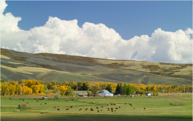
    The conservation easement program was to be a triple play for Colorado.

    “You want landowners to put their property into easements. That’s what makes our state beautiful. That’s a win,” McCurdie said. “And the tax credit helps us, the taxpayer, facilitate it. Everyone is winning.”

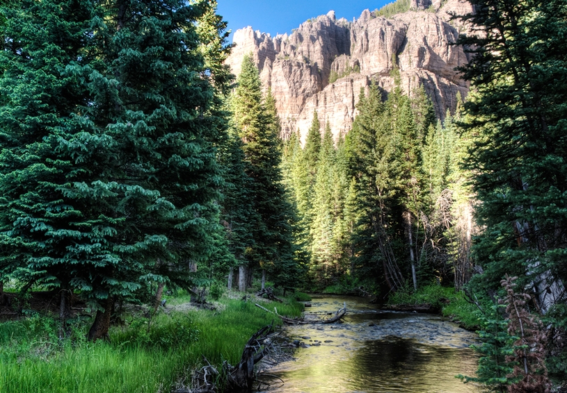
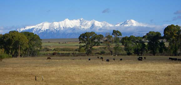
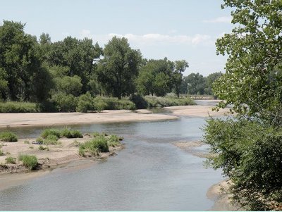
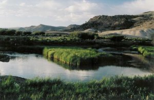
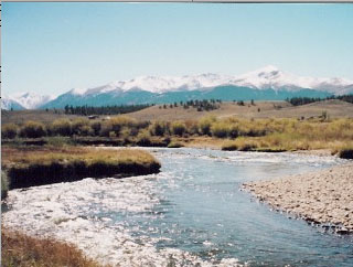
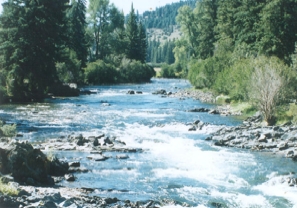
    The state wins because easements are donated to a nonprofit land trust that ensures it remains pristine forever, protected from urban sprawl and development.

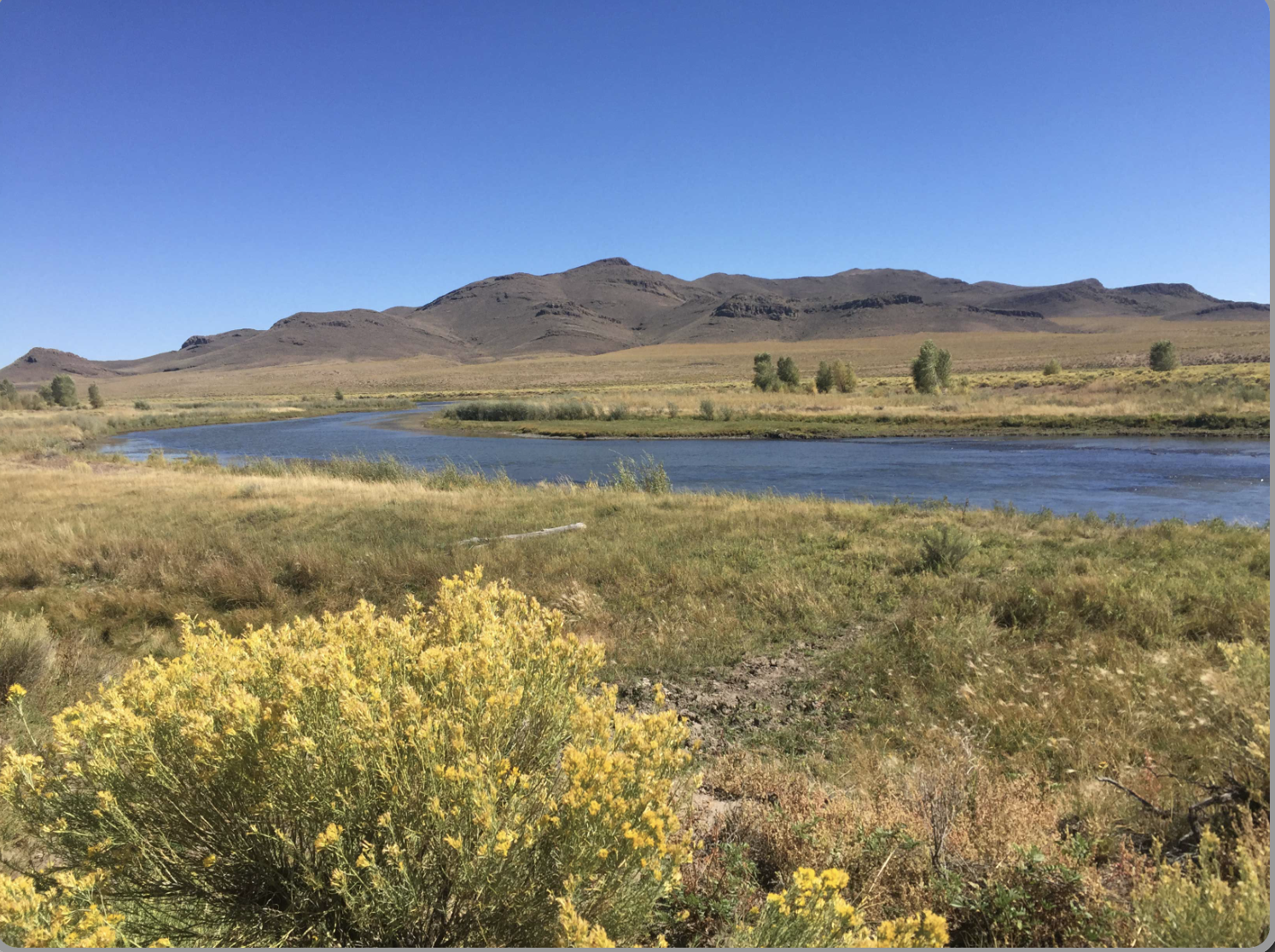
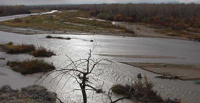
    That’s how Crow saw it when he placed his 30-acre farm into an easement in 2003. He said he wanted to ensure it would never be developed, “that it would stay part of the valley forever.”

    Crow claimed income-tax credits worth $160,000 based on an appraisal that valued his land on its potential use for a housing development should nearby Rocky Ford reach him.

    Crow either could apply the credits against what he owed on his own income taxes, or he could sell the credits to someone else, who in turn could use the credits to pay their taxes.

    To entice buyers, tax credits are typically sold at a discount, so $10,000 of tax credits would sell for as little as $8,000. The buyer can claim the whole $10,000 against their state income-tax debt or stretch it out over a few years.

    And instead of paying the state, the buyer’s money went to the landowner.

    Thousands bought into the idea. To date there have been 4,243 easement donations comprising nearly 2 million acres of land since it began.

    Like hundreds of other ranchers, Crow had little use for tax credits — he never owed that much — and preferred the cash-flow for his small farm.

    “I’m one of the small guys,” he said. “Like so many others, I’m usually just waiting around for the wrath of God to change things.”

    He sold the credits through a broker.

    “We didn’t get rich, but that money sure helped when times were tough,” Crow said. “Those were not easy years.”

    Everything would have been fine had state revenue agents not noticed some tax-credit buyers were making claims in dollar amounts that were out of line from others participating in the program. Something was wrong.

    Money-making scheme

    Investigators found a small group of investors and attorneys had twisted the fledgling program into a monumental money-making scheme.

    Not only were land appraisals abused, but the investors decided a 1,000-acre donation could garner many more times the state maximum of $260,000 in tax credits by carving it into smaller donations.

    Suddenly one property was worth millions of dollars in tax credits that could then be sold for cash.

    Retired attorney Stanley Mann led a group of real-estate investors whose 1,000-acre development near Walsenberg was at a near stand-still with only two houses built.

    “Developing in Walsenberg doesn’t happen overnight, and we saw a minimum of 19 years to get it done,” Mann said. “But we were getting older, and the (easement) idea made perfect sense.”

    The group pared the land into two dozen 35-acre donations at $260,000 in tax credits each, then sold them.

    It was a payday. Between 2003 and 2007, there were 2,417 donations statewide totalling $498 million in tax credits, state officials said.

    About a third of them — covering nearly half the tax-credit total — were found to have faulty appraisals.

    Landowners such as Crow saw only needed money they could make on land they never wanted used for anything other than what it had been for generations — for pasture and plow.

    “There were those who got sucked in because it probably seemed like just another Farm Bill program,” said John Swartout, special policy adviser to Gov. John Hickenlooper and former executive director of Outdoors Colorado.

    Faulty appraisals

    Irregularities first caught investigators’ eyes in about 2007. The early abusers eventually were taken down, some attorneys were sanctioned, a handful of appraisers lost their licenses, and a few speculator investors repaid millions of dollars of credits they had sold to hundreds of unsuspecting taxpayers.

    Meanwhile, the state backtracked through hundreds of other donations, disallowing tax credits that were claimed on 682 donations based on faulty appraisals from 2000 to 2010.

    More than 80 percent of the problem donations were from 2003 to 2007.

    So many credits were disqualified that the state Department of Revenue, which was in charge of the easement program at the time, couldn’t keep up. Cases were tied up in administrative red tape and legal challenges for years.

    In 2011, the legislature devised a shortcut in HB11-1300, creating three regions of conservation easement district courts where the cases would go. All those involved — the state, the taxpayers and the landowners — would be part of a court process to work out who was to pay and how much.

    Although landowners could choose a hearing before revenue department administrators, few did. Ultimately 478 easements headed to court, each with a dozen or more credit buyers.

    “The state encouraged the conservation easements then turned around to nail everyone who had one,” said Walter Kowalchik, a retired lawyer in Jefferson County who was part of Mann’s group. “It was a horrible disappointment to hundreds of people.”

    In dozens of cases since, tax-credit buyers have been told they can either repay the original amount of income tax they owed from as long as a decade ago — penalties and interest forgiven — or fight it out and risk hefty add-ons later.

    “Basically I had two choices: Settle, be happy and pay the smaller amount, or complain and then pay the whole thing with penalties and interest,” said Julius Medgyesy, who runs Front Range Cancer Specialists in Fort Collins. “I had to cut another fat check.”

    Not every credit buyer had to pay. Some wealthy landowners and developers, like Mann’s group, covered the tab because tax credits are sold with a promise of indemnity. If something goes wrong, the seller agrees to pay up.

    Many, like Crow, couldn’t afford that. They had little money left or not enough equity in their property to pay the taxpayers back.

    The money was spent long ago on their farms. Worse, their land is permanently stuck in a conservation easement that’s worth nothing now. They can never develop it, never change its current use. Selling won’t get very much. For Crow, it’s forever a hay farm.

    “It’s a State of Colorado Ponzi scheme,” Medgyesy said.

    “The state doesn’t care”

    When the Department of Revenue told Crow the appraiser’s error on his easement donation meant he should not have gotten $160,000 in tax credits, his heart sank.

    “When they pulled the plug, that was it for us,” Crow said.

    The 10 people who bought the tax credits from Crow had to pay up.

    That meant Jeannine Thomas, who in 2003 paid Crow about $12,000 for $15,000 of his income tax credits, had to write a second check for taxes she thought she’d handled years ago.

    In all, she’s repaid about $40,000.

    “What I’ve paid the state is on top of what I gave the land donors,” she said. “I can put a lien on their property or force a sale of what little they have left.”

    Thomas takes a long pause.

    “So, I can either kick them out of their homes or simply be quiet and eat the loss,” she said. “The state says the easements did not meet their standards, and that it’s just business. Is this what this program was intended to do? Pit the tax-credit buyers against the conservation easement donors? To hurt people?”

    Many say they’ve simply put their head down and accepted their fate.

    “We’ve tried to make noise, but no one wants to go toe to toe with state (tax) revenue,” McCurdie said.

    The Lamar landowner from whom McCurdie and 13 others purchased tax credits works three jobs today, his land nearly worthless because of the easement on it and the subsequent disallowance of its donation value. All the money from the tax credits he sold years ago was put into the farm.

    With penalties and interest, Colorado pegged McCurdie and the others for roughly $1.4 million — on top of the nearly $1 million they’d already paid for the tax credits.

    “We’ve tried to make the point that we bought into (the program) on good faith,” McCurdie said. “The state simply doesn’t care. They’re very clear this is their money and they will have it.”

    No one has helped

    Efforts at fixing the problem have fallen on deaf ears, several say. There have been letters to officials, meetings with agencies, phone calls to the governor’s office. No one has helped.

    “Our point is that the (Department of Revenue) had by far the better chance to catch this abuse back in 2004 than we did,” Fort Collins builder David Neenan wrote Hickenlooper in March, appealing for a solution.

    Neenan bought $80,000 of tax credits for himself and his family for $64,000. Earlier this year, he paid the state $128,000 in back taxes, penalties and interest.

    A tax bill of $80,000 has now cost him more than $200,000.

    “I received a form letter thanking me for my letter,” Neenan said of his plea to Hickenlooper.

    The farmers from whom Neenan bought the credits have gone bankrupt or have only a small house or a few tractors in assets.

    “There’s nothing to collect from,” he said.

    Sen. John Kefalas, D-Fort Collins, said he’d like to take up the cause, but it’s uphill. Two earlier legislative efforts at amnesty have died.

    “There’s an element of fairness here, and we need to find a way to deal with that,” Kefalas said. “But it’s a challenge.”

    Even some businesses have suffered.

    “We thought of participating with the state for a good cause,” said Mark Bower, executive vice president and CFO at Home State Bank in Lafayette. “It was their program. We thought we’d be a good corporate citizen and participate.”

    In all, the bank lost $225,000 because of disallowed credits. Bower said it was “unpleasant” having to explain the loss to the bank’s board of directors.

    “And what were we going to do, evict a rancher over it?” Bower said.

    Today, mostly disabled and a widower, Crow gets by on his wife’s death benefit, too proud, he says, to apply for disability.

    “This whole thing sucked the last bit of life right out of my wife,” he said of his wife, Jane, who died last year.

    Looking north over the barren land behind his small home, Crow sighs.

    “I was broken-hearted about how it’s all fallen apart,” he said, “and now we’re all backed into a corner.”

    Even if Crow had the money to pay the buyers back, nothing would change.

    His small farm is trapped in an easement for Colorado to enjoy — forever.

    Click here to go to the November 23, 2007 Coyote Gulch post when things first breaking. Here’s a post about HB11-1300 designed to provide some relief to taxpayers that got caught up in the shenanigans.

    Kudos to The Denver Post for keeping links alive in the archives.

    More conservation easement coverage here.

    Land trust closer to purchasing 1,000 acres in Ark River Valley — The Mountain Mail

    Arkansas River near Leadville
    Arkansas River near Leadville

    From The Mountain Mail (J.D. Thomas):

    The Land Trust of the Upper Arkansas is closer to its goal of purchasing 1,000 acres scattered throughout the valley, thanks to its fifth annual fundraising event. The land trust raised a net total of $16,990 Friday at Salida SteamPlant.

    Andrew Mackie, executive director, said 120 tickets were sold for the event, with tickets ranging in price from $35 for land trust members to $45 for nonmembers.

    “The event is open to anyone who wants to come out and support what we do,” Mackie said. “We are limited to the amount of people who can attend because of the size of the venue.”

    Of the $16,990 raised, $6,230 went to the $10,000 goal for the land trust to purchase 1,000 acres scattered throughout the Arkansas Valley, said Mackie. “We did pretty solid,” he said. “Over the next few weeks we will be seeking to reach our goal.”

    Mackie said he couldn’t be specific as to the locations of the various properties because he wanted to protect the confidentiality of the landowners and is still negotiating the deals.

    Mackie said the fundraiser typically raises between $8,000 and $10,000.

    The event included a light dinner provided by Kalamatapit Catering, a cash bar, silent auction and a program, “Rivers Are More Than Water: Linking Land and Water in Colorado’s Water Plan.”

    Items such as alcohol, guided trips and outdoor gear were included in the silent auction.

    The program was presented by Ken Neubecker, associate director for the Colorado River Basin Program with American Rivers. Neubecker said he hoped his informative talk would advance the discussion of Colorado’s Water Plan.

    Mackie said people who wish to find out more about the organization and to donate to Land Trust of the Upper Arkansas can visit http://ltua.org or call 539-7700.

    More conservation easement coverage here and here.

    Saguache Creek: 140 years of ranching tradition and 13,000 acres under conservation easements #RioGrande

    Saguache Creek
    Saguache Creek

    From The Pueblo Chieftain (Matt Hildner):

    The creek that drops out of La Garita Mountains and snakes its way toward the north end of the San Luis Valley floor has sustained ranching for 140 years. The ranchers who live in the narrow drainage and the Colorado Cattlemen’s Agricultural Land Trust want to ensure that doesn’t change.

    “They really believe in that lifestyle and the importance of that lifestyle to the rest of us that live in urban areas,” Erik Glenn, the land trust’s deputy director, said.

    Last month, the land trust finalized a conservation easement on the Werner Ranch east of town, pushing the amount of voluntarily protected acreage along the Saguache Creek to 13,000 acres.

    The push to protect the drainage started nearly two decades ago when the Nature Conservancy began reaching out to landowners about protecting their land. But that initial push, which encompassed much of the north end of the San Luis Valley, was slow to take.

    “At that time, conservation easements and the Nature Conservancy in the traditional ag community were probably viewed with some hesitation,” Glenn said.

    The Nature Conservancy’s efforts coincided roughly with the formation in 1995 of the cattlemen’s land trust, which was put together by the membership of the Colorado Cattlemen’s Association. The link to the association, which has been protecting and promoting the interests of the industry since 1867, helped ease some of the locals’ apprehensions, Glenn said. By the late 1990s, a few ranchers in the area led by the Coleman family went ahead with easements. That example made a difference with their neighbors.

    “The landowners down there are very connected to each other,” he said. “It’s a lot of the same families that have been there for years and years.”

    Some of the families along the creek have had their ranches as far back as the 1870s.

    Today, there are 26 easements on parts or all of 21 ranches. The conservation easements share some common traits, Glenn said. They include keeping water rights tied to the property in perpetuity. The easements also restrict the right landowners would otherwise have to subdivide the property and often limit the construction of outbuildings or a new home to small sections of the property. The landowners retain ownership of the land and, in turn, can gain access to federal tax deductions, state tax credits and estate and local property tax benefits, among other potential incentives.

    Glenn said the land trust has gotten financial help from Natural Resources Conservation Service programs in the farm bill that aim to preserve irrigated agriculture. Great Outdoors Colorado also has made grants toward the group’s work. The land trust, which also has done extensive work along Tomichi Creek near Gunnison and the Elk River near Steamboat Springs, will keep working along Saguache Creek.

    Glenn said he hopes the recent conservation of the Werner Ranch will influence others at the eastern end of the drainage.

    “We think that one will probably catalyze additional efforts along the creek east of town,” he said.

    More conservation easement coverage here.

    Conservation Easements: Water Conservation in Northeast Colorado — High Plains Public Radio

    mallardducktakingflight

    From High Plains Public Radio (Dale Bolton):

    When Denver physician and sportsman Kent Heyborne bought land in northeast Colorado, his intent was to leave it undeveloped as bird habitat.

    But working with Ducks Unlimited along the South Platte River, he created a water-conservation project resulting in neighboring farms gaining additional irrigation credits. By putting the land under perpetual easement, he created a development-free zone spanning from one wildlife park to another, ensuring a corridor of waterfowl habitat several miles long. Plus, he earned state and federal tax credits along the way.

    More South Platte River Basin coverage here.

    San Isabel Land Protection Trust hosts water meeting

    Sangres-a2-Coaldale,CO
    From The Mountain Mail:

    San Isabel Land Protection Trust will host an informational meeting on the future of agricultural land and water in western Fremont County at 6:30 p.m. July 24 at the Coaldale Community Building, 13607 CR 6 in Coaldale.

    The meeting will include a presentation about the tools the trust uses to protect land and water.

    For more information visit http://sanisabel.org or call 719-783-3018.

    More conservation easements coverage here

    The Spring 2014 newsletter from the Rio Grande Land Trust is hot off the presses

    riograndelandtrustspring2014newslettercover

    Click here to read the newsletter. Here’s an excerpt:

    … there is nothing quite like the sense of accomplishment we experience at the closing of a conservation easement.

    Conserving land and water is really our core function. And it gives us the chance to work with some of the most committed and generous people here in the Valley who deeply care about the future of their ranches. This is so evident in the heartwarming story in this newsletter from Eveyln Buss about conserving the ranch that she and her brother Doug Davie inherited from their parents. We are grateful to them for protecting that beautiful ranch on the Rio Grande, and its exceptional water rights forever.

    Likewise, we were able to complete the conservation easement on the lovely Garcia Ranch on the Conejos River in December of 2013. Along with his daughters, Lana and Tania, Reyes Garcia was committed to protecting the legacy of his family on that land. His article expressing the deep meaning of this was featured in our Spring 2013 newsletter (you can find that issue on our website).

    Both of these ranches were featured properties in RiGHT’s 2012 and 2013 “Save the Ranch” campaigns. In so many ways, these projects were community projects, and we could not have made our way through the many challenges that easements inherently present, without the generous support of our many friends and neighbors who contribute to RiGHT’s work, with donations of time, funds, and so much more. I hope you will share in our deep sense of accomplishment, that together, we are leaving a lasting legacy of conserved land and water for future generations.

    More Rio Grande River Basin coverage here.

    Conservation easements are helping to keep water in agriculture

    Lake Fork Gunnison River
    Lake Fork Gunnison River

    From Steamboat Today (Michael Schrantz):

    John McClow is general counsel for the Upper Gunnison River Water Conservancy District and a member of Gunnison Ranchland Conservation Legacy, which focuses its efforts solely on agriculture.

    “We broker conservation easements to maintain working agriculture,” McClow said.

    In the Upper Gunnison area, the organization has helped place easements on about 18,000 acres, which McClow said is a substantial percentage of the total area. Most of the easements have a financial incentive for the landowner, he said.

    “Often, they will use the money to invest in more land,” McClow said, adding that it helps keep the ranch operation financially stable.

    “Our easement activity has slowed a little bit,” he said. “We’ve pretty much picked all the low hanging fruit.”

    The organization is getting into more complicated easements on lands that are more valuable and take more money, many being larger and closer to Crested Butte.

    Gunnison County directs some funds from its 1 percent sales tax toward purchasing development rights, about $300,000 per year, according to Mike Pelletier.

    “Typically, we’re able to fund what’s requested,” said Pelletier, who is the county contact for the program. “We have limited funds, and people just don’t ask if they don’t think we can fund it.”

    The tax dollars were reauthorized in 2012, he said, and are used to match dollars from elsewhere…

    “For every dollar we give to local land trusts, they attract $12 from outside” the county, he said. “By doing that you leverage a lot of outside money.”’

    From Steamboat Today (Michael Schrantz):

    George is working on his third easement with the Colorado Cattlemen’s Agricultural Land Trust. He’s donating the value of the development rights in return for a state tax credit he will sell for 82 cents on the dollar, but his previous two easements went through Routt County’s purchase of development rights program, which pairs tax dollars with other funds to buy the right to develop the land and places the property under an easement dedicated to conservation.

    “The benefit was we were able to keep the family ranch in the family,” George said about the easements, especially one in 2012 that was valued at $2.56 million.

    The PDR program contributed $825,000 toward that transaction, about 31 percent of the total cost.

    That money helped buy out other family members while George’s other easements allowed him to buy more land and pay down debt on parcels he’d already purchased.

    “If I die or if we sell the ranch, it cannot be subdivided,” he said. “All these parcels will stay their size.”

    George thinks more ranchers should look into easements on their property.

    “They lack the knowledge,” he said. “They’re scared of them.”[…]

    As early as the 1980s and during the push for major development in Pleasant Valley south of Steamboat, residents banded together in support of open-space conservation.

    In the mid-1990s, these efforts gained momentum with Routt County ranchers placing conservation easements on their property and new county policies being enacted to preserve open space.

    The effect of this work can be seen in the absence of development.

    The drive down Rabbit Ears Pass into Steamboat Springs shows an open south valley floor where hay meadows still dominate the view. Colorado Highway 131 cuts through working ranches in South Routt County, and traffic on county roads still sometimes pauses to accommodate cattle being moved to greener pastures.

    Preventing the fragmentation of agricultural land through subdivision and development keeps more land in production and helps maintain the working order of the landscape.

    Splitting large tracts of agricultural land into ranchettes and subdivisions means introducing new neighbors to rural Colorado.

    “They just don’t have a clue to what’s going on in the ranching world,” Routt County commissioner Doug Monger said about some people who live near land he’s leased for his cattle. “No one fixes their fence.”

    Colorado is a fence-out state where landowners are required to maintain a lawful fence if they want to keep cattle out of their land. The cattle owner is not responsible for trespassing by his livestock if a fence isn’t maintained…

    Gunnison County, another Western Slope county with a long ranching heritage, has seen the effects of agricultural fragmentation that arise from subdividing working ranchland.

    “What happens is when they put in the road and building sites then turn over management of the property to someone who has no experience in the area, it disrupts the irrigation system within that drainage,” said John McClow, general counsel for Upper Gunnison River Water Conservancy District and member of Gunnison Ranchland Conservation Legacy.

    The Gunnison Ranchland Conservation Legacy brokers easements for ranches in Gunnison County.

    “It’s a disruption in the process that makes shortages much more frequent,” McClow said. “It’s not collaborative anymore.”

    With flood-irrigated pasture, such as in Routt County, ranchers depend on water returning from their neighbors’ fields back into the river or ditches. Turning an upstream ranch into a subdivision or 35-acre parcels takes away return flows for the ranches below it.

    Subdivisions downstream and closer to towns also pose challenges as the managers might be unfamiliar with how the river was managed in the past and place a call on the river if they aren’t getting their full allocation. Under Colorado’s prior appropriation system, when a senior rights holder places a call on a river, upstream junior appropriations must stop diverting water until the senior right has its full allocation.

    From The Pueblo Chieftain (Michael P. Dowling/Chris West):

    There is a nice bonus for Colorado in the Farm Bill that President Obama signed last month (Feb. 7). Senate Conservation Subcommittee Chairman Michael Bennet, D-Colo., fought hard for programs that will enable Colorado conservation organizations and local governments to partner with landowners to keep our state’s unique ranches and farm lands in agriculture. The new Agricultural Lands Easement program will provide grants to purchase conservation easements that permanently restrict development on important ranches and farm lands. These voluntary agreements will ensure that land stays in agriculture and continues to be an important — and growing — part of our state’s economy.

    The predecessors to this program have already conserved more than 1 million acres of economically and ecologically important agricultural lands. The new program will easily double that total.

    Senator Bennet joined Senate Agricultural Committee Chairwoman Debbie Stabenow of Michigan in leading the effort to pass this bi-partisan bill, working with other Colorado leaders, including Rep. Scott Tipton, R-Colo., a member of the House Agriculture Committee.

    Senator Bennett also changed the law to allow the agriculture secretary to waive a local cash-match requirement. This waiver will allow the program, at no additional cost, to protect the most important ranches and farmlands, even if they are in rural counties that don’t have the funding to match the federal grants.

    But the question is: Why should this land conservation matter to the vast majority of Americans who are neither farmers nor ranchers?

    While producing crops, livestock and other agricultural commodities for all Americans, properly managed working ranch lands and farms protect important habitat for our wildlife and fish; maintain cherished scenic vistas; and safeguard our water supplies and the water quality of our rivers. In addition, conserving these farms and ranches keeps farmers and ranchers on the land, and is protects an important part of our state’s economy.

    Colorado has 29 land trusts that are members of the Land Trust Alliance, and they have protected more than 1.1 million acres using conservation easements alone. For example, more than 150 years of Colorado history — and a part of its future — were preserved when the Colorado Cattlemen’s Agricultural Land Trust and the Trust for Public Land completed an effort to protect 650 acres of the Hutchinson Ranch in Chaffee County. Protection of the Hutchinson Ranch was made possible by funding from the Farm Bill programs that Senator Bennet just improved, along with lottery-funded Great Outdoors Colorado and Chaffee County.

    Though these lands — including such unique resources as the Hutchinson Ranch — are productive and important for agriculture, without action they are very much at risk. Non-agriculture development overtakes two acres of productive agricultural land every minute. But conservation easement programs ensure that our state’s most beautiful and productive ranches and farm land will continue into the future.

    Near Rocky Ford in Southeastern Colorado, 12,200 acres of the Mendenhall Ranches were protected using Farm Bill conservation funding last summer. The Mendenhalls used the easement to secure the future for their ranch, which is almost entirely native shortgrass prairie, home to cattle and increasingly rare grassland wildlife.

    That is why the Farm Bill’s Agricultural Lands Easement program makes both economic and ecologic sense for Colorado and for America. And that is why we should all thank Senator Bennet for his leadership in making the conservation programs in the Farm Bill work for ranchers and farmers.

    More conservation easement coverage here and here.

    The Colorado Water Trust is coordinating and facilitating a number of sessions at CCLT’s Conservation Excellence Conference

    Saguache Creek
    Saguache Creek

    Click here for the pitch, to view the session descriptions, and register. Here’s an excerpt:

    The Colorado Water Trust is coordinating and facilitating a number of water sessions at the Colorado Coalition of Land Trusts’ Conservation Excellence Conference in Denver in March.

    The Colorado Coalition of Land Trusts (CCLT) promotes and supports land conservation at a state level and serves as the collective voice for land conservation in Colorado. CCLT’s annual Conservation Excellence Conference offers conservation professionals opportunities for learning and networking in Denver on March 17, 18, and 19.

    Because water is often crucial to the conservation values of conserved lands, the Colorado Water Trust has worked closely with CCLT and the land conservation community over time. We provided general guidance, technical assistance, and educational programming specific to land conservation transactions to help professionals make informed decisions about water rights.

    This year, the Colorado Water Trust is coordinating and facilitating a number of sessions and workshops at CCLT’s Conservation Excellence Conference as part of our continuing efforts to assist the land conservation community in understanding water issues.

    More education coverage here.

    Conservation easements: ‘All we’re trying to do is give farmers another option [to buy and dry]’ — Jay Winner

    Purgatoire River
    Purgatoire River

    From The Pueblo Chieftain (Chris Woodka):

    Two groups promoting conservation easements in the Lower Arkansas Valley agreed last week that protecting water is more important than who takes credit.

    “We have been losing land to buy-and-dry,” Ginger Davidson, head of the Rocky Ford office of the Palmer Land Trust told the board of the Lower Arkansas Valley Water Conservancy District. “We don’t want to see another drop leave the valley. A healthy habitat for wildlife means healthy ranch land.”

    The Lower Ark district has accepted and managed conservation easements as part of its mission to protect water since it was formed in 2002. It has some easements outside its boundaries and several that do not include water rights.

    The Palmer Land Trust, in connection with other nonprofit groups and federal agencies, launched its own initiative in an area that overlaps part of the Lower Ark district. Davidson said the trust is open to conservation easements outside the initiative’s boundaries.

    “A lot of people say we’re in competition, but I say, ‘The more, the merrier,’ ’’ said Jay Winner, manager of the Lower Ark district.

    The Palmer Land Trust is working with the Rocky Mountain Bird Observatory, Canyon & Plains and Guidestone in the 10-county initiative. The National Park Service and Nature Conservancy are cooperating as well.

    Each group has its own goals in protecting farm and ranch land from development, but the Palmer trust is primarily concerned with water rights, Davidson said.

    “When people lose their water, they don’t have the incentive to invest, because they don’t know if the water will be there in the future,” Davidson said. “The businesses will stay if there is a critical mass of farming.”

    She agreed with Winner that the primary goal of conservation easements — which provide either tax credits or cash for forgoing development — should be to offer alternatives to selling water to cities.

    “We’re not forcing anyone to do anything,” Winner told the board. “All we’re trying to do is give farmers another option.”

    More conservation easements coverage here.

    The Nature Conservancy passes 1 million preserved acre mark in Montana

    The Nature Conservancy has been involved in protecting a million acres in Montana, including lands along the Rocky Mountain Front such as the Rappold ranch near Dupuyer, where conservation easements restrict development. / Courtesy photo/Dave Hanna
    The Nature Conservancy has been involved in protecting a million acres in Montana, including lands along the Rocky Mountain Front such as the Rappold ranch near Dupuyer, where conservation easements restrict development. / Courtesy photo/Dave Hanna

    From the Great Falls Tribune (Karl Puckett):

    …combined with another recent easement on the Rocky Mountain Front, this one 14,000 acres, it put the The Nature Conservancy over a million acres of land protected in Montana. That’s about an acre protected for every resident.

    “To me it’s unbelievable we’ve reached that size,” said Dave Carr, a Nature Conservancy program manager in Helena and a 24-year employee. “That’s a very large amount of land we have helped protect and conserve, and many of those lands are what I call working lands. They’re still being used. They just won’t be subdivided.”

    It took 35 years for TNC to reach the million-acre milestone, which the group announced earlier this month. The largest conservation organization in the world, TNC opened its doors in Big Sky Country in 1978 when it secured its first conservation easement in the Blackfoot River Valley, one of the state’s first private conservation easements, Carr said.

    Today, the organization has had a hand in protecting 1,004,308 acres of land statewide, from ranches in the Rocky Mountain foothills of northcentral Montana in grizzly bear habitat to unbroken native prairie on the northeastern plains to forested land in the river valleys of western Montana.

    Lands TNC works to protect often are privately owned ranches that feature native habitat and wildlife, but the aim isn’t to end agricultural uses.

    “We very much like to see lands stay in some productive use,” Carr said. “We feel that for long-term conservation, if the community is not part of that decision or doesn’t buy into that, it won’t be lasting.” [ed. emphasis mine]

    Conservation easements are tailored to the needs of the landowner, but generally speaking they restrict development rights and preclude subdivisions, drainage of wetlands, plowing of native prairie and commercial gravel pits.

    Easements The Nature Conservancy works on allow the landowner to continue to ranch. In some cases, harvesting timber to manage trees for beetle kill or fire hazards is allowed.

    Sometimes The Nature Conservancy purchases the easements from landowners, other times they are donated. The recent 14,571-acre easement on the Rocky Mountain Front that helped push the group past the million-acre mark was an anonymous donation.

    Meeting rising costs is a challenge for ranching families, and landowners, particularly those on the Rocky Mountain Front and Blackfoot River Valley, are using easements as a planning tool to keep the family ranch in business, Carr said. Money they received from The Nature Conservancy, for example, can be used to buy adjacent lands…

    Almost half of TNC’s protected acreage falls within western Montana, in a geographic region called the Crown of the Continent, but some 200,000 acres (including TNC’s partnership with other land trusts, Montana Fish, Wildlife and Parks and The Conservation Fund) is now conserved along the Rocky Mountain Front and another 66,000 acres is located on northern Montana prairies. Another 320,000 acres won’t be developed in southwest Montana.

    More conservation easement coverage here.

    The Land Trust of the Upper Arkansas to purchase conservation easement for the Boxcar Ranch

    Bighorn Sheep Rams via the USGS
    Bighorn Sheep via the USGS and Wikipedia

    From The Mountain Mail (J. D. Thomas):

    The Great Outdoors Colorado board announced Thursday that it has approved a $175,000 grant for the Land Trust of the Upper Arkansas to purchase a conservation easement.

    “We applied for the grant and it was certified by GOCO,” said Andrew Mackie, executive director of Land trust of the Upper Arkansas. “Now it’s all about closing on the Boxcar Ranch property, which could take a few months.”

    The property was highly rated by GOCO, Mackie said. “The land was the highest rated property ranked by GOCO,” Mackie said. “It’s right on the Arkansas River, it has frontage access to the river, and the habitat is riparian. There is also year-round bighorn sheep activity on the land.”

    The property also has active agriculture and water rights attached. “That is a big deal here in Colorado,” Mackie said. “On top of all that, the land is surrounded on three sides by public land, some of which is used quite often for recreational activities.”

    The $175,000 grant was the final piece of the puzzle for the Land Trust’s attempt to purchase the property. “We had funding lined up before the grant with donations from National Scenic Byway, the Gates Family Foundation, Rocky Mountain Bighorn Society, Chaffee County and the Land Trust of the Upper Arkansas,” Mackie said. “The owner of the property also donated part of the land as well.”

    “The property has a lot of potential, and this was supported by the high rating from GOCO,” Mackie said. “The conservation value alone is why the property was ranked No. 1. The water and agriculture rights helped too.”

    Mackie expects the Land Trust to close on the property by mid-2014.

    More conservation easement coverage here.