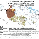

Click here to go to the Climate Predication Center website.

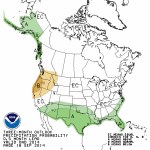
Click here to go to the Climate Predication Center website.
I wrote about the mistaken conflation of "#Fracking" with #oil+#gas development in general back in 2012: http://t.co/mwfcrLDI9O #wordsmatter
— Jonathan P. Thompson (@jonnypeace) September 18, 2014

Here’s the release from the San Juan Citizens Alliance:
The House Committee on Natural Resources failed today to honor the community consensus on the protection of the Hermosa Creek watershed that was fashioned by diverse stakeholders over many years.
The Committee voted 22 to 18 to approve an amended version of the Hermosa Creek Watershed Protection Act (HR 1839), stripping many of the watershed protections and transferring management decisions from localized decision-making to Congressional dictates.
Unfortunately, Rep. Scott Tipton failed to support the community’s consensus, which included very specific protective measures, by voting with the majority to severely alter the locally crafted legislation despite his previous indications that he would honor the legislation as he introduced it to Congress.
Numerous stakeholders involved in the Hermosa Workgroup process that spawned the legislation were incredulous that a “perfectly delivered” legislative process, created locally with near-unanimous support, could be bungled so badly as it moved forward in the House of Representatives. Mark Franklin, a La Plata County business owner, noted, “How possibly could a bipartisan supported piece of legislation to protect a locale so loved by locals be twisted into an effort to promote partisan public lands-related grudges? We were so confident that Rep. Tipton would say, ‘My constituents fashioned this bill in harmony, I stand behind it, please pass it as I introduced it – no modifications are needed’, but he did not.”
The possibilities of resurrecting the legislation to reflect the community consensus are uncertain at this point. Jimbo Buickerood, San Juan Citizens Alliance’s Public Lands Coordinator, stated “In the weeks ahead I’m sure Rep. Tipton will hear from his constituency “loud and clear” that the Hermosa Creek watershed is dear to us and we want it protected as we clearly indicated in the legislation we created. Hopefully from there the Congressman will lead the charge to make the necessary changes on the House floor or in conference to bring home a locally-fashioned prize, rather than a Washington DC designed edict.”
Here’s a response from The Durango Herald editorial board:
In a last-minute dirty trick that could wipe away six years of local consensus-building to protect the Hermosa Creek watershed, the House Committee on Natural Resources circulated a new version of the Hermosa Creek Watershed Protection Act – this one drafted in secret without local input – two days before the committee was to take up the matter. The new language undermines key provisions that enjoyed near-universal local support, replacing them with edicts that run counter to the original measure’s intent, and could set a dangerous precedent for wilderness management nationwide. It is an unacceptable move that U.S. Rep. Scott Tipton, the bill’s House sponsor, should push his colleagues to rectify.
The Hermosa Creek Watershed Protection Act has a rare and elusive pedigree. The measure that would protect 108,000 acres of beloved forest terrain north of Durango is the progeny of a wide-ranging group of local stakeholders from even farther-flung ideology and interests that convened to discuss how to preserve the pristine Hermosa Creek area and all its varied resources. This lengthy, thorough and painstaking process bore a consensus among wilderness advocates, water and mining interests, snowmobilers, business owners, mountain bikers, backcountry hunters, anglers and horsemen, county commissioners, city councilors and many others who worked over several years to craft recommendations for legislation.
The ensuing measure has won the hearts – and political capital – of U.S. senators and representatives from both parties and over several sessions of Congress. It has moved painstakingly slowly, but with steady, consistent, widespread support locally, regionally and federally. As close as lands protection legislation can be – or any legislation at all, these days – the Hermosa Creek bill was a slam dunk. In fact, it is just the sort of thing House Republicans claim they prefer: a locally crafted plan that represents the interests and values of bipartisan stakeholders. Despite this, the measure has moved slowly through a gridlocked Congress, and there has been little news of its progress since a subcommittee hearing in May – other than reiterations from the bill’s numbered and varied supporters that they hoped for action soon.
On Tuesday, though, everything changed when the committee announced a markup scheduled for today and distributed an updated version that would redefine the special management area so as to significantly diminish the local role in crafting a management plan for the newly protected area, ceding that power to Congress instead. Further, the new bill would allow for dam construction within the protection area, should the need someday arise – something the original measure allowed as well – but it goes on to suggest that any associated roads and transmission lines could bisect the measure’s wilderness areas. That has dramatic implications for wilderness management nationwide.
These changes are drastic. They are so profoundly at odds with the locally crafted recommendations that informed the original Hermosa Creek bill as to be antithetical. Unlike the process that yielded the original measure, the committee action took place in secret, without local buy-in and delivers a top-down edict that deeply undermines many years of hard work. Tipton must defend that local consensus and amend the bill to set right what was so inappropriately and surprisingly altered.
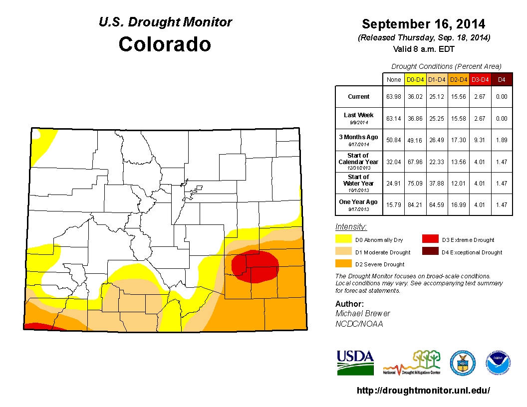
From the Colorado Water Conservation Board (Taryn Finnessey/Tracy Kosloff):
Mild temperatures and above average precipitation has persisted across northern Colorado and portions of the eastern plains, bringing continued drought relief to some of drought stricken Colorado. Forecasts for the coming months indicate that further drought relief is likely in this region. The Rio Grande basin has received less precipitation and conditions there are being closely monitored. Along the Front Range, water providers indicated that storage levels are at, or near, record levels and demand is down.
Currently, 36% of the state is in some level of drought classification according to the US Drought Monitor. 11% is characterized as “abnormally dry” or D0, while an additional 10% is experiencing D1, moderate drought conditions. 13% is classified as severe, 3% as extreme and none of the state is in exceptional drought (D4). Despite recent rains on the eastern plains, the Pueblo weather station is still running a deficit both for the water year and on a 4 year time frame. The 15.58 inch deficit over the last four years illustrates how difficult it can be to recover from persistent drought conditions. Walsh, further down the Arkansas basin, is experiencing a 17.56 inch deficit over the same 4 year period. Year-to-date precipitation at mountain SNOTEL sites remains at 103% of average. July and August, both saw above average precipitation totals, 122 and 112% respectively, while September to-date is right at average. Storms have largely missed the area of extreme drought that remains near the intersection of Crowley, Kiowa, Otero and Bent counties. Reservoir Storage statewide is at 100% of average at the end of August 2014, 28% ahead of where we were for storage this time last year. The lowest reservoir storage statewide continues to be the Upper Rio Grande, with 61% of average storage. The South Platte has the highest storage level at 138% of average. In general, storage is stronger in the northern basins than in the southern river basins. The Surface Water Supply Index (SWSI) for the state is near normal across much of the state, with an “abundant” index in a few northern basins of the South Platte, North Platte, Yampa/White, and Colorado. The lowest values in the state are in the Southwest and Rio Grande reflect very low reservoir and streamflow levels. This area of the state has not received the same moisture as the rest of the state. A weak El Nino is expected to continue as a weak-to-moderate event into early next year. Such an event
may bring wetter than average conditions to the eastern plains for late winter into early spring. Drier
conditions may develop in northwestern Colorado and the Colorado River basin.


Click here to go to the US Drought Monitor website. Here’s an excerpt:
Summary
Coming on the heels of the ninth wettest summer on record for the U.S. (according to the National Climatic Data Center), continued rain this Drought Monitor week led to minor improvements in drought conditions from the Southwest, through the Southern Plains, and into the Midwest. A near-complete lack of precipitation means drought continues largely unabated through California and along the West Coast. Another week of continued dryness saw drought conditions intensifying across the Hawaiian Islands…
The Plains
Locally heavy rain came to the Southern Plains during this Drought Monitor week. Areas from southeastern New Mexico and into western and northern Texas benefited. Texas also experienced improvements along the southern Gulf Coast. Central Texas saw some degradation in drought conditions as did the coastal area around Houston. Improvement continues in Kansas with the eradication of Extreme Dryness (D3) in the western part of the state and minor improvements in the north. Minor improvements were also experienced in South Dakota, Nebraska, and Oklahoma…
The West
Moisture fell in much of the West this week, with the exception of the West Coast and Pacific Northwest. Rain and occasional snow from Montana down to New Mexico led to minor improvements throughout the area. Idaho and Oregon largely missed that precipitation and subsequently degradation in drought conditions took place along the southern border of those two states. The Pacific Coast continues to be the hotbed of fire activity in the country with all 15 current large incident fires occurring in California, Oregon, and Washington. To date, wildfires have burned 2,935,074 acres of the U.S., well below the 6,560,844 acre average for the same time of year (source: National Interagency Fire Center)…
Looking Ahead
During the September 17- 22, 2014 time period, the remnants of Tropical Storm Odile are expected to bring heavy precipitation and flooding to the Southwest, particularly in southern Arizona and New Mexico. Beyond that event, precipitation is expected from the Southwest, through the Plains, and into the Ohio River Valley. At the same time, above normal temperatures are expected along the northern tier of the nation with warmer than average minimum temperatures across the nation with the exception of the East Coast.
For the ensuing 5 days (September 23-27, 2014), the odds favor normal to above-normal temperatures across the western U.S. and along the Gulf of Mexico Coast. Below-normal temperatures are favored around the Great Lakes and into New England. Above-normal precipitation is likely along the Gulf of Mexico Coast and in the Four Corners area of the Southwest. Below-normal precipitation is expected in the Plains and throughout much of the West. Alaska is likely to see above-normal temperatures and below-normal precipitation over much of the southern part of the state.
From The Pueblo Chieftain (Chris Woodka):
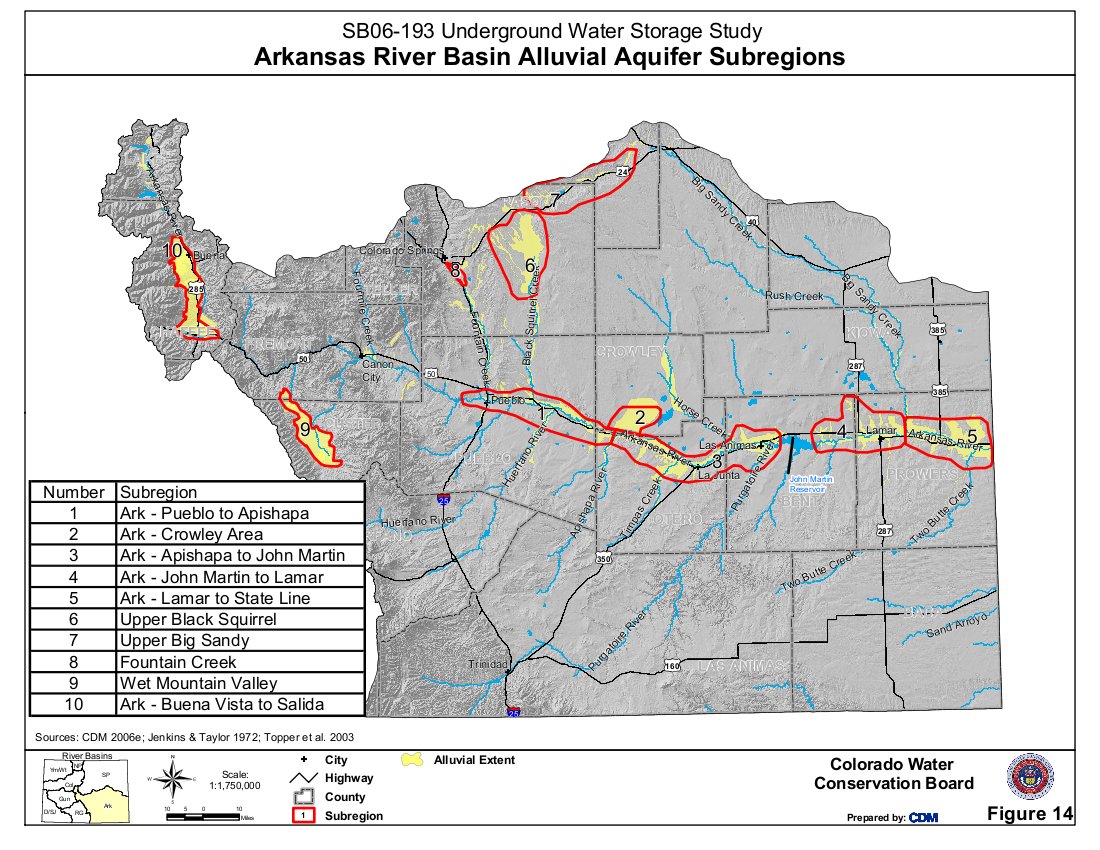
A federal project to map groundwater changes in the Lower Arkansas River was approved by a local board last week. The Lower Arkansas Valley Water Conservancy District voted to spend $45,300 toward a program that will look at changes in groundwater levels during the irrigation season. The project will be conducted by the U.S. Geological Survey, which is contributing $23,260.
“We measure the late fall and early spring water levels,” said Ken Watts, Pueblo scientist for the USGS. “The change in the fall measures the recharge in the system. Groundwater storage is far greater than surface storage.”
The Arkansas River aquifer is about a mile wide, 30 feet deep and 150 miles long, he explained.
The USGS measures eight surface gauges and 144 wells east of Pueblo. Watts proposed eliminating the spring measurement in order to pay for a mapping project under the current funding level of about $52,000. While the USGS has measured the area for years, the data are available only in tables. Mapping would be available online and provide an easier way to compare numbers.
The Lower Ark board voted to add $10,300 of its own money, matched with $5,820 in USGS funds to fund a more complete project.
The data is useful for several reasons, including well pumping regulations, surface irrigation plan and long-term studies.
“Surface supply and groundwater are connected,” Watts said. “If you drop groundwater levels, that will pull water to the aquifer.”
“It’s good data, and ties into the Arkansas River decision support system,” said Bill Tyner, assistant Division 2 engineer. “The data are helpful because of the difference we’ve seen in the last few irrigation seasons.”
More Arkansas River Basin coverage here.

From The Pueblo Chieftain (Chris Woodka):
The Pueblo Dam could start generating hydropower as soon as 2018. The Southeastern Colorado Water Conservancy District got an update Thursday on its proposal to construct hydropower on the new north outlet works from project manager Kevin Meador.
“We’re a couple of years from bidding the project,” Meador said. “I’m feeling optimistic at this point.”
The district, in partnership with Colorado Springs Utilities and the Pueblo Board of Water Works, is working on a lease of power privilege proposal with the federal Bureau of Reclamation. It should be finalized in February.
An unknown in the project is whether Black Hills Energy, the primary power supplier for the area, will enter a power purchase agreement for the hydropower.
“That could go very smoothly or take a while,” Meador said.
If a Black Hills agreement is not reached, another provider could be approached, including Colorado Springs Utilities.
Utilities constructed the new north outlet works as part of the Southern Delivery System. It will be owned by Reclamation as soon as a contract checklist is completed, said Roy Vaughan, Fryingpan-Arkansas Project manager for Reclamation. The hydropower plant would generate 7 megawatts of electric power and cost about $20 million. A loan will be sought in 2015 through the Colorado Water Conservation Board to finance the project. Construction would begin later next year, Meador said.
“Generation could begin in the early spring of 2018,” he said.
More Southeastern Colorado Water Conservancy District coverage here.