
From The Pueblo Chieftain (Chris Woodka):
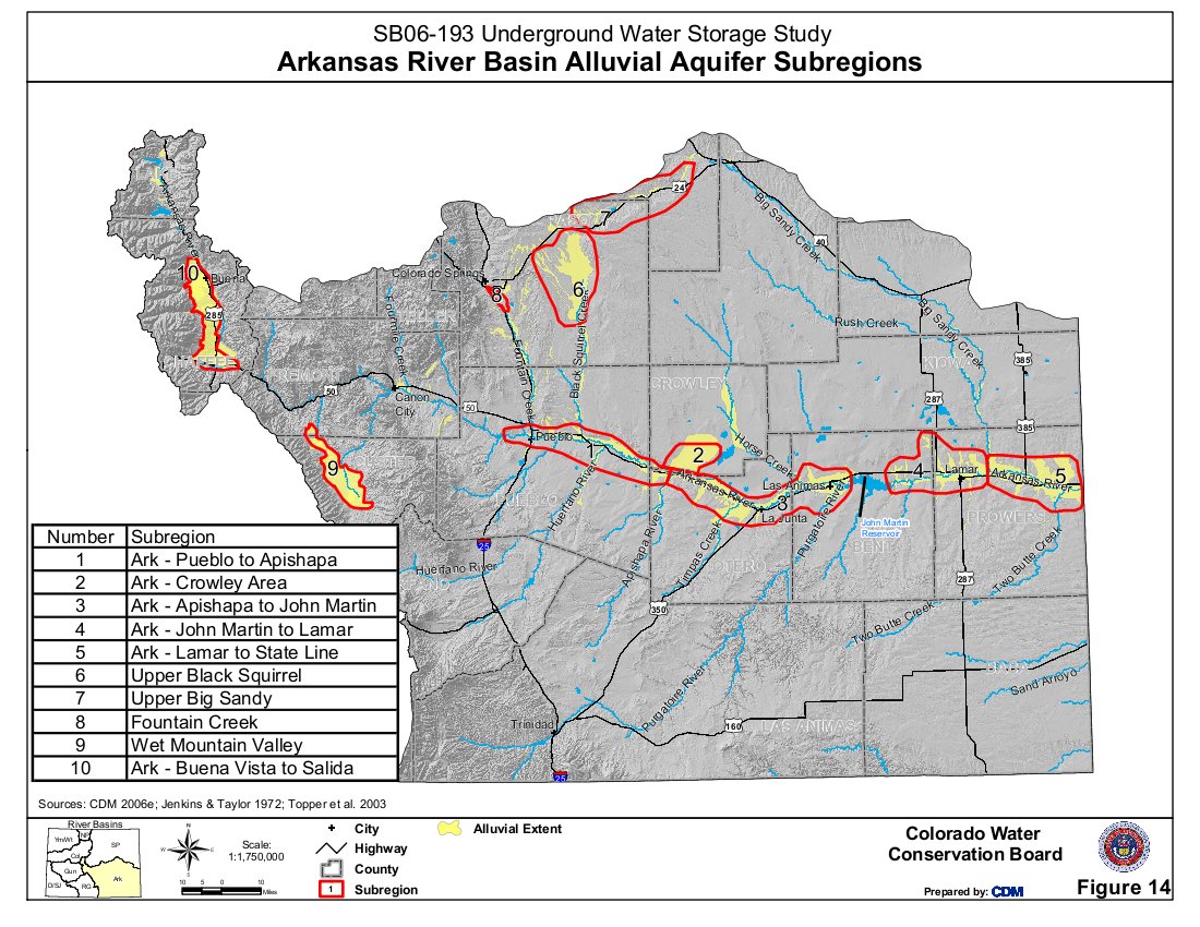
A federal project to map groundwater changes in the Lower Arkansas River was approved by a local board last week. The Lower Arkansas Valley Water Conservancy District voted to spend $45,300 toward a program that will look at changes in groundwater levels during the irrigation season. The project will be conducted by the U.S. Geological Survey, which is contributing $23,260.
“We measure the late fall and early spring water levels,” said Ken Watts, Pueblo scientist for the USGS. “The change in the fall measures the recharge in the system. Groundwater storage is far greater than surface storage.”
The Arkansas River aquifer is about a mile wide, 30 feet deep and 150 miles long, he explained.
The USGS measures eight surface gauges and 144 wells east of Pueblo. Watts proposed eliminating the spring measurement in order to pay for a mapping project under the current funding level of about $52,000. While the USGS has measured the area for years, the data are available only in tables. Mapping would be available online and provide an easier way to compare numbers.
The Lower Ark board voted to add $10,300 of its own money, matched with $5,820 in USGS funds to fund a more complete project.
The data is useful for several reasons, including well pumping regulations, surface irrigation plan and long-term studies.
“Surface supply and groundwater are connected,” Watts said. “If you drop groundwater levels, that will pull water to the aquifer.”
“It’s good data, and ties into the Arkansas River decision support system,” said Bill Tyner, assistant Division 2 engineer. “The data are helpful because of the difference we’ve seen in the last few irrigation seasons.”
More Arkansas River Basin coverage here.