Join Water Education Colorado on September 18 for a 5th anniversary, full-day tour of the 2013 flood-affected zone along the Front Range (to begin and end in Loveland). Jump on the bus with lawmakers, water managers, attorneys, engineers and members of the public to get an up-close look at various recovery projects. Participants will learn about the initial actions that were taken to protect lives and property as well as the subsequent projects that were undertaken to recover and build resilience. Read the draft agenda here, then hurry and reserve your spot today. Seats are limited!
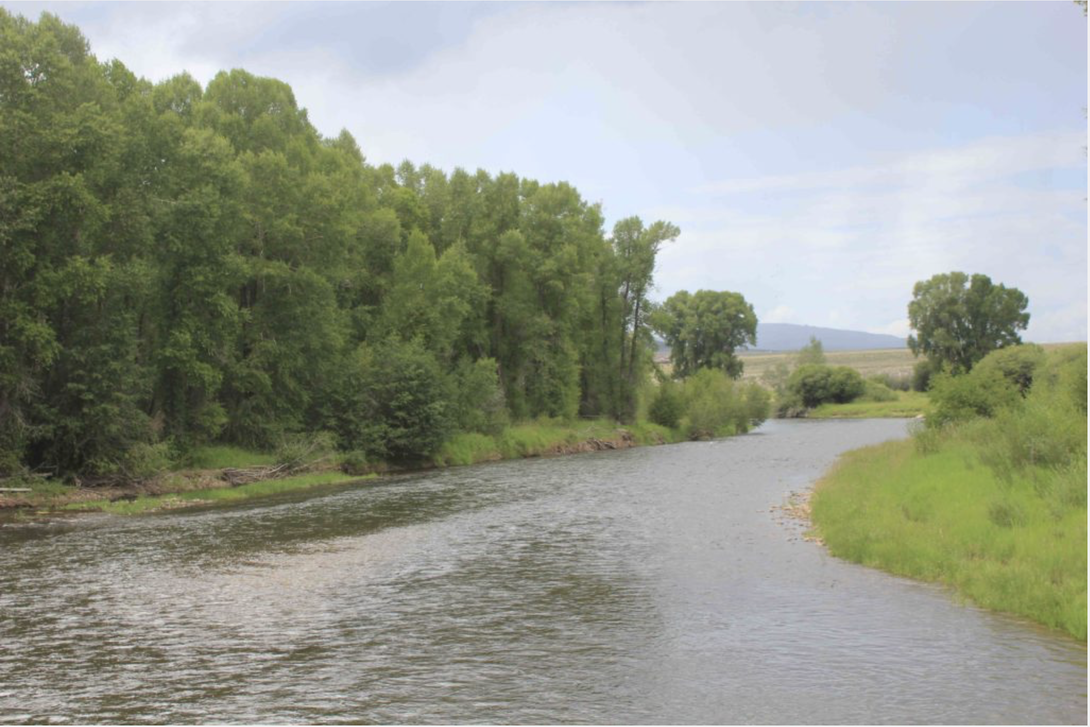
The Colorado Water Trust began releasing 15 cubic feet per second of water into the river July 14. That’s about the equivalent of 15 soccer balls worth of water rolling by per second, said Zach Smith, an attorney at the Colorado Water Trust.
New funding sources have allowed the Water Trust to purchase more water and increase the releases to 25 cfs. The additional water brings the total acre-feet intended to be released into the river from 600 acre-feet to 1,800 acre-feet.
“That’s actually a huge help for the river,” said Kelly Romero-Heaney, water resources manager for the city of Steamboat Springs. “If we can get some additional flow to the river, that increases the available habitat for the aquatic life, in addition to helping to bring down the stream temperatures, so it’s really important given how dry and hot the summer has been.”
The boost could help the Yampa River meet criteria to re-open the river to recreation within city limits. The magic numbers to lift the voluntary closure are a flow consistently greater than 85 cfs at the Fifth Street Bridge and a water temperature below 75 degrees. Managers also consider the levels of dissolved oxygen in the water. Conditions in the Yampa don’t meet these criteria right now.
Colorado Parks and Wildlife has also instituted a voluntary closure of the river from Chuck Lewis State Wildlife Area to the western edge of Steamboat. The agency recently lifted a second, mandatory fishing closure of the tailwaters of Stagecoach Reservoir.
The closures are intended to protect fish, riparian plants and other life that depends on the river. Trout are cold-water fish that have evolved to function best in water temperatures around 50 to 60 degrees, according to a Parks and Wildlife news release. When temperatures exceed 70 degrees, they often stop feeding and become more susceptible to disease.
“We’ve worked closely with partners up there, including Colorado Parks and Wildlife, to determine that this is an appropriate increase in flows and will create some real benefits for aquatic life and recreational users up there,” said Mickey O’Hara, a water resources engineer at the Colorado Water Trust. “It sounds like that reach below Stagecoach Reservoir, since it opened back up, has seen some significant use, and these flows should help fish especially through that region all the way down through the city.”
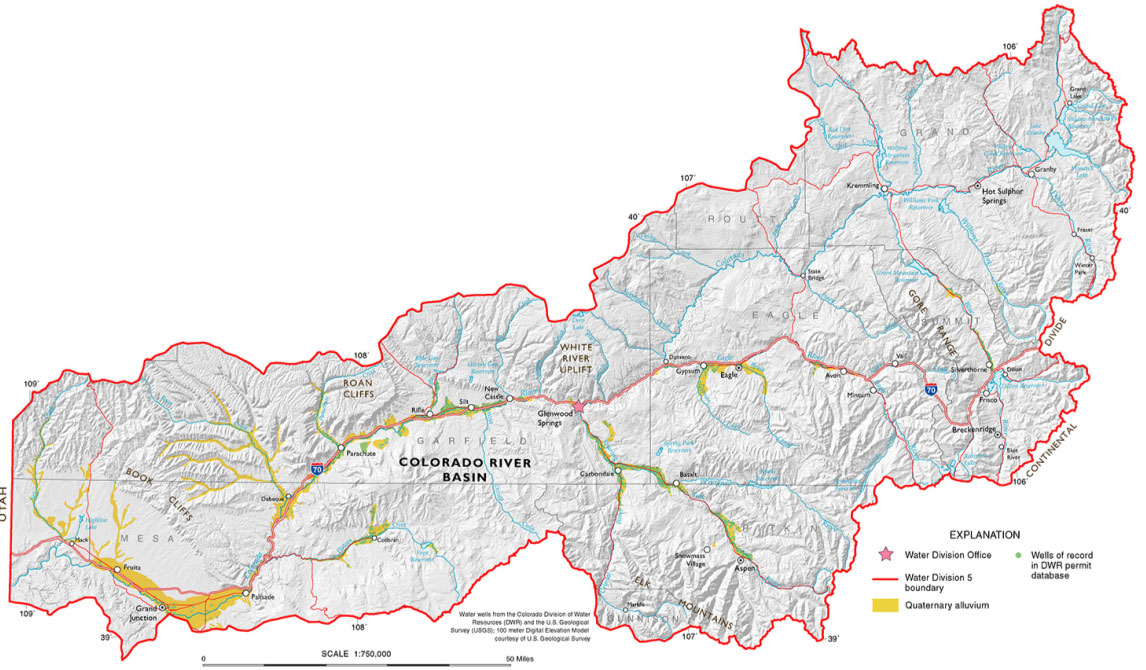
Colorado River Basin in Colorado via the Colorado Geological Survey
FromThe Grand Junction Daily Sentinel (Dennis Webb):
The Colorado River District has agreed to boost water levels to help fish in the Roaring Fork River watershed while also conserving water for use by local irrigators later in the season and improving the chances for boosting flows this fall for endangered fish.
The action also could help protect water quality in the case of anticipated ash in waterways due to expected flooding and debris flows resulting from the Lake Christine Fire near Basalt.
The river district is releasing water from Ruedi Reservoir above Basalt to boost flows in the Fryingpan River and Roaring Fork River to help reduce water temperatures to benefit trout. Low flows and warm temperatures in western Colorado have led to Colorado Parks and Wildlife urging anglers to avoid fishing later in the day on numerous western Colorado waterways due to the stress trout currently are facing.
The U.S. Bureau of Reclamation approved the river district releases last week. They are expected to range between 50 and 100 cubic feet per second.
River district spokesman Zane Kessler said the water to be released is owned and managed by the river district’s enterprise…
The water technically is being delivered downstream for Grand Valley irrigation needs but is creating environmental benefits on its way there. The water otherwise would have been delivered from Green Mountain Reservoir south of Kremmling.
Kessler said the Ruedi releases will allow for conserving a part of what’s called the historic users pool at Green Mountain Reservoir for use later in the season, which would benefit Grand Valley irrigators. The releases also increase the chances that, despite it being a dry year, that pool can be declared to have a surplus. That surplus could then be delivered in September and October to what’s known as the 15-Mile Reach, a stretch of the Colorado River in the Grand Valley where the flows would benefit endangered fish.
“This has never been done before,” Kessler said of the flow agreement. “But we’ve rarely seen river levels like this before either.”
The potential for easing the impacts of ash flow also could be felt in the Grand Valley. There is concern that ash flows could force the Clifton Water District to suspend use of Colorado River water. Area water providers have an agreement to help each other in meeting short-term water needs should that kind of emergency situation arise, but doing so this year would further deplete drought-stressed supplies.
Kessler said retaining some Green Mountain Reservoir water for release later in the year also could benefit recreational uses of the Upper Colorado River.
Meanwhile, the river district is taking another step aimed at helping ensure that benefiting fish in the Roaring Fork Valley doesn’t harm fish on the Colorado River upstream of the Roaring Fork confluence. The district is currently delivering what Kessler called “fish water” from Wolford Reservoir north of Kremmling into the upper Colorado River because it is having to lower the reservoir’s water level in preparation for doing some work on the dam there.
Colorado Parks and Wildlife announced that whitewater boaters and the fishery in the Arkansas River will get a late-season boost in river flow, effective Tuesday.
Colorado Springs Utilities has agreed to move 1,000 acre-feet of water from Twin Lakes Reservoir to Lake Pueblo in support of the Voluntary Flow Management Program (VFMP), according to a press release.
Springs Utilities’ water customers will not be impacted by the release because the water will be collected in the utility’s storage account in Lake Pueblo…
The transfer also will provide cool relief for trout, which have been struggling with unseasonably warm temperatures, Josh Nehring, senior aquatic biologist for Colorado Parks and Wildlife’s Southeast Region, said.
“This water should help to reduce and stabilize water temperatures into mid-August,” Nehring said, noting it will help the trout survive until cooler weather arrives in a few weeks…
White said it a great example of what the voluntary flow program is all about – river partners managing their water requests to the benefit of everyone.
“Early in the summer, Pueblo Water released over 2,650 acre-feet of water in support of the VFMP,” White said. “Then the Bureau of Reclamation, in cooperation with the Southeastern Colorado Water Conservancy District, released 13,100 acre-feet of water. Now we are getting an additional 1,000 acre-feet of water from Colorado Springs Utilities.”
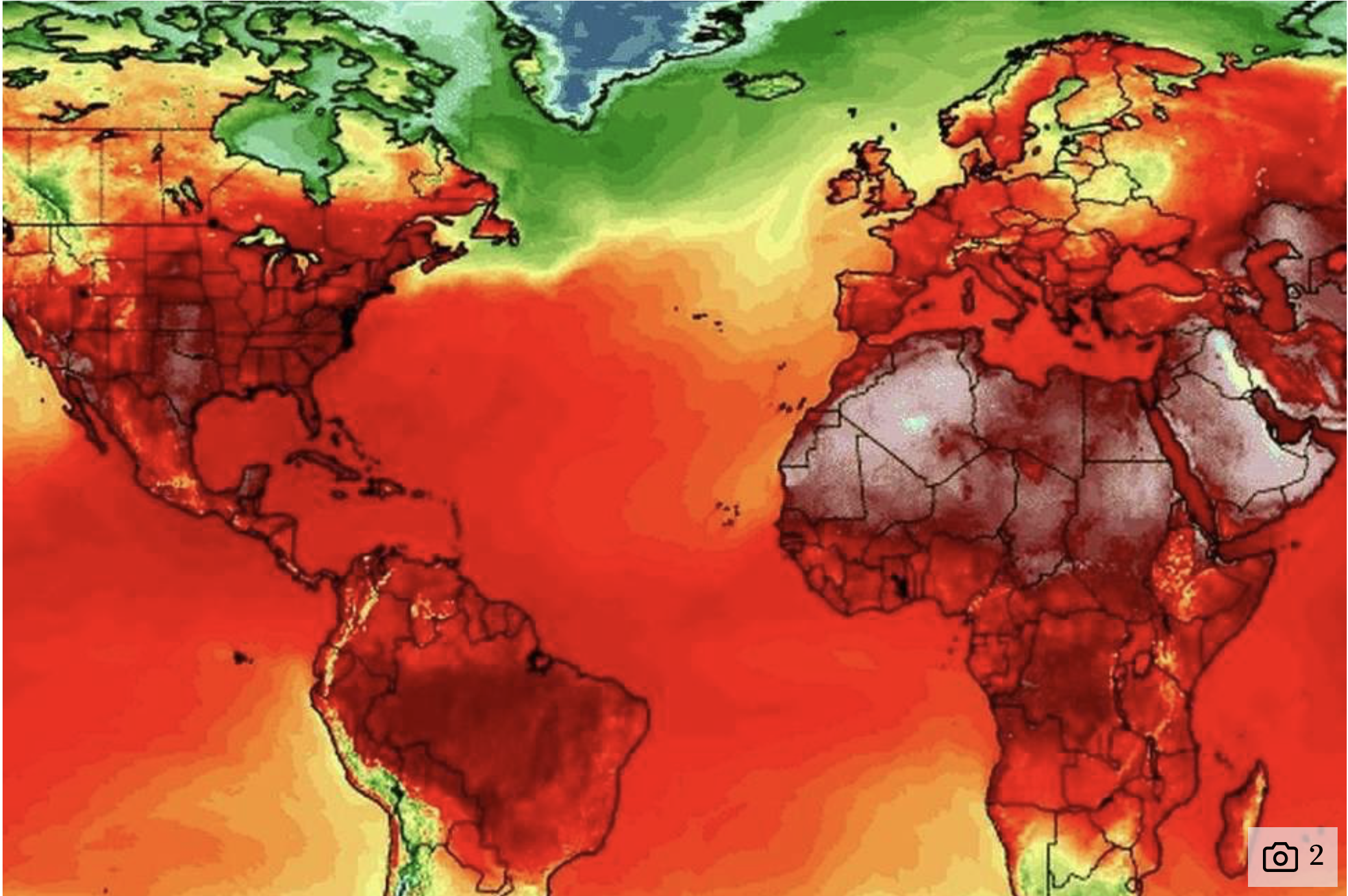
Parts of the globe are experiencing “one of the most intense heat events ever seen”, according to climate scientists.
Climate scientists are worried after several locations in the northern hemisphere saw record high temperatures over the past week.
Meteorologist Nick Humphrey said in a blog post that the extreme spell of hot weather amounted to “a true roasting”, writing: “It is absolutely incredible and really one of the most intense heat events I’ve ever seen for so far north.”
The mercury hit 30.1C in Castlederg in Northern Ireland on June 29 – a new record – while temperatures in Tbilisi, Georgia, and Yerevan, Armenia, rose this week to 40.5C and 42C respectively.
In the US, the Washington Post reports that heat in Denver, Colorado soared to an all-time high of 40.6C on June 28.
Guinness World Records has said that in the town of Quriyet, Oman, on June 26, the lowest temperature over the 24-hour period was a sweltering 42.6C – making a new record for highest “low”.
Deaths linked to a heat wave in Canada’s Quebec province reached 33 on Thursday, health officials said after the region’s largest city Montreal recorded its record high of 36.6C on July 2.
In the UK the heatwave pushed mean temperatures for last month up to 14.8C, making it provisionally the third warmest June since records began in 1910.
According to Humphrey, who interpreted a heat map from the University of Maine’s Climate Reanalyzer, even northern Siberia “has been getting blowtorched” with maximum temperatures of above 32C.
Click here to use a celsius to fahrenheit calculator.
FromAspen Journalism (Brent Gardner-Smith) via The Glenwood Springs Post-Independent:
Like children, every water year is different, but 2018 is now hanging out with some of the most notorious low-flow years in history.
This year started with a thin snowpack that ran off early and now has found trouble in a hot and dry summer.
The Bureau of Reclamation determined this week that 2018 had produced the fifth-lowest amount of runoff from the Colorado and Green rivers down to Lake Powell, between April and the end of July. That puts 2018 behind only 2013, 2012, 1977 and 2002, the low-water mark.
And locally, this year is now revealing dry reaches in the Roaring Fork and Crystal rivers not seen since 2012 or 2002.
Friday just before noon, the upper Roaring Fork River was dribbling through Aspen at 9.12 cubic feet per second, well below the environmental flow level of 32 cfs set by the state.
Also Friday morning, which saw some rare rain to the valley, a section of the lower Crystal River just above the state fish hatchery outside of Carbondale was barely running at 8.86 cfs.
The state’s environmental flow level in that reach of the Crystal is 100 cfs, and the 2016 Crystal River Management Plan set a less-ambitious flow target of 40 cfs for the reach.
Hunter Creek in Aspen was “flowing” at 0.48 cfs at its confluence with the Fork on Friday. That’s less than even half-a-basketball full of water in the stream bed.
“It’s a bad year,” said Alan Martellaro, a division engineer with the Colorado Division of Water Resources who manages water in the Colorado River basin above Grand Junction. “It’s not 2002, I don’t think, but it’s up there.”
This year already has a bad reputation on Colorado’s Western Slope, and especially in the southwest corner, which remains under exceptional drought conditions.
“Hydraulically, 2018 is stacking up across western Colorado as, potentially, depending upon your specific location, the driest year on record,” said John Currier, the chief engineer for the Colorado River District.
Another indicator of how dry 2018 is shaping up to be is the gage on the Roaring Fork River at Stillwater Road, just east of Aspen.
The gauge showed the Fork on Friday was flowing at 28 cfs, without any significant upstream diversions dropping the flow. The lowest flow on Aug. 3, in 53 years of record-keeping, was in 2002, when the river was flowing at 31.7 cfs.
A similar indicator can be found on the Crystal River at the gage that measures the river’s flow below Redstone, and above a series of diversion structures on the lower river.
Friday morning, that gauge showed the Crystal flowing at 68.5 cfs. The lowest flow on Aug. 3, in 62 years of record keeping, was in 1977 when the river was at 64 cfs.
In response to such low flows in the region, the River District on July 27 started releasing water it controls out of Ruedi Reservoir into the Fryingpan River, something it has not arranged to do since 2002.
By increasing flows by about 80 cfs up to 200 cfs in the lower Fryingpan, which runs into the Roaring Fork in Basalt, the District’s water helped cool the warm water in the Fork down to its confluence with the Colorado River in Glenwood Springs.
The water then also helped boost flows in the Colorado River near Grand Junction, where senior water rights known as “the Cameo call” are still calling for more water.
Such calls are often met by releasing water from Green Mountain Reservoir, south of Kremmling. But the River District and other water managers want to keep as much water as they can in Green Mountain until September, and the water released from Ruedi helps with that.
There was the added incentive this year to add water to the Fork and Pan to dilute the still-expected flow of ash and mud from Basalt Mountain in the wake of the Lake Christine Fire and the next heavy rainstorm.
There’s no easy way, however, to add water to the nearly-dry sections of the upper Roaring Fork and the lower Crystal rivers.
On Friday, for example, no water was being diverted upstream off the top of the Fork via the Twin Lakes/Independence Pass diversion system, and a related 3,000 acre-foot allotment of water that can be used to bolster flows already has been sent downstream.
In response to the low-flows, the city of Aspen has dropped its diversions into the Wheeler Ditch, which takes water from the Fork near the Aspen Club, from a potential maximum diversion of 10 cfs down to 0.5 cfs.
On the Crystal, a non-diversion agreement between the Colorado Water Trust and Cold Mountain Ranch, which diverts water from the Crystal, was not implemented this year, despite the dry conditions.
The agreement was meant help boost moderately low flows in the Crystal of around 40 cfs, not to help bring the river up from, say, 10 cfs to 25 cfs, which may not help the environment that much.
“If it’s not going to have an ecological benefit, it is not worth irrigators making the sacrifice,” said Heather Tattersall Lewin, the watershed action director at the Roaring Fork Conservancy.
On Thursday evening, Jim Kravitz, the naturalist program director at the Aspen Center for Environmental Studies, took note of the distressing lack of water in the upper Fork and lower Hunter Creek.
“I didn’t think flows were going to get this bad locally,” he said after walking up a dry Hunter Creek. “It’s eerie to hike up with no sound from the creek.”
Editor’s note: Aspen Journalism is covering rivers and water in the Roaring Fork and Colorado river basins for The Aspen Times. More at http://www.aspenjournalism.org.
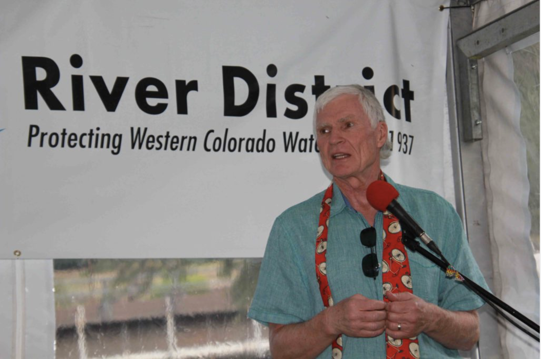
Eric Kuhn has retired as manager of the Colorado River Water Conservation District, but he believes he has an important message about the Colorado River. Photo credit: Allen Best/The Mountain Town News
A time of big pivots for Colorado water — with yet another reckoning to come
Eric Kuhn is now retired as general manager of the Colorado River Water Conservation District, but he may be working on the most important project of his career, a book.
In that book, working with John Fleck of Albuquerque, he’s trying to make the case that science should not be ignored in figuring out how to manage the Colorado River during the 21st century—as it was when Congress approved the 1922 compact governing allocations among the seven states, Indian tribes, and, somewhat more fuzzily, Mexico.
Kuhn was honored recently in Glenwood Springs by his staff and others from around Colorado for his 37 years of work.
Trained as an electrical engineer, Kuhn had been a naval office on a nuclear-powered submarine before pursuing a career in nuclear power plants. But even in 1981, he could see that nuclear power wasn’t going in the right direction. When he noticed an advertisement in the Wall Street Journal for a position at the Glenwood Springs-based water district, he applied.
Obviously, he got the job, moving from energy to water, from California to Colorado.
It was sharp pivot in Kuhn’s life. And Colorado since 1981 has also pivoted hard in very fundamental ways in its conversations about water.
Tom Alvey, who grows fruit and operates a packing shed in Hotchkiss, credited Kuhn with providing transparency and “getting the facts right” during his time as general manager of the Colorado River Water Conservation District, beginning in 1996.
Bill Trampe, who owns a ranch that sprawls between Crested Butte and Gunnison, lauded Kuhn for having “the foresight to see where we were headed and what we needed to do to be effective in protecting water for the Western Slope.”
Peter Fleming, the river district’s general counsel, testified to Kuhn’s “highly intellectual approach to negotiations.” As arguments and counterarguments were waged at one session, said Fleming, he observed Kuhn scribbling into a notepad. Peering over his boss’s shoulder, he said, he saw numbers. What did they represent? “He was calculating complex integers,” Fleming discovered. In that scribbling could be seen a larger lesson.
“He wasn’t disinterested in what was going on,” said Fleming. “He just knew that the timing wasn’t right for him to offer what would inevitably be a good solution.”
Denver Water’s Jim Lochhead was also at the gathering in Glenwood, just a few blocks from where he had for many years staffed the “Aspen office” of one of the state’s leading law firms. Lochhead drew attention to Kuhn’s influence beyond Colorado’s traditional Eastern Slope versus Western Slope schisms to the broader seven-state Colorado River Basin. There, Kuhn’s voice about preparing for a warming climate has become influential.
“He is collaborative. He is innovative. He thinks about different solutions. He listens. He tries to find the common ground,” said Lochhead, now chief executive of Denver Water, an agency that provides water to 25 percent of all Colorado residents.
A time of pivots
Nobody, however, spoke directly to the giant pivots in water politics, policies and problems in the 37 years since Kuhn arrived in Colorado.
One of the largest pivots had already begun in 1981. The federal government had spent most of the 20th century building the giant dams, canals and other hydraulic infrastructure in the West. In Colorado, the greatest ambition was evident in the gigantic transfer of water from the Colorado River headwaters near Grand Lake to the benefit of farmers in northeastern Colorado. It’s called the Colorado-Big Thompson Project.
The transfer—some would call it a heist — was opposed on the Western Slope, of course. One result of the compromise was a 1937 state law that created the river district and charged it with “conservation, use and development of water in the Colorado River and its principal tributaries in Colorado.” It covers 15 counties, including Pitkin, Garfield and Eagle. Southwestern Colorado has a similar district.
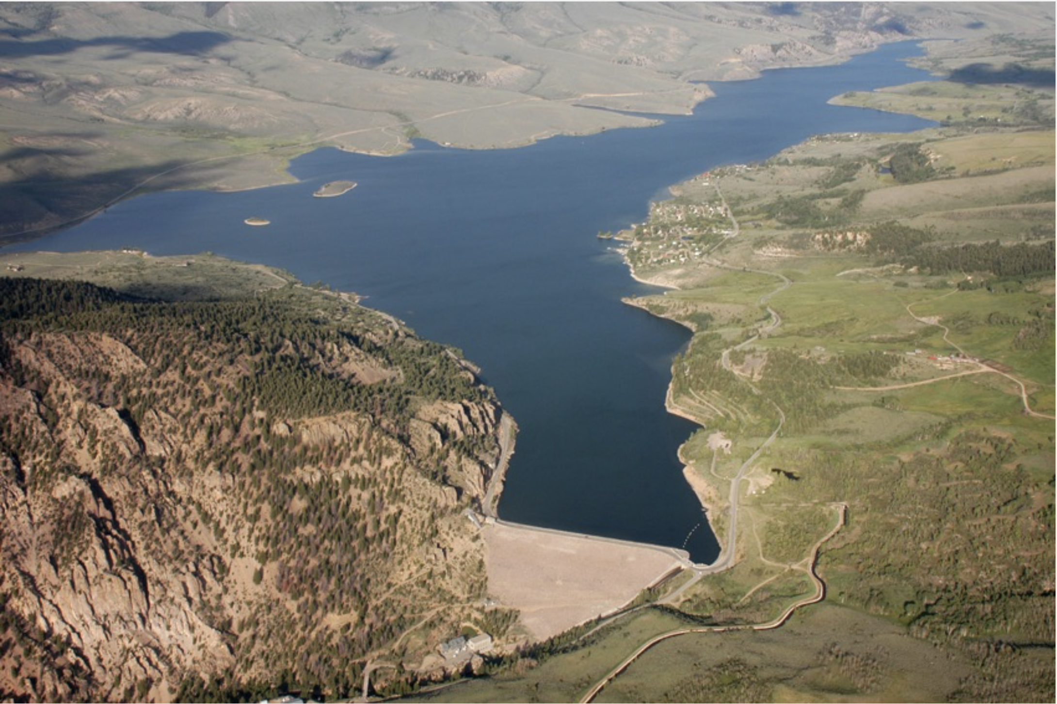
Another outcome was federal construction of Green Mountain Reservoir, on the Blue River north of Silverthorne. The dam had immediate benefits to the Western Slope, helping regulate flows to the benefit of farmers around Grand Junction. Much later, the regulated flows were crucial to providing water for endangered fish species in the Colorado River.
Green Mountain Reservoir, on the Blue River between Kremmling and and Silverthorne, was built for Western Slope interests. Photo/Northern Colorado Water Conservancy District via The Mountain Town News.
A later enterprise, the Fryingpan-Arkansas Project, hewed to the same template: It diverts water from the Roaring Fork drainage to farmers in southeast Colorado. For this, the Western Slope got Ruedi Reservoir. It was completed 50 years ago.
More projects were proposed, but in 1977 President Jimmy Carter announced they wouldn’t get funded. Westerners bristled and ridiculed Carter as a peanut-farmer in rain-drenched Georgia who didn’t understand the West. Ronald Reagan, arriving at the White House in 1981, was heralded as a Westerner who would right things. He only went half-way: Locals would have to come up with half the money for their dams and diversions. For most projects, it wasn’t nearly enough.
The Colorado River originates in Rocky Mountain Natonal Park and soon descends into the bucolic loveliness of Middle Park. Photo/Allen Best
Kuhn noted that during his time, two of the five projects on Carter’s hit list in Colorado were eventually built, if not to the sizes originally envisioned. One of them, Ridgway Reservoir (originally called Dallas Divide), provides hydroelectricity that is part of Aspen Electric’s 100 percent renewable portfolio.
Altogether, however, the river district during Kuhn’s time had a hand in building five smaller-size reservoirs. Wolford Mountain Reservoir near Kremmling, by far the largest, is two-thirds the size of Ruedi. It was built in co-operation with Denver Water.
The River District under Kuhn also worked with Denver Water on other projects. But when Kuhn started work in Glenwood Springs, the relations were rocky. Denver wanted to build a giant dam in the foothills southwest of the city. Two-thirds of the water behind the Two Forks Dam was to have come from the Western Slope, primarily Summit County. Water was to go to Denver’s fast-growing suburbs.
Kuhn had been assigned to represent the river district on a task force appointed by then-Gov. Dick Lamm, to help sort through the controversy. The Western Slope task force aligned with the environmental community and together they conceded need for a small Two Forks as well as expanded diversions from Winter Park area for an enlarged Gross Reservoir west of Boulder. In exchange, the task force said, Denver needed to commit to greater water conservation. Denver Water’s leaders, confident of their rightness to the point of cockiness, refused.
The drama was cut short in 1991 when the administration of President George H.W. Bush vetoed the project, which was to be on federal land, based on environmental impacts.
Kuhn points out that the levels of conservation the Western Slope and environmentalists asked of Denver were much less than what has actually occurred. Denver Water now uses the same water for roughly double the number of people it did in 1990. The default expectation of ever-more water supplies has been shattered.
“You have this decoupling of municipal growth and water use, and we really didn’t see that coming in the early 1980s,” Kuhn said in an interview last week.
Denver, Aspen and other communities have been part of a national trend of declining per-capita use of water that may be far from over. It’s a simple matter of economics. Wringing the sponge of water conservation is cheaper. More expensive is buying water from farms on the Great Plains, but it’s still cheaper than developing new supplies.
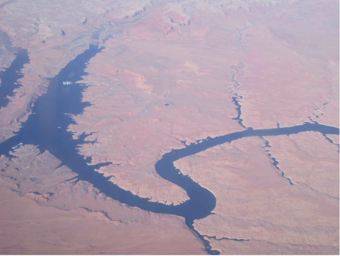
The Colorado River wends its way through southern Utah and, at Glen Canyon, is impounded into Lake Powell. Photo/Allen Best
Still being debated is how much water Colorado has to develop out of its entitlement, under compacts governing the Colorado River. As with Two Forks, a notion that the solution to water shortages is to build more dams and divert more still lingers. It assumes water remains available. A state report issued several years ago concluded that Colorado had as much as 1.5 million acre-feet of water in the Colorado River to develop.
Kuhn scoffed at that estimate. He said then that no more than 150,000 acre-feet remained—and, quite possibly, not even that. Even allocations for existing water uses are questionable because of the dangling uncertainty of the warming climate.
After rummaging around climate change science beginning in about 2000, Kuhn became increasingly vocal through published papers and other work about the need to recognize the profound implications of a warming climate on water supplies in the Colorado River and the demands.
“I was just reading some of the work that was coming out in the early 2000s, and it’s largely proven to be generally correct,” he said last week. “I am surprised how quickly it has come on, because there is so much noise in the system,” he added, referring to the inherent variability of weather, both temperature and precipitation. “Even from one year to the next there can be a lot of noise.”
A cloudy crystal ball
What this means exactly for Colorado is still hard to say. There’s still too much uncertainty about impacts to justify significant infrastructure investments at this time, according to even Denver Water. Kuhn agrees.
“It will take a long time to see how that pattern (of change) sets up,” he said.
Climate modeling suggests—but with low confidence—less snow and precipitation for southern Colorado and more for northern Colorado. The Elk Range between Aspen and Crested butte can be seen as a divide between that wetter and drier future.
“If I were in the southwest, in Durango, I would be a heck of a lot more concerned than if I were in Steamboat Springs, based on what we know now—but it’s still a guess,” he said.
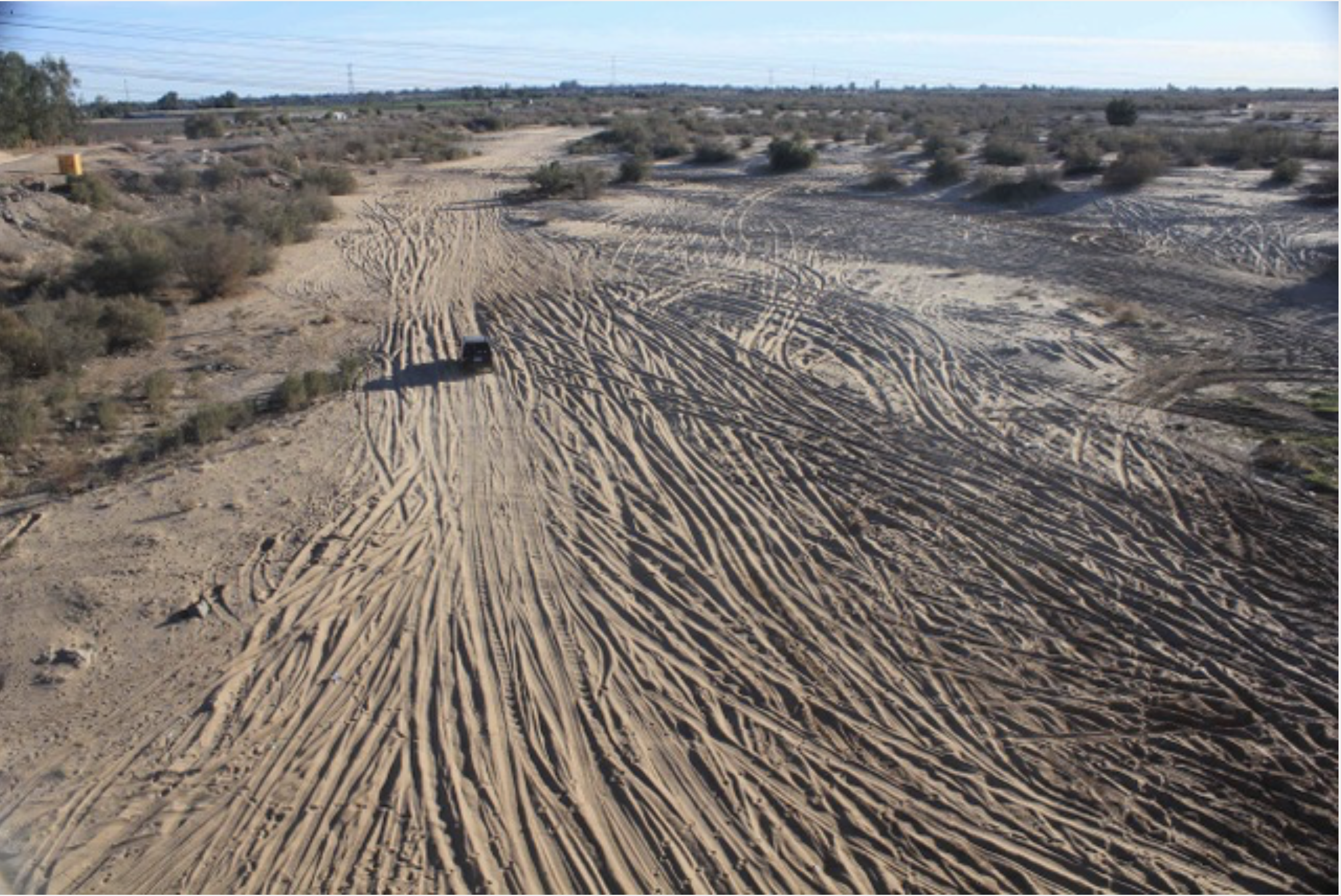
Just inside the Mexican border, at San Luis Rio Colorado, nothing remains of the Colorado River except for its sandy bed. Photo/Allen Best
For the broader Colorado River Basin, though, Kuhn expects less water in the Colorado River as it flows into the Grand Canyon past Lees Ferry. In this, last winter was a harbinger of the future. There are profound implications for how the seven states of the Colorado River Basin – plus Mexico—move forward.
And that is the big idea for the book now being written. In it, he and Fleck point to a report issued before the Colorado River Compact was formally adopted by Congress in 1928. The framers of the compact had assumed 16.4 million acre-feet average flows in allocating the waters among the seven basin states — with more yet due Mexico. In fact, flows during 20th century proved to be somewhat less, about 15 million acre-feet. The report provided accurate evidence of lesser flows beginning in 1875 and, more circumstantially, to 1850.
In other words, it was wishful thinking to assume so much water — and based on what is known about global warming, it’s fair to assume even less water in the 21st century. Through the first 14 years of the century, according to the research of Brad Udall and Jonathan Overpeck, flows have declined 19 percent.
“It’s a story about ignoring inconvenient science,” Kuhn said of the book. “If you had accepted the science, it would have made the political job [of apportioning the waters] much more difficult.”
It’s a story from a century ago, he said — but one fully relevant going forward.
For more of Kuhn’s thinking about the future of the Colorado River, see brief white paper: “Tne Upper Basin is Watching.”
NCEI supports services that help businesses and economy
When weather events happen, economic repercussions usually follow. Consumer behavior as well as supply and demand for a product or raw material can be affected. Energy demand soars during heatwaves; insurance claims rise after hailstorms; snow slows in-store shopping but can increase online sales; and grain prices spike during drought.
Using NOAA’s data archive at NCEI, a broad array of third-party services are meeting the practical needs of companies and their customersUnderstanding how those impacts affect the U.S. economy has spurred a growing demand for analysis of weather and climate data. Using NOAA’s data archive at NCEI, a broad array of third-party services are meeting the practical needs of companies and their customers.
NOAA Data Support Weather Service Providers
Today, more than 250 weather service providers support businesses with information that helps answer how weather and climate affect economic outcomes. For many parts of the U.S. economy, third-party weather vendors are stepping in by analyzing data based on sector-specific issues. The vendors, also known as weather service providers or decision support providers, tailor applications to weather-related questions based on a wide range of needs.
By combining NCEI data with business-specific information, third-party weather vendors are taking the guesswork out of potential market changes. Many businesses use third-party services on a regular basis to study consumer behavior, logistics, weather patterns, and much more. Economic sectors include energy producers, retailers, seasonal maintenance crews, transportation, law firms, and insurance companies.
An increasing number of companies are faced with the need to adapt their business models based on weather volatility. Weather alone can cause the gross domestic product (GDP) to fluctuate 3 to 6 percent a year, or as much as $1.3 trillion, based on a National Weather Service analysis. Demand for value-added weather services is projected to grow by 10–15 percent a year, according to a new study for NCEI that illustrates the important uses of data by leading third-party service providers.
NCEI Weather and Climate Data Lay the Foundation
As the chief repository of NOAA data, NCEI houses a wealth of environmental data that weather service providers use in product and service development. Weather service providers apply NCEI’s data in many ways. Providers, such as The Weather Company, WeatherBELL Analytics, Baron, and AccuWeather, use NCEI’s data a step beyond developing weather forecasts.
For instance:
Energy traders develop consumer-demand forecasts when weather is expected to impact a region
Insurance companies apply forensic analysis to weather-related accidents and claims
Transportation providers determine where to build facilities so that fog, snow, or other weather factors pose fewer challenges to logistics
Retailers analyze how seasonal patterns can affect merchandising and operations
With NCEI data, tailored services are poised for continued growthThe third-party weather service industry, currently valued at $7 billion, creates customized products such as maps, charts, graphics, and reports, or software tools and dashboards based on user specifications. Providers often accompany products with consultation services. With NCEI data, tailored services are poised for continued growth.
FromThe High Country News (Elena Saavedra Buckley):
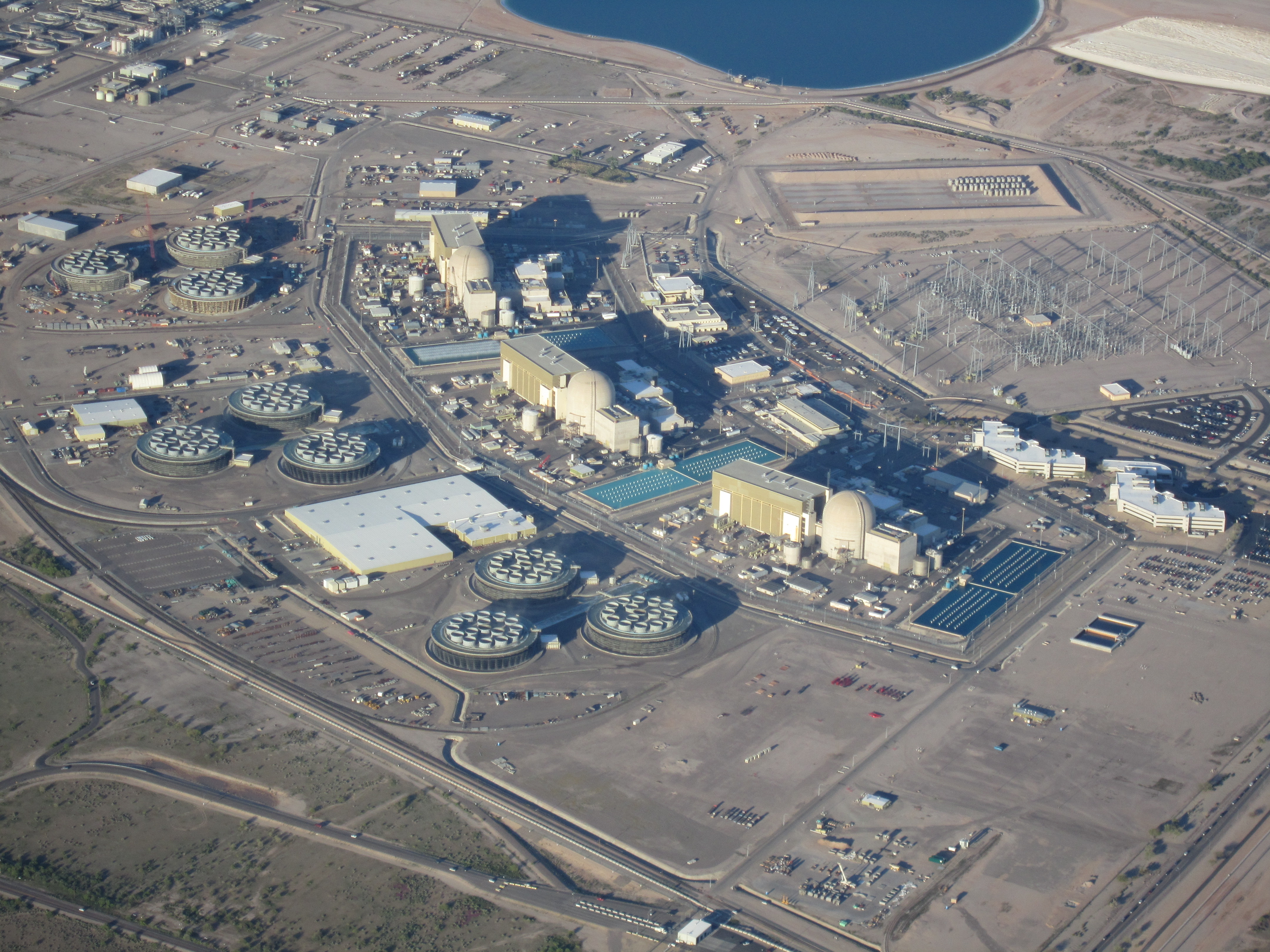
West of Phoenix, Arizona, where cooling towers billow steam into the air, the Palo Verde Nuclear Generating Station churns out more carbon-free energy than any other power producer in the country. But, in the light of a controversial ballot measure meant to steer Arizona towards renewable energy, Palo Verde’s fate has been caught in the crossfire of a battle between state utilities and environmentalists.
Clean Energy for a Healthy Arizona, a committee backed by former Californian hedge fund manager Tom Steyer, drives the initiative. They submitted over twice the amount of signatures needed to get on the ballot. If successful, the measure would constitutionally require Arizona utilities to use 50 percent renewable resources by 2030, holding them accountable for certain percentages each year. But Arizona Public Service, the state’s largest utility, funded a lawsuit filed last week against the initiative. The political action group that filed the suit claims most of the signatures are fraudulent, which the initiative denies. The utility has bigger worries than the signatures, though — they’re worried the measure would force Palo Verde to close in six years. An oversupply of solar, they say, would render the plant useless.
“A clean energy future is something we support,” the utility’s spokesperson Jenna Rowell said, “but you get there through a flexible plan.” The utility owns about a third of the plant, which they licensed to operate until the 2040s.
Palo Verde is the nation’s largest power-producing plant. A new ballot initiative could threaten its longevity. Photo credit: By Cuhlik – Own work, Public Domain, ttps://commons.wikimedia.org/w/index.php?curid=11039169
In Nevada, an identical, Steyer-backed measure is already on the ballot. If the measures pass in November, the two states will join California as the West’s most ambitious examples of renewable commitment. Whether the measure succeeds will determine a step in the West’s path towards cleaner energy — and whether nuclear power, the country’s stronghold of carbon-free power, will be along for the ride.
On its face, the fight between the Clean Energy initiative and utilities is about the price tag. The Arizona utility claims that customers would see a $1,200 average annual uptick in their bills were the initiative to pass. That prediction is based on estimates done by the utility for solar infrastructure and maintenance costs between now and 2030, Rowell said. The Navajo Nation, whose coal generating plant is on shaky ground, also opposes the initiative because of its rumored rate hikes.
The Clean Energy committee disputes the $1,200 figure, saying solar would be cheaper for customers. Wesley Herche, an energy researcher at Arizona State University, released a study that found no correlation between renewable standards and rate increases in U.S. states. He said that solar prices have dropped more than four times what they were in 2006, when Arizona first committed to a renewable standard of 15 percent by 2025.
The two sides agree on little about the measure’s possible effects. Herche said that it’s difficult to convince old-guard utilities, especially those with financial stakes and decades-long commitments to plants like Palo Verde, to pivot to fast-changing renewables technology.
“If you’re a company that operates one way, and you’ve always operated that way, it’s hard to all of a sudden to ask them to change, to be nimble, to be Silicon Valley-like,” he said.
As the lawsuit stymies the ballot measure, Palo Verde’s future is a loose end. Arizona Public Service says the plant will shut down if the measure succeeds. If it closes, thousands of employees would lose their jobs. But the Clean Energy group points to predictions that say the plant could stay open even if the measure passes.
Beyond Arizona, nuclear energy’s place in the carbon-free future of the West is an open question. In California, whose renewable goal is already 50 percent by 2030, nuclear plants have closed decades before their licensed expiration dates, struggling to compete with cheaper natural gas and solar. Whether nuclear plants should stay open as a stable alternative to fossil fuels divides environmentalists. Amanda Ormond of the Western Grid Group, which promotes incorporating clean energy into the grid, thinks nuclear power is an obstacle to a functional renewable future.
“Transitions have costs, and this is a huge transition,” Ormond said of the ballot measure’s proposals. “Palo Verde might close anyway. It’s an inflexible, expensive resource, and it will face the consequences of any resource.”
In the meantime, a utility regulator has proposed an alternate clean energy plan to the Arizona Corporation Commission, the organization that regulates the state’s utilities. Commissioner Andy Tobin wants to require utilities to meet an 80 percent target, including nuclear, by 2050. “The one thing I know about energy right now is that everything is uncertain,” Tobin said. He wants his plan to push clean energy without amending the constitution.
Time and legislative obstacles stand in the way of the Clean Energy initiative. But even if it fails, numbers show that Arizona voters are ready for renewables — in two recent polls, Arizonans wanted their state to prioritize solar power over all other resources. “We’re moving to renewable energy,” Ormond. “The question is how fast.”
Elena Saavedra Buckley is an editorial intern at High Country News.
On Aug. 5, 2015, Environmental Protection Agency workers at the long-abandoned Gold King Mine near Silverton, Colorado, accidentally released 3 million gallons of acidic water. The orange plume, laden with iron, zinc, cadmium and arsenic, flowed into the Animas River, then on into New Mexico and Utah (“Silverton’s Gold King Reckoning,” HCN, 5/2/16). Those two states and the Navajo Nation filed lawsuits seeking to recoup millions of dollars in cleanup costs from the EPA.
Cement Creek aerial photo — Jonathan Thompson via Twitter
FOLLOWUP
In late July, the EPA filed a motion to dismiss the combined lawsuits. The agency says that court intervention is unnecessary because it’s already working on cleaning up the mess — the Gold King and 47 other mine sites got Superfund status in 2016. The EPA ran out of room for storing the sludge waste from water treatment, and in mid-June, workers began moving it to a controversial new site northeast of Silverton. Critics say that location endangers fish, and in early July, a sludge truck crashed, spilling 9 cubic yards into a creek. The EPA is still working on a long-term cleanup plan for the Superfund sites in the Upper Animas watershed.
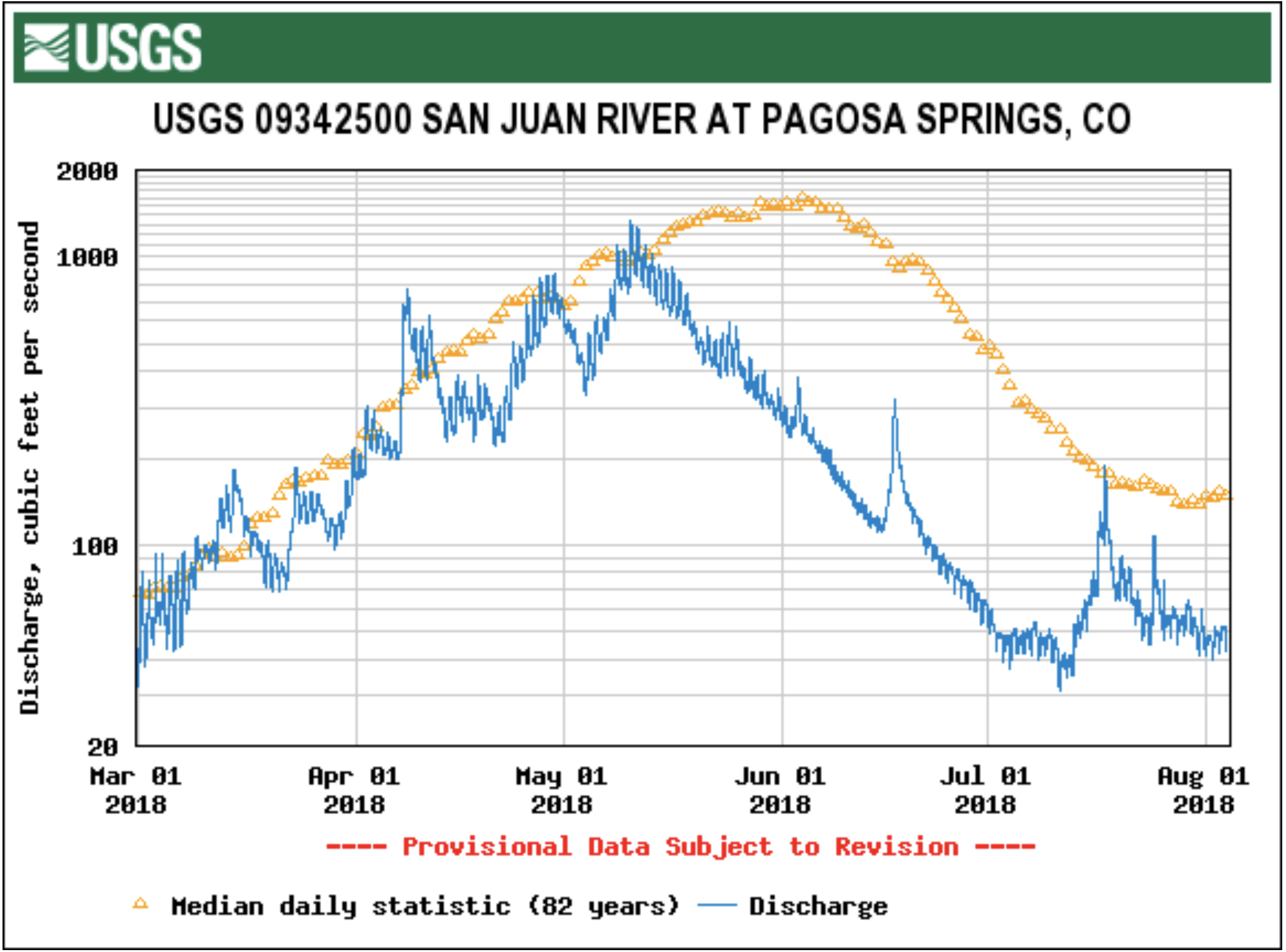
As of July 25, the San Juan River is currently flowing at 73.2 cubic feet per second (cfs).
According to Colorado Basin River Forecast Center (CBRFC) Senior Hydrologist Greg Smith, his- torically, the San Juan River is usu- ally flowing around 150 or 160 cfs.
“That’s kind of the mid-range, that’s kind of the median value, historically. So, I mean, we’re less than half that,” Smith said.
The San Juan River is above flows that were recorded back during the drought of 2002, Smith added later.
During the 2002 drought, cfs levels were around 45-50, Smith explained.
“Still, it’s kind of in the bottom few years, you know, the current flows,” Smith said.
These low river flows stem from the “dismal” winter season that Archuleta County had with poor snowpack conditions, Smith added further.
“And then, of course, we entered the spring somewhat dry as well, which didn’t benefit things. And you still have draws on the river from ir- rigation, especially as you go further downstream,” Smith explained.
This year, Smith described, was the “perfect storm” for low river flows.
Additionally, the seasonal spring runoff volume is currently at 71,000 acre feet (AF) for the San Juan River in Pagosa Springs, Smith added.
“It’s probably not going to be a lot more than that when it’s all to- taled up, the April through July for this year,” Smith said. “And that’s going to be, probably, it looks like to me, the third lowest on record.”
The lowest recorded spring run- off volume was recorded in 2002 with 23,000 AF flows, Smith noted.
The CBRFC has records for spring runoff volumes for the San Juan River dating back to 1936, Smith added later.
“Kind of the only hope we have at this point is if we can just get enough active monsoon weather to at least give us some additional runoff from rain flow,” Smith com- mented.
“The bulk of what you get comes from snow melt. You can get some pretty good stream flows due to the monsoon, due to thunderstorms, but they’re short-lived,” Smith said later.
Public perception
When the public sees such low cfs numbers for the San Juan River, Smith explained that educating the public depends on what its uses are for the river.
“I mean there’s concern for everybody when you get real low flows, you know, from people get concerned about the fisheries and the amount for irrigation,” Smith explained.
A lot of the general concern for the public is if this current year is a low-flow year for the river, what will happen next year, Smith noted.
“Right now at least we have a benefit from how wet last year was,” Smith described. “You know, Navajo Reservoir managed, as you get further downstream, to have some pretty good storage carry over from last year.”
Some of that storage is “saving people” this year, Smith noted.
Another dry year could create some significant concerns among the public, Smith added later.
“There’s been enough water, at least below, for folks below the reservoir. As my understanding this year that they didn’t have re- ally serious shortages,” Smith said.
Low in-stream flows can affect recreational activities as well as irrigation, Smith explained.
However, because of last year’s wet season, Smith notes that there is some optimism to be felt.
“It is cause for concern when you get flows that low. But, you know, this year, again, I think we benefited from last year being so wet. So, it could have been so much worse this year, especially as you get further downstream below the reservoirs,” Smith explained.
Next year will be a year that the CBRFC watches closely, Smith stated.
“Because we could be in a tough situation next year if we had an- other year like this,” Smith said.
Unfortunately, low river flows are a problem that just can’t be solved physically, Smith later com- mented.
“You’re just kind of at the mercy of what happens. Below reservoirs you have a little more control of course in maintaining certain levels for fisheries or for irrigation needs as long as you have the wa- ter source,” Smith said. “But when you’re away from that, when you’re up in the higher elevation headwa- ters, you’re pretty much just at the mercy of mother nature.”
People are seeing flows that are certainly among the lower ones that have been on record for this type of year, Smith added later.
“If folks are saying ‘Wow, I haven’t really seen this,’ then, you know, they probably haven’t,” Smith explained.
“It’s amazingly low. Hopefully we’ll get some monsoon moisture here to push us through the rest of the summer.”
Swim class on the San Juan River. Photo: Brent Gardner-Smith/Aspen Journalism
At the intersection of bluegrass & carbon ranching in Colorado
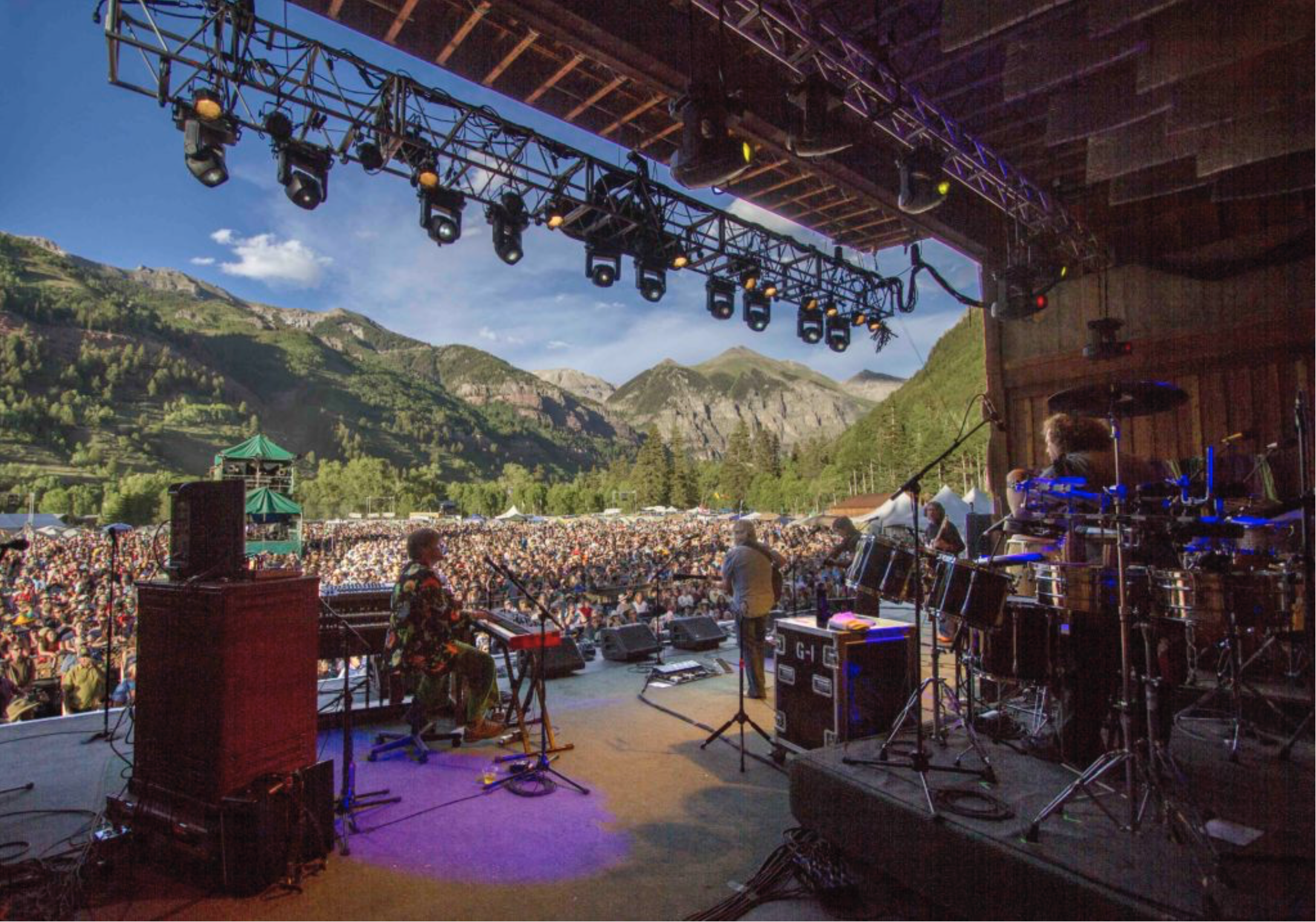
TELLURIDE, Colo. – If both lie within Colorado, eight hours apart by car, Telluride and Lamar would seem to have little in common.
From Lamar, it’s 35 minutes to Kansas, too far away to see even the faint outline of the Rocky Mountains. It was on the Santa Fe Trail and has lots of interesting history. But today it’s a just-getting-by farming town where the politics run red. In the last presidential election, 70 percent of voters in Prowers County voted for Trump, 24 percent for Clinton.
It’s almost exactly opposite in Telluride and San Miguel County: 24 percent voted for Trump and 69 percent for Clinton. The setting is different, of course. Telluride is a place that can cause jaws to literally drop if people arrive for the first time when a rainbow is arching at the end of the box-end canyon on a summer evening. Oprah sprang $14 million for a house a couple years ago. Other billionaires fly on private jets in and out of the airport on a nearby mesa. Those less well-heeled arrive by car for the nearly non-stop festivals that run through the summer.
Now, these two physically and demographically disparate places in Colorado have become connected financially through a carbon offset program.
That relationship came into sharper focus in June as 15,000 people gathered at the 45th annual Telluride Bluegrass Festival. Most of the “festivarians” come from Colorado, particularly Denver and other Front Range cities, but 20 to 25 percent fly to Colorado. Every state is represented and about 10 foreign countries. This sort of thing can be tracked both in post-surveys but also in on-line registrations.
Festival organizer Planet Bluegrass has long been conscious of the festival’s role in generating carbon dioxide and other greenhouse gas emissions. Steve Szymaski, who has been with Planet Bluegrass since 1988 and is vice president, says the company began making efforts to offset the carbon emissions its causes in 2003. “It’s really a philosophy of wanting to understand that that everything has impacts, and that there are ways to encourage renewable energy.”
Planet Bluegrass has invested in both renewable energy certificates and carbon offsets, two parallel but different financial devices.
In the early years, Planet Bluegrass purchased renewable energy certificates for wind, solar and hydro. Most of the money went to wind farms, including one in Minnesota. For three years the money went to a methane-reduction project at a dairy in the Central Valley of California. For two years, money went to a methane-capture project at landfill in Colorado’s Larimer County.
Planet Bluegrass has expanded its accountability over the years. Electricity—produced mostly by burning coal and natural gas—represents just 1 percent of electrical use associated with the festival. lodging represents another small component. Travel—trucking equipment, by performers, even shuttles during the festival—represents the lion’s share. Largest of all is travel by the attendees, 87 percent of the festival’s carbon footprint. The festival last year generated an estimated 2,100 metric tons of carbon dioxide emissions.
Photo via TellurideValleyFloor.org
This year, the bluegrass festival took a new tac. Keeping the dollars local or at least semi-local was important. Telluride’s Pinhead Climate Institute offered an appealing opportunity in a package deal.
The Town of Telluride is also participating for five years, offsetting operations of the in-town bus shuttle, called the Galloping Goose. Mountainfilm last year participated, and a program involving jet travel from the mesa-top Telluride Regional airport, highest in the county to offer commercial service, is also being assembled.
Shepherding the program is Adam Chambers, one of the three co-founders of the climate offshoot of the Pinhead Institute. He has worked extensively in carbon offset programs elsewhere in the country, from the Carolinas to California. “If I were to characterize myself as anything, it would be as a carbon accountant,” he says.
The Pinhead’s carbon offset work got launched through a $50,000 grant from the Telluride Foundation’s program designed to foster innovation. To get the grant, the idea had to get strong community support. It did. Telluride has vowed to become a carbon-neutral community. The sign at the entrance to town says so.
Why not just avoid carbon in energy use? Not likely any time soon, at Telluride or other mountain resort towns. Chambers says that residents of Telluride, Mountain Village and San Miguel County altogether have double the national carbon footprint. This estimate may skew conservative, as it makes no attempt to take responsibility for how its visitors get there or get home except as it may involve sale of fossil fuels locally. The mesa-top airport sells 500,000 gallons of aviation fuel annually. Most guests arrive at other airports outside the county.
There’s only so much switching out of lightbulbs possible. Electricity for Telluride still comes primarily from coal- and natural gas-fired power plants, so even if the town had electric buses they would have a carbon footprint. Jets burn gas—and lots of it. This energy transition is far from complete.
Along the Santa Fe Trail
That’s where the 14,500-acre May ranch near Lamar comes into the picture. Its native sod has never been turned by a plow. That’s a rarity on the Great Plains.
The ranch lies near the Arkansas River. Traders on the Santa Fe Trail wheeled their carts along the river in the 1830s and 1840s, stopping at Bent’s Fort. In late 1864, just a few years after the founding of Denver 200 miles to the northwest, Arapaho and Cheyenne Indians had taken shelter along Sand Creek, at a site north of today’s ranch. The promises were broken when soldiers under the command of John Chivington, the hero of a Civil War battle in New Mexico, whooped down with guns blazing at dawn. Today, the Sand Creek Massacre is observed by Native Americans and Anglos both each year the day after Thanksgiving.
Greenhouse gas emissions from tailpipes and smoke stacks have occupied much of the attention of the environmental movement. They’re not everything, though. The Environmental Protection Agency in April said that 9 percent of U.S. greenhouse gas emissions come from farms and deforestation.
The May Ranch near Lamar, Colo., has never been plowed. Photo/Ducks Unlimited via The Mountain Town News
Most of the attention usually goes to logging of rainforests in Brazil, Indonesia and elsewhere. But the plowing of the Great Plains, the world’s most productive farm region, also ranks high—and, some say, higher.
The great plow-up continues. The World Wildlife Fund, in an October 2017 report called “Plowprint,” estimated 2.5 million acres of grassland on the Great Plains of the United States and Canada had been plowed the prior year. The organization worries about the grasslands being an “absolutely underappreciated ecosystem,” in the words of Martha Kauffman, of the non-profit office in Bozeman, Mont.
Native grasslands sequester carbon as they grow grass. That’s the key to this new connection between Telluride and the May Ranch. Plowing releases carbon into the atmosphere. That makes keeping the land unplowed worth something in the fledgling market of carbon offsets.
Owners of the ranch, the May family, are being paid essentially to stay the course, to do nothing different.
That’s a tricky concept to absorb, kind of like negative numbers. This is how Chambers explains the concept:
“You are saying to farmer Dallas May, ‘You have a stock of carbon in your carbon bank account, and you are agreeing to keep that carbon forever in your bank account without pursuing other crop options that would allow you to deplete that carbon stock. You are not a regulated entity, so you can emit to the atmosphere without any negative repercussions. So, nice work on being a carbon shepherd. You are forgoing plowing the soil to grow soybeans or some other crop. But this carbon farming might be more predictable than commodity prices.”
Spare the plow?
How the ranch came to spare the plow for so long is not clear. What is clear, according to the testimony of Ducks Unlimited, a key partner in preserving its unbroken character, is that there have been threats from every direction. A large diary operation was interested in plowing the native vegetation to plant feed crops with center-pivot irrigation. Next to the ranch, on other property, 2,400 acres of prairie were plowed up in just one month several years ago.
This statistic comes from Billy Gascoigne, an economist and environmental markets specialist for Ducks Unlimited. Based in Fort Collins, Colo., he previously worked in the Prairie Potholes region in the Dakotas. That’s where Ducks Unlimited negotiated the first large carbon transaction in 2015.
Now, the same principles and protocols for determining value have been applied to the 14,500-acre ranch in Colorado.
Billy Gascoigne. Photo credit: The Mountain Town News
Using protocol established by the American Carbon Registry, Ducks Unlimited determined that plowing the native grasses to grow corn or wheat would release around 8,000 metric tons of carbon dioxide per year for the next 50 years. Conserving these grasslands equates to removing the annual emissions of 50,000 cars, according to the calculations of the registry.
The ranch is “literally surrounded on all four sides by cropland and had many offers to plow up the grasslands,” says Gascoigne. “We worked with our partners in the land trust community to get ahead of the plow and make sure that carbon stays in the belowground soil.”
The owner of the ranch, the May family, had been on the property for 30 years and only recently had purchased it. Dallas May, the patriarch of the ranch family, wanted to find a way to preserve the ranch, and hence begin reaching out to conservation organizations to explore options that would not damage the wildlife habitat and would allow continued livestock grazing to occur.
May had come to appreciate the value of the property as wildlife habitat. The Audubon Society has designated the ranch as an area of significance for birds as well as an essential corridor link between two populations of lesser prairie chickens. It also has ducks.
More common
Carbon offsets have become more common. They represent the act of reducing, avoiding, destroying or sequestering the equivalent of a ton of greenhouse gas in one place to “offset” an emission taking place somewhere else, as GreenBiz explained in 2009.
The market remains a voluntary one in Colorado and most places. The Disney Corporation, Shell, Chevrolet and others have used the device to offset emissions.
Another major multi-national corporation will soon announce another offset project involving land in eastern Colorado, says Chambers.
Colorado Green, located between Springfield and Lamar, was Colorado’s first, large wind farm. Photo/Allen Best
This is a voluntary market. Only California has a price on carbon emissions among U.S. states. As relates to prairie ecosystems, there are two protocols for establishing the value of the offset. But because the market for offsets remain small, values are still being determined.
Planet Bluegrass’s Szymanski says his company paid $30,000 this year to offset the impacts of the festival in Telluride. Other years, he says, he has paid as little as $10,000. “This is a small drop in the bucket compared to what Fortune 500 companies can do,” he says. “But we were there at the start.”
The Pinhead Institute wanted to keep it “local,” and Colorado fits within that definition. Other places, closer to Telluride, could in theory work. But getting small plots of land, such as conservation easements on hillsides that might otherwise be carved up into estates, is impossible to do. “The numbers just aren’t large enough to pull it off,” says Gascoigne.
Planet Bluegrass was happy to keep the money local, too. “We feel it was important to get behind this because it was new and they were hungry,” says Szymanski.
The most important point, says Gascoigne, is you don’t have to go preserve a rain forest on another continent to do good work. He believes he is doing very consequential work just eight hours from Telluride.
Avon photo via Jack Affleck and the Mountain Town News.
Click here to view the announcement and to register. Here’s an excerpt:
The Color of Water: Exploring the Spectrum October 9 -11, 2018 Westin Riverfront Resort – Avon, CO
FEATURED PRESENTER: ANTHONY POPONI
In a galaxy far, far away in another lifetime Anthony was a watershed professional and worked on rivers and creeks in the Gunnison Valley for several years. During his professional career Anthony has always been a communicator and favored roles where he either entertains or educates and occasionally he even does both. Anthony loves connecting dots in both simple drawings and in complex settings where his inner-networker brings together individuals to catalyze collaboration and patnerships. He does it all with an authentic personality and always weaves in humor into everything he touches. Laugh and learn along the way with Anthony.
The plan calls for 2020 fuel-efficiency standards to be frozen in place through 2026 while sorting out what a new rule could look like, as well as ending California’s ability to set its own, more stringent standards. The end result will be a huge uptick in carbon emissions.
The Obama rules were made in 2012 after consultation with the auto industry and would have increased car fuel-efficiency standards to 54.5 miles per gallon by model year 2026. The new proposal—announced by the Environmental Protection Agency and the Department of Transportation—would freeze efficiency standards at 43.7 mpg through model year 2026.
California has the ability to set even stricter standards for auto emissions, thanks to a waiver the EPA granted the state in 2013. There are a dozen other states that follow those standards as well. Revoking that waiver, despite the EPA commitment to “cooperative federalism,” is an, uh, odd move.
Robbie Orvis, an analyst with policy research group Energy Innovation, told Earther that revoking California’s waiver is “not in the spirit of the Clean Air Act, and the way it’s been implemented in the past.”
On an existential front, the new rule proposal will commit a hell of a lot more carbon to the atmosphere. The Union of Concerned Scientists estimates that it will result in an extra 130 million metric tons of carbon dioxide going into the atmosphere in 2030. That’s the equivalent of adding 30 coal-fired power plants to the grid.
Because people are likely to hang onto their cars for many years, the impacts would continue to play out beyond 2030. An analysis by Energy Innovation found that by 2035, U.S. transportation emissions will be 11 percent higher than they would be if the Obama-era standards and California’s waiver were kept in place.
The move will also put the U.S. behind the curve globally. While our weirdo climate-denying president obviously doesn’t care about the atmosphere or having a habitable planet, other countries do. And they’ve responded by putting in place stringent fuel efficiency standards, including many based on those in California.
The rollback ensures that the U.S. will be spinning its wheels on climate while the rest of the world forges ahead. That could have very real impacts on the fate of U.S. automakers viability and profits as they produce a wider range of cars. It could also inspire countries to be less ambitious.
“The top vehicle standards in the rest of the world are in line with existing standards,” Orvis said, referring to the Obama-era standards. “Undoing this will make U.S. automakers less competitive with automakers in other markets who are moving ahead making more efficient vehicles. It’s moving us in the wrong direction and making us less competitive with the rest of the world.”
Stanford researchers map out groundwater at stake in the wake of a court decision that bolsters Native American rights to the precious resource across an increasingly arid West.
California’s Coachella Valley may be ground zero for a new chapter in water rights for Native American tribes, according to a new Stanford study published in the journal Science.
Local water agencies have pumped so much water from aquifers to supply homes, farmland and resorts in the Coachella Valley that the land is sinking. The Agua Caliente Indian Reservation, created in 1876, runs in a checkerboard pattern in the area of Palm Springs. (Image credit: Tim Roberts Photography / Shutterstock)
Better known for lush golf courses, glittering pools, a popular music festival and temperatures topping 120 degrees, this inland desert is also home to the Agua Caliente Band of Cahuilla Indians, which has fought since 2013 for federal courts to affirm its right to groundwater beneath its reservation. Lower courts ruled in the tribe’s favor, and in late 2017 the U.S. Supreme Court denied an appeal.
Observers immediately recognized that the decision could set a powerful precedent for tribal groundwater claims, which have suffered murky legal status for more than 100 years. But how much groundwater is at stake as tribes assert this newly bolstered right – and where these claims may clash with nontribal users in an increasingly arid West – remained uncharted until now.
Sizing up water rights
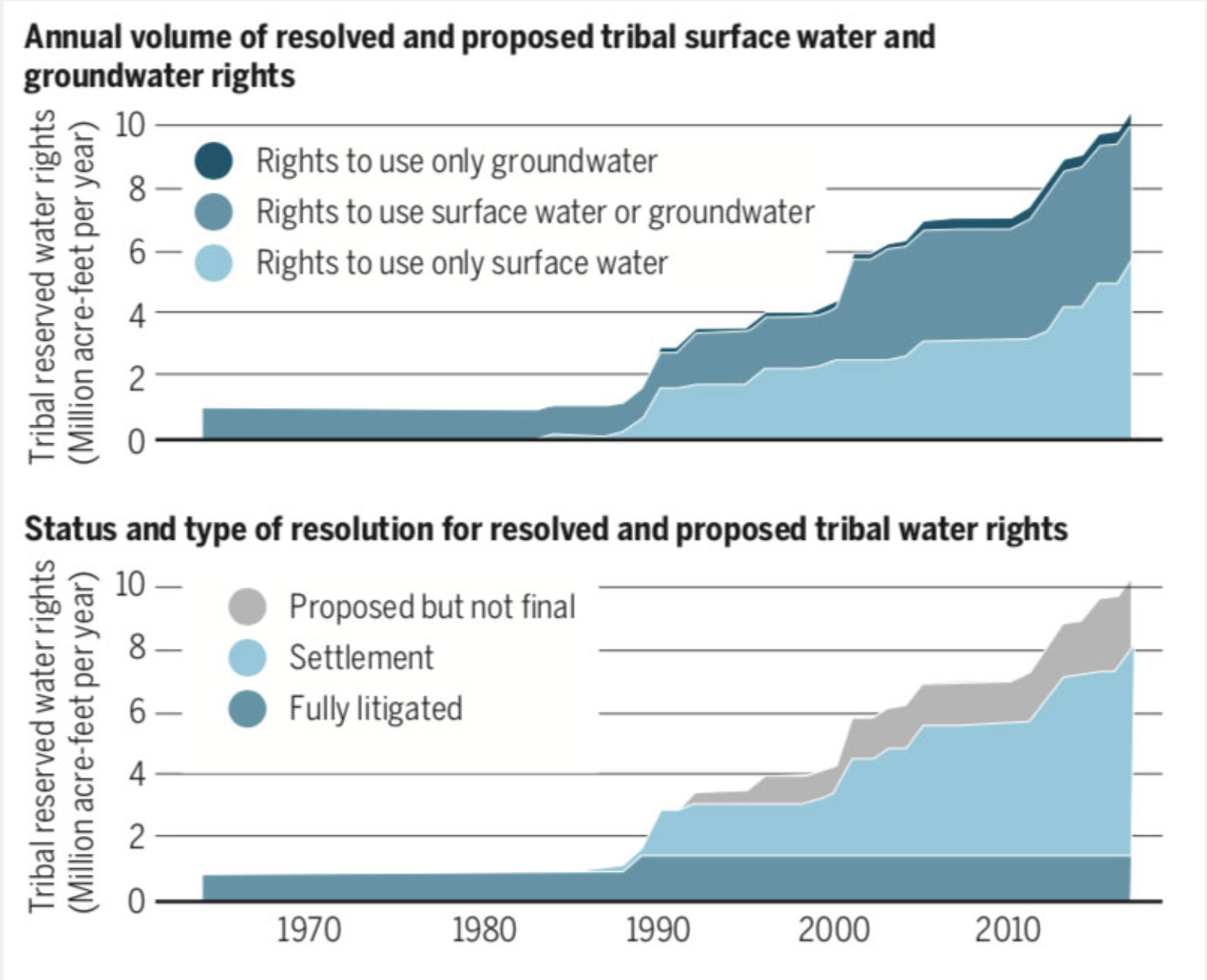
The study reveals that court decrees and settlements have resolved or proposed rights for tribes in western states to use more than 10.5 million acre-feet of surface water and groundwater annually. To put that in perspective, this would be nearly enough water to irrigate all of the alfalfa, almond and rice fields in California for a year. “It’s a major volume,” said lead author Philip Womble, a PhD student in environment and resources in the Stanford School of Earth, Energy & Environmental Sciences (Stanford Earth).
Most unresolved Native American claims to groundwater exist in areas where there’s reason to believe major aquifers could yield significant amounts of groundwater, including in some places where nontribal wells already dot the landscape and increased pumping by tribes might disrupt their production. (Image credit: Philip Womble)
Before the Agua Caliente ruling, the study shows, tribal rights exclusively for groundwater made up a small portion – 4 percent – of all tribal freshwater rights in 17 western states. Now, more tribes will likely seek to resolve their rights to control and use water from the aquifers beneath their land, according to Womble and his co-authors, who include Water in the West executive director and Woods Institute of the Environment professor Leon Szeptycki, as well as Water in the West non-resident fellows Debra Perrone and Rebecca Nelson.
This shift comes at a time when questions of who owns the aquifer and how they can use the water holds increasing urgency, as western states face the likely prospect of demand outstripping the supply of legally available freshwater in most western watersheds by 2030.
“Indigenous communities in several countries have struggled to gain rights to their natural resources,” said study co-author Steven Gorelick, a professor of Earth system science at Stanford Earth and director of the Global Freshwater Initiative. Almost half of all homes on Native American land lack adequate access to drinking water or waste disposal facilities, compared to less than 1 percent for U.S. homes overall. The Agua Caliente ruling, Gorelick said, “is a very important step forward in restoring balance to those injured Native American tribes.”
Competing for a precious resource
In the Coachella Valley, the Agua Caliente tribe has for decades purchased water from local agencies, which have pumped so much water from the region’s aquifers that the land is sinking. Now, as the next phase of Agua Caliente’s lawsuit unfolds in federal court, the tribe is seeking to have judges put a number on its groundwater rights, establishing how much water it can pump from the Coachella Valley aquifer – potentially before most other users are entitled to a single drop.
Before the Agua Caliente ruling in late 2017, tribal rights exclusively for groundwater made up a just 4 percent of all tribal freshwater rights in 17 western states. (Image credit: Philip Womble)
Today, the study shows, fewer than 60 tribes in the western U.S. have this level of legal certainty around their rights to fresh water from any source – whether from lakes and rivers on the surface, or from aquifers underground. Many more tribes have unresolved rights: According to the study, as many as 236 tribes in the western U.S. have lands with groundwater rights that have not been finally quantified in court or in settlements. In all, the research suggests, tribes control at least some water from so many aquifers across the West that any plan to sustainably manage water in the region would be incomplete without considering their role.
These unresolved groundwater claims span large swaths of Arizona, Oklahoma, South Dakota and Utah, and smaller clusters can be found in all other western states except Colorado. Most of them exist in areas where there’s reason to believe major aquifers could yield significant amounts of groundwater, including in some places where nontribal wells already dot the landscape and increased pumping by tribes might disrupt their production.
Ripple effects for laws and markets
“Court disputes usually focus on the specific facts of a given case,” said Womble, who specializes in water policy in the Emmett Interdisciplinary Program in Environment and Resources (E-IPER) at Stanford Earth. He is also an attorney. His team has captured a bigger picture that could help inform decisions about groundwater management throughout the U.S. and in other countries that recognize indigenous community water rights, including Australia, Canada, Chile and New Zealand.
“Even though a U.S. court decision clearly isn’t binding in another country,” Womble said, “it could provide a persuasive precedent that courts confronting this issue in other nations might look to.” Historically, he said, courts in Canada and Chile have adopted some terminology and approaches from U.S. water law.
Already, Gorelick added, the study results suggest that the creation of market-based systems for renting water rights could work to indigenous communities’ advantage. “With this ruling,” he said, “Native American tribes with higher priority rights are now in the driver’s seat to potentially benefit from participating in water markets.”
Steven Gorelick is also Stanford’s Cyrus Fisher Tolman Professor and a senior fellow at the Woods Institute for the Environment. Additional co-authors are from the University of California, Santa Barbara, the University of Washington Law School and Harvard Law School.
The research was funded by the Switzer Foundation and the Stanford Interdisciplinary Graduate Fellowship.
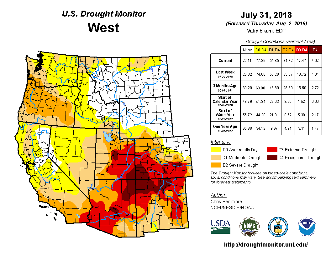
Click here to go to the US Drought Monitor website. Here’s and excerpt:
Summary
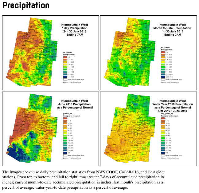
Early in the drought week, moderate precipitation fell along the East Coast with the heaviest rains falling in the eastern Carolinas and central Pennsylvania. Much-needed rains fell in a swath of area covering eastern Wyoming, much of Nebraska, Kansas and Oklahoma, eastern Colorado and the majority of New Mexico. The northern Plains, Midwest and South saw lighter precipitation amounts. Central and south Texas saw little to no precipitation during the week while the dry pattern continued for much of the West. For the month of July, preliminary statewide temperature data suggest much of the U.S. was warmer than average. The West, Southwest, South, and Northeast were among the warmest third of historical records which date back 124 years. Total precipitation amounts for the month of July were below average for much of the Midwest and Northwest. Also during the month of July, above average precipitation fell in the Mid-Atlantic States to Northeast, Southwest and parts of the High Plains…
Much-needed precipitation fell across most of Oklahoma and west central Arkansas, prompting the contraction of drought in some locations. Anywhere from a half inch to nearly 3 inches fell mostly north of I-40 in Oklahoma and south of I-40 in Arkansas. There was a precipitation surplus in parts of western Oklahoma stretching into north Texas, prompting the further contraction of drought and abnormal dryness there as well as in the central part of Oklahoma. In northeast Oklahoma, abundant precipitation the past 30 days prompted the removal of D3. Drought/dryness continued for much of Texas. Precipitation departures mounted, with precipitation approaching 10 percent of normal at the 30-, 60-, and 90-day time periods in much of south and east Texas. Exceptional drought was added to some locations in the south central part of the state where the dryness is the worse as well as in north central Texas along the Oklahoma border. Moderate to severe drought was contracted in southwest Arkansas where moderate rains fell…
A swath of light to moderate precipitation fell in an area roughly covering north and east Wyoming, east Colorado and much of Nebraska and Kansas. The heaviest precipitation fell in western Nebraska, Kansas and eastern Colorado where amounts of 2 inches were widespread. Despite the rains, long-term drought was hardly effected. There was a slight improvement in southeast Colorado, and D1 was removed in southwest Kansas where short term indicators have rebounded. Despite the monsoon season ramping up, dryness continued in west central Colorado where D3 was expanded. Moderate drought was expanded in southwest Wyoming where it remained dry during the period. There was also a slight expansion of D0 and D1 in North Dakota while D0 was contracted in southeast North Dakota into northeast South Dakota…
A swath of light to moderate precipitation fell in an area roughly covering north and east Wyoming and east Colorado. Monsoon rains continued to provide drought relief for some areas of the Southwest. Southern New Mexico saw the greatest improvements as drought was roughly reduced by 1-category in many areas. The heaviest rains have yet to reach east central New Mexico where extreme drought was expanded. The Northwest remains dry as precipitation during the past 6 months was 50-75 percent of normal across much of the region. Wetness prevailed in much of southern Montana. Abnormal dryness (D0) was expanded in Idaho where short-term deficits exist. Based on preliminary data, July ranked as one of the ten driest July’s on record in Idaho. The dry season continued in California and typically no changes are made there this time of year. However, some indices were showing greater drought than what is currently depicted. If negative impacts start to come in, then perhaps degradations would be needed. Wildfires continue to burn in the West. Of those, the Goose Creek fire in Nevada has burned more than 120,000 acres and the Carr Fire, outside of Redding, California, has burned more than 110,000 acres…
Looking Ahead
During the next five days, moderate to heavy precipitation is projected to fall along the East Coast with amounts generally totaling up to five inches. The heaviest rains are forecasted to fall in the Southern Appalachians and the Panhandle of Florida. Much of the South is forecasted to remain dry during the next five days but average temperatures are expected to remain near normal. Temperatures could be as much as 10-20 degrees F below normal for parts of the Midwest early in the period along with 1-2 inches of precipitation. Temperatures in this area are expected to rebound later in the period. The Southwest Monsoon is expected to continue, producing beneficial rains for New Mexico and parts of Arizona. The Climate Prediction Center expects the greatest odds of above normal temperatures in the Southern Rockies stretching into the High Plains and in the Northeast during the next 6-10 days. The greatest probability of below normal precipitation during this period is centered in the High Plains.
Click here to read the newsletter. Here’s an excerpt:
USE MEAD AS A BATTERY?
A proposal to use Lake Mead to store energy by pumping water into it from downstream using solar power and then releasing the water through the dam’s hydropower plant to meet peak energy demands has generated excitement and controversy. This Nevada Independent article sums up the potential and the complications of implementing such a plan.
Building a pipeline from Lake Nighthorse to Farmington could cost between $83 million and $173 million without calculating the cost of acquiring right of way access, a consultant to the San Juan Water Commission told the group today.
Rick Cox, a senior engineer for the engineering firm AECOM who also serves as a consultant for the San Juan Water Commission, targeted that figure while delivering a presentation for the water commission during its monthly meeting here.
The commission spent about $20,000 on a study to look at three alternatives that could help local water users if another mine spill occurred in Colorado and dumped toxic material in the Animas River. Those alternatives included building a small-diameter pipeline from Lake Nighthorse, building a large-diameter pipeline from Lake Nighthorse and building additional storage reservoirs.
The lake is a storage facility located in a recently annexed portion of the city of Durango, Colorado. It stores water from the Animas River for several member entities including the Navajo Nation, the Ute Mountain Ute Tribe, the Southern Ute Tribe, the city of Durango and the San Juan Water Commission.
Building shallow ponds to increase the storage capacity by 50 million gallons at the lake was the least expensive of the three options cited during today’s meeting. Cox said it would cost about $18 million. The additional 50 million gallons of storage would last about 14 days.
The San Juan Water Commission represents Aztec, Bloomfield, Farmington and rural water users in San Juan County. Cox said not all of those water utilities would require additional storage capacity if another mine spill takes place.
He explained that some water utilities, such as the Lower Valley Water Users, already have enough storage capacity. Other water users, such as the city of Bloomfield, could benefit from additional storage capacity, Cox said.
Pipeline could provide water during drought
While the additional water storage capacity would help local water users if another mishap like the Gold King Mine spill of August 2015 occurs, it would not provide much help during drought conditions, Cox said.
A large-diameter pipeline could provide the water users with water for up to 114 days during drought, Cox said.
The commission is considering having a more extensive feasibility study conducted on the three alternatives presented by Cox. San Juan Water Commission executive director Aaron Chavez said that would cost about $250,000…
The San Juan Water Commission has rights to 20,800 acre-feet of water stored in Lake Nighthorse. During a drought, the water commission can call upon the Animas-La Plata Operations, Maintenance and Replacement Association, which oversees Lake Nighthorse operations, to release water for San Juan County water users. Currently, the only way to get that water from Lake Nighthorse to the water users in New Mexico is to release it back into the Animas River. A pipeline would ensure all the water released from Lake Nighthorse reaches water users in San Juan County.
Animas-La Plata Operations, Maintenance and Replacement Association general manager Russ Howard warned commissioners not to rely on Lake Nighthorse. Howard said it could take years to refill the reservoir after water is withdrawn. He warned if there was a multiple-year drought, Lake Nighthorse could only be an option for one year.
From the University of Colorado (Molly Phannenstiel):
Jessica Ghent has had an eventful summer.
As part of a nine-week research internship at CU Boulder, the Front Range Community College student is studying the topography of Colorado’s Mount Princeton to find the ideal placement for ground control points, which are physical markers that drones can follow to create a digital map of the area.
Ghent will use the drone images to make a 3D digital elevation model of the area to understand how to help prevent debris flows, which are fast-moving masses of rock that can destroy towns and homes in a matter of minutes.
She wants to find out how debris flows start and how to improve early-warning systems in the future.
Ghent is one of 11 students participating in the Research Experience for Community College Students (RECCS) program hosted by the Cooperative Institute for Research in Environmental Sciences (CIRES).
Now entering its fifth year, RECCS gives Colorado community college students hands-on research opportunities as they look ahead in their careers.
“The RECCS program is amazing, and it’s so beneficial,” Ghent said. “We all go into something lacking confidence and feel like we don’t know enough, but it’s cool to be around a lot of different people with science backgrounds and learn more about things that you wouldn’t have necessarily come into contact with.”
Sean Will, a student at the Community College of Denver, is studying beaver habitats by looking at water properties and soil permeability to study how this might affect droughts. The research will help reveal whether beaver dams can efficiently manage a limited water supply.
“The research experience is very valuable, not just if I continue on with the research career track, but even if I go back into business or something, I can take a lot of the skills from the RECCS program,” Will said.
RECCS Director Anne Gold and Program Manager Renee Curry Minaya say the program teaches community college students valuable skills that will help them in their careers.
“Being part of a professional research group gives a lot of skills: multitasking, organization, professionalism, interpersonal professional communication skills and how to set goals realistically and work towards them,” Gold said.
Students are assigned a research question to answer on their own while they work alongside their faculty mentors to answer big picture research questions. At the end of the program, they present their findings to their peers, their mentors and the general public.
With RECCS funded for two more years via the National Science Foundation, Gold and Curry plan to continue expanding the program’s reach.
“We are trying to reach more rural community colleges, because for them, the lack of access to resources is even stronger than Front Range community colleges,” Gold said.
Their efforts are already beginning to push past the Front Range. Susannah Rozak, a member of this year’s RECCS class from Pikes Peak Community College in Colorado Springs, has always been passionate about research and the program has been a perfect way to expand her knowledge.
“There’s so much about the world that we don’t know yet and so being able to take part in finding things out and discovering things and sharing those discoveries is really fun,” said Rozak, who is studying student engagement in climate change. “I feel like RECCS has helped me grow a lot and be more confident.”
Ghent hopes to transfer to CU Boulder in the fall, possibly continuing her research into debris flows under her faculty mentors.
“I’ve gained experience in really tangible ways that I’ll be able to take to my future career,” Ghent said.
In the lower levels of the Denver Botanic Gardens, the nonprofit’s herbarium holds more than 70,000 plant specimens as well as fungal samples and plant DNA. The plants are pressed in blotting paper to remove water and preserve the specimen.
Christina Alba, a research associate at the Gardens, has been working since April to collect a small portion of the samples from the High Line Canal trail system. The project will span into September to collect plants from all seasons.
“These collections are living data,” she said. “It’s not just dusty old stuff stuffed away. People are actively using it.”
The herbarium at the Botanic Gardens, 1007 York St., is mostly concentrated on plant samples from Colorado, Alba said. Her recent project with the Denver-based High Line Canal Conservancy will help create a better picture of what plant life lives along portions of the 71-mile trail system…
Alba and a team of 10 volunteers have been collecting samples from every plant along the canal to take back to the Botanic Gardens herbarium. From there, botanists can use microscopes to indentify the plant. Then, the Botanic Gardens will research that plant and whether it’s native to Colorado.
The data being collected by the Botanic Gardens across Colorado is not being hoarded in the herbarium for only scientists to see, Alba said. The organization has been digitizing its archives and making them available online for people to research plant trends and species data.
“People 20 years from now can search the High Line Canal and link to the species list that we generate,” Alba said.
The amount of plant life along the trail depends on the area and how much water it gets. Human interaction in the area has also changed the types of plants growing there. In some spots, residential gardens are directly next to the trail. Plants from those gardens have traveled across the path and down toward the canal itself.
“There’s a lot of influence onto the corridor,” Alba said. “There’s that native ecosystem, or the original ecosystem, and what kind of plants were there, but now there’s that human imprint laid over that.”
Plant counts will help bring data back to the Highline Canal Conservancy, which is working to build a new master plan for the canal’s future.
The master plan will also look at landscaping around the trail, including drought-tolerant plants and using storm water. Josh Phillips, manager of community initiatives with the conservancy, said Denver Water will stop delivering water to the canal in the next few years. The conservancy’s master plan is looking into retrofitting the canal to use storm water for other properties.
“We really want to understand how the ecology of the canal might change as storm water is introduced into the system,” Phillips said.
He added that retrofitting the canal for storm water use would be cheaper than building new storm water retention facilities. The conservancy is hoping that storm water will help keep the vegetation around the canal thriving.
The Colorado River District is working with state and federal water managers to increase flows in the Fryingpan River by as much as 100 cubic feet per second (cfs), helping trout in the watershed survive warm temperatures while supplying water for downstream irrigation needs in the Grand Valley.
Anticipated releases are expected to range between 50 cfs and 100 cfs and will be coordinated between the River District, the U.S. Bureau of Reclamation and the U.S. Fish and Wildlife Service to increase flows in the Fryingpan and Roaring Fork rivers downstream from Ruedi Reservoir.
“This should significantly benefit flows below Ruedi Reservoir,” said John Currier, chief engineer for the district. “We expect that the supplement flows may also help to mitigate water-quality problems anticipated from fire-related ash and debris flows stemming from the Lake Christine Fire on Basalt Mountain.”
Technically, the water will be delivered downstream for Grand Valley irrigation needs while creating environmental benefits as it flows downstream. Green Mountain Reservoir releases will be reduced by an equal amount in order to conserve storage for late-season releases, which in turn will be needed to help endangered fish near Grand Junction.
The coordinated approach was given final approval by the Bureau of Reclamation on Monday. In order to boost Fryingpan levels while the plan awaited approval, the U.S. Fish and Wildlife Service implemented a 50 cfs release from its dedicated endangered fish pool in Ruedi on Friday. Those flows were supplemented by 30 additional cfs Monday, bringing the flow in the Fryingpan to 200 cfs.
Both Ruedi and Green Mountain reservoirs contribute water to the Upper Colorado River Endangered Fish Recovery Program. In this case, the changed water release plan will benefit trout below Ruedi while endangered fish still receive water from upstream Colorado River reservoirs.
Increased flows of cold water out of Ruedi should also help to alleviate some stress on trout fisheries in the watershed brought on by higher-than-normal water temperatures. Colorado Parks and Wildlife announced voluntary fishing closures earlier this month on sections of the Colorado and Roaring Fork rivers.