Click here to read the update (Megan Holcomb/Tracy Kosloff):
On June 22, 2020, Governor Polis activated the State Drought Mitigation and Response Plan and the supporting Drought- and Agricultural Impact Task Forces to respond to deepening drought conditions across the state. The recommendations to activate the State Drought Plan were reviewed by over 50 state experts, department directors, and external advisors that represent a range of Colorado economies, water users, and state regions. As of Thursday, July 2nd, dry conditions cover 84.3% of the state. To stay informed on the evolving 2020 drought season and response resources, please visit the Colorado Water Conservation Board drought website and submit questions or comments on Twitter at @CO_H2O.
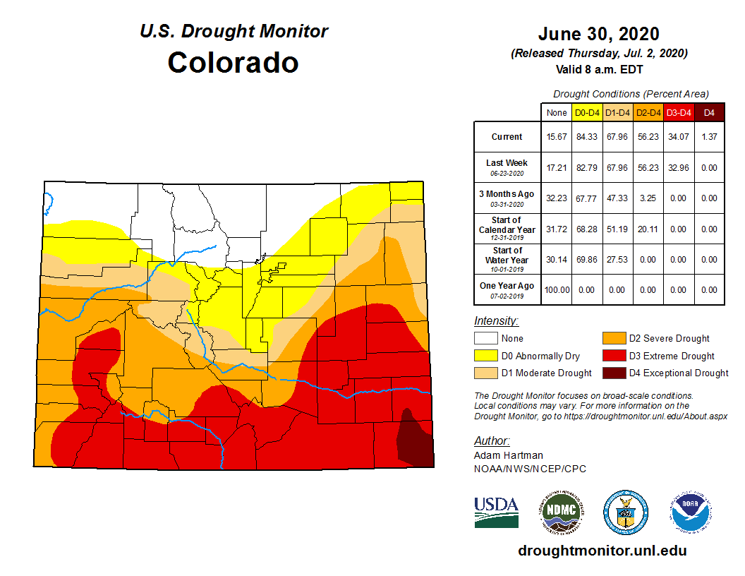
The latest U.S. Drought Monitor, released July 2, presents abnormally dry conditions in all but 15.7% of the northernmost Colorado border. D4 (exceptional) drought conditions emerged for the first time on July 2 in Baca and Prowers counties (1.37% coverage) since Feb. 2019. D3 (extreme) conditions cover 33% of the state; D2 (severe drought) covers 22%; D1 (moderate drought) covers 12%; and D0 (abnormally dry) covers 15% of the state.
The 90-day Standardized Precipitation Index (SPI) (from March 23 to June 20) shows slightly below average moisture for nearly all of Colorado with deeper shortfalls along the eastern border. Above normal temperatures are likely to continue for the eastern half of state for next 2 weeks.
Colorado Drought Monitor June 30, 2020.
El Niño Southern Oscillation (ENSO) conditions are currently neutral with a 50/50 chance of La Niña or neutral conditions for the rest of summer and into the fall. Monsoonal patterns may emerge for Arizona and New Mexico in early July. Recall that during La Niña conditions, the eastern plains are more likely to see above average summer and winter temperatures. During El Niño, the entire state is more likely to experience below average temperatures.
NOAA’s Climate Prediction Center three month outlook maps continue to show very high confidence for above average temperatures July through Sept. and a slight chance for below average precipitation for most of the state.
Reservoir storage, while 100% of average across the state, ranges from 62% of average in the Rio Grande to 115% of average in the Colorado and Yampa/White basins.
Several municipal water providers are reporting demands around 8% above normal and elevated but not extreme concerns around the lack of spring precipitation.
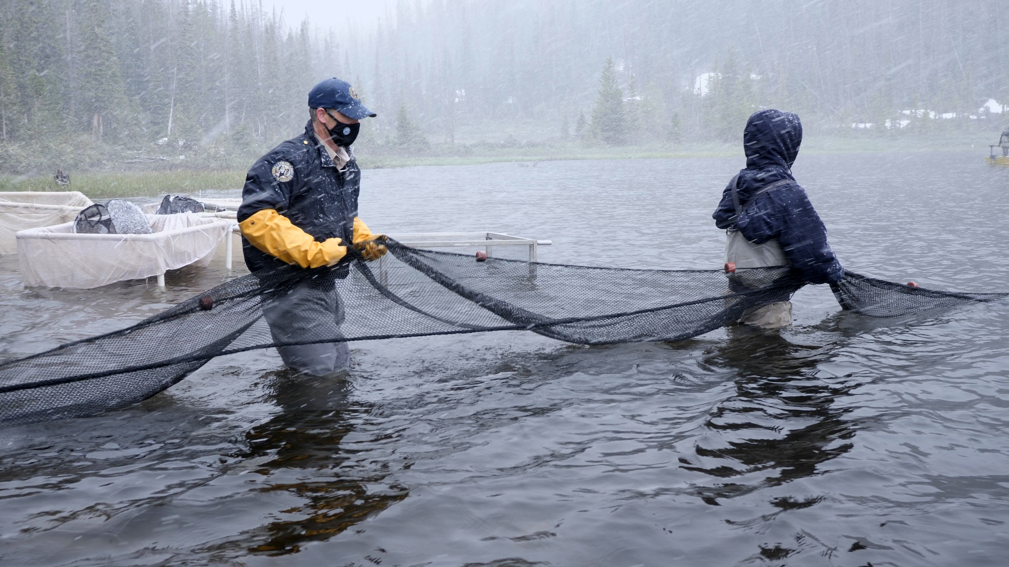
Collecting Greenbacks from trap nets in Zimmerman Lake June 30, 2020. Courtesy of Jerry Neal/CPW
Here’s the release from Colorado Parks & Wildlife:
On June 30, Colorado Parks and Wildlife officials were met with a blizzard and 34-degree temperatures at Zimmerman Lake while conducting its greenback cutthroat trout spawning operation. This video from Senior Video Producer Jerry Neal highlights the dedication of CPW’s aquatics staff working in these winter-like conditions, even if it says summer on the calendar.
While teamed up with CPW Cutthroat Trout Research Scientist Kevin Rogers, the Northeast Aquatics team collected spawn and mark recapture data from the greenback cutthroat trout “broodstock” population at Zimmerman Lake. Aquatic Biologists are always prepared for variable weather when working at 10,000 feet, but they certainly were not expecting blizzard conditions when they arrived at the lake early in the morning on June 30.
The team captured the fish using live “trap” nets that were deployed the previous afternoon (when it was sunny and warm). Eggs were collected from females and mixed with milt (sperm) from males. The fertilized eggs were driven in small one-gallon coolers to CPW’s Salida Isolation Unit, operated by the Mt. Shavano Fish Hatchery, where they are either reared to fry to be stocked back out into the wild at other reintroduction sites, or raised to one year of age to be stocked back into the wild and replenish the broodstocks at Zimmerman Lake and the Leadville National Fish Hatchery.
All of the fish that are stocked into Zimmerman Lake are given a Passive Integrated Transponder (PIT) tag, each with a unique alphanumeric code, and a color coded Visual Implant Elastomer (VIE) tag, with each color representing a different year class and family group. During the spawn operation at Zimmerman Lake, each fish was scanned for its PIT tag and visually checked for its VIE tag. Additionally, aquatic biologists measured length and weight and identified sex of each fish. All of this information enables biologists to assess individual fish growth rates and estimate survival of the different year classes and family groups, and thus evaluate CPWs efforts to maximize genetic diversity in the broodstock.
The broodstocks at Zimmerman Lake and the Leadville National Fish Hatchery, and associated hatchery operations, represent the backbone of efforts to recover the Federally Threatened State Fish of Colorado, the Greenback Cutthroat Trout.
“It is fun and rewarding work for the biologists, even though the weather isn’t always ideal,” said Boyd Wright, CPW Native Aquatic Species Biologist.
Click on a thumbnail graphic to view a gallery of drought data from the US Drought Monitor.
US Drought Monitor June 30, 2020.
West Drought Monitor June 30, 2020.
Colorado Drought Monitor June 30, 2020.
Click here to go to the US Drought Monitor website. Here’s an excerpt:
This Week’s Drought Summary
Precipitation was hit-or-miss this week for many locations east of the Great Plains. Much of the Midwest, South, and Southeast saw combinations of D0 additions and removals based on 7-day rainfall accumulations. Most areas with D0 removal observed at least 2-3 inches of rainfall. Some short-term dryness crept into southern Georgia (isolated 2-4 inch 30-day deficits) and the Florida Gulf Coast (widespread 2-4 inch deficits over the last 14 days). The Mid-Atlantic coast saw some D0 expansion near the Delmarva Peninsula. Portions of New England saw more than 3 inches of rainfall, drastically reducing 30- and 60-day deficits and warranting some D1 removal. However, USGS 7-day average stream flows remain below normal for much of the Northeast. The High Plains and northern Rockies also received some beneficial rainfall. Many locations in Idaho saw 1-category improvements (D1 to D0 and D0 removal), but much of the northern High Plains Region did not receive enough rainfall for much improvement. Some degradation from D3 to D4 occurred in southeastern Colorado and southwestern Kansas in areas where little or no precipitation fell and temperatures averaged above normal for the week. The wildfire risk remains high for many locations that remain in drought, particularly in the West…
Above normal temperatures, low humidity, high winds, and below normal precipitation in recent weeks has led to continued degradation in southeastern Colorado and southwestern Kansas. Although some isolated convection occurred in southeastern Colorado, in areas that did not see precipitation and that continued to see above normal temperatures this week, D4 was introduced, which expanded into southwestern Kansas. However, some D0 and D2 reduction was warranted in western Kansas, as 7-day rainfall accumulations of more than 1.5 inches eliminated 30-day departures for several locations. Some areas of Nebraska saw expansion of existing D0 coverage, where 30-day dryness continues. There are concerns of potential flash drought in eastern Nebraska, where 30-day SPIs of D2 or greater are being reported. The northern High Plains saw enough rainfall this week (1.5-3 inches) to warrant D1 reduction in northwestern South Dakota and southwestern North Dakota. The remainder of the region was generally status quo…
The Western Region is mainly status quo, except for the northern Rockies and Pacific Northwest, where an active storm track. Idaho benefitted the most, with several locations seeing 1-category improvements, particularly western Idaho, which received 0.5-1.5 inches of rainfall. Light showers in eastern Washington and northeastern Oregon led to slight reduction of D0 and D1 coverages. Soil moisture is below the 10th percentile in many areas across the Great Basin and northern California. USGS 7-day average stream flows also continue to be below to much below normal this week for much of the Four Corners Region, the Great Basin, and northern California…
In the Southern Region, the story remains the short-term (30-60 day) dryness. Western Tennessee has missed out in recent weeks on the heaviest precipitation, warranting some D0 expansion (2-3 inch deficits going back 90 days). Northwestern Arkansas and northeastern Oklahoma saw D0 and D1 expansion, as little to no rain fell and most of these areas have received only 10-25 percent of normal precipitation in the last 30 days. 7 inch rainfall deficits in the last 60 days have been observed near Tulsa and Creek Counties in Oklahoma, warranting the addition of a small area of D2. USGS 7-day stream flows are also below normal (10th-24th percentile) for areas around Tulsa County, OK. In western areas of Texas and Oklahoma, heat, low humidity, and lack of rainfall continue to exacerbate existing drought conditions, leading to some D1, D2 and D3 expansion. Widespread D2-D4 SPIs over several time periods for many of these locations…
Looking Ahead
During the next 5 days (July 2-6), WPC’s QPF showed increased probabilities for precipitation across many of the northern tier states, much of the Mississippi Valley, and Southeast, where many areas are favored to receive up to and exceeding 1 inch of precipitation. The Northern High Plains and the Middle Mississippi Valley are expected to see some of the heaviest rainfall (2-4 inches in some cases). Probabilities drop off quite a bit for many locations just east of the Rockies, where below normal precipitation, high winds, low relative humidity, and above normal temperatures continue to be the driving factors for maintenance and exacerbation of drought conditions. Luckily, temperature anomalies are favored to be near to slightly above normal for much of the next week over the western Plains. Much of the Great Lakes is also favored to miss out on some beneficial rainfall in the upcoming week, in addition to positive temperature anomalies of 8-10 °F.
The Climate Prediction Center’s 6-10 day outlook (July 7-11) shows an amplified pattern with a mean ridge over the central CONUS, and troughing over the West Coast and over the eastern CONUS. Enhanced probabilities of below normal temperatures are favored along the West Coast and interior Pacific Northwest, in association with a mean mid-level trough over the West. Above normal temperatures and below normal precipitation are favored in much of the central CONUS, with probabilities for above normal temperatures extending to the Great Lakes and Northeast, underneath a mean ridge. The active storm track is favored to continue for the northern tier states, with elevated odds for above normal precipitation centered over the Upper Midwest and Great Plains.
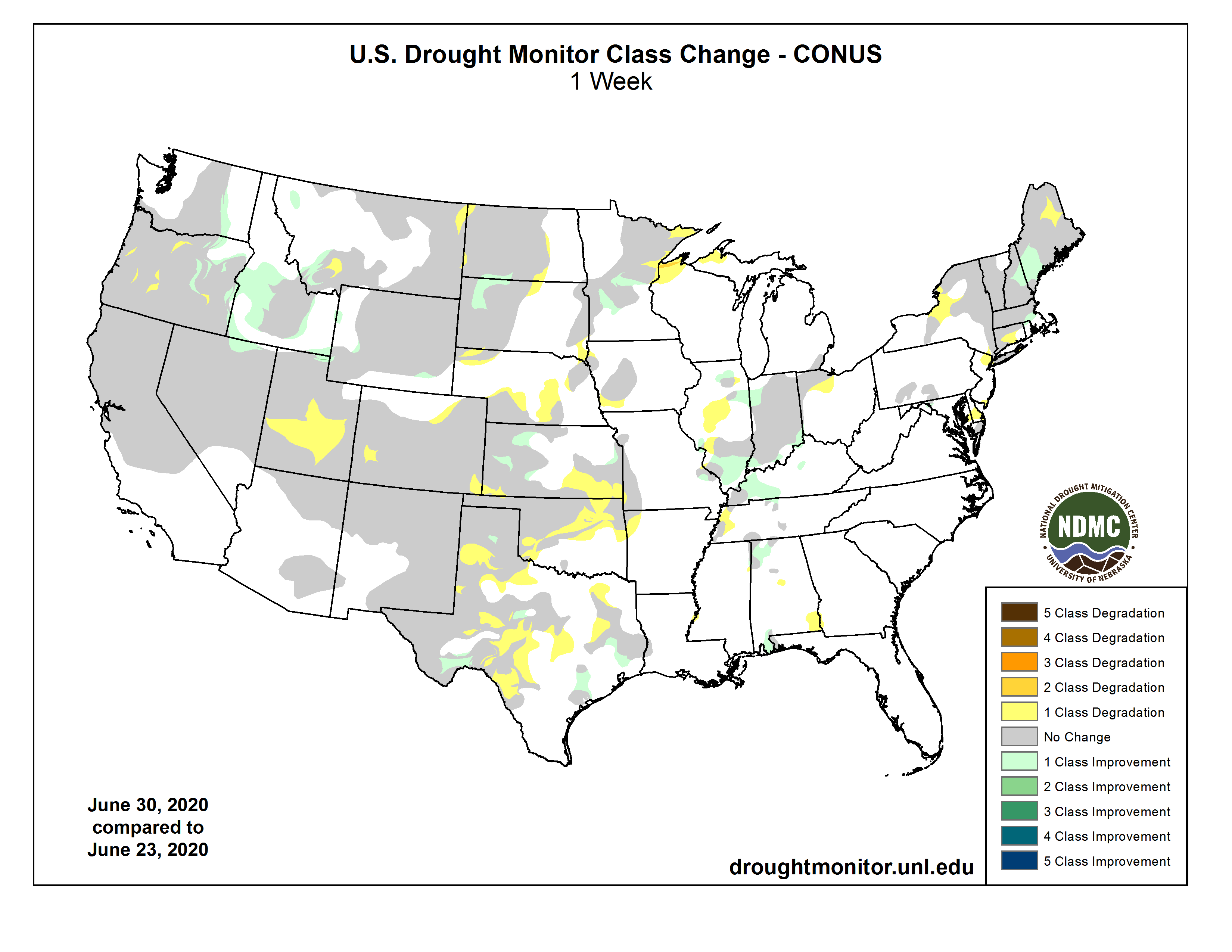
US Drought Monitor one week change map ending June 30, 2020.
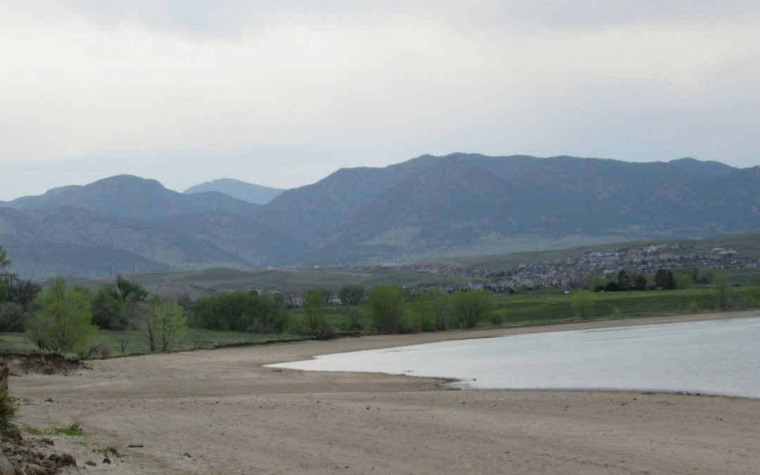
Another dry, blistered year has enveloped Colorado, with more than 80 percent of the state’s 64 counties now enduring some measure of drought.
Just three counties in the northern part of the state, Boulder, Larimer and Jackson, remain drought free, according to the U.S. Drought Monitor.
In response to the return of ultra-dry conditions, last week Gov. Jared Polis activated the state’s drought task force, a move that will allow water, agriculture and public safety officials across the state to coordinate assistance efforts.
In separate action the United States Department of Agriculture has classified at least 55 counties as being in drought emergencies, giving those farmers and communities access to federal financial help.
Megan Holcomb, senior climate and risk resilience specialist at the Colorado Water Conservation Board and a member of the task force, said officials had been closely tracking weather patterns since May.
“Even though we had great snowpack, streamflows dropped dramatically and we had a string of hot weeks that really ran out the reservoir of mountaintop snow,” Holcomb said.
That another severe drought has returned so quickly, 2018 was a major drought year, isn’t alarming, she said, but it has prompted the state to mobilize to help affected communities.
“Every report says we should expect droughts to increase in frequency and intensity,” said Holcomb. “None of this is surprising anymore.”
Colorado Drought Monitor June 30, 2020.
Peter Goble, climate specialist with Colorado State University’s climate center, said dry conditions that date back to last summer and last fall stole much of the moisture held in this year’s winter snowpack.
Hardest hit so far are the southeastern plains. “Lamar has been the epicenter,” Goble said, receiving just 2.19 inches of moisture since March 1, making it the fourth-driest spring on record dating back to 1893.
“Even if we were above average for the rest of the year, we would not expect them [the southeastern plains] to catch up,” he said.
This resurgence of drought marks the fourth time since 2000 that the state has become dangerously dry. The first major drought happened in 2002, then 2012-2013, 2018 and now 2020.
Officials said it’s a worrisome sign that what’s known as the multi-decadal drought pattern choking the American West and major rivers, such as the Colorado, is showing no signs of easing.
Will 2020 shape up to be as bad as 2018? It’s possible.
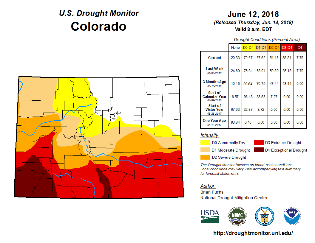
Colorado Drought Monitor June 12, 2018.
“Both droughts hit the southern half of the state much harder than the northern half. Snowpack was significantly worse in 2018, and long-term precipitation deficits were a little worse in 2018. However, 2020 is worse in southeast Colorado,” Goble said.
The Colorado River system has been particularly hard hit. The river, which gets its start in Rocky Mountain National Park’s Never Summer Mountains, supplies water to 40 million people across seven states and Mexico.
But this year’s dry conditions mean lakes Powell and Mead are likely to receive just 62 percent of average inflows, according to the U.S. Bureau of Reclamation’s latest forecast updated June 11.
That’s still better than 2018, when inflows were a dismal 37 percent of average.
But it is the relentless nature of the dry spells that has drought task force members most concerned.
As the droughts roll together, the chances for long-term harm increase, Goble said.
“Single season droughts produce impacts such as yields lost, acres burned, reservoir storage reduced, irrigation curtailed, and cows sold. When droughts occur more frequently, and or with higher intensity, we can see economies and ecosystems transformed,” he said.
Jerd Smith is editor of Fresh Water News. She can be reached at 720-398-6474, via email at jerd@wateredco.org or @jerd_smith.
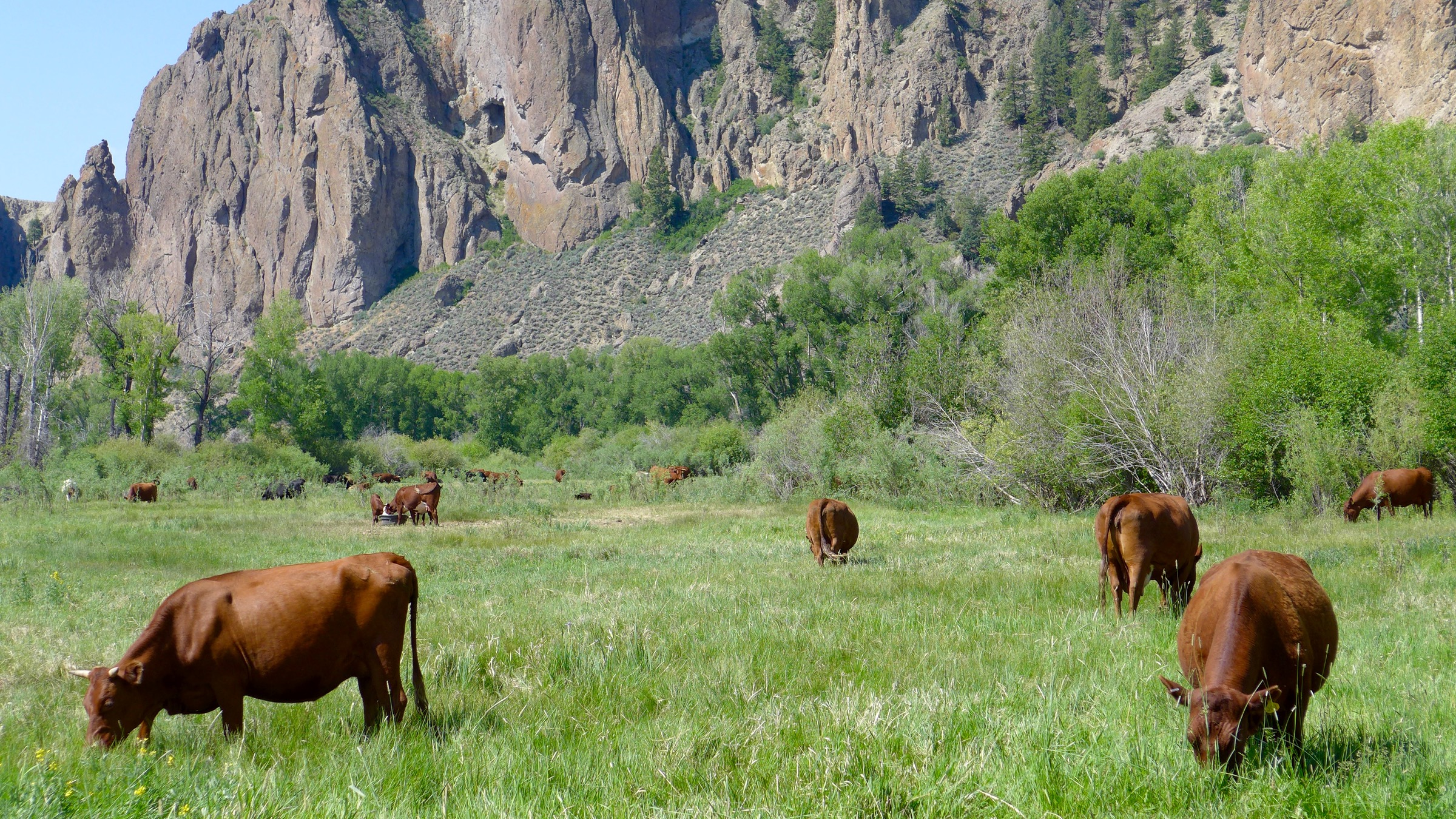
Cattle in a pasture alongside the Gunnison River. Photo: Brent Gardner-Smith/Aspen Journalism
Click here to go to the Nature website to read the paper (Brian D. Richter, Dominique Bartak, Peter Caldwell, Kyle Frankel Davis, Peter Debaere, Arjen Y. Hoekstra, Tianshu Li, Landon Marston, Ryan McManamay, Mesfin M. Mekonnen, Benjamin L. Ruddell, Richard R. Rushforth & Tara J. Troy). Here’s the abstract:
Human consumption of freshwater is now approaching or surpassing the rate at which water sources are being naturally replenished in many regions, creating water shortage risks for people and ecosystems. Here we assess the impact of human water uses and their connection to water scarcity and ecological damage across the United States, identify primary causes of river dewatering and explore ways to ameliorate them. We find irrigation of cattle-feed crops to be the greatest consumer of river water in the western United States, implicating beef and dairy consumption as the leading driver of water shortages and fish imperilment in the region. We assess opportunities for alleviating water scarcity by reducing cattle-feed production, finding that temporary, rotational fallowing of irrigated feed crops can markedly reduce water shortage risks and improve ecological sustainability. Long-term water security and river ecosystem health will ultimately require Americans to consume less beef that depends on irrigated feed crops.
Cattle-feed crops, which end up as beef and dairy products, account for 23% of water consumption in the US
A recent analysis published in Nature found cattle to be one of the major drivers of water shortages. Notably, it is because of water used to grow crops that are fed to cows such as alfalfa and hay. Across the US, cattle-feed crops, which end up as beef and dairy products, account for 23% of all water consumption, according to the report. In the Colorado River Basin, it is over half.
“There are many smaller streams that have been dried up completely,” said Brian Richter, the study’s lead author and the president of Sustainable Waters, a water conservation non-profit. “We’re only seeing the beginning of what’s going to become a major natural resource issue for everybody living in the western United States.”
Agriculture accounts for 92% of humanity’s freshwater footprint across the planet, and has long been identified as a major culprit in drought. But the new study suggests how extreme its impact can be.
“The fact that over half of that water is going to cattle-feed crops just floored us,” Richter said. “We had to double and triple check to make sure we got the numbers right.”
Lake Mead, in Arizona and Nevada, for example, hasn’t been full since 1983, and has fallen by almost two-thirds in the last 20 years alone. According to Richter’s analysis, almost 75% of that decline can be attributed to cattle-feed irrigation.
In the Colorado River Basin as a whole, which services about 40 million people in seven states and is overtaxed to the point that it rarely ever reaches the ocean anymore, that number is 55%.
It takes a lot of water to make a double-cheeseburger. One calculation puts it at 450 gallons per quarter-pounder. The study also found that most of these water-intensive beef and dairy products are being consumed in western cities. “Beef consumers living in the Los Angeles, Portland, Denver and San Francisco metropolitan areas bear the greatest responsibility for these hydrological and ecological impacts,” Richter and his colleagues reported.
Around 60 species of fish in the western US are experiencing increased risk of extinction due to draining water tables, according to the study. As streams dry up, toxic chemicals such as fertilizers and pesticides that run off from farms become concentrated, suffocating river-dwelling fauna. Invasive species can find a foothold in the changing environment…
The most cost-effective solution, proposed in Richter’s paper, is fallowing farmland, meaning letting it sit idle, without irrigation. “You can’t get more water savings off of an acre than by not watering it,” Richter said, and described it as “growing water” rather than a crop. He noted that the strategy should be temporary and rotational, and that ranchers should be compensated because they lose income growing nothing. Fallowing is at least twice as effective as other water-saving tactics, according to Richter’s analysis.
Agricultural strategies aside, people who eat beef and dairy will ultimately need to consume less or choose products that don’t depend on irrigated crops fed to cows, Richter said. Plant-based meat alternatives can play a role, as one analysis found that a meatless Beyond Burger generates 90% fewer greenhouse gas emissions and has practically no impact on water scarcity.