AWRA CO-CGWA Virtual Symposium: Thinking Outside the Box- A Holistic Approach to Water Resources Planning, August 31 – September 2, 2020

Black Canyon July 2020. Photo credit: Cari Bischoff

Update LAST CALL! From email from Karlyn Armstrong:

I am emailing because AWRA Colorado and CGWA are hosting what I would like to think is a really awesome event, and its about to go LIVE! Tonight is a virtual happy hour with technical presentations starting tomorrow morning. Since its virtual, we can let registrants at any point! If you would be willing to share this “last call” with your networks it would be greatly appreciated!!

Click here for all the inside skinny and to register. Here’s the agenda:

This field near Carbondale is irrigated with water that eventually flows into the Colorado River. The state has wrapped up the first year of an investigation into a program that could pay irrigators to reduce their consumptive use in order to send water downstream to a savings account in Lake Powell. Photo credit: Heather Sackett/Aspen Journalism

Aspinall Unit Operations update: 500 CFS in Black Canyon August 31, 2020 #ColoradoRiver #COriver #aridification

Black Canyon National Park July 2020. Photo credit: Claire Codling/The Department of Interior

From email from Reclamation (Erik Knight):

Releases from the Aspinall Unit will be decreased from 1600 cfs to 1500 cfs on Monday, August 31st. Releases are being adjusted to bring flows closer to the baseflow target in the lower Gunnison River. The actual April-July runoff volume for Blue Mesa Reservoir came in at 57% of average.

Flows in the lower Gunnison River are currently above the baseflow target of 900 cfs. River flows are expected to stay at levels above the baseflow target after the release decrease has arrived at the Whitewater gage.

Pursuant to the Aspinall Unit Operations Record of Decision (ROD), the baseflow target in the lower Gunnison River, as measured at the Whitewater gage, is 890 cfs for September.

Currently, Gunnison Tunnel diversions are 1050 cfs and flows in the Gunnison River through the Black Canyon are around 600 cfs. After this release change Gunnison Tunnel diversions will still be around 1050 cfs and flows in the Gunnison River through the Black Canyon will be around 500 cfs. Current flow information is obtained from provisional data that may undergo revision subsequent to review.

Navajo Dam operations update: Turning down to 850 CFS, August 31, 2020 #ColoradoRiver #CORiver #aridification

The San Juan River’s Navajo Dam and reservoir above.U.S. Bureau of Reclamation

From email from Reclamation (Susan Behery):

In response to a cooler weather pattern in the San Juan River Basin and increasing tributary flows, the Bureau of Reclamation has scheduled a decrease in the release from Navajo Dam from 900 cubic feet per second (cfs) to 850 cfs on Monday, August 31st, starting at 12:00 PM. Releases are made for the authorized purposes of the Navajo Unit, and to attempt to maintain a target base flow through the endangered fish critical habitat reach of the San Juan River (Farmington to Lake Powell).

The San Juan River Basin Recovery Implementation Program recommends a target base flow of between 500 cfs and 1,000 cfs through the critical habitat area. The target base flow is calculated as the weekly average of gaged flows throughout the critical habitat area from Farmington to Lake Powell.

This scheduled release change is subject to changes in river flows and weather conditions. If you have any questions, please contact Susan Behery (sbehery@usbr.gov or 970-385-6560), or visit Reclamation’s Navajo Dam website at https://www.usbr.gov/uc/water/crsp/cs/nvd.html.

Dillon Reservoir water levels hold on despite statewide #drought — @AspenJournlism

Low water levels Aug. 18 at Dillon Reservoir expose sand rings around the lake’s islands. The reservoir, which is the largest in the system supplying Denver Water’s customers, is about 94% full. Photo credit: Lindsay Fendt/Aspen Journalism

From Aspen Journalism (Lindsay Fendt):

Amid one of the hottest summers on record for Colorado, Dillon Reservoir is 94% full, nearly 5 feet below its capacity. The reason is a complex combination of past weather patterns, current water-use habits and recent changes to the lakebed.

For most of the summer, Dillon Reservoir has been down about 4 1/2 feet. This low elevation is noticeable from the shore, but the drop in water level is less pronounced than it has been in other dry years. Around this time in 2018, Dillon Reservoir’s elevation was dropping an inch daily and was down about 11 feet by Labor Day.

Dillon Reservoir is no normal mountain lake. The man-made reservoir is one of the largest sources of drinking water for Denver. Usually in late June, Denver Water holds back water that flows into Dillon Reservoir from the Blue River basin and stores the water until it’s needed along the Front Range. In late summer, Denver Water typically begins piping water out of Dillon Reservoir via the Roberts Tunnel, a 23-mile pipe that runs under the Continental Divide and into the North Fork of the South Platte River. From there, the water flows down toward Strontia Springs Reservoir, where it’s delivered to Denver Water’s customers.

In most normal water years, managers at Denver Water are able to fill the reservoir to its 257,000 acre-foot capacity in the spring, and recreation along the reservoir is usually best when it’s full. This year, unseasonably warm spring weather created dry soil that absorbed much of the moisture from melting snow before it reached rivers. Wind and low precipitation in May also contributed to a lackluster runoff season. Denver Water was able to fill Dillon Reservoir to 244,000 acre-feet of water, about 95% of its capacity. The reservoir levels have hovered around that number ever since late June.

“You know, 95% seems like it would be pretty full, but in the past, at this point, we would be moving docks and boat ramps would be unusable,” Frisco Bay Marina General Manager Tom Hogeman said. “But other than tightening cables on docks to adjust for different water levels, we haven’t had to move anything.”

Sailboats anchor offshore Aug. 18 at Dillon Reservoir. It has been a busy summer at the lake for recreation, and the Frisco Bay Marina already has brought in 18% more revenue than last year, with a month left to go before boating season is over. Photo credit: Lindsay Fendt/Aspen Journalism

Big dig

The operational changes for the marina are due to an excavation of the lakebed in 2019. That spring, the lake was at historic low levels after the 2018 drought. The town of Frisco and Denver Water took advantage of the dry lakebed and rolled out heavy digging machines to excavate areas near the shore. The $4 million project moved more than 85,000 cubic yards of dirt, deepening the area around the marina and lengthening the beach.

The “Big Dig,” as the project was dubbed by the town of Frisco, was designed to improve navigation for boaters and lengthen the boating season by making the parts of Dillon Reservoir that are more desirable for recreation less prone to elevation fluctuations. The project is one of the main pillars of the Frisco Bay Marina Master Plan, a long-term blueprint for projects to expand recreation and tourism on Dillon Reservoir.

The reservoir, already a significant source of tourism for Summit County, has seen a bump in visitors this year. The increase is likely the result of the COVID-19 pandemic, which has increased demand for outdoor recreation across the High Country. The marina this year has already brought in 18% more revenue than last year, and there is still a month left before boating season is over.

Last summer, the changes from the lakebed excavation were less noticeable because healthy snowpack from the previous winter filled the reservoir. With water levels down again, Hogeman said it’s clear that the project was a success.

“That has really paid off,” he said. “We are in a better position to deal with these smaller fluctuations. Before, our slip holders would have to adapt to their boats being in different places at different times of the year depending on water levels. Now we’ve just got an improved level of consistency.”

While the lake excavation helped to ward off problems from small water-elevation drops, a more severe drop would still threaten recreation at Dillon Reservoir. According to the U.S. Drought Monitor, the entire state is currently at some level of drought for the first time in eight years. Both Summit County, where Dillon Reservoir is located, and Denver County, where the lake’s water is used, have a mix of moderate and severe drought within their borders.

This level of drought has been manageable this year for Denver Water partly because of the 2018-19 winter. Snowstorms that winter left snowpack levels at about 104% of normal all the way through April 2019, and the reservoir filled to capacity last summer.

According to Nathan Elder, the manager of water supply for Denver Water, that extra water was a big help when this spring-runoff season produced less water than normal.

“We had a really great water supply year last year, and we came into this year roughly 5% above normal (storage at Dillon),” he said. “We pretty much maintained that until late June.”

The storage boost was also helped along somewhat by water use — or lack thereof — in Denver. The city is experiencing one of its hottest years on record, with 65 days seeing temperatures hit at least 90 degrees, a number that is second only to 2012. Despite the heat, water use is only 11% above the five-year average, and Denver Water has not had to implement any restrictions beyond its normal summer watering guidelines.

According to Elder, residential water use has gone up, but with many businesses closed due to the pandemic, commercial water use has dropped significantly.

“Our customers, despite it being hot and dry, (have) been pretty good with usage this year,” Elder said. “We haven’t seen the use that we would expect for these types of temperatures.”

Inflows Aug. 18 into Dillon Reservoir have slowed as drought expands through Colorado. However, storage in the reservoir was above average following the 2018-19 winter. Photo credit: Lindsay Fendt/Aspen Journalism

Tunnel maintenance

Unusually, Dillon Reservoir will have another chance to fill this year. Typically, Denver Water pulls water from the lake using the Roberts Tunnel through the end of the year, but the tunnel will be undergoing about two months of maintenance this fall. That project will cut off Denver from Dillon Reservoir and require Denver Water to rely heavily on Cheesman Reservoir, which draws water primarily from the South Platte River basin, on the Front Range.

This will give Dillon Reservoir an extra chunk of time to bolster its reserves, but only if it rains. According to Elder, forecasters are not predicting a very rainy September. Without a large amount of carryover storage going forward, next year’s levels at Dillon Reservoir will depend on snow from this winter. Although the lake avoided a drought disaster this year, a prolonged dry period could change that.

“The worst-case scenario is that the reservoir doesn’t fill again next year,” Elder said. “So hope for rain.”

Aspen Journalism is a local, nonprofit, investigative news organization covering water and rivers in collaboration with the Summit Daily News and other Swift Communications newspapers. For more, go to AspenJournalism.org.

Denver Water’s collection system via the USACE EIS

As San Luis Valley’s water squeeze intensifies, Gov. Jared Polis mulls climate warming adaptation — The Brush News-Tribune #drought

Aerial view of the San Luis Valley’s irrigated agriculture. Photo by Rio de la Vista.

From The Denver Post (Bruce Finley) via The Brush News-Tribune:

How to survive in hotter, drier world a focus as 93% of state bakes in “severe,” “extreme” or “exceptional” drought

The sun beat down, baking Colorado’s bone-dry, cracking San Luis Valley, where farmers for eight years have been trying to save their depleted underground water but are falling behind.

They’re fighting to survive at an epicenter of the West’s worsening water squeeze amid a 20-year shift to aridity. Federal data this past week placed 93% of Colorado in “severe,” “extreme” or “exceptional” drought .

And Gov. Jared Polis was listening now, as a group of farmers sat around a patio shaking their heads, frowning, frustration etched on their faces — down by 150,000 acre-feet of water below their aquifer-pumping target as the driest months begin.

A center pivot irrigates a field in the San Luis Valley, where the state is warming farmers that a well shut-down could come much sooner than expected. Credit: Jerd Smith via Water Education Colorado

“We’re about as lean as we possibly can be. We’ve re-nozzled our sprinklers. Our pumping is as efficient as it possibly can be. We’re trying different crops,” said Tyler Mitchell, who had cut his water use by 30% after installing soil moisture sensors and shifting from barley to quinoa. “But, at the end of the day, we have too many businesses that are trying to stay in business. I don’t know how we can reduce pumping more than we already have.”

How to adapt to a hotter, drier world is emerging as a do-or-die mission for people living around the arid West. Polis was in the San Luis Valley on Tuesday, embarking on a potentially groundbreaking statewide effort to explore solutions amid increasingly harsh impacts of climate warming, including wildfires burning more than 300 square miles of western Colorado.

Average temperatures will keep rising for decades, federal climate scientists say, based on the thickening global atmospheric concentration of heat-trapping carbon dioxide, now around 412 parts per million, the highest in human history. Heat is depleting water across the Colorado and Rio Grande river basins, where more than 50 million people live.

Nowhere have climate warming impacts exacerbated local difficulties more than here in the Massachusetts-sized, predominantly Hispanic, low-income San Luis Valley between the Sangre de Cristo and San Juan mountains of southern Colorado…

This year, the winter mountain snowpack that determines surface water flow in the Rio Grande River measured 33% of normal in spring. Rainfall so far, 2.7 inches, lags at around 38% of average.

And the Rio Grande barely trickles, at 7 cubic feet per second, leaving Colorado toward New Mexico and Texas. Those similarly drought-stricken states count on shares of surface water in the river under a 1938 interstate legal agreement.

Colorado farmers’ fallback habit of pumping more from the aquifers connected to the river — water use that is restricted under a locally-run, state-ordered conservation plan — has obliterated water savings painstakingly gained since 2012.

The 150,000 acre-feet draw-down this year hurled farmers practically back to their starting point. And a state-enforced deadline of 2030 for restoring the aquifer to a healthy level looms. If not met, state authorities could take control over wells.

Cleave Simpson, bottom right, converses with other water users following a Subdistrict 1 budget meeting. Photo credit: Luna Anna Archey/High Country News

Rio Grande Water Conservation District manager Cleave Simpson said recovery now requires a snow-dependent gain of 680,000 acre-feet — 4.5 times this year’s draw-down…

“A drier and hotter world”

Polis looked out the windows of a black utility vehicle and saw devastation spreading as climate warming impacts hit home. Hot wind churned dust around farms now abandoned and rented to newcomers struggling to get by. San Luis Valley leaders have estimated that low flows and falling water tables may lead to the dry-up of 100,000 irrigated acres, a fifth of the farmland in a valley where residents depend economically and culturally on growing food.

He saw farm crews toiling, coaxing the most from their heavy machinery, after flows from some wells had diminished and even reportedly pulled up just air.

He said he sees different dimensions of problems around climate warming.

On one hand, human emissions of planet-warming greenhouse gases “are going up,” Polis said. “But, then, here in this world, it is about adapting to what is happening. I mean, the global effort needs to succeed. Climate change needs to slow down. Colorado is just a teeny piece of that — a fundamental issue affecting the entire world. America never should have pulled out of the Paris accords. I hope we return, and have a concerted international effort.

“But it is also a reality for how these farmers put food on their plate, for how their communities thrive in a drier and hotter world. … The same crops we have been growing, with one water and warm temperature profile, don’t work with the way things are now.”

Colorado agriculture commissioner Kate Greenberg said state leaders also will hear from producers enduring dry times on the Eastern Plains, where wheat harvests are expected to suffer. Agriculture statewide “is hurting” and the San Luis Valley stands out as “ground zero” in a water squeeze due to low snow, shrinking aquifers, drought and competing demands from inside and outside the valley. Legal obligations to leave water for New Mexico and Texas compel cuts that complicate solutions, Greenberg said…

Few of the farmers on the patio meeting with the governor saw much that state governments can do in the face of a possible environmental collapse.

Many have concluded that, as Jim Erlich said, “we’re going to be farming less here.” Some anticipated an agricultural landscape looking more like western Kansas…

Polis called climate warming “the new normal.” He asked the farmers: “Where does it lead? Do you see a way forward?” State projections show conditions for at lest 15 years will be “likely hotter and drier… What does that mean in terms of crop mix? What does it mean in terms of sustainability? What does it mean in communities?”

The farmers, about a dozen, said they’ll push ahead in the “sub-districts” they’ve formed to encourage saving groundwater — as an alternative to state engineer authorities controlling wells. They now pay fees for pumping and pooled funds can be used to pay farmers for leaving fields fallow…

An entrepreneurial businessman, Polis pushed toward what might be done to create better markets for crops, such as “Colorado quinoa” that use less water, giving a global perspective. “I mean, agriculture does occur in dry parts of the world. It has to work from a water perspective…

The side of a farm building north of Center, Colorado. The farms in the San Luis Valley are known for their fresh potatoes. Photo credit: Luna Anna Archey/High Country News

At another farm, Brendon and Sheldon Rockey showed Polis around. They’ve reduced their use of water from wells by 50% and prospered, growing 25 types of potatoes, shifting off water-intensive crops such as barley and planting more “Colorado Quinoa” along with a half dozen other growers.

Fallow fields fertilized with cows and planted with restorative “cover crops” help boost productivity by improving soil, Brendon Rockey told the governor. “I don’t have a mono-culture anywhere on this farm.”

As president of the potato producers’ council and leader of a water-saving sub-district, Sheldon Rockey is encouraging other farmers — optimistically despite increased stress around the depletion of aquifers. “We can still make it back,” he said, “if we have snow.”

Polis also suggested a relaxed state approach to the 2030 deadline for replenishing the shrinking aquifer. “It is about the long-term trends. … whether goals are being met. There’s nothing that would ever be done based on one bad year.”

The farmers were hanging on that.

“He is genuinely interested in providing what support the state can to help with our water balance challenges,” Simpson concluded following this first meeting.

But “farmers are frustrated,” he said, emphasizing that aquifer recovery can happen only “if mother nature brings snow.”

And Polis left with a more detailed sense of the stakes.

“What we want here is sustainability. That’s why I oppose trans-basin water diversions,” he said. “But we have to make sure that farmers here today don’t live at the expense of farmers here tomorrow and the next decade. This valley is about agriculture. If the water is sold off, or the water is used up, it will become a dust bowl.”

2020 #COleg: Legislative Round-Up: Bills That Passed Colorado’s 2020 Legislative Session — Lexology

From Lexology (Allison P. Altaras):

Water

HB 20-1095 Concerning the authority of local government master plans to include water conservation policies. This bill requires a local government master plan containing a water supply element to also include water conservation polices, which will be determined by the local government. These policies can include goals specified in the Colorado Water Plan; policies can also condition development approvals for subdivisions, planned unit developments, special use permits, and zoning changes on the implementation of water conservation goals and other Colorado Water Plan goals. Additionally, the Department of Local Affairs is authorized to hire a full-time employee to provide educational resources and assistance to local governments that include water conservation policies in their master plans.

SB 20-155 Concerning keeping the presumption of noninjury for a well on divided land. This bill maintains the rebuttable presumption that domestic use of a well exempt from the state engineer’s administration will not cause material injury to others’ vested water rights or to any other existing wells in the event the land on which the well is located is later divided into multiple parcels, provided that well use meets certain requirements.

SB 20-048 Concerning a study to consider the strengthening of the prohibition on speculative appropriations of water. Current law prohibits speculative water appropriation. Speculation may be evidenced where an applicant does not have (i) a legally vested interest or a reasonable expectation of procuring a legally vested interest in the lands or facilities to be served by the appropriation, unless the appropriator is a governmental agency or an agent for those proposed to benefit from the appropriation; or (ii) a specific plan and intent to divert, store, or otherwise capture, possess, and control a specific quantity of water for specific beneficial uses. This bill requires the executive director of the Department of Natural Resources to convene a work group to explore methods for strengthening current anti-speculation law. This group will report any recommended changes to the Water Resources Review Committee in August 2021.

Himes Creek. Photo credit: Colorado Water Conservation Board

Horsetooth Reservoir’s water level dropping rapidly but boating will continue — The Fort Collins Coloradoan

Horsetooth Reservoir looking west from Soldier Dam. Photo credit: Norther Water.

From The Fort Collins Coloradoan (Miles Blumhardt):

Horsetooth Reservoir’s water level dropping around 4 feet per week in July and August certainly hasn’t go unnoticed by concerned boaters.

The water level of the popular reservoir dropped from 97% full at the beginning of the season to around 60% last week. Despite the drop, all boat ramps will be usable through Labor Day weekend, but not so much come mid-September.

Jeff Stahla, Northern Water spokesman, said an unusually dry and hot summer created an increase water demand by agriculture and municipalities, resulting in the sharp drop in water level. He said the rate of that drop is expected to lessen the rest of summer and early fall as water demand lessens…

Mark Caughlan, Horsetooth Reservoir district manager, said he expects the South Bay boat ramp to remain usable throughout the fall but that by mid-September the Satanka and Inlet Bay ramps will be closed due to the low water level.

Stahla said by late this week the reservoir’s water level will be at the lowest level since 2012, which was a historically dry year.

He said lowering the water level will also help divers to safely replace a valve at Soldier Canyon Dam, which he said is routine maintenance and does not involve major construction. He said other work to the reservoir will be done at the same time by other entities…

Stahla said Horsetooth Reservoir, which is the largest reservoir in the Colorado-Big Thompson Project East Slope distribution system, is expected to fill back up next year. He said CBT’s water storage in mountain reservoirs above Horsetooth Reservoir is in good shape with storage at more than 90% in some reservoirs.

CD3 candidates agree on protecting Western Slope water, reservoir enlargements — @AspenJounalism #CWCVirtual2020

From Aspen Journalism (Heather Sackett):

Diane Mitsch Bush, the Democratic candidate for Colorado’s 3rd Congressional District, pledged cooperation and Lauren Boebert, her Republican challenger, promised to fight — the Front Range, neighboring states and the federal government — to protect Western Slope water.

The two candidates on Thursday tackled water-related questions at this year’s Colorado Water Congress. Typically among the largest annual gatherings of water managers, policymakers and scientists, the 2020 series of panels and workshops has gone online due to the COVID-19 pandemic. Mitsch Bush answered questions live via Zoom, while Boebert sent in a prerecorded video. She was attending President Donald Trump’s Republican National Convention speech at the White House on Thursday night.

Mitsch Bush touted her experience as a former Routt County commissioner and three-term state representative, and framed herself as a pragmatic problem-solver who uses science, not ideology, as the basis for decisionmaking. From her history of working with the basin roundtables, she said the best ideas come from listening to one another.

“I’ll work diligently with our delegation and the other Western states to ensure our Western voices are heard and our needs as a headwaters state get met,” she said. “To do that, I will work with colleagues across all the divides: the aisle, basins and states to rebuild our infrastructure so our communities can flourish now and in the future.”

Boebert, the owner of Shooters Grill in Rifle, made headlines earlier this summer when she beat Rep. Scott Tipton, an incumbent endorsed by Trump, in the District 3 Republican primary. The upset has thrust the conservative gun-rights activist and mother of four into the national spotlight.

Moderator Joey Bunch, of Colorado Politics, posed the question of how the burden of drought and a potential Colorado River Compact call could be shared equally by the Front Range’s populous urban center and the rural, agriculture-dependent Western Slope.

Western water managers desperately want to avoid a compact call, which could occur if the upper basin states (Colorado, Wyoming, New Mexico and Utah) can’t deliver on the amount of water they owe the lower basin states (Arizona, Nevada and California). A compact call could trigger involuntary cutbacks in water use for Colorado, known as “curtailment.”

This scenario reveals an interesting intrastate dynamic: Many of the oldest and most valuable water rights are on the Western Slope, meaning the cutbacks wouldn’t affect them because they predate the 1922 Colorado River Compact.

But the state’s population center and deep-pocketed municipal water providers are on the growing Front Range. Some worry that Front Range interests will try to secure these senior Western Slope agricultural water rights so they can avoid cutbacks. Cities’ purchasing of agricultural water rights is sometimes derided as “buy and dry.”

Mitsch Bush said, “My top principle is: We cannot let curtailment lead to buy and dry of agriculture.”

Boebert agreed and played up the urban/rural divide, saying she is against more transmountain diversions to the Front Range and is primed to fight for Western Slope water. The burden for compact curtailment cannot fall solely on District 3, she said.

“I’m 100% committed to fighting this out with Denver and Boulder and making sure they don’t push all the work and all the costs onto us,” Boebert said. “Rural Colorado must have a voice, and we must have someone willing to fight for us in D.C.”

Both candidates agreed on the expansion of existing reservoirs to increase water storage as an alternative to building new reservoirs.

“The enlargement of existing reservoirs is the quickest, least expensive and most environmentally sensitive manner to secure more water storage,” Boebert said. “Increasing water storage capacity is key for Colorado’s future.”

Mitsch Bush agreed.

“Enlarging existing reservoirs is much more cost-effective for the taxpayer and for water users and much less environmentally challenging than building new reservoirs,” she said. “The best sites are already occupied by dams and reservoirs, so increasing the reservoirs’ capacity makes sense.”

After the candidates spoke, political commentator and former Colorado GOP state chair Dick Wadhams gave his analysis on where water issues fit into the campaign.

“Water is one of the most important issues we have in Colorado going back since statehood, and yet it’s the most obscure and least understood and least prioritized oftentimes by voters,” he said. “I do think with our dramatic increase in population that we are headed to a calamity at some point if we have a horrible drought.”

Aspen Journalism is a local, nonprofit, investigative journalism organization covering water and rivers in collaboration with Swift Communications newspapers. This story appeared in the Aug. 28 edition of The Aspen Times, and Steamboat Pilot & Today.

Boundaries for Colorado’s 3rd United States Federal Congressional District. By 1: GIS (congressional districts, 2013) shapefile data was created by the United States Department of the Interior. 2: Data was rendered using ArcGIS® software by Esri. 3: File developed for use on Wikipedia and elsewhere by 7partparadigm. – GIS shapefile data created by the United States Department of the Interior, as part of the "1 Million Scale" geospatial data project. Retrieved from: http://nationalatlas.gov/atlasftp-1m.html?openChapters=#chpbound, Public Domain, https://commons.wikimedia.org/w/index.php?curid=32797497

#Colorado #drought continues to intensify – Kiowa County enters exceptional category — The Kiowa County Press

From The Kiowa County Press (Chris Sorensen):

Generally hot and dry conditions have led to further expansion of drought across Colorado, with central Kiowa County slipping into exceptional drought – the worst category – according to the latest report from the National Drought Mitigation Center. Temperatures across the state’s eastern plains have been well above normal by as much as two to ten degrees. Few areas saw any significant moisture.

Colorado Drought Monitor August 25, 2020.

In eastern Kiowa County, Sean Harkness noted on social media that dry conditions were contributing to cracks in the soil. “You know it’s been pretty dry when the buffalo grass is cracking,” he stated.

In southwest Colorado, extreme drought expanded to fill in the remaining areas of Dolores and La Plata counties, along with most of Montezuma County. In the northwest, the remainder of Garfield and Eagle counties moved into extreme conditions. Extreme drought also expanded into most of Summit and Grand counties, and smaller portions of Jackson, Routt and Rio Blanco counties.

Severe conditions have overtaken moderate drought from the central and northern mountains to the northeast plains across all or large portions numerous counties. All of Colorado’s Front Range counties are now in severe drought. Severe conditions also expanded in Routt and Moffat counties.

The state did see one small area of improvement. Northeast and east central Yuma County moved from moderate drought into abnormally dry conditions. A sliver of adjacent southeast Phillips County also shifted to abnormally dry.

Drought conditions are expected to persist across the state through the end of November according to the U.S. Seasonal Drought Outlook released August 20 by the Climate Prediction Center. The small areas of abnormally dry conditions in Colorado are forecast to move into drought.

100 degrees in Siberia? 5 ways the extreme Arctic heat wave follows a disturbing pattern — The Conversation


This Arctic heat wave has been unusually long-lived. The darkest reds on this map of the Arctic are areas that were more than 14 degrees Fahrenheit warmer in the spring of 2020 compared to the recent 15-year average.
Joshua Stevens/NASA Earth Observatory

Mark Serreze, University of Colorado Boulder

The Arctic heat wave that sent Siberian temperatures soaring to around 100 degrees Fahrenheit on the first day of summer put an exclamation point on an astonishing transformation of the Arctic environment that’s been underway for about 30 years.

As long ago as the 1890s, scientists predicted that increasing levels of carbon dioxide in the atmosphere would lead to a warming planet, particularly in the Arctic, where the loss of reflective snow and sea ice would further warm the region. Climate models have consistently pointed to “Arctic amplification” emerging as greenhouse gas concentrations increase.

Well, Arctic amplification is now here in a big way. The Arctic is warming at roughly twice the rate of the globe as a whole. When extreme heat waves like this one strike, it stands out to everyone. Scientists are generally reluctant to say “We told you so,” but the record shows that we did.

As director of the National Snow and Ice Data Center and an Arctic climate scientist who first set foot in the far North in 1982, I’ve had a front-row seat to watch the transformation.

Arctic heat waves are happening more often – and getting stuck

Arctic heat waves now arrive on top of an already warmer planet, so they’re more frequent than they used to be.

Western Siberia recorded its hottest spring on record this year, according the EU’s Copernicus Earth Observation Program, and that unusual heat isn’t expected to end soon. The Arctic Climate Forum has forecast above-average temperatures across the majority of the Arctic through at least August.

Arctic temperatures have been rising faster than the global average. This map shows the average change in degrees Celsius from 1960 to 2019.
NASA-GISS

Why is this heat wave sticking around? No one has a full answer yet, but we can look at the weather patterns around it.

As a rule, heat waves are related to unusual jet stream patterns, and the Siberian heat wave is no different. A persistent northward swing of the jet stream has placed the area under what meteorologists call a “ridge.” When the jet stream swings northward like this, it allows warmer air into the region, raising the surface temperature.

Some scientists expect rising global temperatures to influence the jet stream. The jet stream is driven by temperature contrasts. As the Arctic warms more quickly, these contrasts shrink, and the jet stream can slow.

Is that what we’re seeing right now? We don’t yet know.

Swiss cheese sea ice and feedback loops

We do know that we’re seeing significant effects from this heat wave, particularly in the early loss of sea ice.

The ice along the shores of Siberia has the appearance of Swiss cheese right now in satellite images, with big areas of open water that would normally still be covered. The sea ice extent in the Laptev Sea, north of Russia, is the lowest recorded for this time of year since satellite observations began.

The loss of sea ice also affects the temperature, creating a feedback loop. Earth’s ice and snow cover reflect the Sun’s incoming energy, helping to keep the region cool. When that reflective cover is gone, the dark ocean and land absorb the heat, further raising the surface temperature.

Sea surface temperatures are already unusually high along parts of the Siberian Coast, and the warm ocean waters will lead to more melting.

The risks of thawing permafrost

On land, a big concern is warming permafrost – the perennially frozen ground that underlies most Arctic terrain.

When permafrost thaws under homes and bridges, infrastructure can sink, tilt and collapse. Alaskans have been contending with this for several years. Near Norilsk, Russia, thawing permafrost was blamed for an oil tank collapse in late May that spilled thousands of tons of oil into a river.

Thawing permafrost also creates a less obvious but even more damaging problem. When the ground thaws, microbes in the soil begin turning its organic matter into carbon dioxide and methane. Both are greenhouse gases that further warm the planet.

In a study published last year, researchers found that permafrost test sites around the world had warmed by nearly half a degree Fahrenheit on average over the decade from 2007 to 2016. The greatest increase was in Siberia, where some areas had warmed by 1.6 degrees. The current Siberian heat wave, especially if it continues, will regionally exacerbate that permafrost warming and thawing.

A satellite image shows the Norilsk oil spill flowing into neighboring rivers. The collapse of a giant fuel tank was blamed on thawing permafrost.
Contains modified Copernicus Sentinel data 2020, CC BY

Wildfires are back again

The extreme warmth also raises the risk of wildfires, which radically change the landscape in other ways.

Drier forests are more prone to fires, often from lightning strikes. When forests burn, the dark, exposed soil left behind can absorb more heat and hasten warming.

We’ve seen a few years now of extreme forest fires across the Arctic. This year, some scientists have speculated that some of the Siberian fires that broke out last year may have continued to burn through the winter in peat bogs and reemerged.

A satellite images shows thinning sea ice in parts of the East Siberian and Laptev Seas and wildfire smoke pouring across Russia. The town of Verkhoyansk, normally known for being one of the coldest inhabited places on Earth, reported hitting 100 degrees on June 20.
Joshua Stevens/NASA Earth Observatory

A disturbing pattern

The Siberian heat wave and its impacts will doubtless be widely studied. There will certainly be those eager to dismiss the event as just the result of an unusual persistent weather pattern.

Caution must always be exercised about reading too much into a single event – heat waves happen. But this is part of a disturbing pattern.

What is happening in the Arctic is very real and should serve as a warning to everyone who cares about the future of the planet as we know it.

[Get our best science, health and technology stories. Sign up for The Conversation’s science newsletter.]The Conversation

Mark Serreze, Research Professor of Geography and Director, National Snow and Ice Data Center, University of Colorado Boulder

This article is republished from The Conversation under a Creative Commons license. Read the original article.

As pressure to regulate #YampaRiver continues, locals raise cash to aid compliance effort — @WaterEdCO #ColoradoRiver #COriver #aridification #GreenRiver

Scott Hummer, water commissioner for District 58 in the Yampa River basin, checks out a recently installed Parshall flume on an irrigation ditch. Hummer said most water users in the Yampa are complying with a state order issued nearly a year ago that requires measuring devices. Photo credit: Heather Sackett/Aspen Journalism

From the Fresh Water News (Jerd Smith):

Nearly one year after the state ordered Yampa River water users to begin measuring their diversions from the iconic river, local community groups have raised more than $200,000 to help cash-strapped ranchers and others install the devices needed to comply with the law.

According to Erin LIght, the top water regulator in the region, roughly 60 percent of diversion structures, about 1,760 in total, remain out of compliance in what is known as Colorado’s Water Division 6, which includes the Yampa, North Platte, White and Green river basins.

Under state law, water users who do not measure their diversions can be subject to prosecution and have access to their water rights suspended, something the state has threatened to do but has not yet implemented.

Local groups, including the Upper Yampa Water Conservancy District and the Yampa/White/Green Basin Roundtable, have stepped up to help, creating a $200,000 grant fund to ensure those who are trying to comply can afford to do so.

“Everyone is interested in getting the best infrastructure we can into the river,” said Holly Kirkpatrick, who is overseeing the grant program for the conservancy district. “A lot of different organizations are working very hard on this.”

The Yampa River Fund, spearheaded by The Nature Conservancy, also plans to step in with funding should the need arise.

“I envision that there will be a request for funding,” said fund manager Andy Baur, “and we are here to help.”

This remote region in the northwest corner of the state for decades has had so much water that regulators rarely had to step in to ensure the rivers’ supplies were being properly distributed in accordance with state water law, something it does routinely in Colorado’s other major river basins. But as water shortages loom in the state, the Yampa is coming under increasing scrutiny.

“People need to understand that if we find ourselves in another administrative situation [where the Yampa runs dry as it did in 2018], people need to know they will be shut off,” said Light, who oversees the region for the Colorado Division of Water Resources.

The picture is much different than even 20 years ago, when Yampa Valley ranchers and other water users with water rights were often able to divert as much as they wanted whenever they wanted because the river had huge flows and relatively few demands.

Light, who oversees the Yampa and North Platte basins, as well as the Green and White river sub-basins, said the White River region has the most work to do to comply with the state’s order, with 83 percent, or 596, of its diversion structures taking water that is not being measured.

On the Yampa River, 50 percent of diversion structures, or 900, remain unmeasured, Light said. In the North Platte, 34 percent, or 190, lack measuring devices, while in the Green 74, or 69 percent, of devices remain unmeasured, Light said.

Because the White and Green sub-basins are so remote, and installing measuring devices can cost thousands of dollars, Light said she is giving water users there another year to comply with the order.

At the same time, she said she has granted more than 100 extensions to water users who are trying to comply to give them more time to find funds and get the work done.

Light said she is hopeful ranchers and others will begin to understand that measuring is no longer optional, and that those who begin recording their water use will have new opportunities as the entire Colorado River system, to which the Yampa, White and Green rivers are tributary, moves into a water-short future.

Under at least one scenario now being studied, a large, statewide conservation program called demand management would pay ranchers and others to voluntarily forego their water diversions for a period of time. Options to receive payment for suspending use would only be available to those who have diversion records that demonstrate how much water they’ve historically used.

“If someday we have an opportunity to [temporarily] dry up lands under a demand management program, their [actual water] use will be greatly in question because they have not measured their water. As demands get higher in the Colorado River, it’s going to behoove them to measure,” Light said.

Jerd Smith is editor of Fresh Water News. She can be reached at 720-398-6474, via email at jerd@wateredco.org or @jerd_smith.

Yampa River Basin via Wikimedia.

Diane Mitsch Bush touts experience in U.S. House race

From The Montrose Daily Press (Katharhynn Heidelberg):

Says her leadership can help bring jobs and tame health care costs

Congress needs to take action on soaring health care costs, a faltering economy and public lands, Democratic candidate for the 3rd Congressional District Diane Mitsch Bush said.

Mitsch Bush, a former Routt County commissioner who also served in the State House from 2013-2017, is making her second bid for the U.S. House. She faces Republican nominee Lauren Boebert, who defeated a five-time incumbent for her party’s nod.

“At the very whole-nation level, our democracy is clearly in some danger,” Mitsch Bush said Thursday. “We need for us, the people of the 3rd Congressional District, a representative who has the experience to lead. We need a representative who actually listens to us, looks at the data and the evidence, and really knows how to legislate. This is not a time to have inexperience.”

The current COVID-19 pandemic, which has killed more than 170,000 Americans and spawned an economic downturn, is only the most current crisis, she said, citing fires and the past recession. Dealing with those issues requires leadership and bipartisanship, she also said.

“I have those skills. I want to use my skills at bringing people together across the aisle,” Mitsch Bush said…

People in the 3rd District have to spend a lot to obtain health coverage and prescription medication, she said. In Montrose County, few insurance carriers offer plans on the state’s public health exchange, where people without coverage can purchase it. The exchange also provides subsidies for those who qualify.

Mitsch Bush said she will work to reduce premiums, deductibles and prescription drug costs; end surprise medical billing practices; allow Medicare to negotiate drug prices and increase coverage for mental health.

“Health care costs here are just so difficult for people. We pay some of the highest premiums in the country,” she said.

Boundaries for Colorado’s 3rd United States Federal Congressional District. By 1: GIS (congressional districts, 2013) shapefile data was created by the United States Department of the Interior. 2: Data was rendered using ArcGIS® software by Esri. 3: File developed for use on Wikipedia and elsewhere by 7partparadigm. – GIS shapefile data created by the United States Department of the Interior, as part of the "1 Million Scale" geospatial data project. Retrieved from: http://nationalatlas.gov/atlasftp-1m.html?openChapters=#chpbound, Public Domain, https://commons.wikimedia.org/w/index.php?curid=32797497

@USBR launches prize competition to improve streamflow forecasting

Streamflow Forecasting Prize Competition.

Here’s the release from the Bureau of Reclamation (Peter Soeth):

The Bureau of Reclamation is launching a prize competition to improve short-term streamflow forecasts. Evolving data science such as artificial intelligence, machine learning and high-performance computing are starting to be used in streamflow forecasting. The Streamflow Forecast Rodeo competition seeks to spur innovation using these technologies.

Reclamation is making up to $500,000 available through this prize competition.

“Streamflow forecasts are integral to managing water,” said Reclamation Commissioner Brenda Burman. “Finding improvements to forecasting will allow water managers to better operate their facilities for high flows, mitigate drought impacts and maximize hydropower generation.”

This competition delivers on the Department of the Interior and Reclamation’s commitment to improve water availability. It also supports the goals of the President’s memo on Promoting the Reliable Supply and Delivery of Water in the West.

The competition will begin with a “pre-season” in August, followed by a year of real-time forecasting beginning October 1, 2020. The pre-season will allow competitors to build and refine their forecast methods. The real-time forecasting competition will have solvers forecast streamflow for the next 10 days, updated daily at multiple locations across the West, for the duration of the competition.

Reclamation is partnering with the CEATI International’s Hydropower Operations and Planning Interest Group, NASA Tournament Lab and Topcoder on this crowdsourcing competition. Partnering with CEATI HOPIG includes a companion project that will provide benchmarks against which the competitors will be evaluated, as well as scoring of solver forecasts by RTI International. Other CEATI HOPIG members making contributions include Department of Energy’s Water Power Technologies Office, Tennessee Valley Authority, Hydro-Quebec, and Southern Company. To learn more about this competition, please visit https://www.usbr.gov/research/challenges/streamflowrodeo.html.

Reclamation conducts prize competitions to spur innovation by engaging a non-traditional, problem-solver community. Through prize competitions, Reclamation complements traditional design research to target the most persistent science and technology challenges. It has awarded more than $1,000,000 in prizes through 22 competitions in the past 6 years. Please visit Reclamation’s Water Prize Competition Center to learn more.

@Audubon Conservation Ranching Webinar: An Emerging Land Ethic, September 3, 2020 — @AudubonRockies

Western Meadowlark, Pronghorn Ranch, Wyoming, 18,000 acres enrolled in the Audubon Conservation Ranching Initiative. Photo: Evan Barrientos/Audubon

Click here register:

Thursday, September 3, 2020 7:00 PM – 8:00 PM ET

You are probably familiar with Aldo Leopold’s land ethic, but did you know that he wrote an essay in Audubon magazine in 1942 that essentially proposed the concept of market-based conservation and the power of the consumer? This webinar will look at how the Audubon Conservation Ranching Initiative seeks to turn Leopold’s bold ideas into reality, with beneficial outcomes for the land, birds, and the ranchers that bring a conservation ethic in the management of their lands. Learn how you can further the emergence of a conservation ethic through your food purchases that bear the Audubon certification seal.

Navajo Dam operations update: Releases to turn down to 900 CFS August 29, 2020 #ColoradoRiver #COriver #aridification

The outflow at the bottom of Navajo Dam in New Mexico. Photo: Brent Gardner-Smith/Aspen Journalism

From email from Reclamation (Marc Miller):

In response to a cooler weather pattern in the San Juan River Basin, the Bureau of Reclamation has scheduled a decrease in the release from Navajo Dam from 1,000 cubic feet per second (cfs) to 900 cfs on Saturday, August 29th, starting at 4:00 AM. Releases are made for the authorized purposes of the Navajo Unit, and to attempt to maintain a target base flow through the endangered fish critical habitat reach of the San Juan River (Farmington to Lake Powell).

The San Juan River Basin Recovery Implementation Program has recommended flows in the critical habitat reach as close to 500 cfs as possible for the summer of 2020. This is within their normal recommended range of 500 to 1,000 cfs. This target base flow is calculated as the weekly average of gaged flows throughout the critical habitat area from Farmington to Lake Powell.

This scheduled release change is subject to changes in river flows and weather conditions. If you have any questions, please contact Susan Behery (sbehery@usbr.gov or 970-385-6560), or visit Reclamation’s Navajo Dam website at https://www.usbr.gov/uc/water/crsp/cs/nvd.html.

#HurricaneLaura was the latest storm to strengthen fast, but is this rapid intensification really becoming more common? — The Conversation


Hurricane Laura intensified quickly over the Gulf of Mexico before making landfall on Aug. 27, 2020.
CSU/CIRA and NOAA/NESDIS, CC BY-ND

Chris Slocum, Colorado State University

Hurricane Laura blew up quickly as it headed for the Louisiana coast, intensifying from a tropical storm to a major hurricane in less than 24 hours. By the time it made it landfall, it was a powerful Category 4 hurricane with 150 mile-per-hour winds.

The Atlantic has seen several hurricanes rapidly intensify like this in recent years.

In 2018, Hurricane Michael unexpectedly jumped from Category 2 to Category 5 in the span of a day before hitting the Florida Panhandle. Hurricanes Harvey, Irma and Maria in 2017 also met the definition of rapid intensification: an increase of at least 35 miles per hour in a 24-hour period. Based on preliminary reports from the National Hurricane Center, Laura gained 65 mph in one 24-hour period and, more impressively, added 80 mph from Aug. 25 to Aug. 27.

But do all these fast-growing, powerful storms in recent years mean rapid intensification is becoming more common?

With information about hurricanes coming through social media and phone apps, that’s a question hurricane scientists like myself are hearing a lot. It’s useful to consider a few things: the history of U.S. hurricanes, why the Atlantic is currently so active, and the ingredients that allow storms to strengthen so quickly.

What makes storms blow up?

Just as a pastry chef needs all the ingredients to successfully make a cake, storms like Laura need favorable conditions to be able to form and rapidly intensify.

Three key ingredients help a hurricane rapidly intensify:

  • Warm ocean waters. Hurricanes draw energy from warm surface water, particularly when it’s at least 80 degrees Fahrenheit or warmer.

  • Ample moisture, or water content in the atmosphere, to maintain clouds.

  • Low vertical wind shear. This is a measure of how the wind changes speed and direction with height in the atmosphere. High wind shear will disrupt the clouds, making it hard for the storm to stay together.

When all of these ingredients are present, vigorous thunderstorms can form and organize, allowing a robust eyewall to develop. Large-scale changes in ocean temperature, like the El Niño–Southern Oscillation and the Atlantic Multidecadal Oscillation, can also have an impact on hurricane activity.

Because these ingredients change, the Atlantic hurricane season varies year to year. This year, as the seasonal forecasts created by Colorado State University and the National Oceanic and Atmospheric Administration warned, the ingredients are favorable for an active season with more major hurricanes. A review of storms from 1981 to 2012 found that 70% of major Atlantic hurricanes – those reaching Category 3 or higher – had gone through rapid intensification.

Why don’t all storms grow this quickly?

Just having the right water temperature and moisture won’t ensure that storms will undergo rapid intensification or become major hurricanes.

We saw that with Hurricane Marco. It swept through the Gulf of Mexico just ahead of Hurricane Laura but weakened to a tropical storm before landfall.

A big difference was the wind shear. The thunderstorms powering Marco’s core struggled to stay connected to its circulation as high wind shear in the Gulf of Mexico stripped them away.

When then-Tropical Storm Laura passed over Cuba into the Gulf, the high wind shear conditions had receded, leaving nothing but a favorable environment for Laura to develop catastrophic winds and a dangerous storm surge.

As with ice skaters who pull their arms in during a spin to rotate faster, the thunderstorms of Laura’s eyewall pulled in the atmosphere around the storm, causing the winds to accelerate into a high-end Category 4 storm. While there are additional complexities to this process, a theoretical framework for intensification that I further developed with colleauges highlights how the location of eyewall thunderstorms relative to the storm’s maximum winds triggers rapid intensification. This theory has been supported by eyewall observations collected during “hurricane hunter” flights.

So, are these events becoming more common?

This is a challenging question and an active topic of research.

Because rapidly intensifying hurricanes are fairly rare, there isn’t enough information yet to say if rapid intensification is happening more often. The hurricane research community has consistent, reliable observations of storm intensity only since the start of the satellite era and routine storm-penetrating “hurricane hunter” flights since the 1970s.

We have seen more rapid intensification events in recent years, and some scientists have concluded that the warming climate is likely playing a role. However, we’ve also had more active hurricane seasons in those years, and more work needs to be done in this area to understand global trends, such as why hurricanes are crossing ocean basins more slowly.

To try to answer this puzzle, hurricane researchers are using historical records to help refine mathematical theories and computer simulations of storms to better understand rapid intensification. The new knowledge will continue to improve forecast guidance and lead to a better understanding of how hurricanes will change in an evolving climate system.

[Deep knowledge, daily. Sign up for The Conversation’s newsletter.]The Conversation

Chris Slocum, Physical Scientist, NOAA and Cooperative Institute for Research in the Atmosphere, Colorado State University

This article is republished from The Conversation under a Creative Commons license. Read the original article.

#Drought worsens; #monsoon rains miss #FourCorners again — The Cortez Journal #ColoradoRiver #COriver #aridification

Calendar year 2020 US Drought Monitor animation through August 25, 2020.

From The Cortez Journal (Jim Mimiaga):

On Aug. 25, Montezuma County went from a severe drought to extreme drought, which covers nearly the entire Western Slope, according to the U.S. Drought Monitor. Extreme drought Level D3 – is the fourth-highest of five drought categories.

Then there is the record-breaking heat wave.

Cortez broke eight daily high temperature records in August and tied one, said Jim Andrus, a Cortez weather observer for the National Weather Service…

Farmers experienced 10% to 15% water shortages this year from McPhee Reservoir, said General Manager Ken Curtis of the Dolores Water Conservancy District. Allocations for full-service irrigators were at 19 inches per acre, down from the full supply of 22 inches.

The 380,000-acre-foot reservoir will be drawn down to its 151,000-acre-feet inactive pool…

Project irrigators, Montezuma Valley Irrigation Co., the Ute Mountain Ute Tribe Farm and Ranch and the downstream fish pool all shared in the water shortages.

Back-to-back years of limited monsoonal rains have left soils dry going into fall. Much of the winter snowpack melt was absorbed into the soil before making it to the river and reservoir.

This year’s saving grace was carryover supply in McPhee left over from the above-normal snowpack of last winter, Curtis said.

Unfortunately, there is no carryover storage for McPhee heading into this winter, and the soil has again dried out.

Yields were somewhat down for alfalfa, officials said, because the limited water supply was spread too thin or was concentrated on fewer fields, Curtis said.

Alfalfa for Montezuma and Dolores counties is harvested three times per summer and is marketed to dairy farms. Farther south, Ute Mountain Ute farms harvest alfalfa four times per year.

Soil moisture was below 50% of average for dryland farmers, said Gus Westerman, Dolores County Extension agent.

Yields for winter wheat, which is planted in fall and harvested in early summer, especially suffered from the soil moisture deficit.

Pinto beans and the third alfalfa crop have not yet been harvested, and farmers are preparing to plant winter wheat…

The dry weather the past two years was attributed to persistent high pressure over the Four Corners, said meteorologist Tom Renwick of the National Weather Service in Grand Junction…

Why the persistent high pressure zone in the Four Corners area of the Southwest is a bit of a mystery to meteorologists, who have nicknamed it Triple R for “Ridiculously Resilient Ridge,” Renwick said. “It is happening more and more frequently.”

Concerns rise over #GrizzlyCreekFire’s impact on #ColoradoRiver’s endangered fish downstream — @AspenJournalism #COriver #aridification

The Colorado River divides Glenwood Canyon slurry on the ridge from the Grizzly Creek Fire on Monday, August 24, 2020. (Kelsey Brunner/The Aspen Times via Aspen Journalism)

From Aspen Journalism (Heather Sackett):

The Grizzly Creek Fire in Glenwood Canyon has many people praying for rain. But the very thing that could douse the blaze, which has burned 32,000 acres as of Tuesday, has some experts concerned it also could create problems for downstream endangered fish.

A heavy rain could wash dirt — no longer held in place by charred vegetation — and ash from the steep canyons and gullies of the burn area into the Colorado River. Scorched soils don’t absorb water as well, increasing the magnitude of the flood. And the heavy sediment load in the runoff could suffocate fish. A similar scenario played out in 2018 when thousands of fish were killed by ash and dirt that washed into the Animas River from the 416 Fire burn area.

Downstream from the Grizzly Creek Fire, beginning in DeBeque Canyon, is critical habitat for four species of endangered fish: humpback chub, Colorado pikeminnow, bonytail and razorback sucker.

“Yes, we are very concerned about a fire in that kind of terrain that close to critical habitat. There’s just no question,” said Tom Chart, director of the U.S. Fish & Wildlife Service’s Upper Colorado River Endangered Fish Recovery Program. “There’s a probability we could have an effect all the way down into the 15-mile reach.”

The Colorado River’s so-called 15-mile reach, near Grand Junction, is home to those four species of fish. This stretch often has less water than is recommended for these fish by Fish & Wildlife mainly because of two large irrigation diversions that pull water from the river to irrigate Grand Valley farms: DeBeque Canyon’s Grand Valley Project, which takes water from the river at a structure known as the Roller Dam, and the Grand Valley Irrigation Canal, which takes water from the river near Palisade.

Between these diversions and the confluence of the Gunnison River is a problem spot where water managers constantly work to bolster water levels through upstream reservoir releases. According to Chart, there is currently a total of about 250 cubic feet per second being released from Ruedi, Wolford and Granby reservoirs for the benefit of fish in the 15-mile reach.

With hot, dry weather, a weak monsoon season and the ongoing diversions for irrigation season, which continue into the fall, current river conditions are already stressful for the fish, Chart said. Water managers say they have seen fish using fish ladders to swim upstream and downstream of the 15-mile reach in search of deeper, cooler water.

“As far as concern about the ecological health of the 15-mile reach right now, we are very concerned about conditions there right now,” Chart said. “Native fish do move out of those dewatered stretches in search of better conditions.”

A debris flow on top of these already-challenging conditions could be devastating for fish populations.

“The potential with the Grizzly Creek Fire could be as bad as it gets if we get a rainstorm on top of a low baseflow,” Chart said. “You pray for rain, but at the same time this would be a tough time to get a flow of ash and retardant off the burned area.”

This map shows the 15-mile reach of the Colorado River near Grand Junction, home to four species of endangered fish. Experts are concerned that rain on the Grizzly Creek Fire burn area could create ash and sediment flows that could pose a threat to fish. Map credit: CWCB

Burned area assessment begins

The U.S. Forest Service’s Burned Area Emergency Response team has done a preliminary assessment of the severity of the soil burns to determine where debris flows would most likely occur, according to Lisa Stoeffler, deputy forest supervisor for the White River National Forest.

Areas of concern include Dead Horse Creek, Cinnamon Creek and No Name Creek, among others. More than an inch of rain in an hour — or a quarter-inch in 15 minutes, as occurs in a fast-moving thunderstorm — could trigger a debris flow, the BAER team found.

But this initial assessment, Stoeffler said, is mostly focused on potential impacts to Interstate 70, and water and power infrastructure, not on impacts to the aquatic environment.

“We may look at environment later on, once we have a final footprint of the fire,” she said. “The BAER process is really looking at things that we would need to address because it would cause an emergency-type situation.”

When the Grizzly Creek Fire first broke out, the city of Glenwood Springs switched its municipal water source from Grizzly and No Name creeks, which are near the burned area, to the Roaring Fork River.

“We are concerned about the ash and debris entering the water system and the costs we are going to incur because of this,” said Hannah Klausman, public information officer for Glenwood Springs.

The 15-mile reach of the Colorado River near 19 Road in Grand Junction is home to four species of endangered fish. The Colorado River Water Conservation District is discussing releasing water from upstream reservoirs to help dilute any ash and sediment flows from the Grizzly Creek Fire. Photo © Brent Gardner-Smith/Aspen Journalism

Solution is dilution

Since preventing the dirty runoff from reaching the river would be difficult, if not impossible, in the steep, rocky terrain, the best bet, Chart said, would be tapping into upstream reservoir water to flush sediment and ash.

In other words: The solution to pollution is dilution.

The Roaring Fork River, which flows into the Colorado at Glenwood Springs, also would help dilute the ash and sediment before it got to the 15-mile reach. Some of it would probably settle out before it got there anyway. But that would do little to help native fish populations closer to the burn area. Although not listed as endangered, other species such as flannelmouth sucker, bluehead sucker and roundtail chub also could be impacted.

“We get concerned about the endangered fish the most, but it’s really the entire native fish community we need to be paying attention to,” Chart said.

The Colorado River Water Conservation District has some water in Wolford and Ruedi reservoirs that could potentially be used for a flushing flow. But it would take careful coordination between reservoir operators. And it could be a complicated juggling act to figure out how to accommodate all the different demands for that limited water supply, said River District chief engineer John Currier.

“I think we stand ready to try and figure out how to do something,” Currier said. “It will be a topic of discussion sooner rather than later.”

Managing the impacts of the burned landscape on the fish will be ongoing long after the fire is extinguished.

“I think this is going to be an issue for years to come,” Chart said. “That landscape is going to take a long time to heal.”

Aspen Journalism is a local, nonprofit, investigative news organization covering water and rivers in collaboration with The Aspen Times and other Swift Communications newspapers. This story ran in the Aug. 26 edition of The Aspen Times and the Vail Daily.

Colorado Water Congress Day 2 recap

From The Grand Junction Daily Sentinel (Charles Ashby):

Historically, water has never been a political issue, but a geographical one, and that axiom was borne out Thursday between Democrat Diane Mitsch Bush and Republican Lauren Boebert in comments at the Colorado Water Congress’ 2020 Summer Conference.

The two candidates agreed on several matters asked during a virtual panel discussion about how each would approach water issues while serving in Congress. Both had advanced knowledge of the questions asked, giving each time to research their answers.

Mitsch Bush said people back East don’t understand how water law works in the West. There, she said, they go by a system known as riparian water rights, which allocates water among those who possess land along its path…

“It’s really, really critical for us, as Coloradans, that we have a representative that understands Colorado water law, that understands the issues of drought and scarcity, and understands what we need in terms of federal funding to deal with them,” she said.

Unlike Mitsch Bush, Boebert has no background in working on water issues. Still, the Silt resident said she’s brought in experts to teach her, and ended up agreeing with much of what Mitsch Bush said.

Both, for example, said it is unlikely the state will be able to get the funding and permits needed to build new water storage projects, such as dams and reservoirs. Instead, it should concentrate on expanding existing reservoirs to increase their storage capacity…

Both also agreed that, should there be a squeeze on Colorado’s water allotment either by the federal government or downstream states, that Colorado should decide for itself where its water allotment goes.

The two also agreed how the state allots any funding for water projects should be dictated by the Colorado Water Plan, and said they would work with anyone in any state regardless of political affiliation who wants to help boost and protect Colorado’s and the West’s existing water supply.

#Colorado: Mine may have bulldozed lands without #stormwater permit — The Grand Junction Daily Sentinel #ActOnClimate #KeepItInTheGround

West Elk Mine. Photo/WildEarth Guardians via The Mountain Town News.

From The Grand Junction Daily Sentinel (Dennis Webb):

A state agency has informed the West Elk Mine in the North Fork Valley that it may have violated the law by failing to get a stormwater permit when it built a road and well pads in a national forest roadless area this year.

The action by the state Water Quality Control Division comes as the underground coal mine remains under a cessation order by the state Division of Reclamation, Mining and Safety prohibiting further surface-disturbing activities in the roadless area. That agency says the mine has failed to maintain a legal right to enter the roadless area.

The mine has been seeking to expand its operations beneath about 1,700 acres in the Sunset Roadless Area of the Gunnison National Forest. To do so it needs to build roads and drill wells to vent methane produced during mining.

A Colorado-specific Forest Service roadless rule includes an exemption allowing for the possibility of building of temporary roads by coal mines on some 20,000 acres in the North Fork Valley. In March, the 10th Circuit Court of Appeals ruled that the Forest Service improperly failed to consider keeping another roadless area out of the exception area, and ordered a district court to vacate the entire exception area. But before a district court judge did that in June, the mine’s owner, Arch Resources, built about a mile of road in the Sunset Roadless Area.

Even with the district judge’s action, the company is continuing to argue to the state and in court that the appeals court upheld its coal lease rights beneath the roadless area and it can keep building roads and pads there. It has warned of a temporary mining shutdown and layoffs if it can’t proceed with that work this year…

This month, an official with the Water Quality Control Division wrote to the mine in a compliance advisory letter that an inspection showed about 3,960 feet of road and two methane vent borehole pads in the roadless area. According to the letter, a stormwater discharge permit is required for those surface disturbances. It said the state had no record of a discharge permit being applied for or obtained, and an existing permit held by the mine doesn’t authorize discharges at those locations. The letter says it “provides notification of potential violations of the Colorado Water Quality Control Act.”

The letter gave the mine until Aug. 20 to apply for a permit or permit modification.

Allison Melton, a staff attorney with the Center for Biological Diversity conservation group, said she spoke to the Water Quality Control Division this week and was told the mine submitted that paperwork after receiving the letter. She said she understands the discharge application will be subject to a 30-day public comment period…

The advisory letter the mine received said the letter isn’t a notice of violation, and the Water Quality Control Division will determine if formal enforcement action is deemed necessary.

We need a robust circular economy for #water, our most useful resource — GreenBiz

El Torno treatment plant. Photo credit: FutureENVIRO

Here’s an in-depth look at how a circular economy for water would look from GreenBiz (Nick Jeffries & Tansy Fall). Click through and read the whole article. Here’s an excerpt:

Water is a vital resource that has fueled human progress. It transports solids, dissolves minerals, chemicals and nutrients and stores thermal energy. This “carrier characteristic” allows for countless industrial, agricultural and transport processes that enable our society to thrive.

But water is also key to life. The water in our oceans is home to phytoplankton that produce 70 percent of the oxygen we breathe. The lakes and rivers, and the groundwater beneath our feet, are our sources of drinking water without which we would soon perish. The food we eat relies on fresh water to grow.

In nature, water purifies and renews itself endlessly as it flows through the planet’s hydrological cycle. But nature’s capacity to renew on her own is being disrupted. In the last century, intensive industrial activities and urbanization have significantly affected our water supplies.

To make just one pair of jeans, for example, requires around 1,981 gallons of water and produces difficult-to-clean wastewater. With the number of clothes produced annually doubling from 50 billion to 100 billion units in the last 15 years, industrial water use in the clothing industry alone also has increased dramatically.

Extrapolating this growth across the economy, and factoring in an expanding population, it is easy to understand why the United Nations estimates that water demand will exceed easily accessible supply by 40 percent in 2040.

To make things more complex, the evolving climate emergency is leading to more unpredictable rainfall and greater frequency of extreme and unusual weather events. This has manifested as floods in South East Asia, droughts in California and Australia and wildfires in Greenland. The recent U.N. Water Policy Brief on Climate Change and Water is unambiguous on such effects: “The global climate change crisis is inextricably linked to water.”

Water is never waste

With more unpredictable weather events and increased demand for fresh water, the ways in which we use and reuse water resources have never been more important. Reimagining wastewater not as a costly problem but as a valuable resource is a good illustration of this.

One example is the El Torno wastewater treatment plant in Cadiz, southern Spain. Like thousands of similar treatment facilities across the world, El Torno receives wastewater flows from surrounding businesses and homes, which it purifies so the water can be safely discharged into the nearby river. However, an aerial view of the El Torno site shows this plant to be different from the rest.

Extending from the North West corner of the facility is a pair of very straight emerald green channels, each about 328 feet long. In these “raceways,” algae are cultivated that produce oxygen to fuel the biological treatment of the wastewater, thus almost eliminating the need for an energy supply to the facility.

To avoid suffocating the water flow, dead algae constantly are harvested and pumped to an anaerobic digester where they are converted into biogas. The gas is then scrubbed of impurities, leaving pure biomethane, which is pressurized and used to fuel a fleet of cars. Results from the full-scale pilot facility indicate that just one hectare of algae can treat the effluent of 5,000 people and produce enough biofuel to power 20 cars driving 18,600 miles a year. Although the burning of biomethane produces carbon dioxide, it releases only the same amount of CO2 that the algae absorbed while it grew. Carbon also remains in the byproducts of this process, which can be returned to the soil of local farms, meaning that the process has the possibility of being net carbon positive.

When we connect systems such as this and think of them as a whole, it is possible to transform a costly carbon emitting process into both an economic opportunity and a means of addressing a number of global challenges. The implications are significant. Wastewater treatment consumes about 3 to 4 percent of U.S. energy demand. In India, inadequate wastewater treatment, due to unreliable or expensive power, costs the Indian economy more than $50 billion a year. Imagine the positive impact that could be made if all future new wastewater treatment facilities in Africa, for example, were designed as power plants…

Regenerative action

Regenerating the environment by redesigning systems is a critical element of the circular economy. It advocates that economic activities should go beyond doing less harm, and strive for a regenerative or net-positive impact on nature. Natural systems provide us with food, oxygen and clean water, regulate our climate, absorb floods, provide recreation and much more. The WWF Living Planet Index estimates these “ecosystem services” provide humans with more than $120 trillion of benefits each year. Our current extractive and polluting economic model drastically diminishes the ability of ecosystems to provide these services.

No sector of the economy illustrates the potential for circular economy to regenerate natural systems more than agriculture. And, as farming consumes 70 percent of the planet’s freshwater, no part of the circular economy offers more to the conservation of water resources than regenerative agriculture.

Regenerative agriculture describes a broad set of food production methods with two complementary outcomes: the production of high quality food and the improvement of the natural environment. It recognizes that farms are part of a larger ecosystem, which farming activities must not just extract from, but also support. Farming in this way shifts from monoculture practices heavily reliant on chemical inputs, towards a more holistic way of thinking that cherishes diversity, encourages virtuous cycles of renewal and focuses on the health of the system as a whole.

The specifics vary, or as soil expert David Montgomery puts it: “What works for temperate grasslands may not work so well in tropical forests.” However, there are common regenerative practices that can be applied across all soil farming. These include the use of cover crops, wider crop diversity, minimizing soil disturbance and, most important, the building up of soil organic matter. For every 1 percent increase in organic matter in the top 7.9 inches of topsoil, 90 metric tons of carbon can be sequestered and an additional 38,000 gallons of water stored. This shows that regenerative agriculture is a powerful tool for climate mitigation and adaptation, while at the same time meeting demand for food.

#Drought news: April-July 2020 was the 3rd driest on record for #Colorado

Click on a thumbnail graphic below to view a gallery of drought data from the US Drought Monitor.

Click here to go to the US Drought Monitor website. Here’s an excerpt:

This Week’s Drought Summary

This U.S. Drought Monitor week saw continued intensification of drought across parts of the western U.S. including Northern California, the Great Basin, Southwest, and parts of the Intermountain West where hot and dry conditions continued and large wildfires burned in California and Colorado. In Northern California, the National Interagency Coordinator Center is reporting 34 uncontained large fires with approximately 1,276,751 cumulative acres burned (all active fires) and more than 11,000 personnel deployed to the region. Further east, drought-related conditions continued to deteriorate in areas of West Texas where significant rainfall deficits (4 to 8 inches) have been mounting during the past 90 days as well as extreme heat and drying winds that have stressed crops and degraded rangeland conditions. In the Trans Pecos region of western Texas, the August 2019 to July 2020 period was the warmest on record—according to the National Oceanographic and Atmospheric Administration (NOAA) National Centers for Environmental Information (NCEI). Along the Gulf Coast of Louisiana, Tropical Storm Marco made landfall this week, but fortunately weakened before making landfall causing no significant damage. A much more powerful storm, Hurricane Laura (Category 4), is expected, however, to make a Gulf Coast landfall along the border of Louisiana and Texas on Thursday (August 27)—where a life-threatening storm surge, hurricane-force winds, and widespread flash flooding are expected. In the Midwest, above-normal temperatures and dryness in Iowa during the past 90-day period (3-to-7 inch rainfall deficits) led to expansion of areas of drought statewide. In the Northeast, areas of drought intensified in portions of the region including New Hampshire where streamflow levels were well-below-normal level (<10th percentile) and reports of some agricultural impacts emerged…

High Plains

On this week’s map, areas of Moderate Drought (D1) expanded in the following areas: northwestern and central North Dakota, southwestern and eastern South Dakota, and eastern and western portions of Nebraska. In eastern South Dakota, corn has been drying prematurely as a result of the recent heat and strong winds. For the week, average temperatures were well above normal across the Dakotas, Nebraska, and the plains of Colorado, Wyoming, and Montana—ranging from 2-to-10+ degrees above normal. Further south, Kansas experienced cooler-than-normal temperatures (2-to-6 degrees) for the week. Overall, the region was mainly dry with some light accumulations (generally < 1.5 inches) observed in eastern North Dakota, southern South Dakota, and western Nebraska…

West

During the past week, numerous large wildfires continued to burn across California leading to mandatory evacuations in some communities around the Bay Area and in other locations in Northern California. The wildfires have been creating unhealthy air quality conditions downwind of the fires in California as well as in western Nevada, and southern Oregon —with smoke plumes extending as far as away as the Midwest. During the past week, the West saw some minor cooling compared to the record-setting heat of last week; but average temperatures were still well above normal across the most of the region. On the map, areas of drought expanded and intensified across California, Nevada, and the Four Corners States. In the Four Corners states, a combination of factors have led to the current drought depiction on the map—starting with an extended period of above-normal temperatures across Arizona, Colorado, and New Mexico beginning in mid-April and extending into mid-June. This warming triggered a premature melting of the snowpack across the mountain ranges of the Colorado River Basin. As summer continued, the extreme heat and a weak monsoon exacerbated the situation with numerous heat-related records broken across the region during July and August. According to NOAA NCEI, the April-July 2020 period was the 2nd driest on record in the Southwest Climate Region (Arizona, Colorado, New Mexico, Utah) while on a state level, the May-July 2020 period was the 2nd warmest on record for both Arizona and New Mexico. In terms of precipitation, April-July 2020 was the 3rd driest on record for Colorado, 4th driest for New Mexico, 5th driest for Colorado, and 6th driest on record for Utah. As of August 1, statewide reservoir storage was slightly below normal in California, Colorado, Nevada, and Oregon with New Mexico worse off at ~50% of normal while above-normal levels were observed in Arizona, Idaho, Montana, Utah, Washington, and Wyoming…

South

On Monday, Tropical Storm Marco made landfall near the mouth of the Mississippi River after weakening significantly thus sparing the residents of the Gulf Coast of Louisiana any significant impacts while a strengthening Hurricane Laura is expected to make landfall as a dangerous hurricane early Thursday morning. On this week’s map, drought intensified (due to continued hot temperatures and mounting precipitation deficits) across Texas with western Texas as a focal point of deterioration. According to NOAA NCEI, the Trans Pecos Climate Division (Texas, Division 5) observed its warmest July on record as well as its warmest August-July period on record. Elsewhere in the region, drought intensified on the map in southwestern Oklahoma where 4-to-6 inch rainfall deficits, since June 1, exist and rangelands reportedly are in poor condition. For the week, average temperatures continued to be above normal (2 to 8 degrees) across Far West Texas while areas to the east were below normal (2 to 8 degrees). In terms of precipitation, moderate accumulations (2 to 5 inches) were observed in portions of eastern Louisiana and southern Mississippi while some light precipitation (generally <1 inch) was observed along the Texas Gulf Coast and central Texas…

US Drought Monitor one week change map ending August 25, 2020.

Looking Ahead

The NWS WPC 7-Day Quantitative Precipitation Forecast (QPF) calls for very heavy rainfall accumulations in association with Hurricane Laura making landfall along the Gulf coast of Louisiana and Texas. Along the coast, rainfall accumulations are expected to range from 3 to15 inches while areas inland in the Lower Mississippi River Basin are expected to see moderate-to-heavy accumulations (2-to-10 inches). In the Midwest, moderate rainfall accumulations (2-to-5 inches) are expected across parts of the region including Missouri, Iowa, Minnesota, Wisconsin, and Michigan as well as in parts of the Northeast. Out West, generally dry conditions are forecasted with the exception of some light precipitation (generally <1inch accumulations) in isolated areas of Arizona, New Mexico, and Colorado. Further northward, isolated mountain showers and thunderstorms are expected in the Northern Rockies of Wyoming and Montana with light accumulations (generally <1 inch). The CPC 6-10-day Outlook calls for a moderate-to-high probability of above-normal temperatures in the Far West, Southwest, South, Southeast, and Mid-Atlantic states, while a high probability of below-normal temperatures are expected across the remainder of the West, Plains states, and the Midwest. In terms of precipitation, there is a moderate-to-high probability of above-normal precipitation across most of the eastern half of the U.S., Northern Rockies, and Alaska. Drier-than-normal conditions are forecast for the Pacific Northwest, Four Corners states, and the Gulf Coast region of Texas and Mississippi.

#Colorado farmers, ranchers hit by double, triple whammy — @WaterEdCO #drought #COVID19 #coronavirus

A farmer uses a center pivot to battle drought on a field in Center, Colo., in the San Luis Valley on Aug. 24, 2020. Credit: Allen Best

From Water Education Colorado (Allen Best):

After a hard winter finally broke in March, Patrick O’Toole hoped for a good year. Operating at the Ladder Ranch north of Steamboat Springs, along the Colorado-Wyoming border, O’Toole and his wife, Sharon, have several bands of sheep as well as cattle.

Sheep normally graze through winter amid the high desert sagebrush of Colorado’s northwest corner. Last winter’s snow was so deep, the sheep had to be moved.

Photo credit: U.S. Department of Energy via Flickr

Then came COVID-19, the pandemic that barred entry by a third of the sheepherders who normally arrive from Peru to tend the sheep grazing around Mt. Zirkel and other peaks of the Park Range. The O’Toole family figured out remedies, even putting grandchildren on the range for cattle and finding other alternatives for sheep. “We really had to improvise to have all the sheep handled correctly,” O’Toole says. A bigger issue has been the closed restaurants and cruise ships that have dampened demand for lamb chops. “Those markets fell of the edge of the table,” he says.

And then there’s the drought. The deep snows of winter—water content was still 111 percent of average in northwestern Colorado on April 1—were eviscerated by what is seemingly becoming a new normal, a warm spring robbing soils and vegetation of moisture and hence less water in the Little Snake River. It is in line with what happened across the West, a more than 100 percent snowpack in the Colorado River Basin yielding just over 50 percent of average runoff. At the headwaters north of Steamboat, O’Toole sees “crispy” surroundings and risk of wildfire that, with a dry lightning storm, would be terrifying. “The whole forest is very, very dry.”

Colorado farmers and ranchers have patience in abundance. Agriculture demands it. This year many might want a special consultation with Job. Commodity prices have sagged, COVID-19 has caused multi-faceted disruptions, and then there’s drought. Maps show the state blanketed in blotches of yellow, tan and blood red, the latter most notable in the state’s southwestern section. Conspicuously absent has been green. The summer monsoon has been stingy.

“It’s hard to find a lot of bright spots on the ag scene these days. Starting with the commodity prices, corn prices are low, wheat prices are low, livestock prices bounced off decades-lows recently,” says Tom Lipetzky, director of marketing programs for the Colorado Department of Agriculture. “A lot of this goes back to the pandemic.”

COVID-19 has affected everything from how wheat-threshing crews were organized to where food gets delivered. Dairies accustomed to filling cartons sent to schools and restaurants had to shift supplies to larger demand in grocery stores. Something similar happened to beef supply lines after the dark curtain of the coronavirus descended. Normally half of Colorado beef goes to restaurants, half to groceries. As with milk, groceries picked up the slack after restaurants closed.

There’s been a shift to local connections. The rapid spread of the coronavirus in meat-packing plants stopped production at the JBC plant near Greeley and slowed it at the Cargill plant in Fort Morgan. Smaller companies could barely keep up with demand for slaughtering and processing to fill new freezers in basements.

Highlands Square farmers market in Denver. Photo credit: Colorado.com

Farmers markets benefited from the new attention to local sourcing. Rosalind May, executive director of the Colorado Farmers Market Association, relays reports of brisk business at markets in Montrose, Durango and Alamosa.

But for farmers who depend on regional and global markets, this has been a year of struggle.

“In some ways, [COVID-19] has been the lesser of our worries,” says former Colorado Agriculture Commissioner John Stulp from his farm south of Lamar, in southeastern Colorado. “Low commodity prices are the most negative. There was downward dollar pressure in the cattle sector when the packing plants shut down because of [COVID-19] in their employees. The tariffs and trade wars hurt individuals and our communities. And drought—no stranger to southeast Colorado—aggravates the situation.”

Production of wheat, which is harvested in early summer, was down 53 percent this year in Colorado, according to the National Agricultural Statistics Service. That’s 46.5 million bushels compared to 98 million bushels last year. “That’s just a huge reduction,” observes Les Owen, director of conservation for the Colorado Department of Agriculture.

Drought has scorched southcentral Colorado’s San Luis Valley. On Tuesday, Colorado Gov. Jared Polis and Colorado Agriculture Commissioner Kate Greenberg met with farmers and ranchers at the potato-growing powerhouse of Center, as well as with farmers at Alamosa and Saguache.

Impacts of drought have been broad but not uniform. Kelly Spitzer and her husband, Greg, own and operate three grain elevators on the Eastern Plains, one at Wiley, just north of Lamar. After five good years, she reports, they project harvest of corn for grain will be down 80 percent to 90 percent around Wiley, due in part to reduced irrigation water supplies from the Arkansas River. At the grain elevators they own at Vona and Bethune, located 160 miles southeast of Denver along Interstate 70, production is down only 50 percent. More corn there comes from areas irrigated with Ogallala Aquifer water. In both places, she reports it being “really hot and dry” for the last several weeks, creating need for even more water. “It’s been bad for the corn crop,” she says.

Most of the corn from the Wiley area will be reduced to silage, the entire plant ground up for lower-value feed for cattle, with no attempt to shell the grain. This produces less income for local communities. Still, the cattle need their feed, which will cost operators of feeder operations for both cattle and hogs more money.

The Ogallala aquifer, also referred to as the High Plains aquifer. Source: National Oceanic and Atmospheric Adminstration

Near Cope, 120 miles east of Denver, Troy Schneider produces wheat, corn and cattle on 1,250 acres of irrigated land and 2,600 acres of dryland. Drought has reduced the yield he can expect from the 320 acres of dryland corn he planted this year, but he hopes careful allocation of his permitted Ogallala water will deliver normal yield from his 875 acres of irrigated corn despite hot summer winds. But what price will he get for that corn?

Trade uncertainty coupled with coronavirus made the market wobbly. “The shutdown of the economy did a number on us. It definitely did,” says Schneider. Normally, he ships his corn north to the big feedlots at Yuma and also to the ethanol plant. Roughly a third of Colorado corn goes to ethanol production. But ethanol production has dropped, reflecting sliding prices for petroleum. The virus suppressed travel even as Russia and Saudi Arabia engaged in a price war, swamping global markets. And, of course, there’s the drought, part of what Schneider calls a double whammy. Some of the dryland corn will be baled, to be used for lower-quality cattle feed.

One year is bad enough. According to a U.S. Department of Agriculture report issued Monday, 64 percent of the state is now considered to have poor or very poor conditions on pasture and range. Two years would be devastating. Faced with a two-year drought in 2012-2013, some cattle ranchers such as the Flying Diamond of Kit Carson expanded into the Wet Mountain Valley to become more diversified geographically.

“Widespread economic impacts of multi-season drought is something we’re not in the middle of right now and hopefully will not be,” says Terry Fankhauser, executive vice president of the Colorado Cattlemen’s Association. A second year of drought, he says, will cause livestock producers to start liquidating holdings.

“That’s why I’m really counting on this winter being a significant snowfall winter,” says Fankhauser. “It will be necessary, without a doubt.”

Allen Best is a freelance writer and editor of Mountain Town News, based in Arvada, Colo. He can be reached at allen.best@comcast.net.

#Drought conditions take their toll on Blue Mesa and other area reservoirs — The Montrose Daily Press #ColoradoRiver #COriver #aridification

Blue Mesa Reservoir September 2017

From The Montrose Daily Press (Katharhynn Heidelberg):

As drought conditions hammer the state, area reservoirs are shrinking, with Blue Mesa predicted to end the year at 23 feet below its winter target.

Despite the past winter season bringing nearly average snowpack, runoff throughout the Gunnison Basin fell well below average, according to the U.S. Bureau of Reclamation’s spring forecast and runoff review, provided Aug. 20.

Warm weather brought the snowpack off the mountains early and summer monsoons failed to provide much of a meaningful drink, while extraordinarily hot, dry conditions persist.

For the Uncompahgre Valley Water Users Association’s storage accounts in area reservoirs, conditions are mixed.

Taylor Park Reservoir

Taylor Park Reservoir, which is at about 72 percent of full capacity, is OK for the association, manager Steve Anderson said. The UVWUA’s storage account there is full, with only about 20,000 acre feet used.

“That’s not the case with our storage in Ridgway (Reservoir). We’ll use all our storage this year out of Ridgway. We’ll have to replenish that one with the winter,” Anderson said.

Ridgway Dam

The UVWUA has been running its delivery of water to shareholders at 80 percent. “Which, in a year like we’ve had, is good,” Anderson said. “With the limited supply, we’ve managed to meet demand at 80 percent.”

The largest impoundment managed in the Aspinall Unit, Blue Mesa Reservoir, peaked at 604,000 acre feet, which is 25 feet below full.

As of Aug. 20, the reservoir was at 521,000 acre feet and peak flow targets for the Black Canyon and lower Gunnison River at Whitewater were met, although the base flow targets for Whitewater were lowered under drought rule provisions.

Aspinall Unit

Paonia Reservoir had shriveled to 2 percent of full capacity, while Silver Jack was reported at 46 percent of full.

Paonia is basically empty, but that isn’t unusual, given the dry year, BuRec hydrologist Erik Knight said.

Paonia Reservoir

“They chose to use their full supply of reservoir water as best they could, but being a small reservoir, sometimes it only lasts until August. So it’s not surprising, at least to us or them, that it’s gone already,” he said.

The reservoir is expected to stay empty as long as more senior water right priorities keep the call on the North Fork of the Gunnison, Knight said.

Other reservoirs in the Aspinall fared better, with Ridgway showing at 71 percent, Crystal at 88 percent and Morrow Point at 94 percent.

Bureau of Reclamation’s spring forecast and runoff review noted the early melt-off of the snowpack. Although rains at the start of June kept flows into reservoirs in the Aspinall Unit elevated longer than was expected, those levels plunged to “much below normal” by mid-month. Monsoon activity was anemic, providing “almost no precipitation this summer,” the report also said.

Since runoff ended, hot and dry conditions have prevailed, with near-record dry conditions occurring in April and May. Although those actual conditions caused a higher than normal forecast error, actual runoff volume still fell within the lower range of predictions.

The National Weather Service’s August weather outlook did not hold encouraging news. It found a high probability of below-normal precipitation and above-normal temperatures heading into fall…

The U.S. Drought Monitor shows all of Colorado in at least moderate drought, with Montrose and surrounding counties in either severe or extreme drought.

The monitor on Aug. 20 noted temperature-breaking records in cities across the West, as well as massive wildfires that broke out in California. The monitor’s report, too, calls the monsoon season a “bust” for much of the Southwest.

Bear hurt in fire near Durango released back to the wild — @COParksWildlife

A bear injured in a forest fire in June near Durango was released back into the wild on Monday. Images below show the bears feet when it was found and with bandages applied at CPW’s Frisco Creek facility. Photo credit: Colorado Parks and Wildlife

Here’s the release from Colorado Parks & Wildlife (Joe Lewnandnowski):

A bear injured in a fire west of Durango in June has healed and was released back to the wild on Monday (Aug. 24) by officers with Colorado Parks and Wildlife.

The bear was taken to a remote location not far from where it was found. The bear hesitated for about a minute while it sniffed its new surroundings. Then it jumped from the container in the back of a CPW pick-up truck and dashed into the thick cover of the aspen forest.

“Now he’s got food, he’s got water, he’s got everything he needs,” said Wildlife Officer Steve McClung, “And I hope I never see him again.”

On June 16, firefighters at the East Canyon fire reported to the CPW Durango office that they saw a bear that appeared to be injured. Wildlife officers responded and when found the bear in a boggy area. It did not move when approached which indicated it was in a lot of pain. The bear, a male, was tranquilized and taken to CPW’s Frisco Creek wildlife rehabilitation facility in Del Norte.

The two-year-old bear weighed just 43 pounds and its feet were badly burned. At Frisco Creek, CPW’s wildlife technician cleaned the bear’s paws, applied salves to treat the burns and wrapped its feet. The bear was kept in a pen with concrete floors to assure the wounds would stay clean. Fortunately, the bear did not tear off the bandages as a bear rescued from a fire two years ago had done.

“He was a good patient,” said Michael Sirochman, veterinary technician and manager of the Frisco Creek facility.

The bear’s bandages were changed 16 times from mid-June to mid-July. When the paws were healed it was placed in a regular pen that provides trees to climb on and places to hide. Sirochman said the bear now weighs 110 pounds and its paws are toughened up.

“He’s now about the weight he should be for a two-year-old bear and is in good shape for going into the fall,” Sirochman said.

As a two-year old, the bear has well developed instincts to survive in the wild. No tracking devices have been placed on the bear and it is now on its own.

Larimer County #NISP hearing recap

Map of the Northern Integrated Supply Project via Northern Water

From The Fort Collins Coloradoan (Jacy Marmaduke):

Larimer County’s first public comment session for the Northern Integrated Supply Project’s 1041 permit application showcased heavy opposition to a reservoir plan that critics say would cause devastating impacts to the Poudre River.

About 100 people gave about 6 hours’ worth of testimony at the Monday hearing, which was the first of two hearings devoted solely to public comment on NISP’s 1041 proposal. Over 90% of the comments were in opposition to the permit.

Larimer County commissioners will accept more public comment Aug. 31, and NISP proponent Northern Water will have the chance to provide rebuttal to the comments at an upcoming meeting. Commissioners are expected to vote on the permit Sept. 2, but that could be pushed back.

The 1041 permit covers only a part of the NISP project: the siting of Glade Reservoir, NISP’s main water storage component, and four water pipelines throughout the county…

NISP opponents, however, say they doubt the project will be able to deliver all that water. They also say the project’s heavy spring and summer diversions will constitute a death blow to an already strained river that loses over half of its water before it reaches Fort Collins. The project could divert between 25% and 71% of the Poudre’s stream flows, depending on the month and time of year, with most of the diversions taking place in the higher-flow months of April to August…

[David] Jones was one of many local scientists who spoke in opposition of NISP and offered pointed criticism of its wildlife mitigation and enhancement plan. The plan includes a “conveyance refinement” proposal that would run some of the diverted water through a portion of the river in Fort Collins with the goal of addressing dry-up points and improving streamflows…

[Barry Noon] also criticized the mitigation plan for not sufficiently accounting for climate change, which climatologists project will deteriorate Colorado river flows, shrink mountain snowpack and exacerbate droughts like the one currently gripping the state. The Poudre relies solely on mountain snowpack, and the Grey Mountain water right that accounts for about half of NISP’s water is a relatively junior water right that is less likely to be satisfied in drier years…

Noon and others emphasized that Northern Water won’t have to meet its river flow requirements through Fort Collins until “full buildout conditions when NISP participants are consistently taking their full NISP yield,” according to the mitigation plan. The plan does commit to conveying at least 36% of total NISP deliveries through Fort Collins before buildout…

If it does happen, CSU biology professor and ecologist LeRoy Poff fears the river will buckle under the impact of degraded springtime flows that he predicts will fossilize the river channel, dry out wetlands and degrade riparian habitat. He said he found in research conducted for the city of Fort Collins that even the flows promised after buildout wouldn’t be enough to sustain the river and would result in damaged natural areas…

Fort Collins resident Joe Rowan said there’s “ample evidence” that Northern Water’s permit application meets or exceeds the standards laid out in Larimer County’s 1041 permitting process. He added that NISP “has been subjected to the most arduous, comprehensive and objective analysis any of us have ever witnessed” over the past few decades…

Residents near proposed pipelines speak up

Also present at Monday’s hearing were over 20 county residents whose property would be impacted by the four pipelines involved in the permit. Lisa Pewe, who recently moved to a Larimer County Road 56 property with plans to open an equine-assisted therapy nonprofit there, said the Northern Tier pipeline would be “devastating to my business, my dream and my property’s value.”

A 60-foot easement would run across the western and southern borders of her property, negatively affecting about 40% of her 5-acre property, she said. She asked commissioners to reject that portion of the pipeline or require Northern Water to use existing rights-of-way and easements in the area…

Loss was a key theme among the speakers. So was a reverential, almost familial connection to the Poudre. Will Walters said the Poudre River valley is home to four generations of his family since his granddaughter, Georgie, was born last winter. He described the way her birth renewed in the family “a sense of awe and wonder in our natural world” — and underlined a desire to protect it.

There’s no more water to wring from the river, Walters said, because what remains after generations of diversions does “crucial ecological work.”

#Colorado Water Congress Summer Meeting Day 1 recap #CWCVirtual2020

Part of the memorial to Wayne Aspinall in Palisade. Aspinall, a Democrat, is a legend in the water sector, and is the namesake of the annual award given by the Colorado Water Congress. Photo: Brent Gardner-Smith/Aspen Journalism

From Colorado Politics (Joey Bunch):

U.S. Sen. Cory Gardner said Colorado can’t conserve its way out of a deep drought and a decades-long struggle over the state’s water, as he spoke to the state’s water managers Tuesday…

He said he had passed more water legislation than the rest of the state’s congressional delegation combined during his six years in the Senate and four years in the U.S. House before that. Gardner also is a former state legislator.

“We have such diverse water needs in our state,” Gardner said, noting his Yuma County community depends on groundwater and that a canoe would dam up the nearest river 30 miles away. He also cited his work on the Arkansas Valley Conduit to deliver fresh water to the parched farm region east of Pueblo, a project on the books since 1983 that only this year got federal funding, as well as other funding for endangered species recovery on the Colorado River.

He spoke of the complexity of solutions given the diversity of users and suppliers, plus the Front Range’s dramatic and steady growth.

“No. 1, we have to have more water storage, that’s an absolute,” Gardner told the Water Congress. “We have to have conservation, No. 2. We cannot conserve our way out of our water shortfall, though.”

[…]

Former Gov. John Hickenlooper began his recorded statement by noting he’s spoken in-person to the Water Congress before. He then spoke of the challenges created by COVID-19 “made worse by the reckless action of the United States Senate,” before he pivoted to climate change and wildfires.

Hickenlooper spoke of his time building bridges with Denver and the rest of the state, recalling how he visited the Western Slope soon after he became mayor of Denver in 2003 and received a standing ovation for his remarks.

“Unfortunately today’s politics almost begs us to be partisan, assuming the worst in each other, raising suspicions between neighbors on either side of the Continental Divide,” Hickenlooper said. “At the federal level Washington is as dysfunctional as a broken septic system.”

He said water provided grounds to put partisanship aside.

Hickenlooper spoke of water often during his eight years as governor and adopted the Colorado’s first statewide water management plan. Hickenlooper did not acquire legislative or public support for funding the plan – an estimated $100 million a year – during one of the state’s strongest period of economic growth…

Pollster Floyd Ciruli interviewed Republican strategist Cinamon Watson and Democratic strategist Rick Ridder after the two candidates spoke.

Forests scorched by wildfire unlikely to recover, may convert to grasslands — CU Boulder Today

Slopes above Cheesman Reservoir after the Hayman fire photo credit Denver Water.

From the University of Colorado (Lisa Marshall):

With flames racing across hundreds of square miles throughout Colorado and California this summer and a warming climate projected to boost wildfire activity across the West, residents can’t help but wonder what our beloved forests will look like in a few decades.

A new University of Colorado Boulder-led study offers an unprecedented glimpse, suggesting that when forests burn across the Southern Rocky Mountains, many will not grow back and will instead convert to grasslands and shrublands.

“We project that post-fire recovery will be less likely in the future, with large percentages of the Southern Rocky Mountains becoming unsuitable for two important tree species—ponderosa pine and Douglas fir,” said lead author Kyle Rodman, who conducted the study while a PhD student in the Department of Geography.

Previous CU Boulder studies have looked at individual fire sites, including the site of the 2000 Walker Ranch fire in Boulder County, and found that forests recovered slowly or not at all. Even 15 years post-fire, as many as 80% of the plots the researchers surveyed still contained no new trees.

Rodman and his team of coauthors—including scientists from the U.S. Forest Service, Northern Arizona University, Colorado State University and the University of North Carolina Wilmington—wanted to build on those studies, projecting the future by looking at the past.To that end, they looked at 22 burned areas encompassing 710 square miles from southern Wyoming through central and western Colorado to northern New Mexico. The team focused on ponderosa pine and Douglas fir forests, which make up about half of the forested area in the region.

“For those of us who live along Colorado’s Front Range, these are the trees that we see, live near and recreate in on a daily basis,” said Rodman.

The study included regions that had burned as long ago as 1988, and land ravaged by the 2002 Hayman Fire near Colorado Springs; the 1996 Buffalo Creek Fire southwest of Denver; the 2000 Eldorado Springs and Walker Ranch fires near Boulder; and the 2002 Missionary Ridge fire outside of Durango.

Using satellite images and on-the-ground measurements, the scientists first reconstructed what the forests looked like prior to the fire. Then, by counting juvenile trees and looking at tree rings, they assessed how well the forests were recovering.

Cooler, wetter areas more resilient

Not surprisingly, those at higher-elevations with lower temperatures, and more precipitation fared better. Those with more surviving trees nearby (which can spread their seeds via wind and water) were also more likely to rebound.

Meanwhile, lower-elevation forests, like those south of Pueblo or in portions of the Front Range foothills, proved less resilient.

And compared to regions that burned in the 19th and early 20th centuries, the more recent burn areas failed to bounce back.

“This study and others clearly show that the resilience of our forests to fire has declined significantly under warmer, drier conditions,” said coauthor Tom Veblen, professor of geography at CU Boulder.

The team then used statistical modeling to project what might happen in the next 80 years if montane forests of ponderosa pine and Douglas fir were to burn under different scenarios. In one scenario, humans do nothing to reduce greenhouse gas emissions, and climate change escalates unchecked. In another, considered a “moderate emissions scenario,” emissions begin to decline after 2040.

‘The future is not in set in stone’

Currently, the team estimates that about half of its study area is suitable for post-fire “recovery.” (Trees there may return to at least their lowest densities from the 1800s).

By 2051, under the moderate emissions scenario, less than 18% of Douglas fir and ponderosa pine forests will likely recover if burned. Under the higher emission scenario, that number dips to 6.3% for Douglas fir and 3.5% percent for pine forests.

Meanwhile, Veblen notes, the number and intensity of wildfires will continue its steady rise. The number of acres burned annually across the country has already doubled since the 1990s.

“The big takeaway here is that we can expect to have an increase in fire continue for the foreseeable future, and, at the same time, we are going to see much of our land convert from forest to non-forest,” said Veblen.

Rodman, now a postdoctoral research associate at the University of Wisconsin-Madison, hopes the database of post-fire recovery he and his team have created can help land managers better plan where to invest their resources, or not, after a fire.

For instance, they may be better off planting seedlings in regions more likely to bounce back, rather than plant them in dry sites no longer suitable for their survival.

He also hopes the projections spelled out in the paper give people one more reason to care about climate change.

“This was a hard study to write and can be a bit depressing to read, but there are some positive takeaways,” he said. “If we can get a handle on some of these trends and reduce our greenhouse gas emissions, the outcomes may not look so dire. The future is not written in stone.”

A forest burns during the High Park Fire West of Fort Collins in 2012. Photo credit: University of Colorado

Agricultural Impact Task Force — #Colorado Ag Today #drought

Colorado Drought Monitor August 18, 2020.

From Colorado Ag Today (Maura Bennett):

Over 72% of Colorado is in severe or extreme drought conditions according to the U.S. Drought Monitor. Extreme drought conditions exist across southern and western Colorado, as well as parts of the eastern plains.

In June Governor Polis activated the Agricultural Impact Task Force to survey the physical and economic impacts on agriculture and recommend opportunities for mitigation.

Agriculture Commissioner Kate Greenberg co-chairs the Ag Impact Task Force and recently spoke with Colorado Ag Today.

Greenberg: “This is really about reporting up from the field what’s going on, what are the impacts, what needs to change in the future. We know that this is becoming more regular. Drought is a part of our life. Water scarcity is becoming an increasing issue across the state whether we’re talking surface or groundwater we’ve got pressures from all sides. Increasing urban development increasing pressures from interstate compacts, developments out of state with states and entities that rely on water that starts here in Colorado.”

She says the drought impacts are clear. Then you add the increased risk of wildfire like what we’re seeing this summer with such aridity in the high country.

Greenberg: “So it’s a reality and part of the work of these task forces, the Ag Impact one in particular, in my mind is not just assessing the near- term impacts, but really thinking about how can we take what we learn from this year and make ag more resilient for the future knowing that we’re going to have more of this in the years ahead.”

#Aspen, Pitkin County in ‘extreme #drought’ — The Aspen Times #ColoradoRiver #COriver #aridification

West Drought Monitor August 18, 2020.

From The Aspen Times (Carolyn Sackariason):

The city of Aspen is now under stage 2 water restrictions due to extreme drought conditions.

Aspen City Council on Tuesday unanimously passed a resolution to move from stage 1 restrictions to stage 2, acknowledging that as of Aug. 18, the U.S. Drought Monitor elevated Aspen and Pitkin County from severe drought to extreme drought conditions countywide…

The last time the city declared a stage 2 water shortage was in 2018.

“We haven’t received any sort of measurable rainfall in over a month and we’re already in stage 1,” he told council. “Current stream flows are around the lows that we had experienced in 2018 and forecasted precip and temperature projections are not looking favorable to ending this drought.”

Stage 2 necessitates a 15% to 20% reduction in water use citywide, along with some stricter rules that are mandatory rather than voluntary, which was part of stage 1 restrictions passed in July…

As such, watering of any lawn, garden, landscaped area, tree, shrub or other plant is prohibited from 9 a.m. to 5 p.m.

Alternating odd-even water schedules for addresses ending in odd numbers and even numbers are now mandatory.

Swimming pools can’t be filled with city water, and washing sidewalks, driveways, parking areas, tennis courts, patios, or other paved areas are not allowed.

Also, privately owned cars, other motor vehicles, trailers or boats cannot be washed except from a bucket and from a hose equipped with a positive shutoff nozzle.

New public or private landscaping installations are not allowed, with the exception that they are required as a minimum for erosion control of disturbed surfaces as determined by the city.

Staff will enforce the restrictions first by education and then by fines, which range from $500 for the first offense to $1,500 for subsequent offenses, as well as a disconnection of water services by the city.

Temporary rate increases for large water users also will go into effect to encourage efficient use of the commodity.

Without a citywide reduction in normal water usage, agricultural and recreational activities and fish and wildlife habitat along the Maroon, Castle, Roaring Fork and Colorado rivers will be more negatively impacted, according to city officials.

While the US is reeling from #COVID19, the…administration is trying to take away health care — The Conversation #coronavirus #Election2020


People affected by the downturn in the economy caused by coronavirus at a food bank in Central Florida in April, 2020.
Paul Hennessy/NurPhoto/Getty Images

Paul Shafer, Boston University and Nicole Huberfeld, Boston University

The death toll from COVID-19 keeps rising, creating grief, fear, loss and confusion.

Unfortunately for us all, the pain only begins there. Other important health policy news that would ordinarily make headlines is buried under the crushing weight of the coronavirus. Many have not had time to notice or understand the Trump administration’s efforts to wreck health care coverage.

We are both professors at Boston University School of Public Health who study health insurance, one using economics and statistics and the other focusing on law and policy. We have researched the big picture of COVID-19’s impact on the safety net and the details of how our federalist system, with states having considerable control over policy, has made a coordinated response to the pandemic more difficult.

Here, we highlight two major actions by the Trump administration that should be receiving more attention – attempting to cap federal Medicaid funding, and arguing to the Supreme Court that the entire Affordable Care Act should be struck down.

Several patients on gurneys outside a hospital.
COVID-19 patients arrive to the Wakefield Campus of the Montefiore Medical Center on April 06, 2020 in the Bronx borough of New York City.
John Moore/Getty Images

Limits on Medicaid funding

Complicated language and political posturing make it hard to understand health care in the best of times. This is particularly true for proposals to change the funding for Medicaid, the health insurance program for low-income Americans that also covers many disabled and elderly people.

Medicaid has historically been funded like this: States pay a percentage of Medicaid costs, and the federal government covers the rest. The federal match ranges from 50% to as much as 83% of every dollar. It doesn’t matter whether a state has one thousand or one million Medicaid enrollees, that same cost sharing applies. Uncapped federal funding gives Medicaid flexibility to meet that need.

The Trump administration wants to change the promise of unlimited federal funding and instead use a payment method often called “block grants.”

Block grants are pre-set amounts of money that the federal government offers to states, which then have control over the money within broad guidelines. While that may sound harmless and even appealing to some, block granting reduces the amount of federal money available and shifts the risk of economic, health, and other emergencies to states. Medicaid block grants would set limits on how much money the federal government spends, either in total or per person.

President Johnson shaking hands with former President Harry Truman.
President Lyndon Johnson, left, shakes hands with former President Harry Truman when Medicare and Medicaid became law in 1965. Truman had tried to pass Medicare-like bill but failed. Vice president Hubert Humphrey is in the background.
LBJ Presidential Library

Medicaid has never been capped this way in its 55-year history, but block granting for Medicaid has long been an unfulfilled dream for conservatives, with Ronald Reagan, Newt Gingrich, and Paul Ryan trying but failing to make block grants a reality.

A work-around

When the GOP-dominated Congress tried in 2017 to repeal the ACA, many replacement bills featured Medicaid block grants. The bills failed in the Senate, with the late Sen. John McCain, R-Arizona, casting a famous deciding vote.

The Trump administration decided to try a different road. In January 2020, the Centers for Medicare and Medicaid Services issued a letter to state Medicaid directors describing a new Healthy Adult Opportunity policy that would fundamentally change the way Medicaid has always worked by implementing block grants.

Instead of the current partnership, in which the pie (Medicaid spending) can expand but the pieces (federal and state share of costs) stay the same size relatively, this new block grant policy would provide states either a set dollar amount for each enrollee (a per capita cap) or for their entire program (a fixed annual grant). Either way, the state would be responsible for any extra costs. To be clear, we and others believe this policy is illegal without a change in federal law.

So why would states pursue this? Political ideology and less federal oversight are big factors.

Giving states greater control over health policy could encourage states to find savings in their Medicaid programs. But unexpected spending on Medicaid, such as spikes in enrollment from natural disasters, could lead states to cut benefits, payments to providers, or other necessary services. This could make good quality care harder to get. It could also lead states to shift funding away from other essential services, like education, to meet medical needs.

We believe this is an especially bad time to pick this fight, while the nation tries to prevent spikes in COVID-19 and state budgets are in decline. Limiting the amount of money states have for Medicaid could not only limit health care access for the 65 million Americans already enrolled in Medicaid, but also potentially millions more who may need it as a result of the pandemic.

Killing the ACA

The ACA has faced near constant legal and political challenges since it became law a decade ago. Even enthusiastic supporters admit that it is far from perfect. But, some 20 million people gained insurance through the law.

The first challenge came when some states claimed that the law’s individual mandate, a requirement to have health insurance or pay a penalty, was unconstitutional. The Supreme Court ruled in 2012 that the mandate is constitutional, and the law was implemented.

In 2017, the Republicans controlling Congress tried but failed to repeal the ACA. Congress was only able to reduce the tax penalty to zero for the individual mandate, meaning the law still requires having health insurance coverage but the penalty is now $0.

Now, states argue once again that the mandate is unconstitutional because the penalty fails to “produce at least some revenue.” This new case is scheduled to be heard by the Supreme Court on Nov. 10. Texas v. California is the third major legal challenge to the ACA, but the first time that the federal government will not defend the law in court.

Texas leads 17 other states, with full support from the Trump administration, in arguing that the ACA cannot exist without the individual mandate penalty because the law is not “severable” – meaning that if one part of a law fails, then the entire law falls.

Of course, Congress did exactly that, severing the penalty from the rest of the ACA when it enacted the Tax Cuts and Jobs Act of 2017.

And, the Supreme Court already decided that the ACA is severable when it made Medicaid expansion optional in 2012. This case has been called “balderdash” by legal scholars, yet the court could issue a decision in a few months that eliminates the ACA.

If the ACA is struck down, that means the loss of coverage for preexisting conditions, the return of annual or lifetime caps, or policies being revoked for cancer patients. Those who don’t earn much money still deserve good health care. Nearly everyone will feel it if the Trump administration and Texas are successful, regardless of whether your health insurance is through your work, HealthCare.gov, Medicaid or Medicare.

Staying healthy is first priority during this pandemic, but understanding that health insurance could be on the brink of evaporating for millions is a close second.The Conversation

Paul Shafer, Assistant Professor, Health Law, Policy, and Management, Boston University and Nicole Huberfeld, Professor of Health Law, Ethics & Human Rights and Professor of Law, Boston University

This article is republished from The Conversation under a Creative Commons license. Read the original article.

The #YampaRiver is under Administration for the 2nd time in its history #GreenRiver #ColoradoRiver #COriver #aridification

Irrigated pasture at Mantle Ranch along the Yampa River. Ranchers in the Yampa River basin are grappling with the enforcement of state regulations that require them to monitor their water use. Photo credit: Brent Gardner-Smith/Aspen Journalism

From email from the Colorado Division of Water Resources (Erin Light via Scott Hummer):

Right in step with the unprecedented year of 2020, the Yampa River is going on call for the second time in three years. And once again, the structures located at the bottom of the system do not have enough natural flow to meet their diversion demands.

We, the Division of Water Resources, are currently protecting reservoir water released from Elkhead Creek Reservoir for the protection of the endangered fish species. The amount of reservoir water currently being released for the Endangered Fish Recovery Program is 75 cfs. This in turn requires that there is 61 cfs at the Yampa River at Deerlodge Park gage station. The flow this morning is hovering around 50 cfs which means reservoir water is being diverted by water users upstream.

The entire Yampa River system is under administration for several reasons, the most obvious of which is that if the reservoir water was not in the system the structures at the bottom of the system would have no water and we would be instituting what one might consider a standard or more typical call that would encompass the entire Yampa River and its tributaries. Additionally, the water users on the mainstem of the Yampa River between Elkhead Creek and its confluence with the Green River should not have to bear the brunt of the entire Yampa River being short of water simply because their structure is located within the Critical Habitat Reach (the protected reach for the Endangered Fish).

Actions have already been put in place to institute the call and as of 12:00 PM today, the Yampa River and all of its tributaries are considered under administration. The Calling Priority right (or most junior water right that may divert at this time) is located at the Craig Station Power Plant with an administration number of 37149.00000 (this water right has an adjudication date 9/1/1960 and an appropriation date of 9/17/1951). This Calling Priority may change as the call progresses. In order to follow the call you may visit the following website:
https://dwr.state.co.us/Tools/AdministrativeCalls/Active?submitButton=Submit&SelectedWaterDivisionId=6

If you have a water right junior to the above listed priority and you are diverting water, please cease your diversions unless your diversion can operate under a decreed augmentation plan or substitute water supply plan approved by the State Engineer. Also, if you are the owner of a pond, you are required to bypass all out of priority inflows.

If you have any questions or concerns please feel free to contact me or your water commissioner.

Erin Light, P.E.
Division Engineer, Water Division 6

The latest “E-Newsletter” is hot off the presses from the Hutchins Water Center #ColoradoRiver #COriver #aridification

Current Situation: Successful firing operations occurred on Spruce Ridge yesterday. There was some lightning reported Monday afternoon, as well as strong outflow winds causing fire activity to pick up in several areas within the perimeter of the fire. Containment of the fire has increased to 44 percent.
CDOT reopened the I-70 corridor for through traffic from Gypsum to Glenwood Springs, urging drivers to use extreme caution while driving in this corridor as fire crews are still using the road to access the fire. The interstate is open to through traffic only, and there will likely be periodic closures due to mudslides and other events. No stopping is allowed, and rest areas are closed. Reduced speed limits are also in place. A flare up at mile marker 126.5 yesterday evening, temporarily closed the highway, while helicopter’s utilized buckets to drop water.

Click here to read the newsletter. Here’s an excerpt:

FIRE AND WATER

The Grizzly Creek Fire has incinerated dessicated vegetation on the steep canyon walls on both sides of the Colorado River in Glenwood Canyon, engulfing the usual intakes for the domestic water supply for the City of Glenwood Springs. This Colorado Sun article discusses the potential long-term impacts on the river.

Larimer County residents question environmental impact of #NISP during public hearing — The Loveland Reporter-Herald

Northern Integrated Supply Project (NISP) map July 27, 2016 via Northern Water.

From The Loveland Reporter-Herald (Max Levy):

Second round of comments scheduled for Aug. 31

Larimer County residents weighed in on the proposed Northern Integrated Supply Project on Monday, with the majority of dozens of speakers asking the county commissioners not to grant a 1041 permit for the $1.1 billion effort…

Members of the public mostly focused on the environmental impacts of the project, which would build two reservoirs capable of holding close to 216,000 acre feet of water on the dime of the 15 area water providers that could benefit, including the Fort Collins-Loveland Water District.

John Shenot of the Fort Collins Audubon Society brought up the group’s work to have the local stretch of the Poudre recognized as an Important Bird Area by the National Audubon Society, meaning it includes areas such as nesting grounds, migratory stopovers or other essential habitats for at least one species of bird.

He called Glade Reservoir, which would tap into the Poudre River near the mouth of Poudre Canyon, an “existential threat” to bird habitats…

Another speaker, Larimer County alfalfa farmer Ken McCullough, said his opinion on the project turned when he learned that some of the water to be stored in Glade would be purchased from farms.

He questioned whether the project would take needed irrigation water from area farmers…

While the project has purchased Poudre River water from farms, that water has been exchanged for South Platte water, so it is not “buy-and-dry.”

Although the majority of speakers opposed the project, at least one man, Joe Rowan, who described himself as a longtime Fort Collins resident spoke in favor, describing the opposition as “sanctimonious rancor” and “ill-advised hyperbole.”

He located NISP in more than a century of water transfer and storage projects on the Cache la Poudre watershed.

“There would be no discussion of preserving habitat and sensitive ecological systems were water storage projects not pursued by prior generations,” Rowan said.

He also pointed out that county staff have recommended approval of the permit, and said commissioners deciding based on the input of some rather than the requirements of the permitting process would be the same as intimidation.

“We simply can’t be expected to self-govern if the loudest and most vitriolic of our fellow residents are allowed to cower elected representatives into submission,” Rowan said.

Others said the project would benefit communities outside of Larimer County, while county residents would bear the majority of the adverse impacts, particularly from the construction of Glade Reservoir west of Fort Collins.

David Jones, a vegetation ecologist at Colorado State University who stated he has been following the NISP project for more than a decade, said the project was “not in the interest of the vast majority of Larimer County residents.”

[…]

The next public comment session is scheduled for Aug. 31, and the commissioners are expected to make a decision on Sept. 2.

Six Pathways to a Clean and #Green #RenewableEnergy Buildout — The Nature Conservancy #ActOnClimate #KeepItInTheGround

From the Nature Conservancy:

Accelerating clean energy development is critical—here’s how we do it the right way.

We are at the beginning of an enormous global buildout of clean energy infrastructure. This is good news for climate mitigation—we need at least a nine-fold increase in renewable energy production to meet the Paris Agreement goals. But this buildout must be done fast and smart.

Renewable energy infrastructure requires a lot of land—especially onshore wind and large-scale solar installations, which we will need to meet our ambitious climate goals. Siting renewable energy in areas that support wildlife habitat not only harms nature but also increases the potential for project conflicts that could slow the buildout—a prospect we cannot afford. Building renewables on natural lands can also undermine climate progress by converting forests and other areas that store carbon and serve as natural climate solutions.

Fortunately, there is plenty of previously developed land that can be used to meet our clean energy needs—at least 17 times the amount of land needed to meet the Paris Agreement goals. But accelerating the buildout on these lands requires taking pro-active measures now.

Clean & Green: Pathways for Promoting Renewable Energy, a new report from The Nature Conservancy (TNC), is a call to action that highlights six ways for governments, corporations and lenders to promote a clean and green renewable energy buildout.

1. Get in the Zone: Identify areas where renewable energy buildout can be accelerated

Establishing renewable energy zones based on both energy development potential and environmental considerations can steer projects away from natural lands and support faster project approval—it’s a win-win for people and nature.

Learn More: TNC supports the identification of renewable energy development areas on U.S. federal lands and in New York state where development has community support and will have low impact on nature.

2. Plan Ahead: Consider habitat and species in long-term energy planning and purchasing processes

Governments and utilities make long-term plans to guide how they will meet energy demand and climate goals. They also establish purchasing processes for securing new renewable energy generation and transmission. When nature is considered in this planning and purchasing, renewable energy development can be directed to places that are good for projects and low impact for wildlife and habitat.

Learn More: TNC’s Power of Place project in the U.S. and renewable energy planning initiative in India are demonstrating how to integrate nature into energy planning processes.

3. Site Renewables Right: Develop science-based guidelines for low-impact siting

Siting guidelines help developers evaluate potential impacts to natural habitat and steer projects to low-impact areas. Such guidelines are even more effective when regulators and lenders set clear standards and expectations for their implementation.

Learn More: TNC’s Site Wind Right supports the U.S. Fish and Wildlife Service’s Wind Energy Guidelines by showing the ample opportunities for developing wind resources in the Great Plains while minimizing impacts to grasslands habitat.

4. Choose Brownfields Over Greenfields: Facilitate development on former mine lands and industrial sites

Using former mines, brownfields and other industrial sites for renewable energy development can turn unproductive lands into assets, create jobs and tax revenue for local economies, and support goals for climate and nature. These sites can be ideal for renewable energy projects, as they often have existing transmission infrastructure and enjoy strong local support for redevelopment. It’s an approach that benefits communities, climate and conservation.

Learn More: TNC’s Mining the Sun work in Nevada and West Virginia demonstrates that developing solar on former mining lands can support renewable energy and local redevelopment goals.

5. Buy Renewables Right: Make corporate commitments to buy low-impact renewable energy to meet clean energy goals

Corporate sourcing of renewable energy is growing rapidly around the world. When companies buy renewable energy from projects that avoid impacts to wildlife and habitat, they can support their sustainability goals for climate and nature.

Learn More: TNC works with corporate members of the Renewable Energy Business Alliance to integrate low-impact siting considerations into procurement processes.

6. Invest for Climate and Nature: Apply lending performance standards to ensure renewable energy investments are clean and green

Financial institutions influence renewable energy siting through their environmental and social performance standards, due diligence processes, and technical assistance, all of which can require or incentivize developers to locate projects in low-impact areas.

Learn More: TNC works to strengthen the lending performance standards of multilateral development banks and private financial institutions.

@AudubonRockies Afterschool: Migration Mayhem, Thursday, September 10, 2020

From Audubon Rockies:

Learn about bird migration in this virtual youth education program.
Thursday, September 10, 2020
4:00pm – 5:30pm Mountain
Online Event

Sandhill Cranes. Photo: Tara Tanaka/Audubon Photography Awards

We’re excited to continue our youth virtual learning opportunities this fall with Audubon Afterschool! Kids between the ages 7–11 years-old are welcome to join our Community Naturalists to learn about nature in monthly sessions. Each hands-on, interactive program will include an activity kit mailed right to your home.

Migration occurs every year for many species of birds. Learn about the incredible physical traits birds have that help them survive their epic journeys and prepare yourself for an obstacle course wrought with migration perils! Registration closes September 4.

Cost: $15 per camper
Register here

Severe and extreme #drought expand in western #Colorado as hot, dry conditions continue — The Kiowa County Press

From The Kiowa County Press (Chris Sorensen):

Drought conditions continue to grow worse in Colorado, with severe and extreme drought expanding in the western part of the state, in part due to above-normal temperatures, according to the latest report from the National Drought Mitigation Center.

Extreme drought expanded further in Garfield County where the Pine Gulch and Grizzly Creek fires are burning. Those fires have consumed a combined total of 160,000 acres.

Extreme conditions also reached most of Eagle and Pitkin counties, along with northern Gunnison and northwest Summit counties.

Colorado Drought Monitor August 18, 2020.

Severe drought expanded elsewhere in the northwest, replacing moderate conditions for all or portions of Rio Blanco, Routt, Moffat, Jackson, Grand, Summit, Lake, Park, Clear Creek, Gilpin, Larimer, Jefferson, Douglas and Arapahoe counties.

Abnormally dry conditions were replaced with moderate drought in Park, Teller, El Paso, Douglas, Elbert and Arapahoe counties. In north central Colorado, a similar shift was noted for Jefferson, Gilpin, Boulder and Larimer counties, as well as much of the abnormally dry area in Weld County.

The monthly drought outlook for August from the National Weather Service Climate Prediction Center – released July 31 – predicted that abnormally dry areas would fall into drought. Only northeast Weld and eastern Kit Carson counties retained abnormally dry areas this week…

Monthly Drought Outlook for August 2020 via the Climate Predication Center.

Overall, one percent of Colorado is abnormally dry, down from six percent last week. Moderate drought dropped six percent to 25, while severe drought increased seven percent to 45. Extreme conditions grew three percent to 27. The total does not equal 100 percent due to rounding.

The failures of U.S. immigration policies — @HighCountryNews

Credit: Michelle Urra / High Country News

From The High Country News (Sarah Tory):

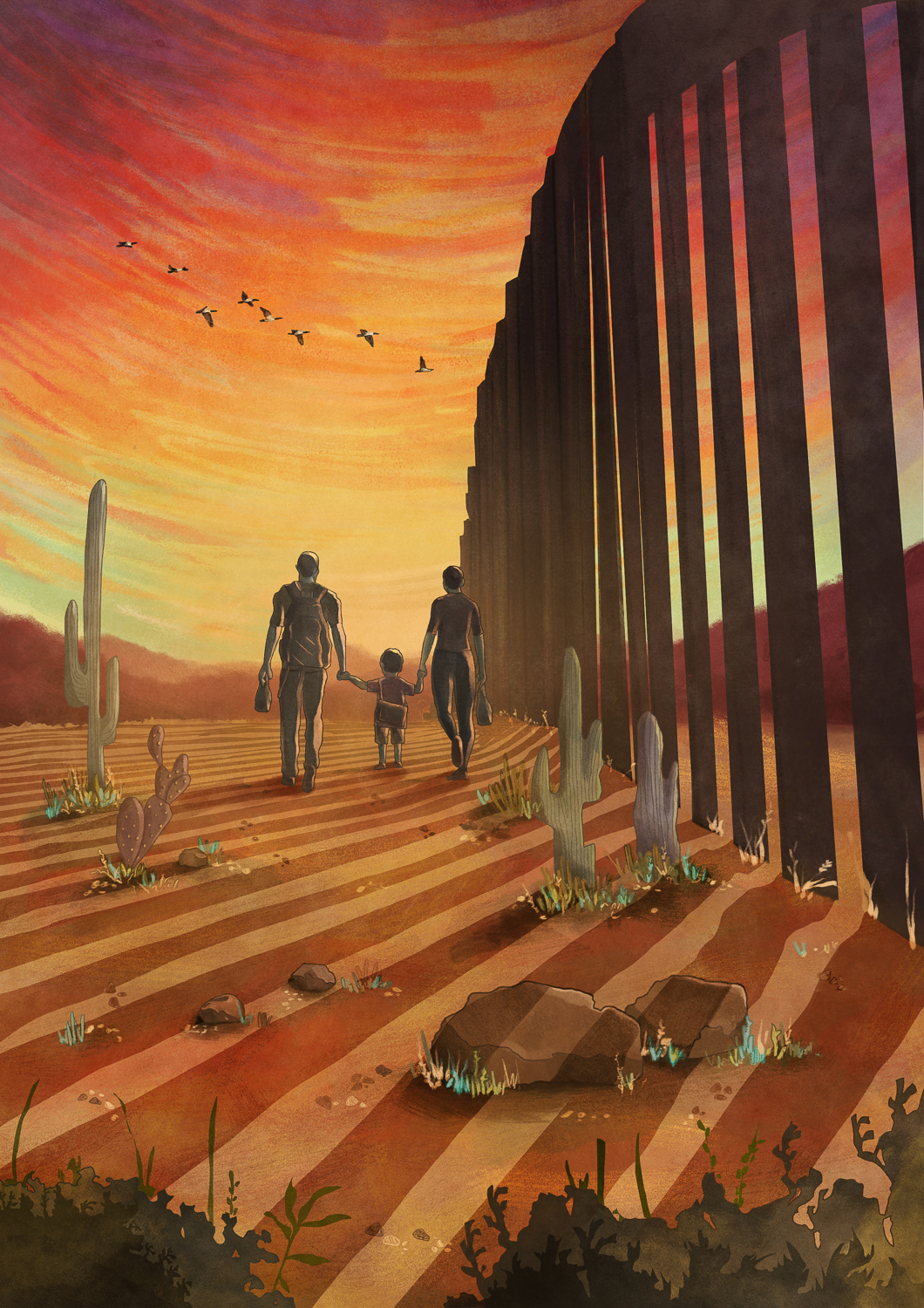
Three new books challenge the way we imagine the U.S.-Mexico border.

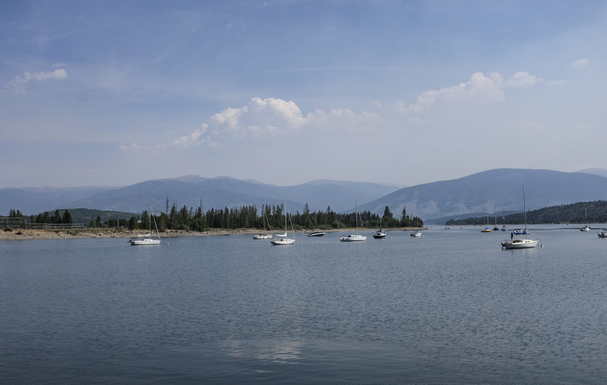
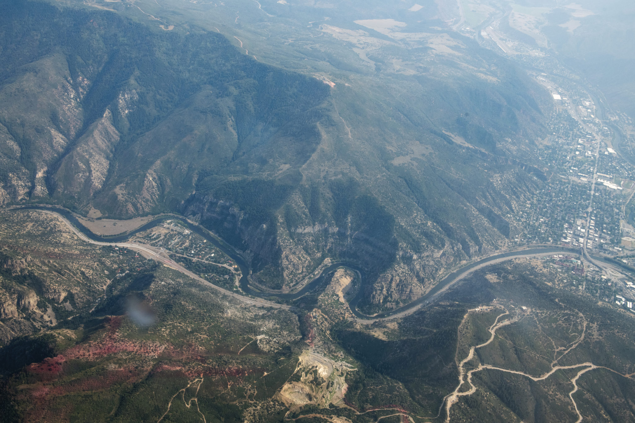
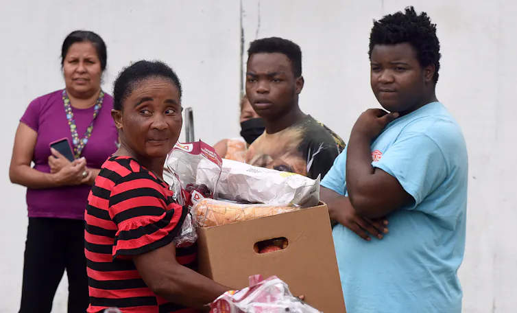
In 2018, I met a 29-year-old man I’ll call Alex (to protect his identity) at a soup kitchen for migrants in Nogales, Sonora, just across the U.S.-Mexico border from Nogales, Arizona. Most of the migrants were families with young children who came from Central America and the state of Guerrero, Mexico, fleeing poverty and violence fueled by a legacy of U.S.-backed military coups and corporate plundering. They had come to seek asylum in America.

Alex was different. His parents brought him to the U.S. from Honduras when he was 7, and he grew up in New York City undocumented. At 21, he got into a fight, and the police were called. Immigration and Customs Enforcement eventually deported Alex, separating him from his infant son. He spent the next eight years in Honduras. Now, knowing he had no chance of asylum and no legal way to return to the U.S., Alex planned to cross the border illegally. “I’m trying get back to my son,” he told me.

A month later, Alex called me. He was staying with a friend in Tennessee, after spending 12 days crossing a deadly stretch of the desert from outside Nogales, Sonora all the way to Phoenix, Arizona, walking more than 150 miles, mostly alone. He survived, he thought, because of his military training; Alex had served briefly in the U.S. military reserves.

Without knowing his story, it would be easy to categorize Alex as either a victim or a criminal. But he was neither. He was a boxing aficionado, a construction worker and above all, a father who desperately wanted to be reunited with his son. But like so many, he was caught in the web of U.S. immigration policies.

Three new nonfiction books examine the failures of those policies, from the flawed, outdated science that shaped them, to the current wall-building fiasco, and, finally, to what it might take to create a more effective, and just, immigration framework.

IN 1994, the Clinton administration implemented a new border enforcement strategy called “prevention through deterrence,” designed to force migrants away from Borderlands cities and toward far more remote and dangerous routes, like the one Alex took. Such policies have not stopped migration, but they have made it far more deadly.

In The Next Great Migration, Sonia Shah questions this strategy, challenging the view that migration is a “crisis.” As Shah reveals, the science tells a different story: Migration is central to human biology and history.

Draconian immigration policies, Shah argues, are a response to flawed public opinion, not a reflection of the facts. The perception of migrants as a global threat has become lodged in the public mind. Studies show that many Americans vastly overestimate the number of undocumented immigrants and are convinced they worsen crime. In fact, high rates of immigration (both legal and unauthorized) are associated with lower rates of both violent and property crimes.

“We’ve constructed a story about our past, our bodies, and the natural world in which migration is the anomaly,” Shah writes. But that story is an illusion. Shah explores how three centuries of outdated scientific ideas about the role of migrants, both in the natural world and in human societies, have shaped anti-immigrant viewpoints that persist today.

Shah begins with the 18th century Swedish botanist Carl Linnaeus, charting the path from his failed quest for proof that different races were biologically distinct species, to contemporary white nationalist and anti-immigration crusader John Tanton, a retired Michigan ophthalmologist who warned about a coming “Latin onslaught” in a series of memos revealed in 1988.

Shah skillfully weaves the connections between science, policy and public opinion, demonstrating how, for instance, biologist Paul Ehrlich’s ideas about catastrophic population growth inspired environmentalist support for immigration restriction — though even Ehrlich later admitted that his 1968 book The Population Bomb had not been rooted in science at all. Rather, it was a “propaganda piece,” he said, aimed at mobilizing interest in environmental protection.

Shah takes readers to nearly every corner of the world: from human migration hotspots like the Darién Gap, at the Colombia-Panama border, to the San Miguel Mountains in Southern California, one of the last habitats for the endangered checkerspot butterfly, whose survival hinges on its ability to migrate. Though her scientific history is expansive and rigorous, at times she sidesteps research that undermines her argument, overlooking, for example, the damage invasive species can inflict on ecosystems.

Still, Shah helps illuminate why Alex and so many others are choosing to migrate. “The idea that there should be a single explanation for migration is rooted in a sedentarist notion,” Shah writes, referencing the geographer Richard Black. Both human and non-human species respond to devastating environmental changes by moving. When people are threatened by war, rising seas or persistent poverty, fleeing is a matter of survival. Likewise, for someone like Alex, a father facing a future without his son, the decision was only natural.

IF SHAH SHOWS how outdated beliefs explain current attitudes towards migration, journalist and author D.W. Gibson reveals how those attitudes are playing out at the U.S.-Mexico border today. After the Department of Homeland Security advertised for border wall prototypes in 2017, Gibson began visiting the construction site south of San Diego, where they were erected.

His book, 14 miles: Building the Border Wall, starts there, chronicling the locals whose lives are affected by the building of the wall. Among others, we meet a member of the Kumeyaay Tribe, whose traditional territory stretches from Southern California to northern Baja California, Border Patrol agents, a Haitian asylum seeker, a former human smuggler, and activists who leave jugs of water in the desert for migrants.

Unfortunately, few of the characters are fully developed, and at times, the interviews and extensive dialogue feel excessive. Gibson divulges little personal information, portraying himself as an out-of-place reporter who swigs bad coffee at a Denny’s restaurant and speaks mediocre Spanish. His strength lies in the way his interviews reveal the absurdities and contradictions of the border and the wall-building endeavor — its crass capitalism and phony politicking.

The most revealing character is the real estate baron and U.S. presidential hopeful Roque De La Fuente, one of several scammy businessmen clamoring to profit from the future wall. De La Fuente owns 2,000 acres of desert abutting the proposed wall expansion, and publicly hopes to sell his land to the federal government. Privately, however, he acknowledges that the wall “is a crazy stupid idea. We need more crossings.” Indirectly, De La Fuente supports Shah’s argument that human societies thrive on connection. What’s unnatural is trying to cut those connections off.

For Gibson, the border is less the frontier than its mirror, reflecting the vision of America people want to see. Such visions leave little room for “hyphenated Americans” — as a San Diego property owner refers to any people whose identities complicate his monolithic idea of America.

POETRY CAN “extend the document,” Susan Briante writes in Defacing the Monument, a book of documentary poetry. For Briante, the border’s failures emerge not only in cruel and inhumane policies like Operation Streamline, but also in how we tell the stories and record the history of those on the margins of our society.

Documentary poetry often resembles a scrapbook, mixing primary source material — photos, court records, letters and maps — with the poet’s own words, conveying her interpretation of the historical record and, crucially, what the documents leave out. “A frame of words can determine what one sees,” Briante writes.

Briante calls documentary poetry the “anti-journalism,” but I see it more as a meditation on the difficult moral and ethical questions facing anyone — whether journalist or poet — writing about the pain of others. “How can we amplify voices without turning other people’s stories into commodities, without re-affirming the faulty myth of ‘giving voice?’ ” Briante wonders.

Perhaps this is why those other voices are mostly absent from Defacing the Monument. But Briante is not writing here as a journalist; she is less concerned about the migrants’ stories than the way those stories are obscured or erased. Like Shah and Gibson, Briante asks us to reimagine the way we see the border and the lives it encompasses — to interrogate the false sense of normalcy that pervades our current immigration regime, and to “reframe and recontextualize every exception and every unexceptional atrocity.”

Briante doesn’t offer concrete suggestions for how to fix our inhumane immigration system. Instead, she urges another kind of transformation. Instead of new walls, Briante suggests, the U.S. needs new narratives, and a more expansive idea of what its borders are for. That requires a more expansive idea of America itself, rooted in connection rather than fear.

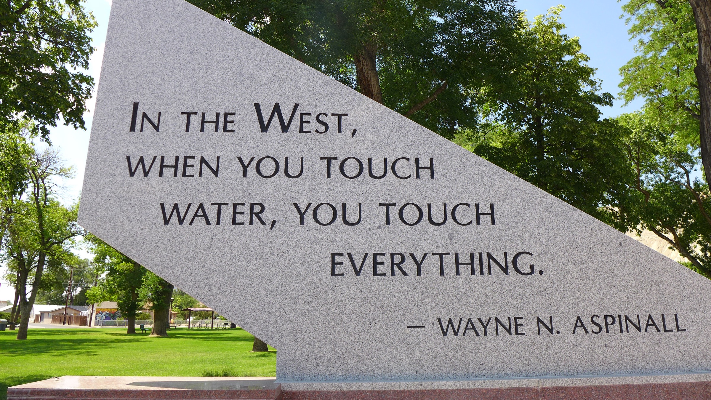
“The future unfurls like the sky above the cities of Nogales, Arizona, and Nogales, Sonora, a sky redacted by the bars of a wall. What will we write or imagine between those bars? What will we make from them?” Briante asks.

When Alex called me to say he had survived the crossing, he spoke of his journey — about the blisters on his feet, the hallucinations from the heat. He saw a puma, he said, and the remains of a human body. But he kept walking. He focused on his son, he said, “the only thing I think about.”

Sarah Tory is a correspondent for High Country News. She writes from Carbondale, Colorado. Follow @tory_sarah.

#ColoradoRiver District “State of the River” meeting video recordings now online #COriver #aridification

The Colorado River Water Conservation District spans 15 Western Slope counties. River District directors are asking voters this fall to raise the mill levy.

Click here to watch the video recordings:

Every year, the Colorado River District works with its partners to host educational meetings about water issues in each river basin in the 15-county district.

Learn more about the water we all rely on…Local experts present on how much water we expect to see in local rivers, ditches and reservoirs as well as up to date information about regional, statewide and local water issues.

Fountain Creek lawsuit parties ask for more time to reach a settlement

Fountain Creek photo via the Fountain Creek Watershed Flood Control and Greenway District

From The Pueblo Chieftain (Robert Boczkiewicz):

Attorneys who are trying to settle an environmental lawsuit against Colorado Springs for degrading Fountain Creek last week asked, once again, a judge to give them more time to reach an agreement. The judge balked.

“The Parties respectfully request . . . an additional 90 days,” the attorneys stated in a court filing to the judge overseeing the case in Denver at the U.S. District Court for Colorado.

Senior Judge John L. Kane met them part of the way, but warned that his patience was wearing thin…

Kane has approved six extensions since last year to keep the case on hold while all sides try to agreed on a plan, rather than continue to fight it out in court.

The most recent 90-day extension expired on Thursday.

In last week’s request for a new extensions until Nov. 18, the attorneys for all sides told Kane they “have worked diligently” to complete a settlement, known as a “Consent Decree,” in which Colorado Springs agrees to take specific actions. If the judge approves the terms of the settlement, it would become a court order.

The attorneys stated they have “accomplished as much as possible under challenging circumstances by telework, various means of remote communication, exchanging redline drafts of individual provisions and complete drafts” of a tentative proposed settlement, including three technical appendices. Those documents consist of more than 170 pages.

“In our last request for an extension, the Parties advised the Court that we had reached an agreement on almost all issues and had substantially completed a proposed (settlement agreement), the attorneys told Kane. “The Parties further advised the Court that there were a few remaining open issues that needed to be resolved.

“These final issues have taken longer than anticipated to be resolved and, therefore, a final proposed agreement was not ready to be presented to the appropriate approval authorities in the timeframe anticipated by the Parties when we requested our last extension” the attorneys stated. “The Parties have recently resolved these remaining issues and are finalizing the proposed (agreement) now.”

The attorneys said that during a 90-day extension, they “will finalize the proposed Consent Decree, as well as brief and present the proposed Decree to the appropriate approval authorities for their respective governments or governing boards in order to request their review and decision regarding approval of the proposed Consent Decree. “In answering the extension request, Kane wrote: “I am fully aware of the difficulties involved in reaching a conclusion to this case. Not only are all of us hampered by measures instituted to deal with the coronavirus epidemic, but in addition each of the parties to this case has additional responsibilities to their constituent governments and taxpayers amounting to fiduciary obligations…

“This is, however, the seventh request for ninety-day extensions to complete settlement agreements and file a proposed consent decree. This Court, too, has a public obligation to ensure the prompt, speedy and just resolution of cases presented to it,” the judge wrote. “As such, it is inappropriate for the Court to engage in excessive accommodation to this settlement process.

“I find we have reached that point, if indeed not exceeded it. Accordingly, rather than the requested ninety days, I will allow the parties an extension of the stay up to and through Oct. 30, 2020.

The latest seasonal outlooks (through November 30, 2020) are hot off the presses from the Climate Prediction Centers: Hot and dry in the Upper #ColoradoRiver Basin #COriver #aridification

#ClearCreek through #Golden will close indefinitely starting Monday, August 24, 2020 #COVID19 #coronavirus

Photo credit Terry Smith via The City of Golden.

From OutThereColorado.com (Breanna Sneeringer):

Clear Creek in Golden will be indefinitely closed starting on Monday, August 24 due to large crowds of tubers and other waterway recreators ignoring masks and social distancing regulations.

The City of Golden originally closed off access to Clear Creek in July. The creek itself remained open with recreators entering the water west of city limits and exiting the creek at Vanover Park. However, not all COVID-19 guidelines were not being followed along the creek and within downtown areas.

According to the City of Golden, police made contact with more than 500 individuals in one weekend (August 1-2) related to mask requirements and violated creek access. A total of six citations were issued, which included for cutting of the fence and climbing over it.

As a result, the City of Golden will tighten its closure of Clear Creek access within city limits. Temporary waterway restrictions will be enacted on Monday, prohibiting the operation of vessels in Clear Creek including all single-chambered air inflated devices such as belly boats, inner tubes, single chambered rafts, body surfing, and swimming as well as kayaks, whitewater canoes, and multi-chambered river boards.

City officials say they have been busy “counting mask order compliance twice a day, every day” with an average compliance of 88%. In addition to mask compliance, officials say they have also been monitoring the area with “photos and drone video footage” to see if gatherings are taking place.

Vanover Park, which is located just before the Coors property, will also no longer be used as a point of exit. Signage and barriers to be placed in the area warn of a possible citation for trespassing into the creek and banks.

Study Finds Water Levels Average, Not Enough To Replenish Reservoirs — #Wyoming Public Media #ColoradoRiver #COriver #aridification #LakeMead #LakePowell

From Wyoming Public Media (Ashley Picco ne):

A study by the Bureau of Reclamation predicts that the current water levels in the Colorado River Basin will only postpone water shortages.

The study found that water levels in western reservoirs this year are similar to the past few years. John Berggren, a water policy analyst at Western Resource Advocates, said the overall trend in water levels over the past 30 years has been downward.

Because water levels have been in decline, Berggren said one good snow year is not enough to replenish the reservoirs. He said this year will only postpone water shortages by a few years…

Berggren said dry soil, warmer air, and earlier blooms use up more water that doesn’t end up in the reservoirs.

State urges Coloradans to be aware, avoid toxic algae — Colorado Department of Public Health & Environment

Here’s the release from the Colorado Department of Public Health & Environment (MaryAnn Nason):

The Colorado Department of Public Health and Environment reminds people recreating in Colorado waters to be aware of the potential for toxic algae and take precautions to avoid it. State testing so far this summer has found toxic algae in Prospect Lake in Colorado Springs, Barr Lake, Cherry Creek Reservoir, and Steamboat Lake. It likely is present in other lakes and slow-moving waters as well.

Toxic algae are made up of what many people call blue-green algae or harmful algae blooms. This algae is common and natural to our waters in Colorado, but sometimes it grows and produces toxins that can harm people and be fatal to animals like dogs.

“If you suspect toxic algae is present, do not let your kids, pets, or livestock touch or drink the water — when in doubt, stay out,” said Kristy Richardson, state toxicologist. “If any person or animal has had contact with the water, make sure they shower immediately and watch for symptoms.”

Symptoms for people include skin rash, gastrointestinal upset, fever, headache, sore throat, muscle, and joint pain. Symptoms for pets include vomiting, diarrhea, loss of appetite, abdominal swelling, stumbling, seizures, disorientation, or difficulty breathing. There have been a number of possible cases of toxic algae-associated illness reported to the state this summer.

Only lab tests or test strips can determine if an algae bloom is toxic, but algae that may contain toxins has certain characteristics. It may resemble thick pea soup, spilled paint on the water’s surface, and/or create a thick mat of foam along the shoreline. Toxic algae are typically not stringy or mustard yellow in color (the latter is probably pollen). If you see possible signs of toxic algae:

  • Keep kids and animals out of the water.
  • Don’t swim or wade.
  • Don’t drink the water and know it’s never safe to drink water from lakes or rivers.
  • When boating, avoid the areas with the algae.
  • Clean fish well with potable water, and discard the guts.
  • Contact poison control at 1-800-222-1222, or a health care provider, if people or animals have symptoms.
    Some lake managers test for toxic algae at certain locations and report it to the state. The state takes this information and updates an online dashboard at the end of the season to show historical trends and help raise awareness for the future season. The state encourages other managers of water bodies to also report to the state if they inspect or test for toxic algae.

    “With resources granted by the legislature in 2018, we were able to start a toxic algae program to better understand the problem in Colorado,” said Nicole Rowan, Clean Water Program Manager for the department. “These resources cover testing for just a small portion of Colorado’s lakes and ponds, so we depend on other waterbody managers to be aware and vigilant about this problem.”

    Toxic algae is most common in the hottest months of summer. Excess nutrients, high temperatures, and standing or slow-moving water provide an optimal environment for toxic algae, so it’s not commonly found in rivers or high mountain lakes.

    “There isn’t an easy fix for this,” Melynda May, Water Quality Specialist for Colorado Parks and Wildlife. “There are some physical and chemical controls but they are expensive and they don’t guarantee the removal of the toxic algae. Everyone can be algae aware and play a role to help prevent toxic algae blooms from forming in the first place.”

    Simple acts such as not using excess fertilizer, picking up pet waste, and not using de-icers that contain urea can help reduce the amount of nutrients entering our waterways and ultimately reduce the risk of algae blooms.

    More information, including guidance for managers or owners of waterbodies or owners of pets can be found at colorado.gov/cdphe/harmful-algae-blooms.

    Cherry Creek Reservoir photo of algae that tested positive for toxins
    Taken July 14, 2020. Credit: Colorado Department of Public Health & Environment

    Monsoon flops, #drought intensifies in #AZ — The White Mountain Independent #monsoon #ColoradoRiver #COriver #aridification #ActOnClimate

    North American Monsoon graphic via Hunter College.

    From The White Mountain Independent (Peter Aleshire):

    Bone dry.

    Sweltering hot.

    Welcome to Monsoon 2020.

    Westwide SNOTEL April 3, 2020 via the NRCS.

    Despite a near-normal winter, a hot, dry spring and a fizzled monsoon has cast Arizona back into drought and water shortages.

    Although the Rocky Mountains got 105% of a normal winter snowfall, runoff into Lake Powell remains just 52% of normal…

    Combined with declining reservoir levels and plunging water tables statewide, the return to a water crisis in the state underscores the enviable position of Payson with its supplemental C.C. Cragin water supply and White Mountain communities like Show Low, Pinetop and others with ample groundwater.

    The bizarre lurch from a normal winter to a reservoir-draining drought has also validated climate model predictions suggesting the gradual warming of the planet will create a fitful, ongoing water crisis in the Southwest. Studies show it’s not enough to have a good winter if a hot, dry spring melts the snow quickly and increases evapotranspiration, sapping the spring runoff.

    So far, this year ranks as the third-driest on record statewide. Most of the state so far ranks as “much below average” with some areas in the south setting records. Most of California is now in record-breaking territory as the drought returns with a vengeance. Wildfires are burning out of control, with thousands of homes threatened.

    Xcel as a transportation company — The Mountain Town News #ActOnClimate #KeepItInTheGround

    Photo credit: Allen Best/The Mountain Town News

    From The Mountain Town News (Allen Best):

    Utility plans for EVs align with Colorado’s decarbonization goals, says analyst

    Xcel Energy announced Wednesday a vision to drive toward 1.5 million electric vehicles in its service areas—including a large chunk of Colorado—by 2030. The company also operates in seven other states.

    In a sense, this announcement merely confirms the legislative marching orders given the utility by Colorado and several other among the eight states in which it operates. In the case of Colorado, SB 19-077 required Xcel Energy and Black Hills Energy, the two investor-owned utilities to apply to the state’s Public Utilities Commission to build facilities to support electric vehicles and recover the costs. Xcel in May submitted its plan, which is expected to be approved later this year by PUC commissioners.

    The announcement should be seen in an even broader context, says Travis Madsen, transportation program manager for the Southwest Energy Efficiency Project, a major player in driving public policy in the energy sector in Colorado.

    “Xcel, he said, “is evolving beyond just being an electricity company. It’s also becoming a transportation company. I am excited that the company is embracing the idea that part of what it’s doing is to enable electric vehicles.”

    This is from the Aug. 14, 2020, issue of Big Pivots. Go HERE to subscribe.

    Colorado legislators in 2019 adopted a raft of energy legislation, the most over-arching economy wise decarbonization goals: 26% by 2025 and, more challenging by far, 50% by 2030. Gov. Jared Polis reasserted and expanded somewhat the goal adopted by his predecessor, Gov. John Hickenlooper, to have 940,000 EVs on Colorado roads by 2030. Polis expanded the plan by including medium and heavy-duty vehicles, although Colorado does not have tax incentives for them, unlike cars.

    Xcel’s ambitions and those of Colorado align very well, says Madsen. He points to an Xcel filing with the PUC of its goal of having roughly 500,000 electric vehicles in its service territory in Colorado. Xcel delivers more than 60% of the state’s electricity.

    Travis Madsen. Photo via The Mountain Town News

    Madsen says he expects Colorado will meet and then exceed the EV goals because of the simple fact that the economics of vehicle electrification are starting to align. Vehicle costs are changing, and electricity has always been cheaper than petroleum. This was noted by Xcel in the press release posted on its website. “By 2030, an EV would cost $700 less per year to fuel than a gas-powered car, saving customers $1 billion annually.

    Xcel’s goals also align with the state’s efforts to decarbonize its electricity. “This activity by Xcel is one of the key ingredients in making that happen,” he says. This vehicle electrification by 2030 will reduce emissions from transportation 40%.

    There’s another component: air quality. Air pollution poses a serious health threat to people, and new studies reinforce and expand that understanding. The northern Front Range has had air pollution issues for many decades, less now than 50 years ago, but still dangerous and with a stubborn persistence. There are multiple causes, including oil-and-gas drilling, but transportation exhausts are the single largest cause.

    “The more we learn about air pollution and how bad it is, the greater the push to switch,” says Madsen. “The switch to EVs is one of the major tools.”

    In its May filings with the PUC, Xcel laid out a multi-pronged approach to aiding the charging of EVs in its Transportation Electrification Plan. It proposes to invest $100 million during three years in electric vehicle infrastructure and programs. See the 48-page plan filed with the PUC here.

    These include programs to help people rewire their garages for charging, as most charging is expected to be done at home. The program also calls for efforts to allow those in multi-family housing, such as condominiums and apartments, to have access to charging. Another component addresses fleet-charging. And, if a relatively small part of the program, Xcel proposes how it will figure out where to put expensive fast-chargers in locations that private companies, like EVgo and ChargePoint, do not, because of infrequent use.

    Madsen expects PUC approval for Xcel’s plans by early 2021 and the laying out of the programs, which will then accelerate the adoption of EVs in Colorado. The deadline for adoption of the plan was specified by legislators as March 1, 2021.

    Allen Best is a Colorado-based journalist who publishes an e-magazine called Big Pivots. Reach him at allen.best@comcast.net or 303.463.8630.

    Cloth masks do protect the wearer – breathing in less #coronavirus means you get less sick — The Conversation #COVID19


    When people wear masks, they can still get infected, but they’re more likely to have milder symptoms.
    Wenmei Zhou/Digital Vision Vectors via Getty Images

    Monica Gandhi, University of California, San Francisco

    Masks slow the spread of SARS-CoV-2 by reducing how much infected people spray the virus into the environment around them when they cough or talk. Evidence from laboratory experiments, hospitals and whole countries show that masks work, and the Centers for Disease Control and Prevention recommends face coverings for the U.S. public. With all this evidence, mask wearing has become the norm in many places.

    I am an infectious disease doctor and a professor of medicine at the University of California, San Francisco. As governments and workplaces began to recommend or mandate mask wearing, my colleagues and I noticed an interesting trend. In places where most people wore masks, those who did get infected seemed dramatically less likely to get severely ill compared to places with less mask-wearing.

    It seems people get less sick if they wear a mask.

    When you wear a mask – even a cloth mask – you typically are exposed to a lower dose of the coronavirus than if you didn’t. Both recent experiments in animal models using coronavirus and nearly a hundred years of viral research show that lower viral doses usually means less severe disease.

    No mask is perfect, and wearing one might not prevent you from getting infected. But it might be the difference between a case of COVID-19 that sends you to the hospital and a case so mild you don’t even realize you’re infected.

    Healthcare workers wheel a patient into a New York hospital on a gurney.
    The higher the viral dose, the higher the chance of developing severe COVID-19 that could require hospitalization.
    AP Photo/Kathy Willens

    Exposure dose determines severity of disease

    When you breathe in a respiratory virus, it immediately begins hijacking any cells it lands near to turn them into virus production machines. The immune system tries to stop this process to halt the spread of the virus.

    The amount of virus that you’re exposed to – called the viral inoculum, or dose – has a lot to do with how sick you get. If the exposure dose is very high, the immune response can become overwhelmed. Between the virus taking over huge numbers of cells and the immune system’s drastic efforts to contain the infection, a lot of damage is done to the body and a person can become very sick.

    On the other hand, if the initial dose of the virus is small, the immune system is able to contain the virus with less drastic measures. If this happens, the person experiences fewer symptoms, if any.

    This concept of viral dose being related to disease severity has been around for almost a century. Many animal studies have shown that the higher the dose of a virus you give an animal, the more sick it becomes. In 2015, researchers tested this concept in human volunteers using a nonlethal flu virus and found the same result. The higher the flu virus dose given to the volunteers, the sicker they became.

    In July, researchers published a paper showing that viral dose was related to disease severity in hamsters exposed to the coronavirus. Hamsters who were given a higher viral dose got more sick than hamsters given a lower dose.

    Based on this body of research, it seems very likely that if you are exposed to SARS-CoV-2, the lower the dose, the less sick you will get.

    So what can a person do to lower the exposure dose?

    Masks reduce viral dose

    A man in a red shirt holding a soda while wearing a mask in front of a display of mannequins all wearing masks
    A surgical or cloth mask can’t block out 100% of the virus, but it can reduce how much you inhale.
    AP Photo/Marcio Jose Sanchez, File

    Most infectious disease researchers and epidemiologists believe that the coronavirus is mostly spread by airborne droplets and, to a lesser extent, tiny aerosols. Research shows that both cloth and surgical masks can block the majority of particles that could contain SARS-CoV-2. While no mask is perfect, the goal is not to block all of the virus, but simply reduce the amount that you might inhale. Almost any mask will successfully block some amount.

    Laboratory experiments have shown that good cloth masks and surgical masks could block at least 80% of viral particles from entering your nose and mouth. Those particles and other contaminants will get trapped in the fibers of the mask, so the CDC recommends washing your cloth mask after each use if possible.

    The final piece of experimental evidence showing that masks reduce viral dose comes from another hamster experiment. Hamsters were divided into an unmasked group and a masked group by placing surgical mask material over the pipes that brought air into the cages of the masked group. Hamsters infected with the coronavirus were placed in cages next to the masked and unmasked hamsters, and air was pumped from the infected cages into the cages with uninfected hamsters.

    As expected, the masked hamsters were less likely to get infected with COVID-19. But when some of the masked hamsters did get infected, they had more mild disease than the unmasked hamsters.

    Four passengers wearing masks wave from a balcony aboard the Greg Mortimer cruise ship.
    Every passenger aboard the Greg Mortimer, a cruise ship bound for Antarctica, was given a surgical face mask.
    AP Photo/Matilde Campodonico

    Masks increase rate of asymptomatic cases

    In July, the CDC estimated that around 40% of people infected with SARS-CoV-2 are asymptomatic, and a number of other studies have confirmed this number.

    However, in places where everyone wears masks, the rate of asymptomatic infection seems to be much higher. In an outbreak on an Australian cruise ship called the Greg Mortimer in late March, the passengers were all given surgical masks and the staff were given N95 masks after the first case of COVID-19 was identified. Mask usage was apparently very high, and even though 128 of the 217 passengers and staff eventually tested positive for the coronavirus, 81% of the infected people remained asymptomatic.

    Further evidence has come from two more recent outbreaks, the first at a seafood processing plant in Oregon and the second at a chicken processing plant in Arkansas. In both places, the workers were provided masks and required to wear them at all times. In the outbreaks from both plants, nearly 95% of infected people were asymptomatic.

    There is no doubt that universal mask wearing slows the spread of the coronavirus. My colleagues and I believe that evidence from laboratory experiments, case studies like the cruise ship and food processing plant outbreaks and long-known biological principles make a strong case that masks protect the wearer too.

    The goal of any tool to fight this pandemic is to slow the spread of the virus and save lives. Universal masking will do both.The Conversation

    Monica Gandhi, Professor of Medicine, Division of HIV, Infectious Diseases and Global Medicine, University of California, San Francisco

    This article is republished from The Conversation under a Creative Commons license. Read the original article.

    What drought conditions statewide mean for Denver’s water supply — News on TAP

    Summer 2020 marked by forest fires, lots of 90-degree days and thirsty lawns. The post What drought conditions statewide mean for Denver’s water supply appeared first on News on TAP.

    via What drought conditions statewide mean for Denver’s water supply — News on TAP

    Denver Water’s newest treatment plant rising from the ground — News on TAP

    When finished in 2024, the new plant will be able to treat up to 75 million gallons of water per day. The post Denver Water’s newest treatment plant rising from the ground appeared first on News on TAP.

    via Denver Water’s newest treatment plant rising from the ground — News on TAP