
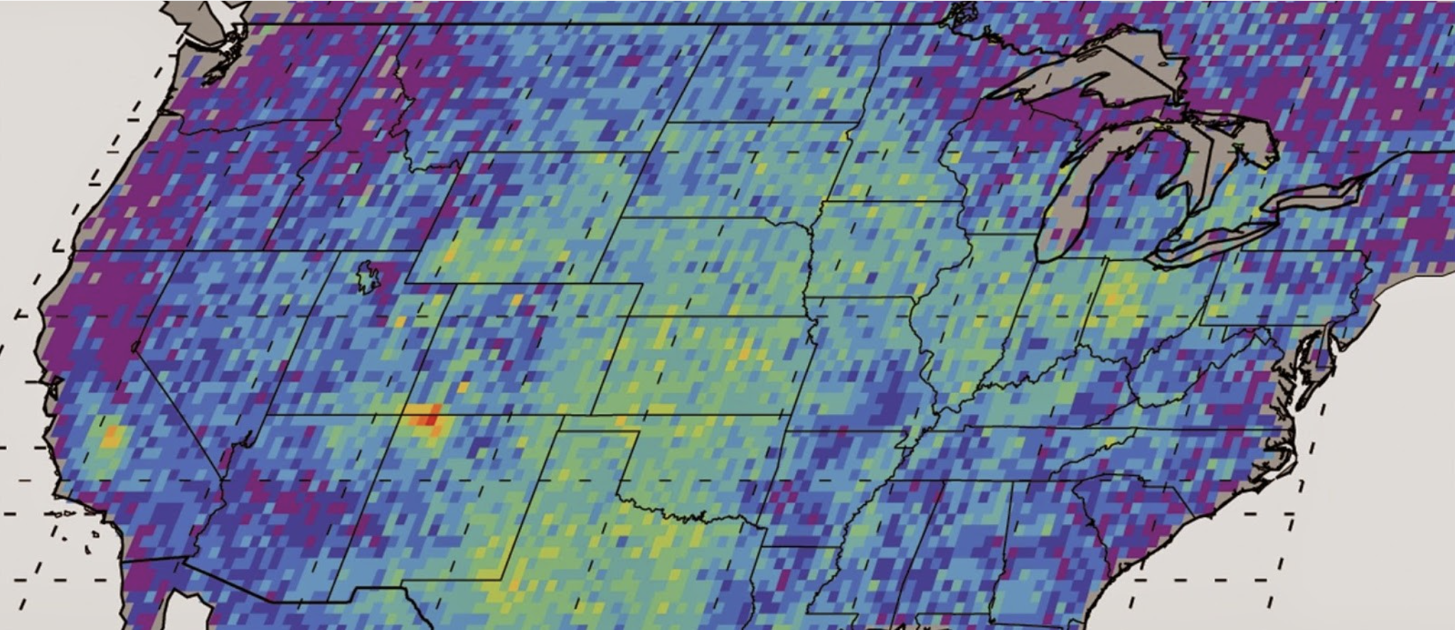
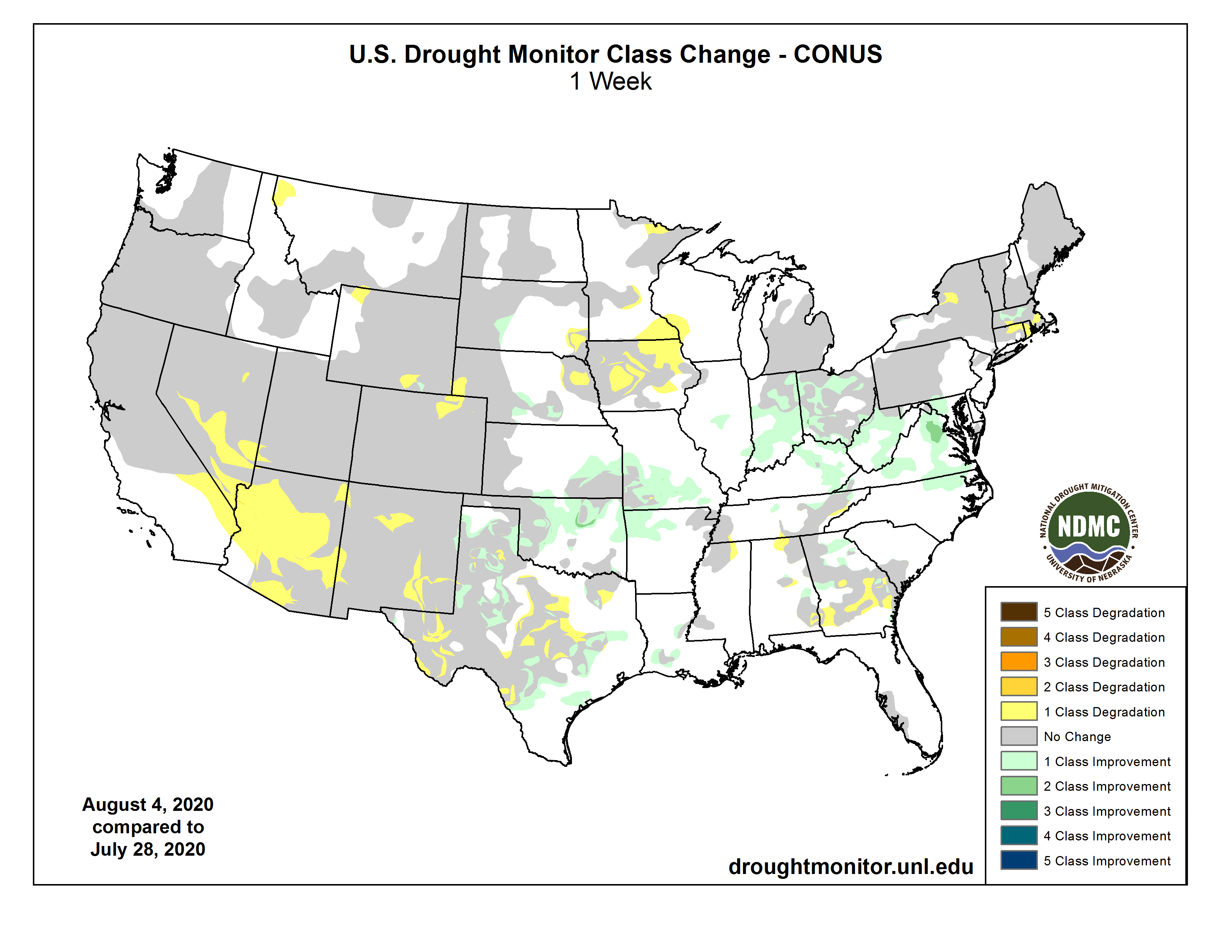
Click on a thumbnail graphic to view a gallery of drought data from the US Drought Monitor.


Click here to go to the US Drought Monitor website. Here’s an excerpt:
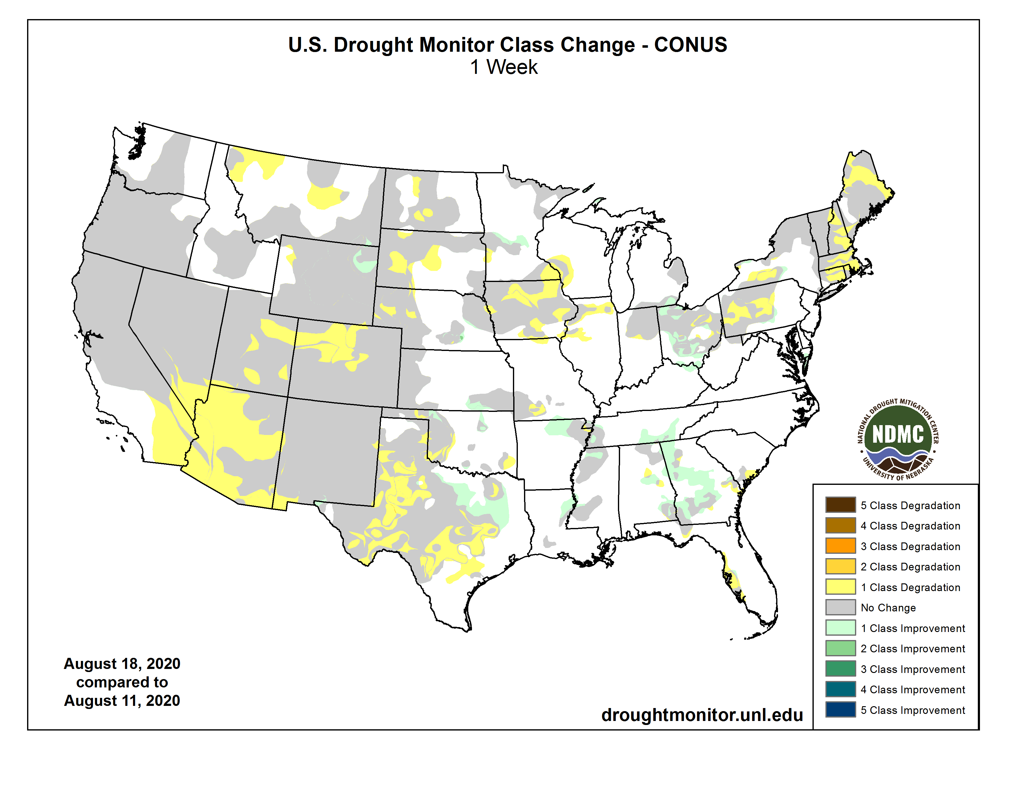
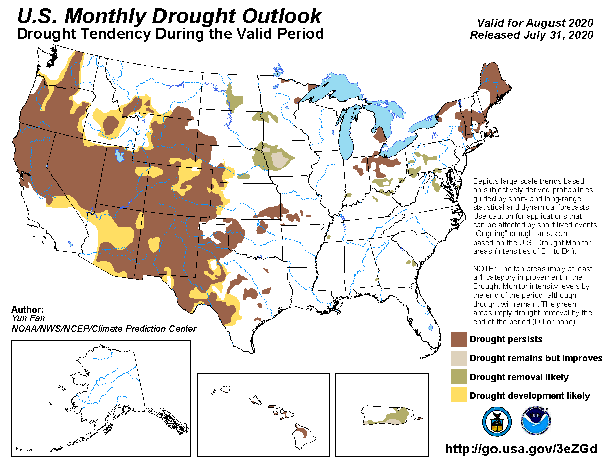
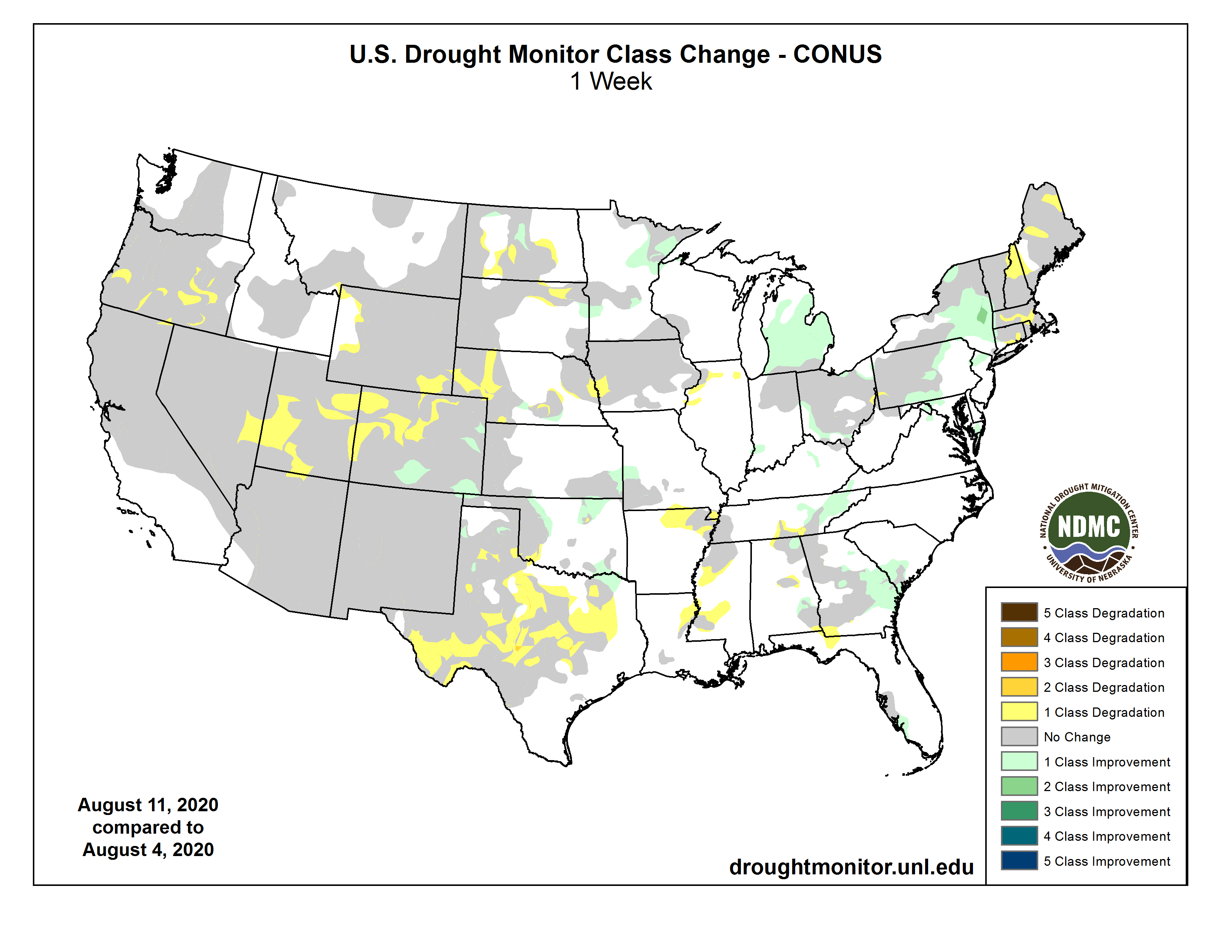
This Week’s Drought Summary
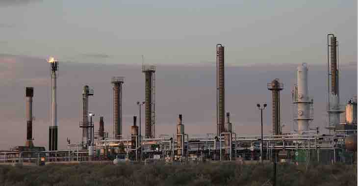
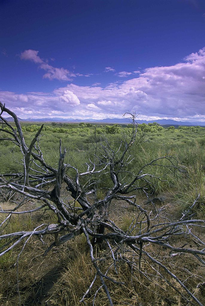
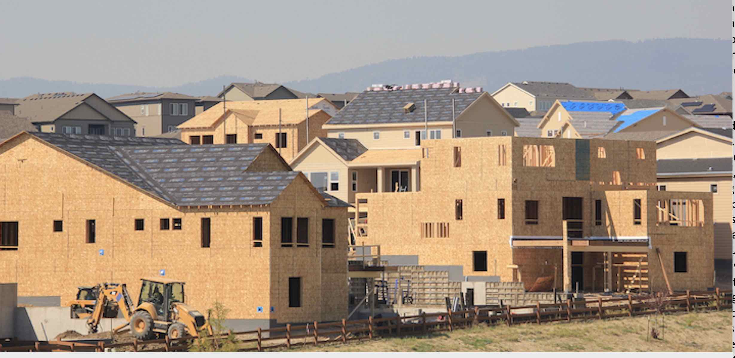
This U.S. Drought Monitor week saw intensification of drought across parts of the western U.S. as hot and dry conditions persisted with a historic heat wave currently gripping much of the region. Since last Friday, dozens of high temperature records were broken across the West including a scorching 130° F recorded at the Furnace Creek Visitor’s Center in Death Valley National Park. If verified, this high would represent the hottest temperature on Earth since 1913. Accompanying the extreme heat, numerous lightning-ignited wildfires broke out across California during the past week causing air-quality issues across parts of the region. In the Southwest, the continued weak monsoon has led to expansion and intensification of drought-related conditions with areas of Arizona and New Mexico observing less than 50% of normal precipitation since the beginning of the monsoon season. Similarly, drought conditions in the western half of Texas have deteriorated from persistent dry conditions and extreme heat. In the Midwest, short-term precipitation deficits (past 60 days) have led to the expansion of areas of drought, particularly in Iowa, where impacts are being reported in the agricultural sector. In the Northeast, anomalously warm temperatures and below-normal precipitation during the past 90-day period have led to deterioration in drought-related conditions in parts of New England—including Massachusetts where state officials declared a Level 2 drought on August 14 for all regions of the state…
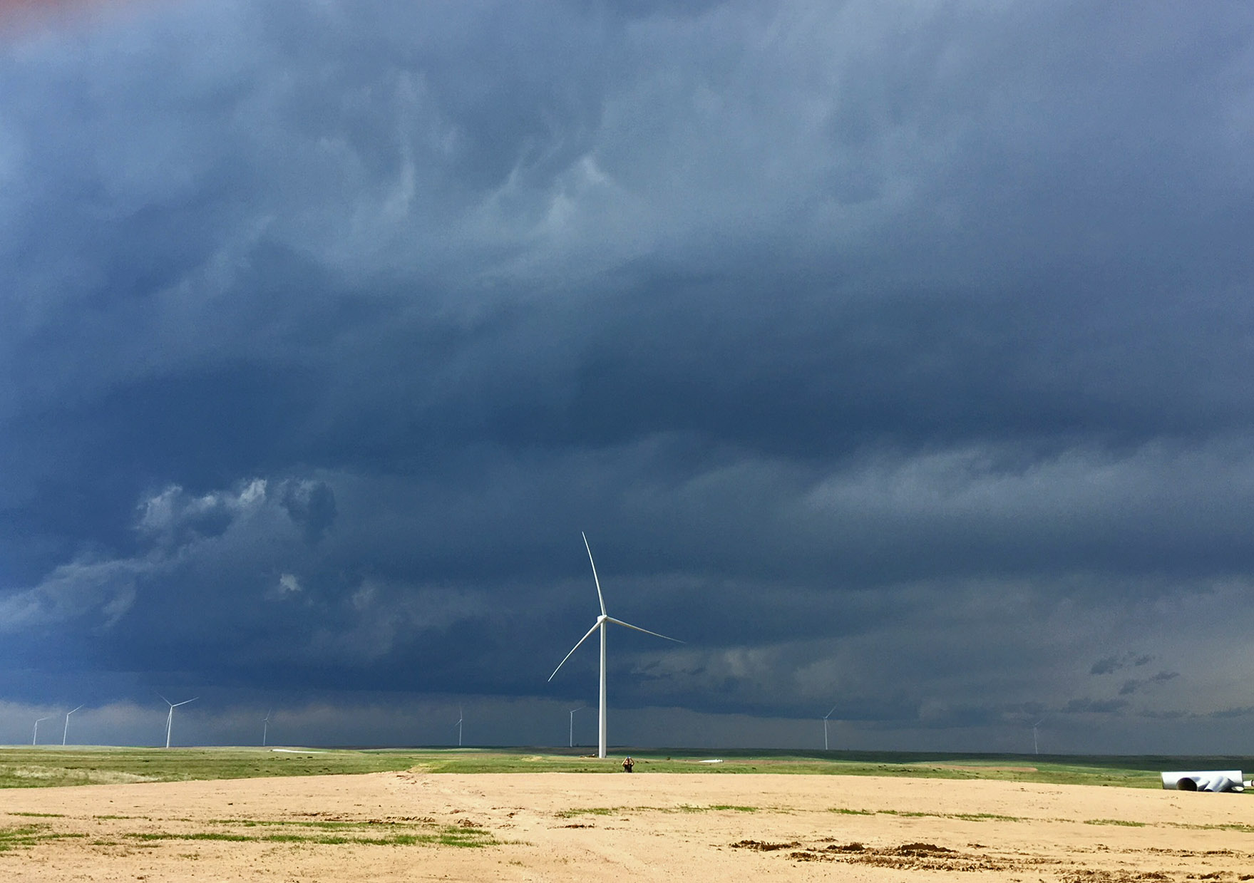
On this week’s map, areas of the region—including central North Dakota and western Nebraska—saw modest expansion in areas of Moderate Drought (D1) and Severe Drought (D2) in response to below-normal precipitation during the past 30-to-90-day period. Elsewhere, drought-related conditions deteriorated in southwestern South Dakota leading to the expansion of areas of Moderate Drought (D1). In northeastern Wyoming, some minor improvements were made in an area of Moderate Drought (D1) where precipitation has been above normal during the past 30-60-day period. For the week, average temperatures were mainly above normal with the greatest anomalies occurring in eastern Colorado, southeastern Wyoming, western Nebraska, and southwestern South Dakota where temperatures were 2-to-8 degrees above normal. Overall, the region was generally dry with some lesser accumulations (generally < 1 inch) observed in the Dakotas, eastern Montana, Nebraska, and Kansas…
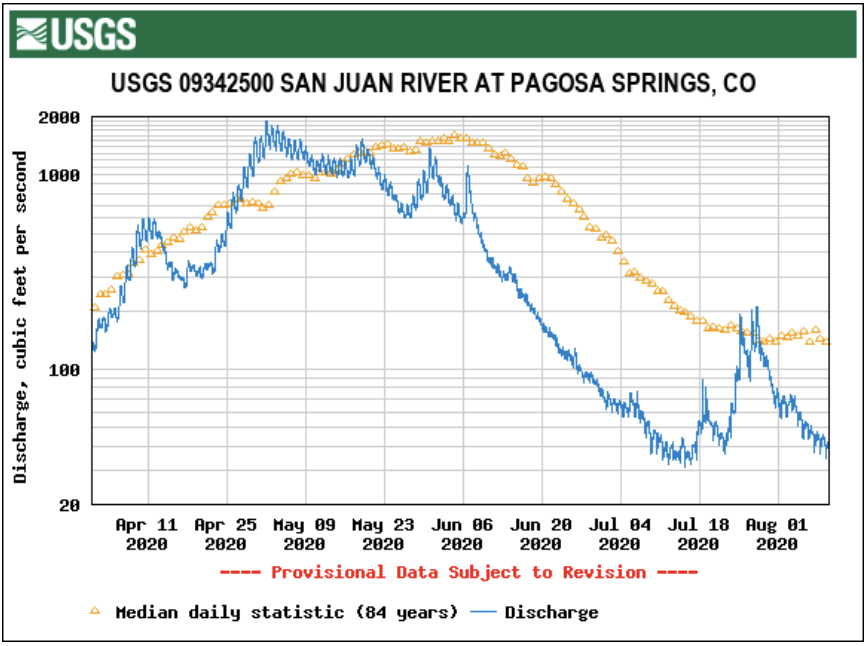
During the past week, an intense heat wave impacted the region as a strong mid/upper level ridge of high pressure parked over the region. Since Friday, numerous high temperature records were broken in cities across the West including Phoenix, Flagstaff, Oakland, Sacramento, and Reno—to name a few. In addition to the extreme heat, thunderstorm activity caused dozens of lightning-ignited wildfires to break out across central and northern California leading the Governor to declare a state of emergency on Tuesday, August 18. The wildfires have intensified and spread quickly leading to large-scale evacuations across numerous communities in northern California. On the map, areas of Severe Drought (D2) and Extreme Drought (D3) expanded in Arizona, Colorado, and Utah. To date, the monsoon has been a “bust” across much of the Southwest with cities like Phoenix, Tucson, Albuquerque, Las Vegas, and El Paso all reporting well below-normal precipitation totals for the monsoon season…
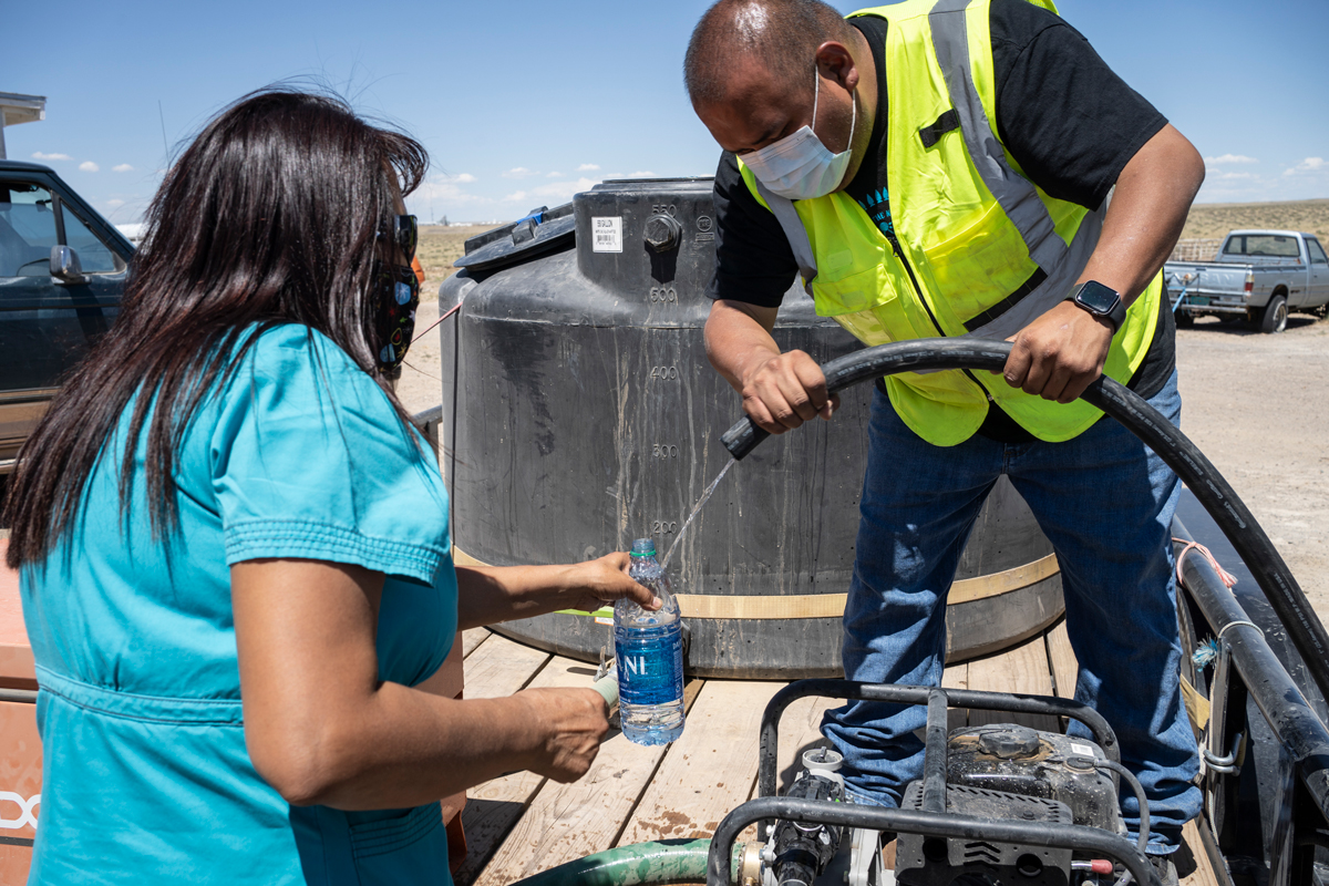
On this week’s map, drought intensified across the western half of Texas in response to continued anomalously hot temperatures, high winds, and mounting precipitation deficits. Changes on the map for Texas include expansion of areas of Moderate Drought (D1), Severe Drought (D2), Extreme Drought (D3) as well as the introduction of an area of Exceptional Drought (D4) in the Trans-Pecos region. According to the Texas A&M Agrilife Extension (August 11), the Far West region had reports of very poor rangeland conditions with many grass fires in addition to reports of a number of crops struggling—including cotton, corn, and sorghum. In Oklahoma, areas of drought intensified in the extreme southwestern part of the state with agricultural producers reporting very poor rangeland conditions and dry stock tanks. According to the Oklahoma Mesonet, for the period from January 1 to August 18, southwestern Oklahoma had experienced more than 30 days with temperatures exceeding 100° F. Elsewhere in the region, improvements were made in areas of Abnormally Dry (D0) in Arkansas, Louisiana, Mississippi, and Tennessee in response to showers and thunderstorm activity during the past week. For the week, most of the significant rainfall activity occurred in areas not experiencing drought with the heaviest accumulations observed in west-central and southwestern Arkansas where 5-to-8 inch accumulations were observed. Average temperatures were well above normal across much of Texas with areas in the Trans-Pecos and West Central Texas experiencing temperatures ranging from 6-to-10 degrees above normal for the week…
Looking Ahead
The NWS WPC 7-Day Quantitative Precipitation Forecast (QPF) calls for light-to-moderate accumulations ranging from 1-to-5 inches across portions of the South, Southeast, and the Mid-Atlantic with Florida and eastern portions of the Gulf Coast expected to receive the heaviest accumulations. In the Upper Midwest and northern portions of New England, accumulations of less than 1 inch are expected. Elsewhere, generally dry conditions are expected across the remainder of the conterminous U.S. with some isolated thunderstorm activity expected across the Southwest, central and northern Rockies, and the Great Basin—although rainfall accumulations are expected to be light (<1 inch). The CPC 6-10-day Outlook calls for a moderate-to-high probability of above-normal temperatures across most the conterminous U.S. with the exception of the far northern portions where temperatures are expected to be normal except for the Upper Midwest where below-normal temperatures are expected. In terms of precipitation, there is a moderate-to-high probability of above-normal precipitation across parts of the West including the Great Basin and areas of the Intermountain West including Utah, Wyoming, Idaho, and Montana. Other areas with a moderate probability of above-normal precipitation include much of the Midwest and the eastern tier. Conversely, drier-than-normal conditions are forecasted for western portions of Oregon and Washington as well as the Desert Southwest, northern Texas, and the Southern Plains.


