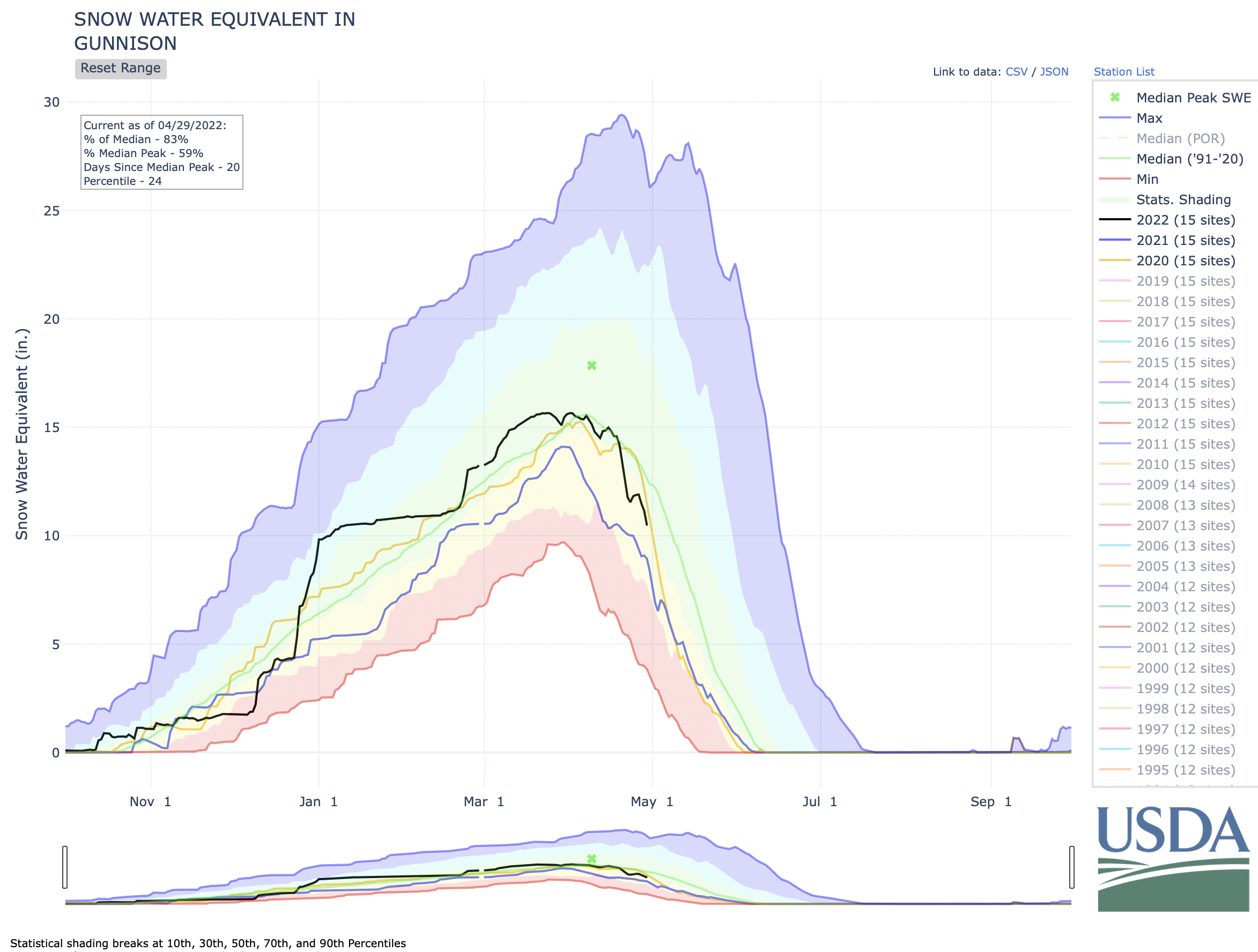
The Gunnison River Basin snow water equivalent (SWE) as of April 10 was 96% of normal for this time of year, and the upper basin SWE was 92% of normal. Precipitation has ranged between 69% to 82% of average for the entire upper basin since December and soil moisture varies from 1-31% of normal in Gunnison County, with most areas at an average of 10%.
“The Gunnison River looks like it might be similar to last year, for example the Gunnison River at Gunnison stream gage peaked at 1,720 cfs, but we’re hoping for more as there was more snowpack than last year,” she said. “Storage in the entire Upper Colorado River Basin is 63% of average right now, and Blue Mesa and Lake Powell are the lowest in that system.”
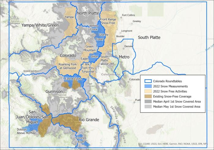
The blue areas in the map above are where the Airborne Snow Observatory flights are scheduled to collect information about the snowpack in 2022. The light tan areas will be flown this summer and fall to collect baseline information about the ground when it is free of snow. Image credit: Lynker.
Richards described a few potential tools being considered in the basin, such as Rocky Mountain Biological Laboratory’s (RMBL) interest in an airborne remote sensing program to track moisture during peak “greenness” from March through October. She said the program would help inform water managers of snow melt timing in the future. Chavez said the UGRWCD is also hoping to work more closely with USGS to increase monitoring frequency in Blue Mesa to understand Harmful Algal Blooms (HABs) using satellite and stream and lake sampling and might apply for a grant to aid in the endeavor.
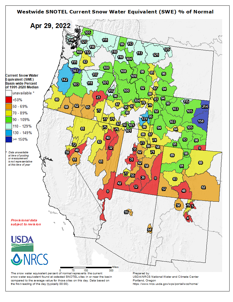
Westwide SNOTEL basin-filled snowpack map April 29, 2022 via the NRCS.