
Click on a thumbnail graphic to view a gallery of drought data from the US Drought Monitor website.

Click the link to go to the US Drought Monitor website. Here’s an excerpt:
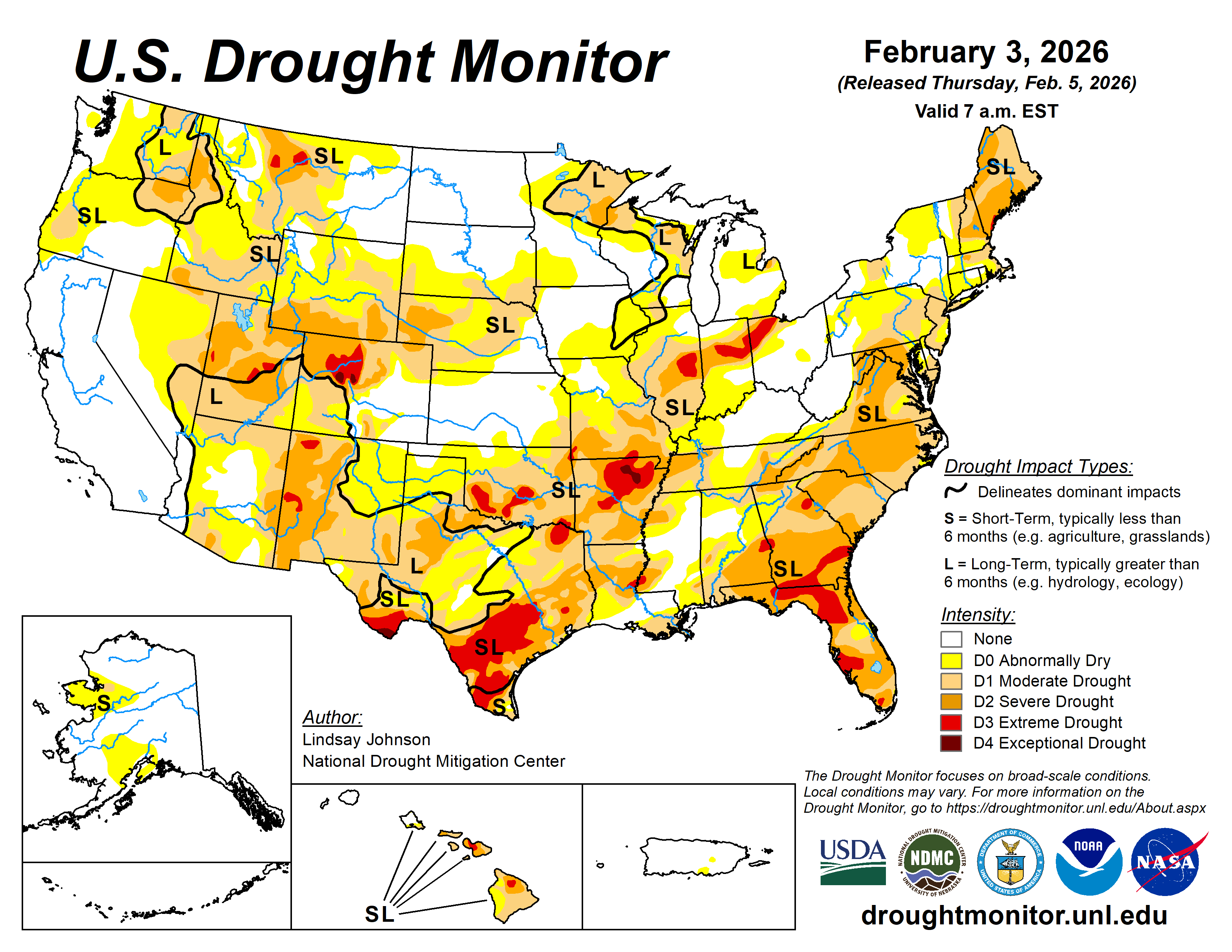
This Week’s Drought Summary
There was a strong west-to-east temperature gradient this week, with temperatures below normal in the East, particularly in the Midwest and Northeast, and above normal in the West. Precipitation was scarce across large portions of the nation, with many areas receiving less than 25% of normal precipitation. Areas of localized precipitation fell across the Pacific Northwest, northern Rockies and the Great Lakes region. Out east, a winter storm brought snow and mixed precipitation to parts of the Tennessee Valley and the Carolinas, with locally heavy snowfall in some locations.
Across the West, snowpack remains well below the seasonal average. Even in areas that received snow, low snowpack combined with dry soils and low streamflows led to degradations across the Intermountain West. Along the West Coast, precipitation remained limited and uneven. Western Oregon saw dry and drought conditions expand toward the Pacific coast and into far south Washington and northwest California.
Elsewhere, scattered degradations occurred across the South and Southeast, where another week without precipitation added to growing precipitation deficits, except for localized areas of improvement that continued to benefit from last week’s heavy snowfall. Other isolated areas of improvement were seen in southern New Mexico and in the Midwest and Northeast…
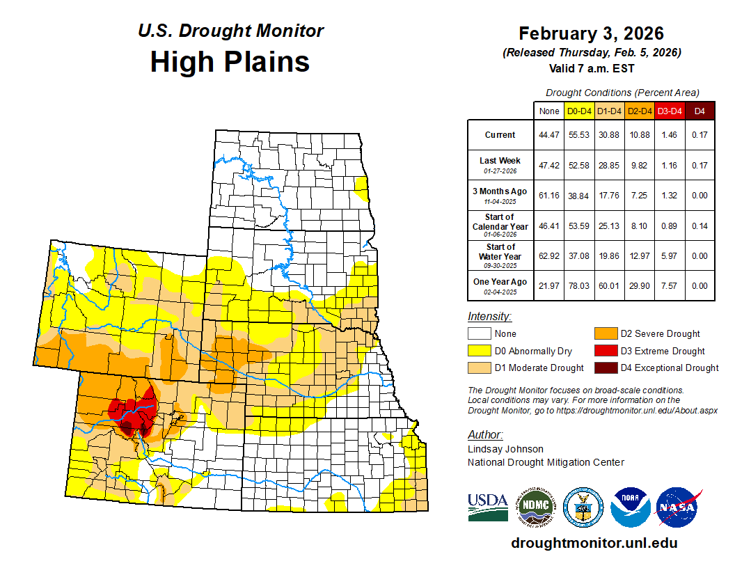
High Plains
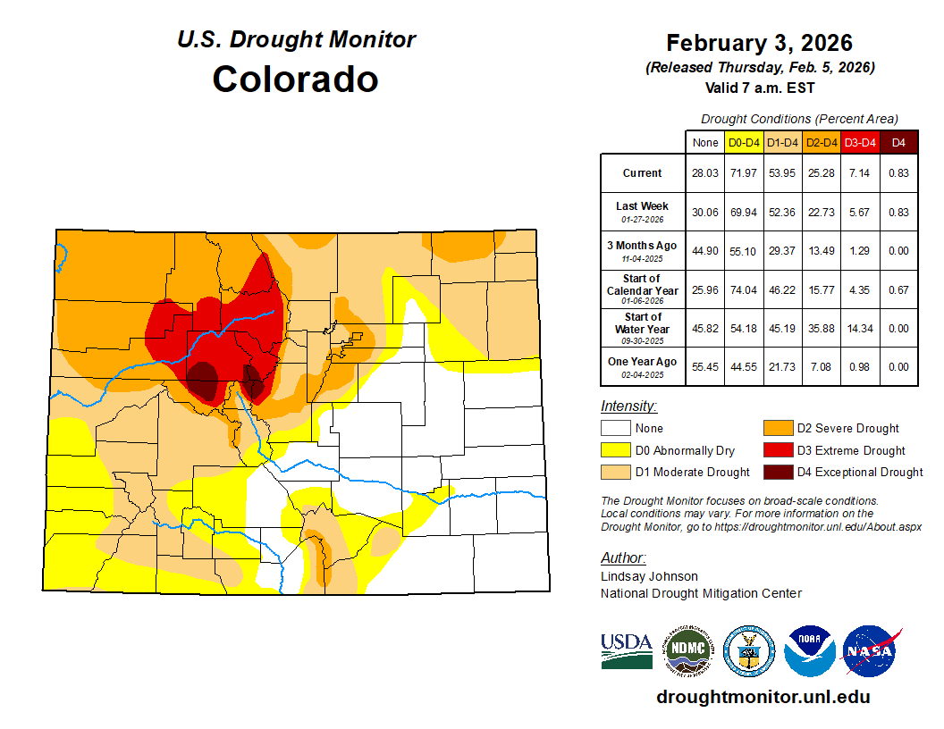
Conditions across the central and northern High Plains were mostly unchanged this week, as most of the region received little to no meaningful precipitation. Cold temperatures persisted, and where snow did fall, it remained largely frozen in place, limiting short-term benefits to soils or hydrologic conditions. Conditions across the Wyoming and Colorado Plains continued to deteriorate. Snow water equivalent (SWE) remains well below average, with SNOTEL data showing values generally in the 50 to 70 percent of median range, reflecting how snowpack continues to fall short for this time of year despite recent snowfall. Severe drought (D2) expanded from southeastern Wyoming into northeastern Colorado and a little into the Nebraska Panhandle. Abnormal dryness (D0) and moderate drought (D2) also expanded across portions of Kansas…

West
Across much of the West, conditions worsened, driven by a deepening snow drought, limited precipitation, and above-normal temperatures that continued to undermine snowpack development. While some mountain snowfall occurred, amounts were generally modest and failed to keep pace with early February climatological accumulation rates, causing snowpack deficits to expand across much of the region.
The Intermountain West saw conditions intensified as snow accumulation continues to fall well short of what is expected this time of the year. Numerous SNOTEL sites reported SWE below the 15th percentile, with several stations registering the lowest SWE on record for early February. These snowpack deficits were compounded by limited recent precipitation, declining soil moisture, and below-normal streamflows, particularly across northern Idaho and western Montana and extending into central and southern Montana and Wyoming. Similarly, Colorado and Utah saw conditions deteriorate as SWE levels are well below the median level along with drier soil moisture.
Across southwestern Idaho, northern Nevada and into eastern Oregon, persistent warmth, scarce precipitation, poor low-elevation snowpack, and low streamflows led to the expansion of abnormally dry (D0) and moderate drought (D1) conditions as well as the introduction of moderate drought (D2) along the Idaho-Wyoming border. SNOTEL stations in the Owyhee, Independence and Snake Mountains are reporting SWE levels between the ninth percentile to the worst on record…
South
Drought conditions across the South generally continued to worsen this week, as much of the region received little to no precipitation. Temperatures were near to slightly above normal across large portions of the region. Outside of a few localized improvements in northeast Louisiana and southeast Mississippi from last week’s winter storm, conditions continued to degrade across most of the region. Across the southern Plains into the Lower Mississippi Valley, one-category degradations were seen across parts of Texas, Oklahoma, Arkansas, Louisiana and southwest Mississippi after another dry week with no meaningful precipitation. Short- to mid-term precipitation deficits continue to grow and soil moisture continues to decline, along with streamflows…

Looking Ahead
Over the next five to seven days, an active weather pattern is expected across much of the continental U.S., with several regions showing a strong signal for precipitation. The heaviest precipitation is forecast from the lower Mississippi Valley northeastward into the Ohio and Tennessee valleys, where widespread totals of 1 to 3 inches are expected, with locally higher amounts possible. Portions of the central Plains, Midwest, and Great Lakes are anticipated to receive generally 0.5 to 1.5 inches of precipitation during this period. Across the West, precipitation is expected to be widespread from the Pacific Northwest into the northern and central Rockies. Liquid-equivalent totals of 1 to 3 inches are forecast in the Cascades and northern Rockies, with locally higher amounts possible at higher elevations. Farther south into the Great Basin and Southwest, precipitation becomes more scattered, with most areas receiving less than 0.5 inches, and many locations remaining dry. Drier conditions are expected to persist across California, the northern Great Plains, central and southern Texas, and much of the Florida Peninsula, where little to no precipitation is forecast over the next week.
The Climate Prediction Center’s 6–10 day temperature outlook (Feb. 10-14) shows a strong and widespread signal for above-normal temperatures across much of the continental U.S. The highest probabilities of above-normal temperatures are centered over the central and southern Plains, extending northward into the northern Plains and Upper Midwest. Much of the Intermountain West, Rockies, and interior West also favors above-normal temperatures. Along the West Coast, temperatures are expected to be near normal, while parts of the Northeast show a transition from below normal in northern New England to near or above normal farther south. Portions of the Southeast, including Florida, are favored to see near-normal temperatures. Alaska shows a mix of near- to below-normal temperatures across the mainland, with near-normal conditions favored over the southern coast. Hawaii is favored to experience above-normal temperatures during this period.
The Climate Prediction Center’s 6–10 day precipitation outlook (Feb. 10–14) favors above-normal precipitation across much of the western U.S., including the Southwest and West Coast, with elevated probabilities extending into parts of the northern Rockies. Above-normal precipitation is also favored across Alaska and Hawaii during this period. In contrast, below-normal precipitation is favored across Florida and portions of the far Southeast, while much of the central U.S. is expected to see near-normal precipitation.

Just for grins here’s a slideshow of early February US Drought Monitor maps for the past few years.

US Drought Monitor map February 3, 2026. 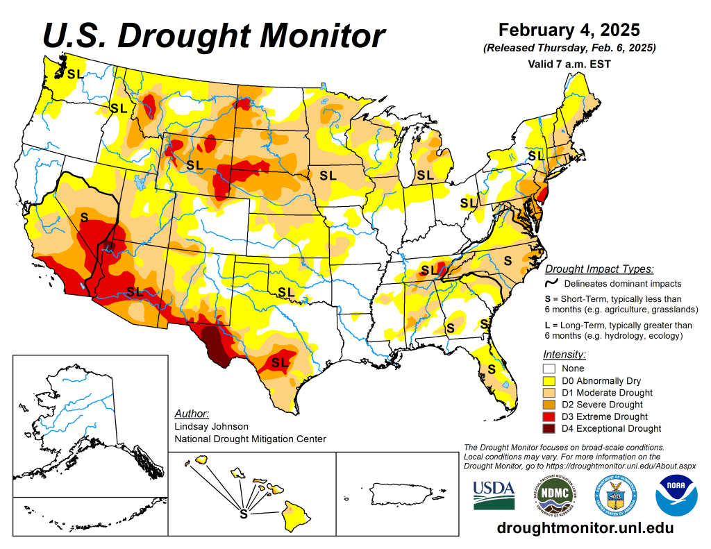
US Drought Monitor map February 4, 2025. 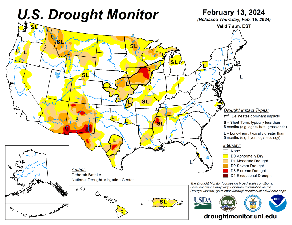
US Drought Monitor map February 13, 2024. 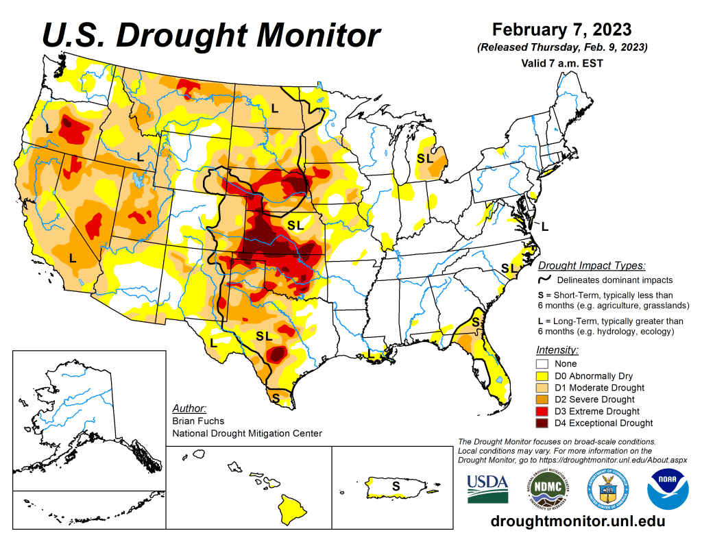
US Drought Monitor map February 7, 2023. 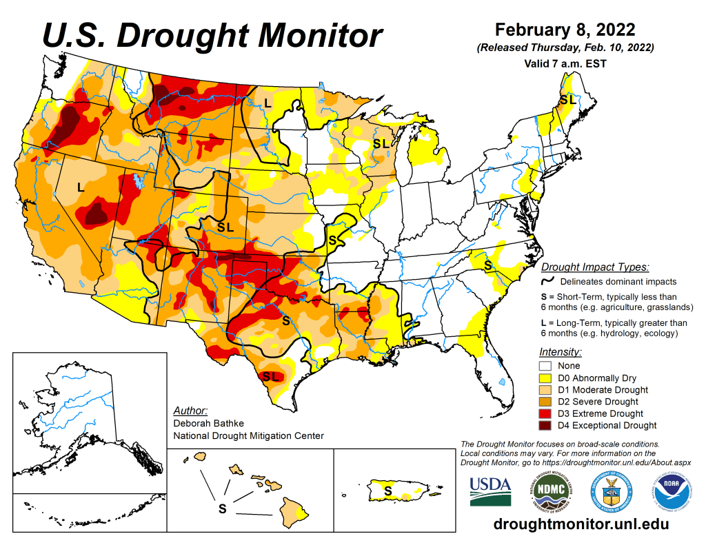
US Drought Monitor map February 8, 2022. 
US Drought Monitor February 2, 2021. 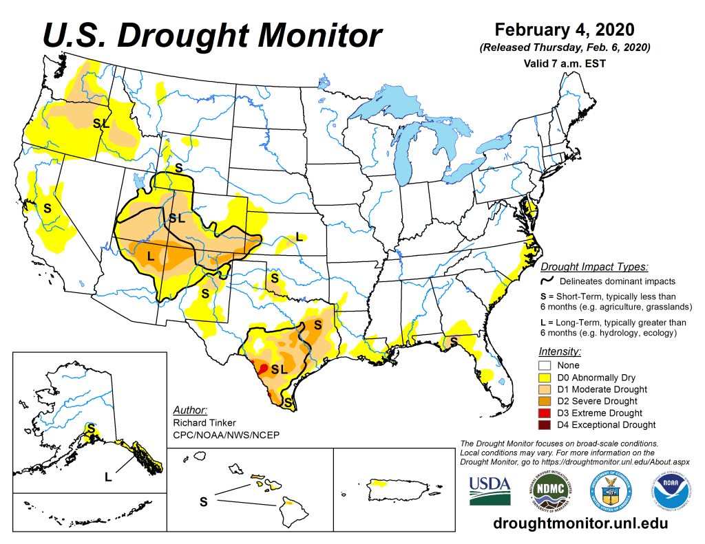
US Drought Monitor February 4, 2020. 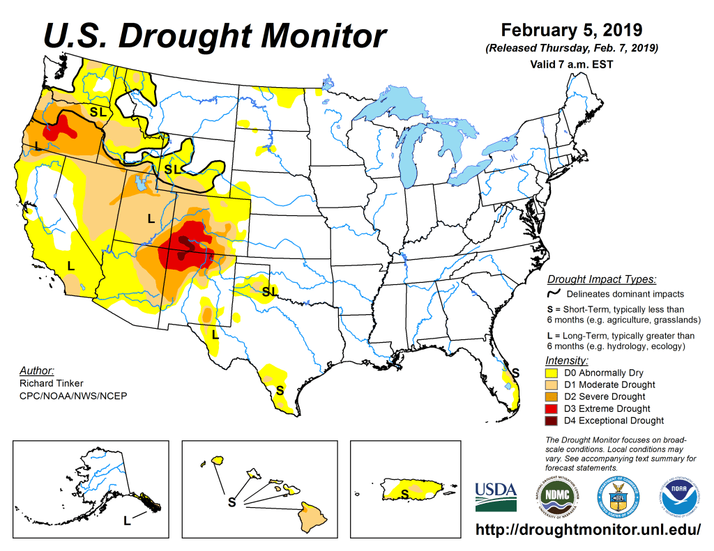
US Drought Monitor February 5, 2019. 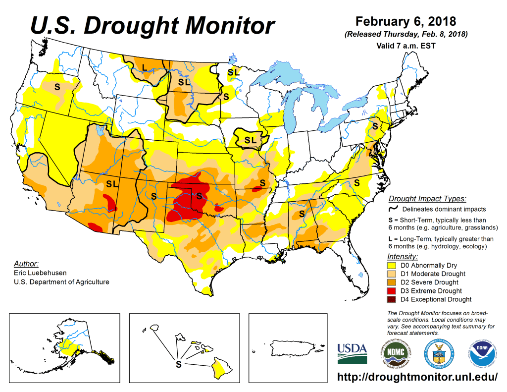
US Drought Monitor February 6, 2018. 
US Drought Monitor February 7, 2017. 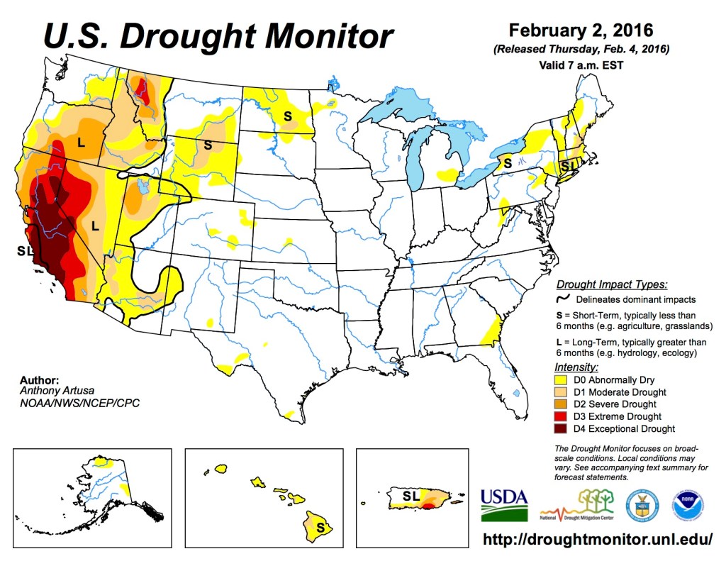
US Drought Monitor February 2, 2016 
US Drought Monitor February 3, 2015 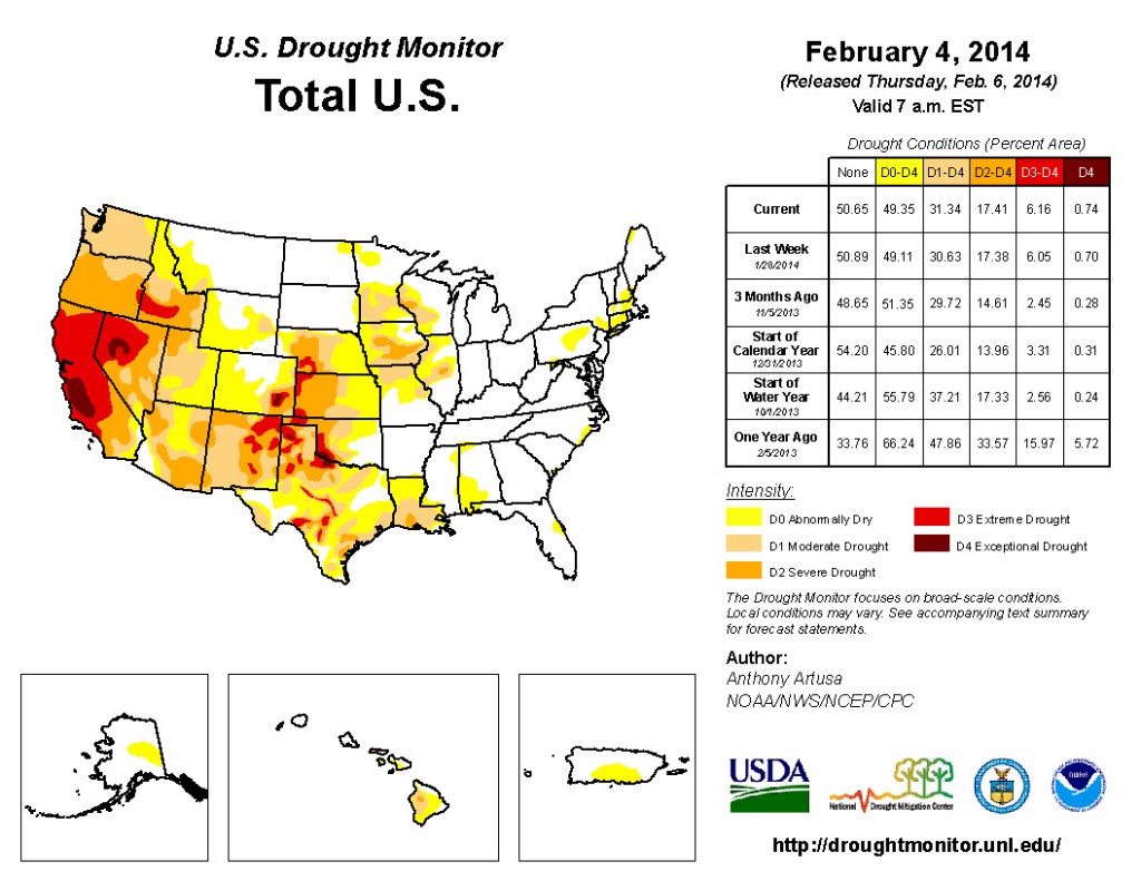
US Drought Monitor February 4, 2014 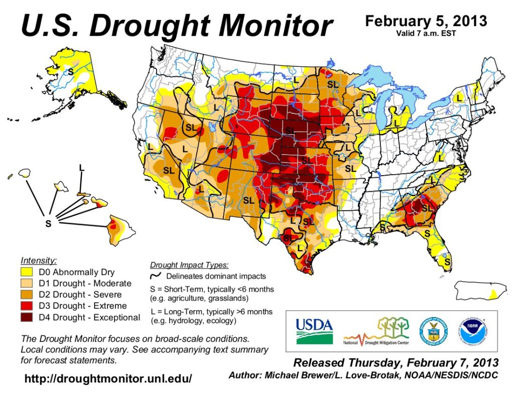
US Drought Monitor February 5, 2013 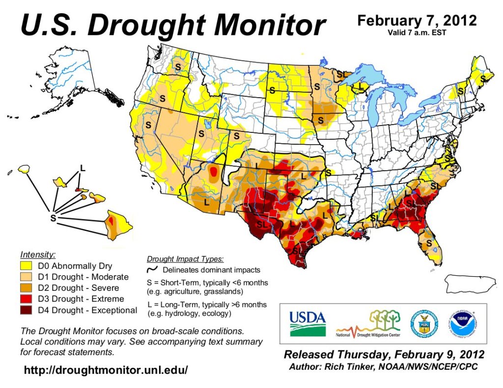
US Drought Monitor February 7, 2012 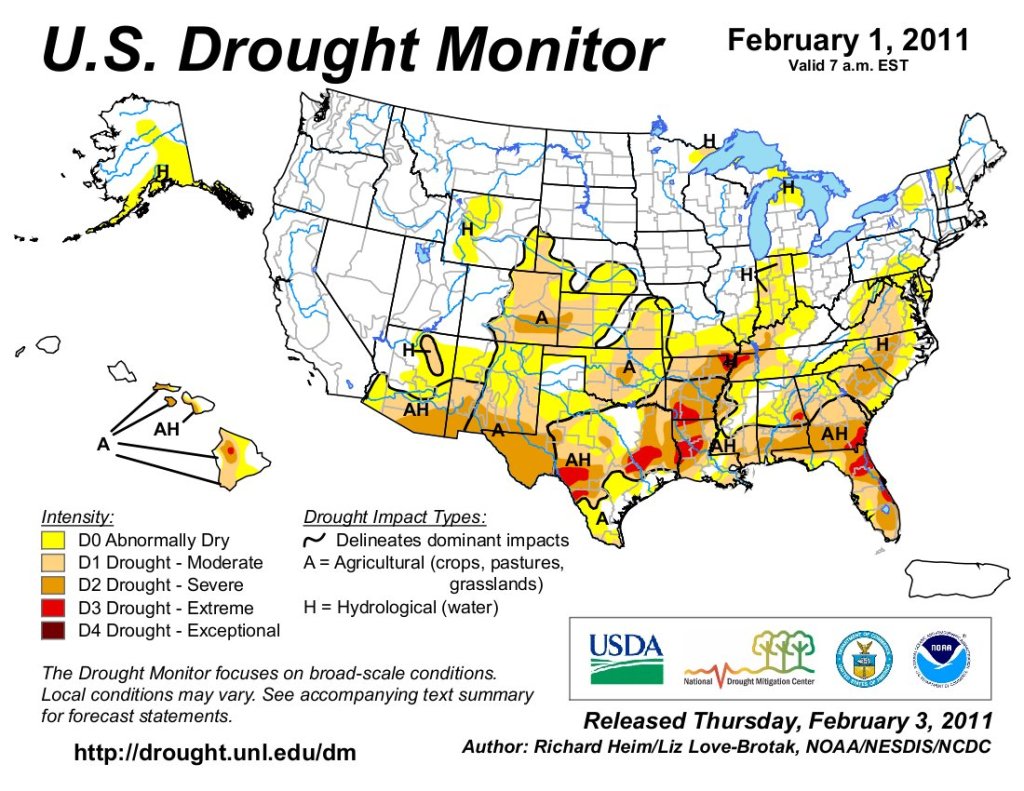
US Drought Monitor February 1, 2011 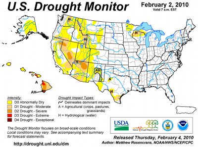
US Drought Monitor February 1, 2010