
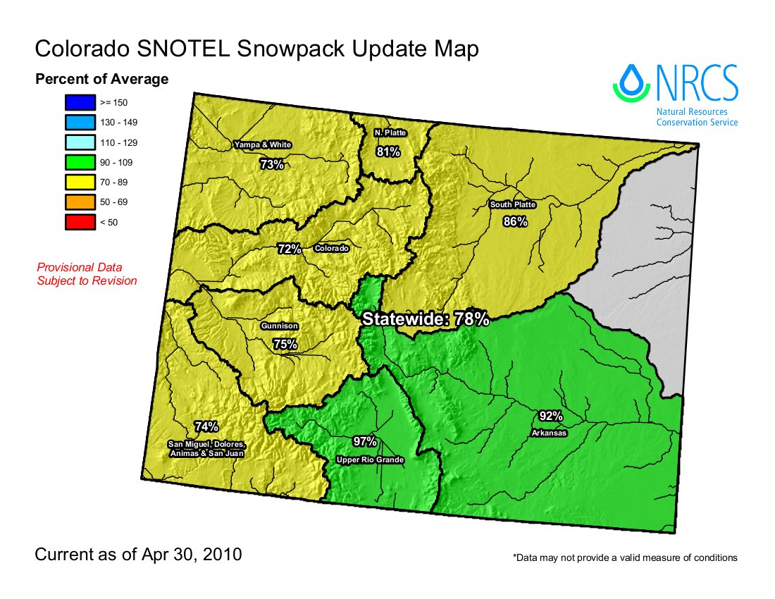
From The Greeley Tribune (Bill Jackson):
Recent snows have left a lot of snow in the lower levels of the northern mountains — which tends to melt quickly once spring finally gets a grip on things — but higher level fields continued a season-long trend of trailing the long-term average as well as last year’s readings. Because the snow is not that deep at lower levels, the melt-off later this spring is not anticipated to bring much threat for flooding — unless, of course, it is combined with heavy rains. And those heavy rains of the past week, expected to continue into the first part of next week, go a long way in reducing concerns for a lack of water, especially for farmers…
John Fusaro and Todd Boldt with the U.S. Department of Agriculture Natural Resources Conservation Service office in Fort Collins, took the survey earlier this week in the Big Thompson and Poudre Canyons, where two rivers bring water out of the mountains and empty into the South Platte River. Fusaro said there were about 2 inches of new snow in the lower levels of the canyons, and seven inches of new snow at the summit of Cameron Pass in the Poudre Canyon. He estimated there were maybe 15 inches of new snow in the upper regions of the canyons since the last survey in late February. “But the density wasn’t there. That’s been a common theme all year long. There just wasn’t much water in the snow,” Fusaro said. “It just wasn’t a typical April snow survey, but who knows? There have been years when we’ve seen 2 feet of new snow in the mountains in May. Maybe it’s going to be one of those years.”