
From the Cortez Journal (Paula Bostrom):
According to Cortez Meteorologist Jim Andrus, Saturday, Jan. 1, set a new record low temperature for that date at minus 13. The previous record was 11 degrees below zero on Jan. 1, 1991. Sunday, Jan. 2, also set a record low for that same date at a nosehair freezing 18 degrees below zero, breaking the record of minus 16 set in 1976. A third day of sub-zero temperatures continued on Monday, Jan. 3, with a temperature of minus 10, but didn’t break the record of minus 17 set way back on Jan. 3, 1937…
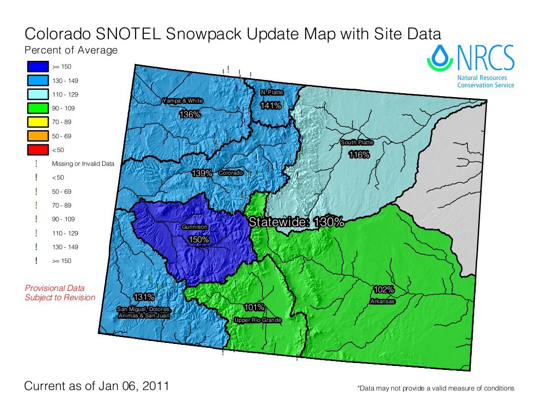
“This last storm on Dec. 29 through Dec. 31 brought a total of 14 inches of snow to the area,” Andrus said. Snowfall amounts for 2010 soared above the 18- to 24-inch average with a total of 77.4 inches for the entire year. Current snowpack levels for the Colorado Basin are hitting the average mark with 7.5 inches of precipitation, according to Snotel. Snowpack levels for the year 2010 were above average for the second year in a row with 17.5 inches of precipitation reported by Snotel on Lizard Head Pass between Rico and Telluride…
Precipitation amounts are taken from any rainfall and the liquid equivalent of snowfall. Overall, the region received 15.50 inches of precipitation in 2010, which is 117 percent of normal. Last year was an El Nino weather pattern, which means wetter weather, Andrus said…
Current elevation levels for McPhee Reservoir are looking good so far, according to Ken Curtis, an engineer with the Dolores Water Conservancy District. As of Monday, McPhee had a water elevation level of 6,897.69, which is about 5 percent higher than average for this time of year.