
From The Denver Post (Tom McGhee):
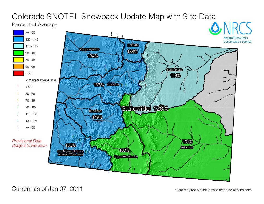
Snow in some basins, particularly those in northern Colorado, was almost double last year’s readings on Jan. 1, according to the Natural Resources Conservation Service snow survey office. Statewide snowpack is 159 percent of last year’s Jan. 1 readings and 136 percent of the 30-year average, according to the snow survey office.
State officials say it is too early to predict the runoff levels that typically crest in late May and early June. “It depends on how the weather patterns are entering the spring. We don’t see (major) flooding in most years, but it is not uncommon to see some minor flooding,” said Mike Gillespie, snow-survey supervisor of the U.S. Department of Agriculture’s NRCS…If the snowpack remains high into February, officials of the Colorado Water Conservation Board will reach out to local emergency managers in vulnerable areas, said Kevin Houck, engineer with the board’s flood mitigation section.
“We may work with them as the season goes on, if appropriate,” he said. “You can’t stop flooding from coming; the only thing you can do is be as prepared as you can.”
Meanwhile, you can download the NRCS’ January 11, 2010 Colorado Basin Outlook Report here. So far runoff looks good due to the great early season snowpack. Reservoir storage is at last year’s levels or better most everywhere.