

From the U.S. Bureau of Reclamation via the Cortez Journal:
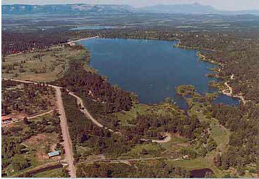
Jackson Gulch reservoir live content stood at 6,020 acre-feet with a 9,948 acre-feet maximum capacity and a 9,014 acre-feet average (1981-2010) end-of-month content. At Jackson Gulch, a daily maximum/minimum of 76/51 cubic-feet-per second was released into the Mancos River, and 88 acre-feet were released for municipal purposes.
McPhee Reservoir live content stood at 299,646 acre-feet, with a 381,051 acre-feet maximum capacity and a 343,394 average (1981-2010) end-of-month content. At McPhee, 4,120 acre-feet were released into the Dolores River, and 45,079 acre-feet were released for trans-basin purposes. At McPhee, a daily maximum/minimum of 70/57 cubic-feet-per-second was released into the Dolores River.
Questions can be directed to the Southern Water Management Group, Resource Management Division of the Western Colorado Area Office, Durango.
More Dolores River Watershed coverage here. More Mancos River Watershed coverage here.
In 1950 the Jackson Gulch Dam took all of the water from the Mancos River, even though the Ute Mountain Ute tribe had senior water rights on the Mancos. The result was that the Ute’s Mancos Farm went bust.
Robert,
Thanks for commenting. Do you have a link that you can share? … or an elder I can speak with?
John Orr
https://coyotegulch.blog/
Hi John, thanks for your reply. I’m presently editing a video for the Ute Mountain Ute Tribe about their successful negotiation, which came about after the Bureau of Reclamation agreed that the Tribe’s senior rights to the Mancos River had been violated. I have filmed the ruins of the Mancos Farm, (later called the Mancos Ranch), and was fortunte to have filmed a tribal leader who actually lived in Mancos Creek, (a small cluster of homes), when the Jackson Gulch dam was built and the river (downstream) went dry.
Here’s information from Perplexity AI:
In the Colorado Ute Indian Water Rights Settlement, the Dolores Project and Animas–La Plata Project together were used to satisfy reserved water rights claims of the Ute Mountain Ute and Southern Ute Tribes; the Dolores component primarily benefits Ute Mountain Ute, while Southern Ute’s outstanding claims were focused on the Animas and La Plata rivers.
Service areas include non‑tribal lands (Dove Creek area, central Montezuma Valley) as well as the Towaoc area on the Ute Mountain Ute Reservation, indicating that tribal supply was one component among several broader project objectives.
The Ute Mountain Ute Tribe agreed to subordinate older Mancos River rights in exchange for Dolores Project storage and delivery infrastructure, making the project central to delivering municipal and irrigation water to Towaoc and the Tribe’s farm and ranch enterprise, but that tribal-focused function was negotiated into an existing regional project rather than being its sole original purpose.
Best wishes!
Robert Marcos, photojournalist
Grand Junction, Colorado
robertmarcos2@gmail.com
Robert,
Are you interested in posting on Coyote Gulch? I get 6,000 to 7,000 hits a week and my followers, here on WordPress, and on X, Bluesky, Facebook, and LinkedIn are a sophisticated bunch.
Thanks for posting.
John Orr
https://coyotegulch.blog/
Yessir, I’d be honored. I might ask for parameters, especially guidelines regarding topics…
Here’s a link to the Perplexity info: https://www.perplexity.ai/search/if-the-ute-mountain-ute-tribe-y__YftbcQoWiatVcPLVG9A