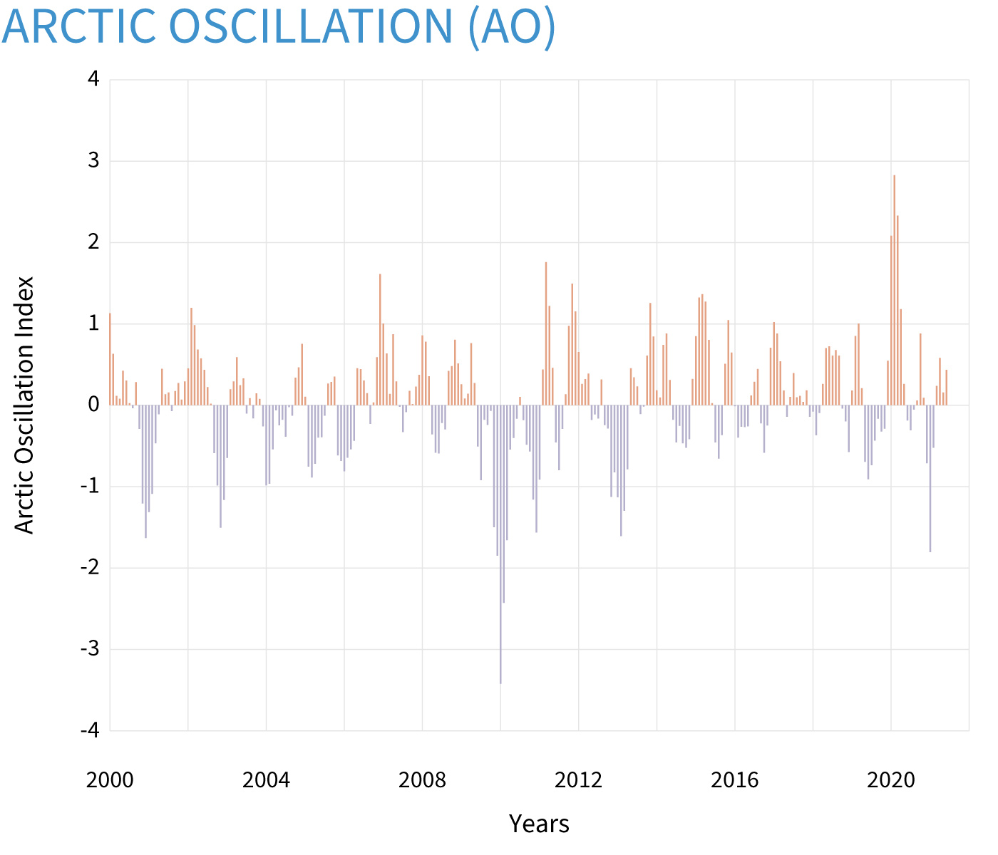
Seasonal (3-month) values for the Arctic Oscillation Index, which tracks shifts in surface pressure between the mid-latitudes and the Arctic. During the positive phase, the jet stream stays farther north, and mid-latitude winters are milder than usual. During the negative phase, the jet stream dips into the mid-latitudes, creating cold-air outbreaks. NOAA Climate.gov image, based on data from the Physical Sciences Lab.
The Arctic Oscillation (AO) refers to an atmospheric circulation pattern over the mid-to-high latitudes of the Northern Hemisphere. The most obvious reflection of the phase of this oscillation is the north-to-south location of the storm-steering, mid-latitude jet stream. Thus, the AO can have a strong influence on weather and climate in major population centers in North America, Europe, and Asia, especially during winter.
Winter surface pressure across the Northern Hemisphere compared to the 1981-2010 average when the Arctic Oscillation (AO) was strongly negative (top, 2009-10) and when it was strongly positive (bottom, 1988-89). The negative AO favors a warm Arctic and cool conditions across the U.S. and Europe. The positive phase favors a cool Arctic and relatively warm conditions in the mid-latitudes. NOAA Climate.gov image, based on data from the Physical Sciences Lab.
The AO’s positive phase is characterized by lower-than-average air pressure over the Arctic paired with higher-than-average pressure over the northern Pacific and Atlantic Oceans. The jet stream is farther north than average under these conditions, and storms can be shifted northward of their usual paths. Thus, the mid-latitudes of North America, Europe, Siberia, and East Asia generally see fewer cold air outbreaks than usual during the positive phase of the AO.
Conversely, AO’s negative phase has higher-than-average air pressure over the Arctic region and lower-than-average pressure over the northern Pacific and Atlantic Oceans. The jet stream shifts toward the equator under these conditions, so the globe-encircling river of air is south of its average position. Consequently, locations in the mid-latitudes are more likely to experience outbreaks of frigid, polar air during winters when the AO is negative. In New England, for example, higher frequencies of coastal storms known as “Nor’easters” are linked to AO’s negative phase.
AO phases are analogous to the Southern Hemisphere’s Antarctic Oscillation (AAO), a similar pattern of air pressure and jet stream anomalies in the Southern Hemisphere. Viewed from above either pole, these patterns show a characteristic ring-shape or “annular” pattern; thus, AO and AAO are also referred to as the Northern Annular Mode (NAM) and Southern Annular Mode (SAM), respectively.
Monthly and Daily values for the Arctic Oscillation Index are available from NOAA’s Climate Prediction Center.
References
Thompson, D.W.J., S. Lee, and M.P. Baldwin, 2002: Atmospheric Processes Governing the Northern Hemisphere Annular Mode/North Atlantic Oscillation. From the AGU monograph on the North Atlantic Oscillation, 293, 85-89.
Thompson, D.W.J., and J.M. Wallace, 2001: Regional Climate Impacts of the Northern Hemisphere Annular Mode. Science, 293, 85-89.
Thompson, D.W.J., and J.M. Wallace, 2000: Annular modes in the extratropical circulation. Part I: Month-to-month variability. J. Climate, 13, 1000-1016.
Thompson, D.W.J., and J.M. Wallace 1998: The Arctic Oscillation signature in wintertime geopotential height and temperature fields. Geophys. Res. Lett. 25, 1297-1300.
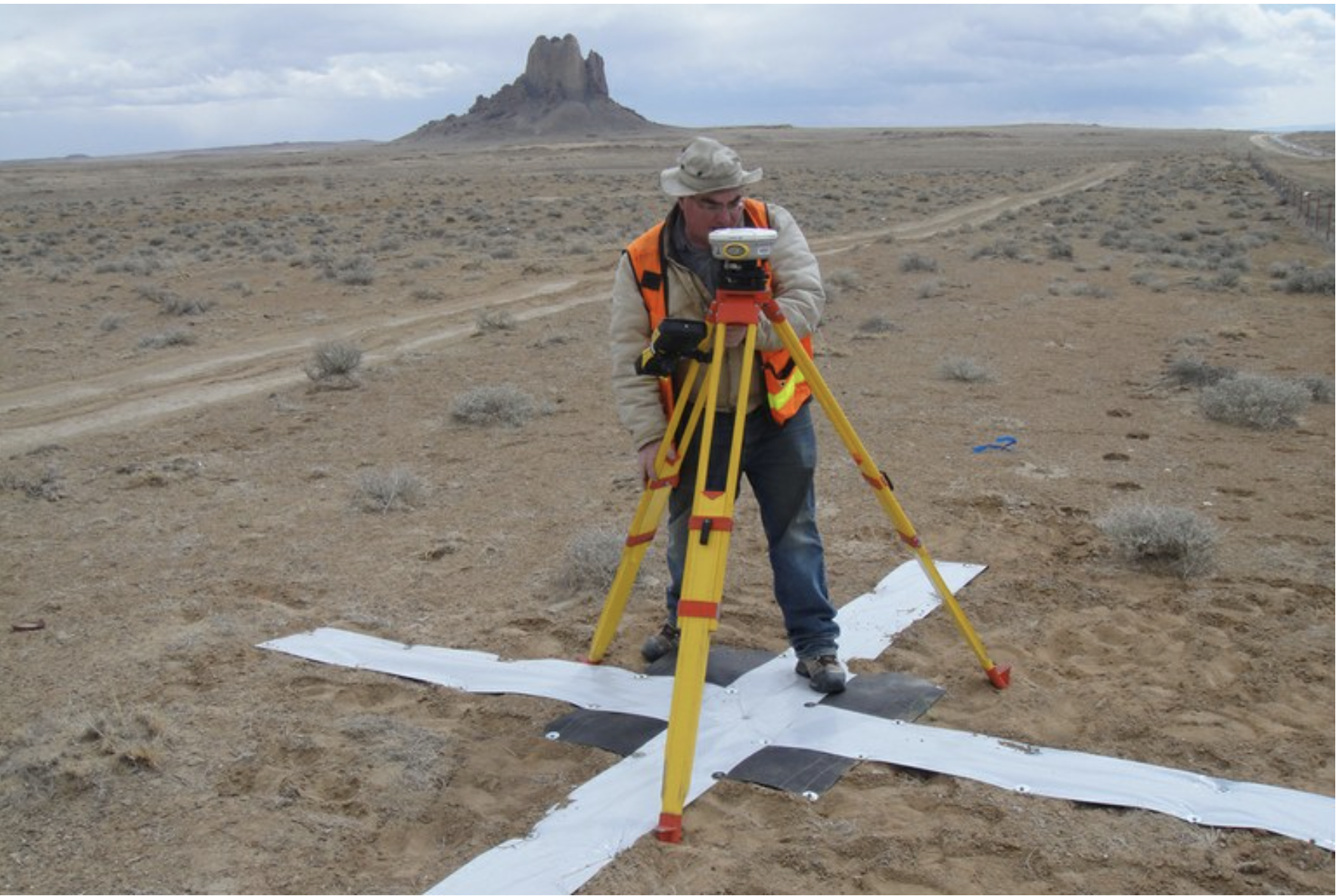
Survey work begins in 2018 for the Navajo-Gallup Water Supply Project on the Navajo Nation. Photo credit: U.S. Bureau of Reclamation via The High Country News
Here’s the release from the Bureau of Reclamation:
The Bureau of Reclamation continues to make significant progress towards completion of the Navajo-Gallup Water Supply Project (NGWSP) with today’s award of a $76,113,868 contract to SJ Louis Construction of Rockville, Minnesota, for construction of the next portion of the project, the Navajo Code Talkers Sublateral.
The sublateral will further the NGWSP, which is bringing clean and reliable water to Tribal and rural communities in northwestern New Mexico. The work will be located along New Mexico State Highway 264 between Yah-Ta-Hey, New Mexico, and Window Rock, Arizona, and will consist of the installation of approximately 17 miles of 24- to 30-inch diameter pipe and one water storage tank. Work under this contract will begin in January 2022 and is expected to last for approximately two years.
“This is a significant milestone for the Navajo-Gallup Water Supply Project and illustrates the Department of the Interior’s commitment to Tribal communities,” said Assistant Secretary for Water and Science Tanya Trujillo. “The department is excited to leverage the new resources in the Bipartisan Infrastructure Law to make similar investments to ensure that clean, safe drinking water is a right in Tribal communities.”
“Reclamation is pleased to begin construction on the Navajo Code Talkers Sublateral,” said Reclamation Commissioner Camille Calimlim Touton. “This will mark another step towards meeting the United States’ obligation to the Navajo Nation under the Nation’s water rights settlement agreement on the San Juan River Basin in New Mexico, where over a third of households still haul drinking water to their homes.”
These areas currently rely on a rapidly depleting groundwater supply of poor quality to meet the current and future demands of more than 43 Navajo chapters, the southwest area of the Jicarilla Apache Reservation and the City of Gallup, New Mexico. The NGWSP consists of two main pipeline systems – the San Juan Lateral and the Cutter Lateral.
When the full project is completed, it will include approximately 300 miles of pipeline, two water treatment plants, 19 pumping plants and multiple water storage tanks. Construction on the Cutter Lateral is nearly complete and water deliveries are currently being made to eight Navajo communities and soon to the southwestern portion of the Jicarilla Apache Reservation, serving 6,000 people or 1,500 households.
This contract continues many years of hard work by Reclamation, the Navajo Nation and other project partners constructing the NGWSP to improve the lives of residents and provide opportunities for economic development and job creation.
DEVON Peña and The Acequia Institute in San Luis just landed a $1.5 million grant from the Colorado Health Foundation that promises to restore the Culebra River Acequia Communities of Costilla County to its healthy foods heritage.
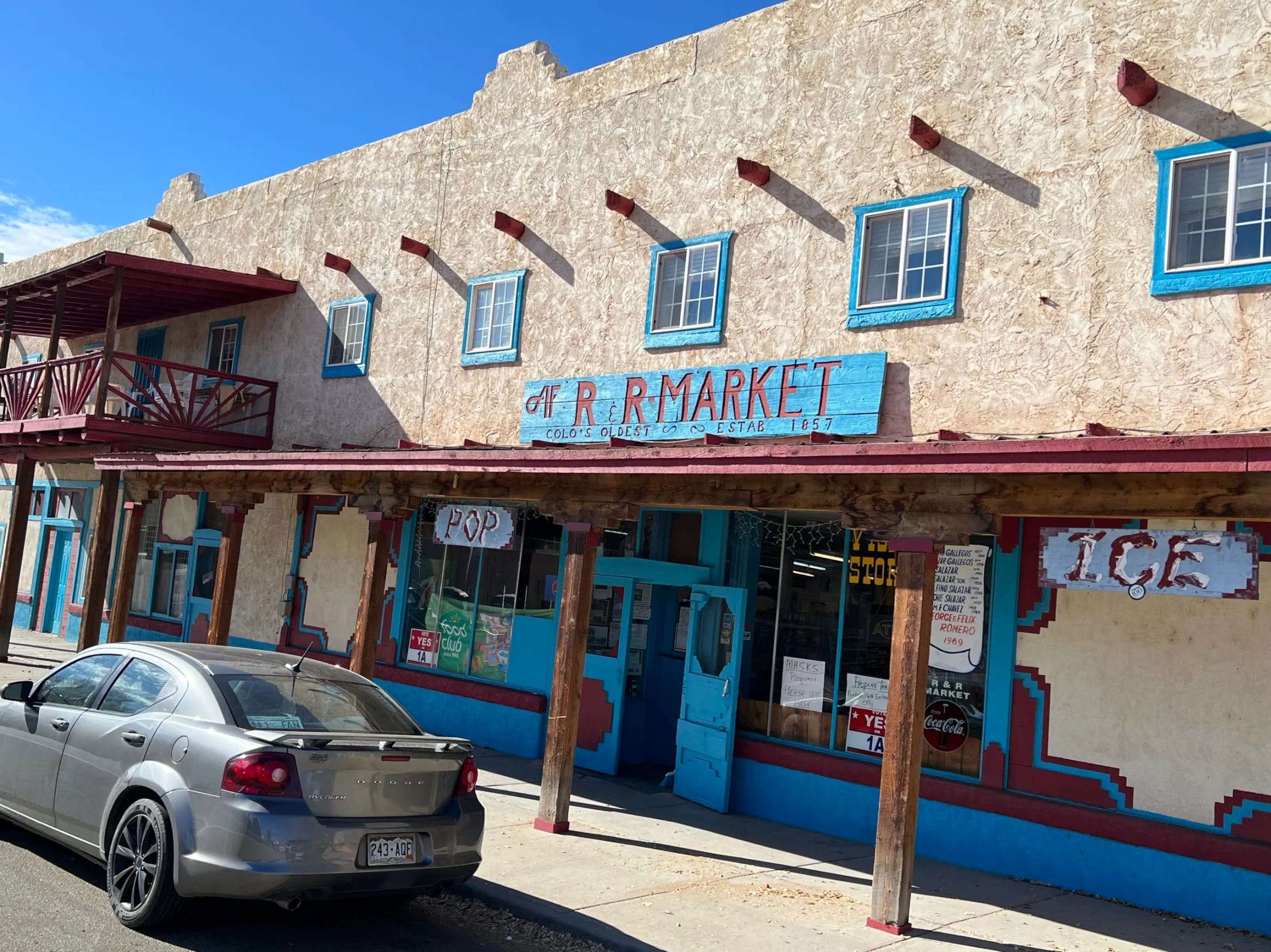
The initiative “Growing a Healthy Community Foodscape, Food System & Food Economy for the Culebra River Acequia Communities” was awarded the funding over a two-year period. The most immediate work and initially most visible part of the effort is to finalize purchase of the R&R Market in San Luis and continue with its restoration and upgrade which has started through other grants.
Devon Peña. Photo credit: The Alamosa Citizen
The bold and comprehensive strategy includes:
Establishing a Food & Community Revolving Credit Association (RCA) that provides zero percent interest credit to local agriculture and food producers.
Creating a Milpa/Molino/Masa harina Marketing Collaborative that assists acequia farmers in transitioning from cow and alfalfa reliance to an “agroecosystem that includes growing traditional non-GMO corn and associated companion crops.” The farming effort involves producing companion plants like beans (bolita, fava), squash, cauliflower, broccoli, kale, chard, spinach, beets, and other crops that are part of the region’s traditional and healthier adopted diets, according the prospectus for the grant.
Integrating youth and young adults into all of the stages of the collaborative through the Move Mountains Youth Leaders Partnership which supports young people (teenagers and young adults through their 30s) in growing food for elders and families; participating in the design and operation of the grocery and community food center; and developing their own food production and value-added food enterprises, among other youth-led efforts.
“The underlying objective of this project,” said Peña, “is to improve long-term community health through a resurgence of food sovereignty by reviving and strengthening the local agri-food system, rebuilding our polyculture agroecosystem traditions, unleashing the creativity and commitment among our youth and younger adults by participating in and establishing a set of local institutions to generate and keep our agriculture-generated wealth in the community.
“What concerns us is that our county also has some of the highest rates of obesity and diabetes in Colorado. According to one recent report, 25.4 percent of the population in Costilla County is obese while 41 percent is overweight (Costilla County Public Health Agency 2018), more than twice the statewide rates. The same report indicates that 13.3 percent of the Costilla County population is currently diagnosed with diabetes compared to the Colorado rate of 5.6 percent. Among epigenetic factors, diet is strongly associated with emergent conditions like diabetes and cardiovascular illnesses. The evidence suggests community health and well-being in the acequia villages are casualties of the enclosure of the common lands and the dramatic long duration effects including the diminishment of our food sovereignty and healthier heritage foodways.”
It’s a heady effort that now has major investment from the state’s largest health foundation. The Colorado Health Foundation grant to The Acequia Institute announced Tuesday is among the single largest grants awarded to a San Luis Valley non-profit organization and community.
San Luis garden. Photo credit: The Alamosa Citizen
Other notable recent awards include a 2020 Great Outdoors Colorado $1.9 million grant to SLV Generation Wild through the city of Alamosa, and a $2.3 million RISE grant from the state of Colorado to a group of nonprofits working with Adams State on youth development. Antonito, also this week, received a $1 million grant from the Colorado Office of Economic Development & International Trade to restore the S.P.M.D.T.U., Sociedad Protección Mutua de Trabajadores Unidos building, on its main drag.
“Support for this initiative will increase food sovereignty and security while strengthening the local agriculture-food system in Costilla County,” the Colorado Health Foundation said in its award letter. “Local agriculture traditions will be rekindled, the San Luis grocery store will be renovated and expanded, a new commercial kitchen will increase production of local value added foods, and youth will reconnect to the land, acequias, and healthy food while developing skills that will support them to remain in their villages and secure employment.”
The youth component may be the most challenging of The Acequia Institute’s strategy. Like other communities in the San Luis Valley, San Luis struggles to keep its youth in the community and to find a next generation to maintain and sustain operations.
This past summer teen farmers, as part of a trial run for the grant, were paid $15 per hour to grow and maintain a one-acre garden. For the summer of 2022 the program will pay $17 per hour. Scholarships, training and internships in trade specialties needed in the agricultural community, an emergency fund for youth and young adults, and a paid staff member for counseling services are all part of the youth efforts under the grant.
“We still face the challenge of the next generation,” Peña said. “So we’re already working on youth leader development.”
Originally from Laredo, Texas, Peña first came to San Luis in 1984 as an assistant professor for Colorado College in Colorado Springs. A few years later, while on a field trip with Colorado College, he met the late Costilla County Commissioner Joe Gallegos who invited him to get involved with San Luis.
It was with Gallegos’ nudge that Peña started to more intently learn about the acequia farming system, the issues of Costilla County, and the plight of the land. In 2005 Peña established The Acequia Institute, and by 2007 he continued his transition by spending at least half his time living in San Luis while also teaching at the University of Washington in Seattle, a position he still holds. Only now he resides full-time in the outlying area of San Francisco, a few miles east of the town, where he’s neighbors as the country roads go with Costilla County’s two world-renowned artists, sculptor Huberto Maestas and muralist Carlos Sandoval.
“My proudest accomplishment is helping the land heal,” he said. “That’s what I’m most proud of is repairing the damage to the land.”
Cottonwoods and willows have come back along the river corridor through a conservation easement that was put in place. The feeling of neighbors looking after each other, whether it’s through growing and sharing food, or learning new ways to do business in a technology-driven society, has San Luis and Costilla County looking ahead.
While the state of Colorado commonly refers to San Luis as the oldest town in the state, Peña has flipped it by saying San Luis is the “last town in Mexico, not the oldest in Colorado.” It’s his way of recognizing the land history of Costilla County and forcing a different interpretation of San Luis as he and The Acequia Institute work to re-establish its cultural heritage to the land and farming system.
He promises accountability and transparency to the San Luis community with the health foundation grant, and said he won’t draw a salary for the work because he’s already paid well through his professor work at the University of Washington.
His persistent rap about San Luis, work of The Acequia Institute and efforts to highlight the plight of local farmers, and his willingness to challenge traditional power structures of the San Luis Valley which he says have worked against San Luis and its interests, has won him audiences and influence.
National Geographic recently featured the community, and a grocery chain is expressing interest in carrying food grown through the program as part of its store offerings.
“The goal is to address community health through making good, fresh healthy food,” said Peña, and then making it available beyond San Luis and the R&R Market. He’s purchased two corn mills so that corn grown by the farmers can be turned into tortillas which can then be offered with other fresh food efforts locally.
The Revolving Credit Association (RCA) is the key to the plan, “the operational heart and soul of the entire project as it revives the soft infrastructure of our cultural heritage including the solidarity norms expressed in our acequia associations, land grant councils, and mutual aid and cooperative labor traditions and institutions,” according to the project prospectus.
Peña has patterned the RCA after the S.P.M.D.T.U., a Society for the Mutual Protection of Workers popular in the early 1900s to protect Hispanic property rights and fight discrimination. He sees the model as fitting for the type of rebirth of the community farmer that the project envisions.
The plan relies on local farmers committing one acre of their land for community growing, with a goal of 20 farmers participating in the effort. Over time the project is shooting for 1,000 acres set aside for community purposes out of the 23,000 acres of acequia irrigated farm land in the southern half of Costilla County.
It gets back to the community eating healthy with the assistance of local growers. “We are just as responsible as anyone for the failing health of our communities,” Peña said.
Of the request for farmers to set aside an acre for community purposes, Peña said, “We’re very happy with the response of the farmers around here.”
His role, he said, is to bring resources into the community and then to let community leaders like Shirley Romero-Otero and others take over.
“Colorado Health Foundation thinks we’re on the right track,” said Peña.
Indeed it does.
Selection of the 2015 native heirloom maize harvest of the seed library of The Acequia Institute in Viejo San Acacio, CO Photo by Devon G. Peña
After five long years of discussion and negotiation, the Colorado River states and the federal government agreed in May 2019 to a Drought Contingency Plan to help protect the river system from the worsening effects of drought and over-use.
On December 15, the Lower Basin States and their partners in the water-using community took a further step to help keep Lake Mead from descending to dangerous levels, agreeing to plan to leave at least 500,000 acre-feet of water in the reservoir above their DCP commitments in 2022 and 2023.
And they managed that agreement after less than four months of negotiation.
The agreement, known as the “500+ Plan” aims to add 500,000 acre-feet of additional water to Lake Mead in both 2022 and 2023 by facilitating actions to conserve water across the Lower Colorado River Basin. The additional water – enough water to serve about 1.5 million households a year – would add about 16 feet total to the reservoir’s level, which continues to reach record low levels.
Together, water agencies in California, Nevada and Arizona and the Bureau of Reclamation committed to investing up to $200 million in projects at Lake Mead over the next two years.
Following the signing of a Memorandum of Understanding, Arizona Department of Water Resources Director Tom Buschatzke noted the remarkable sense of urgency to get the job done among the participants.
“Our work on the 2019 DCP took more than five years to complete. This commitment to work together to stabilize Lake Mead came together in a matter of a few months,” said Director Buschatzke. “That alone is a powerful testament to the commitment of the Lower Basin States to work together with our partners at (the Bureau of) Reclamation to protect this vital river system.”
Under the terms of the MOU signed during the Colorado River Water Users Association’s annual conference, ADWR commited up to $40 million to the initiative over two years, with the Central Arizona Project, the Metropolitan Water District of Southern California and the Southern Nevada Water Authority each contributing up to $20 million. The federal government plans to match those commitments, for a total funding pool of $200 million.
Some of the specific conservation actions and programs that will be implemented through the 500+ Plan have already begun, while others are still being identified. The MOU includes conservation efforts in both urban and agricultural communities, such as funding crop fallowing on farms to save water, including the recent approval of a short-term agricultural land fallowing program in California, or urban conservation to reduce diversions from Lake Mead.
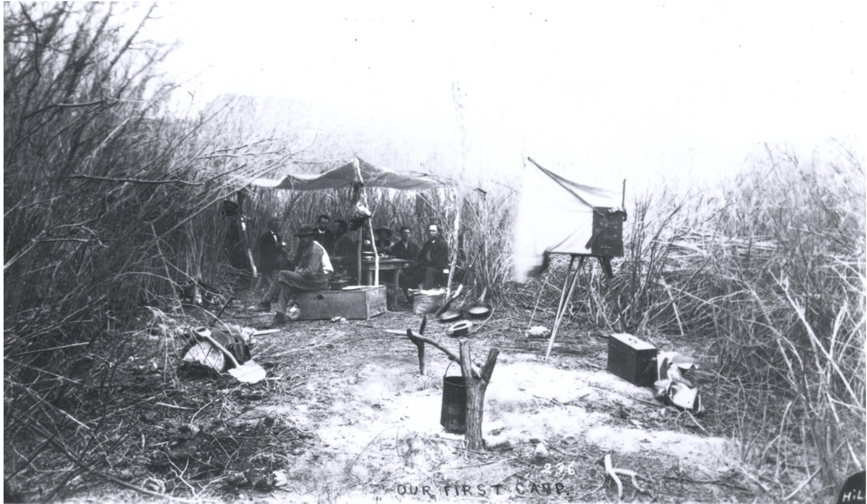
The camp and cooking setup for the second expedition (pictured) was likely very similar to the first expedition and consisted of a few pots and pans to cook over a fire. May 4, 1871. (Credit: E.O. Beaman. Public domain.)
On May 24th, 1869, the ten men of the Colorado River Exploring Expedition stood at the banks of the Green River in Wyoming prepared to enter into a region of the United States known only as “unexplored territory.” The expedition was to enter into the “Great Unknown,” take scientific measurements, chart the region, and effectively complete our nation’s maps. To John Wesley Powell, unexplored territory was unacceptable and unknowns were opportunities for greater understanding. Powell and his crew traveled over 900 miles from Green River, Wyoming to the mouth of the Virgin River, in present day Lake Mead, through a wild, largely uninhabited system of river canyons. The West was a new and final frontier, ripe for development and lacking only a system for the manipulation of the Colorado River’s water, a subject Powell addressed in his “Report on the Lands of the Arid Region of the United States”. By erasing empty space and, in turn, leaving only defined place, Powell’s journey fueled a western migration that continues today.
The unexplored territory of 1869 through which the Colorado River Exploring Expedition was the first to travel in a continuous, deliberate progression continues to be explored by adventurous boatmen and boatwomen. Powell’s unknown has become a highly visited, studied and managed environment encompassing five states, two U.S. Forest Service units, three Bureau of Land Management field offices, three U.S. Bureau of Reclamation reservoirs, two U.S. Fish and Wildlife Service refuges, and five Nation Park Service units The Colorado River Basin also continues to support indigenous groups in five Native American reservations.
In many ways, experiences similar to those of the Colorado River Exploring Expedition are available through the stewardship of public land management agencies. However, our perception of place and the resulting relationship to the environment of the arid West are easily distinguished from Powell’s time. The Colorado River Exploring Expedition embarked from Green River, Wyoming armed with “two sextants, four chronometers, a number of barometers, thermometers, compasses, and other instruments” (Powell 1875, pg. 8) and began a process of complete geographic, geologic, and topographic surveys of the American West. The linear progression of the systematic and methodological utilization of water resources— a process commenced by Powell’s surveys of the arid region of the United States—has led to a contemporary Great Unknown, one in which we have inherited a system of management built upon incomplete scientific knowledge and techniques better applied in more humid regions. This system has begun to show weaknesses and has forced reactive management as pressures increase from climatic uncertainties, increased populations, compact obligations for water allocations, and most recently a move to privatize 640 million acres of public lands. Today, nearly 150 years after Powell, a methodological lineage exists between his systematic inquiry into the unexplored territory of the arid West and the complex plumbing of the modern Colorado River system that supports over 40 million Americans through storage reservoirs, irrigation, and transbasin diversions.
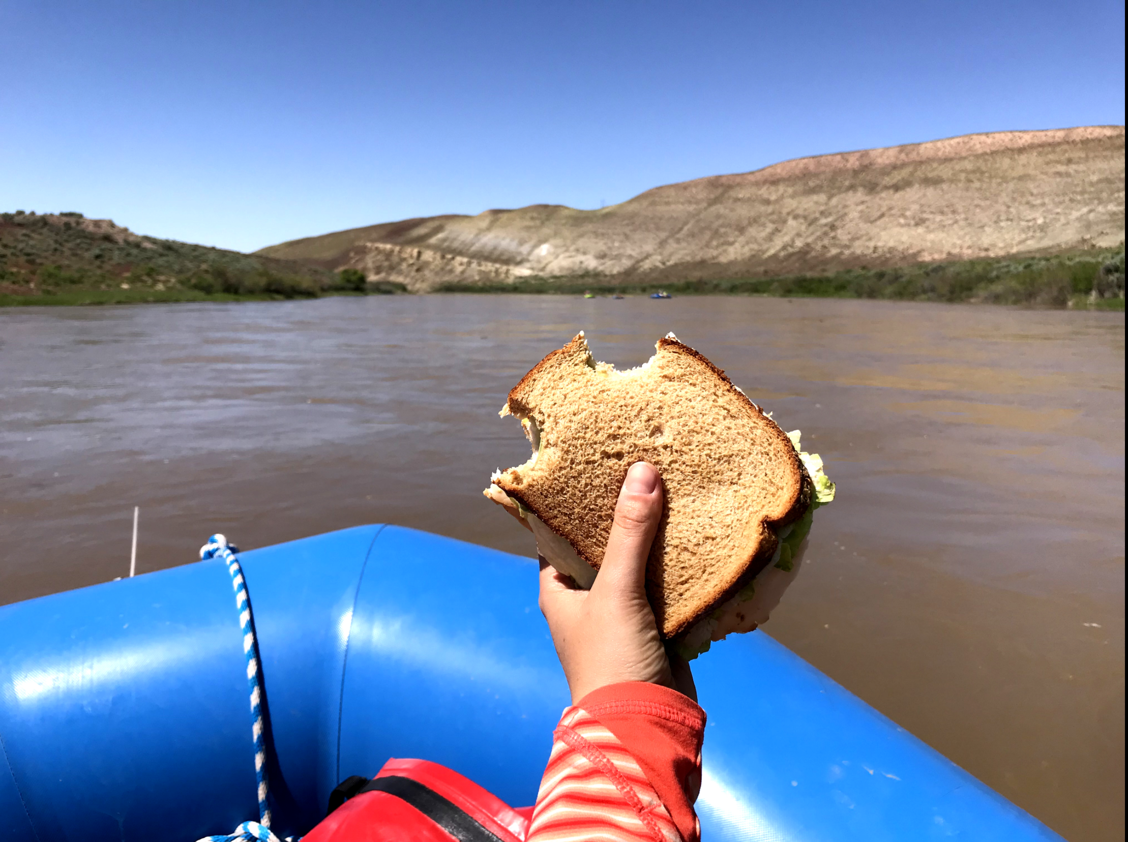
Powell 150 Expedition – sandwich Lunch was usually a sandwich packed in the morning, but with great scenery. Photo credit: USGS
The 150th anniversary of the Colorado River Exploring Expedition offers an opportunity to once again begin a systematic and deliberate expedition into the unexplored territory of Western economies, politics, and ideologies as they relate to the water resources of the Colorado River Basin. Powell was able to travel through a continuous, natural riparian ecosystem. This experience is no longer possible, as the system is now separated into two basins, with three major dams, 15 management areas, and over 20 significant laws governing the allocation of Colorado River water. Because of these major differences, this expedition is not a reenactment of the past, but rather a re-envisioning of our future that engages traditional, historic, and contemporary river ecosystem perspectives to derive proactive management strategies, integrating community values, science, and humanities through an analysis of culture, informed management, and traditional ecological knowledge.
San Luis People’s Ditch March 17, 2018. Photo credit: Greg Hobbs
In the Río Culebra Villages of arid, desert southern Colorado, el agua es vida: Water is life.
The crux of ranching and farming is snowmelt and any supplemental rain. Natural waterways wind from the canyons through the desert terrain. The acequia system taps into these creeks and streams with a series of earthen and concrete-lined ditches that bring water to fields. Dug by settlers in the mid-1800s, acequias are physically cleaned, repaired and maintained by water rights holders. Today, many of those people are descendants of area settlers.