Click the link to read the newsletter on the CoCoRaHS website. Here’s an excerpt:
The Wild Rollercoaster We Call “Spring”
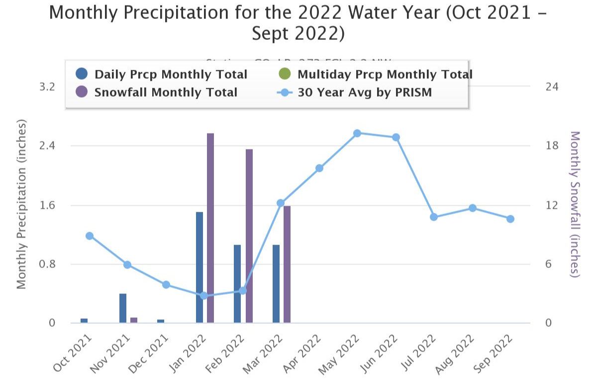
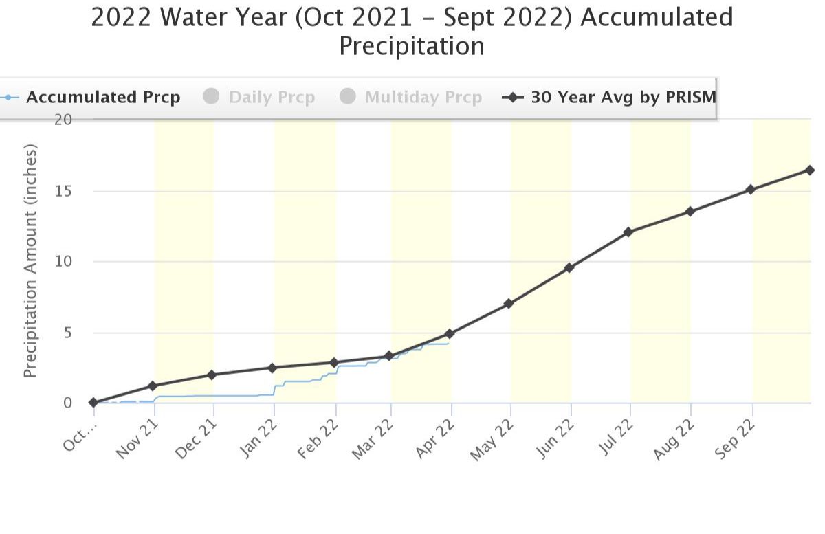
March has been living up to expectations. When I started writing this more than two weeks ago the midday temperature here in Northern Colorado was hovering near +10 F (~ -2C) and snow was tumbling down. Now that we’re eight weeks past Groundhog Day we’re in the 70s. Day to day weather changes this time of year in the middle of North America can be huge. After our mild and nearly snow-free fall and early winter, we have had plenty of cold and snow. In fact, we’ve now received over 45 inches of snowfall since December 31 and nearly double our average precipitation for that time period as well (as of mid-March). As you can see from this graph, we are now back up to average after five+ months of the 2022 water year as we move into our wetter seasons of the year…
Yesterday there were furious wildfires in portions of TX, OK and NM as well as major dust storms. Severe thunderstorms are rumbling into the Mississippi Valley. And in the Upper Great Lakes area it probably still felt a lot more like January than spring. What comes next? Well, that depends on where you are. For our southern states, the last bites of winter are about done. And for those of you who happen to be in the Bahamas, Hawaii, Puerto Rico, the US Virgin Islands, and the Florida Keys – we know your song – ‘Winter? What’s that?” But for areas farther north or higher in elevation there can still be several more weeks that look and feel a lot like winter – except, of course, for the ever-longer daylength. The old saying that goes “As the days grow longer, the storms grow stronger” just may be true. For the next several weeks as the transition from winter to summer progresses, be ready for just about anything – especially in the battle grounds between north and south where airmasses duke it out.