
Click the link to read the article on The Durango Herald website (Scout Edmondson). Here’s an excerpt:
February 26, 2026
Last week, Southwest Colorado saw enough snow to cancel school and snarl travel. A week later, winter appears to have vaporized – replaced by clear skies, dry roads and temperatures warm enough for sandals and T-shirts. According to the National Weather Service, high temperatures in Durango reached 63 degrees Thursday. It is the latest episode of weird winter weather this year. Jonathan Harvey, an associate professor of geosciences at Fort Lewis College, said in an email to The Durango Herald that winter’s absence is because of stubborn high-pressure ridges steering the jet stream – a belt of fast-moving winds that separates warm tropical air to the south from cold arctic air to the north – toward the northern United States.
“We have spent most of the winter under a ‘ridge’ in the jet stream, which has prevented cold air and storms from hitting our region,” he said.
That, according to National Weather Service forecaster Lucas Boyer, is because of warm seawater temperatures in the Eastern Pacific Ocean.
“We’ve had ample warm water in the in the Eastern Pacific for a lot of the winter,” he said. “We’ve really seen the jet stream get pushed north, which means warm air to the south. It’s been really devastating for any kind of snowfall production.”
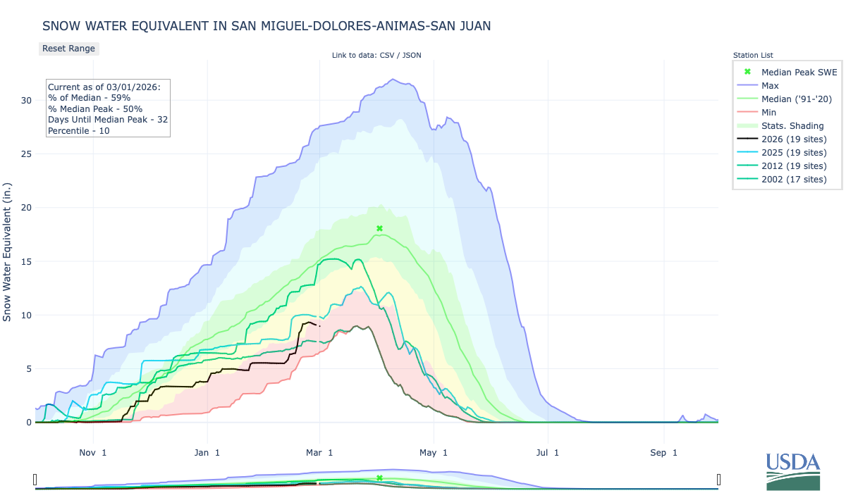
Boyer said any storms that have managed to break through that high-pressure ridge were followed by periods of temperatures 10 to 15 degrees above the historical average…The warm, dry winter has hurt snowpack in the San Juan Mountains. Boyer said the water equivalent in the San Juan River Basin is at 17% of the historical median, while the snowpack in the San Juan Mountains is 40% to 50% of average. Unfortunately, Harvey said there is not much time left for mid-elevation snowpack. But, there is still time for high-elevation snowpack.
