Federal Water Tap, March 2, 2026: Reclamation Outlines Options to Prop Up Shrinking #LakePowell — Brett Walton (circleofblue.org) #ColoradoRiver #COriver #aridification

Click the link to read the article on the Circle of Blue website (Brett Walton):

The Rundown

  • Interior Department overhauls its environmental review procedures.
  • GAO says NOAA, which has oversight authority, should do a better job of tracking cloud seeding and other weather modification.
  • Senate passes a bill to allow southern Nevada’s water authority to build a water-supply pipeline beneath a national conservation area.
  • EPA staff decreased 7 percent in the nine months through June 2025, GAO found.
  • Army Corps directive aims to speed up infrastructure work, prioritize projects.
  • House Democrats from the D.C. region ask Congress to fund the repair of a major sewer pipe break.

And lastly, Bureau of Reclamation officials outline options for propping up a shrinking Lake Powell.

“I think it’s safe for us to assume that unless Mother Nature is uncharacteristically generous, that Lake Powell elevations are going to fluctuate at elevations that we’re not comfortable with.” – Wayne Pullan, Bureau of Reclamation Upper Colorado regional director, speaking about the possibility that Lake Powell drops low enough later this year that Glen Canyon Dam cannot generate hydropower.

In context: Two-Decade Hydropower Plunge at Big Colorado River Dams

By the Numbers

7 Percent: Decrease in EPA staff between September 2024 and June 2025, according to a Government Accountability Office audit.

10: States that have weather modification programs, typically cloud seeding to induce rainfall, according to a GAO report.

News Briefs

Interior NEPA Changes
The Interior Department overhauled its environmental review procedures, aligning them with recent court decisions, congressional action, and Trump administration priorities.

The final rule sets page limits (150 pages in most cases, up to 300 for actions of “extraordinary complexity”) and time limits (generally two years) on environmental impact statements.

The new rules do not require public comment on draft environmental impact statements. The only mandatory opportunity for public comment is after the department issues a notice that it intends to prepare an EIS.

Reviews already in progress, those with “applications that are sufficiently advanced,” will be held to the previous standard.

Illustration from the report, “Antique Plumbing & Leadership Postponed” from the Utah Rivers Council,
Glen Canyon Institute and the Great Basin Water Network. Courtesy of Utah Rivers Council
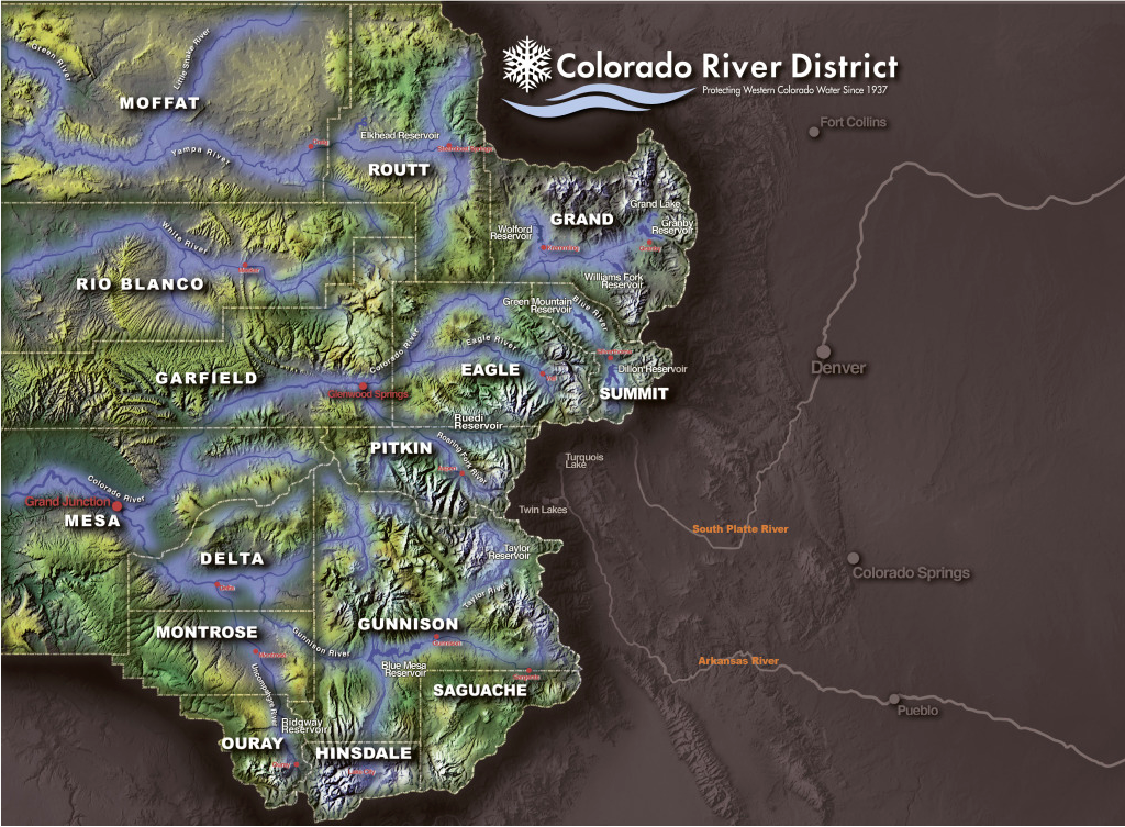
Lake Powell Options
Officials at the Bureau of Reclamation, the federal agency that manages Colorado River dams, outlined several actions they are considering in the coming months to boost water levels in a rapidly shrinking Lake Powell, which could drop to a record low later this year that would halt hydropower production from Glen Canyon Dam for the first time.

The Colorado River’s second-largest reservoir behind Lake Mead is entering one of the most difficult periods in its six-decade history. The basin is drying due to a warming climate. Powell is just a quarter full, and projected to drop lower this year. Winter has been a dud, with warm temperatures and a historically bad snowpack in the Colorado mountains that feed into the reservoir.

Reclamation officials discussed their options during a meeting last week of the Glen Canyon Dam Adaptive Management Work Group, an expert committee that advises on the dam’s ecological impacts.

2024 decision allows Reclamation to “consider all tools that are available” to keep Powell from dropping below 3,500 feet, an elevation that provides a little wiggle room for maintaining hydropower production. Powell today sits at 3,531 feet.

The tool from the 2024 decision is Section 6(E), which grants Reclamation the authority to restrict water releases from Powell to as low as 6 million acre-feet. The planned release this year is 7.48 million acre-feet, so the Section 6(E) authority represents a potential 20 percent reduction.

A cut of that magnitude might not be necessary because Reclamation has another tool it can use in tandem.

That option is releasing more water from Flaming Gorge and other smaller reservoirs located higher in the watershed. This is called a DROA release after its authorizing document. Pullan said this action, which states in the lower basin are advocating for, is being discussed and the volume of those releases would be determined in the spring, around April or May.

In context: Big Decisions Loom for a Rapidly Shrinking Lake Powell

Southern Nevada Water Pipeline
The Senate passed a bill that allows southern Nevada’s water provider to tunnel beneath Sloan Canyon National Conservation Area in order to build a pipeline to increase the water-supply system’s reliability. The bill now goes to the president’s desk.

Studies and Reports

‘Army Mode’ for the Army Corps
Adam Telle, head of the Army Corps of Engineers, issued a collection of directives aimed at reducing paperwork and speeding up water infrastructure construction.

In one memo, Telle called for an “Army Mode” mobilization. He ordered a bottom-up approach whereby officials will select at least 20 projects nationally to prioritize. The list is due March 20.

A separate memo lists seven focus areas for infrastructure work. In descending order of importance: human life and safety, economically or strategically important infrastructure, efficient navigation and supply chains, human property, aquatic ecosystems, state-level infrastructure, and municipal infrastructure.

In yet another memo, he said that project investigations – part of the planning phase – should take no more than three years and $3 million.

Cost of Natural Hazards for the Defense Department
The Defense Department lacks data to understand fully the costs of natural hazards to its installations, according to a Government Accountability Office report.

The GAO made five recommendations, including resilience planning, data collection standards, guidance, and procedures. The Defense Department agreed with all of them.

Weather Modification
The GAO also looked into NOAA’s tracking of activities to induce rainfall or otherwise change the weather.

Thanks to a 1972 law, NOAA has oversight authority over weather modification and any entity that shoots silver iodide into clouds to make it rain is required to file a report with the agency. Solar geoengineering, which attempts to reduce air temperatures, is far less common but also covered under this authority.

The GAO found that NOAA’s database is incomplete, inconsistent, and unreliable. One fifth of interim and final reports had at least one error, the GAO estimates.

“Consequently, NOAA is not fully aware of the extent of weather modification activities that have occurred and are occurring within the U.S., how they are being conducted, or potential effects,” the GAO concluded.

On the Radar

How to Sue the EPA
The EPA is proposing to change the process for filing citizen lawsuits, moving from mail delivery to electronic submissions.

Public comments are due March 26. Submit them via http://www.regulations.gov using docket number EPA-HQ-OGC-2024-0557.

Water Infrastructure Funding
In the wake of a large-diameter sewer line rupture along the Potomac River, House Democrats from Maryland, Virginia, and the District of Columbia wrote to leaders of the House Transportation and Infrastructure Committee asking for funding for repairs.

The letter also asked for the Army Corps of Engineers to prioritize a study of a backup drinking water source for the capital region, which relies on the Potomac.

“Unlike other major metropolitan areas, the region lacks a secondary water supply, which would provide critical redundancy in the event of a future crisis.”

Federal Water Tap is a weekly digest spotting trends in U.S. government water policy. To get more water news, follow Circle of Blue on Twitter and sign up for our newsletter.

Map of the Colorado River drainage basin, created using USGS data. By Shannon1 Creative Commons Attribution-Share Alike 4.0

How much water remains in aquifers of SE #Colorado? — Allen Best (BigPivots.com)

Corn in Baca County. Photo credit: Allen Best/Big Pivots

Click the link to read the article on the Big Pivots website (Allen Best):

February 28, 2026

Study being completed will help guide decisions about continued mining of groundwater in the Springfield area. Ogallala will be gone within 20 years, but deepest formation could last a century.

Before center-pivot sprinklers powered by rural electrification in the mid-20th century, farmers in Colorado’s southeastern corner necessarily relied upon what came from the sky for water. HIgh-capacity pumps, first used in the Springfield area during the late 1940s allowed the farmers to go underground, to more lucratively plumb a series of aquifers and deliver far-higher crop yields.

The Ogallala — also called the High Plains — is the water-bearing geologic formation nearest the surface, followed by the more water-rich Dakota and Cheyenne formations. Underlying both is a far larger reservoir yet called the Dockum Group.

How long will that water last? A new report commissioned by Colorado, still in rough draft stage, finds that a little more than 2,000 wells mine these formations in Baca County and a portion of adjoining Prowers County. The vast majority of the water, 97%, irrigates alfalfa, corn and other crops. Remaining water goes to hog farms, stock ponds, and domestic wells for farmhouses as well as municipal supplies in Springfield and several even smaller towns.

An average 157,000 acre-feet were mined annually from these subterranean deposits from 2020 through 2024. To put that into perspective Denver Water delivers an average 232,000 acre-feet to the 1.5 million residents in Denver and adjoining jurisdictions.

The answer to the question about how long the water will last has not been fully answered. At current rates of pumping, the Ogallala will be gone by 2045, according to this draft study. The next two deeper formations, Dakota and Cheyenne, have been depleted more rapidly but have more water.

The deepest water, in the Dockum, could last a century or more. It depends partly on the quality of water extracted at greater depths. There seem to be some unknowns about this. Cost of extraction is also a factor. Deeper wells cost more money to drill. It also takes more electricity to pump water to the surface. Would crop prices justify the added expenses?

Pueblo can be seen in the upper left-hand corner of this map, and the southern high plains district is designated by lavender.

With those asterisks in mind, the study estimates nearly 33 million acre-feet of water can be economically recovered from the four water-bearing geologic formations in that southern high plains groundwater district.

On average, Colorado consumes 5.3 million acre-feet of water per year, although some of that water gets reused. Think of runoff from farm fields or treated sewage that reenters streams and rivers. When that is added up, Colorado’s total diversions hit 15.3 million acre-feet. This southern plains basin bordering Kansas and Oklahoma is just a small part of Colorado.

Unlike Colorado’s rivers, which are mostly derived from snowmelt and rainfall, the groundwater recharges but much more slowly than the extraction. This study estimates an annual recharge of 32,000 acre-feet compared to the 157,000 acre-feet withdrawn.

Apart from the river valleys, dryland areas of southeastern Colorado were among the last places homesteaded in Colorado. First came the settlements of Denver, Colorado Springs, and Boulder with their access to water from the mountain streams and rivers and proximity to the mountain mining camps. Very quickly, water was diverted to create farms.

Homesteading of the high plains began about 30 years later. By then, the buffalo were gone, and the last battle with Native Americas had occurred in 1869 at Summit Springs. Settlement near Springfield, Walsh and other Baca County towns continued through the 1920s. Peak settlement occurred in about 1930, before the weather turned hotter and drier and the skies filled with dust. Baca County during the decade of the Dust Bowl and the Great Depression lost more than a third of its population.

Baca County since then has continued to lose population as farm sizes have grown. While groundwater extraction has provided a modicum of prosperity, the county ranked 57th among Colorado’s 64 counties in per-capita income as of 2022.

The hydrogeology that is believed to exist in this basin can be seen in this west-east profile. Some formations, including the Graneros and Kiowa shales, contain no water and act as barriers.

The Colorado Ground Water Commission — created in 1965, before groundwater became a common word — has legal purview over extraction. The commission can set limits on the allowable rate of depletion.

The southern high plains district limits new wells within a half-mile of existing high-capacity wells. But it is still possible to get a permit for a new well. That is in dispute. Some think the basin needs to be “closed,” to bar future wells and hence prolong the life of the aquifers.

Cimarron River Basin. By Shannon1 – Drawn by myself; shaded relief data from NASA SRTM North America imagery here, CC BY-SA 4.0, https://commons.wikimedia.org/w/index.php?curid=12115861

This groundwater basin in southeastern Colorado is very different from the Republican River Basin of northeastern Colorado in one crucial way. The aquifers do not deliver water to a river subject to a multi-state compact. The Cimarron River nicks the extreme corner of Colorado, but testimony to the poverty of water in this “river” is provided by those traveling to Santa Fe in the 19th century. Nearly all followed the Arkansas River, not the Cimarron, despite the latter route being much shorter.

In contrast, a compact struck in 1943 governs flows in the Republican River. It arises far from Colorado’s mountains and is instead nourished by water seeping out of the Ogallala in places like Holyoke and Yuma and Burlington. Mining of groundwater in the basin to grow crops reduced flows to the extent that Kansas sued Nebraska, which in turn sued Colorado. Now, farmers in the basin are trying to reduce their withdrawals by voluntary retirement of 25,000 acres from active irrigation. The 19,000-plus acres retired so far have been induced by financial incentives that tap federal but also state funds.

Without a compact to force reduced pumping in southeastern Colorado, the state can adopt its own rules.

Residents of southeastern Colorado appear to be somewhat conflicted about whether new rules governing withdrawal are needed and what they should look like. Baca County’s Herald Plainsman in March 2023 reported on a “highly charged” meeting in Springfield called by the state’s Division of Water Resources. Tracy Kosloff, the deputy state engineer, explained that a group from the community had requested a rule change in the previous year.

Their intent was to block the issuance of new permits for high-capacity wells. Kosloff asked for the community to come to a consensus, if possible.

No consensus was evident at that meeting. at least according to the Plainsman Herald report. One speaker said that “without high-capacity wells, there will be no people left in the county.” Tim Hume, who is the region’s representative on the Colorado Ground Water Commission, said that without irrigation, two thirds of the people in the room would not be there. He also noted that one of the 67 monitoring wells had actually shown higher levels in the previous 20 years. But another speaker, Jack Dawson, said to keep irrigation going for quite some time, there was a real need to start conserving water.

With aid of a special $250,000 appropriation by state legislators, the Division of Water Resources commissioned a study by Wilson Water Group and HRS Water Consultants to provide new estimates of how much water remains that can be recovered economically. These consultants are also creating a planning tool to allow groundwater basin users to evaluate future groundwater use scenarios.

At a meeting scheduled for March 16 in Springfield, the consultants hope to glean insight from farmers about what constitutes economically viable extraction. How deep into the Dockum can they go and hope to be able to make money? How much water treatment is required and feasible? The big question is whether new rules will be needed to limit extraction.

Also to be determined are the goals under future conditions. How fast should the groundwater be mined? Or should there be limits beyond those few already in place?  The consultants are to submit a final report before the end of 2026.

What comes of this new knowledge? It’s possible — maybe even likely — that some residents of southeastern Colorado will then file a petition with the Colorado Ground Water Commission to adopt new rules restricting extraction. This study sets up the facts for helping make that decision of whether to do so, and if so, how.

The draft study says a range of viewpoints can be expected. Some stakeholders will favor the status quo. Others might favor restricted pumping from specific aquifers or even from new wells, conceivably all wells. Expansion of irrigated acreage cold be curbed — although in some cases land has been taken out of irrigated production already.

Also relevant is the shifting climate. The study mentions climate change just once, noting that hotter or drier conditions may occur in 50 years, affecting crop irrigation requirements. Already, however, the hotter temperatures of southeastern Colorado cause crops to need a third more water than those grown 200 miles north.

The most direct parallel to a ban on new wells in southeastern Colorado would be a similar ban on new wells in the upper Crow Creek drainage northeast of Greeley near the Wyoming border. The alluvial, Fan and White River aquifers within the designated basin were declared over-appropriated effective April 14, 2017.

Hydrogeology of Colorado’s southeastern corner has been studied several times. First was a studyby the U.S. Geological Survey in conjunction with the Colorado Water Conservation Board completed in 1954. It recorded springs and creeks and pumping from wells for house and towns and stock ponds, with some of the records gleaned by New Deal workers in the 1930s. It made no attempt to quantify groundwater storage volume. Aquifer mining was non-existent in that area as high-capacity pumps had been created less than a decade before.

1967 study by R.W. Beck and Associates did attempt to quantify the groundwater resources. It estimated that groundwater extraction of 13,200 acre-feet in 1950 had grown by 1964 to 118,700 acre-feet.

The study projected that groundwater extraction in the basin would grow to 276,000 acre-feet by 2017. It is somewhat less. That study also projected that population of Baca County would grow to 4,700 by 2017. Actually, it declined to 3,500.

That study made no mention of the Dockum, the formation now believed to have the most water, based on well logs and other lines of evidence.

That study also recommended creation of a groundwater management district to assist in “development” of the extraction. That district was created.

Southeastern Colorado’s groundwater was also part of a six-state study of the Ogallala Aquifer in 1983.

Most recent were two related reports in 2002 by McLaughlin Water Engineers. This new study differs in a substantial way in that it uses data deeper than the 200 feet of the Dockum and hence increases the volume of water that may potentially be extracted. It also employs newer tools to figure out what exactly is going on down there in the dark, although exactly how much sharper insight this report delivers is not yet clear.

The Division of Water Resources also has conducted three studies in this century that define a steady but not dramatic decline of the aquifers in southeastern Colorado.

See Updated Southern High Plains Groundwater Study Draft Report and Planning Tool at the High Plains Study website.

Colorado River District Responds to the Bureau of Reclamation’s Proposals for Post-2026 #LakePowell and #LakeMead Operations #ColoradoRiver #COriver #aridification

Colorado River District land area.

Click the link to read the release on the Colorado River District website (Lindsay DeFrates):

March 2, 2026

Last week, the Colorado River District submitted comments and specific recommendations to the Bureau of Reclamation on the recently released Post-2026 Operational Guidelines and Strategies for Lake Powell and Lake Mead Draft Environmental Impact Statement (DEIS). In its comments, the River District calls for future operational decisions that reflect hydrologic realities, address Lower Basin overuse, and move the Colorado River System beyond constant crisis management.

“A core part of our mission is safeguarding, for all Coloradans, the waters of the Colorado River to which our state is entitled under the various laws, agreements and compacts that govern the river,” said Raquel Flinker, Director of Interstate and Regional Water Resources at the Colorado River District. “Our water users have adapted to the reality of variable hydrology. We are living with a river that has 20% less water and this trend is expected to continue. It is past time that our neighbors in the Lower Basin learn how to live within the means provided by the river.”

“What is very clear in these proposals is that we still have a basic math problem,” said Colorado River District General Manager Andy Mueller. “Every year, around 1.5 million acre feet of Colorado River water disappears due to evaporation and transit loss in the Lower Basin, yet this amount is unaccounted for in the Bureau’s water deliveries. If we want to move out of crisis response mode, every proposal must begin by reducing consumptive use in the Lower Basin by this amount every single year before discussing shortages. If we had fixed the math to align with the laws of nature twenty-five years ago, we would have almost 30-million-acre feet of storage still available in the system today.”

The River District’s letter includes 13 specific recommendations organized around several key themes. First, it calls for post-2026 operations that align demand with available supply and put hydrologic reality, not predictability for the Lower Basin, at the center of decision-making. The River District urges Reclamation to evaluate alternatives that perform under critically dry hydrology, provide a fair, transparent analysis of actions and impacts, and clearly disclose Upper Basin shortage risks in the main body of the analysis.

The letter also stresses that Lower Basin use must be reduced by roughly 1.5 million acre-feet at all times, defined as system losses rather than “shortage,” and that Upper Basin conservation assumptions and scale must be re-evaluated. In addition, the River District calls for clear, durable guidelines and definitions, including fully defining and analyzing “gap water” and “additional Upper Basin actions,” and for CRSP initial unit water to remain in Lake Powell. Finally, it raises Law of the River concerns, including that inter-basin transactions must not be allowed.

The River District’s full comment letter is available here:

Reclamation formally published the DEIS on January 16, 2026, opening a 45-day public comment period. The Bureau of Reclamation must consider public feedback when developing a preferred alternative for management of the system, and the basin states will continue their negotiations alongside this process with the hope of reaching a seven-state consensus. The current guidelines expire at the end of September 2026.