The #Colorado Water Conservation Board votes yes on Shoshone: The #ColoradoRiver District will retain some control over management of powerful water rights — Heather Sackett (AspenJournalism.org) #COriver #arification

River District General Manager Andy Mueller speaks to the Colorado Water Conservation Board in front of a packed house Wednesday. The board voted unanimously to accept water rights tied to the Shoshone hydropower plant to benefit the environment. CREDIT: HEATHER SACKETT/ASPEN JOURNALISM

Click the link to read the article on the Aspen Journalism website (Heather Sackett):

November 20, 2025

In a historic move Wednesday evening, the state water board voted unanimously to accept water rights tied to the Shoshone hydropower plant, a major step toward securing those flows in perpetuity for the Western Slope.

The Colorado Water Conservation Board said the Shoshone water rights, which are some of the oldest and most powerful on the mainstem of the Colorado River, can be used to benefit the environment. 

“The Shoshone acquisition makes a lot of sense to me, and I’m very proud to be a part of the work that everybody’s put into it,” said Mike Camblin, who represents the Yampa, White and Green river basins on the CWCB. “I hope that our children and our grandchildren look back and realize we made the right decision on this.”

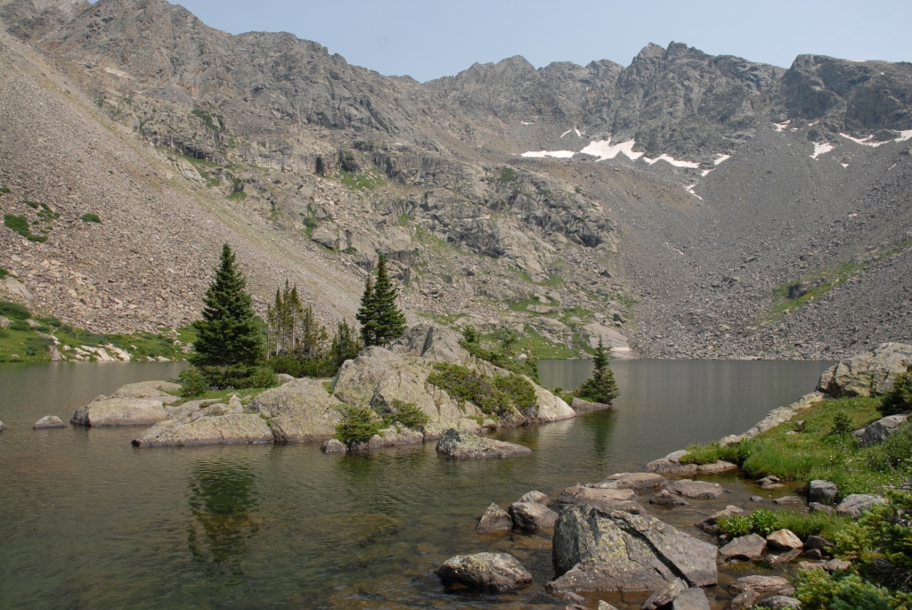
The Glenwood Springs-based Colorado River Water Conservation District plans to purchase the Shoshone water rights for $99 million from Xcel Energy, but the district first needed the approval of the CWCB, which is the only entity in the state allowed to hold instream-flow water rights to benefit the environment. Because the water is returned to the river after it runs through the hydroplant’s turbines, downstream cities, irrigators, recreators and the environment all benefit.

River District General Manager Andy Mueller called it a fantastic day in Colorado history. 

“I think that was the right decision for the Colorado River and the right decision for our whole state,” Mueller said. “I think the state for generations to come, centuries in the future will benefit from having that water in the Colorado River.”

Importantly, the instream-flow agreement approved by the board says that the Western Slope, along with the CWCB, will retain some control over exercising the rights. The River District and its constituents drew a hard line in the sand regarding this point and said they would walk away from the deal if they had to cede control solely to the CWCB.

Though not totally unprecedented, co-management is a departure from the norm, as the CWCB has never shared management of an instream-flow water right this large or this powerful with another entity. 

In attendance at Wednesday’s CWCB meeting in Golden were representatives of ditch companies, elected officials and water managers from across the River District’s 15-county area. Some of the attendees said during their public comments that if the River District didn’t retain some control over the water rights, they would pull their funding and withdraw their support from the Shoshone campaign. 

Mesa County Commissioner Bobbie Daniel said the joint-management proposal is a safeguard that ensures that Western Slope interests are not pushed aside. Mesa County has committed $1 million toward the purchase of the water rights.

“The Shoshone call is one of the great stabilizing forces on the river, a heartbeat that has kept our valley farms alive, our communities whole and our economy steady, even in lean years,” Daniel said. “If a joint management is not adopted, Mesa County will withdraw its support for this acquisition. It’s not out of anger or politics, but because anything less would fail the people that we serve.”

The Shoshone hydropower plant in Glenwood Canyon has some of the oldest and most powerful nonconsumptive water rights on the Colorado River. A broad coalition of Western Slope entities support the River District purchasing the rights. CREDIT: HEATHER SACKETT/ASPEN JOURNALISM

Blow to the Front Range

The CWCB’s decision was a blow to Front Range water providers, who objected to the River District’s having a say over how to manage the water rights, even though they supported the overall goal of protecting flows for the environment. Denver Water, Northern Water, Aurora Water and Colorado Springs Utilities argued that the CWCB has exclusive authority over the rights, according to state statute. 

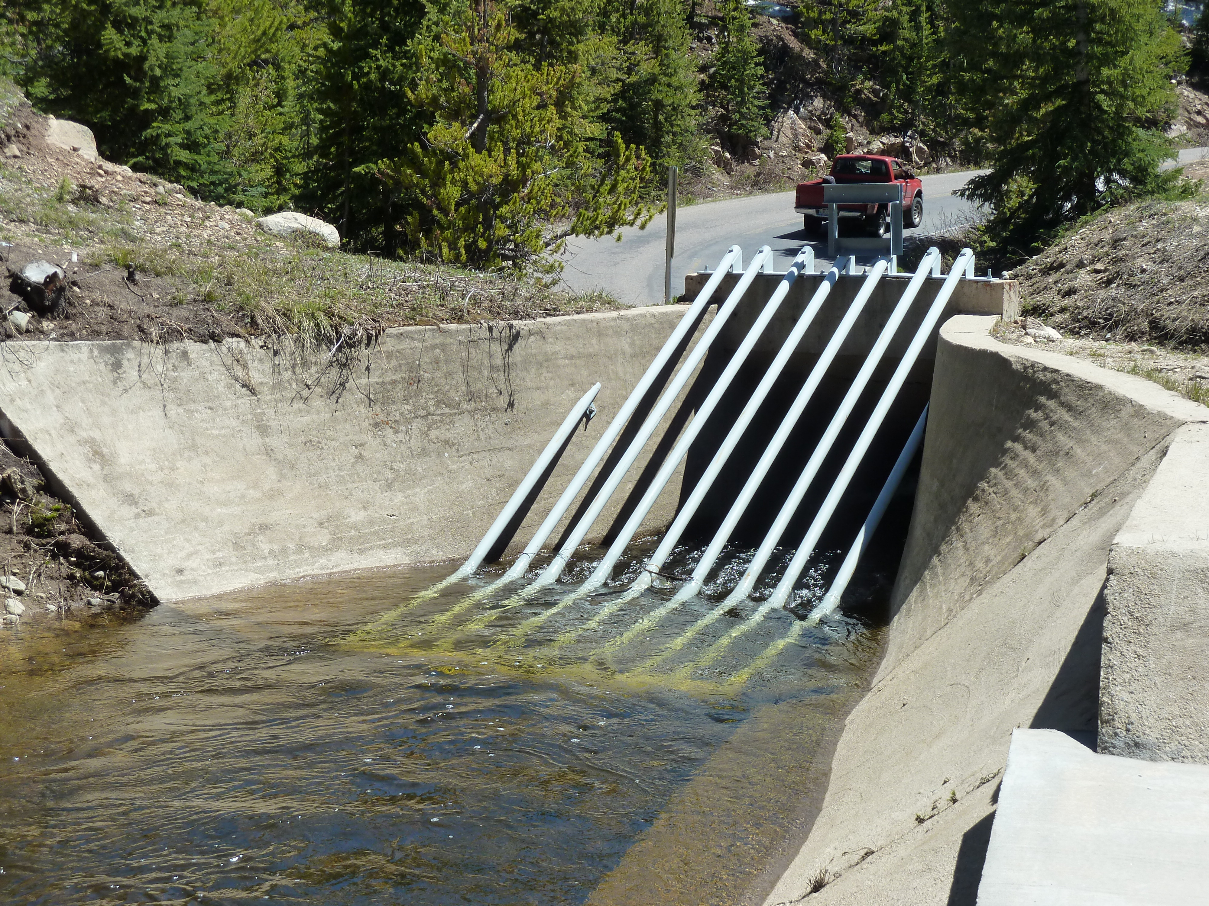
Critically, because the Shoshone plant’s water rights — one that dates to 1902 for 1,250 cubic feet per second and another that dates to 1929 for 158 cfs — are senior to many other water users, they have the ability to command the flows of the Colorado River and its tributaries upstream all the way to the headwaters. This means that the owners of the rights can “call out” junior Front Range water providers with younger water rights that take water across the Continental Divide via transmountain diversions and force them to cut back. 

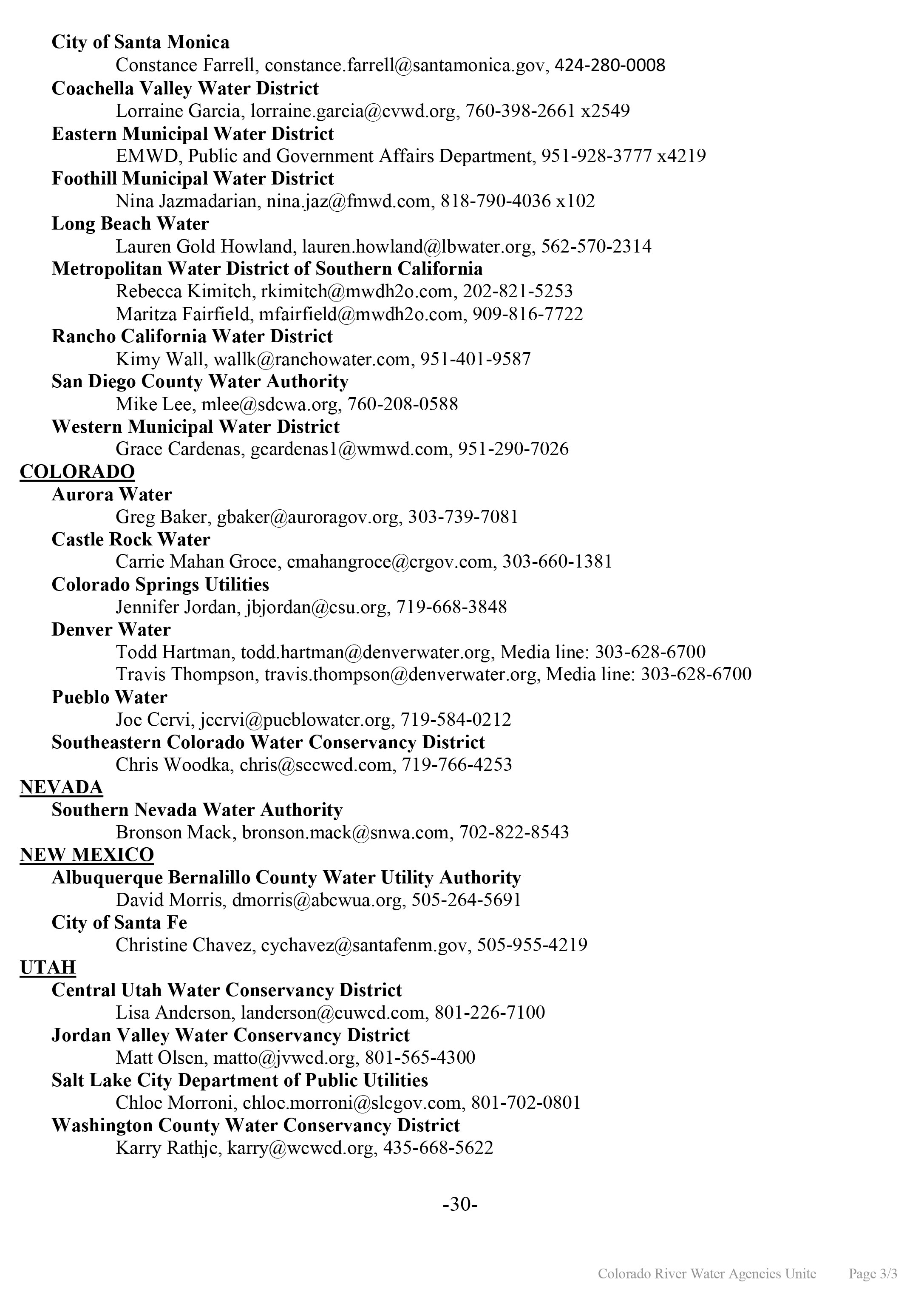
The fact that Front Range water providers take about 500,000 acre-feet annually from the headwaters of the Colorado River is a sore spot for many on the Western Slope, who feel the growth of Front Range cities has come at their expense. These transmountain diversions can leave Western Slope streams depleted. 

The Shoshone call pulls water west much of the time. But the Front Range parties wanted assurances that during extreme droughts or emergency situations, the call would be “relaxed,” allowing them to take more water to their cities’ millions of customers. 

Alex Davis, assistant general manager with Aurora Water, said the CWCB should retain the ability to relax the call as a “backstop” under extremely rare circumstances. 

“It is asking that in those emergency situations, the board has the ability to step in and say: We’re going to do what we think is best for the state of Colorado,” Davis said.

The agreement approved by the board lays out a collaborative process to consider a call relaxation, with a stakeholder panel of water managers from both sides of the divide. The specific wording of this agreement was hashed out during Wednesday’s meeting, with lawyers representing the CWCB and River District conferencing to tweak language and make edits.

Colorado Water Conservation Board member representing the Arkansas River basin Greg Felt, left, talks with River District General Manager Andy Mueller Wednesday after the board voted to accept the Shoshone water rights for instream flow purposes. The move represents a major step toward securing those rights in perpetuity for the Western Slope. CREDIT: HEATHER SACKETT/ASPEN JOURNALISM

The CWCB had been set to decide on the Shoshone rights at its meeting in September, but the River District granted an eleventh-hour 60-day extension so they could address issues raised by the board and try to negotiate a consensus with the Front Range parties. 

Despite all the detailed arguments laid out by the parties, thousands of pages of technical and legal documents, and hours of testimony and public comment over the September and November CWCB meetings, the board’s scope of decisionmaking remained narrow: Should the CWCB accept a perpetual interest in the Shoshone water rights and will these rights preserve the natural environment to a reasonable degree? 

In the end, the board decided yes, and also determined that it did, in fact, have the authority to allow the River District to co-manage the Shoshone water rights alongside it.

“I really think it’s pretty incredible that there’s no objection to the environmental aspects of this flow and the purpose of this water right for environmental purposes,” said CWCB Director Taylor Hawes, who represents the mainstem of the Colorado River where the Shoshone plant is located. “(The River District is) donating that water right. It seems like they should have a say. And while I realize this case is unique, I don’t see anything in the statute or the rules that prohibits us from doing this.”

But the fight to keep Shoshone flowing west is not over for the River District. The CWCB, River District and the water rights’ current owner, Xcel, now plan to file a joint application in water court to make the deal official by adding the instream-flow use to the water rights. 

The water court process will decide another contentious issue that is sure to again highlight disagreement between the Western Slope and Front Range as they compete for the state’s dwindling water resources: precisely how much water is associated with the water rights, a number based on the plant’s past use.

“I also very much understand the concerns of both sides of the divide in not wanting the other side to have a windfall,” Hawes said. “That has been kind of the heart of all of this. And I hope we can all trust that the water court’s process will give us a result where we don’t have to worry about that. Everyone’s concerns will be addressed in that process.”

View of Shoshone Hydroelectric Plant construction in Glenwood Canyon (Garfield County) Colorado; shows the Colorado River, the dam, sheds, a footbridge, and the workmen’s camp. Creator: McClure, Louis Charles, 1867-1957. Credit: Denver Public Library Digital Collections

The #Colorado Water Conservation Board says “yes” to $99M Western Slope plan for Shoshone Power Plant’s water rights — Shannon Mullane (Fresh Water News) #ColoradoRiver #COriver #aridification

Shoshone Falls hydroelectric generation station via USGenWeb

Click the link to read the article on the Water Education Colorado website (Shannon Mullane):

November 20, 2025

 In a momentous decision for the Western Slope, state water officials unanimously approved a controversial proposal to use two coveted Colorado River water rights to help the river itself.

Members of the Colorado Water Conservation Board voted to accept water rights tied to Shoshone Power Plant into its Instream Flow Program, which aims to keep water in streams to help the environment.

The decision Wednesday is a historic step forward in western Colorado’s yearslong effort to secure the $99 million rights permanently. But some Front Range water providers pushed back during the hearings, worried that the deal could hamper their ability to manage the water supply for millions of Colorado customers.

For the state, the two water rights will be a crown jewel in its five-decade environmental effort to help river ecosystems. It’s one of several steps in the agreement process, and it could take years before the river feels that environmental benefit.

“The Shoshone acquisition makes a lot of sense to me, and I’m very proud of the work that everybody’s put into it,” said Mike Camblin, who represents the Yampa and White river basins on the Colorado Water Conservation Board. “I hope that our children and our grandchildren look back at this and realize we made the right decision.”

Over 100 Colorado water professionals and community members gathered in Golden for a six-hour hearing about the environmental proposal, brought forward by the Colorado River District, which represents 15 counties on the Western Slope.

The small hydropower plant off Interstate 70 near Glenwood Springs has used Colorado River water to generate electricity for over a century. But the aging facility has a history of maintenance issues, and Western Slope water watchers have long worried about what happens to the rights if it were to shut down for good.

The Colorado River District wants to add the environmental use as part of a larger plan to maintain the “status quo” flow of water past the power plant, regardless of how long it remains in operation.

Western Slope communities, farms, ranches, endangered species programs and recreational industries have become dependent on those flows over the decades and broadly supported the district’s proposal.

From left, Hollie Velasquez Horvath, Kathy Chandler-Henry, and Andy Mueller, general manager of the River District, at the kickoff event Tuesday [December 19, 2023] for the Shoshone Water Right Preservation Campaign in Glenwood Springs. CREDIT: HEATHER SACKETT/ASPEN JOURNALISM

“I’m good. I’m much more relaxed now,” Andy Mueller, the district’s general manager, said after the vote Wednesday. “The reality is, we have set up our state, through this instream flow agreement, for success for centuries on the Colorado River.”

Some powerhouses in Colorado water support the general permanency effort but oppose parts of the agreement. Northern Water, Colorado Springs Utilities, Denver Water and Aurora Water said the proposal would give the Colorado River District too much sway in decisions that would impact them.

These water managers and providers are responsible for delivering reliable water to millions of people, businesses, farms and ranches across the Front Range. Any change to Shoshone’s water rights could have ripple effects that would affect over 10,000 upstream water rights, including some held by Front Range water groups.

The negotiations over the agreement continued throughout the meeting. Board members had about 24 hours to review a stack of documents marked with tweaked phrasing and proposed edits.

Both sides are concerned that the other could get a water windfall through the agreement, said Taylor Hawes, who represents the Colorado River on the board. Those concerns can be addressed in the next step of the process: Water Court.

“That has been the heart of all of this,” Hawes said. “I hope we can all trust that the water court’s process will give us a result where we don’t have to worry about that.”

Who will control the flow of water?

The Colorado Water Conservation Board was supposed to make its final ruling on the environmental use proposal in September. Then Public Service Company of Colorado, the Xcel subsidiary that owns the rights, and the Colorado River District filed an 11th-hour extension to delay until the meeting Wednesday.

That’s, in part, because they needed more time to address a central conflict in the agreement: Who makes the final decisions when managing the powerful rights?

Shoshone uses two rights to access the Colorado River: one for 1,250 cubic feet per second that dates back to 1905, and a right to 158 cubic feet per second that dates back to 1940.

They amount to a big chunk of water. Plus, these rights can be used year-round, and they supersede more recent, junior rights like several held by Front Range water providers.

Under the agreement, the water rights will be co-managed by the Colorado River District and the Colorado Water Conservation Board.

Western Slope parties were adamant about this. Several speakers said they would pull their funding, and there would be no agreement if the River District did not have a say in how the water rights would be used.

“If joint management is not adopted, Mesa County will withdraw its support for this acquisition,” Bobbie Daniel, Mesa County Commissioner, said. “It’s not out of anger or politics, but because anything less would fail the people that we serve.”

The Front Range groups said the state should make the final decision if Colorado River District staff and CWCB staff disagreed over how to manage the water rights. They argued the board has exclusive authority under state law.

Alex Davis with Aurora Water said her team was pushing for a “hammer” — an entity, preferably the state, that could force water providers on either side of the Continental Divide to come to the negotiating table or that could make the final decision, especially in times of crisis.

Aurora pulls about 25,000 acre-feet of water from the Western Slope, through mountain tunnels and into its water system each year, she said. (An acre-foot of water is about what two to three  households use in a year.) But when Shoshone is using its 1905 water right to its fullest, nearly all of Aurora’s transmountain diversions are turned down or turned off.

The city might want to ask Shoshone to use less water to provide some relief in an emergency. The agreement seems to give the Colorado River District a veto, Davis said.

“By the River District having that decision-making power, it may lead to less incentive on the West Slope side in those emergency situations,” Davis said in an interview with The Sun. “That’s what we were worried about.”

Colorado Water Conservation Board members decided to continue with the co-management approach, saying they were not giving up authority or working outside of state statute by doing so.

Mueller said the agreement is a win for the river and the entire state. It will protect endangered fish and a critical 15-mile stretch of habitat near Grand Junction. It includes exceptions that will protect cities during multi-year droughts and emergency situations, he said.

“The CWCB and the River District can act together for the best interest of the state,” Mueller said in an interview. “We’ll have to earn some trust in that realm over the years, but I’m quite convinced we can do it.”

About that $99 million bill…

The Colorado River District has entered into a $99 million agreement with Xcel Energy to buy the Shoshone water rights.

The state’s decision to accept Shoshone’s water rights into its environmental program met one of four key closing conditions of that purchase agreement, Amy Moyer, chief of strategy for the Colorado River District, said.

The deal still needs approval by Colorado’s Public Utilities Commission. It’ll be weighed in Water Court, where Western Slope and Front Range representatives will wade through another thorny issue: What has Shoshone’s “status quo” water use been over the last century?

The Colorado River District and its Western Slope supporters need to pay up. Although they’ve pulled together over half the asking price, they’re still waiting to hear about whether a request for federal funding will be approved.

If the deal passes those hurdles, then the resulting purchase and instream flow agreement will go on indefinitely. It will provide more predictability for water users across the state, and it will continue to factor into how Colorado communities grow, officials said Wednesday. “We’re making some very far-reaching decisions here,” Nathan Coombs, the board’s Rio Grande Basin representative, said. “I still think this is the right choice right now with the information we have.”

More by Shannon Mullane

Photo: 1950 “Public Service Dam” (Shoshone Dam) in Colorado River near Glenwood Springs Colorado.

Negotiations to continue beyond 14-hour hearing over one of the #ColoradoRiver’s oldest water rights — The #Aspen Times #COriver #aridification

View of Shoshone Hydroelectric Plant construction in Glenwood Canyon (Garfield County) Colorado; shows the Colorado River, the dam, sheds, a footbridge, and the workmen’s camp. Creator: McClure, Louis Charles, 1867-1957. Credit: Denver Public Library Digital Collections

Click the link to read the article on the Aspen Times website (Ali Longwell). Here’s an excerpt:

September 20, 2025

The battle over one of the Colorado River’s oldest, non-consumptive water rights continued this week during a 14-hour Colorado Water Conservation Board hearing over whether the rights could be used for the environment. The Colorado River District is seeking to acquire the Shoshone water rights — tied to a hydropower plant on the Colorado River in Glenwood Canyon — from Xcel Energy for $99 million. The River District, a governmental entity representing 15 Western Slope counties, is proposing to add an instream flow agreement to the acquisition, which would allow a certain amount of water to remain in the river for environmental benefits. While the state’s water board — the only entity that can hold an instream flow water right in Colorado — was set to decide on the proposal this week, this was pushed to November after the parties agreed to take more time to reach a consensus on the proposal.

“The exercise of the Shoshone water rights impacts almost every Coloradan,” said Davis Wert, an attorney speaking on behalf of Northern Water.

Northern Water is contesting the instream flow agreement alongside Denver Water, Aurora Water, and Colorado Springs Utilities. These providers rely on transmountain diversions from the Colorado River basin to supply water to their customers…While the hearing did include some back and forth, the entities west and east of the Continental Divide agreed on a few things during the hearing. First, adding an instream flow agreement to the Shoshone right will preserve and improve the natural environment. Second, they want to maintain the status quo on the Colorado River…Michael Gustafson, in-house counsel for Colorado Springs Utilities, said the provider did not oppose the change of the senior Shoshone water right for instream flow purposes “to provide for permanency of the historic Shoshone call and maintenance of the historical Colorado River flow regime…

With that, however, there were a few sticking points during the hearing: who should manage the instream flow agreement — and have the authority to make decisions on Shoshone calls — and how much water has historically been granted as part of the right. The historic flow regime has been highly contested between the parties but will ultimately be determined in the Colorado Water Court proceedings that will conclude the River District’s acquisition. Wert acknowledged this as the Front Range entities presented a historic use analysis that contrasted the preliminary analysis obtained by the River District…The Colorado River District’s proposed instream flow agreement includes a “co-management strategy,” while the contesting Front Range providers want the sole management authority to reside with the Colorado Water Conservation Board.

Front Range and Western Slope debate who should control Shoshone water rights: The #Colorado Water Conservation Board decision postponed until November — Heather Sackett #COriver #aridification

From left, Hollie Velasquez Horvath, regional vice president for state affairs and community relations for Xcel, Kathy Chandler-Henry, president of the Colorado River Water Conservation District and Eagle County commissioner and Andy Mueller, general manager of the River District, at the kickoff event Tuesday [December 19, 2023] for the Shoshone Water Right Preservation Campaign in Glenwood Springs. The River District has inked a nearly-$100-million deal to acquire the water rights tied to the Shoshone hydropower plant in Glenwood Canyon. CREDIT: HEATHER SACKETT/ASPEN JOURNALISM

Click the link to read the article on the Aspen Journalism website (Heather Sackett):

September 19, 2025

Over two days of hearings, Colorado water managers laid out their arguments related to one of the most powerful water rights on the Colorado River and who should have the authority to control it.

The Colorado River Water Conservation District plans to buy the water rights associated with the Shoshone hydropower plant in Glenwood Canyon from Xcel Energy and use the water for environmental purposes. To do so, it must secure the support of the Colorado Water Conservation Board. The CWCB is the only entity allowed to own instream-flow water rights, which are designed to keep a minimum amount of water in rivers to benefit the environment.

The CWCB heard more than 14 hours of testimony Wednesday and Thursday from the River District and its supporters, as well as the four big Front Range water providers — Northern Water, Denver Water, Aurora Water and Colorado Springs Utilities. All the parties agree that the water rights would benefit the environment. 

But the Front Range parties object to certain aspects of the River District’s proposal that they say could harm their interests. They said this is not a water grab for more; their goal is to protect what they already have.

“Colorado Springs Utilities is not looking to gain additional water by the conversion of the Shoshone water rights for use as an instream flow,” said Tyler Benton, a senior water resource engineer with CSU. “Quite simply, Colorado Springs Utilities cannot afford to lose existing water supplies as our city continues to grow.”

The CWCB was supposed to have voted Thursday on whether to accept the senior water rights, which are for 1,408 cubic feet per second and date to 1902, for instream-flow purposes, but the River District on Tuesday granted a last-minute 60-day extension. The board is now scheduled to decide at its regular meeting in November. 

Adding this instream-flow right would ensure that water keeps flowing west even when the 116-year-old plant — which is often down for repairs and is vulnerable to wildfire and mudslides in the steep canyon — is not operating, an occurrence that has become more frequent in recent years. 

Critically, because the plant’s water rights are senior to many other water users, Shoshone has the ability to command the flows of the Colorado River and its tributaries upstream all the way to the headwaters. This means it can “call out” junior Front Range water providers with younger water rights who take water across the Continental Divide via transmountain diversions and force them to cut back. And because the water is returned to the river after it runs through the plant’s turbines, downstream cities, irrigators, recreators and the environment on the Western Slope all benefit.

Over two days of debate in a meeting room on the campus of Fort Lewis College, the parties went deep into the weeds of complicated technical aspects of the River District’s proposal, including the historic use of the water rights, the interplay of upstream reservoirs, detailed external agreements among the parties, state Senate documents and hydrologic modeling. 

But these were all proxy arguments for the underlying implicit questions posed to the state water board: Who is most deserving of the state’s dwindling water supply and who should control it: the Western Slope or the Front Range? 

The River District is pushing for co-management of the water rights with the CWCB. It would be a departure from the norm, as the CWCB has never shared management of an instream-flow water right this large or this important with another entity. 

“Choosing not to accept these rights now or choosing to impose a condition that involves the lack of co-management of these rights with us means that you have chosen the opposers over the West Slope,” River District General Manager Andy Mueller told board members Wednesday. “It actually is a decision to side with one side of the divide.”

That Front Range water providers take about 500,000 acre-feet annually from the headwaters of the Colorado River is a sore spot for many on the Western Slope, who feel the growth of Front Range cities has come at their expense. These transmountain diversions can leave Western Slope streams depleted.

The board heard from a wide coalition of Western Slope supporters, including irrigators, water providers, elected officials, environmental advocates and recreation groups about how the Shoshone flows are critical to their rural communities, economies and culture. They also heard from Front Range water providers who reminded the board that their cities are an economic engine and home to some of the state’s best hospitals, institutions of higher education, biggest employers and important industries. 

The Shoshone hydropower plant in Glenwood Canyon has one of the biggest and oldest nonconsumptive water rights on the Colorado River. The River District plans to buy it from Xcel Energy and add an instream flow water right, but it needs the cooperation of the state water board. CREDIT: HEATHER SACKETT/ASPEN JOURNALISM

Call authority

One of the most contentious issues that remains unresolved between the Western Slope and Front Range is who gets to control the Shoshone call and when the call is “relaxed.” Under existing but rarely used agreements, the Shoshone call can be reduced during times of severe drought, allowing the Front Range to continue taking water. According to the River District’s proposed draft instream flow agreement, the CWCB and River District would have to jointly agree in writing to reduce the call. 

The River District and members of the coalition drew a line in the sand on this issue: The Western Slope must have some authority over the exercise of the Shoshone water rights. If control rests solely with the CWCB — meaning the Denver-based staff could control the call without input from the Western Slope which would be purchasing the rights at great expense — it would be a deal-breaker.

“That is the one sword that the West Slope is prepared to fall on,” Mueller said. “It would be a clearly undesirable outcome, from our perspective, not to have that partnership with the CWCB. I think we would be forced to walk away from the instream-flow process.” 

Mueller added that if the deal falls apart, the River District would find another way to secure the Shoshone water rights for the Western Slope.

“Do I have other ideas? Do we have other mechanisms that we would then pursue to guarantee the perpetual Shoshone rights?” he said. “Yes, we do. None of them are as collaborative. None of them are as beneficial to the state as a whole.”

The parties also disagree on another major point: precisely how much water is associated with the water rights. But the issue is outside the purview of the CWCB and will be hashed out in a later water court process if the state agrees to move forward with the proposal. 

The Front Range parties believe the River District’s preliminary estimate of the hydro plant’s historic water use is inflated and would be an expansion of the water right. Past use of the water right is important because it helps set a limit for future use. The amount pulled from and returned to the river must stay the same as it historically has been because that is what downstream water users have come to rely on. 

Kyle Whitaker, water rights manager for Northern Water, said that if the River District insists on co-management of the call, it could make for an ugly water court process that has a chilling effect on cooperation among the parties.

“The most important issue for Northern Water is for the CWCB to retain the full discretion of the exercise of the Shoshone water rights for instream-flow purposes,” Whitaker said. “I can assure you that if any level of discretion on the exercise of the rights is not retained by the CWCB, it will force all the entities involved to drive towards a significantly lower historic-use quantification. We have to protect our systems.”

Board members implored the River District and Front Range parties to use the 60-day extension to come to an agreement over the call authority issue. CWCB Chair Lorelei Cloud asked Mueller if he could bring everybody from both sides together for a win-win agreement that protects the entire state.

“We can’t have another divide within the state of Colorado,” Cloud said. “And so I’m asking: Are you capable and willing to do that by November?”

Mueller promised the River District and Western Slope coalition would do everything in their power to reach an agreement. The River District granted the two-month extension, in part, so that the parties could attempt to negotiate a resolution. But ultimately, Mueller said, it’s not up to him.

“We have been engaged in very good faith efforts, and we have been putting offers on the table and listening to the needs of the Front Range and trying to create solutions for them,” he said. “But can I guarantee you that we will be responsible for getting all of those parties to agree? I can’t say that because I have no actual control or ability over the Front Range to make that happen.”

Xcel Energy plans to sell water it once held for power production to Lower #ArkansasRiver farmers — Jerd Smith (Fresh Water News)

As part of the sale, a new company is being formed by combining shares in two irrigation companies the Las Animas Consolidated Canal System and the Las Animas Consolidated Extension Canal, both in in Bent County. (Western Water Partnerships map)

Click the link to read the article on the Water Education Colorado website (Jerd Smith):

September 11, 2025

Xcel Energy will offer water it owns but no longer needs to farmers in the water-strapped Lower Arkansas River Valley, in an innovative deal advocates hope will help the struggling region regain control of vital water supplies and protect its agricultural economy.

Under the preliminary terms of the proposal, valued at more than $44 million, Xcel will sell 12,500 acre-feet of water to a newly formed irrigation company, 70% of which will be owned by farmers and 30% of which will be owned by Colorado Springs Utilities.

An acre-foot of water equals 326,000 gallons, enough to serve two to four urban households for one year, or enough to cover an acre of farmland with a foot of water.

The news comes as tensions continue to rise between farm interests in the Lower Arkansas River Basin and cities, such as Colorado Springs and Aurora, that continue to tap its water to supply growth.

Advocates say this new project may be an important new method for reducing those tensions by keeping farm water in the communities where it has historically been used.

The water sale is backed by a coalition that includes Xcel Energy, the Palmer Land Conservancy, farmers, and Colorado Springs Utilities. The planning work is funded by a $245,000 grant from the Colorado Water Conservation Board and additional support from Colorado Springs and Palmer.

“The new company means farmers will become owners,” said Jennifer Jordan, a spokesperson for Colorado Springs Utilities. “It also means the water will remain in the Arkansas Basin.”

Xcel bought the water back in the 1980s as part of a new coal-fired power plant project that never materialized. Since then, the power company has leased the water to farmers in the region under year-to-year contracts.

The decision to sell the water to farmers is an effort by Xcel to aid the community, according to Todd Doherty, a principal with Western Water Partnerships, which is coordinating the sale.

“Xcel is really wanting to leave this community as good as, or better off, than they found it,” Doherty said. “They could have sold the water to the highest bidder and walked away.”

Closing coal-fired power plants frees up water

Xcel officials did not respond to a request for comment. The power company is also involved in another, larger water sale on the Western Slope, where it has agreed to sell several hundred thousand acre-feet of water it owns on the Colorado River to local water districts and cities.

Power companies are closing coal-fired power plants across the state and the country, and Doherty said the hope is the sale to a company majority-owned by farmers could serve as a model when water previously used for power production is sold.

An appraisal placed the value of the water rights at $9,000 an acre-foot for municipal use and $1,250 an acre-foot for agricultural use, Doherty said. At those prices, the deal would be valued at $44.6 million.

Rebecca Jewett, president of the Palmer Land Conservancy, said the Las Animas project has the potential to create new tools to protect irrigated farm lands in Colorado. During the past 30 years, those lands have shrunk by 30% due to chronic drought, climate-related reductions in streamflows and municipal water purchases.

The state has tried for decades to find ways to keep farm communities whole and to protect their water supplies and economies. To do so, it has spent millions of dollars and crafted new laws that made it easier for farmers and cities to share water, largely through leasing deals. But farm economies have continued to suffer and farmers have called for better tools to protect their water.

Through the new company, farmers will control their water supplies and will be able to use their water each year. But some dry up of farmland will occur to provide 30% of the water to Colorado Springs, Doherty said.

Originally, some 6,500 acres were served by the irrigation systems that will now become part of a new consolidated ditch company. But because hundreds of acres of irrigated land on the system are no longer being used as farmers have left the system, the sale will likely require a dry up of just 100 new acres, once Colorado Springs Utilities begins taking its water out of the system. That will leave 4,100 acres still in production.

Farmer and rancher Glen Brown, president of the new company, said the intent of the sale agreement and the new company “is to keep the water in the valley. We’ve protected 70% of this water better than it has ever been protected before.”

But other growers in the valley remain concerned that this deal doesn’t provide enough long-term protection.

“If there is no perpetual tying of 70% of the water to the land, that would be a major concern of ours,” said Jack Goble, general manager of the Lower Arkansas Valley Water Conservancy District. “Who knows, when enough money is laid on the table 10 or 20 years down the road, unless it’s a perpetual agreement, what will happen.”

Doherty and Jewett acknowledge that the legal mechanism in place right now, which gives farmers majority control of the new company, might not prevent a future sale of the water if the farmers decided to do so themselves, but they say it would be extremely difficult to pull off.

“At Palmer, our ultimate goal is an unbreakable long-term tying of the water to the land,” Jewitt said, and she said more protections may be added before the final papers are signed early next year.

For now, Brown said, growers are ready to move forward with the purchase.

“Getting the water back on the ground is an opportunity that can’t be passed up,” he said.

More by Jerd Smith

Straight line diagram of the Lower Arkansas Valley ditches via Headwaters Magazine

Front Range, Western Slope heavyweights lay out arguments over #ColoradoRiver’s Shoshone water rights as state hearing nears — Shannon Mullane (Fresh Water News) #COriver #aridification

Shoshone Falls hydroelectric generation station via USGenWeb

Click the link to read the article on the Water Education Colorado website (Shannon Mullane):

September 4, 2025

The points and counterpoints are in: Colorado’s water heavyweights have laid out their arguments about the future of a powerful Colorado River water right ahead of a state hearing in mid-September.

A Western Slope coalition led by the Colorado River District and Front Range groups — Aurora Water, Colorado Springs Utilities, Denver Water and Northern Water — are debating a potential change to water rights tied to the Shoshone Power Plant in Glenwood Canyon. The influential water rights, owned by an Xcel Energy subsidiary, impact how water flows across the state.

The Western Slope wants to add an environmental use to the water rights, which currently allow Xcel to use the water for hydropower, mining, milling, manufacturing and other purposes. It’s part of the coalition’s broad plan to keep the Colorado River’s “status quo” flows at Shoshone Power Plant long into the future.

Front Range water managers and providers are concerned that their water supplies could be impacted, especially if the Colorado River District is overestimating the amount of water that should head west toward Shoshone, near Glenwood Springs, rather than east to growing Front Range cities.

Each side has insinuated that the other is swaying its estimate of past water use to send more water to their part of the state.

Graphic credit: Laurine Lassalle/Aspen Journalism

“We do not contest the environmental benefits. Protecting flows in Glenwood Canyon is valuable,” said Aurora Water in a rebuttal statement filed Friday. “Aurora’s participation in this hearing is not about securing any sort of ‘windfall,’ as some have wrongly alleged. That claim is baseless and pure projection. Our sole position is that Shoshone should be preserved as it has historically operated — no more, no less.”

Thirteen entities submitted rebuttal statements, totaling 367 pages,[to] the Colorado Water Conservation Board. It’s part of the state’s multistep review process in advance of the hearing at the board’s next meeting, Sept. 16-18.

For western Colorado communities, the Shoshone water rights impact their economies, quality of life and environments. Shoshone’s water rights are old enough that they have priority over other, more recent water rights in dry periods under state law. Over the past century, these communities have grown up relying on the power plant to send water westward — toward their farm diversions and rafting corridors — as it generates electricity.

For Front Range communities, the stakes are similar. Water providers rely on water from western Colorado to support growing cities, industries and farms. And in some cases, their water rights come in second to Shoshone’s under the “first in time, first in right” water administration system.

With high stakes on either side, Fresh Water News is breaking down some of the key questions in the debate.

What is an instream flow right? 

An instream flow right is meant to help preserve the natural environment. In 1973, Colorado lawmakers allowed a state agency, the Colorado Water Conservation Board, to use water rights to keep water in rivers, streams and natural lakes through the Instream Flow Program.

At the time, Coloradans were concerned about stretches of streams that dried up when mountain runoff slowed while demand from humans — cities, farms and industries — continued. Shallower, slower streamflows impact habitat and food sources for native species while sometimes creating better habitat for their competitors.

The program aims to keep water in streams and natural lakes to reduce these impacts. Since 1973, the state has appropriated instream flow rights on nearly 1,700 stream segments covering more than 9,700 miles. In Shoshone’s case, the instream flow right would apply to a 2.4-mile stretch of the Colorado River between the point where Shoshone takes water out of the river and the point where it releases that water back into the river channel.

What’s this state-led process?

The state-led process will determine whether the water rights attached to the Shoshone Power Plant can be used to protect instream flows.

Colorado lawmakers designated the Colorado Water Conservation Board, a state water policy agency, as the sole entity that can own and operate instream flow rights. The agency’s board of directors is reviewing testimony, environmental analyses, and other materials as part of a standard, 120-day review process for proposed instream flow rights. The board is scheduled to make its final determination at its September meeting.

The Colorado River District kicked off the review period in May when it formally proposed adding an instream flow right to Shoshone’s water rights. Under the district’s proposal, the district would own the title to Shoshone’s water rights, but the state would manage it in perpetuity.

After the hearing, the proposed Shoshone environmental water right would also need to go through a water court process.

What is this “historical use” debate about?

In order to legally change Shoshone’s water rights to include environmental use, state officials need to know how much water has been used under Shoshone’s water rights in the past.

Shoshone’s 1905 water right allows the power plant to divert up to 1,250 cubic feet per second of water. A second, more recent, water right allows the plant to divert 158 cfs. But the amount of water that is actually used to generate power at Shoshone fluctuates or has paused because of facility maintenance.

Calculating past use is complicated. BBA Water Consultants, hired by the Colorado River District, looked at Shoshone’s operations from 1975 through 2003. The plant’s 29-year average historical use was 844,644 acre-feet, according to the consultants’ preliminary analysis.

They excluded years after 2003 because Shoshone had significant outages totaling 1,466 days over 19 years compared with 89 days during the study period.

Some Front Range water users say this estimate is too high or that more recent years should have been included.

Aurora Water said the Western Slope group used “cherry-picked data” and the historical use was closer to 538,204 acre-feet, a 36% difference.

Are there other disagreements?

In short, yes. The oft-repeated refrain in water deals is “the devil’s in the details.”

Colorado Springs Utilities raised concerns in its rebuttal about adding an environmental use to Shoshone’s more recent, or junior, water right, which currently allows water to be used for manufacturing and power generation. The Colorado River District’s plan would expand the junior right and potentially cause a water-administration ripple effect that would impact the utility’s water supplies.

Denver Water was concerned about historical use. It and Aurora Water also took issue with how the environmental water right would be owned and managed under the Colorado River District’s proposal. State lawmakers gave the CWCB exclusive authority to hold and use instream flow rights, but the River District’s plan encroaches on that authority by saying the district will hold the title, but the state agency will manage the right.

Northern Water shared many of these concerns, requesting that the state delay its decision.

For its part, the Colorado River District said everyone agrees on the main issue — adding an environmental use to the Shoshone water rights — but that the objectors “misstate the law” and are trying to distort the parameters of the state’s upcoming decision.

The district says the water court decides how much water is at stake, saying the water providers should leave “historical use” up to the court. It has also suggested the state stay neutral on the historical use amount.

More by Shannon Mullane

This historical photo shows the penstocks of the Shoshone power plant above the Colorado River. A coalition led by the Colorado River District is seeking to purchase the water rights associated with the plant. Credit: Library of Congress photo

#ColoradoRiver District offers proposal on Western Slope water deal — Heather Sackett (AspenJournalism.org) #CORiver #aridification

The Shoshone hydro plant in Glenwood Canyon. The Shoshone hydropower plant in Glenwood Canyon. The CWCB will hold a hearing on the water rights associated with the plant in September. Credit: Heather Sackett/Aspen Journalism

Click the link to read the article on the Aspen Journalism website (Heather Sackett):

July 25, 2025

Front Range asked for Colorado Water Conservation Board neutrality on historic use of Shoshone water rights

In an effort to head off concerns about the state’s role in a major Western Slope water deal, a Western Slope water district has offered up a compromise proposal to Front Range water providers. 

In order to defuse what Colorado River Water Conservation District General Manager Andy Mueller called “an ugly contested hearing before the CWCB,” the River District is proposing that the state water board take a neutral position on the exact amount of water tied to the Shoshone hydropower plant water rights and let a water court determine a final number. 

“Although we believe this would be an unusual process, the River District believes it would address the primary concern (i.e., avoiding the state agency’s formal endorsement of the River District’s preliminary historical use analysis) that we heard expressed by your representatives at the May 21, 2025 CWCB meeting regarding the Shoshone instream flow proposal,” Mueller wrote in an email to officials from the Front Range Water Council.

The River District worked with CWCB staff to draft the proposal, but it may not go far enough to address Front Range concerns.

The River District, which represents 15 counties on the Western Slope, is planning to purchase some of the oldest and largest non-consumptive water rights on the Colorado River from Xcel Energy for nearly $100 million. The water rights, which are tied to the Shoshone hydropower plant in Glenwood Canyon, are essential for downstream ecosystems, cities, endangered fish, and agricultural and recreational water users. As part of the deal, the River District is seeking to add an instream flow water right to benefit the environment to the hydropower water rights.

The effort has seen broad support across the Western Slope. The River District has raised $57 million toward the purchase from at least 26 local and regional partners. The project was awarded a $40 million Inflation Reduction Act grant in the waning days of the Biden administration, but those funds have been frozen by the Trump administration. 

“These water rights are foundational to the Colorado River,” said Amy Moyer, chief of strategy at the River District. “It’s the number one project for the Western Slope. It’s the top priority to move forward.”

Critically, because its water rights are senior to many other water users — they date to 1902 — Shoshone can force upstream water users to cut back. The Shoshone call has the ability to command the flows of the Colorado River and its tributaries upstream all the way to the headwaters.

The twin turbines of Xcel Energy’s Shoshone hydroelectric power plant in Glenwood Canyon can generate 15 megawatts. The River District is proposing that the CWCB remain neutral on the issue of the plant’s historic water use. Credit: Heather Sackett/Aspen Journalism

Putting a precise amount on how much water the plant has historically used is a main point of contention between the River District and the Front Range Water Council, a group that includes some of Colorado’s biggest municipal water providers: Denver Water, Colorado Springs Utilities, Aurora Water and Northern Water. These entities take water that would normally flow west, and bring it to farms and cities on the east side of the Continental Divide through what are called transmountain diversions. About 500,000 acre-feet of water annually is taken from the headwaters of the Colorado River and its tributaries to the Front Range.

Estimates by the River District put the Shoshone hydro plant’s average annual use at 844,644 acre-feet using the period between 1975 and 2003 — before natural hazards in the narrow canyon began knocking the plant offline regularly in recent years.

But Front Range Water Council members say this estimate is flawed and could be an expansion of the historical use of the water right. They have requested a hearing at the September CWCB meeting to hash out their concerns.

“The preliminary analysis that has been presented appears to expand historic use and creates potential injury,” Abby Ortega, general manager of infrastructure and resource planning at Colorado Springs Utilities told the CWCB at its May meeting.

Determining past use of the Shoshone water rights is important because it will help set a limit for future use. While changing the use of a water right is allowed by going through the water court process, enlarging it is not. The amount pulled from and returned to the river must stay the same as it historically has been.

As part of the River District’s deal to buy the water rights, the CWCB — which is the only entity in the state allowed to hold an instream flow water right — must officially accept the water right and then sign on as a co-applicant in the water court change case. 

But Front Range water providers said that doing so would amount to an endorsement of the River District’s historical use estimate, which would mean taking a side in the Front Range versus Western Slope disagreement.

“If you agree to accept the right and as I understand it, the instream flow agreement, you’re agreeing to be a co-applicant, which risks you accepting their analysis,” said Alexandra Davis, an assistant general manager with Aurora Water, at the CWCB’s May meeting.

Some members of the Front Range Water Council have asked that the CWCB remain neutral during the water court change case. In May 9 and June 9 letters to the CWCB from Marshall Brown, general manager of Aurora Water, he said the CWCB shouldrefrain from endorsing any specific methodology or volume of water.

“… [T]he CWCB should remain neutral in the water court proceedings and defer to the court’s determination of the appropriate methodology and volumetric quantification,” the May 9 letter reads. 

The River District’s offer does just that: It proposes that the CWCB should not take a position regarding the determination of historical use of the Shoshone water rights. 

“We heard the issues that are most front and center from these entities,” Moyer said. “And so we are trying to find a path forward that works for everyone.”

But even if Front Range Water Council members are in favor of the proposal, it is unlikely to result in a cancellation of the hearing. CWCB Executive Director Lauren Ris said in an email that under the board’s rules, they are required to hold a hearing. And Jeff Stahla, public information officer at Northern Water, said they will still be asking for the hearing to proceed. 

Spokespeople from Colorado Springs Utilities, Aurora Water and Denver Water all declined to comment on the River District’s proposal because it was marked as confidential. 

Some members of the Front Range Water Council have concerns beyond CWCB neutrality that could be addressed at the September hearing. 

In a May 14 letter to the CWCB, Denver Water’s CEO Alan Salazar said the water provider also wants to carry over some provisions from existing agreements like the Shoshone Outage Protocol. This agreement has an exception in cases of extreme drought that allows Denver Water to keep taking water if its reservoirs fall below certain levels and streamflows are low. Denver Water added that by omitting the last two decades of Shoshone water use, the River District’s study period is skewed, and that using an upstream stream gauge to measure historical use is improper.  

The hearing is scheduled for the next CWCB board meeting Sept. 16-18. The board can approve or disapprove the acquisition of the water rights, or make changes to the proposal and adopt the amended proposal. The board is required to take action at the September hearing unless the River District approves an extension. Pre-hearing statements are due by Aug. 4.

CWCB board members Brad Wind, who is general manager of Northern Water, and Greg Johnson, manager of resource planning at Denver Water, recused themselves from the July 17 CWCB board meeting discussion of the Shoshone water rights and plan to recuse themselves from future Shoshone discussions and decisions. 

Map of the Colorado River drainage basin, created using USGS data. By Shannon1 Creative Commons Attribution-Share Alike 4.0

Front Range concerns over purchase of Colorado River rights on Western Slope to get hearing: #ColoradoRiver District wants to buy Shoshone Power Plant rights to protect water flows — The #Denver Post #COriver #aridification

Shoshone Falls hydroelectric generation station via USGenWeb

Click the link to read the article on The Denver Post website. (Elise Schmelzer). Here’s an excerpt:

July 2, 2025

Four major Front Range water providers — Denver Water, Aurora Water, Colorado Springs Utilities and Northern Water — will present their concerns about the purchase of the Shoshone Power Plant water rights by the Colorado River District during a hearing in September before the Colorado Water Conservation Board. The board during a special meeting Tuesday decided to hold the hearing to hash out the urban utilities’ concerns about how much water should be allocated to the right. The board must decide by September whether to approve the new use of the water right proposed by the district…The Colorado River District, a taxpayer-funded agency that works to protect Western Slope water, in 2023 announced a $99 million deal to buy the water rights from Xcel Energy, which owns the power plant. The purchase — a decades-long effort by the district — will ensure that water will continue to flow west past the plant tucked into Glenwood Canyon and downstream to the towns, farms and others who rely on the Colorado River even if the century-old power plant were decommissioned.

Each of the Front Range utilities have said they do not oppose the purchase itself. They do, however, question the river district’s calculations of how much water has been used historically under the rights. Under Colorado water law, that number will determine how much water must flow through the plant in the future. The district’s calculations are too high, the four utilities argue, and would leave them with less water from the Colorado River for their own uses. The river district has repeatedly said it plans to maintain the status quo and will not use more water than has been used in the past. Disputes about the amount of water historically used under a water right should be settled in water court, the district’s general manager Andy Mueller said Tuesday in a statement.

“We are deeply concerned that the Front Range entities requesting this contested hearing are asking the CWCB to encroach on the jurisdiction of water court,” Mueller said. “… We believe maintaining public trust relies on following the right path and avoiding political intrusion.”

Colorado transmountain diversions via the State Engineer’s office

More Coyote Gulch coverage of the Shoshone plant.

Front Range cities step up opposition to $99M #ColoradoRiver water rights purchase — (Shannon Mullane) #COriver #aridification

This historical photo shows the penstocks of the Shoshone power plant above the Colorado River. A coalition led by the Colorado River District is seeking to purchase the water rights associated with the plant. Credit: Library of Congress photo

Click the link to read the article on the Water Education Colorado website (Shannon Mullane):

May 22, 2025

Denver, Aurora, Colorado Springs and Northern Water voiced opposition Wednesday to the Western Slope’s proposal to spend $99 million to buy historic water rights on the Colorado River.

The Colorado River Water Conservation District has been working for years to buy the water rights tied to Shoshone Power Plant, a small, easy-to-miss hydropower plant off Interstate 70 east of Glenwood Springs. The highly coveted water rights are some of the  largest and oldest on the Colorado River in Colorado.

The Front Range providers are concerned that any change to the water rights could impact water supplies for millions of people in cities, farmers, industrial users and more. The Front Range providers publicly voiced their concerns, some for the first time, at a meeting of the Colorado Water Conservation Board, a state water policy agency.

The proposed purchase taps into a decades-old water conflict in Colorado: Most of the state’s water flows west of the Continental Divide; most of the population lives to the east; and water users are left to battle over how to share it.

“If this proposal were to go forward as presented in the application, it could harm our ability to provide water for essential use during severe or prolonged drought. I think it’s important for the board to understand that,” Jessica Brody, an attorney for Denver Water, told the 15-member board Wednesday. 

Denver Water, the oldest and largest water provider in Colorado, delivers water to 1.5 million residents in the Denver area.

The Colorado River District, which represents 15 Colorado counties west of the Continental Divide, wants to keep the status quo permanently to support river-dependent Western Slope economies without harming other water users, district officials said.

The overstressed and drought-plagued river is a vital water source for about 40 million people across the West and northern Mexico.

“That right is so important to keeping the Colorado River alive,” Andy Mueller, Colorado River District general manager, said during the meeting’s public comment period. “This is a right that will save this river from now into eternity … and that’s why this is so important.”

Over 70 people, nearly twice the usual audience, attended the four-hour Shoshone discussion Wednesday, which involved 561 pages of documents, over 20 speakers and a public comment period.

The Western Slope aims to make history

The water rights in question, owned by Public Service Company of Colorado, a subsidiary of Xcel, are some of the most powerful on the Colorado River in Colorado. 

Using the rights, the utility can take water out of the river, send it through hydropower turbines, and spit it back into the river about 2.4 miles downstream.

One right is old, dating back to 1905, which means it can cut off water to younger — or junior — upstream water users to ensure it gets its share of the river in times of shortage. Some of those junior water rights are owned by Denver Water, Aurora, Colorado Springs Utilities and Northern Water.

The rights are also tied to numerous, carefully negotiated agreements that dictate how water flows across both western and eastern Colorado. 

Bicycling the Colorado National Monument, Grand Valley in the distance via Colorado.com

Over time, Western Slope communities have come to rely on Shoshone’s rights to pull water to their area to benefit farmers, ranchers, river companies, communities and more. 

The Colorado River District wants to buy the rights to ensure that westward flow of water will continue even if Xcel shuts down Shoshone (which the utility has said, repeatedly, it has no plans to do). 

They’ve gathered millions of dollars from a broad coalition of communities, irrigators and other water users. The state of Colorado plans to give $20 million to help fund the effort. 

The federal government might give $40 million, but that funding was tied up in President Donald Trump’s policy to cut spending from big Biden-era spending packages. It was unclear Thursday if the awarded funds will come through, the district said.

Supporters sent over 50 letters to the Colorado Water Conservation Board before Wednesday’s meeting. 

“I wanted to just convey the excitement that the river district and our 30 partners have, here on the West Slope, to really do something that is available once in a generation,” Mueller said. 

The Front Range water providers all said they, too, wanted to maintain those status quo flows. They just don’t want to see any changes to the timing, amount or location of where they get their supplies.

Under the district’s proposal, the state would be able to use Shoshone’s senior water rights to keep water in the Colorado River for ecosystem health when the power plant isn’t in use. 

The Colorado Water Conservation Board is tasked with deciding whether it will accept the district’s proposal for an environmental use. The meeting Wednesday triggered a 120-day decision making process.

“Any change to the rights will have impacts both intended and unintended, and it is important for the board to understand those impacts to avoid harm to existing water users,” Brody said. 

The water provider plans to contest the Colorado River District’s plan within that 120-day period.

How much water is at stake?

The Front Range providers voiced another concern: The River District’s proposal could be inflating Shoshone’s past water use.

Water rights come with upper limits on how much water can be used. It’s a key part of how water is managed in Colorado: Setting a limit ensures one person isn’t using too much water to the detriment of other users.

For those who have a stake in Shoshone’s water rights — which includes much of Colorado — it’s a number to fight over.

The River District did an initial historical analysis, which calculated that Shoshone used 844,644 acre-feet on average per year between 1975 and 2003. One acre-foot of water supplies two to three households for a year.

Denver Water said the analysis ignored the last 20 years of Shoshone operations. Colorado Springs, Northern Water and Aurora questioned the district’s math. Northern was the first provider to do so publicly in August.

“We think the instream flow is expanded from its original historic use by up to 36%,” said Alex Davis, Aurora Water’s assistant general manager of water supply and demand.

She requested the board do its own study of Shoshone’s historical water use instead of accepting the River District’s analysis — which would mean the state agency would side with one side of the state, the Western Slope, against the other, Davis said.

The River District emphasized that its analysis was preliminary. The final analysis will be decided during a multiyear water court process, which is the next step if the state decides to accept the instream flow application.

Water court can be contentious and costly, Davis said. 

“This could be incredibly divisive if we have to battle it out in water court, and we don’t want to do that,” Davis said.

More by Shannon Mullane

Colorado transmountain diversions via the State Engineer’s office

Southeastern #Colorado Water Conservancy District Board welcomes new directors

Arkansas Valley Conduit map via the Southeastern Colorado Water Conservancy District (Chris Woodka) June 2021.

From email from Southeastern Water (Chris Woodka):

April 17, 2025

Two new directors joined the Board of the Southeastern Colorado Water Conservancy District and were sworn in on Thursday, April 17, 2025.

Abby Ortega. Photo credit: Colorado Springs Utilities

Abby Ortega will represent El Paso County and Mike Bartolo will represent Otero County on the 15-member Board. Returning directors who were sworn in include Matt Heimerich, Crowley County; Greg Felt, Chaffee County; Andy Colosimo, El Paso County; and Seth Clayton, Pueblo County. Terms are for four years. Ortega will fill the term for the seat held by Mark Pifher, who retired in December. The term expires in 2028. Bartolo will take over the seat held by Howard “Bub” Miller, who was recognized for 20 years of service to the Board by President Bill Long at Thursday’s meeting.

Ortega is a Fremont County native who is General Manager of Infrastructure and Resource Planning for Colorado Springs Utilities, where she manages resources for gas, electricity, wastewater and water services. She has worked at CS-U since 2003 and held various positions in the water resources area.

She holds a bachelor’s degree from Colorado State University-Fort Collins and is a licensed professional engineer. She has served on the Colorado River Energy Distributors Board, the Fountain Valley Authority Board, the Arkansas Basin Roundtable, Colorado Canal and Twin Lakes Reservoir Co. board and the Arkansas Headwaters Recreation Area Citizen Task Force.

“Fostering relationships across the entire spectrum of issues is crucial for collaborative progress,” Ortega said. “The SECWCD is positioned to be a leader in the future of water in the Arkansas River Valley and I would like to be part of that as a Board member. I have a history of working with recreation, as well as farmers and ranchers.”

She and her husband of 26 years, Gabe Ortega, have three children and live in Fountain.

Mike Bartolo via his LinkeIN page.

Bartolo is a native of Pueblo County and grew up on the St. Charles Mesa. He retired as manager of the Colorado State University Research Center at Rocky Ford in 2023 after more than 30 years. Much of his time since then has been spend advocating for agriculture and developing new strains of peppers. In February 2025, Bartolo was inducted into the Colorado Agricultural Hall of Fame.

He has a PhD in plant physiology from the University of Minnesota, a master’s degree in horticulture from CSU-Fort Collins, and a bachelor’s degree in bioagricultural science from CSU-Fort Collins. He is a member of the Super Ditch Board, the Hilltop Water Company Board and is active in St. Peter’s Church in Rocky Ford.

“I wanted to join the Southeastern Board from a technical aspect to continue learning about water and a concern for agriculture and the communities that rely on agriculture,” Bartolo said.

Bartolo and his wife, Kyle, have two grown children and live in the Rocky Ford area.

The Southeastern District includes parts of nine counties and has a 15-member Board. Its major purpose is administration of the Fryingpan-Arkansas Project in partnership with the  Bureau of Reclamation, and their top project currently is construction of the Arkansas Valley Conduit.

Who will give up their water? #Colorado farmers fear Colorado Spring’s need for more to feed development — The #Denver Post

Straight line diagram of the Lower Arkansas Valley ditches via Headwaters Magazine

Click the link to read the article on The Denver Post website (Elise Schmelzer). Here’s an excerpt:

April 6, 2025

Colorado Springs’ latest annexations, now under challenge, have left Arkansas River communities wary

As a worker maneuvered a massive leveler in the fields behind their house, Alan and Peggy Frantz pondered the future of their Rocky Ford farm — and their larger agricultural community strung along the Lower Arkansas River east of Pueblo. The collapse of it all doesn’t feel too far out, too improbable, Alan Frantz said. Maybe not in their lifetimes, the couple said, but they’ve made sure to send their kids to college in case it all goes away.

“At some point, the cities just have to stop growing,” Alan Frantz said. “If you want a Dust Bowl like the ’30s, go ahead and take all the water, dry this all up.”

Flood irrigation in the Arkansas Valley via Greg Hobbs

Colorado Springs is one of the cities Frantz and many of his neighbors worry most about — and now they fear a proposed 6,500-home annexation to that city will increase pressure on its utilities to source more water from the Arkansas. The farmers use the river to irrigate more than 220,000 acres of farmland, the economic backbone of the region. Already, Colorado Springs Utilities estimates it will need 34,000 more acre-feet of water — or 11 billion gallons — annually to meet population growth for when the city fully develops inside its current boundaries, estimated to occur around 2070. Every annexation of land into the state’s second-largest city adds to that future gap. Without water, there is no farming. And without farming, Frantz said, there would be no towns along the Lower Arkansas as it stretches from Pueblo to the Kansas border…

The controversy around the Colorado Springs annexation is the most recent flashpoint illustrating one of the central tensions in the state: Colorado’s cities do not have enough water to meet projected growth and climate change is shrinking the finite amount of water available. Where should the cities go for more supply? Who will give up their water? The decades-old battle plays out across the state as growing Front Range communities seek new water sources. Communities on the Western Slope fear more of their water will be routed east across the Continental Divide, especially as the region’s largest river shrinks. Farmers and ranchers in the San Luis Valley successfully fought off an attempt by a company to pipe water from the valley’s depleting aquifer to ever-growing Douglas County. Aurora’s $80-million purchase of Otero County water rights last year rankled water leaders in southeastern Colorado, prompting threats of litigation.

Colorado transmountain diversions via the State Engineer’s office

Lower #ArkansasRiver water districts, #Aurora prepare for talks over city’s controversial $80M farm water purchase — Jerd Smith (Fresh Water News)

Straight line diagram of the Lower Arkansas Valley ditches via Headwaters Magazine

Click the link to read the article on the Water Education Colorado website (Jerd Smith):

October 3, 2024

Arkansas Valley water districts and Aurora plan to open talks as soon as December aimed at providing aid to the region to offset the impact of a controversial, large-scale water purchase by Aurora that will periodically dry up thousands of acres of farmland.

The talks are likely to include renegotiating a hard-fought, 21-year-old agreement among water providers, Aurora, Pueblo, Colorado Springs and the U.S. Bureau of Reclamation, and others.

A map filed as part of Southeastern’s diligence application that shows the extent of the Fry-Ark Project. On its southern end, it diverts water from creeks near Aspen. The conditional rights within the Holy Cross Wilderness are on its northern end.

The agreement is not set to expire until 2047, but Bill Long, president of the Southeastern Water Conservancy District, which manages the Fryingpan-Arkansas Project for the Bureau of Reclamation, said the districts and Aurora have agreed to reopen the pact early to find ways to compensate the valley for the new loss of farm water.

“We hope that this issue can be resolved in a way that’s beneficial to both parties,” Long said. “What that looks like at this point I am not sure. We strongly believe the agreement has been violated and appropriate mitigation, or them not taking the water out of the valley, needs to occur. In our minds, there is no gray area.”

Aurora declined an interview request, but spokesman Gregory Baker acknowledged via email that Aurora has agreed to the talks, though a firm date has not been set.

Baker also confirmed that the water rights have been placed in a special account and won’t be used for two years while negotiations are underway.

The original 2003 agreement helped settle a number of lawsuits and disputes with Aurora after it asked to use the federally owned Fryingpan-Arkansas Project and Pueblo Reservoir. The deal gave Aurora the right to use the federal system for moving farm water it owned at the time in exchange for $25 million in cash payments over the 40-year life of the deal, among other provisions. The contract with the federal government was finalized in 2007.

Catlin Ditch water serving the Arkansas Valley an Otero County Farm to be purchased by Aurora Water. The purchase allows for periodic water draws from the Arkansas River basin for Aurora, a unique water transfer proposal in Colorado, officials say. PHOTO COURTESY OF AURORA WATER

The latest battle erupted this spring shortly after Aurora announced its $80 million purchase of more than 5,000 acres of farmland and the irrigation water used to farm the land in Otero County.

Southeastern’s board quickly voted unanimously in April to oppose the purchase, and others, such as Colorado Springs and the Lower Arkansas Valley Water Conservancy District in Rocky Ford, followed suit.

Jack Goble, general manager of the Lower Arkansas Valley district, said the planned talks should pave the way for ensuring the valley’s farmers and ranchers are better protected against urban water harvesting.

“This is a big deal,” Goble said.

Aurora facing growth pressures

While Lower Arkansas officials argue that the 2003 agreement prohibits future water exports by Aurora, city officials have said previously that the purchase does not violate the pact, in part, because it involves leasing the water temporarily, rather than permanently removing it from the valley.

Fast-growing Aurora, Colorado’s third largest city, has had a controversial role in the history of agricultural water in the Arkansas Valley. In the 1970s and 1980s, it purchased water in several counties, drying up the farms the water once irrigated, and moving it up to delivery and storage systems in the metro area.

The Fryingpan-Arkansas project was built in the 1950s to gather water from the Western Slope and the headwaters of the Arkansas River and deliver it to the cities and farms of the Arkansas Valley. Local residents, via property taxes, have repaid the federal government for most of the construction costs and continue to pay the maintenance and operation costs of the massive project, according to Southeastern’s Long.

Aurora isn’t the only city that has moved to tie up agricultural water in the Lower Arkansas Valley. Recently, Colorado Springs inked a deal with Bent County and Pueblo Water has purchased water in the historic Bessemer Ditch just east of Pueblo.

At the same time, irrigated farm and ranch lands, the backbone of the state’s $47 billion agricultural economy, have been disappearing across the state. A new analysis by Fresh Water News and The Colorado Sun shows that 32% of irrigated ag lands have been lost to drought and urban development, and to other states to satisfy legal obligations to deliver water.

Long said the pending talks are “a recognition by Aurora that when making deals to acquire ag water, they need to be responsible and make sure there are benefits for all the parties. When we get to the table they may play hard ball, but I truly do think they want to fix this issue. That is in the best interest of all of the parties.”

More by Jerd Smith. Jerd Smith is editor of Fresh Water News. She can be reached at 720-398-6474, via email at jerd@wateredco.org or @jerd_smith.

Map of the Arkansas River drainage basin. Created using USGS National Map and NASA SRTM data. By Shannon1 – Own work, CC BY-SA 4.0, https://commons.wikimedia.org/w/index.php?curid=79039596

Cities in the West are booming in population. Will they need a lot more water?: Most major metro areas have shown they can grow without straining their supplies. But there could be limits to that success. — Luke Runyon (WaterDesk.org) #conservation

Homes line the foothills outside Colorado Springs on Sept. 11, 2024. The city has doubled down on water conservation to make its recent spike in population growth possible. (Luke Runyon/The Water Desk)

Click the link to read the article on The Water Desk website (Luke Runyon):

September 30, 2024

When researcher Brian Richter set out to take a close look at how big cities in the Western U.S. were adapting to water scarcity, he already knew the story’s basic contours. 

Previous studies showed the trend clearly for some large utilities. As a megadrought has baked the Southwest since 2000, the region’s biggest cities have reined in their use to keep pace with the declining supply. 

But it had been years since someone took a more region-wide look at who was conserving and how much. Richter, a lecturer at the University of Virginia, and president of his own independent research firm, Sustainable Waters, was up to the task.

After gathering data for 28 large and medium-size water utilities dependent on the Colorado River, Richter and his team were able to see the more modern trend lines in sharp detail. The results surprised him. It wasn’t just that cities like Denver, Los Angeles, Tucson and Las Vegas were using less. They were doing it while growing rapidly. 

His 2023 study found that collectively the region’s cities had grown by 25% from 2000 to 2020, while their water use dropped by 18%. Per person use rates declined even more sharply, falling by 30%. 

“We thought that was nothing short of miraculous, to be honest,” Richter said. “It’s quite a water conservation success story.”

Richter had heard the region’s growth anxieties before. As homes spring up, highways widen and new schools open, conversations about rising populations in the arid West eventually find their way to water. Those new residents mean more green lawns and household faucets, forcing cities to scramble to meet the new demand, or so the thinking goes.

It’s easy to understand why the notion that more people beget more water use jumps to people’s minds, Richter said. All of the on-the-ground impacts of growth are highly visible.

“What you can’t see so easily are the numbers, the water numbers behind that growth,” Richter said. “We felt it was really important to start getting those numbers out there, and to start revealing the fact that it’s not necessarily true any longer, that as a city’s population grows its water use has to increase at the same time.”

Now, as pressure from climate change mounts, the region faces a critical question: Can urban areas keep pace with their past successes in water conservation, or is there a floor to just how much water savings can be wrung from Southwestern cities?

The Colorado Springs skyline rises above Fountain Creek on Sept. 11, 2024. For the past couple decades the city has experienced rapid population growth while ratcheting down its demand for water. (Luke Runyon/The Water Desk)

Using less in Colorado Springs

Until 2002, Colorado Springs was using water like there’s no tomorrow. As the city grew, so did its water demand, hand-in-hand. 

“There was a lot of inefficiency out there, a lot of inefficient fixtures, a lot of landscape irrigation, primarily of turf grass,” said Scott Winter, Colorado Springs Utilities water conservation project manager. “A lot of it was, frankly, egregious.” 

A punishing drought in 2002 provided a shock to the system. While reservoirs declined, the people in charge of Colorado Springs started to realize that unchecked water use would eventually lead to serious shortages. Mandatory restrictions on use at the city level ran from 2002 to 2005.

“I don’t think people thought of the water system, the water supply, as being constrained in any way until we hit 2002 and then our perspective changed on the scarcity of water and how reliable our supply was,” Winter said.

Conservation is now seen as a reliable way to live within their means, he said. 

Scott Winter, Colorado Springs Utilities water conservation project manager, points out a turf grass conversion project on Sept. 11, 2024. The utility offers incentives to encourage homeowners and commercial businesses to swap lawns for native grasses. (Luke Runyon/The Water Desk)

Colorado Springs has taken a gradual approach. First came the rate changes. Residents who irrigated more paid more per gallon. Then came the incentives to swap out indoor plumbing fixtures, such as replacing a toilet that uses 5 gallons per flush with a new model that uses less than 1. 

The city has also begun to embrace the loss of its lawns. It ramped up its lawn replacement program, in which thirsty yards are replaced with native grasses, like blue grama or buffalo grass, which use 60%-80% less water. The utility offers 50 cents per square foot of lawn converted. 

Since Colorado Springs started those conversions in 2013, the city has swapped in native grass on about 3.1 million square feet, or about 72 acres, mostly on commercial properties like shopping centers, churches and business parks. In 2020 a permanent shift to only allow for three days per week of outside watering on existing grass went into effect as well.

Blue grama grows alongside a Colorado Springs parkway on Sept. 11, 2024. Concerns over dwindling water supplies have sped up the city’s conversions of turf grass to blue grama and other native species. (Luke Runyon/The Water Desk)

All of the focus on conservation is paying off, Winter said. From 2000 to 2023, Colorado Springs has grown by about 40%, while also recording a 39% reduction in average per capita water use and about a 25% drop in total water deliveries. The city’s water use is now about equal to what it was in the late 1980s, despite the rapid growth, he said.

Mandatory conservation measures have started taking hold in some parts of the Colorado River Basin, like a nonfunctional turf ban in Las Vegas, for example. But Winter said the cultural and political contours of Colorado Springs mean water managers have to get creative, relying more on voluntary incentives than strict mandates that could rile its conservative voter base.

When the city decided to overhaul its building code a few years ago, the process brought up the usual tensions over growth. One code change ruffled feathers. A restriction on new developments limited turf to 25% of the total landscape. 

“Individual freedom is a core value here,” said Nancy Henjum, a Colorado Springs city council member. Henjum summarized the early complaints of some fellow council members: “What do you mean I wouldn’t be able to have Kentucky bluegrass in my whole yard?” 

But after lengthy discussions, plus field trips to the infrastructure that brings Colorado River basin water over the mountains to Colorado Springs, lightbulbs went off for the city council members about the scarce nature of their supply, she said. As of June 2023, the turf restriction is now officially part of the city’s landscape code.

“It was ultimately fascinating to watch people who are policymakers kind of push back initially, and then little by little over time recognize this is the right thing to do,” Henjum said. 

A sign indicates where to find low water use plants in Colorado Springs Utilities demonstration garden on Sept. 11, 2024. A punishing drought in 2002 reframed the way the community saw its reliance on the shrinking Colorado River. (Luke Runyon/The Water Desk)

Conserving the way out

While city leaders are proud of the water conservation success they’ve had over the past two decades, they say that was the easy part. In Colorado Springs, another 40% reduction in use over the next few decades will be tough, if not impossible, Winter said. 

“Used to be that we could put a conservation program out there and anyone could participate. Almost everyone was inefficient, and so you could just broadcast a program out there and it worked,” he said. “It’s getting harder, it’s getting more expensive. We’re having to get a lot more strategic and targeted in our approach.”

The same is true just to the north, in Aurora. The city grew by 40% from 2000 to 2020, while lowering both its total water use and per-person use, according to Richter’s study. 

“We are the first city (in Colorado) to pass a turf ban,” said Alex Davis, assistant general manager for Aurora Water. “Fifty percent of our use is outdoor water use in the summer, and we’re trying to ratchet that down.”

A path winds through the Colorado Springs Utilities demonstration garden on Sept. 11, 2024. Because of gradual water conservation measures the city has been able to add thousands of new residents while using less water from the Colorado River basin. (Luke Runyon/The Water Desk)

But Davis isn’t convinced a city like Aurora, with its steep population curve, can rely solely on conservation to make its way toward a stable water future. 

“When we look at our demand projections going forward, we have a gap that we need to fill, right?” she said. “We have a projected need that we can’t meet today for what we expect the population to be in 2060, and so we have to acquire more water resources and do more supply projects in order to meet that gap.”

A big portion of that gap is being driven by climate change, Davis said. Longer, hotter dry spells mean the uncertainty about future water supplies is greater than it was 20 years ago. Her team uses models to game out what kinds of policies the city might need to make it through extreme droughts. 

Under those severe scenarios, Aurora’s plans indicate it would first cut down on outdoor watering, then eliminate it all together. That would leave just indoor, household use, but Davis said, “there are projections where we don’t have enough water to meet household use only in these very severe projected scenarios.”

John Fleck, a University of New Mexico water policy professor, said this is the challenging future facing many of the West’s municipal water leaders. Even so, he cautioned against too much hand-wringing over population growth and urban water use. There’s still a lot of slack in the system and a lot more savings to be had, he said.

Because so much water is used outdoors, Western cities face a fundamental question: As the region warms and dries, how much green space are they willing to part with to close the gap between supply and demand? It’ll be a tough call, but not an impossible one, Fleck said.

“When you think deeply about it, it would be weird for people, for communities, not to take the necessary steps to ensure their future existence, right?” he said. 

“If you’re facing the choice of getting rid of some swimming pools and lawns, or abandoning your city, it’s a no-brainer. People are going to use less water. And that’s what we see happen over and over again.”

This story is part of a series on water myths and misconceptions, produced by KUNC, The Colorado Sun, Aspen Journalism, Fresh Water News and The Water Desk at the University of Colorado Boulder. 

Mrs. Gulch’s landscape September 12, 2024. Blue Gramma in the far left corner of the photo.

South Catamount Dam project will restrict access — Pikes Peak Courier

South Catamount is one of three reservoirs owned and operated by Colorado Springs Utilities in the North Slope Recreation Area (NSRA) of Pikes Peak. The dam structure, constructed in 1936, requires a major rehabilitation project to enhance its safety and performance. Project work includes resurfacing of the dam’s steel face and replacement of infrastructure in and around the dam. Photo credit: Colorado Springs Utilities

Click the link to read the article on the Pikes Peak Courier website (Doug Fitzgerald)

April 29, 2024 

Dam work will restrict access to parts of the North Slope Recreation area this season. The area opened May 1, but critical work continues on the dam at South Catamount Reservoir and will limit access. The reservoir, which holds drinking water for Colorado Springs, is undergoing a major rehabilitation project on its 87-year-old dam. Project work is expected to last through 2025. The water in the reservoir was lowered significantly last year and will remain nearly empty during construction. The reservoir is not available for public recreation during this time…

The reservoir was built in 1937 and features a dam face constructed of steel, a unique feature that is exhibited in only four other reservoirs in the country, including Crystal Creek Reservoir on Pikes Peak. The steel must be resurfaced periodically to protect it from corrosion. Project work includes face resurfacing, and replacement of dam infrastructure and underground pipes.

Water conflict: #ColoradoSprings Utilities, others say #Aurora in violation of 2003 pact — #Colorado Politics #ArkansasRiver

Straight line diagram of the Lower Arkansas Valley ditches via Headwaters Magazine

Click the link to read the article on the Colorado Politics website (Mary Shinn). Here’s an excerpt:

April 22, 2023

Aurora Water is spending $80 million on a ranch of about 5,000 acres near Rocky Ford and its associated water rights. An Aurora presentation showed it estimates it is paying about $9,600 per acre-foot of water. The purchase could yield 18,000 to 22,500 acre-feet every 10 years, Aurora city documentation states…Aurora Water expects to use the water three out of every 10 years to help support its growth and allow the water to irrigate crops during the remaining seven years…

Southeastern Colorado Water Conservancy District President Bill Long said the purchase breaks an agreement Aurora Water signed with the district. Residents in the district have paid property taxes to support bringing water from the Western Slope to the Arkansas Basin.  

“They have purchased water when they agreed not to,” he said.

Colorado Springs Utilities said in an official statement they agree with the Southeastern Colorado Water Conservancy District’s interpretation that the purchase is a violation of the 2003 agreement.

#ColoradoSprings agrees to give up water rights for Summit County reservoirs — @AspenJournalism #BlueRiver #SouthPlatteRiver

Montgomery Reservoir, a source of water for Colorado Springs Utilities, can hold about 5,700 acre-feet of water. As the result of an agreement with West Slope opposers, Colorado Springs will be allowed to enlarge the reservoir to hold an additional 8,100 acre-feet without West Slope opposition. CREDIT: COLORADO SPRINGS UTILITIES

Click the link to read the article on the Aspen Journalism website (Heather Sackett):

February 6, 2024

Colorado Springs has agreed to give up water rights tied to reservoirs in the Blue River basin in exchange for the ability to expand Montgomery Reservoir on the east side of the Continental Divide without opposition from Western Slope entities.

Colorado Springs Utilities had been fighting in water court since 2015 to hang on to conditional water rights originally decreed in 1952 and tied to three proposed reservoirs: Lower Blue Reservoir, on Monte Cristo Creek; Spruce Lake Reservoir, on Spruce Creek; and Mayflower Reservoir, which would also have been built on Spruce Creek. Lower Blue Reservoir was decreed for a 50-foot-tall dam and 1,006 acre-feet of water; Spruce Lake Reservoir was decreed for an 80- to 90-foot-tall dam and 1,542 acre-feet; and Mayflower Reservoir, was decreed for a 75- to 85-foot-tall dam and 618 acre-feet.

After negotiations with eight opposers, including the Colorado River Water Conservation District, Summit County and the town of Breckenridge, the parties are set to approve an agreement that would cancel the conditional water rights for Spruce Lake and Mayflower reservoirs. A third potential reservoir, Lower Blue, would keep its 70-year-old rights, but Colorado Springs would transfer the majority of the water stored to Breckenridge and Summit County, and would share the costs of building that reservoir, which would be owned and operated by Breckenridge and Summit County.

In exchange, the Western Slope parties will not oppose Colorado Springs’ plan to enlarge Montgomery Reservoir to hold an additional 8,100 acre-feet of water for a total capacity of about 13,800 acre-feet. That project is expected to enter the permitting phase in 2025. After the permitting and construction of the Montgomery Reservoir expansion, the conditional water rights for Spruce Lake and Mayflower reservoirs would be officially abandoned and the water rights for Lower Blue Reservoir transferred to Summit County and Breckenridge.

“These conditional rights we’re relinquishing in the agreement are for future reservoirs that would be difficult to permit and build for us,” Jennifer Jordan, senior public affairs specialist at Colorado Springs Utilities (CSU), said in an interview with Aspen Journalism. “And we can gain in average years that same yield and perhaps a little bit more by getting the Montgomery Dam enlargement completed.”

A 2015 evaluation of the conditional water rights and proposed reservoirs by Wilson Water Group found several potential environmental and permitting stumbling blocks, including the presence of endangered species and challenging high-Alpine road construction.

CSU also agreed to a volumetric limit of the amount it will be allowed to take through the Hoosier Tunnel after the Montgomery Reservoir expansion: 13,000 acre-feet per year over a 15-year rolling average. CSU currently takes about 8,500 acre-feet per year through the tunnel.

Montgomery Reservoir is part of CSU’s Continental Hoosier System, which takes water from the headwaters of the Blue River between Breckenridge and Alma to Colorado Springs via the Hoosier Tunnel, Montgomery Reservoir and Blue River Pipeline. It is the city’s oldest transmountain diversion project.

Each year, transmountain diversions take about 500,000 acre-feet from the Colorado River basin to the Front Range. Colorado Springs is a large water user that draws from this vast network of tunnels and conveyance systems that move water from the mountainous headwaters on the west side of the Continental Divide to the east side, where the state’s biggest cities are located. Colorado Springs’ largest source of Western Slope water is its Twin Lakes system, which draws from the headwaters of the Roaring Fork River above Aspen.

Proposed reservoirs on the Blue River

Map: Laurine Lassalle – Aspen Journalism Source: Colorado Springs Utilities Created with Datawrapper

CSU to support Shoshone

The Glenwood Springs-based River District was created in 1937 to combat these types of diversions and keep water on the Western Slope. It was one of the entities that opposed CSU’s conditional water rights in its nearly nine-year water court battle, which kicked off when the water provider filed a diligence application. That is the process in which a conditional water-right holder must demonstrate to the water court that it can and will eventually develop the water right, and that in the previous six years, it has done its diligence in seeing a project through.

On Jan. 16, the River District board approved the settlement agreement, which includes a commitment from Colorado Springs that the utility will support the River District’s efforts at securing the Shoshone water right.

The River District is working to purchase water rights from Xcel Energy associated with the Shoshone hydropower plant in Glenwood Canyon. The water rights date to 1902 and are nonconsumptive, meaning the water would stay in the river and flow downstream to the benefit of the environment, endangered fish and other water users on the Western Slope. The Colorado Water Conservation Board approved $20 million toward the $98.5 million purchase last week.

Map of the Blue River drainage basin in Colorado, USA. Made using USGS data. By Shannon1 – Own work, CC BY-SA 4.0, https://commons.wikimedia.org/w/index.php?curid=69327693

“The settlement provides additional local water supplies to the Blue River Valley and a commitment of support from Colorado Springs Utilities for the Shoshone Water Right Preservation effort, which provides substantial benefits to the health of the entire Colorado River, including important water security, economic and environmental benefits to the West Slope,” River District General Manager Andy Mueller said in a prepared statement. “In addition, the West Slope will benefit from clearly specified limits on the total amount of water Colorado Springs can divert through its Continental-Hoosier transmountain diversion tunnel.”

The agreement was also good news for Breckenridge, which will split the 600 acre-feet of water from Colorado Springs in a future Lower Blue Reservoir equally with Summit County. The reservoir was originally decreed for 1,006 acre-feet, but the agreement now limits the reservoir capacity to 600 acre-feet. Colorado Springs will retain the remaining amount, about 400 acre-feet, which can be stored in Montgomery Reservoir.

Breckenridge Mayor Pro Tem Kelly Owens said Breckenridge will be able to use the stored water in late summer, when flows in the Blue River are at their lowest.

“The way we see it is that we’ve now protected those waters, the snowmelt, and keeping it in the Blue River basin,” Owens said.

According to the agreement, Colorado Springs would pay 50% of the construction costs of a future Lower Blue Reservoir, and Breckenridge and Summit County would each pay 25%.

Colorado Springs City Council is expected to approve the agreement at its Feb. 13 meeting.

This story ran in the Feb. 5 edition of the Summit Daily.

Nearly finalized New #BlueRiver agreement to provide more water for #ColoradoSprings — The Colorado Springs Gazette

A view of Montgomery Reservoir in Park County, Colorado. The mountain behind the reservoir is North Star Mountain. By Jeffrey Beall – Own work, CC BY 4.0, https://commons.wikimedia.org/w/index.php?curid=92368569

Click the link to read the article on The Colorado Springs Gazette website (Breanna Jent). Here’s an excerpt:

February 4, 2024

If approved by all seven subject parties, the agreement will settle about nine years of debate and allow Colorado Springs Utilities to expand its Montgomery Reservoir in Park County, between Alma and Hoosier Pass, to increase Colorado Springs’ water supply, officials with the city-owned utility told its board of directors in mid-January.

“The agreement gives more certainty in our Blue River water supply. For the general customer, it brings more reliability for how we go forward and what our future looks like” as Colorado Springs continues to grow, said Abby Ortega, Colorado Springs Utilities’ general manager of infrastructure resources and planning…

The deal too will advance plans to build a new water reservoir at the southern base of Quandary Peak for use by Summit County and the town of Breckenridge. All six Western Slope entities have approved the agreement — Breckenridge, Summit County, the Colorado River Water Conservation District, the Ute Water Conservancy District, the Orchard Mesa Irrigation District and the Grand Valley Water Users Association. The Colorado Springs City Council, which acts as the Utilities Board of Directors, will vote on the proposal Feb. 13.

Colorado Springs Collection System via Colorado College.

Chaffee County Commissioners hear proposal for Clear Creek Reservoir expansion — The Chaffee County Times #ClearCreek #ArkansasRiver

Clear Creek Reservoir

Click the link to read the article on the Chaffee County Times website (Hannah Harn). Here’s an excerpt:

The presented concept project would be a partnership between Pueblo Water and [Colorado Springs Utilities] to enlarge the reservoir. Colorado Springs Utilities would use the enlarged space for the first 30 years, at which point Pueblo Water would get half of it. The reservoir’s dam was built in 1902 and was used by the Otero Irrigation Co. until 1955 when the reservoir was sold to Pueblo Water. Since then, [Alan] Ward said, Pueblo Water has “spent a lot of money doing various projects to upgrade the dam for improved safety.”

The purpose of the project “is to bring it up to modern dam safety standards,” Ward said. “The challenge with the dam as it is today … the dam is built on a foundation of rock and gravel, which allows a lot of water to seep through. We’ve constantly battled seepage issues over the years.”

The other reason for the enlargement is to increase water storage to “increase resiliency, reliability, and flexibility” in meeting future water needs for Pueblo Water and Colorado Springs Utilities. The current dam is 70 feet high with a capacity of 11,140 acre-feet (currently restricted at 9,100 af). The enlargement proposal would bring the dam to a height of 106 feet and 30,000 af capacity. The reservoir’s surface area would increase from 414 acres to 631 acres. The dam would be built on the downstream side of the current dam, closer to the highway. Another impact of the project…They also may be adding an upstream buttress to hold things in place in case of an earthquake…Around 30-40 acres of wetlands around the reservoir would be impacted as the reservoir backs further up the valley, as well as a few small areas at the base of the existing dam. Ward also noted the large boreal toad population in nearby ponds.

Arkansas River Basin — Graphic via the Colorado Geological Survey

#Colorado Springs Utilities Dam Rehabilitation Project:  North Slope Recreation Area Closures @CSUtilities

Credit: Colorado Springs Utilities

From email from the Pikes Peak Outdoor Alliance:

A two-year dam rehabilitation construction project at South Catamount Reservoir will begin October 15th when the North Slope Recreation Area (NSRA) closes for its season. This planned work and closure will continue through Spring 2026. This construction project will result in the closure of all public motor vehicle access to South Catamount and North Catamount due to the use of heavy machinery on the roadway. In addition, access to the public through permitted guided recreational activities, such as fishing and paddle boarding, will not be allowed and their future is uncertain. Hiking access to North Catamount Reservoir will be available during the project but is subject to construction project planning. Crystal Creek Reservoir reopened to the public this summer following similar rehabilitation work to its dam. It will remain open for public recreation for the 2024-2025 seasons. For more information, please email Colorado Springs Utilities at engage@csu.org or call 719-668-7765.

Learn more about the project and closures here.

Learn More About the Project and Closures Here

Colorado Springs Collection System via Colorado College.

As the #ColoradoRiver Declines, #Water Scarcity and the Hunt for New Sources Drive up  Rates — Inside #Climate News #COriver #aridification

All American Canal Construction circa. 1938 via the Imperial Irrigation District. The 80-mile long canal carries water from the Colorado River to supply nine Southern California cities and 500,000 acres of farmland in the Imperial Valley where a few hundred farms draw more water from the Colorado River than the states of Arizona and Nevada combined

Click the link to read the article on the Inside Climate News website (Wyatt Myskow and Emma Peterson, June 17, 2023):

The price of water is rising across the Southwest as utilities look to cover the cost of the increasingly scarce resource, the infrastructure to treat and distribute it and the search for new supplies.

PHOENIX—Across the Southwest, water users are preparing for a future with a lot less water as the region looks to confront steep cuts from the Colorado River and states are forced to limit use to save the river. Farms are being paid to not farm. Cities are looking to be more efficient and find new water supplies. And prices are starting to go up. 

In Phoenix, the city’s Water Services Department is preparing to increase residents’ monthly water bills starting this October if the hike is approved by the city council. The city isn’t alone. Water providers throughout the entire Colorado River Basin have raised water rates, or are preparing to, to compensate for increasing costs of infrastructure repairs and water shortages along the river. Inflation is driving up the costs of resources to treat and deliver water to customers, and other additional fees are planned to incentivize conservation.

The issue is economics 101, said Casey Wichman, an assistant economics professor at Georgia Institute of Technology and a university fellow with Resources for the Future who studies water pricing. Providers along the basin are coming to terms with the diminishing supply in the river and the infrastructure that needs to be repaired or replaced, largely driven by the rapid growth in population. All of those drive up costs, he said. 

“The cheapest way to build new supply is just to get your customers to use less.” To do that, he said, water utilities often turn to raising rates, making the need to incentivize conservation another driver of the increasing price of water. 

Finding new water sources and getting people to conserve more is becoming increasingly important as the Southwest grapples with climate change and looks to shore up its supply.

“We have a lot of people living in areas where the water supplies just aren’t there,” Wichman said.

Arizona released a report this month showing the Phoenix metropolitan area was over-drafting the region’s groundwater and announced that moving forward, no new development would be allowed if it relied on groundwater. Throughout the Valley, cities like Phoenix and Tempe are introducing drought contingency plans. Further cutbacks of Colorado River water, particularly in the Lower Basin, which consists of Arizona, California and Nevada, are unavoidable. 

The region has experienced more than 20 years of drought and decades of overallocation. Arizona’s supply from the Colorado River has already been extensively cut back, and under a proposal from the river’s Lower Basin states introduced last month and supported by the Biden Administration, the states would agree to cut an additional 3 million acre feet of water over the next three years to prevent Lake Mead and Lake Powell, the nation’s two largest reservoirs, from falling to levels that wouldn’t allow electricity generation at the Hoover and Glen Canyon dams, or the river stops flowing past the dams altogether. 

Aerial photo – Central Arizona Project. The Central Arizona Project is a massive infrastructural project that conveys water from the Colorado River to central and southern Arizona, and is central to many of the innovative partnerships and exchanges that the Gila River Indian Community has set up. Public Domain, https://commons.wikimedia.org/w/index.php?curid=326265

In recent years the Central Arizona Project, a 336-mile-long system that delivers Arizona’s allocation of Colorado River water to around 80 percent of the state’s population, has seen a nearly 25 percent cut in the amount of water that flows through its canal. 

The price CAP charges is derived from how much it costs to deliver the water to where it needs to go, said Chris Hall, CAP’s assistant general manager for administration and finance. If less water is being delivered to the state, the price of each gallon will go up. 

“We’re spreading that cost over fewer acre feet. It’s really just that simple,” he said. “It doesn’t have anything to do with us having to do any major retrofits to accommodate less deliveries or change our business operations in a meaningful way. It’s just less water.”

This year, the cost of an acre foot of water, enough for about three homes for a year, is $217. Next year it will be $270. By 2028, CAP is expecting the price to rise to $323.

“Water in the Southwest is still, especially in Arizona, relatively affordable,” Hall said. CAP’s goal, he said, is ensuring rates go up in a way that is stable. 

Rates Have Long Been Too Low, Experts Say

Among the biggest expenditures in water utility infrastructure are pipelines. In order to fund their repairs and replacements, utilities will have to raise the price of water. Many experts believe that is long overdue, and that water rates haven’t been high enough to keep up with the large investments required to keep infrastructure in acceptable condition.

The City of Phoenix has over 7,000 miles of utility pipelines that deliver water to companies and households. The average water pipe will last 70 to 75 years in Arizona, but a large portion of them are reaching that age where they need to be replaced. While these pipes are built to last using what, at the time of any given pipeline’s construction, are enormously expensive and durable components, corrosion takes place over time and the pipe can crack, introducing contaminants into the drinking water system. 

“It is a matter of water quality and water reliability,” said Kathryn Sorenson of Arizona State University’s Kyl Center for Water Policy. 

Utility companies and elected officials are reluctant to raise prices, she said, which underfunds these vital investments. Other experts believe water prices across the country are historically low, and increases are inevitable. 

“Water is remarkably cheap for the value it provides to individuals and how we can’t sustain life without it,” said Wichman, the assistant economics professor.

But raising rates isn’t a simple task, he said. Cities like Phoenix have a much larger customer base to spread the increased costs over, he said, but rural communities tend to just eat the costs or not increase rates at the pace needed. 

Wichman said residents feel the same way about higher water rates as they do higher taxes: They’re not big fans. 

At a May public meeting regarding the proposed increase in Phoenix’s water rates, residents were skeptical of the proposal. “I want the city to be a lot more creative in how they search for funds to help cover some of these costs other than just putting it on the backs of the ratepayers,” said Jeff Spellman, a West Phoenix resident, who also questioned how the city would make sure the parts of the city most affected by climate change—like his—get the help they need to confront it.

Residents on fixed incomes, like Spellman, have expressed concern over water increases and how they will affect their lives, as well. “My pension isn’t going up by almost 40 percent like these rates are,” he said.

Higher water rates tend to have a greater impact on people in low-income communities, who generally have less efficient appliances and households with more members, resulting in more use, Wichman said. 

He said that utilities often adopt complicated rate structures designed to recover costs, promote conservation and keep fees affordable, but those are all very different, and often contradictory, goals. “Those tend to not work that well,” Wichman said.

There are no laws capping how much municipal utilities can charge per month for water, just some that require it be reasonably priced. The Arizona Corporation Commission, however, has a strict rate-making process, Sorenson said, that is taken very seriously. 

Cutbacks, Inflation and Conservation Spike Rates

For providers in Arizona that get water from the Colorado River, the costs are beginning to add up. 

Starting this October, Phoenix customers could see a 6.5 percent increase—roughly $2 for the average user per month—with another 6.5 percent increase next March and a final 13 percent increase in 2025. Phoenix Water Services will also impose a water allowance on customers to promote conservation, resulting in a $4 increase each month should customers use more than what is allotted to them.

For Phoenix, the rate increases were born out of trying to find a way to signal to residents how much water they were using, said Water Services director Troy Hayes. The city currently has a flat rate for water until a customer uses a certain number of gallons. 

“If you use water below that, your bill doesn’t change,” Hayes said. “So they can go up and go down as long as they stay below that amount. They just don’t have really a concept of the amount of water they’re using.”

Many believe raising water rates is the best, and perhaps the only way to disincentivize citizens from overusing their allotments. 

“Back in the 1970s, something like 75 to 80 percent of single-family homes in Phoenix had majority turf or lush landscaping, that number today is down to nine percent,” Sorenson said.

A canal delivers water to Phoenix. Photo credit: Allen Best

She believes a huge amount of that change is directly related to Phoenix charging more in the summer months for water than winter months, giving a direct price signal that people will pay attention to.

The cost of raw water has gone up 35 percent in recent years, according to the city, but it’s not just the price of water itself driving the change. Inflationary pressures are having big impacts, too, with the chemicals to treat the water to drinkable standards rising by 136 percent.

Measures to reduce the demand on the river and overtaxed aquifers are forcing cities to invest hundreds of millions of dollars to find new sources of water, whether from desalination, agreements with tribal governments, recycling more wastewater or finding new untapped groundwater resources. Those costs, water utility directors and city staff have said, will force utilities to raise rates in the future to pay for the new sources of water. 

The pressures from inflation are not isolated to Arizona, though. 

Colorado Springs Utilities raised rates by 5 percent at the beginning of the year to address inflation and infrastructure projects. The utility created a separate fund supported by a new fee to purchase other water rights and infrastructure, according to Jennifer Jordan, a spokesperson for the utility. Denver also raised its rates this year.

California has also implemented fees for years to discourage overuse, which is expected to increase. 

#ColoradoSprings seeks to keep #water rights tied to dams, reservoirs: Water court process for diligence filing enters eighth year — @AspenJournalism #BlueRiver #ColoradoRiver #CORiver #aridification

Colorado Springs Utilities is fighting to keep conditional water rights tied to three small reservoirs in the headwaters of the Blue River. Photo credit: Denver Water.

Click the link to read the article on the Aspen Journalism website (Heather Sackett):

A Front Range water provider is entering its eighth year of trying to keep water rights alive for three small reservoirs in the headwaters of the Blue River in Summit County to take more water from the Western Slope.

Colorado Springs Utilities has been mired in water court since 2015, fighting for its conditional water rights, which date to 1952 and are tied to three proposed reservoirs: Lower Blue Lake Reservoir, which would be built on Monte Cristo Creek with a 50-foot-tall dam and hold 1,006 acre-feet of water; Spruce Lake Reservoir, which would be built on Spruce Creek with an 80- to 90-foot-tall dam and hold 1,542 acre-feet; and Mayflower Reservoir, which would also be built on Spruce Creek with a 75- to 85-foot-tall dam and hold 618 acre-feet.

An acre-foot is the amount of water needed to cover an acre of land to a depth of 1 foot.

The water rights case has eight different opposers, including the town of Breckenridge; Summit County; the Colorado River Water Conservation District; agricultural and domestic water users in the Grand Valley; the Lower Arkansas Water Conservancy District; and a private landowner who has mining claims in the area. Most of the opposers say they own water rights in the area that may be adversely impacted if the Blue River project’s conditional rights are granted.

Representatives from the town of Breckenridge, Summit County and Colorado Springs Utilities all declined to comment on the case to Aspen Journalism.

The proposed reservoirs would feed into Colorado Springs’ Continental-Hoosier system, also known as the Blue River Project, which takes water from the headwaters of the Blue River between Breckenridge and Alma, to Colorado Springs via the Hoosier Tunnel, Montgomery Reservoir and Blue River Pipeline. It is the city’s first and oldest transmountain diversion project. The Hoosier Tunnel takes an average of about 8,000 acre-feet of water a year, according to state diversion records.

Colorado transmountain diversions via the State Engineer’s office

Each year, transmountain diversions take about 500,000 acre-feet from the Colorado River basin to the Front Range. Colorado Springs is a large part of this vast network of tunnels and conveyance systems that move water from the west side of the Continental Divide to the east side, where the state’s biggest cities are located.

Colorado Springs Utilities, which serves more than 600,000 customers in the Pikes Peak region, takes water from the headwaters of the Fryingpan, Roaring Fork, Eagle and Blue rivers — all tributaries of the Colorado River. Colorado Springs gets 50% of its raw water supply — about 50,000 acre-feet annually — from the Colorado River basin, according to Jennifer Jordan, public affairs specialist with Colorado Springs Utilities. The existing Blue River system represents about 9% of Colorado Springs’ total raw water supply, she said.

These wetlands, located on a 150-acre parcel in the Homestake Creek valley that Homestake Partners bought in 2018, would be inundated if Whitney Reservoir is constructed. The Forest Service received more than 500 comments, the majority in opposition to, test drilling associated with the project and the reservoir project itself. Photo credit: Heather Sackett/Aspen Journalism

CSU and the city of Aurora are working on another potential transmountain diversion project: a reservoir on lower Homestake Creek in the Eagle River basin that would hold between 6,850 acre-feet and 20,000 acre-feet.

The River District, which was formed in 1937, in part, to fight transmountain diversions that take water from the Western Slope, is opposing the Blue River water rights case.

“We are open to hear what the applicants have to say about the project, what their needs are and if they can provide meaningful compensation and mitigation of the impacts,” said Peter Fleming, River District general counsel. “At the end of the day, there might be a deal where the West Slope gets a result that hopefully makes sense.”

Proposee Blue River headwaters reservoirs. Credit: Colorado Springs Utilities via Laurine Lassalle/Aspen Journalism

A water rights place holder

In Colorado water law, the prior appropriation doctrine reigns supreme. Those with the oldest water rights get first use of the water, making the oldest rights the most valuable, or senior. Under the prior appropriation system, a water user has to simply put water to “beneficial use” — for example, irrigating land or using water in a home — to get a water right. The user can then ask a court to make it official, securing their place in line.

Conditional water rights are an exception to this rule, letting a water user, such as Colorado Springs Utilities, save their place in line in the prior appropriation system while they work to develop big, complicated, multiyear water projects. But they must file a “diligence” application with the water court every six years, proving that they have, in fact, been working toward developing the project and that they can and will eventually put the water to beneficial use. Hoarding water rights with no real plan to put them to beneficial use amounts to speculation and is not allowed.

In its 2015 diligence filing, CSU said during the previous six years that it had hired consultants — Wilson Water Group and its subcontractors — to do a water supply assessment; an engineering and geotechnical evaluation of each reservoir site; and an investigation of potential environmental effects of development of the reservoirs. CSU said it also acquired 28 undeveloped parcels of land to protect the project’s infrastructure and also performed maintenance work on other parts of the Blue River system that contributed to more than $4.2 million in spending on the overall Blue River Project.

Assistant Pitkin County Attorney Laura Makar is not involved in the Blue River case, but she is a legal expert in conditional water rights.

“The idea is that every six years, you address what the needs are, so you don’t have someone out there parking themselves in line for 100 years,” Makar said. “They must show that the project can and will be completed with diligence in a reasonable time and applied to the beneficial uses in the amounts they have claimed.”

The Wilson Water Group study concludes there is enough water physically and legally available to fill the reservoirs.

Declining snowpack will lead to more variable and unpredictable streamflow. Some of the snowmelt flowing in the Blue River as it joins the Colorado River near Kremmling, Colo., will reach the Lower Basin states. Dec. 3, 2019. Credit: Mitch Tobin, the Water Desk

Ancient fens and endangered species

According to the Wilson Water Group study, there are several environmental considerations. Soil samples indicate that at least a portion of the wetlands near the Lower Blue Lake Reservoir site contain fens, ancient and fragile groundwater-fed wetlands with organic peat soils.

“The presence of fen wetlands may result in permitting challenges,” the report reads.

The report also says the three reservoir sites may be home to endangered species, including Canada lynx and Greenback cutthroat trout. Construction access to the Spruce Lake Reservoir would be challenging and would require a new 2-mile-long road. A new 1.5-mile-long road would be needed for access to Mayflower Lake Reservoir.

The project would need permits from the U.S. Army Corps of Engineers, the Colorado Department of Public Health and Environment and the U.S. Forest Service, and a 1041 permit from Summit County.

Kendra Tully, executive director of the Blue River Watershed Group, said her organization’s main concern with the project is its potential impacts to the already-low flows in the Blue River.

“We do feel like there is an environmental concern already with how much water is allotted for environmental flows in the river, and if we remove anymore from the very, very top, we are just going to affect everything downstream,” she said.

Although the Blue River Watershed Group is not an opposer in the water court case, Tully said the group is encouraging Summit County to do its own environmental impact study of the project and to potentially use their 1041 powers, which allow local governments to regulate development. In 1994, Eagle County stopped Colorado Springs and Aurora from building the Homestake II reservoir project using its 1041 powers to deny permits.

“What we are asking (Summit County) to do is make sure they are really taking into consideration all the power they have with the 1041 permit, which is what CSU will need to actually develop any of their water right,” Tully said.

Timeline

But before permitting and construction of the reservoirs could begin, CSU first has to secure another six-year extension on its conditional storage rights. It has been eight years since CSU filed the diligence case — a lengthy but not totally unusual period of time, according to Makar. If CSU can’t work out agreements with each of the opposers with the help of a water referee, the case may go to a trial, which is not an ideal situation for any water user, Makar said.

“When you get on a trial track, then you are forced into discovery and a standard litigation posture, you’re taking depositions of everyone’s witnesses, and it tends to make people clam up,” she said. “It’s not a great model to allow for discussion and resolution of issues.”

The next status conference in the case is scheduled for April 13.

Aspen Journalism covers water and rivers in collaboration with The Aspen Times.

Map of the Blue River drainage basin in Colorado, USA. Made using USGS data. By Shannon1 – Own work, CC BY-SA 4.0, https://commons.wikimedia.org/w/index.php?curid=69327693

Three New Projects to Protect #Water Supplies for Over a Million Coloradans — #Colorado State Forest Service

Click the link to read the release on the Colorado State Forest Service website:

There is a critical connection between clean drinking water and forests. For 80 percent of Coloradans, their water starts in the state’s forests before making its way downstream to their taps.

Given this connection, it is important for Colorado to protect its forested watersheds from the ever-present threat of wildfire to ensure residents and communities have water for drinking, agriculture and other uses. The Colorado Legislature recognizes this need and passed House Bill 22-1379 during the 2022 legislative session to fund projects that reduce wildfire fuels around high-priority watersheds and water infrastructure.

Today, the Colorado State Forest Service announces three projects funded through HB22-1379 that will reduce the risk wildfire poses to water supplies for more than a million Coloradans.

“We are excited to put these funds provided by the legislature to work in high-priority areas where an uncharacteristic wildfire could significantly impact water supplies and infrastructure,” said Weston Toll, watershed program specialist at the CSFS. “All three projects connect to prior fuels reduction work completed by the CSFS and our partners, so we can make an impact on a large scale in our forests.”

The CSFS received $3 million through HB22-1379 to fund forest management in critical watersheds and has allocated $1 million each to three projects in these locations:

Staunton State Park, Colorado. CSFS Photo.

Staunton State Park, Park and Jefferson counties

The project in Staunton State Park will build upon more than 800 acres of prior fuels treatments to reduce the impact a wildfire could have to water resources, communities, outdoor recreation areas and wildlife habitat. Creeks running through the park feed into the North Fork South Platte River, which flows into Strontia Springs Reservoir. Eighty percent of Denver Water’s water supply moves through Strontia Springs Reservoir.

This area, about 6 miles west of Conifer, is noted as a priority for action in assessments by the CSFS, Denver Water, Upper South Platte Partnership, Elk Creek Fire Protection District and in local Community Wildfire Protection Plans. It is also in a focus area for the Rocky Mountain Restoration Initiative.

“This project will allow us to get into areas of the park we haven’t been able to treat yet,” said Staunton State Park Manager Zach Taylor, “to reduce the risk of a wildfire spreading from the park to adjacent neighborhoods. The project also reduces wildfire risk to creeks in the park and the entirety of the drainage.”

Taylor said that the park has worked alongside neighbors in the area, including private landowners and the U.S. Forest Service, to address wildfire fuels since the park was acquired in the 1980s.

“Staunton State Park lies between all of these communities,” he said. “This project could set up the park for the next 5 to 10 years in helping us meet our goals for fuels reduction.”

Teller County, Colorado. CSFS photo.

North Slope of Pikes Peak, Teller County

The project on the North Slope of Pikes Peak will help protect essential drinking water and water infrastructure for the City of Colorado Springs. Reservoirs on the North Slope provide about 15 percent of the city’s drinking water supply. Work there will add to more than 3,500 acres of prior fuels treatments on Colorado Springs Utilities’ municipal lands and fill an important gap in treated areas around North Catamount Reservoir and the headwaters of North Catamount Creek. It will also help protect infrastructure that conveys water from the utility’s Blue River collection system to the reservoir.

The Pikes Peak Watershed is noted as a high priority area in plans by the CSFS, U.S. Forest Service and Colorado Springs Utilities. It is also in a focus area for the Rocky Mountain Restoration Initiative.

“Colorado Springs Utilities’ 34-year-long partnership with the Colorado State Forest Service has enabled many beneficial forest management activities that reduce the risks and impacts of wildfire in and adjacent to our watersheds,” said Jeremy Taylor, forest program manager with Colorado Springs Utilities. “Through the Pikes Peak Good Neighbor Authority (GNA), we’ve expanded this collaboration to include the U.S. Forest Service for cross-boundary work, and we’re now embarking on the Big Blue project on the North Slope of Pikes Peak. It’s a valued partnership that prioritizes working together to improve forest health and protect our water resources, public lands and neighboring private lands.”

Sheep Mountain, Grand County, Colorado. CSFS Photo.

Fraser Valley, Grand County

The project in the Fraser Valley will lower the risk of wildfire to water supplies for Denver and the towns of Fraser and Winter Park by reducing fuels on U.S. Forest Service, Denver Water and private lands. It connects to several prior treatment areas to establish a connected, large-scale fuel break that could allow firefighters to engage a wildfire in the event of a fire. During the William’s Fork Fire in 2020, the project area was identified as where a wildfire could spread into the densely populated Fraser Valley.

The Grand County Wildfire Council identified the project area as a high priority through planning efforts by the CSFS, USFS, Bureau of Land Management, Denver Water, Grand County and local fire departments.

“These projects are critical for watershed health and source water protection for Denver Water and our 1.5 million customers. Healthy forests equal healthy watersheds,” said Christina Burri, watershed scientist with Denver Water. “Denver Water is so grateful for the partnerships and collaboration that make these projects possible.”

The CSFS expects work on these projects to begin in 2023 and will monitor the project work in future years to evaluate its impact and efficacy. All three projects allow the CSFS and its partners to achieve goals and enact strategies identified in the 2020 Colorado Forest Action Plan and are in areas identified as priorities in the plan.

“Governor Polis and the Colorado legislature have made tremendous investments to protect our watersheds from the increasing threat of wildfires and the Colorado State Forest Service is at the forefront in moving these projects forward”, said Dan Gibbs, executive director of the Colorado Department of Natural Resources. “The three projects announced today build on existing efforts to increase resiliency and make impactful investments in key watersheds to create healthier forests and reduce the threat of future wildfires.”

“Thank you to the Colorado Legislature for making the $3 million available for this important work and to our many partners for working alongside the Colorado State Forest Service on these projects,” Toll said. “Together, we are making a landscape-level impact and leveraging our collective resources toward the goal of lowering wildfire risk to water supplies and protecting one of our state’s most precious resources.”

#Water supply and growth: New annexation rule passes in #ColoradoSprings — KOAA #ColoradoRiver #COriver #aridification

Colorado Springs with the Front Range in background. Photo credit Wikipedia.

Click the link to read the article on the KOAA website (Bill Folsom), Here’s an excerpt:

The ongoing drought in the west motivated a request from Colorado Springs Utilities for an update to city ordinances on annexing new developments into the city. With five in favor and four against, City Council approved the change saying for any development annexations to be considered, the city’s water supply has to be at 130% of what is needed for existing residents. Mayor John Suthers supported the change saying tough decisions are being forced by the current water crisis along the Colorado River Basin.

“Our citizens are asking a simple question, ‘Can you ensure we’ll have enough water?’ This ordinance acts in the public interest and answers that question loud and clear,” said Suthers…

Many developers from the community spoke against the change saying it will make large developments outside the city almost impossible.

Suthers Tweeted, “If we do nothing to maintain a buffer between our water supply and our water usage, and the city suffers a major curtailment of our Colorado River water, further drought will put us in an untenable situation, and we will be responsible for a failure of public policy.”

Colorado Springs Utilities (CSU) recommended the 130% number following an in-depth review of the organization’s capacity and ability to provide water to the city’s citizens.  Utilities maintain that the city’s 30% margin buffer allows CSU to consistently provide water year in and year out.

$1 million fire mitigation project planned near #ColoradoSprings Utilities’ reservoir — The Colorado Springs Gazette

A 300-acre fire mitigation project scheduled for 2023 is shown on the map in light green. COLORADO STATE FOREST SERVICE

Click the link to read the article on The Colorado Springs Gazette website (Mary Shinn):

Contracted crews will remove trees across 300 acres to reduce the high risk of catastrophic wildfire near North Catamount Reservoir south of U.S. 24, said Luke Cherney, a forester with the State Forest Service. The area on U.S. Forest Service land was prioritized for fire mitigation because of the dense trees, damage from pests and proximity to drinking water infrastructure. The goal is to ensure when the forest burns, it will not be as extreme and hot as some of the state’s most destructive fires, such as the Waldo Canyon fire, that run through the crowns of trees, blackening the landscape and killing nearly all the vegetation. This type of fire can hurt the watershed and water infrastructure because without living plants the ash and sediment will wash into reservoirs and intake pipes, creating major problems for water managers. Areas hit by intense fire also can see major debris flows without any vegetation to hold back soils. Thinning trees will help create conditions where fires will burn at a lower intensity through the underbrush, leaving many trees alive…

View of Pikes Peak from the South Catamount Reservoir. Photo: Andy Schlosberg, CSFS

The parcel, adjacent to areas that Colorado Springs Utilities already has mitigated, never has been mitigated for fire risk, said Jeremy Taylor, Utilities’ forestry program manager, and the work will protect pipelines, electrical lines and the overall watershed. Runoff from a healthy watershed is also far cleaner and easier to treat.  

“We are restoring the landscape to a more historic and healthy condition that previously would have been achieved by wildfire,” he said in an email. 

The project will remove about half the trees in an area where western spruce budworm and Douglas-fir beetle have damaged the forest, Cherney said. The work will increase the space between trees and allow each tree more access to water and nutrients to improve their health, putting them in a better position to fend off pests, he said.

Bobcat® Compact Track Loader with Masticating Attachment. Photo credit: Wilderness Forestry, Inc.

The crews may use masticators to thin trees, Cherney said. The masticators, similar to front-end loaders, are equipped with large drums loaded with metal teeth to remove and mulch trees. In steep areas, crews may also need to use chain saws.

Green Mountain Falls Trustees Approve New Water Pump Station — The Mountain Jackpot News

By Smallbones – Own work, Public Domain, https://commons.wikimedia.org/w/index.php?curid=10986442

Click the link to read the article on The Mountain Jackpot News website. Here’s an excerpt:

The Green Mountain Falls Board of Trustees approved plans last week for a new vastly expanded water pump station, being developed by  Colorado Springs Utilities.

According to a town staff report,  “the new pump station will be located at 10685 Hondo Ave. and will ensure reliable water service for residents and businesses in Green Mountain Falls. It will also provide a safer and more readily accessible working space for CSU, enabling more efficient maintenance and repair activities. CSU is currently finalizing an easement agreement with the property owner to allow the pump station to be built on the site.”

The project was recently discussed by the planning commission. At last week’s trustees meeting, the elected leaders had an extensive discussion with representatives of the project applicant, Dewberry Engineers. The trustees support the project goals, with the need for better infrastructure and the fact that the current pump station, located at the base of several prime trail areas, is outdated. The main concern dealt with a staging area for the preliminary construction efforts. Following considerable discussion, the staging area will occur at intersection of Ute Pass Avenue and Olathe Street. Not all the trustees were on board with the details, especially with the pre-construction staging area, which could involve a number of vehicles. But the Dewberry representatives stressed that they had limited options in GMF due to the small roadways.

The project will get underway sometime in 2023.

Through a Memorandum of Understanding delivered to the @usbr, the @SNWA_H2O & water agencies in the Upper & Lower #ColoradoRiver Basin affirmed their commitments to implement comprehensive & innovative #water #conservation programs, initiatives, policies & actions within their communities #COriver #aridification #CRWUA2022

Major municipal #water providers across #ColoradoRiver Basin announce commitment to significant reductions in water use — @DenverWater #COriver #aridification

[

Map credit: AGU

Click the link to read the article on the Denver Water Website:

Large water providers from across the Colorado River Basin announced today a commitment to substantially expand existing efforts to conserve water, reduce demands and expand reuse and recycling of water supplies.

The agreement includes water providers in both the upper and lower basins of the Colorado River, stretching from Colorado’s Front Range to Las Vegas and Los Angeles. The providers invite other utilities in the basin to join in the commitment to increasing water-use efficiency and reducing the demand for water.

The agreement comes amid a two-decade drought on the river that affects 40 million people who rely on it for drinking water, agriculture, power production, landscape irrigation, recreation and more. Demands for water in the basin have exceeded available supply, reducing storage levels in lakes Mead and Powell to critically low levels.

The water providers are outlining their commitments in a Memorandum of Understanding that was delivered to Bureau of Reclamation Commissioner Camille Touton today. Some providers have committed to pursuing the MOU’s intent while awaiting final approval through their various governing boards.

“We are developing prudent municipal water conservation actions that every community that relies on the Colorado River should be using,” water providers said in the letter to Touton. Moving forward, “We will describe the steps our organizations will take now and codify our commitment to continued effort as we work to ensure our river and the communities it serves continue to thrive. We sincerely hope our commitment to action inspires other stakeholders that share the river to do the same.”

Specifically, the agreement will focus on several key areas as pathways to cutting water use, including:

  • Develop programs to replace non-functional or passive cool weather turf grass (grass that serves primarily a decorative role and is otherwise unused) with drought- and climate-resistant landscaping, while maintaining vital urban landscapes and tree canopies where appropriate.
  • Increase water reuse and recycling programs where feasible.
  • Continue and expand conservation and efficiency programs to accelerate water savings.
  • “Achieving the protection storage volumes needed to preserve water and hydropower operations within the Colorado River basin cannot be met by a singular country, basin, state, or water use sector,” continued the letter to BOR. “While municipal water use represents only a small fraction of total Colorado River water use, progress begins with one and then many until we are all moving in the same direction.”

    While not all the conservation strategies under consideration may make sense for each community, utilities say the agreement demonstrates the commitment that municipal water providers have not only to coordinating and collaborating on strategies to conserve and manage water demands, but to also help protect the Colorado River system.

    Links to the letter to the BOR, the MOU and a support letter from the Southeastern Colorado Water Conservancy District.

    Quotes from signatories to the BOR letter:

    “The water supply challenges we are facing on the Colorado River are accelerating at an alarming pace. Everyone who relies on the Colorado River must take bold and immediate action to reduce their use on this vital water source,” said Adel Hagekhalil, general manager of the Metropolitan Water District of Southern California. “This agreement represents our commitment to working with our municipal partners on the river to come up with innovative, collaborative approaches to better manage our Colorado River supplies and promote a more sustainable future for our communities.”

    “With climate change and aridification affecting the entire Basin, improving the health of the Colorado River system requires a swift and collective effort of all water users — in all sectors — to reduce water use and implement actionable strategies, policies and programs to protect this vital resource and balance water supplies with demands,” said John Entsminger, Southern Nevada Water Authority general manager.

    “Climate change and overuse of the Colorado River have put us squarely within the crisis we long saw coming. The bottom line now: We all need to work on solutions, no matter our individual impacts on river flows,” said Jim Lochhead, CEO of Denver Water. “While we have long been a conservation leader, Denver Water has consistently said it is prepared to do even more, and the commitments contained in this agreement reflect our readiness to take further important steps to keep more water in the Colorado River Basin.”

    “Water issues in the arid west are accelerating,” stated Aurora Water General Manager Marshall Brown. “Aurora is embracing these conservation pathways through Colorado’s largest potable reuse system, an aggressive turf replacement rebate program and a new ordinance that prohibits nonfunctional turf in new developments. We’re doing what needs to be done to ensure a reliable water supply for our community in unpredictable times and we challenge other municipalities to do the same.”

    “Colorado Springs Utilities is committed to conservation programming that ensures a clean, reliable water supply for years to come. Building on our customers’ successful 41% reduction in per capita use since 2001, we continue to pursue and implement water efficiency and reuse initiatives that support our vibrant community and make wise use of this valuable resource,” said Colorado Springs Utilities CEO Aram Benyamin.

    “The Southeastern Colorado Water Conservancy District supports the efforts of the Upper Colorado River Commission (UCRC), the State of Colorado, and municipal and agricultural water providers in the basin, to collaborate in bringing the system into balance,” said Jim Broderick, executive director of the district.

    #ColoradoSprings Utilities plans to share #water with Eastern Plains farmers — KRCC

    Agricultural water sharing via Colorado Springs Utilities:

    Sharing water with farmers in our native Arkansas River Basin is one of the ways we are meeting our water needs for the future. This innovative program provides water for Colorado Springs customers while protecting rural communities and the agricultural economy in our region.

    Agricultural water sharing is an Alternative Transfer Mechansim, or ATM, and it’s one way we are diversifying our water supply portfolio. Our sustainable water plan – the Integrated Water Resource Plan (IWRP) – outlines our future needs over a 50-years planning horizon, including the need to add 15,000-25,000 acre-feet of water supply through agricultural water sharing and other ATMs.

    Agricultural Irrigation Pivot. Photo credit: Colorado Springs Utilities

    In the past, water transfers between agriculture and municipalities primarily involved purchasing farms and transferring the associated water rights to the city. Today, balancing municipal needs with farmers’ needs involves a partnership to share the water. These partnerships range from storage cooperation to the development of perpetual 3-in-10-year lease/fallowing programs. Sometimes water becomes available when the farmer transitions to more efficient irrigation methods and needs less water to produce the same amount of crops. The farmer’s productivity per acre is preserved, while the city receives the unused water.

    In essence, water sharing agreements help us and farmers manage water supplies while keeping water in agriculture and sustaining economic growth in the Arkansas Basin region.

    We continue to build on the successes of our first water sharing agreements, started in 2015. In 2018. we established the Lower Arkansas Water Management Association (LAWMA) project, which provides water for Colorado Springs municipal use in five of every 10 years, while farmers in the Las Animas and Lamar areas take additional water during the other five years. We also supported LAWMA’s development of storage to help them manage the program and their supplies.

    Agricultural Irrigation Ditch. Photo credit: Colorado Springs Utilities

    Why does water sharing work?

  • It emphasizes collaboration rather than competition for water. Both partners benefit.
  • It provides multiple ways to create stability for municipal supplies and agriculture.
  • It reduces large scale transfers and permanent removal of water from agriculture.
  • When working with an augmentation entity, water sharing supports the use of more efficient irrgation technology resulting in more efficient use of water.
  • Flood irrigation in the Arkansas Valley via Greg Hobbs

    From KRCC (Shanna Lewis):

    Two Bent County farmers will shift away from flood irrigation to more efficient agricultural sprinklers that circle around a center pivot. Colorado Springs will acquire the rights to use the water saved by this change…

    The total cost for this acquisition is about $2 million. Additionally, the farmers will rotationally fallow their fields three years out of every ten and Colorado Springs Utilities will lease that water.

    In all, it’s a small amount of water, but Benyamin said it’s the first of a series of similar deals the utility is working on as it diversifies its water supply portfolio.

    Growing Front Range municipalities have, in the past, purchased water rights using what’s known as “buy and dry,” meaning that land in rural areas was often left barren and unfarmable.

    Councilmember Wayne Williams, who chairs the utilities board, said that “buy and dry” has far-reaching negative effects on rural communities that results in a declining population in Colorado’s Eastern Plains…

    Colorado Springs City Council approved the agreement [February 1, 2022]. Next, the city will complete the purchase and submit the permanent water transfer request to the state.

    That process can take years to go through water court, but Colorado Springs Utilities staff said there’s an administrative approval process to allow the water to be immediately available for municipal use.

    #Fountain looking to #ColoradoSprings Utilities to help fill water gap — The Colorado Springs Gazette

    From The Colorado Springs Gazette (Mary Shinn):

    The city of Fountain is on the hunt for more water to support growth and the most likely short-term option is an agreement with Colorado Springs Utilities.

    “Fountain is coming to the ceiling of the treated water supply,” said Mike Fink, city water resources manager, during a recent board meeting.

    While the city owns enough water rights to double its treated water capacity, enough to serve 8,800 taps, developing the infrastructure to treat that water will take time and purchasing water could provide a more immediate solution, Utilities Director Dan Blankenship said.

    In the long-term, the town expects residents could consume about four times as much water as they do now, a recent water master planning process showed, Fink said. The study showed the town uses about 3,167 acre feet of water annually, or about 1 billion gallons and it will need 11,527 acre feet or about 3.75 billion gallons, he said. The town’s maximum daily demand for water could also increase four fold, he said…

    The need for more water is not tied to a calendar date, rather it will be driven by the speed of growth within the city’s service area. Those developments will also be expected to pay for additional water infrastructure, Blankenship said.

    The town’s service area is distinct from the town’s boundaries because five water providers serve homes and businesses within the city’s boundaries, Fink said.

    To meet the need, Blankenship said he recently put in a formal request to Colorado Springs Utilities to purchase treated water and would like to have an agreement in two years, he said…

    the water could be delivered to Fountain by way of a new water main line that could run from the Edward Bailey Water Treatment Plant south to the eastern side of Fountain, he said.

    Blankenship would like to see an agreement to purchase water over 15 to 25 years until the water is needed to serve Colorado Springs, he said…

    Fountain is also working on a new reservoir so it can use water rights it already owns. It has purchased gravel pits on the very southwest side of Fountain west of Interstate 25, just north of the Nixon power plant and has hired a consultant that is designing the new facility. However, the excavation company must complete reclamation on the property before the town can start work, Blankenship said.

    Widefield aquifer via the Colorado Water Institute.

    Town officials are also exploring other options, such as injecting the Widefield aquifer with surface water from Fountain Creek to store it, he said. When water is stored in existing aquifers none of it is lost to evaporation.

    The Widefield aquifer is contaminated with chemicals from firefighting foam that used to be used on Peterson Space Force Base and all the water from the aquifer goes through extensive treatment to ensure its safe for consumption.

    Still, Fountain, Security and Widefield are interested in the injection as a potential to increase water storage, Blankenship said…

    “There’s science that indicates the aquifer could be cleaned over time,” he said.

    Denver Basin Aquifer System graphic credit USGS.

    Fountain could also become a partner in the project to recapture Denver basin groundwater water released into Fountain Creek by northern water users.

    A map being shown around El Paso County by suburban water agencies traces the path of the Loop, a complex $134 million pipeline and pumping project that would allow northern and eastern communities in the county to reuse aquifer water returning to Fountain Creek, and pipe along water rights they have bought up on the southern side of the county. (Provided by Woodmoor Water and Sanitation District)

    Colorado Springs Utilities, Monument and six groundwater districts are working together on the feasibility of capturing the water.

    It’s possible the water could be diverted below Colorado Springs and may require new water storage, such as a reservoir or tank, Colorado Springs Utilities said in the past.

    Colorado Springs’ overhaul of development rules calls for scaling back high-water turf grass — The #ColoradoSprings Independent

    Colorado Springs with the Front Range in background. Photo credit Wikipedia.

    From The Colorado Springs Independent (Pam Zubeck):

    Changes in landscaping regulations for new Colorado Springs developments are on the horizon, the latest effort to curtail the use of water-thirsty lawns as drought continues to grip the West and pressure the Colorado River, the source of up to 70 percent of the city’s water supply.

    The rules would reduce the amount of turf a residential lot would be allowed to have to minimize use of the city’s water supply on landscaping.

    Part of Retool COS, a revamp of all city regulations governing development, the turf restrictions could be adopted as early as next May.

    But those rules won’t affect existing sprawling lawns and high water-using plants. Officials hope the use of tiered water rates and education will encourage property owners to reduce demand, which already has happened.

    As the consequences of severe drought become more apparent, Colorado Springs residents should recognize the condition of the state’s rivers has a direct impact on them, says Colorado Springs Utilities spokesperson Natalie Eckhart…

    West Drought Monitor map October 26, 2021.

    Drought in the West has spanned 20 years, and on Oct. 18, the Bureau of Reclamation released its Two-year Probabilistic Projections that updated modeling for inflows at Lake Powell and Lake Mead, fed by the Colorado River, showing the reservoirs are at risk of reaching critically low levels…

    The Bureau of Reclamation study removed the wet period of the 1980s from the calculations and “further underscores the possible dire drought conditions that the [Colorado] Basin may experience in the next two years and the need for immediate action to bolster resiliences going forward,” the Water for Colorado Coalition said in a release. The coalition is made up of nine organizations — including The Nature Conservancy, Conservation Colorado, Trout Unlimited and Western Resource Advocates — that work to ensure the state’s rivers support those who depend on them.

    The study and projections illustrate “the grim state of hydrology in the Basin and offers an impetus for urgent collaborative action,” the coalition said.

    “The Colorado River is in trouble, and under the status quo there is uncertainty as to how the River system will continue to support thriving economies, communities, and river systems within the state, let alone the 40 million people, trillion dollar economic market, diverse cultures, and myriad fish and wildlife habitats that rely on it.”

    The coalition urged water users to incorporate all the tools available to “increase preparedness and resilience to climate change,” including voluntary conservation efforts, forest management and restorative agricultural practices to boost soil health and reduce loss of water…

    For Colorado Springs Utilities, the need to monitor and conserve water is a pragmatic one, not being located on a river system but rather relying heavily on transmountain supplies, most notably from the Colorado River.

    About 50 percent of the city’s water supply comes from the Colorado River Basin. That portion rises to 70 percent with reuse, a method that allows for additional use of previously used water. For example, once water is used for domestic purposes, it’s treated and reused in the city’s non-potable system.

    “We take the risks very seriously and employ a number of mitigation strategies,” Colorado Springs Utilities Board Chair Wayne Williams says via email.

    Among those:

    • Diversifying Colorado River sources by acquiring and developing rights from various other sources, including share agreements with lower Arkansas River Valley agricultural users.

    • Expanding the current infrastructure to allow for more storage. Utilities has spent millions of dollars in recent years repairing and upgrading dams at its reservoirs for maximum storage potential. It secured the equivalent of a third of the city’s supply by inking a storage contract at Pueblo Reservoir and building the Southern Delivery System pipeline to Colorado Springs, which became operational in 2016. It’s also in the planning and research stage of building a new reservoir in the White River National Forest in Eagle County to perfect water rights owned by the city and Aurora since the 1950s.

    • Reducing per capita water consumption through efficiency and conservation measures. Data show the average use per person in Colorado Springs dropped from 139 gallons per day in 2000 to 82 gallons per day this year, Springs Utilities spokesperson Jennifer Kemp says. Moreover, of that 139 gallons some 20 years ago, 60 percent went for outdoor use, while outdoor use today comprises only 41 percent of total usage per person.

    • Exploring more uses for the city’s non-potable water supply.

    • Researching the feasibility of incorporating recycled water into the domestic supply.

    Now, the city’s Retool COS land use code proposes to incorporate “recognized water conservation principles” into development requirements to conserve water.

    The proposal calls for reducing consumption through use of xeriscape concepts and “standards for the selection, installation, and maintenance of organic soil amendments and plant materials, and the conservation of indigenous plant[s].”

    Those steps will, in turn, reduce mowing and fertilization requirements of limited turf areas, preserve species habitat, and curtail air, water and noise pollution, Retool COS says.

    Specifically, the proposed code change would apply to all single-family and two-, three- and four-family residential projects by limiting turfgrass to no more than 25 percent of the portion of the lot not covered by a primary or accessory structure or a driveway, patio, deck or walkway.

    Also, no contiguous area of less than 100 square feet could be planted with high-water-use turfgrass or other landscaping with spray irrigation. This provision’s intent is to minimize pockets of high water turf outside of the “tree lawn” — that space between a detached sidewalk and street curb, Planning Supervisor Morgan Hester says in an email…

    Past efforts have included education about plants and their individual watering needs, and tiered rate structures that increase the per-unit cost of water based on levels of usage. Simply put, the more water you use, the higher the price, or the less water you use, the lower your bill will be.

    Eagle River Watershed Council: A deeper diver into the #EagleRiver MOU — The Vail Daily

    Ken Neubecker, formerly of American Rivers, gives a presentation about the Eagle River Memorandum of Understanding during a hike and public outreach event organized by the Eagle River Watershed Council. The 1998 MOU, which lays out the amounts of water the signatories are entitled to develop, may be based on hydrology that is outdated due to climate change impacts of the last 20 years.
    CREDIT: HEATHER SACKETT/ASPEN JOURNALISM

    From The Current (Ken Neubecker) via The Vail Daily:

    This is Part II of a three-part series.

    In the previous column, we reviewed the history of water development in the Homestake Valley, as well as some of the key points contained in the Eagle River Memorandum of Understanding that was agreed to and signed by the principal parties in 1998. Of primary interest in this column is what is referred to as “Exhibit 2” in the MOU, and pertains to Homestake Creek-based alternatives.

    As a reminder, the Eagle River Assembly and signatories of the MOU were Aurora and Colorado Springs (named the Cities in the memorandum), Colorado River Water Conservation District (River District), Climax Molybdenum Company (Climax) and the Vail Consortium, consisting of Vail Associates, the Eagle River Water and Sanitation District, and the Upper Eagle Regional Water Authority. The Vail Consortium and the River District together are known as the “Reservoir Company” in the MOU.

    The primary objective of the MOU was to create a joint project from one of four options, which were explained in the previous column. The idea was to develop a water supply project that “minimizes environmental impacts, can be permitted by local, state and federal agencies, and provides sufficient yield to meet the water requirements of project participants…”

    The baseline sharing of water would provide as much as 10,000 acre-feet (an acre foot is enough water to cover one acre — about a football field — one foot deep), on average, for the Eagle County participants, 20,000 acre-feet on average for the east slope participants and 3,000 acre-feet average for Climax. These amounts were based on a firm dry year yield, which means the maximum quantity of water which can be guaranteed during a critical dry period.

    Ken Neubecker via LinkedIn

    There are provisions in the MOU for the range of needs and timelines of the parties. Any party or parties wishing to build a project must seek the participation of all the other parties. If the other party or parties do not wish to participate at that time, then the initial parties may “proceed independently of the others…,” with additional caveats regarding money, infrastructure and “rights of refusal” to water, depending on the final size of a project.

    If the proposed project is a joint project, the parties shall all apply for permits as co-applicants for federal, state and county permits. But, what happens if one or more of the parties decline to participate?

    The MOU outlines the following: “To the extent that any party exercises its right not to participate… such party shall nevertheless support any application that is consistent with the terms of this MOU.” The non-participating parties will “provide favorable testimony and letters of support in any permit proceedings…” If any party or parties fail to support a proposed project than “the Cities shall have no obligation to subordinate their water rights…”

    Such refusal of support would also jeopardize a specific exchange of water.

    The MOU considers the need to study and mitigate potential environmental impacts. It is designed to focus primarily on compiling all information on existing wetlands, identifying and quantifying wetlands in the area, estimating mitigation costs and “identifying potential benefits for recreation, fish and wildlife in a qualitative sense.” This last comment is important and reflects a long history of resistance by Front Range water diverters to any quantification of flow needs for environmental protection or recreation.

    If any flow rates, seasonal or otherwise, including any range of flows needed for the environment, fish, wildlife and recreation were provided, the diverters might be expected to provide for flows through depletions, or when their diversion is impacting local stream flows.

    The MOU calls for an environmental analysis of the various alternatives to identify impacts to wetlands and concerns from inundation, or the flooding of the valley floor and surrounding landscapes. It specifically states that, “If it is found that there are less environmentally damaging practicable alternatives [any of these proposed projects] may prove difficult to permit.”

    Now that’s an understatement.

    The third column will explore some serious questions brought to mind by both the MOU and the assumptions underlying the work of the Eagle River Assembly. The significant cultural, hydrologic and climatic changes that have occurred since 1998 will also be investigated. The world and problems we face with water and rivers in the West in 2021 are not the same as those the Eagle River Assembly was trying to address in the early 1990s.

    Ken Neubecker is a founder of and former board president for Eagle River Watershed Council and recently retired from his position as the Colorado Project Director at American Rivers. The Watershed Council has a mission to advocate for the health of the Upper Colorado and Eagle River basins through research, education and projects. Contact the Watershed Council at (970) 827-5406 or visit erwc.org.

    The latest “The Roundup” newsletter is hot off the presses from @AspenJounalism #EagleRiver #ColoradoRiver #COriver #aridification

    Contractors for Homestake Partners are drilling test holes for a geotechnical study near Homestake Creek. A proposed project could develop more water from Homestake Creek for Aurora and Colorado Springs, and could also benefit Western Slope entities.
    CREDIT: HEATHER SACKETT/ASPEN JOURNALISM

    Click here to read the newsletter (Curtis Wackerle). Here’s an excerpt:

    The Eagle River Watershed Council on Tuesday hosted a hike for the public in the Homestake Valley, an area receiving increased scrutiny because of a project that proposes to take more water from the Colorado River basin and bring it to the fast-growing Front Range.

    The goal of the event — which included presentations from representatives from public-lands conservation group Wilderness Workshop, municipal water provider Aurora Water and other experts — was to provide a broad overview of a complicated issue, according to watershed council executive director Holly Loff.

    “We know it’s going to be a long process, but we want to make sure people are engaged in the conversation and look to us as a resource,” Loff said. “We will continue to provide science-based, factual information.”

    The watershed council advocates for the health of the upper Colorado and Eagle river watersheds through research, education and projects, according to its website.

    Opinion: It’s time to stop shipping water across the Rockies — Writers on the Range #EagleRiver #ColoradoRiver #COriver #aridification

    These wetlands, located on a 150-acre parcel in the Homestake Creek valley that Homestake Partners bought in 2018, would be inundated if Whitney Reservoir is constructed. The Forest Service received more than 500 comments, the majority in opposition to, test drilling associated with the project and the reservoir project itself. Photo credit: Heather Sackett/Aspen Journalism

    From Writers on the Range (David O. Williams):

    David O. Williams is a contributor to Writers on the Range. Photo credit: Writers on the Range

    It was 1952 when the cities of Aurora and Colorado Springs first started gobbling up water rights in a remote, high mountain valley on the state’s Western Slope. The valley is called Homestake, and now, those same cities want even more of its pure water.

    In western Colorado, where only about 20% of Colorado’s population lives, all water tries to flow toward the Pacific Ocean. On the east side, where most people live, water flows to the Atlantic. To bring the water from the west side to the east side of the Rockies requires lots of money and lots of pipelines.

    But money isn’t much of a barrier when your population is exploding: Colorado Springs, with 478,961 residents, and Aurora, with 386,261, need more water. And they aim to get it even if it must cross under the Continental Divide and damage a fragile and ancient wetland called a “fen” in the process.

    The new reservoir the two cities plan to build would be five miles downstream from their existing Homestake Reservoir, and called Whitney Reservoir after a creek that flows into Homestake Creek. There’s also a Whitney Park within the nearby Holy Cross Wilderness Area, which could lose some 500 acres if the new reservoir goes through.

    The Holy Cross Wilderness Area near Vail, which could lose 500 acres under the new reservoir plan.
    (Photo Credit: John Fielder via Writers on the Range)

    But protesters are already active, and conservation groups are threatening lawsuits. Meanwhile, the cities have already quietly begun test drilling at four possible dam sites on U.S. Forest Service land along Homestake Creek.

    Obstacles, however, are popping up. The Forest Service says it won’t even consider a reservoir proposal that shrinks a wilderness area, and the cities would have to get that approval from both Congress and the White House.

    The U.S. congressman for the district, rising Democratic star Joe Neguse, has also made it clear he doesn’t support shrinking a designated wilderness or damaging wetlands. Local leaders are also chiming in: “A Whitney Reservoir would irreparably change and harm our community,” said Minturn Mayor John Widerman and Red Cliff Mayor Duke Gerber, who co-wrote a letter to the Forest Service. Both represent small towns dependent on tourism and outdoor recreation.

    State Sen. Kerry Donovan, a Democrat who grew up in the nearby ski town of Vail, also wrote the Forest Service to oppose the dam: “I cannot express how sternly the citizens of my district … oppose water diversion projects to Front Range communities.”

    Another issue, and for some it’s the most critical, is the fate of valuable “fen” wetlands that would be destroyed by a dam and reservoir. “This is one of the finest wetlands we can find on our forest — it’s unbelievable,” White River National Forest Supervisor Scott Fitzwilliams told Aspen Journalism in 2019. “You can mitigate, but you can’t replace 10,000 years of work.”

    etlands, which are havens of biodiversity, offer priceless ecological benefits. As wetlands are lost to development nationwide, critics of the dam project worry about its local impact.
    (Photo Credit: John Fielder via Writers on the Range)

    Nor can you turn the clock back to 1952, when Colorado’s population was 1.36 million, compared to 5.7 million today, and the global land and ocean temperature was 1.52 degrees Fahrenheit cooler. Climate change, scientists say, will cause the Colorado River to lose up to 31% of its historical flow by 2052. That prediction was a factor in a recent, first-ever federal water shortage declaration.

    “When Colorado Springs and Aurora got their water right, the [Holy Cross] wilderness wasn’t there and wetlands at that time were something we were just filling in,” said Jerry Mallett, president of the local conservation group Colorado Headwaters. “Since then (wetlands) have become an extremely valuable resource because of what they can do for groundwater recharge, addressing climate change — all kinds of things.”

    Then there’s the issue of Kentucky bluegrass, Colorado’s landscaping groundcover of choice. Kentucky gets more than 50 inches of rain a year compared to the Front Range average of 17, so why pump western Colorado’s high-elevation water through the Rockies for lawns?

    Colorado photographer and conservationist John Fielder, who says he’s been just about everywhere within the nearly 123,000-acre Holy Cross Wilderness Area, wants people to just look at his images of the fen wetlands along Homestake Creek, and then ask themselves these questions:

    “Is anything more sublime and fertile and life-giving than a 10,000-or-more-year-old fen wetland? You can’t “mitigate” the loss of ancient wetlands by creating a manmade wet place somewhere else. No more water to the Front Range.”

    David O. Williams is a contributor to Writers on the Range, writersontherange.org, a nonprofit dedicated to spurring lively conversation about the West. He is a freelance writer who lives near Vail, Colorado.

    New reservoir project shared by Colorado Springs, Fountain, Pueblo, Pueblo West, Aurora, Southeastern Enterprise — KRDO

    From KRDO (Scott Harrison):

    On Tuesday, city leaders approved their involvement in a project to build a new reservoir and partner with four local communities and a metro-Denver city.

    The city will work with Fountain, Pueblo, Pueblo West, the Southeastern Water Activity Enterprise and Aurora on the Haynes Creek Reservoir Project, located along U.S. 50 and around 20 miles east of Pueblo, near the town of Boone.

    Graphic credit: City of Colorado Springs via KRDO

    The Colorado Springs City Council unanimously approved its role in the project during its Tuesday regular meeting.

    Councilman Wayne Williams, who also is chairman of the Utilities Board, said that the reservoir is part of the Southern Delivery System for Colorado Springs Utilities…

    The six partners will share the $2.8 million cost of the 641-acre reservoir site — with Colorado Springs, Pueblo and Aurora each using 28.5% of the water and thereby paying higher shares of the cost.

    The remaining partners will each use 4.7% of the water.

    Officials said that because of the permitting process and other requirements, the reservoir likely won’t be ready until 2030 at the earliest.

    Red Cliff takes center stage in Homestake Valley Reservoir debate — The #Vail Daily #EagleRiver #ColoradoRiver #COriver #aridification

    These wetlands, located on a 150-acre parcel in the Homestake Creek valley that Homestake Partners bought in 2018, would be inundated if Whitney Reservoir is constructed. The Forest Service received more than 500 comments, the majority in opposition to, test drilling associated with the project and the reservoir project itself. Photo credit: Heather Sackett/Aspen Journalism

    From Vail Daily (John LaConte):

    A group of Colorado residents demonstrated Saturday against the construction of a reservoir in the Homestake Valley, marching through the streets of Red Cliff and treating passing vehicles to a variety of colorful signs.

    If you were headed south on Highway 24 on Saturday afternoon, you might have been able to read a clever statement like “Stop the whole dam thing,” and “They can’t ‘fen’ for themselves.”

    Or you might have noticed a message or two that was more direct. Using an elongated trash picking tool to hoist her sign, Silverthorne resident Jan Goodwin wrote “CO Springs doesn’t need Red Cliff’s water.”

    The group is opposed to building a new reservoir in the Homestake Valley 6 miles southeast of Red Cliff, which would be used by the people of Colorado Springs and Aurora, who hold water rights in the area, including the rights to the water in the existing Homestake Reservoir.

    These wetlands in the Homestake Creek valley are near the site of the proposed Whitney Reservoir. The Forest Service is considering whether to issue a permit for drilling and a geotechnical study to test whether the site would support a dam. Photo credit: Heather Sackett/Aspen Journalism

    But the nuances of the issue, including the sensitive wetlands known as “fens” and the study required for “the whole dam thing,” as referenced in the signs, was also discussed among the demonstrators. In order to construct a new dam and reservoir, the area will require some study, and the Forest Service has already approved that study, which will allow the cities to drill “10 bore samples up to 150-feet deep using a small, rubber-tracked drill rig as well as collect geophysical data using crews on foot,” according to the Forest Service, along with the construction of more than a half-mile of temporary roads to facilitate the work.

    The effort could also impact up to 180 acres of wetlands on lower Homestake Creek, wetlands that include fens — groundwater-fed wetlands which began forming during the last ice age. A scientifically unproven idea to relocate the fens is being spearheaded and paid for by Aurora Water and the Board of Water Works of Pueblo…

    A map prepared by Aurora Water that shows a potential 500-acre adjustment to the Holy Cross Wilderness boundary near the potential Whitney Reservoir on lower Homestake Creek. The map as current as of July 16, 2019.

    [Charles] Fleming said he would like to see the people of Colorado Springs and Aurora make more of a good faith effort toward water conservation before seeking another reservoir in the Homestake Valley.

    “I’d like to see them get rid of the green grass and focus more on xeriscaping first,” he said.

    Parks said as a hotelier in Red Cliff, she sees the recreational appeal of the Homestake Valley as a wild space, not a space that would benefit from the creation of a National Recreation Area or reservoir.

    One version of the reservoir envisions an encroachment into 500 acres of the Holy Cross Wilderness area of the White River National Forest, which would require an act of Congress.

    Pikeview Reservoir tests positive for blue-green algae — #ColoradoSprings Utilities

    Warning sign for Blue-green algae at Pikeview Reservoir July 2021. Photo credit: Colorado Springs Utilities

    Here’s the release from Colorado Springs Utilities:

    Pikeview Reservoir, a popular fishing spot in central Colorado Springs and part of our water system, has tested positive for blue-green algae. While the reservoir is still safe for fishing, humans and pets are prohibited from entering the water until further notice. Anglers are directed to thoroughly clean fish and discard guts.

    Pikeview has been removed as a source for drinking water until the reservoir is determined to be clear of the algae. There are no concerns about this affecting water supply for the community.

    “It’s our responsibility to provide safe, reliable drinking water to our community and to always consider public safety at our reservoirs. We will continue to closely monitor our reservoirs and take appropriate actions,” Earl Wilkinson, Chief Water, Compliance and Innovation Officer said.

    We conduct more than 400 water quality tests a month and collect approximately 12,000 water samples throughout our water system annually. With the increased risk of the blue-green algae, we are increasing the frequency of testing reservoirs at lower elevations.

    In the past several years, there’s been increasing occurrence of toxic blue-green algae in reservoirs across the United States, forcing limitation of recreational access to the bodies of water for public safety.

    Sickness including nausea, vomiting, rash, irritated eyes, seizures and breathing problems could occur following exposure to the blue-green algae in the water. Anyone suspicious of exposure with onset of symptoms should contact their doctor or veterinarian.

    A Massive Plumbing System Moves #Water Across #Colorado’s Mountains. But This Year, There’s Less To Go Around — KUNC

    The Lost Man diversion canal, about to duck under SH 82 above Aspen, in the Roaring Fork River watershed. Photo: Brent Gardner-Smith/Aspen Journalism

    From Aspen Public Radio (Alex Hager) via KUNC:

    High up on Colorado’s Independence Pass, a narrow, winding road weaves through the evergreens and across mountain streams, up and over the Continental Divide at more than 10,000 feet. At one point that road crosses a canal.

    It’s easy to miss if you’re not looking for it, but that canal is part of water infrastructure that makes life on Colorado’s Front Range possible.

    The state has a geographical mismatch between where water shows up and where much of the population has settled.

    “Wherever you are in this state, you’re either at the source of the drinking water supply, you’re in the middle of the drinking water supply, or you’re at the end of the tap,” said Christina Medved, outreach director at Roaring Fork Conservancy. “So on the Western slope, we are at the source of the water.”

    About 80% of Colorado’s water falls on the western side of the state. Much of it is high-mountain snow and rain that eventually trickles down into streams and rivers like the ones on Independence Pass.

    But about 80% of Colorado’s people live on the east side of the mountains. Because of gravity, that water doesn’t flow to them naturally. Instead, Colorado’s heavily-populated Front Range relies on a massive plumbing system to keep drinking water flowing to its taps.

    Colorado transmountain diversions via the State Engineer’s office

    For a century and a half, engineers have carved up the mountains with tunnels and canals that pipe water across the state through trans-mountain diversions. Some of that infrastructure is nestled near the high-alpine headwaters of the Roaring Fork River, which eventually flows through Aspen and Glenwood Springs on its way to the Colorado River. Near Lost Man reservoir, a dam and tunnel create a juncture between water that will follow that natural path westward to the Colorado, and water that will be diverted eastward through the mountains and onto cities such as Colorado Springs.

    A tunnel through the mountains draws in water that will pass through two reservoirs and the Arkansas River on its way to the southern portion of the Front Range. Water diverted from the Colorado River basin, through trans-mountain diversions, makes up 60 to 70% of the water used by Colorado Springs. Denver, Greeley, Fort Collins and smaller municipalities on the Front Range also rely heavily on Western Slope water.

    Graphic via Holly McClelland/High Country News.

    And these kinds of set ups aren’t confined to Colorado. Similar systems bring water to big cities all across the region. Salt Lake City, Albuquerque and Los Angeles rely on canals and tunnels to ship faraway water into their pipes. New ones are in the works on the Front Range and in southern Utah.

    But these systems aren’t without critics.

    Water from the Roaring Fork River basin heading east out of the end of the Twin Lakes Tunnel (June 2016), which is operated by the Twin Lakes Reservoir and Canal Co., a member of the Front Range Water Council. Photo: Brent Gardner-Smith/Aspen Journalism

    “When you first learn about it, the concept of a trans-mountain diversion is crazy,” said Andy Mueller, general manager of the Colorado River Water Conservation District. “It seems wrong. It seems antithetical to the health of the river. And I have to say all of that’s true.”

    His organization was set up in the 1930s to oppose these diversions and ensure that there is enough water for people on the Western side of the state…

    The issue is, contemporary environmental values aren’t written into the West’s water law. Instead, water use is defined by regulations written when Colorado first became a state in the 1800s. The rules say that if you have rights to use water, it doesn’t matter if you want to use it hundreds of miles away from its source – even if that requires miles of cross-mountain plumbing to do so.

    Colorado Drought Monitor map July 13, 2021.

    At this moment, there is less water to pull from in every part of the state. The Front Range escaped from drought after steady spring rains, but those high-mountain areas that usually provide a dependable source of water for all of Colorado are experiencing a different fate. The western slope is deep in the second year of drought conditions, leaving snowpack and river flows lower than they should be.

    Mueller thinks that only sharpens the need for the Front Range to curtail its water use. Although they retain the legal right to use a certain amount of water, he’s asking them to use less – which he says will promote the health of rivers and their ecosystems west of the divide.

    The ditch that moves water from Lost Man Reservoir to Grizzly Reservoir and then under the Divide to the South Fork of Lake Creek and the Arkansas River.

    On the Front Range, those on the receiving end of diversions say they are listening to their western counterparts when they put up distress signals during particularly critical times. They also say deliberate conservation work is paying off in the longer term. Nathan Elder, water supply manager for Denver Water, said over the past two decades, per capita water use in his district is down by 22%.

    “Everyone in Colorado needs to decrease their use,” he said…

    Amid tension between demands for water on both sides, exacerbated by extreme drought conditions, is the fact that there is not much of an alternative. Colorado’s water system is built to accommodate the fact that the majority of its people and the majority of its water are far from each other. Without fundamental changes to the bedrock of water law, those asking for water will have to work within a system built on trans-mountain diversions…

    Some contingency planning – within the reality of a diversion-centric system – is already in place. In Colorado Springs, which receives some of the flow diverted from the top of Independence Pass, re-use practices are helping the city get more mileage out of the water it’s apportioned.

    Graphic credit: Water Education Colorado

    Abby Ortega, water resources manager for Colorado Springs Utilities, said reused water accounts for 26% of the city’s total portfolio and the city relies heavily on storage to get through dry years like this one.

    Brad Udall: Here’s the latest version of my 4-Panel plot thru Water Year (Oct-Sep) of 2019 of the #coriver big reservoirs, natural flows, precipitation, and temperature. Data goes back or 1906 (or 1935 for reservoirs.) This updates previous work with @GreatLakesPeck

    But climate change threatens to increase the frequency and intensity of droughts, which has water managers on edge and looking more intently at ways to maximize what’s available.

    “Every water planner in the state has some worry with the rapidly declining hydrology on the Colorado river,” Ortega said.

    Diminishing #Denver basin #groundwater in El Paso County could be reused instead of flowing downstream — The #ColoradoSprings Gazette #reuse

    The confluence of Monument Creek (right) with Fountain Creek (center) in Colorado Springs, Colorado. By Jeffrey Beall – Own work, CC BY 4.0, https://commons.wikimedia.org/w/index.php?curid=78939786

    From The Colorado Springs Gazette (Mary Shinn):

    Much of the groundwater pumped up from the Denver basin in northern and central El Paso County flows down Monument or Fountain creeks, never to be seen again after it’s been used and treated once.

    Colorado Springs Utilities, Monument and six groundwater districts want to see that water returned back to homes and businesses to be reused and to help ease the pressure on groundwater.

    The groundwater that’s already flowed through showers, sinks and toilets once could potentially be treated and reused twice, and that could help the diminishing aquifer last longer, said Jenny Bishop, a senior project engineer with the water resources group within Colorado Springs Utilities.

    Reusing the water could reduce the amount of fresh groundwater that must be pumped annually, limit the need for new wells, give districts more time to pursue additional water rights and make the most of a finite resource, she said. The deeper groundwater in El Paso County is not replenished by rain or other natural sources.

    Denver Basin Aquifer System graphic credit USGS.

    While Colorado Springs Utilities does not rely on Denver basin groundwater, future water reuse projects identified by an ongoing study involving Monument and the groundwater districts could rely on Utilities infrastructure. In recent years, Utilities has also started to focus more on effective water use across the county.

    Utilities “recognizes that long-term water security for the Pikes Peak region depends on the efficient use and reuse of reusable water supplies,” Bishop said.

    The Pikes Peak Regional Water Authority Regional Water Reuse Study is going to determine how and where groundwater could be diverted from Monument or Fountain creeks and returned to the water providers. It’s possible the water could be diverted below Colorado Springs and may require new water storage, such as a reservoir or a tank, she said.

    Larger projects that could serve multiple water providers, such as Tri-View and Forest Lakes metro districts, are expected to be efficient, Bishop said. The study could also recommend more than one project to recapture water, she said.

    Not all of the groundwater that is pumped up from the ground will be available for reuse, because some of it goes into outdoor irrigation, some is used up by thirsty residents, some is lost in the treatment process and some is lost to evaporation in the creeks, among other points of loss. But the water returned to districts could be substantial…

    Study participants

    The following water providers are participating the water reuse study although not all of them would benefit from groundwater flowing back to be used again. Some are interested in portions of the project like additional water storage

  • Woodmoor Water and Sanitation District
  • Town of Monument
  • Triview Metropolitan District
  • Forest Lakes Metropolitan District
  • Cherokee Metropolitan District
  • Donala Water and Sanitation District
  • Security Water District
  • Colorado Springs Utilities…
  • The $100,000 study to identify the projects that would allow the most water reuse may be finished by the end of the year. The document is expected to project cost estimates for construction and operation of the projects. The work could include new water storage, such as reservoirs.

    Funding, permitting and designing the projects is expected to take a few years as well, Bishop said.

    #ColoradoSprings Utilities’ water-wise rules are here — The Fort Carson Mountaineer

    Colorado Springs with the Front Range in background. Photo credit Wikipedia.

    From The Fort Carson Mountaineer (Susan C. Galentine):

    Colorado Springs Utilities, with approval by the City of Colorado Springs, launched new water-wise rules last year to encourage the efficient use of water in the community.

    The rules align with other Colorado municipalities in conserving water during irrigation season every year, not just during drought conditions. These practices are considered foundational to water use efficiency programs in Colorado to conserve limited resources.

    Springs Utilities is focusing on water-wise rules education and resources to help customers have healthy landscapes while being water wise.

    The impact of the new program on Fort Carson residential water users depends on where people live.

    Fort Carson Family Homes, as a large-water user, will operate under a water allocation plan for managed irrigation areas within housing, said Victor Rodriguez, utility manager, DPW. On-post housing residents may water up to three days a week of their choosing to comply with Springs Utilities guidance.

    Off-post Springs Utilities residential water customers will be required to follow the water-wise rules outlined below.

    Six key customer rules to new water-wise rules:

  • Customers can water up to three days a week on days of their choice.
  • In warmer weather, from May 1 to Oct. 15, run sprinklers before 10 a.m. or after 6 p.m. to reduce evaporation.
  • Do not let water pool on hard surfaces or flow down gutters.
  • Repair leaking sprinkler systems within 10 days.
  • Use a shut-off nozzle when washing anything with a hose.
  • Clean hard surfaces (such as driveways, sidewalks and patios) with water only if there is a public health or safety concern.
  • Homestake Reservoir release proves tricky to track — @AspenJournalism

    Two men fish the Eagle River just above its confluence with the Colorado River in Dotsero. Homestake Partners released 1,667 acre-feet of water down Homestake Creek and into the Eagle River in September to test how a release would work in a compact call.
    CREDIT: BETHANY BLITZ/ASPEN JOURNALISM

    From Aspen Journalism (Heather Sacket):

    Getting water to state line would be key in compact call

    In September, Front Range water providers released some water downstream — which they were storing in Homestake Reservoir — to test how they could get it to the state line in the event of a Colorado River Compact call.

    But accurately tracking and measuring that water — from the high mountain reservoir in the Eagle River watershed all the way through the Colorado River at the end of the Grand Valley — turned out to be tricky, according to a recently released report from the Colorado Division of Water Resources.

    From Sept. 23 through Sept. 29, Colorado Springs Utilities, Aurora Water and Pueblo Board of Water Works released a total of 1,667 acre-feet of water, which would have otherwise been diverted to the Front Range, from the reservoir into Homestake Creek, a tributary of the Eagle River. The release gradually ramped up from about 25 cubic feet per second to 175 cfs and then gradually back down over the seven days.

    But officials were unable to put a number on how much of that water made it to the state line.

    In their attempt to quantify the actual amount of reservoir release delivered to the state line, state engineers ran into challenges that caused uncertainty, they said in an email.

    Although they couldn’t measure how many acre-feet officially made it, State Engineer Kevin Rein said that the exercise was still a success and that all the water, minus transit losses, crossed into Utah.

    “We have heard this is a failure because not everything worked perfectly, but in my mind, this was an opportunity under non-stress conditions to find out what we need to do to ensure that things will work,” Rein said.

    A goal of this project, known as the State Line Delivery Pilot Reservoir Release, was to see if the water could be “shepherded” downstream without senior water-rights holders diverting the extra water. This required Division 5 water commissioners to actively administer some headgates, especially on Homestake Creek and the Eagle River.

    According to the report, the water took about 2½ days to make the journey from the reservoir to the gage on the Colorado River near Cameo — about 16 hours longer than predicted by the Colorado Basin River Forecast Center. Along the way, about 10% of the water either evaporated or was soaked up by thirsty streamside soils and vegetation — processes known collectively as transit loss.

    Making sure water could get to the state line would be essential in the case of a compact call.

    This scenario, the chances of which increase as climate change continues to reduce river flows, could occur if the upper-basin states (Colorado, Wyoming, Utah and New Mexico) can’t deliver the 7.5 million acre-feet of water per year to the lower-basin states (Arizona, California and Nevada), as required by a nearly century-old binding agreement.

    A compact call could be especially problematic for Front Range water providers since most of their rights that let them divert water over the Continental Divide from the Western Slope date to after the 1922 Colorado River Compact. That means mandatory cutbacks in water use could fall more heavily on the post-compact water rights of Front Range water providers.

    Colorado Springs Utilities and Aurora Water, operating together as Homestake Partners, said the problem was that the rate of release was too low. It was more a matter of flow volume than administration. Even in a dry year, a release of 175 cfs was not high enough to reliably track the water, especially when it reaches the Colorado River, which has a much higher volume of water than Homestake Creek or the Eagle River, and the reservoir release is a smaller fraction of its overall flow.

    In an email to Aspen Journalism, Homestake Partners said: “A bigger pulse of water would overcome some of the issues that DWR had in tracking the release. This sort of result is exactly what we wanted to explore — it tells us that if we, or anyone else in the state, chooses to make a state line release in the future, a higher volume of water will probably need to be released to be reliably tracked.”

    State engineers also had to deal with a river that was constantly in flux. Upstream reservoir releases and changes to irrigation diversions made for additional challenges.

    State officials said it was hard to separate the reservoir release from the rest of the Colorado River’s flow at the state line because of numerous ungaged streams and return flows from irrigation that enter the river between Palisade and the state line.

    “The ungaged inflows could not be subtracted from the total flow in the river, therefore the separated flows were too large and did not allow for the initial waves of the reservoir release to be identified,” officials said in an email.

    The total flows at the state line at the time of the reservoir release’s arrival were around 2,500 cfs, according to DWR.

    The total flows at the state line at the time of the reservoir release’s arrival were around 2,500 cfs, according to DWR.

    River District concerns

    The Glenwood Springs-based Colorado River Water Conservation District, which protects Western Slope water interests, had several concerns about the reservoir release.

    “I think it’s important that the public and the state recognize that they released 1,600 acre-feet of water during an incredibly dry period and they couldn’t actually track it to the state line,” said River District general manager Andy Mueller.

    But Mueller’s concerns go beyond the trouble with tracking. He said the state engineer did not reach out to Western Slope water users who had the potential to be injured by the release. He also doesn’t trust that the cities won’t just refill the hole created by the release with more Western Slope water.

    The River District’s main concern is that in a water-collection system as complex as Homestake Partners — with several different transmountain diversions bringing water from the Western Slope to the Front Range — it’s hard for the state to make sure they won’t take more water to replace the pool they released.

    “From our perspective, it’s very difficult for the state to verify that they haven’t just brought the water over from a different part of their diversion system,” Mueller said. “So it leaves us with a lot of skepticism, and we voiced that in several discussions.”

    To address some of these concerns, the cities are required to submit a verification plan to the state to prove three things: that they had enough space available in reservoirs on the east side of the divide to store the water, and they weren’t just releasing water downstream they couldn’t use anyway; that they actually decreased water taken through the Homestake Tunnel by the same amount as the pilot release; and that they didn’t create additional space in Homestake Reservoir to allow for greater storage this year.

    “In essence, we brought the ‘hole’ we created in our storage in Homestake Reservoir through to the East Slope when we operated the tunnel in February and March,” the Homestake Partners’ email reads. “This was accomplished by not drawing down Homestake Reservoir quite as much as we otherwise could have this winter in preparation for spring runoff.”

    Homestake Creek flows from Homestake Reservoir near Red Cliff. A pilot reservoir release to test how to get water to the state line in the event of a Colorado River Compact Call proved hard to track for state engineers.
    CREDIT: BETHANY BLITZ/ASPEN JOURNALISM

    Demand management

    The reservoir release also could have implications for a potential demand-management program, the feasibility of which the state is currently investigating. At the heart of a demand- management program is a reduction in water use on a temporary, voluntary and compensated basis in an effort to send as much as 500,000 acre-feet of water downstream to Lake Powell to bolster water levels in the giant reservoir — which spans Utah and Arizona — and, indirectly, to meet Colorado River Compact obligations.

    Under such a program, agricultural water users could get paid to temporarily fallow fields and leave more water in the river. Front Range water providers could participate by releasing water stored in Western Slope reservoirs.

    Rein was careful to say that the Homestake pilot release was in no way connected to demand management. Still, the experiment may have revealed potential problem areas should a demand-management program become reality.

    “The ability to track water that is conserved consumptive use all the way to the state line is really critical for the success of that program,” Mueller said. “And if you can’t track a slug of 1,600 acre-feet of water to the state line, how are you going to track the voluntary reduction in use of a small ditch on the West Slope that maybe they are saving 15 acre-feet?”

    Aspen Journalism covers rivers and water in collaboration with the Vail Daily and The Aspen Times. This story ran in the April 16 edition of the Vail Daily and The Aspen Times.

    Forest Service approves test drilling for Whitney Reservoir site — @AspenJournalism #EagleRiver

    These wetlands, located on a 150-acre parcel in the Homestake Creek valley that Homestake Partners bought in 2018, would be inundated if Whitney Reservoir is constructed. The Forest Service received more than 500 comments, the majority in opposition to, test drilling associated with the project and the reservoir project itself. Photo credit: Heather Sackett/Aspen Journalism

    From Aspen Journalism (Heather Sackett):

    OK is first step toward dam and reservoir on Homestake Creek

    The U.S. Forest Service on Monday approved an application from the cities of Aurora and Colorado Springs for geotechnical drilling in the Homestake Valley, one of the first steps toward building a new dam and reservoir on Homestake Creek.

    The approval allows the cities, operating together as Homestake Partners, to drill 10 bore samples up to 150 feet deep and for crews on the ground to collect geophysical data. The goal of the work, which is expected to begin in late summer and last 50 to 60 days, is a “fatal flaw” feasibility study to determine whether the soil and bedrock could support a dam and reservoir.

    The project, known as Whitney Reservoir, would be located near the Holy Cross Wilderness Area, which is six miles south of Red Cliff. Various configurations of the project show it holding between 6,850 and 20,000 acre-feet of water. The area is home to a rare kind of groundwater-fed wetland with peat soils known as a fen.

    Eagle-Holy Cross District Ranger Leanne Veldhuis approved the project despite receiving a total of 775 comments on the drilling proposal during the scoping period. According to the public scoping comment summary, the most common topics commenters had concerns about included the potential loss of wilderness, the destruction of fens and wetlands, impacts to water quality and disturbance to wildlife.

    But just 80 letters — about 10% — were individual comments that the Forest Service considered substantive and specific to the geotechnical investigation. Most comments were form-letter templates from organizations such as Carbondale-based conservation group Wilderness Workshop or pertained to concerns about the Whitney Reservoir project as a whole, not the geotechnical drilling.

    “A lot of the public comments were pertaining to a reservoir, and the proposal is not for a reservoir; it’s for just those 10 geotechnical bore holes,” Veldhuis said.

    Many commenters also said the level of analysis under the National Environmental Policy Act wasn’t appropriate and questioned why the proposal was granted a categorical exclusion, rather than undergoing the more rigorous Environmental Analysis typical of big projects on Forest Service land. Veldhuis said the geotechnical investigation, a common occurrence on public lands, didn’t rise to the level of an EA; that could come later with any reservoir proposal.

    “If the future holds any additional sort of proposal, then that would trigger a brand-new analysis with additional rounds of public comments,” she said. “Any future proposals for anything more would undergo an even bigger environmental analysis than this underwent.”

    Homestake Creek flows from Homestake Reservoir near Red Cliff. Starting Wednesday, Homestake Partners will be releasing water out of the reservoir to make sure that water can get to the state line as another option to fulfill the state’s upstream duties of delivering water to the lower basin states (Arizona, California and Nevada). Photo credit: Bethany Blitz/Aspen Journalism

    Whitney Reservoir

    The proposed Whitney Reservoir would pump water from lower Homestake Creek back to Homestake Reservoir, about five miles upstream. Then it would go through a tunnel under the Continental Divide to Turquoise Reservoir, near Leadville, and then to the cities of Aurora and Colorado Springs. The idea of expanding the intrastate plumbing system to take more water from the headwaters of the Colorado River over to thirsty and growing Front Range cities doesn’t sit well with many people and organizations.

    Wilderness Workshop issued a news release saying it would oppose the reservoir project every step of the way. The organization also launched an online petition Monday to rally opposers, which had already garnered more than 200 signatures as of Monday evening.

    “We would like to see the Forest Service change course,” said Juli Slivka, Wilderness Workshop’s conservation director. The decision was discouraging, she said, but Wilderness Workshop will continue pressuring the federal agency. “The idea of moving water from the Western Slope to the Front Range is not very appreciated out here.”

    A map from Colorado Springs Utilities that shows how tunnels could bring water to Whitney Reservoir from Fall and Peterson creeks, and from the Eagle River. The map also shows the route of a pipeline to pump water from Whitney Reservoir to Homestake Reservoir.

    Eagle River MOU

    But Front Range municipalities are not the only ones set to benefit from a new water-storage project. The Eagle River Memorandum of Understanding lays out a plan for both Front Range and Western Slope entities to develop water in the upper Eagle River basin. The agreement, signed in 1998, provides 20,000 acre-feet of water a year to Homestake Partners and 10,000 acre-feet a year to the Colorado River Water Conservation District, the Eagle River Water and Sanitation District, Upper Eagle Regional Water Authority and Vail Resorts, known collectively in the MOU as the “Reservoir Company.”

    The Reservoir Company is not an applicant in the drilling proposal and none of the Western Slope entities that are parties to the MOU submitted comments on the drilling proposal.

    Diane Johnson, communications and public affairs manager for the Eagle River Water and Sanitation District, said the water provider supports Homestake Partners’ right to pursue an application for their water.

    “We trust the permitting process to bring all impacts and benefits to light for the community to consider and weigh in total,” Johnson said in an email.

    The Forest Service also determined that impacts to wetlands from the drilling are negligible. Homestake Partners plans to place temporary mats across wetland areas to protect vegetation and soils from the people and machinery crossing Homestake Creek. In a June letter, a representative from the U.S. Army Corps of Engineers said the work did not require a permit from that agency.

    The Forest Service also conducted a biological assessment and found that the drilling would not impact endangered Canada lynx.

    This story ran in the March 23 edition of The Vail Daily and The Aspen Times.

    Aurora, #ColoradoSprings clear hurdle on Whitney Reservoir in Eagle County — The #Aurora Sentinel #EagleRiver #ColoradoRiver #COriver #aridification

    From The Aurora Sentinel (Grand Stringer):

    U.S. Forest Service District Ranger Leanne Veldhuis approved the cities’ plan Monday to drill into the high-alpine Homestake Valley and test whether the underlying geology could support a reservoir diverting water from the Colorado River to the growing municipalities.

    It’s an early, key step in the effort to build the new reservoir, which would be called the Whitney Reservoir, in the National Forest about six miles southwest of the town of Red Cliff.

    The cities have long held the water rights to build the new reservoir and divert the water, usually destined for the beleaguered Colorado River, to thirsty residents in Aurora and Colorado Springs.

    With approval in tow, Aurora and Colorado Springs have the green light to test for several possible reservoir sites in the Homestake Valley.

    Greg Baker, Aurora Water’s manager of public relations, told the Sentinel last year the reservoir could be built in about 25 years if the complicated approval process pans out. The new reservoir in the Homestake Valley could hold between 6,850 acre-feet and 20,000 acre-feet of water, according to the Forest Service…

    Notably, the project requires environmental impact studies and possibly an act of Congress, according to Baker, to shave up to 500 acres from the popular Holy Cross Wilderness. However, he added that the plan is far from set in stone.

    The plan has drawn scrutiny from conservation groups concerned about devastating the ancient wetland habitant that retains water — an increasingly scare commodity in the West. Various endangered fish species would be downriver from the dam.

    The Colorado River itself has seen reduced flows in recent decades, in part because of human-induced climate change. Many environmentalists argue that as much water as possible should be left in the river, which multiple states and Mexico rely on…

    Baker said in an email that the drilling study is “routine.”

    “We value the collaborative process involved in exploring alternatives that minimize environmental impacts, are cost effective, can be permitted by local, state, and federal agencies, and which will meet the water requirements of the project partners,” he said.

    As reported by Colorado Public Radio, the project has also run into early opposition from central Colorado and Western Slope communities.

    Democratic state Sen. Kerry Donovan represents seven counties that include communities like Aspen and Crested Butte. In a letter opposing the project, Donovan wrote that, “she can’t express how sternly the people in her district dislike water diversion projects to the front range,” according to CPR.

    From The Colorado Sun (Michael Booth and Jason Blevins):

    The decision to let the Front Range water utilities move forward in taking more Western Slope water is only one of countless regulatory hurdles for a future Whitney Reservoir, but conservation groups say they are adamantly against any new water transfers to suburban water users across the Continental Divide and will oppose every approval step.

    Colorado Headwaters, which opposes any new dams and water transfers, said it expected the approval but remains steadfast against any progress on the project. “We don’t think it will ever be built,” president Jerry Mallett said. “They haven’t done a transmountain diversion in 45 years. Water on the Colorado River is dropping from climate change. We don’t want to lose those natural resources.”

    The decision from White River said the approval applies only to drilling 10 test bore holes the utilities applied for, and does not have bearing on any future decisions should the cities pursue the dam north of Camp Hale. The proposed reservoir would hold about 20,000 acre feet…

    The cities partnered with Eagle County, the Colorado Water Conservation District, Vail Resorts and other Western Slope water users in 1998 in a deal that gave water rights to Eagle River communities and developed the 3,300 acre-foot Eagle Park Reservoir on the Climax Mine property.

    The 1998 Eagle River Memorandum of Understanding included plans for possible reservoirs along Homestake Creek. The agreement — which brought together a diverse group of downstream users as “Homestake Partners” in the Eagle River Joint Use Water Project — also affirmed that no partner could object to a new reservoir plan if it met the memorandum’s agreement to “minimize environmental impacts” and could be permitted by local, state and federal agencies.

    The proposed Whitney Reservoir project is not new and “represents our continued pursuit to develop water rights in existence for many years,” Colorado Springs Utilities spokeswoman Jennifer Kemp said.

    Kemp said the cities have developed alternatives to building a new reservoir in the Homestake Creek drainage but those other options have not been proposed or discussed publicly. The results of the test boring and geotechnical work will help the two cities vet possible alternatives…

    Environmental groups oppose new dams on Homestake in part because they would take water out of tributaries that feed the already-depleted Colorado River. But they are also focused on preserving complex wetlands called “fens” that develop over the long term and support diverse wildlife. They say fens cannot easily be recreated in any mitigation work that utilities traditionally include in dam proposals.

    The headwaters group also questions why the Forest Service would encourage any steps when completion of a dam appears impossible. The utility proposals include shrinking the size of the Holy Cross Wilderness Area to create dam access, “which Congress will never approve,” Mallett said.

    #Aurora and #ColoradoSprings Want More #Water. The Proposed Solution — A New Reservoir — Would Have Far-Reaching Impacts — #Colorado Public Radio

    This map shows the location of test holes Homestake Partners plans to drill as part of its geotechnical investigation into the feasibility of a dam site in the Homestake Creek valley. The Forest Service has received more than 500 comments, most of them in opposition to, the drilling and the overall reservoir project. Credit: USFS via Aspen Journalism

    From Colorado Public Radio (Michael Elizabeth Sakas):

    Aurora and Colorado Springs want to bring more of that water to their growing cities, which are the state’s largest after Denver. To do that, they want to dam up Whitney Creek in Eagle County south of Minturn and create a reservoir that could supply water for thousands of new homes…

    There are a few different spots along the creek that could be the home to the proposed Whitney Reservoir. The largest of the potential sites would hold about 20,000 acre-feet of water…

    Tension between protecting wetlands and securing more water for growing cities

    [Jerry] Mallett’s group works to restore and protect areas like this one — a wetland with fox and moose tracks in the snow.

    Mallett has fought Aurora and Colorado Springs before. After these cities teamed up and built Homestake Reservoir in the 1960s, they tried to build the reservoir Homestake II. That project was shut down in the 1990s.

    “We’re not saying you shouldn’t grow or that you’ve got to control the population, that’s your issue,” Mallett said. “Ours is protecting the natural resources for other values.”

    Aurora and Colorado Springs are working together because they have the same problem: Planners don’t think they have enough water where they are to support the cities’ expected growth. If the cities get their way and dam up Homestake Creek, it would reduce the amount of water that ends up in the Colorado River — which the Front Range and some 40 million people have come to rely on over the decades…

    That’s changed, Mallett said. West Slope communities now see water as a crucial part of keeping their economies alive and now fight for it to stay. Democratic state Sen. Kerry Donovan represents seven counties that include communities like Aspen and Crested Butte. In a letter opposing the project, Donovan wrote that, “she can’t express how sternly the people in her district dislike water diversion projects to the front range.

    “West Slope is not in a position I think today where they’re going to roll over and say, ‘Fine, we’ll lose that water,’” Mallett said. “I think they’ve got the political clout now, it’s a new game.”

    If Colorado Springs and Aurora secure permits to build the Whitney Reservoir, it would be the first major trans-mountain water diversion project in decades…

    These wetlands, located on a 150-acre parcel in the Homestake Creek valley that Homestake Partners bought in 2018, would be inundated if Whitney Reservoir is constructed. The Forest Service received more than 500 comments, the majority in opposition to, test drilling associated with the project and the reservoir project itself. Photo credit: Heather Sackett/Aspen Journalism

    Environmentalists are concerned about losing these wetlands, which are threatened by climate change. Delia Malone, an ecologist and wildlife chair of the Colorado Chapter of the Sierra Club, said most animals rely on wetlands…

    Malone said the proposed reservoir locations could include areas that are home to fens, a type of wetland that is rare in the arid West and supports plant biodiversity. Fens have layers of peat, require thousands of years to develop and are replenished by groundwater. Fens also trap environmental carbon, improve water quality and store water…

    Colorado and other states are obligated to send a certain amount of water downstream to states like California because of a century-old agreement. As the Colorado River dries with climate change, and more demand is put on the river, Udall said there’s higher risk for what’s called a “compact call,” a provision that gives downstream states like California authority to demand water from upstream states like Colorado for not sending enough water down the Colorado River.

    If that happens, Udall said newer Colorado water projects — including the proposed Whitney Reservoir — could have to cut their usage to make sure enough water is sent downstream.

    [Brad] Udall said the best available science is needed to answer the question: Is this water better left in the river or sent to Aurora and Colorado Springs?

    Brad Udall: Here’s the latest version of my 4-Panel plot thru Water Year (Oct-Sep) of 2019 of the #coriver big reservoirs, natural flows, precipitation, and temperature. Data goes back or 1906 (or 1935 for reservoirs.) This updates previous work with @GreatLakesPeck

    “The science really does need to be heard here,” Udall said. “It’s somewhat disturbing and is very different from the science that we used in the 20th century to assess the value and benefits of these kinds of projects.”

    Officials in Colorado Springs and Aurora declined CPR News’ interview requests.

    Before the cities can move towards building the reservoir, the U.S. Forest Service has to sign off on structural testing and surveying which requires drilling test holes in the wetlands. A decision is expected later this month on that permit, which has received more than 500 public comments, with most arguing against the drilling and the project as a whole.

    “We are looking to be moving toward a future that is really decoupled from the past” — Kenneth Williams via The #ColoradoSprings Gazette #drought

    From The Colorado Springs Gazette (Mary Shinn):

    The hot dry conditions that melted strong snowpack early in 2020 and led to severe drought, low river flows and record setting wildfires across the state could be a harbinger of what is to come in Colorado.

    Climate change is likely to drive “chaotic weather” and greater extremes with hotter droughts and bigger snowstorms that will be harder to predict, said Kenneth Williams, environmental remediation and water resources program lead at Lawrence Berkeley National Laboratory, headquartered in California.

    “We are looking to be moving toward a future that is really decoupled from the past,” said Williams, who is leading a long-term watershed research project in Crested Butte.

    In 2020, the Colorado River system had 100% of average snowpack on April 1 but then thwarted expectations when it didn’t deliver the 90% to 110% of average runoff that water managers could typically predict. The river system only saw 52% of average runoff because water was soaked up by dry soils and evaporated during a dry, warm spring, said Brad Udall, senior water and climate research scientist at Colorado State University.

    “It’s not typical, but it could very well be our future,” he said.

    The 2020 drought will end at some point, but that appears unlikely this spring with the National Oceanic and Atmospheric Administration forecasting above-normal temperatures and below-normal precipitation through March, April and May.

    Conditions could improve more rapidly on the eastern plains with big spring and summer rain, said Russ Schumacher, Colorado’s state climatologist.

    In the larger picture, breaking the drought across the vast Colorado River Basin will likely take a string of winters with much above average snowfall, Schumacher said.

    Brad Udall: Here’s the latest version of my 4-Panel plot thru Water Year (Oct-Sep) of 2019 of the #coriver big reservoirs, natural flows, precipitation, and temperature. Data goes back or 1906 (or 1935 for reservoirs.) This updates previous work with @GreatLakesPeck

    In the long term, conditions across the Southwest are going to become more arid as average temperatures rise, driven by greenhouse gas emissions, Udall said, with lower soil moisture and stream flows among the negative impacts.

    The 19-year stretch of only intermittingly interrupted drought from 2000 to 2018 in the Southwest U.S. was exceeded only by a late 1500s megadrought, the journal Science reported in a paper this year…

    New reservoirs could play a role in the future, but construction alone cannot resolve the coming water woes.

    “Anyone who thinks they can build themselves out of climate change is nuts,” Udall said. “There is a limit to the amount of storage that’s helpful.”

    Too much storage can sit empty and if the water is allowed to sit for too long a valuable portion is lost to evaporation, he said.

    In the highly variable years of climate-related weather to come, keeping water flowing to homes and farms will take better planning and a much better understanding of the “water towers of the West,” the remote peaks where significant amounts of snow accumulate above 8,000 feet.

    Water managers are keen to know not just how much water may flow into rivers and streams, but when, and also what it might contain because as water flows drop water quality is also likely to be more of a concern…

    Fort Collins weather station on the CSU campus via the Colorado Climate Center.

    The rapid change has left water managers and researchers in need of better data to understand short-term trends, such as how much runoff to expect this year and longer-term shifts.

    Traditionally Colorado and the West have relied on a network of more than 800 snow telemetry sites — SNOTELS, as they are called by the Natural Resources Conservation Service — that automatically collect snowpack, temperature and precipitation. But now more snow is falling at elevations above the SNOTELS and aerial observations are needed to provide an alternative source of data on snowpack utilities and others wouldn’t otherwise know about, Williams said…

    A flight from NASA’s Airborne Snow Observatory gathers data about the snowpack above Dillon Reservoir on a flight. Information gathered from the flight helped Denver Water manage reservoir operations. Photo courtesy of Quantum Spatial

    So Denver Water is forming a new collaborative to bring utilities, including Colorado Springs Utilities and other water users, such as water conservancy districts that serve farmers and ranchers, together to fund statewide flights, which can be quite expensive, she said.

    The formal planning work around what data to collect and funding flights is set to begin in April and already the collaborative has attracted members from across the state, Kaatz said.

    The group hopes to start funding the flights in about a year to provide the high quality data to water managers, Kaatz said. Having that data will be a valuable asset in Colorado’s semi-arid climate as it warms, she said.

    “Warming is here and now. It’s not the next generation’s challenge.”

    […]

    The rapid spring runoff is often the star in the water world. But high elevation groundwater is key to feeding streams in the late summer and winter, helping to sustain fish and late season irrigation. It is also an important source for reservoirs, said Rosemary Carroll, a hydrologist with the Desert Research Institute and collaborator on the Department of Energy projects in Crested Butte.

    When Carroll started studying groundwater in the upper Gunnison watershed, she expected to find water that had percolated through the soil for two or three years before reaching streams. Instead, she’s found groundwater about a decade old, which has benefits and drawbacks during dry times, she said.

    If the watershed is in a shorter drought, the groundwater can act as a buffer supplying old water that fell as snow and rain years ago, she said. But if it is a sustained drought then the absence of water from the system persists through a lack of groundwater, she said.

    If the area continues to see hotter drier conditions, it’s likely that groundwater coming to the surface would be older and there will be less groundwater available to support streams, she said.

    Colorado Springs Collection System via Colorado College.

    From The Colorado Springs Gazette (Mary Shinn):

    As Colorado Springs Utilities braces to absorb hundreds of thousands of new residents in the coming decades amid hotter weather, it is looking to conservation, agriculture, and new water supplies from the Colorado and Arkansas rivers to help fill the gap.

    Utilities examined 50 future climate scenarios to prepare its latest 50-year plan and settled on a future that will be on average 3 degrees Fahrenheit warmer with no change in average precipitation, instead of relying on historical weather trends to make projections, said Kevin Lusk, a water engineer with Utilities…

    As new neighborhoods take shape, particularly in Banning Lewis Ranch, Utilities is planning for the city’s population to increase 53% from about 470,000 people to 723,000, the 50-year plan states. As those residents move in, the city’s annual water demands are expected to rise from 95,000 acre feet a year to 136,000 acre feet a year…

    For Colorado Springs, reservoirs are already a key piece of a complex water system that brings 80% of the 95,000 acre feet of water the city uses annually into the area.

    The largest amount of new water supply, 90,000 to 120,000 acre feet of water, is expected to come from the new or enlarged reservoirs or water storage within the Arkansas River basin, according to the 50-year plan. One of those projects could be a new reservoir or gravel pit complex between Twin Lakes and Pueblo Reservoirs, the plan states.

    These wetlands in the Homestake Creek valley are near the site of the proposed Whitney Reservoir. The Forest Service is considering whether to issue a permit for drilling and a geotechnical study to test whether the site would support a dam. Photo credit: Heather Sackett/Aspen Journalism

    Utilities may also build additional reservoir space in the Colorado River watershed, and it is working with Aurora on a highly controversial new reservoir in the Holy Cross Wilderness in Eagle County. The U.S. Forest Service is expected to make a decision soon on whether to permit the exploration of the new reservoir’s feasibility…

    Through conservation, Utilities expects to save 10,000 to 13,000 acre feet of water annually, said Patrick Wells, general manager with Colorado Springs Utilities Water Resources and Demand Management. The city’s watering restrictions adopted last year that limit outdoor watering to three days a week from May 1 to Oct. 15 are meant to help achieve long-term water savings and more than 550 acre feet of water was saved in the first year, he said.

    In the future, water owned by agricultural interests, particularly farmers and ranches in the Lower Arkansas River basin, will also play a key role. But rather than purchase it outright, Utilities is looking to lease 15,000 to 25,000 new acre feet of water annually.

    The leases are a move away from purchasing farms and their associated water rights outright and transferring that water to the city, a practice called buy and dry. In the 1970s, farmers sold the water rights that previously served 45,000 acres in Crowley County leaving only 5,000 acres in production, The Gazette reported previously.

    Cities bought water outright from agriculture through the early 2000s as the primary means of transfer, said Scott Lorenz, water sharing senior project manager with Colorado Springs Utilities.

    Now, the state and city are focused on lease agreements that can serve farmers in dry times, he said. For example, in a dry year a farm may not have enough water to put all the fields in production, the producer can lease some water to the city and earn money through the water instead, Lorenz said.

    Compensating farmers for their water and taking land out of production can have consequences, however, because it can disrupt the overall agriculture market when farmers aren’t buying seed or materials or employing laborers, said Brad Udall, senior water and climate research scientist at Colorado State University. The buyers the farms supply may also go elsewhere for products if farms aren’t producing annually, he said.

    Utilities’ already has several lease agreements in place, including one in perpetuity with the Lower Arkansas Water Management Association, a group that replaces the water taken from the Arkansas River through wells. As farmers pump from ground wells supplied by the river, the association ensures water flows back into the river so that downstream residents in Kansas receive their full water rights.

    The city has agreed to lease water from the association five out of every ten years and pay for its water every year, said Bill Grasmick, association president. The city also paid for a new reservoir that the association is already using.

    Decision looms on Holy Cross reservoir exploration permit — @WaterEdCO #ColoradoRiver #COriver #aridification #EagleRiver

    Mystic Island Lake, Holy Cross Wilderness Area, south of Eagle, Colorado. By CoMtMan – Own work, CC BY 3.0, https://commons.wikimedia.org/w/index.php?curid=12260170

    From Water Education Colorado (Jerd Smith):

    The U.S. Forest Service said it is just weeks away from deciding whether a high-profile request to explore the geological feasibility of a new reservoir site in Colorado’s Eagle County that would capture water flowing from the iconic Holy Cross Wilderness should be granted.

    The request comes from Aurora and Colorado Springs, among others, who want to be able to capture more of the water flowing from the wilderness area to meet their own growing needs.

    David Boyd, a spokesman for the U.S. Forest Service, said a decision is expected “early this year.”

    Proponents had hoped for a decision late last summer, but Boyd said the delay wasn’t unusual and was triggered in part by last summer’s Grizzly Creek Fire.

    Aurora and Colorado Springs, which own and operate the only reservoir in the area, Homestake I, hope to demonstrate that they can divert more water and build another reservoir to serve Front Range and West Slope interests without damaging the delicate wetlands and streams in the mountain forests there.

    But in advance of any request to build an actual reservoir, they have asked the Forest Service for a special use permit to survey the area and to bore several test holes to determine soil conditions and areas best suited to build the proposed Whitney Reservoir.

    If a reservoir were to be built, it would also require that the 122,000-acre-plus wilderness area shrink by 500 acres, an action that will require congressional approval.

    Significant opposition to the exploratory permit erupted almost as soon as the proposal became public last year. The U.S. Forest Service received more than 500 comments on the proposal last summer. The majority of those were opposed to it, citing the need to protect the wilderness and the need to preserve as much of the region’s water as possible. The Eagle River, a part of the Colorado River system, is fed in large part by the Holy Cross watershed.

    Warren Hern, a co-founder of the Defenders of the Holy Cross Wilderness, said the plan would do irrevocable damage to the rare bogs and wildflowers that populate the area.

    He also noted that the proposed reservoir site lies along a major fault line.

    “We will do everything in our power to stop this,” Hern said.

    Greg Baker, a spokesman for Aurora Water, said his agency is well aware of the special relationship thousands of Coloradans have with the Holy Cross and its spectacular wetlands and hiking trails.

    Baker declined to comment for this article, saying the agency would wait until the Forest Service issues a decision.

    But in a recent interview, Baker said the cities had little choice but to pursue additional water supplies to meet growing demand.

    “Water is a rare commodity and it needs to be used very carefully,” Baker said.

    He also said any environmental damage that might occur could be successfully mitigated.

    “What you do is wetlands rehabilitation, where you develop wetlands in other areas on a two- or three-to-one basis so you’re restoring additional wetlands for those you may lose,” Baker said.

    The new proposal comes under a 1998 agreement known as the Eagle River Memorandum of Understanding, which allows the reservoir proponents to develop enough water to serve environmental, municipal and industrial interests.

    Parties to the 1998 agreement include Aurora, Colorado Springs, the Colorado River District, the Eagle River Water and Sanitation District, and the Upper Eagle Regional Water Authority.

    Located west of Vail between Minturn and Leadville, the Holy Cross Wilderness Area was the subject of a significant battle in the 1980s when Aurora and Colorado Springs sought to build a second major reservoir there known as Homestake II.

    After the case made it all the way to the U.S. Supreme Court, Homestake II was defeated in 1994.

    In exchange, however, the cities were granted permission to develop a smaller amount of water in the future in partnership with Western Slope interests, resulting in the permit request now being considered by the Forest Service.

    Correction: An earlier version of this article incorrectly listed Vail Associates as a participant in the Whitney Reservoir proposal.

    Jerd Smith is editor of Fresh Water News. She can be reached at 720-398-6474, via email at jerd@wateredco.org or @jerd_smith.

    Local regs loom large in dam battle as #Colorado cities seek more Western Slope water — The Rocky Mountain Post #ColoradoRiver #COriver #aridification

    Here’s a deep-dive into the proposed Whitney Reservoir Project from David O. Williams that’s running in The Rocky Mountain Post. Click through and read the whole article. Here’s an excerpt:

    With Wednesday’s move by the Trump administration to weaken one of the nation’s bedrock conservation laws – the National Environmental Policy Act (NEPA) – all eyes will increasingly be on local opposition and regulation when it comes to major infrastructure on federal lands.

    That’s pretty much what Eagle County Commissioner Kathy Chandler-Henry told me when I asked about the proposed Whitney Reservoir project currently being scoped out by the U.S. Forest Service along Homestake Creek in southeastern Eagle County. The reservoir is being proposed by Colorado Springs and Aurora to pump Western Slope water to the Front Range.

    All that’s currently being considered by the Forest Service is a test-drilling project to detect fatal flaws and see if one of four possible dam configurations is feasible, at which point an actual proposal for Whitney Reservoir would be submitted and considered by the feds, including a possible request to shrink the Holy Cross Wilderness by up to 500 acres to realign the road.

    The Forest Service was flooded with more than 500 online comments opposing the drilling and the reservoir, demanding higher levels of environmental scrutiny for a special use permit for the drilling project that could be issued under what’s known as a “categorical exclusion.” Opponents are demanding an Environmental Assessment (EA) or Environmental Impact Statement (EIS)…

    What didn’t make it into my Vail Daily story due to space constraints was the Eagle County angle. It’s important because way back in the 1990s, when I first moved to the Vail area, there was a huge battle going on over what was then called Homestake II – a reservoir proposed for the same area by the same cities, which still hold 20,000 acre-feet of water rights here.

    Eagle County used its 1041 permitting powers, which give counties some degree of local control over infrastructure projects with regional or statewide impacts, to deny Homestake II – a move that wound up in court and went all the way to the Colorado Supreme Court before Eagle County ultimately won. Those 1041 regulatory powers were granted by a state law in the 1970s.

    All of that led to the Eagle River Memorandum of Understanding (MOU) that outlines how all the various stakeholders in the Eagle River Basin would work together going forward to resolve their issues. But one important thing remains true: Eagle County, not a signatory to the MOU, still has 1041 permitting authority.

    So Chandler-Henry, the water leader on the board, had some important things to say last spring. First, on any proposal that would require redrawing the boundaries of the Holy Cross Wilderness Area: “I can tell you that’s not anything that we would ever be supportive of is moving wilderness boundaries.” Then, on the importance of local permitting power:

    Chandler-Henry points out that federal protections have been stripped away by the current administration, with fens and ephemeral streams recently being removed from the definition of Waters of the United States by the U.S. Environmental Protection Agency. Those changes, she said, are making it much easier for water providers to get their federal permits in place.

    “Which means 1041 is all the more important for local considerations,” Chandler-Henry said, adding she believes her constituents oppose a dam. “I think that that is going to be a huge public sentiment, that we don’t want anything there.”

    That being said, the county has to be somewhat diplomatic on both the test drilling and a possible future reservoir. Eagle County officials said they are working with the Forest Service on the test drilling proposal and may comment later…

    “Eagle County cannot take a position regarding, and will not be commenting on, any future reservoir project because of its permitting authority powers,” county officials said in an email. “Eagle County must avoid prejudging a file based upon this authority.

    “Eagle County plans to meet with the USDA USFS to discuss procedural questions regarding the proposed Whitney Creek Geotechnical Investigation project. Depending upon the outcome of that conversation, Eagle County may or may not choose to provide comment [to the Forest Service],” officials added.

    Chandler-Henry, who talked to me well before the formal test drilling application and the recent Trump move to gut NEPA, said the county is keeping an open mind on 1041 permitting for whatever proposal eventually comes before the board. However, she reiterated that shrinking the Holy Cross boundary – something Congress would have to approve – is a non-starter.

    “Sen. [Michael] Bennett’s office says that whenever they’re approached by Aurora Water about moving those boundaries in Holy Cross, they say, ‘You need to go see what Eagle County thinks.’” Chandler-Henry added. “To date they have not done that because I think they know what we think about that.”

    An official with Bennet’s office confirmed they are aware of the wilderness adjustment plan but are not supportive of pulling back boundaries to make room for a proposed reservoir because there is not broad local backing. Bennet has been a strong advocate of wilderness expansion, not shrinkage…

    Conservation groups see this as a key issue, linking the test drilling to an eventual dam proposal that could lead to less wilderness. The original Homestake II proposal would have been in the Holy Cross Wilderness Area…

    Chandler-Henry said Eagle County is firm on the wilderness issue but staying openminded on 1041 so any proposal can be weighed fairly on its merits.

    “One of the things that we’re doing, which is going to be really useful, is trying to tie our 1041 permitting in with the community water plan that [Eagle River Watershed Council] is working on … because a 1041 allows us to look at environmental impact, economic impact, infrastructure,” Chandler-Henry said, adding the utility has been modeling for future growth.

    “Those are always our concerns with any sort of 1041 permit,” Chandler-Henry added. “What happens if water is dammed up in a reservoir? Then what happens to the Eagle River, to the environment, to the subdivisions that are relying on that water, to the recreation economy?”

    Chandler-Henry said Aurora Water has been a part of that planning process…

    These wetlands, located on a 150-acre parcel in the Homestake Creek valley that Homestake Partners bought in 2018, would be inundated if Whitney Reservoir is constructed. The Forest Service received more than 500 comments, the majority in opposition to, test drilling associated with the project and the reservoir project itself. Photo credit: Heather Sackett/Aspen Journalism

    The U.S. Forest Service has been inundated with more than 500 online comments in opposition to a geotechnical and drilling study by the cities of Aurora and Colorado Springs to determine the feasibility of a second reservoir in the Homestake Creek drainage six miles southwest of Red Cliff, including objections from nearby towns and a local state senator…

    Operating together as Homestake Partners, Aurora and Colorado Springs own water rights dating back to the 1950s that, under the 1998 Eagle River Memorandum of Understanding (MOU), ensure them 20,000 more acre-feet of average annual water yield. They’ve been studying four potential dam sites in the Homestake Valley several miles below the cities’ existing Homestake Reservoir, which holds 43,600 acre-feet…

    Western Slope signatories of the Eagle River MOU were tight-lipped on the geophysical study and drilling. Jim Pokrandt, director of community affairs for the Colorado River District, declined to comment on the investigatory test work, saying only, “Yes, we have signed the MOU. That said … we are not participating in the Whitney Creek effort.”

    Diane Johnson,communications and public affairs manager for the Eagle River Water & Sanitation District, said: “The short answer is we – [ERWSD] and Upper Eagle Regional Water Authority — support [Homestake Partners’] right to pursue an application for their yield. We trust the permitting process to bring all impacts and benefits to light for the community to consider and weigh in total.” Neither organization submitted a comment to the Forest Service…

    Two prominent local conservation groups – the Eagle Valley Land Trust and the Eagle River Watershed Council – both submitted comments to the Forest Service expressing serious reservations about both the drilling and the possibility of a dam…

    The Eagle River MOU was drawn up after a lengthy court battle that ended in the 1990s when Eagle County rejected the cities’ Homestake II reservoir proposal using its 1041 powers under a state law passed in the 1970s that gives counties permit authority over certain outside infrastructure projects that could impact the local economy and environment.

    Besides Homestake Partners (the two cities), the MOU was signed by the Colorado River District, Climax Molybdenum Company, and the Vail Consortium consisting of the Eagle River Water and Sanitation District, Upper Eagle Regional Water Authority and Vail Associates (now Vail Resorts).

    The two private companies signed onto the MOU – Vail Resorts and Freeport-McMoRan (Climax) – declined to comment on either the drilling study or Whitney Reservoir.

    Any proposed water storage project by any of the signatories has to meet the objectives of the MOU, which are, “Develop a joint use water project in Upper Eagle River basin that minimizes environmental impacts, is cost-effective, technically feasible, can be permitted by local, state and federal agencies, and provides sufficient yield to meet the water requirements of project participants as hereinafter defined.”

    ERWSD’s Johnson said the water provider can’t comment on Whitney Reservoir because its environmental impacts have yet to be defined, but she did have overall praise for the MOU.

    “To date, water users in the Eagle River basin have received great benefits from the MOU,” Johnson said. “It has been the basis to develop key elements of the local municipal and snowmaking water supplies that have been essential to the economic vitality of our community.”

    The MOU provides 20,000 acre-feet for the cities, 10,000 acre-feet of firm water yield for the Vail Consortium (meaning if there’s a shortage, those needs are met first), and 3,000 acre-feet of water storage for Climax. About 2,000 acre-feet were already developed with Eagle Park Reservoir, but that leaves 28,000 acre-feet of yield and 3,000 of storage undeveloped.

    Reservoir-release pilot project in #Colorado begins this week to test possible compact call — @AspenJournalism #ColoradoRiver #COriver #aridification

    Homestake Creek flows from Homestake Reservoir near Red Cliff. Starting Wednesday, Homestake Partners will be releasing water out of the reservoir to make sure that water can get to the state line as another option to fulfill the state’s upstream duties of delivering water to the lower basin states (Arizona, California and Nevada). Photo credit: Bethany Blitz/Aspen Journalism

    From Aspen Journalism (Heather Sackett):

    Beginning Wednesday, Front Range water providers will release water stored in Homestake Reservoir in an effort to test how they could get water downstream to the state line in the event of a Colorado River Compact call.

    Aurora Water, Colorado Springs Utilities and Pueblo Board of Water Works will each release 600 acre-feet from Homestake Reservoir, which is near the town Red Cliff, for a total of 1,800 acre-feet that will flow down Homestake Creek to the Eagle River and the Colorado River.

    The release, scheduled to take place Wednesday through Sept. 30, will produce additional flows ramping up to 175 cubic feet per second.

    That amount of water represents less than 0.3% of current systemwide storage for Colorado Springs Utilities and less than 0.4% of Aurora’s storage, according to a news release from Aurora Water.

    The Front Range Water Council, an informal group made up of representatives from Front Range urban water providers and chaired by Denver Water CEO Jim Lochhead, approached the state engineer about running the experiment.

    “The Front Range Water Council is, of course, concerned about what’s going on on the Colorado River in terms of climate change and the flows and compact compliance issues,” said Alexandra Davis, deputy director for water resources at Aurora Water. “We thought it would be helpful to do a pilot project to test some of those authorities and administration capabilities with the state engineer.”

    The utilities are releasing water downstream that would have otherwise been sent to the Front Range in a water-collection system known as a transmountain diversion.

    Two men fish the Eagle River just above its confluence with the Colorado River in Dotsero. Beginning Wednesday, Homestake Reservoir will begin releasing 1,800 acre-feet of water to flow into the Eagle River, then into the Colorado River and down to the Utah border. Photo credit: Bethany Blitz/Aspen Journalism

    Compact-call scenario

    A compact call could occur if the upper basin states (Colorado, Wyoming, Utah and New Mexico) can’t deliver the 7.5 million acre-feet of water per year to the lower basin states (Arizona, California and Nevada), as required by a nearly century-old binding agreement. This could trigger an interstate legal quagmire, a scenario that water managers desperately want to avoid.

    A compact-call scenario could be especially problematic for Front Range water providers since most of their rights that let them divert water over the Continental Divide from the Western Slope date to after the 1922 Colorado River Compact. Many Western Slope consumptive water rights date to before the compact, so they are exempt from involuntary cutbacks under a compact call. That means those cutback obligations could fall more heavily on the post-compact water rights of Front Range water providers.

    The goal of the pilot project is to see how the water could be shepherded downstream to the state line. Division of Water Resources engineers will have to make sure senior water rights holders don’t divert the extra water. Water commissioners are visiting dozens of irrigation headgates on the Eagle River to ensure this doesn’t happen, said Division 5 engineer Alan Martellaro.

    “We will see how much work and time and pre-planning it is going to take to make sure these ditches don’t pick up the water,” he said.

    But even with shepherding, it’s unlikely the entire 1,800 acre-feet will make it to the state line because of this year’s dry conditions. Water managers expect to see transit losses in the form of evaporation and thirsty riparian vegetation along the riverbanks sucking up the water. That’s OK because this year’s dry conditions could mimic the conditions that water managers would expect to see in a year with a compact call.

    “Not coincidentally, if there’s a need to do this for compact administration in the future years, it’s probably going to be under dry conditions,” said Colorado State Engineer Kevin Rein.

    Figuring out how much water actually makes it to Utah is one of the main questions this experiment will try to answer.

    “That’s the perfect question to give validity to this pilot,” Rein said. “We will have a better answer for you on that after the pilot is done.”

    Water managers will be closely monitoring stream gauges to track the release as it flows downstream. Martellaro estimates it will take the water about four days to get from the headwaters of Homestake Creek to the state line west of Grand Junction.

    The release will be a big boost for streamflows in Homestake Creek and the Eagle River, which was running at 15 cfs near Red Cliff on Tuesday afternoon, according to the U.S. Geological Survey stream gauge. The Colorado River near Glenwood will rise from Tuesday’s reading of 1,920 cfs.

    The release will begin at 9 a.m. [September 23, 2020] with an additional 25 cfs coming out of Homestake Dam and slowly ramp up to 175 cfs, reaching that level by Wednesday afternoon. It will stay there until Monday morning, then ramp down slowly over the final two days to keep fish from being stranded in side pools, Martellaro said. According to Greg Baker of Aurora Water Public Relations, streamflows will still be below spring runoff levels and there’s no concern about flooding.

    The Eagle River, left, flows into the Colorado River in Dotsero. On Wednesday, Homestake Reservoir will begin releasing 1,800 acre-feet of water to flow into the Eagle River, then into the Colorado River and down to the Utah border. Photo credit: Bethany Blitz/Aspen Journalism

    Demand-management implications

    The reservoir release also could have implications for a potential demand-management program, the feasibility of which the state is currently investigating. At the heart of a demand-management program is a reduction in water use on a temporary, voluntary and compensated basis in an effort to send as much as 500,000 acre-feet of water downstream to Lake Powell to bolster water levels in the giant reservoir and, indirectly, to meet Colorado River Compact obligations.

    Under such a program, agricultural operators could get paid to leave more water in the river, but the program stirs fears of Front Range water providers throwing money at the problem without having to reduce their own consumption, while Western Slope fields are fallowed.

    Responding to those concerns, Denver Water’s Lochhead has said his agency would participate in a demand-management program by using “wet water.”

    This week’s Homestake release is an example of how Front Range water providers could send water stored in Western Slope reservoirs downstream under a demand-management program.

    “What we are trying to do is help the state engineer gather options and thinks through how these might operate in practice, which might be helpful to the state of Colorado,” said Pat Wells, general manager for water resources and demand management at Colorado Springs Utilities.

    Aspen Journalism is a local, nonprofit, investigative news organization covering water and rivers in collaboration with The Aspen Times and other Swift Communications newspapers. This story ran in the Sept. 23 edition of The Aspen Times.

    Homestake Partners participate pilot project in #EagleRiver — Aurora Water #ColoradoRiver #COriver #aridification

    Eagle River Basin

    Here’s the release from Aurora Water (Greg Baker):

    Reservoir release being made in cooperation with State Engineers Office

    Beginning Wednesday, September 23, 2020, the Homestake Partners, which is comprised of Aurora Water and Colorado Springs Utilities, will make a one-time release of approximately 1,800 acre feet of water from Homestake Reservoir in Eagle County. The objective of this reservoir release is to determine the effectiveness of current administrative practices in shepherding released water from Homestake Reservoir, located south of Minturn, CO, downstream to the Colorado State Line.
    This pilot project was developed by the Front Range Water Council and utilizes water contributed by Aurora Water and Colorado Springs Utilities, as well as by the Pueblo Board of Water Works. This water will be released from Homestake Reservoir into Homestake Creek, which is tributary to the Eagle River and the Colorado River.

    The pilot release protocols were developed cooperatively with the Colorado State Engineer’s Office, with the release expected to provide the State and Division Engineers, as well as water users on the West Slope and East Slope, with valuable information related to compliance with the Colorado River Compact and the Upper Colorado River Compact. The project will test important aspects of administration practice. It will also provide data on hydrologic influences that would affect the timing and amount of the arrival of the released water at the state line.

    “For municipalities that rely either wholly or partially on the Colorado River for their drinking water, it’s critical to understand all of the potential aspects a compact curtailment could have on our supplies,” said Pat Wells, General Manager for Water Resources and Demand Management for Colorado Springs Utilities. “Gathering this data before we get to that point will help us all plan for the future.”

    As the water is released into Homestake Creek and travels downstream to the Eagle River and the Colorado River, the State Division of Water Resources will “shepherd” or facilitate the released water to the state line. The release of 1,800 AF represents contributions of 600 AF each by Colorado Springs Utilities, Pueblo Board of Water Works, and Aurora Water. This will not put any of the entities’ storage at risk; for example, 600 AF represents less than 0.3% of current system-wide storage in Colorado Springs Utilities’ raw water system and less than 0.4% of Aurora’s storage.

    “The timing is perfect for this sort of investigation,” stated Alexandra Davis, Deputy Director for Water Resources for Aurora Water “Our reservoirs are well positioned at this time, even with the current drought conditions, and the lower flows in the rivers mean we will generate valuable information regarding protocols and practices currently in place for releasing stored water.”

    The release is scheduled to occur Sept 23 – Sept. 30 and will produce flows of less than 175 cfs (cubic feet/second). These flows are higher than normal for this time of year in Homestake Creek and Eagle River, but within normal spring/summer runoff levels. There is no inundation concern for property adjacent to the tributaries.

    The project also has the support by Boulder-based Western Resource Advocates.

    “We are pleased these Front Range communities are taking a proactive step to address questions about conserving municipal water and shepherding saved water downstream,” Laura Belanger, senior water resources engineer and policy advisor with Western Resource Advocates said. ”This test release will help us understand potential benefits for water security and streams and demonstrates that all Colorado communities have an important role to play in ensuring a sustainable water future for Colorado.”

    Booming Front Range cities take first steps to build $500 million dam, reservoir near Holy Cross Wilderness — The Denver Post

    Here’s an in-depth report from (Bruce Finley) writing in The Denver Post. Click through and read the whole article. Here’s an excerpt:

    A hundred miles from Colorado’s Front Range house-building boom, field scientist Delia Malone dug her fingers into spongy high-mountain wetlands at the edge of the Holy Cross Wilderness.

    She found, about 15 inches underground, partially decayed roots, twigs and the cold moisture of a fen. These structures form over thousands of years and store water that seeps down from melting snow.

    Malone has been digging about 20 holes a day, surveying fens for the U.S. Forest Service, to better understand nature’s water-storage systems — which sustain vegetation and stream flows that 40 million people across the Colorado River Basin rely on in the face of increasing aridity.

    Aurora and Colorado Springs are planning to flood these wetland fens and replace natural storage with a man-made system: a $500 million dam and a reservoir that may require changing wilderness boundaries.

    The cities each own rights to 10,000 acre-feet a year of the water that flows out of the wilderness and would pump what the reservoir traps, minus evaporation, through tunnels under mountains to other reservoirs and, finally, to pipes that deliver steady flows from urban faucets, toilets, showers and sprinkler systems…

    Fens play a key role ensuring that streams and rivers still flow after winter snow melts. And as climate warming leads to earlier melting and depletes surface water in the Colorado River, natural wetlands increasingly are seen as essential to help life hang on. The benefits stood out this summer as the West endured record heat, wildfires and drought…

    Yet Front Range developers’ desire for more water is intensifying. Across the mountains at construction sites on high dusty plains, roads and power lines have been installed, heavy dirt-movers beep and carpenters thwack atop roofs.

    Local governments already have approved permits allowing house-building at a pace that in some areas is projected to nearly double water consumption.

    Colorado Springs officials issued 3,982 permits for new single family homes last year, 18% higher than the average over the previous five years, according to data provided to The Denver Post. They estimated the current population around 476,000 will reach 723,000 “at build-out” around 2070. This requires 136,000 to 159,000 acre-feet of water a year, city projections show, up from 70,766 acre-feet in 2019.

    Aurora officials estimated their population of 380,000 will reach 573,986 by 2050. They’ve approved entire new communities, such as the 620-acre Painted Prairie with more than 3,100 housing units in the “aerotropolis” that Denver leaders have promoted near Denver International Airport, and projected current water consumption of 49,811 acre-feet a year will increase to 85,000 acre-feet and even as much as 130,158 acre-feet in a high-growth, rapid-warming scenario…

    To make a new dam and reservoir more palatable, the cities are exploring unprecedented “mitigation” of digging up and physically removing the underground fens, then hauling them and transplanting them elsewhere to restore damaged wetlands. An experiment on a ranch south of Leadville, officials said, is proving that this could help offset losses of Homestake Creek wetlands.

    This would challenge a federal policy laid out in 1999 at Interior Department regional headquarters in Denver that classifies fens as “irreplaceable.” The policy says “onsite or in-kind replacement of peat wetlands is not thought possible” and that “concentrated efforts will be made to encourage relocation of proposed reservoirs… that might impact fens, when practicable.”

    Covered by grasses and shrubs, water-laden fens blanket the Homestake Valley — wetlands filled with porous peat soils that receive minerals and nutrients in groundwater. Moving such wetlands, if attempted, would require massive hauling of soil blocks combined with the delicate precision of an organ transplant to retain ecological functioning…

    Some environmental groups are preparing for legal combat should the cities seek required state, county and federal permits. Others haven’t weighed in. Conservation Colorado leaders declined to comment on this water push.

    Transplanting fens as mitigation to try to restore wetlands elsewhere “for our convenience” is impossible, WildEarth Guardians attorney Jen Pelz said. “Fens and other sensitive high-elevation wetlands are quite beautiful and mysterious, more art than science, not something we can re-engineer.”

    Dams and diversions proposed in recent years around the West “are just as destructive as those built a century ago, and building dams today is actually more irresponsible because we know that dams disconnect aquatic and riparian habitat, cause species extinction, disrupt ecosystem function, dry rivers and harm native cultures and communities,” she said.

    “We need to start removing dams, not building more. This project is one of many where water managers are looking to cash in on their undeveloped rights or entitlements at the expense of people and the environment. … It’s time to draw a line in the sand.”

    Eagle County 1041 authority looms large in proposed Whitney Reservoir debate as feds slash more regs — Real Vail

    These wetlands, located on a 150-acre parcel in the Homestake Creek valley that Homestake Partners bought in 2018, would be inundated if Whitney Reservoir is constructed. The Forest Service received more than 500 comments, the majority in opposition to, test drilling associated with the project and the reservoir project itself. Photo credit: Heather Sackett/Aspen Journalism

    From Real Vail (David O. Williams):

    With Wednesday’s move by the Trump administration to weaken one of the nation’s bedrock conservation laws – the National Environmental Policy Act (NEPA) – all eyes will increasingly be on local opposition and regulation when it comes to major infrastructure on federal lands.

    That’s pretty much what Eagle County Commissioner Kathy Chandler-Henry told me when I asked about the proposed Whitney Reservoir project currently being scoped out by the U.S. Forest Service along Homestake Creek in southeastern Eagle County. The reservoir is being proposed by Colorado Springs and Aurora to pump Western Slope water to the Front Range.

    All that’s currently being considered by the Forest Service is a test-drilling project to detect fatal flaws and see if one of four possible dam configurations is feasible, at which point an actual proposal for Whitney Reservoir would be submitted and considered by the feds, including a possible request to shrink the Holy Cross Wilderness by up to 500 acres to realign the road.

    The Forest Service was flooded with more than 500 online comments opposing the drilling and the reservoir, demanding higher levels of environmental scrutiny for a special use permit for the drilling project that could be issued under what’s known as a “categorical exclusion.” Opponents are demanding an Environmental Assessment (EA) or Environmental Impact Statement (EIS)…

    in the 1990s, when I first moved to the Vail area, there was a huge battle going on over what was then called Homestake II – a reservoir proposed for the same area by the same cities, which still hold 20,000 acre-feet of water rights here.

    Eagle County used its 1041 permitting powers, which give counties some degree of local control over infrastructure projects with regional or statewide impacts, to deny Homestake II – a move that wound up in court and went all the way to the Colorado Supreme Court before Eagle County ultimately won. Those 1041 regulatory powers were granted by a state law in the 1970s.

    All of that led to the Eagle River Memorandum of Understanding (MOU) that outlines how all the various stakeholders in the Eagle River Basin would work together going forward to resolve their issues. But one important thing remains true: Eagle County, not a signatory to the MOU, still has 1041 permitting authority.

    So Chandler-Henry, the water leader on the board, had some important things to say last spring. First, on any proposal that would require redrawing the boundaries of the Holy Cross Wilderness Area: “I can tell you that’s not anything that we would ever be supportive of is moving wilderness boundaries.” Then, on the importance of local permitting power:

    Chandler-Henry points out that federal protections have been stripped away by the current administration, with fens and ephemeral streams recently being removed from the definition of Waters of the United States by the U.S. Environmental Protection Agency. Those changes, she said, are making it much easier for water providers to get their federal permits in place.

    “Which means 1041 is all the more important for local considerations,” Chandler-Henry said, adding she believes her constituents oppose a dam. “I think that that is going to be a huge public sentiment, that we don’t want anything there.”

    That being said, the county has to be somewhat diplomatic on both the test drilling and a possible future reservoir. Eagle County officials said they are working with the Forest Service on the test drilling proposal and may comment later.

    “Eagle County cannot take a position regarding, and will not be commenting on, any future reservoir project because of its permitting authority powers,” county officials said in an email. “Eagle County must avoid prejudging a file based upon this authority.

    “Eagle County plans to meet with the USDA USFS to discuss procedural questions regarding the proposed Whitney Creek Geotechnical Investigation project. Depending upon the outcome of that conversation, Eagle County may or may not choose to provide comment [to the Forest Service],” officials added.

    Chandler-Henry, who talked to me well before the formal test drilling application and the recent Trump move to gut NEPA, said the county is keeping an open mind on 1041 permitting for whatever proposal eventually comes before the board. However, she reiterated that shrinking the Holy Cross boundary – something Congress would have to approve – is a non-starter…

    Western Slope signatories of the Eagle River MOU were tight-lipped on the geophysical study and drilling. Jim Pokrandt, director of community affairs for the Colorado River District, declined to comment on the investigatory test work, saying only, “Yes, we have signed the MOU. That said … we are not participating in the Whitney Creek effort.”

    Diane Johnson,communications and public affairs manager for the Eagle River Water & Sanitation District, said: “The short answer is we – [ERWSD] and Upper Eagle Regional Water Authority — support [Homestake Partners’] right to pursue an application for their yield. We trust the permitting process to bring all impacts and benefits to light for the community to consider and weigh in total.” Neither organization submitted a comment to the Forest Service…

    Impacts from fatal-flaw drilling

    If approved by the Forest Service for a special use permit, Homestake Partners would send in crews on foot to collect seismic and other geophysical data later this summer or fall. Then crews with heavy equipment would drill 10 bore holes of up 150 feet deep in three separate possible dam locations on Forest Service land.

    Crews would use a standard pickup truck, a heavy-duty pickup pulling a flatbed trailer, and a semi-tractor and trailer that would remain on designated roads and parking areas, with some lane closures of Homestake Road (703) and dispersed campsites possible.

    For off-road boring operations, crews would use a rubber-tracked drill rig, a utility vehicle (UTV) pulling a small trailer, and a track-mounted skid steer. The drill rigs are up to 8 feet wide, 22 feet long, and 8 feet high and can extend up to 30 feet high during drilling, requiring possible tree removal in some areas. The rigs would also have to cross Homestake Creek and some wetland areas, although crews would use temporary ramps or wood mats to mitigate impacts.

    According to a technical report (pdf) filed by Homestake Partners, the subsurface work is expected to take up to five days per drilling location, or at least 50 days of daytime work only. However, continuous daytime noise from the drilling could approach 100 decibels, which is equivalent to an outboard motor, garbage truck, jackhammer or jet flyover at 1,000 feet. If work is not done by winter, crews have up to a year to complete the project and could return in 2021.

    The drilling process would use several thousand gallons of Homestake Creek water per day that engineers say “would have negligible impacts on streamflow or aquatic habitat. Water pumped from Homestake Creek during drilling would amount to less than 0.01 [cubic feet per second], a small fraction of average flows.”

    Homestake Partners would avoid wetlands as much as possible during drilling, but “where temporary wetland or waters disturbance is unavoidable, applicable 404 permitting would be secured from the U.S. Army Corps of Engineers (Corps).” Crossing of Homestake Creek would occur in late summer or fall when stream flows are low, and no drilling would occur in wetlands.

    While no permanent roads would be built for the drilling, temporary access routes would be necessary and reclaimed as much as possible. “Access routes would be selected to reduce surface disturbance and vegetation removal, and to avoid identified or potential unexploded ordnances (UXOs) discovered during field surveys.” The famed 10th Mountain Division of the U.S. Army used the area for winter warfare training during World War II.