Colorado State University researcher Perry Cabot talks to a group about forage crops at the Fruita field station. Cabot studies the effects of irrigation withdrawal and forage crops that use less water. CREDIT: HEATHER SACKETT/ASPEN JOURNALISM
The findings of recent water-conservation studies on the Western Slope could have implications for lawmakers and water managers as they plan for a future with less water.
Researchers from Colorado State University have found that removing irrigation water from high-elevation grass pastures for an entire season could have long-lasting effects and may not conserve much water compared with lower-elevation crops. Western Slope water users prefer conservation programs that don’t require them to withhold water for the entire irrigation season, and having the Front Range simultaneously reduce its water use may persuade more people to participate. Researchers also found that water users who are resistant to conservation programs don’t feel much individual responsibility to contribute to what is a Colorado River basinwide water shortage.
“It’s not a simple economic calculus to get somebody to the table and get them to sign a contract for a conservation agreement,” said Seth Mason, a Carbondale-based hydrologist and one of the researchers. “It involves a lot of nuance. It involves a lot of thinking about tradeoffs.”
Udall/Overpeck 4-panel Figure Colorado River temperature/precipitation/natural flows with trend. Lake Mead and Lake Powell storage. Updated through Water Year 2025. Note the tiny points on the annual data so that you can flyspeck the individual years. Credit: Brad Udall
Over the past 25 years, a historic drought and the effects of climate change have robbed the Colorado River of its flows, meaning there is increasing competition for a dwindling resource. In 2022, water levels in Lake Powell fell to their lowest point ever, prompting federal officials to call on the seven states that share the river for unprecedented levels of water conservation.
The Upper Basin states (Colorado, New Mexico, Utah and Wyoming) have experimented for the past decade with pilot programs that pay agricultural water users to voluntarily and temporarily cut back by not irrigating some of their fields for a season or part of a season.
The most recent program was the federally funded System Conservation Pilot Program, which ran in the Upper Basin in 2023 and 2024, and saved about 100,000 acre-feet of water at a cost of $45 million. The Upper Basin has been facing mounting pressure to cut back on its use, and although some type of future conservation program seems certain, Upper Basin officials say conservation must be voluntary, not mandatory.
Despite dabbling in these pilot conservation programs, Upper Basin water managers have resisted calls for cuts, saying their water users already suffer shortages in dry years and blaming the plummeting reservoirs on the Lower Basin states (California, Nevada and Arizona). Plus, the Upper Basin has never used its entire allocation of 7.5 million acre-feet a year promised to it under the 1922 Colorado River Compact, while the Lower Basin uses more than its fair share.
Sketches by Floyd Dominy show the way he’d end the Glen Canyon Dam. From the article “Floyd Dominy built the Glen Canyon Dam, then he sketched its end on a napkin” on the Salt Lake Tribune website
But as climate change continues to fuel shortages, makes a mockery of century-old agreements and pushes Colorado River management into crisis mode, the Upper Basin can no longer avoid scrutiny about how it uses water.
“We need a stable system in order to protect rivers,” said Matt Rice, director of the Southwest region at environmental group American Rivers, which helped fund and conduct the research. “(Upper Basin conservation) is not a silver bullet. But it’s an important contributing factor, it’s politically important and it’s inevitable.”
Researchers from Colorado State University used this monitoring station to track water use on fields near Kremmling. Researchers have found that Western Slope water users are more likely to participate in conservation programs if there is a corresponding Front Range match in water use reduction. CREDIT: HEATHER SACKETT/ASPEN JOURNALISM
Findings
Papers by the researchers outline how water savings on Colorado’s high-elevation grass pastures — which represent the majority of irrigated acres on the Western Slope — are much less than on lower-elevation fields with other annual crops. Elevation can be thought of as a proxy for temperature; fewer frost-free days means a shorter growing season and less water use by the plants.
“Our results suggest that to get the equivalent conserved consumptive-use benefit that you might achieve on one acre of cornfield in Delta would require five acres of grass pasture if you were up near Granby, for example,” said Mason, who is a doctoral candidate at CSU. “This is a pretty important constraint as we’re thinking about what it means to do conservation in different locations across the West Slope.”
In addition to the science of water savings, Mason’s research also looked at the social aspects of how water users decide to participate in conservation programs. He surveyed 573 agricultural water users across the Western Slope and found that attitudes toward conservation and tendencies toward risk aversion — not just how much money was offered — played a role in participation.
Many who said they would not participate had a low sense of individual responsibility to act and a limited sense of agency that they could meaningfully contribute to a basinwide problem.
If you don’t pay attention to the attitudes of water users, you could end up with an overly rosy picture of the likelihood of participation, Mason said.
“It may do well to think less about how you optimize conservation contracts on price and do more thinking about how you might structure public outreach campaigns to change hearts and minds, how you might shift language as a policymaker,” he said. “A lot of the commentary that we hear around us is that maybe this isn’t our problem, that this is the Lower Basin’s problem. [ed. emphasis mine] The more you hear that, the less likely you are to internalize a notion of responsibility.”
Mason also found that a corresponding reduction in Front Range water use may boost participation by Western Slope water users. The fact that Front Range water providers take about 500,000 acre-feet annually from the headwaters of the Colorado River is a sore spot for many on the Western Slope, who feel the growth of Front Range cities has come at their expense. These transmountain diversions can leave Western Slope streams depleted.
Western Slope water users often describe feeling as if they have a target on their back as the quickest and easiest place to find water savings.
“I think they tend to be appreciative of notions that have some element of burden sharing built into them,” Mason said. “So they aren’t the only ones being looked at to contribute as part of a solution to a problem.”
Perry Cabot, a CSU researcher who studies the effects of irrigation withdrawal and forage crops that use less water, headed up a study on fields near Kremmling to see what happens when they aren’t irrigated for a full season or part of a season. The findings showed that fields where irrigation water was removed for the entire season produced less hay, even several years after full irrigation was resumed. Fields where water was removed for only part of the season had minimal yield loss and faster recovery.
“In the full season, you can have a three-year legacy effect, so that’s where the risk really comes in if you’re a producer participating in these programs,” Cabot said. “For three years after, you’re not getting paid even though you’ve diminished that yield.”
At the CSU research station in Fruita, Cabot is studying a legume called sainfoin, a forage crop and potentially an alternative to grass or alfalfa. He said sainfoin shows promise as a drought-tolerant crop that can be cut early in the season, allowing producers to have their cake and eat it too: They could maintain the income from growing a crop, avoid some of the worst impacts of a full-season fallowing, and still participate in a partial-season conservation program.
“I’d like to see flexible options that allow us to think about conservation happening on fields that still have green stuff out there,” Cabot said.
This field near Kremmling participated in an early study on the effects of removing irrigation water. Researchers found the effects of full-season fallowing can have lasting impacts. CREDIT: HEATHER SACKETT/ASPEN JOURNALISM
Part of the solution
The Glenwood Springs-based Colorado River Water Conservation District has been one of the loudest voices weighing in on conservation in recent years, helping to fund Cabot’s and Mason’s studies, as well as conducting its own. The River District, which represents 15 counties on the Western Slope, is not a fan of conservation programs, but it has long accepted their inevitability. It has advocated for local control and strict guidelines around a program’s implementation to avoid negative impacts to rural agricultural communities.
River District General Manager Andy Mueller said there is still a lot of resistance to a conservation program in Colorado — especially if the saved water is being used downstream to fuel the growth of residential subdivisions, computer-chip factories and data centers in Arizona. In addition to wanting the Front Range to share their pain, Western Slope water users don’t want to make sacrifices for the benefit of the Lower Basin. [ed. emphasis mine]
“They want to be part of the solution, but they don’t want to suffer so that others can thrive,” Mueller said. “That’s what I keep hearing over and over again from our producers on the ground: They are willing to step up, but they want everybody to step up with them.”
Water experts agree Upper Basin conservation is not a quick solution that will keep the system from crashing. Complicated questions remain about how to make sure the conserved water gets to Lake Powell and how a program would be funded.
And as recent studies show, the tricky social issues that influence program participation, multiseason impacts to fields when water is removed and the scant water savings from high-elevation pastures mean the state may struggle to contribute a meaningful amount of water to the Colorado River system through a conservation program.
“If the dry conditions continue, it’s hard to produce the volumes of water that make a difference in that system,” Mueller said. “But are we willing to try? Absolutely. It has to be done really carefully.”
Map of the Colorado River drainage basin, created using USGS data. By Shannon1 Creative Commons Attribution-Share Alike 4.0
Despite the escalating threats to rivers, this past year brought real progress worth celebrating. To highlight the positive strides being made across the country, we’ve curated a list of 10 exciting wins for rivers, community safety, people, and wildlife. From proposed Wild and Scenic protections for nearly 100 miles of the Gallatin and Madison rivers, to major investments in river restoration and wildfire resilience in California, and stronger permit safeguards for the Rappahannock River, 2025 proved to be a year of meaningful breakthroughs for waterways nationwide.
In no particular order, here’s a snapshot of 10 of our biggest river wins of 2025:
Secured major wins for America’s Most Endangered Rivers® of 2025
Our 2025 America’s Most Endangered Rivers® report ranked the Tijuana River #2 due to toxic pollution threatening border communities. This designation, developed with partners Surfrider Foundation and Un Mar de Colores, helped catalyze swift federal action. Within three months of the April report release, American Rivers and others were invited to meet with EPA Administrator Lee Zeldin in southern California, which helped build momentum for a landmark agreementbetween the United States and Mexico to address the ongoing public health crisis. This demonstrates how strategic advocacy, combined with persistent community leadership, drives solutions for rivers and their communities.
The Rappahannock River’s designation as one of America’s Most Endangered Rivers® of 2025 brought crucial national attention to the threats facing Virginia’s longest free-flowing river. But this spotlight did more than raise awareness; it galvanized action that delivered tangible results. Working alongside our dedicated partners, The Friends of the Rappahannock, the Rappahannock Tribe, and the Southern Environmental Law Center, we achieved a significant victory for the river and the communities that depend on it. This collaborative effort secured permit changes for a proposed data center, banning industrial cooling withdrawals and reducing drought withdrawals by millions of gallons.
Mobilized action to protect Public Lands and Roadless Areas
The Trump administration is looking to rescind the Roadless Rule, which protects clean water and wildlife habitat by preventing road construction and timber harvest on roughly 45 million acres of national forests. This would be a significant setback (100,000 river miles) to our goal of protecting one million miles of rivers. Our team is making sure decision makers understand the impacts to clean drinking water supplies and we are mobilizing our supporters (we’ve collected more than 10,000 signatures so far) in support of these important river protections.
Rainbow trout in the Gallatin River, Montana.
Safeguarding Montana’s Gallatin and Madison Rivers
Rep. Ryan Zinke (MT) introduced the Greater Yellowstone Recreation Enhancement and Tourism Act (GYREAT Act) – Wild and Scenic legislation to protect nearly 100 miles of the Gallatin and Madison rivers and their tributaries in southwestern Montana. This legislation was developed through collaboration with American Rivers and our partners. If passed, these protections would create a vital corridor linking the rivers of Yellowstone National Park to the headwaters of the Missouri River.
Defending healthy rivers and Tribal sovereignty
American Rivers helped rally national, regional, and local partners in urging the Department of Transportation to protect aquatic connectivity programs — efforts that restore fish passage, reconnect rivers and wetlands, and replace outdated culverts and road crossings. The joint comment letter was signed by 140 groups — including Tribes, anglers, businesses, universities, research institutions, conservation organizations, community leaders, agencies, faith groups, and planners — all united for healthier, more connected waterways.
Additionally, when the Department of Energy urged the Federal Energy Regulatory Commission to roll back its 2024 policy protecting Tribal sovereignty in hydropower permitting, American Rivers acted fast. Working with Tribal attorneys, Native networks, and partner organizations, we mobilized national opposition and filed formal comments — demonstrating our deep commitment to Tribal leadership and ensuring healthy rivers. We’ll continue working alongside Tribal partners to ensure these protections remain strong.
Restoring mountain meadows in California
American Rivers is a key member of The Sierra Meadows Partnership, a coalition of environmental organizations working together to restore 30,000 acres of mountain meadows by 2030. These meadows act as natural sponges that store water, improve drought resilience, and provide essential wildlife habitat. Through this collaborative effort, we successfully secured a $24.7 million block grant from the Wildlife Conservation Board to support our restoration work.
Restored Wilson Ranch Meadow, California | Allison Hacker
Advanced critical protections for New Mexico’s waterways
After naming New Mexico’s waterways #1 on America’s Most Endangered Rivers® of 2024 list, we’re celebrating significant wins across the state. In the Pecos watershed — home to elk, black bears, Rio Grande cutthroat trout, and generations-old acequia farms — the Department of Interior paused new mining claims across 165,000 acres while pursuing longer-term protections. Through advocacy with our partners, we helped secure Outstanding National Resource Waters protection for over 250 miles of rivers across five watersheds, including the Rio Grande. And now, Senator Heinrich (NM) and the All Pueblo Council of Governors are championing protection of the Caja del Rio — a 107,000-acre landscape along the Rio Grande and Santa Fe rivers that holds deep cultural significance for Puebloan and Hispanic communities while supporting diverse wildlife.
Furthering community safety through dam awareness
American Rivers spoke on panels and hosted webinars addressing the deadly threat of low head dams, generating hundreds of participants from across the dam removal and safety industries. A low head dam is a human-made structure that spans the full width of a river and is designed to allow water to continuously flow over it, creating a dangerous hydraulic and earning them the nickname “drowning machines.” Our educational workshops brought together leading experts to discuss solutions for addressing these public safety hazards while advancing river restoration solutions.
Building momentum for dam removal across the Northeast
American Rivers is celebrating a wave of funding that will free multiple rivers across the Northeast. We were awarded $220,000 to remove the Yopp Pond dam on the Fourmile River in Connecticut — the first barrier blocking this coastal river that drains to Long Island Sound. Fisheries biologists note this removal will be transformational for alewife runs in this critical watershed. Additionally, New Hampshire Fish and Game committed $150,000 to support two strategic dam removals: North Branch Gale dam in the Upper Connecticut River watershed and Mead Brook dam in the Contoocook River watershed. Both dams impact excellent cold-water habitat and are scheduled for removal in 2026. Additionally, the Davis Conservation Foundation granted $20,000 for our hydropower relicensing work in Maine.
Defended Idaho’s Salmon River
Along with our partners at Advocates for the West and coalition members in Idaho, American Rivers and our Action Fund filed a lawsuit against the Forest Service to prevent a massive open-pit gold mine at the headwaters of the South Fork Salmon River. This important waterway is a national treasure that provides critical spawning habitat for the longest-distance, high-elevation salmon migration on Earth, as well as world-class whitewater recreation and fishing. It has been listed as one of America’s Most Endangered Rivers® for three consecutive years.
Improved wildfire resilience in California
American Rivers and our partner, Terra Fuego Resources Foundation, completed prescribed fire burns on 160 acres as part of a 570-acre fuel reduction and prescribed fire project — a critical effort to protect the South Yuba River and the communities of Nevada City and Grass Valley from catastrophic wildfire. In a major boost for river restoration, the California Wildlife Conservation Board approved nearly $5 million to launch the Pickel Meadow Restoration Project on the West Walker River. Construction begins this summer, marking an exciting next chapter for this important watershed.
Created by Imgur user Fejetlenfej , a geographer and GIS analyst with a ‘lifelong passion for beautiful maps.’ It highlights the massive expanse of river basins across the country – in particular, those which feed the Mississippi River, in pink.
Colorado Senate Bill 24-005 (SB5) seeks to reduce unnecessary outdoor water use by limiting high-water landscaping in commercial areas to conserve water amid mounting drought concerns. Beginning Jan. 1, 2026, the legislation will restrict non-functional turf (irrigated grass areas used for decoration), artificial turf and invasive plant species in non-residential settings.
Implementing SB5
SB5 requires changes to land-use code to specify these restrictions for the following applications:
Commercial, institutional and industrial properties
Homeowner association common-interest community areas
Public spaces such as street right-of-way, medians, parking lots and transportation corridors
Restrictions and Applications
Due to the value and appropriateness of higher water use and activity they support, SB5 does not apply to areas considered functional or recreational, including turf for athletic fields, parks and golf courses.
The bill does not impact existing development; it applies only to new developments and certain redevelopment projects that require building or landscaping permits and disturb at least 50 percent of a site’s landscape. It excludes single-family residential properties, focusing instead on public and commercial areas where landscaping serves primarily for aesthetic purposes.
New Landscape Rules Matter for Colorado’s Future
Landscapes play a vital role to communities, but historical turf-heavy designs consume significant resources to meet social expectations. Today, more sustainable solutions exist that use less water while still delivering functionality. Allocating water budgets to landscape formats that provide the highest social value for the water invested is a sensible application to managing this scarce resource.
Areas that are primarily ornamental can be designed to use less water than traditional turf grass while still providing important non-recreational functionality. For spaces that require turf-like groundcover, multiple alternatives exist that use less water than cool season Kentucky Bluegrass, including Tahoma31 warm season grass, Dog Tuff grass and a variety of native grass combinations that thrive in this climate with minimal supplemental needs. These alternatives support stormwater management, provide cooling and pollution mitigation, while also delivering enhanced benefits of habitat for Colorado’s native flora and fauna. Non-turf areas such as gardens and groves have plentiful options for perennials, groundcovers, shrubs and trees that use less water than turf while providing essential livability features to our region.
Northern Water’s Role
To support SB5 implementation, Northern Water has been providing training to regional municipalities, including the Growing Water Smart program from the Sonoran Institute. These workshops introduce new sustainable landscape options that meet municipal needs while also providing flexibility for cities to determine a unique sense of place for their regions. Northern Water and its partners also provide tools such as landscape designs and demonstrations at our Berthoud Conservation Campus so city planners and consultants can experience ColoradoScapes and understand their resource uses as they update land use codes. Many cities are excited to modernize the message their landscapes convey and have begun showcasing these features on their own properties.
Lower Water, Higher Value Landscapes
SB5 ensures that water resources are dedicated to areas with the highest essential and recreational use, while maintaining high quality, aesthetically pleasing commercial, industrial and transportation areas that require less water. These changes will create communities that show our region’s natural beauty and restore ecosystem services to our pollinators, birds and other animals, while offering an authentic Colorado experience. Learn more about all of our water efficiency services that support this water-wise future.
Colorado River “Beginnings”. Photo: Brent Gardner-Smith/Aspen Journalism
December 15, 2025
The effort to permanently protect the historic Shoshone water rights gained additional momentum as two more west slope communities committed funding in their 2026 budgets toward the Colorado River District’s $99 million purchase agreement with Xcel Energy. The Town of Breckenridge has pledged $100,000, and the Town of Gypsum has committed $15,000, underscoring the importance of reliable Colorado River flows for communities from the headwaters to the state line and beyond.
By committing financial support for the Shoshone Water Rights Preservation Project, Breckenridge and Gypsum join a large and growing coalition of Western Slope partners working to safeguard flows that support local economies, healthy rivers, and long-term water security for Colorado.
Breckenridge circa 1913 via Breckenridge Resort
“The Shoshone water rights are a cornerstone of the Colorado River system and a critical part of protecting our quality of life in the high country,” said Breckenridge Mayor Kelly Owens. “Breckenridge is proud to stand with partners across the West Slope and headwaters region to keep water in the river, support our outdoor recreation economy, and protect this vital resource for generations to come.”
Town of Gypsum via Vail.net
“Look, in Gypsum we see it every single day, our local ranches, our jobs, our families all depend on the Eagle and the Colorado running strong and flowing,” said Gypsum Mayor Steve Carver. “Backing Shoshone just makes sense. It gives us some certainty when water gets tight. We’re happy to jump in with everybody else and keep that water right here on the Western Slope.”
The Shoshone Water Rights Preservation Coalition, led by the Colorado River District, now includes 35 local governments, water entities, and regional partners across the Western Slope, as well as support from across the state. Together, these partners have committed over $37.3 million toward the $99 million purchase price, in addition to state and federal investments to protect a critical piece of Colorado’s water security.
“Communities across the West Slope continue to step up together in a powerful way,” said Andy Mueller, general manager of the Colorado River District. “Support from Breckenridge and Gypsum reflects a shared understanding that Shoshone is about more than one community or region. It’s about working together to keep the Colorado River and its tributaries flowing for the environment, agriculture, recreation and local communities across Colorado that rely on this water.”
Shoshone Hydroelectric Plant back in the days before I-70 via Aspen Journalism
The Shoshone hydroelectric plant, located in Glenwood Canyon, holds nonconsumptive senior water rights that date back to 1902. These rights are essential for supporting flows in the Colorado River, benefiting agriculture, recreation, rural economies, and water users across the West Slope and beyond.
In December 2023, the Colorado River District entered a purchase and sale agreement with Xcel Energy to acquire and permanently protect the water rights, with plans to negotiate an instream flow agreement with the Colorado Water Conservation Board. This agreement would safeguard future flows, regardless of the Shoshone plant’s operational status.
In January 2025, the Bureau of Reclamation awarded $40 million in federal funding through a program authorized by the Inflation Reduction Act. The River District continues to work with the Bureau and remains optimistic that the project’s broad support and clear public benefit will secure the necessary federal funds to complete this once-in-a-generation investment.
Learn more about the Shoshone Water Rights Preservation Project & Coalition at KeepShoshoneFlowing.org.
The Colorado River Water Conservation District spans 15 Western Slope counties. Colorado River District/Courtesy image
Aldo Leopold, Colorado River delta, Baja California, Mexico Credit: Courtesy Aldo Leopold Foundation and the University of Wisconsin-Madison Archives
Click the link to read the article on the AZCentral.com website (Brandon Loomis). Here’s an excerpt:
December 15, 2025
Key Points
Seven states and 30 tribes that depend on the Colorado River are looking for ways to share a shrinking resource, but environmental groups fear little will be left for the river itself.
A wetlands at the end of the river and a fishery at its midpoint show what can happen when water is managed to preserve nature’s needs.
Growing demand on the river and competing interests, including electric power providers, could force negotiators for the states to confront difficult decisions.
CIÉNEGA DE SANTA CLARA, Mexico — The rusty observation tower at the edge of this wastewater-fed marsh offers an osprey-eye view of two possible futures for the parched and overworked Colorado River. To one side, the marsh spreads across more than 20 square miles of pools and islands choked with cattails and phragmites, convoys of pelicans descending and splashing down for a rest on their journey south from the Great Salt Lake or other western waters. Dragonflies hover below, while a fish hawk circles above, scanning the open water between the reeds. This is a vision of a future in which partners across the Western United States and Mexico save enough water that they can spare some for nature, even if it means irrigating it with the salty dregs. On the tower’s other side, boundless flats of sand and cracked mud spread to the horizon across what was, prior to the river’s damming a century ago, one of Earth’s great green estuaries.
Colorado River Dry Delta, terminus of the Colorado River in the Sonoran Desert of Baja California and Sonora, Mexico, ending about 5 miles north of the Sea of Cortez (Gulf of California). Date: 12 January 2009. Source http://gallery.usgs.gov/photos/10_15_2010_rvm8Pdc55J_10_15_2010_0#.Ur0mcvfTnrd. Photographer: Pete McBride, U.S. Geological Survey
Jennifer Pitt leaned against a rail atop the tower and scanned that dusty horizon. A century ago, she said, the river had meandered so widely and soaked so much verdant ground there that the naturalist Aldo Leopold had written in “A Sand County Almanac” that “the river was nowhere and everywhere,” unable to “decide which of a hundred green lagoons offered the most pleasant and least speedy path to the Gulf (of California).”
Now the Grand River’s delta supports just a handful of green lagoons, all fed either by wastewater or by targeted environmental irrigation. Pitt leads the Audubon Society’s Colorado River program. She has toiled for decades alongside American and Mexican conservationists to rebuild slivers of living delta from what’s left of the water after dams, farm ditches and growing cities divert most of the great river along its 1,450-mile route from the Rocky Mountains toward its dry mouth on the Sea of Cortez near here. A century ago, the river would have wandered a soaked delta teeming with birds, jaguars and legendary biodiversity. Now, a wastewater marsh must do the ecological heavy lifting.
Jennifer Pitt and Brad Udall at the Getches-Wilkinson Center/Water and Tribes Initiative conference June 5, 2025. Photo credit: Allen Best/Big Pivots
“If we can’t prioritize taking care of a place like this, I fear for our ability to take care of ourselves,” Pitt said.
Udall/Overpeck 4-panel Figure Colorado River temperature/precipitation/natural flows with trend. Lake Mead and Lake Powell storage. Updated through Water Year 2025. Note the tiny points on the annual data so that you can flyspeck the individual years. Credit: Brad Udall
The next few months will be a turning point in efforts to preserve a measure of nature here and across the river’s length, as the seven U.S. states that split the bulk of the water struggle to reach a new deal among themselves that could also determine how much water is available to nurse a remnant of the river’s own environment. Federal officials have said Interior Secretary Doug Burgum is prepared to impose his own cuts if the states can’t reach their own deal, and have said they need a negotiated plan by late winter to avoid that outcome. More than two decades of “megadrought,” unprecedented in U.S. history, have left little wiggle room for year-to-year operations. Reservoirs that were near their 58.48 million-acre-foot capacity in 2000 began the 2026 water year on Oct. 1, with just 21.8 million acre-feet behind the dams. Each acre-foot contains about 326,000 gallons and is roughly enough to support three households for a year, though the bulk of the water flows to the region’s farms.
Jennifer Pitt, the National Audubon Society’s Colorado River program director, paddles a kayak through a restoration site. (Source: Jesus Salazar, Raise the River)
Graphic credit: Colorado River Research Group from the report “Dancing with Deadpool”
Click the link to access the report Dancing with Deadpool on the Getches-Wilkinson Center website (Doug Kenney1):
The rapid loss of storage in Lakes Mead and Powell is certainly deserving of the attention and angst it has generated and continues to generate, but it is the tip of larger trends altering the landscape of risk in the basin. The dismantling of many other “safety nets,” defined broadly, is happening at a pace far surpassing the already unprecedented declines in reservoir storage. Presumably that’s not an immediate problem if new post-2026 rules are able to recover and protect storage in Mead and Powell (and some of the other upstream facilities), but does anyone have that much faith in the power of new reservoir operating rules to combat the forces that have brought us to this point? What about when we have a 10 million acre-feet/year river?
GRACE TWS trend map. (a) The time series of nonseasonal GRACE/FO TWS (km3/year) over UCRB and LCRB for the period (4/2002–10/2024). (b) Spatial variation in TWS trends for the Colorado River Basin for the investigated period (mm/year) (c) Time series comparison of the change in storage ΔS/Δt derived from the water balance equation (Equation 1) and GRACE/FO. ΔS/Δt calculated from GRACE/FO TWS anomalies in km3. The light shading represents uncertainties.
From Groundwater to Governance
Perhaps the most obvious of those other diminishing safety nets is groundwater. Data on groundwater reserves throughout the basin is spotty at best. One approximation of a truly regional assessment comes from a creative use of satellite-based tools—namely NASA’s GRACE (Gravity Recovery and Climate Experiment) system that can detect tiny changes in gravitational forces associated with the fluctuating mass of aquifers losing (or gaining) storage. Those findings paint a truly disturbing picture. Despite the familiar (and troubling) images of bathtub rings emerging at Mead and Powell, researchers using GRACE data now estimate that, from 2002 to 2024, nearly two-thirds of storage—both surface and groundwater—lost in the Colorado River Basin actually came from groundwater depletions.2 Significant groundwater losses have occurred throughout the basin, but the problem is particularly acute in Arizona and is likely to accelerate as shortages in Central Arizona Project (CAP) deliveries are likely offset by groundwater pumping—an ironic outcome given that CAP was originally proposed as the solution to groundwater mining in the region. Simply shifting unsustainable surface water uses to unsustainable groundwater uses does nothing to address the core mismatch of supplies and demands.
A very different and multi-faceted trend undercutting the regional safety nets is happening within the federal government, where federal agencies, programs and science programs are being systematically dismantled under the guise of “efficiency.” It’s hard to understate the significance of these actions, as it is the federal government that, presumably, has the scope, mandate and resources to oversee the entirety of the River and the full diversity of its roles and values. Interior Department agencies in 2025, like much of the overall federal bureaucracy, have been tasked to achieve significant staffing reductions, and to eliminate (or significantly scale back) spending on key water conservation programs—including programs under the Inflation Reduction Act (IRA) and WaterSMART.3
Additionally, agencies across the federal landscape have mobilized to coerce and shut down climate-related science and scientists, despite the nearly universal acknowledgment among water managers of the central role of climate change in the unfolding crisis.4 Collectively these efforts constitute a systematic effort to discredit and hide the primary cause of the broken water budget, while sabotaging the most effective coping mechanisms available. As members of the research community, the Colorado River Research Group (CRRG)unfortunately has a front-row seat to this culling of the people and programs essential to long-term data collection and analysis. It defies logic, and is dangerous.
Unfortunately, hostility toward the people and programs essential to responding to the Colorado River crisis is not the full extent of federal obstruction. One largely unappreciated threat to the water budget resulting from federal policy shifts comes from efforts to “re-carbonize” (and accelerate) water-intensive energy generation, in part to meet the demands of AI, a particularly troubling trend given that the previous emphasis on renewable energy generation and enhanced energy conservation was one of the few positive trends working to repair the regional water budget.5 Attempts to weaken or dismantle bedrock environmental laws, such as NEPA and the Endangered Species Act, are an additional wildcard likely to inflict irreparable harm on already strained species and ecosystems.6
Given the turmoil at the federal level, it’s tempting to absolve the States for stubbornly clinging to a policy making system reliant on 7-state dealmaking, but that would ignore the reality that the governance of the river has been a problem for decades. A seemingly never-ending series of crisis-inspired negotiations, held in largely secretive forums without direct tribal involvement or tools for meaningful public or scientific engagement, is an uninspired way to manage and protect the economic, cultural and environmental heart of the American Southwest. The river is too big and too important to govern in such an ad hoc and primitive manner. [ed. emphasis mine]
That this approach mostly ”worked” to keep deliveries flowing for so long—except, of course, for the tribes and the environment—rested, in part, on the accepted norm that decisions would emerge collaboratively from the States and would not spill over to the federal courts. But even that governance safety net is eroding, as the States seem to be increasingly resigned—and almost “comfortable”—with the notion that the resolution of existing conflicts may not emerge from a negotiated 7-state agreement. For those parties and viewpoints that have historically been left out of the state-dominated processes and the resulting agreements, then maybe this prospect is welcome. But all would concede that would be a stunning outcome with ramifications that are difficult to predict.
Ever since the Arizona v. California experience, the use of litigation to resolve interstate (and/or interbasin) conflicts in the basin has been a third rail issue, and for very good reasons. As shown by the basin’s earlier foray into Supreme Court action, the process would undoubtedly be lengthy, expensive, and likely to create as many issues and questions as it resolves. It certainly wouldn’t reduce risk, as the states, and the water management community more broadly, would lose control over the process of managing the shared resource. In fact, judicial intervention might be the impetus to trigger yet another traditionally feared decision pathway to be invoked—a Congressional rewrite of river allocation and management—either before or after the litigation concludes. In this setting, the extreme disparity in political influence—as measured by the number of Congressional representatives—between the Upper and Lower Basin is an obvious concern, as is the realization that congressional involvement means the future of the Colorado now becomes a national issue and, potentially, a bargaining chip to be used in the political logrolling necessary to enact legislation in dozens of otherwise unrelated areas.
Screenshot from Kestrel Kunz’s presentation at the CRWUA 2023 Annual Conference.
Rowing in the Wrong Direction
Managing water in the arid and semi-arid West is often more about risk than water. From the seniority concept in prior appropriation to the sizing of infrastructure based on low probability events, the goal of water management is often to clearly define and then minimize the risks of running out. Given that, you’d think that the communities dependent upon Colorado River water would be more committed to protecting (and enhancing) the safety nets that are increasingly critical as storage in Lakes Mead and Powell—the basin’s primary risk management tools—increasingly flirt with deadpool. But at the basin scale, that’s typically not what I see. Sure, individual water managers serving major cities or districts have their own risk management plans focusing on everything from new infrastructure to market solutions, but that’s far from a comprehensive or integrated approach, and safety nets designed by and for the “established players” only deepen the inequities that increasingly divide the Colorado River community.
There’s a lot of work left to do in this basin, both prior and after the 2026 deadline. Viewing the problems through the lens of risk management is not a bad place to start. But if doing so, it’s also not a bad idea to remember that poor risk management often comes at expense of diminished equity—an indispensable element of an equitable apportionment. Numerous examples around the world remind us that water scarcity can be the impetus for joint problem-solving in a spirit of camaraderie and mutual support, or it can sharpen and refine alliances that further distance the powerful from the weak. In this regard, I’m inclined to think we are rowing in the wrong direction. ●
Footnotes
1 Director, Western Water Policy Program, Getches-Wilkinson Center, University of Colorado Law School; and Chair, Colorado River Research Group.
2 Abdelmohsen, K., Famiglietti, J. S., Ao, Y. Z., Mohajer, B., & Chandanpurkar, H. A. (2025). Declining freshwater availability in the Colorado River basin threatens sustainability of its critical groundwater supplies. Geophysical Research Letters, 52, e2025GL115593. https://doi.org/10.1029/2025GL115593.
3 Finding accurate data on federal workforce reductions is challenging; see Competing numbers emerge on federal workforce reductions. Between “incentivized retirements,” RIF (reduction in force) layoffs, recently resumed terminations of employees losing court-ordered protections, remaining planned cuts, and the ongoing hiring freeze, the total workforce of the Department of Interior could drop by over a third in 2025. The Interior Department is taking steps to implement layoffs – Government Executive. Similarly, data on efforts to reduce agency budgets is difficult to compile, particularly given the complex back and forth between the administration, Congress, and, increasingly, the courts. The President’s 2026 budget request cuts Reclamation’s budget approximately by a third (Fiscal-Year-2026-Discretionary-Budget-Request.pdf (see page 28 and Table 2); Briefly: Budget proposal defunds Western water conservation grants – Water Education Colorado). Overall, proposed cuts to the Department of Interior total over $5 billion, or 30.5% of the 2025 enacted budget (Table 2). To this point, that request has not been embraced by Congress.
4 For example, within NOAA, the administration’s 2026 budget request “terminates a variety of climate-dominated research, data, and grant programs,” and “cancels contracts for instruments designed for unnecessary climate measurements,” while also cutting National Science Foundation support of research “with dubious public value, like speculative impacts from extreme climate scenarios” (Fiscal-Year-2026-Discretionary-Budget-Request.pdf; see pages 24-25, and 38).
5 Data Center Energy and Water Use Trends Explained – Circle of Blue
6 Regulatory Tracker – Environmental and Energy Law Program
Colorado River “Beginnings”. Photo: Brent Gardner-Smith/Aspen Journalism
On the evening of November 19, a packed conference room in the Denver West Marriott erupted in cheers when the Colorado Water Conservation Board approved one of the largest ever dedications of water for the environment in Colorado’s history. This new deal, if completed, will ensure that water currently running through the aging Shoshone Hydropower Plant on the Colorado River, deep in the heart of Glenwood Canyon, will keep flowing through the canyon when the plant eventually goes off-line. It’s not a sure thing yet – water court wrangling over the details and financial hurdles remain. But the Board’s action was a crucial step forward.
Currently, when the plant is running full steam, 1,400 cubic feet/ second (think 1,400 basketballs full of water passing by every second) is diverted out of the river into a tunnel and then into massive pipes visible against the canyon walls, where the power of falling water spins turbines to generate electricity. The water is then returned back to the river. Under the new deal, when the plant stops operating (it is over 100 years old and vulnerable to rockfall), the water would instead stay in the river, vastly improving conditions for fish and the bugs they eat in the 2.4-mile reach between the diversion and the powerplant’s return flows. The dedication of the plant’s water rights to that stretch of river would bring benefits that ripple hundreds of miles up and downstream because of the crucial role these water rights play in controlling the river’s flow through Western Colorado.
Shoshone Power Plant, Colorado | Hannah Holm
In Colorado, as in most of the West, older water rights take priority over newer ones when there’s not enough water to satisfy everyone’s claims. On the Colorado River, the Shoshone Hydropower rights limit the amount of water that can be taken out of the river upstream by junior rights that divert water from the river’s headwaters through tunnels under the Continental Divide to cities and farms on the eastern side of the Rocky Mountains. The new deal to enable the Shoshone rights to be used for environmental flows would preserve those limitations on transmountain diversions in perpetuity.
Upstream from the power plant, near the ranching town of Kremmling, Colorado, the river carries less than half the water it would without the existing transmountain diversions. This stresses fish populations and the iconic cottonwood groves that line the river. The Shoshone rights downstream prevent these diversions from being even larger. Because the power plant returns all the water it uses to the river without consuming it, the water continues to provide benefits downstream from the plant to rafters, farms, cities and four species of endangered fish that exist only in the Colorado River Basin. Securing these flows for the future is particularly important as climate change continues to reduce the river’s flow, which has already declined by roughly 20% over the past two decades.
The people cheering in the hearing room represented cities, towns, counties and irrigation districts from up and down the Colorado River. Their entities had pledged ratepayer and taxpayer dollars to help secure the rights in the complex transaction spearheaded by the Colorado River Water Conservation District. Environmental organizations, including American Rivers, Audubon, Trout Unlimited and Western Resource Advocates, were also parties to the hearing and supportive of the deal, but were vastly outnumbered.
The Coloradans cheering in that room were there because their constituents’ livelihoods, clean drinking water and quality of life depend on a living Colorado River. American Rivers is proud to stand with them and will continue advocating for the completion of this historic water transaction.
January date scrapped in favor of June 29, 2026, after ‘key witness unavailability’ — four years after Fourth Amended Plan of Water Management was first approved by Subdistrict 1 and with the unconfined aquifer still in a historic decline
The San Luis Valley’s highly-anticipated district water court case — the water trial of this century if you will — originally scheduled to last five weeks beginning in January has been pushed back six months to the summer of 2026 due to the departure of a key witness in the fallout from a series of contentious October emails.
The Fourth Amended Plan of Water Management by Subdistrict 1 in the Rio Grande Water Conservation District has lived a precarious life without ever being implemented, going back to 2022 when it was originally crafted by subdistrict managers and January 2023 when it was adopted by Rio Grande Water Conservation District board.
Later came approval by the state engineer, and then after objections were filed against the new amended plan, Colorado Water Court Division 3 Judge Michael Gonzales set a trial date to commence on Jan. 5, 2026, and to last five weeks.
That is, until the week before Thanksgiving when Gonzales scrapped the January date in favor of June 29, 2026, some four years after the plan was first approved at the subdistrict level and the unconfined aquifer still in a historic decline. The judge did so after a series of emails sent by a key expert witness for the main objectors to the plan surfaced.
The effect is that a new plan to recover the Rio Grande’s unconfined aquifer, which has been approved at the local and state levels but still requires sign-off from district water court, remains in limbo.
Following filings by the Northeast Water Users Association and Sustainable Water Augmentation Group requesting a six-month continuance to the start of the trial, and the Rio Grande Water Conservation District and state Division of Water Resources objecting to the request, Gonzales ruled the two main objectors challenging the new aquifer recovery plan had good reason to ask for a six-month continuance after Taylor Adams, an environmental and water resources engineer for Hydros Consulting in Boulder, resigned from the case due to “personal and family circumstances.”
Adams was set to challenge the Subdistrict 1 water plan on a variety of engineering fronts until a series of emails he sent in October to State Engineer Jason Ullman and Senior Assistant Attorney General Preston Hartmann came to light. In one email, he tells Ullman, “Also, GFY.” In another, he emails that he is “no longer interested in anything other than publicly exploding the rampant corruption at DWR and the AG Office.”
And in an email sent Sunday, Oct. 19, to Attorney General Phil Weiser, Adams writes, “We haven’t met, but I understand that you’re running for governor of Colorado. You should know that if you continue this pursuit without addressing the persistent and laughable perjury that has been carried out in your name by Preston Hatman (sic) and Jason Ullman, you will be the subject of my attention throughout your campaign…”
The Rio Grande Water Conservation District asked Gonzales not to delay the water court proceedings due to the urgency to recover the unconfined aquifer and the lack of “credible evidence that demonstrates that Mr. Adams is unavailable. Rather, they now assert that he ‘should not be pressured into returning to the case at the risk of further harm to his mental health.’”
“In any event,” district water attorneys argued in their objection to a trial delay, “none of this changes the fact that the unconfined aquifer is still over 1.3 million acre-feet below the water levels measured in 1976, and more than 830,000 acre-feet below the water levels previously determined by this Court and the Colorado Supreme Court to be sustainable.”
State Engineer Jason Ullman, consultant Taylor Adams, Colorado Water Court Division 3 Judge Michael Gonzales
Subdistrict 1 is home to the San Luis Valley’s richest crops of potatoes, barley and alfalfa. Without recovery of the shallow aquifer, the state is threatening mass shut down of groundwater pumping wells and requires both a master plan and annual replacement plans to show recovery efforts.
The subdistrict’s proposed Fourth Plan of Water Management is its most drastic effort yet to meet the state’s orders. The new plan, crafted in 2022 and adopted by the Rio Grande Water Conservation District in January 2023, is designed to “match the amount of groundwater pumping to the amount of water coming into the subdistrict.”
It does this through a 1-to-1 augmentation, meaning for every acre-foot of water used, an acre-foot has to be returned to the unconfined aquifer through recharging ponds. The amended plan relies on covering any groundwater withdrawals with natural surface water or the purchase of surface water credits.
Farmers in the subdistrict have expressed support for the plan, which includes a $500 per acre-foot overpumping fee that farmers would pay if they exceed the amount of natural surface water tied to the property in their farming operations.
Objections are coming from farmers who do not have natural surface water coming into their property and around the steep fee for purchasing surface water credits from a neighboring operation to offset groundwater pumping irrigation. Both proponents and opponents of the plan say the $500 per acre-foot overpumping fee could put farmers who rely on groundwater pumping out of business.
The five-week water trial will sort through these issues in much more granular detail. With the trial date pushed back six months, any new strategy to recover the Valley’s ailing aquifer will shift into 2027 at the soonest.
San Luis Valley farm. Photo credit: Allen Best/Big Pivots
For decades, farmers have sought to conserve water in agriculture, with a focus on improving irrigation efficiency. That has included decreasing the practice of flood irrigation, in which water flows through trenches between rows of plants. Instead, many farmers are adopting more precise methods of delivering water to plants’ roots, such as sprinklers and drip systems.
In recent years, policymakers, researchers and consumers have come to look more closely at opportunities to conserve water throughout the entire process of growing, shipping, selling and eating food. Working with colleagues, we have identified several key ways to reduce water used in agriculture – some of which directly involve farmers, but two of which everyone can follow, to help reduce how much water is used to grow the food they eat.
The condition of the soil also matters. Many farmers have focused on short-term productivity, relying on fertilizers or frequent tillage to boost yields from one season to the next. But over time, those practices wear down the soil, making it less fertile and less able to hold water.
Adapting on-farm practices addresses only part of the water conservation effort. While crops are grown in fields, they move through a vast network of processors, distributors, supermarkets and households before being eaten, wasted or lost. At each link in this chain, consumers’ choices determine how much agricultural water is ultimately saved.
People’s dietary preferences, in particular, play a major role in agricultural water use. Producing meat requires significantly more water than growing plant-based foods.
While eliminating meat altogether is not everyone’s goal, even modest shifts in diet, whether reducing overall meat consumption or selecting proteins that use less water to produce, can ease the strain. Producing a pound of beef requires an estimated 1,800 gallons of water, compared with about 500 gallons for a pound of chicken.
Replacing all meat with the equivalent quantities of plant-based foods with comparable nutrition profiles could cut the average American’s food-related water use by nearly 30%. Even replacing a small amount of meat with plant-based foods or meats that require less water can make a difference.
While a single meal may seem inconsequential, if multiplied across millions of households these choices translate into meaningful water savings.
Perhaps the simplest and most powerful step people can take to save water used in agriculture is to cut back on food waste.
In the United States, 22% of total water use is tied to producing food that ultimately goes uneaten.
In developing countries, losses often result from limited storage and transportation, but in high-income nations like the United States, most waste happens at the retail and household level. In the U.S., households alone account for nearly 50% of all food discarded nationwide.
This creates a major opportunity for everyone to contribute to water conservation. Understanding the water embedded in different foods can make people more mindful about what ends up in the trash.
And on top of feeling good about helping the environment, there’s a financial reward: Wasting less food also means saving the money spent on food that would have gone to waste.
The Colorado Cattlemen’s Agricultural Land Trust brokered a new 2,348-acre conservation easement with the Snyder family on Fish & Cross Ranch west of Yampa.
CCALT/Courtesy photo
The Colorado Cattlemen’s Agricultural Land Trust has completed a new 2,348-acre conservation easement with the Snyder family on Fish & Cross Ranch, a working cattle ranch located at the base of the Little Flattops west of Yampa.
The ranch is in an area known as “The Gateway to the Flat Tops” where landscape-level conservation investments through the Routt County Purchase of Development Rights program have created a “stronghold of interconnected agricultural lands and habitat corridors,” according to a land trust media release.
This new conservation easement adds to Routt County’s commitment to conserve working landscape and allows the family owners to continue taking care of the agricultural lands and wildlife habitat. In exchange for county funds, the landowner grants a perpetual conservation easement, or deed restriction, on the property, protecting the land from development.
Ownership of the property remains vested with the landowner, who can use and manage the property consistent with the terms of the conservation easement.
“Their commitment to agricultural conservation will carry on to future generations of their family and continue to support the rural economy in South Routt County,” CCALT Conservation Manager Monica Shields said.
“As was evident this summer, agricultural lands not only provide important wildlife habitat and scenic views, but the hay meadows and wetlands act as critical wildfire breaks during times of drought. The Fish and Cross Ranch, nestled up against the Flat Tops Wilderness area, serves all these critical community functions,” added Shields.
Routt County Commissioner Tim Redmond noted the “property links together U.S. Forest Service, BLM and state lands, as well as existing conservation easements, to form a pristine tract that protects views and critical wildlife corridors.”
Lands within the easement include sagebrush rangelands, aspen woodlands and irrigated pastures with senior water rights along Watson Creek tied to those lands through the conservation easement. The property is utilized as part of a larger cattle and hay operation operated by the Snyders as well as natural habitat. Allen Snyder and his family purchased the ranch in 2006, and four generations currently live and work on the ranch.
“We would like to thank everyone who helped make this easement possible, from the PDR board and county commissioners to the CCALT team and Natural Resources Conservation Service,” said Tyler Snyder. “We are very blessed to be able to take a step forward in continuing to pass down the generational legacy of ranching in the Yampa Valley to generations to come.”
Since the initiation of the program in 1997, Routt County has helped fund the purchase of conservation easements on 68,535 acres for approximately $32 million. Funding for the program comes from a 1.5 mill levy in county property tax approved by voters through 2035.
The Colorado Cattlemen’s Agricultural Land Trust brokered a new 120-acre conservation easement with landowner Susan Larson on Wild Goose Ranch south of Steamboat Springs. CCALT/Courtesy photo
In addition, earlier in October the land trust and the county program worked with landowner Susan Larson to conserve 120 acres of Wild Goose Ranch south of Steamboat Springs.
The easement secures irrigated hay meadows and riparian habitat and fulfills the conservation vision of Susan and her late husband, Jim Larson. The Wild Goose Ranch is comprised primarily of irrigated hay meadows with 92% of the easement area in active hay production.
“Since our arrival in the Yampa Valley full time, our family has always felt a duty to protect the land and the water, especially here in the South Valley,” Larson said. “We have felt even more strongly about this responsibility with all the growth that has occurred in the last several years all over Colorado and notably here in Routt County.”
This protection safeguards valuable wildlife habitat for elk, mule deer, moose, black bear and species of special concern such as the Columbian sharp-tailed grouse and greater sandhill crane, while also securing scenic views along Colorado Highway 131 and U.S. Highway 40, according to a media release.
Routt County Commissioner Sonja Macys noted, “Nestled in the highly scenic South Valley floor corridor, the ranch is a vital part of the iconic landscape of working agriculture and conserved lands that residents and visitors alike enjoy when descending Rabbit Ears Pass.”
The land trust has conserved more than 820,000 acres of farmland, ranchland, wildlife habitat and open space across Colorado, including more than 83,000 acres in Routt County.
“About 80% of the water goes to agriculture. If you’re using a big share and it’s more cost-effective, then that’s going to need to be the target,” said a co-author of the study. (Photo: Bureau of Reclamation Flickr, CC BY-SA 2.0)
The most cost-effective and quickest way to conserve the Colorado River’s shrinking water supply amid persistent drought and rapid population growth is changing how states handle the largest use of water on the river: agriculture.
Agriculture uses about 80% of the river’s water, but the good news is that paying farmers not to use water allotted to them has proved to be remarkably cost-effective.
That’s according to a comprehensive study examining 462 federally funded Colorado River conservation and supply projects using available spending data from the U.S. Bureau of Reclamation.
The study, published in the Journal of the American Water Resources Association last week, was conducted by UC Riverside’s School of Public Policy in partnership with the Utah Rivers Council.
The water projects examined – ranging from large-scale infrastructure such as reservoirs and wastewater treatment plants to agricultural water use – totaled about $1 billion in federal funding between 2004 and 2024.
“How much water is actually being saved for every dollar we are spending?” asks Mehdi Nemati, an assistant professor of public policy, co-author of the study. “If we want to be more efficient or gain more water saved per dollar spent, then answering this question matters.”
“The big message is not all water savings are equal. Some projects saved water at a fraction of the cost of others,” he continued.
Agricultural conservation programs conserved water for as low as $69.89 per acre-foot. On average, agricultural conservation programs cost about $417 per acre-foot, while local supply projects —such as reservoirs, wells, and wastewater treatment facilities—cost more than $2,400 per acre-foot on average. (An acre-foot is the amount of water needed to cover one acre of land to a depth of one foot, or about 325,851 gallons.)
“Spending money to conserve water within the agriculture sector seems to be one of the most cost-effective ways. There’s also a lot of room to improve and save more water in this sector,” Nemati said. “About 80% of the water goes to agriculture. If you’re using a big share and it’s more cost-effective, then that’s going to need to be the target.”
Historically, farmers have been reluctant to lower their water use out of fear the government might take their water permanently. But the study found that agricultural conservation programs, particularly those that provided financial incentives to promote behavioral changes among farmers, were successful at delivering water savings at a relatively low cost.
The most common type of agricultural conservation program was paying farmers who rely on the Colorado River to reduce their water use on crops during certain non-critical periods, saving an average of 747 acre-feet per year at a cost of about $140 per acre-foot.
Paying farmers to temporarily leave their fields empty – particularly for water-intensive crops like alfalfa – produced an average annual water saving of 17,500 acre-feet per year at an average cost of about $193 per acre-foot, according to the study.
“Grass, alfalfa, corn pasture, these are all water intensive crops. That’s where we get our most savings per dollar, and there is huge room for savings. I would say these are low hanging fruit,” Nemati said.
Other programs studied paid farmers to replace flood irrigation with precision methods such as drip or sprinkler systems, which demonstrated substantial efficiency improvements while maintaining agricultural productivity.
The U.S. Bureau of Reclamation spent about 30% of water conservation funding between 2004 and 2024 on agricultural projects.
Agricultural conservation projects had an average lifespan of about three years, meaning once those short-term projects end water savings are expected to gradually decline.
Water-intensive crops are where the savings are
Much of the funding used to pay farmers to conserve Colorado River water was provided by the Biden-era Inflation Reduction Act, which helped double agricultural water conservation from 1.5 million acre-feet of water to over 3 million acre-feet of water, according to the study.
Water recycling and treatment facilities also proved to be a cost-effective way to conserve substantial amounts of water in the long-term, despite higher initial construction costs. Water recycling and treatment facilities had an average lifetime cost of $385 per acre-feet with an average annual water savings of about 18,600 acre-feet.
Despite the large potential for water savings through water reuse projects, only about 7% of the bureau’s water conservation funding was spent on reuse projects. California got the lion’s share of that funding, about 80%. Upper Basin states received only 4% of reuse funding, while Tribal areas received no funding.
There’s a lot of room for improvement in water recycling across states that rely on the Colorado River. One recent study found that Upper Basin states – Colorado, Utah, Wyoming and New Mexico – recycled less than 5% of their water, as compared to Lower Basin states – California, Arizona and Nevada– which recycled more than 30% of their water.
The study also revealed a major disparity in federal funding for water conservation projects between the Upper Basin and Lower Basin states.
Between 2004 and 2024, Upper Basin states only received about 6% of overall water conservation spending by the U.S. Bureau of Reclamation, while about 75% was directed to the Lower Basin, and about 19% was designated for Tribal areas, some of which extend across both regions.
Nevada received nearly $6 million for 28 water conservation projects for an average annual savings of roughly 1,500 acre-feet at a cost of about $3,800 per acre-foot.
It’s a stark contrast to Upper Basin states like Colorado, which received about $610,000 in federal funding for 47 water conservation projects for an average annual savings of about 2,100 acre-feet at a cost of about $285 per acre-foot.
It’s an example of how federal dollars could be more efficiently used to conserve water across the Colorado River Basin by rethinking funding priorities.
“In some areas in Nevada there has been tremendous investment in the urban side and efficiency gains in the urban side. But if you’re looking at the lowest dollar per acre feet, water-intensive crops are the areas we want to target,” Nemati said.
“There are areas in the Upper Basin that could save water for a fraction of money being used in Nevada or southern California,” he said.
In 2020, the Land and Water Conservation Fund provided a critical $8.5 million to help transfer ownership of Sweetwater Lake to the White River National Forest. Photo credit: Todd Winslow Pierce with permission
Click the link to read the article on the Summit Daily website (Ali Longwell). Here’s an excerpt:
September 16, 2025
The U.S. Department of the Interior is shifting priorities within a federal conservation and land access program in a way that some conservation groups say is antithetical to its purpose of preserving public lands. Interior Secretary Doug Burgrum issued a secretarial order on Sept. 4 that adds guardrails for how the Land and Water Conservation Fund is implemented within the department. Specifically, the order places a priority on land acquisitions by the U.S. Fish and Wildlife Service and National Park Service over those by the Bureau of Land Management. Opposing groups are concerned that it will essentially preclude Bureau of Land Management acquisitions.
“Basically, all of the BLM projects we’ve seen in the last several years would not qualify,” said Amy Lindholm is the director of federal affairs for the LWCF Coalition, an advocacy organization that connects group stakeholders, including nonprofits, ranchers, local governments and land trusts.
It also requires projects to receive approval from the governors and local municipalities, grants states the ability to use the funds to purchase “surplus” federal property and limits how nonprofits can participate in the program. The department said in a news release that the actions are meant to align with President Donald Trump’s “commitment to expanding outdoor recreation, reducing red tape and ensuring that America’s public lands serve the American people.” Some environmental, hunting and recreation groups have expressed concerns over the impact the order will have, claiming that it will unnecessarily narrow eligibility, politicize the process and open up the door for the disposal of public lands.
From left, Western States Ranches Agricultural Operations Manager Mike Higuera, Conscience Bay Research Program Officer Dan Waldvogle and Colorado State University researcher Perry Cabot. The three held a field day and ranch tour in August for other local ranchers to learn about water conservation and deficit irrigation. CREDIT: HEATHER SACKETT/ASPEN JOURNALISM
As reservoir levels continue to plummet at the end of another dismal water year, some agricultural water users are asking Colorado lawmakers to consider a bill next session that would make it easier for them to get credit for conserving water.
It would be the next step in creating a conservation pool in Lake Powell that the Upper Basin states could use to protect against water scarcity.
Over the past decade, Colorado, New Mexico, Utah and Wyoming have dabbled in programs that pay willing participants to use less water on a temporary basis. But so far, that saved water has flowed downstream unaccounted for. Changes to state laws would be needed to allow state officials to shepherd conserved water into a Lake Powell pool.
“Our message is simple: Protect Colorado agriculture by enabling voluntary, compensated water conservation without causing injury to other water users,” Dan Waldvogle told state legislators at an August meeting of the Water and Natural Resources Committee in Steamboat Springs. “Give us credit for the water we save and guarantee that conserved consumptive use is fairly and fully compensated … . The 2026 legislative session is our last best chance to take action and control our future.”
Waldvogle was speaking on behalf of the Colorado Farm Bureau and Rocky Mountain Farmers Union. He also works for Conscience Bay Co., a Boulder-based real estate investment firm that owns a cattle-ranching operation in Delta County known as Western States Ranches.
But allowing the state to shepherd conserved water resurrects old concerns for some on the Western Slope. They say it could open the state to speculators and interstate water markets, with Colorado water users selling their water to the highest bidder in the Lower Basin, which includes California, Arizona and Nevada.
“We’re saying you should not pass a standalone shepherding law or conserved consumptive use law that would allow and enable the state engineer to do that without having a thorough discussion with all stakeholders and encoding in legislation important sideboards and protections for our agricultural industry and our community,” Colorado River Water Conservation District General Manager Andy Mueller told lawmakers at the August meeting.
State Engineer Jason Ullmann said in an email that he does “not have authority to require water conserved through voluntary programs to bypass other Colorado water users’ headgates unless it is necessary to meet Colorado’s compact obligations.” The bypassing of other users’ headgate to deliver water to a point downstream is more commonly known as shepherding.
The General Assembly would need to pass legislation in order to give him that authority, many stakeholders believe.
Western States Ranches near Eckert enrolled some of its fields in the 2024 System Conservation Pilot Program. The ranch was paid about $278,000 to save about 550 acre-feet of water. CREDIT: HEATHER SACKETT/ASPEN JOURNALISM
The conservation conversation comes at a pivotal time for water users on the Colorado River, which remains wracked by drought and climate change. The most recent projections from the U.S. Bureau of Reclamation show water levels at Lake Powell potentially falling below the threshold needed to make hydropower by November 2026. The reservoir is currently about 28% full.
State Sen. Dylan Roberts, a Democrat who represents several Western Slope counties including Eagle, Garfield, Grand, Moffat, Rio Blanco, Routt and Summit and is the chair of the Water and Natural Resources Committee, told Aspen Journalism that as of now, no bill to address shepherding or future conservation programs is in the works in Colorado. But that may be because the seven states that share the Colorado River are still hashing out how reservoirs will be operated and how cuts will be shared when the current guidelines expire next year.
The potential path forward.
At the beginning of this summer, negotiators from the seven basin states agreed to a concept that would share water based on flows in the river and not on demands, but talks have since stalled. Federal officials have given the states a Nov. 11 deadline to come up with the outline of a deal.
“I remain fully committed to reaching consensus, but I want to be candid, especially with you all,” Becky Mitchell, Colorado’s lead negotiator, told lawmakers. “The discussions with my counterparts have been and continue to be challenging. I understand why this discussion is so challenging for our Lower Basin counterparts. They have developed a reliance on water that is above their apportionment that is simply not there.”
Colorado and the other Upper Basin states have been tiptoeing into voluntary conservation pilot programs since 2015, and the 2019 Drought Contingency Plan allowed for a 500,000-acre-foot conservation pool in Lake Powell. Late last year, Upper Basin officials offered up a 200,000-acre-foot pool in Powell as part of negotiations, and some type of future voluntary conservation program for the Upper Basin appears increasingly likely.
The System Conservation Pilot Program, which first ran from 2015 to 2018, was rebooted in 2023 and paid water users in the Upper Basin to cut back in 2023 and 2024. Over two years, the program doled out about $45 million to conserve just over 100,000 acre-feet of water across the four states.
A main criticism of the SCPP was that the conserved water was not tracked to Lake Powell, even though one of the program’s stated intents was to boost levels in the nation’s second-largest reservoir. In some cases, the water was probably picked up by a downstream water user, with no net gain to Lake Powell. This is the issue that new state legislation could remedy. Until now, the experimental conservation programs were allowed with temporary approvals from state officials.
“We want action,” Waldvogle said. “And I think the way I define action is for [lawmakers] to move forward in developing a program in order to really catalyze our communities into these discussions. To really develop all the sideboards necessary to have a program is going to take a longer time frame.”
Western States Ranches
Conscience Bay owns about 3,800 acres on parcels scattered throughout Delta County, 3,000 of which the company says are irrigated. About 3,200 of these total acres are clustered in Harts Basin near Eckert, making up the headquarters of the company’s reaching operation known as Western States Ranches. The ranch participated in the SCPP in 2024, with water to some fields shut off June 1 and others July 1. The ranch saved about 550 acre-feet, or 7% of its water, according to ranch managers.
Ranch representatives see participation in these early voluntary conservation programs as a way to have some control over their operations should water cuts become mandatory in the future. They say they are interested in innovative ways to adapt to water scarcity, and they partnered with Colorado State University scientists to study the effects on forage crops of taking irrigation off their fields that were enrolled in SCPP in 2024.
“We wanted to figure out how this is going to affect us, and if we are required to do this in the future, we want to have the knowledge to make good decisions,” said Mike Higuera, agricultural operations manager of Western States Ranches. “We assume that we are going to have to conserve water in this game.”
Western States Ranches in Delta County participated in the 2024 System Conservation Pilot Program. The ranch is working with Colorado State University researchers to learn what happens when water is removed from fields. CREDIT: HEATHER SACKETT/ASPEN JOURNALISM
Western States Ranches hosted an August field day in Eckert with the Western Landowners Alliance for other local farmers and ranchers to learn about drought-resilient ranching and share the findings from CSU researchers.
The ranch’s participation in SCPP has resurrected fears that the owners, who began purchasing the Delta County properties in 2017, are speculating — buying up land for its senior water rights and hoarding them for a future profit. With a water-conservation program in the Upper Basin all but guaranteed, some worry that Western States Ranches could be looking to profit off sending their water downstream.
The question came up at the August field day when a Paonia-area rancher said he had heard the ranch owners were speculators. Conscience Bay representatives have always denied that accusation.
“I can tell you there are a lot better ways to make money,” Higuera replied.
According to SCPP documents, the ranch was paid $278,372 for their water in 2024. Higuera said that amounted to about 10% of their revenue last year, with cattle sales making up the other 90%.
Colorado in recent years has tried to tackle the thorny issues of how to fairly roll out a conservation program while prohibiting speculation. Defining what speculation is and who is a speculator is slippery and hinges on determining the water rights purchaser’s intent — a nearly impossible thing to know or police with 100% certainty. The bottom line of the state’s existing anti-speculation policy is that water-rights owners must put that water to beneficial use.
Ultimately, a 2021 workgroup failed to find consensus about ways to strengthen protections against speculation and a drought task force failed to provide recommendations about conserved consumptive programs for lawmakers, underscoring the difficulty of protecting the state’s water without infringing on private property rights. Some agricultural producers balked at laws that could restrict their ability to make money by selling their land and associated water rights.
At the heart of speculation concerns is the fear of large-scale, permanent dry-up of agricultural lands. Mueller has long cautioned that conservation programs, if not done carefully, could disproportionately impact rural agricultural communities. Although SCPP was open to all water-use sectors, all of Colorado’s participants in SCPP in 2023 and 2024 were from Western Slope agriculture.
“Any program that we have must be designed for our state’s best ability to support the longevity of agriculture and the vitality of our communities, and we’ve got to be thoughtful and precise,” Mueller said.
This equipment in a field on Western States Ranches helps figure out how much water crops use. The ranch partnered with Colorado State University researchers to track what happens to a forage crop when water is removed mid-way through the irrigation season. CREDIT: HEATHER SACKETT/ASPEN JOURNALISM
Paying for programs
Another big question about Upper Basin conservation remains: How will it be paid for?
SCPP in 2023 and 2024 was funded with money from the federal Inflation Reduction Act. The bill that could have authorized SCPP again in 2025 is still stalled in the House. Over 2023 and 2024, the program doled out about $45 million to water users in the Upper Basin and saved about 101,000 acre-feet.
Without overhauling the West’s system of water rights, voluntary, temporary and compensated conservation programs are one of the only carrots to entice agricultural water users — who account for the majority of water use in the Colorado River Basin — to cut back. But they are expensive, and it’s unclear how future long-term conservation programs would be funded.
Colorado’s entire congressional delegation in early August sent a bipartisan letter to federal water managers, in an effort to shake loose $140 million in funding that was promised for projects addressing drought on the Western Slope in the final days of the Biden administration and then frozen by the Trump administration.
U.S. Sen. Michael Bennet, D-Colo., addressed the question at a Colorado Water Congress meeting in Steamboat Springs in August.
“We’re now not going to have a great federal partner for a while, I’m afraid, and we’re going to have to figure out how to rely on each other and do it in more imaginative ways than maybe we have in the past,” Bennet said.
Map of the Colorado River drainage basin, created using USGS data. By Shannon1 Creative Commons Attribution-Share Alike 4.0
Can I just make a little confession: I don’t like constantly writing about the Republicans’ relentless attacks on Americans’ public lands, the agencies that oversee them, and the regulations designed to protect them. I’d much rather be delivering some good news, or pondering some historical mystery or old maps, or explaining the complicated workings of the Colorado River’s plumbing, the power grid, or oil and gas drilling.
And yet, the Trump administration and the GOP simply won’t let up, so neither can I. For those of you who come here for not-so-gloomy content, please stick around. The nightmare has to end sometime. Doesn’t it? (And just to be clear, much more heinous things are happening outside the public lands/environmental sphere like, you know, the loss of democracy and the rapid slide into authoritarianism — but this is the Land Desk, so I’ll stick to land coverage, mostly.)
The latest developments include:
In an unprecedented move, House Republicans this week voted to wield the Congressional Review Act to “disapprove” Bureau of Land Management Resource Management Plans in Alaska, Montana, and North Dakota. It is the first time the CRA — which allows Congress to revoke recently implemented administrative rules — has been used to eviscerate an RMP. That’s in part because RMPs are not considered “rules,” according to a January opinion by the Interior Department’s Solicitor. The Senate is expected to vote on the resolutions soon. These plans provide a framework for managing large swaths of land and authorize the BLM to permit mining, drilling, grazing, and other activities. They endeavor to balance the agency’s multiple-use mandate with environmental protections, guiding resource extraction and development away from sensitive areas and toward more appropriate ones, for example. They can take years to develop, and incorporate science, legal considerations, court orders, tribal consultation, and input from local officials and the general public.
Overturning the three RMPs in question would reopen: 2 million acres in Montana’s Miles City Field Office planning area to future coal leasing; 4 million acres to coal leasing and 213,000 acres to oil and gas leasing in North Dakota; and 13.3 million acres in Alaska’s Central Yukon planning area to oil and gas leasing and mining claims. The Alaska move would also revive the Ambler Access Project, a proposed 211-mile road through the Brooks Range foothills and the Gates of the Arctic National Park and Preserve that would provide mining companies access to copper and zinc deposits.
But it also throws management of these planning areas, covering some 30 million acres, into question. While the Miles City resolution only targets a court-ordered, coal leasing-specific amendment to the RMP, the others include the entire RMPs, and don’t say anything about whether the agency is supposed to revert back to the older — sorely outdated (the 2024 Central Yukon RMP replaced a 1986 version) — RMPs, or simply try to manage the land without RMPs (which they are not authorized to do). The CRA not only revokes the “rules,” but also bans the agency from issuing a rule in “substantially the same form.” That will severely limit the BLM in efforts to replace the revoked RMPs, and could hinder it from issuing any permits or authorizations at all.
Using the CRA in this way (as if RMPs were “rules”) also blows a cloud of uncertainty over every other RMP implemented since 1996, when the CRA was passed. First off, it makes other Biden-era RMPs subject to being revoked by Congress. More broadly, if Resource Management Plans are deemed subject to the CRA, wrote Interior Solicitor Robert Anderson in January, it would create “uncertainty as to whether post-1996 RMPs have ever gone into effect, which also raises questions as to the validity of implementation decisions issued pursuant to these plans …”
Prior to the House vote, 31 law professors and public land experts called on Congress to refrain from using the CRA to revoke RMPs. “The resulting uncertainty could trigger an endless cycle of litigation,” they wrote, “effectively freezing the ability of the BLM and other agencies to manage public lands for years, if not decades to come.”
The Interior Department has been on a bit of a tear recently, especially when it comes to blocking solar and wind projects and encouraging fossil fuel extraction, especially coal. Over the last month, the department has:
Fast-tracked the environmental impact statement for Canyon Fuel Company’s application to expand the Skyline Mine in Utah via lease modifications.
Approved Navajo Transitional Energy Company’s bid to expand its Antelope Coal Mine in the Powder River Basin to an additional 857 federal acres.
Moved forward with coal lease sales in Utah (the Little Eccles tract as requested by Canyon Fuel Company) and Montana (at the Navajo Transitional Energy Company’s Spring Creek Mine).
The Trump administration is moving to rescind the 2001 Roadless Rule, which limits new roadbuilding in parts of the National Forest that are currently roadless. It would open up nearly 45 million acres of public land to new roadbuilding and, by extension, new logging, mining, and drilling, including in the Tongass National Forest in Alaska. Colorado’s and Idaho’s state-specific roadless rules would be spared from this move. At least for now.
It’s important to remember that this rule didn’t and doesn’t shut down roads — of which there are already far too many criss-crossing our public lands — it just keeps new ones from being built. That’s important because roads are, well, pretty darned bad for forests and deserts and everywhere else.
Roads fragment landscapes, they enhance erosion, and liberate dust to be carried away by the wind, degrading air quality. Vehicles traveling on the roads leak oil and other nasty fluids, while also spewing exhaust and disrupting the natural sounds of the wild. A study found that a toxicant used to protect car-tires is winding up in streams, killing salmon. Most problematic: a backcountry road serves as a giant hypodermic syringe, injecting humanity and accoutrements deep into the backcountry, where they can do more damage to otherwise difficult-to-access, sensitive areas.
Interior Secretary Doug Burgum issued new restrictions on the Land and Water Conservation Fund yesterday, possibly hampering the program’s effectiveness.Still, it could have been worse.
Congress established the LWCF in 1964 to further conservation and enhance recreation by using offshore oil and gas drilling revenues to acquire private land in or near national parks, wilderness areas and forests, and then making it public. It has been popular with both parties, and in 2020, Congress passed the Great American Outdoors Act with bipartisan support, permanently funding the LWCF to the tune of $900 million annually and creating a separate account for national park and public lands maintenance. After the bill’s sponsor, Sen. Cory Gardner, R-Colo., showed Trump a photo of a spectacular parcel acquired by the fund in Black Canyon of the Gunnison National Park, the president agreed to sign the bill into law.
Initially Trump and Burgum wanted to divert hundreds of millions of dollars from the fund and use it to maintain infrastructure in national parks and other public lands. But they backed off, perhaps because they knew congressional Republicans would bear the brunt of the backlash. Instead, Burgum tacked a bunch of restrictions on how the funds can be used, which could slow or nix proposed land acquisitions.
A while back I mentioned the new surfing wave on the Animas River in Farmington and how that has been rendered un-surfable by low streamflows. I don’t have any good news to report on that, but I do have a link to a live webcam of the surf wave, which is pretty cool and a good way to check in on the lower Animas River from anywhere at anytime!
🤖 Data Center Watch 👾
Some readers have asked what they can do about data centers, AI, and their profligate energy and water use. There aren’t any easy answers. You can’t exactly boycott data centers unless you’re willing to remove yourself from the modern age. After all, virtually the entire digital world requires data centers to operate, including me sending you this newsletter. Abstaining from AI might be a little easier, except that you’re often using it without knowing, simply because the tech companies employ it as a default (try doing a Google search and you’ll see that the first result is usually an AI-generated answer; you can opt out by adding “-ai” after your search query, but you’re still using a data center).
I would recommend learning as much as you can about the technology and how much water and power each one uses. This piece from The Conversation provides a good breakdown of some of these things, and is a good place to start.
Here’s a crazy one: Texas firm BorderPlex Digital Assets is looking to build what they say will be a $165 billion data center complex in Doña Ana County, New Mexico. Holy frijole, that’s a lot of cash (all of the property in neighboring El Paso County is currently valued at $95 billion, according to El Paso Matters.
The developers are claiming Project Jupiter, as it’s called, would create 750 new jobs, use minimal amounts of water, and would be powered by a dedicated, on-site microgrid. But the details are sparse on exactly how they would cool the facilities (which is the where most of the water use comes from) and what their electricity generation sources would be. Solar? Natural gas? Nuclear?
Seems like these details should be made public before the county commissioners enter into a deal with the developers in which they would issue industrial revenue bonds and exempt the facility from property taxes in exchange for a $300 million payment. El Paso Matters has more on the plan.
Indigenous youths with Ríos to Rivers’ Paddle Tribal Waters program head toward the shore where the Klamath River meets the Pacific Ocean in Northern California on July 11. The young kayakers were joined by a flotilla with dozens of tribe and community members on the final days of their monthlong, 310-mile journey. CREDIT: ERIK BOOMER / COURTESY OF RÍOS TO RIVERS
Click through to listen to an audio version of this story, produced for Aspen Public Radio.
In a thick forest along the remote northern California coast earlier this month, a group of mostly young Indigenous kayakers pushed off into the clear-emerald waters of the recently undammed Klamath River.
The 13- to 20-year-olds from more than six tribes in the Klamath Basin, along with several instructors, had been paddling for a month, covering over 300 miles.
In just a few hours, they would reach the Pacific Ocean, making the group among the first in over a century to descend the river from its headwaters in southern Oregon to its mouth in northern California. The expedition began in early June after the largest dam-removal project in history was completed last fall to restore salmon populations, improve water quality and support tribe-managed lands.
In the group was 15-year-old Hoopa Valley tribe member Carmen Ferris, who comes from a long line of fishing people along California’s Trinity River.
“The Trinity is the biggest tributary to the Klamath,” she said. “So I feel like I have a deep connection and ancestry with both of the waters.”
Carmen and about 40 other Indigenous kayakers had spent years training for the expedition with the help of Ríos to Rivers. Founded by Aspen resident Weston Boyles, 38, the nonprofit organization works with Indigenous youths around the world to protect rivers through advocacy, education and exchange programs.
Thirteen-year-old Scarlett Schroeder, left, and Coley Miller, 14, who belong to tribes on the Upper Klamath, stand with their paddles on the banks of the Klamath River. The Paddle Tribal Waters group of 13- to 20-year-olds from more than six tribes in the Klamath Basin, along with several instructors, were among the first in a century to paddle the free-flowing river after several major hydropower dams were removed last year. CREDIT: ERIK BOOMER / COURTESY OF RÍOS TO RIVERS
Historic paddle
In anticipation of the removal of four of the Klamath’s six dams, Boyles teamed up with local Indigenous youths and kayak instructors to launch the Paddle Tribal Waters program, with the goal of supporting young tribal members aiming to be the first to paddle the mostly free-flowing river since the first dam was built in 1918.
Although Carmen had heard about the dams growing up, it wasn’t until joining the program that she learned the full history of the decades-long effort by tribes and environmentalists, including her own Hoopa Valley people, to remove the dams from the Klamath and restore the salmon that local tribes once depended on.
“I was like, ‘Oh, my God, that is happening, and it’s nearby,’” she said. “I was in shock, and I learned about the history and what my ancestors and people before me have gone through for these dams to finally come out.”
Eighteen-year-old Ruby Rain Williams, of the Karuk tribe, and several other kayakers with Paddle Tribal Waters, navigate a section of whitewater on the Klamath River along the California-Oregon border. The group of local Indigenous youths trained for several years with the support of Aspen-based nonprofit Ríos to Rivers to be among the first in a century to paddle the recently undammed river. CREDIT: ERIK BOOMER / COURTESY OF RÍOS TO RIVERS
Carmen spent two years in the Paddle Tribal Waters program — taking tribe-led classes on river ecosystems, advocacy and cultural knowledge, as well as learning to whitewater kayak both in her own backyard and on exchange trips to Chile.
“I built a love for kayaking,” she said. “And then I was like, I’m definitely doing the descent, like I can’t stop kayaking now.”
The journey from the river’s headwaters to the Pacific Ocean wasn’t easy, from camping in a remote, rugged wilderness to tackling a number of Class 4 rapids on the upper Klamath, including one called “Big Ikes.”
“I got battered into this hole for a little bit, and if I didn’t know how to roll, I’d probably swim that day, which wouldn’t have been fun, because there were a lot of rocks,” she said. “I ended up being OK, but everyone was like, ‘Carmen, what happened?’”
Ruby Rain Williams of the Karuk tribe, who turned 18 on the trip, said the paddle group faced other challenges beyond navigating technical and dangerous rapids.
“There were definitely some hard parts, like getting up every morning around 6:30, and also the flat-water days on the lake with the headwind were quite treacherous,” Ruby said.
They also learned some valuable river-trip lessons, including the importance of sun protection.
“I remember the first couple days, we’re all like, ‘Oh, we don’t need sunscreen. We never wear sunscreen,’” Ruby said. “You know, we’re swimming in the river all day and I put pink Zinc on my face just to look cool and I had polka dots burned all over my cheeks and my ears were burnt, and even my eyes because I didn’t wear sunglasses. It was just gnarly.”
A map of the Klamath River Basin shows the four hydroelectric dams that were removed last year: Iron Gate, Copco 1, Copco 2, and J.C. Boyle. The two remaining dams in the upper river basin (located west and northwest of J.C. Boyle Dam and depicted as gray dots) are mostly used for farming irrigation.
The recently undammed Klamath River runs through the site of the former Copco Lake reservoir, named for the Copco 1 dam, in Northern California. Restoration efforts have begun at the former reservoir site, but signs of the former reservoir still remain on the landscape. CREDIT: ELEANOR BENNETT / ASPEN JOURNALISM & ASPEN PUBLIC RADIO
The recently undammed Klamath River runs through the site of the former Copco Lake reservoir, named for the Copco 1 dam, in Northern California. Restoration efforts have begun at the former reservoir site, but signs of the former reservoir still remain on the landscape.
CREDIT: ELEANOR BENNETT / ASPEN JOURNALISM & ASPEN PUBLIC RADIO
Reshaped landscape
Along the river, the young kayakers saw how the dam- removal and restoration effort had started reshaping landscapes and communities as they paddled through former reservoirs and dam sites, including Northern California’s Kikacéki Canyon, where for decades the water had been diverted to a power station, leaving a dry stretch of riverbed.
The four recently removed hydropower dams, which were built between 1918 and the mid-1960s, were still producing relatively low amounts of electricity. According to PacifiCorp, which operated the dams and is owned by Warren Buffett’s company Berkshire Hathaway, the sites were producing less than 2% of the operator’s total power generation — enough to power about 70,000 homes when they were running at full capacity.
In addition to losing a relatively low amount of power generation, there were other concerns about removing the dams. These included potential impacts of drained reservoirs such as exposed sacred burial sites that had been previously submerged, increased fire risk, loss of tax revenues for nearby counties, and decreased property values for former lakeside homes.
Still, scientists and advocates for dam removal maintained that the dams and their reservoirs worsened water quality in the river and that removing them would reduce the likelihood of sediment buildup, toxic algae blooms and diseases that thrive in warmer, stagnant waters and are harmful to salmon. They also maintained that the dams blocked salmon from returning to their upstream habitat where fish lay eggs and babies grow before migrating to the ocean.
Eventually, local tribes and other dam-removal advocates came to an agreement with PacifiCorp and federal regulators, and in 2022, the four dams on the lower Klamath were approved for removal.
In order to alleviate some of the community concerns, the Klamath River Renewal Corporation (KRRC), which helped broker the dam-removal deal, and Resource Environmental Solutions (RES) are now overseeing restoration efforts. These include working with fire officials concerned about the loss of a wildfire-fighting resource once the reservoirs were drained to set up dry-hydrant systems that allow crews to pull water directly from the river.
They also worked with the Shasta Indian Nation to mitigate the risk of damage to newly exposed cultural sites. Last year, the state of California also transferred some of the land near one of the former reservoirs back to the group.
Other restoration projects include excavating sediment that had built up behind the dams and planting billions of native seeds along the riverbanks and former reservoir sites.
The two dams that remain in the upper section of the river in southern Oregon are primarily used to divert water for irrigation and farming. During their monthlong river trip, which began in Chiloquin, Oregon, the Paddle Tribal Waters group carried their kayaks on land and portaged around these remaining dams.
Tribal Paddle Waters youths kayak below the Keno dam, one of the two remaining dams on the upper Klamath. The expedition group carried their kayaks on land and portaged around both of the remaining dams. CREDIT: ERIK BOOMER / COURTESY OF RÍOS TO RIVERS
Salmon returning
Brook Thompson, a scientist and Yurok and Karuk tribe member, researches salmon life cycles and water quality, and joined the paddlers for the last few days on the river.
Despite an unexpected salmon die-off after the first of four dams came down last year, Thompson said hundreds of miles of fish habitat on the Klamath and its tributaries have now opened up and dwindling salmon populations are already returning to spawn in greater numbers.
Chinook salmon on the Klamath River, Oct. 16, 2024. Photo: Oregon Department of Fish & Wildlife
“We really did not know what was going to happen with the salmon and if they would return right away, or if it would take years,” Thompson said. “So the fact that they immediately started going past where the dam sites were is so exciting for me as a tribal member.”
Researchers have also found lower rates of disease-carrying parasites and toxic algae since the dams were removed last year, according to Thompson.
Thompson decided to study environmental engineering, water infrastructure and ecosystems after tens of thousands of dead salmon clogged the lower reaches of the river during a major drought in 2002, after a decision by the Bush administration that reversed environmental protections and allowed upper Klamath farmers to divert much of the remaining water.
“Witnessing thousands of fish die on the river firsthand as a 7-year-old really devastated me, personally, because these salmon are not just a food source for my family, they weren’t just our income — I paid for all my school clothes and supplies through selling fish as a kid — but they’re also a connection to family, they’re my connection to my ancestors and they’re really the lifeblood of the tribes here,” Thompson said.
Now that the dams are out, Thompson hopes reconnecting with the river, including through salmon fishing and recreation opportunities, can help address a rise in health concerns such as cardiovascular disease and diabetes, as well as mental health challenges faced by tribes in the region, including addiction and suicide.
“When you lose out on that culture, you’re having all these issues health-wise, and you’re having people die because of it,” Thompson said. “I know for me, if I’m not by the river, and I don’t get a chance to fish and pray and be thankful for this food that feeds my body, that connects me to my ancestors, then I don’t feel as well mentally either.”
Although the Klamath was once the third-largest salmon-producing river on the West Coast, young people such as Ruby, the Karuk tribe member, had only heard stories about those days.
“My grandma and my dad always told me how there used to be so many salmon in the river, you used to be able to walk across their backs and almost make it across,” Ruby said. “There was such an abundance of them that my grandpa would go spearfishing and be able to see them swimming through the river, because it was so clean and healthy.”
During a fall scouting trip before their monthlong journey, Ruby and another young kayaker were some of the first to witness the salmon migrate past one of the former dam sites in Kikacéki Canyon.
“We looked down, and then there’s these salmon just flying up the river, and you could see their heads at the top of the river’s edge,” Ruby said. “I’ve never seen that before. And to be able to say that I saw some of the first set of salmon make it up above where the dams used to be was incredible.”
Ma-Kaych McConnell, right, and several of his fellow Paddle Tribal Waters kayakers get ready to push off into the Klamath River on July 10, the day before reaching the Pacific Ocean. About 15 of the young paddlers finished the full, 310-mile descent of the river, and about 30 more met up with the group for the second half of the journey. CREDIT: ELEANOR BENNETT / ASPEN JOURNALISM & ASPEN PUBLIC RADIO
Carmen Ferris, in the red kayak, of the Hoopa Valley tribe, and Ruby Rain Williams, in the blue kayak, of the Karuk tribe, float on a peaceful stretch of the Klamath River the day before reaching the Pacific Ocean. The two young paddlers grew up hearing stories from their elders about a time when the undammed river was plentiful with salmon. CREDIT: ELEANOR BENNETT / ASPEN JOURNALISM & ASPEN PUBLIC RADIO
‘Only the beginning’
John Acuna, a Hoopa Valley tribe member and Ríos to Rivers kayak instructor, helped lead the group of young people on the Klamath just a few years after being introduced to the sport.
Despite nearing the end of a long expedition with only a day left on the river, Acuna sees the monthlong descent as the beginning of something bigger.
“This is the biggest dam removal in history, and kind of the question is ‘What do we do next?’” Acuna said. “The hope is that this sets a precedent for other dam-impacted rivers and dam-threatened rivers, and I think our work has kind of just begun.”
Ríos to Rivers board member and river guide Jaren Roberson, who grew up in Arizona, agrees — and he hopes the recent dam-removal can be a model for how his own Diné (Navajo) and Hopi tribes can have a greater say in how water is allocated in the Colorado River basin.
“Indigenous people should be figures in these resource management areas because they’re the ones who have been taking care of them and have been living in these places for generations and generations and generations,” Roberson said.
During the last few days of the trip, Boyles, Ríos to Rivers’ founder, invited Indigenous groups from Bolivia, Chile and New Zealand to join a flotilla with dozens of local tribe and community members, which accompanied the long-distance paddlers as they neared the end of their journey.
Afterward, the visitors were invited to share their experiences with dams in their own communities during a two-day symposium on the Yurok Reservation, near the California towns of Requa and Klamath, where the river meets the ocean.
“In other basins, the mistakes of building dams, of destroying habitat, destroying culture, can be avoided if we learn from the past,” Boyles said, addressing the symposium crowd July 12. “And that’s a goal and a vision of ours, is to make sure that folks in river basins that have yet to be impacted or could avoid having the big impacts of dams, can come here to the Klamath and other parts of the world and learn from all of your lived experiences.”
Paddle Tribal Waters youths run to touch the ocean at the mouth of the Klamath River after finishing their monthlong journey July 11. Some of the young paddlers have already started their own kayak clubs in their communities to help other Indigenous youth reclaim their rivers. CREDIT: ELEANOR BENNETT / ASPEN JOURNALISM & ASPEN PUBLIC RADIO
Young kayakers with Paddle Tribal Waters embrace a loved one on the beach July 11 after completing a 310-mile journey to the Pacific Ocean. Community members welcomed the paddlers home with a traditional prayer ceremony on the beach. CREDIT: ELEANOR BENNETT / ASPEN JOURNALISM & ASPEN PUBLIC RADIO
Reaching the ocean
On July 11, the final day of the monthlong paddle, dozens of community members lined the beach and cheered as the flotilla, with the young kayakers leading the way, emerged from the mist and paddled toward the Pacific Ocean.
Clarence Hostler, of the Hoopa Valley, Yurok and Karuk tribes, and two younger men brought traditional drums to welcome the paddlers.
He grew up swimming on the river as a kid in the 1950s, but he had to stop after he got a rash from the toxic algae.
Clarence Hostler, of the Hoopa Valley, Yurok and Karuk tribes, waits on the shore at the mouth of the Klamath River to greet the young Indigenous paddlers as they reach the ocean. Having grown up on the river in the 1950s, Hostler witnessed decades of violence, protests and legal battles over fishing and water rights before the dams were removed last fall. CREDIT: ELEANOR BENNETT / ASPEN JOURNALISM & ASPEN PUBLIC RADIO
“So I hadn’t been on the water on the Klamath since 1965, and just a couple of days ago, I joined the paddle group and it was a stretch of river that I’d never been on because I didn’t want to get that rash again,” Hostler said. “And then being with the group, it settled with me that this was a triumph of a spirit coming back to the river, that we get to live with the river again after so many of us had to stay away from the river because of the contamination.”
Seeing the young kayakers paddle the river, after experiencing decades of violence, protests and legal battles over fishing and water rights on the Klamath, brought him to tears.
“A lot of the early warriors had to do the difficult work, and there are some of us, older ones, who carry the knowledge of old ways,” Hostler said. “But now, some real work starts with these young people who are activists on the water because there’s more contaminated water yet that needs to be worked on.”
As Carmen and her fellow kayakers reached the ocean and splashed in the waves, she felt the weight of that history.
“We shouldn’t be having to do this — like, there shouldn’t have been dams in the first place — but we fought a lot for nearly a century, for decades and decades, and now dams are finally out,” Carmen said.
Even with feelings of sadness and frustration over what her people endured, Carmen is proud of what she and her peers accomplished.
“We’re making history,” she said. “This is something I never thought I’d ever do, but I’m doing it today.”
Now that the dams are out, Carmen and several of the other young kayakers who have already started their own kayak clubs, are looking forward to returning to their communities to help the next generation of young paddlers reclaim their rivers and their ancestry.
This story was produced by Aspen Journalism and Aspen Public Radio, in partnership with The Water Desk at the University of Colorado Boulder’s Center for Environmental Journalism.
This story was produced through a social justice reporting collaboration between Aspen Journalism and Aspen Public Radio.
The Central Arizona Project canal carries water through Phoenix in 2019. The project’s former general manager, Ted Cooke, was recently nominated to run the top federal agency for the Colorado River. Those who have worked with Cooke described him as a qualified expert. Ted Wood/The Water Desk
Click the link to read the article on the KUNC website (Alex Hager):
June 17, 2025
This story is part of ongoing coverage of the Colorado River, produced by KUNC and supported by the Walton Family Foundation.
President Donald Trump has tapped longtime water manager Ted Cooke to be the next commissioner of the U.S. Bureau of Reclamation. The nomination, submitted Mondayto the Senate Committee on Energy and Natural Resources, attempts to fill a pivotal role at the top federal agency for Western rivers, reservoirs and dams.
If confirmed, Cooke will become the main federal official overseeing Colorado River matters. His nomination comes at a tense time for the river. The seven states that use its water appear deadlocked in closed-door negotiations about sharing the shrinking water supply in the future.
Cooke will likely try to push those state negotiators toward agreement about who should feel the pain of water cutbacks and when. If they can’t reach a deal ahead of a 2026 deadline, the federal government can step in and make those decisions itself.
Cooke has spent most of his lengthy career with the Central Arizona Project, which brings Colorado River water to the Phoenix area. He first joined the agency in 2003, according to his LinkedIn page. He climbed the ranks and served as CAP’s general manager from 2015 to 2023.
Ted Cooke and Tom Buschatzke: Photo credit: Arizona Department of Water Resources
Water experts across the Colorado River basin, including some who have worked with him in the past, told KUNC they regard Cooke as a qualified technical expert. Sharon Megdal, whose tenure on CAP’s board of directors overlapped with Cooke’s time as general manager, said she had “great admiration” for Cooke.
“He’s thorough, he’s deliberative, he looks for solutions, and boy, we need to find solutions right now,” said Megdal, who now directs the Water Resources Research Center at the University of Arizona. “My observation of seeing him in action in tough situations shows that he’ll keep working until a resolution is reached or a solution is achieved, and I think that’s what we need now.”
John Entsminger, Nevada’s top water negotiator, called Cooke’s appointment a “great choice,” and cited his work in shaping the 2019 Drought Contingency Plan. If confirmed, Cooke will likely be in the same negotiating rooms as Entsminger.
“There are times when [the Bureau of Reclamation Commissioner] has to level pretty realistic threats at everybody,” Entsminger said. There’s also times when they have to be the mediator… I think Ted has both of those skills. I’ve seen him be pretty pointed, and I’ve seen him drive compromise.”
The seven states working on the next set of rules for managing the Colorado River are currently split into two caucuses – the Upper Basin states of Colorado, Wyoming, Utah and New Mexico and the Lower Basin states of California, Arizona and Nevada.
The appointment of Cooke, a longtime Arizonan, could upset some on the other side of that divide. The Central Arizona Project, his former employer, is generally among the first entities to lose water under any plan for cutbacks.
Eric Kuhn is the former general manager of the Colorado River District. The taxpayer-funded agency was founded to keep water flowing to the cities and farms of Western Colorado. He said Cooke is qualified, but added “the nomination of someone from Arizona is interesting at a time when the Lower Division and the Upper Division states are far off.”
“I assume that he would recuse himself from decisions that could affect the CAP – which is just about any decision in the basin,” Kuhn wrote to KUNC. “None the less, his nomination is a plus for Arizona and the Lower Division States.”
Negotiators from Colorado and New Mexico declined to comment, and negotiators from Wyoming and Utah did not get back to KUNC in time for publication. Chuck Cullom, executive director of the Upper Colorado River Commission and a former colleague of Cooke’s, also declined to comment.
Fascinating observation from Jim Lochhead this morning at the Getches-Wilkinson Center Colorado River Conference about the nature of the current negotiations and the role of the federal government. It came during a panel moderated by Anne Castle focused on what we learned from the expiring 2007 river management guidelines, which are the subject of intense renegotiation among the seven basin states.
From the perspective of the panel’s charge – what have we learned since the 2007 agreements – the way I phrased that, the the way the current process is going, should seem weird to us: “intense negotiation among the seven basin states.”
According to Lochhead, a Coloradan who was in the room for the ’07 negotiations, the current cloistered seven-state process is very different from what happened leading up to the ’07 agreement. In 2007, Lochhead explained, the states weren’t the decision maker, the federal government was the decision maker, playing a much more active role as facilitator compared to the current process, which has deferred to the states to come up with a deal.
This is not going well. At least I think it’s not going well. Who knows? Lochhead likened it to the selection of a pope, as we all await the puff of smoke. “The current process seems to me to be like the conclave.”
In my gossip network, I’ve heard good things about the current role being played by Scott Cameron, the Trump Administration’s point person on this stuff. We will hear from him tomorrow. I look forward to that.
Other stuff from the morning sessions
Weirdly, after driving all the way to Colorado for the meeting, I spent the morning in my hotel room on Zoom – a bit under the weather, not feeling up to the social battery drain of all those people, saving energy for tomorrow when I’m moderating the closing panel. But what I lost in social capital construction and maintenance, I made up for in being able to focus on the talks. Among them.
Brad Udall, our modern-day E.C. LaRue, was pretty frank about the climate change trajectory, arguing that we need to prepare for a 10 million acre foot river. For those not steeped in the numbers, that’s not very much water. The current climate trajectory, Brad said, is “beyond awful.”
Gov. Stephen Roe Lewis from the Gila River Indian Community argued that enduring solutions to the Colorado River’s problems will require federal financial help.
A couple of useful nuggets from my Bill Hasencamp of the Metropolitan Water District of Southern California. One: Bill talked about a really interesting analysis his team has done of the Intentionally Created Surplus Program, which concludes that there is a lot more water in the reservoirs right now, including in Lake Powell, than would otherwise be the case. They’ve briefed me on their analysis and shared the report with me, I just haven’t had the time to write about it yet, it’s super interesting.
Bill also talked about the weird state of the current state negotiations. One on one, people say they’re interested in compromise, in finding an agreement. In the negotiating room, they stick to hard line positions. This circles back nicely to Lochhead’s point that last time around, this was a federal process, not a state-run process.
Anne Castle made an incredibly important point about the challenges face by the state’s negotiators. They are sent into the room to advocate for their state’s water supplies. They need permission from their constituents to compromise, to be able and willing to give up some water in order in the interests of the good of the basin.
As the climate warms and the risk of drought grows, the Eagle River Water & Sanitation District is taking action to protect its most precious resource. In presentations at the 2025 Eagle River Valley State of the River on May 29 and to the Eagle River Water & Sanitation District board on May 22, David Norris, the district’s director of business operations and Allison Ebbets, the district’s water conservation manager, laid out the district’s plan for encouraging its most consumptive customers to lessen their use. The hard truth is that some homes in Eagle County are using way too much water. Nearly 600 individually metered residential accounts — single-family homes — used over 30,000 gallons of water for three or more months in 2024. One home used over 1 million gallons of water throughout the year, equivalent to the use of a large hotel.
“Water conservation is crucial,” Norris said at the State of the River. “We all need to be a part of this together.”
[…]
The Eagle River Water & Sanitation District has set a goal to reduce its customers’ overall water use by 400 acre feet by the end of 2026…Since the district began working on the project in 2023 through strategies that include a conservation-focused water rate redesign, an industry standard-focused rate redesign and increased public outreach, its total reduction has been 111 acre feet. That leaves 279 acre feet to reduce to reach the district’s goal.
Grasses growing in the shade of a solar array were only a little less productive than those growing nearby in open grassland during years of average and above-average rainfall – but in a dry year, the shaded plants grew much better than those growing in full sun. That’s the result of a four-year study we conducted in a semi-arid grassland of northern Colorado.
When choosing a location for generating solar power, consistent sunlight and interconnection to the electric grid are key criteria. In Colorado the combination of new electrical transmission infrastructure, abundant sunlight and short vegetation that is easy to maintain have made grasslands a prime target for solar development.
Grasslands, like those that dominate the eastern plains of Colorado, provide important habitat for wildlife and serve as a critical food source for livestock. Although these grasslands have long been productive despite their normally arid environment, a warmer climate has increased the potential for more frequent and severe drought. For instance, a recent global study found that previous research likely underestimated the threat of extreme drought in grasslands.
Semi-arid grassland near Cheyenne, Wyo., with close-ups of flowers of some of the plants that grow there. Matthew Sturchio, CC BY-ND
At Colorado State University, biology professor Alan Knapp and I started the ecovoltaics research group to study the effects of solar development in grasslands. Our primary goal is to ensure an ecologically informed solar energy future.
Solar panels create microclimates
Strings of solar panels redirect rain to the edge of panels. Because of this, small rain events can provide biologically relevant amounts of water instead of evaporating quickly.
Simultaneously, solar panels shade plants growing beneath them. Some arrays, including the ones used in our study, move the panels to follow the path of the Sun across the sky.
This results in a combination of sun and shade that is very different from the uninterrupted sunlight beating down on plants in a grassland without solar panels. In turn, patterns of plant stress and water loss also differ in grasses under solar arrays. https://www.youtube.com/embed/Up4HoJYVbR4?wmode=transparent&start=0 A time-lapse video shows how a single-axis tracking solar array at Jack’s Solar Garden modifies patterns of sunlight availability.
How grasses respond to a solar panel canopy
To get a handle on how these different conditions affect grasses, we measured plant physiological response during the early stages of our study. More specifically, we tracked leaf carbon and water exchange throughout daylight hours, 9 a.m. to 5 p.m., over 16 weeks in summer 2022 at Jack’s Solar Garden, a solar array over grassland in Longmont, Colorado.
In general, plants that are adapted to full sun conditions, including most grasses, might not be expected to grow as well in partial shade. But we suspected that growth benefits from reduced water stress could outweigh potential reductions in growth from shading. We call this the “aridity mitigation potential” hypothesis.
Sure enough, we found evidence of aridity mitigation across multiple years, with the most pronounced effect during the driest year.
When water is scarce, increases in grassland productivity are more valuable because there isn’t as much around. Therefore, increasing grassland production in dry years could provide more available food for grazing animals and help offset some of the economic harm of drought in rangelands.
Informing sustainable solar development in grasslands
So far, our research has been limited to a grassland dominated by a cool season grass: smooth brome. Although it is a perennial commonly planted for hay, fields dominated by smooth brome lack the diversity of life found in native grasslands.
Future work in native shortgrass prairies would provide new information about how solar panels affect plant water use, soils and grazing management in an ecosystem with 30% less precipitation than Jack’s Solar Garden. We’re beginning that work now at the shortgrass ecovoltaic research facility near Nunn, Colorado. This facility, which will be fully operational later in 2025, was constructed with support from the U.S. Department of Agriculture, through the wider SCAPES project.
Testing the effects of solar panels over grasslands in a native ecosystem with even greater aridity will help us develop a clearer picture of ways solar energy can be developed in concert with grassland health.
Matthew Sturchio, Postdoctoral Research Associate in Natural Resources and the Environment, Cornell University; Faculty Afffiliate in Ecology, Colorado State University
The Blue River flows through Silverthorne on May 22 on its way to the Colorado River. Photo/Allen Best
Click the link to read the article on the Big Pivots website (Allen Best):
May 29, 2025
Even-steven. That was the intent of delegates from the seven basin states in 1922 when they met near Santa Fe to forge a compact governing the Colorado River.
But what exactly did they agree upon? That has become a sticking point in 2025 as states have squared off about rules governing the river in the drought-afflicted and climate-changed 21st century. The negotiations between the states, according to many accounts, have been fraught with tensions. Becky Mitchell, Colorado’s lead negotiator, delivered a peek into that dispute at a forum on May 22 in Silverthorne along the headwaters of the river.
The Colorado River Compact was a quid pro quo. California, in particular, but also Arizona, was ready to see the highs and lows of the rivers smoothed out. They, as well as Nevada, wanted a giant reservoir in Boulder Canyon near the small town of Las Vegas, which then had a population of 2,300. Those Southwestern states couldn’t do it alone, though. They needed the federal government to build the dam later called Hoover. For that, they needed the support of Colorado and the three other upper-basin states.
Colorado, represented by Delph Carpenter, and the three other headwaters states realized that they had best reach a compromise, as they would more slowly develop the rivers. If the doctrine of prior appropriation that they had all adopted within their own states prevailed on the Colorado River, the water would be gone by the time they found need for it.
This was the foundation for Article III of the Colorado River Compact. It apportions 7.5 million acre-feet in perpetuity for the exclusive beneficial consumption by each of the two basins. On top of this 15 million acre-feet, they knew there would be water lost to evaporation, now calculated at 1.5 million acre-feet annually, plus some sort of delivery obligation to Mexico, which later turned out to be 1.5 million acre-feet.
In Santa Fe, delegates had assumed bounteous flows in the river, as had occurred in the years prior to their meeting. And so, embracing that short-term view of history, they believed the river would deliver 20 million acre-feet.
Source: Colorado River Water Conservation Board.
It has not done so routinely. Even when there was lots of water, during the 1990s and even before, as Eric Kuhn and John Fleck explained in their 2019 book, “Science be Dammed,” troubles ahead could be discerned. And by 1993, when the Central Arizona Project began hoisting water to Phoenix and Tucson, the river ceased absolutely to reach the ocean.
Then came the 21st century drought. Those framing the compact understood drought as a temporary affliction, not the multi-decade phenomenon now perplexing the states in the Colorado River Basin.
Nor did they contemplate a warming, drying climate called aridification. Similar to drought in effects, it is rooted in accumulating atmospheric gases. Unlike drought, it has little to no chance of breaking.
Now, faced with creating new rules governing the sharing of this river, delegates from the seven states are at odds in various ways, but perhaps none so much as in their interpretation of compact’s Article D. It says that the upper-division states “will not cause the flow of the river at Lee Ferry to be depleted below an aggregate of 75,000,000 acre-feet for any period of ten consecutive years.”
The lower division states have so far received 75 million acre-feet over every revolving 10-year period. The upper-basin states have not fully developed their apportionment, although Colorado has come close. In the last 25 years, the upper-basin states have been using 3.5 million to 4.5 million acre-feet. The lower-basin states that a decade ago were still using 10 million acre-feet have cut back their use to 7.5 million acre-feet.
In May 2022, water levels at Glen Canyon Dam were dropping so rapidly as to make relevant discussions about potential loss of hydroelectricity. Photo credit: Allen Best/Big Pivots
Lake Powell serves as a water bank for the upper basin states. The storage in 2022 had declined to 22%, although a good snow winter in 2022-23 restored levels somewhat. Today, the two reservoirs are at a combined 34% of full.
“That means 66% empty,” said Mitchell at the forum along the Blue River in Silverthorne at a “state of the river” forum organized by the Colorado River Water Conservation District.
Mitchell, an engineer by training, has a large on-stage presence. She’s spunky, not one to mince words, sometimes straying into the colloquial. This outspokenness is more evident when she speaks exclusively to a home-town crowd. Silverthorne certainly counted as one.
Shared risk is at the heart of the dispute. Colorado and other upper-basin states want the lower-basin states to accept that the river will not always satisfy all needs.
“How do we handle drought? We know how to do that in the upper basin, and most of the people in this room know that you get less,” said Mitchell, Colorado’s representative on the Upper Colorado River Commission. “That hasn’t been the case in the lower basin.”
The two basins differ in three fundamental ways. One is the pace of development. The lower basin developed quickly. The upper basin still has not used its full allocation. From the upper-basin perspective, that does not mean that the lower-basins states should expect something beyond a 50-50 split.
“The main thing that we got from the compact was the principle of equity and the ability to develop at our own pace,” said Mitchell. “We shouldn’t be punished because we didn’t develop to a certain number. The conversation now, she added, is “what does equity look like right now?”
Another difference is that the upper basin has thousands of individual users. Sure, there are a few big ones, like Denver Water and the other Front Range transmountain water diverters who collectively draw 400,000 to 450,000 acre-feet annually across the Continental Divide. The lower basin has just a handful of diverters, and the diversions are massive.
Also different — as alluded to by Mitchell — is that the lower basin has the big reservoirs lying upstream. The largest is Mead, with a capacity of almost 29 million acre-feet, followed closely by Powell at a little more than 25 million acre-feet. Mead was created expressly to meet needs of irrigators and cities in the desert southwest.
Source: Colorado River Water Conservation Board.
Powell was created essentially to ensure that the upper-basin states could meet their delivery obligations. Mitchell shared a telling statistic: More water has been released from Powell in 8 of the last 10 years than has arrived into it.
Upper-basin states must live within that hydrologic reality, said Mitchell. If it’s a particularly bad snow year in the upper basin, the farms and ranches with junior water rights and even the cities can get shorted. The lower basin states? Not a problem. They always get their water — at least so far. But the two big reservoirs have together lost 50 million acre-feet of stored water.
“We’re negotiating how to move forward in a way different place than we were negotiating 20 years ago,” said Mitchell.
Upper-basin states have managed to deliver the 75 million acre-feet across 10 years that the compact specifies, but what exactly is the obligation? That has long been a gray area.
At a forum two days before Mitchell spoke in Colorado, her counterpart in Arizona, Tom Buschatzke, reiterated at a conference in Tucson that they see the compact spelling out a clear obligation of upper-basin states to deliver 75 million acre-feet plus one-half of the water obligated to Mexico.
What if the water isn’t there? That’s the crux of this dispute as the upper and lower basin states negotiate in advance of a September deadline set by the Bureau of Reclamation.
Denver Water sends diversions from the Ffaser River and other headwater tributaries through the Moffat Tunnel at Winter Park. Photo/Allen Best
In theory, if the situation were dire enough, Colorado could stop all its post-1922 diversions to allow the water to flow downstream. But is that what those gathered in Santa Fe in the shortening days of November 1922 had in mind?
Will lawsuits toss this into the court system for resolution? That process might take decades and, if it ended up at the Supreme Court, it might not yield a nuanced outcome. Mitchell didn’t address that directly, although she did say everybody on the river wants to avoid litigation.
The situation described by Mitchell and other upper-basin proponents is perhaps analogous to a divorce settlement. The settlement may call for a 50-50 split of all earnings between the partners, but what if one becomes destitute and has no money to pool?
Upper-basin states do have reservoirs to help buffer them from short-term droughts. Altogether, however, they don’t come close to matching the capacity of Powell.
Again, from the perspective of upper-basin states, California and Nevada have a sense of entitlement. Not that the upper basin states are angelic, said Mitchell. It’s because they have no choice.
“I say we use three to four million acre-feet less than our apportionment. It varies. You know why? Because hydrology varies. And so we respond to hydrology. It’s all based on snowpack and it’s all gravity. Most of it is gravity dependent. We don’t have those two big reservoirs above us like the lower basin does. We don’t have those reservoirs to equal out the flows or allow us to overuse. We have to live with variable hydrology, and we take cuts every single year.”
Upper-basin states want a willingness in this settlement for agreement that focuses on the water supply, not the demand. “Common sense would tell you, maybe Mother Nature should drive how we operate the system.” That, she said, is the bedrock principle of the proposal from the upper division.
With plentiful snowfall, greater releases from Powell might be possible, said Mitchell, and in times of extreme duress, water from Flaming Gore and perhaps the Blue Mesa and Navajo too. She said there might be room for greater conservation measures in the upper basin states.
But there must be “real work happening down in the lower basin,” she said.
The audience in Silverthorne was comprised of many “rookies” to the water world. Some who might have attended, those more knowledgeable about the negotiations, would have wanted more: What are the deal breakers; what are the red lines, what are the issues they intend to kick down the road?
As the session in Silverthorne neared its end, time remained for one last question, and I asked it:
“I have to wonder about who we have in the White House right now, and how the President might alter the negotiations on the Colorado River. Any thoughts you might be willing to share?
“No!” she barked back without hesitation. “Allen, you know better than that.”
I laughed heartily, and so did many others.
Given what we’ve seen since January, though, I must continue to wonder.
Postscript: Before her remarks in Silverthorne, Becky Mitchell offered the opportunity for an in-depth interview with Big Pivots sometime later in June. I intend to take up that offer.
Delph Carpenter’s original map showing a reservoir at Glen Canyon and one at Black Canyon via Greg Hobbs
Click the link to read the article on the InkStain website (John Fleck):
May 26, 2025
The Bureau of Reclamation has released its May 24-Month Study. It confirms that 2025 will be another very dry year and the consequences will be significant. Under the minimum probable forecast, active storage in Lake Powell will fall to an elevation of 3530’ (5.8 maf), only about 9 feet higher than the February 2023 low of 3521’ (5.3maf). Just as alarming, under the “most probable” scenario, 2027 is projected to be another year for a 7.48 maf release from Glen Canyon Dam. This means that the ten-year flows at Lee Ferry are projected to fall well below the 82.0 maf tripwire – the point at which the basin states’ disagreement over interpreting the Colorado River Compact’s Lee Ferry delivery/non-depletion requirement could trigger interstate litigation.
The May 1st “most probable” forecast for unregulated April to July inflow to Lake Powell was 3.5 maf, down from an April 1 st forecast of 4.3 maf. Since May 1st. However, the runoff forecast has continued to decline, down another ~400kaf as we write this (May 26, 2025). No one should be surprised if we end up with an actual inflow closer to the May 1st “minimum probable” forecast of 2.6 maf.
Even with continued crop fallowing programs, storage in Lake Mead also continues to decline, dropping to an elevation of 1047’ at the end of Water Year 2026 under the “most Probable” forecast and to elevation 1041’ under the “minimum probable” forecast.
cloudy forecast, part II
Lower Basin use continues to run well below long term averages, with this year’s consumptive use by Arizona, California, and Nevada forecast at 6.3maf, well below the legal paper water allocation of 7.5maf. Yet Mead keeps dropping. The latest analysis of total reservoir storage from our colleague and collaborator Jack Schmidt (here’s Jack and colleagues from March, with an update expected later this week) clearly shows that we are once again failing to rebuild reservoir storage. We’re draining the system.
Of course, the 2007 Interim Guidelines expire after 2026, so we do not know what the rules will be for Glen Canyon Dam releases in Water Year 2027. Lacking any better information, the Bureau of Reclamation has assumed a continuation of the 2007 Interim Guidelines rules. Another approach would be for the Bureau of Reclamation to assume that absent an agreement among the states, the Secretary of the Interior could return to an annual release of 8.23 maf from Glen Canyon as set by the 1970 Long-range Operating Criteria. And curiously, under the “minimum probable” scenario, assuming a continuation of the 2007 Interim Guidelines, the projected 2027 annual release at Glen Canyon Dam reverts to 8.23 maf. Under a quirk in the 2007 Interim Guidelines, if the December 31, 2026, projected elevation of Lake Powell is below 3525’ and the projected elevation of Lake Mead is below 1075,’ the release reverts to 8.23 maf. This was referred to as the “sacrifice Lake Powell to save Lake Mead” strategy (seriously!).
Unless the 2025-26 winter is very wet or the Basin States can find consensus, the choices facing the Basin are stark: sacrifice Lake Powell for Lake Mead and perhaps keep ten-year Lee Ferry flows above the tripwire (no guarantee) or reduce annual releases from Glen Canyon Dam to maintain a balanced but small amount of storage in both reservoirs, which risks pushing cumulative 10-year flows past Lee Ferry across the tripwire.
The Colorado River from the Navajo Bridge. Jonathan P. Thompson photo.
Click the link to read the article on the AZCentral.com website (Austin Corona). Here’s an excerpt:
May 15, 2025
Key Points
With no settlement yet on how to manage shortages on the Colorado River, the Trump administration is preparing to fill its last vacant Western water post, commissioner of the Bureau of Reclamation.
The seven states who draw water from the Colorado have struggled for years to agree on a plan to deal with shortfalls. The divisions remain among the states on the upper river and lower river.
Arizona’s top water negotiator says the Trump administration seems more willing to talk about different approaches to shortage sharing, but issues about who should take the largest cuts remain
The Trump administration is preparing to announce its pick to head the Bureau of Reclamation, a crucial position in deciding the future of the Colorado River, a White House spokesperson told The Arizona Republic. The move would effectively complete the new federal team overseeing strained negotiations over one of Arizona’s largest water sources. The new commissioner will take charge amid tense negotiations among the seven states that use the Colorado River, which has strained under multi-decade drought and high water demand…
Experts worry that this year’s poor river flows could trigger lawsuits over foundational river-management laws as soon as 2027. States only have months to reach a deal, and negotiators have not shown signs of progress.
Tom Buschatzke, director of the state Department of Water Resources and Arizona’s Colorado River negotiator, has said the Trump administration is already more “engaged in a much more meaningful way” on the Colorado River than former President Joe Biden’s team and has responded to some of Arizona’s long-unanswered requests in the negotiating process. Trump officials could give Arizona and the other Lower Basin states of California and Nevada a new opportunity to convince federal regulators that those states should not have to take all the cuts on the river. Biden negotiators would not call for cuts in the Upper Basin, while Buschatzke said the new administration may be more open to finding a “collaborative” solution. Even so, Upper Basin states — Colorado, Wyoming, Utah and New Mexico — have continued arguing that they cannot be forced to cut their water use if climate change and drought are the causes of low flows in the river, meaning any attempts to cut their use could lead to a lawsuit. A case could drag on for years, while water levels in the reservoirs continue to drop.
Lake Powell at Wahweap Marina as seen in December 2021. Dwindling streamflows and falling reservoir levels have made it more likely that what some experts call a Colorado River Compact “tripwire” will be hit in 2027. Credit: Heather Sackett/Aspen Journalism
When Colorado convened a working group on water speculation, its members shared stories of times in which they’d seen or thought they might have seen investment water speculation occurring — when water rights are purchased with a primary purpose of profiting from the future sale or lease of that water as demand drives up its price. On the list was the notion that buyers with no real interest in agriculture would buy agricultural land and water rights with the primary intention of enrolling in a program that pays water rights holders not to use that water.
The concern, essentially, was that programs that compensate farmers for fallowing fields like the Upper Colorado River Basin’s System Conservation Pilot Program, and nonprofits that fundraise to keep water in streams weren’t sufficiently guarded against abuse, particularly when it comes to an increasingly constrained Colorado River system.
“The impacts of drought and the risks that drought causes in the Colorado River Basin, just by way of example, attract money to the concept that money can be made from taking water out of production — conservation,” says Peter Fleming, general counsel for the Colorado River District.
“Where do you draw the line in that?” Fleming asks. “Which one is a good, socially recognized benefit that the state as a whole should support versus which one is bad because it encourages speculation in water resources, and it makes things more difficult for others, and it has adverse secondary impacts in the local economies when you take water out of production?”
A few guardrails exist to make real conservation efforts — those that serve the common good — clear. But questions remain on whether those protections can really stop investment water speculation before speculation occurs.
Little Cimarron Ranch, where a first-of-its-kind agreement allows water rights to go to irrigation in the spring and summer, and to instream flows to support river health in the summer and fall. Photo courtesy of Mirr Ranch Group
Streamflows for the Public Good
In 1973, Colorado lawmakers legally recognized instream flows, in which water is allocated to the river to maintain flows and habitat as a “beneficial use” in parallel with industries, cities and agriculture. That 1973 legislation tried to prevent speculators from prospectively appropriating instream flows and locking up the state’s water by taking measures like limiting who can operate instream flows to a single state agency, the Colorado Water Conservation Board.
“There is government oversight for specifically this reason — to prevent speculation,” says Josh Boissevain, staff attorney with the Colorado Water Trust, a nonprofit that works to secure water for streams. “Instream flow is a decreed use, so using that water for instream flow is not speculation at all, even though it’s left in the river.”
When water rights owners work with the water trust to use their water to restore flows, it takes a lot of paperwork and a close look at the web of other users affected. The process can be tedious and time-consuming, and the profits marginal.
“Nobody is doing that for the money,” Boissevain says. “They do it because they care.”
Some loopholes have been closed. For example, a 1994 change to Colorado’s water law prevents conditional water rights holders, who hold onto water rights for unbuilt projects or potential future uses, from transferring those rights to instream flows. That law blocks speculators from selling conditional water rights to the CWCB for a profit.
Shoshone Hydroelectric Plant back in the days before I-70 via Aspen Journalism
Having a perfected water right — one that is fully established and has been put to beneficial use — converted to instream flows is fine, Fleming says. The Colorado River District participates in those programs and is working to buy a water right currently used to generate 15 megawatts at Xcel Energy’s aging Shoshone hydroelectric power plant. The River District aims to convert that hydropower right to an instream flow right to ensure that this water continues to flow from the headwaters down through boating hotspots in Glenwood Canyon, regardless of the 115-year-old power plant’s future.
But Fleming, who worked on a 2021 report that reviewed Colorado’s legal sideboards on speculation, remains concerned that the lines are not clearly enough drawn between those recognizable benefits to the state and local economies, and the place where speculators could start counting on those efforts and “conserving” to make a profit. At a certain scale, the effects of taking water off farm fields could ripple out beyond bare fields to farm supply stores and gas stations, as well as the local job market in rural communities.
Perhaps the most frightening possibility that could result from profiteering is that water rights bought and steered from use in Colorado will somehow be sold to thirsty fields or towns in Arizona or Nevada. But even if both buyer and seller are willing, specific language in interstate compacts and existing law complicates the likelihood of selling water from one state to a buyer in a different state.
Meanwhile, conservation groups are also concerned about speculators cornering them out of the increasingly expensive water rights market, Boissevain says. To adapt to the current water market, the Colorado Water Trust is exploring a new acquisition model with Qualified Ventures, a consulting company based in Washington, D.C. Through this new approach, the water trust would buy land with water rights through financing from lenders. A conservation easement would protect the land as agricultural, and the tax rebate from that status would partially repay the loan. The water trust would reassess how to profitably farm that land while sharing the water rights between agriculture and environmental flows. Then the land could be sold, potentially at a reduced price, perhaps to a first-generation farmer.
“It’s another way to keep ag in production and keep water on the land,” Boissevain says. “It’s another step up in the competition against people that might try and buy [irrigated farms] for speculation or maybe even development.”
Confluence of the Cimmaron and Gunnison rivers. Photo: Brent Gardner-Smith/Aspen Journalism
The results might resemble a project on the Little Cimmaron River near Gunnison, where the Colorado Water Trust purchased 5.8 cubic feet per second of flow in the McKinley Ditch to return water to a river that was nearly dry in late summer months. The water trust partnered with a land trust to buy the water rights and land, put a conservation easement on the land, then sell the land and water rights to a private landowner. In a first-of-its-kind agreement, the water rights can go to irrigation in the spring and summer, and to the CWCB for instream flow in the late summer and fall when the river needs it most. In a very dry year, all of the water can be left in the stream protected, and in a wet year, all of it can be diverted for agriculture.
This map shows the 15-mile reach of the Colorado River near Grand Junction, home to four species of endangered fish. Map credit: CWCB
Environmental groups contend that for the environment to thrive, the entire river system needs this kind of adaptability, particularly as Colorado River Basin states renegotiate operations for Lake Powell and Lake Mead ahead of the current guidelines’ expiration in 2026.
“We want to see better, more realistic management of the Colorado River that accounts for climate change and … drastic shifts in hydrology,” says Matt Rice, Southwest regional director with American Rivers. “It’s all about creating, from our perspective, more flexibility in the system to avoid emergency action after emergency action because we’re collectively afraid to make hard decisions when we need to.”
With an eye on the prospect of a compact call or other crisis, WaterCard, a Colorado-based company, aims to leverage private market dynamics to promote water conservation in the Colorado River system. It also provides an avenue for companies and individuals to offset their water footprint.
It works like this: A person can buy a WaterCard, which gives them conservation credits linked to a quantifiable amount of water conserved on a Colorado farm or ranch. It’s like an offset. The WaterCard buyer also receives an NFT digital token as proof of purchase.
In the field, WaterCard funds are used to compensate farmers and ranchers who sign up for the program and voluntarily reduce water usage by fallowing fields for a season, decreasing irrigation, or transitioning to drought-resistant crops.
To demonstrate the concept, WaterCard founder James Eklund, who is also a working water attorney and rancher, is fallowing 66 acres of grass-alfalfa hay at his family ranch in western Colorado’s Plateau Valley. Introducing a market-based mechanism for water conservation in a headwaters state does not equate to speculation, Eklund says, because buyers are only purchasing credits tied to conserved water, not the underlying water rights themselves.
“This approach aligns fully with the anti-speculation doctrine, which I strongly support. That doctrine prohibits buying a water right, leaving it unused, and flipping it for profit — that’s speculation,” he says.
WaterCard’s model is designed to work within the Upper Colorado River Commission’s System Conservation Pilot Program (SCPP) and, Eklund hopes, eventually within a demand management framework. SCPP was designed to explore solutions to low flows in the Upper Colorado River Basin by granting funding to irrigators who voluntarily apply to conserve water for the season. If a demand management program is developed, conserved water could serve as a “savings account” in Lake Powell, helping Colorado meet future obligations to send water to downstream states under the Colorado River Compact.
By piggybacking off of the SCPP, WaterCard benefits from the SCPP’s efforts to verify conservation efforts. Therefore, producers enrolled in WaterCard must also have a project enrolled in the SCPP. WaterCard will simply boost the amount of funding those irrigators receive for conservation efforts, making SCPP participation more appealing. As of early 2025, however, it’s unclear whether the SCPP will continue. Eklund argues that this model allows private entities and individuals to play a meaningful role in preventing water crises, one $3.50 WaterCard — representing 500 gallons of water saved — at a time.
Farmers and ranchers who participate can diversify revenue sources while continuing to farm and ranch. Eklund contends that current SCPP payments are insufficient and rejects the notion that fair compensation would cause agricultural producers to abandon their livelihoods.
“That idea is insulting,” he says. However, if farmers and ranchers can derive a higher dollar value for conserved water through a market-based system, he says, that’s not speculation, that’s “market-based capitalism.”
Independent journalist Elizabeth Miller has written about environmental issues around the American West for publications including The Washington Post, Scientific American, Outside, Backpacker and The Drake.
Map of the Colorado River drainage basin, created using USGS data. By Shannon1 Creative Commons Attribution-Share Alike 4.0
Selling off federal public lands, once a fringe idea, is now gaining traction among Republicans in Congress, the courts and in the White House. President Donald Trump has proposed using the money from such sales to offset the cost of extending his 2017 tax cuts, which would massively increase the federal budget.
In March, the U.S. Senate narrowly voted down an amendment that would have banned selling public land to balance the federal budget. Around the same time, the House adopted new rules that, opponents say, quietly lowered the bar for disposing of such lands.
“Republicans’ plans to sell off our public lands to pay for tax handouts for their billionaire donors is an outrageous slap in the face to all of us,” New Mexico Sen. Martin Heinrich, D, who sponsored the amendment blocking those sales, told High Country News in a statement.
Under the revised rules, legislation authorizing the sale of land managed by agencies such as the U.S. Forest Service, Bureau of Land Management and National Park Service would no longer require assigning a dollar value to the property first — a change that would make it much easier for lawmakers to introduce and pass such bills without triggering fiscal scrutiny. All this comes at a time when recent mass layoffs have further destabilized the agencies tasked with managing public lands.
“The threats have never been higher,” said Land Tawney, executive director of American Hunters and Anglers, a nonpartisan network of public-lands advocates. “Politicians are saying things out loud about divesting our public lands with more vigor and publicly. The threats are real.”
Canyons surrounding the Owyhee River, Oregon, on BLM land. Bob Wick/BLM
But even as these ideas gain traction in the GOP, most Americans, regardless of their political belief remain largely united in their love for the nation’s public lands, especially in the Western U.S. This has forced some Republicans to break with the national party on the issue, setting the stage for what could become an unusual political alliance.
THE ATTACKS ON public lands began immediately after Trump took office in January. Staffing cuts implemented by the Department of Government Efficiency (DOGE) have disproportionately impacted land-management agencies. Critics say these staffing reductions are part of a deliberate strategy to undermine the agencies’ ability to manage their lands effectively, thereby paving the way for privatization.
“I’m really concerned about what I see as a deliberate effort to set federal land management agencies up to fail. Once they fail, it’s not such a stretch to say, ‘Well, someone else could do a better job,’” said Susan Brown, a lawyer at Silvix Resources, a nonprofit legal group that focuses on public lands and environmental governance. [ed. emphasis mine]
The Trump administration — working with Interior Secretary Doug Burgum and Housing and Urban Development Secretary Scott Turner — has launched a joint task force to identify “underutilized” federal lands suitable for residential development, arguing that selling off these acres could help solve the nationwide housing shortage.
Critics argue that this idea is simply an excuse to open the door to privatization, as well as being a poor solution to the housing crisis. A new report from the Center for American Progress found that in the 10 Western states with the most BLM-managed land, less than 1% of that land is located within 10 miles of a population center, and much of it is unlikely to be suitable for sale or development.
Colorado Republican Lauren Boebert of Colorado told HCN that she is trying to strike a balance on the issue. “I stand with the far majority of Coloradans who see and believe in the value of protecting our public lands,” she said in a statement provided by her office. At the same time, Boebert added that she rejected “the idea that these public lands must be completely locked up from reasonable economic development and responsible energy exploration.” Utah Sen. Mike Lee, chairman of the Energy and Natural Resources Committee, did not respond to HCN’s requests for comment.
Across the West, Democrats and conservation advocates have used the threat of public land transfers to galvanize support. Protests against potential sales have erupted in various state capitols, including Idaho and Colorado, as well as at Arches National Park. Meanwhile, major outdoor brands are trying to rally recreationists around the issue. Earlier this month, more than 70 businesses launched an initiative called Brands for Public Lands, headlined by Patagonia and Black Diamond. The group is helping people contact their congressional representatives and urge them to oppose public land sales.
“The overwhelming majority (of Americans) want to keep public lands in public hands. It’s where we hunt, fish, gather berries, mountain bike, hike, float and just go escape,” said Tawney. “It’s all of our backyards, and I have confidence that the people will stand united.”
The 40 million or so people who rely on the Colorado River for drinking, bathing, irrigating, cooling data centers or power plants, or filling their swimming pools with have a problem. The amount of water being pulled out of the river for all of this stuff exceeds the amount of water that’s actually in the river — at least during most years in the last couple decades. And on the rare exception that supply exceeds demand, the surplus does little to dent the deficit, resulting in perennially low reservoir levels and chronically high water-manager stress levels.
Udall/Overpeck 4-panel Figure Colorado River temperature/precipitation/natural flows with trend. Lake Mead and Lake Powell storage. Updated through Water Year 2024. Credit: Brad Udall
There is exactly one way out of this mess: The collective users simply need to use less.
Yet while the solution may be simple, it’s not exactly easy to carry out. That’s in part because people keep moving to the region, increasing demand. Plus, as the climate warms, we need more water to keep the crops or the grass or ourselves from drying up, making cutting consumption difficult and even dangerous.
An even bigger obstacle to reducing use is the societal urge to try to solve problems by consuming more, building more, and doing more (see the rise of the “Abundance” movement among American liberals). Using less goes directly against that urge (see Trump’s recent executive order titled: Maintaining Acceptable Water Pressure in Showerheads). That inclination drives the slew of schemes to try to produce more water, whether its by building dams, throwing dynamite into the sky, seeding clouds, desalinating seawater, or draining the Great Lakes and piping the water across the nation and over mountains to water Palm Springs golf courses. While it’s true that dams have given folks a bit more time to find a solution, building more of them now — with the exception of stormwater capture basins — won’t do any good (since even existing reservoirs are far from full).
But there is one thing we can do more of to help us consume less: recycling. While the idea of recycling water inspires turn-off terms like “toilet to tap,” the practice is actually quite common in the Colorado River states. (And, really, if you live downstream from any other community, you are probably drinking the upstream towns’ recycled wastewater, though that isn’t counted as recycling, per se.)
A new report out of UCLA’s Institute of the Environment & Sustainability gives the rundown on wastewater recycling in the Colorado River Basin, and reveals that Arizona and Nevada are way ahead of the Upper Basin when it comes to reusing water, yet still have room for improvement. And it finds that if all of the Colorado River states aside from Arizona and Nevada were to increase wastewater reuse by 50%, they would free up some 1.3 million acre-feet of water per year, which is about one-third of the way to the 4 million acre-feet of cuts deemed necessary.
To be clear, not all water recycling is “toilet to tap.” In fact, most is not. In Las Vegas, for example, treated effluent is used to irrigate golf courses, and it’s also returned back to Lake Mead, which is then credited against Nevada’s water allotment. And in Arizona, treated wastewater from the Phoenix-area is used for steam production and cooling at the Palo Verde nuclear plant (which evaporates a whopping 45,000 gallons of water per minute), and treated effluent is used to “recharge” groundwater aquifers (eventually ending up in taps).
While recycled water can be used to irrigate crops, you can’t really recycle irrigation water. That fact, in a way, is why Nevada is the leader in Colorado River water-recycling: Almost all of its allocation from the river goes to the Las Vegas metro area for public supply/domestic use, with virtually none of it going to irrigate crops. That means most of the water eventually goes into the sewer system, making it available for recycling. And that, in turn, makes it easier to slash water use in cities than on farms, further throwing off the balance between agricultural use and municipal use, and putting more pressure on farmers to either sell out or become more efficient, which has. Its own drawbacks.
Water recycling can have unintended side effects, too. While it’s nice that Palo Verde doesn’t rely on freshwater, the 72,000 acre-feet of recycled water it uses per year all evaporates — it is a zero water-discharge plant — meaning it does not soak into aquifers or otherwise benefit ecosystems, as it would if it were used to water parks or was discharged back into the Gila River. And, water treatment is highly energy-intensive, so the more water you want to recycle, the more power you’ll need.
Ultimately, using less water in the first place is going to be necessary. But recycling what we do use could help.
Senator Beck Basin on March 31. This is near Red Mountain Pass, one of the few SNOTEL sites in the San Juan Mountains that had a near normal snowpack on April 1. Andy Gleason photo.
⛈️ Wacky Weather Watch⚡️
In the days following my April 1 snowpack update, the snowpack updated itself, with a nice storm bolstering snow water equivalent levels by up to two inches in some places. But it was closely followed by an unusually warm spell, which erased all of the gains and then some. What that means is a relatively paltry spring runoff for many of the Upper Colorado River Basin streams, with water levels likely peaking earlier and at lower levels than in 2021. How much earlier and lower depends on how warm or cool (and dry or wet) the rest of the spring is, but at this point it’s safe to say it won’t be a big water year for irrigators or boaters.
I’m especially worried about the Upper San Juan River and the Rio Grande, both of which have their headwaters in the southeast San Juan Mountains, which are running close to empty, snow-wise. Yes, Wolf Creek got pounded by the April 6-9 storms, but it has also experienced some abnormally high average temperatures over the last several days — the average temperature in the Rio Grande Headwaters on April 12 was 45.5° F, compared to the median for that date of 32°. If that continues, what little snow is left will mostly be gone within weeks.
Meanwhile, the high temperature in Tucson and Phoenix, neither of which have received more than a hint of precipitation during the last eight months, exceeded 100° F on April 11, setting new daily records and further desiccating the soil.
It may seem a bit early, but I think it’s time to start predicting peak runoffs for Four Corners area rivers. I’ll start with the Animas, which I’m pessimistically predicting will peak on May 17 at 2,950 cubic-feet per-second, based on previous years’ snowpacks and peak runoffs. I say “pessimistic” because if I’m right, it would only be the fourth time this century that the Animas peaked below 3,000 cfs. Here’s hoping I’m wrong.
Waste rock from the Sunday Mine Complex near Slick Rock, Colorado. Jonathan P. Thompson photo.
⛏️ Mining Monitor ⛏️
Is the uranium mining renaissance upon us? I don’t think so. But the industry’s zombified carcass is beginning to twitch — figuratively speaking, of course. The stirrings include:
A couple of weeks ago, the Energy Information Administration crowed that U.S. uranium production last year was the highest in six years. That sounds huge, right? Really, it’s not: Production was virtually zero from 2019 to 2023, making last year’s total of 676,939 pounds look pretty good. But as recently as 2014 — which was not boom times, by any means — production was nearly 5 million pounds. The big 2024 producers were in-situ recovery operations in Wyoming and Texas, as well as Energy Fuels’ White Mesa Mill in southeastern Utah. It should be noted, however, that the White Mesa Mill’s production was not from the company’s mines, but from its “alternate feed program,” which is to say it extracted uranium from other folks’ waste streams.
Energy Fuels is now producing ore at its Pinyon Plain Mine near the Grand Canyon and hauling it by truck across the Navajo Nation to the White Mesa Mill. The company says it plans on beginning production and shipment at its La Sal and Pandora Mines as well. This represents the first conventional ore production in the U.S. in years.
Western Uranium & Vanadium says Energy Fuels has agreed to purchase up to 25,000 short tons of uranium ore from WU&V’s Sunday Mine complex near Slick Rock, Colorado, in the Uravan Uranium Belt. They plan to begin shipping later this year.
Meanwhile, there is plenty of noise around a potential nuclear renaissance, as tech giants look to promised advanced and small modular reactors to power their electricity-guzzling data centers. But there are no reactors yet. I tallied some of that talk for High Country News.
📸 Parting Shot 🎞️
McElmo Car. Jonathan P. Thompson photo-illustration.
To save a dying aquifer – or at least their piece of it – a group of roughly 60 farmers in northwest Kansas decided on a self-imposed diet.
The move a dozen years ago to voluntarily restrict the water they pumped from the Ogallala Aquifer, the lifeblood of the High Plains, was seen by some as a risky proposition. In the semi-arid region, farmers might have gone bankrupt without water drawn from deep underground. But they were skilled and savvy land managers, and thought they could survive a 20 percent water cut.
Years of scholarship and economic analysis have proved them correct – in more ways than one.
The farmers in northwest Kansas not only remain profitable. They are practicing irrigated agriculture with a significantly lighter environmental footprint. Fewer carbon emissions, less fossil energy use. Annual groundwater declines of 1.5 to 2 feet before the restrictions are now a half foot or less. In some years, the groundwater level has inched up. Their part of the Ogallala is not quite stable, but a balance between recharge and extraction is closer than it has been in generations.
In light of these successes, the experiment in little Sheridan County is instructive, illustrating a plan of attack for other areas of the planet where agriculture – the biggest consumer of water – is exceeding the limits of a finite resource. Northern India, California’s Central Valley, Iran, and the North China Plain – all are arid and semi-arid farming hot spots and epicenters of groundwater depletion that could learn from Kansas, where four additional groundwater management areas with varying conservation targets have been established following the Sheridan model. For an ag industry that can be leery of untested practices and new methods, the undisputed achievement on the High Plains is a compelling proof of concept.
“I think it’s been pretty transformational, particularly in the area of Kansas water policy and management, but certainly in adjacent states as well, because I think it helped to allay fears of the producers of trying to tackle change,” said Jean Steiner, an adjunct professor of agronomy at Kansas State University.
McGuire, V.L., and Strauch, K.R., 2022. Data from U.S. Geological Survey.
The importance of the Ogallala Aquifer to the economy of the High Plains is difficult to understate. Spanning eight states from South Dakota in the north to Texas in the south, the Ogallala is North America’s largest source of underground fresh water. In a region with few flowing rivers and sporadic rain, its groundwater nurtures vast harvests of cotton, corn, soybeans, and wheat, in addition to some of the nation’s biggest cattle feedlots. All told, the Ogallala supports an agriculture industry worth $35 billion.
Because of limited precipitation, the Ogallala as it has been managed is essentially a finite resource, a bank account slowly being drawn down to produce immense quantities of grain. Some areas on the aquifer’s fringe are already too depleted for irrigation.
Seeing the trend lines and wanting to delay or avoid that fate, farmers in Sheridan County said enough. In 2013, they became the first group in the state to adopt a new conservation tool, called a Local Enhanced Management Area.
The LEMA was locally designed but came with the force of law. It bound farmers in the 99-square-mile management area to a 20 percent cut in groundwater pumping. To help farmers cope, the volume restrictions were paired with more flexible rules for water use. If they did not need a portion of their water allocation one year – because of sufficient rain or a different crop mix – farmers could carry it over to the next. The change allowed them to take advantage of a wet year by saving their pumping for a drier period in the future.
What benefits did this bring? Previous studies found that pumping restrictions did not hurt farm profitability. Farmers cut their operational costs – less money spent on seeds, fertilizer, energy – or shifted from corn to less water-intensive crops, and were less wasteful with the water they had, producing yields that were a bit smaller than before but not drastically so. The dollars and cents penciled out.
“We can safely say it’s not economically detrimental to reduce water use,” said Bill Golden, a Kansas State University agricultural economics professor who conducted the research.
The Ogallala Aquifer crosses eight states and is North America’s largest underground source of fresh water. Map: Erin Aigner for Circle of Blue
To the economic gains, now add ecological benefits.
Steiner is a co-author on a new study that is the first to assess the LEMA’s effect on the environment. The study, using computer models that simulated resource inputs and crop outputs, found a host of co-benefits to reducing water use.
Compared to nearby farmland that had no water limits, the Sheridan LEMA came out ahead. Fossil energy use – natural gas is the most common fuel source for the groundwater pumps – was 22 percent lower. Greenhouse gas emissions were 20 percent lower. Losses of reactive nitrogen, linked to fertilizer use, were down 1.4 percent.
Because yields were smaller in the LEMA, the numbers were slightly less impressive when measured per unit of grain produced. Reactive nitrogen losses were even a touch higher than the control group without water limits. Still, the benefits were impressive overall, Steiner said.
“Replicating LEMA-type policies more widely across the region can be a viable solution (environmental and economic) to stabilize the Ogallala Aquifer water levels for the next few decades, as demonstrated by this and previous research,” the study concluded.
Stabilizing the aquifer is a main reason the Sheridan farmers went on their water diet. They wanted to preserve the aquifer for their children and grandchildren. That outcome appears to be happening.
Before the LEMA went into effect in 2013, annual water level declines in the area averaged 1.5 feet, sometimes as much as 3 feet, said Brownie Wilson of the Kansas Geological Survey, which conducts annual groundwater monitoring. Now the declines are roughly a half foot, and some years the water level has increased.
“You can definitely see a shift in water use and a shift in water level,” Wilson said.
Shifting behaviors are another measurement of the LEMA’s success. The concept is spreading through the state. Sheridan County farmers have twice extended their LEMA agreement, which now runs through 2027. Four other LEMAs have been established, including all of Groundwater Management District 4, which is the district that contains Sheridan County.
Golden is working on an economic analysis for Wichita County, which established a LEMA in 2021. He is finding similar results as in Sheridan County: no decrease in net revenue.
State officials are also looking for ways to reward this locally driven conservation. Last year representatives from the office of Gov. Laura Kelly and the Kansas Water Authority held public meetings to gather suggestions for a state water infrastructure funding program. The blueprint, published in December, recommends that farmers participating in a LEMA should have top priority for irrigation funding.
White House moves to cut funding for keystone federal climate change report and targets “unlawful” regulations.
President Trump signs an order to relax showerhead water efficiency standards.
Another order opposes state laws that impede his “energy dominance” vision and seeks to invalidate them.
Yet another order requires agencies to put maximum 5-year expiration dates into existing energy and environmental laws.
EPA says it will review new studies of health outcomes from fluoridated drinking water.
Mexico says it will immediately release some water in the Rio Grande basin.
April 1, 2025 seasonal water supply forecast summary. Credit: Colorado Basin River Forecast Center
And lastly, federal forecasts indicate a down year for Colorado River runoff and the river’s already depleted reservoirs.
“These State laws and policies are fundamentally irreconcilable with my Administration’s objective to unleash American energy. They should not stand.” – Executive order from President Donald Trump that takes aim at state climate change laws that limit carbon-emitting energy production. The order instructs the attorney general to identify state laws and policies that the Justice Department believes illegally impede energy projects, and then attempt to halt implementation of the laws. The order mentions nearly every type of energy source except solar and wind.
“The attorney general will prioritize investigating state laws that mention one of the administration’s many ideological bugbears: climate change; environmental, social, and governance initiatives; environmental justice; greenhouse gas emissions; and carbon taxes.:
Any merit to all this? No, says Ted Lamm of UC Berkeley School of Law. Accusations of state overreach in this arena are a “mirage.”
By the Numbers
67 Percent of Average: Most probable runoff into Lake Powell this year from the Colorado River, according to a federal forecast. The report covers the April-July period. The down year is not good news for Lake Powell (33 percent full) or Lake Mead (34 percent).
4.1 Million Barrels Per Day: U.S. crude oil exports in 2024, a new annual record. Europe is now the biggest export market, after its decision in 2022 to ban Russian imports.
News Briefs
Rio Grande Water Negotiations President Claudia Sheinbaum said Mexico would carry out “immediate delivery” of some water to the Rio Grande basin, an instance of trade politics influencing water policy, The Hill reports.
Under a 1944 treaty, Mexico is required over five years to deliver 1.75 million acre-feet from its side of the basin. It is far behind in the current cycle, even as deliveries have picked up this year in response to political pressure.
As of April 5, Mexico had delivered 512,604 acre-feet in this cycle.
Eliminating “Unlawful” Regulations Recent Supreme Court decisions – Sackett (wetlands), Ohio (air emissions), Loper Bright Enterprises (deference to agency expertise), among others – have curtailed the executive branch’s regulatory powers. The White House now wants to institutionalize those rulings.
It will be action by subtraction, quickly.
Trump signed an executive order giving agencies 60 days to draw up a list of current “unlawful and potentially unlawful” regulations and devise a plan to repeal them.
The order directs agencies to repeal these rules without public notice and comment periods, which are generally required by law. The order claims that because these unnamed rules are unlawful, getting rid of them merits an exemption from notice and comment.
Pressure Politics Ticking a favored topic, Trump also signed an order to rescind Biden-era water conservation regulations for certain high-end showerheads.
The rule restricted multi-nozzle showerheads to a total flow rate of 2.5 gallons per minute, which has been the federal standard for showerheads since 1992. The flow rate could not apply to each nozzle individually, which would multiply water use.
The Trump administration’s previous attempt to allow multi-nozzle showerheads to flow at higher rates was criticized by the plumbing industry. IAPMO, a trade group, argued that plumbing systems in new buildings, which are built for conservation, could be undersized if higher water volumes are allowed.
Sunset Provisions Another order seeks to cut existing and future regulations in a different way: by adding “sunset provisions” that set an expiration date.
The order directs agencies to insert sunset provisions into bedrock environmental and energy laws such as the Energy Policy Act, Mining Act, Federal Power Act, and Endangered Species Act. The sunset dates are to be between one and five years after the provision is finalized. Regulations can be renewed “as many times as is appropriate, but never to a date more than 5 years in the future” if they are deemed worthy.
Studies and Reports
Cutting Climate Research Funding The Trump administration is cutting funding for the federal government’s keystone report on climate change in the United States and its impacts, Politico reports.
The White House is cancelling a contract with the firm that oversees the U.S. Global Change Research Program, which conducts the National Climate Assessment. Ending the contract “forever severed” interagency climate change work, one senior official told Politico.
The National Climate Assessment is mandated by Congress, written by hundreds of academic and federal researchers, and summarizes the most recent science on climate change and its consequences for the country.
Coal Executive Order To assist the dying U.S. coal industry, Trump signed a proclamation that gives coal-fired power plants a two-year reprieve from stricter air pollution standards.
U.S. coal production has fallen off a cliff, down more than half from its peak in 2008, according to government data. The reasons are structural and interrelated: higher production costs, stricter environmental controls, and cheaper competitors.
On the Radar
Fluoride Lee Zeldin, the EPA administrator, said the agency will review scientific information about the health effects of fluoride as it considers potential regulatory action under the Safe Drinking Water Act.
The agency will produce “an updated health effects assessment for fluoride.”
A federal judge ruled last year that the agency must update its fluoride regulations due to new research into health risks.
Cybersecurity Drill The EPA will host a nationwide drill next month to prepare drinking water utilities for a cyberattack.
Federal Water Tap is a weekly digest spotting trends in U.S. government water policy. To get more water news, follow Circle of Blue on Twitter and sign up for our newsletter.
Click the link to read the report on the UCLA website (Noah Garrison, Lauren Stack, Jessica McKay, and Mark Gold). Here’s the executive summary:
The impacts of climate change and prolonged drought on water scarcity in the Western United States have accelerated since the end of the 20th century. The Colorado River has been strained by a history of excessive withdrawals and long-term drought. Increasingly less water is available across the seven Colorado River Basin states—Arizona, California, Colorado, Nevada, New Mexico, Utah, and Wyoming—for natural ecosystems and the 40 million people that rely, in part or in whole, on its diverted flows to cities and farms. Faced with this challenge, the importance of recycled water at a large scale has never been greater. Water recycling of treated municipal wastewater is a cost-effective source of reliable, sustainable water supply; people shower, flush toilets, and wash clothes and dishes on a regular basis even in times of fluctuating water availability, and these waste flows go to publicly owned treatment works (POTWs) in urban areas.
To assess the current state of water recycling across the Colorado River Basin and its affected states, UCLA Institute of the Environment and Sustainability, in partnership with Natural Resources Defense Council, has investigated water recycling progress and policy development across the seven states in the basin. We analyzed the amount of water entering municipal wastewater treatment plants treating an average of greater than 1 million gallons per day across the 2022 calendar year, the amount these plants reclaim or reuse, and the amount they discharge back into the environment. Our analysis demonstrates that while individual treatment facilities, cities, or even regions may be making substantial progress toward water sustainability, most basin states are falling well short of their potential to reuse wastewater. Overall, the Colorado River Basin states are missing opportunities to ensure a safe, sustainable, climate-resilient supply of water in a hotter, drier future.
While across the Colorado River Basin, an average of 26% of municipal wastewater from POTWs was recycled, there are striking differences between states that are prioritizing reuse and those that are falling behind. Arizona (reusing 52% of treated wastewater) and Nevada (as much as 85%) deserve accolades for their efforts to develop the recycled water supply. California, which produces by far the largest volume of wastewater, only recycled 22% of its treated wastewater in 2022. Of the remaining four states, New Mexico recycles a similarly modest 18%, and Colorado (3.6%), Utah (less than 1%), and Wyoming (3.4%), for a variety of state-specific reasons, have made little to no progress to date on reusing meaningful volumes of treated wastewater. Further and distinct breaks appear to exist between efforts and progress made by states in the lower Colorado River Basin (Arizona, California, and Nevada) and those of the upper basin (Colorado, New Mexico, Utah, and Wyoming). In 2022, the upper basin states as a whole recycled less than 5% of their assessed influent, as compared to more than 30% for the lower basin. (See Figure EX-1 for state-by-state results of our analysis.)
Figure EX-1. Volume of municipal wastewater effluent vs. current reuse by state across the Colorado River Basin for 2022. Totals include figures for the whole state, not only for wastewater generated in the Colorado River watershed. Credit: UCLA
In addition to the lack of progress on wastewater reuse, the overall lack of data on wastewater recycling, including volume, level of treatment, and end use of the recycled water is also glaring. California maintains the most comprehensive database of recycled water, including its end uses, through the California Open Data Portal (see SWRCB, 2022). While we were able to gather data directly from individual wastewater treatment facilities in other states, determining how much water is being recycled was a significant challenge, and determining how much recycled water is ultimately directed to municipal, agricultural, or industrial users was often limited to qualitative description, if information was available at all.
All of the state results have been achieved in the absence of strong federal recycled water policy or any federal regulation. The lack of federal support for or consistency among state programs has hampered efforts and stands as a significant impediment to further growth of recycled water use. Promoting consistent and growing national water reuse will require action at both the federal and state level.
To this end, through our investigation we have developed a set of recommendations for the U.S. Environmental Protection Agency (EPA) and other federal and state partners and stakeholders. Additional detail and guidance for these recommendations is presented in the main report body and conclusions. These recommendations include the following:
Within two years, EPA, working with state partners, water agencies, and nongovernmental organizations, should develop a model state program and ordinance for recycling of municipal wastewater with minimum elements.
EPA should improve data acquisition and management, including developing guidance for standardized facility-level reporting and state data sharing, to ensure availability of information and comparability of data between states.
EPA should further develop and disseminate the latest science and technical information on treatment processes and pathogen risk assessment for different sources of water and reuse applications.
In partnership with the states, EPA should develop wastewater reuse goals and timelines.
EPA—working with other federal agencies including the Bureau of Reclamation and the Departments of Agriculture, Energy, and Defense—should develop and implement funding strategies beyond those already in existence, including furthering the Pilot Program for Alternative Water Source grants.
In addition, our analysis uncovered that, across the Colorado Basin states, inconsistency between programs and overall lack of state-level oversight or even awareness of wastewater recycling efforts in several states is alarming. Recommended improvements needed at the state level for those states without these programs include:
Work with local water reclamation or reuse agencies to develop funding strategies to meet targets for 30%, 40%, or 50% goals.
Work with EPA to establish numeric targets for wastewater reuse for each state, with timelines and interim goals. Figure EX-2 provides a breakdown of the total water supply that would be made available for each state with targeted goals of 30%, 40% or 50% reuse by 2040, a number already exceeded by two of the basin states.
Improve data acquisition and management, as well as reporting requirements where applicable, for wastewater treatment facilities and wastewater reuse operations.
Conduct assessments of current state legal and regulatory requirements to identify barriers to wastewater reuse and develop formal state policies for overcoming those barriers.
Overall, substantial action needs to be taken to achieve sustainable water management across the Colorado River Basin. Better use of climate modeling, water pricing that does not encourage waste and unreasonable use, stronger water conservation and efficiency programs and requirements for agricultural and urban users, enhanced stormwater capture, greater and longer-term cutbacks in Colorado River water withdrawals, and, critically, a substantial increase in water reuse all must be embraced as climate resiliency solutions.
Figure EX-2. Recycled water volume created for each state at targeted reuse percentage of 30%, 40%, and 50%of the state’s total wastewater influent, with net increase in overall potential available water supply. Credit: UCLA
As shown in Figure EX-2, if the Colorado Basin states other than Arizona and Nevada were to increase wastewater reuse to even 40% of treated influent it could increase current recycled water availability by nearly 900,000 acre-feet per year (AFY) over current efforts. Reuse of 50% of influent would increase water availability by nearly 1.3 million AFY. This represent a significant percentage of the projected shortfall on the Colorado River, and a rsolution that should be pursued aggressively to ensure sustainable management of the river.
Map of the Colorado River drainage basin, created using USGS data. By Shannon1 Creative Commons Attribution-Share Alike 4.0
At Colorado Water Trust, we’ve spent more than two decades working to restore the health of Colorado’s rivers, primarily in rural and agricultural areas. But as Colorado’s population grows, as our urban spaces expand, and as our climate gets hotter and drier, our rivers and streams face new sets of challenges. These new challenges are surfacing at the same time that cities and towns across the state are reevaluating and rediscovering their relationships with their local waterways.
As part of our Strategic Plan, Colorado Water Trust is embarking on an exciting new initiative to see how we can help protect and restore river flows in more urban settings than we have historically operated in. As part of this initiative, we are thrilled to announce that we’re partnering with the University of Colorado’s Master of the Environment (MENV) capstone program to help us get a better understanding of how to do just that.
This partnership brings together a team of three talented MENV capstone students, who will work alongside Colorado Water Trust staff to help us better understand how cities and towns across the state relate to the streams and rivers that run right through their communities. Whether that’s recreation, water quality, wildlife or something else, Colorado Water Trust wants to know what residents care about most when it comes their local waterway.
Historic Arkansas Riverwalk of Pueblo, credit: Jeffrey Beall
Throughout 2025, the MENV students will be systematically analyzing the needs, opportunities, and challenges for urban river flow restoration around the state. Through their collaboration with Colorado Water Trust, these students will gain invaluable experience in water law, environmental policy, and community mapping and engagement—all while contributing to the future of urban water management in Colorado. To learn more about the MENV capstone program, check out their website. And stay tuned here, as we will also be featuring blog posts by the MENV students throughout their project to give you an inside look at who they are and what they are learning.
Why Urban River Flow Restoration Matters
In Colorado, the conversation about river health has historically centered on rural rivers and agricultural uses of water. While those concerns remain critical, urban rivers face their own set of unique challenges. With climate change, rapid urbanization, population growth, and competing demands on water resources, cities (and towns) need innovative solutions to ensure their waterways remain healthy, vibrant, and accessible to local communities. And by urban, we don’t just mean Denver and Colorado Springs, we mean towns of all sizes that have natural waterways running through their population centers.
Urban rivers provide a host of ecological, recreational, and social benefits. They help mitigate urban heat islands, improve water quality, provide green spaces for recreation, and offer an opportunity to connect with nature. Unfortunately, many of Colorado’s urban rivers are struggling with degraded water quality, reduced flows, and lack of public access. These problems are compounded by infrastructure demands, development pressures, competition from other water uses, and the complexities of managing water in urban settings.
Restoring water to urban rivers is crucial for sustaining these benefits. But to make meaningful progress, we need to develop strategies that reflect the unique needs and perspectives of urban communities. And to do that, we need to better understand the lay of the land. That’s where our community mapping approach with the MENV students comes in.
Pueblo River Walk at Night, credit: John Wark
The Power of Community Mapping
Community mapping doesn’t mean literal mapping of cities and their water ways, rather it is a process that involves identifying a community’s assets, resources, and challenges (in this case related to how residents of towns and cities interact with their local streams). Through conversations with water managers, municipal staff, residents, organizations, and local businesses, the MENV capstone students will gather insights into how these communities use and value their rivers, as well as any challenges or barriers they face in accessing or engaging with these waterways.
This participatory process will allow us to create a flow-restoration strategy that is tailored to the unique needs of each community. For example, understanding whether a river is used primarily for recreation, as a wildlife corridor, or as a local water source can help us develop solutions that not only improve river health but also meet the needs of the people who live and work alongside these rivers.
BNSF Train at The Arkansas River in Pueblo
What’s Next
With Colorado Water Trust staff support, the MENV capstone students will play the lead role in this mapping process. By conducting interviews and surveys, collecting data, and analyzing community needs, they’ll provide valuable insights that will inform the ways Colorado Water Trust supports these communities to implement their visions.
Our collaboration with the MENV capstone program offers several benefits for the students involved. The capstone project is designed to be a hands-on, real-world experience where students can apply the knowledge and skills they’ve gained throughout their academic careers to tackle complex and pressing environmental issues like urban river restoration.
Additionally, Colorado Water Trust will continue to emphasize equity and inclusion in all aspects of this project. Ensuring that the voices of historically marginalized communities are heard and incorporated into the process is critical to creating a water management strategy that works for everyone.
In the coming months keep an eye out for more blog posts as we’ll be introducing the MENV team and sharing more updates on our progress. If you are interested in being involved in this process and would be open to sharing thoughts about your local urban stream, please reach out to Josh Boissevain at jboissevain@coloradowatertrust.org.
Lake Powell at Wahweap Marina as seen in December 2021. Dwindling streamflows and falling reservoir levels have made it more likely that what some experts call a Colorado River Compact “tripwire” will be hit in 2027. Credit: Heather Sackett/Aspen Journalism
Time is ticking for states that share the shrinking Colorado River to negotiate a new set of governing rules. One major sticking point, which has the potential to thrust the parties into a protracted legal battle, hinges on differing interpretations of a few sentences in a century-old agreement.
In a recent letter, the river’s Lower Basin states – California, Nevada and Arizona – asked federal officials to analyze the effects of a hypothetical legal concept known as a “compact call.”
The problem? The 1922 Colorado River Compact says nothing about a compact call. And although the phrase often looms like a threat over Colorado River discussions, there is no agreed-upon definition of the term, what would trigger a compact call nor how one would play out. In fact, the Upper Basin states – Colorado, New Mexico, Utah and Wyoming – don’t believe the laws governing the river even contemplate it.
The February letter comes as water managers from all seven Colorado River Basin states are in the midst of deciding how Lake Powell and Lake Mead will be operated and cuts will be shared after 2026 when the current guidelines expire. In March 2024, each basin submitted competing proposals to the U.S. Bureau of Reclamation. In January, federal officials with the outgoing Biden administration released their analysis of five different potential ways forward and did not include either basin’s proposal, but a “basin hybrid” that incorporated elements from both.
In essence, the Lower Basin states have identified a potential opening with the Trump administration, and asked new leaders at the Interior Department to adopt the Lower Basin’s view on some of the most contentious and disagreed-about parts of Colorado River management.
“I believe that under the law, the compact requires delivery of 7.5 million acre-feet of water on a 10-year rolling average, plus one-half of the Mexico Treaty obligation to the Lower Basin,” said Tom Buschatzke, director of Arizona’s Department of Water Resources. “So we want to see Reclamation, as our request indicated, incorporate that outcome into the modeling for any alternative to look at. That includes how reductions in the Upper Basin states might have to occur.”
Members of the Colorado River Commission, in Santa Fe in 1922, after signing the Colorado River Compact. From left, W. S. Norviel (Arizona), Delph E. Carpenter (Colorado), Herbert Hoover (Secretary of Commerce and Chairman of Commission), R. E. Caldwell (Utah), Clarence C. Stetson (Executive Secretary of Commission), Stephen B. Davis, Jr. (New Mexico), Frank C. Emerson (Wyoming), W. F. McClure (California), and James G. Scrugham (Nevada)
CREDIT: COLORADO STATE UNIVERSITY WATER RESOURCES ARCHIVE via Aspen Journalism
Over a century ago, the compact split the river’s water evenly, with half (7.5 million acre-feet a year) going to the Upper Basin and half to the Lower Basin. Another 1.5 million acre-feet a year was later allocated to Mexico.
The crux of the dispute comes from how the Upper Basin states and the Lower Basin states each interpret a key phrase in the compact: “The States of the Upper Division will not cause the flow of the river at Lee Ferry to be depleted below an aggregate of 75,000,000 acre-feet for any period of ten consecutive years…”
To the Upper Basin states, “will not cause” means that their use won’t be the reason the Lower Basin doesn’t get its allocation. They see it as a “non-depletion” obligation.
According to Colorado officials, they’re not delivering water downstream, but rather they’re not causing the flows to be depleted.
“What this means is that if the flows were to drop below 75 million acre-feet over a ten-year period, there would be an inquiry into what caused that to occur,” Michael Elizabeth Sakas, Colorado River communications specialist with the Colorado Water Conservation Board said in a written response to questions from Aspen Journalism.
On the other hand, the Lower Basin states say they’re owed the water, with the Upper Basin states required to send the 75 million acre-feet over 10 years, plus half of the Mexico Treaty obligation (which works out to 82.5 million acre-feet every 10 years) downstream to the Lower Basin.
Compact “tripwire” threatens to complicate
Colorado River expert Eric Kuhn says that the latest report from the U.S. Bureau of Reclamation is a major caution sign for the basin. An anemic snowpack this past winter could be setting the basin on the road to a compact call (as defined by the Lower Basin). The most recent federal forecast predicts that in 2027, the 10-year cumulative flow at Lee Ferry could drop below 82.5 million acre-feet, a threshold Kuhn calls the first “tripwire” for a compact call.
“If flows were to go below 82.5 million, then that’s the first time, in theory, the lower division states could point to the Upper Basin and say, ‘You’re not complying with your compact obligations,’” Kuhn said. “This is not going to sneak up on us. I think most of the modeling shows that it’s almost inevitable we will drop below 82.5 in the next three or four years.”
But Upper Basin officials disagree. In their interpretation, this tripwire doesn’t exist. A compact call is a concept recognized only by the Lower Basin.
They also point out that calls for water apply to situations where there is a senior rights holder and a junior rights holder. Under the prior appropriation system, the oldest water rights get first use of the river, and senior rights can force junior rights to stop using water so seniors can get the full amount they are entitled to. But Upper Basin officials say there is no priority between the two basins; they are on equal standing. [ed. emphasis mine]
That may be true, but the three Lower Basin states are also home to the basin’s biggest water users and cities, with more political power than the sparsely populated Upper Basin states.
Navajo Bridge spans the Colorado River downstream from Lake Powell near Lee Ferry, the dividing line between the upper and lower basin. Some federal forecasts predict that in 2027, the flow at Lee Ferry could drop below a critical threshold that some experts call a “compact tripwire.”
River headed for “wildly uncharted territory”
So what would happen if and when the river shrinks enough to trigger the first compact tripwire?
In practice, a compact call could mean the Lower Basin states would sue the federal government to get them to send more water downstream from Lake Powell. (The U.S. Bureau of Reclamation is responsible for making releases from Lake Powell and Lake Mead.) The Lower Basin states could also demand that the Upper Basin states implement cuts to get more water into Lake Powell. But the Upper Basin states will almost certainly argue they are in compliance with the compact and don’t need to make cuts. The Supreme Court could then decide whether the Upper Basin states are in compliance with the compact.
“It’s wildly uncharted territory,” said Chuck Cullom, the executive director of the Upper Colorado River Commision. “It’s not a straightforward path to say: ‘We need you to release more water out of Glen Canyon Dam and curtail uses.’”
Udall/Overpeck 4-panel Figure Colorado River temperature/precipitation/natural flows with trend. Lake Mead and Lake Powell storage. Updated through Water Year 2024. Credit: Brad Udall
The Upper Basin’s argument hinges on what is causing the flows at Lee Ferry to drop. The four states say it’s not their fault, because they only use between 3.5 and 4.5 million acre-feet a year, far less than their allocation of 7.5 million acre-feet. The culprit, they say, is climate change, which according to scientists has contributed to a 20% decline in flows from the 20th century average. They have also shown that every 1 degree Celsius of warming results in a 9% reduction in flows.
With a fixed number for how the river is shared, and a slowly dwindling amount of water available, the Upper Basin has been bearing the brunt of the effects of climate change, a phenomenon that Kuhn calls the “Upper Basin squeeze.” But the climate change argument could open a can of worms.
“There are numerous other water compacts between states,” Kuhn said. “Are we reopening every one of those? It could mean that other states do not have to comply with their compact obligations.That would be a precedent decision that would affect every compact in the western United States.”
How would cuts work?
Water users on Colorado’s Western Slope are eager to know how cuts could play out and over the past few years they have asked state officials repeatedly for more clarity on this issue. One reason is because most of the big transmountain diversions that take water from the mountainous headwaters of the Colorado to Front Range cities date to after the 1922 compact, meaning they would likely be cut first. But as the population centers and economic engines of the state, it’s unlikely a plan to cut water use would include turning off the taps to Denver.
In a crisis situation where cuts are mandatory, the strict prior appropriation system would probably not hold.
“They’re going to have to make hard decisions, and they are going to primarily meet the human health and safety needs of people first,” Kuhn said. “It’s an open secret that the priority system works under normal conditions; it doesn’t work in emergencies.”
Western Slope water users also want to know the state’s plan for cuts, because some areas may be more at risk of forced cutbacks than others. The Yampa/White/Green River basin in the northwest corner of the state, for example, developed later than other places, with lots of more junior water rights. Would they be first on the chopping block?
“We believe that regardless of where things stand on the river, clarity can’t hurt water users,” said Peter Fleming, general counsel with the Colorado River Water Conservation District. “In the long run, clarity will help people to plan better.”
But state officials have been reluctant to provide clarity about how cuts could be implemented, saying now is not the time to plan for it and that the Upper Basin states have always been in compliance with the compact.
“Colorado is not at risk of any compact curtailment scenario in the near future,” Sakas said in a written response to Aspen Journalism. “For the last 20 years, the Upper Basin has been using half of what we are allowed to use under the 1922 Compact while our downstream neighbors use significantly more than their apportionment.”
Figuring out who would be the first to take cuts and tracking that water to the state line would not be an easy task, said Colorado River expert Jennifer Gimbel. Gimbel is the senior water policy scholar at the Colorado State University Water Center and is the former director of the Colorado Water Conservation Board.
“It would be a tremendous headache and a huge undertaking,” she said. “But I don’t know if that means we shouldn’t be doing it.”
The Colorado Division of Water Resources, in a first step, has been developing measurement rules and requiring measurement devices for water users across the Western Slope. According to state officials, the goal of this effort is to accurately measure diversions so that if necessary, Colorado sends downstream only the water that is required to maintain compact compliance and not a drop more.
From left, J.B. Hamby, chair of the Colorado River Board of California, Tom Buschatzke, Arizona Department of Water Resources; Becky Mitchell, Colorado representative to the Upper Colorado River Commission at the Colorado River Water Users Association Conference in 2023. Water managers from all seven Colorado River Basin states are in the midst of deciding how Lake Powell and Lake Mead will be operated and cuts will be shared after 2026Credit: Tom Yulsman/Water Desk, University of Colorado, Boulder
Trying to stay out of court
One thing most water managers agree on is that finding a seven-state consensus is better than the potentially protracted litigation possible under some kind of compact call scenario. Some are hoping for the best but preparing for the worst. The Arizona Department of Water Resources requested about $1 million last year for Colorado River litigation from the state budget. Buschatzke said the Upper Basin states might fare worse under a compact call than they would by adopting the Lower Basin proposal.
“Because there are a lot of moving parts, litigation — a compact call — is a possibility,” he said. “It’s not a possibility I want to see occur. But I’ll have to do what I have to do to protect the state of Arizona.”
If the states can come up with new guidelines that fairly share the river, the threat of a compact call, which has long hung over Colorado River management discussions, could evaporate like water from the surface of Lake Mead. Cullom said that in 2007 when the seven states implemented the soon-to-expire guidelines that are currently in place, they agreed that if the two basins made good on their commitments outlined in those guidelines, they would set aside the issue of compact compliance — at least until after 2026.
“If they can figure out a way to live within the means of the river in such a manner that both the Upper Basin and Lower Basin agree, hopefully addressing a compact call again won’t be needed because it’s been addressed,” Gimbel said.
This story was produced by Aspen Journalism, in partnership with The Water Desk at the University of Colorado’s Center for Environmental Journalism.
Map of the Colorado River drainage basin, created using USGS data. By Shannon1 Creative Commons Attribution-Share Alike 4.0
My friend Joe’s son and the Orr kids at the top of the Crack in the Wall trail to Coyote Gulch with Stevens Arch in the Background. Photo credit: Joe Ruffert
Kevin Fedarko was the keynote speaker at the symposium and he is as inspirational a speaker as you could ask for. It doesn’t hurt that the landscape that he spoke about is the Grand Canyon. He urged the attendees to, “Take your children out into these landscapes so that they can learn to love them.” He is advocating for the protection of the Grand Canyon in particular but really he is advocating for the protection all public lands.
Kevin Fedarko and Coyote Gulch at the Rio Grande State of the Basin Symposium hosted by the Salazar Rio Grande del Norte Center at Adams State University in Alamosa March 29, 2024.
What an inspirational talk from Kevin. I know what he is saying when he speaks about the time after dinner on the trail where the sunset lights up the canyon in different hues and where, he and Pete McBride, his partner on the Grand Canyon through hike, could hear the Colorado River hundreds of feet below them, continuing its work cutting and molding the rocks, because the silence in that landscape is so complete. He and I share the allure of the Colorado Plateau. Kevin was introduced to it through Collin Flectcher’s book The Man Who Walked Through Time, after he received a dog-eared copy from his father. They lived in Pittsburgh in a landscape that was industrialized but the book enabled Kevin to imagine places that were unspoiled.
My introduction to the Colorado Plateau came from an article in Outside magazine that included a panoramic photo of the Escalante River taken from the ledges above the river. Readers in the know can put 2 and 2 together from the name of this blog — Coyote Gulch — my homage to the canyons tributary to Glen Canyon and Lake Foul.
Stevens Arch viewed from Coyote Gulch. Photo via Joe Ruffert
Kevin’s keynote came at the end of the day on March 29th after a jam-packed schedule.
Early in the day Ken Salazar spoke about the future of the San Luis Valley saying, “Where is the sustainability of the valley going to come from.” Without agriculture this place would wither and die.” He is right, American Rivers and other organizations introduced a paper, The Economic Value of Water Resources in the San Luis Valley which was a response to yet another plan to export water out of the valley to the Front Range. (Currently on hold as Renewable Water Resources does not have a willing buyer. Thank you Colorado water law.)
Claire Sheridan informed attendees that their report sought to quantify all the economic benefits from each drop of water in the valley. “When you buy a bottle of water you know exactly what it costs. But what is the value of having the Sandhill cranes come here every year?”
Sandhill Cranes Dancing. Photo by: Arrow Myers courtesy Monte Vista Crane Festival
Russ Schumacher detailed the current state of the climate (snowpack at 63%) and folks from the Division of Water Resources expounded on the current state of aquifer recovery and obligations under the Rio Grande Compact.
The session about the Colorado Airborne Snow Measurement Program was fascinating. Nathan Coombs talked about the combination of SNOTEL, manual snow courses, Lidar, radar, and machine learning used to articulate a more complete picture of snowpack. “You can’t have enough tools in your toolbox,” he said.
Coombs detailed the difficulty of meeting the obligations under the Rio Grande Compact with insufficient knowledge of snowpack and therefore runoff volumes. Inaccurate information can lead to operational decisions that overestimate those volumes and then require severe curtailments in July and August just when farmers are finishing their crops. “When you make an error the correction is what kills you,” he said.
If you are going to learn about agriculture in the valley it is informative to understand the advances in soil health knowledge and the current state of adoption. That was the theme of the session “Building Healthy Soils”. John Rizza’s enthusiasm for the subject was obvious and had me thinking about what I can do for my city landscape.
Amber Pacheco described how the Rio Grande Basin Roundtable and other organizations reach out to as many folks in the valley as possible. Inclusivity is the engine driving collaboration.
The Bessemer Ditch is an irrigation canal that serves agricultural areas in Pueblo County. In 2009 and 2010, the Pueblo Board of Water Works acquired nearly one-third of water rights to the ditch to supply the city of Pueblo with water. While necessary to support the city, it simultaneously threatens producers’ livelihoods.
Since 2015, Palmer Land Conservancy, a nonprofit based in Colorado Springs, has been working with the county to help preserve the area’s agricultural identity while allocating water wisely.
As part of these efforts, a “substitution of dry-up” provision was developed and later incorporated into Pueblo Water’s decree. This keeps the most fertile agricultural land in production by enabling voluntary, market-based transactions where less productive farmland is substituted to be dried-up.
Palmer was invited to work with the Pueblo County agricultural community to identify ideal dry-up candidate areas (DCAs) through the Bessemer Farmland Conservation Project. The DCA farms, which are often located along riparian corridors, would be revegetated once dried up, according to the plan—bolstering local ecology.
The project is funded by the Colorado Water Conservation Board of the Colorado Department of Natural Resources and partners.
Map of the Colorado River drainage basin, created using USGS data. By Shannon1 Creative Commons Attribution-Share Alike 4.0
Click the link to read the editorial on the Las Vegas Sun website. Here’s an excerpt:
February 28, 2025
The Colorado River is drying up, and now, thanks to President Donald Trump’s unprecedented freeze on federal funding, efforts to save it are drying up too. On his first day back in office, Trump signed an executive order halting the disbursement of funds from the Inflation Reduction Act (IRA). Trump claimed the order was intended to attack far-left “Green New Deal” initiatives — an inexplicable claim given that almost no Green New Deal policies have ever been implemented at the federal level. In reality, the order gutted nearly all federal environmental initiatives and anything the president simply didn’t like or considered too “woke” — a term Trump has refused to define.
Among Trump’s victims was $4 billion earmarked to protect the flow of the Colorado River. Those funds were set aside to pay farmers to use less water, increase the efficiency of Western water usage and upgrade critical infrastructure and water capture technology. Now, with the West already parched by a historic megadrought, Trump’s freeze is making a dire situation even worse…The IRA funding was designed to prevent catastrophe. Much of the money was being used to pay farmers and Native American tribes to leave more water in the river, helping to stabilize reservoir levels while putting money in the pockets of rural Americans. In California’s Palo Verde Irrigation District alone, landowners received $40 million to cut back on water use. Without those funds, conservation efforts will grind to a halt. Farmers want to be part of the solution, but they can’t afford to reduce water use and thus reduce crop yield, or move to crops that aren’t as water intensive, without compensation. This freeze leaves them in limbo just as they plan for the next growing season.
The funding freeze also jeopardizes projects meant to support new water-sharing agreements. Arizona lawmakers spent the past 16 months securing $86 million in Bureau of Reclamation funding to build a recycled water plant in Tucson, Ariz., allowing the city to rely less on the Colorado River. But with federal funds in limbo, those plans, and others like them, may be dead in the water. According to Pima County Wastewater Reclamation, the Tucson project alone would have saved an estimated 56,000 acre-feet of Colorado River water over the next 10 years. That’s roughly equivalent to the combined annual water usage for 100,000 homes…Other projects that are now in jeopardy include local conservation projects designed to restore watershed habitat that helps store and filter water that flows to the river and to underground aquifers. These are projects that ensure clean and reliable long-term water supplies in the West…Here in Nevada, lawmakers have been working to retire overdrawn water rights, allowing groundwater to replenish — but those projects rely on federal funding. Similarly, in Arizona and California, farmers depend on federal funds to balance their water budgets. Without these programs, aquifers will continue to shrink, wells will go dry and agricultural output will decline even further. That means higher food prices nationwide and economic devastation for rural communities. If Trump refuses to be a president for all Americans, he should at least recognize that many of his own supporters are among those who stand to lose the most…
Beyond the immediate impact on water supplies, Trump’s funding freeze threatens delicate negotiations over the future of the Colorado River. The current Colorado River Compact expires in 2026. Seven states, 30 Native American tribes and representatives of both the U.S. and Mexican federal governments have spent years locked in tense negotiations over how to allocate the river’s dwindling supply.
Congress ended a program that offered $8.3 million, mostly to ranchers, to conserve water in 2023. Wyoming wants it renewed.
Wyoming’s federal delegation has filed legislation to restore millions of dollars to pay state irrigators in the Colorado River Basin for conserving water.
Bills filed in the U.S. Senate and House would restore the System Conservation Pilot Program that Congress ended in December.The program contracted to pay $8.3 million in 2023 to 21 entities in Wyoming,
The conservation effort aims to supply more water to downstream states without harming Wyoming water users. Headwater upper-basin states of Wyoming, Colorado, Utah and New Mexico favor voluntary paid-for conservation over uncompensated reductions proposed by California, Nevada and Arizona.
The seven Colorado River Compact states propose competing programs to share dwindling flows in a river system that supports some 40 million people in the southwest and Mexico.
It’s uncertain whether the bills might enable the conservation program this year, according to members of the Upper Colorado River Commission who met Tuesday.
“With that uncertainty,” said Wyoming State Engineer Brandon Gebhart, “the four of us as [upper-basin] commissioners haven’t had sufficient time to figure out what a program would be.”
He made his remarks to fellow commissioners Becky Mitchell, Gene Shawcroft and Estevan Lopez representing Colorado, Utah and New Mexico respectively.
The federal representative on the commission, Anne Castle, resigned on Jan. 28 as requested by the Trump administration, according to her resignation letter obtained by journalist John Fleck. She stated she was worried that the administration’s policies are creating “a more disordered and chaotic Colorado River system.”
Bills moving
The pilot program contracted with 21 entities to conserve 15,571 acre feet of “consumptive use” in 2023, according to the latest report posted on the commission’s website published in June 2024. Eighteen of the contracts offered ranchers up to $611 an acre foot for water left in the stream.
(A report on the 2024 program has not been posted on the commission’s website, but could be available this summer if the previous publication schedule is followed.)
The four states and federal government had hoped to continue the program in 2025, but it expired in December when the U.S. House failed to reauthorize it.
“Last year, the Commission was hopeful that the SCPP would be reauthorized and could be used as a potential tool,” Mitchell, the chair of the Upper Colorado group said at the meeting. “However, that federal package that we saw [at] the end of last year did not include much in the way of natural resources legislation.”
Maps of ranch land along South Piney Creek show how low flows in 2022 resulted in curtailment of irrigation compared to the flush water year of 2023. The images were presented to the Upper Colorado River Basin Commission in February 2025. (Screengrab/UCRBC)
Although bills to resurrect the program have been filed, “the future of SCPP legislation remains unclear, as does federal funding,” she said. In 2023, the multi-state program administered by the Bureau of Reclamation received $125 million through the Biden administration’s Inflation Reduction Act.
The Colorado River Basin System Conservation Extension Act would extend the program through 2026, at which time stopgap rules governing drought allocations expire. U.S. Sen. John Hickenlooper, a Colorado Democrat, sponsored the Senate version with U.S. Sens. John Barrasso and Cynthia Lummis, Wyoming Republicans. U.S. Rep. Harriet Hageman, also a Republican, has offered a version in the U.S. House.
“Our bipartisan legislation extends these important programs to help address drought issues across our states.” Barrasso said in a statement. Lummis called the program “forward-thinking.”
Hageman said the pilot program to pay ranchers allows irrigators and water managers a chance to explore alternatives to “severe water regulation during droughts.”
Both bills have begun to advance in their respective chambers.
Yampa River Basin via Wikimedia.
Piney creeks, Little Snake River
The 2023 program saw significant contracts awarded in the Little Snake River drainage in Carbon County and also around Big Piney in Sublette County.
The largest single contract was for $2.6 million in the Little Snake. Irrigators along North, Middle and South Piney creeks collectively signed up for $3.4 million.
By the end of the 2023 summer, a consultant estimated the program conserved 8,477 acre feet of water or about 55% of the 15,507 acre-foot contracted goal for Wyoming, according to calculations made from the 2023 Upper Basin report.
In the Piney creeks area, the program saved about 55% of the stated goal, in the Little Snake about 42%.
“In all cases, the participant completed the required conservation activities,” the 2023 report states. “Variation in average estimated [conserved consumptive use] and actual [conserved consumptive use] is to be expected” due to annual variations in temperature and precipitation, the report said.
In theory, the water that ranchers — plus one municipal and one industrial entity — did not use would flow on to Lake Powell. That would help prevent lower basin states from demanding their share — allowed under laws, compacts and agreements — and forcing reductions in upper basin usage.
Myriad factors complicate that concept, however, including whether conserved water actually makes it to the reservoir, how and whether upper basin states are credited for conserved water, what toll evaporation takes and more.
Green River Basin
What’s not complicated is the impact of diminishing river flows to the economy of Wyoming’s Green River and Little Snake River basins and Cheyenne, which uses Colorado River Basin water diverted across the Continental Divide.
“Hydraulic shortages, the increased variability and the changed timing of the available water supply increases the uncertainty to all of our water-use sectors,” Gebhart told fellow commission. “If our farmers and ranchers are forced to reduce or eliminate the herd size because they don’t have the water to grow the food, it can take many years to recover and regrow these herds.”
There are larger implications, he said.
“These shortages also impact the fish, wildlife, wetlands, the riparian areas, and that has an impact on our tourism [and] recreation sectors,” Gephart said. “Not only do [lower flows] negatively impact our economy, but they impact our culture, and it impacts the relationships that have evolved and exist between all of our water use sectors. This can create conflict.”
Map of the Colorado River drainage basin, created using USGS data. By Shannon1 Creative Commons Attribution-Share Alike 4.0
To claim that the elimination of water efficiency standards will “lower the cost of living” is a blatant falsehood.
The EPA had previously estimated that low-flush toilets enable American families to reduce their water use by 20-60% and save $110 per year on average and $2200 over the lifetime of a toilet (note that this web page has now been removed from EPA’s website).
The genesis of the Water Sense program was, interestingly, the National Energy Policy Act of 1992, passed under the administration of George HW Bush. The architects of this energy bill recognized that drinking water and wastewater plants are often the largest energy consumers within municipalities, typically accounting for 30–40% of total energy consumed. The Act thus set residential fixture and appliance standards that limit the volume of water used per flush or per minute for toilets, urinals, showerheads, and faucets. Most notably, it required that every toilet installed after 1994 use just 6 L (1.6 gallons) of water per flush, a 54% reduction from the pre-legislation norm of 13 L per flush (3.4 gallons). The associated reduction in energy resulting from use of low-flow plumbing fixtures has further reduced the cost of residential water bills.
US toilet manufacturers have thus been making low-flush toilets for more than 30 years.
The Water Sense label was created to push water conservation even further. It recognizes plumbing fixtures that are 20% more efficient than required under the energy act.
These federal initiatives have had a substantial influence on residential indoor water use in the US. The 1992 Act has been credited with saving an estimated seven billion gallons per day, equating to seven times the daily water use of New York City and 18% of total daily US public water-supply use. They are a major reason for the ‘decoupling’ of water use from population growth in the US; the graph below shows that as water-efficient plumbing fixtures began to become available in the 1980s, total water use in the US began to decrease for the first time. As cities began to encourage replacement of old water-guzzling toilets with new low-flush toilets by offering rebates on purchases of low-flush toilets, the decline in water use steepened further.
Why in the world would we want to take away the single-most important tool in the water conservation toolbox used by cities around the planet?
Source: USGS
Our manufacture of low-flush toilets and water-efficient dishwashers, washing machines, and other appliances is also important to our global trade economy. The US sold its low-flush toilets to 156 different countries last year. Similar to the sentiment of US farmers to “feed the world,” US manufacturers take pride in providing water-saving devices around the world. As Bill Darcy Jr., global president and CEO of the US National Kitchen and Bath Association has put it: “The commitment to water efficiency and hygiene is more crucial now than ever.” When Trump tried to weaken the efficiency standards in his first term, the International Association of Plumbing and Mechanical Officials offered a bunch of good reasons for not rolling back the standards.
Trump has falsely complained that low-flush toilets don’t work properly. “People are flushing toilets 10 times, 15 times as opposed to once.” His comment reminded me of a conversation I had with the president of American Standard, a leading US manufacturer of low-flush toilets in the US. He boasted that “Our toilets can flush a one-pound russet potato.” I will spare you the visual imagery of the YouTuber that easily flushed 56 chicken nuggets in his low-flush toilet.
Westerners Who Prefer Public Land Conservation Over Energy Development Reaches All Time High
Fifteenth annual Conservation in the West Poll reveals there is no mandate from voters in the West to roll back public lands protections or expand oil and gas development
COLORADO SPRINGS—Colorado College’s 15th annual State of the Rockies Project Conservation in the West Poll released today shows Western voters continue to support strong conservation and protection policies as a new presidential administration takes power, promising rollbacks, budget cuts, and expanded energy development.
The poll, which surveyed the views of voters in eight Mountain West states (Arizona, Colorado, Idaho, Montana, Nevada, New Mexico, Utah, and Wyoming), found Westerners prefer public land conservation over oil and gas development at the highest margins measured in the poll’s 15-year history.
Western voters continue to express concern about issues related to land, water, and wildlife. Strong majorities of Western voters – including self-identified “MAGA” voters – support policies that focus on the protection and conservation of public lands and oppose policies that would open public lands up to drilling, mining, or other development.
Given a choice between protection and development, 72 percent of Westerners prefer their elected officials to place more emphasis on protecting clean water sources, air quality, and wildlife habitat while providing opportunities to visit and recreate on public lands. By contrast, only 24 percent prefer their elected officials to prioritize the production of more domestic energy by maximizing the amount of national public lands available for responsible oil and gas production. Self-identified MAGA voters are split on the question, with 51 percent favoring an emphasis on protecting public lands and 44 percent wanting to maximize oil and gas production on public lands.
The first Trump administration reduced the size of national monuments, an unpopular decision in the West at the time. Reducing or removing national monument protections are even more unpopular now, with 89 percent of voters opposing the idea, compared to 80 percent when the question was asked in January 2017. Similarly, proposals to give state governments control over national public lands are more unpopular now, with 65 percent of Westerners in opposition, compared to 2017 when 56 percent were opposed.
“The consensus favoring public lands conservation remains consistent and strong in the West,” said Katrina Miller-Stevens, Former Director of the State of the Rockies Project and an Associate Professor at Colorado College. “Westerners do not want to see a rollback of national monument protections and there is no mandate for oil and gas development. Voters from all political ideologies are united in support of public land conservation in the West.”
Proposals to reduce protection and expand energy development on public lands are deeply unpopular in the West:
72 percent oppose removing protections for parts of existing national public lands to allow more drilling, mining and other development.
63 percent oppose reducing protections for some of the rare plants and animals under the Endangered Species Act.
60 percent oppose expanding the amount of national forest and other public lands available to private companies for logging.
Instead, Westerners are supportive of initiatives to protect public lands and natural resources from the impacts of development:
92 percent support keeping the requirement that oil and gas companies, rather than taxpayers, pay for all of the clean-up and land restoration costs after drilling is finished.
88 percent support continuing to require oil and gas producers that operate on public lands to use updated equipment and technology to prevent leaks of methane gas during the extraction process and reduce the need to burn off excess natural gas into the air.
71 percent support only allowing oil and gas companies the right to drill in areas of public lands where the likelihood of actually producing oil is high.
84 percent support maintaining or increasing the royalty rates that oil companies pay for producing oil and gas on national public lands.
89 percent support managing public lands to ensure there are more outdoor places free of light pollution to see the stars at night.
86 percent support ensuring Native American Tribes have greater input into decisions made about areas within national public lands that contain sacred or culturally significant places to their Tribes
With hiring freezes and a reduction of the federal workforce underway, Westerners are clear about who they prefer to make decisions about public lands, water, wildlife and other natural resources. 87 percent prefer these decisions be made by career professionals such as rangers, scientists, fire fighters, and other specialists in the field, compared to just 9 percent who prefer decisions be made by new political appointees.
Overall, voters gave positive marks – ranging from 61 percent approval to 86 percent approval – for the federal agencies charged with protecting public lands and the environment, including the U.S. Forest Service, National Park Service, Environmental Protection Agency, U.S. Fish and Wildlife Service, and Bureau of Land Management. Three-quarters of Western voters – including bipartisan majorities – are opposed to reducing funding to these agencies. More than two-thirds (69 percent) of MAGA voters oppose funding reductions for these federal agencies as well.
Despite 81 percent expressing serious concern about the rising cost of living, Westerners do not want to sacrifice public lands to build more housing. 82 percent of Westerners prefer building more housing within or close to existing communities, compared with 14 percent who favor selling off public lands to develop housing on natural areas.
Westerners value the natural beauty of their states, with more than three-in-ten naming nature as the thing they like most about living in the West. 67 percent of Westerners report visiting national public lands three or more times in the past year, and 24 percent visited them more than 10 times.
That connection translates into concern around the loss of habitat and natural areas, wildlife declines, pollution, and inadequate water supplies. All the land, water, and wildlife issues tested in the poll are viewed as extremely or very serious problems by more than half of Western voters, with a level of concern that is consistent with prior years.
Against that background of concern, voters support a variety of efforts to reduce or mitigate the impacts of climate change:
72 percent support the federal government taking action to reduce the carbon pollution that contributes to climate change.
71 percent support the federal government taking action to ensure the reliability of water supplies that may be threatened by climate change.
91 percent support allowing private landowners the ability to conserve their lands as working farms, ranches, natural areas, and wildlife habitat through voluntary land conservation easements.
92 percent support promoting nature-based solutions to improve water quality, such as conserving forests and lands along rivers, lakes, and streams.
94 percent support allowing trained fire teams to use controlled burns to remove growth in forests that could fuel wildfires when and where it is safe to do so
This is the fifteenth consecutive year Colorado College gauged the public’s sentiment on public lands and conservation issues. The 2025 Colorado College Conservation in the West Poll is a bipartisan survey conducted by Republican pollster Lori Weigel of New Bridge Strategy and Democratic pollster Dave Metz of Fairbank, Maslin, Maullin, Metz & Associates. The survey is funded by the William and Flora Hewlett Foundation.
The poll surveyed at least 400 registered voters in each of eight Western states (AZ, CO, ID, MT, NV, NM, UT, & WY) for a total 3,316-voter sample, which included an over-sample of Black and Native American voters. The survey was conducted between January 3-17, 2024 and the effective margin of error is +2.46% at the 95% confidence interval for the total sample; and at most +4.9% for each state. The full survey and individual state surveys are available on the State of the Rockies Project website.
About Colorado College Colorado College is a nationally prominent four-year liberal arts college that was founded in Colorado Springs in 1874. The College operates on the innovative Block Plan, in which its 2,200 undergraduate students study one course at a time in intensive three and a half-week segments. For the past eighteen years, the college has sponsored the State of the Rockies Project, which seeks to enhance public understanding of and action to address socio-environmental challenges in the Rocky Mountain West through collaborative student-faculty research, education, and stakeholder engagement.
About Fairbank, Maslin, Maullin, Metz & Associates Fairbank, Maslin, Maullin, Metz & Associates (FM3)—a national Democratic opinion research firm with offices in Oakland, Los Angeles and Portland, Oregon—has specialized in public policy oriented opinion research since 1981. The firm has assisted hundreds of political campaigns at every level of the ballot –from President to City Council—with opinion research and strategic guidance. FM3 also provides research and strategic consulting to public agencies, businesses and public interest organizations nationwide.
About New Bridge Strategy New Bridge Strategy is a Colorado-based, woman-owned and operated opinion research company specializing in public policy and campaign research. As a Republican polling firm that has led the research for hundreds of successful political and public affairs campaigns, New Bridge has helped coalitions bridging the political spectrum in crafting winning ballot measure campaigns, public education campaigns, and legislative policy efforts.
About Hispanic Access Foundation Hispanic Access Foundation, a 501(c)(3) non-profit organization, connects Latinos with partners an opportunities to improve lives and create an equitable society. Our vision is that one day every Hispanic individual in America will enjoy good physical health and a healthy natural environment, a quality education, economic success, and civic engagement in their communities with the sum of improving the future of America. For more information visit www.hispanicaccess.org.
People walk through the Red Cliffs National Conservation Area, designated during Obama administration, in Washington County, Utah. Credit: Bob Wick/BLM
Colorado College’s annual survey included residents of 8 Western states, the majority of whom identified as politically conservative or moderate.
As oil and gas production in the U.S. continues to reach record highs, the margin of Westerners who support public land conservation over increased oil and gas development also continues to climb.
In a new “Conservation in the West Poll” released today by Colorado College, 72 percent of respondents from eight Western states said they would prefer their member of Congress to emphasize protecting clean air, water and wildlife habitat while boosting outdoor recreation over maximizing the amount of public land used for oil and gas drilling.
The figure marks a two-percent increase from last year’s poll, and only 24 percent of those surveyed expressed interest in more oil and gas drilling and mining on public lands. The 48-point margin in favor of conservation is the highest in the poll’s fifteen-year history.
“The consensus favoring public lands conservation remains consistent and strong in the West,” said Katrina Miller-Stevens, an associate professor at Colorado College and the former director of the State of the Rockies Project, which runs the annual polls, in a statement. “Westerners do not want to see a rollback of national monument protections and there is no mandate for oil and gas development. Voters from all political ideologies are united in support of public land conservation in the West.”
Colorado College worked with Lori Weigel of New Bridge Strategy, a Republican pollster, and Dave Metz of Fairbank, Maslin, Maullin, Metz & Associates, a Democratic pollster, to survey 3,316 respondents, most of whom identified as politically conservative or independent. The poll, funded by the William and Flora Hewlett Foundation, included at least 400 voters each from Arizona, Colorado, Idaho, Nevada, New Mexico, Montana, Utah and Wyoming. Just under 40 percent of the survey-takers said they supported President Donald Trump’s “Make America Great Again” platform.
The results come at a time when politicians in the nation’s capital and across the West are drumming up expansive, divisive plans for public lands.
Last Friday, the Trump administration fired over 5,400 employees across the departments of the Interior and Agriculture, most of whom worked for the National Park Service and U.S. Forest Service. The date of the firings have led them to be called a “Valentine’s Day Massacre,” a reference to the murders in Chicago nearly a century ago by gangsters working for Al Capone.
Since taking office, Trump has appointed people with close ties to the oil and gas industry to lead key federal agencies overseeing public lands. His secretary of the interior, Doug Burgum, who ordered last week’s Interior Department firings, was previously the governor of North Dakota, where he joined industry lawsuits to halt or overturn Biden-era regulations on oil and gas production. The Associated Press reported that he has relationships with several oil and gas executives and lobbyists.
Lawmakers in Utah and Wyoming have demanded the federal government give control of public lands in their states, including areas protected by the National Park Service, the U.S. Fish and Wildlife Service, the Bureau of Land Management and the U.S. Forest Service, back to state legislatures. Neither initiative went very far—Utah’s was rejected by the courts and Wyoming’s failed to make it out of the state’s Senate after a series of dramatic revotes.
“A lot of the actions that the Trump administration has taken or has proposed to take are pretty far out of step with what Westerners want to see in terms of our public lands,” said Rachael Hamby, policy director at the Center for Western Priorities. “Westerners care about public lands a lot and want to see them protected.”
No more than 40 percent of residents in any of the eight states offered approval for state-based land grabs, and an overwhelming majority of Westerners—87 percent—supported career officials at various federal departments making decisions regarding public lands; only nine percent wanted to see elected representatives appoint new officials “who come from other industries and may have different perspectives” on public land, water and wildlife decisions.
Nearly three-quarters of Westerners agreed with federal efforts to combat climate change, though state-by-state levels of approval varied widely. Of the respondents from New Mexico, which has voted for Democrats in all but one presidential election since 1992, 77 percent backed federal action to combat climate change; in Wyoming, the only state where a majority of respondents said they supported President Trump’s “Make America Great Again” agenda, 52 percent of those surveyed said they agreed with federal action on climate change.
Just under 90 percent of those surveyed expressed a desire to keep national monument designations implemented in the last decade in place. The new administration has begun to review those monument designations, and Trump shrunk some of them during his first term.
Other measures enjoying broad support across the West included giving private landowners the ability to conserve their land through conservation easements, using nature-based solutions to improve water quality and allowing the use of controlled burns to thin overgrown forests and lower the threats posed by wildfires.
As a new administration sets a different direction for public lands, Hamby warned that diverging from Westerners’ preferences would carry consequences.
“If elected officials are straying too far from what their constituents want to see,” she said, “they’re going to have to answer to their voters.”
The old is new again and this time, it’s saving water. Residents in the desert southwest are rediscovering the use of clay pots for watering plants and there’s a company in Tucson that’s trying to mass produce the “olla balls” for wider use. Experts say they use much less water than typical present-day irrigation methods. Producer: Tony Paniagua
Feb. 10, 2025- A newly announced conservation easement will protect more than 7,400 acres in the North Fork Valley from development.
Landowner Peter Slaugh worked with the Colorado West Land Trust to permanently protect Scenic Mesa Ranch, which is south of Hotchkiss and near the confluence of the North Fork of the Gunnison River and the mainstem of the Gunnison River.
“Thanks to the commitment of landowner Peter Slaugh, this remarkable landscape will remain protected forever — ensuring its rich wildlife habitat, agricultural legacy, and scenic beauty continue to benefit the community for generations to come,” the land trust said in a news release.
The ranch includes miles along the two rivers, borders the Gunnison Gorge National Conservation Area and helps connect lower-elevation public land with the West Elk wilderness.
“The property’s scale, high-quality habitat, and strategic location make this an incredibly important conservation achievement,” Rob Bleiberg, executive director of the land trust, said in the release. “We are grateful to partner with Peter Slaugh to protect this incredibly important piece of Western Colorado’s wildlife and agricultural heritage.”
The mesa and the ranch’s riparian areas and canyons are home to wildlife such as eagles, river otters, elk, mule deer, bighorn sheep, mountain lions and black bears. Scenic Mesa also supports livestock grazing, irrigated hay production and dryland pastures, and the conservation easement permanently secures senior water rights, ensuring the land’s continued agricultural productivity and preservation of open space, the land trust said.
Slaugh said in the release, “We live in a dry climate where water is key to promoting healthy habitats. We feel honored to act as stewards of this ranch with a rich history. While raising cattle, we are equally committed to managing the health and survival of wildlife and their habitats. It’s important to us that this land remains a wildlife preserve and avoids development.”
Slaugh and the land trust plan to partner on restoration projects to improve aquatic and upland habitats, including river restoration work with the Western Colorado Conservation Corps.
According to the land trust, the conservation easement preserves the beauty of a mesa visible from Colorado Highway 92 and surrounding public roads. The land also is adjacent to more than 13,000 acres of conserved land and near public lands, further enhancing its value as an ecological asset.
The nonprofit Colorado West Land Trust, based in Grand Junction, has conserved more than 144,000 acres in Delta, Gunnison, Mesa, Montrose, Ouray and San Miguel counties.
Cosmos in full-summertime bloom in the North Fork Valley in October 2024. Jonathan P. Thompson photo.
Glenwood Springs homeowners Ginny and Jim Minch replaced their lawn with drought-tolerant plants and decorative rocks using a rebate program through the city of Glenwood. Colorado lawmakers have introduced another bill this session taking aim at thirsty turf as a way of conserving water. Credit: Heather Sackett/Aspen Journalism
Colorado lawmakers want to add more restrictions on thirsty grass in new residential developments in an effort to conserve water.
House Bill 1113 would limit planting non-functional turf, artificial turf or invasive plant species in new and redeveloped apartment or condominium housing. This year’s bill is an extension of last year’s Senate Bill 5, which requires local governments by Jan. 1, 2026, to establish policies prohibiting the planting of nonfunctional turf as part of any new development or redevelopment alongside roads and streets or in medians, as well as in areas surrounding offices or other commercial buildings, in front of government buildings, and in entryways and common areas managed by homeowners associations.
Under HB 1113, local governments would also have to enact their own policies about how to limit new turf on properties not covered by either of the two state bills by 2028.
The bill represents a continuing effort across the Colorado River basin to wring savings from municipal water use in the face of a warming and drying climate. State Sen. Dylan Roberts, who represents District 8, is a sponsor of the bill, along with representatives Karen McCormick and Lesley Smith, all Democrats. Roberts, whose district includes Garfield, Routt, Summit and Eagle counties, said the bill was born out of a general desire to conserve water.
“Whether it’s ongoing drought that is putting a strain on our water supply, negotiations over interstate compacts like the Colorado River or population growth, there’s just a lot of demands on Colorado’s water,” Roberts said. “Water that’s being used for non-functional turf is a pretty obvious place to look for water savings.”
The prohibition on new grass is not aimed at lawns for single-family homes, parks, playgrounds or sports fields. Non-functional turf is defined as grass that is not used for civic, community or recreation purposes. Often planted alongside roads or sidewalks, medians or around offices, commercial or government buildings, it is purely ornamental and the only person who ever walks on it is pushing a lawnmower.
In recent years, municipalities and urban water providers have focused on thirsty Kentucky bluegrass as low-hanging fruit in reducing outdoor water use. Outdoor water use can be the biggest factor in a development’s water use overall. Voluntary turf removal incentives have grown in popularity, with lawmakers creating a state funding source in 2022 for property owners to replace lawns with less water-intensive landscaping. A 2023 statewide drought task force also recommended to the legislature that they continue to fund turf removal programs.
Rep. Karen McCormick, whose district includes Boulder County, said the second part of the bill that requires local entities to enact their own regulations on turf is a nod to local control. Those regulations could include limiting new turf planted around single-family homes, as a handful of municipalities, including Aurora and Castle Rock, have done.
“We’re not telling the local entities how to do that or what to do, but to do this your way that works for your community and your county, your city,” McCormick said. “We’re just saying, please look at how you are allowing high-water-use turf and please sit down and address how you can be part of the solution.”
Real estate developers in Aurora typically created lavish areas devoted to turf along streets, including this one, but a 2022 law dramatically reduced what is permitted in future developments.
CREDIT: ALLEN BEST/BIG PIVOTS
Environmental groups like Conservation Colorado, Western Resource Advocates, the Sierra Club and 350 Colorado are supporting the measure.
Chelsea Benjamin, a policy advisor at WRA, said the organization is supporting HB 1113 to build on the statewide progress over the past few years toward more water-wise landscaping.
“Especially in the context of Colorado becoming a hotter and drier place, our resources are getting stretched thin,” Benjamin said. “There have been a lot of efforts to date to focus on water conservation because we know that it’s the cheapest, fastest and most reliable way to help our communities thrive in this new reality.”
The place where HB 1113 may be most effective is in fast-growing Front Range cities. Several large municipal water providers on the east side of the Continental Divide are monitoring the legislation as it makes its way through the state House and Senate, including Denver Water, Colorado Springs Utilities and Aurora Water, which together serve about 2.4 million residents.
Colorado Springs, like some other communities around the state, is already addressing turf in its land use code. According to Julia Gallucci, water conservation supervisor for CSU, the city of Colorado Springs, which is a separate entity, would need to make only minor tweaks to its land use code to be in compliance with state rules. In Colorado Springs’ 2023 land use code update, new construction projects are limited to 25% turf in any irrigated areas.
For cities, reducing outdoor water use is key to meeting conservation goals and stretching existing water supplies. Gallucci said that outdoor watering accounts for 40% of Colorado Springs’ total use system wide.
“Water is a limited resource,” Gallucci said. “We are a water-depleted state and we are a growing city so we have to do our part.”
The lone group opposing the bill as of Wednesday was Colorado Counties, Inc., which represents all of the state’s 64 counties. Reagan Shane, CCI’s legislative and policy advocate, said that while many county representatives, especially those on the Western Slope, supported the idea of water conservation, more than 65% of the state’s counties voted to oppose the bill.
“We just don’t even know that it’s something we can police,” Shane said. “How do we pass regulations that we can’t functionally police and what are the implications of that and is that good governance?”
The National Association of Landscape Professionals, GreenCO and the Synthetic Turf Council are looking to amend the bill.
John McMahon is CEO of Associated Landscape Contractors of Colorado, which is one of the seven organizations under the umbrella of GreenCO. He said his group is hoping to amend the bill so that certain species of less-thirsty grass are excluded from the definition of “turf.”
“We are looking for exemptions for new species of hybridized turf available out there,” McMahon said. “Our overall view is the right turf for the right climate and certainly the right part of the yard. We don’t agree with having Kentucky bluegrass everywhere either.”
HB 1113 is scheduled for a hearing before the House Agriculture, Water & Natural Resources Committee on Feb. 20.
This hayfield near Rifle is irrigated with water from a tributary of the Colorado River. The future of Colorado River management is almost guaranteed to include a conservation program for the Upper Basin. CREDIT: HEATHER SACKETT/ASPEN JOURNALISM
After years of studying and experimenting with pilot programs, the future of Colorado River management will almost certainly include a permanent water conservation program for the Upper Basin states.
Upper Basin officials have submitted refinements to their March 2024 plan for how water should be released from Lake Powell and Lake Mead, and how shortages should be shared after the current guidelines expire in 2026. In it, they offer up the potential for up to 200,000 acre-feet per year of water conservation.
“The kind of conservation activities, I think the exact contours of that and how that would work, all that is yet to be determined,” said Amy Ostdiek, chief of the interstate, federal and water information section of the Colorado Water Conservation Board. “But conservation activities across the Upper Division states, in one way or another, I think, will likely continue.”
The proposal by the Upper Basin states (Colorado, New Mexico, Utah and Wyoming) now includes two water-savings accounts in Lake Powell. One is a Lake Powell Conservation Account that will store up to 200,000 acre-feet per year from conservation and from quantified and settled but unused tribal water. The second, a Lake Powell Protection Account, would store water released from upstream reservoirs — Flaming Gorge, Navajo and Blue Mesa — when Lake Powell drops below 3,535 feet in elevation.
These pools would be part of what the Upper Basin is calling “parallel activities,” and details would be hammered out in agreements separate from the new reservoir operation guidelines, which the seven Colorado River basin states are negotiating. Conservation is based on each year’s hydrology, with more water saved in wet years.
For the past several years, Upper Basin officials have pushed back on the notion that their states should contribute to cutbacks in water use since their water users already suffer shortages in dry years and the four states have never used their entire allocation of the river, while the Lower Basin (California, Arizona and Nevada) overuses its share. At the same time, however, the Upper Basin has been exploring programs that would pay water users to cut back. These programs include the System Conservation Pilot Program and the state of Colorado’s study of a demand management program.
In March, each basin submitted to the U.S. Bureau of Reclamation competing proposals for future river management, with the Lower Basin calling for cuts to be shared by the Upper Basin under the most critical conditions. For months, each basin dug in their heels, saying their alternative was best. The result was a stalemate when talks ground to a halt by the end of the year.
According to state officials, representatives of the seven basin states have recently resumed talks.
“I’m happy to report that the seven states are continuing discussions,” Becky Mitchell, a commissioner to the Upper Colorado River Commission and who represents Colorado in talks among the seven states, said at the Colorado Water Congress annual convention Thursday in Aurora. “We are working hard to identify potential areas of consensus.”
Colorado River expert and author Eric Kuhn said the Upper Basin’s proposal for the two water savings pools in Lake Powell is a sign of optimism.
“I kind of see it as a change in tone and putting something on the table that is closer to the Lower Basin’s proposal,” Kuhn said. “That seems like fairly significant progress to me.”
The watchwords for these types of conservation programs have always been “temporary, voluntary and compensated.” But in the face of a hotter, drier future with less water to go around, officials are acknowledging the inevitability of a more permanent Upper Basin water-conservation program.
“I think it’s almost guaranteed,” said Amy Haas, executive director of the Colorado River Authority of Utah.
Navajo Bridge spans the Colorado River downstream from Lake Powell near Lee Ferry, the dividing line between the upper and lower basin. Upper Basin officials have proposed up to 200,000 acre-feet of water conservation a year in Lake Powell. Photo credit: Aspen Journalism
Western Slope concerns remain
Paying water users to cut back is not a new concept in the Upper Basin.
In 2023, using federal money from the Inflation Reduction Act, the Upper Basin states rebooted the System Conservation Pilot Program, which first took place from 2015 to 2018. Over two years, the program saved 101,000 acre-feet of water at a cost of $45 million. SCPP has been criticized for a lack of transparency, for not tracking conserved water to Lake Powell and the high cost.
And although all water-use sectors — including agriculture, cities and industry — were invited to participate, in practice all the participating water users in the state of Colorado were Western Slope irrigators.
This disproportionate participation by one area of the state and the potential harm it could cause to rural agricultural communities has long been something the Glenwood Springs-based Colorado River Water Conservation District has warned against. The district, which leads in the protection, conservation, use and development of water across 15 Western Slope counties, had sought to play a role in setting criteria and approving applications for the SCPP. But in the end, the Upper Colorado River Commission had the sole authority for deciding who could participate.
Now that the Upper Basin seems poised for more permanent and robust conservation, the River District is reasserting the need for rules that protect the Western Slope.
“Our state and the three other Upper Basin states have put it on the table as a negotiating chip,” River District General Manager Andy Mueller said at the district’s regular board meeting Jan. 21. “We will see some form of program come out of this. The question is: When it gets operated inside of our state, can we influence how it gets operated? Can we create a situation where we avoid every drop of that water coming out of the West Slope?”
The River District board on Jan. 21 authorized writing a letter to state officials and Colorado’s congressional delegation about creating a conservation program that avoids disproportionate impacts to Western Slope water users. One of the River District’s fears is that Front Range cities — which have junior water rights from the Colorado River and have deep pockets — in a version of “buy and dry” could pay for water conservation in Western Slope agriculture and store the water in Lake Powell to protect themselves from future mandatory cutbacks.
“That’s not something we would be supportive of,” Mueller said. “That’s the kind of guidelines we want to see come out of the state for conditions on participating in a program.”
Lake Powell is seen in a November 2019 aerial photo from the nonprofit EcoFlight. The Upper Basin states are proposing two pools of stored water in Lake Powell: A Lake Powell protection account and a Lake Powell conservation account. Credit: EcoFlight
Utah demand management
The future of SCPP in 2025 is unclear, with federal funding authorization pending. But the state of Utah is not waiting for a basinwide program to materialize. With a $4 million appropriation, the state is funding a two-year demand-management pilot program, which will pay irrigators to take water off their fields, switch to more efficient irrigation methods or release downstream water stored in reservoirs. Haas said the program has received 26 applications for 2025.
A main goal of Utah’s conservation program is to track and account for the saved water in Lake Powell, something the SCPP has failed to do in its first years. The Upper Colorado River Commission recently penned an agreement with Reclamation that will allow Upper Basin water users to account for water saved through conservation programs in Lake Powell.
“Utah really believes that in order to put teeth on our commitments in the Upper Basin post-2026, we’ve got to be undertaking these conservation activities,” Haas said. “I think that’s why we are headed in this direction, and we are leading among the four Upper Division states in terms of piloting our own demand-management program.”
The state of Colorado did a two-year study of its own potential demand-management program beginning in 2019, but the state has since shelved that work.
Federal water managers also seem to be gravitating toward conservation in the Upper Basin. On Jan. 17, the Bureau of Reclamation released a report on five potential alternatives for reservoir operations and shortage sharing. Three of the four “action” alternatives include the provision for storing up to 200,000 acre-feet of water annually in Lake Powell. (The analysis also includes a “no-action” alternative as a formality, which is required by the National Environmental Policy Act.)
Even though the Upper Basin states will commit to some amount of future water conservation, officials say exactly how much will vary by year.
“That number is going to be driven by hydrology,” Ostdiek said. “We also know in the Upper Basin, our ability to store water in that type of account will probably be greater in wetter years. … It’s not an assumption that we would be able to do 200,000 acre-feet in every year.”
Udall/Overpeck 4-panel Figure Colorado River temperature/precipitation/natural flows with trend. Lake Mead and Lake Powell storage. Updated through Water Year 2024. Credit: Brad Udall
It’s time for an agreement in the Colorado River Basin, Colorado water and climate experts say.
Colorado River officials are at odds over how to store and release water in the basin’s reservoirs when the current rules lapse in 2026. Publicly, state negotiators stick close to their original, competing proposals, released early in 2024. Colorado experts watching the process understand the difficulty — it’s painful to talk about cutting water use — but time is of the essence.
Jennifer Pitt, the National Audubon Society’s Colorado River program director, paddles a kayak through a restoration site. (Source: Jesus Salazar, Raise the River)
“I have no idea what’s going to get them to agreement,” said Jennifer Pitt, the Colorado River program director for the National Audubon Society. “To me, the biggest pressure seems like time is running out.”
But there seems to be a lack of trust between the state negotiators, said Jennifer Gimbel, senior water policy scholar at the Colorado Water Center at Colorado State University.
“Not only is there this lack of trust, but there almost seems to be this effort to promote your own proposals by denigrating other proposals,” Gimbel said. “That frustrated me to no end. It’s like they have these political rallies.” [ed. emphasis mine]
If states are going to propose a united plan, then they need to do it by the end of 2025, preferably sooner, experts said.
“We continue to stand firmly behind the Upper Division States’ Alternative, which performs best according to Reclamation’s own modeling and directly meets the purpose and need of this federal action,” Colorado’s negotiating team said in a prepared statement Tuesday.
The basin is also about to see new leadership at the federal level. Colorado water experts are waiting to know who President Donald Trump will appoint to key positions, like the commissioner of Reclamation and the assistant secretary for water and science.
“They’re in a really tough spot. I would understand that,” said John Berggren with the environmental group Western Resource Advocates. “I hope they’re continuing to negotiate and have productive conversations, and I hope they’re open to some more creative options.”
Planning for the extremes
So what options are they considering? In the absence of a seven-state agreement on how to manage the basin’s water supply, the Bureau of Reclamation outlined five possible plans in November:
No action: Included as a formality and shows the risk of doing nothing
Federal authorities: Includes maximum Lower Basin cuts of 3.5 million acre-feet in extremely dry years
Federal authorities hybrid: Includes maximum cuts of 3.5 million acre-feet in the Lower Basin and conserving up to 200,000 acre-feet in the Upper Basin
Cooperative conservation: Includes maximum cuts of 4 million acre-feet in the Lower Basin and conserving up to 200,000 acre-feet in the Upper Basin
Basin hybrid: Includes maximum cuts of 2.1 million acre-feet in the Lower Basin and conserving up to 100,000 acre-feet in the Upper Basin
Colorado experts want to make sure the federal planning process is broad enough to include the worst possible conditions.
Udall/Overpeck 4-panel Figure Colorado River temperature/precipitation/natural flows with trend. Lake Mead and Lake Powell storage. Updated through Water Year 2024. Credit: Brad Udall
The Colorado River Basin’s flows are about 20% lower now than in the 20th century, said Brad Udall, senior water and climate research scientist at the Colorado Water Center at Colorado State University. That’s a drop from about 15.2 million acre-feet per year to about 12.4 million acre-feet, he said.
That’s not enough for the 15 million acre-feet allotted to the seven U.S. states, much less the additional water owed to Mexico and tribal nations.
Udall wants to make sure officials are planning for scenarios in which the river’s flow drops by an additional 10%, or down to 11 million acre-feet.
“The question is … who takes the pain? Is it all Lower Basin? Is Upper Basin sharing that?” he said.
One new detail for the Colorado experts who reviewed the report was the duration of the next management plan: Reclamation wants it to last for at least 20 years after 2026. It is unlikely to be a short-term, interim plan to give negotiators more time to reach a unified agreement.
The revised proposal submitted by the Upper Basin states — Colorado, New Mexico, Utah and Wyoming — also highlighted conserving up to 200,000 acre-feet of water (depending on river conditions), which seemed to move the states closer to alignment with Reclamation, experts said…
The Upper Basin’s revised proposal, and the federal options, include different “pools” in Lake Powell on the Utah-Arizona border, which would function like savings accounts and could store water conserved by Upper Basin states. Colorado water experts are keeping a close eye on how these accounts might work.
“Putting water in Powell is a good thing, but nobody in the Upper Basin wants to send water to protect Powell that ultimately just runs downstream,” said Steve Wolff, general manager of the Southwestern Water Conservation District based in Durango.
The experts wanted to know more about how conservation pools would function; how federal authorities in the basin might expand; which reservoirs will be included in the plan; what the impacts to the Grand Canyon would be under the different plans; and ultimately, what plan will stabilize the system.
They’ll have to wait to find out: The bureau is expected to release a deeper analysis of how each alternative could impact water management in different conditions later this year.
The Bureau of Reclamation’s final selection will likely mix and match elements of the different alternatives, said Carly Jerla, senior water resource program manager with the Bureau of Reclamation in a December presentation in Las Vegas.
“It’s a shame we don’t have a combined Upper Basin and Lower Basin plan right now,” Udall said. “Once Reclamation does its modeling, we’ll learn a lot. But we need a combined plan.”
At the confluence of Canyon Creek and the Colorado River. Photo credit: Friends of Canyon Creek
Click the link to read the article on The Denver Post website (Elise Schmelzer). Here’s an excerpt:
The pilot program has paid water users — mostly farmers and ranchers — in the four states in the Colorado River’s Upper Basin to voluntarily use less river water than their water rights allow. Farmers from Wyoming, Colorado, New Mexico and Utah could choose not to irrigate some of their land or to grow a crop that uses less water. Over the last two years, the Upper Colorado River Commission has spent $44.6 million to conserve 101,441 acre-feet of water, enough water to supply more than 200,000 households with a year’s worth of water. But federal lawmakers late last year failed to pass a bill that would reauthorize the System Conservation Pilot Program, or SCPP. That lapse has forced the program’s managers to cancel plans to begin accepting applications early this month for 2025 projects and has jeopardized the effort’s near-term future. Congressional leaders from Colorado and other states in the drought-stricken river basin on Tuesday filed legislation that would restart the System Conservation Pilot Program. The bill — the Colorado River Basin System Conservation Extension Act — is sponsored by lawmakers from both political parties who represent Colorado, Wyoming and Utah…
President Donald Trump, on the first day of his new administration, issued an executive order freezing spending from the Inflation Reduction Act. That law was part of billions of dollars of investments by former President Joe Biden’s administration into clean energy and climate change-related projects, including $125 million for the SCPP. While more than $80 million remains allocated for the SCPP, the program cannot continue until Congress reauthorizes it and the administration allows Inflation Reduction Act spending again.
Chris Bowers (right) surveys a site where nonfunctional turf is being replaced on the University of Northern Colorado campus on January 15, 2025. The landscaping change will bring water use on that patch of campus down from about 3 million gallons each year to 1 million. Photo credit: Alex Hager/KUNC
Click the link to read the article on the KUNC website (Alex Hager):
January 23, 2025
This story is part of ongoing coverage of water in the West, produced by KUNC in Colorado and supported by the Walton Family Foundation. KUNC is solely responsible for its editorial coverage.
Way before spring, when the trees are leafless skeletons and the grass is dry and beige, the people in charge of helping plants blossom at the University of Northern Colorado were hard at work. Chris Bowers, the school’s energy and sustainability manager walked through the churned-up dirt of a construction site near the campus commons building. Sparse and brown on a chilly January day, he laid out a vision for the space’s future in warmer months.
“There will be people hanging out and studying and eating lunch and using a space that was not used at all before,” Bowers said.
This site is an experiment in reshaping the unused grassy expanses that sprawl across campus. For decades, the area was a patch of green grass that fell into the category of “nonfunctional turf” – a term water experts use to describe grass that serves no purpose besides aesthetics.
Now, as part of a statewide effort to save water, Colorado’s government is trying to convince people and institutions to rip out their thirsty grass lawns and replace them with native plants and more functional space. It comes amid an urgent need to cut down on water use, but there are limits to the amount of water that can be saved.
With the help of a state grant and money from the nonprofit Western Resource Advocates, UNC’s patch of grass — which long served no purpose besides looking pretty — will be replaced with a patio, spots for hammocks and native prairie grasses.
“This is the first step in what we hope is a push forward in this becoming more of a standard across campus,” Bowers said.
While UNC is only replacing grass in a relatively small area for now, the water savings are fairly substantial. That area will see its water use go down from about three million gallons each year to about one million. UNC officials said the native plants in that area may actually demand more water than is currently used during their first three years of growth but will need less in the long term. Some years, they said, those plants might require no irrigation water and grow using only water that falls from the sky.
The project is part of a program from the Colorado Water Conservation Board, the state’s top water management agency. It gave grants to fifty different water-saving projects, the majority of which are on the Front Range.
A car drives by a turf replacement project at the University of Northern Colorado on January 15, 2025. Proponents of the work hope its location near a busy road, will help raise awareness about water-saving landscaping. Photo credit: Alex Hager/KUNC
As Colorado – and more broadly, the arid Southwest – struggles with drought and long-term drying due to climate change, policymakers are under pressure to cut back on water use. Colorado’s turf replacement program is borne out of that reality, but it may only be able to make a minuscule dent in the state’s overall water use.
The overwhelming majority of the state’s water — between 80-90% — is used for agriculture. Only 7% of the state’s water is used by cities and towns, and only 2.7% of the state’s water is used outdoors in cities and towns. So any efforts to cut down on lawn watering will only be working within that tiny slice of the state’s overall water portfolio.
A 2024 report from the CWCB estimated how much water could reasonably be saved through turf replacement programs. After taking out water used for trees and shrubs, and functional turf like sports fields or city parks — which experts say are worth watering — state officials think they can save .004% of the state’s total water use.
The CWCB requested $1.4 million in its 2025 budget to run a more complete analysis of land cover across Colorado and get a more accurate appraisal of how much nonfunctional turf there is across the state.
Jenna Battson, the agency’s outdoor water conservation coordinator, said programs to replace nonfunctional turf are still worthwhile, especially as a way to give people a visible reminder of ways to cut back on water use.
“They think, ‘Oh, I can do this and save water,’ and then it might cascade and allow them to start thinking about other ways that they can reduce their water use,” she said. “Which I think will have a broader impact than just the water savings on its face.”
Battson said a turf replacement project like UNC’s, on a college campus near a busy road, might have an added impact because of what she called “the neighbor effect.”
“If you’re doing more really public spaces that are highly visible,” Battson said.” That impact can also spread because people are seeing it.”
Larger projects like the one on UNC’s campus will certainly deliver water savings, but what actually happens to that saved water is another question entirely. In cities across the arid West, conserving municipal water rarely means more water is left in the rivers that supply them.
Around Colorado and the Southwest, some cities have instituted conservation measures to help facilitate further growth. In Colorado Springs, for example, a regime of grass replacement and lawn watering restrictions has allowed the city to grow by about 40% while bringing average per capita water use down by nearly 40%, and total water deliveries down by about 25%.
Those kinds of savings are especially important in Greeley, where population growth has exploded in recent years. Between 2022 and 2023, Greeley grew by 3.1%, far and away the largest rate of growth among Colorado’s 15 largest cities.
Lindsay Rogers, policy manager for municipal conservation at Western Resource Advocates, says those water savings are still valuable.
“It’s very possible that the savings from the UNC project are not going to end up back in the Poudre River,” she said. “But there’s still a huge benefit to using those savings to support new growth, as opposed to relying on new supplies.”
Western Resource Advocates helped pay for the UNC project. The group also receives funding from the Walton Family Foundation, which supports KUNC’s Colorado River coverage.
Clinton Meagher nails artificial turf into the ground at a Henderson, Nevada home on June 15, 2021. Aggressive water conservation measures have helped the Las Vegas area bring its water use down while adding population. Photo credit: Luke Runyon/KUNC
Turf replacement programs have been switched into hyperspeed in the cities that need it most. While the practice is still gaining traction in Colorado, fast-growing cities elsewhere in the Colorado River basin have leaned hard into it.
In Las Vegas, which has a relatively small allocation of water from the Colorado River, the city has grown by about 750,000 people since 2002 and managed to bring down its use of Colorado River water by 26%. Those kinds of savings are partially thanks to a turf removal program going back more than two decades, but also a uniquely aggressive enforcement strategy in which a team of investigators drives around issuing fines for water waste.
While similar efforts are unlikely in Colorado anytime soon, policymakers are pushing ahead to cut back on nonfunctional grass to save more water in cities.
The Colorado Water Conservation Board is still taking proposals for more water conservation projects like the one at UNC. It recently picked seven projects that are close to getting approved. Battson said there’s already high demand for the next round of funding, which is about $470,000.
Starting January 1, 2026, a new statewide law will go into effect prohibiting local governments from allowing new nonfunctional turf to be planted.
Yampa River near Deer Lodge Park. Photo credit: Allen Best/Big Pivots
Premiered Jan 22, 2025
Discover the magic of the Yampa, the last wild river in the Colorado River Basin, and learn how to build a movement to protect a wild river near you. Step 1: Be proactive… Since 2012, OARS has joined forces with American Rivers and Friends of the Yampa, to host an annual Yampa River Awareness Project (YRAP) river trip. This initiative invites key decision-makers, stakeholders, and activists on a transformative rafting journey along the free-flowing Yampa River, offering them the chance to experience firsthand what could be lost if the river is threatened by a major dam, diversion, or dewatering project. Filmed during the 2024 YRAP trip, A Guide to Fighting for Wild Rivers illustrates how immersing people in a river’s beauty and sharing its ecological significance fosters deep, personal connections that inspire long-term conservation. Each trip builds a growing network of passionate river defenders, united by a shared commitment to preserving the Yampa for future generations. Explore Yampa River rafting trips: https://bit.ly/49DoNCA The step-by-step conservation model shared in the film takes a cue from early river crusaders like David Brower, Bus Hatch, and Martin Litton, whose advocacy efforts helped achieve several major conservation wins for western rivers, galvanized by people’s love of a place.
In December 2007 the Secretary of the Interior adopted coordinated operating guidelines for operation of Glen Canyon Dam and Hoover Dam for an interim period that expires in 2026.To address long-term Colorado River operations after the expiration of these guidelines, the United States Department of the Interior initiated a National Environmental Policy Act process on June 16, 2023, to develop and adopt successor domestic guidelines and agreements for the operation of Glen Canyon Dam and Hoover Dam to take effect in mid-2026, before the current operational framework expires. On November 20, 2024, the Bureau of Reclamation published the range of alternatives planned for analysis in the draft environmental impact statement and committed to providing additional information in a subsequent report. This report describes these alternatives and the process for developing them in more detail.
The alternatives were developed over the past year and incorporate considerable input received from the Colorado River Basin States, Colorado River Basin Tribes, conservation organizations, other federal agencies, and other stakeholders during that time. Throughout 2024, the Bureau of Reclamation worked extensively with these key partners to integrate their input into the range of alternatives. The alternatives identified in this report provide a reasonable and broad range of Colorado River operations that capture an appropriate range of potential environmental impacts from implementing new operational guidelines post-2026.
The five alternatives described in detail in this report are:
Udall/Overpeck 4-panel Figure Colorado River temperature/precipitation/natural flows with trend. Lake Mead and Lake Powell storage. Updated through Water Year 2024. Credit: Brad Udall
No Action Alternative – Included as a requirement of the National Environmental Policy Act, the No Action Alternative assumes Colorado River operations would revert to annual determinations announced through the Annual Operating Plan for Colorado River Reservoirs process and be based on operating guidance in place prior to the adoption of the 2007 Colorado River Interim Guidelines for Lower Basin Shortages and Coordinated Operations for Lake Powell and Lake Mead.
Federal Authorities Alternative – This alternative is designed to achieve protection of critical infrastructure within the Department of the Interior’s and Bureau of Reclamation’s current statutory authorities and absent new stakeholder agreements.
Federal Authorities Hybrid Alternative – This alternative is based on proposals and concepts from Tribes, federal agencies, and other stakeholders and is designed to achieve protection of critical infrastructure while benefitting key resources through an approach to distributing storage between Lake Powell and Lake Mead that enhances the reservoirs’ ability to support the Colorado River Basin.
Receding waters at Lone Rock in Lake Powell illustrate the impacts of megadrought. Hydroelectric generation will be endangered if the lake continues to shrink. Credit: Colorado State University
Cooperative Conservation Alternative – This alternative is informed by a proposal submitted by a consortium of conservation organizations with the goal of stabilizing system storage, integrating stewardship and mitigation strategies of Lake Powell and Lake Mead, maintaining opportunities for binational cooperative measures, incentivizing water conservation, and designing flexible water management strategies.
Hoover Dam with Lake Mead in the background December 3, 2024.
Basin Hybrid Alternative – This alternative reflects components of the proposals and concepts submitted by the Upper Division States, Lower Division States, and Colorado River Basin Tribes that could provide a basis for coordinated operations and may facilitate greater agreement across the Basin.
Releasing the Bureau of Reclamation’s intended approach to the alternatives in advance of publishing the draft environmental impact statement enhances transparency and public understanding of this important National Environmental Policy Act process and provides greater opportunities for collaboration. Information submitted following the November 20, 2024, publication of the range of alternatives has not been considered in this report. Following the publication of this report, the Bureau of Reclamation will continue its efforts working with Colorado River Basin partners and stakeholders and will analyze information submitted after November 20, 2024. The Bureau of Reclamation will also prepare the environmental impact analysis for the draft environmental impact statement.
Colorado River “Beginnings”. Photo: Brent Gardner-Smith/Aspen Journalism
The Burr Trail as it approaches the western boundary of Capitol Reef National Park. Jonathan P. Thompson photo.
Click the link to read the article on the Land Desk website (Jonathan P. Thompson):
January 17, 2024
🤯 Crazytown Chronicle 🤡
You really can’t make this stuff up: The Garfield County board of commissioners really wants to name a highway in their midst after President-elect Donald Trump. They will consider two options at their Jan. 27 meeting, with the first one being to change the “Burr Trail Scenic Backway” to the “Donald J. Trump Presidential Burr Trail Backway.”
Oy frigging vey.
The Burr Trail, which runs from Boulder, Utah, through Grand Staircase-Escalante National Monument, the Waterpocket Fold, and Capitol Reef National Park, ending up just outside Ticaboo, started out as a livestock trail in the 1880s and is named after rancher John Atlantic Burr. It is now not only a spectacularly scenic drive, but also one of the most controversial roads in the West.
Portions of the trail became a road in 1948, when the Atomic Energy Commission bulldozed the switchbacks through the Waterpocket Fold to provide motorized access to uranium mining claims. According to a National Park Service history, the road was widely used by uranium miners throughout the ‘50s and into the ‘60s. In 1967 the federal government funded improvements to the route as part of a project to provide road access to the new Bullfrog Marina on Lake Powell (which started filling up in 1963)
The Silver Bullet on the Burr Trail just above the switchbacks in Capitol Reef National Park. Jonathan P. Thompson photo.
Ever since, Garfield County has wanted to continue to improve the road and, ultimately, pave its entire 66 miles, thinking it would attract a more conventional, bigger-spending brand of tourists than the dirtbag backpackers that frequented the region in the 70s and 80s. The county was in tough shape economically, largely because market forces were crushing the uranium mining industry and small-scale ranching, and so it was looking to fill the void with tourism. In 1983, Wayne County Commissioner and paving advocate H. Dell LeFevre told the New York Times:
Coyote Gulch’s VW Bus South Park 1973.
Environmental groups and the National Park Service, however, have pushed back, saying paving the gravel, washboarded route would encroach on federal lands and increase access — and impacts — to the backcountry. Conservationists launched lawsuits countering county claims that it owns the road and should control how it’s maintained.
The Burr Trail thus became yet another symbol in the long-running culture war over roads, federal land management, and an arcane federal mining law statute known as RS-2477.
In 1987, as an environmental lawsuit seeking to block blacktopping made its way through the courts, someone poured sugar into the fuel tanks of Garfield County bulldozers being used to work on the Trail, a la the Monkey Wrench Gang. A local uranium miner and founding member of what would become the Southern Utah Wilderness Alliance was charged with the crime but acquitted.
Shortly thereafter, a district judge ruled against the environmentalists and allowed the BLM to greenlight Garfield County’s bid to blacktop the section of road from Boulder to the western boundary of Capitol Reef National Park.
That didn’t end the battle, however. Garfield County has continued its crusade to pave the remainder of the route, and the Burr Trail has been featured in many a court case. In 1996, the National Park Service dragged the county to court after its crews bulldozed a hill to fix a blind corner. And in 2019, Trump’s Bureau of Land Management permitted it to chip-seal a seven-mile section on the other side of Capitol Reef NP; the county carried out the work before environmentalists had a chance to challenge it. A judge ultimately let the asphalt remain.2
The Burr Trail, in other words, is almost as polarizing as a certain president-elect, which could be one reason a rural Utah county wants to rename the backroad after a Manhattan real estate baron and reality TV show host who has never set foot in that part of the world and sure as hell couldn’t tell a juniper from a piñon tree even if a giant coyote whacked him over his orange head with it.
But Garfield County Commissioner Leland Pollack says he wants to rename the route to show his appreciation for Trump’s first-term policies, including shrinking Grand Staircase-Escalante National Monument, telling KSL: “This is just a sign of appreciation. This guy right here was good to Garfield County and he was good to all of the Western public land counties.” Sure, Leland.
The Grand Staircase-Escalante Partners opposes the renaming, even going so far as to refuse to utter the proposed new name in its press release. The statement notes:
🌵 Public Lands 🌲
In its waning days, the Biden administration has been quite active on the public lands front. In a future post I’ll get into Biden’s environmental legacy, but for now here’s a quick rundown of some of the administration’s latter-day moves:
Biden’s designation of the Chuckwalla National Monument in southern California adds another link to what is now being called the Moab to Mojave Conservation Corridor, a strip of protected lands that follows the Colorado River from southeastern Utah to the Mojave Desert. Prior to Chuckwalla, Biden bolstered the corridor by restoring Grand Staircase-Escalante and Bears Ears national monuments and by establishing the Baaj Nwaavjo I’tah Kukveni and Avi Kwa Ame national monuments.
Source: National Parks Conservation Association
The administration finalized the management plans for both Grand Staircase-Escalante and Bears Ears national monuments. I’m not going to give a full rundown on the plans here, because they are so similar to the draft plans, which I detailed in earlier dispatches (GSENM & Bears Ears). There are a few modifications, however. Perhaps most significant is that a ban on recreational shooting throughout Bears Ears was scaled back to apply only to campgrounds, developed recreation sites, rock writing sites, and structural cultural sites. Meanwhile, both plans, especially Bears Ears, take an overly laissez faire approach to livestock grazing, perpetuating impacts on ecological and cultural resources.
The federal Bureau of Land Management terminated Utah’s right of way for a proposed four-lane highway across the Red Cliffs Conservation Area outside St. George. The state and Washington County have been trying for years to build the road in order to “accommodate” the area’s breakneck growth. In 2020, the Trump administration finally issued a right of way, but conservationists sued and forced the BLM to reconsider. In December, the agency sided with the conservationists, revoking the right of way and suggesting St. George expand the existing Red Hills Parkway rather than build a new road through desert tortoise habitat.
The Interior Department launched the process of banning new mining claims and mineral leases on about 270,000 acres of federal land (plus an additional 40,000 acres of private land the feds hope to acquire) near Ash Meadows National Wildlife Refuge in Nevada. Conservationists had been looking to get added protections on the area after lithium mining and geothermal energy companies began eyeing it.
***
Republican lawmakers have launched their latest bid to diminish a president’s power to protect landscapes and cultural resources. This week, Rep. Celeste Maloy, of Utah (and who happens to be Ammon Bundy’s cousin), and Rep. Mark Amodei, of Nevada, introduced the Ending Presidential Overreach on Public Lands Act, which would gut the 1906 Antiquities Act and end a president’s power to establish national monuments. I doubt this will make it very far, since national monuments and parks are pretty damned popular, and Grand Canyon, Zion, Arches, and many other national parks were first established as national monuments under the Antiquities Act.
***
On that note, the Senate held hearings on Trump’s nominee for Interior Secretary, Doug Burgum. Burgum is the former governor of North Dakota, which, by the way, is not considered a public lands state. So it’s a bit bizarre that he’s even being considered for this position — except he is big on fossil fuels and is clearly on board with Trump’s “drill, baby, drill-energy dominance” approach. In the clips I saw, Burgum displayed a lack of knowledge on the public lands he will probably soon oversee. For example, he talked about timber harvesting on public lands, when most public-land logging occurs on U.S. Forest Service land, which is overseen by the Agriculture Department, not Interior. Then he responded to a question about the aforementioned Antiquities Act, saying: “The 1905 Antiquities Act … it’s original intention was to protect … antiquities … areas like Indiana Jones type archaeological protections.” Uhhh… that would be the 1906 act, buddy. And what the hell are Indiana Jones type archaeological protections? Do we really want an Interior Secretary who gleans his knowledge from the movies? Oy.
During his confirmation hearing this AM, @dougburgum.bsky.social said the Antiquities Act was meant only for "Indiana Jones-type archeological protections."Does he know his hero Teddy Roosevelt used the AA to protect 800,000 acres in and around the Grand Canyon?
Energy Fuels — the owner of the White Mesa uranium mill and the Pinyon Plain mine — is perhaps the most active of all the uranium companies making a lot of noise about exploration and reopening long-idled facilities. They are also the most vocal, telling reporters that current safety and environmental standards and regulations and enforcement are far better than during the Cold War era when the industry ravaged lives and the landscape.
As if to prove the point, the federal Mine Safety & Health Administration recently issued 16 citations to Energy Fuels and its contractors working on the company’s La Sal Mines Complex in southeastern Utah. Violations related to radon concentration and radon monitoring requirements, worker training, personal protection equipment use, and explosive material storage.
Sarah Fields, of Uranium Watch, says she’s “never seen this many violations of this nature at an operating uranium mine from a single inspection.”
One of the contractors, Three Steps Resources, is run by Kyle Kimmerle, holder of numerous mining claims throughout southern Utah and a party to Utah’s lawsuit seeking to revoke Bears Ears National Monument.
1 LeFevre would become an outspoken opponent of Bill Clinton’s 1996 designation of Grand Staircase-Escalante National Monument. Interestingly, many opponents of that and the Bears Ears designation worried that they would increase industrial-scale tourism.
2 Garfield County also wants to pave a portion, at least, of the Hole-in-the-Rock road, which also crosses a section of GSENM near Escalante. Conservationists are also pushing back.
Rio Grande, looking south near Cole Park. The Alamosa Riverfront Project is among several that received funding last week under the 2022 Inflation Reduction Act. Credit: The Citizen
Conservationists focused on the Rio Grande Basin signal it as an initial win in a battle for federal dollars to address the impacts of drought and the need for a sustainable water supply.
They’ve seen how the federal government has kicked into gear to address the same issues on the Colorado River Basin, and have wondered why the Rio Grande Basin largely has been ignored.
Until now.
The U.S. Department of Interior and Bureau of Reclamation announced last week in the final days of the Biden Administration a $24.97 million award to support water conservation and habitat restoration efforts in the headwaters of the Rio Grande.
It’s a drop in the bucket compared to the billions that have been awarded to projects on the Colorado River, but it’s a start.
“Today’s announcement provides a critical down payment that will make the headwaters of the Rio Grande better prepared to handle the ongoing impacts of drought, while supporting state and local efforts to sustainably manage water supplies for future generations,” said Alexander Funk, Director of Water Resources, Theodore Roosevelt Conservation Partnership.
The money came through the 2022 Inflation Reduction Act (IRA) and was among the final announcements by the Biden Administration of funding awarded through the federal legislation.
The significance of that is nobody in the agriculture, conservation, and water world knows if the incoming Trump Administration will carry on with the Inflation Reduction Act, or if that particular federal legislation and the $369 billion approved by Congress falls to the wayside.
“We’re shocked we got anything,” said Amber Pacheco of the Rio Grande Water Conservation District and member of the Rio Grande Basin Roundtable. She described a rush at the end to send to the Bureau of Reclamation “shovel-ready” projects that could earn IRA funding.
“It was a ‘quick overnight, send some projects that we can fund,’” said Pacheco.
Rio Grande and Pecos River basins. Map credit: By Kmusser – Own work, Elevation data from SRTM, drainage basin from GTOPO [1], U.S. stream from the National Atlas [2], all other features from Vector Map., CC BY-SA 3.0, https://commons.wikimedia.org/w/index.php?curid=11218868
Out of the award comes funding for a variety of projects in the San Luis Valley as well projects for the middle Rio Grande in New Mexico. Overall, $18 million will go toward Rio Grande Basin projects in Colorado and $7 million for Rio Grande restoration efforts in New Mexico.
The San Luis Valley and Conejos Water Conservancy Districts, the Rio Grande Water Conservation District and the Rio Grande National Forest in southern Colorado are among the eight recipients selected under one cooperative agreement to receive $24.9 million for several drought resiliency activities in the Upper Rio Grande Basin, the Bureau of Reclamation said in announcing the money.
For the Valley, those projects will include the Alamosa Riverfront Restoration project; Rio Grande Reservoir Low Flow Valve; Pine River Weminuche Pass Ditch Turnback Structure; Lower Conejos River Restoration Project; Platoro Reservoir Restoration and Wildfire Risk Mitigation Project – Phase 1; Saguache Creek Multi-benefit Restoration at Upper Crossing Station; and Rio Grande Confluence Restoration Project, among others.
“This announcement shows that when Colorado and New Mexico work together, big things can help that benefit fish and wildlife, support local economies, and tackle some of the region’s most pressing water challenges,” said Funk.
“The Rio Grande is the underpinning that supports the economic and ecological health of the region. This funding allows conservation partners to critically address and relieve the challenges this habitat and community have experienced from long-term drought and sustainability insecurity,” said Tracy Stephens, senior specialist for riparian connectivity at The National Wildlife Federation. “We applaud the Bureau of Reclamation’s investment and recognition of the importance of riparian health and habitat connectivity. This funding is an important step forward in a collective effort to achieve well-connected and functional riparian corridors to protect the wellbeing of people, plants, and wildlife in the Upper Rio Grande.”
Screen shot from the Vimeo film, “Rio Grande Headwaters Restoration Project: Five Ditches,” https://vimeo.com/364411112
These hay bales stand ready to be collected on a ranch outside of Carbondale in July 2024. A program that pays irrigators in the Upper Colorado River Basin to cut back is facing uncertainty in 2025 because of Congressional delays. Credit: Heather Sackett/Aspen Journalism
A federally funded water conservation program in the Upper Colorado River Basin is facing uncertainty for 2025 after the bill to authorize funding for it stalled in Congress late last year.
On Friday, Upper Colorado River Commission Executive Director Chuck Cullom said the commission planned to communicate to participants in the 2024 System Conservation Pilot Program that the UCRC is not accepting applications at this time for a 2025 program. Officials will let people know later this month if and when the application process will open for 2025.
According to a post on the UCRC’s website, which has since been removed, applications were potentially going to be available Jan. 9, with a now-cancelled informational webinar scheduled for Jan. 10.
Officials are holding out hope that the program can still get federal authorization in time for water users — mostly farmers and ranchers — in Colorado, New Mexico, Utah and Wyoming to conserve water during the upcoming growing season.
“The commission recognizes that SCPP has been an important and useful tool for the Upper Basin to understand the opportunities and issues that conservation programs represent,” Cullom said. “We are hopeful we will have that tool available in 2025 and again in 2026.”
The System Conservation Pilot Program, which pays water users who volunteer to cut back, was restarted in 2023 as part of the Upper Basin’s 5-Point Plan, designed to protect critical infrastructure from plummeting reservoir levels. Over two years, the program spent about $45 million to save about 101,000 acre-feet of water. Funding for SCPP comes from $125 million allocated through the Inflation Reduction Act.
The U.S. Bureau of Reclamation’s authorization to spend this money expired in December and now must be renewed if the program is to continue.
Anthony Rivera-Rodriguez, a press secretary with the office of U.S. Sen. John Hickenlooper, D-Colo., said lawmakers plan to introduce a new bill for funding authorization in the next couple of weeks. He said funding for Western drought programs has not been controversial and has received bipartisan support. The authorization didn’t pass in December, he said, because lawmakers simply ran out of time before the end of the session. The Colorado Sun reported last month that the Senate passed the Colorado River Basin System Conservation Extension Act, but the House of Representatives “left it on the chopping block as lawmakers raced to pass legislation to avoid a government shutdown.”
“We are trying to get this authorized as soon as we possibly can,” Rivera-Rodriguez said.
SCPP has been dogged by controversy since it was rebooted in 2023. The program originally took place from 2015 to 2018.
SCPP has been criticized for a lack of transparency in the 2023 program, not measuring and tracking how much of the conserved water eventually makes it to Lake Powell, and for its potential negative impacts, in general, to the agricultural communities of the Western Slope and, in particular, to an irrigation company in the Grand Valley. In response to the second criticism, officials are working on how Upper Basin states could “get credit” for conserved water through a memorandum of understanding with the U.S. Bureau of Reclamation.
Delta County farmer Paul Kehmeier kneels by gated pipes in his family’s alfalfa field. Kehmeier participated in the 2024 System Conservation Pilot Program and said he would again in 2025 if funding is reauthorized by Congress. Credit: Natalie Keltner-McNeil/Aspen Journalism
Whether reauthorization will come quickly enough for Upper Basin agricultural producers to participate in the upcoming irrigation season remains to be seen. Short notice and a hasty rollout of SCPP for the 2023 growing season meant low participation numbers for that year, with just 66 water-saving projects and about 38,000 acre-feet conserved across the four Upper Basin states. The number of projects in 2024 jumped to 109, with about 64,000 acre-feet conserved.
A last-minute reprieve for the program wouldn’t be a problem for one Delta County rancher who participated in SCPP in 2024. Paul Kehmeier enrolled 58 acres of his ranch in the program last year and said he plans to participate again if the program is extended.
“There are two reasons that I’m planning to participate,” Kehmeier said. “One is that the money is very good, and second is that I don’t think we in the Upper Basin can stick our heads in the sand on all this big river stuff. … My irrigation season starts April 1, so anytime up until the last day of March, if I had a chance to participate, I would jump at the chance.”
The reauthorization of System Conservation comes at a pivotal moment for water users on the Colorado River. Negotiations between the Upper Basin states and the Lower Basin states (California, Arizona, Nevada) on how shortages will be shared after 2026 have ground to a halt. Lower Basin water managers say all seven states that use the Colorado River must share cuts under the driest conditions, while Upper Basin officials maintain they already take cuts in dry years because they are squeezed by climate change and can’t rely on the massive storage buckets of Lake Powell and Lake Mead for their water supply. Upper Basin leaders also maintain that they shouldn’t have to share additional cuts because their states have never used the entire 7.5 million-acre-foot apportionment given to them by the Colorado River Compact, while the Lower Basin regularly uses its full allotment.
But there has been a recognition in recent months by some Upper Basin officials that their states will have to participate in some kind of future conservation program — SCPP or otherwise — on a river whose flows have declined over the past two decades due to drought and climate change.
“As we get more familiar with this, maybe that can be ramped up to 100,000, 200,000 (acre-feet), I don’t know,” Esteban Lopez, the UCRC commissioner from New Mexico, told attendees at the December Colorado River Water Users Association Conference in Las Vegas. “Maybe we can get there, maybe we can’t. But the point is: We will conserve and we will commit to conserve what we can conserve when there’s water available and put it in an account in Lake Powell.”
Rancher Andy Rice picks a handful of plants from one of his pastures in southern Utah on Aug. 21, 2024. His ranch is part of a state program aimed at conserving water that helps cover the cost of modernizing irrigation equipment. David Condos/KUER
Click the link to read the article on the KUNC website (Dave Condos):
January 3, 2025
This story is part of ongoing coverage of the Colorado River, produced by KUER in Utah, distributed by KUNC in Colorado, and supported by the Walton Family Foundation. It was also produced as part of the Colorado River Collaborative. KSL TV photographer Mark Wetzel contributed to this story.
Southern Utah is not your typical farm country. At a glance, there appears to be more red rock than green fields.
To make a go of it, farms often huddle around the precious few rivers that snake across the sun-baked landscape. That’s the case for rancher Andy Rice, who raises hundreds of hungry goats and sheep in the town of Boulder — population 227 — just outside Grand Staircase-Escalante National Monument.
In a bright green meadow packed with more than a dozen types of grasses, clovers and flowers, Rice reached down to pluck a makeshift bouquet. He has intentionally planted diverse species here over the years to improve the ranch’s sustainability.
“Isn’t that beautiful?,” he said, holding up a handful of flora. “On top of everything else that’s cool about it, it’s just really pretty.”
But this is still the dry Southwest. The edges of his lush pasture give way to a rugged sandstone ridge. So this grazing smorgasbord is dependent upon irrigation.
The ranch draws water from Boulder Creek, which flows to nearby Lake Powell, the nation’s second-largest reservoir and a pivotal piece of the Colorado River system. Between drought, climate change and competition for that river, however, Rice knows the West faces a precarious future.
“We will have less water. Forever,” Rice said. “We have to accept that and … it’s up to us to be more efficient.”
That’s why he applied for funding from Utah’s Agricultural Water Optimization Program, a $276 million push to help farmers and ranchers modernize their irrigation systems.
Andy Rice holds one of the nozzles on a center pivot sprinkler system his ranch was able to install thanks to state money, on Aug. 21, 2024. Utah’s Agricultural Water Optimization Program has put millions of dollars into helping farmers and ranchers modernize their irrigation systems since 2019. David Condos/KUER
Agriculture uses between 70-80% of the Colorado River’s water, so a lot of ideas about saving the shrinking river rely on getting farmers and ranchers to cut back. The Utah program — which covers half the cost of buying new, more efficient gear — provides a case study that other Western states might look to as they search for solutions. However, it’s not yet clear how big of a dent these types of efforts can make when it comes to saving water on a basin-wide scale.
Rice stood next to the automated center pivot sprinkler system the program helped buy and grabbed one of the dozens of spray nozzles that dangle a few feet above the ground. Compared to the efficiency of the equipment it replaced, he said, the difference is night and day.
“This farm alone has saved millions of gallons of water. We’re using millions less. And we are one tiny farm in one tiny region,” Rice said.
That’s the idea behind the Utah program. If state money lowers the financial barrier for producers to modernize, the water savings might add up to help Utah get more out of the little moisture it has.
Rice is just one example of the state’s approved projects — 551 of them since the initiative began in 2019, said Program Manager Hannah Freeze. The Utah Legislature has set aside $276 million for the effort. As of late 2024, $108 million of that has been assigned to projects. A majority of the money is benefitting the Great Salt Lake, however. Only $23 million has been approved for 112 projects in Utah’s portion of the Colorado River Basin so far.
It’s a good start, Freeze said, but a drop in the bucket compared to what it might take.
“If we were going to make a real dent or reach the majority of the farmers that we have, it’s more like a $2 billion number,” she said.
That would require more time, too — probably around three decades, Freeze said.
Growing the program that much wouldn’t be easy. Some producers are hesitant to change farming practices. For others, equipment cost remains a barrier even with the subsidy.
Many also don’t know that government incentives like the optimization program exist. A 2023 survey of irrigators across the Colorado River Basin by the Western Landowners Alliance and the University of Wyoming found a “stark lack of awareness” about state and federal funding meant to help them conserve water.
Eventually, farmers won’t have much of a choice, noted Freeze.
“There’s going to be water reductions that have to take place,” she said. “So if we can come in first and say, ‘Let us help you get this improved irrigation system,’ then our farmers can stay in business.”
Sprinklers spray water across farm fields in southern Utah on Aug. 22, 2024. Some research has suggested that improving irrigation efficiency ultimately depletes more water from local watersheds. David Condos/KUER
The Utah program offers a glimpse of what a state-funded program to help producers make that transition can look like.
Some science, however, contradicts the idea that installing new, more efficient irrigation systems automatically means saving water in the Colorado River.
New Mexico State University professor Frank Ward and his colleagues found in their research that applying less water is not the same thing as consuming less water.
Higher irrigation efficiency means a larger percentage of the applied water makes it to the roots of the plants, which is good for crop yields. But even if that lets a farmer decrease the total amount of water they apply to a field, it often increases the amount of water depleted from the local watershed.
Ultimately, he said upgrading sprinkler systems typically means less of the water applied as irrigation soaks into groundwater and returns to nearby rivers as run-off, disrupting the local water cycle.
“Drip irrigation and center pivot are good things to do.They promote the goal of lower food prices, higher food production and farm income,” Ward said. “Just don’t call it investments in water conservation.”
To truly assess if a program like Utah’s is saving water for the Colorado River Basin, he said, you’d need to also calculate how much of the water applied to crops is lost to evapotranspiration, a measurement of the water that evaporates and is released into the air from plants.
In Ward’s view, there are more effective ways a state could spend its money to conserve water in agriculture. Government funds could pay farmers to switch to less thirsty crops or water their fields less than what the crops need for optimal growth. Another option would be to pay growers to temporarily leave some land empty or switch sprinkler-fed farmland to a rain-fed ranching pasture.
A lot of these alternatives might not improve the agricultural economy, Ward said, but that’s a trade-off states need to consider if their ultimate goal is to save water.
Andy Rice explains how the irrigation system updates at his southern Utah ranch have changed the way he uses water on Aug. 21, 2024. David Condos/KUER
When it comes to the Utah optimization program, the results remain a bit hazy.
The state is just beginning to quantify how much water it saves, so comprehensive data isn’t available yet. A legislative audit in 2023 criticized the program for not collecting detailed reports on the impact of its projects.
Early examples like Andy Rice’s ranch, however, point to the potential role that irrigation modernization efforts could play across the West.
All told, Rice said the upgrades to the field with a new sprinkler represent a quarter of a million dollars. For family farms that buy irrigation equipment with the same money they use to keep the business afloat or buy their kids’ shoes, he said it can be hard to justify those costs.
If states across the Colorado River Basin help make it easier for farmers to take that leap, however, he believes that could have far-reaching impacts.
“If hundreds of farms can save millions of gallons of water, I mean, we can fix it,” Rice said. “And do I feel like we have a responsibility to do that? Yeah, hell yeah.”

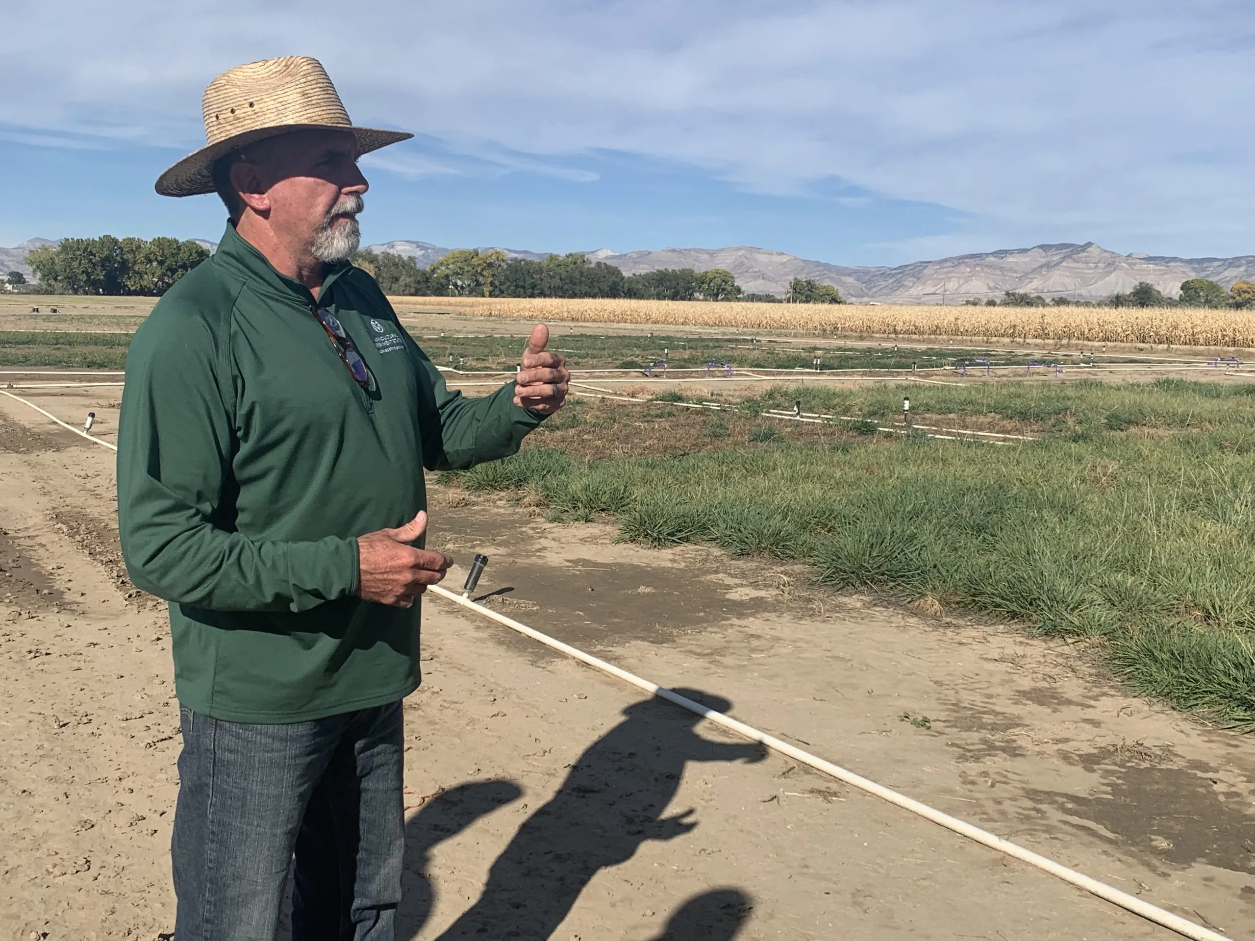

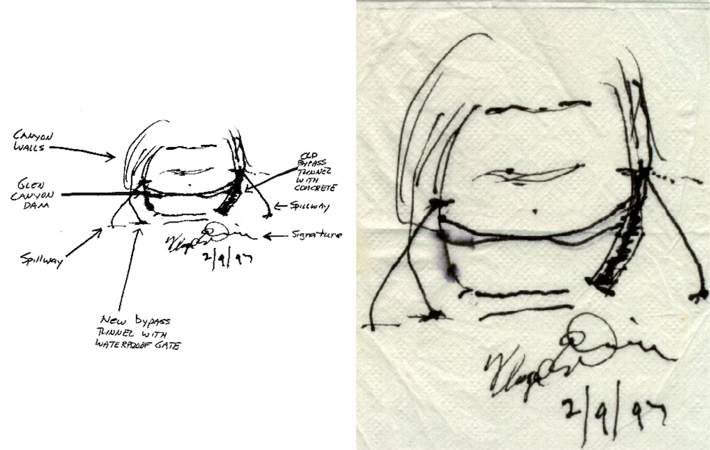
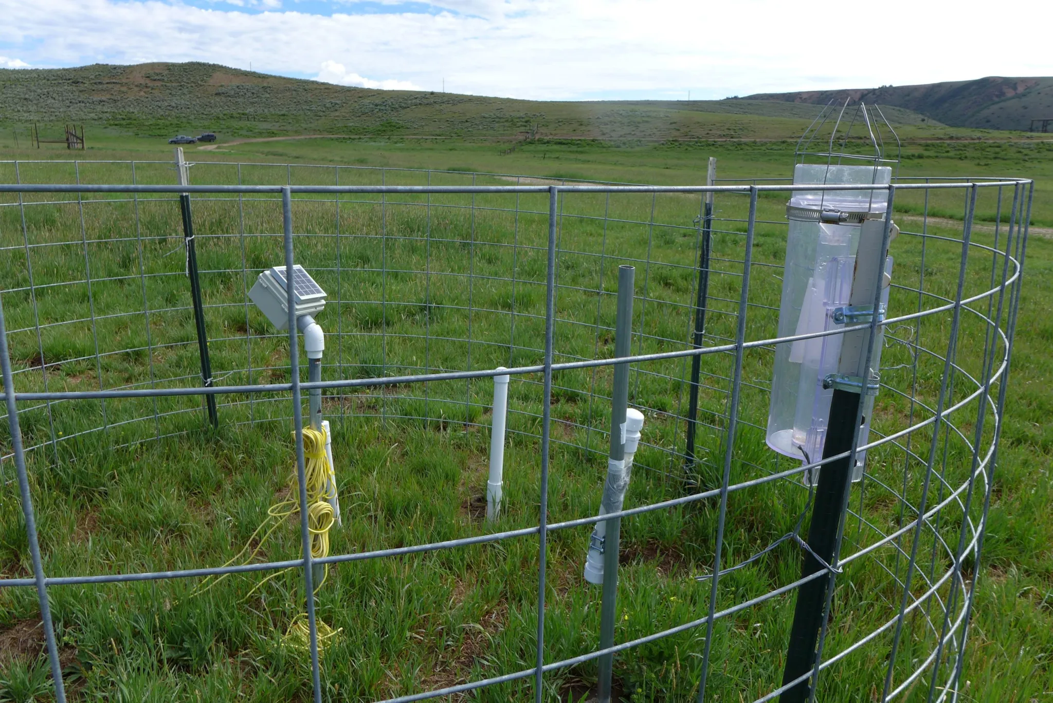


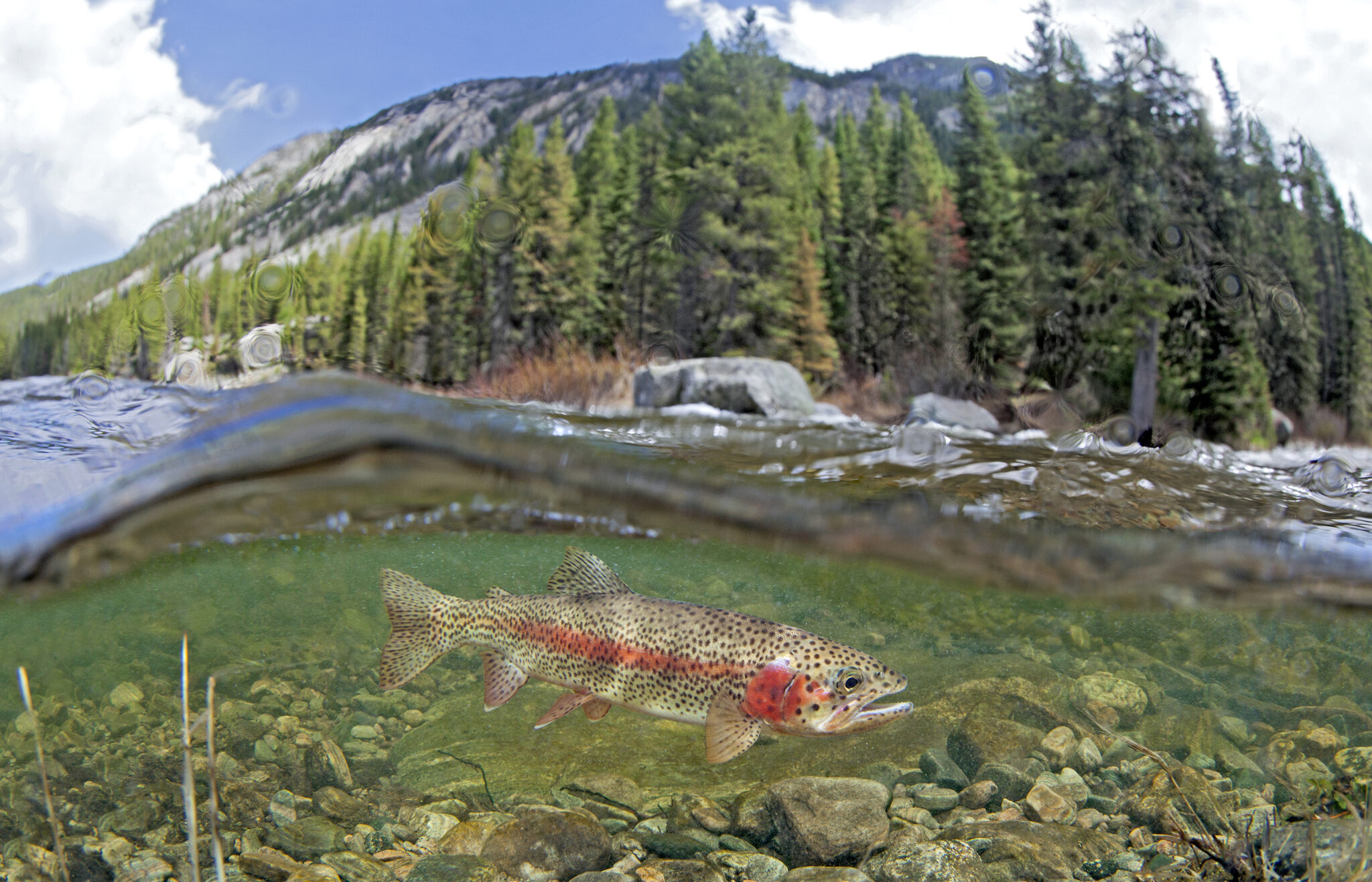


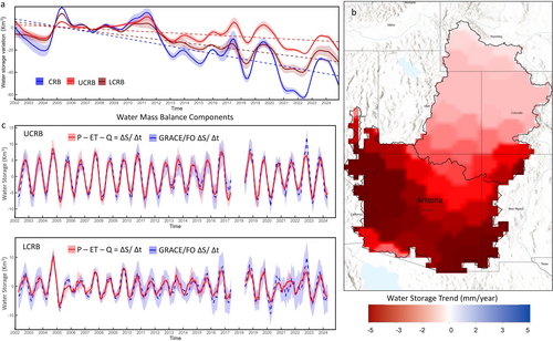


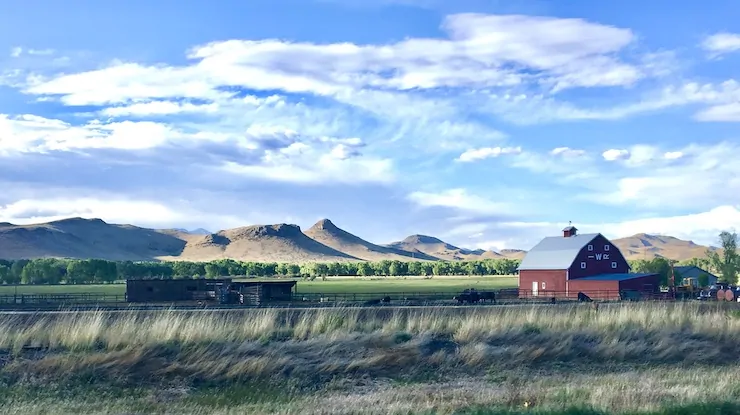
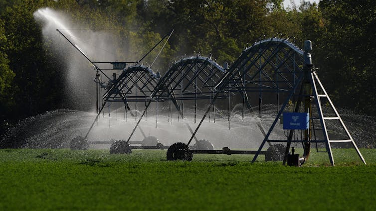

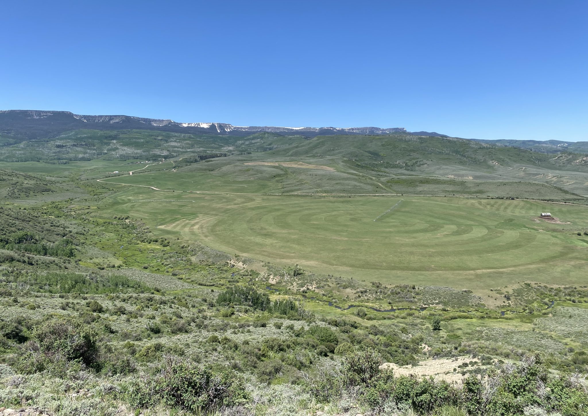
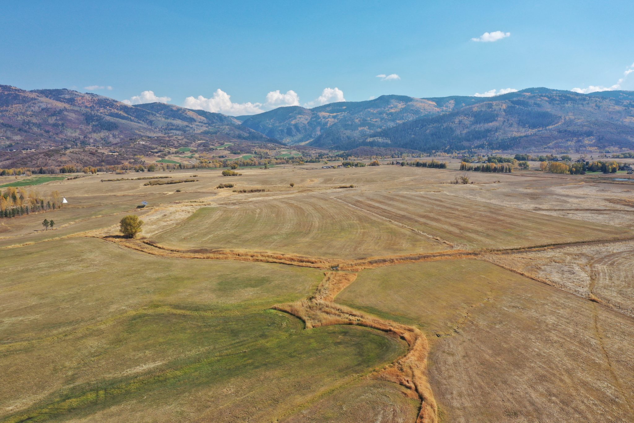


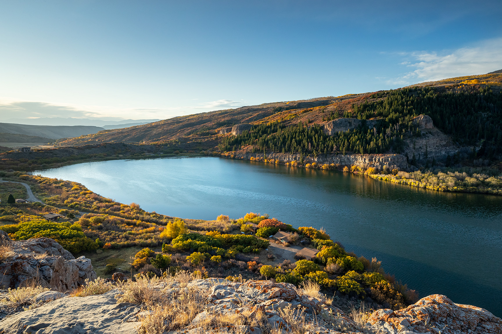

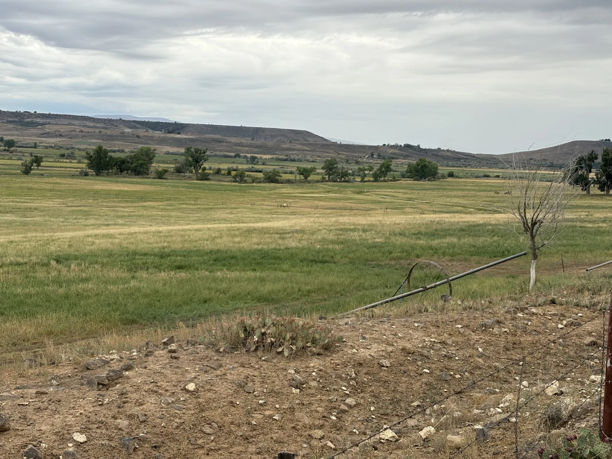


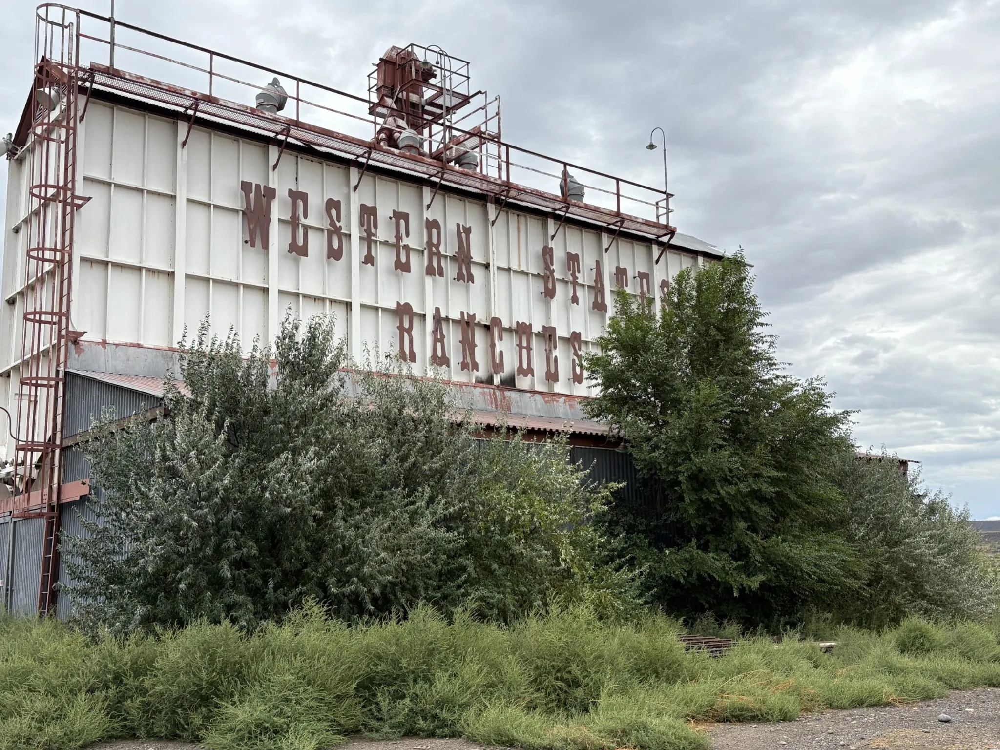


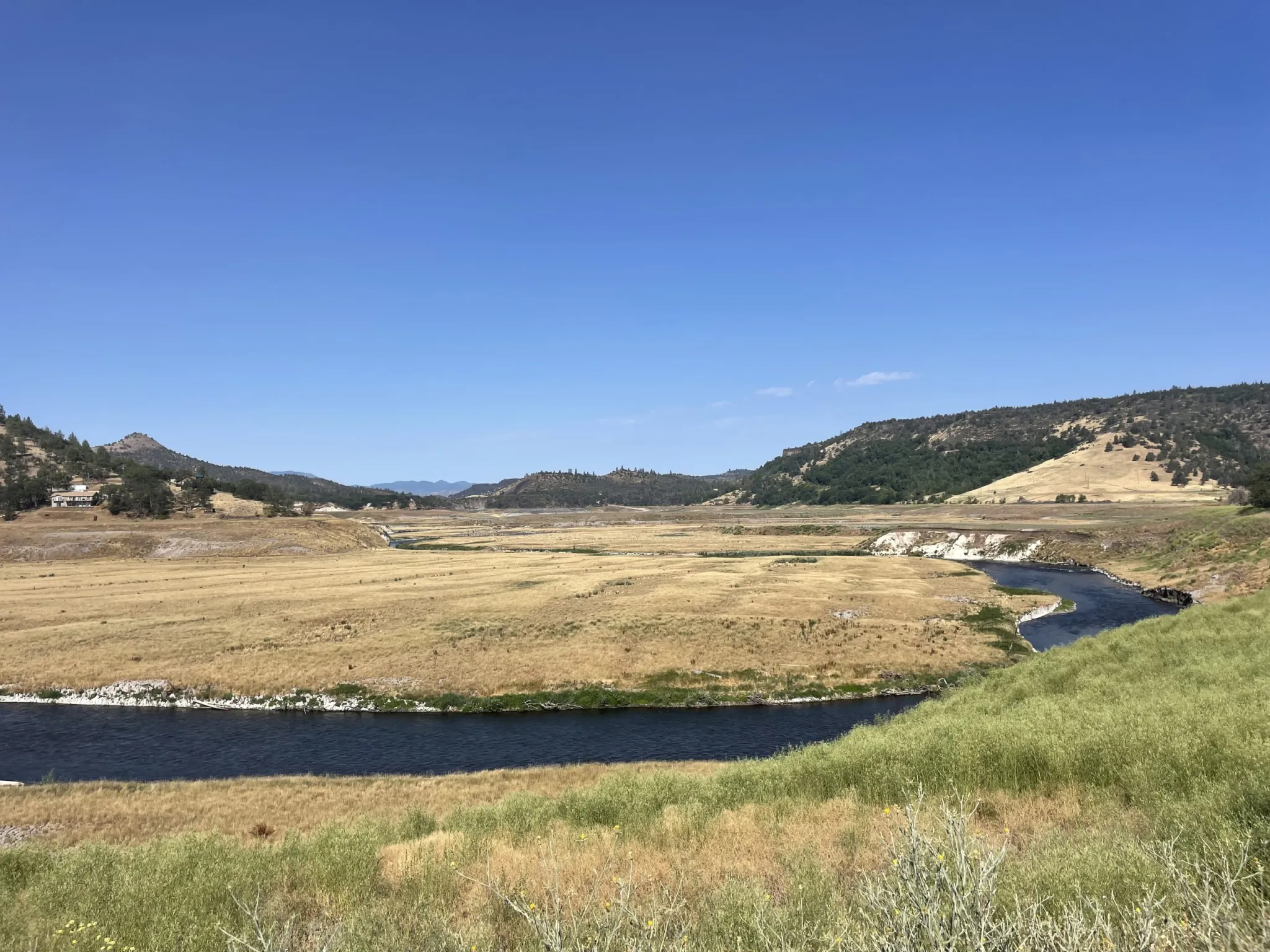
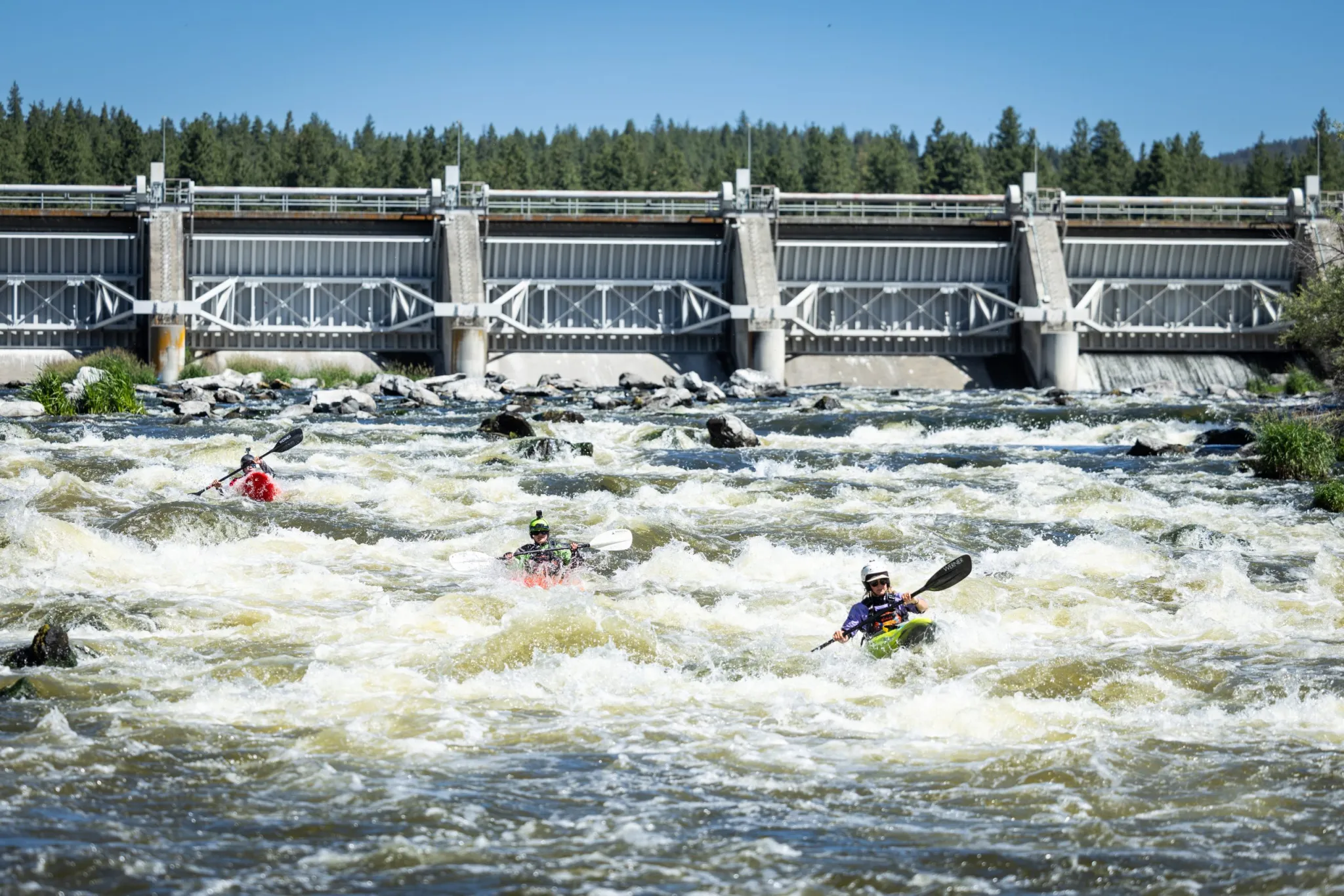


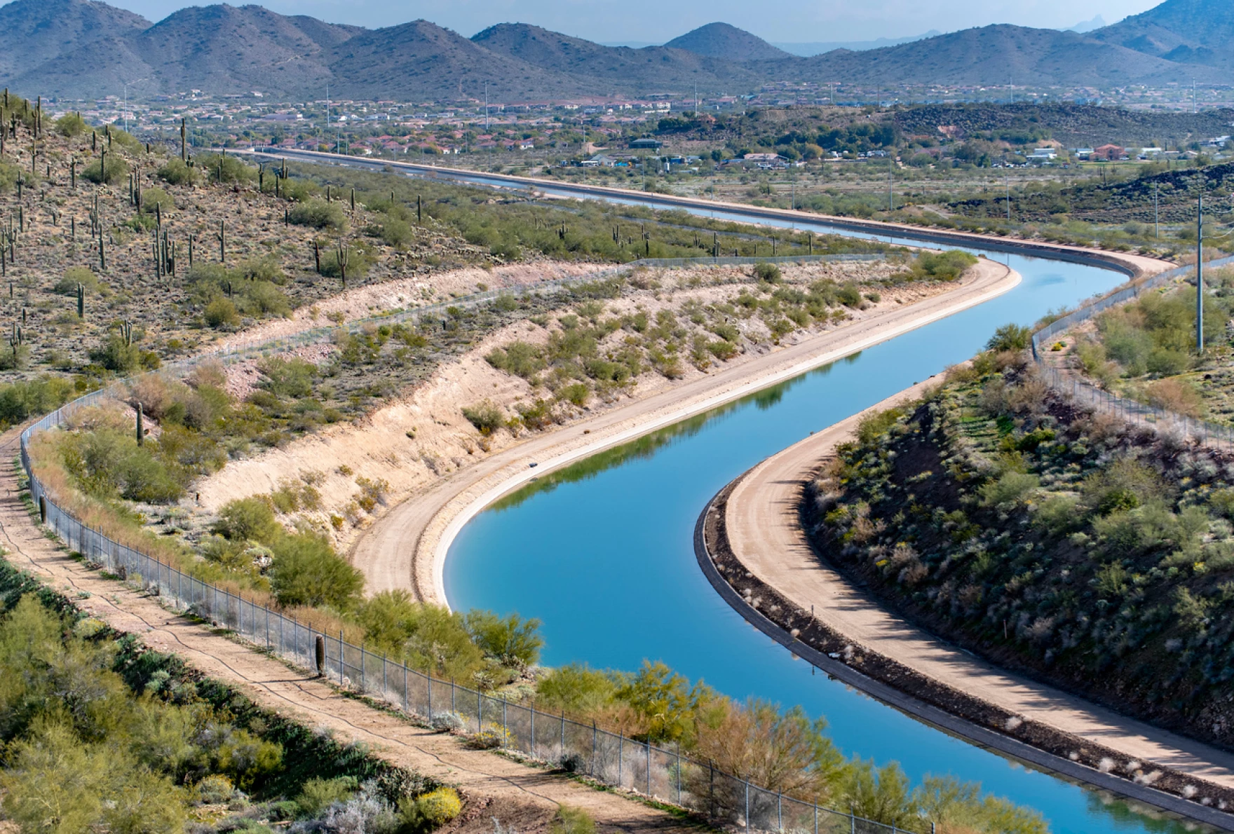


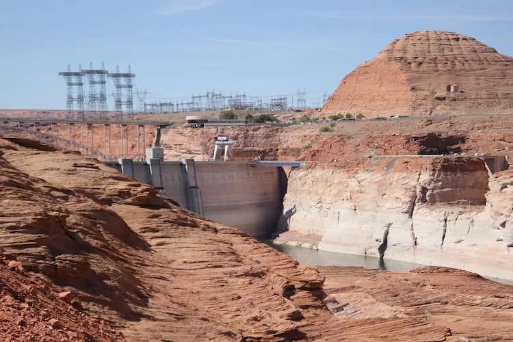


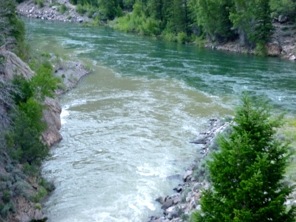


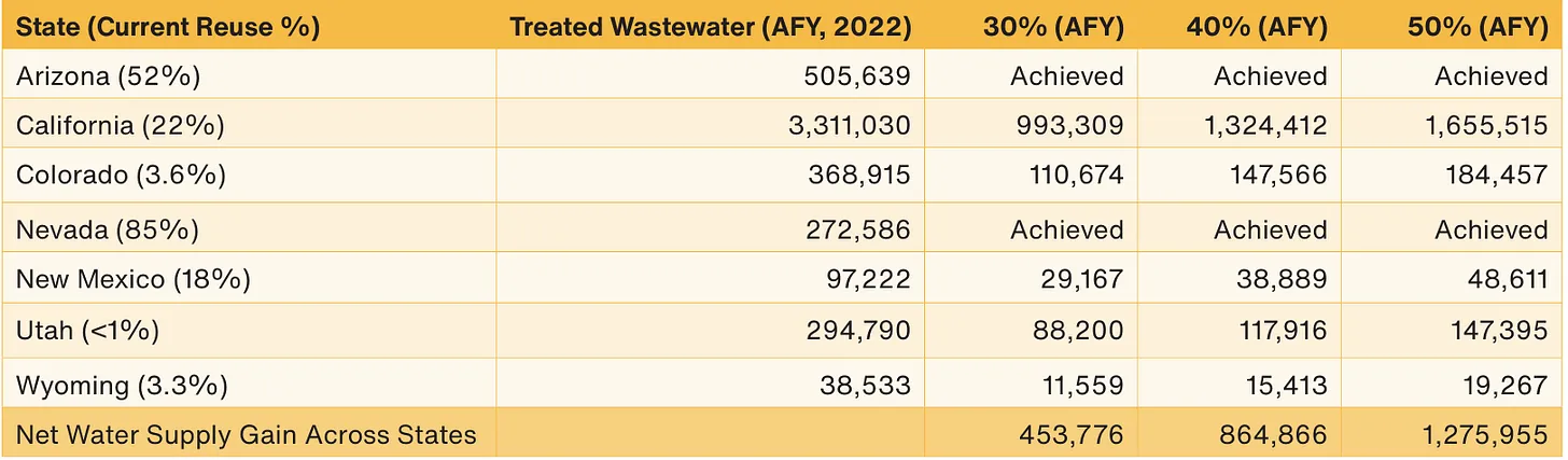


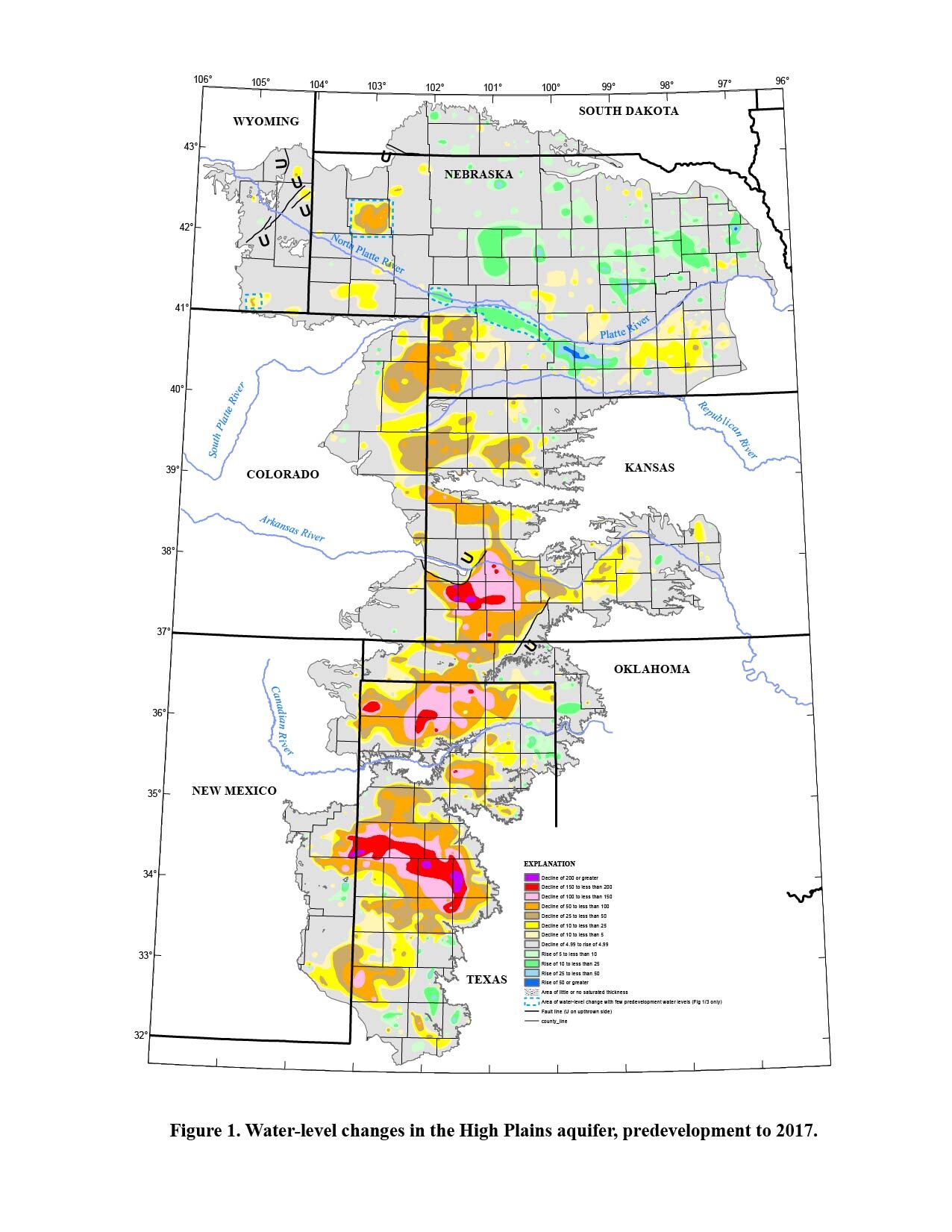


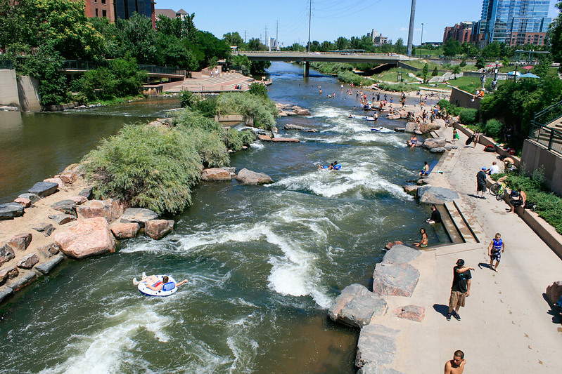


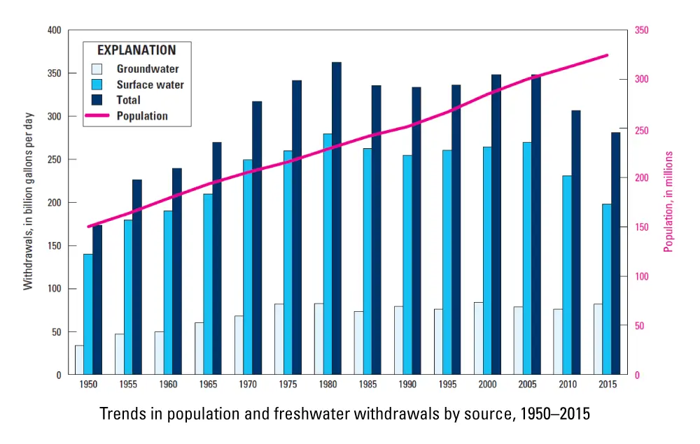


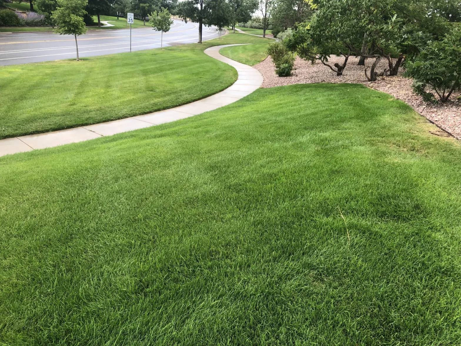


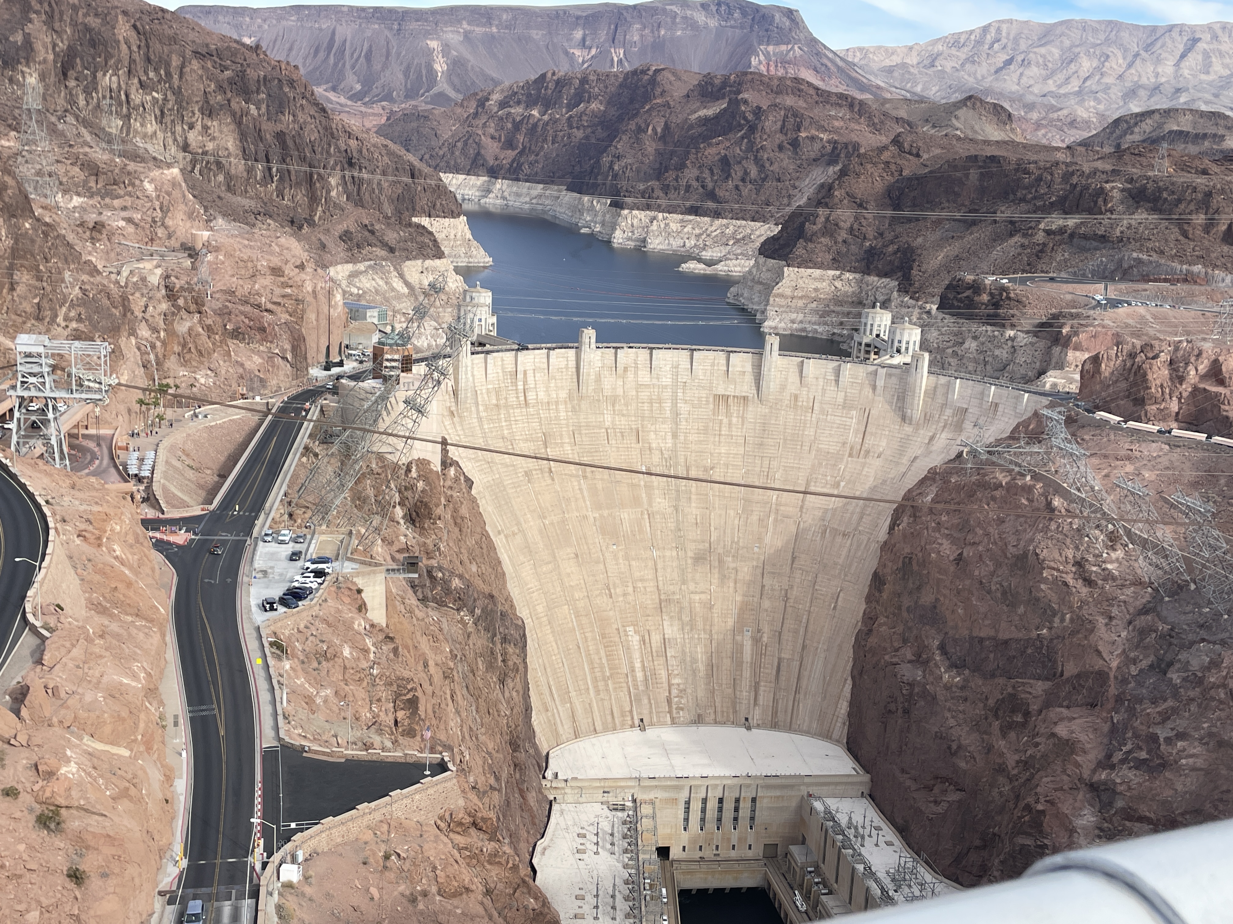


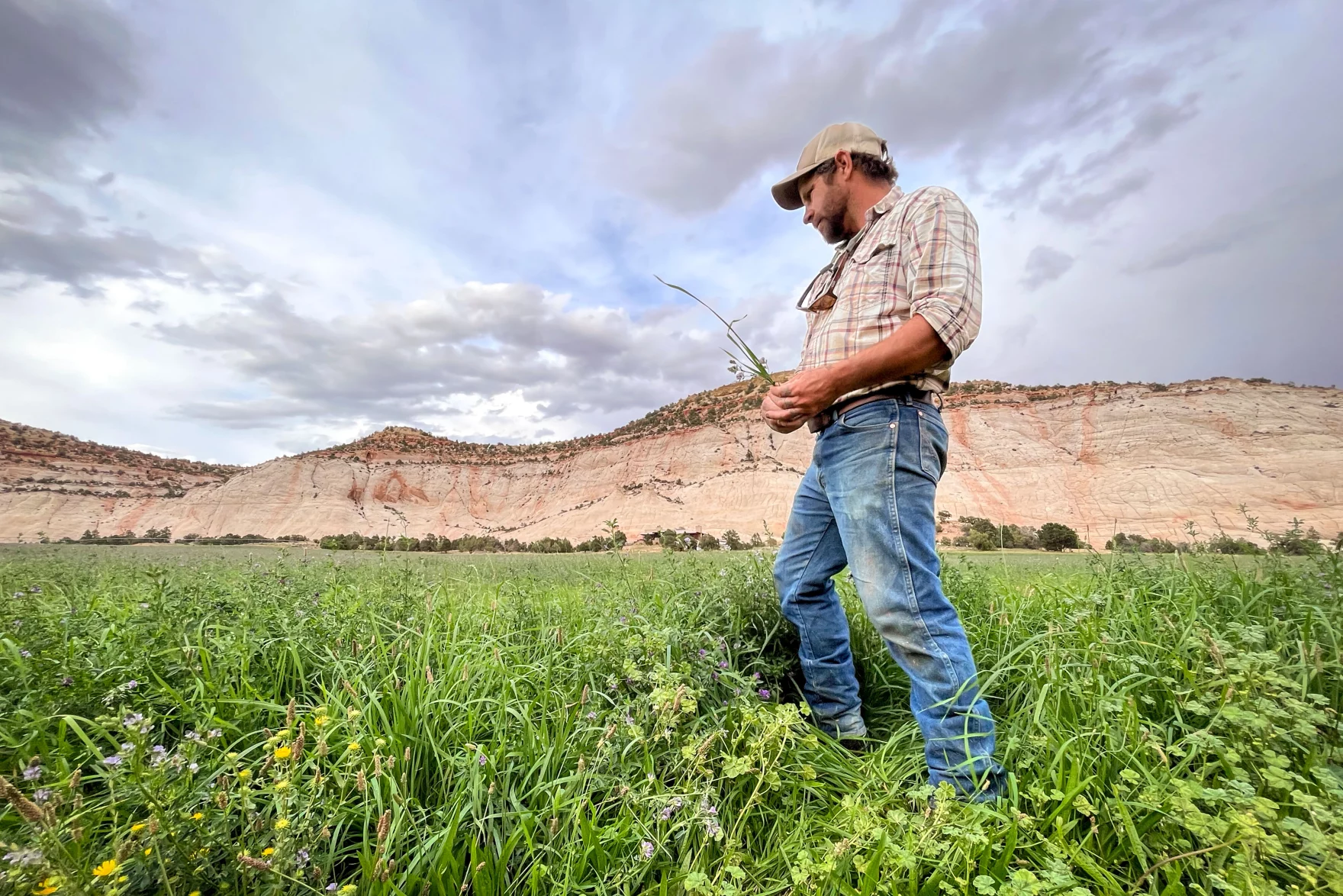
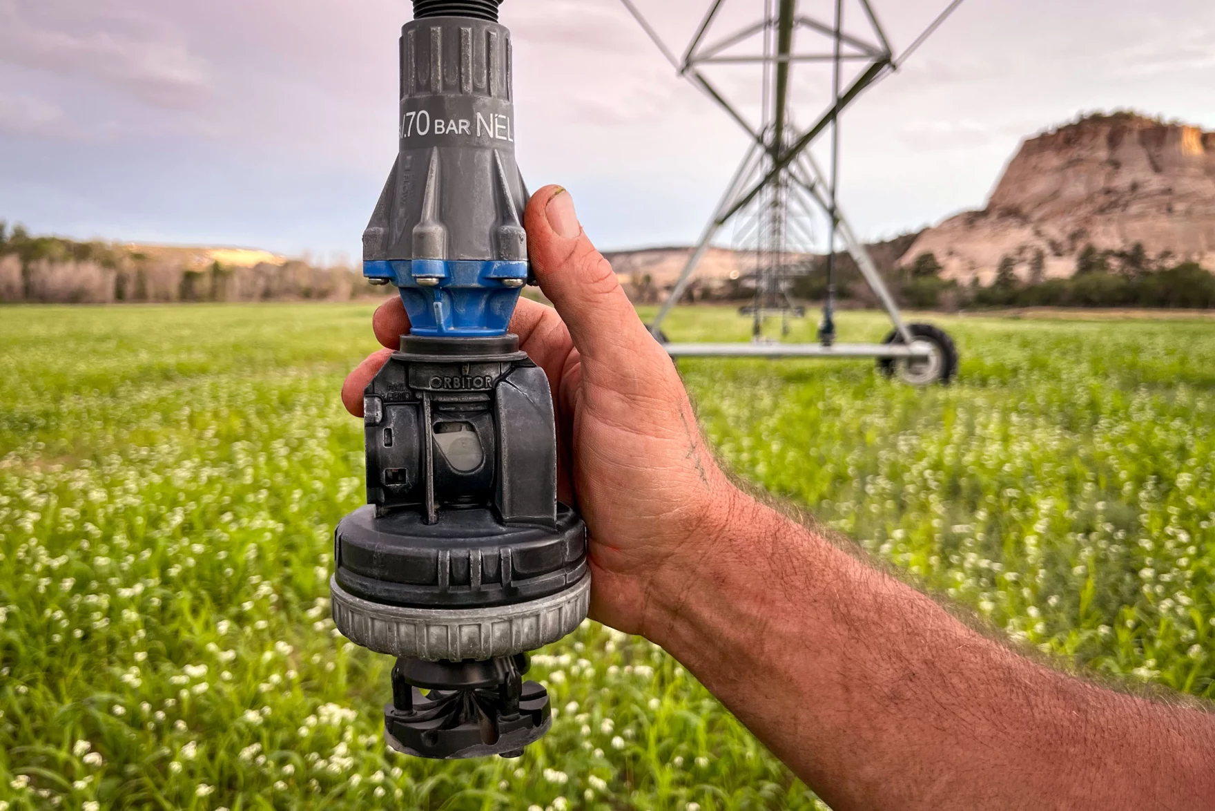

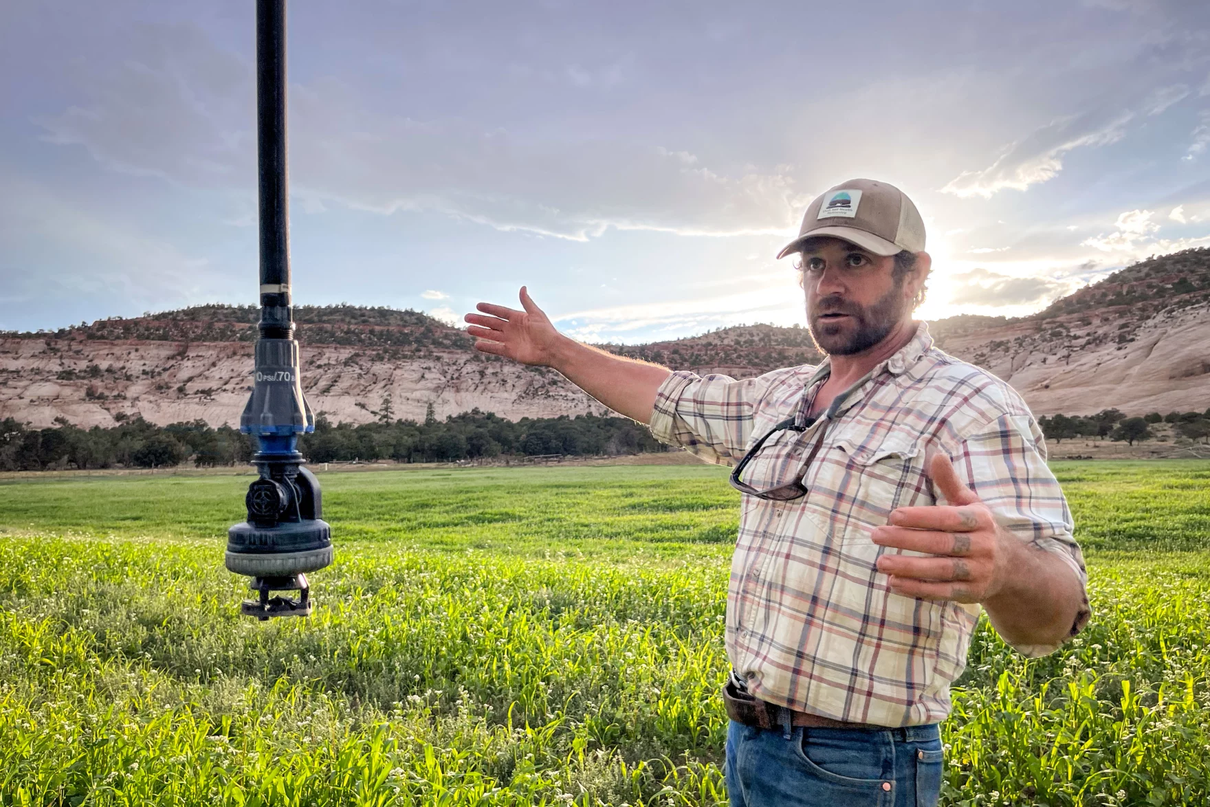